The Shenandoah Valley is yielded to development with expansion of Harrisonburg. A regional center, the city of Harrisonburg boasts a population of over 50,000. Founded in July 1780, Harrisonburg is the seat of Rockingham County and consists of 17.394 square miles in area.
|
| New Market represents a gateway to the attractions in and around Shenandoah National Park. U.S. 211 traverses Massanutten Mountain east from the town across New Market Gap to Luray in Page Valley. 08/06/13 |
|
| U.S. 211 climbs into Shenandoah National Park east from Page Valley to Thorntop Gap, where it meets the famous Skyline Drive. The scenic byway straddles the Blue Ridge Mountains north to Front Royal and south toward Waynesboro. 08/06/13 |
|
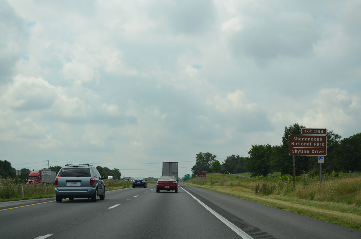
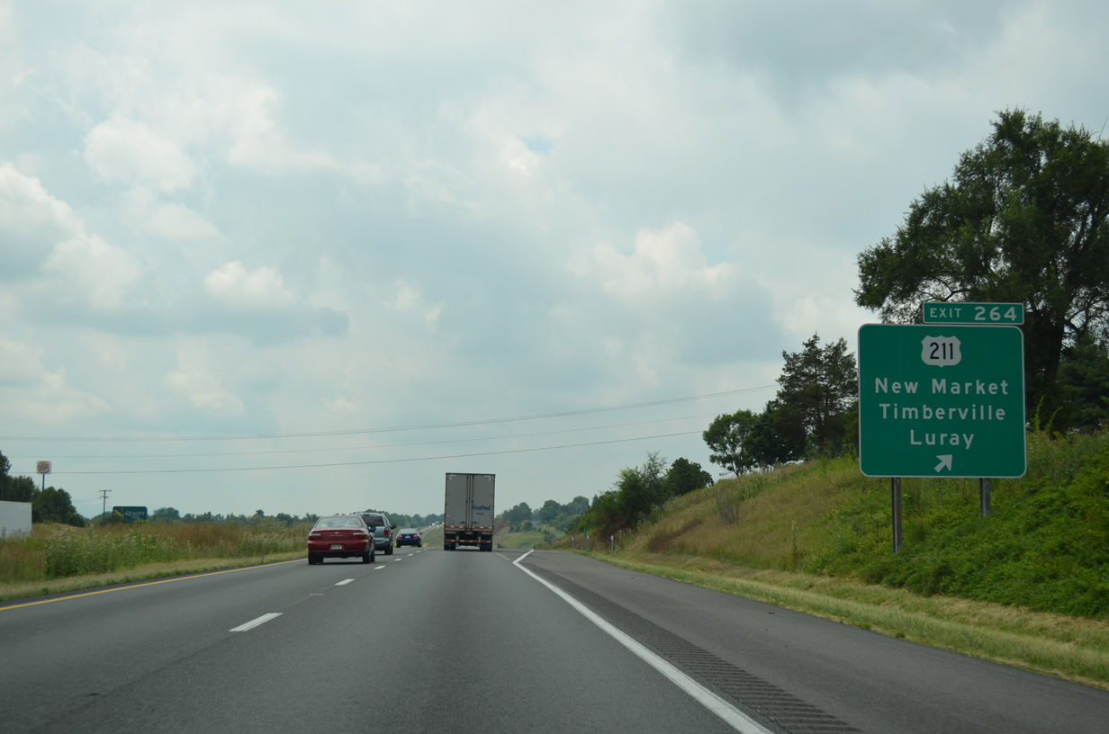
| Exit 264 joins I-81 with U.S. 211 (W Old Cross Road) east to the New Market business district and SR 211 west to SR 42 in the town of Timberville. 08/06/13 |
|
| U.S. 211 and SR 211 shields posted at Exit 264 are erroneous, as U.S. 211 begins to the east. SR 211 (W Old Cross Road / New Market Road) extends 5.63 miles west to Plains Mill and SR 42 (S Main Street) in Timberville. 12/30/08 |
|
| U.S. 211 runs 59.15 miles overall from New Market to Luray Caverns, Washington and Warrenton. Prior to 1980, U.S. 211 extended east to Arlington. 12/30/08 |
|
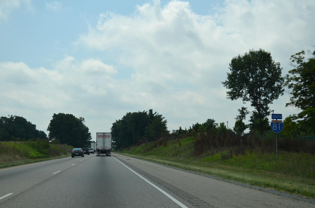
| Interstate 81 crosses the Rockingham County south from New Market. 08/06/13 |
|
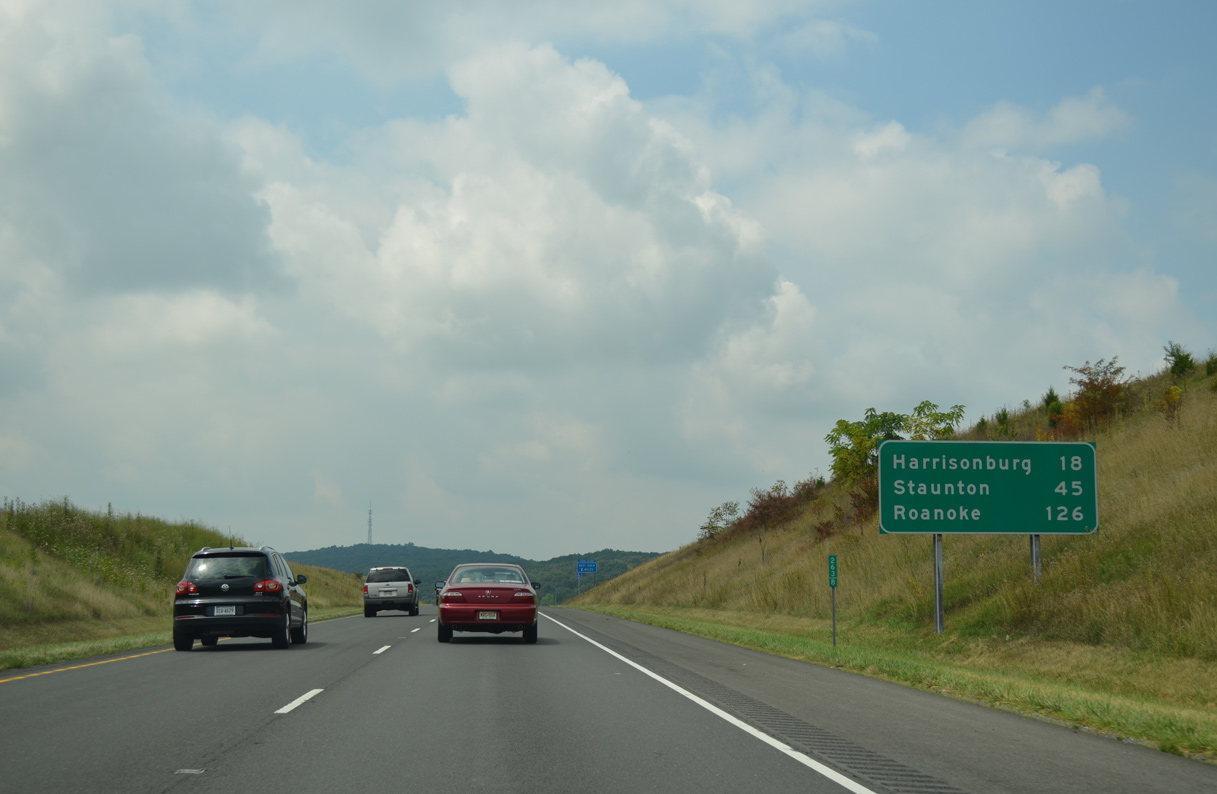
| 18 miles ahead, the independent city of Harrisonburg lies within the center of Rockingham County. 08/06/13 |
|
| Advancing toward the New Market Safety Rest Area, I-81 shifts westward onto a set of hills at an elevation of around 1,200 feet above sea level. 08/06/13 |
|
| The succeeding rest area on I-81 south is 32 miles beyond the New Market Safety Rest Area. 12/30/08 |
|
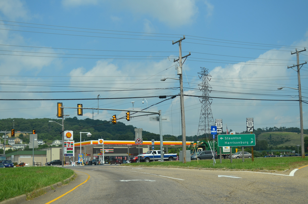
| U.S. 11 (N Valley Pike) converges with Interstate 81 again at Exit 257 and SR 259 (Mayland Road) south of Tenth Legion. 12/30/08 |
|
| SR 259 branches northwest from U.S. 11 at Mauzy and the modified diamond interchange (Exit 257) with I-81 to the town of Broadway along a 21.81 mile long course to West Virginia Route 259 between West and Cove Mountains. 08/06/13 |
|
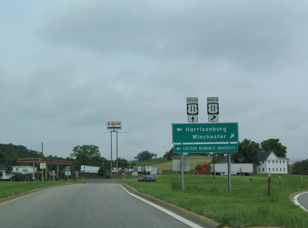
| A 6.3 mile long exit less stretch precedes the first of four interchanges for the city of Harrisonburg. Downtown is 11 miles to the southwest where U.S. 11 and U.S. 33 meet. 08/06/13 |
|
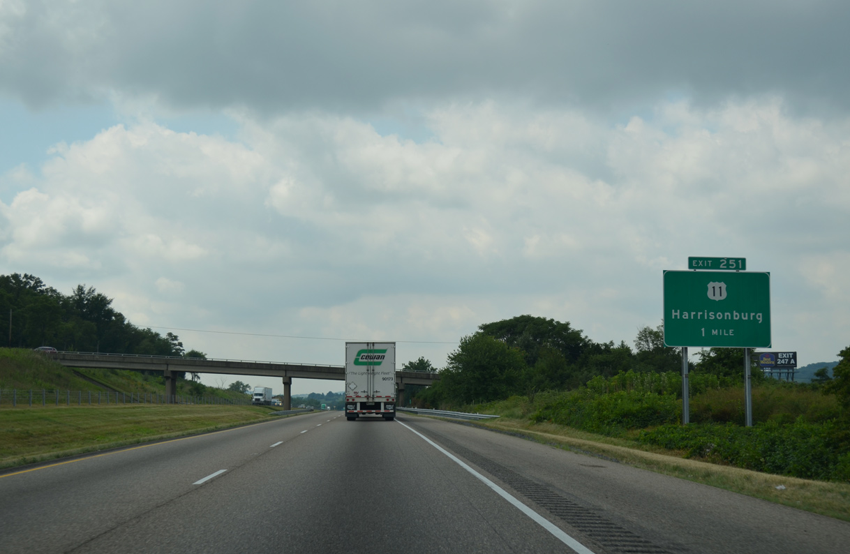
| A trumpet interchange (Exit 251) links Interstate 81 with parallel U.S. 11 (N Valley Pike) south of Melrose in one mile. 08/06/13 |
|
| U.S. 11 (N Valley Pike) constitutes a three lane boulevard leading 2.3 miles south from the access road at Exit 251 to the Harrisonburg city line. 08/06/13 |
|
| Traffic lights were added where the access road from Exit 251 intersects U.S. 11 by 2018. U.S. 11 (N Valley Pike) north leads to Lacey Spring. 06/06/04 |
|
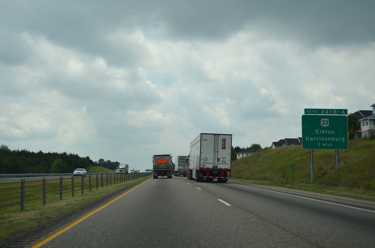
| Apartments and subdivisions abut the west side of I-81 south leading to the cloverleaf interchange (Exit 247) with U.S. 33 (Market Street). 08/06/13 |
|
| U.S. 33 (Market Street) curves northwest 1.51 miles to the Rockingham County Court House at U.S. 11 (Main Street) in Downtown Harrisonburg. 08/06/13 |
|
| U.S. 33 originates in Richmond and travels northwest to Elkton and Harrisonburg. West from the city, U.S. 33 passes through Rawley Springs before climbing to a 3,450 foot summit in the Shenandoah Mountains at the West Virginia state line. 08/06/13 |
|
| Exit 247B leaves I-81 north beyond the Country Club Road underpass. U.S. 33 ventures west to Franklin, West Virginia en route to Corridor H (U.S. 48) in Elkins. 08/06/13 |
|
| East from Exit 247A, U.S. 33 (Market Street) crosses Shenandoah National Park en route to Standardsville, Gordonsville and Louisa. The loop ramp from U.S. 33 west to I-81 south was removed to eliminate weaving traffic after 2008. 08/06/13 |
|
| West from the Reservoir Street overpass by Harrisonburg Crossing shopping center, I-81 crosses the campus of James Madison University (JMU). 08/06/13 |
|
| SR 253 (Port Republic Road) meets I-81 at a diamond interchange (Exit 245) west of Carrier Drive and a pedestrian underpass by Bridgeforth Stadium. JMU was founded in 1908 and named for the fourth president of the United States. 08/06/13 |
|
| SR 659 southeast from U.S. 11 (Main Street), 12.18 miles to U.S. 340 (East Side Highway) between Port Republic and Grottoes was upgraded to State Route 253 in 2005.1 08/06/13 |
|
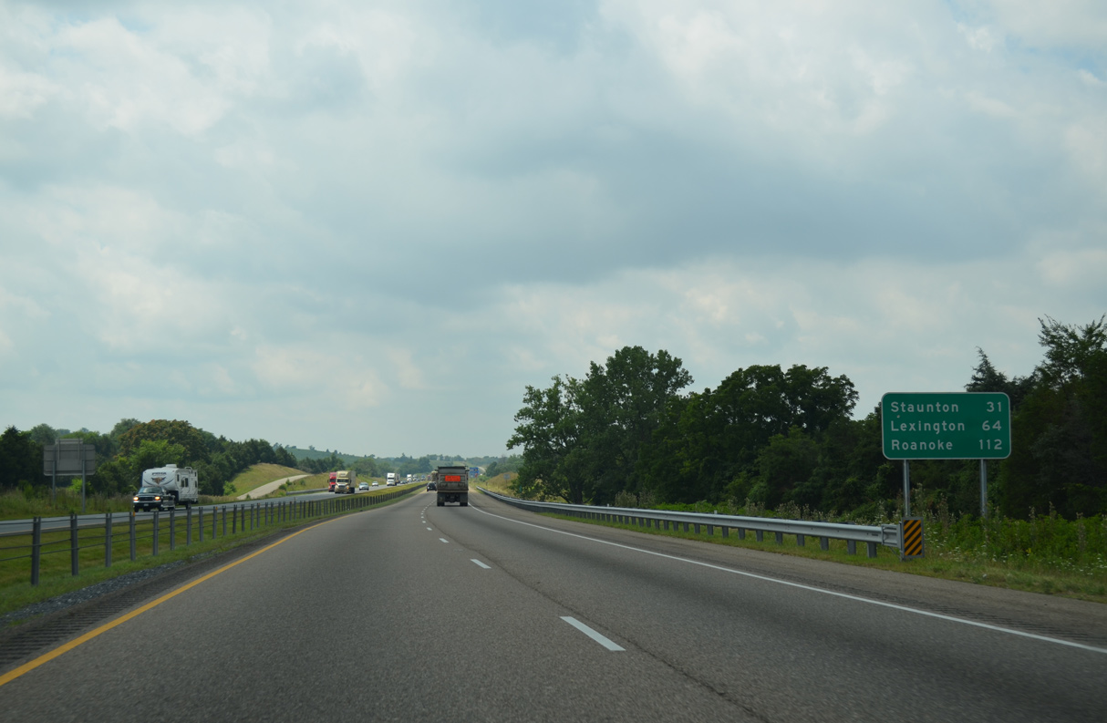
| Interstate 81 continues from Harrisonburg 26 miles to Staunton and 59 miles to Lexington. 08/06/13 |
|
| A trumpet interchange (Exit 243) and access road connects I-81 with adjacent U.S. 11 (S Main Street) at south Harrisonburg in one mile. 08/06/13 |
|
| U.S. 11 (S Main Street) continues along Interstate 81 from south Harrisonburg to Mount Crawford. 08/06/13 |
|
| The access road at Exit 243 ties into U.S. 11 (S Main Street) along a commercialized stretch east of Shavers Hill. 08/06/13 |
|
| Interstate 81 progresses south from Pleasant Valley 23 miles to the independent city of Staunton and 104 miles to Roanoke. 08/06/13 |
|
| Crossing Blacks Run, Interstate 81 south reenters Rockingham County. 08/06/13 |
|
| SR 257 and SR 682 (Friedens Church Road) converge at I-81 east of the town of Mount Crawford at Exit 240. 08/06/13 |
|
| SR 257 (Friedens Church Road) travels west from Mount Crawford to the town of Bridgewater. SR 682 continues Friedens Church Road 4.30 miles east to SR 276 (Cross Keys Road) near Timber Ridge. 08/06/13 |
|
| 1.4 miles south of the Rockingham County line, Interstate 81 meets SR 256 (Weyers Cave Road) at Exit 235. SR 256 extends 6.78 miles east from adjacent U.S. 11 (Lee-Jackson Highway) to SR 276 by Weyers Cave and U.S. 340 at Grottoes. 08/06/13 |
|
| The diamond interchange (Exit 235) with SR 256 (Weyers Cave Road) lies midway between Burketown and Mount Sidney along parallel U.S. 11. 08/06/13 |
|
| The Mount Sidney Safety Rest Area follows the SR 775 (Keezletown Road) overpass on southbound I-81 at mile marker 232.5. 08/06/13 |
|
| The succeeding rest area beyond Mount Sidney is the Fairfield Safety Rest Area at mile marker 199.3. 08/06/13 |
|
| A diamond interchange (Exit 227) joins Interstate 81 with SR 612 (Laurel Hill Road) at the unincorporated community of Verona in one mile. 08/06/13 |
|
| SR 612 arcs 8.09 miles west from Interstate 81 and Verona to Quicks Mill, Huckleberry Hill and U.S. 250 (Churchville Road). SR 612 (Laurel Hill Road) east continues 9.65 miles to Laurel Hill, Crimora and U.S. 340 (E Side Highway). 08/06/13 |
|
| The first exit for the city of Staunton along I-81 south is SR 262 (Woodrow Wilson Parkway). Forming a 13.91 mile loop west from SR 254 (Hermitage Road) to I-81 at Exit 220, SR 262 is mostly either a controlled access or limited access expressway. 05/28/21 |
|
| SR 262 (Woodrow Wilson Parkway) west to U.S. 11 (Commerce Road) leads to the Woodrow Wilson Presidential Library and Museum, located east of Downtown Staunton near Mary Baldwin University. 08/06/13 |
|
| SR 262 concludes 0.59 miles east of the diamond interchange (Exit 225) with I-81 at SR 254 (New Hope Road). SR 254 arcs southeast to Waynesboro. SR 262 along Woodrow Wilson Parkway was fully completed by August 2006. 05/28/21 |
|
| Interstate 81 crosses Lewis Creek south beyond this confirming marker. 05/28/21 |
|
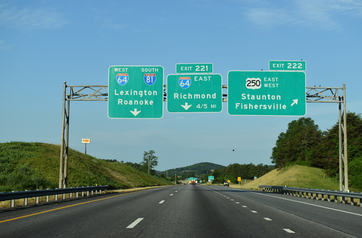
| Straddling the east Staunton city line, Interstate 81 advances two miles to Exit 222 with U.S. 250 (Jefferson Highway) east to Waynesboro and west along Richmond Road toward Downtown. 05/28/21 |
|
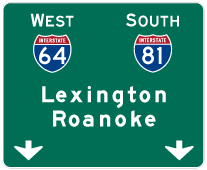
| Interstate 64 west converges with I-81 south at a directional T interchange (Exit 221) just beyond the exchange with U.S. 250. 05/28/21 |
|
| The city of Staunton is the home of former President Woodrow Wilson, and it is the "Queen City" on the Great Wagon Road between the Blue Ridge and the Alleghenies, located in the Shenandoah Valley. 08/06/13 |
|
| Travelers headed to Wayensboro or Charlottesville are directed onto I-64 east at Exit 221 instead of U.S. 250. 05/28/21 |
|
| Interstate 64 connects with both Skyline Drive north into Shenandoah National Park and Blue Ridge Parkway south at Exit 99 with U.S. 250 at Rockfish Gap. 05/28/21 |
|
| Originating in Sandusky, Ohio, U.S. 250 travels southeast to Richmond. Locally U.S. 250 (Jefferson Highway) parallels I-64 to the north through Fishersville and Waynesboro. 05/28/21 |
|
| Beyond Staunton, U.S. 250 heads toward West Virginia via Churchville, Shenandoah Mountain (elevation 3,760 feet) and Monterey in Highland County. U.S. 250 reaches a summit of 4,271 feet at the state line. 06/06/04 |
|
| Interstate 64 crosses the Commonwealth of Virginia from Brushy Mountain west of Callaghan to Chesapeake in Hampton Roads. East from Exit 221, I-64 joins Staunton with Waynesboro and Charlottesville, home of the University of Virginia. 05/28/21 |
|
| Exit 221 separates from I-81 south along the Staunton city line for Interstate 64 east to the capital city of Richmond and the Hampton Roads region. 05/28/21 |
Page Updated 08-10-2021.

 South
South