|
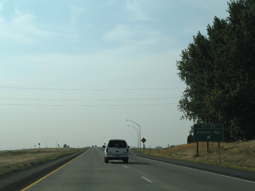
| Interstate 82 generally stays north of Grandview, though the freeway passes through the city limits on three separate sections. Exit 73 leaves in one mile for Stover Road. 08/28/06 |
|
| Wine Country Road ties into the folded diamond interchange at Exit 73 from the south; Yakima Valley Highway begins to the north with both constituting the original U.S. 410 and U.S. 12 alignment. 08/28/06 |
|
| Stover Road continues west from Wine Country Road to SR 241 (Mabton-Sunnyside Road) at Midvale. 08/28/06 |
|
| I-82/U.S. 12 west and parallel Yakima Valley Highway continue five miles to Sunnyside. Yakima is 40 miles to the northwest beyond Yakima Valley. 08/28/06 |
|
| One mile southeast of the diamond interchange (Exit 69) with SR 241 (Waneta Road) on I-82/U.S. 12 west. This is the first of three exits for the city of Sunnyside. 08/28/06 |
|
| SR 241 travels 25.18 miles overall between SR 22 in Mabton to SR 24 between the Rattlesnake Hills and Yakima Ridge. 08/28/06 |
|
| I-82/U.S. 12 advance west to a parclo interchange (Exit 67) with S 1st Street and Midvale Road. 08/28/06 |
|
| Mabton-Sunnyside Road passes over the freeway ahead of Exit 67 to S 1st Street north to the Sunnyside city center. 08/28/06 |
|
| S 1st Street, Lincoln Avenue and S 6th Street leads to Downtown Sunnyside. Exit 67 links I-82 with the Port of Sunnyside and to connections with Alexander Road east to SR 241 (Mabton-Sunnyside Road) south to Mabton. 08/28/06 |
|
| U.S. 12 is missing from this shield assembly for Interstate 82 west. Snipes Mountain rises to the west. 08/28/06 |
|
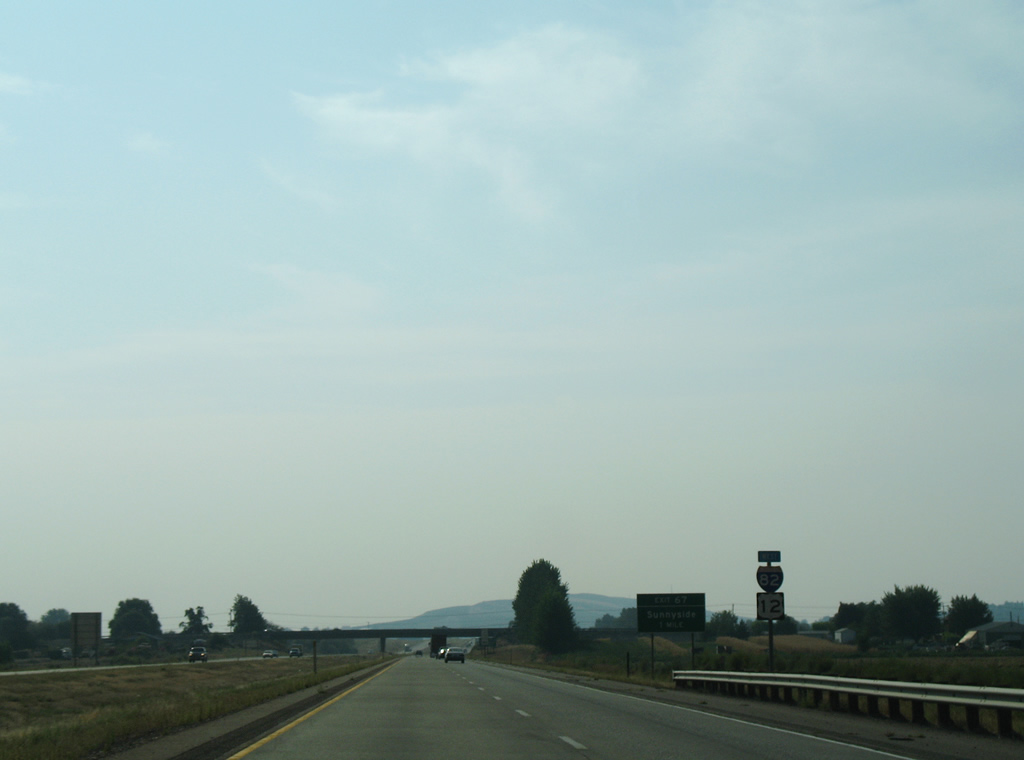
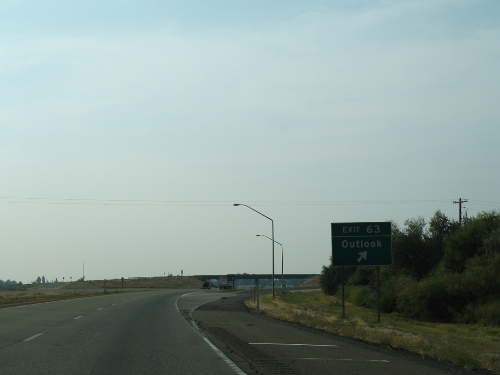
| Exit 63 is a diamond interchange with Sunnyside Road, a short connector road between Gap Road to the west and Yakima Valley Highway to the north. Old U.S. 410 and U.S. 12 return to Sunnyside to the east and enter the nearby unincorporated community of Outlook to the west. 08/28/06 |
|
| I-82/U.S. 12 confirming markers posted near Outlook. 08/28/06 |
|
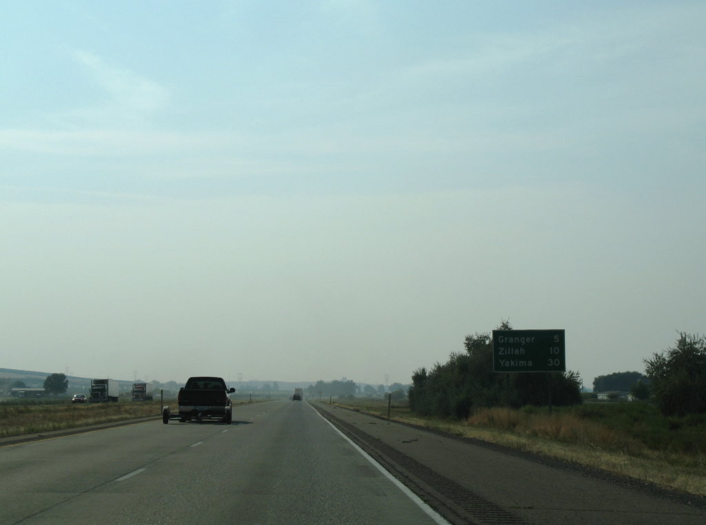
| Granger and Zillah represent the final two cities directly along I-82/U.S. 12 west in Yakima Valley. 08/28/06 |
|
| I-82/U.S. 12 stay north of Snipes Mountain and next meet SR 223 (Vanbelle Road) at the city of Granger. SR 223 travels 3.80 miles southwest miles to SR 22 near Alfalfa. 08/28/06 |
|
| Exit 58 leaves the westbound freeway beyond the Central Washington Railroad under pass for SR 223 west and Vanbelle Road east. Yakima Valley Highway parallels the diamond interchange just to the east.
SR 223 originally followed E Avenue north to U.S. 12. Construction of I-82 displaced that intersection, with Yakima Valley Highway shifting to a more northerly alignment and SR 223 taking a new course to the east. 08/28/06 |
|
| The freeway turns northwesterly toward the Yakima River on the four mile drive to Zillah. 08/28/06 |
|
| Yakima Valley Highway (old U.S. 410 and U.S. 12) lead north to Punkin Center and west to pass under I-82/U.S. 12. The two lane road parallels the west side of the freeway to a diamond interchange at Exit 54. 08/28/06 |
|
| Yakima Valley Highway continues north from Exit 54 to bypass the city of Zillah. Along the route is the Teapot Dome Service Station National Historic Site. 08/28/06 |
|
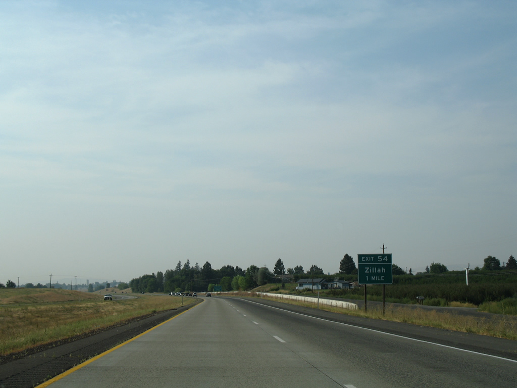
| Exit 54 departs I-82/U.S. 12 west for Yakima Valley Highway north to 1st Avenue west to the Zillah city center. 08/28/06 |
|
| Abandoned BNSF and Central Washington Railroad lines span I-82/U.S. 12 west ahead of the succeeding shield assembly. 08/28/06 |
|
| 1st Avenue angles southwest from Cheyne Road in Zillah to meet I-82/U.S. 12 at a diamond interchange (Exit 52) in one mile. 08/28/06 |
|
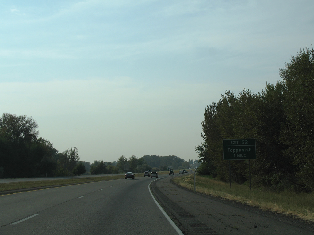
| Meyers Road extends southwest from 1st Avenue and Exit 52 across the Yakima River en route to Lincoln Avenue on the east side of Toppenish. 08/28/06 |
|
| I-82/U.S. 12 continue by the Yakima River northwest to Buena and Exit 50. 08/28/06 |
|
| SR 22 returns to Interstate 82 at Exit 50, completing its 35.84 mile loop through south Yakima Valley. 08/28/06 |
|
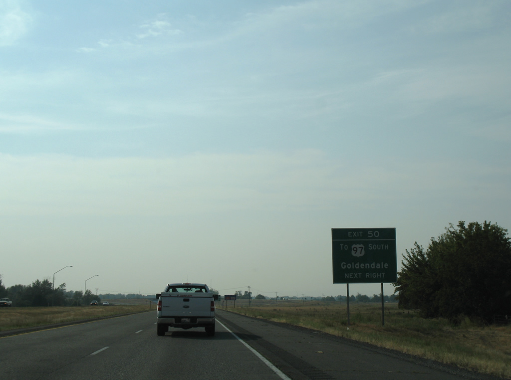
| SR 22 leads 3.31 miles south to U.S. 97 at Evergreen Highway. U.S. 97 leaves Toppenish across Toppenish Ridge and the Simcoe Mountains and continues 48 miles south to Goldendale. 08/28/06 |
|
| Buena Road ties into the diamond interchange at Exit 50 from Yakima Valley Highway and unincorporated Buena to the north. SR 22 spans the Yakima River to the south, which represents the northern boundary of the Yakama Indian Reservation. Points of interest served by Exit 50 include the Yakama Nation Cultural Center and Heritage University. 08/28/06 |
|
| Turning more toward the north, I-82/U.S. 12 continue 12 miles to Union Gap and 17 miles to the city of Yakima. 08/28/06 |
|
| Donald Wapato Road crosses paths with I-82/U.S. 12 at a diamond interchange (Exit 44) in one mile. 08/28/06 |
|
| Donald Wapato Road links 1st Street in Wapato with the adjacent census designated place of Donald at Yakima Valley Highway (old U.S. 410 and U.S. 12). 08/28/06 |
|
| Angling northwest toward the end of Yakima Valley between Rattlesnake Hills to the east and Ahtanum Ridge to the west. The city of Union Gap lies just north of Union Gap between the two mountains. 08/28/06 |
|
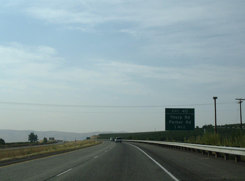
| Thorp Road south and Parker Bridge Road east come together at Yakima Valley Highway and the diamond interchange at Exit 40. 08/28/06 |
|
| Yakima Valley Highway north concludes at Exit 40 as I-82/U.S. 12 overtakes the original alignment into Union Gap. 08/28/06 |
|
| Exit 40 departs I-82 for Yakima Valley Highway south and Thorp Road north. Parker Bridge Road links old U.S. 410 and U.S. 12 with 2nd Avenue and U.S. 97 at Parker. Thorp Road encircles Rattlesnake Hills to Birchfield Road near Moxee. 08/28/06 |
|
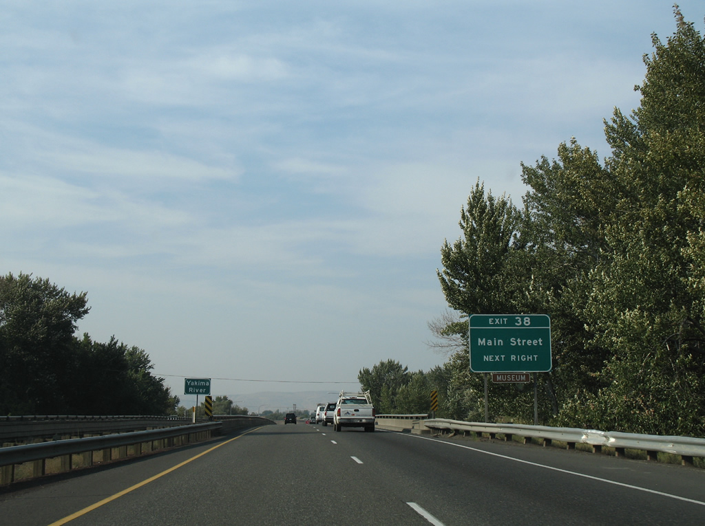
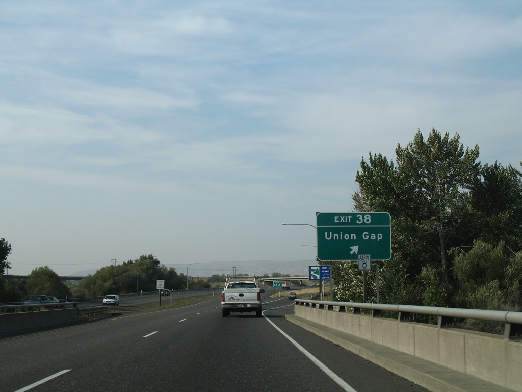
| Exit 38 connects I-82/U.S. 12 west with Main Street (old U.S. 97) north to the Union Gap city center in one mile. 08/28/06 |
|
| Speed limits reduce to 60 miles per hour ahead of the Yakima River bridge at Union Gap on I-82/U.S. 12 west. 08/28/06 |
|
| The 0.92 mile long ramp at Exit 38 leads directly onto Main Street (old U.S. 97) as it parallels the freeway northward through Union Gap to S 1st Street in Yakima. 08/28/06 |
|
| A loop ramp joins U.S. 97 northbound with the ramp for Exit 38 to Main Street by the Washington Central Railroad. 08/28/06 |
|
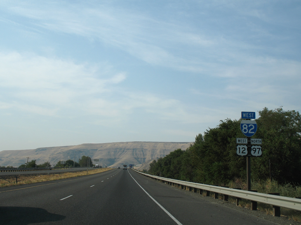
| U.S. 97 combines with I-82/U.S. 12 west at a wye interchange. I-82/U.S. 97 overlap for 37.5 miles to Ellensburg. 08/28/06 |
|
| I-82/U.S. 12-97 advance north to a roundabout interchange (Exit 36) with Valley Mall Boulevard west. 08/28/06 |
|
| Valley Mall Boulevard stem west from I-82/U.S. 12-97 to S 1st Street at Valley Mall. An extension opened in 2009 joins the arterial with S 16th Avenue near Yakima Airport/ McAllister Field (YKM). 08/28/06 |
|
| Reassurance markers posted for Interstate 82-U.S. 12 west and U.S. 97 north near the Yakima city limits east of Washington Avenue. 08/28/06 |
|
| A diamond interchange (Exit 34) joins I-82/U.S. 12-97 north with Nob Hill Boulevard west and the eastbound beginning of SR 24 in 0.75 miles. 08/28/06 |
|
| SR 24 stretches 79.23 miles east from Yakima and Yakima Sportsman State Park through Moxee to SR 26 at Othello. Nob Hill Road extends west from Exit 34 to State Fair Park (home of the Sundome), Yakima Valley Community College and West Valley. SR 24 was expanded east from I-82 across the Yakima River to University Parkway in 2006. 08/28/06 |
|
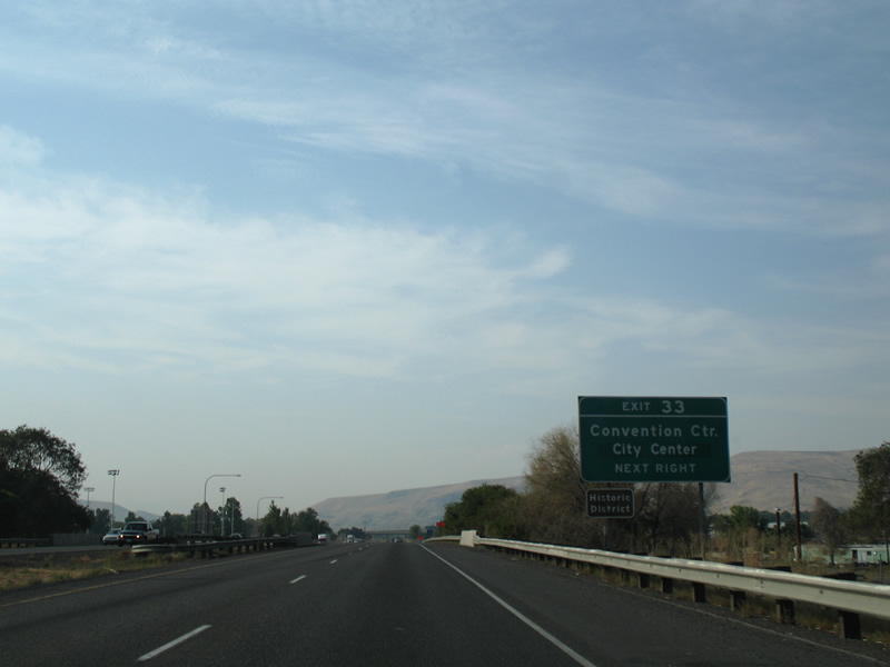
| Exit 33 joins I-82/U.S. 12-97 with Yakima Avenue west to Convention Center and Downtown Yakima and Terrace Heights Drive east to the Terrace Heights community. 08/28/06 |
|
| A diamond interchange with a flyover ramp links I-82 with Yakima Avenue / Terrace Heights Drive at Exit 33. Yakima Avenue west was signed as Business Loop I-82 until 2000. The business route took Yakima Avenue, N 6th Street, a couplet along Lincoln Avenue / Martin Luther King, Jr. Boulevard and N 1st Street to Exit 31. 08/28/06 |
|
| The flyover to Yakima Avenue joins the boulevard ahead of N 9th Street, Union Street and the Yakima city center. Terrace Heights Way extends east to the census designated place of Terrace Heights. 08/28/06 |
|
| I-82/U.S. 12-97 proceed north alongside the Yakima River to Twin Bridges and Yakima Ridge. 08/28/06 |
|
| A steel truss bridge spans the Yakima River east of Interstate 82 along the Central Washington Railroad line. 08/28/06 |
|
| Ellensburg is the final control city for I-82 west. Wenatchee is 105 miles to the north via U.S. 97 beyond Interstate 90 west. 08/28/06 |
|
| U.S. 12 branches west from I-82/U.S. 97 toward Naches at a two-wye interchange (Exit 31) in a half mile. 08/28/06 |
|
| Exit 31 includes a flyover ramp to N 1st Street (former U.S. 97 and Business Loop I-82) south into central Yakima. 08/28/06 |
|
| The freeway along U.S. 12 includes exits to N 16th Avenue and N 40th Avenue. The freeway predates the U.S. 12 extension west over U.S. 410 in 1967. 08/28/06 |
|
| U.S. 12 parts ways with I-82 west after a 71 mile overlap from the Tri-Cities. U.S. 12 west from Naches and the historic U.S. 410 corridor for Rimrock and White Pass to Interstate 5 near Napavine. 08/28/06 |
|
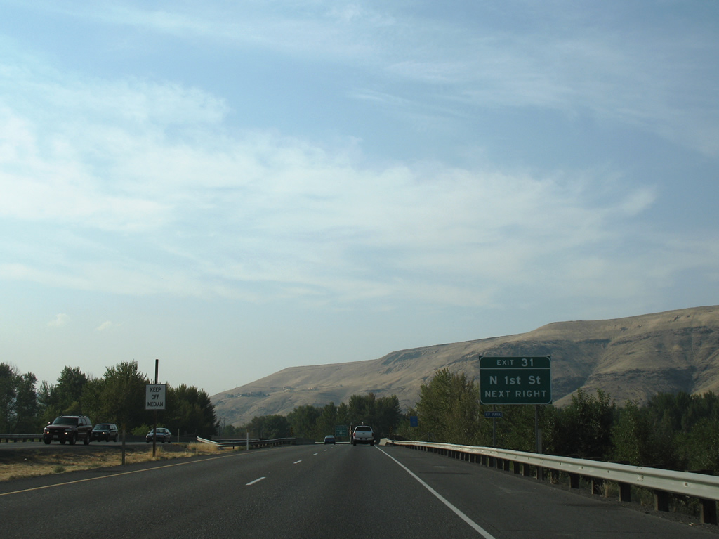
| Exit 31 partitions into ramps for the U.S. 12 mainline and N 1st Street south. 1st Street becomes SR 821 northward from U.S. 12 to Selah Road. 08/28/06 |
Page Updated 09-29-2011.


 West
West


 North
North