|
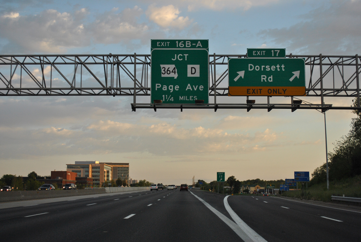
| Interstate 270 south expands to five lanes from I-70 to the diverging diamond interchange (DDI) with Dorsett Road. The second Maryland Heights exits follows with MO 364 west and Highway D (Page Avenue) in 2.25 miles. 05/03/12 |
|
| Dorsett Road extends Midland Boulevard west from U.S. 67 (Lindbergh Boulevard) along the northern periphery of a large industrial park area of Maryland Heights. 05/03/12 |
|
| Two lanes part ways with I-270 south for Dorsett Road. West from Exit 17, the five lane arterial serves an assortment of apartment complexes and shopping centers before transitioning into a residential two lane road to Marine Avenue at Creve Coeur County Park. 05/03/12 |
|
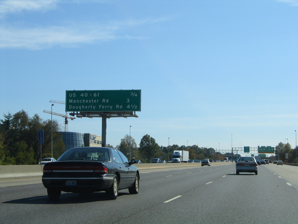
| Decorative lighting adorns the I-270 overpass above Dorsett Road. $10 million in construction completed on October 18, 2010, upgraded Exit 17 to a DDI.1 05/03/12 |
|
| An auxiliary lane runs south from the Dorsett Road on-ramp to Exit 16B with Missouri 364 (Page Avenue Extension) west. 05/03/12 |
|
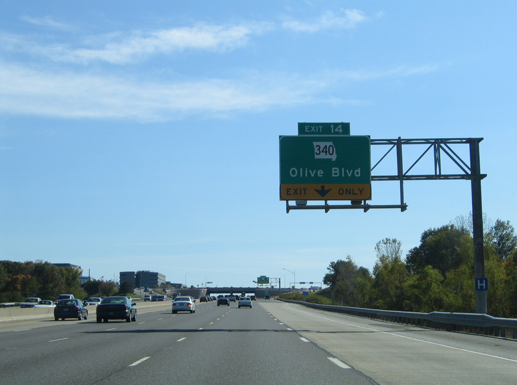
| Missouri 364, first opened in 2003 between I-270 and St. Charles, lies one half mile ahead. Missouri 340 (Olive Boulevard) follows in the city of Creve Coeur. 05/03/12 |
|
| Missouri 364 constitutes a 21.38 mile long commuter freeway west to St. Charles County. The freeway was completed to Interstate 64 by Lake St. Louis on November 1, 2014. 05/03/12 |
|
| A directional cloverleaf interchange joins Interstate 270 with Missouri 364 west (Exit 16B) and Highway D (Exit 16A). A flyover constructed for north to westbound replaced a congested loop ramp. It opened on July 23, 2011. Provisions were made during that road work for a new directional ramp linking I-270 south with Page Avenue east. 05/03/12 |
|
| Highway D extends Page Avenue east as a freeway to Schuetz Road. An expressway takes over from there east to U.S. 67 (Lindbergh Boulevard) at the Maryland Heights city line. The state highway otherwise extends 15.72 miles into St. Louis, ending at Broadway by Interstate 44. 05/03/12 |
|
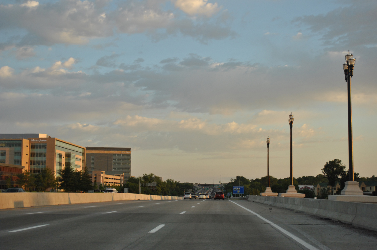
| Interstate 270 enters an unincorporated swath of St. Louis County between Page Avenue and Olive Boulevard (Exit 14). Interstate 64 & U.S. 41-61 meet the freeway in 3.25 miles. 10/16/04 |
|
| Missouri 340, a 19.28 mile highway east to Ferguson Avenue in University City and west to Missouri 100 in Ellisville, crosses paths with I-270 at Exit 14. 10/16/04 |
|
| Olive Boulevard comprises a busy commercial arterial across northern reaches of Creve Coeur. The state highway joins the city with Olivette to the east and Chesterfield to the west. 10/16/04 |
|
| Exit 14 was upgraded from a diamond interchange into a single point urban interchange (SPUI) in the early 2000s. 10/16/04 |
|
| Continuing south through Creve Coeur, drivers next meet Ladue Road (Highway AB) at a diamond interchange (Exit 13). 10/16/04 |
|
| Highway AB lines Ladue Road west 3.25 miles to the Missouri 141 expressway in Chesterfield. 10/16/04 |
|
| Ladue Road is a two lane road serving a number of residential areas west through Town And Country and east to Ladue.
1.25 miles further south is the systems interchange (Exits 12A/B) with Interstate 64 and U.S. 40-61. 10/16/04 |
|
| This ground level sign for I-64/U.S. 40-61 was replaced with an overhead by 2007. The right lane expands to two lanes ahead of Exit 12 for I-64/U.S. 40 west through Chesterfield and east to Frontenac and Ladue. 10/16/04 |
|
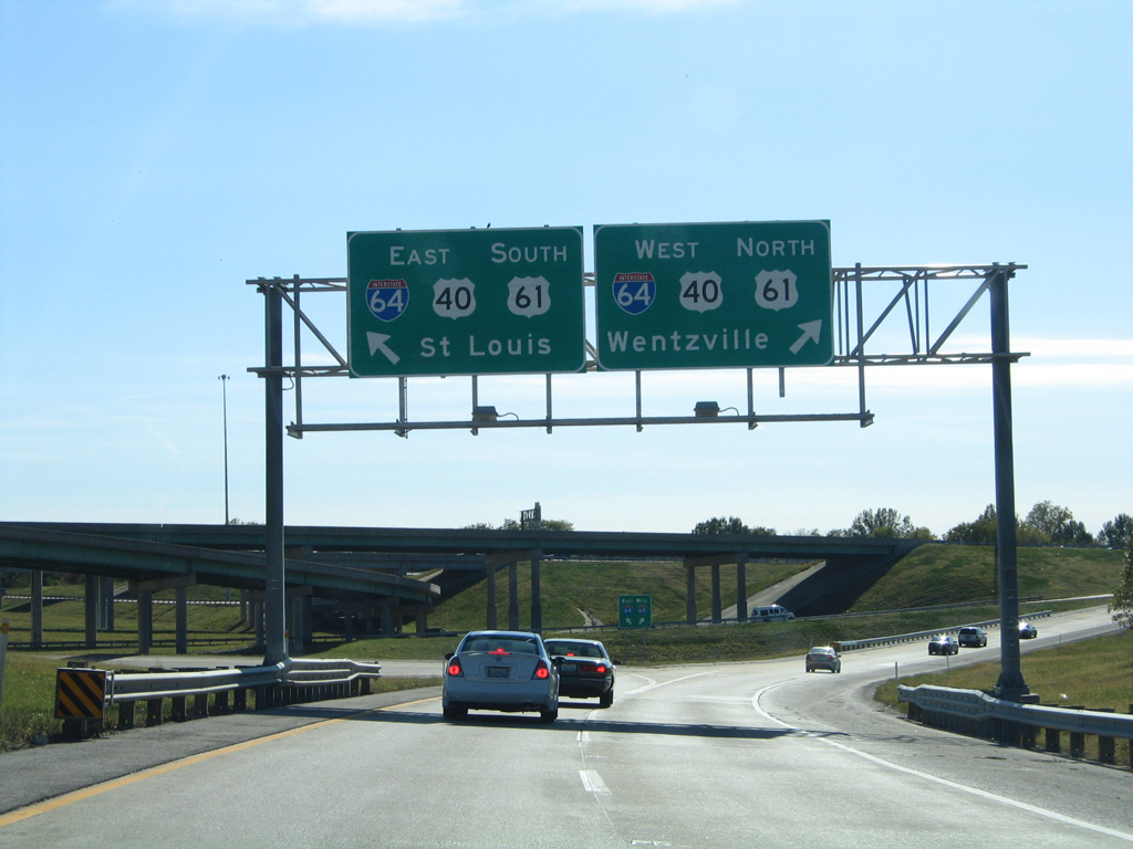
| This interchange sequence sign, 0.75 miles north of Exit 12, refers to I-64 as just U.S. 40-61. Interstate 64 was extended west from the Poplar Street Bridge to I-270 in 1987. 10/16/04 |
|
| Approaching the Conway Road underpass and departure point for Exits 12A/B prepare to I-64/U.S. 40-61. I-64 overlays U.S. 40 east to the Poplar Street Bridge and west to Wentzville, while U.S. 61 runs along the freeway east to Lindbergh Boulevard and west to the Avenue of the Saints corridor leading north from I-70 to Hannibal and Iowa. 10/16/04 |
|
| I-270 continues south with three lanes as Exits 12A/B peel away for I-64/U.S. 40-61. 10/16/04 |
|
| I-64-U.S. 40/61 north cross the Daniel Boone Bridge into St. Charles County. The trio turn northward through Weldon Spring, O'Fallon and Lake St. Louis. 10/16/04 |
|
| A single lane ramp joins I-64-U.S. 40 east & 61 south to Richmond Heights, Forest Park and Downtown St. Louis. The freeway was reconstructed and modernized between I-270 and Kingshighway from 2000 to 2009. 10/16/04 |
|
| Interstate 270 continues south through the city of Town and Country with a frontage road lining the west side to Exit 9. 04/13/13 |
|
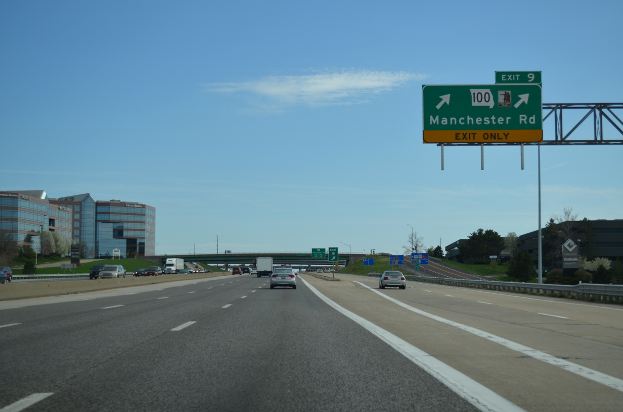
| A directional cloverleaf interchange (Exit 9) joins Interstate 270 with Missouri 100 (Manchester Road) at the city of Des Peres in 0.75 miles. 04/13/13 |
|
| I-270 south expands to six lanes ahead of Exit 9 to MO 100 (Manchester Road). MO 100 runs 121 miles west from I-55 by Downtown St. Louis to U.S. 50 in Linn. 04/13/13 |
|
| Two lanes part ways with I-270 south for Missouri 100 at Exit 9. Missouri 100 constitutes a commercial arterial east from the West County Center mall to north Kirkwood, Glendale, Rock Hall, Brentwood and Maplewood. 04/13/13 |
|
| Separate ramps depart for Missouri 100 as the state route partitions into a one way couplet between I-270 and Barrett Station Road to the west. The arterial ventures west to Manchester, Ballwin and Ellisville. 04/13/13 |
|
| Southbound I-270 reaches the exchange with Interstate 44 & U.S. 50 in three miles at the city of Sunset Hills. 04/13/13 |
|
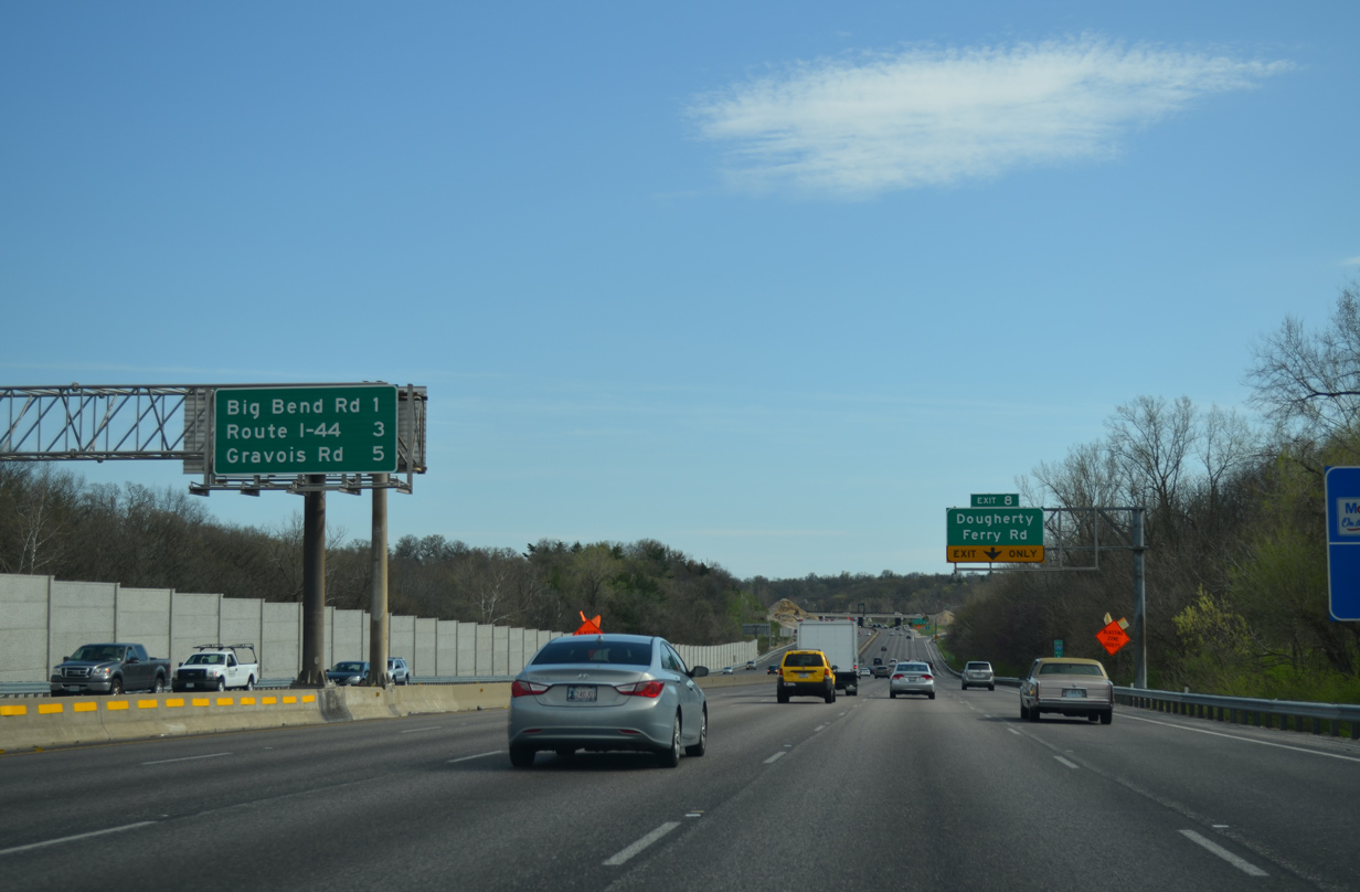
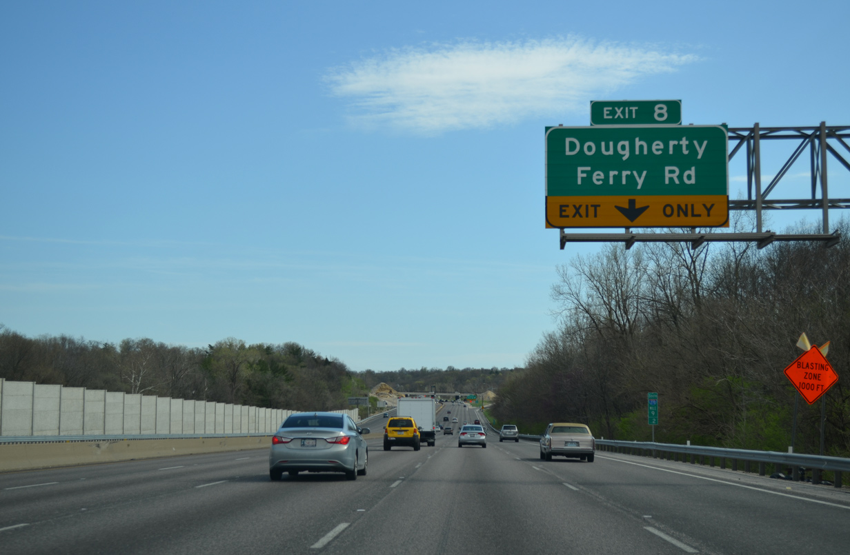
| Next in line for southbound motorists is the diamond interchange (Exit 8) with Dougherty Ferry Road at the Des Peres and Kirkwood city line. 04/13/13 |
|
| Dougherty Ferry Road angles northeast to Geyer Road in Kirkwood. West from Exit 8, the road expands to a five lane arterial parallel to Grand Glaize Creek to Big Bend Road at Valley Park. 04/13/13 |
|
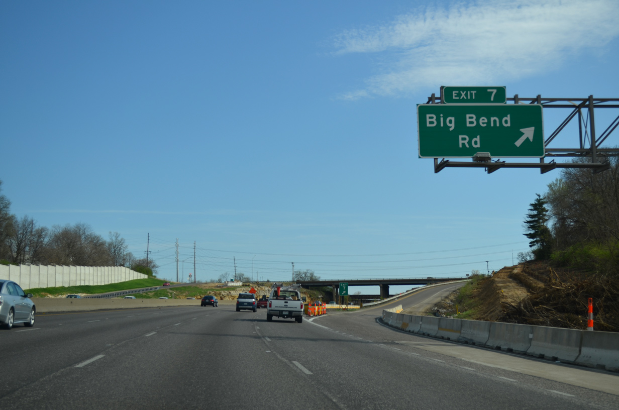
| Interstate 270 crosses into the city of Kirkwood on the half mile approach to Exit 7 with Big Bend Road. Exits 5B/A follow with Interstate 44 & U.S. 50 in two miles. 04/13/13 |
|
| Exit 7 consists of a half diamond interchange with Big Bend Road west to Valley Park and Mancehster and east through Kirkwood. Originally Exit 8 was a half diamond interchange with northbound access as well. 04/13/13 |
|
| Interstate 270 starts to curve southeast on the approach to the cloverstack interchange (Exits 5B/A) with Interstate 44, U.S. 50 and Missouri 360 (Watson Road) east. 04/13/13 |
|
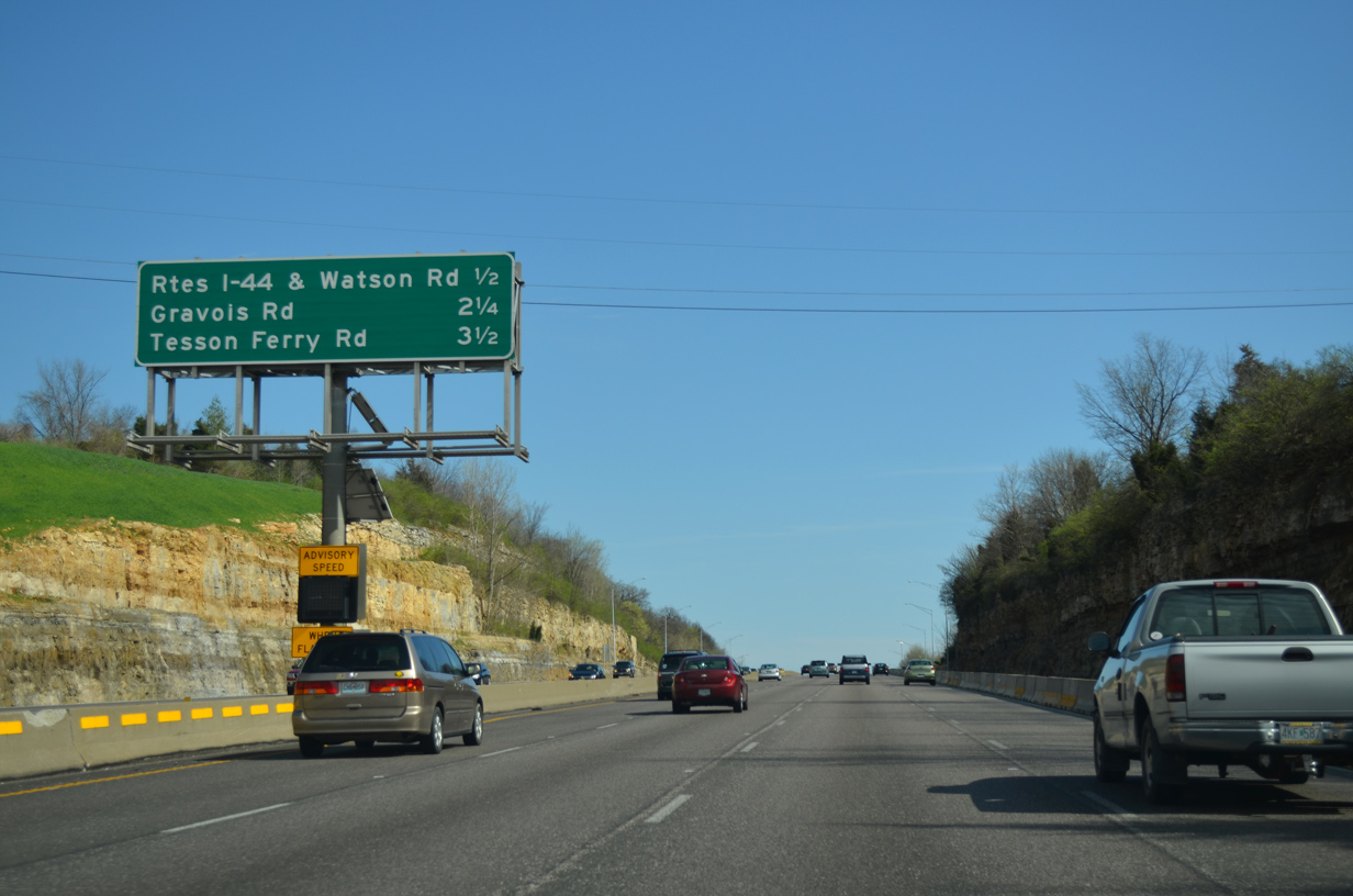
| The final two mainline exits of I-270 appear on this interchange sequence sign. A variable speed limit assembly here was repurposed to show the advisory speed. 04/13/13 |
|
| A lane drop occurs at Exits 5B/A for Interstate 44 & U.S. 50. The pair travel west from Lindbergh Boulevard (Exit 277B) at Kirkwood to Exit 247 near Union. 04/13/13 |
|
| Interstate 44 passes through Fenton, Valley Park and Eureka before exiting St. Louis County at Pacific. Springfield is the main control city heading west across the state, while Tulsa is used on signs in the St. Louis area. 04/13/13 |
|
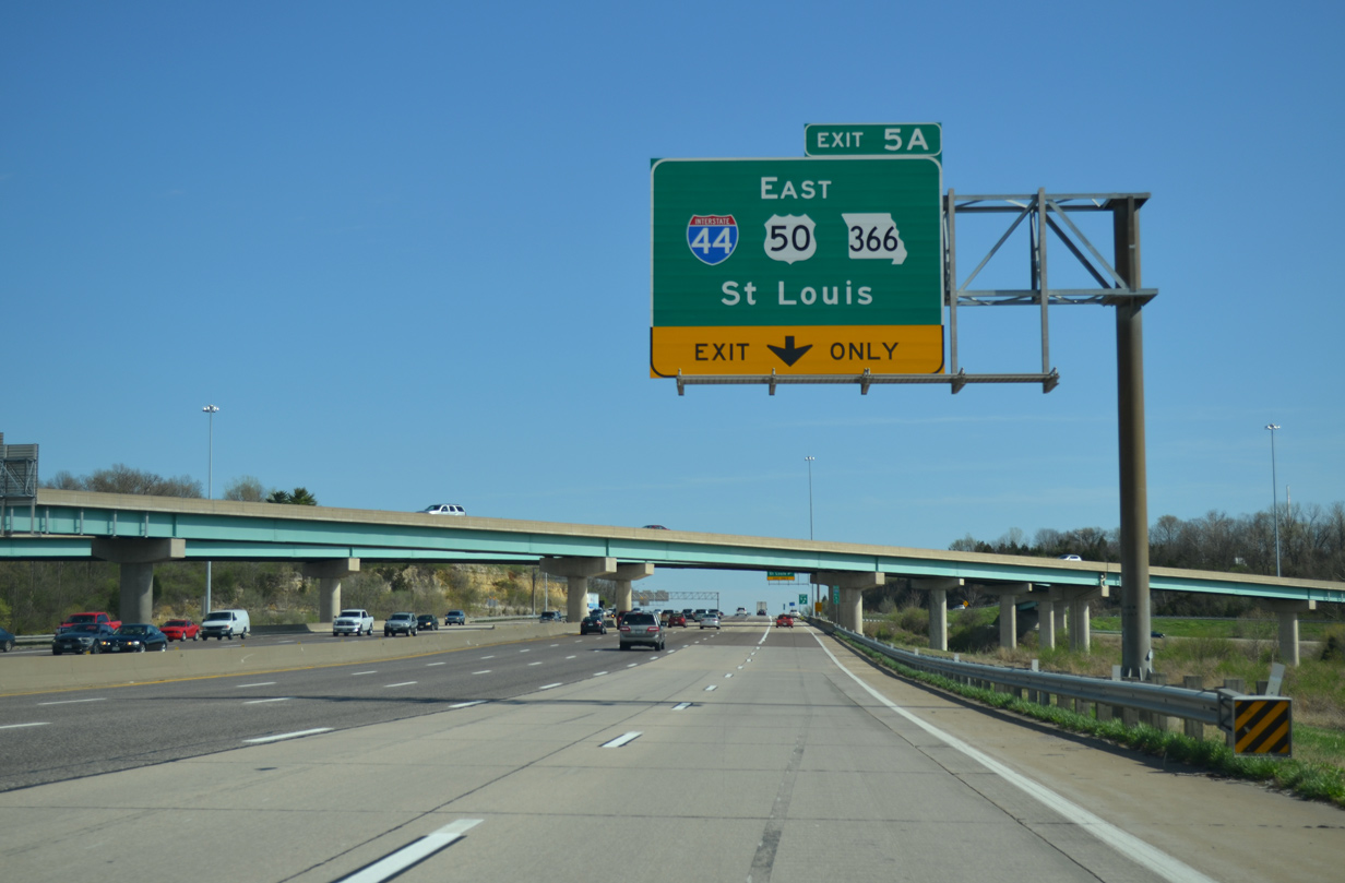
| Exit 5A loops onto a collector distributor roadway along I-44 east to a wye interchange with Missouri 366 (Watson Road).
MO 366 begins there and follows old U.S. 50 & 66 east to Crestwood, Marlborough and Shrewsbury into the Lindenwood Park neighborhood of St. Louis. MO 366 concludes a 12.0 mile route at Broadway Street at Marine Villa in St. Louis. 04/13/13 |
|
| Interstate 44 winds east northeast through Crestwood and Webster Groves to enter St. Louis at the Ellendale neighborhood. I-44 merges with I-55 north at LaSalle Park to the Poplar Street Bridge (PSB) and Downtown.
I-44 ended at the Mississippi River along the PSB until February 2014, when it was extended north over former I-70 to the west end of the new Stan Musial Veterans Memorial Bridge. 04/13/13 |
|
| Interstate 270 angles southeast across the city of Sunset Hills over the next several miles. Pictured here was a sign posted during the three-year period of variable speed limits along I-270. Static speed limits returned in June 2011. 12/20/09 |
|
| An auxiliary lane accompanies I-270 south from I-44 & U.S. 50 to the diamond interchange (Exit 3) with Missouri 30 (Gravois Road). 12/20/09 |
|
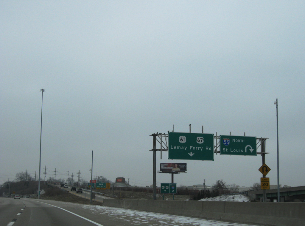
| 4.25 miles remain of I-270 to the exchange with I-55, I-255 north and U.S. 61/67 (Lemay Ferry Road). 12/20/09 |
|
| Missouri 30 totals 52.72 miles from I-44 (Exit 239) at St. Clair to Interstates 44 and 55 at their merge by the Soulard neighborhood in St. Louis. 12/20/09 |
|
| Two lanes branch away from I-270 south for Exit 3 to Missouri 30 (Gravois Road) in Sunset Hills. MO 30 (Gravois Road) heads east to Grantwood Village and Affton to enter St. Louis at Boulevard Heights. The state route takes a four lane divided highway west to Fenton, Murphy and High Ridge. 12/20/09 |
|
| Interstate 270 leaves the city of Sunset Hills for unincorporated St. Louis County on the approach to Exit 2 with Missouri 21 (Tesson Ferry Road). 12/20/09 |
|
| The first exit (Telegraph Road / MO 231) of Interstate 255 north appears on this centerline posted distance sign. 12/20/09 |
|
| Two miles of I-270 south remain leading into the cloverstack interchange (Exit 1A) with Interstate 55. Exit 2 departs after the Sappington Road overpass for MO 21 (Tesson Ferry Road). MO 21 concludes a 194.13 mile route from the Arkansas state line at MO 30 (Gravois Road). 12/20/09 |
|
| South from the diamond interchange (Exit 2) with I-270, Route 21 winds through south St. Louis County to span the Meramec River into Jefferson County. A freeway ensues south from Route 141, 20 miles to Highway B at Hillsboro. 12/20/09 |
|
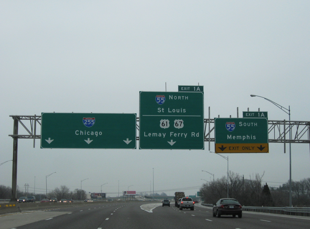
| Turning more easterly one mile ahead of Exit 1A, which references both ramps to Interstate 55 and the connection with U.S. 61/67 (Lemay Ferry Road) at Forder Road. 12/20/09 |
|
| As Interstate 270 south ends Interstate 255 north begins. I-255 encircles the east side of the St. Louis metropolitan area along a 30.82 mile route to I-270 at Edwardsville, Illinois. 12/20/09 |
|
| Exit 1A departs in one half mile for I-55. Three exits line the 3.77 mile stretch of I-255 to the Jefferson Barracks Bridge across the Mississippi River. 12/20/09 |
|
| Two lanes serve Exit 1A onto Interstate 55 south to Festus, Cape Girardeau and Memphis, Tennessee. I-55 retains eight overall lanes southward to Exit 185 at Barnhart and six overall lanes to Exit 180 at Pevely. 12/20/09 |
|
| Three lanes partition from the ending I-270 for Interstate 55 and the Lemay Ferry Road off-ramp. The cloverleaf interchange between the two freeways was upgraded with two new flyovers during work between 1991 and 1994. 12/20/09 |
|
| Exit 1A splits with the ramp for I-55 south. A loop ramp follows onto I-55 north for St. Lous. Interstate 55 enters the city at the Patch neighborhood, mirroring the course of the Mississippi River thorugh to the Poplar Street Bridge and Downtown. 12/20/09 |
|
| Until November 2008, the ramps for I-55 north and Lemay Ferry Road were signed as Exits 1B and 1C respectively. 12/20/09 |
|
| A single lane continues beyond the I-55 northbound loop ramp for U.S. 61/67 (Lemay Ferry Road) at Forder Road. U.S. 61/67 north combine with U.S. 50 west along Lindbergh Road nearby at Mehlville. The pair head south to Mattese and the city of Oakville. 12/20/09 |
Page Updated 12-11-2014.


 South
South