|
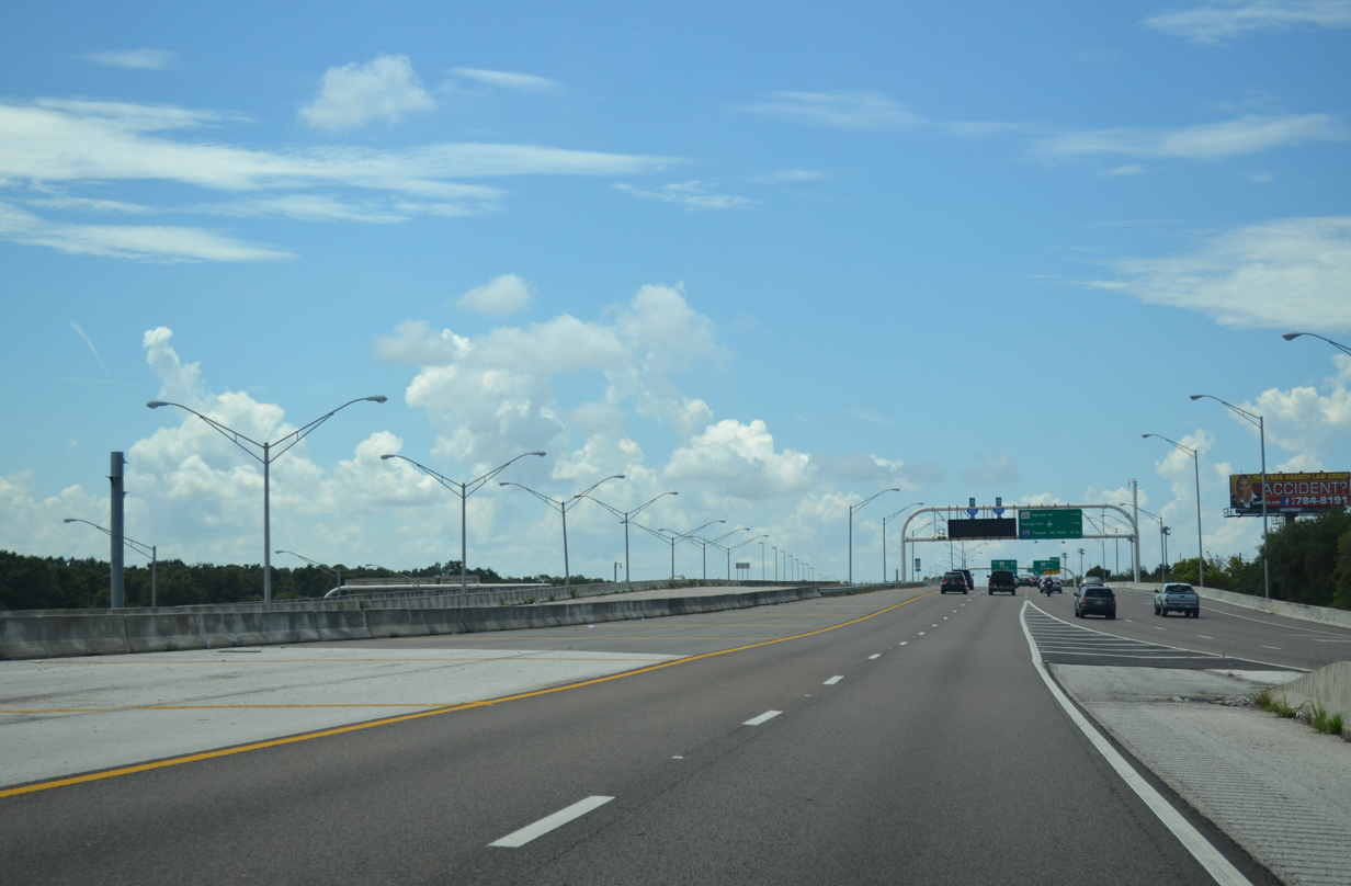
| With traffic added from SR 568 west, SR 589 crosses over Lake Le Clare Road one mile from the separation with the Veterans Express Lane. 05/29/19 |
|
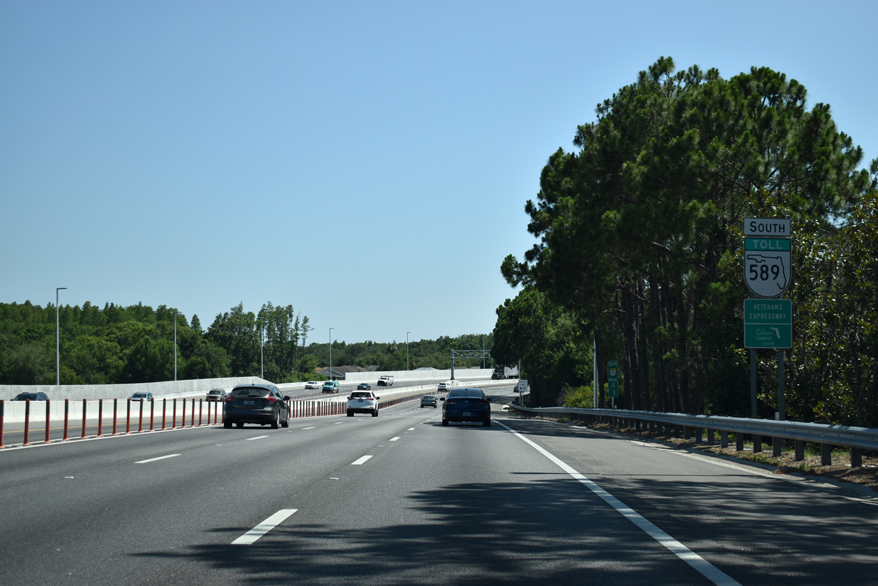
| Opened in Spring 2018, Phase 2 of the Veterans Express Lanes starts at the SR 589 transition from the Suncoast Parkway. 05/29/19 |
|
| A Veterans Expressway sign stands along the easterly curve by Lake LeClare. 05/29/19 |
|
| A diamond interchange (Exit 12) precedes the Sugarwood toll collection point with Hutchinson Road by the Northdale community. 05/29/19 |
|
| Spanning Wilcox Road, SR 589 reaches the first of two ingress points for the southbound Express Lane. 05/29/19 |
|
| Hutchinson Road winds east from Mobley Road near Cosme and Pretty Lake to Ehrlich Road and the Carrollwood area just south of SR 589. 05/29/19 |
|
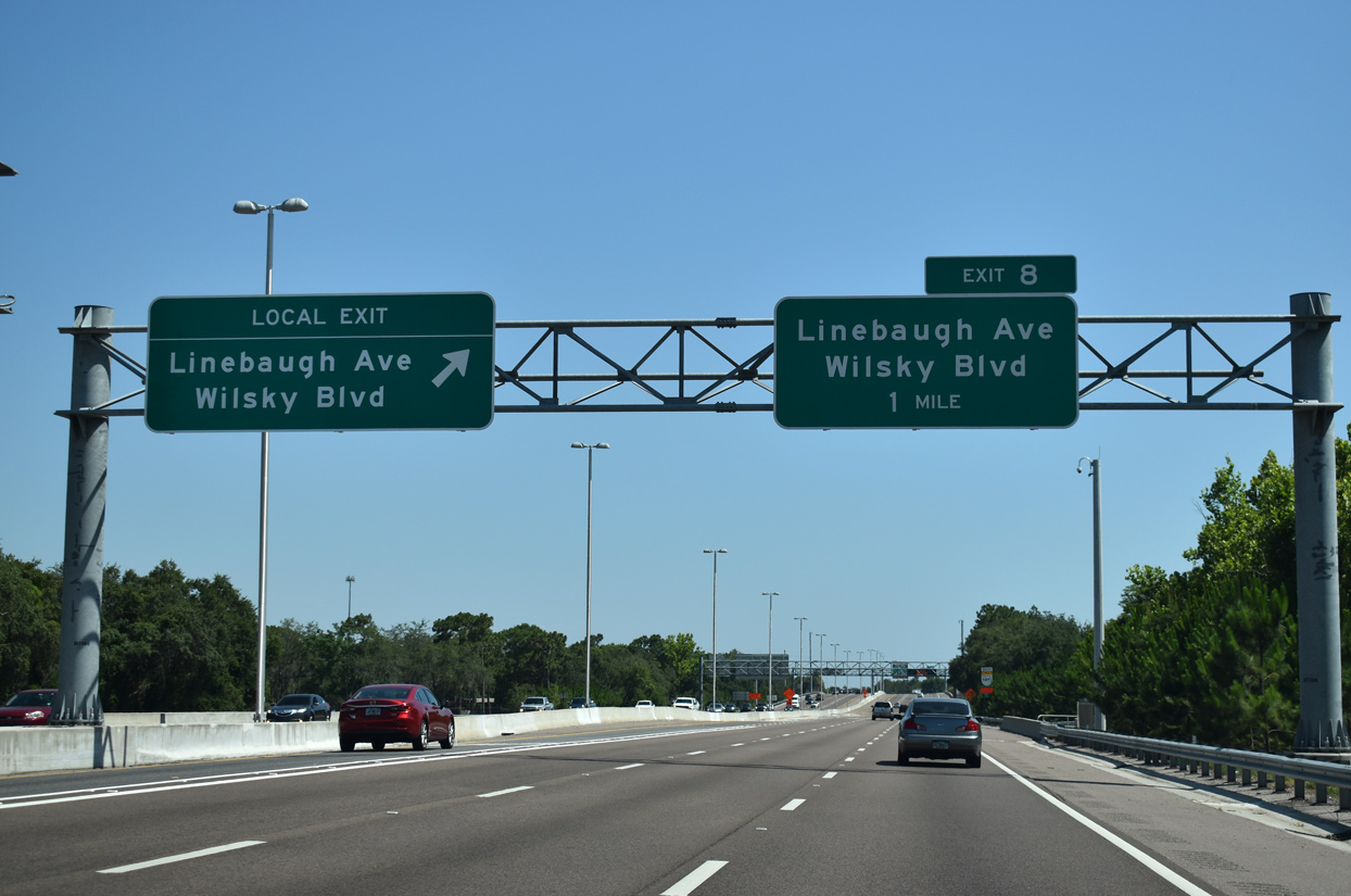
| The Veterans Express lane continues uninterrupted to an egress point ahead of Exit 8 (Wilsky Boulevard). 05/29/19 |
|
| Confirming marker posted beyond the Rawls Road underpass on SR 589 south. 05/29/19 |
|
| Ehrlich Road extends west from SR 597 (Dale Mabry Highway) to a single point urban interchange (SPUI) with the Veterans Expressway and adjacent Gunn Highway (CR 587). 05/29/19 |
|
| Arcing west by the Sugarwood Grove subdivision, travelers approach the first of two all electronic toll (AET) gantries. Demolished in 2014, this site was the previous location of the Sugarwood Toll Plaza. 05/29/19 |
|
| SR 589 winds westward from the AET gantry between a pair of subdivisions to Exit 10 for Ehrlich Road. Ehrlich Road joins the toll road with Citrus Park to the west. 05/29/19 |
|
| SR 589 weaves between a pair of subdivisions westward from the AET gantry to Exit 10. Ehrlich Road joins the toll road with Citrus Park and Westfield Citrus Park Mall to the west. 05/29/19 |
|
| Exit 10 departs SR 589 south for Ehrlich Road west to Gunn Highway (CR 587), which leads north from Citrus Park to Cosme. Ehrlich Road east becomes Bearss Avenue beyond Dale Mabry Highway through the Lake Magdalene area. 05/29/19 |
|
| Phase I Widening of the Veterans Expressway extended southward from CR 587 to SR 580. It included the addition of the Express lane south to Memorial Highway (Exit 3). 05/29/19 |
|
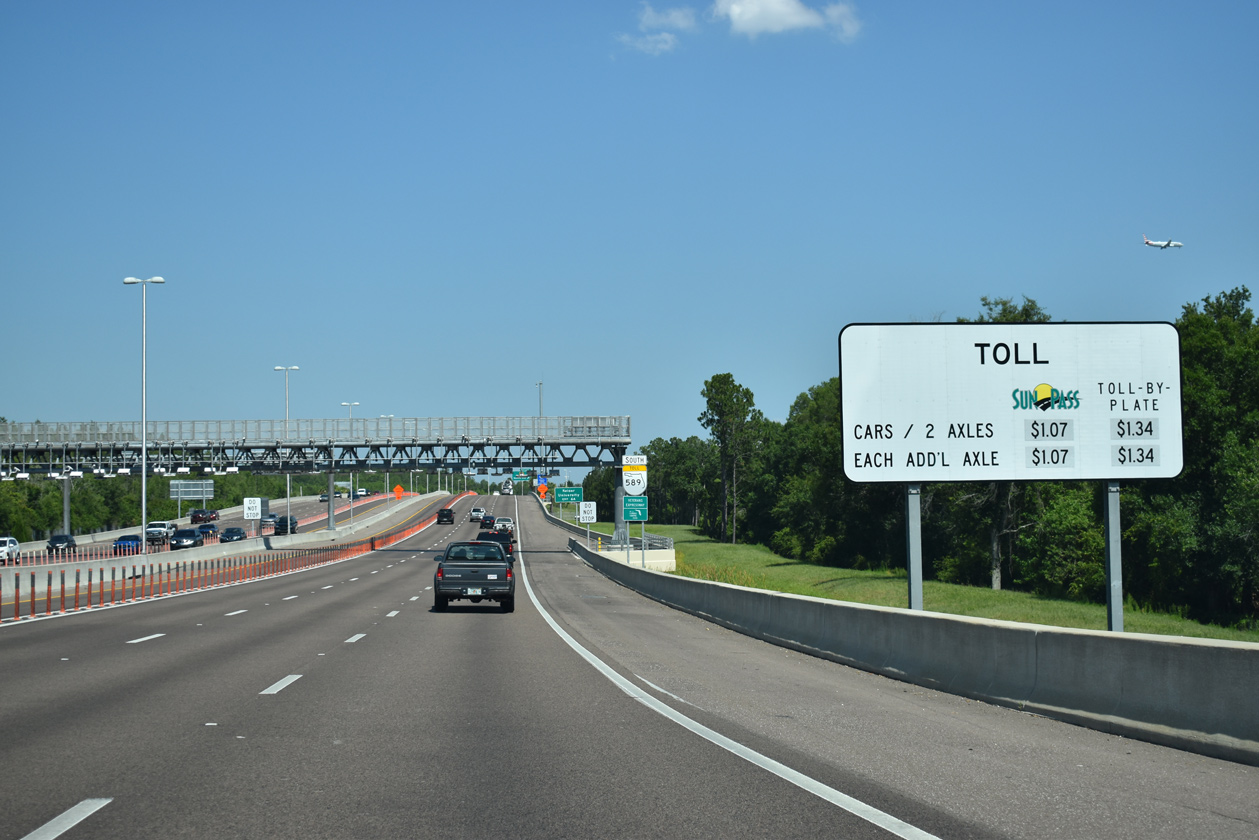
| Toll schedule sign for the Veteran Express Lane south. Rates vary depending upon traffic congestion on the general lanes. 05/29/19 |
|
| Gunn Highway (CR 587) leads east from Exit 9 to Carrollwood and the exchange of SR 580/597 at Dale Mabry Highway and Busch Boulevard. CR 587 extends 14.64 miles north from SR 597 to SR 54 at Odessa. 05/29/19 |
|
| Crossing Rocky Creek, SR 589 south enters the SPUI (Exit 9) with CR 587 (Gunn Highway). Gunn Highway east links with Lynn and Anderson Roads at Carrollwood. CR 589 stems west along Citrus Park Drive and south along Sheldon Road to Town 'n' Country. 01/14/22 |
|
| Continuing south from Gunn Highway toward the second Express Lane entrance on SR 589. 05/29/19 |
|
| SR 589 runs alongside the Upper Tampa Bay Trail ahead of Exit 8 for Wilsky Boulevard south to Linebaugh Avenue. 05/29/19 |
|
| Wilsky Boulevard stems south from Exit 8 to connect SR 589 with Linebaugh Avenue, Hanley Road and Waters Avenue at Town 'N' Country. 05/29/19 |
|
| A new overpass was constructed for Wilsky Boulevard and the loop ramps at Exit 8 during Phase I widening of the Veterans Expressway (SR 589). 01/14/22 |
|
| Exit 8 loops away from SR 589 south to Wilsky Boulevard. Linebaugh Avenue constitutes a busy suburban arterial between Westchase and Carrollwood. 01/14/22 |
|
| Turning southeast, SR 589 (Veterans Expressway) passes over Linebaugh Avenue one mile from Exit 6A with Waters Avenue (CR 584). 05/29/19 |
|
| Waters Avenue runs east from Exit 6A toward Egypt Lake-Leto and Lowery Park in Tampa. 01/14/22 |
|
| An entrance ramp joins SR 589 south from Linebaugh Avenue east at the Anderson toll collection point. 05/29/19 |
|
| The All Electronic Toll (AET) gantry west of Henderson Road replaced a conventional toll plaza within the wye interchange for Anderson Road. 01/14/22 |
|
| Exit 6A departs from SR 589 south ahead of the Anderson Road flyover, 0.9 miles north of Waters Avenue. Waters Avenue doubles as CR 584 for a distance of 7.22 miles between Countryway and SR 580 (Dale Mabry Highway). 01/14/22 |
|
| The ramps from Anderson Road south to SR 589 and from SR 589 north to the parallel arterial were realigned to no longer join the inside lanes of the Veterans Expressway. 05/29/19 |
|
| SR 589 advances two miles south from the SPUI with Waters Avenue to SR 580 (Hillsborough Avenue). 05/29/19 |
|
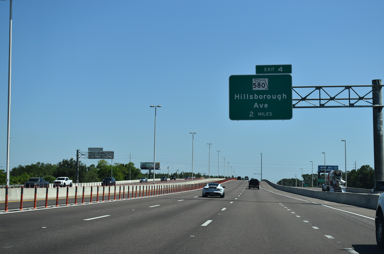
| The Veterans Expressway spans both Barry Road and Channel G of Sweetwater Creek, 1.25 miles ahead of Exit 4 with SR 580 (Hillsborough Avenue). 05/29/19 |
|
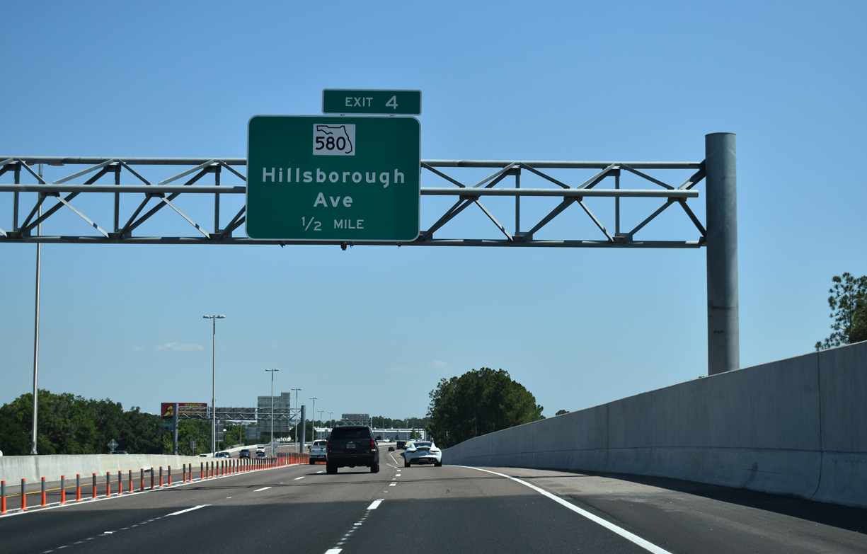
| Southbound SR 589 (Veterans Expressway) makes a subtle S-curve just ahead of the diamond interchange (Exit 4) with SR 580 (Hillsborough Avenue). 05/29/19 |
|
| SR 580 (Hillsborough Avenue) west skirts the northern reaches of Old Tampa Bay, crossing waters of Safety Harbor en route to Oldsmar, Safety Harbor, Clearwater and Dunedin in Pinellas County. SR 580 continues along Hillsborough Avenue east to Dale Mabry Highway at Drew Park, where U.S. 92 takes over to Seminole Heights in North Tampa. 05/29/19 |
|
| Eisenhower Boulevard forms a service road system for the Veterans Expressway south from Hillsborough Avenue to Memorial Highway. A slip ramp brings motorists on southbound from SR 580. 05/29/19 |
|
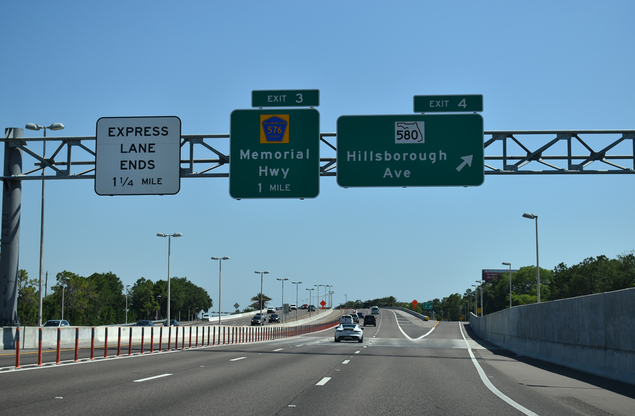
| The penultimate exit along southbound SR 589 leaves in one half mile for Memorial Highway (CR 576) west to Town 'N' Country. 05/29/19 |
|
| SR 589 straddles the west side of Tampa International Airport (TPA) from SR 580 south to Spruce Street (SR 616). An auxiliary lane runs between the SR 580 entrance ramp and CR 576 off-ramp on this stretch. 05/29/19 |
|
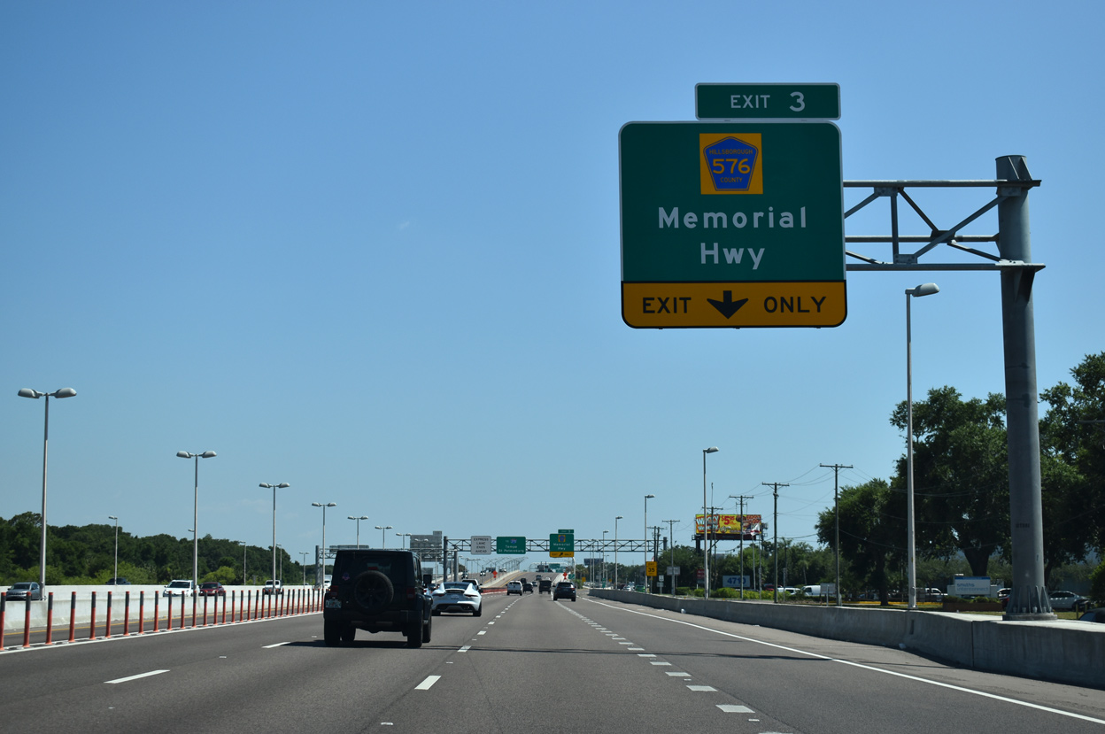
| The Veterans Express Lane southbound concludes within the diamond interchange (Exit 3) joining SR 589 with CR 576 (Memorial Highway) west. 05/29/19 |
|
| The forthcoming ramps with SR 60 (Courtney Campbell Causeway) west were reconstructed into a three-wye interchange as part of the massive rebuild of SR 60 east from Rocky Point to Interstate 275. 05/29/19 |
|
| A wide swath of pavement and a roadway stub remains from the original layout of the Veterans Expressway south at the wye interchange with Independence Parkway (Exit 2A from SR 589 north). 08/15/15 |
|
| An end shield for SR 589 appears at the Independence Parkway underpass. The Veterans Expressway directly transitions onto SR 60 (Memorial Highway) east ahead of Spruce Street (SR 616 east) and George J. Bean Parkway north to Tampa International Airport (TPA). 05/29/19 |
|
| A left side entrance ramp joins the south end of SR 589 from Independence Parkway east as Exit 2A departs for SR 60 (Courtney Campbell Causeway) west to Rocky Point and Clearwater in Pinellas County. 01/17/20 |
|
| Leading away from Memorial Highway, SR 60 is initially a freeway before intersecting Rocky Point Drive at a traffic light. Courtney Campbell Causeway traverses northern reaches of Old Tampa Bay for nine miles between Tampa and Bayview in Clearwater. 01/14/22 |
|
| Four lanes lead directly onto SR 60 (Memorial Highway) east from SR 589 (Veterans Expressway) south. The seamless transition provides commuters with a high speed route to Interstate 275 in the Westshore area of Tampa. 01/17/20 |
|
| Ramps from SR 60 east join both sides of the Veterans Expressway end just ahead of the ramps for SR 616 (Spruce Street) east to International Plaza mall and Bean Parkway north to TPA Airport. 01/14/22 |
Page Updated 02-28-2022.

 South
South