U.S. 25 joins Greenville and the Upstate of South Carolina with Hendersonville and Asheville. Northward beyond Asheville, U.S. 25 combines with U.S. 70 west from Weaverville to Hot Springs and Newport, Tennessee along the pre-I-40 route to Knoxville.
U.S. 25 was realigned to bypass Hendersonville and Flat Rock along I-26 between Exits 54 and 44 in July 2003. I-26 also overlays the older freeway taking U.S. 19-23-25-70 north from Asheville to Weaverville. The I-26 extension was established on August 5, 2003.
A 2.8 mile long stretch of U.S. 25 from N.C. 225 to Interstate 26 was widened between June 2009 and Spring 2012. The project upgraded the highway to freeway standards.
The Tuxedo bypass portion of U.S. 25 in Henderson County was completed in August 1980 with the opening of new roadway between Green River Road and Zirconia. The route south to the state line was already open at the time, and work continued on four laning the stretch east to the U.S. 176 connector.2 The original two lane segment of N.C. 225 (renumbered to U.S. 25 in 2004) opened from Zirconia to I-26 as part of the Henderson bypass section of Interstate 26 on January 12, 1967.3
|
| U.S. 25 constitutes a limited access highway northward from the South Carolina state line to I-26/U.S. 74. The first confirming marker in North Carolina stands beyond the S Bobs Creek Road overpass. 05/30/05 |
|
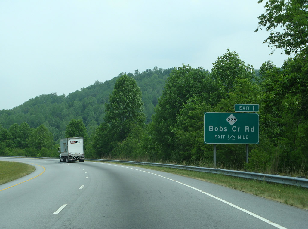
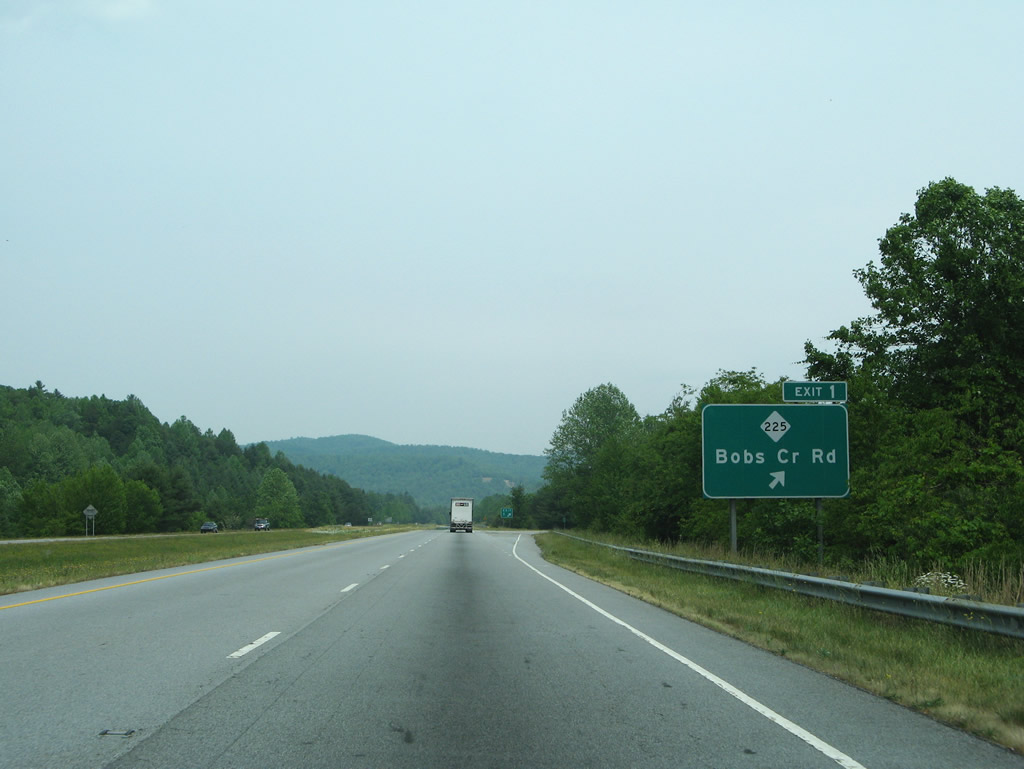
| U.S. 25 meets NC 225 at Exit 1. NC 225 overtakes Bobs Creek Road from SR 1104 eastward to Old U.S. 25 north of Posey Mountain and Chestnut Springs, South Carolina. 05/31/07 |
|
| Northbound U.S. 25 at the diamond interchange (Exit 1) with Bobs Creek Road (NC 225 north). Bobs Creek Road extends west from the exit between Long Mountain and the Saluda Mountains to Green River Road at Maybin Mountain. NC 225 meanwhile parallels U.S. 25 north for nine miles. 05/31/07 |
|
| U.S. 25 winds northward by Long Mountain toward the community of Tuxedo. The crest of the Blue Ridge Mountains appear on the northern horizon. 05/31/07 |
|
| Green River Road parallels the Green River northeast from Green River Gap on the Transylvania County line to cross paths with U.S. 25 at a diamond interchange (Exit 3). 05/31/07 |
|
| Drivers bound for the community of Tuxedo on Lake Summit depart U.S. 25 north at Exit 3 for Green River Road east. Green River Road ends at NC 225 (Old U.S. 25) south of town. 05/31/07 |
|
| Passing over Mt. Olivet Road along U.S. 25 northbound at Tuxedo. 05/31/07 |
|
| NC 225 (Old U.S. 25) leads north from Tuxedo and switches sides with U.S. 25 at Exit 5 near Zirconia. NC 225 continues north along Greenville Highway by King Mountain into Flat Rock. 05/31/07 |
|
| U.S. 25 runs along McAlpine Mountain in the Blue Ridge Mountains ahead of Exit 5. 05/31/07 |
|
| Exit 5 leaves U.S. 25 north for NC 225 (Greenville Highway). This exchange represented the swap between NC 225 northeast to I-26/U.S. 74 and U.S. 25 northward into Hendersonville. Changes were made in 2004 to area signage, shifting U.S. 25 to bypass Hendersonville via NC 225 and I-26. This left NC 225 to follow old U.S. 25 into the county seat. 05/31/07, 08/23/03 |
|
| U.S. 25 continues north as a freeway to U.S. 176 & U.S. 25 Business (Spartanburg Highway) and as a surface highway to I-26/U.S. 74 near East Flat Rock. U.S. 25 Truck used to follow the route north to U.S. 176. 05/31/07, 08/23/03 |
|
| Interstate 26 trailblazer posted along U.S. 25 northbound at Zirconia. Widening of the two lane stretch of roadway leading north to the merge with I-26/U.S. 74 was undertaken between June 2009 and April 2012. The $17 million project brought the roadway up to freeway standards, eliminating all at-grade intersections with the construction of frontage roads for area residents.1 05/31/07 |
|
| Next in line for northbound drivers along U.S. 25 is the diamond interchange with U.S. 176 (Spartanburg Highway) east of Butt Mountain. U.S. 176 connects the expressway with Saluda and Tryon to the east and East Flat Rock and Hendersonville to the north. 05/31/07 |
|
| U.S. 25 Business follows U.S. 176 (Spartanburg Highway) northwest from Five Points to S Main Street (NC 225 / old U.S. 25) in Hendersonville. There U.S. 176 ends and U.S. 25 Business turns northward to the central business district. 05/31/07, 08/23/03 |
|
| U.S. 25 north near the former intersection with Kay Road. This at-grade was removed during the freeway upgrade project for U.S. 25. 05/31/07 |
|
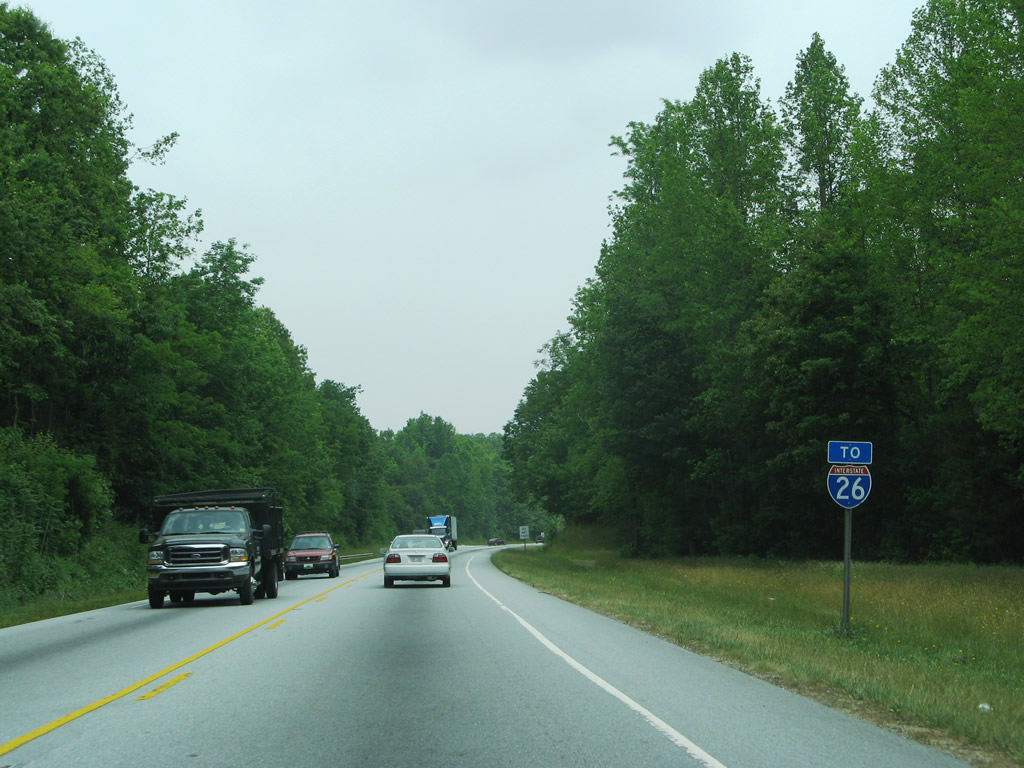
| A short distance north of Tabor Road is the trumpet interchange that joins U.S. 25 north with I-26/U.S. 74 west. 05/31/07 |
|
| U.S. 25 widens to two lanes ahead of the ramp split to I-26/U.S. 74. U.S. 74 overlaps with I-26 from Columbus northwest to I-40/240. 05/31/07 |
|
| Asheville lies 23 miles to the north. Spartanburg is a 37 mile drive to the southeast. I-26/U.S. 25-74 have two interchanges for Hendersonville as well. 05/31/07 |
|
| U.S. 25 follows Interstate 26 west from here (Exit 54) to Exit 44 and again from Exit 23 northward to Exit 19. 05/31/07 |
|
| U.S. 25 (Asheville Highway) southbound at I-26/U.S. 74 (Exit 44) at Fletcher in Henderson County. U.S. 25 combines with I-26 to bypass Hendersonville and Flat Rock to the east between Exit 44 and 54. U.S. 25 Business continues Asheville Highway south into Hendersonville. 08/13/04 |
|
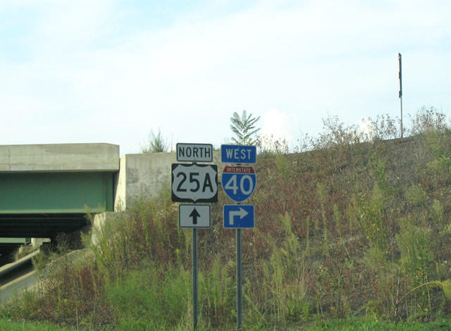
| U.S. 25A (Sweeten Creek Road) north at Interstate 40 (Exit 51). U.S. 25 parallels the route to the west along Hendersonville Road through Arden, Skyland, Valley Springs and Biltmore Forest. 09/12/04 |
Sources:
- "U.S. 25 widening to begin." The Times-News (Hendersonville, NC), June 4, 2009.
- "U.S. 25 By-Pass Nears Completion." The Times-News (Hendersonville, NC), July 21, 1980.
- "Interstate 26 Will Be Reality Thursday." Herald-Journal (Spartanburg, SC), January 11, 1967.
- 08/23/03 by AARoads and Justin Cozart.
- 08/13/04 by Carter Buchanan.
- 09/12/04 by Carter Buchanan.
- 05/30/05 by AARoads.
- 05/31/07 by AARoads and Carter Buchanan.
Connect with:
Interstate 26
Interstate 40
Interstate 240
U.S. 19
U.S. 64
U.S. 70
U.S. 74
Page Updated 01-30-2013.

 North
North