|
| SR 50 begins in the city of Weeki Wachee, overtaking Cortez Boulevard from County Road 550 at U.S. 19. 03/26/18 |
|
| SR 50 travels 12 miles east from Weeki Wachee to Brooksville and 77 miles to Orlando. 03/26/18 |
|
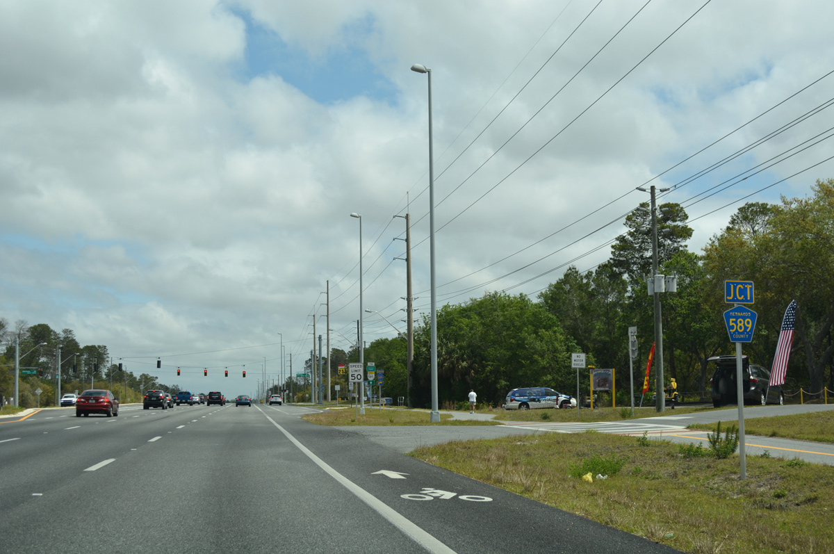
| Just east of the city line, SR 50 (Cortez Boulevard) meets the north end of County Road 589 (Deltona Boulevard). 03/26/18 |
|
| Deltona Boulevard represents one of two main north-south arterials through the community of Spring Hill. CR 589 follows the boulevard 5.31 miles south to Weekiwachee Prairie Lake and CR 574 (Spring Hill Drive). 03/26/18 |
|
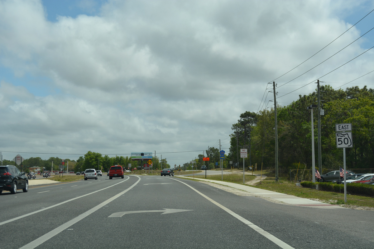
| Expansion of SR 50 to six lanes between U.S. 19 in Weeki Wachee and the Suncoast Parkway (SR 589) was underway from October 2012 to October 2015. 03/26/18 |
|
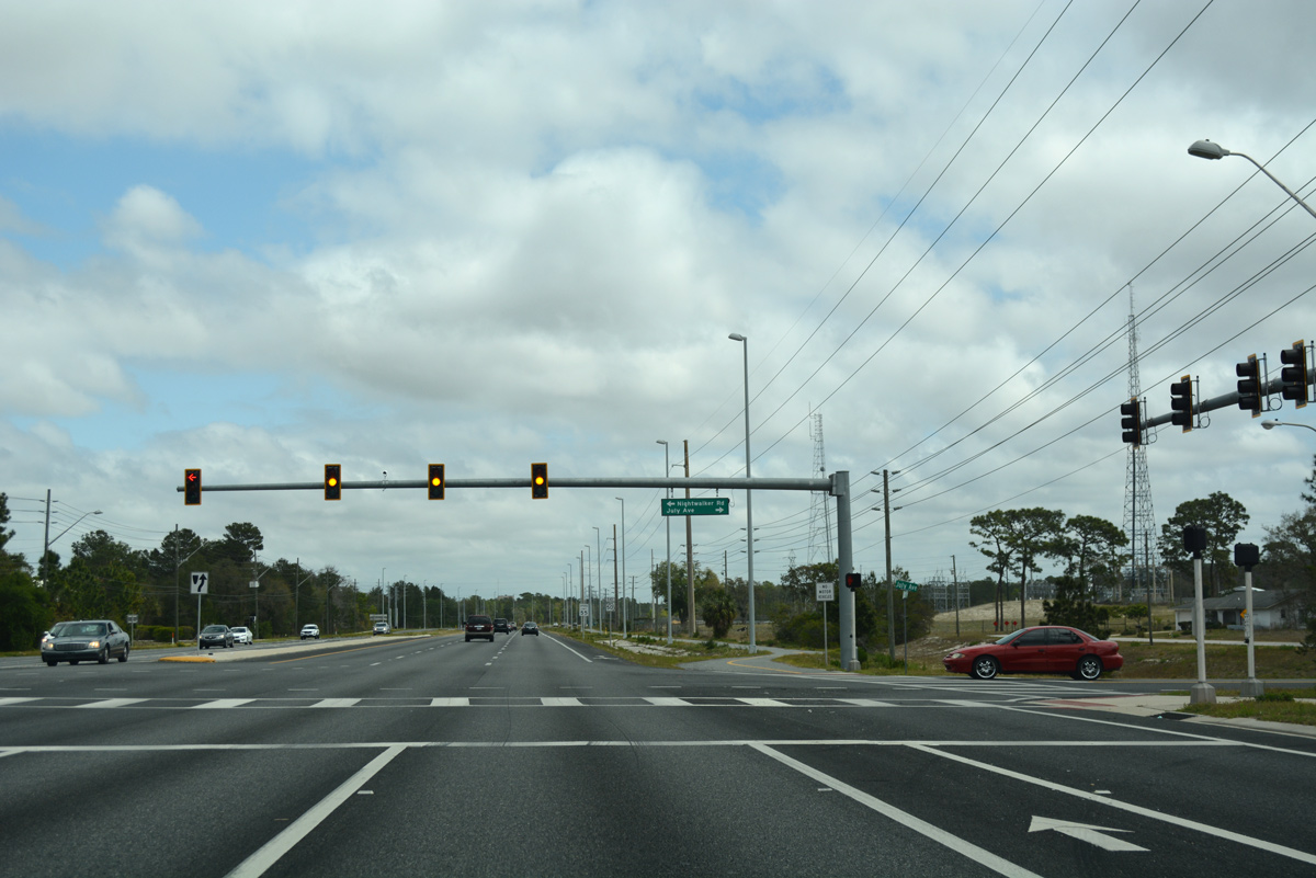
| Cortez Boulevard intersects Night Walker Road north and July Avenue south at this traffic light. 03/26/18 |
|
| SR 50 lines the northern boundary of the Sand Hill Scout Reservation to the signal for Oak Hill Hospital. 03/26/18 |
|
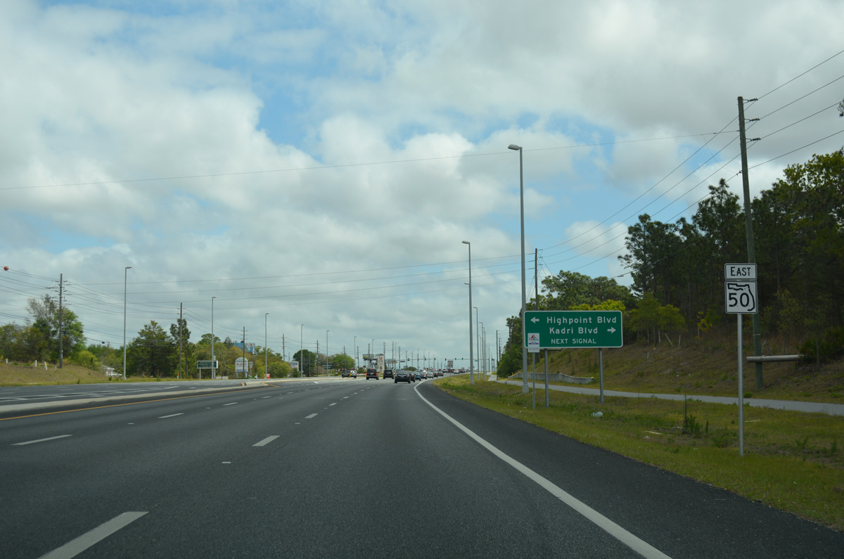
| Highpoint Boulevard ties into Cortez Boulevard opposite Kadri Boulevard south as the main entrance to the High Point Golf Club community. 03/26/18 |
|
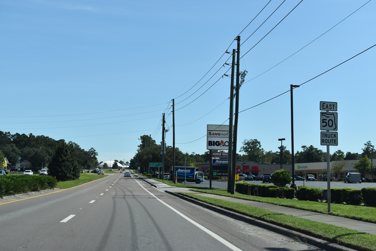
| SR 50 (Cortez Boulevard) advances due east through an increasing amount of commercial development on the north side of Spring Hill. 03/26/18 |
|
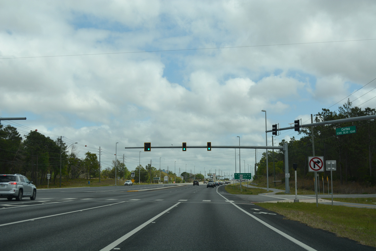
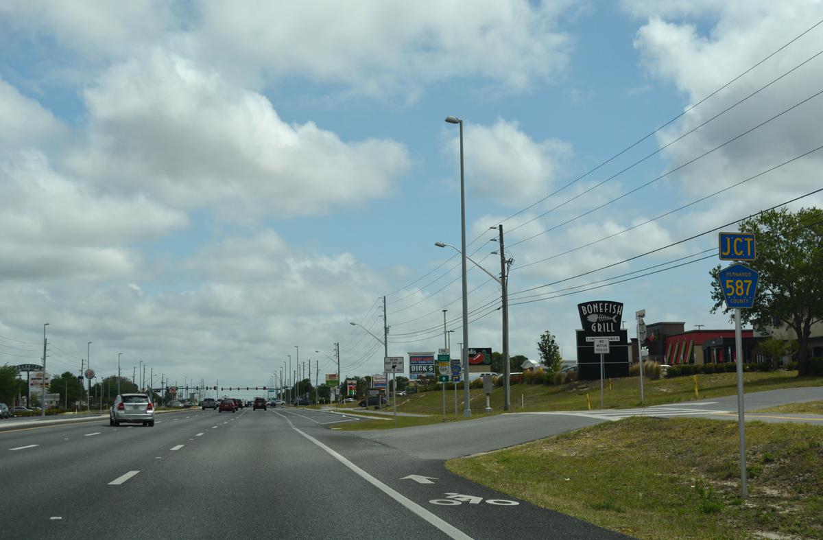
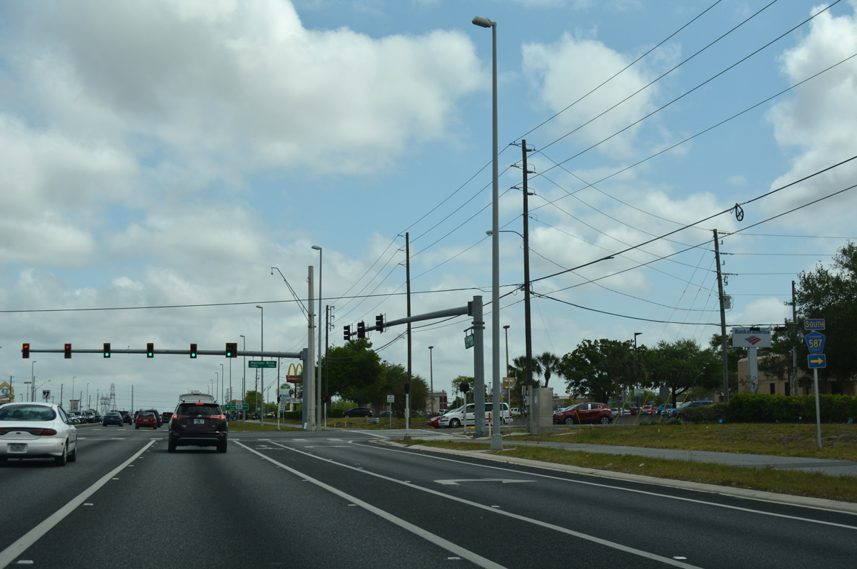
| The succeeding traffic light along SR 50 east joins Cortez Boulevard with the north end of Hernando County Road 587 (Mariner Boulevard). 03/26/18 |
|
| Mariner Boulevard ventures south from parallel Jacqueline Road to become CR 587 at SR 50. The county road winds 7.87 miles southward through Spring Hill to end at County Line Road (CR 578). 03/26/18 |
|
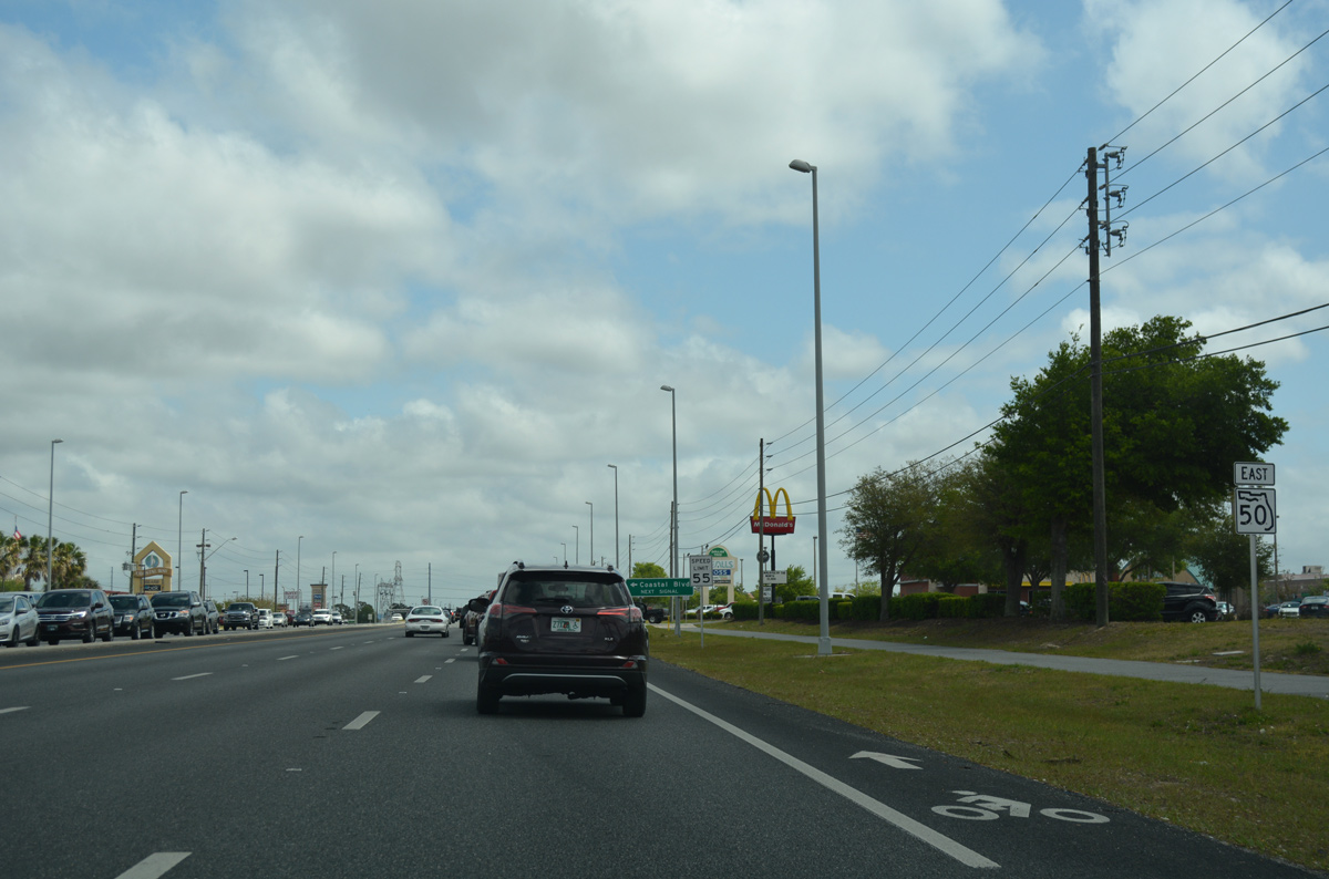
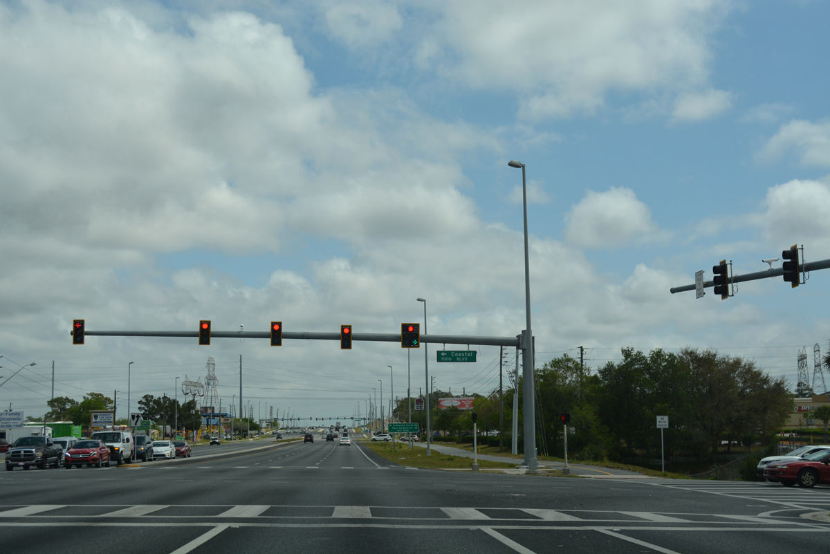
| Big box retail lines both sides of SR 50 between CR 587 and CR 493 (Sunshine Grove Road). A traffic light lies midway along this stretch at Coastal Boulevard. 03/26/18 |
|
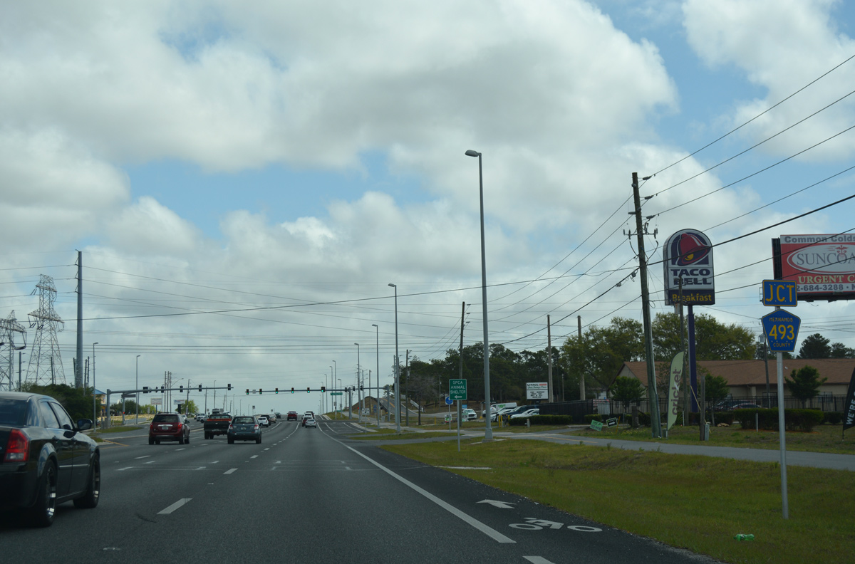
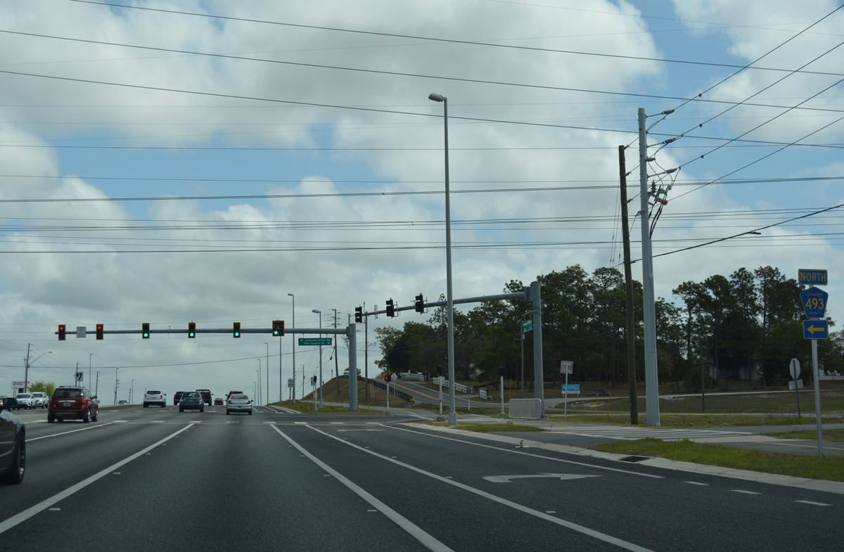
| Hernando County Road 493 leads north from SR 50 along Sunshine Grove Road to County Road 476 (Centralia Road) at Royal Highlands. The FDOT Federal Aid Report only references the northernmost 1.51 miles, from Sorrel Street to CR 476, as a county road. 03/26/18 |
|
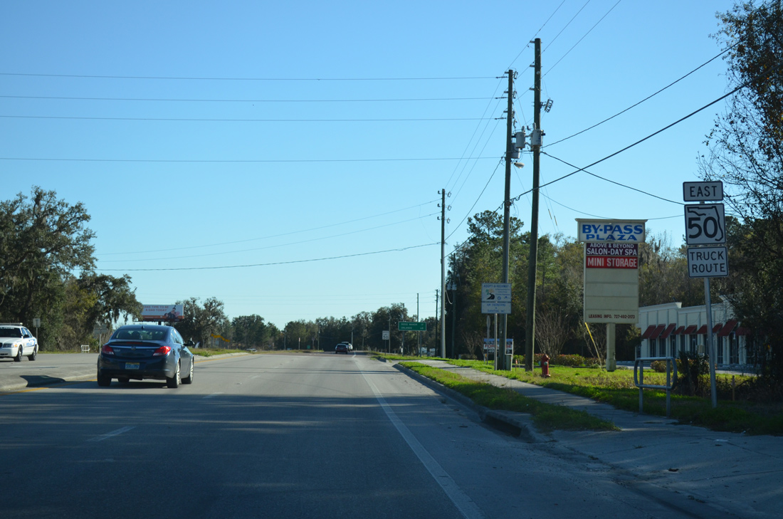
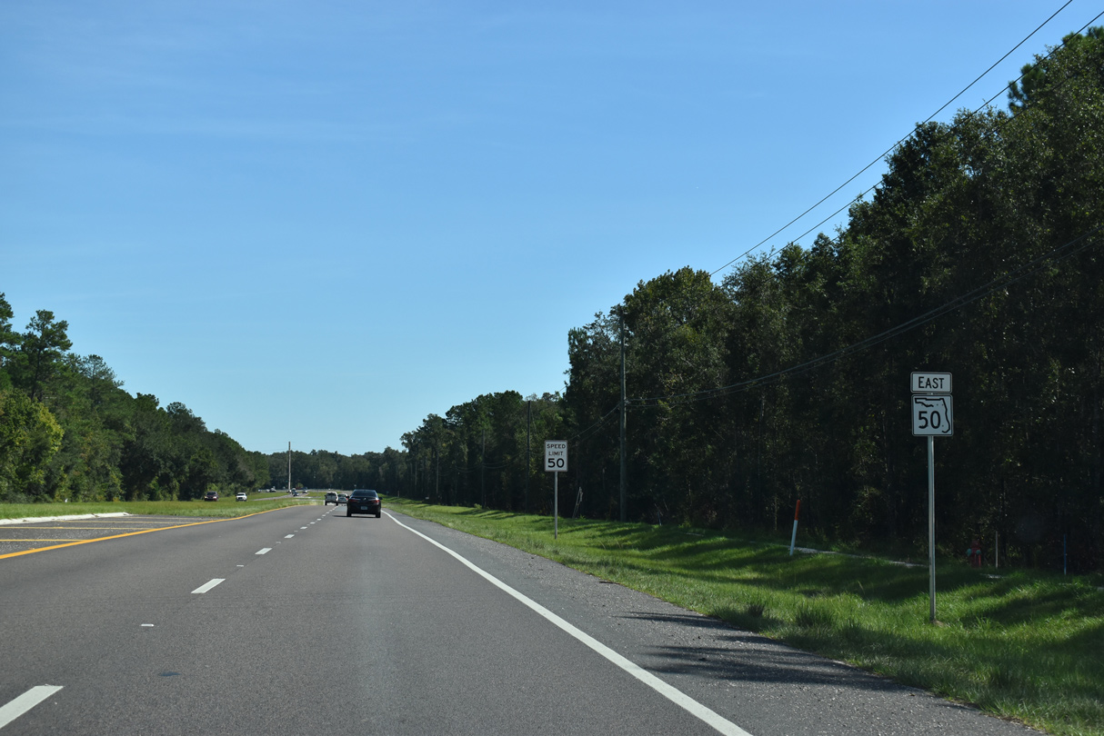
| Confirming marker for SR 50 east, posted east of CR 493 and south of the Brookridge Community. 03/26/18 |
|
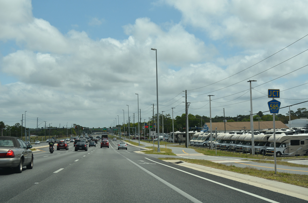
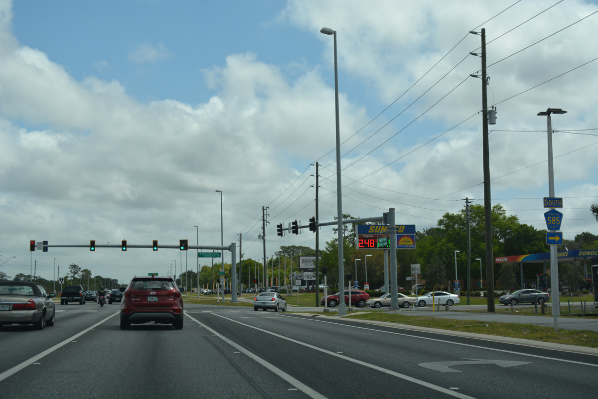
| Traveling along the northeast side of Spring Hill, SR 50 next meets the north end of Hernando County Road 585 (Barclay Avenue). 03/26/18 |
|
| CR 585 (Barclay Avenue) heads south 7.09 miles to County Line Road through eastern areas of Spring Hill. 03/26/18 |
|
| The Suncoast Parkway parallels County Road 585 just to the east between SR 50 and Pasco County. 03/26/18 |
|
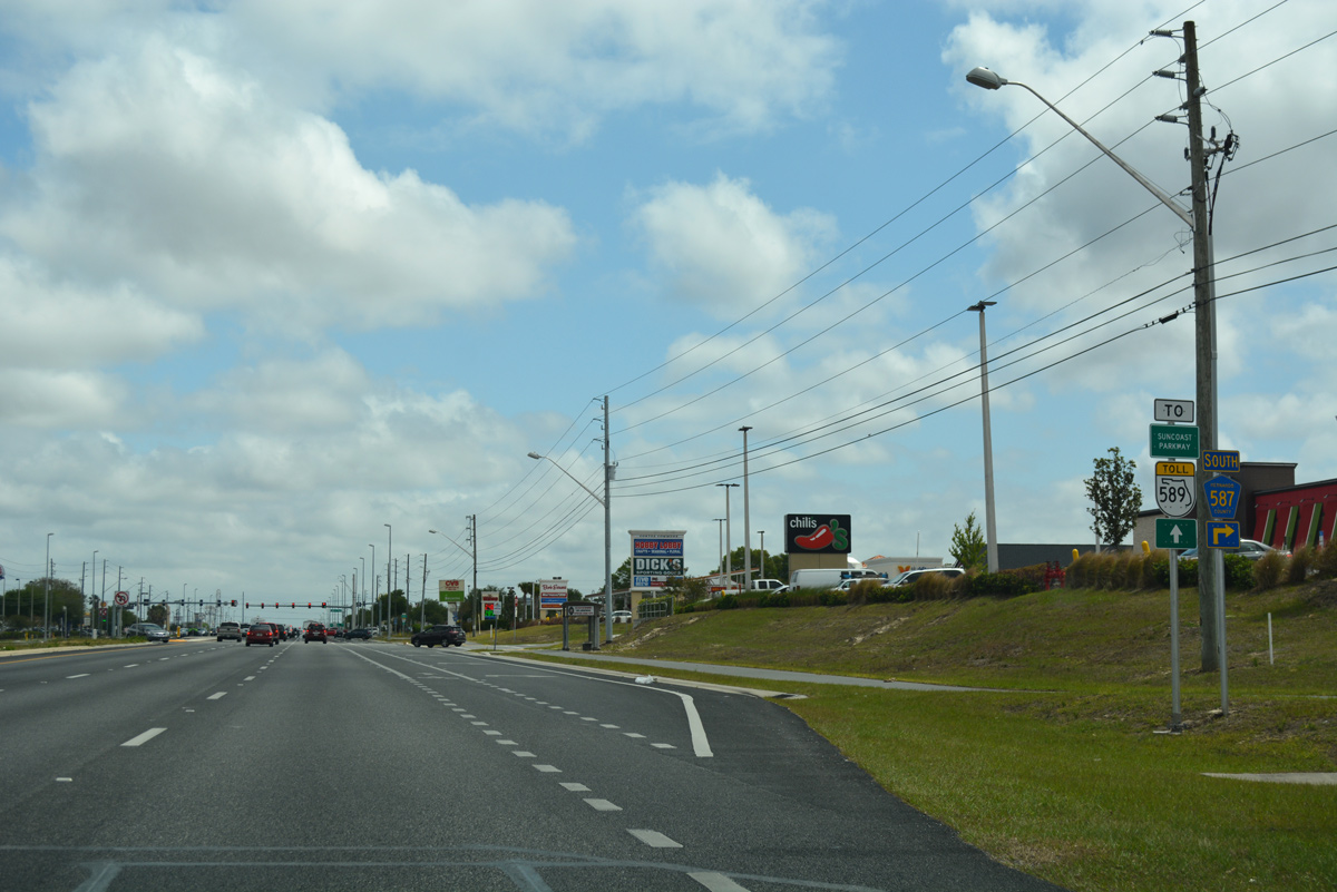
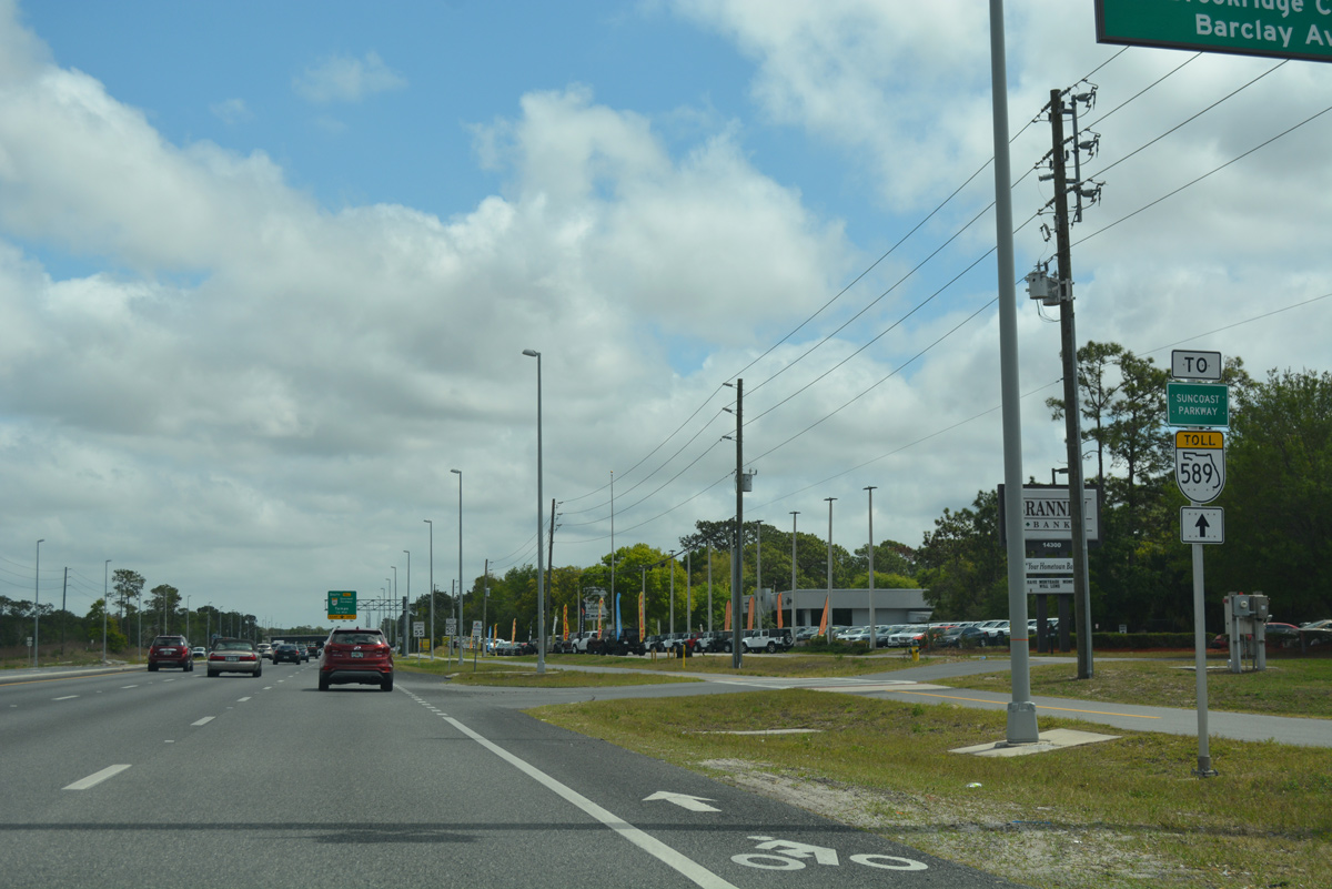
| A lane drop on SR 50 east occurs at the forthcoming ramp for SR 589 southbound. 03/26/18 |
|
| New overheads went up for SR 50 east to SR 589 south as part of the six-laning of Cortez Boulevard between U.S. 19 and the Suncoast Parkway. A diamond interchange joins the two roads in one half mile. 03/26/18 |
|
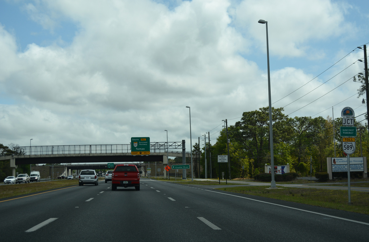
| The Suncoast Trail, a multi-use path parallel to SR 589 through both Hernando and Pasco Counties, elevates to pass over Cortez Boulevard as SR 50 reaches the southbound ramp to Tampa. 03/26/18 |
|
| Motorists joining SR 589 south reach New Port Richey in 29 miles and Tampa in 48 miles (via SR 60 east and I-275 north). 03/26/18 |
|
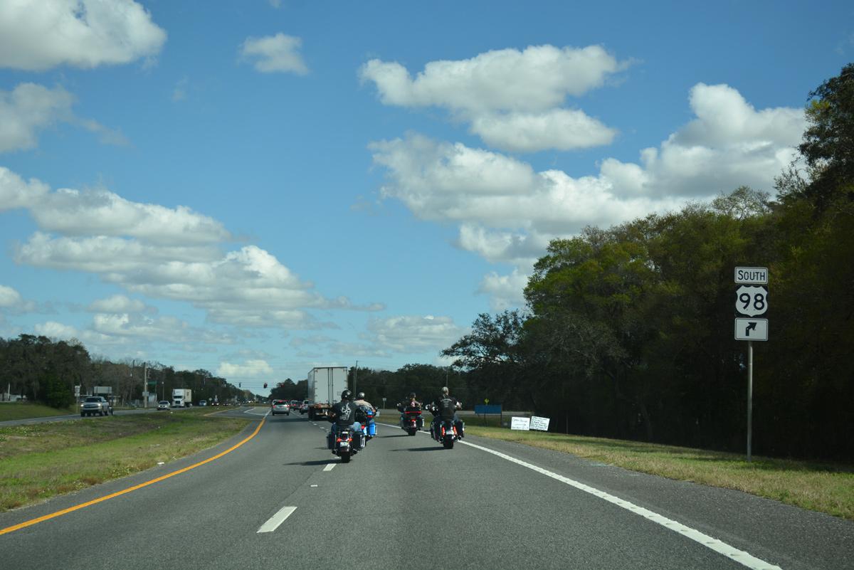
| A left turn takes motorists from SR 50 east onto the Suncoast Parkway north 10.7 miles to U.S. 98 near the Citrus County line. 03/26/18 |
|
| The Suncoast Parkway opened north from U.S. 98 (Ponce De Leon Boulevard) to SR 44 in Citrus County on February 28, 2022. 02/15/14 |
|
| SR 50 curves northward and splits with Wiscon Road (CR 570) immediately east of SR 589. 03/26/18 |
|
| Wiscon Road branches east from Cortez Boulevard to Wiscon and U.S. 41 in south Brooksville. Hernando County Road 570 follows all 4.2 miles of Wiscon Road. 03/26/18 |
|
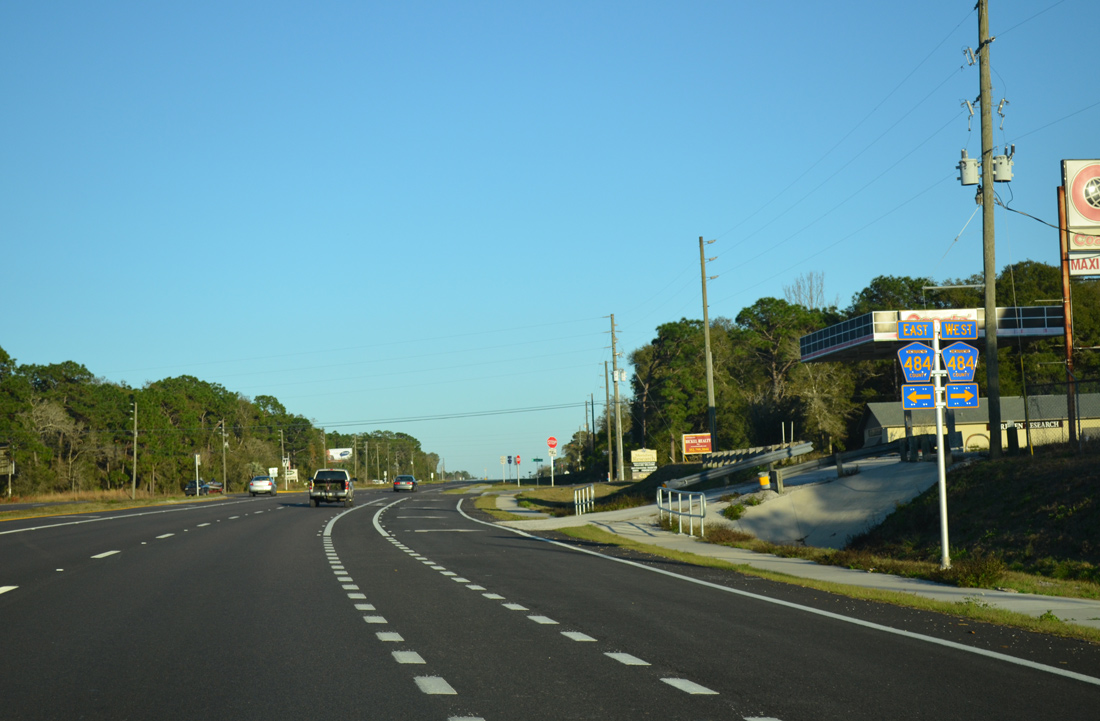
| Fort Dade Avenue angles northeast from Wiscon Road to become County Road 484 at SR 50. The route continues to County Road 491 (Citrus Way), which heads north to Lecanto in Citrus County. 02/09/14 |
|
| Hernando County Road 484 loops north from SR 50 as part of a 12.63 mile alignment east through Brooksville. The county road concludes a half mile south of SR 50 at Wiscon Road (CR 570). 02/09/14 |
|
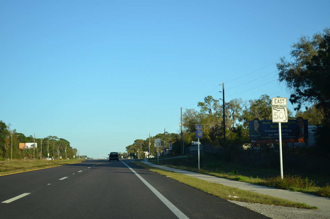
| SR 50 meets the north end of County Road 583 (California Street) as Cortez Boulevard turns eastward again. 02/09/14 |
|
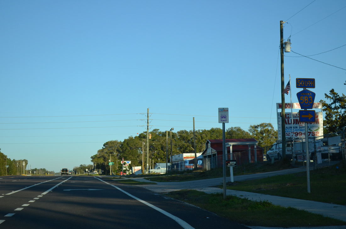
| A 4.19 mile route, Hernando County Road 583 follows all of California Street south to Wiscon and Spring Hill Drive (CR 574) at Brooksville-Tampa Bay Regional Airport (BKV). 02/09/14 |
|
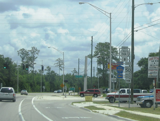
| SR 50 curves northward again on the approach to Brooksville and SR 50A (Jefferson Street) east and County Road 485 (Cobb Road) north. Cortez Boulevard veers southward to bypass Brooksville with SR 50A acting as a business loop to Downtown. 02/09/14 |
|
| U.S. 98 travels to Brooksville from Sugarwood Mills in Citrus County to the northwest. Hernando County Road 485 (Cobb Road) provides a direct route to U.S. 98 north from SR 50 east for interests to Crystal River. Motorists bound for U.S. 98 south are directed to remain on SR 50 and bypass Downtown Brooksville. 06/05/04 |
|
| SR 50 splits with SR 50A (Jefferson Avenue) to follow an older alignment of SR 50 through Downtown Brooksville. Hernando County Road 485 (Cobb Road) begins at the same intersection and travels 4.45 miles north to U.S. 98 (Ponce De Leon Boulevard). 06/05/04 |
|
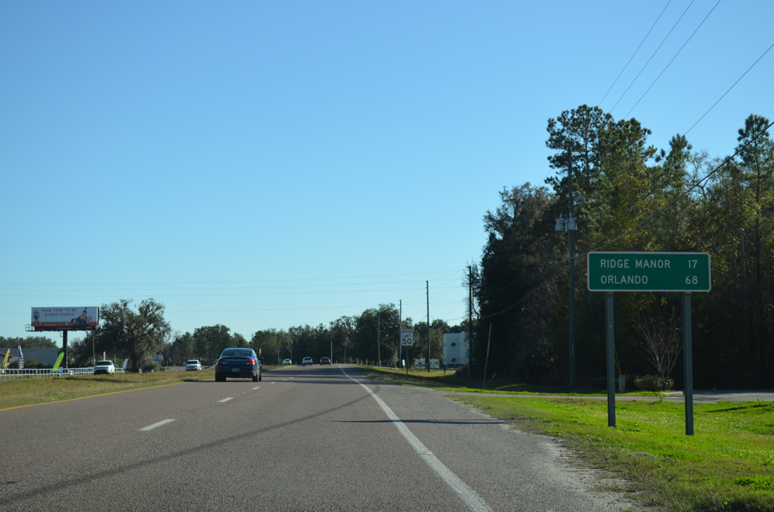
| Eastbound distance sign posted on the Brooksville bypass section of SR 50. Ridge Manor lies 17 miles to the east. Orlando is another 51 miles beyond the split with U.S. 98 south. 02/09/14 |
|
| Buck Hope Road ties into SR 50 (Cortez Boulevard) at a retail area surrounding the forthcoming junction with U.S. 41 (Broad Street). 02/09/14 |
|
| U.S. 41 (Broad Street) enters Brooksville from Masaryktown near the Pasco County line. 02/09/14 |
|
| U.S. 41 north provides another route to Downtown Brooksville from SR 50 (Cortez Boulevard) east. The US highway carries six overall lanes along this stretch as the main commercial strip for the county seat. 02/09/14 |
|
| Trailblazers direct motorists bound for U.S. 98 onto U.S. 41 north for Citrus County and SR 50 east for Ridge Manor. U.S. 41 and 98 share a brief overlap through Downtown. 02/09/14 |
|
| Additional retail lines the south side of SR 50 as Cortez Boulevard leads away from U.S. 41 (Broad Street). 10/23/19 |
|
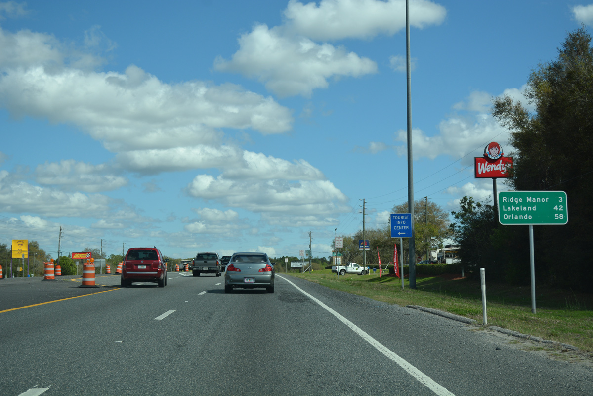
| Ridge Manor is one mile closer while Orlando is two miles closer on this distance sign as compared to the one posted south of SR 50A (Jefferson Street). 10/23/19 |
|
| SR 50 (Cortez Boulevard) exits the Brooksville city limits ahead of the traffic light with County Road 445 (Main Street) north and Mitchell Road south. 10/23/19 |
|
| Main Street leads due north to the Hernando County Courthouse. CR 445 follows Main as an unsigned route to Howell Avenue; Howell Avenue completes the 3.15 mile route to U.S. 41 on the north side of Brooksville. 10/23/19 |
|
| Mitchell Road extends south from the end of CR 445 (Main Street) to County Road 581 (Emerson Road). 02/09/14 |
|
| SR 50 crosses a CSX Railroad at-grade just east of Main Street and west of this shield assembly. 10/23/19 |
|
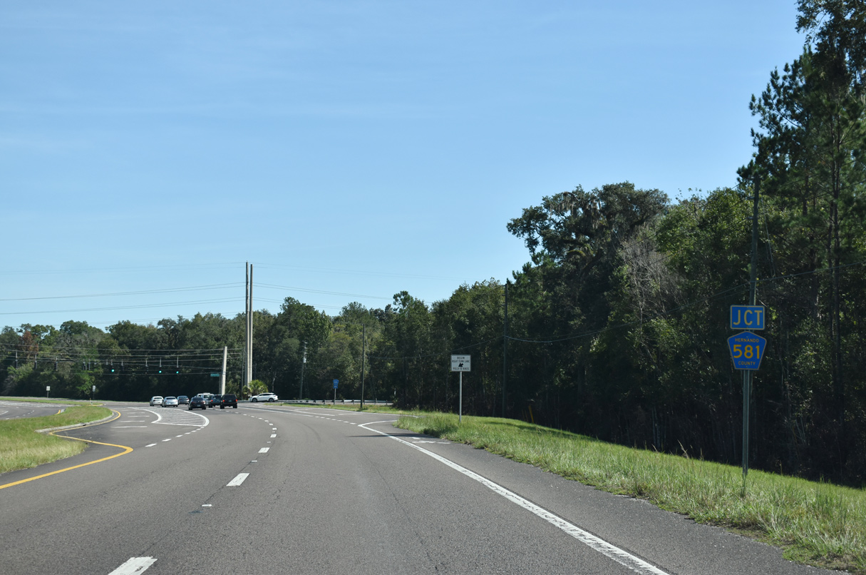
| Advancing three quarters of a mile east, Cortez Boulevard east next intersects Hernando County Road 581 (Emerson Road). 10/23/19 |
|
| County Road 581 ends a half mile to the north at U.S. 98/SR 50A (Jefferson Street) while leading south to Darby and SR 52 in Pasco County. 10/23/19 |
|
| SR 50 curves northward to the return of SR 50A from Downtown Brooksville. 10/23/19 |
|
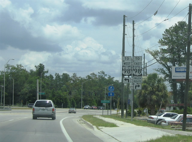
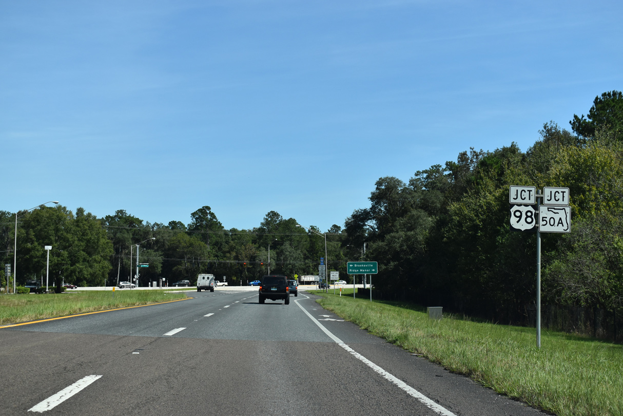
| SR 50A overlaps 1.4 miles southeast with U.S. 98 from U.S. 41 along Jefferson Street to SR 50 (Cortez Boulevard). 10/23/19 |
|
| U.S. 98 combines with State Road 50 along Cortez Boulevard east from Brooksville to Ridge Manor. 10/23/19 |
|
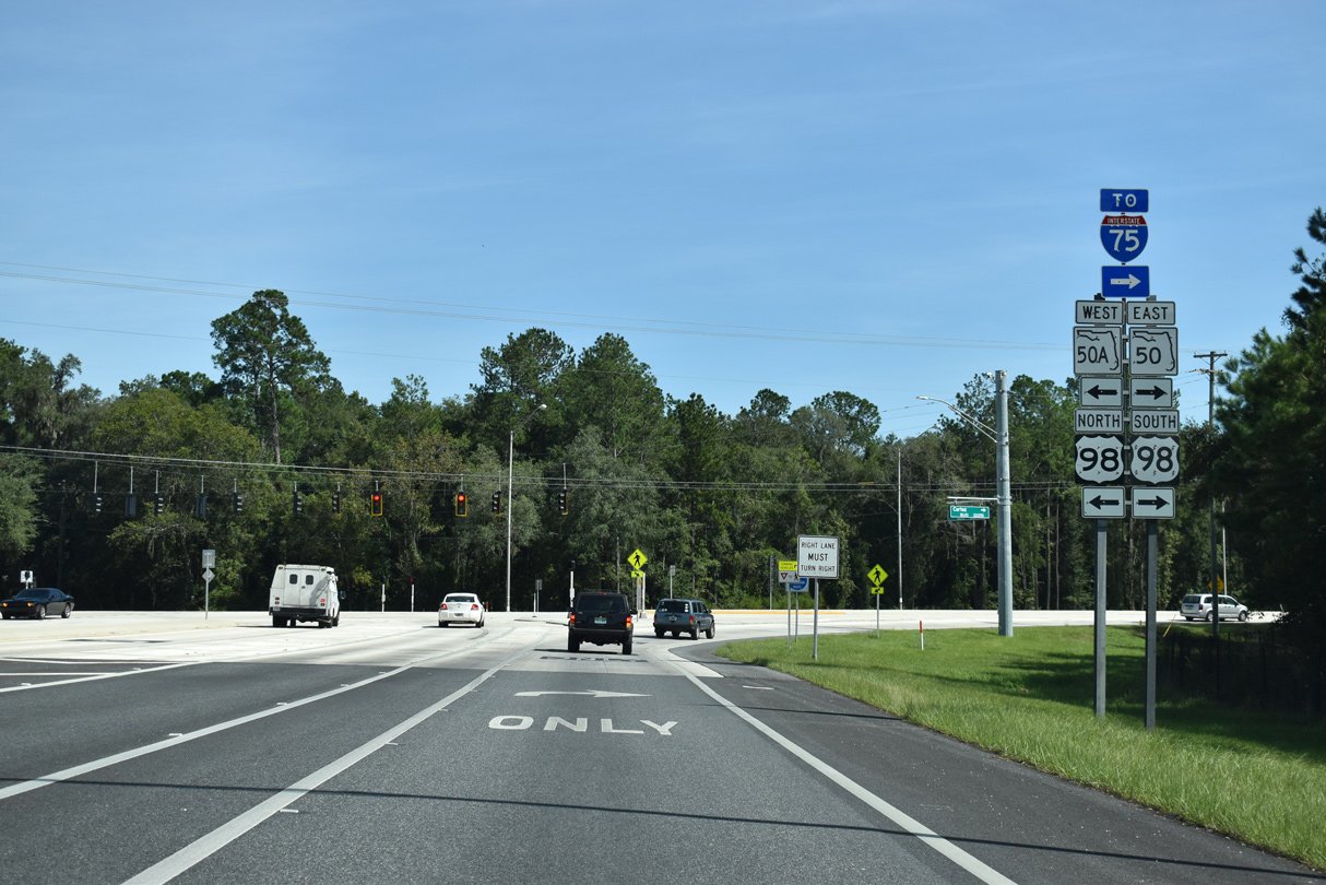
| Construction from September 2017 to Summer 2018 rebuilt the intersection joining SR 50 (Cortez Boulevard) with U.S. 98/SR 50A (Jefferson Street). Costing $4.7 million, the road work replaced asphalt with concrete to better support heavy truck traffic through Brooksville.1 10/23/19 |
|
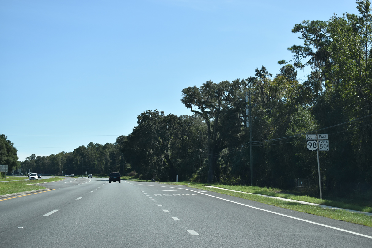
| U.S. 98 south and SR 50 east combine 8.2 miles ahead of Interstate 75. 10/23/19 |
|
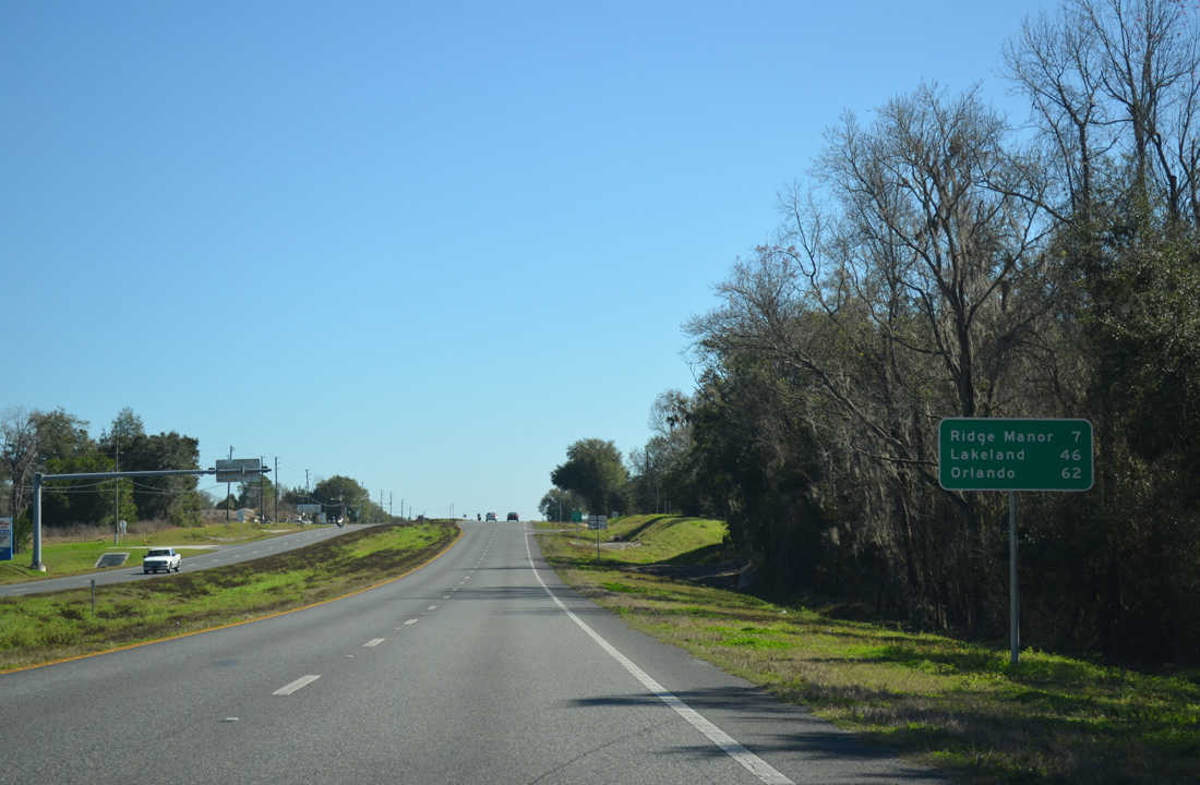
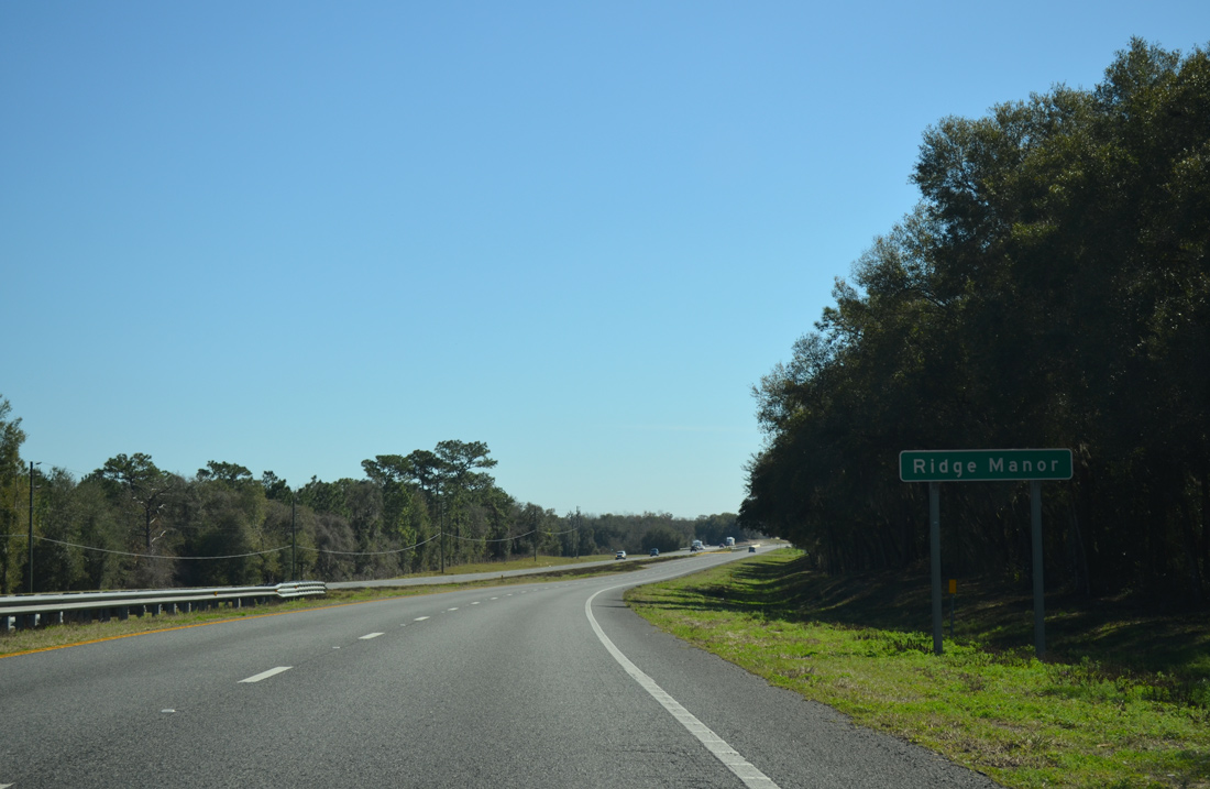
| Distance sign posted after CR 541 (Spring Lake Highway) south and CR 484 (Mondhill Hill Road) west. The unincorporated community of Ridge Manor lies seven miles ahead. 02/09/14 |
|
| Reassurance markers for U.S. 98 south / SR 50 east posted along Cortez Boulevard by the Hill &apos'N Dale community. 02/09/14 |
|
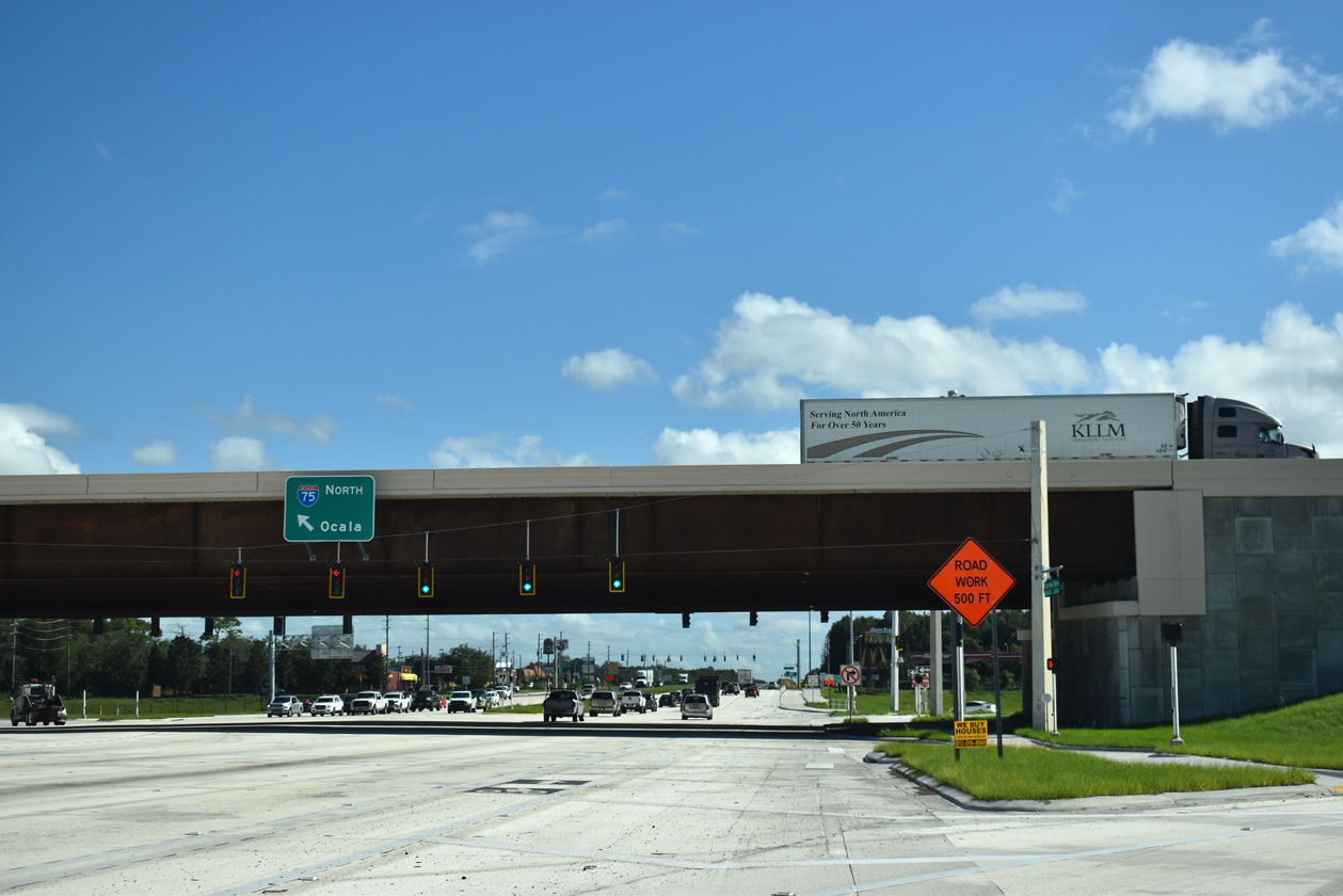
| Four miles further east, U.S. 98/SR 50 enter a single point urban interchange (SPUI) interchange with Interstate 75. Construction completed in Fall 2019 upgraded this exchange from a diamond interchange. 11/11/19 |
|
| Interstate 75 angles southwest across ranch land from U.S. 98/SR 50 south into Pasco County to San Antonio and Land O' Lakes. 11/11/19 |
|
| The entrance ramp for Interstate 75 south to Tampa departs U.S. 98/SR 50 east. I-75 partitions with I-275 south to St. Petersburg in 27 miles. 11/11/19 |
|
| Passing under I-75, U.S. 98 south / SR 50 east reach the northbound ramp for Ocala, Gainesville and Lake City. 11/11/19 |
|
| Windmere Road south and Bronson Boulevard north come together at a traffic light just east of Interstate 75. Windmere Road provides one of two access roads to the Sherman Hills golf course community to the north. 01/20/20 |
|
| Continuing beyond Windmere Road and I-75, U.S. 98/SR 50 partition at Ridge Manor for Lakeland and Orlando respectively. 02/09/14 |
|
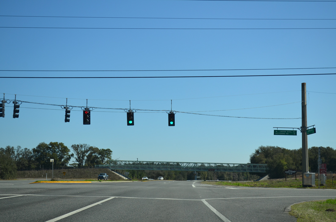
| Croom Rital Road stems north from U.S. 98/SR 50 (Cortez Boulevard) to Withlacoochee State Forest and the Croom Wildlife Management Area. Kettering Road spurs south from the intersection to a Wal-Mart Distribution Center. 02/09/14 |
|
| Withlacoochee State Trail spans U.S. 98/SR 50 (Cortez Boulevard) just east of Croom Rital Road. The multi-use path is a linear state park stretching 46 miles from Citrus Springs to Trilby. It replaced a Seaboard Coast Line Railroad, which was abandoned by CSX in 1987 and purchased by the state in 1989.1 02/09/14 |
|
| U.S. 98 south / SR 50 east enter the Ridge Manor, which consists of a street grid network of mostly unpaved roads to the north and more conventional subdivisions to the south. 02/09/14 |
|
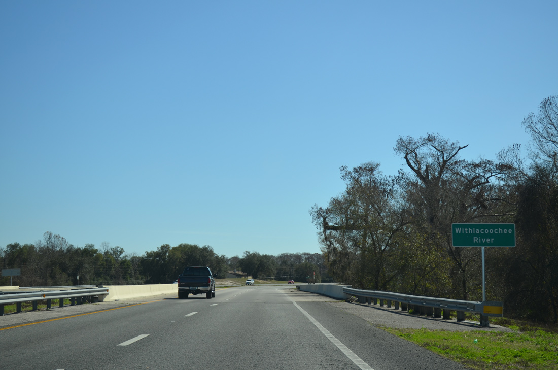
| Drivers next span the Withlacoochee River as U.S. 98/SR 50 curve southeast into Ridge Manor. The 141 mile waterway flows west from Green Swamp near Polk City into the Gulf of Mexico by Yankeetown. 02/09/14 |
|
| Ridge Manor Boulevard (the former alignment of State Road 50), crosses U.S. 98/SR 50 ahead of this shield assembly. Cortez Boulevard bypassed this stretch of roadway. 02/25/17 |
|
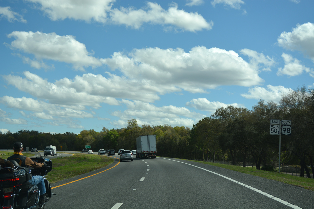
| U.S. 98 parts ways with SR 50 (Cortez Boulevard) for McKethan Road south to Lakeland. Olancha Road, the former alignment of SR 23, ties in from the north. 02/25/17 |
|
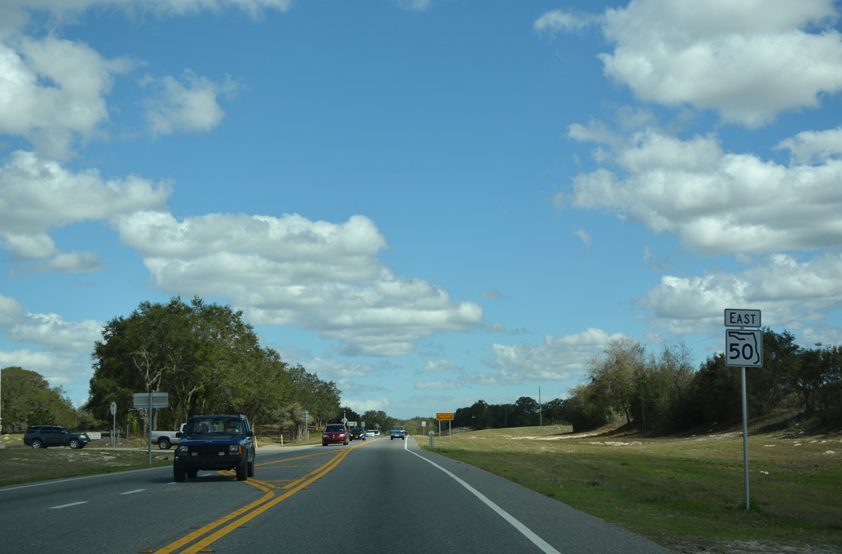
| SR 50 remains eastward through Ridge Manor to Groveland while U.S. 98 turns south to Trilby and a merge with U.S. 301 to Dade City. 02/25/17 |
|
| SR 50 narrows to two lanes just beyond U.S. 98. The next four lane section lies 21 miles ahead at SR 33 in Mascotte. 02/25/17 |
|
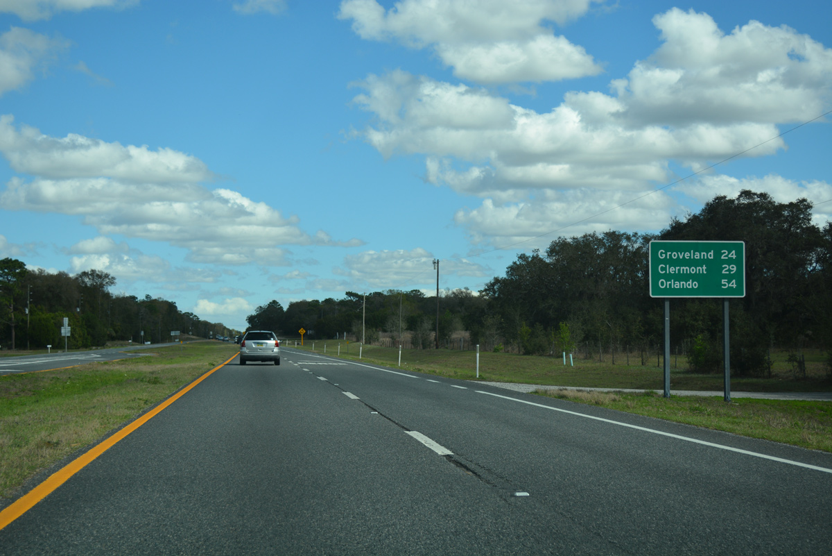
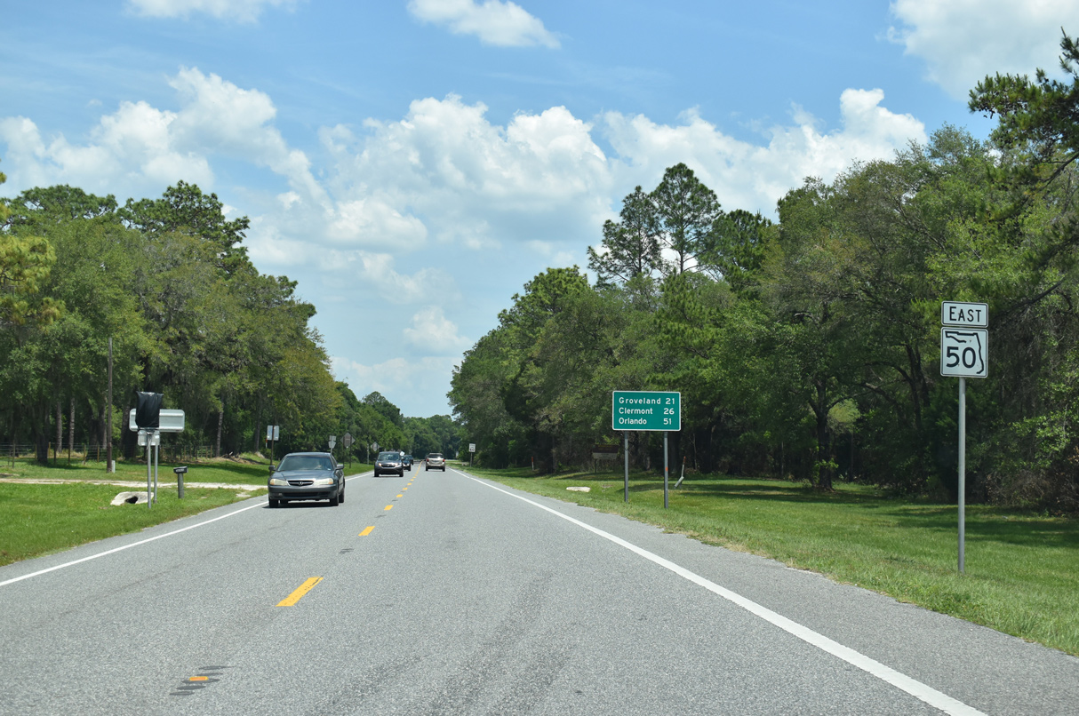
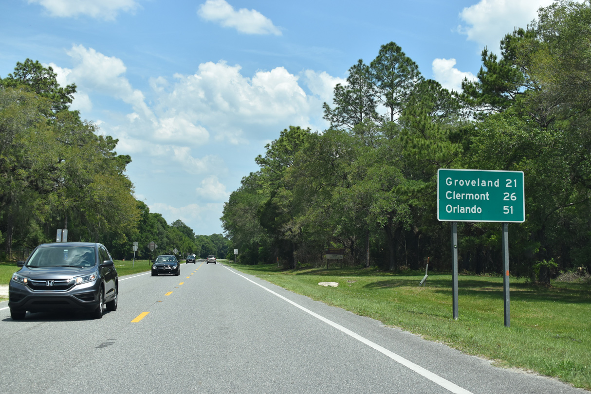
| A mostly rural drive along SR 50 east takes motorists 24 miles to the city of Groveland. Orlando is over an hour away. 02/25/17 |
|
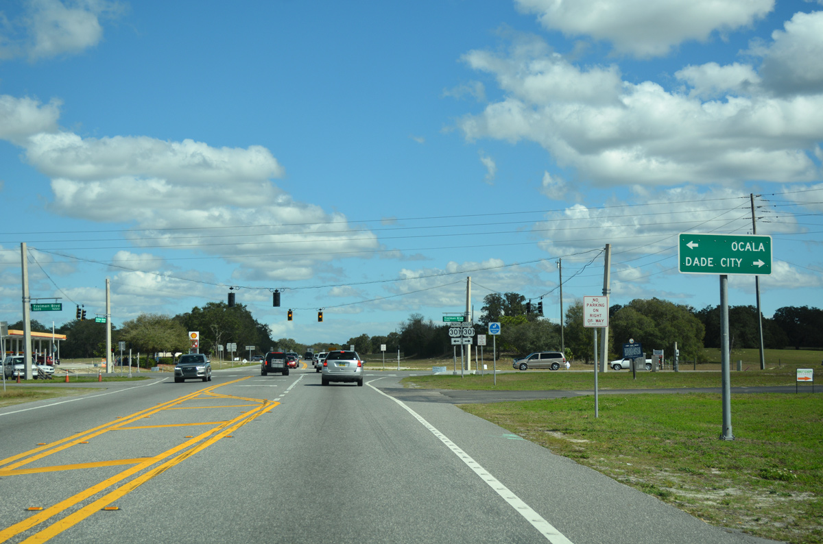
| 1.5 miles east of the partition with U.S. 98 south, SR 50 intersects U.S. 301 (Treiman Boulevard). 02/25/17 |
|
| U.S. 301 heads north to The Villages and Bushnell and south to its merge with U.S. 98 and Dade City. 02/25/17 |
|
| SR 50 advances east from U.S. 301 and Ridge Manor across a swath of ranch land to an at-grade crossing of the CSX Railroad. 02/25/17 |
|
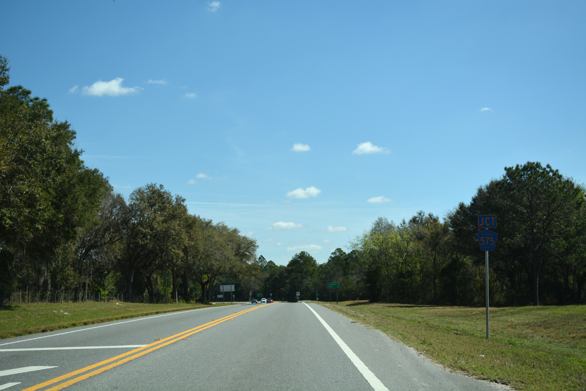
| Hernando County Road 575 (Burwell Road) winds two miles north from the Pasco County line to end at SR 50 just east of the CSX Railroad. 02/20/17 |
|
| South into Pasco County, CR 575 becomes SR 575 as it arcs west to the rural communities of Lacoochee and Trilby. 02/25/17 |
|
| Collectively Hernando County Road 575, SR 575, and Pasco County Road 575 travel 11 miles southwest along a rural course to Pasco County Road 41 (Blanton Road). 02/20/17 |
|
| Cortez Boulevard traverses areas of Withlacoochee State Forest and Richloam Wildlife Management Area east to the Hernando County line. 05/02/21 |
|
| $41.5 million in construction started on November 18, 2021 expands 4.7 miles of SR 50 east from U.S. 301 to the Sumter County line. Anticipated completion is Spring 2025. 05/02/21 |
|
| SR 50 makes a gradual northeasterly turn ahead of the Little Withlacoochee River and Sumter County line. 05/02/21 |
Page Updated 03-06-2022.

 East
East


 South
South