|
| Interstate 5 crosses the Coweeman River three times in the Kelso area. A pair of non-descript bridges carry the six lane freeway over the river near Davis Terrace. These were built in 1979 and 1980. 09/02/06 |
|
| A two lane truss bridge carries Kelso Drive across the Coweeman River east of Interstate 5. This bridge opened in 1947 as part of the original U.S. 99 Kelso bypass.1 09/02/06 |
|
| Attached to the Grade Street (original U.S. 99 & 830) overpass is southbound distance sign posted nine miles north of Kalama and 18 miles out from Woodland. 09/02/06 |
|
| The final Kelso / Longview area exit joins Interstate 5 south with SR 432 west at Exit 36. SR 432 constitutes a 10.32 mile loop west to SR 4 (Ocean Beach Highway) in west Longview. 09/02/06 |
|
| A collector distributor roadway departs Interstate 5 south for SR 432 (Tennant Way) west and Old Pacific Highway) south. SR 432 comprises an expressway west from Longview Junction to SR 411 (3rd Avenue) in Longview. The state route follows 3rd Avenue south to Industrial Way west and generally bypasses Longview. This change was made in 1992, dropping Tennant Way west and Nichols Boulevard north to SR 4 from the state highway system.2 SR 433 (Oregon Way) between Industrial Way and Nichols Boulevard was also decommissioned.3 09/02/06 |
|
| Drivers bound for SR 432 (Tennant Way) west depart the c/d roadway of Exit 36. SR 432 to SR 433 leads drivers south to Rainier, Oregon and U.S. 30. The former toll bridge (tolls dropped in 1965) opened in 1930.3 09/02/06 |
|
| The directional cloverleaf interchange with SR 432 west connects with Old Pacific Highway south alongside Interstate 5. Former U.S. 99 & 830 continues to Vision Acres and Carrolls. 09/02/06 |
|
| Carrolls Channel of the Columbia River basin flows adjacent to the BNSF Railroad and southbound lanes of Interstate 5. This view looks at the waterway from near Carrolls Bluff. 09/02/06 |
|
| Kalama River Road meets Interstate 5 at a diamond interchange (Exit 32). Kalama River Road follows the Kalama River east from the Columbia River into the Cascade Range foothills. 09/02/06 |
|
| Drays Mound rises alongside Interstate 5 south at the Exit 32 ramp departure to Kalama River Road. Kalama River Road meets Old SR 99 north and Meeker Drive south (old alignments of U.S. 99 & 830). The road otherwise continues to Pigeon Springs. 09/02/06 |
|
| Interstate 5 crosses the Kalama River on a pair of non-descript bridges built in 1970 and 1971. 09/02/06 |
|
| A 1952-truss bridge carries Meeker Drive (Old U.S. 99 & 830) across the Kalama east of Interstate 5. This bridge was originally just one half of the original four lane U.S. 99 & 830. 09/02/06 |
|
| A split diamond interchange (Exit 30) serves the City of Kalama from Interstate 5. Frontage Roads connect the ramp at Oak Street with Elm Street and the city center. 09/02/06 |
|
| Exit 30 leaves Interstate 5 south for Oak Street. Oak Street crosses the BNSF Railroad to an industrial area along the Columbia River to the south. Frontage Roads lead south to the ramps at Elm Street; 1st Street (old U.S. 99 & 830) parallels one block to the east. 09/02/06 |
|
| Reassurance shield assembly posted for Interstate 5 at Kalama. Woodland lies eight miles to the south. 09/02/06 |
|
| Todd Road joins Interstate 5 with the Port of Kalama west of Exit 27 and Old Pacific Highway east of the diamond interchange. The alignment of Interstate 5 replaced the pre-expressway routing of U.S. 99 & 830 south to Exit 22.1 09/02/06 |
|
| Southbound Interstate 5 at Exit 27 to Todd Road. Todd Road ventures east from the port area to Cloverdale Road. There is no through access south to Woodland independent of I-5. 09/02/06 |
|
| A roadway separation occurs along Interstate 5 at Martin Bluff. The freeway briefly sees the Columbia River before it veers west of Martin Island. 09/02/06 |
|
| The roadway split accommodates the BNSF Railroad that lines the median of Interstate 5 along Martin Slough. 09/02/06 |
|
| Dike Access Road connects Interstate 5 south with Old Pacific Highway (Old U.S. 99 & 830) south into Woodland and Dike Road west to the levee along Burke Slough. 09/02/06 |
|
| Exit 22 departs Interstate 5 south for Dike Access Road and the Port of Woodland. Exit 21 follows in one mile for Pacific Avenue south to SR 503 (Lewis River Road) east. Dike Access Road east to Old Pacific Highway south provides a more direct route to the 54.11 mile state route. 09/02/06 |
|
| A split diamond interchange connects Interstate 5 with the west end of SR 503 in Woodland. SR 503 follows the Lewis River 21 miles east to Lake Merwin, Yale and SR 503 Spur. The spur heads to Cougar and the south end of Mount St. Helens National Volcanic Monument while SR 503 turns southward to Chelatchie and Battle Ground. 09/02/06 |
|
| An on-ramp joins Interstate 5 south from Pacific Avenue, Goerig Street, and SR 503 (Lewis River Road) near Horseshoe Lake. Interstate 5 briefly enters Clark County and southbound drivers see Vancouver as the next control city. 09/02/06 |
|
| A pair of steel truss bridges span Lewis River along Interstate 5 south of Woodland. The freeway crosses into Clark County for good at the crossing. The northbound bridge was built in 1940 as part of U.S. 99 & 830. The southbound span was added in 1968 during the upgrade to Interstate 5. 09/02/06 |
|
| A short distance to the south, Interstate 5 crosses the East Fork Lewis River at Paradise Point. The northbound bridge dates back to 1936 as U.S. 99 & 830; southbound travelers use a non-descript span built in 1969. 09/02/06 |
|
| One and half mile advance sign for Exit 16, NW La Center Road and the community of La Center. A greenout for NW LaCenter Road covers the older NW 319th Street designation. 09/02/06 |
|
| Interstate 5 meets NW La Center Road at Exit 16. NW La Center Road arcs two miles northeast from a dumbbell interchange with I-5 into the town of La Center. Paradise Park Road stems north from Exit 16 to Paradise Park State Park. 09/02/06 |
|
| Interstate 5 enters Ridgefield on the one mile approach to Exit 14 with SR 501 (Pioneer Street) west. Split into two segments, the northern section of SR 501 travels 2.97 miles west to the Ridgefield city center. The southern section spurs 10.99 miles northwest from Exit 1C to Ridgefield National Wildlife Refuge. 09/02/06 |
|
| Exit 14 departs Interstate 5 south for SR 501 (Pioneer Street) west at Ridgefield. Pioneer Street east becomes South 65th Avenue and South 5th Street east to NE 10th Avenue (Old U.S. 99 & 830). 09/02/06 |
|
| The Gee Creek Rest Area lies along Interstate 5, one mile south of Pioneer Street. 09/02/06 |
|
| Heading south from the rest area, Interstate 5 continues to a parclo interchange (Exit 11) with SR 502 (NE 219th Street) east. Opened on October 15, 2008,4 Exit 11 improves access to Battle Ground and relocates SR 502 from former U.S. 99 & 830 south of NE 219th Street. 09/02/06 |
|
| One mile north of the diamond interchange (Exit 9) with NE 179th Street by the Clark County Fairgrounds. Exit 9 was the end of SR 502 until the exchange at Exit 11 opened. NE 179th Street and SR 502 otherwise join Interstate 5 with the city of Battle Ground. 09/02/06 |
|
| Exit 9 leaves Interstate 5 south 1.50 miles ahead of the split with Interstate 205 south (Exit 7). Completed in Washington by 1983, Interstate 205 travels 10.57 miles southeast to the Glenn Jackson Bridge over the Columbia River. The freeway provides a suburban bypass of Portland, Oregon. 09/02/06 |
|
| Approaching the wye interchange (Exit 7) with Interstate 205 south on I-5 south. I-205 provides a direct route to SR 14 east to Camas and Interstate 84 east to Hood River. The control city of Salem references the continuation of Interstate 5 south from Tualatin. 09/02/06 |
|
| Exit 7 provides access to NE 134th Street via Interstate 205 south at Exit 36. NE 134th Street meets I-5 at a half diamond interchange adjacent to old U.S. 99 & 830 beyond the freeway split. The east-west arterial serves interests to Washington State University Vancouver. 09/02/06 |
|
| Interstates 5 & 205 part ways at Exit 7 near Salmon Creek. Interstate 5 briefly drops to four lanes to NE 134th Street. Interstate 205 angles southeast 6.26 miles to the SR 500 freeway at the Vancouver city line. The freeway reaches Portland International Airport in 12 miles and Interstate 84 in 14 miles. 09/02/06 |
|
| Interstate 5 leaves the SR 14 interchange and passes under a BNSF Railroad line ahead of the Interstate Bridge across the Columbia River. 08/27/06 |
|
| A pair of vertical lift bridges carry Interstate 5 from Vancouver, Washington onto Hayden Island in Oregon. The Interstate Bridge stretches 3,538 feet at a height of 72 feet above the Columbia River. Southbound Interstate 5 utilizes the 1958-built span; northbound travelers cross a span dating to 1917. Tolls were charged at the crossing until 1966.5 08/27/06 |
|
| The aging Interstate Bridge is in need of a replacement, but an extraordinarily high price tag associated with a new bridge, and up to five miles of approach freeway, have left any potential work in doubt. In the meantime southbound travelers are relegated to a three-lane shoulder less bridge with speed limits set at 50 mph at the crossing. 08/27/06 |
|
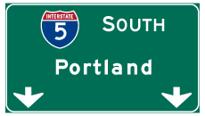
| Entering the city of Portland, Oregon on Interstate 5 south. 08/27/06 |
Page Updated 11-13-2010.

 South
South