

In 1961, the Arizona Highway Department and the federal government removed most of the Marana business district to widen Interstate 10. The high school, several of the shops, and the businesses relocated but were not centralized and ended up scattered throughout the area. Consequently there is no "Main Street" in north Marana yet and the business district in southern Marana has become the main shopping region.
 West
West
$128 million in construction between February 2017 to April 2019 widened Interstate 10 to six overall lanes and rebuilt the diamond interchange (Exit 248) with Ina Road.1
04/26/17

Interstate 10 was lowered below grade through the exchange with Ina Road during 2017-19 road work.
04/26/17
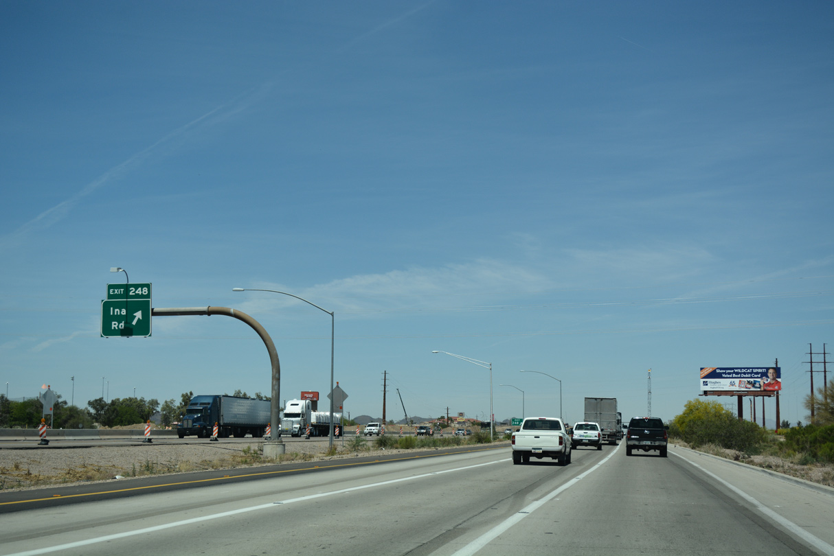
Ina Road leads east into northern Tucson, passing by Foothills Mall before reaching the southern edge of the Front Range and Coronado National Forest via SR 77 (Oracle Road) and several intersecting city streets. Heading west, Ina Road crosses the Santa Cruz River, then connects to Saguaro National Park via N Wade Road and Picture Rocks Road.
04/26/17

04/26/17

04/26/17

Cortaro Road heads east into the city of Tucson toward Tucson National Golf Resort. The four lane arterial transitions into Magee Road en route to SR 77 (Oracle Road) in the town of Oro Valley.
04/26/17

Cortaro Road extends southwest from Cortaro Farms Road and Exit 246 to Arizona Pavilions Shopping Center and across the Santa Cruz River to Ina Road.
04/26/17
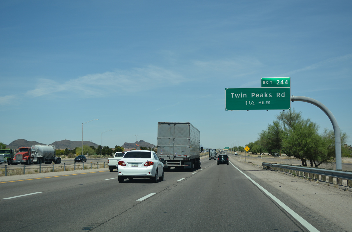
The ensuing exit with Twin Peaks Road opened to traffic on November 19, 2010.
04/26/17

04/26/17

2009-10 work on the diamond interchange (Exit 244) with Twin Peaks Road preceded construction of the adjacent Tucson Premium Outlets.
04/26/17

Interstate 10 is designated the Pearl Harbor Memorial Highway throughout Arizona. I-10, along with Interstate 8, is also part of the Border Friendship Route.
04/26/17

Twin Peaks Road angles northeast to the community of Tortolita and west to the Sunflower, Marbella and Saguaro Bloom suburban developments.
04/26/17

04/26/17

Avra Valley Road stems west from the diamond interchange at Exit 242 to Marana Regional Airport (AVQ) and the community of Avra Valley.
04/26/17

Casa Grande Highway, the I-10 frontage road system, connects Exit 242 with the community of Rillito to the northwest.
04/26/17

04/26/17

04/26/17
04/26/17

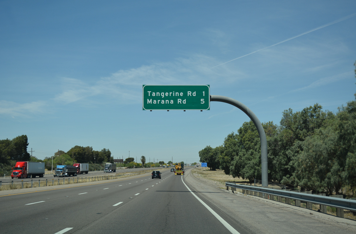
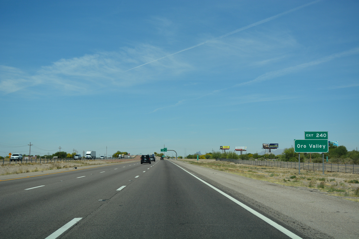
Passing by Rillito, Interstate 10 parallels the Union Pacific Railroad closely northwest to the diamond interchange (Exit 240) with Tangerine Road.
04/26/17
Tangerine Road runs 13.47 miles east from Exit 240 to SR 77 in Oro Valley, near Coronado National Forest and Catalina State Park.
04/26/17

Tangerine Road continues 2.83 miles west from Exit 240 to become Tangerine Farms Road at Lon Adams Road and the Gladden Farms development.
04/26/17

The 2006-07 widening projects along Interstate 10 concluded just past Tangerine Road.
04/26/17

Interstate 8 appears on signage along I-10 west for the first time 40 miles out.
04/26/17

Previously signed simply for Marana, Exit 236 links I-10 with Marana Road. The town of Marana incorporated in 1977, however much of the region was settled for decades prior. The suburban community grew from approximately 20,000 residents as of 2000 to 51,908 as of the 2020 Census.
04/26/17

04/26/17

The Marana town limits extend northwest along Interstate 10 to the Pinal County line.
04/26/17
04/26/17

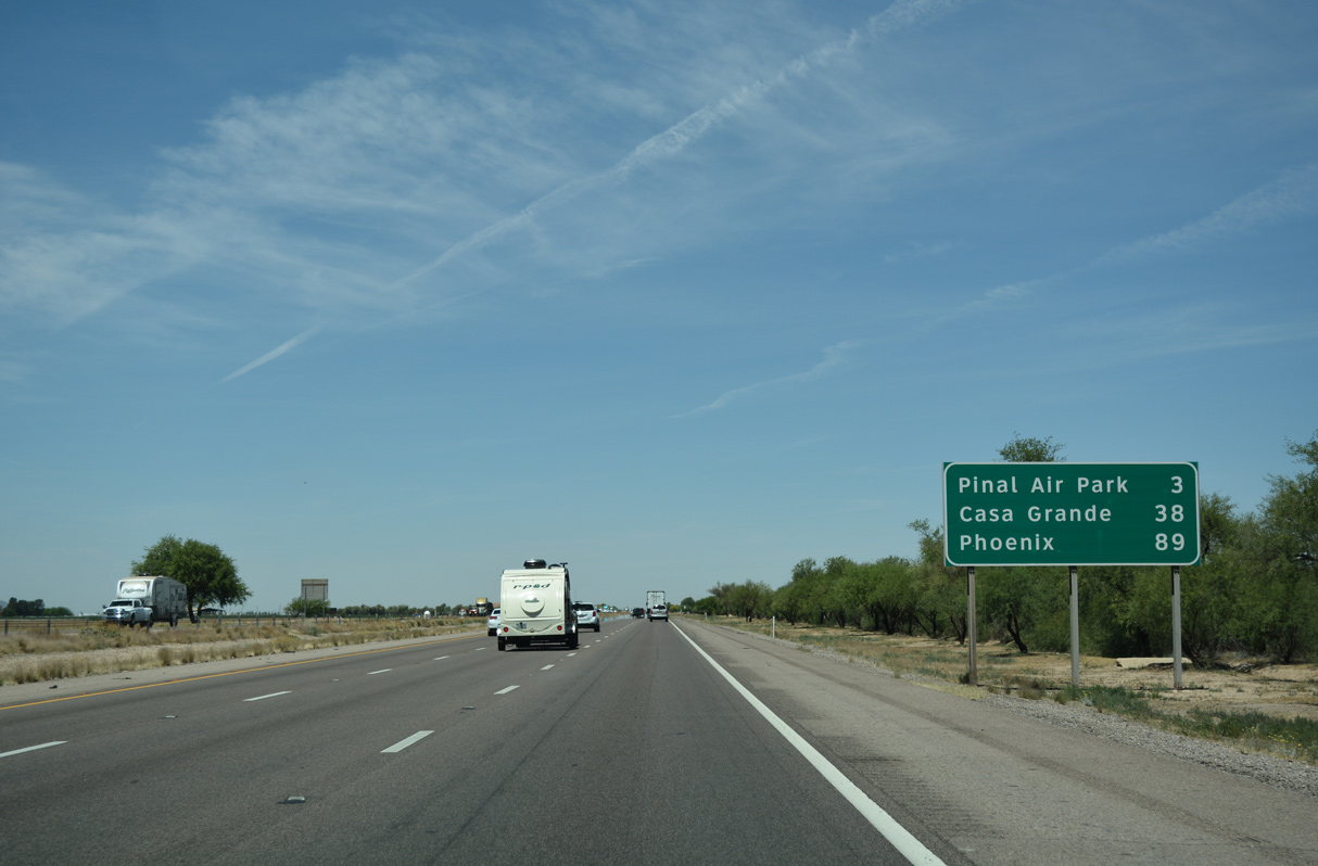
Pinal Air Park Road parallels the Pima County line west to Pinal County Airport (MZJ), where an Army National Guard station and aviation training site are located.
04/26/17

Pinal Air Park can be seen to the southwest of the freeway, and it is readily visible with its many large planes, including some commercial jets.
04/26/17

A half cloverleaf interchange connects I-10 with Pinal Air Park Road west of the Union Pacific Railroad siding of Naviska.
04/26/17

04/26/17

04/26/17

This unnumbered exit serves the nearby APS Saguaro Power Plant. The power plant is a gas-powered peak plant used primarily during Summer.
04/26/17

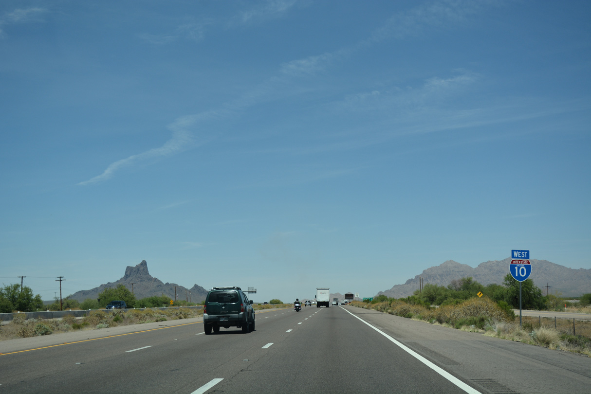
Picacho Peak appears to the west of the freeway beyond forthcoming Red Rock. Interstate 10 passes between Picacho Peak and the Picacho Mountains to the northeast.
04/26/17

Exit 226 connects Interstate 10 with Sasco Road west to the Red Rock Village development.
04/26/17

04/26/17
04/26/17

04/26/17

Picacho Peak (el. 3,374 feet) rises to the west as Interstate 10 ascends to Picacho Pass (el. 1,800 feet).
04/26/17

Picacho Peak falls within Picacho Peak State Park.
04/26/17

Picacho Peak Road spurs west from Exit 219 into Picacho Peak State Park. Services at Exit 219 are located northeast of the diamond interchange.
04/26/17

04/26/17

04/26/17

Newman Peak tops out at 4,506 feet above sea level within the Picacho Mountains northeast of Interstate 10.
04/26/17

Interstate 10 continues to the unincorporated community of Picacho and the south end of SR 87 at Exit 211.
04/26/17

Interstate 10 gradually descends across the Santa Cruz Flats from Picacho Pass to the cities of Eloy and Casa Grande.
04/26/17

Construction underway in 2019 consolidated Exits 212/211 into a single diamond interchange northwest of Picacho. Work also straightened out Interstate 10 and expanded the freeway to six overall lanes.
04/26/17

Combining with SR 287 eastbound, SR 87 bee lines 19.63 miles north to the city of Coolidge and Casa Grande Ruins National Monument.
04/26/17

SR 87 is a major corridor, originating just south of Exit 211 at Phillips Road, and continuing north through La Palma and Coolidge, then turning northwest toward the Phoenix metropolitan area.
04/26/17

Although not entering the city of Phoenix, SR 87 passes through the cities of Chandler, Gilbert and Mesa before turning northeast along the Beeline Highway through Tonto and Coconino National Forests toward Payson, Winslow and the Hopi Reservation. SR 87 concludes to the north at SR 264 in Second Mesa.
04/26/17

04/26/17

Sunshine Bouleard is the first of three exits from Interstate 10 west for the city of Eloy.
04/26/17

Sunshine Boulevard heads 0.86 miles north to Frontier Street (old SR 84) in the Eloy street grid.
04/26/17

04/26/17
04/26/17

04/26/17

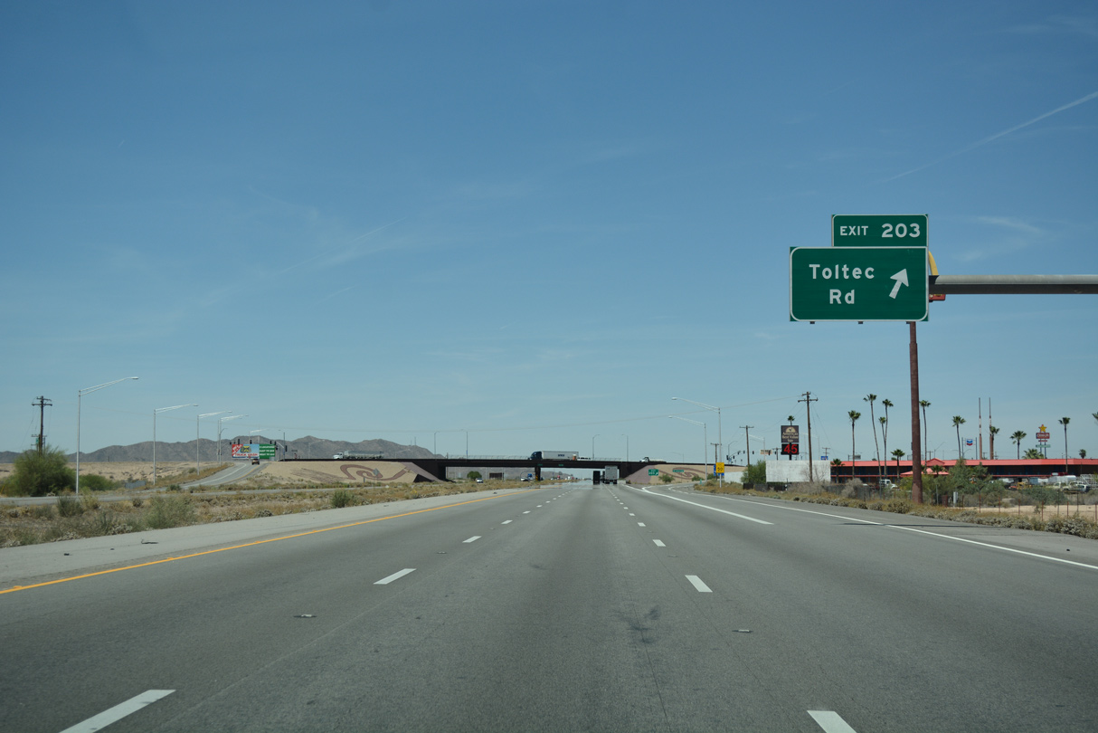
Toltec Road provides a few motorist services at Exit 203, including fast food and gas. Interstate 10 between Tucson and Phoenix is dubbed "Arizona's Autobahn" due to its relatively high traffic counts, so services are a bit more frequent along this stretch than in other rural areas of the Grand Canyon State.
04/26/17

04/26/17
04/26/17

04/26/17

04/26/17

I-10 enters the southeastern reaches of the Casa Grande city limits at the east end of Interstate 8. While I-10 heads northwest toward Phoenix, I-8 heads west to Gila Bend, Yuma, and El Centro, California.
04/26/17
I-10 enters the southeastern reaches of the Casa Grande city limits at the east end of Interstate 8. While I-10 heads northwest toward Phoenix, I-8 heads west to Gila Bend, Yuma, and El Centro, California.
04/26/17

Interstate 8 west to Business Loop I-8 at Gila Bend and SR 85 north to Buckeye is recommended as a bypass of metropolitan Phoenix for through traffic to San Bernardino and Los Angeles, California.
04/26/17

Sunland Gin Road connects Interstate 10 with Arizona City, 3.2 miles to the south. Interstate 8 travels 178 miles west to Yuma.
04/26/17

Overall Interstate 8 travels 351 miles west from Exit 199 to Ocean Beach in San Diego, California.
04/26/17

Interstate 8 commences west from the trumpet interchange at Exit 199.
04/26/17

The Phoenix bypass route via I-8 and SR 85 from Gila Bend is 96.5 miles in length versus 87.3 miles along Interstate 10 across the Valley of the Sun.
04/26/17

Eliminating weaving traffic between Exits 200 and 199, the entrance ramp from Sunland Gin Road includes a connection onto Interstate 8 west.
04/26/17

Sources:
- "New Ina Road interchange promises increased capacity, improved safety." Inside Tucson Business (AZ) , April 26, 2019.
Photo Credits:
04/26/17 by AARoads
Connect with:
Interstate 8
State Route 87 - Beeline Highway
Page Updated 04-14-2022.