The recommended plan by the South Carolina Department of Transportation (SCDOT) for tree clearing along Interstate 26 through Dorcester and Berkeley Counties called for removing trees along 23 out of 30 miles and installing guardrails on the remaining miles. A compromise was achieved between the state and local government to clear trees instead from just the seven miles with the highest fatality rates. The plan was approved on February 24, 2014.1
|
| Interstate 26 traverses timberland west of Four Hole Swamp along the ensuing stretch in northern Dorchester County. 06/01/21 |
|
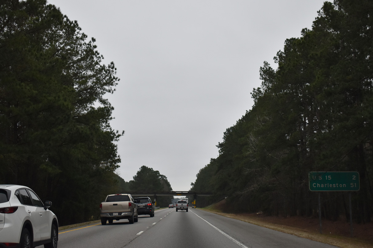
| A distance sign precedes the Weathers Farm Road overpass, two miles out from Exits 172A/B with U.S. 15. Charleston lies 51 miles to the southeast. 02/17/19 |
|
| U.S. 15 crosses paths with Interstate 26 at a rural cloverleaf interchange (Exit 172). U.S. 15 concludes 29.3 miles to the south at Walterboro. 02/17/19 |
|
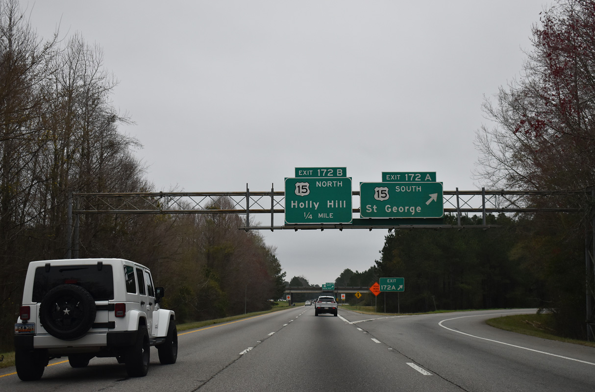
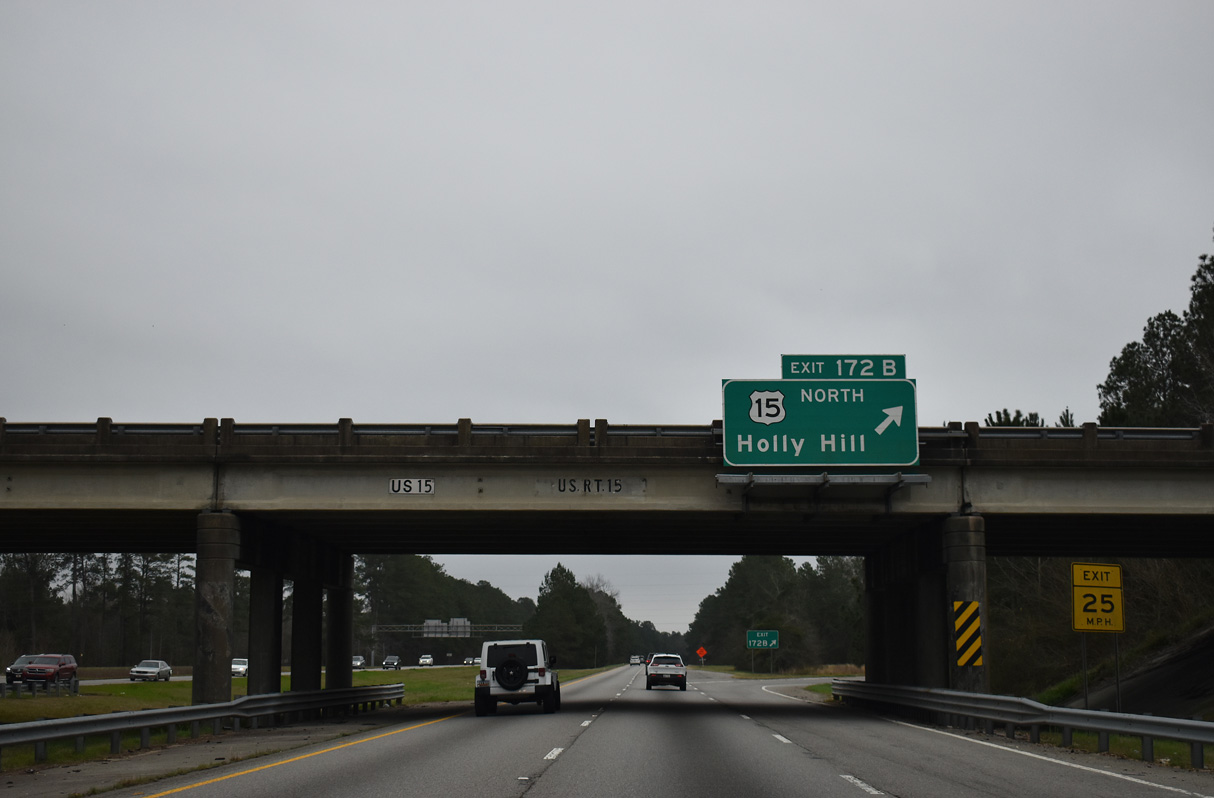
| Exit 172A leaves I-26 east for U.S. 15 south 8.3 miles to U.S. 78 in the Dorcester County seat of St. George. 02/17/19 |
|
| U.S. 15 crosses Four Hole Swamp into Orangeburg County, splitting with S.C. 314 in 3.5 miles. S.C. 314 connects with U.S. 176 south into the town of Holly Hill, while U.S. 15 shifts northwest toward I-95 and Santee. 02/17/19 |
|
| Confirming marker posted ahead of Spring Branch along I-26 east. The freeway continues just west of Four Hole Swamp and the Orangeburg County line. 02/17/19 |
|
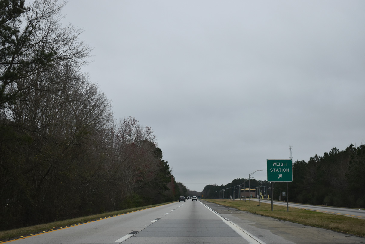
| A weigh station operates along I-26 eastbound between Spring Branch and mile marker 174. 02/17/19 |
|
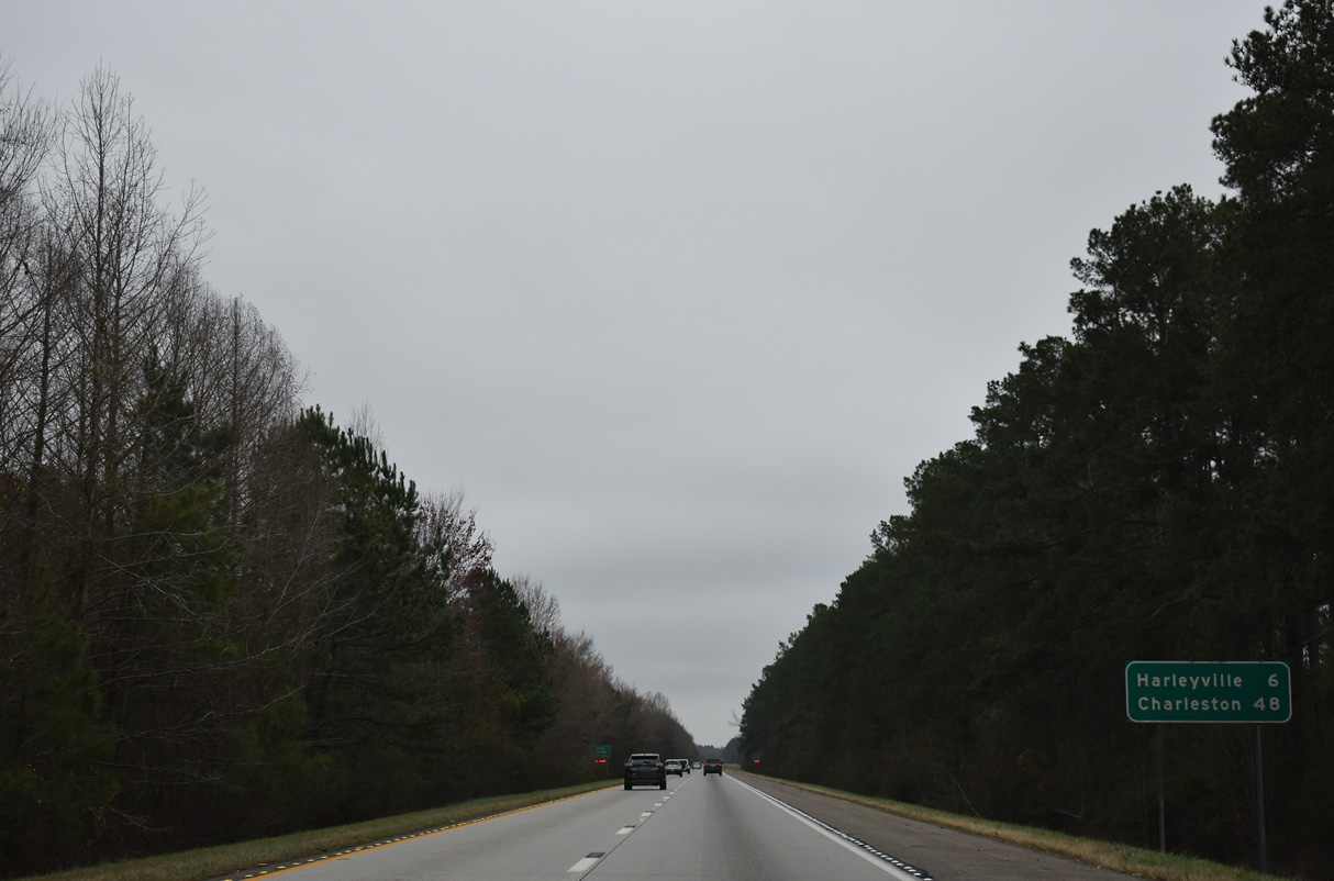
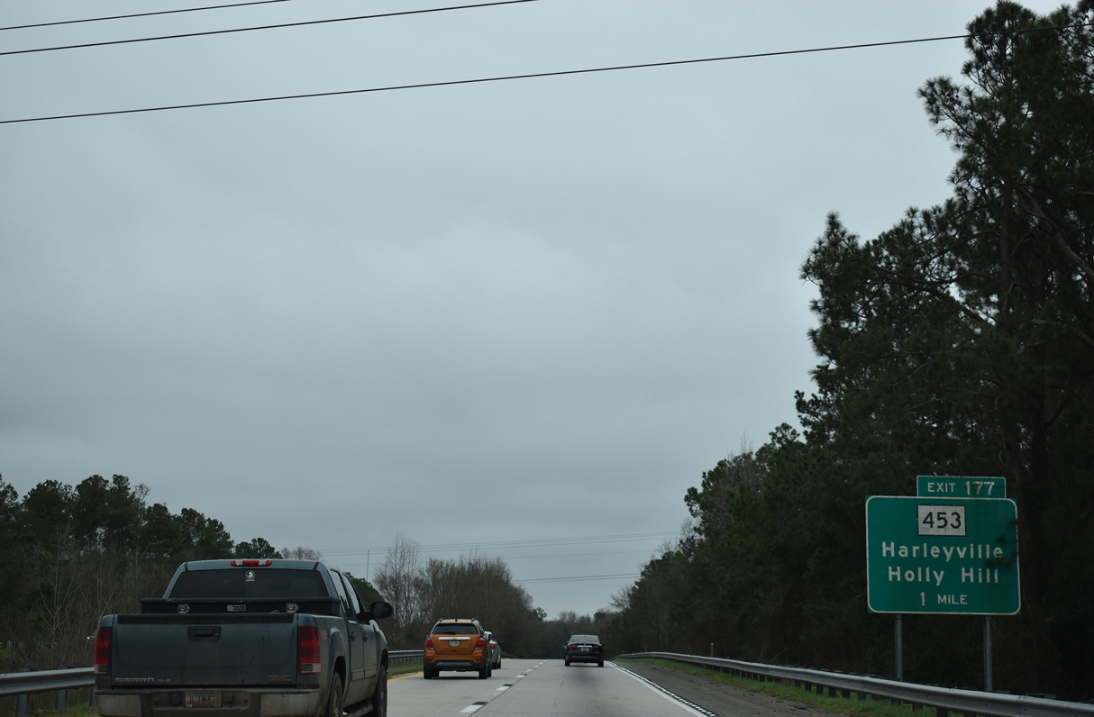
| The succeeding exit joins I-26 with the town of Harleyville in six miles. Charleston is 42 miles further. 02/17/19 |
|
| Weigh stations along both sides of I-26 between U.S. 15 and S.C. 453 were formerly rest areas. 02/17/19 |
|
| S.C. 453 constitutes a 14.93 mile long route between U.S. 178 (Main Street) in Harleyville and S.C. 45 (Eutaw Road) in Eutawville. 02/17/19 |
|
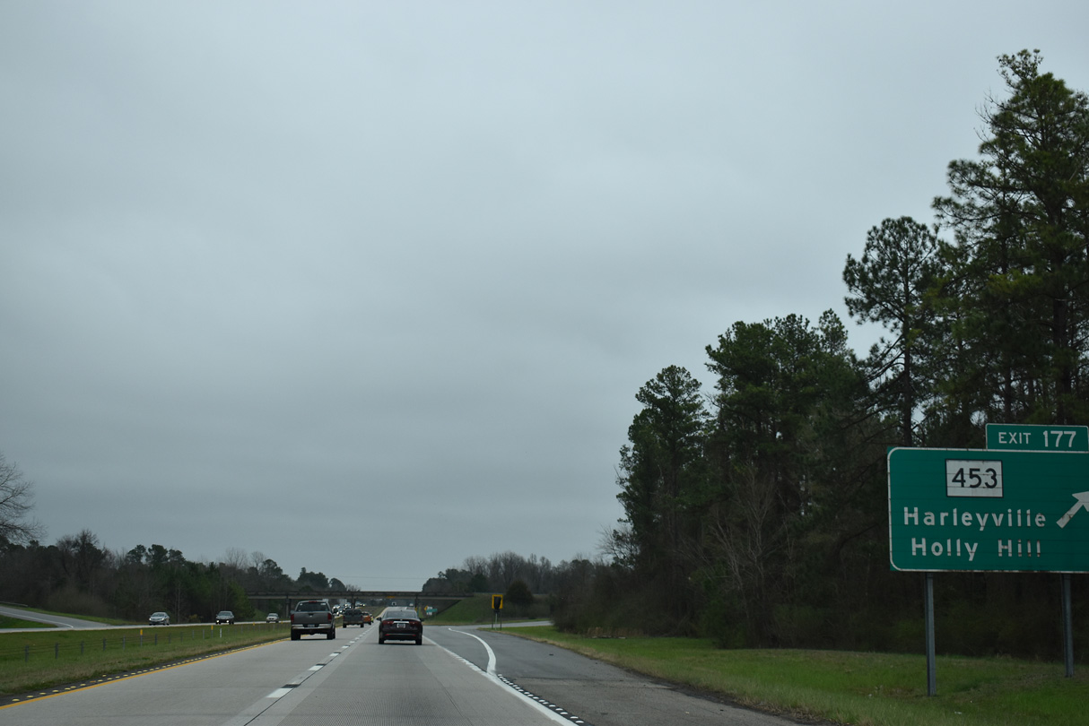
| Interstate 26 east at the diamond interchange (Exit 177) with S.C. 453 (Judge Street) south to Harleyville and north to Holly Hill. The rural exchange serves three cement plants and Francis Beidler Forest to the east. 02/17/19 |
|
| 40,500 vehicles per day (vpd) were recorded along I-26 between S.C. 453 and S.C. 27 by SCDOT in 2017. This same stretch had 31,400 vpd in 2009. 02/17/19 |
|
| A 9.51 mile exit less stretch takes I-26 eastbound from outside Harleyville to S.C. 27 at Pringletown. 02/17/19 |
|
| One mile ahead of the diamond interchange (Exit 187) with S.C. 27 (Ridgeville Road / Old Gilliard Road) on I-26 east. 02/17/19 |
|
| Exit 187 leaves I-26 east for S.C. 27. A 19.51 mile long highway, S.C. 27 extends south from U.S. 78 and Ridgeville to S.C. 61 at Givhans and north to U.S. 176 near Holly Hill. 02/17/19 |
|
| The town of Ridgeville lies 2.7 miles southwest from Exit 187 along S.C. 27. 02/17/19 |
|
| Trees in the median of I-26 between Exits 187 and 194 were cleared to improve safety. 05/27/07 |
|
| The suburban town of Summerville lies 14 miles ahead, with Charleston just a half hour's drive. 05/27/07 |
|
| The SCDOT Volvo Interchange Project added ramps between I-26 and Volvo Car Drive along the forested stretch of freeway between mile markers 188 and 191. Construction on the directional T interchange commenced in September 2017 and was substantially complete in June 2019. Volvo Car Drive heads northeast to Camp Hall Commerce Park and the new Volvo manufacturing facility. 05/27/07 |
|
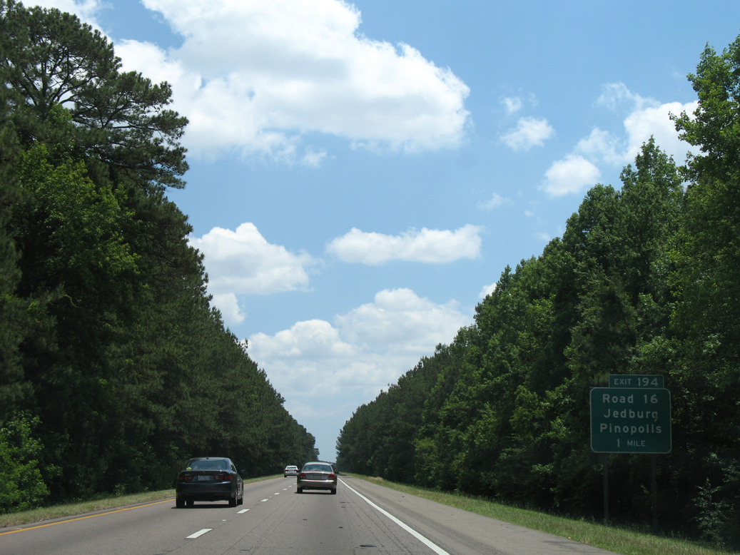
| Interstate 26 shifts eastward into Berkeley County and crosses Cypress Swamp, which feeds the Ashley River further south. The freeway next meets Jedburg Road (Road 16) at a diamond interchange (Exit 194). 05/27/07 |
|
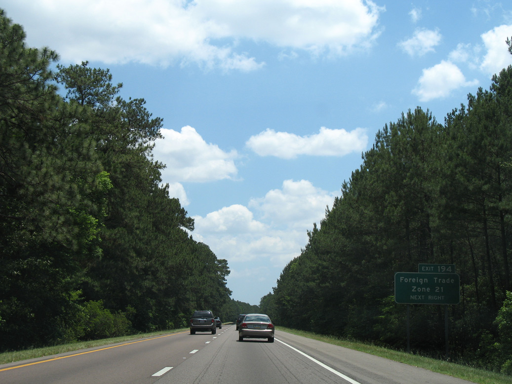
| Supplemental guide sign for Foreign Trade Zone 21 at Exit 194. A number of distribution centers and warehouses populate the immediate vicinity of I-26 at Jedburg Road. 05/27/07 |
|
| Road 16 (Jedburg Road) leads 4.56 miles north to U.S. 176 (State Road), and 12.87 miles to S.C. 6 near Pinopolis and Lake Moultrie. The community of Jedburg lies 2.54 miles to the southeast at the crossroads of Road 16 and U.S. 78. 05/27/07 |
|
| Traffic lights were added at the ramp end from Exit 194 to Road 16 by 2011. A Flying J travel center was constructed in the southwest quadrant of the previously rural exchange between I-26 and Jedburg Road. Opened in February 2018, traffic counts along Jedburg Road increased, with 19,000 vpd recorded by SCDOT.2 A $90.7 million widening project along I-26 in 2019 included upgrading the interchange, with expansion of Road 16 to five overall lanes.3 05/27/07 |
|
| The previously rural stretch of Interstate 26 leading southeast into the town of Summerville and Exit 199 changed with the May 7, 2018 opening of $88 million Sheep Island Interchange. Connecting I-26 with Nexton Parkway, the six-ramp parclo interchange (Exit 197) opens up land for development, including Nexton, Carnes Crossroads and Cane Bay.4 05/27/07 |
|
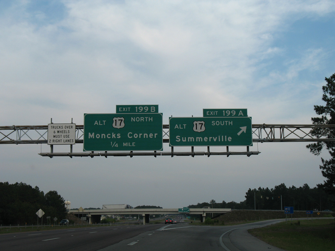
| Forthcoming U.S. 17 Alternate (Main Street) crosses paths with Interstate 26 at a commercialized six-ramp parclo interchange. Through Summerville, U.S. 17 Alternate follows Main Street to Downtown, connecting with east-west streets to the town of Linconville. 05/27/07 |
|
| Loop ramps from U.S. 17 Alternate (Main Street) to I-26 were eliminated at Exit 199 to remove weaving traffic along the six lane freeway. U.S. 17 Alternate bypasses the Charleston metropolitan area inland between Georgetown and Yemassee. 05/27/07 |
|
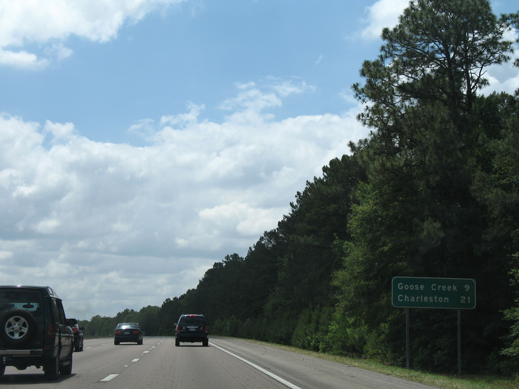
| The previous northern extent of the six lane section for I-26 began at Exit 199. The freeway advances south 21 miles to Charleston. The city of Goose Creek spreads to the east along U.S. 176 between U.S. 17 Alternate and U.S. 52. 05/27/07 |
|
| The final rest area along Interstate 26 eastbound lies two miles ahead by Ancrum and Bluehouse Swamps. 11/12/06 |
|
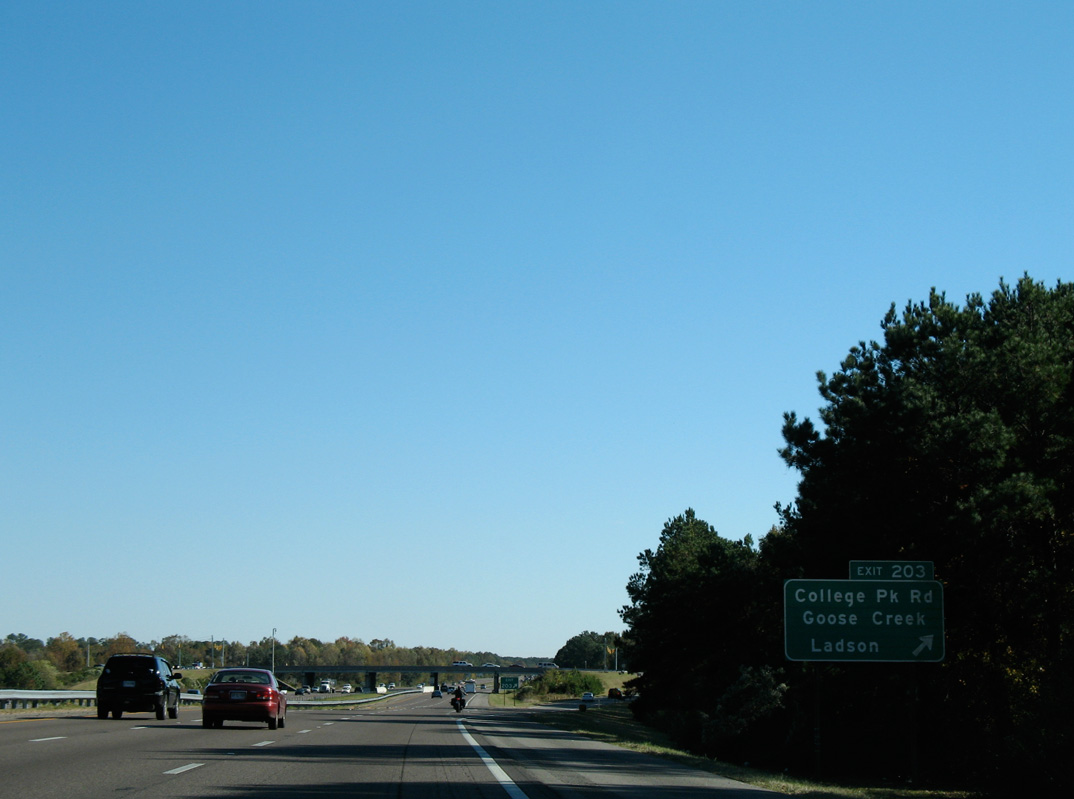
| Eastbound traffic along I-26 next reaches the diamond interchange (Exit 203) with College Park Road at the community of Ladson. 11/12/06 |
|
| College Park Road (Road 82) comprises an arterial leading 0.66 miles south to U.S. 78 and Ladson Road by Exchange Park and north 4.90 miles to U.S. 17 Alternate (Main Street) along the west side of Goose Creek. 11/12/06 |
|
| Interstate 26 crosses the Charleston County line at the rest area off-ramp beyond College Park Road. 11/12/06 |
Page Updated 09-15-2021.

 East
East