|
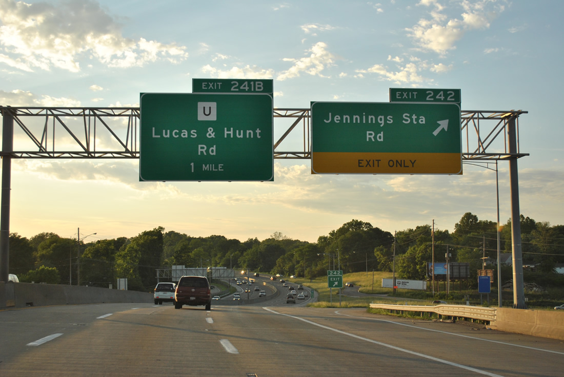
| Jennings Station Road heads south from Exit 242 into the city of Pine Lawn and north through Jennings to Flordell Hills. Exit 242 was a cloverleaf interchange until reconstruction in 2000. 05/03/12 |
|
| Three exits leave I-70 west in a the span of a mile between Northwoods and the city of Normandy. 10/16/04 |
|
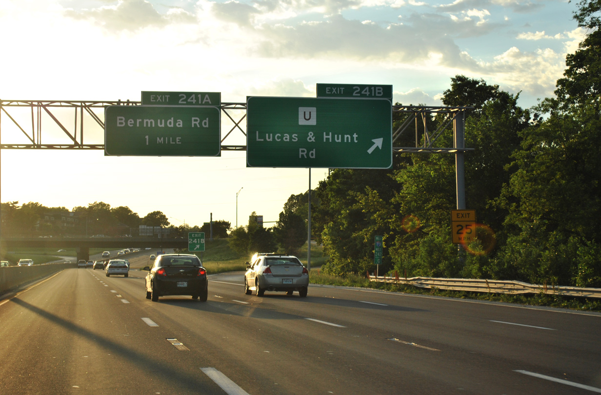
| A 2.29 mile route, Highway U lines Lucas & Hunt Road south to Beverly Hills and Woodrow Avenue at Velda Village and north to West Florissant Avenue at Country Club Hills. 05/03/12 |
|
| A diamond interchange (Exit 241A) follows along I-70 west at Bermuda Drive within the city of Normandy. 05/03/12 |
|
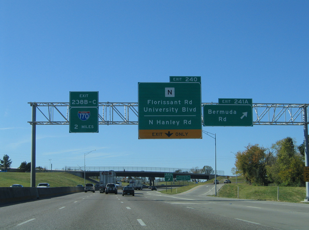
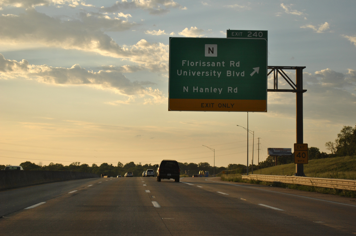
| Construction between January 2001 and Spring 2003 smoothed out a series of curves, including the infamous Bermuda Triangle known for a high accident rate, along I-70 between Bermuda Drive and Hanley Road. The $47.97 million project converted Exit 240 with Highway N from a cloverleaf into a single point urban interchange (SPUI).1 05/03/12 |
|
| The first sign for Interstate 170 (Exits 238B/C) appears two miles out at the Bermuda Road off-ramp (Exit 241A). Bermuda Road winds south a short distance to Highway N (Florissant Road) and north to Paul Avenue in the city of Ferguson. 10/16/04 |
|
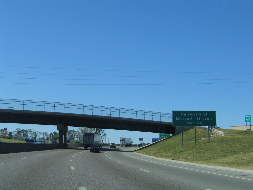
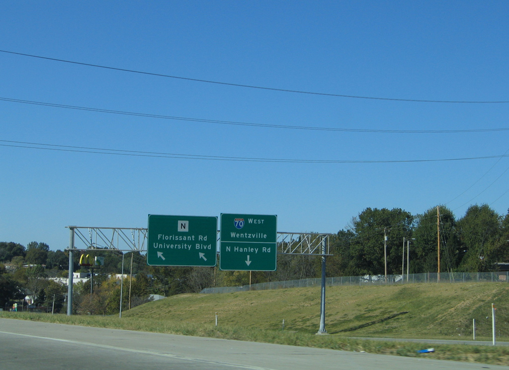
| Highway N runs south from Exit 240 through the adjacent campus of the University of Missouri-St. Louis (UMSL). 10/16/04 |
|
| A collector distributor roadway was constructed as part of the 2001-03 project to serve both Highway N (Florissant Road) and North Hanley Road. Previously a half diamond interchange (Exit 239) departed in a half mile for Hanley Road. 05/03/12 |
|
| Exit 240 partitions with two lanes for Highway N, a 5.20 mile route southeast to Missouri 115 (Natural Bridge Road) and north through Ferguson to Interstate 270 at Florissant. 10/16/04 |
|
| Interstate 70 turns northwest 1.25 miles from the diamond interchange with Hanley Road to a directional stack interchange (Exits 238C/B) with Interstate 170. 05/03/12 |
|
| The Exit 240 c/d roadway returns to Interstate 270 ahead of the North Hanley Road overpass. Hanley Road parallels I-170 north to Kinloch and Berkeley and south to Bel-Ridge and University City. 10/16/04 |
|
| Interstate 170, the Inner Belt Freeway, goes for 11.26 miles between I-64/U.S. 40 at Brentwood and Interstate 270 at the Hazelwood and Florissant city line. 05/03/12 |
|
| Passing by Ramona Lake, Interstate 70 approaches left Exit 238B to Interstate 170 south. 10/16/04 |
|
| Interstate 170 winds southwest through Bel-Ridge, Overland and Olivette before curving back east to University City, Clayton and Richmond Heights. 05/03/12 |
|
| Five lanes of I-70 west continue toward Interstate 170. St. Louis Lambert International Airport (STL) lies west of I-170 and north of I-70. 05/03/12 |
|
| Exit 238C departs Interstate 70 west for Interstate 170 south. I-170 was signed as Missouri 725 initially and completed in 1983. 05/03/12 |
|
| North from Exit 238B, I-170 travels through Berkeley to end at I-270 in 3.3 miles. The freeway serves Cargo City and the Boeing St. Louis site on the east side of STL Airport and otherwise mostly functions as a commuter route. 05/03/12 |
|
| A left side ramp brings traffic onto I-70 west from I-170 north. A Metrolink line winds through the interchange to STL Airport from the UMSL area. 10/16/04 |
|
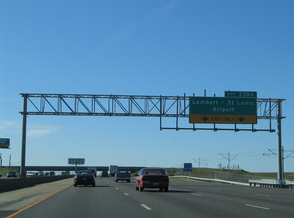
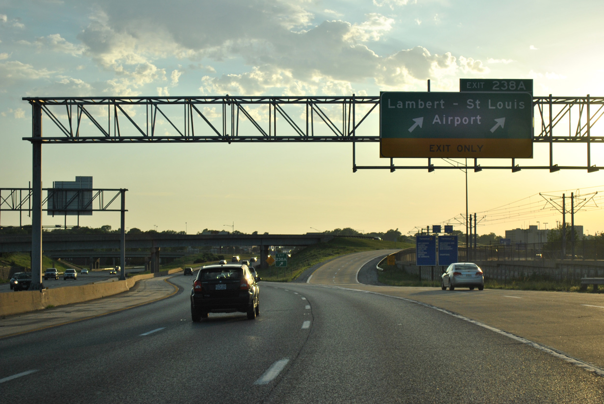
| I-70 west reduces to three through lanes beyond the two lane off-ramp of Exit 238A to St. Louis Lambert International Airport (STL). 10/16/04 |
|
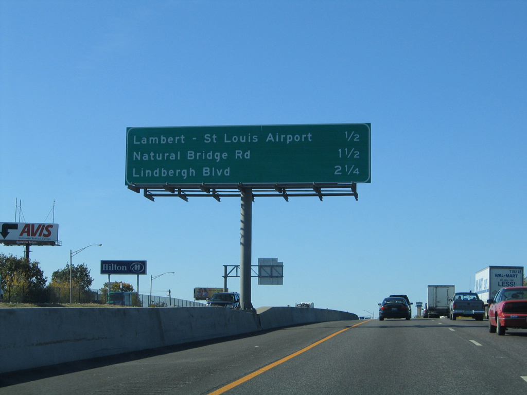
| Back to back wye interchanges (Exit 238A west / Exit 237 east) tie Interstate 70 west in with Lambert International Boulevard to the Terminal 2 of STL Airport and with the ending Missouri 115 (Natural Bridge Road) west. 05/03/12 |
|
| Exit 236 to Terminal 1 of St. Louis Lambert International Airport departs in one half mile. Natural Bridge Road resumes northwest from Exit 235C as Highway B in 1.5 miles. 10/16/04 |
|
| Metrolink lines the median of parallel Lambert International Boulevard as Interstate 70 enters the small city of Edmundson. 10/16/04 |
|
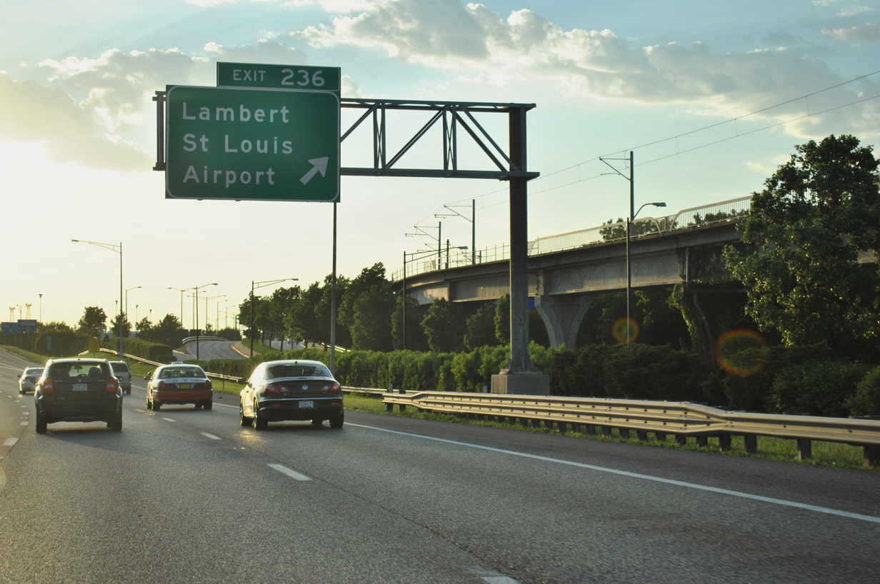
| Entering the parclo interchange (Exit 236) with Airflight Drive on I-70 west. Airflight Drive connects I-70 with Terminal 1 of STL Airport to the north and Pear Tree Drive west and Natural Bridge Road (former MO 115) east to the south. 05/03/12 |
|
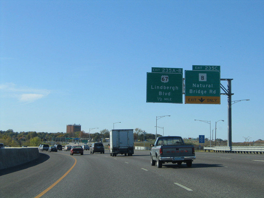
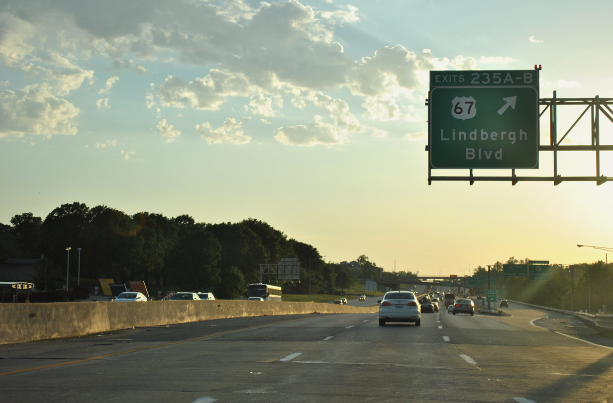
| The one mile sign for Exits 235B/A to U.S. 67 (Lindbergh Boulevard) proceeds Exit 235C for Highway B (Natural Bridge Road). 05/03/12 |
|
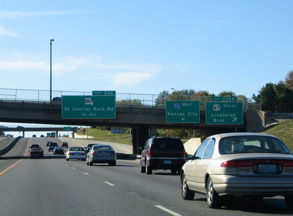
| Natural Bridge Road doubles as Highway B northwest from Interstate 70, 2.92 miles to Missouri 180 (St. Charles Rock Road) in the city of Bridgeton. MO 180 meets I-70 directly in 1.75 miles. 10/16/04 |
|
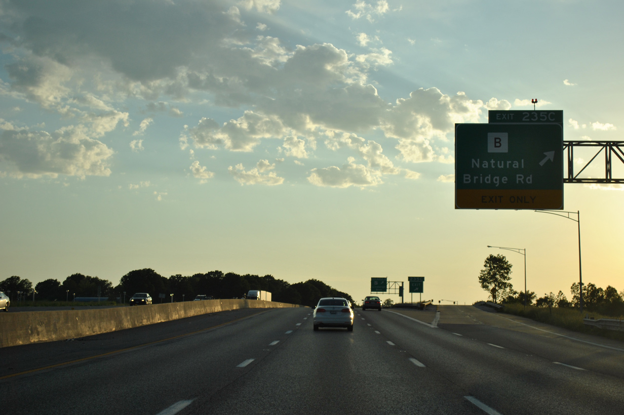
| Exit 235C loops away from I-70 west onto Highway B (Natural Bridge Road), just west of Lambert International Boulevard. U.S. 67 (Lindbergh Boulevard) curves north from Exit 235B to meet Highway B ahead of tunnel under the third runway of STL Airport. 10/16/04 |
|
| Exit 235C was altered from a half diamond interchange with Natural Bridge Road to a parclo A2 during the $1.1-billon Phase 1 expansion of STL Airport2. Natural Bridge Road was realigned to parallel the airport grounds just north of I-70 to rejoin its original alignment by Majella Drive and the former site of Bridgeton city hall.
A portion of old Highway B remains in use north of the third runway as a service road for the Airport Office Building. Half of the original diamond interchange between Highway B and U.S. 67 remains in use there. 05/03/12 |
|
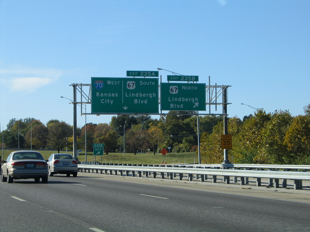
| A collector distributor roadway (Exits 235B/A) ensues along I-70 west for U.S. 67 (Lindbergh Boulevard) north to Hazelwood and south to St. Ann. 05/03/12 |
|
| 2.1 miles of U.S. 67 north from Exit 235A was realigned between fall 2001 and September 2004 to accommodate STL Airport expansion. The runway tunnel is the first in Missouri.2 10/16/04 |
|
| U.S. 67 follows the majority of Lindbergh Boulevard from Missouri 367, near the Missouri River south to Lemay Ferry Road at Mehlville. The boulevard encircles St. Louis generally as an arterial route with an assortment of interchanges. 10/16/04 |
|
| Missouri 180 (St. Charles Rock Road) angles northwest from Breckenridge and St. Ann to cross paths with I-70 in south Bridgeton next. 05/03/12 |
|
| Fee Fee Road spans Interstate 70 beyond the c/d roadway return and before the U.S. 67 southbound on-ramp merge. 05/03/12 |
|
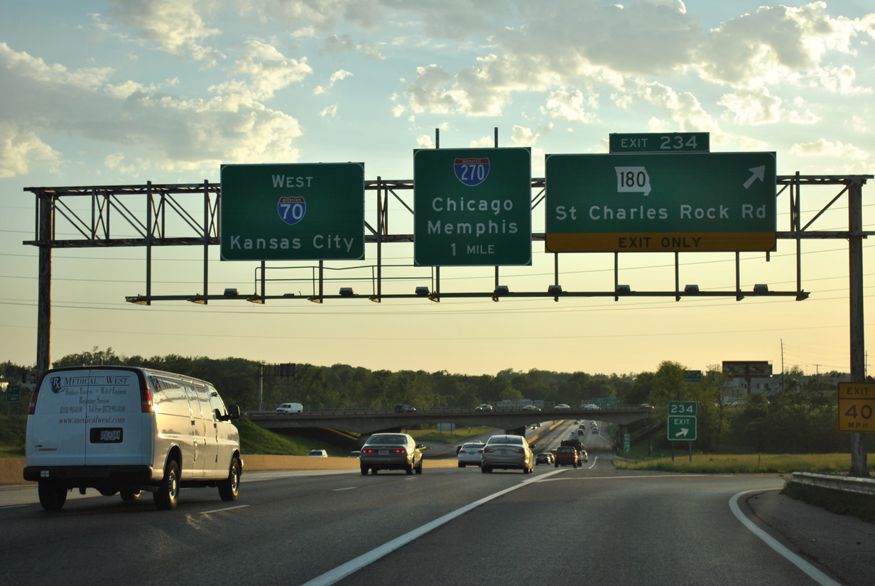
| An auxiliary lane expand I-70 west to four lanes leading into the parclo A2 interchange (Exit 234) with Missouri 180 (St. Charles Rock Road). 10/16/04 |
|
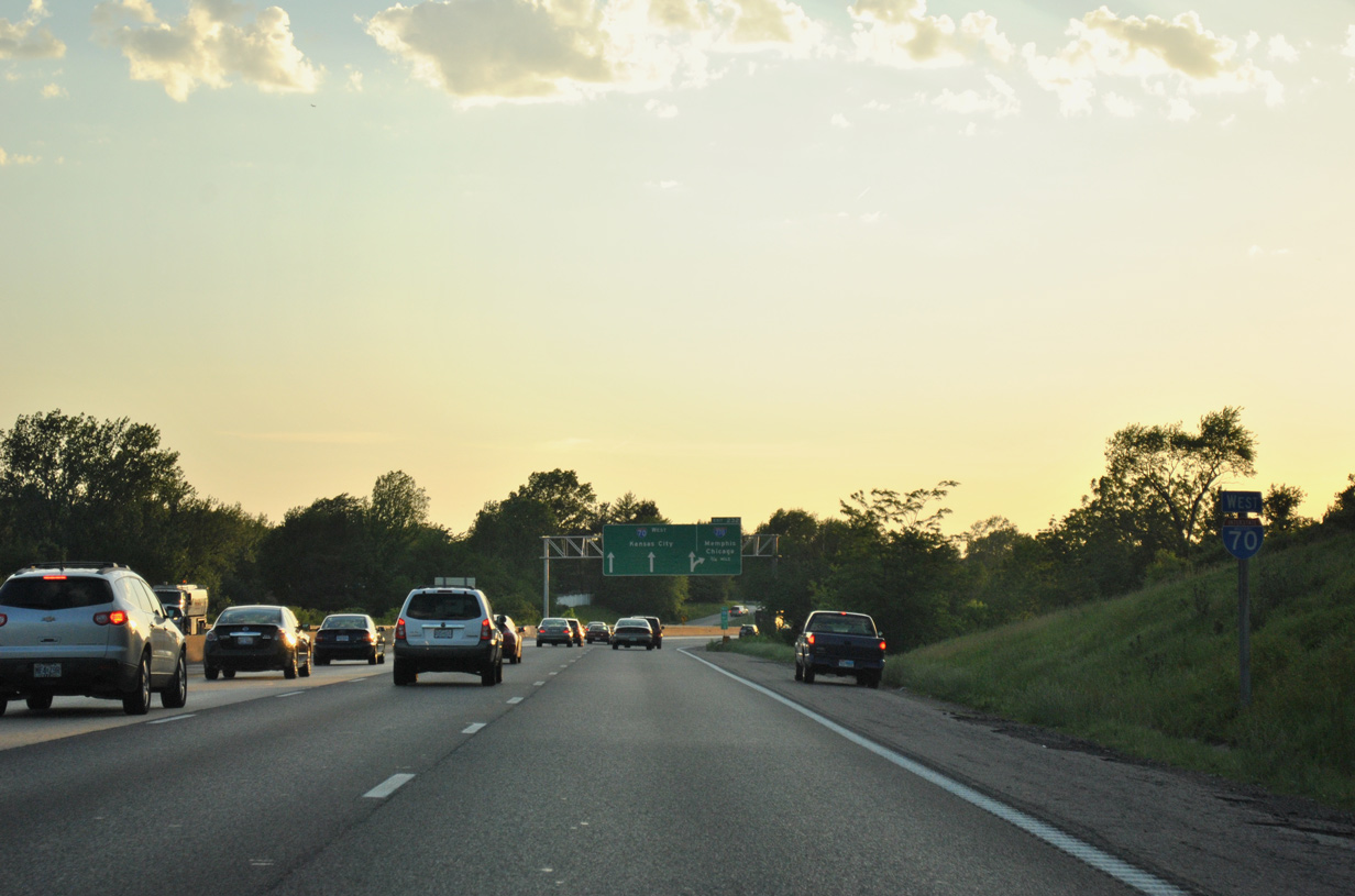
| An interchange sequence sign posted 1.5 miles ahead of the systems interchange (Exit 232) with Interstate 270. 05/03/12 |
|
| Missouri 180 (St. Charles Rock Road) originates at the St. Louis city line in Wellston. The 13.90 mile route concludes at Interstate 270 and Pennridge Drive in Bridgeton. 05/03/12 |
|
| Interstate 70 reassurance marker posted as the freeway passes by a wedge of retail between adjacent Missouri 180. 05/03/12 |
|
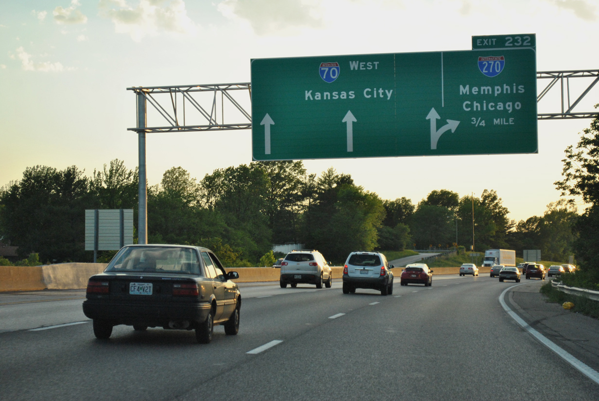
| An Arrow-Per-Lane (APL) sign precedes the turbine interchange (Exit 232) with I-270 by 0.75 mile. Flyovers replaced loop ramps at the former cloverleaf interchange between the two freeways in the early 1980s. 05/03/12 |
|
| Interstate 270 and Missouri 141 (Earth City / Maryland Heights Expressways) are the final two St. Louis County exits of I-70 west. 05/03/12 |
|
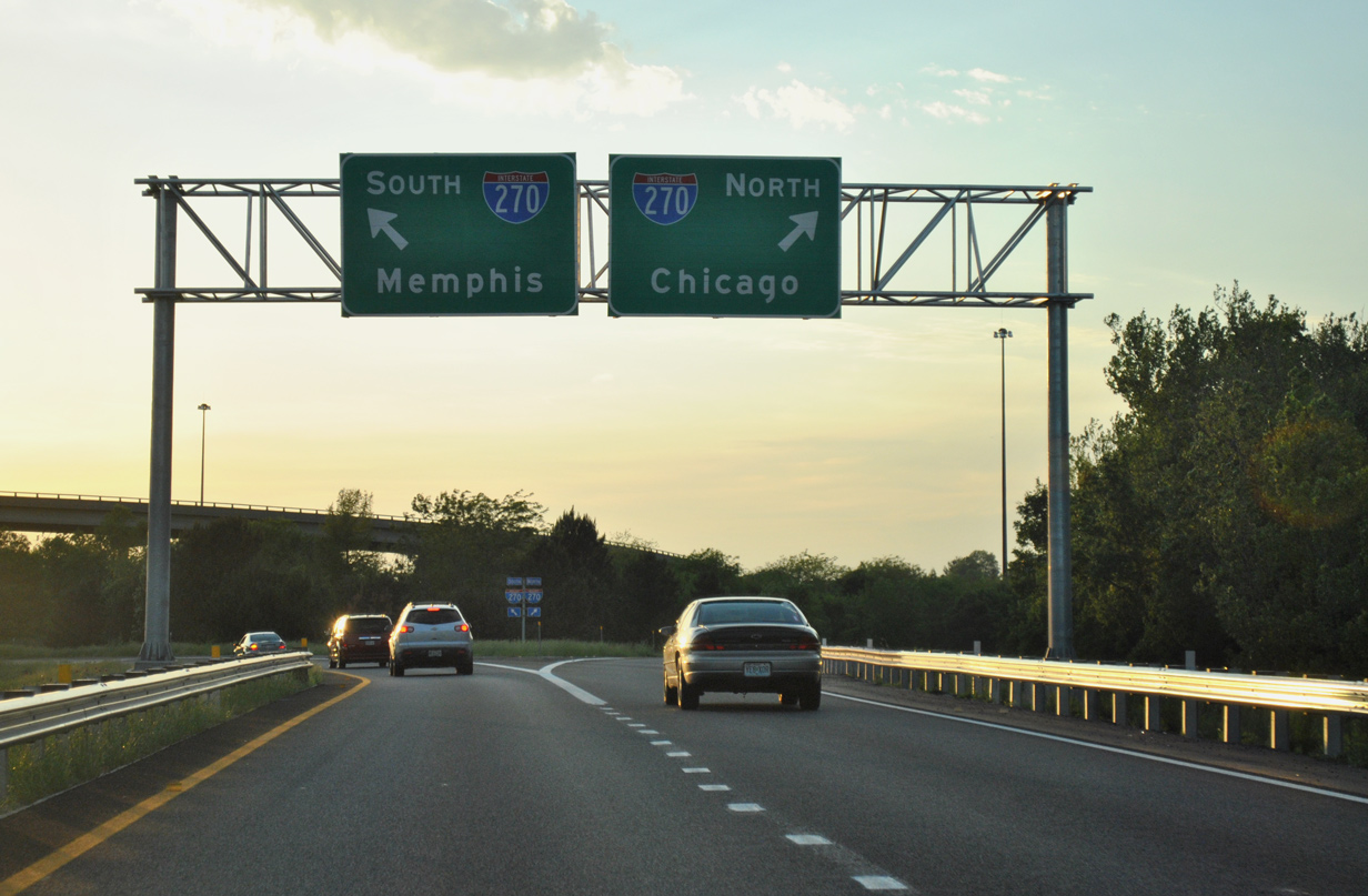
| The St. Louis beltway uses control cities of Interstates it connects with. Memphis highlights I-55 south while Chicago is posted for I-55 north.
This overhead was removed by 2012 in favor of a new APL sign bridge further ahead. 10/16/04 |
|
| Exit 232 for the St. Louis beltway was expanded to a two lane ramp between September 2012 and July 2013. 05/03/12 |
|
| Interstate 270 turns east at Bridgeton through Hazelwood, Florissant, and Bellefontaine Neighbors to span the Mississippi River at the Chain of Rocks Bridge. 05/03/12 |
|
| Interstate 270 travels 50.59 miles overall south to I-55 and 255 at Mehlville and east to I-55/70 near Troy, Illinois. 05/03/12 |
|
| The ramp to I-270 south travels the lowest level of the stack at I-70 as the beltway ventures south through Maryland Heights, Creve Coeur and Sunset Hills. 05/03/12 |
|
| Leading away from I-270, Interstate 70 travels between the cities of Bridgeton and Maryland Heights to Earth City and the Riverport Levee District.
This interchange sequence sign was replaced and now reflects Maryland Heights Expressway as the second entry. 10/16/04 |
|
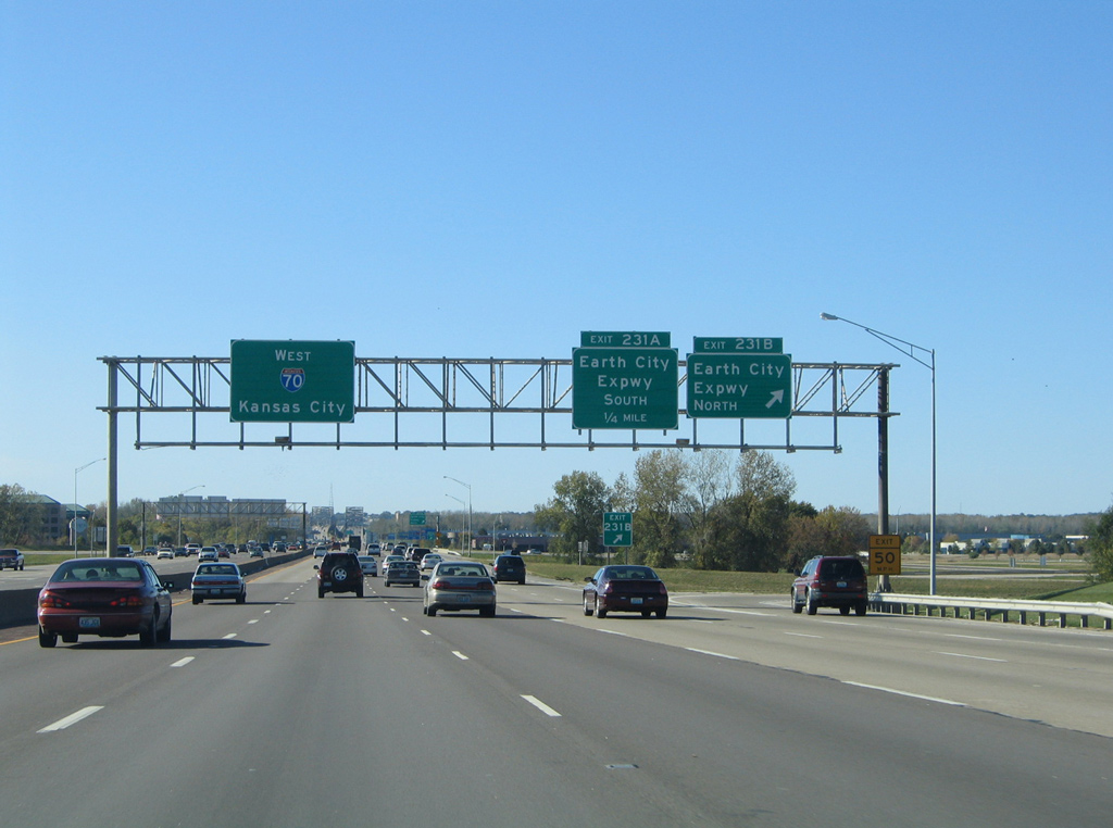
| A cloverleaf interchange (Exits 231B/A) joins Interstate 70 with Earth City Expressway north and Maryland Expressway south. Collectively the two expressways are part of Missouri 141, a 30.90 mile belt route from U.S. 61/67 in Jefferson County to the Missouri 370 freeway in Bridgeton. 10/16/04 |
|
| Exit 231B departs Interstate 70 west for Missouri 141 (Earth City Expressway) north through Earth City, a major business park bound by I-70 and St. Charles Rock Road (former MO 115). 10/16/04 |
|
| Missouri 141 follows Maryland Heights Expressway southwest by Riverport Business Park and the Verizon Wireless Amphitheater St Louis to the Missouri 364 freeway. The Page-Olive Connector, constructed between summer 2010 and July 2012, extended the expressway south to MO 340 in Chesterfield. 10/16/04 |
|
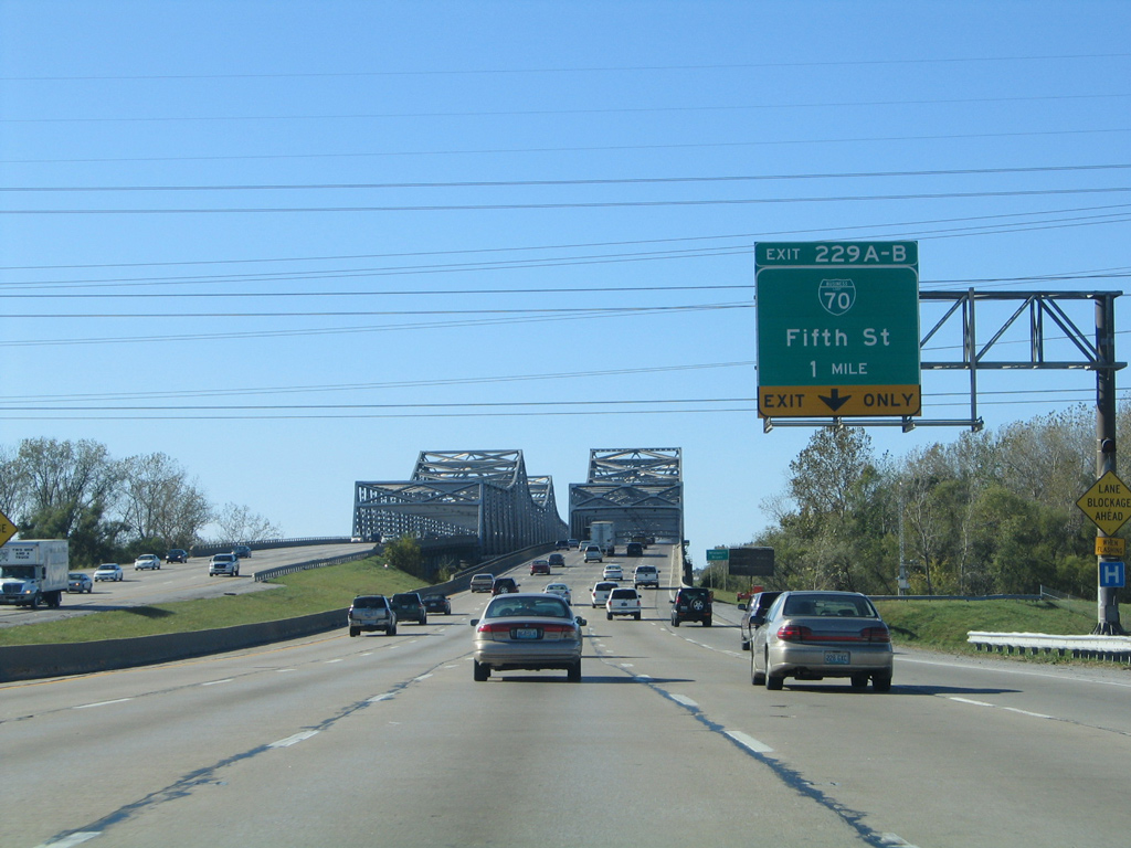
| Four exits line Interstate 70 west through the city of St. Charles. Exit 229B departs in 1.25 miles next for Business Loop I-70 (Fifth Street) west into Downtown. 10/16/04 |
|
| Exit 229B leaves I-70 west at the end of the Blanchette Bridge for Fifth Street north to Historic Downtown St. Charles and the First State Capitol historic site. Exit 229A loops onto Fifth Street south to River Road for Family Arena and St. Charles Convention Center. 10/16/04 |
|
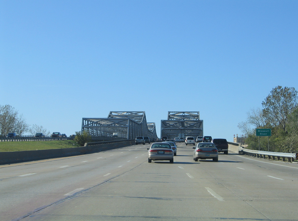
| The Blanchette Bridge spans the Missouri River with ten overall lanes along Interstate 70. 10/16/04 |
|
| A $64 million project rehabilitated the westbound span between November 2012 and August 24, 2013. Work resulted in a closure of the westbound bridge so crews could replace existing truss spans, replace the concrete driving surface and eliminate the three spans near the west end and elevate the roadway on embankment.3 10/16/04 |
|
| The westbound span across the Missouri River opened in 1958 at a width of 60 feet and a length of 4,083 feet.4 10/16/04 |
|
| The eastbound bridge opened to traffic in 1978 at a length of 3,792 feet and a width of 68 feet. Both continuous steel through truss bridges span the Missouri at 66 feet in height.4 10/16/04 |
|
| A St. Charles County line sign appears at the end of the Blanchette Bridge superstructure. I-70 enters the county midway across the Missouri River, 19.92 miles west of the Illinois state line. 10/16/04 |
Page Updated 05-14-2018.


 West
West