
Interstate 84, which was designated as I-80N until 1980, joins Portland and the Interstate 5 corridor with interior Oregon and Boise, Idaho. Much of the route is cosigned with U.S. 30 in the state, as the freeway replaced the original Columbia River Highway. The drive through Columbia River Gorge is arguably one of the most beautiful stretches of the Interstate highway network within the entire country.
Much of Interstate 84 is also signed as U.S. 30 along the Columbia River. The two routes continue eastward from the Umatilla Indian Reservation and climb into the Blue Mountains east of Pendleton. The freeway curves southeastward from Emigrant Hill through Deadman Pass and southward to a summit of 4,193 feet above sea level near Meacham. Along the eastward drive from Exit 216 to 224, vista points allow motorists a chance to take in the expansive nature of the western desert like horizon before the freeway leaves for La Grande. The two freeway roadways of I-84 separate by quite a distance at several intervals across the state.
Interstate 84 Oregon Guides
East

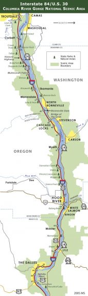
Columbia River Gorge
Heading west from Hood River, Interstate 84 enters the heart of the Columbia River Gorge National Scenic Area. The gorge's high bluffs keep the freeway close to the river for nearly the entire trip from Hood River to the Portland metropolitan area. Attractions along this 45 mile stretch of freeway come seemingly at every passing milepost: state parks and natural areas, historic sites (including Lewis and Clark sites), Bonneville Dam, and Multnomah Falls are just a few. As the only near sea-level break in the Cascade Range, the Gorge is also a unique area both geologically and botanically. The Columbia River and Gorge also hold a certain mystique for residents of the Pacific Northwest, perhaps best expressed by these lines from Woody Guthrie's ballad "Roll On Columbia":
Roll on, Columbia, roll on
Roll on, Columbia, roll on
Your power is turning our darkness to dawn
So roll on, Columbia, roll onGreen Douglas firs where the waters cut through
Down her wild mountains and canyons she flew
Canadian Northwest to the oceans so blue
Roll on Columbia, roll on
 scenes scenes |
 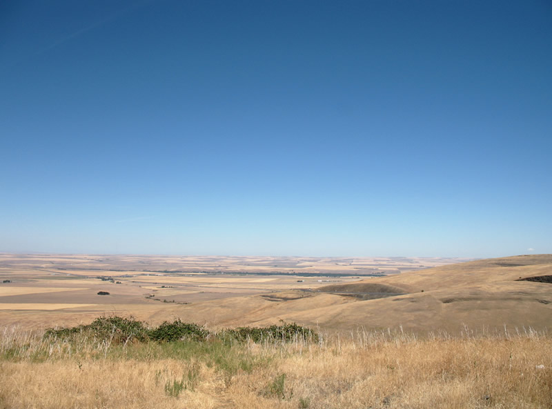 | Looking north at I-84/U.S. 30. The view point lies five miles east of Exit 216. 08/31/06 |
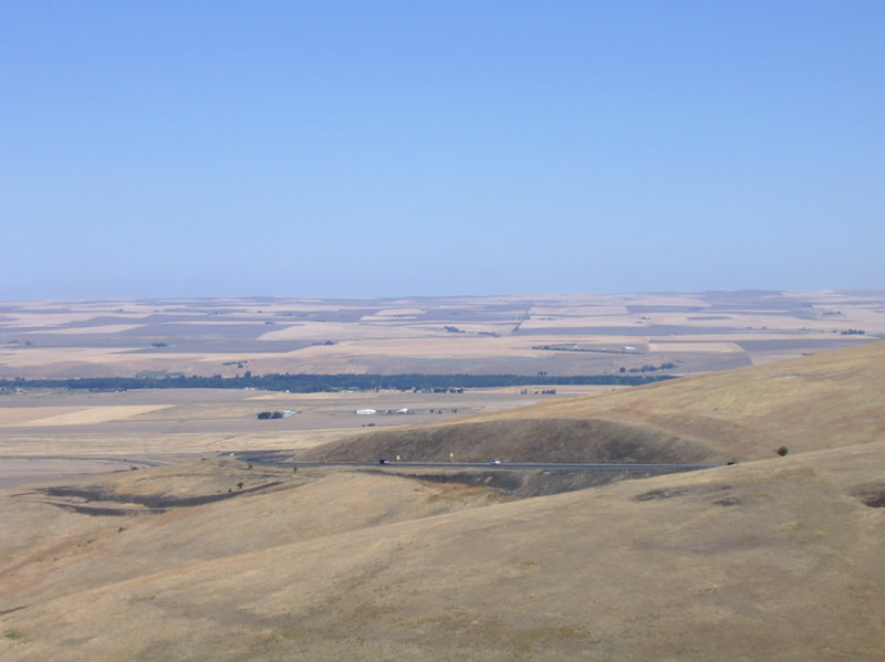 | Northwesterly view of I-84/U.S. 30 from Umatila Indian Reservation (Exit 216) east. The scenic pull off doubles as a chain up area for wintry weather in the forthcoming Blue Mountains. 08/31/06 |
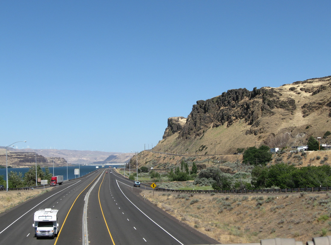
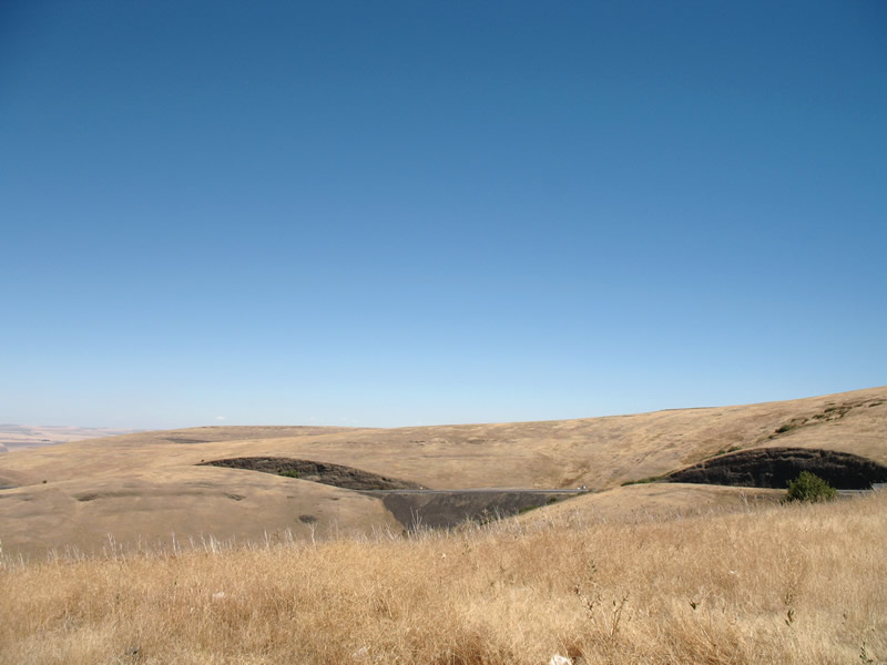
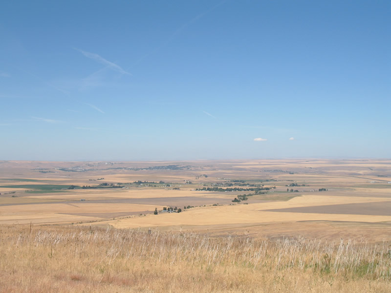
    | Vast ranch lands spread out over the basin west of the Blue Mountains. Much of the land is arid due to the rain shadow effect of the Cascade Mountains. 08/31/06 |
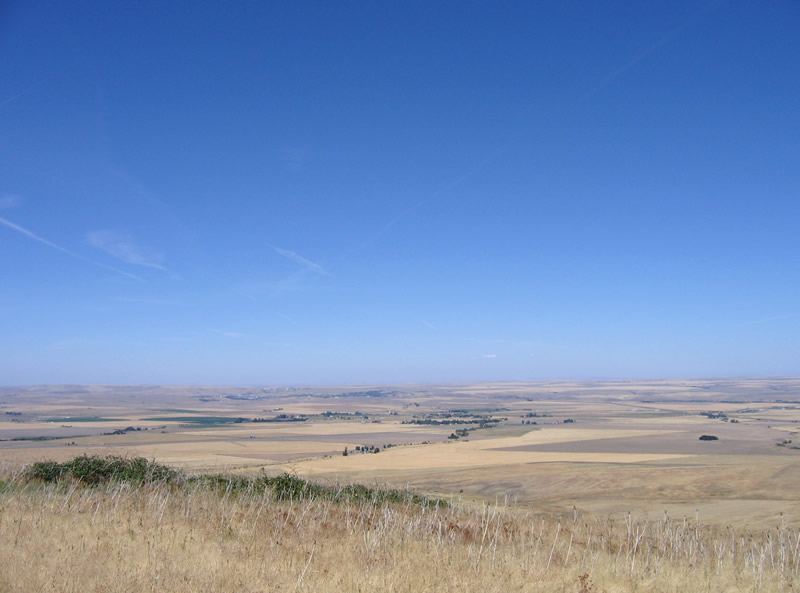
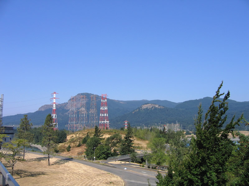
 | I-84/U.S. 30 east continue their eastward rise toward Red Hawk Gulch independent of the westbound roadway. The I-84/U.S. 30 vista point was reserved as part of the 1961 Oregon Scenic Areas Act, which designated 3,585 miles of highways as scenic routes in Oregon. 08/31/06 |
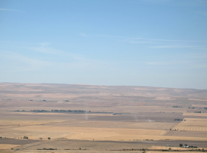
 | Storie Lane follows Patawa Creek southeast to a small settlement west of the I-84/U.S. 30 climb. 08/31/06 |
| Bonneville and Bonneville Dam |
 | Tanner Creek Road joins I-84/U.S. 30 at Exit 40 with Bonneville Dam and Dam Road east/Hatchery Road west at Bonneville. 08/28/06 |
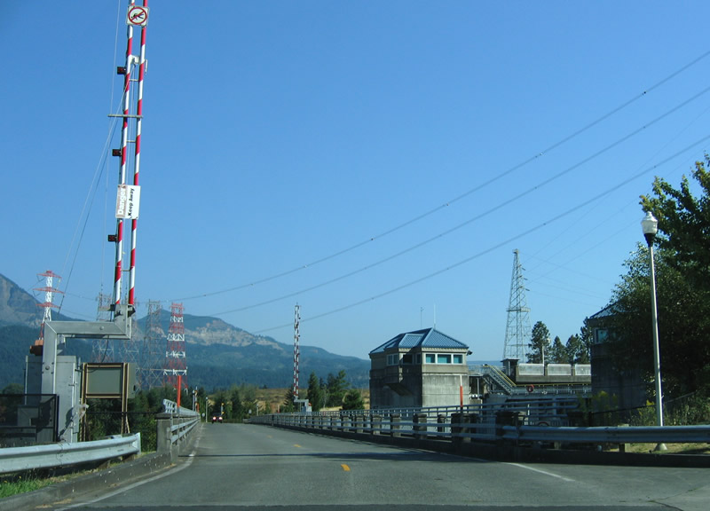 | Dam Road north stems northeast from Tanner Creek Road and Hatchery Roads to Bonneville Dam. A swing bridge spans the navigational canal onto Robins Island. 08/28/06 |
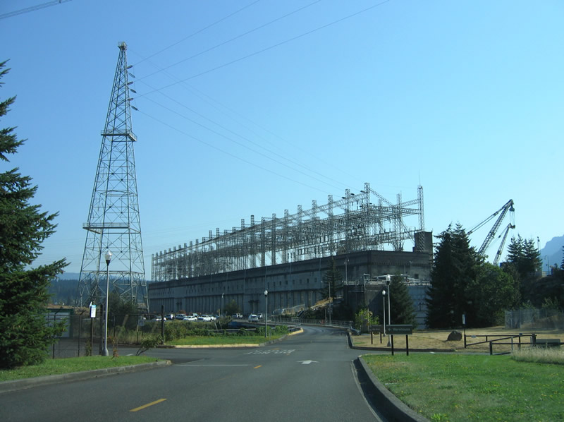 | Bonneville Dam generates hydroelectric power and includes fish ladders used by salmon and steelhead swimming upstream during their mating season. The dam is open to visitors on a daily basis. 08/28/06 |
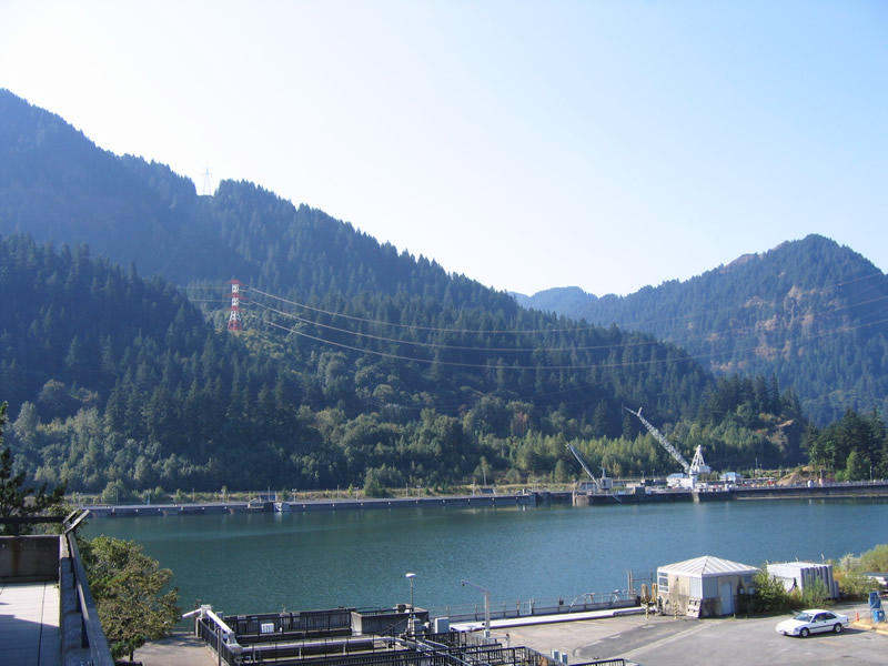
 | Bonneville Reservoir is formed by the Bonneville Dam to the east. The Dam was named after Army Captain Benjamin Bonneville, an early explorer associated with the Oregon Trail.1 08/28/06 |
 | Due to the narrow nature of flat land between the Columbia River and the edge of Mt. Hood, Interstate 84 splits between a westbound viaduct and eastbound tunnel at Bonneville. In view here is the elevated roadway for eastbound and the adjacent Union Pacific Railroad line below. 08/28/06 |
 | One of the fish ladders (Bradford Island Fishway) that allow the passage of sturgeon and steelhead beyond Bonneville Dam. A viewing room allows visitors an underwater look at the current fish must overtake eastward. Table Mountain in Washington rises along the horizon. 08/28/06 |
 | A navigation canal and locking system lies between Robins Island and the south banks of the Columbia River. 08/28/06 |
 | Bonneville Dam 08/28/06 |
 | Massive power lines carry electricity generated from the powerhouse northward into Washington state. The dam has supplied power to the region since 1938. 08/28/06 |
 | Robins Island lies midway between the Columbia River north banks and Bradford Island. The island includes a Recreational Area and is joined to Bonneville by a narrow swing bridge. 08/28/06 |
 | Crossing Dam Road south over the navigational canal at Bonneville Dam. 08/28/06 |
 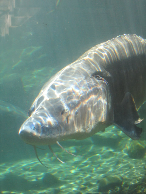 | A fish hatchery lies west of the intersection of Dam and Tanner Creek Roads adjacent to the south banks. Visitors are provided with access to a large tank to view some of the larger resident steelhead, sturgeon and salmon. 08/28/06 |
 | Leaving Bonneville on Tanner Creek Road north; a diamond interchange provides return access to Portland via I-84/U.S. 30 west and Hood River via east. A Union Pacific Railroad line parallels Interstate 84 through much of the Columbia River valley. 08/28/06 |
| Vista House at Crown Point |
 | Magnificent views are afforded to visitors of the Vista House high above I-84/U.S. 30 and the Columbia River. 08/27/06 |
  | Crown Point and Rooster Rock State Parks surround the Vista House and I-84/U.S. 30's path through this stretch of the Columbia River Gorge. 08/27/06 |
 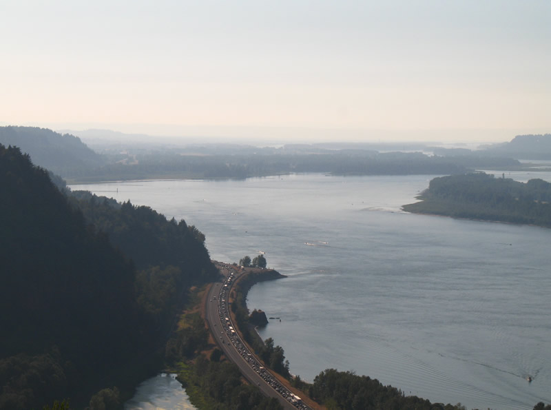 | A traffic accident blocked the eastbound lanes of I-84/U.S. 30 at Exit 22 (Corbett Station), resulting in extremely long back-ups in both directions. Note that several sections of Interstate 84 travel along causeways between the river and wetlands associated with Young Creek and Mirror Lake. 08/27/06 |
   | I-84/U.S. 30 at Rooster Rock, far below the Vista House and Historic Columbia River Highway (old U.S. 30). A trumpet interchange (Exit 25) joins the freeway with the Park's main access point and parking area. 08/27/06 |
| Rooster Rock State Park |
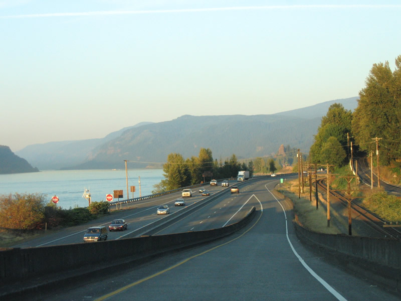
 | Eastward view from Rooster Rock State Park near I-84/U.S. 30. The park includes three miles of beaches, a boat ramp, the two mile Volkswalk trail and even a nude beach. 08/27/06 |
 | Nearing sunset at Rooster Rock State Park. Winds through the Columbia River Gorge during the winter have topped at 110 mph. On this day, there was hardly any wind and temperatures instead soared to the mid to upper 90s. 08/27/06 |
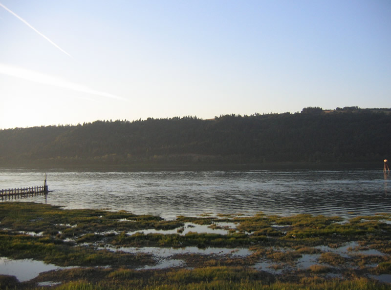 | Washington state rises along the north banks of the Columbia River, opposite Rooster Rock State Park. 08/27/06 |
 | Exit 25 consists of a trumpet interchange sandwiched between wetlands south of Interstate 84 and Rooster Rock State Park. There is no access to the Historic Columbia River Highway (old U.S. 30) from here. 08/27/06 |
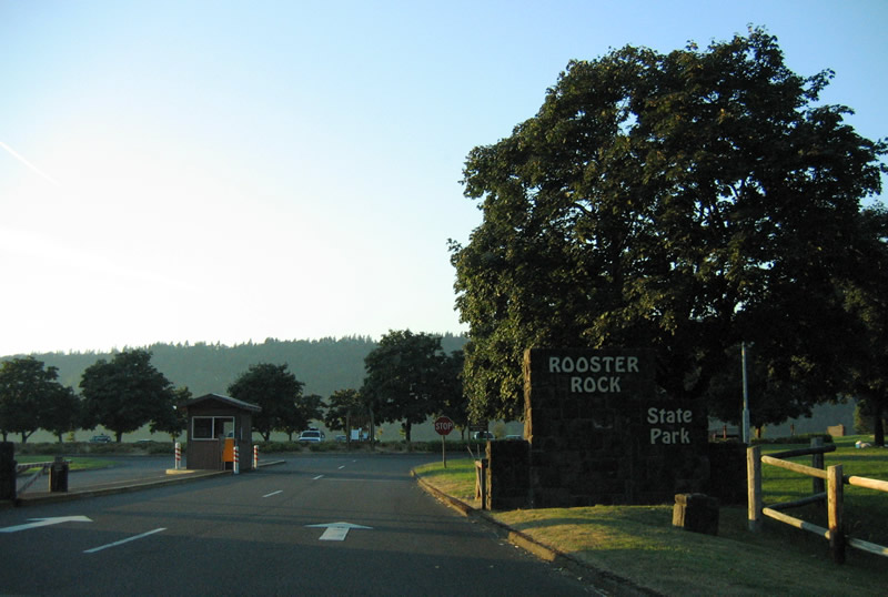 | Rooster Rock State Park lies along the south banks of the Columbia River at I-84/U.S. 30 Exit 25. The park is only accessible by the freeway. 08/27/06 |
| scenes |
 | Corbett Hill Road meanders upwards from I-84/U.S. 30 (Exit 22) at Corbett Station to Historic Columbia River Highway (old U.S. 30) at Corbett. This view looks at the eastbound entrance ramp signage for Hood River. The missing trailblazer directed motorists to the Vista House. 08/27/06 |
 | Westward from the Corbett Hill Road diamond interchange (Exit 22) at Corbett Station. 08/27/06 |
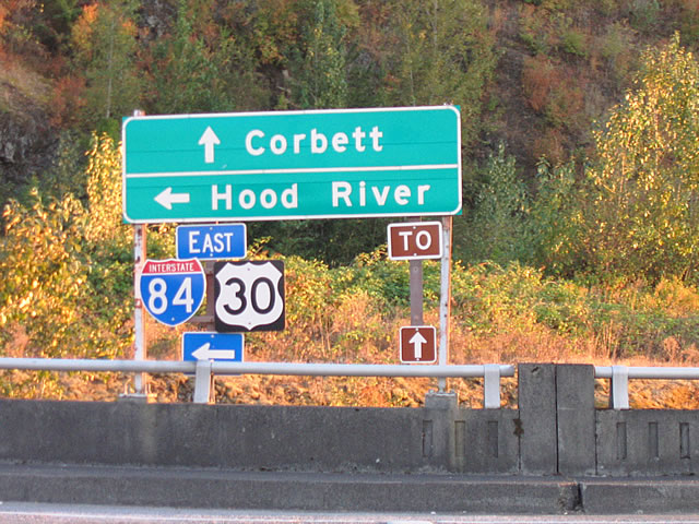
  | U.S. 30/OR 35 westbound at Interstate 84 at west Hood River. U.S. 30 combines with the freeway to Exit 44 at Cascade Locks. 04/24/05 |
 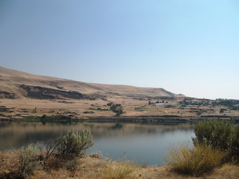 | Looking north from the Columbia Gorge Discovery Center area west of the Dalles, adjacent to I-84/U.S. 30. Hugging the north banks of the river is a BNSF Railroad line. Washington State Route 14 (former U.S. 830), leaves the river area for higher elevations just west of this scene. 08/27/06 |
- Bonneville Dam. Wikipedia.
Photo Credits:
- 04/24/05 by Matt Strieby.
- 08/27/06 by AARoads.
- 08/28/06 by AARoads.
- 08/31/06 by AARoads.
Connect with:
Interstate 5
Interstate 82
Interstate 205
U.S. 97
Page Updated 07-05-2023.