


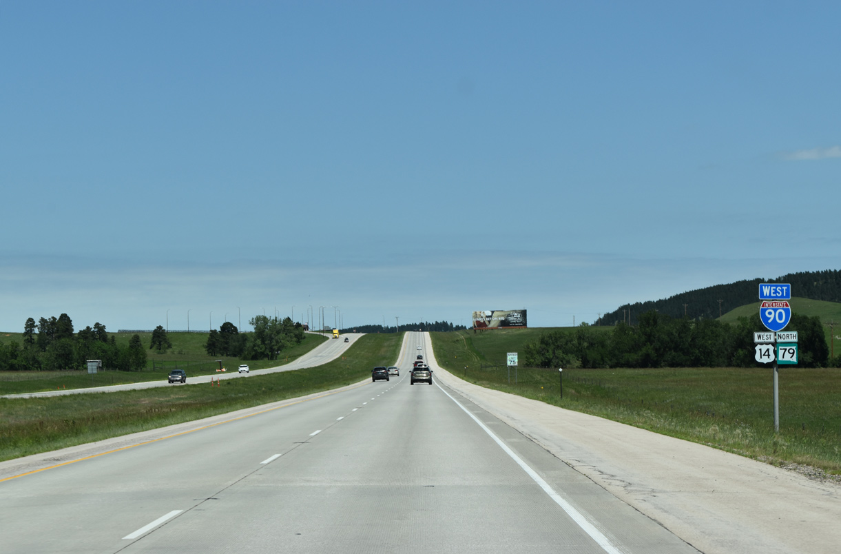
 West
West  East
East  North
North
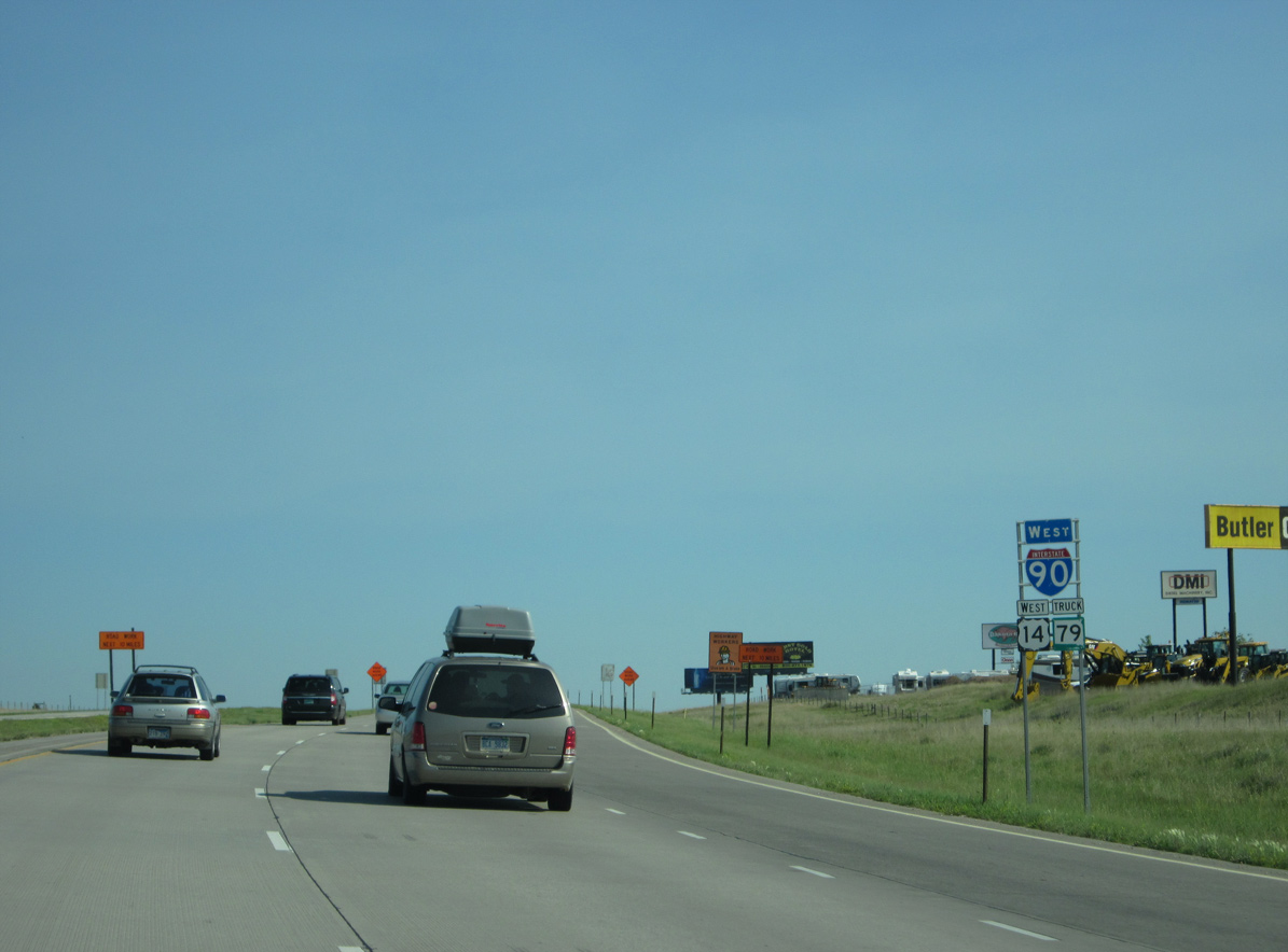
U.S. 16 Truck/SD 79 combine with Interstate 90 and U.S. 14 west from Exit 61.
08/20/14
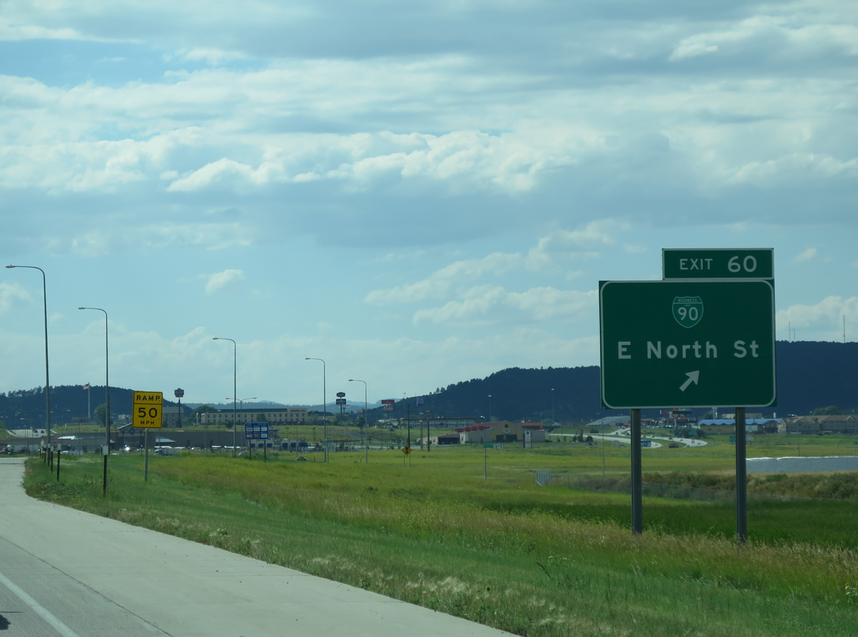
Business Loop I-90 branches southwest from I-90/U.S. 14-16 Truck-SD 79 toward Downtown Rapid City along E North Street at Exit 60.
08/20/14

The SPUI at Exit 60 replaced a wye interchange with a left exit ramp for Business Loop I-90 west. Replacing U.S. 16, the locally maintained business route lines East Boulevard south to a couplet of Main Street west and St. Joseph Street east through the Rapid City center.
08/20/14

An auxiliary lane opens along Interstate 90 west from the Haines Street entrance ramp to the trumpet interchange (Exit 57) with I-190 south / U.S. 16 west.
04/16/18
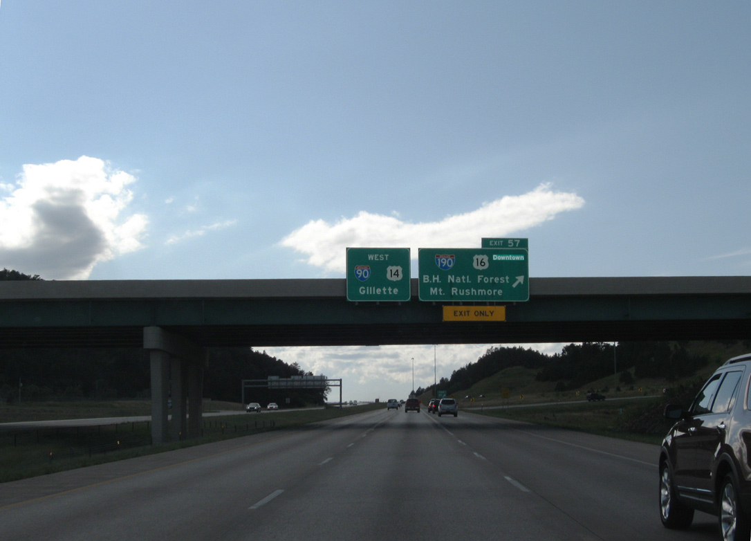
Interstate 190 spurs 1.82 miles south from Exit 57 to SD 44 (Omaha Street) outside Downtown Rapid City. U.S. 16 follows the freeway to Omaha Street east to Mount Rushmore Road south.
08/16/11
Exit 57 constitutes a sharp loop ramp from I-90/U.S. 14-SD 79 west onto Interstate 190. This trumpet interchange replaced a directional-T interchange with left exit ramps.
04/16/18
West North
06/24/12

Unsigned SD 445 stems 2.37 miles north from Chicago Street / Omaha Street ( SD 231) along Deadwood Avenue to the diamond interchange at Exit 55.
06/24/12

06/24/12

Deadwood Avenue extends north from Exit 55 and SD 445 as CR 260 to CR 7 in Meade County east of Black Hawk.
06/24/12
SD 79 formerly traveled north from Rapid City along Sturgis Road (old U.S. 14) to Black Hawk. SD 79 bypasses the city from the Heartland Expressway north alongside U.S. 16 Bypass to I-90 at Exit 61 en route to Sturgis.
06/24/12

06/24/12

Angling northwest, Interstate 90 lowers to cross Box Elder Creek.
06/24/12

Advancing north into the unincorporated community of Black Hawk, I-90/U.S. 14-SD 79 converge with the west end of Business Loop I-90 (Peaceful Pines Road) at Exit 52.
06/24/12

Interstate 90 enters Meade County ahead of the diamond interchange (Exit 52) with Peaceful Pines Road.
08/16/11

Construction completed in 2009 relocated a portion of I-90 to eliminate an S-curve that took the freeway across the DM&E Railroad. This work consolidated a split interchange configuration (Exit 51) with the exchange built at Exit 52 and Peaceful Pines Road.
08/16/11

Norman Avenue runs along the east side of Interstate 90 on the ensuing stretch north of Exit 52.
06/24/12

06/24/12

A half diamond interchange (Exit 51) formerly connected I-90/U.S. 14 with Business Loop I-90 (Sturgis Road) south to Black Hawk ahead of the S-curve across the CP Rail Systems line.
08/16/11

Exit 51 linked Interstate 90 directly to Foothill Road south for the adjacent Sturgis Road. The exchange along with the previous roadways spanning the parallel railroad line were removed during 2009 road work.
08/16/11

Continuing northwest through the city of Summerset, I-90/U.S. 14-SD 79 next meet Stage Stop Road at a diamond interchange (Exit 48).
06/24/12

Formerly signed as Stagebarn Canyon Road at Exit 48, Stage Stop Road connects I-90/U.S. 14-SD 79 with parallel Sturgis Road (old U.S. 14/SD 79), which is maintained as a county road.
06/24/12

Continuing northwest, I-90/U.S. 14-SD 79 enter the city of Piedmont.
06/24/12
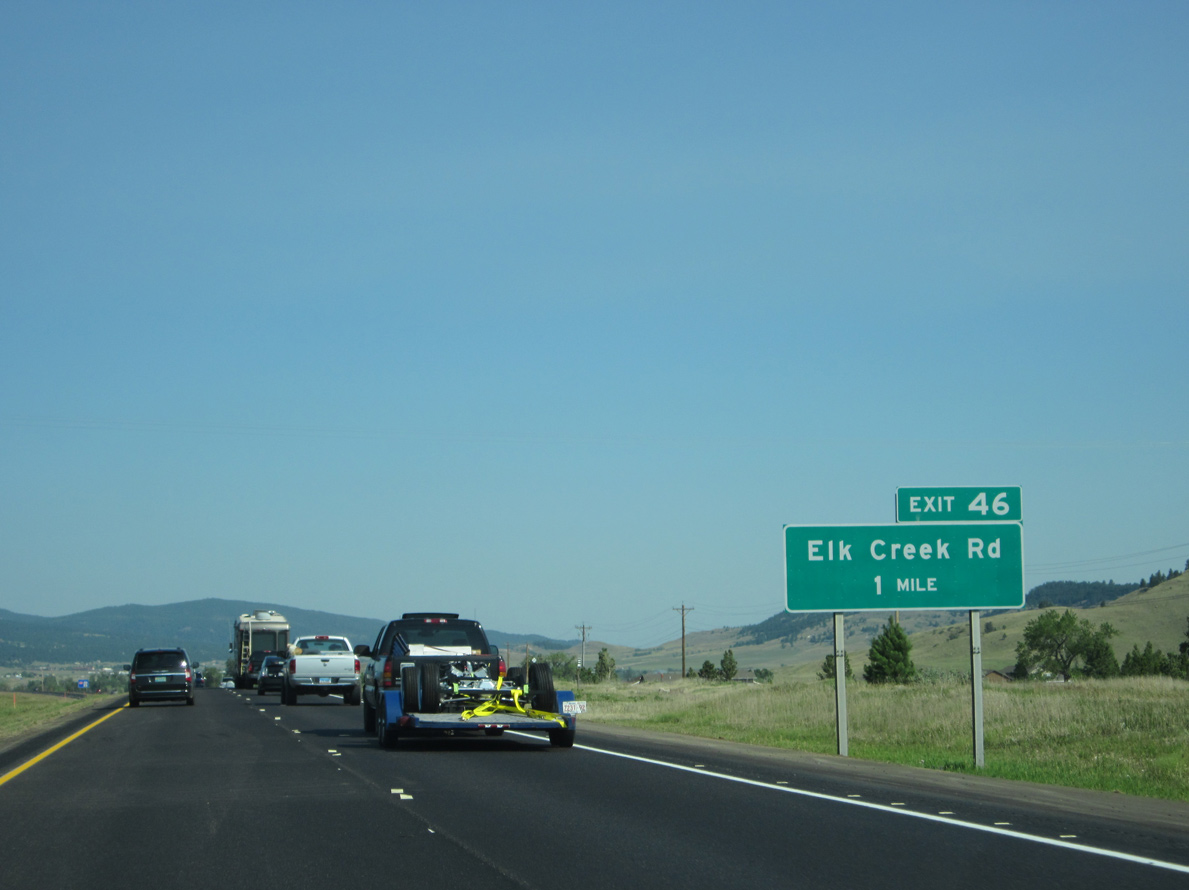
The succeeding exit along I-90 west is for Elk Creek Road (CR 4). Elk Creek Road stems east from suburban areas of Piedmont to farms and ranches along Elk Creek.
06/24/12
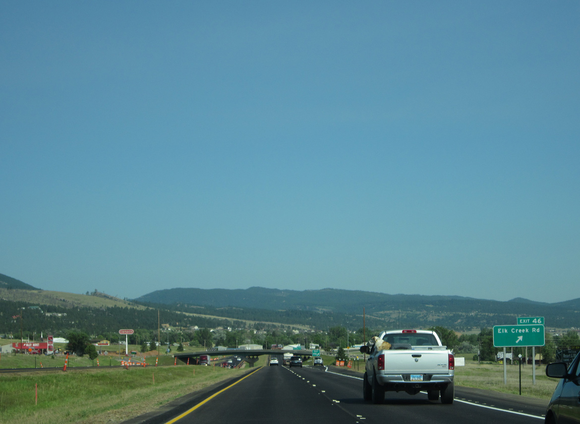
The modified diamond interchange at Exit 46 connects I-90/U.S. 14-SD 79 with both Elk Creek Road (CR 4) and parallel Sidney Stage Road north.
06/24/12

The succeeding exit along Interstate 90 west is for Deerview Road (Meade County Route 4A) west to Chimney Canyon Road and east to area ranch and farm land. Sign replacements made for Exit 44 by 2018 changed Bethlehem Road to Deerview Road.
06/24/12

I-90/U.S. 14-SD 79 directly overlaid the original alignment of U.S. 14/SD 79 through Piedmont to the diamond interchange (Exit 44) with CR 4A (Deerview Road).
06/24/12

07/04/18

Formerly rest areas with full bathroom facilities, parking areas line both roadways of Interstate 90 one mile beyond Elk Creek.
06/24/12

The westbound parking area near Tilford is located near milepost 42 to the east of Bald Mountain (el. 4,324 ft).
07/04/18

Interstate 90 proceeds northward one mile to the diamond interchange (Exit 40) with 214th Street / Tilford Road at the unincorporated community of Tilford.
07/04/18

Paralleling Morris Creek, 214th Street / Tilford Road extends east from I-90/U.S. 14-SD 79 across nearby hills to ranch land. Sturgis Road (old U.S. 14/SD 79) ties into the exchange from the west.
07/04/18
SD 79 continues with I-90/U.S. 14 west to the second Sturgis interchange.
07/04/18

Photo Credits:
- 08/16/11 by AARoads.
- 06/24/12 by AARoads.
- 08/20/14 by AARoads.
- 04/16/18 by Jim Maffrand.
- 07/04/18 by AARoads.
Connect with:
Interstate 190
U.S. 16
Page Updated 02-26-2023.