|
| Interstate 29 enters South Dakota after crossing the Russell E. Christiansen Bridge over the Big Sioux River. A welcome sign lies just north of the Iowa line. 04/20/07 |
|
| Pictured here is the first northbound reassurance marker for I-29 in South Dakota. The majority of shields in the state do not include the state name. 04/20/07 |
|
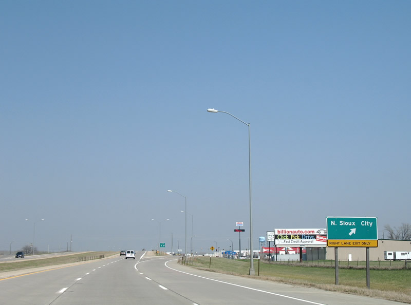
| Exit 1 serves the Dakota Dunes golf course community sandwiched between the Big Sioux and Missouri Rivers in extreme southeast South Dakota. Dakota Dunes Boulevard meanders north and south a short distance from Interstate 29. Freeway frontage roads (Derby Lane and Sioux Point Road) stem northward from Dakota Dunes Boulevard into North Sioux City. 04/20/07 |
|
| The next two interchanges serve North Sioux City on I-29 north. Posted within the six-ramp parclo interchange at Exit 1 was the initial overhead for former SD 105 (River Drive) north. Replaced by 2012, this sign still displayed a SD 105 shield. That designation was retired in 1998 with the exception of a one mile segment between Jefferson and Exit 9. SD 105 followed the historic routing of U.S. 77 between 1980 and 1998.1 04/20/07 |
|
| Interstate 29 shield posted between Exits 1 and 2 near North Sioux City. 04/20/07 |
|
| Northbound at the ramp departure of Exit 2 onto River Drive (former SD 105). River Drive heads east to Military Road within North Sioux City. River Drive was apparently a part of unsigned Business Spur I-29P between the freeway and Military Road until some point.2 SDDOT GIS indicated that a portion of forthcoming North Shore Drive between Exit 4 and Old Highway 105 is now Business Spur I-29P. 04/20/07 |
|
| The second North Sioux City interchange joins Interstate 29 with North Shore Drive at Exit 4. The diamond interchange serves the Adams Homestead and Nature Preserve. 04/20/07 |
|
| Interstate 29 north at Exit 4 for North Shore Drive. North Shore Drive spurs west from Military Road and former SD 105 to Westshore Drive around McCook Lake. 04/20/07 |
|
| Interstate 29 leaves the Sioux City metro area for Jefferson and Sioux Falls. The maximum speed limit on rural South Dakota Interstates increased to 80 miles per hour on April 1, 2015. 04/20/07 |
|
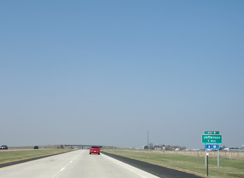
| Nearing the city of Jefferson along I-29 north. Exit 9 joins the freeway with 330th Street west and Dakota Street (former SD 105) east. 04/20/07 |
|
| 330th Street extends Dakota Street (old SD 105) west from a diamond interchange (Exit 9) at I-29 toward the Missouri River. Old U.S. 77 continues nearby along Main Street.
This sign was replaced by 2012. 04/20/07 |
|
| Elk Point represents the next city along Interstate 29 north. 04/20/07 |
|
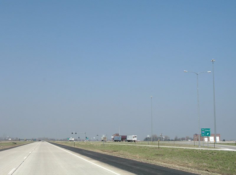
| A truck weigh station operates along Interstate 29 northbound between Jefferson and Elk Point. Commercial vehicles including buses and rental trucks must stop for inspection. 04/20/07 |
|
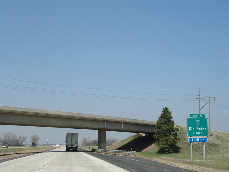
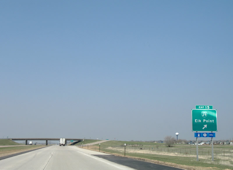
| The first of two Business Loops for Interstate 29 serves Elk Point between Exits 15 and 18. Pictured here is the one mile guide sign for Exit 15 at the 478th Avenue overpass.
This sign was replaced by 2012. 04/20/07 |
|
| Exit 15 consists of a diamond interchange with 477th Avenue and Business Loop I-29 north. The business route follows Main Street through the city center and was designated in 1984.2 04/20/07 |
|
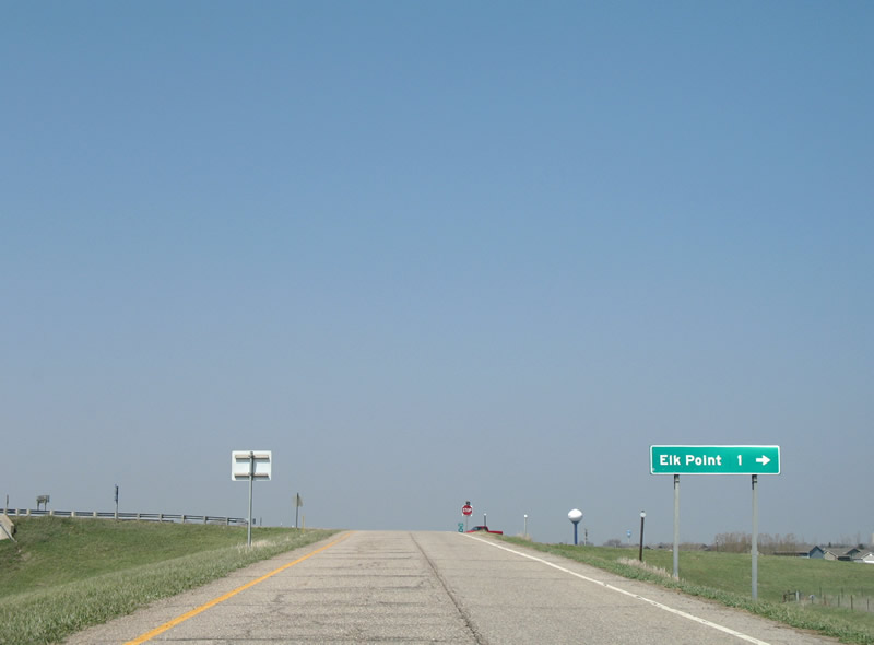
| Downtown Elk Point lies one mile north of Exit 15 via Business Loop I-29 (Main Street) north. SD 11 bee lines north from Elk Point to SD 50 as part of a two-segmented route north from Rose and Franklin Streets in Elk Point to the Minnesota state line near Sherman. 04/20/07 |
|
| Interstate 29 straddles the western city limits of Elk Point from 477th Avenue to the BNSF Railroad underpass beyond Exit 18. 06/17/15 |
|
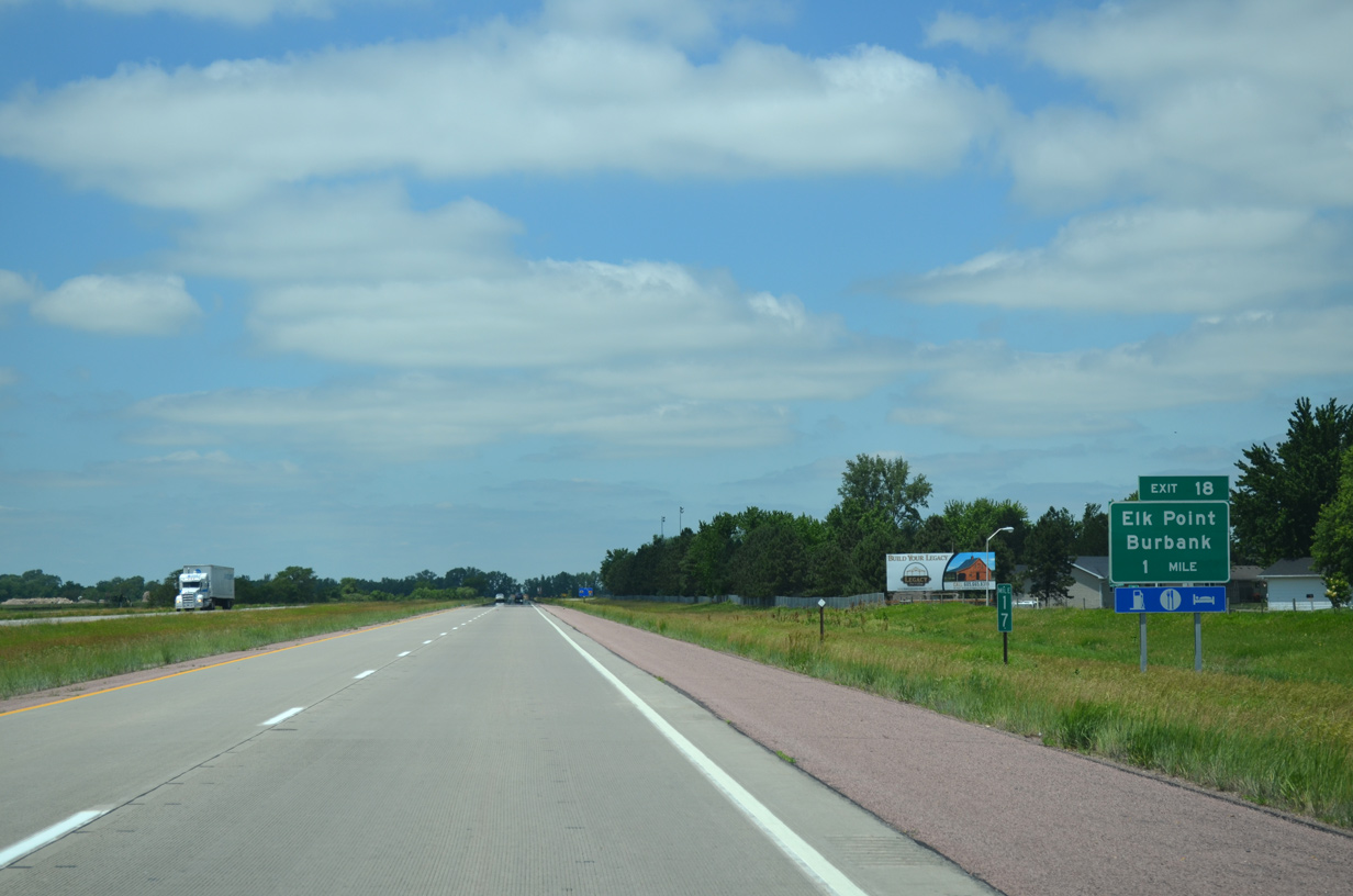
| Business Loop I-29 returns to Interstate 29 via Main Street (Exit 18) and Downtown Elk Point. 06/17/15 |
|
| Points of interest for Exit 18 include a Lewis and Clark Trail wayside exhibit. 04/20/07 |
|
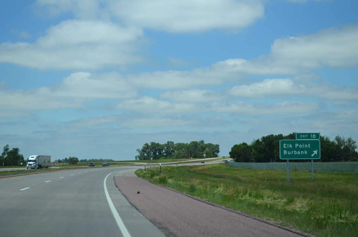
| A parclo interchange connects I-29 with Business Loop I-29 (Main Street) south at Exit 18. Interests for SD 11 north to SD 50 west of Richland are directed onto Main Street south to Franklin Street through Elk Point. 06/17/15 |
|
| Taking Exit 18 from I-29 north to Main Street. Burbank Road (County Road 10) extends northwest to the settlement of Burbank in Clay County. 06/17/15 |
|
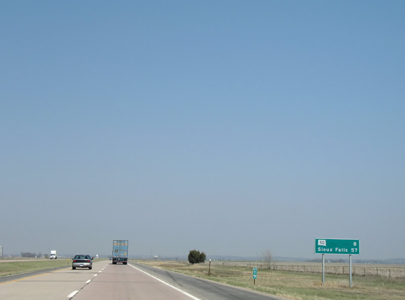
| SD 50 crosses paths with Interstate 29 at the next interchange in eight miles. Sioux Falls is now 57 miles away. 04/20/07 |
|
| Interstate 29 curves northwest away from parallel SD 11 toward Junction City along an uninterrupted drive. 04/20/07 |
|
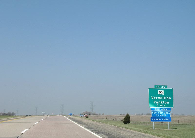
| Two miles south of Junction City and the diamond interchange (Exit 26) with SD 50 on I-29 north. SD 50 constitutes a four lane route west to Vermillion, where it has a business route, and Yankton.
This sign preceding the 472nd Avenue overpass was replaced by 2012. 04/20/07 |
|
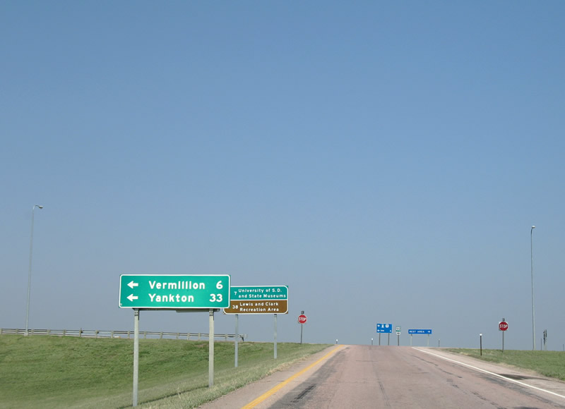
| SD 50 heads six miles west to Vermillion, home of the University of South Dakota and the W.H. Over Museum of Natural and Cultural History. Eastward, the state highway continues 8.25 miles to Richland and 9.4 miles to the state line and transition to Iowa 3. 04/20/07 |
|
| SD heads west from Exit 26 toward Yankton and Lewis and Clark Recreation Area. SD 50 travels 212.42 miles overall between Iowa and SD 34 at Fort Thompson. 04/20/07 |
|
| Interstate 29 continues four miles to SD 48 (Exit 31) and 48 miles to Sioux Falls. 04/20/07 |
|
| SD 48 travels east 12.46 miles from Exit 31 to the Iowa state line. Iowa 403 formerly linked the east end of SD 48 with Iowa 12 at Akron. 04/20/07 |
|
| Exit 31 departs Interstate 29 north for SD 48 east. SD 48 travels through the settlement of Spink at former U.S. 77. 313th Street advances west from the diamond interchange through agricultural areas to University Road.
This guide sign was replaced by 2012 and now displays IA by Akron. 04/20/07 |
|
| Leaving Exit 31, Interstate 29 continues 16 miles toward Beresford. 04/20/07 |
|
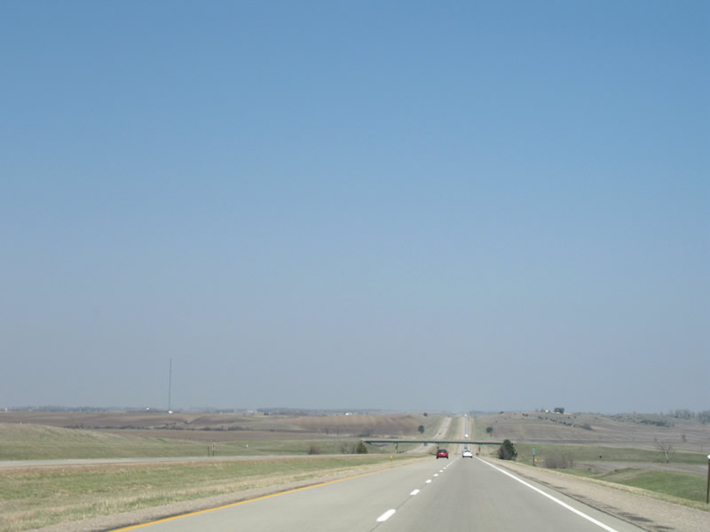
| Slow rolling hills dot the landscape of Interstate 29 in Union County to the west of Brule Creek and Union County State Park. 309th and 307th Streets pass over the freeway on the drive. 04/20/07 |
|
| A diamond interchange (Exit 38) joins Interstate 29 with 306th Street to the north of Union Grove State Park.
Guide signs for Exit 38 were replaced by 2012. 04/20/07 |
|
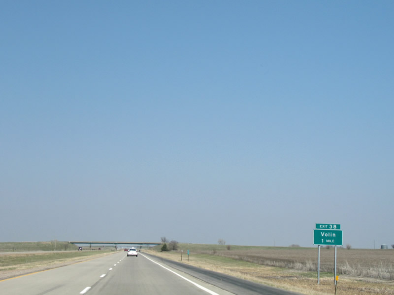
| Northbound I-29 at Exit 38 for 308th Street. 308th Street heads west 8.5 miles to Hub City (SD 19) and 19.5 miles to the town of Volin. 04/20/07 |
|
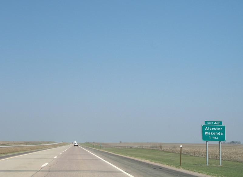
| An abandoned rest area lies 1.5 miles north of Exit 38. The ensuing exit is the diamond interchange (Exit 42) with 302nd Street. 04/20/07 |
|
| 302nd Street heads 15.5 miles west to the town of Wakonda and 8.4 miles east to SD 11 near the city of Alcester. 04/20/07 |
|
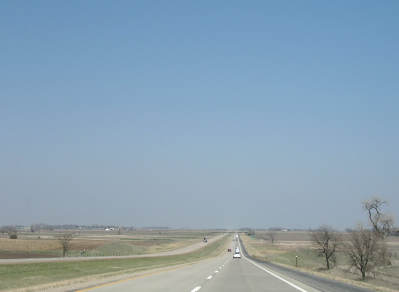
| Interstate 29 remains one half mile east of the Clay County line as it bee lines north toward Beresford. 04/20/07 |
|
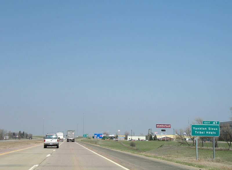
| SD 46 (Cedar Street) crosses paths with I-29 at a diamond interchange (Exit 47) on the outskirts of Beresford. Beresford, a city of around 2,000, lies on the Union and Lincoln County lines and was incorporated in 1884.
This guide sign was replaced by 2011. 04/20/07 |
|
| SD 46 serves interests to the Yankton Sioux Tribal Headquarters, Fort Randall Dam, and Hawarden, Iowa (via the transition to Iowa 10). 04/20/07 |
|
| Interstate 29 north at Exit 47. SD 46 follows Cedar Street through Downtown Beresford, where it briefly overtakes former U.S. 77 between North 3rd Street and 472nd Avenue. The state highway travels 105.5 miles overall from Iowa west to U.S. 18/281 at Pickstown. 04/20/07 |
|
| SD 46 straddles the Union and Lincoln County line east from Bereford to its southward turn to Iowa and west across Interstate 29 to the city of Irene. 04/20/07 |
|
| The truncation of U.S. 77 from South Dakota leaves U.S. 18 as the first US highway encountered along Interstate 29 north in 11 miles. 04/20/07 |
|
| 294th Street meets I-29 at a diamond interchange (Exit 50) east of Centerville.
Guide signs with centered exit tabs for Exit 50 were replaced by 2011. 04/20/07 |
|
| Exit 50 leaves Interstate 29 north for 294th Street. 294th Street heads west 8.5 miles to Centerville and east 18 miles to Hudson along the Big Sioux River. 04/20/07 |
Page Updated 07-20-2016.

 North
North