

 East
East
Forthcoming Winona has a far greater reputation than its size deserves because of the song "Get your Kicks on Route 66". The settlement is little more than a gas station and road junction.
04/27/17

Interstate 40 crosses Walnut Canyon here. The depth of the canyon is deceptive from the freeway, as it is up to 1000 feet deep in places.
04/27/17

Cinder Mountain
04/27/17

Bypassed in 1947, an old section of U.S. Route 66 ties into I-40 at Winona from U.S. 89 north of Flagstaff.
04/27/17

Townsend Winona Road (CR 510) travels 10.24 miles northwest from the diamond interchange at Exit 211 to U.S. 89 near Doney Park.
04/27/17

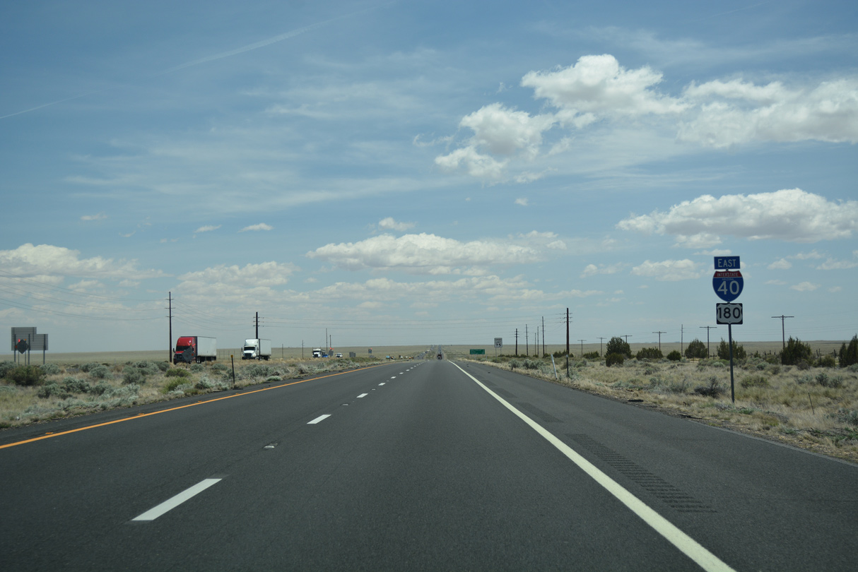
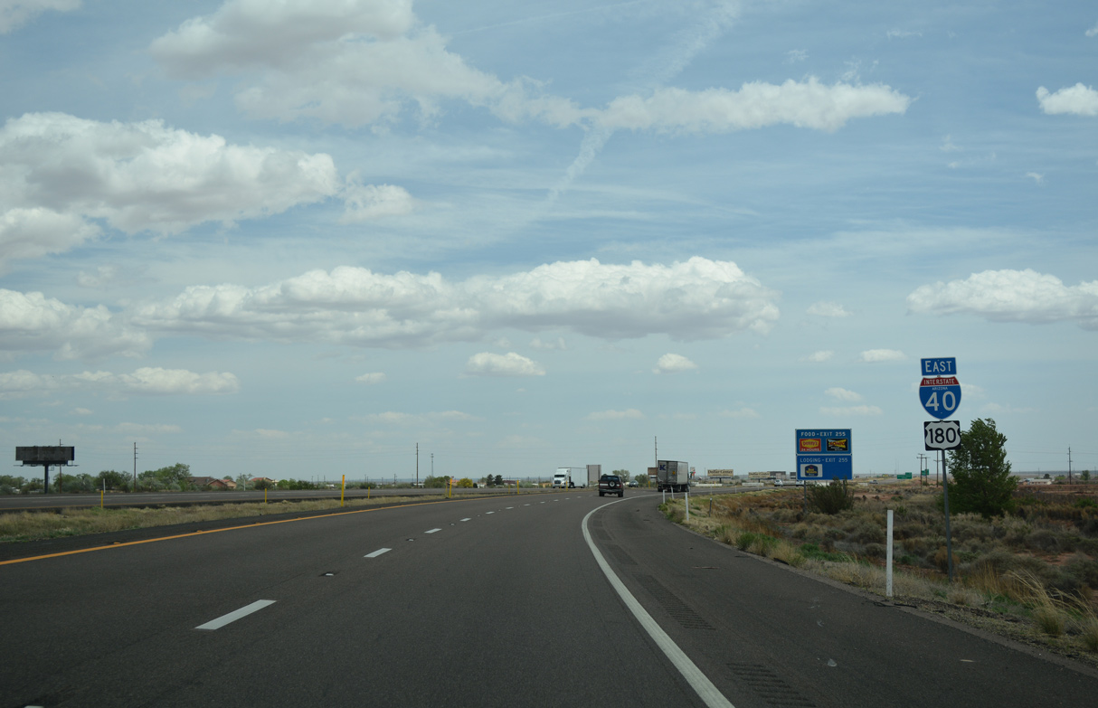
Prevalent across Northern Arizona, Elk can frequent the ensuing five miles of I-40/U.S. 180 east from Winona.
04/27/17

Leaving Coconino National Forest, I-40/U.S. 180 continue 42 miles to Winslow.
04/27/17

Having dropped 1,000 feet in elevation over the course of 16 miles, Interstate 40 leaves the pine trees of Flagstaff and begins slowly descending to the high grasslands of Northeast Arizona.
04/27/17

Twin Arrows is the site of another former Route 66 trading post, long closed.
04/27/17

The off-ramp to Twin Arrows at Exit 219 was relocated by 2018 from the frontage road just beyond the bridge taking I-40/U.S. 180 across Padre Canyon eastward directly onto Twin Arrows Road.
04/27/17

The Twin Arrows Navajo Casino Resort was constructed just north of Exit 219 over previously undeveloped ranch land. The grand opening of the casino was May 24, 2013.
04/27/17
04/27/17

04/27/17

04/27/17

04/27/17

04/27/17

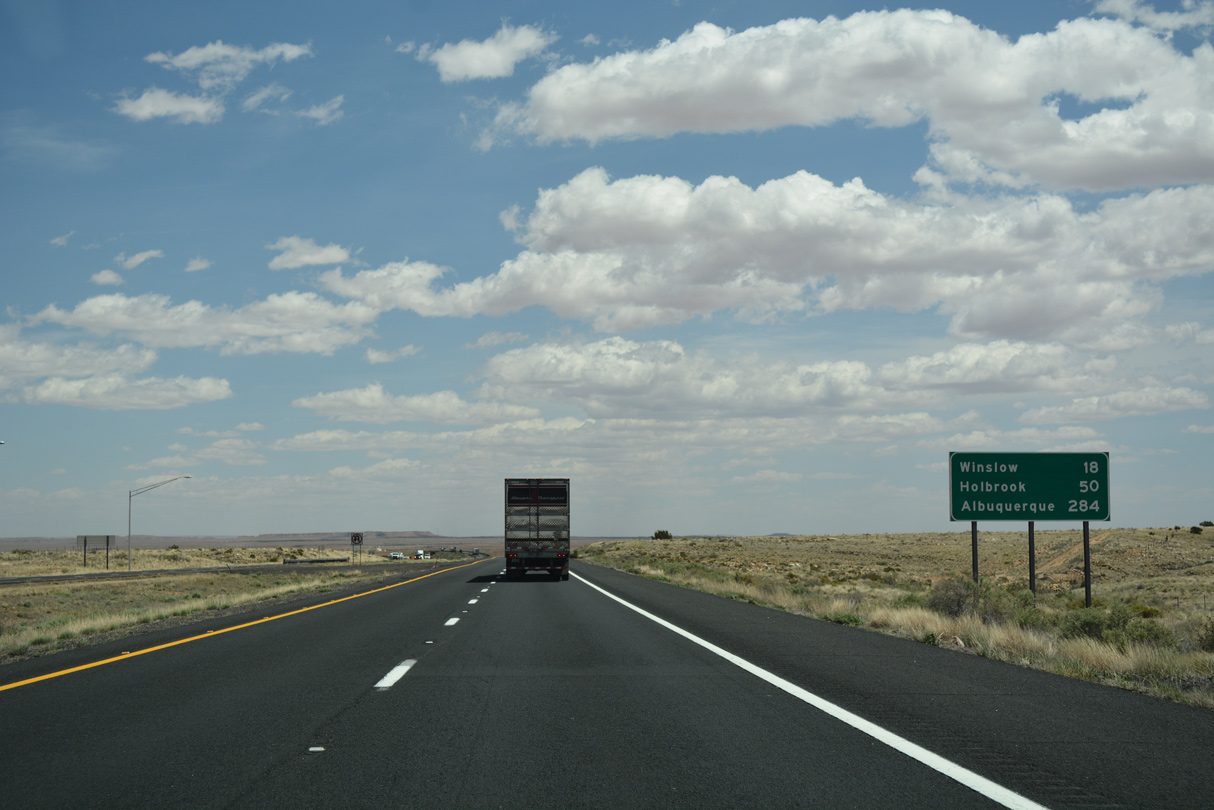
Distance sign to Winslow (29 miles), Holbrook (60 miles) and Albuquerque, New Mexico (294 miles).
04/27/17

04/27/17

West Sunset Mountain appears along the far southern horizon.
04/27/17

The ranch exit for Two Guns connects with unpaved sections of Old U.S. 66 and Canyon Diablo Road north.
04/27/17
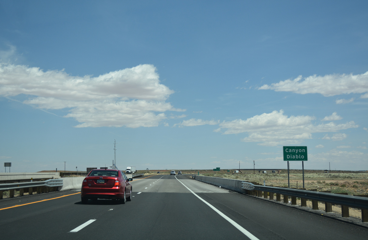
Just before reaching the Two Guns exit, I-40/U.S. 180 crosses Canyon Diablo.
04/27/17

Two Guns has a bloody history, from the days when it was originally occupied by "Two Gun" Miller. The site was also home to an old trading post that has long since closed.
04/27/17

Old U.S. 66 diverges south from I-40/U.S. 180 between Two Guns and the Meteor Crater Rest Area.
04/27/17

I-40/U.S. 180 reach Winslow in 23 miles. Albuquerque, New Mexico lies at the cross roads with Interstate 25 in 289 miles.
04/27/17

A diamond interchange (Exit 233) joins I-40/U.S. 180 with Meteor Crater Road south in one mile.
04/27/17

04/27/17

Located 5.77 miles south of Exit 233, the Meteor Crater is privately owned, but is open for public tours. NASA used the crater for Moon lander training during the Apollo program.
04/27/17

Exit 233 departs I-40/U.S. 180 east for Meteor Crater Road and Sunshine Road north to the BNSF Railroad siding of Sunshine.
04/27/17

The Meteor Crater Rest Area is one mile east of the diamond interchange (Exit 233) with Meteor Crater Road.
04/27/17

The Meteor Crater Rest Area is the second and last rest area along Interstate 40 eastbound in the Grand Canyon State.
04/27/17

A reassurance marker for Interstate 40 and U.S. 180 precedes the Meteor Crater Rest Area.
04/27/17

The succeeding rest area along Interstate 40 east is the New Mexico Welcome Center.
04/27/17

04/27/17
04/27/17

The parallel BNSF Railroad line shifts south of I-40/U.S. 180 at milepost 237. With the area subject to strong winds, a windsock is mounted just before the under crossing.
04/27/17

The white dome of Meteor City Trading Post can be seen from the top of the bridge spanning the BNSF Railroad.
04/27/17

04/27/17

The white buildings at forthcoming Exit 239 are for the trading post, which is not affiliated with Meteor Crater.
04/27/17

Red Gap Ranch Road ties into the diamond interchange (Exit 239) with Meteor City Road from the north.
04/27/17

04/27/17

04/27/17

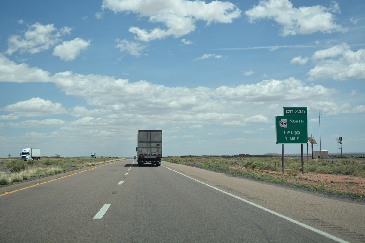
I-40/U.S. 180 converge with SR 99 south at Leupp Corner in two miles.
04/27/17
SR 99 was designated in 1970 between Leupp on the Navajo Reservation north of Interstate 40, and the Apache National Forest boundary southeast of Winslow.
04/27/17

SR 99 runs along the north side of I-40 from Leupp Corner east to the diamond interchange at Exit 245.
04/27/17

State Route 99 spurs 19.54 miles north to Indian Route 15 at Leupp, west of the Painted Desert.
04/27/17

04/27/17
East  South
South
Lowering to 5,000 feet above sea level, Interstate 40 will stay at approximately that elevation the rest of the way through Arizona.
04/27/17

Although unmarked, SR 99 accompanies I-40/U.S. 180 east 6.64 miles to the succeeding exit at Winslow.
04/27/17

Interstate 40 crosses Tucker Flat Wash beyond this distance sign posted eight miles from the Winslow city center.
04/27/17

04/27/17

West and East Sunset Mountains appear along the southwestern horizon.
04/27/17

Three exits join I-40/U.S. 180 with Winslow. The city was established as a railway division stop along the AT&SF railroad. Today, the town is best known for "Standing in a Corner" park, from the Eagles song "Take It Easy".
04/27/17

04/27/17
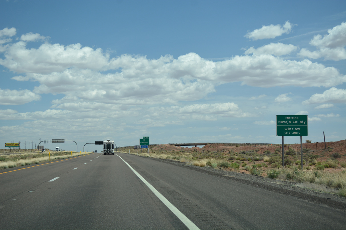
I-40/U.S. 180-SR 99 enter both the city of Winslow and Navajo County.
04/27/17
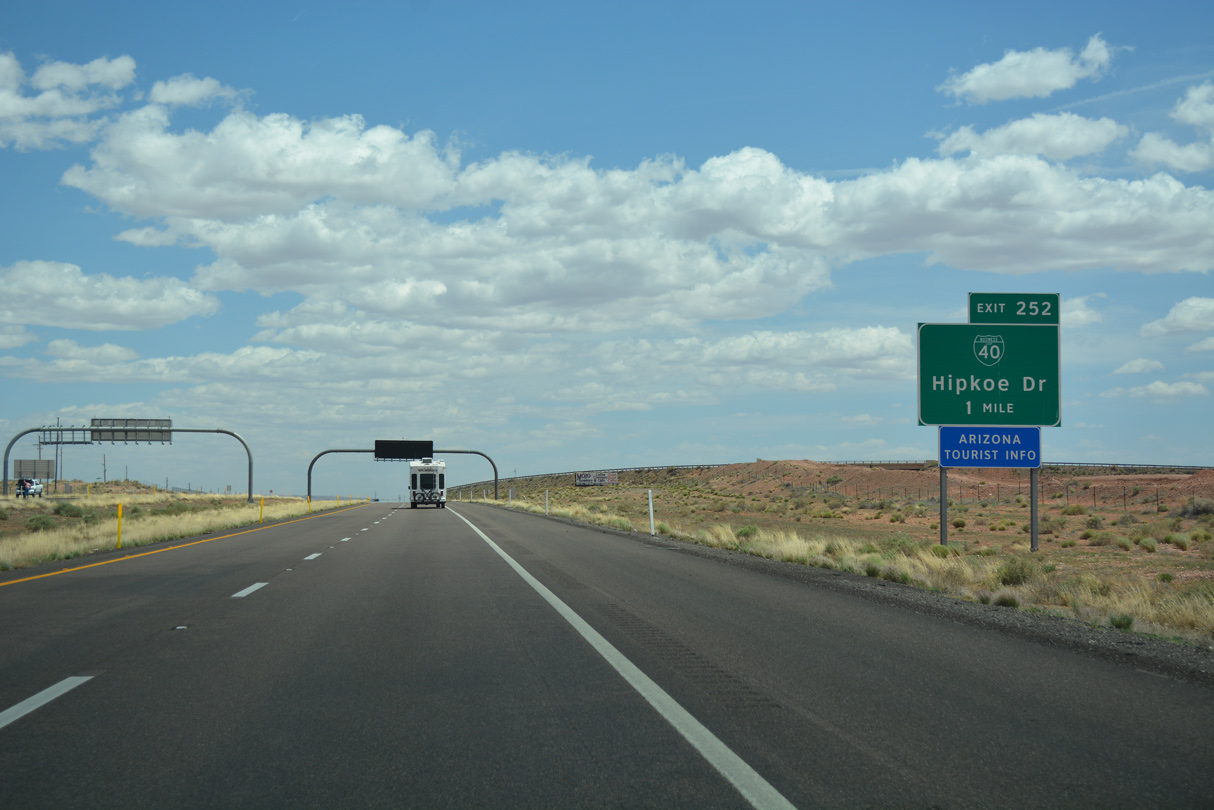
The diamond interchange at Exit 252 links I-40/U.S. 180 with former Business Loop I-40 and Hipkoe Drive. Still acknowledged on guide signs in 2021, Business Loop 40 was decommissioned in 2007 and 2nd/3rd Streets turned over to the city of Winslow for maintenance.
04/27/17

The continuation of SR 99 south overlaps with SR 87 from Historic U.S. 66 (old Business Loop I-40) in Downtown Winslow. SR 87 travels southwest across the Mogollon Rim to Payson.
04/27/17

Business Loop I-40 lines parallel W 3rd Street 1.01 miles to the West Winslow Industrial Spur.
04/27/17

SR 99 parts ways with I-40/U.S. 180 at the diamond interchange (Exit 252) with Hipkoe Drive. SR 99 combined with Business Loop I-40 east 1.97 miles to SR 87 (Williamson Avenue).
04/27/17

Historic U.S. 66 branches southeast from Business Loop I-40 to the couplet of 2nd/3rd Streets across the city of Winslow.
04/27/17
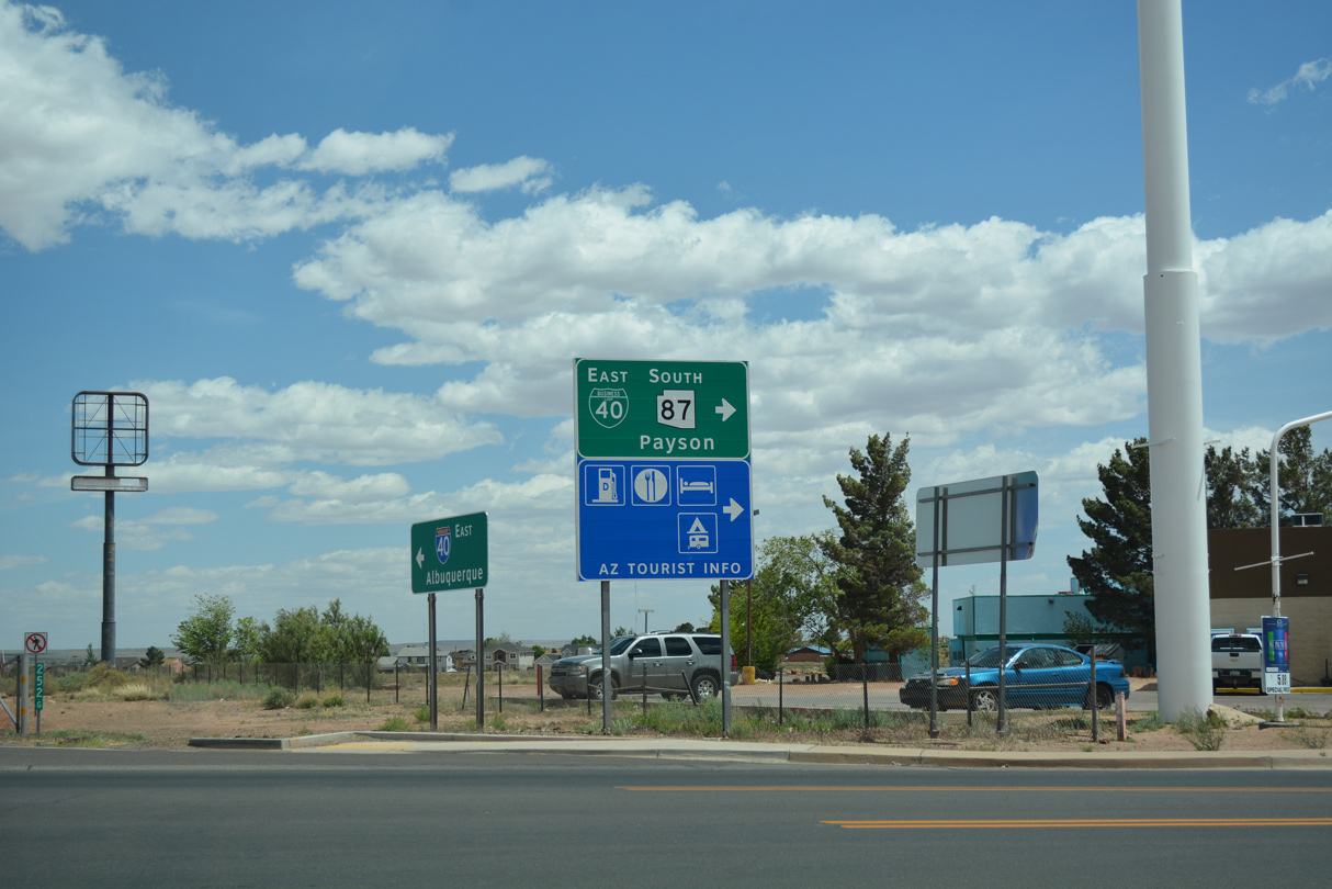
Hipkoe Drive extends north from Business Loop I-40 to a housing development. SR 87 north meets I-40/U.S. 180 at Exit 257.
04/27/17
East
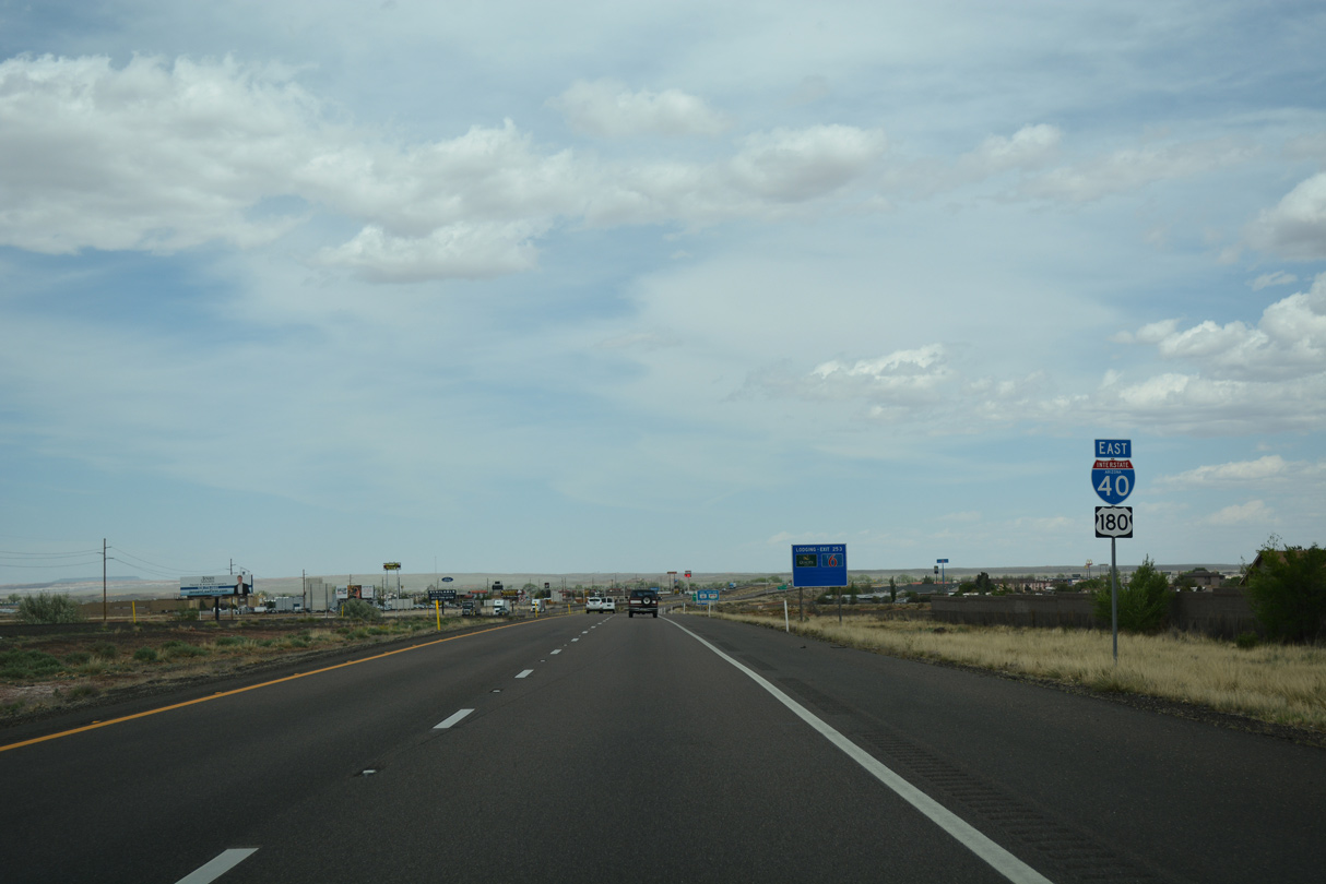
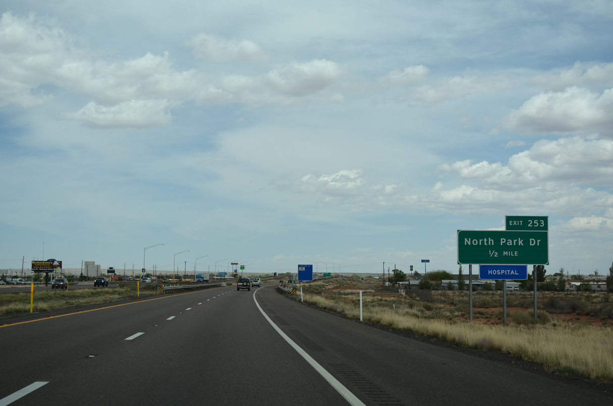
I-40/U.S. 180 advance 1.25 miles from Hipkoe Drive to Exit 253 with North Park Drive.
06/28/08
04/27/17
04/27/17
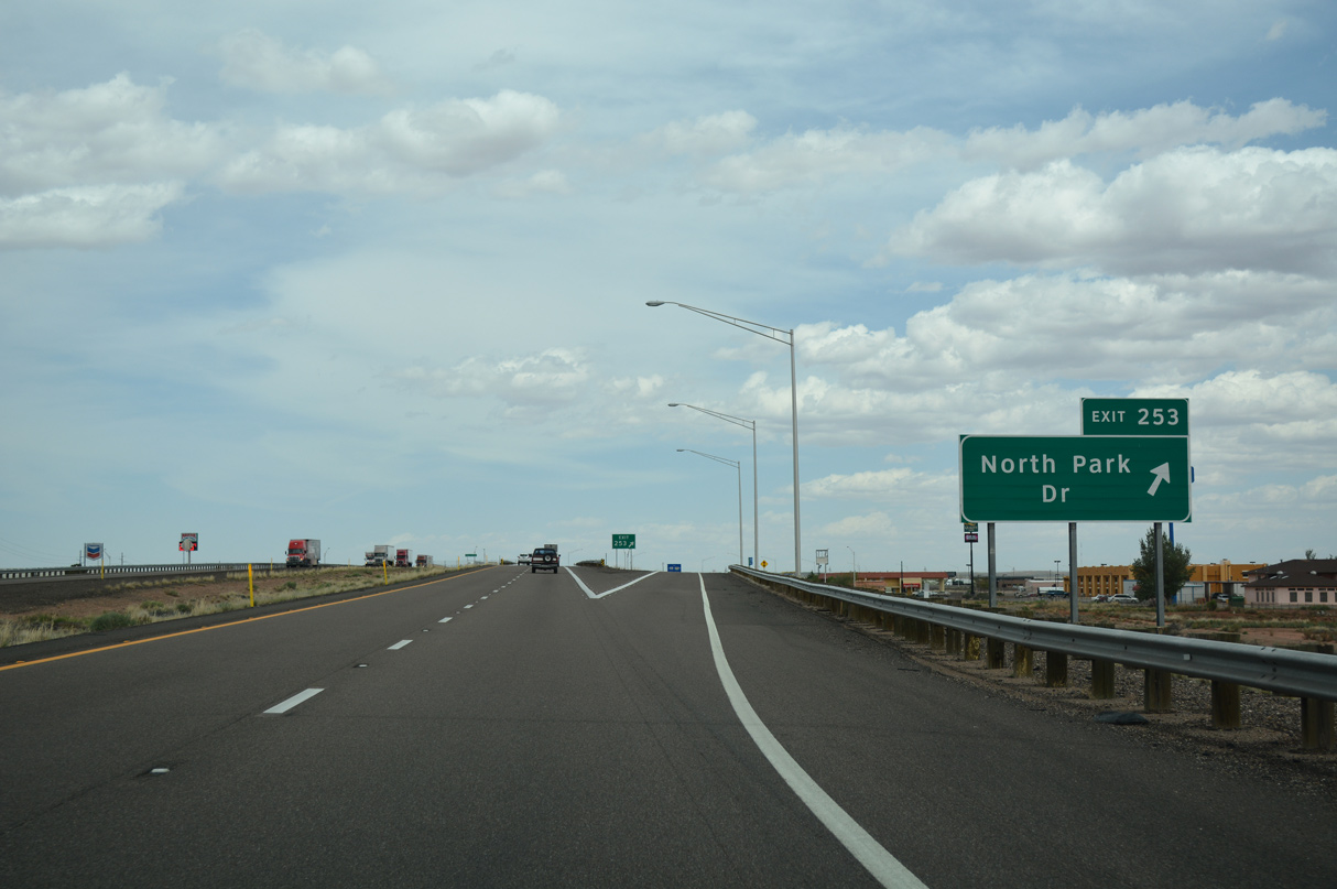
A SPUI (Exit 253) joins I-40/U.S. 180 with a commercial strip along North Park Drive.
04/27/17
04/27/17

Former Business Loop I-40 through Winslow returned to I-40/U.S. 180 from parallel SR 87 (E 2nd Street) via Transcon Lane.
04/27/17

Transcon Lane ties into SR 87/Historic U.S. 66 just east of the 2nd/3rd Street couplet and Northland Pioneer College.
04/27/17

04/27/17

SR 87 converges with I-40/U.S. 180 at Exit 257, east of the Little Colorado River.
04/27/17

Homolovi Ruins State Park lies just north of forthcoming Exit 257. Opened in 1993, the park protects an old Hopi pueblo.
04/27/17

Incorporating former SR 65, SR 87 was extended north of Interstate 40 in 1968.
04/27/17

Exit 257 leaves I-40/U.S. 180 east for SR 87 south back into Winslow and north to Second Mesa. The diamond interchange marks the eastern end of another driveable section of old U.S. 66.
04/27/17

Photo Credits:
06/28/08, 04/27/17 by AARoads
Connect with:
State Route 87 - Beeline Highway
State Route 99
Page Updated 03-31-2022.