|
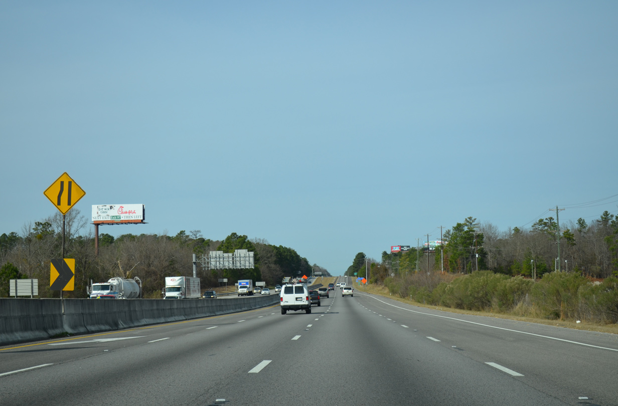
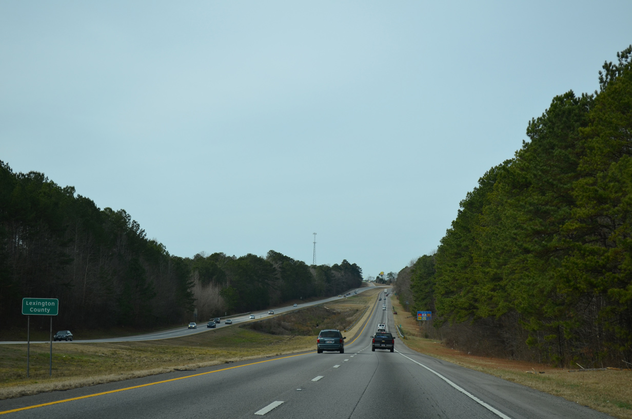
| The left lane ends as Interstate 26 vacates the Irmo city limits for unincorporated Richland County. 12/31/13 |
|
| Western Lane runs along the east side of the freeway from U.S. 176 to Koon Road (Road 58). 12/31/13 |
|
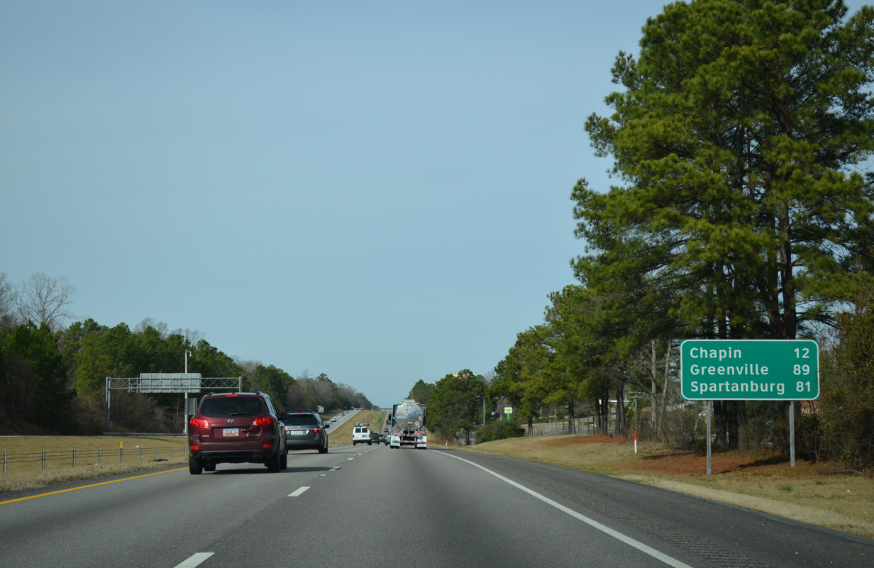
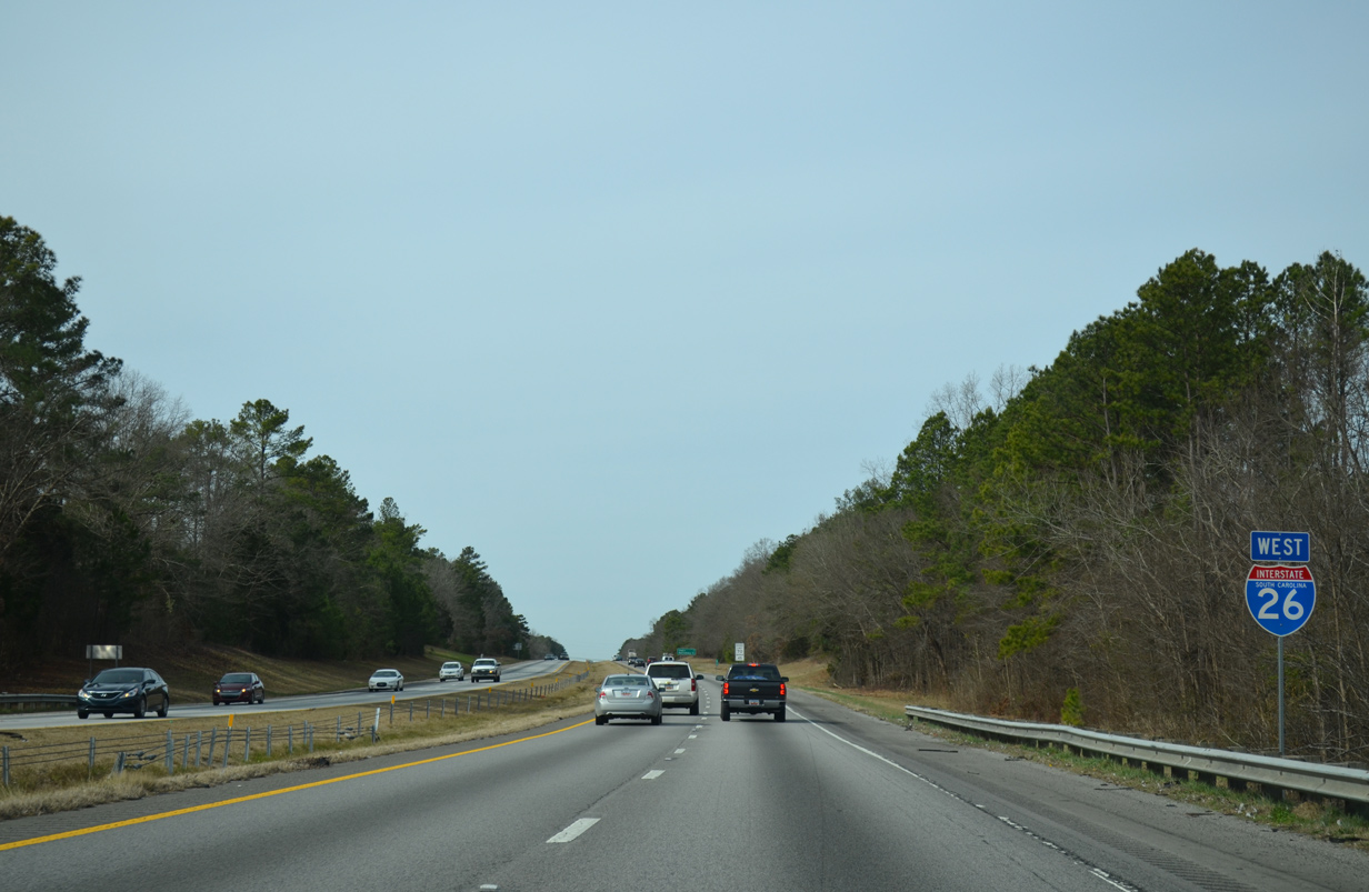
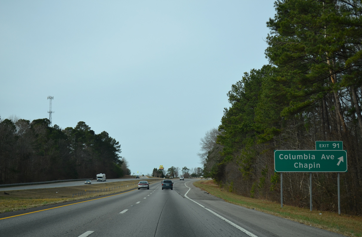
| The town of Chapin along parallel U.S. 76 is the next destination via Exit 91 (Columbia Avenue). Greenville, via Interstate 385 north, is referenced going forward on I-26 to Exit 51. 12/31/13 |
|
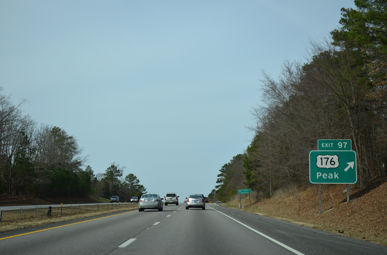
| U.S. 176 (Broad River Road) branches north from U.S. 76 (Dutch Fork Road) to cross paths with Interstate 26 again at a parclo A2 interchange (Exit 97). 12/31/13 |
|
| U.S. 176 takes a rural course northwest to Spring Hill and Pomaria, though some suburban development lies nearby. Peak is a 192 acre town along the Broad River via U.S. 176 north to R. Stoudemayer Rd (Road 32). 12/31/13 |
|
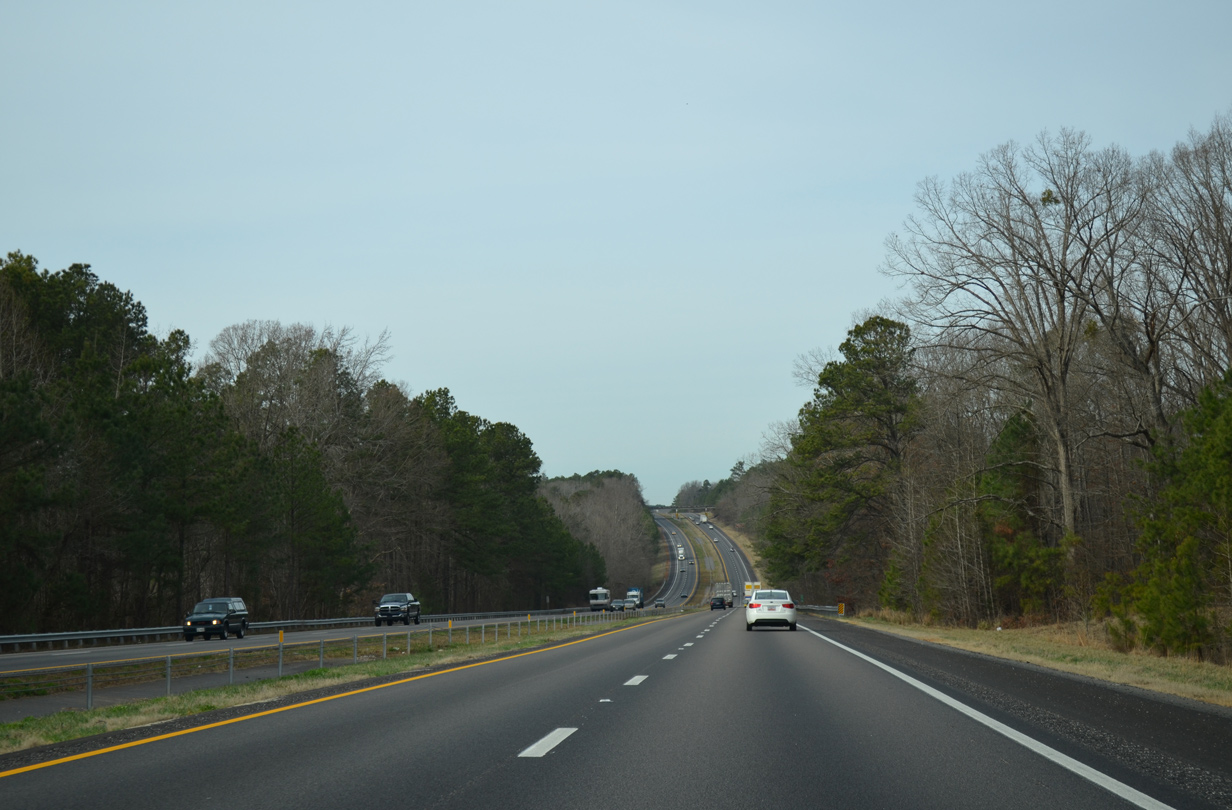
| 2013 traffic counts steadily decreased from 69,800 vehicles per day (vpd) recorded ahead of the split with U.S. 76 to 48,000 vpd recorded between Exits 97 and 91. 12/31/13 |
|
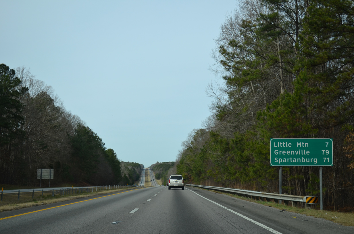
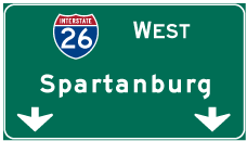
| Chapin lies seven miles ahead, with Spartanburg still over an hour away to the north. 12/31/13 |
|
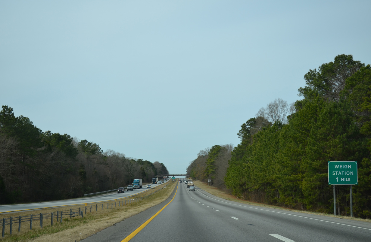
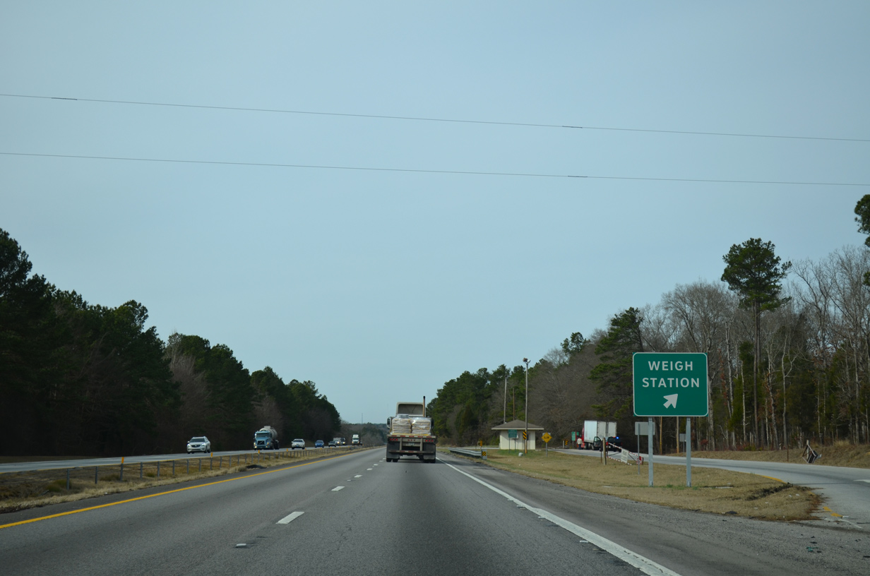
| A westbound side weigh station lies along Interstate 26 south of Spring Hill. 12/31/13 |
|
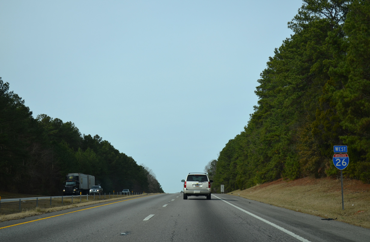
| The truck scales along I-26 west precede a final swath through Lexington County. 12/31/13 |
|
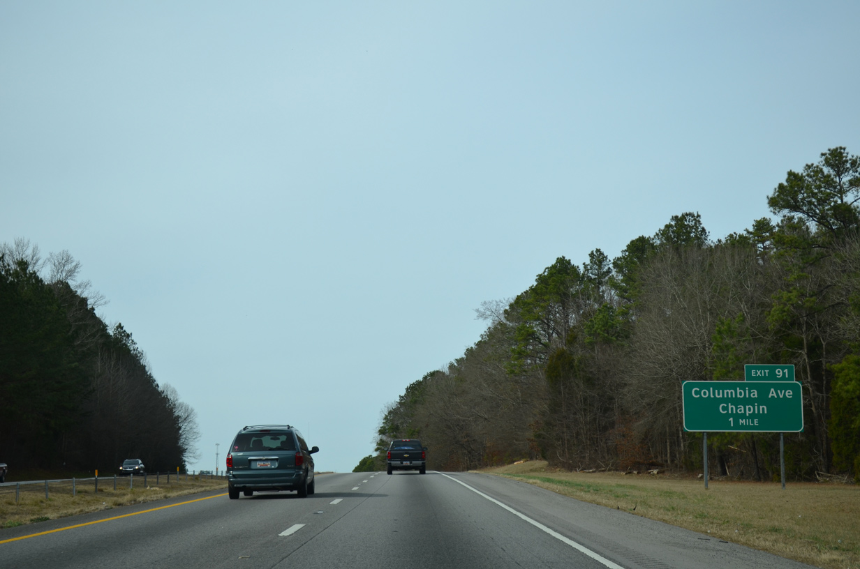
| Forthcoming Columbia Avenue (Road 48) extends Chapin Road west from U.S. 176 and Richland County into the town of Chapin. 12/31/13 |
|
| Sinking toward Wateree Creek, westbound travelers along Interstate 26 enter Lexington County for the final time. 12/31/13 |
|
| Interstate 26 climbs to 400 feet above sea level at the diamond interchange (Exit 91) with Columbia Avenue. Columbia Avenue (Road 48) curves southwest to Chapin High School and U.S. 78 (Chapin Road) opposite Amicks Ferry Road south. 12/31/13 |
|
| Rolling hills continue along Interstate 26 west with Risters Creek beyond this shield assembly. 12/31/13 |
|
| U.S. 76 remains parallel to the south through the town of Little Mountain. Greenville comes before Spartanburg for Interstate 385 in 40 miles. 12/31/13 |
|
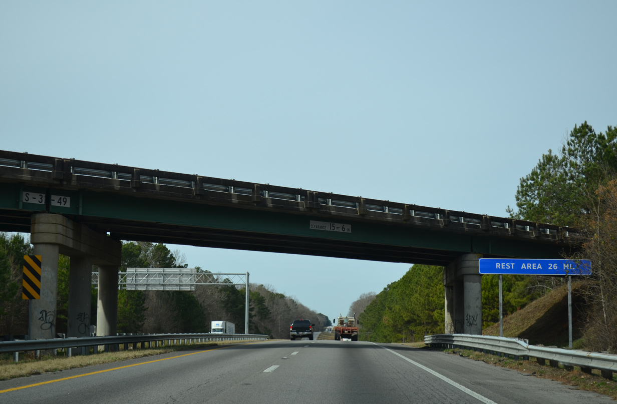
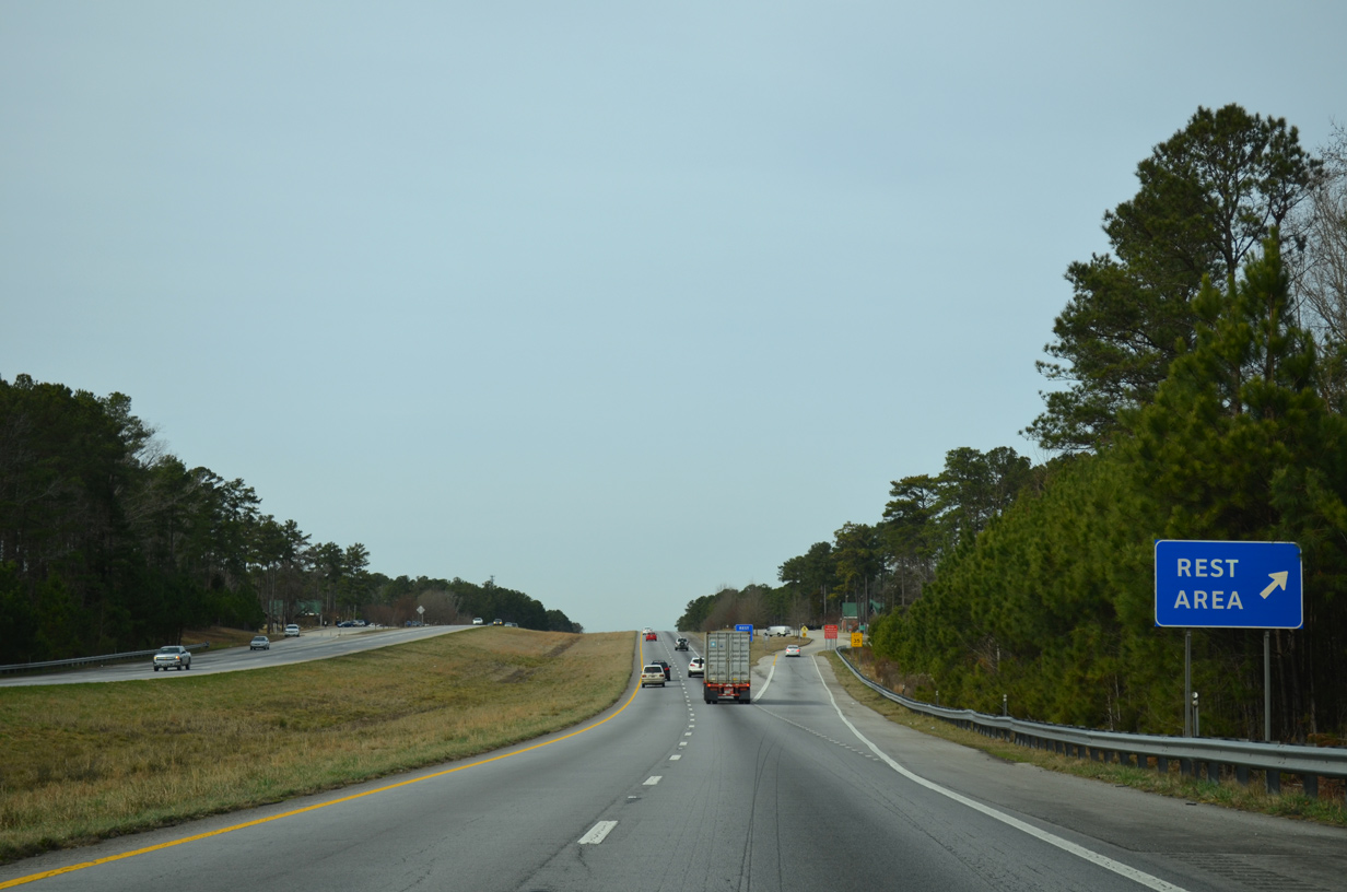
| Peak Street (Road 49) passes over Interstate 26 one mile ahead of a former rest area. Typical for shuttered rest areas, SCDOT references the next open facility along the freeway. 12/31/13 |
|
| Passing by the abandoned rest area between the Newberry County line and Holy Trinity Church Road (Road 39) overpass. 12/31/13 |
|
| Interstate 26 undulates northwest to over 500 feet above sea level in this scene. 12/31/13 |
|
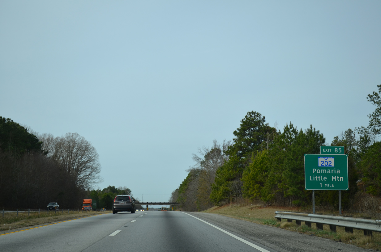
| S.C. 202, a 4.52 mile route between Little Mountain and Pomaria, meets Interstate 26 at Exit 85 in one mile. 12/31/13 |
|
| A folded diamond interchange (Exit 85) joins Interstate 26 with S.C. 202 south to U.S. 76 in Little Mountain and north to U.S. 176 outside Pomaria. 12/31/13 |
|
| The former east side rest area comes into view as Interstate 26 leaves Exit 85 at Rocky Creek. 12/31/13 |
|
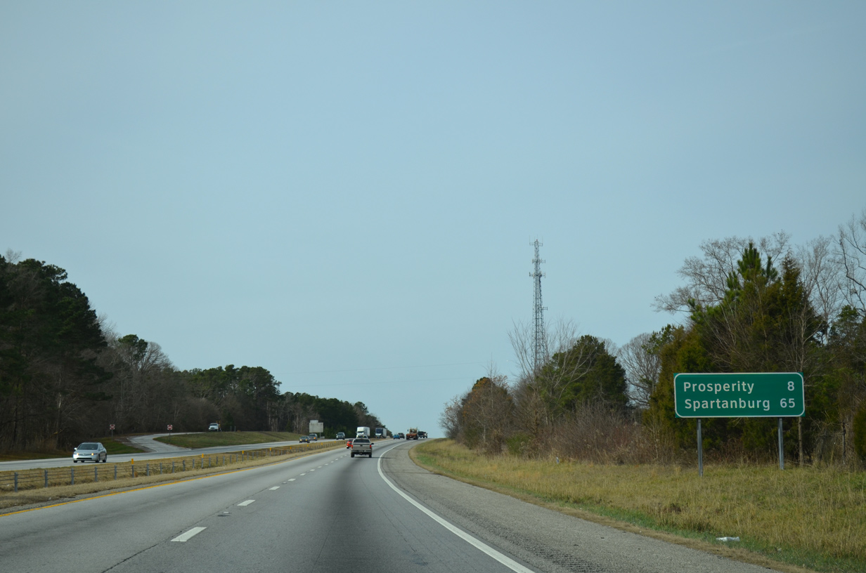
| Prosperity, a town of over 1,100, is eight miles to the west via the next exit while Spartanburg is an hour away. 12/31/13 |
|
| Crims Creek flows underneath Interstate 26 in this scene near the railroad siding of Kibler. 12/31/13 |
|
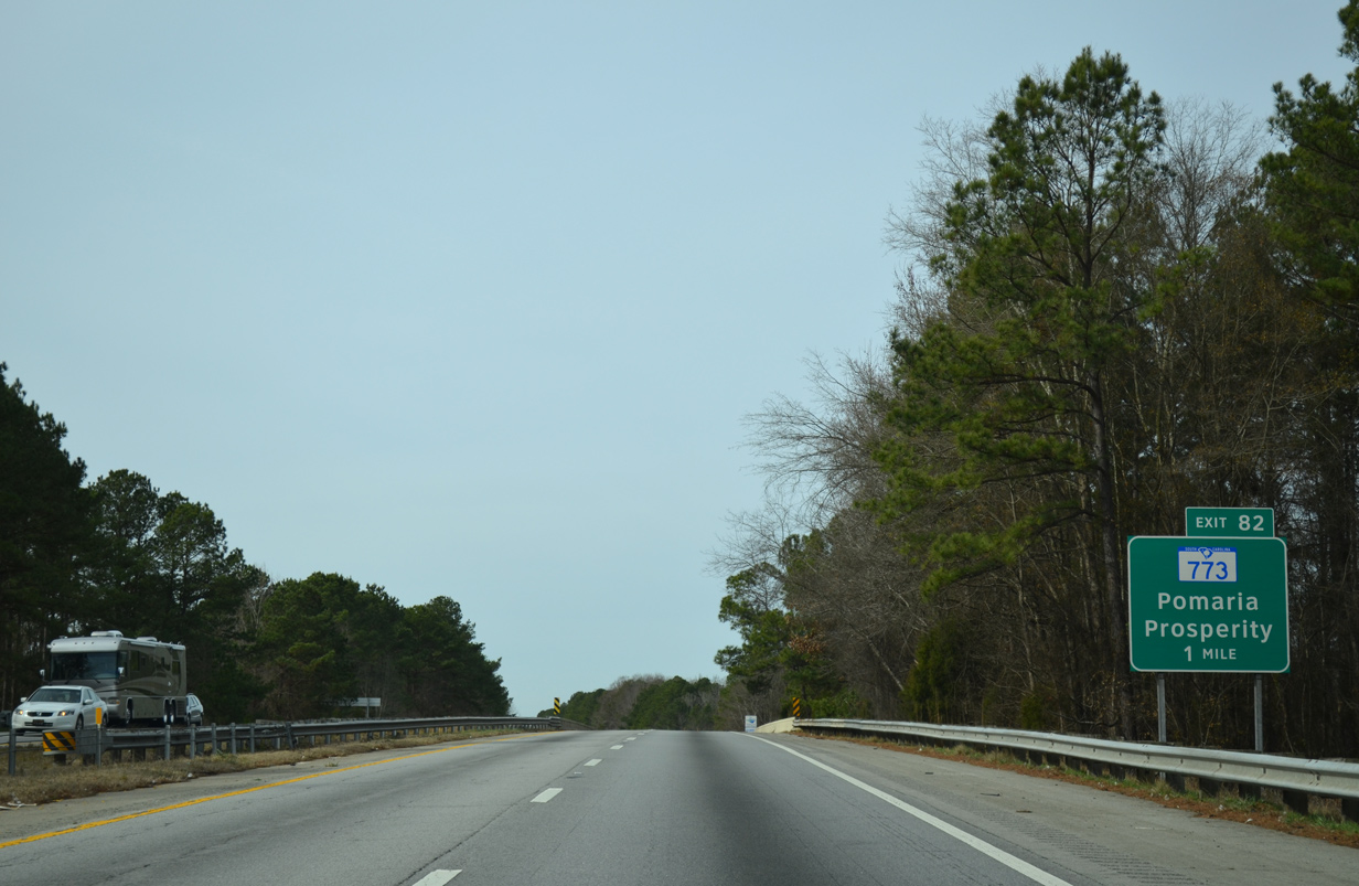
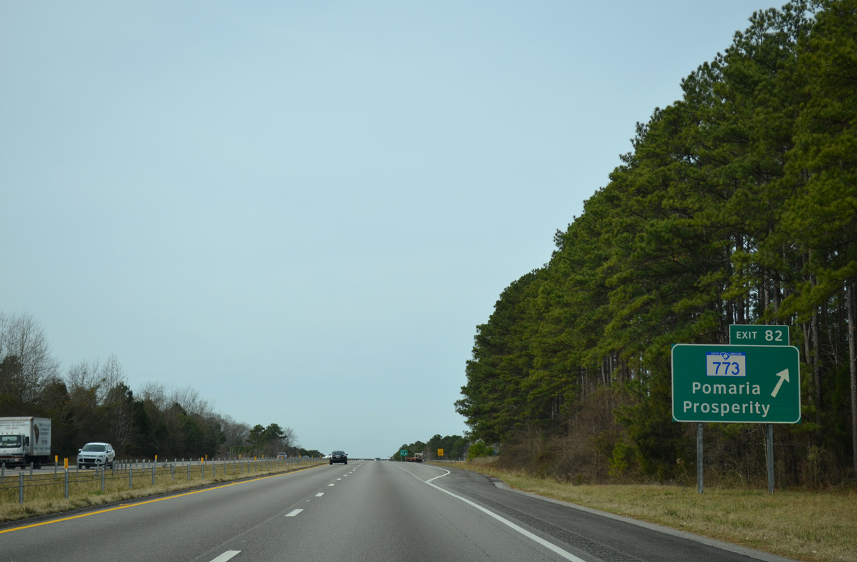
| Interstate 26 west crosses over an abandoned Southern Railroad line one mile ahead of the diamond interchange (Exit 82) with S.C. 773. 12/31/13 |
|
| Like S.C. 202 previously, S.C. 773 simply connects U.S. 76 with U.S. 176. The 5.49 mile highway ends in Pomaria to the north and at U.S. 76 three miles east of Prosperity. 12/31/13 |
|
| Interstate 26 curves more northerly to pass between Taylors Crossroads and Bachman Chapel over the next several miles. 12/31/13 |
|
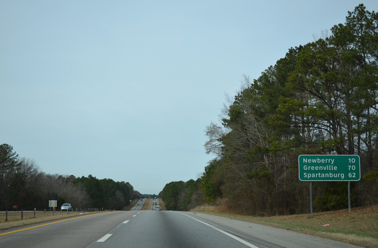
| Newberry, seat of Newberry County, lies ten miles ahead while Greenville reappears at 70 miles out on this distance sign. 12/31/13 |
|
| Thick pine forest abuts Interstate 26 in this scene ahead of Kerr Creek and the Bachman Chapel Road overpass. 12/31/13 |
|
| Three interchanges serve Newberry, a city of over 10,000, over the course of six miles on Interstate 26. The city limits extend outward along S.C. 219 to reach I-26, but the freeway remains mostly rural. 12/31/13 |
|
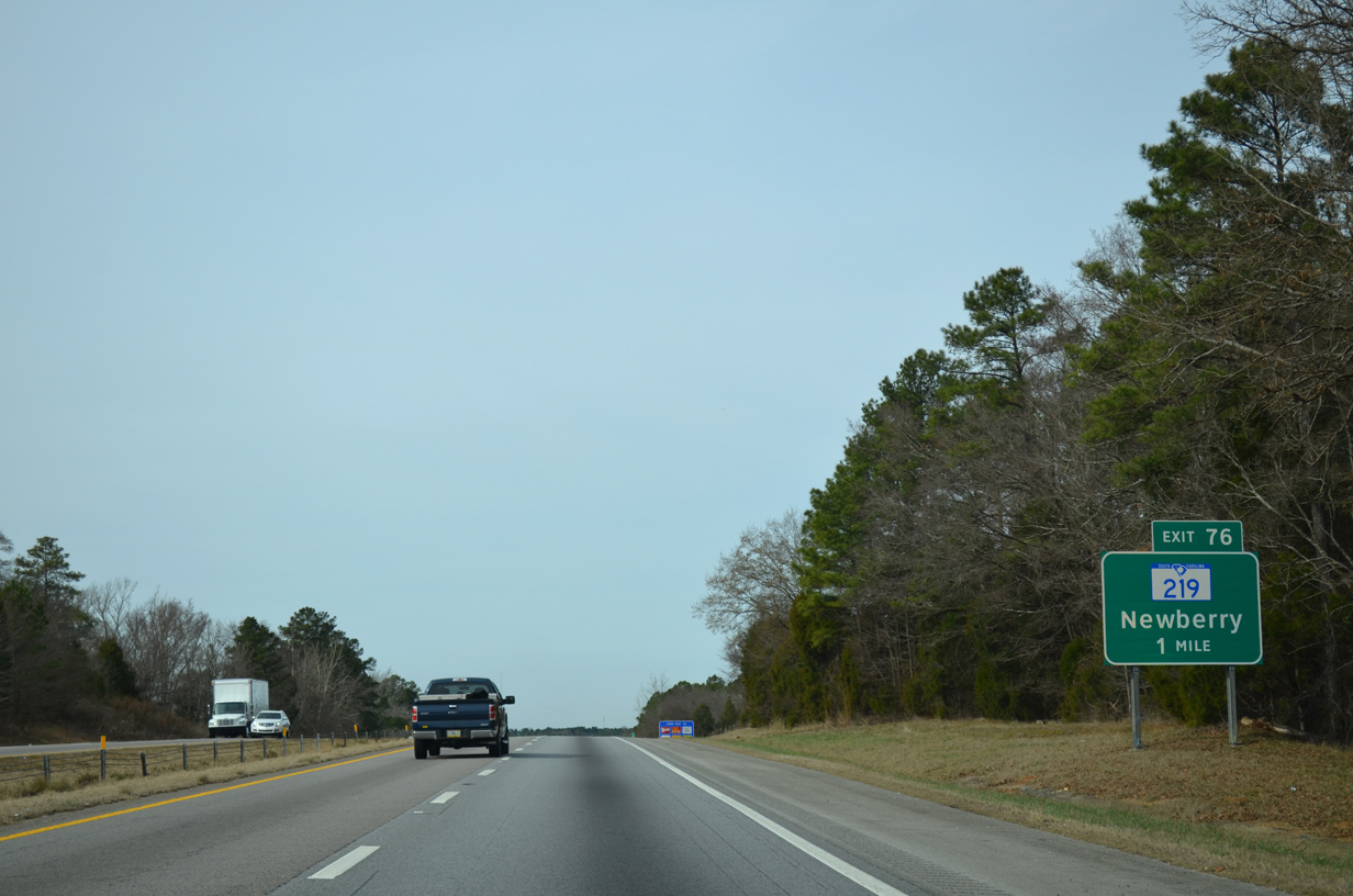
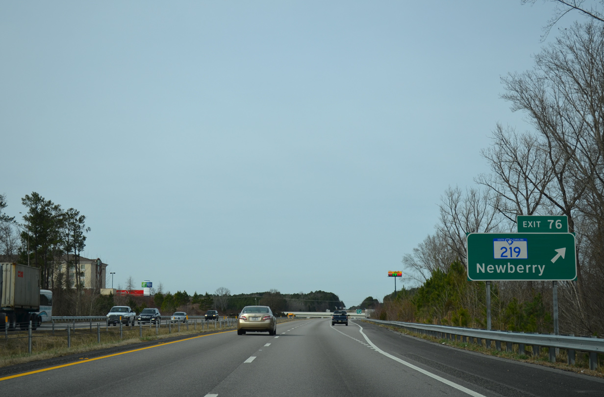
| Upcoming S.C. 219 links Newberry with U.S. 176 west of Pomaria along a 9.03 mile course. 12/31/13 |
|
| Entering the diamond interchange (Exit 76) with S.C. 219 along Interstate 26 west. S.C. 219 follows Main Street west to U.S. 76/S.C. 34 (Wilson Road) outside Downtown Newberry. 12/31/13 |
|
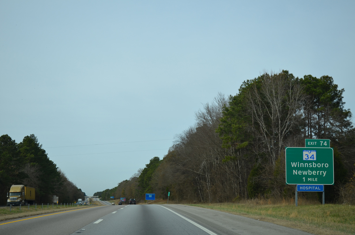
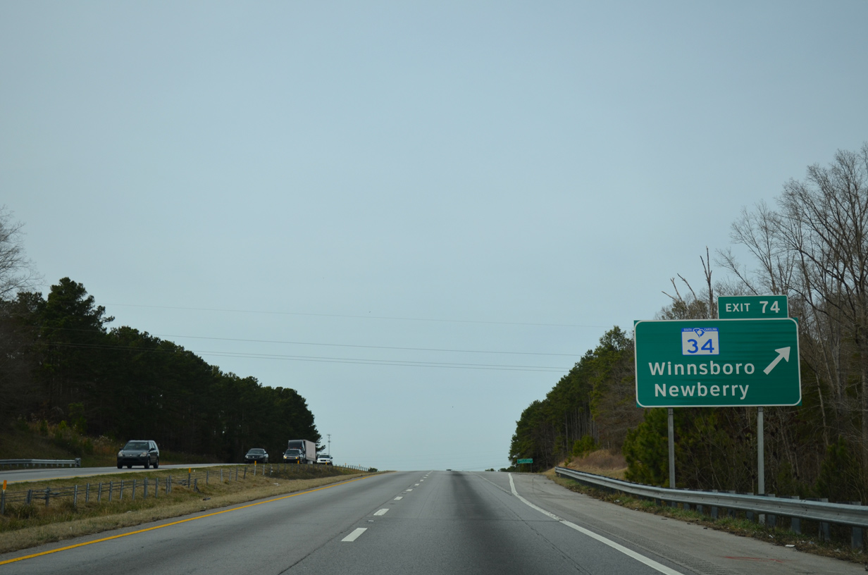
| S.C. 34 branches northeast from U.S. 76 (Wilson Road) along Winnsboro Road 2.3 miles to a diamond interchange (Exit 74) with Interstate 26. 12/31/13 |
|
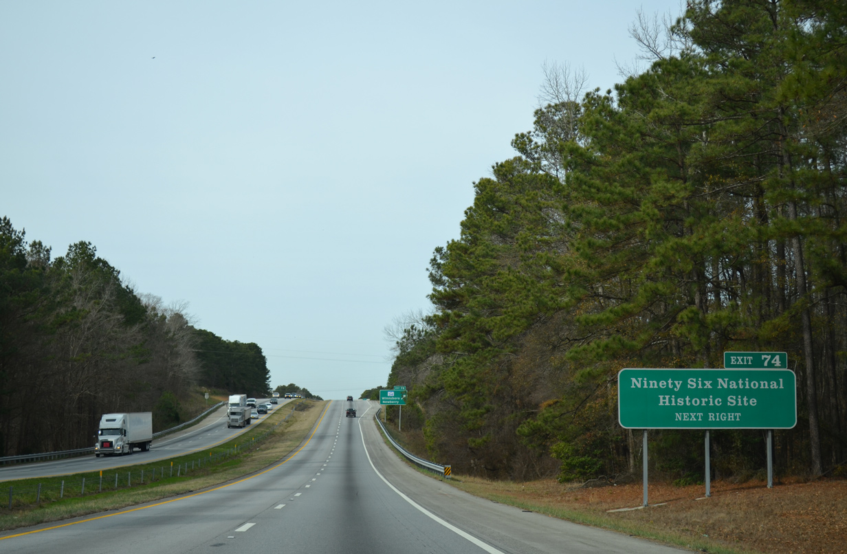
| Clarendon font is used on this guide sign for Ninety Six National Historic Site. The park where two Revolutionary War battles were fought lies in Greenwood County to the west along S.C. 248 south of S.C. 34. 12/31/13 |
|
| Exit 74 departs Interstate 26 west for S.C. 34 (Winnsboro Road). Traveling 186 miles overall, S.C. 34 originates in Greenwood and ends at Dillon. The state highway meanders 32 miles east from Exit 74 to the Fairfield County seat of Winnsboro. 12/31/13 |
|
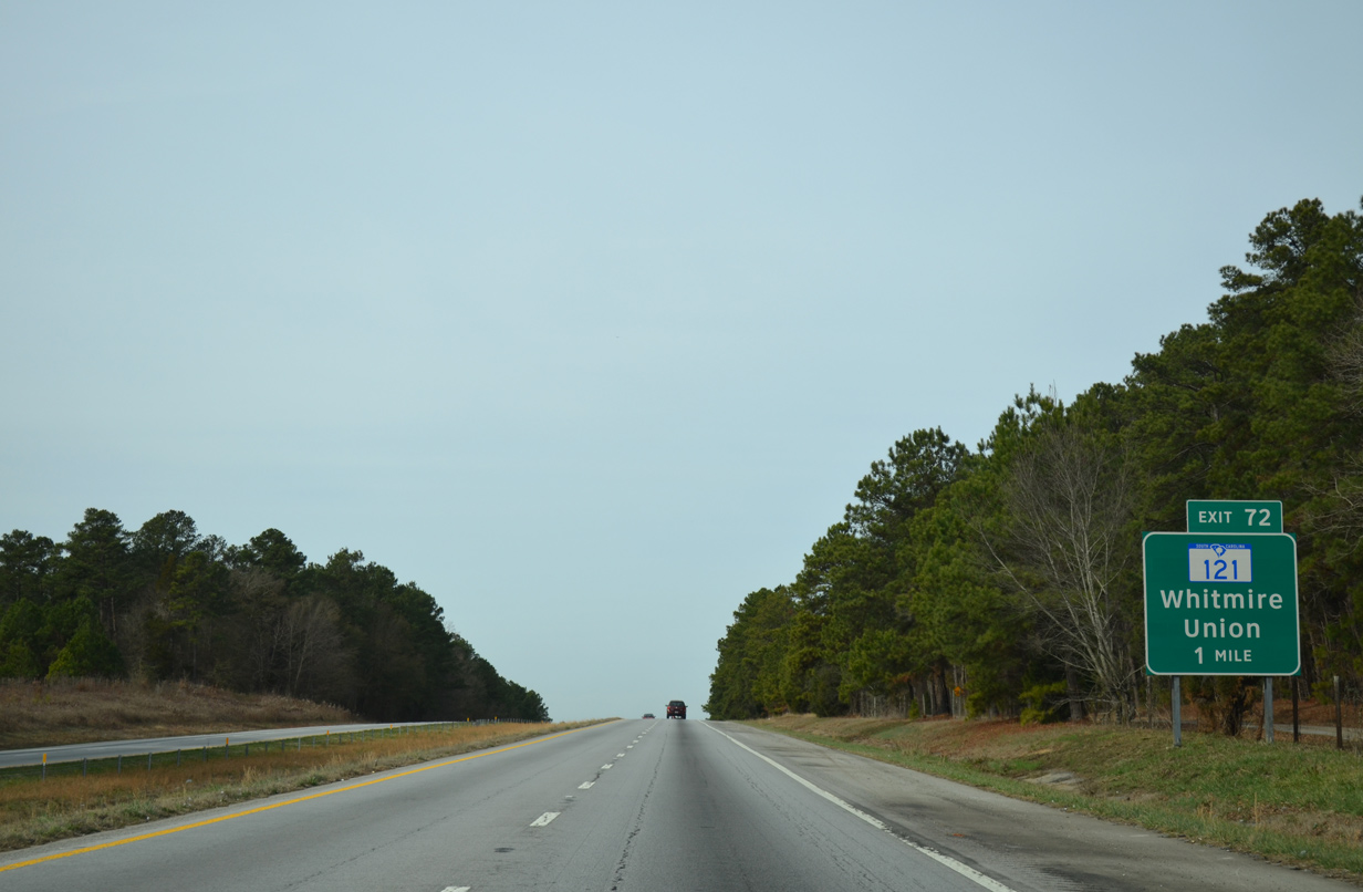
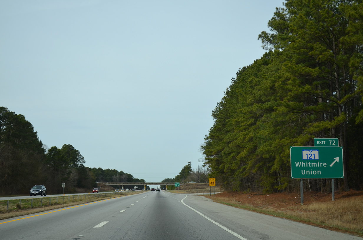
| Interstate 26 enters Sumter National Forest and advances to a parclo A2 interchange (Exit 72) with S.C. 121. S.C. 121 encircles the west side of Newberry. 12/31/13 |
|
| Part of a multi state route south to Levy County, Florida and north to Rock Hill, S.C. 121 runs northeast six miles to combine with U.S. 176 en route to Whitmire. The two split from there with U.S. 176 continuing to the Union County seat of Union. 12/31/13 |
|
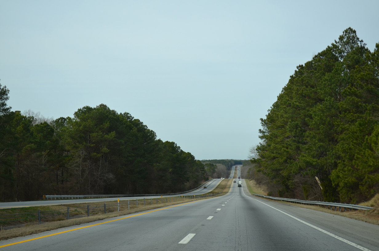
| Westbound Interstste 26 climbs to around 550 feet in elevation just north of Exit 72. 12/31/13 |
|
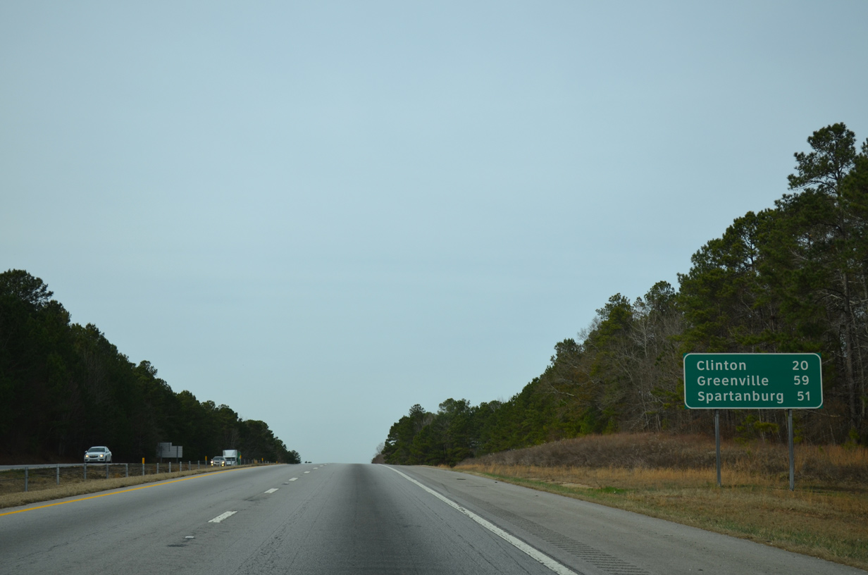
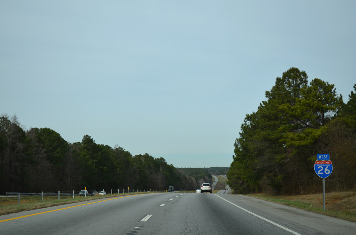
| Interstate 26 stays within Sumter National Forest to Clinton in 20 miles. Interstate 385 leads northwest from I-26 outside the city 38 miles into Greenville. 12/31/13 |
|
| I-26 west ahead of Gilders Creek. 2013 traffic counts drop to 33,800 vpd along this stretch. 12/31/13 |
|
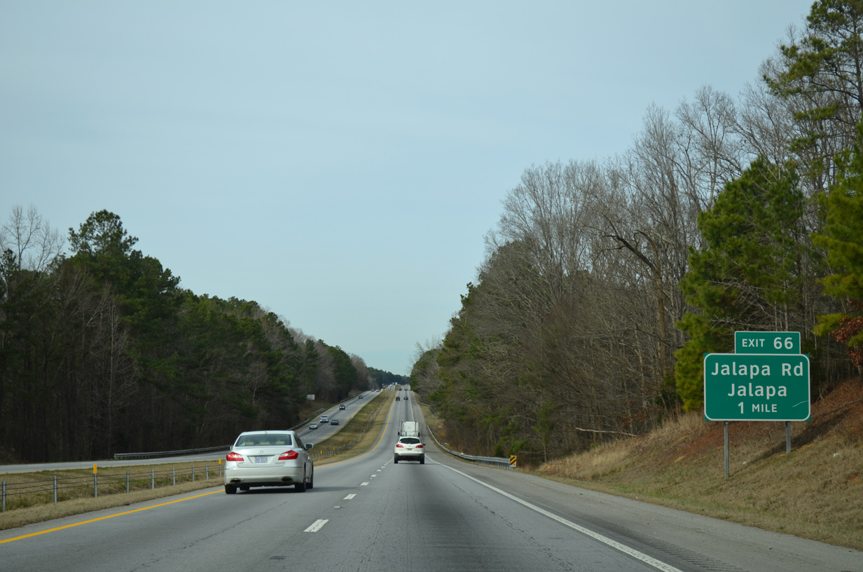
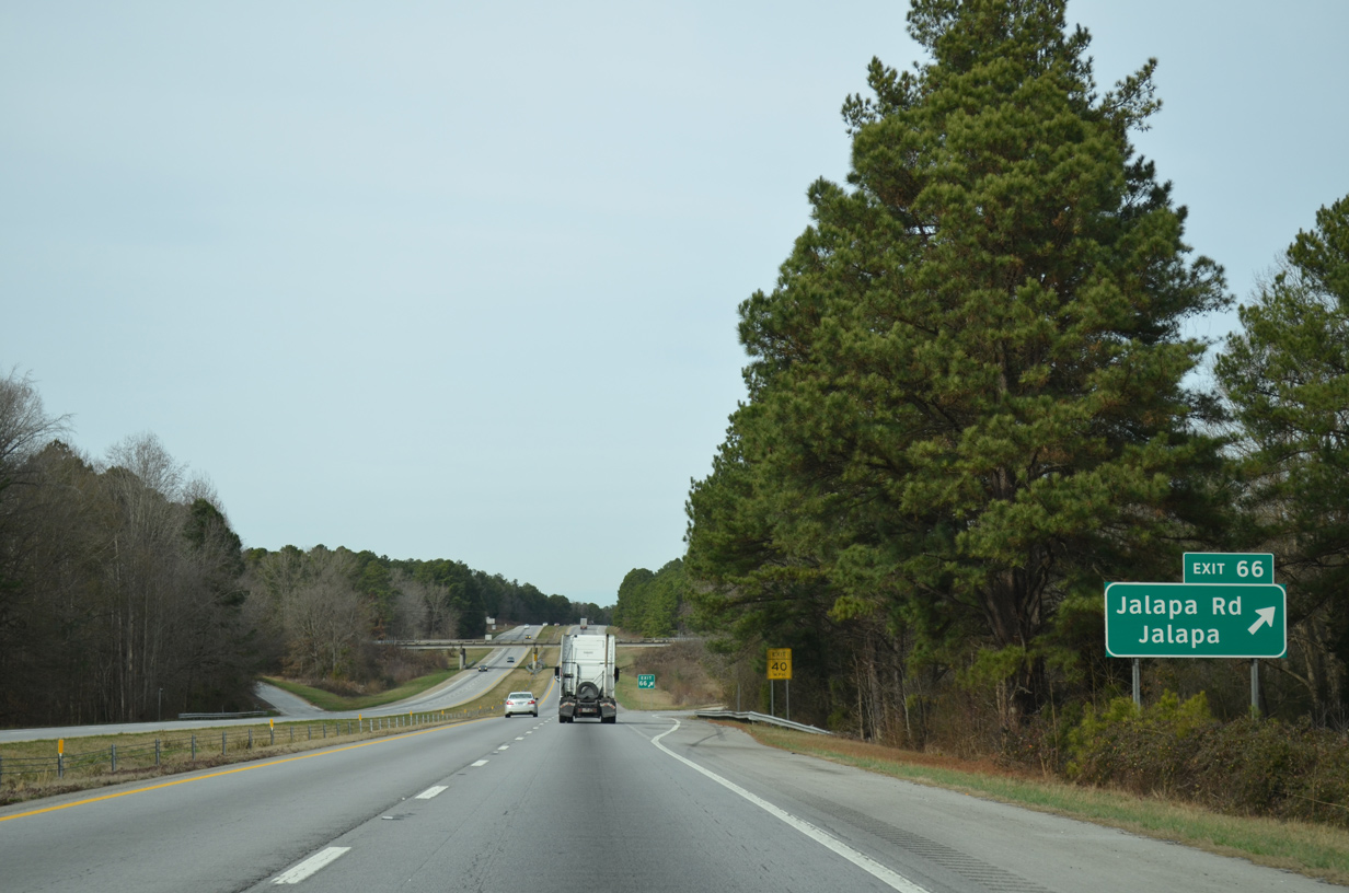
| Jalapa Road (Road 32) arcs east from U.S. 76 (Wilson Road) at Jalapa to a diamond interchange (Exit 66) with Interstate 26 in one mile. 12/31/13 |
|
| Northeast from Exit 66, Jalapa Road (Road 32) meanders to Cromer Crossroads and S.C. 66 at Eison Crossroads. 12/31/13 |
|
| A reassurance marker for I-26 west stands ahead of Long Branch. 12/31/13 |
|
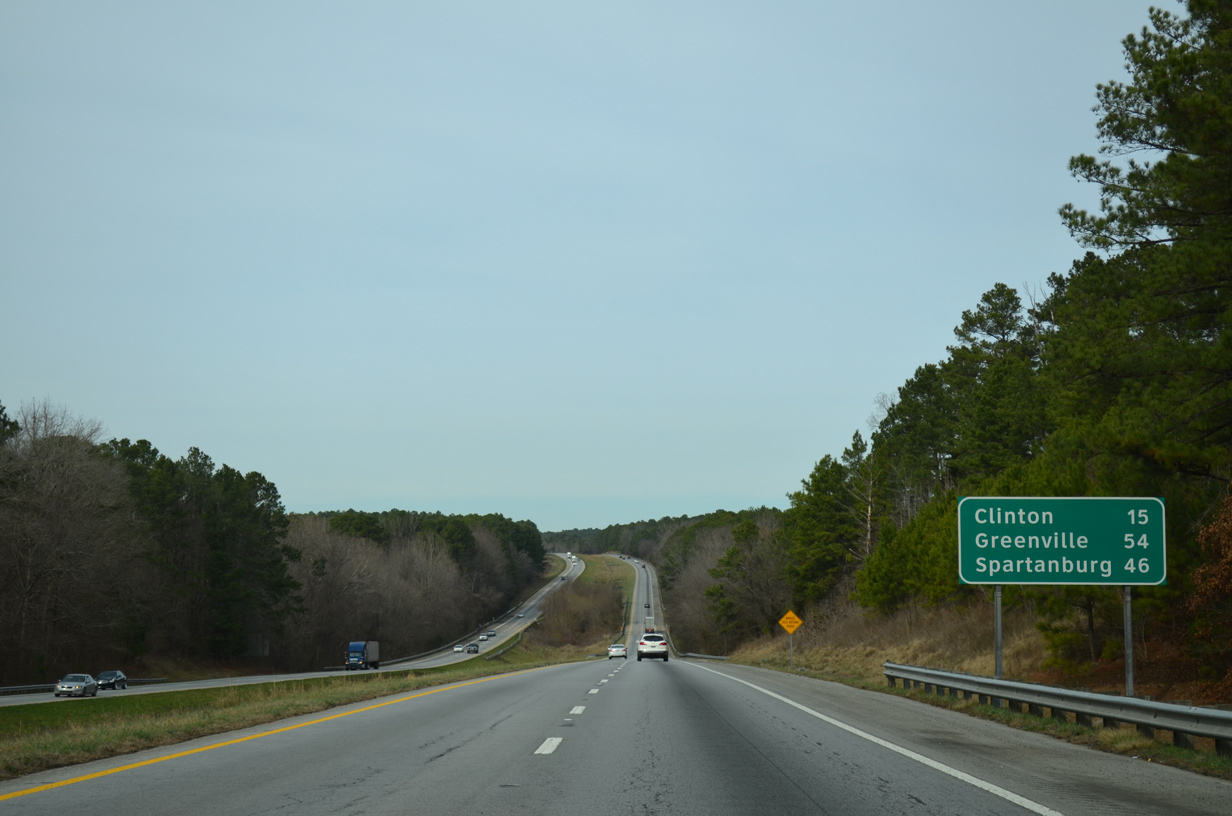
| Clinton is 15 miles away, followed by Greenville in 54 miles via I-385 and Spartanburg in 46 miles. 12/31/13 |
|
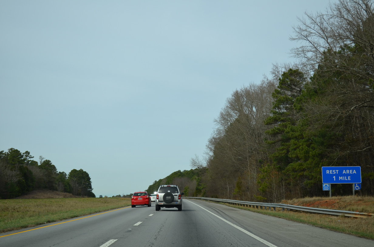
| Rest areas serve travelers in both directions of Interstate 26 by Peges Creek. 12/31/13 |
|
| The westbound rest area in Sumter National Forest is the last for Interstate 26 in the Palmetto State. 12/31/13 |
|
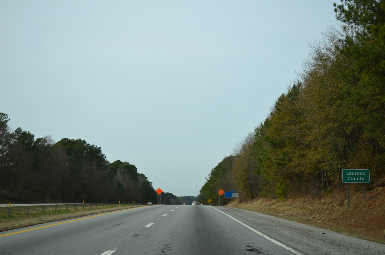
| Interstate 26 crosses the Laurens County line at milepost 61.27. 12/31/13 |
|
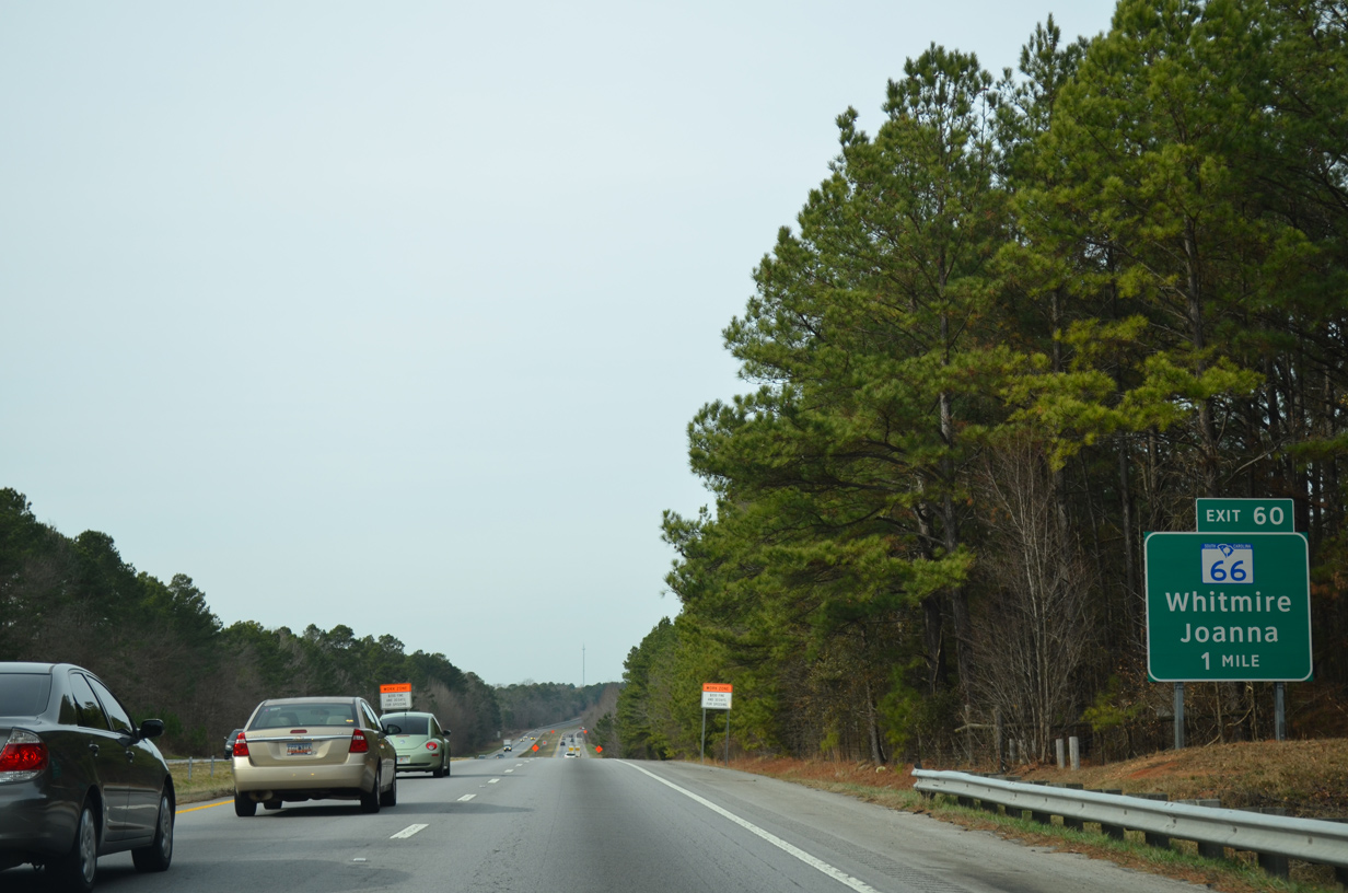
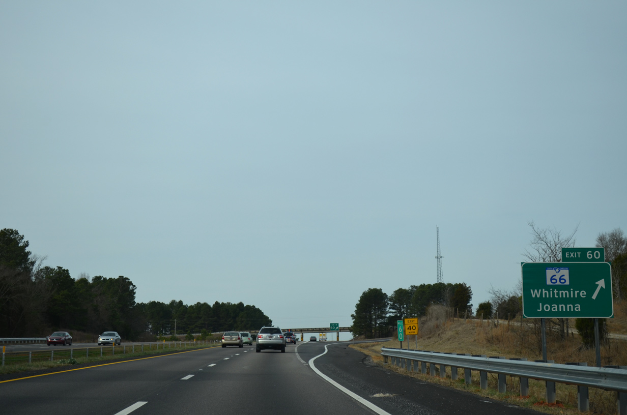
| The first of four Laurens County exits along Interstate 26 west departs in one mile for S.C. 66 (Whitmire Highway) west to Joanna and east to Whitmire. 12/31/13 |
|
| S.C. 66 measures 17.61 miles from S.C. 56, three miles west of Joanna, and U.S. 176 Connector/S.C. 72 (Clinton Highway) in Whitmire. 12/31/13 |
|
| Downtown Clinton is an eight miles via I-26 west and S.C. 72 west. Spartanburg is approximately 30 miles to the north of the city. 12/31/13 |
|
| Interstate 26 leaves Sumter National Forest at the Hurricane Church Road (Road 34) overpass in the distance. 12/31/13 |
|
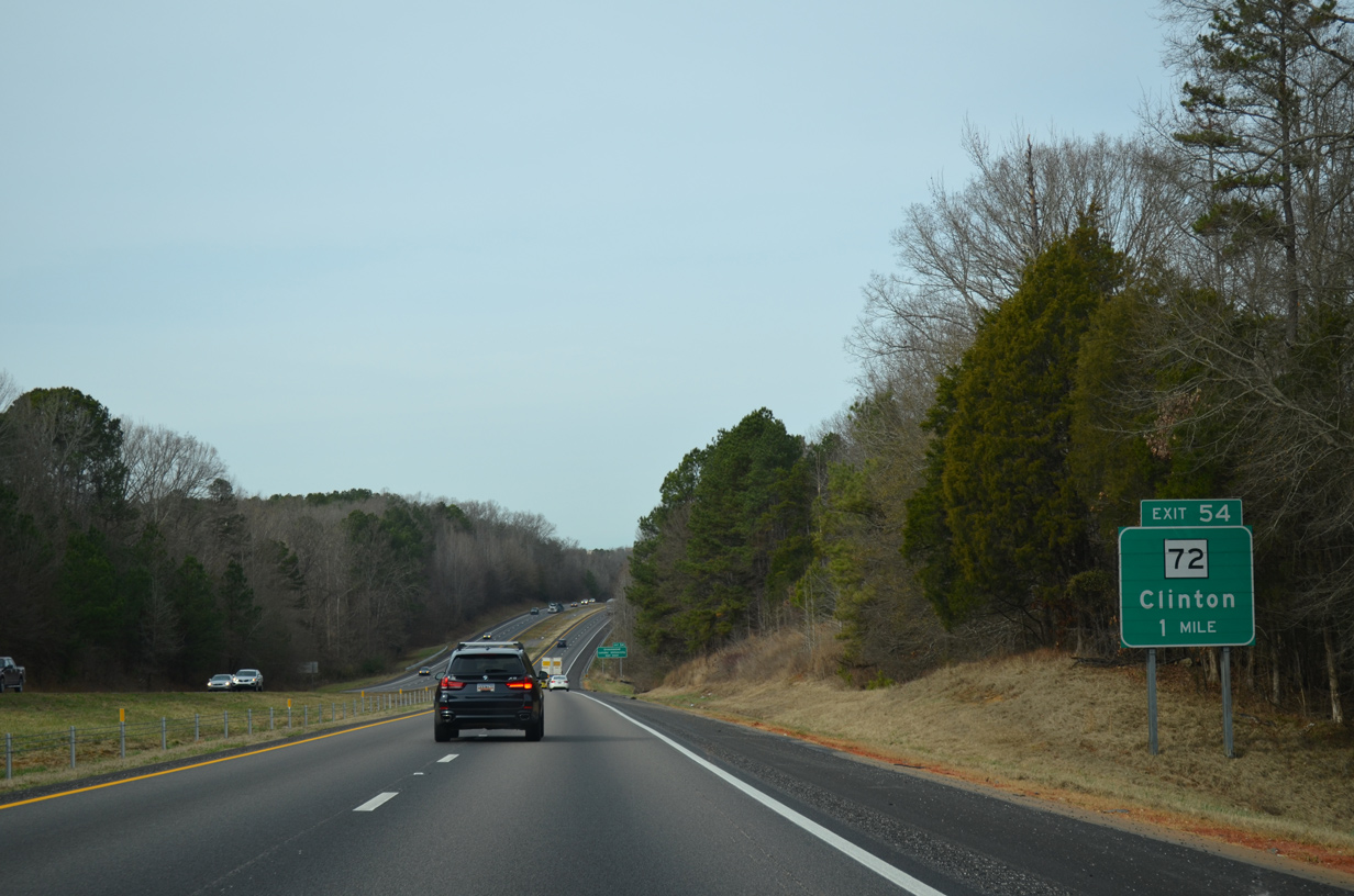
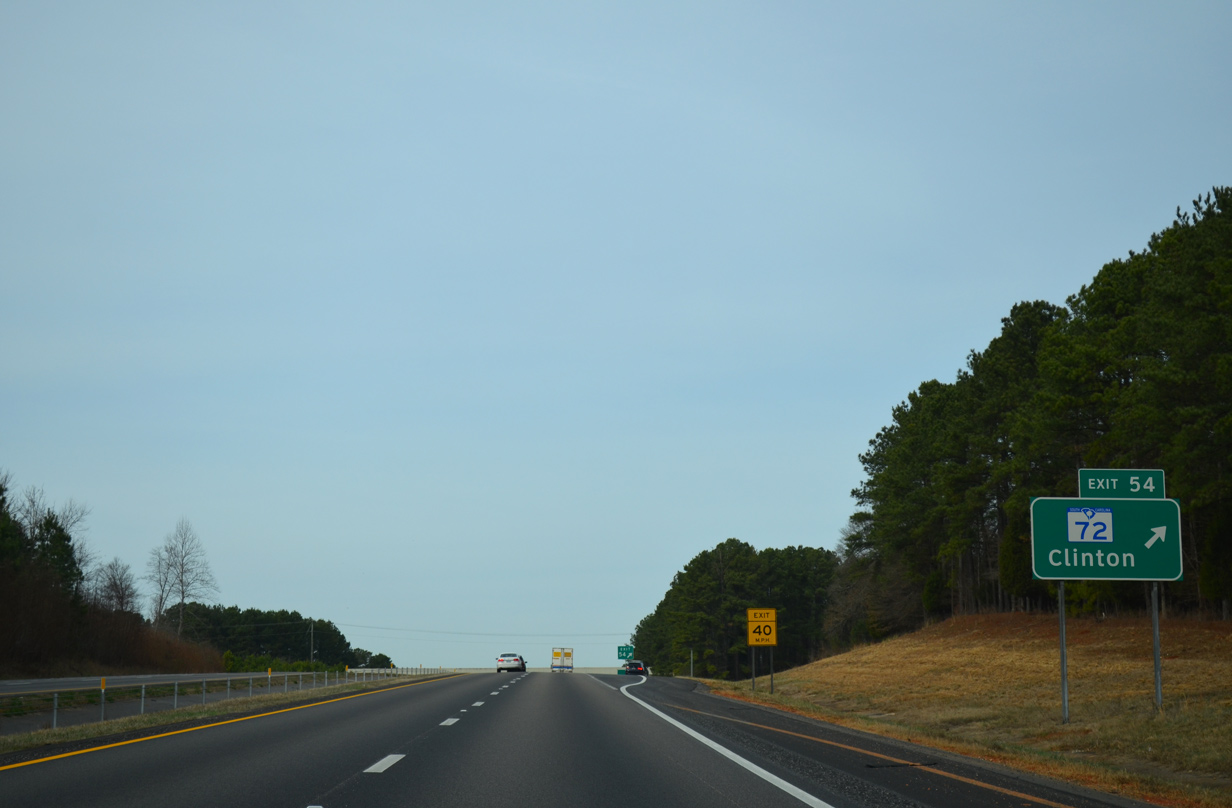
| Like S.C. 121 previously, S.C. 72 represents a multi state route ending at Rock Hill to the northeast. The 171.5 mile long highway connects Clinton with Greenwood and Athens Georgia to the west. 12/31/13 |
|
| S.C. 72 curves west from the diamond interchange (Exit 54) with I-26 to overlap with S.C. 56 south along Broad Street into Downtown Clinton. 12/31/13 |
|
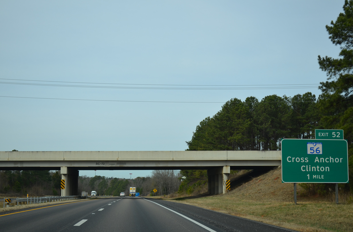
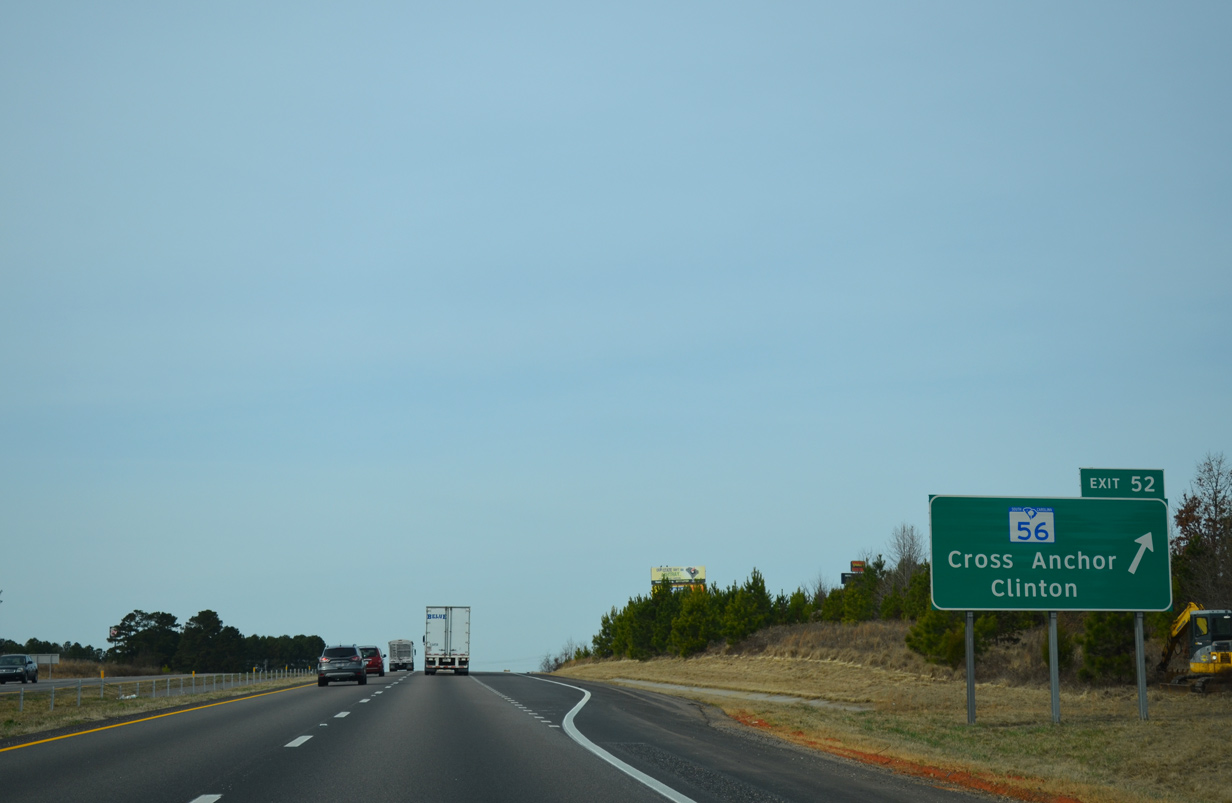
| Exit 52 with S.C. 56 falls within a mile of S.C. 72. S.C. 56 runs 63.7 miles from S.C. 39 near Chappells to U.S. 176 outside Spartanburg. 12/31/13 |
|
| Interstate 26 climbs from Millers Fork to over 600 feet in elevation at the diamond interchange (Exit 52) with S.C. 56. 12/31/13 |
|
| S.C. 56 takes Musgrove Street south to the overlap with S.C. 72 through Clinton. Northward the state highway follows a rural course ten miles to Cross Anchor. 12/31/13 |
|
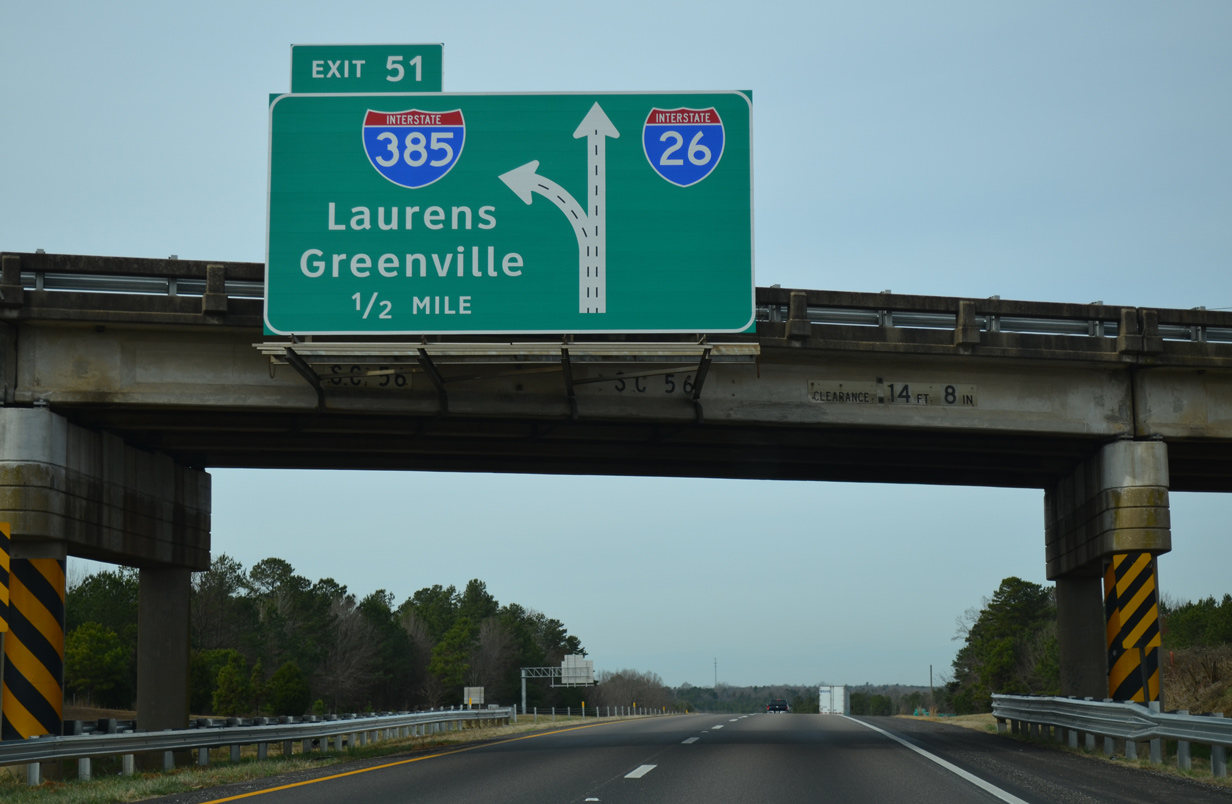
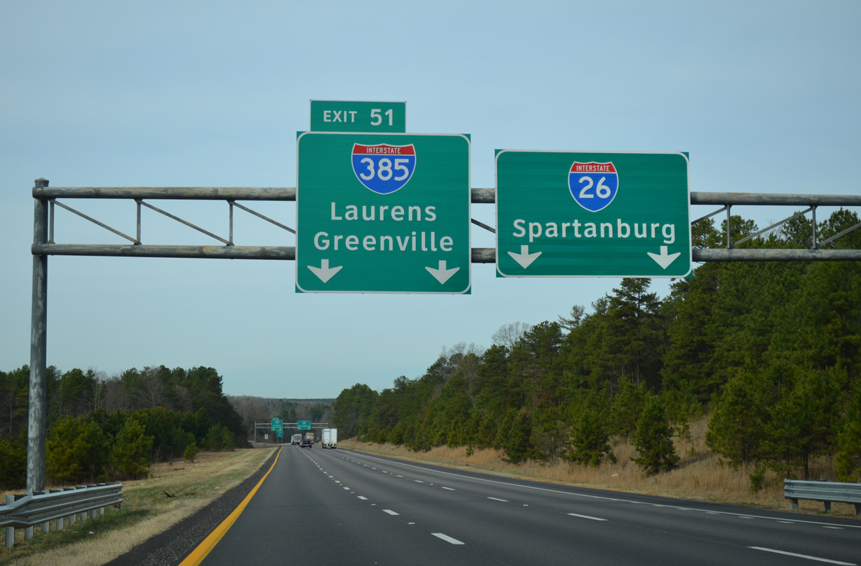
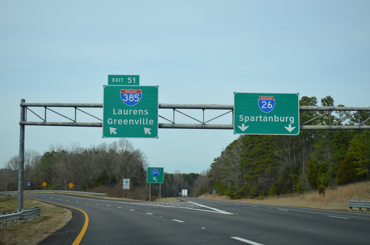
| Interstate 385 branches northwest to Greenville from a wye interchange (Exit 51) one half mile beyond the S.C. 56 overpass at Exit 52. 12/31/13 |
|
| I-385 stretches 42.16 miles northwest from near Clinton to end just shy of Downtown Greenville. The freeway originally consisted of a separate spur from I-85 into Greenville, and an extension of U.S. 276 south from Mauldin. 12/31/13 |
|
| Left Exit 51 parts ways with I-26 west for Interstate 385 north. I-385 provides access to the Laurens County seat of Laurens at Exit 5 and 9. Further north the freeway is a commuter route from Fountain Inn and Simpsonville to Greenville. 12/31/13 |
Page Updated 09-15-2021.

 West
West