|
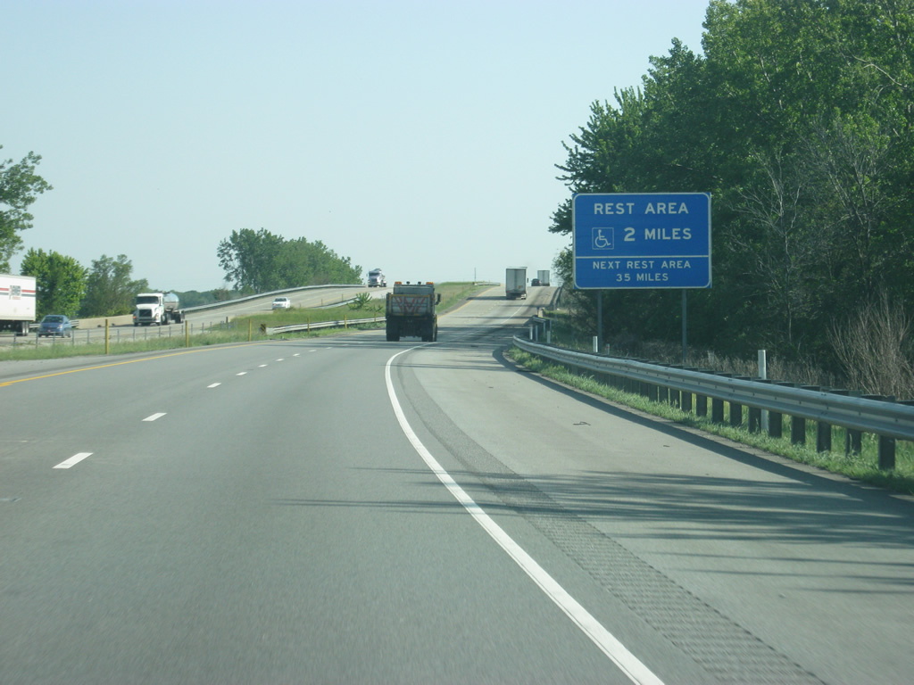
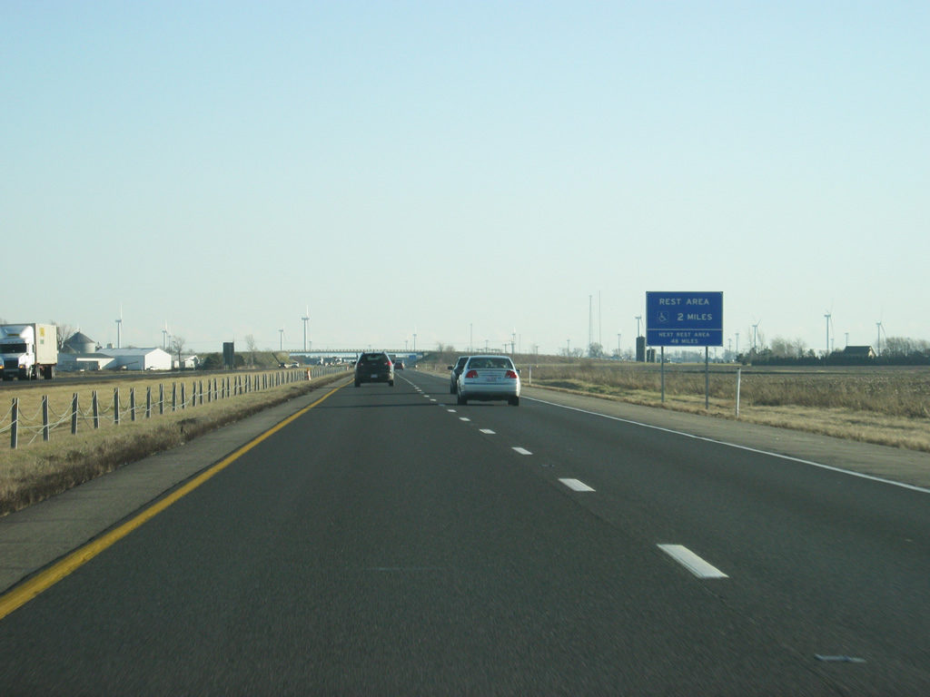
| Interstate 65 nips the northeast corner of Newton County as the first rest area to serve southbound Interstate 65 greets motorists two miles south of the Kankakee River crossing. The next rest area is 35 miles away in White County. 05/14/12 |
|
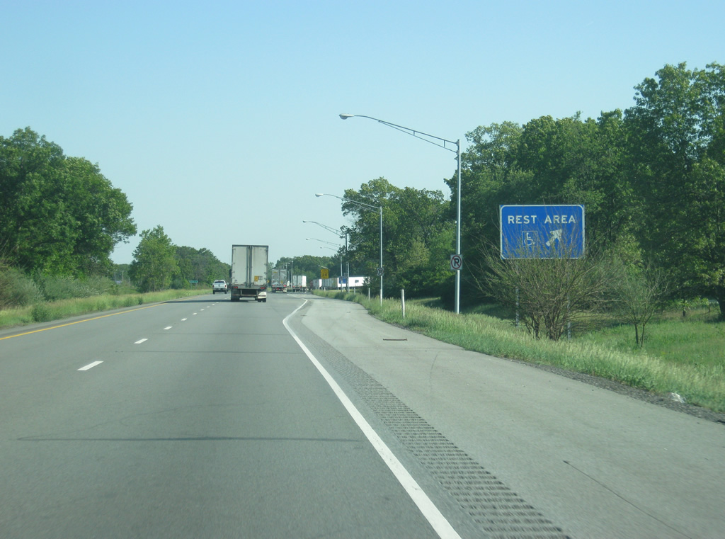
| Rest areas near Forest City include a tourist information center for northbound motorists along Interstate 65 heading toward Lake County and for southbound motorists heading further into Indiana. 05/14/12 |
|
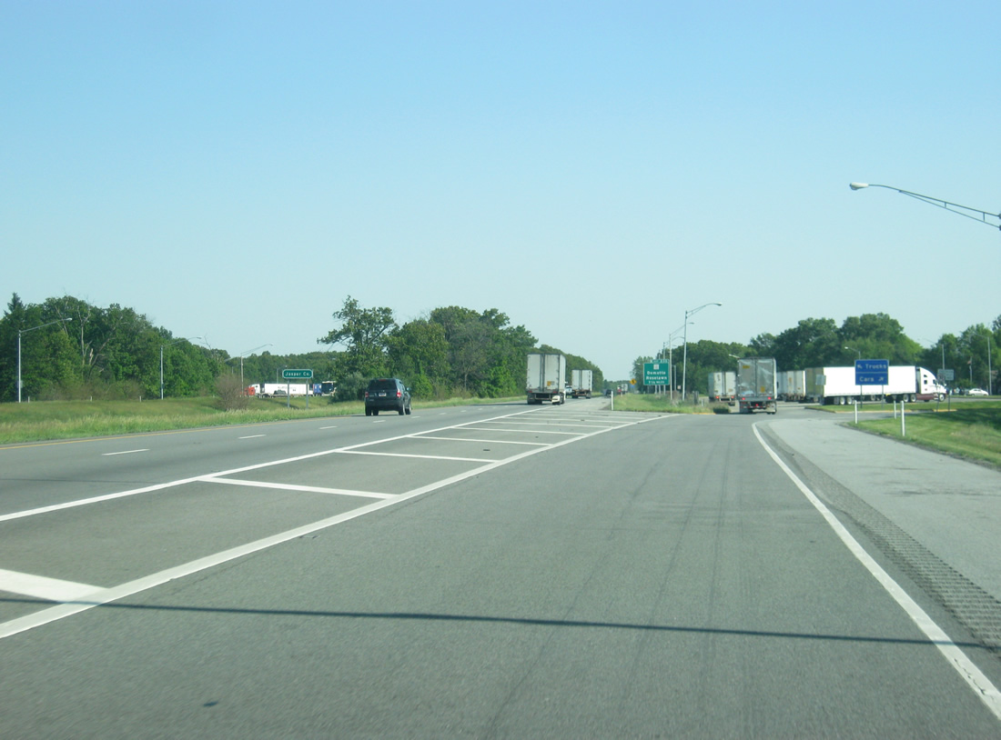
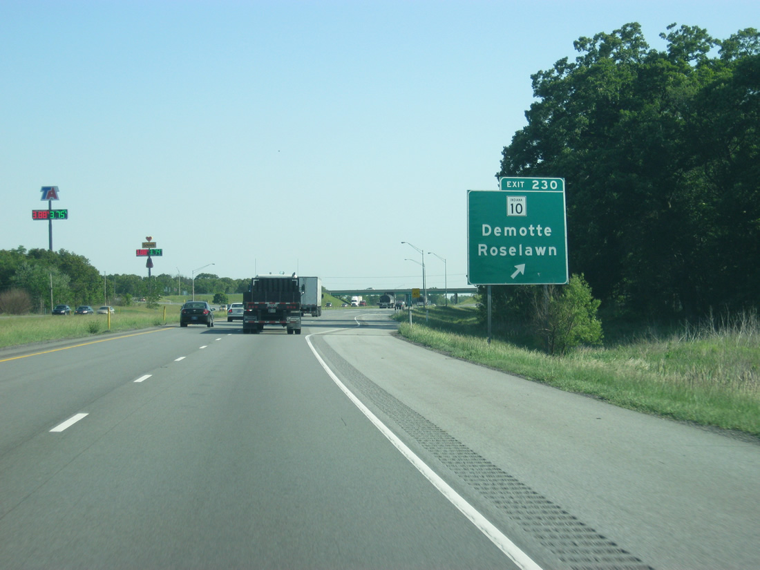
| At the off ramp to the rest area, Interstate 65 enters Jasper County. In the distance is the 1 1/4 mile approach to the SR 10 interchange (Exit 230). 05/14/12 |
|
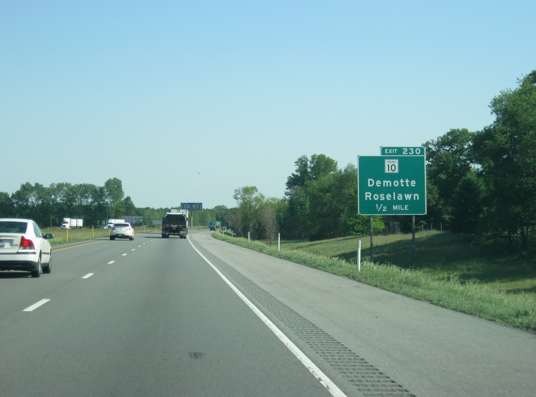
| A hodgepodge of leafy subdivisions dot the area of Exit 230 and Interstate 65 along and to the north of SR 10. Roselawn lies just to the west. Roselawn and Demotte are the last exurban outposts of the Chicago area in Northwest Indiana. 05/14/12 |
|
| Exit 230 leaves Interstate 65 south for the 85.3 mile long SR 10. SR 10 ends as SR 114 near Lake Village to the west and at SR 19 near Etna Green to the east. The rural route dog legs north to Demotte and an overlap with U.S. 231 to the east. 05/14/12 |
|
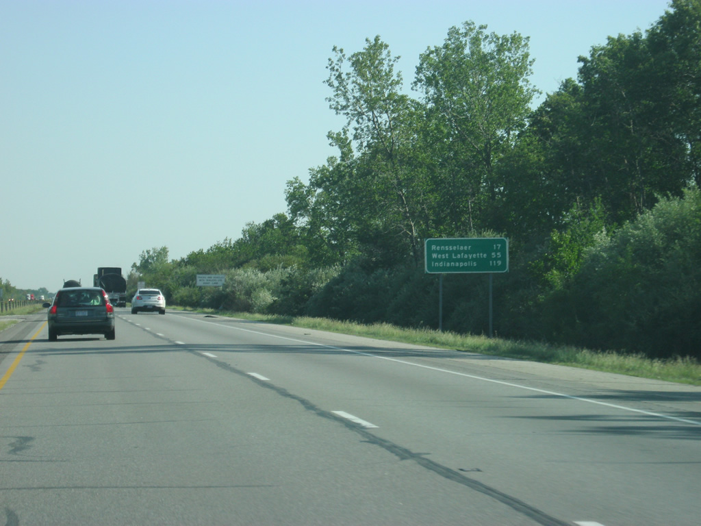
| South of Exit 230, the Jasper County seat of Rensselaer is 17 miles away. West Lafayette, most famous for Purdue University, is 55 miles away and Indianapolis follows at 119 miles. 05/14/12 |
|
| Interstate 65 remains in western Jasper County as it runs parallel the county boundary with Newton County to the west for the ten miles in between Exit 230 and 220. Until Exit 220 was built in 2005, this was part of a 15 mile exit-less stretch along Interstate 65, the longest in Indiana. 05/14/12 |
|
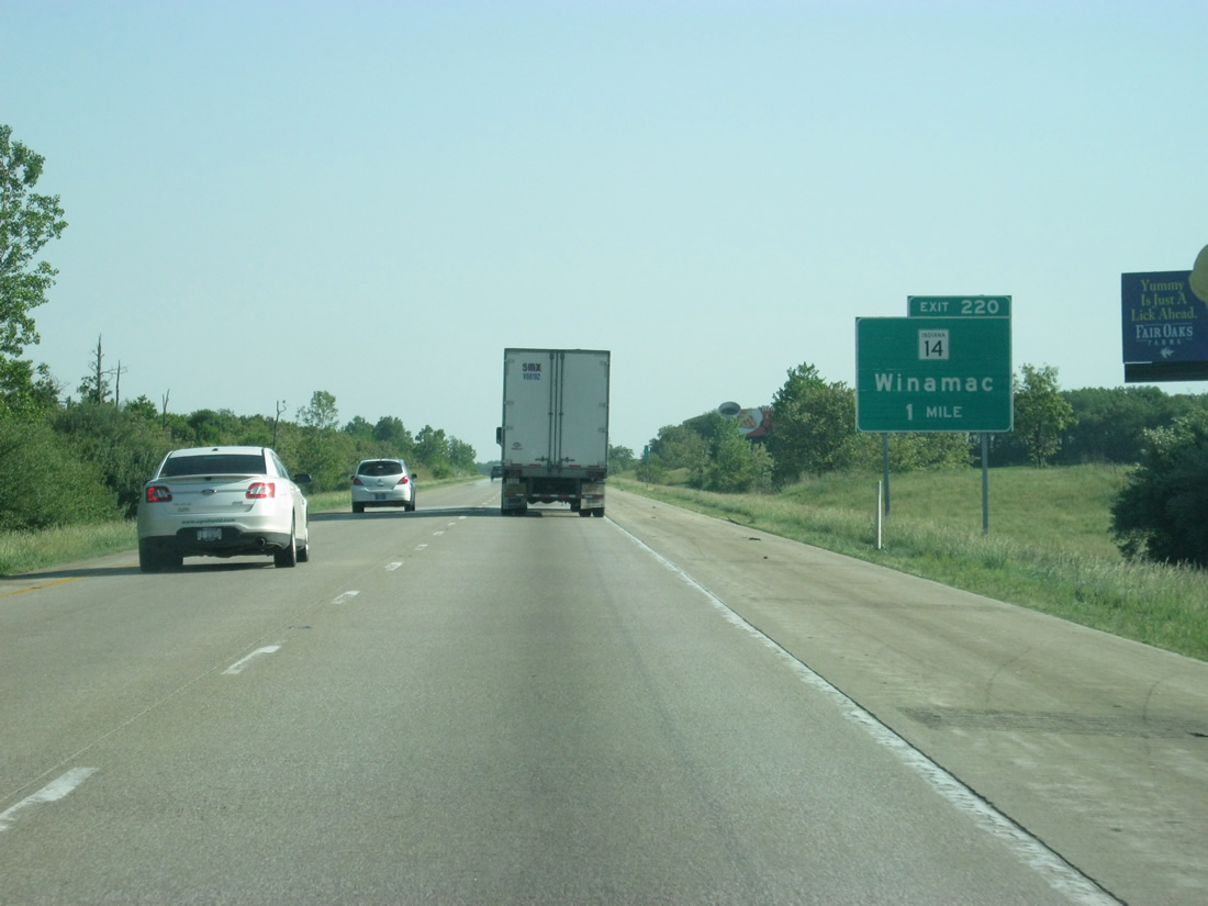
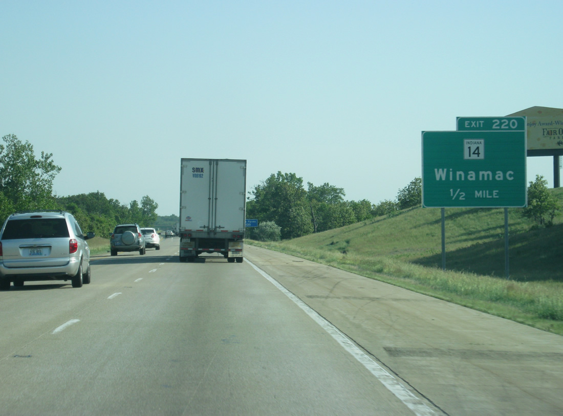
| SR 14 meets Interstate 65 at the next exit, a diamond interchange added in 2005. Winamac, the county seat for Pulaski County lies 38.5 miles to the east at the junction of SR 14 and U.S. 35. Due to a lack of communities of any size (save for Enos and Parr) Winamac was the first available town to use as a control city, despite its rather far distance. 05/14/12 |
|
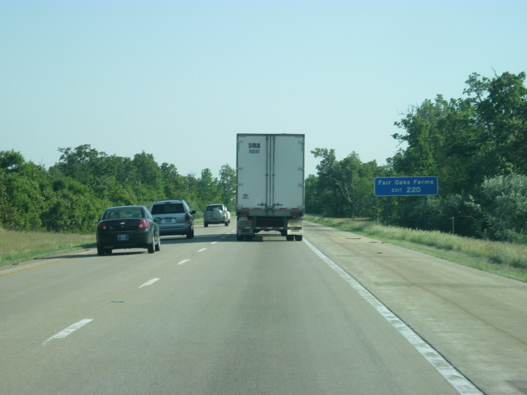
| Beginning at U.S. 41 at Enos, SR 14 heads east across the state to Winamac, Rochester, North Manchester and Fort Wayne for a distance of 123 miles. Use Exit 220 for the town of Fair Oaks and Fair Oaks Farms. 05/14/12 |
|
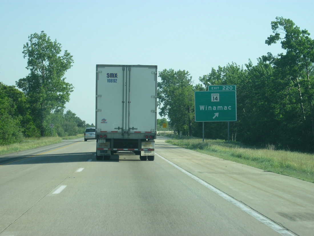
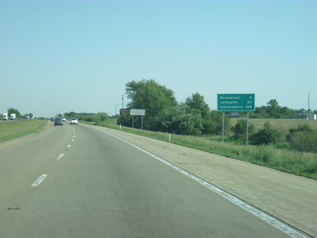
| Exit 220 leaves Interstate 65 south for SR 14. The settlements of Kents and Parr lie nearby. U.S. 41 is 9.2 miles to the west while U.S. 231 is about eight miles to the east. Very few settlements lie along the state highway across Newton and Jasper Counties. 05/14/12 |
|
| Rensselaer now lies nine miles away with Lafayette at 45 miles. Indy is 108 miles away, still a good two-hour drive. 05/14/12 |
|
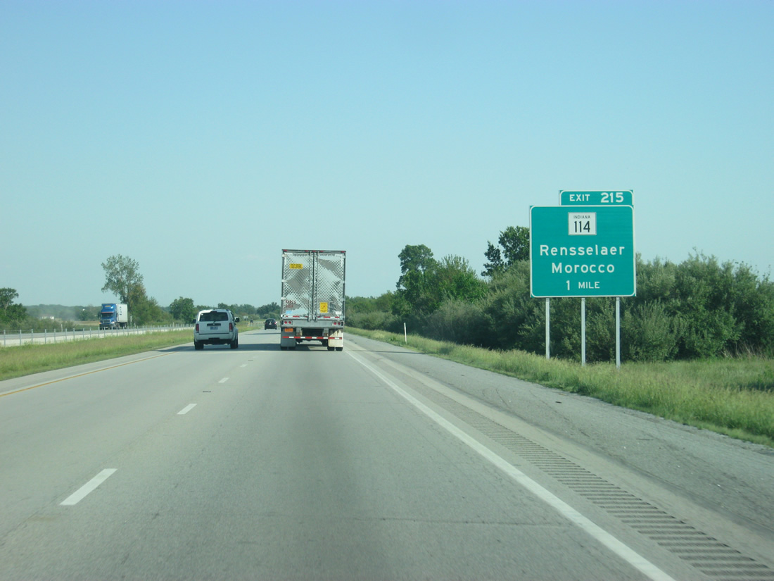
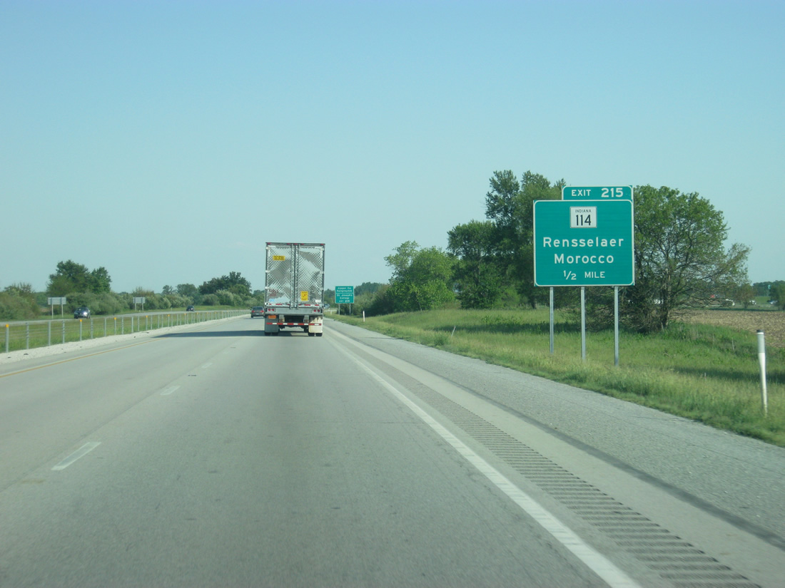
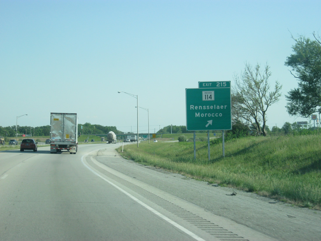
| Interstate 65 starts to turn back toward the southeast as the highway nears the one mile approach to the diamond interchange with SR 114 at Exit 215. 05/14/12 |
|
| SR 114 stretches 34.6 miles east from a beginning at U.S. 41 near Morocco to Rensselaer and U.S. 421 between Francesville and Monon. Two other sections of the route exist at Fulton and between Akron and the Fort Wayne area. 05/14/12 |
|
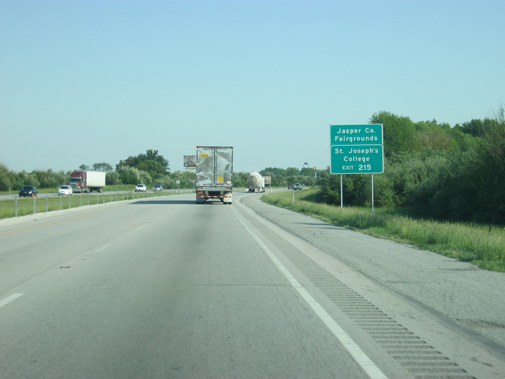
| Both the Jasper County Fairgrounds and St. Joseph College lie to the east of Exit 215 in Rensselaer, which is the county seat and largest community in Jasper County. The city serves as the economic hub for both Jasper and Newton Counties. 05/14/12 |
|
| Staying west of Rensselaer, Interstate 65 partitions with Exit 215 to SR 114. SR 114 follows Clark Street to Cullen Street and downtown before exiting the city along Grace Street. Westward, the state road meets SR 55 near Mount Ayr. SR 55 parallels Interstate 65 northward to Hobart and southward toward Goodland and Fowler. 05/14/12 |
|
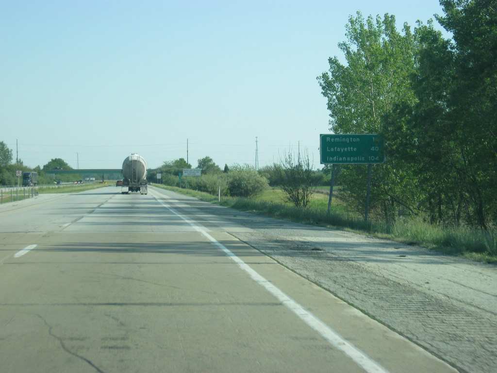
| ast Exit 225, Remington is the next community 14 miles to the south. Lafayette and Indianapolis follow at 40 and 104 miles respectively. 05/14/12 |
|
| Interstate 65 continues in a south-southeast direction for another 10 mile stretch in between interchanges. Halfway in between, the interstate passes underneath SR 16, the only state highway for this stretch of Interstate 65 to not have an interchange. 05/14/12 |
|
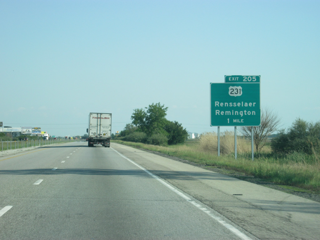
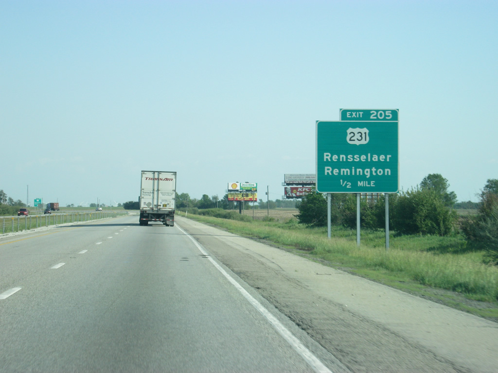
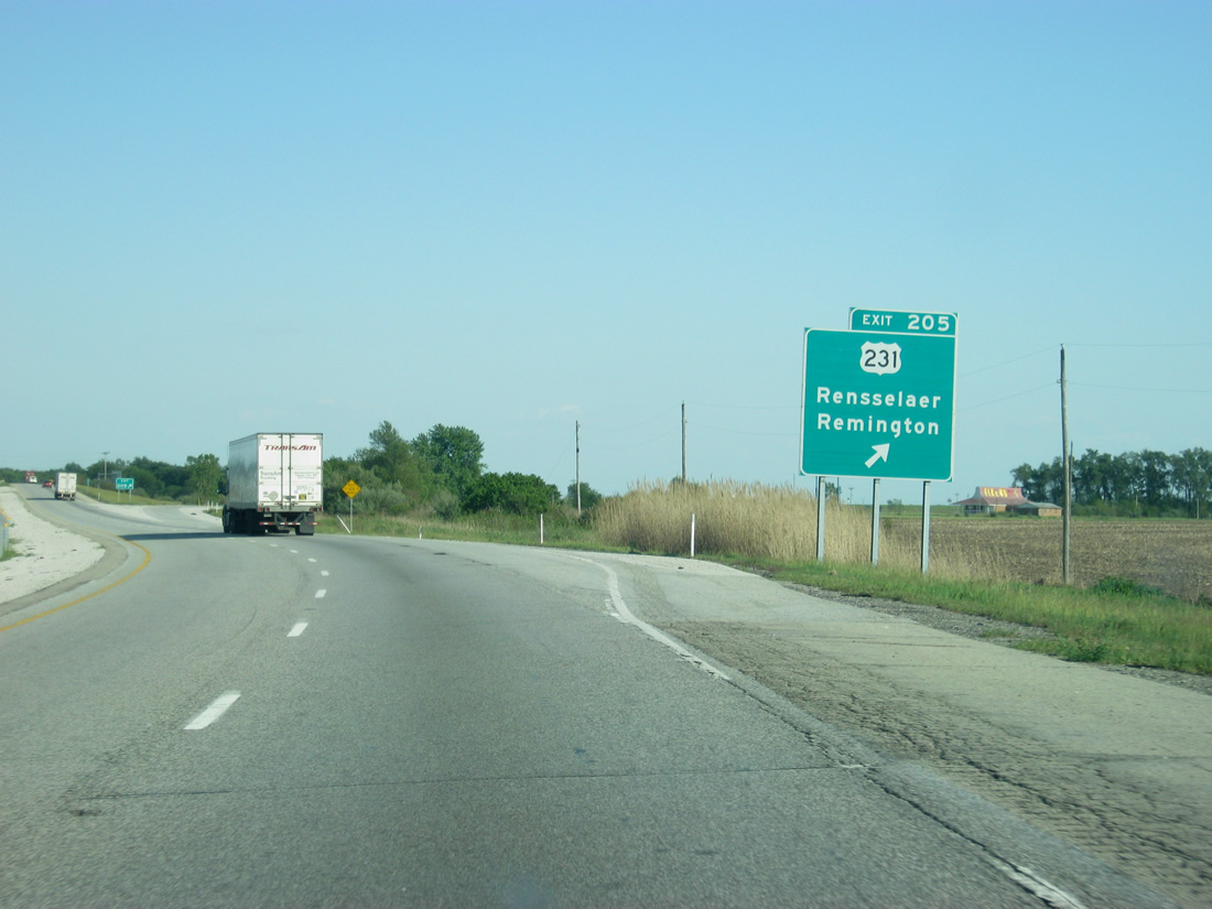
| Approaching ahead is the second crossing with Interstate 65 and U.S. 231, and the first of three consecutive interchanges with the US highway. 05/14/12 |
|
| Exit 205 provides the first of two routes from Interstate 65 into Remington, about three miles to the south. U.S. 231 continues due north from the freeway eight miles to Collegeville, where St. Joseph's College is located. 05/14/12 |
|
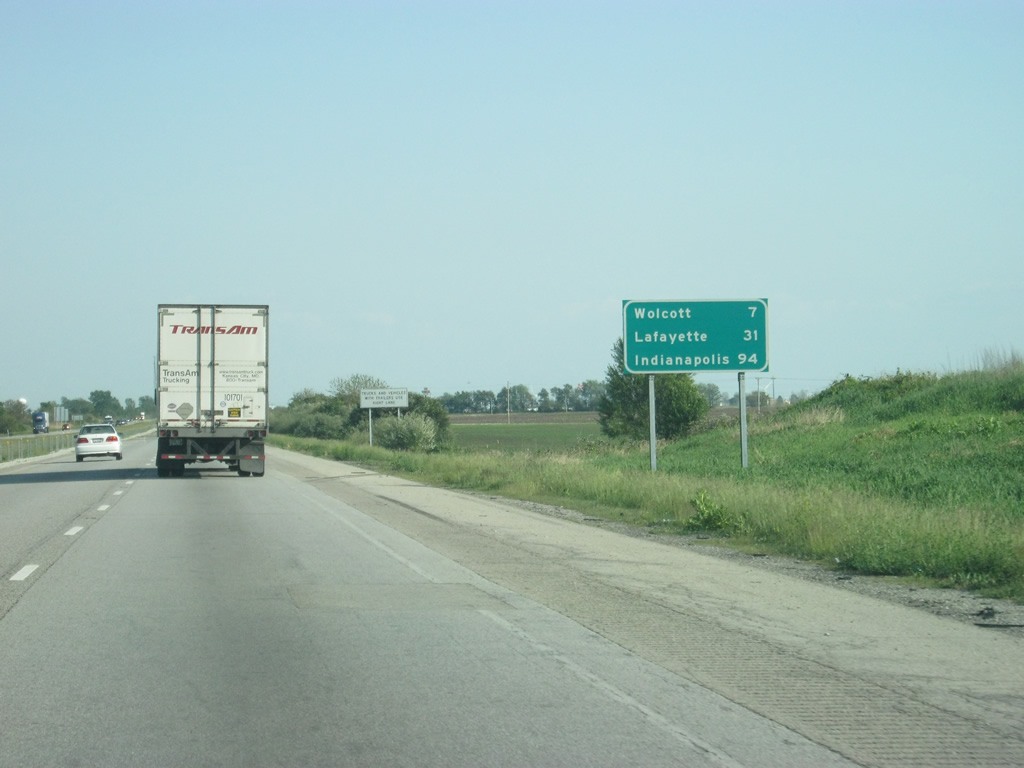
| U.S. 231 leads south toward the town of Remington and the junction with U.S. 24, which will share a multiplex with U.S. 231 eastward toward Wolcott. 05/14/12 |
|
| Wolcott, in western White County, is seven miles away. Lafayette follows at 31 miles and Indianapolis at 94 miles. 05/14/12 |
|
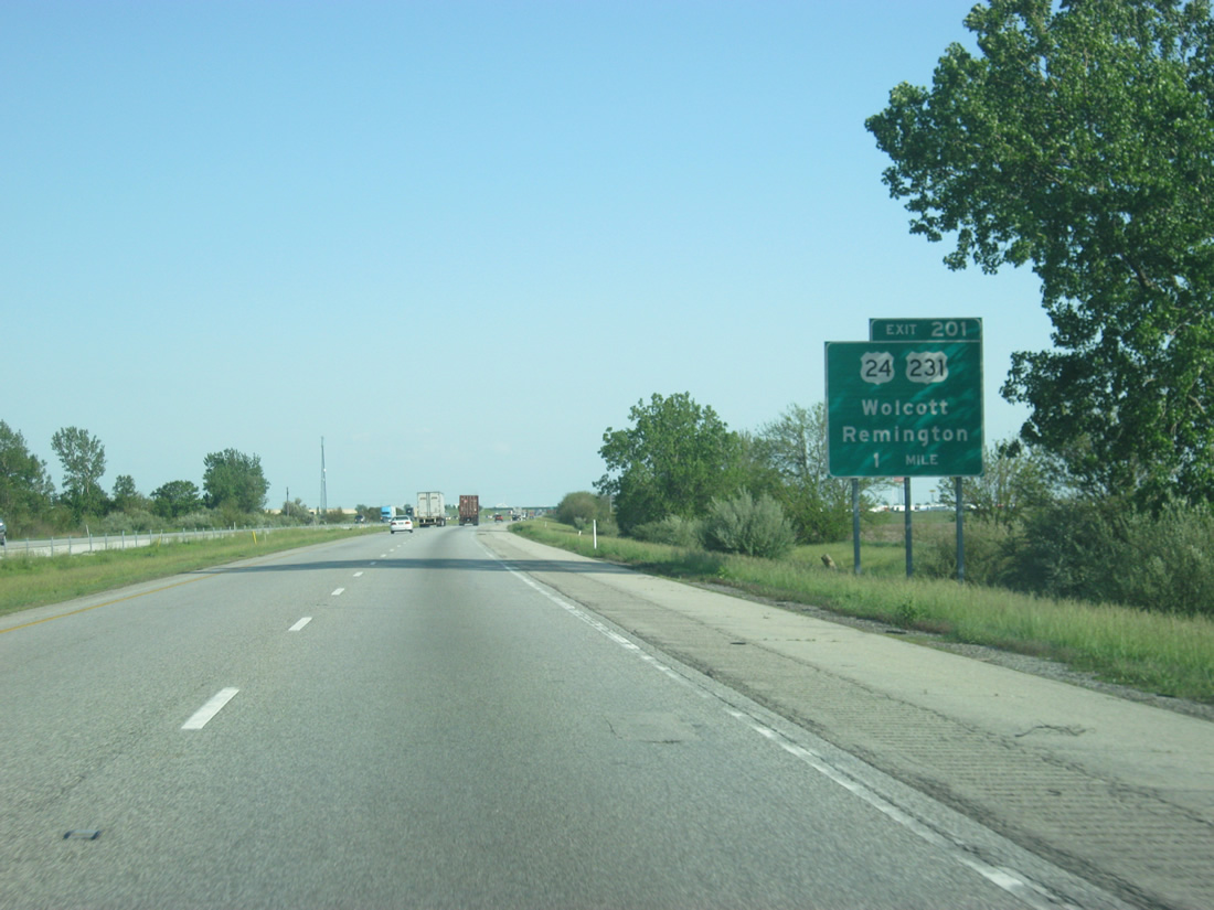
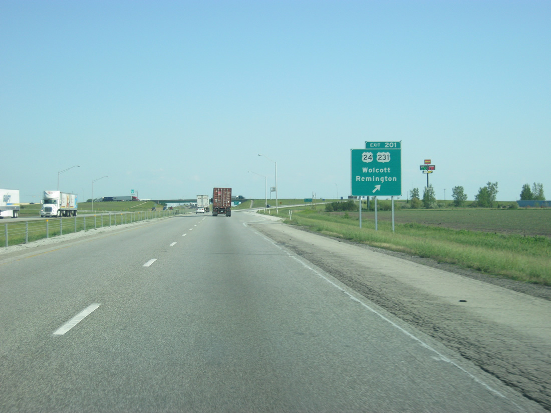
| U.S. 24 & 231 and Interstate 65 see a diamond interchange (Exit 201) on the outskirts of Remington in one mile. The US highway tandem share 6.8 miles of pavement from Remington east to just south of Wolcott. 05/14/12 |
|
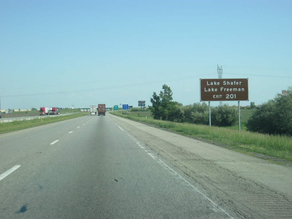
| U.S. 24 is the best route from the north to the resort destinations of Lake Shafer and Lake Freeman and the Indiana Beach amusement part, all located in the vicinity of Monticello, about 20 miles away to the east of Exit 201. 05/14/12 |
|
| Exit 201 departs Interstate 65 south for U.S. 24 & U.S. 231. U.S. 24 continues west from Remington to Goodland, Kentland and Effner, exiting the state for Sheldon, Illinois. Much of western U.S. 24 in Indiana consists of a rural two lane highway. East from Logansport however, U.S. 24 generally consists of four lane expressway associated with the Hoosier Heartland Industrial Corridor through Peru, Wabash, Huntington and Fort Wayne. 05/14/12 |
|
| Beyond Exit 201 (U.S. 24 & U.S. 231), Interstate 65 enters White County, and crosses over into the Eastern Time Zone for the first time heading south. 12/29/11 |
|
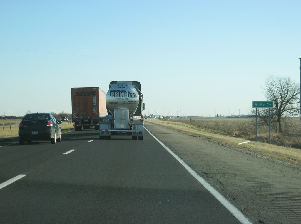
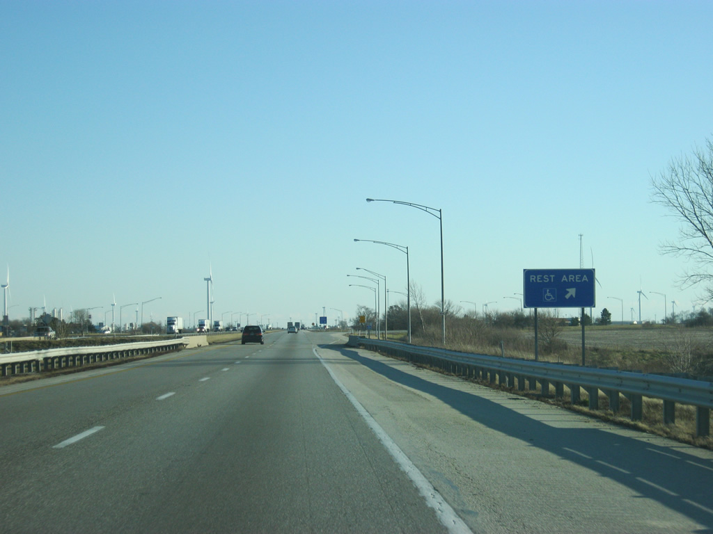
| The second rest area along Interstate 65 south lies in western White County. Facilities lie opposite one near Hoagland Ditch. 12/29/11 |
|
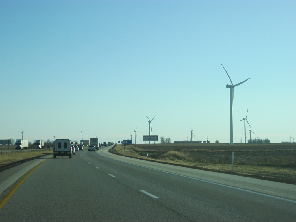
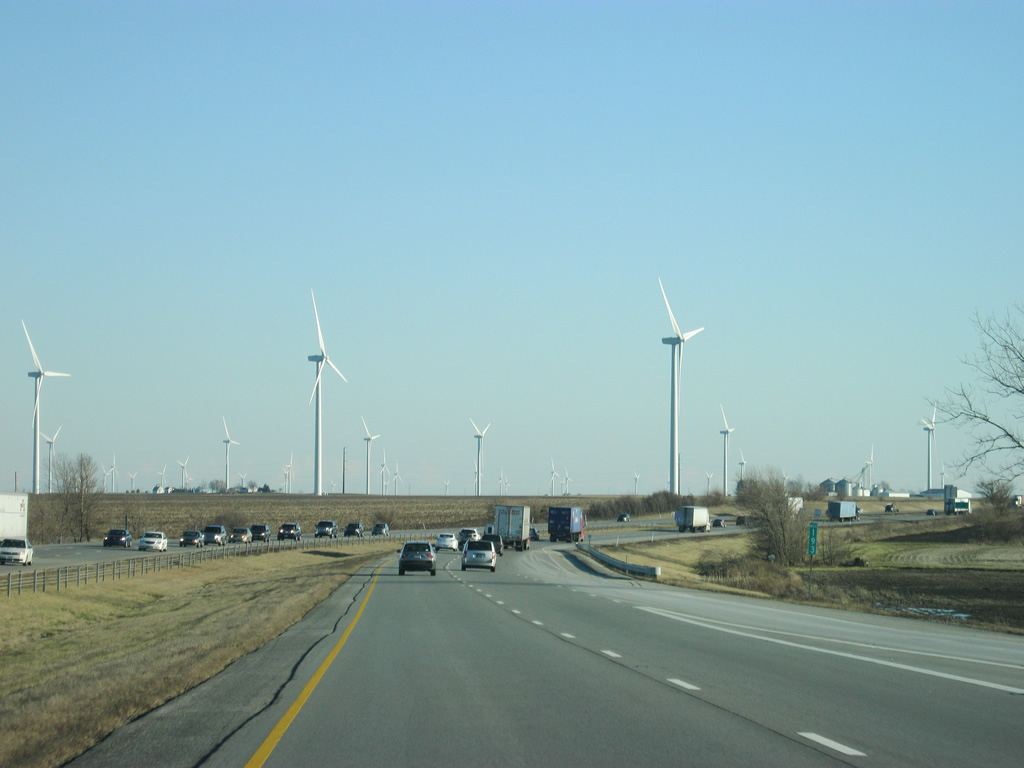
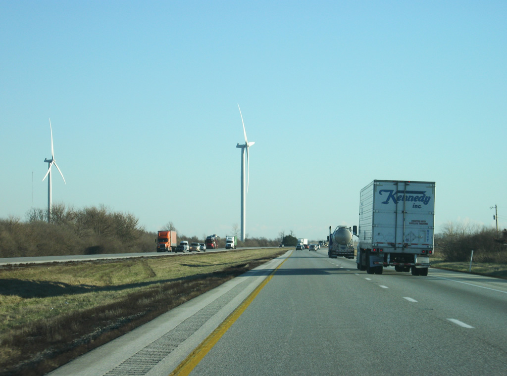
| South of the rest area, Interstate 65 enters the Meadow Lake Wind Farm, which consists of large swatch of wind turbines that cross White County and adjacent Benton County to the west. The wind farm was first constructed in 2009 and has been added on to since. 12/29/11 |
|
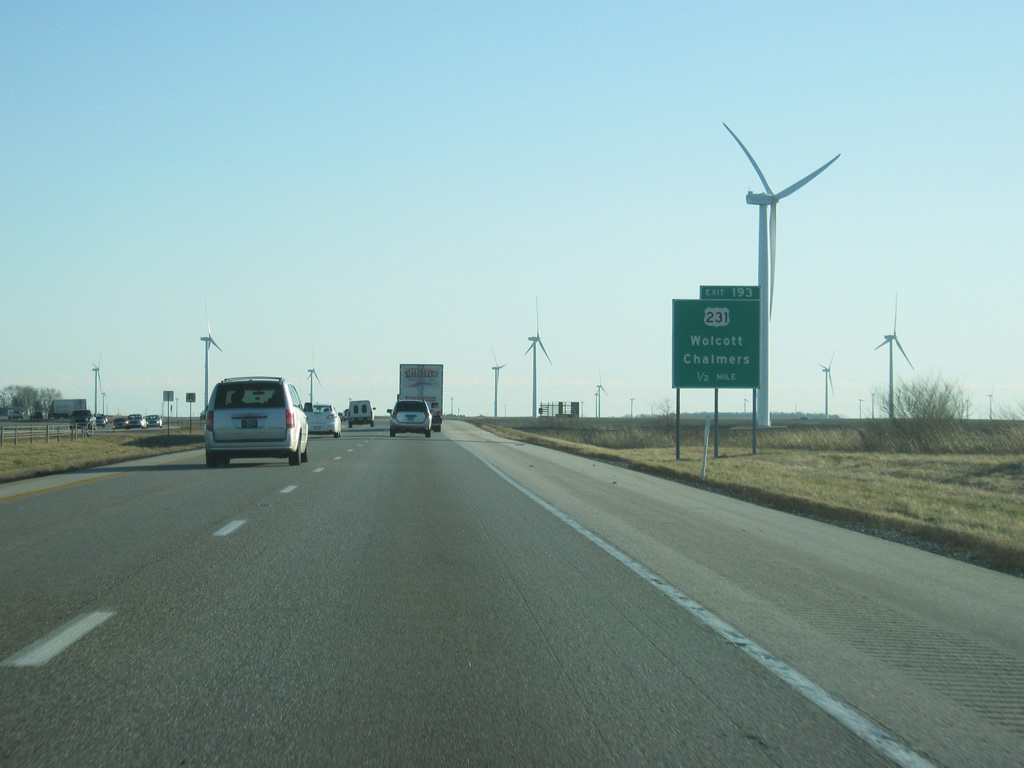
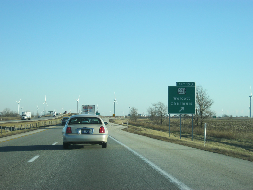
| U.S. 231 travels six miles southward from the town of Wolcott and a split with U.S. 24 to meet up with Interstate 65 at the upcoming diamond interchange (Exit 193). The town of Chalmers can be reached by taking County Road 600 South off of U.S. 231 just north of the exit. 12/29/11 |
|
| U.S. 231 journeys south to U.S. 52 at Montmorenci from the diamond interchange with Interstate 65 (Exit 193). U.S. 231 totals 297 miles in Indiana, from the Ohio River near Rockport, to a northern terminus at U.S. 41 at St. John. 12/29/11 |
|
| Another view of the Meadow Lake Wind Farm to the south of Exit 193. The wind turbines will surround the interstate for the next few miles. 12/29/11 |
|
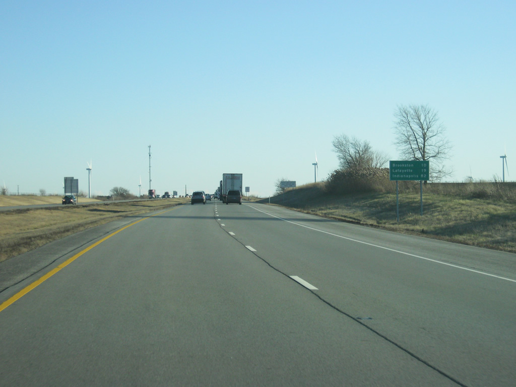
| Brookston and Lafayette are 10 and 18 miles away respectively, while Indianapolis is 82 miles down Interstate 65. 12/29/11 |
|
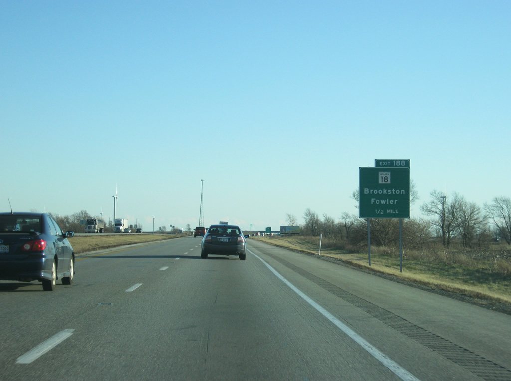
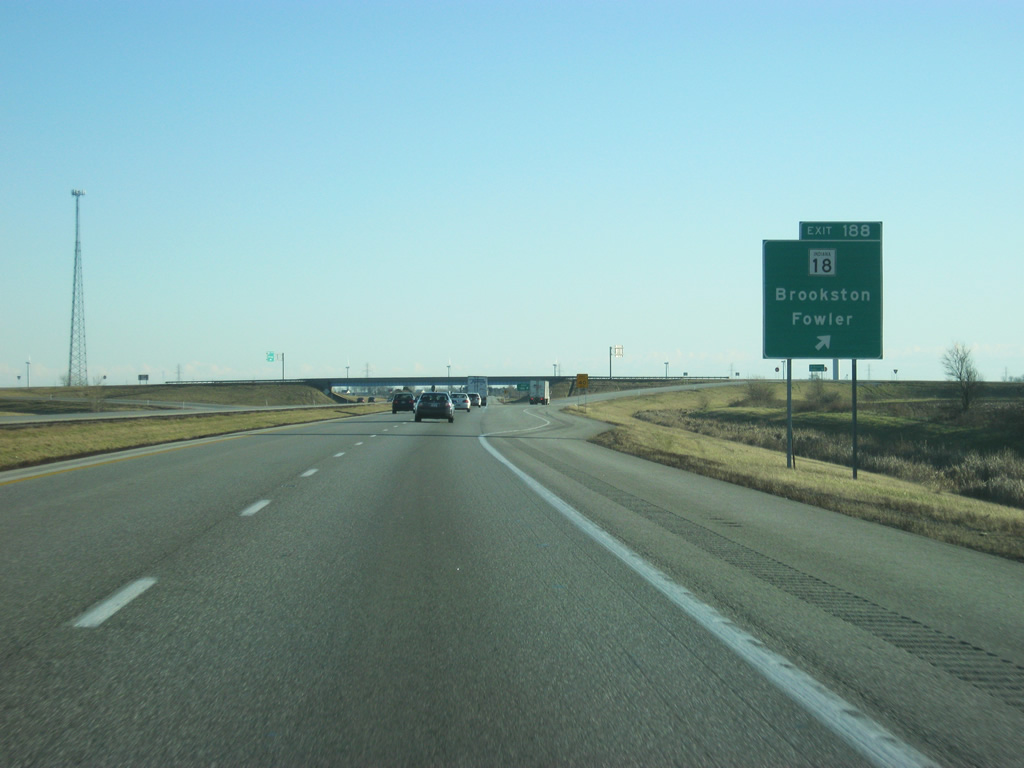
| SR 18 meets Interstate 65 at the second of the two White County interchanges (Exit 188) in one mile. 12/29/11 |
|
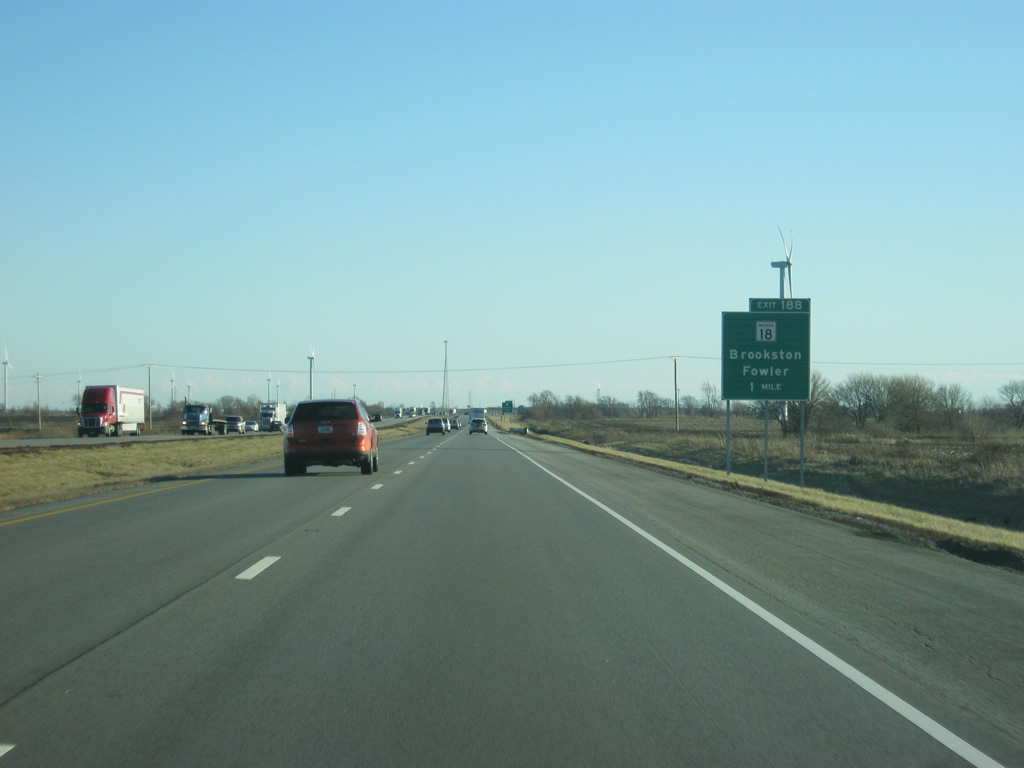
| Almost crossing the entire width of Indiana, SR 18 travels 141.1 miles from Illinois, west of Fowler, to end at U.S. 27 and SR 67 at Bryant, 8.9 miles west of the Ohio state line. 12/29/11 |
|
| Southbound at the Exit 188 ramp departure for SR 18. SR 18 heads west 17 miles to merge with U.S. 52 into Fowler. Eastward, Brookston is a five mile drive, with SR 18 joining U.S. 421 into Delphi beyond there. 12/29/11 |
|
| South of Exit 188 (SR 18), Interstate 65 passes by a couple more wind turbines before leaving White County. 12/29/11 |
Page Updated 02-25-2013.

 South
South