|
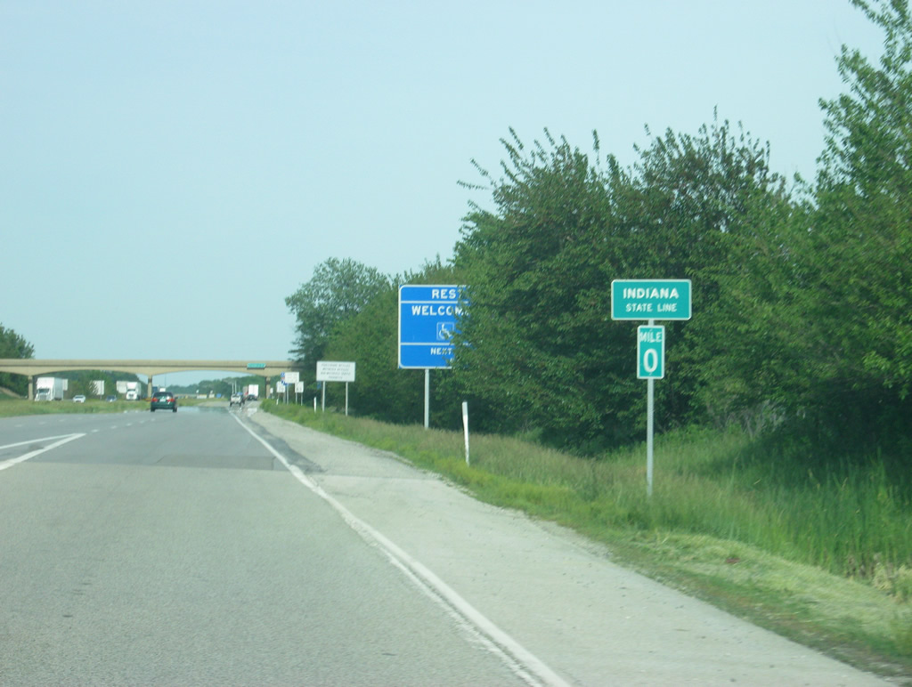
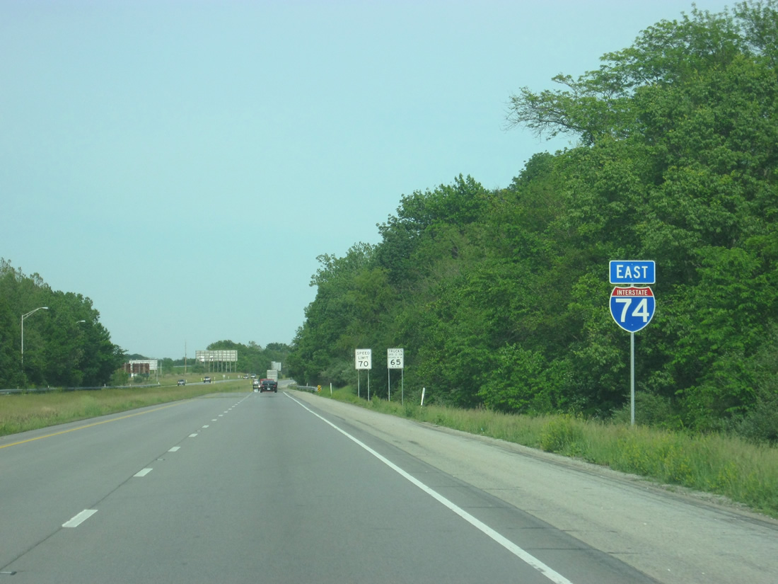
| Interstate 74 crosses the boundary into Indiana as it merges with the on-ramp from the Lynch Road interchange (Exit 220) in southeast Danville, Illinois. The state line represents the western border of Vermillion County, an elongated north-south county stretching along the state line south to Vigo County and north to a point just outside Exit 4. 05/28/12 |
|
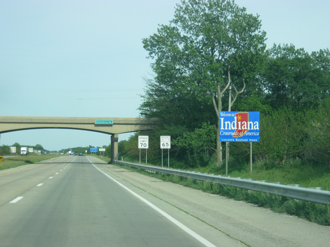
| A Welcome to Indiana sign greets motorists on eastbound Interstate 74 near the Rileysburg Road overpass. 05/28/12 |
|
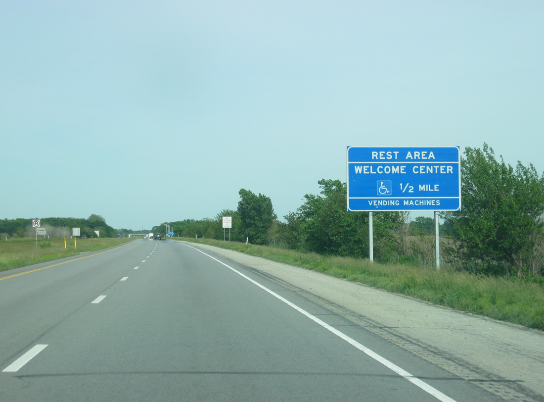
| The Spring Creek Welcome Center serves as the information center for eastbound travelers in the first two miles into the state. The next rest area is in Lizton, about 56 miles away. 05/28/12 |
|
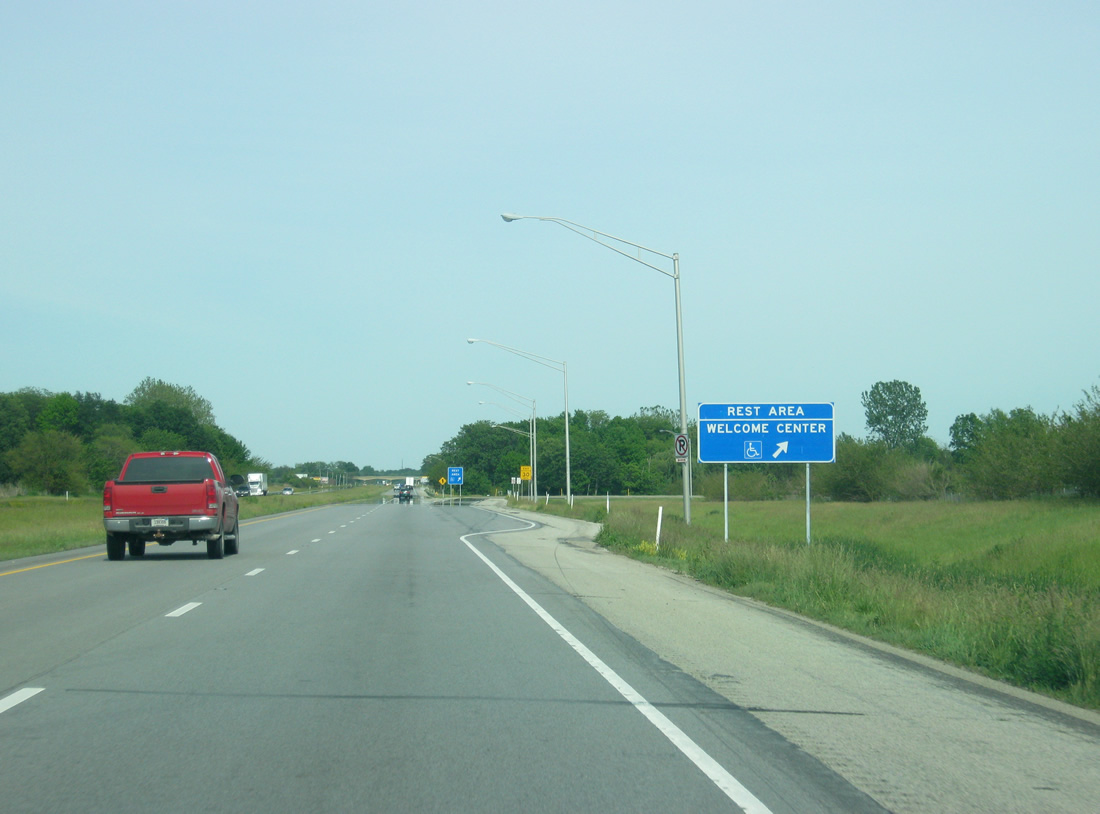
| Now at the on-ramp from eastbound Interstate 74 to the Spring Creek Welcome Center. 05/28/12 |
|
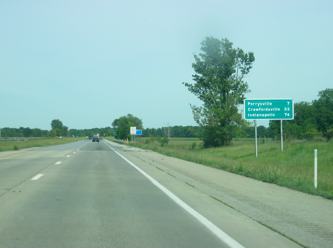
| Perrysville is the first community that is reached via Interstate 74 at a distance of seven miles. Crawfordsville at 32 miles away is the county seat of Montgomery County and the largest community along Interstate 74 from Danville to Indianapolis. The Indiana capital of Indianapolis is 76 miles away. 05/28/12 |
|
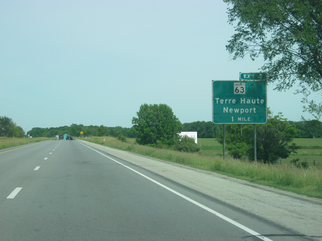
| The SR 63 expressway crosses paths with Interstate 74 at the first Indiana exit, a parclo interchange, in one mile. 05/28/12 |
|
| SR 63 constitutes a 61.4 mile portion of the expressway route between Northwest Indiana and Terre Haute. The state road overtakes U.S. 41 in importance due to the geography of the US highway to the east, which made upgrading it cost prohibitive. 05/28/12 |
|
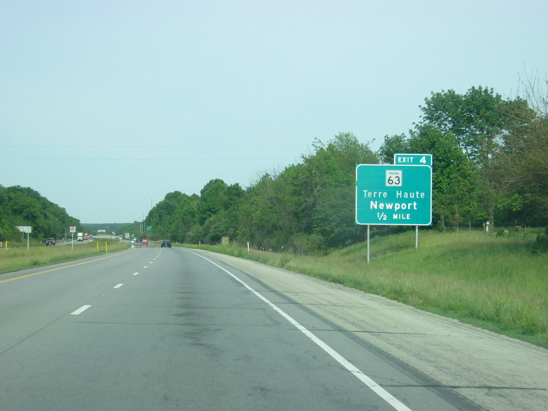
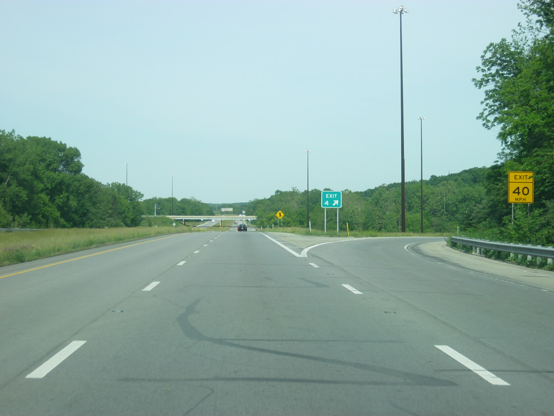
| Exit 4 leaves Interstate 74 west for SR 63. SR 63 ventures north to West Lebanon and south to Perrysville, Newport and Clinton in Vermillion County. 05/28/12 |
|
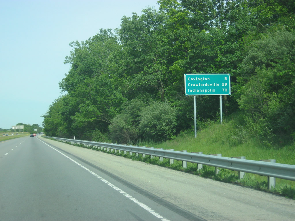
| Shield and distance sign to the east of Exit 4. The Fountain County seat of Covington is five miles off. Crawfordsville and Indianapolis follow at 29 and 70 miles away respectively. 05/28/12 |
|
| East of Exit 4, Interstate 74 descends into the valley of the Wabash River. 05/28/12 |
|
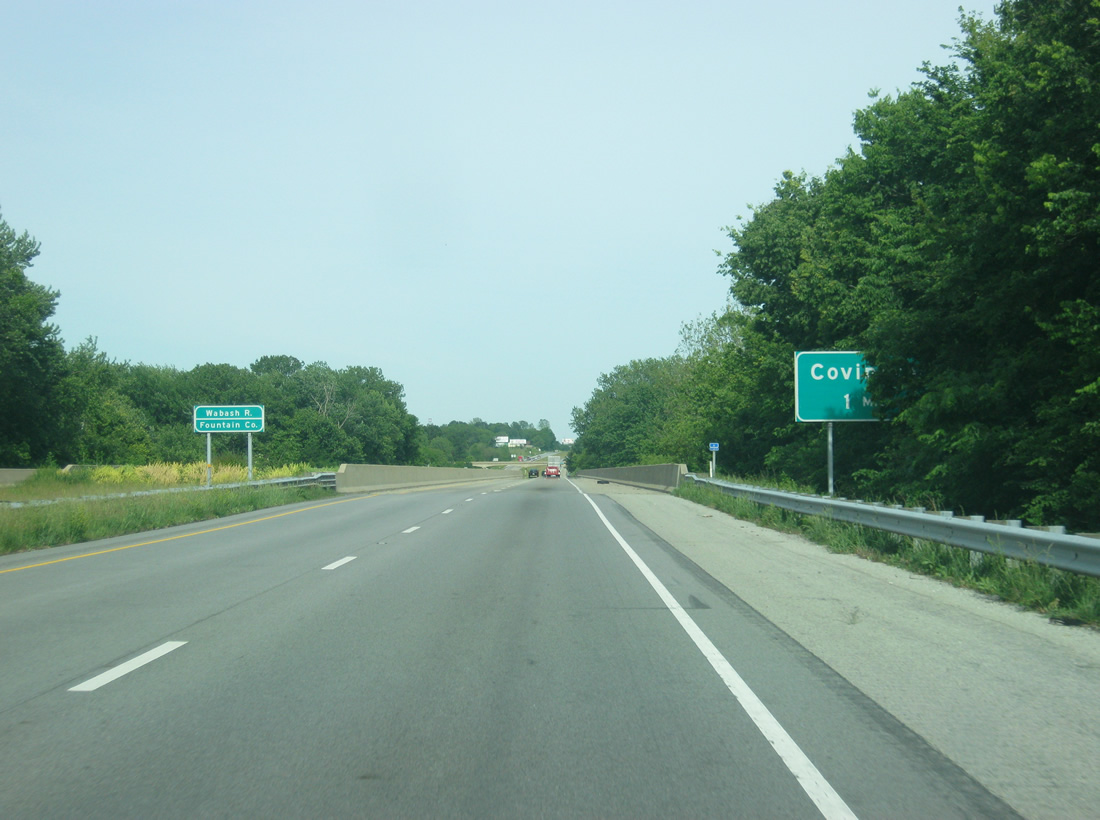
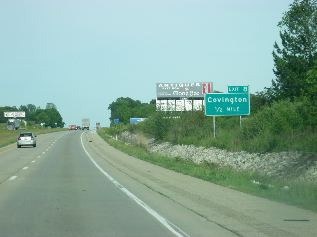
| Interstate 74 crosses the Wabash River, Indiana's longest river, and enters Fountain County. The county seat of Covington is reached from Stringtown Road in one mile via the Exit 8 diamond interchange. 05/28/12 |
|
| An uncovered guide sign announces the half mile approach to Exit 8. Stringtown Road becomes 11th Street in Covington, intersecting U.S. 136 (Liberty Street). 05/28/12 |
|
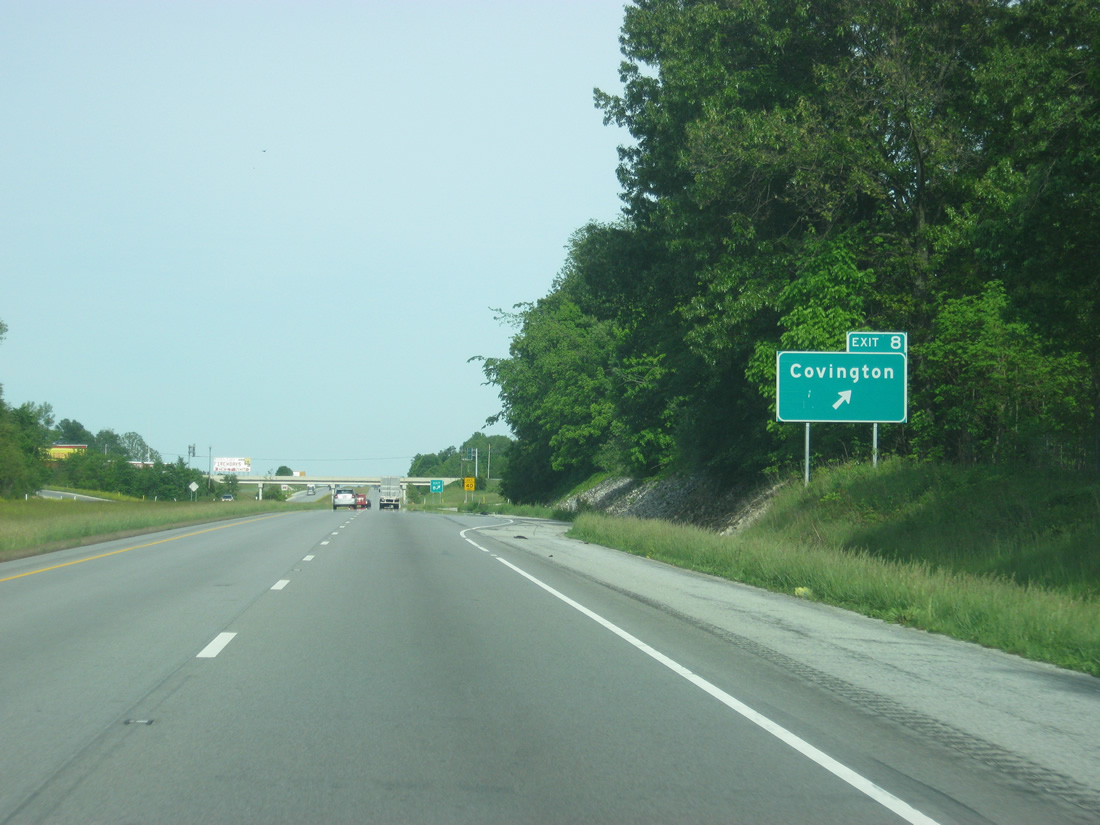
| Exit 8 turns off of eastbound Interstate 74. South of Exit 8, Stringtown Road continues to Coal Creek, becoming a part of SR 32 east of Perrysville. 05/28/12 |
|
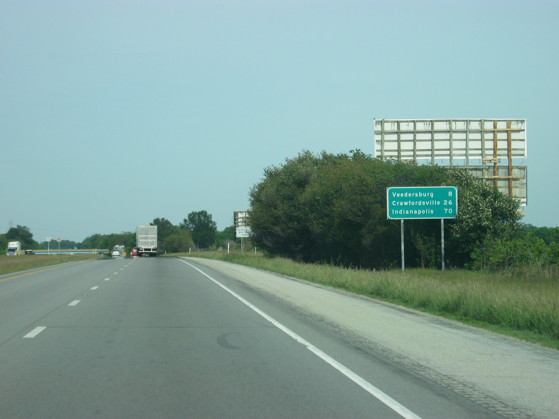
| The town of Veedersburg is eight miles away from Exit 8. Crawfordsville is 26 miles away and Indianapolis is one hour away (based on the speed limit of 70 MPH). 05/28/12 |
|
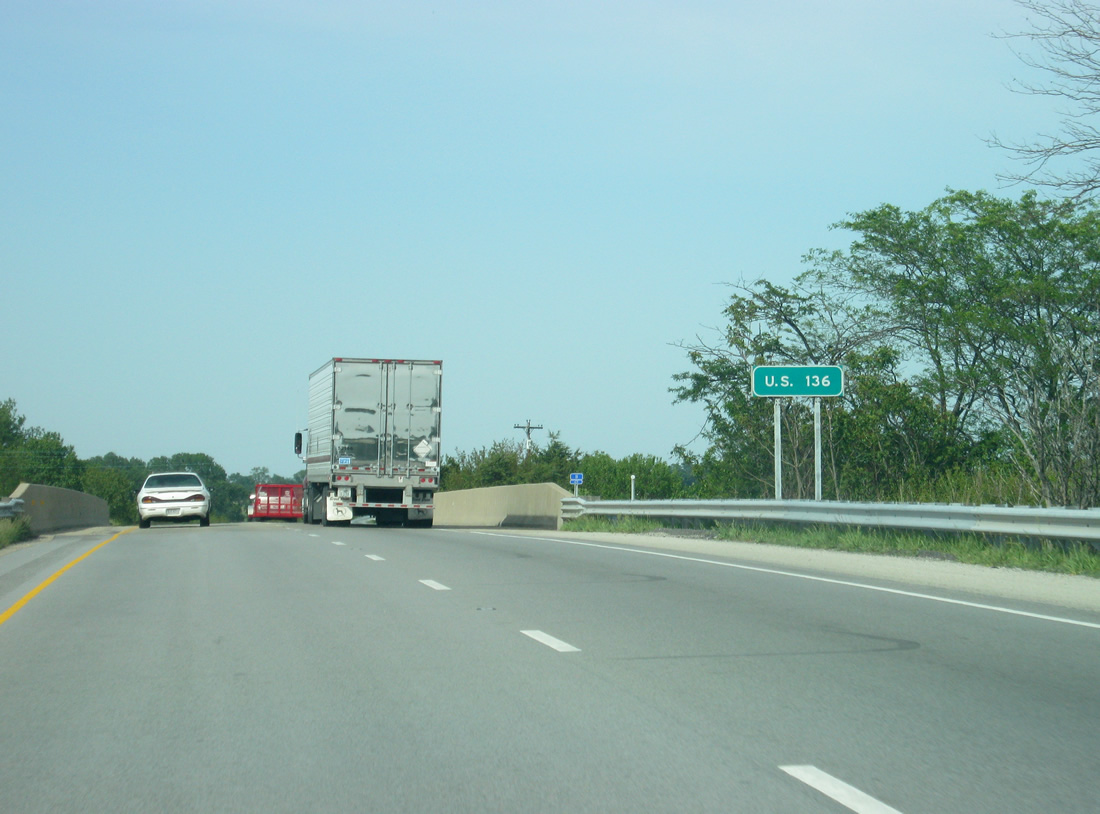
| U.S. 136 swaps sides with Interstate 74 near milepost 11 and Layton. The US highway remains south of the freeway for the remainder of its journey through Veedersburg, Crawfordsville and Brownsburg to its endpoint at Interstate 465 in Indianapolis. 05/28/12 |
|
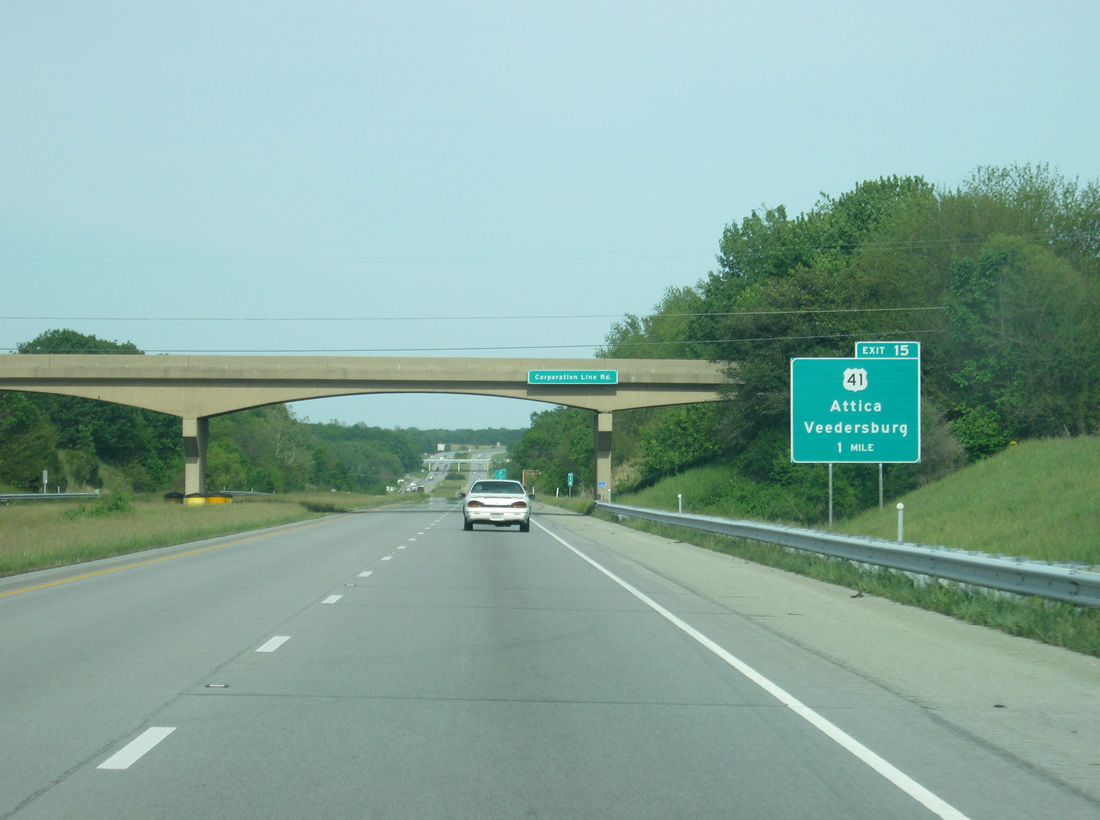
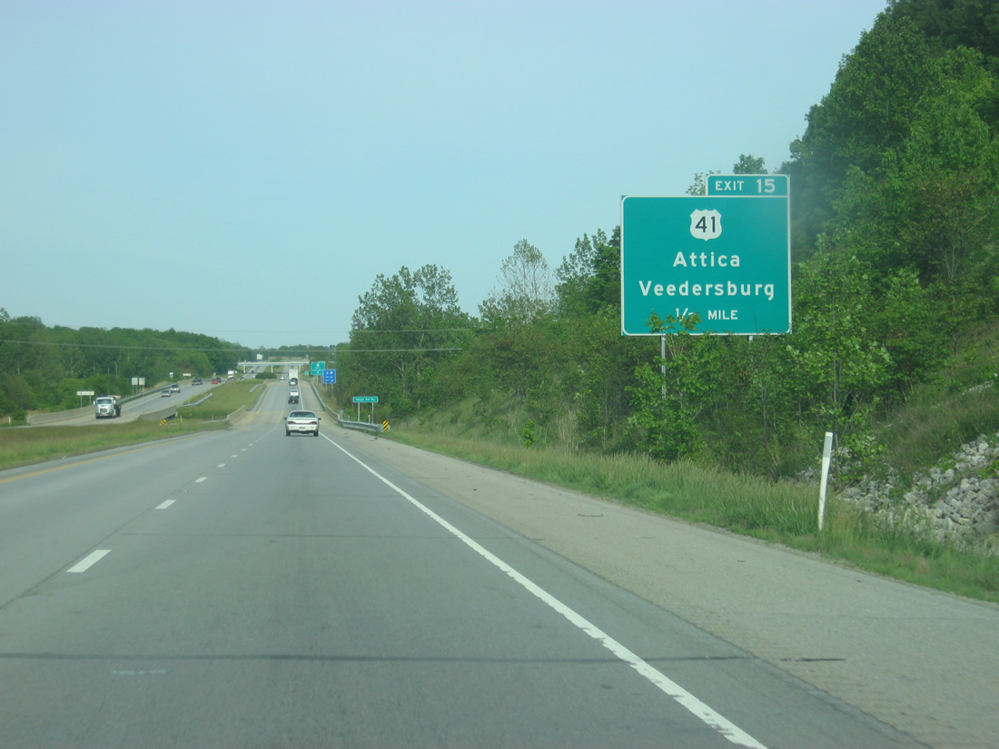
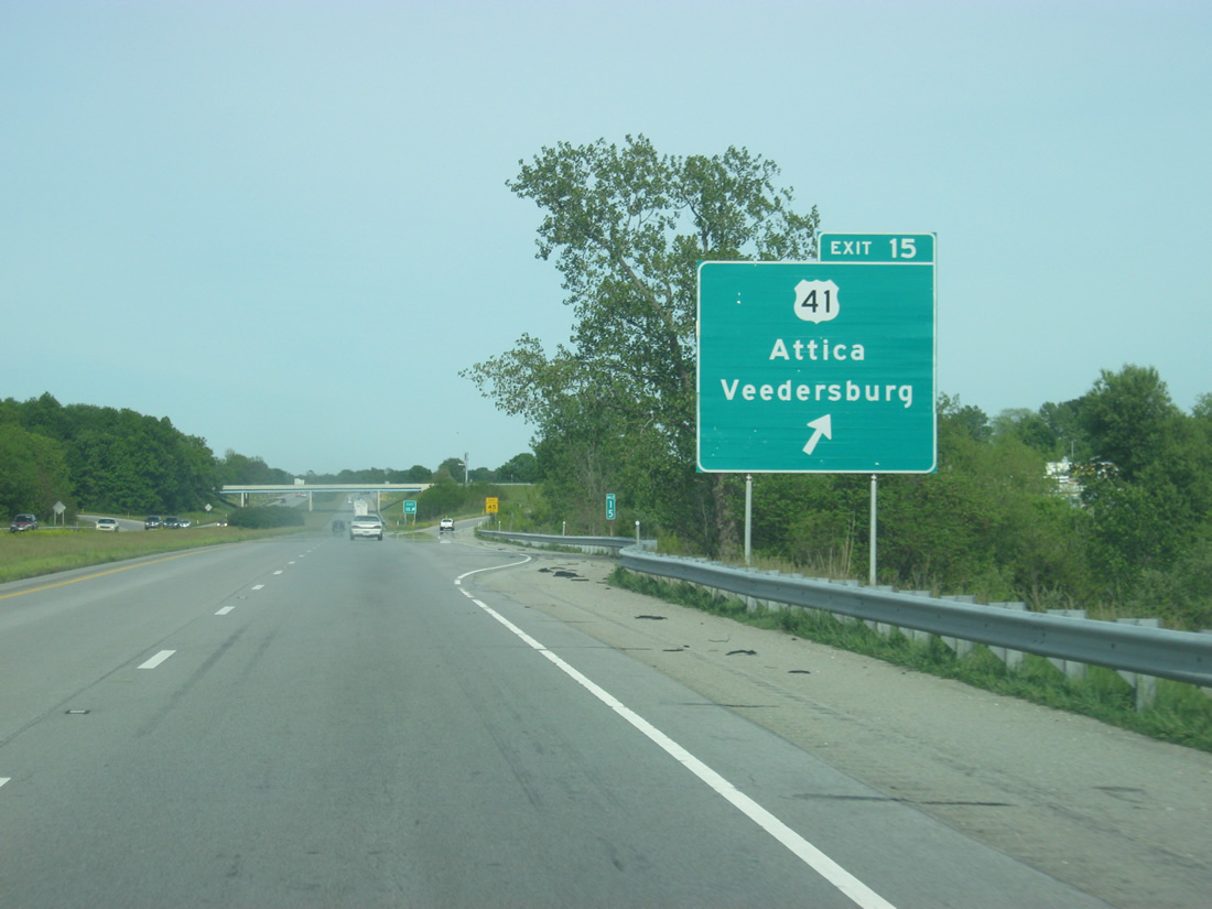
| Meeting the freeway on the outskirts of town is U.S. 41 at a diamond interchange (Exit 15) in one mile. 05/28/12 |
|
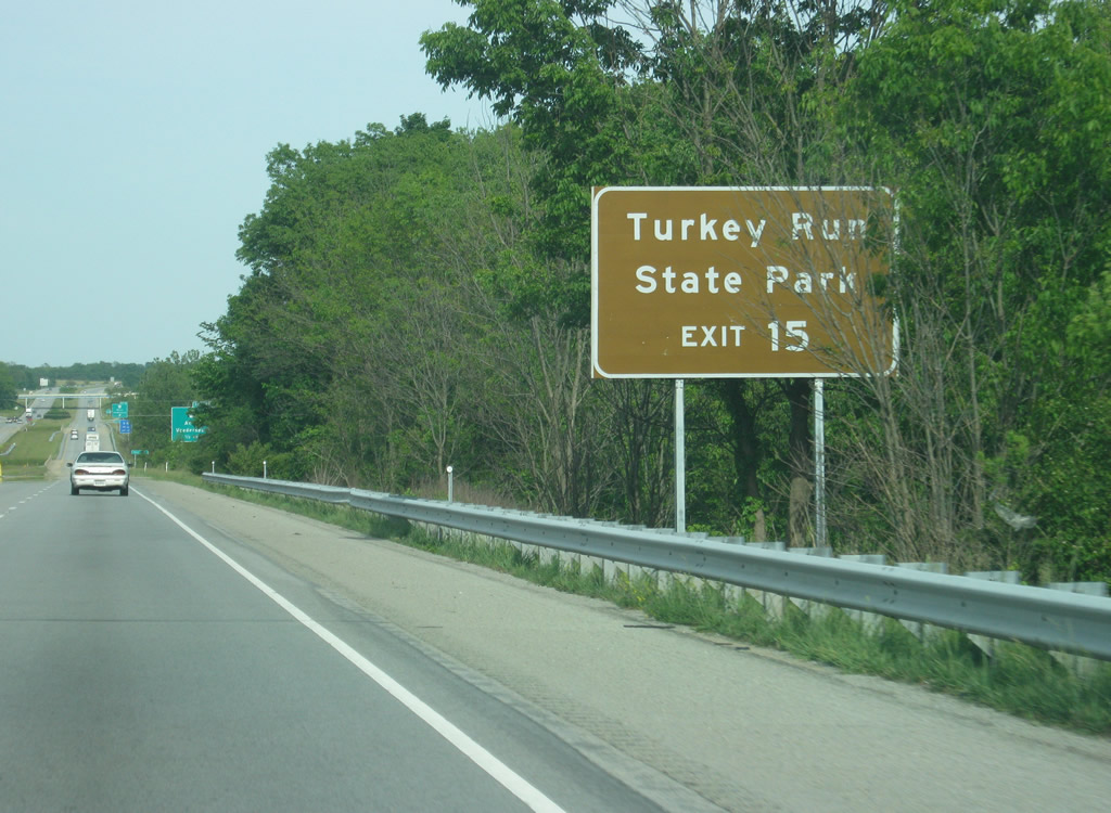
| Turkey Run State Park, among the most popular in the Indiana state park system, is 20 miles to the south along U.S. 41 south and SR 47 east. 05/28/12 |
|
| U.S. 41 comprises a four lane divided highway as it straddles the east side of Veedersburg. The US Route shares a brief overlap with U.S. 136 between East 2nd and State Streets. U.S. 136 follows 2nd Street to the town center. 05/28/12 |
|
| Traveling 280 miles in Indiana, U.S. 41 doubles as the main route between Gary, Hammond and Northwest Indiana to Terre Haute and Evansville. The stretch through Veedersburg and Attica, 11.7 miles to the north, is bypassed as the through route via the SR 63 expressway to the west. U.S. 41 overtakes the expressway from SR 63 near Carbondale to the north. 05/28/12 |
|
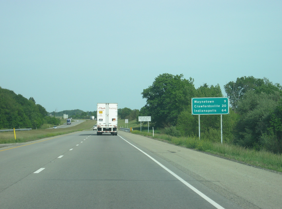
| Waynetown is the next community at a distance of nine miles. Once again, Crawfordsville and Indianapolis are listed at 20 and 64 miles respectively. 05/28/12 |
|
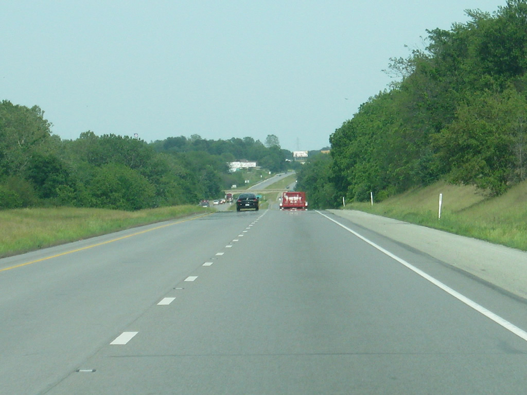
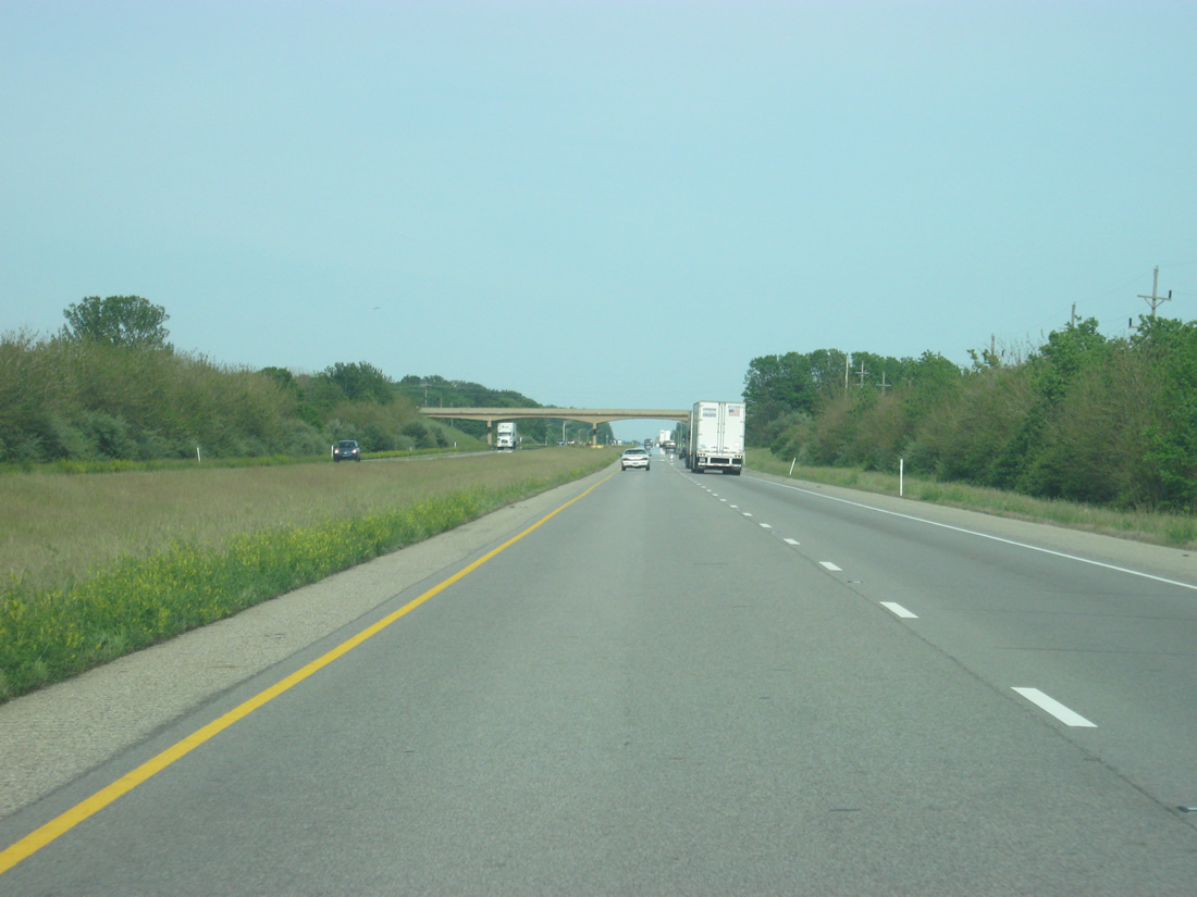
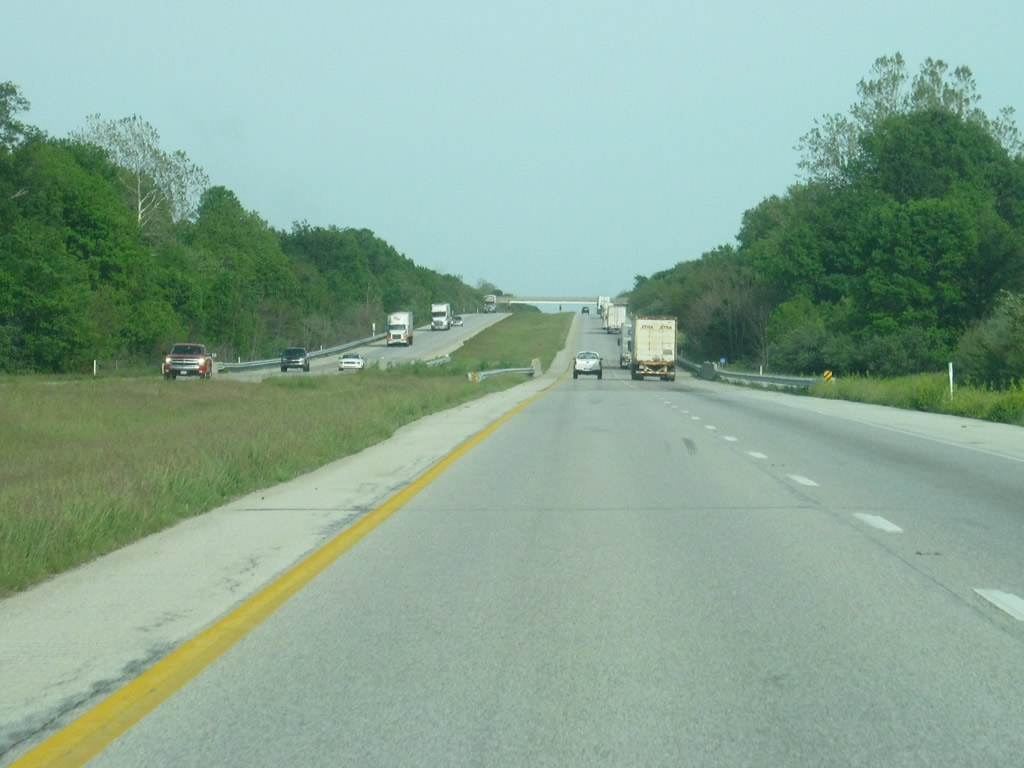
| Views of Interstate 74 as it treks across eastern Fountain County. 05/28/12 |
|
| Further east, a set of abandoned weigh stations lie east of the Epperson / County Road 325 East over crossing. 05/28/12 |
|
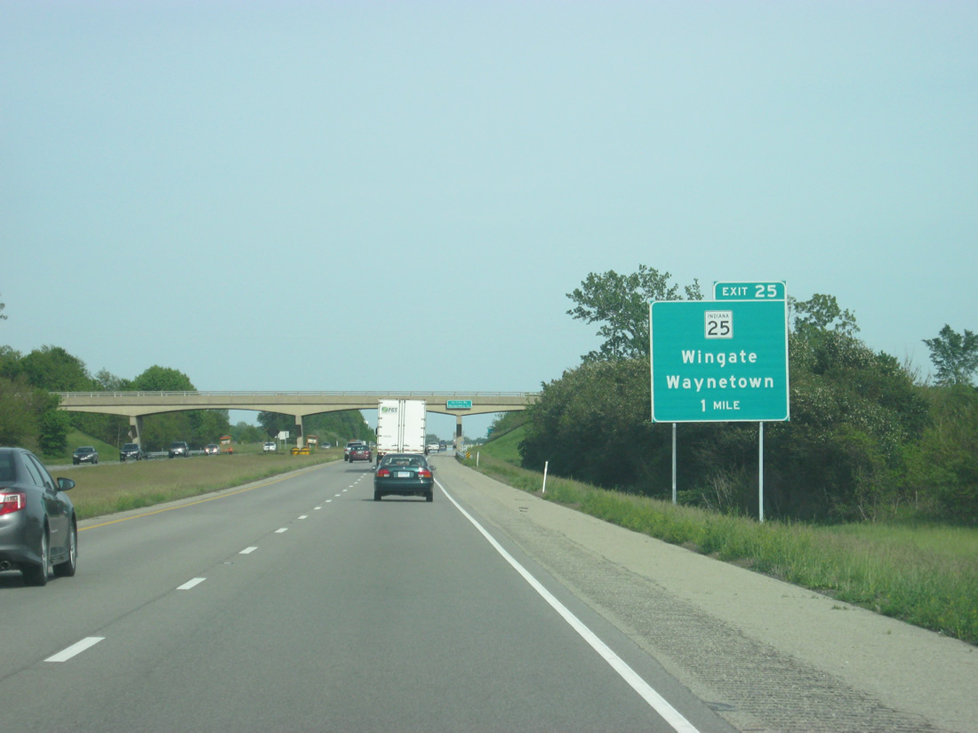
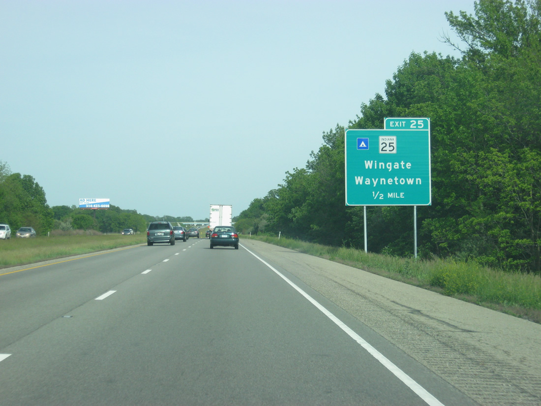
| SR 25 joins Interstate 74 with Wingate, 4.5 miles north of Exit 25. Waynetown lies just south of the freeway at SR 25 (Wingate Road) and U.S. 136 (Washington Street). 05/28/12 |
|
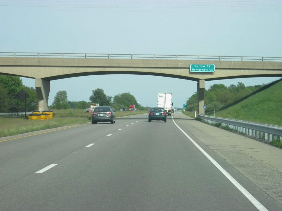
| Within a mile of Exit 25, Interstate 74 crosses into Montgomery County. 05/28/12 |
|
| One half mile east of the Exit 25 ramp departure to SR 25 on Interstate 74 east. SR 25 begins at SR 32, 4.3 miles south of Waynetown, and ends 123 miles to the northeast at Warsaw. A portion of the route doubles as the Hoosier Heartland expressway Corridor between Lafayette and Logansport. 05/28/12 |
|
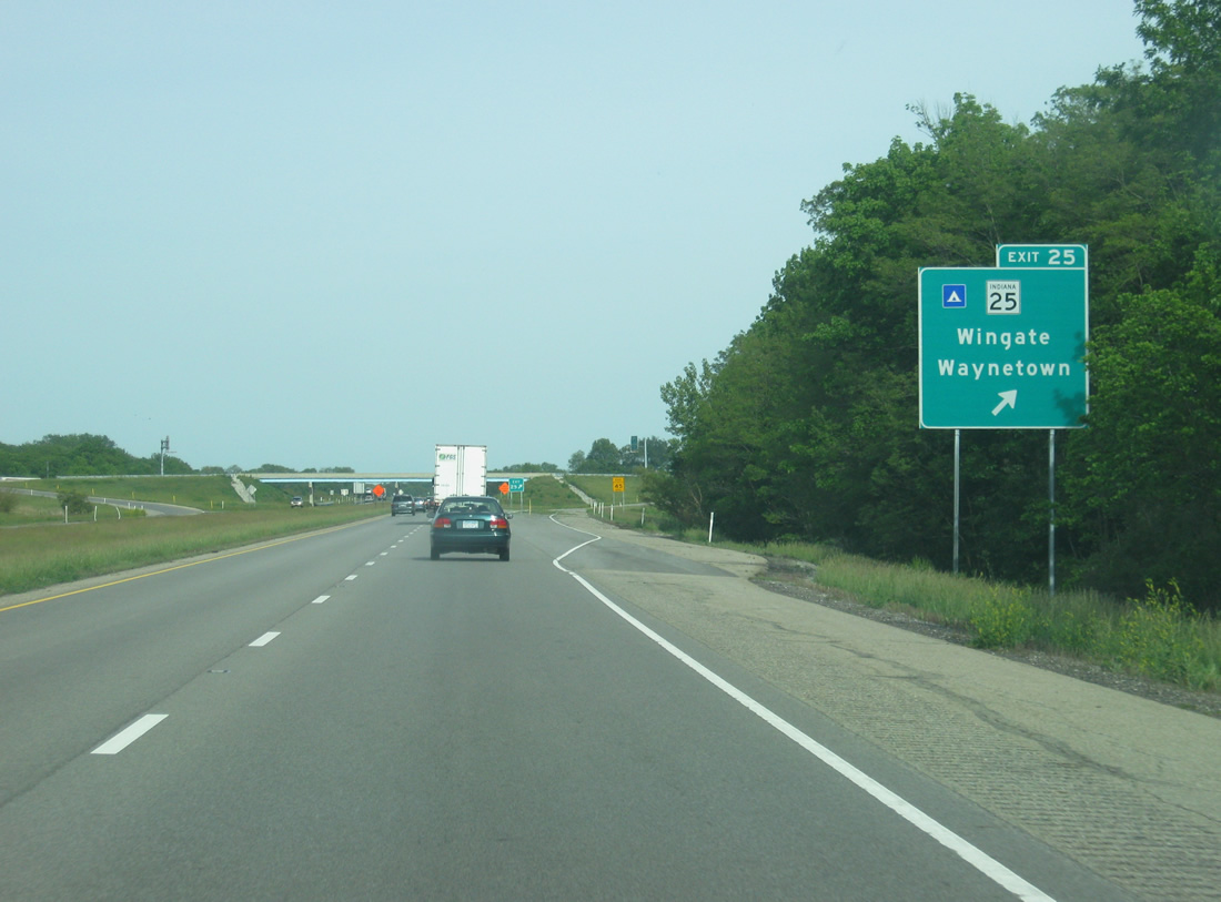
| Interstate 74 eastbound partitions with the Exit 25 ramp to SR 25. SR 25 reaches Lafayette in 28 miles. 05/28/12 |
|
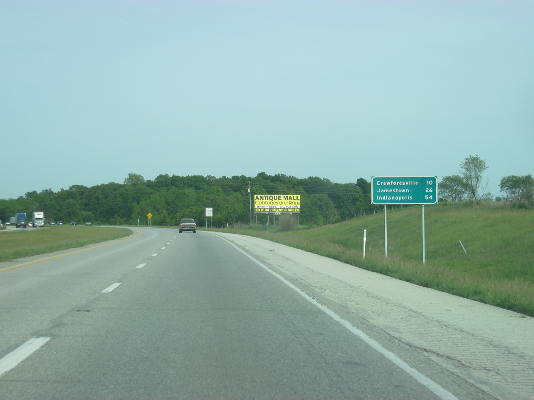
| East of Exit 25, Crawfordsville is now ten miles away. Jamestown (26 miles) and Indianapolis (54 miles) follows. 05/28/12 |
|
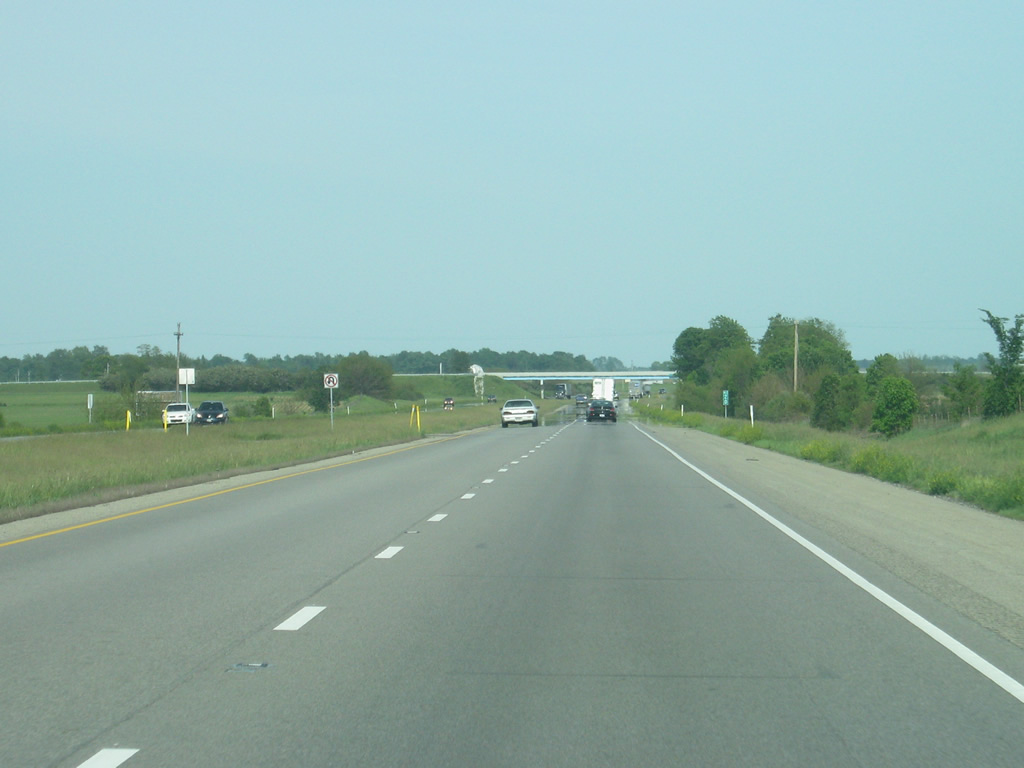
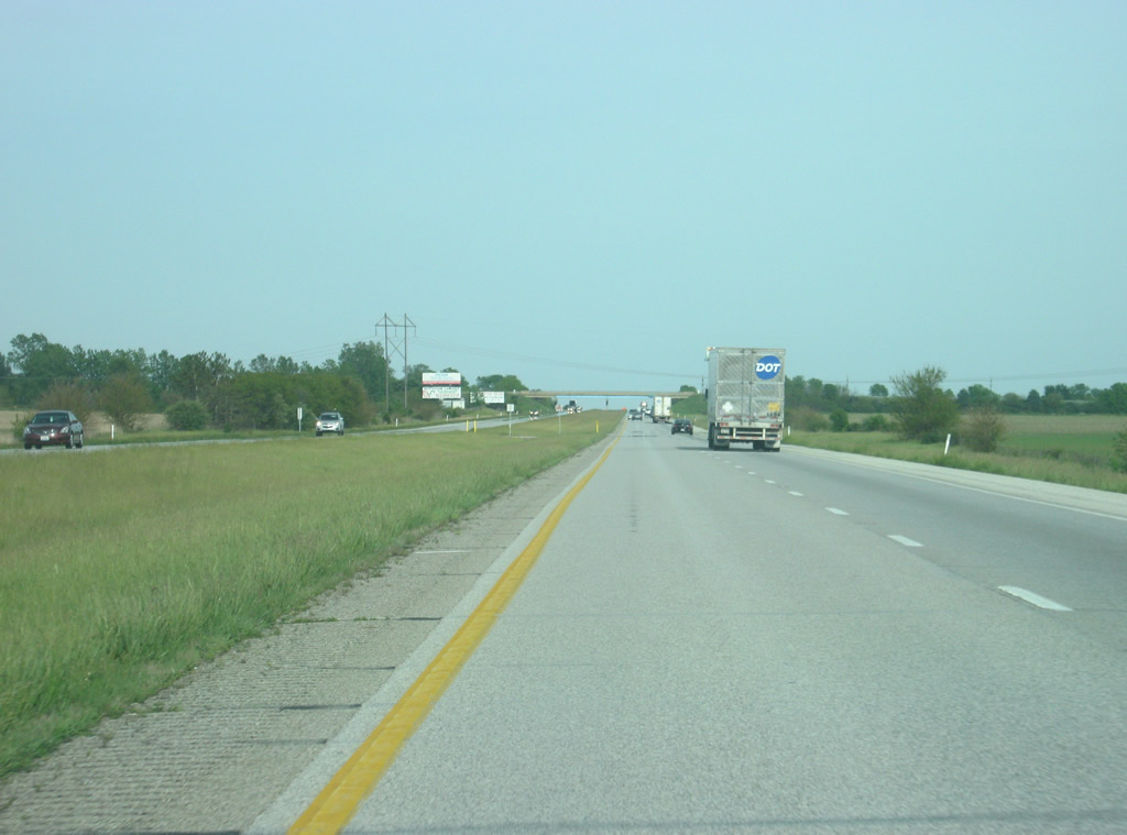
| A view of Interstate 74 in western Montgomery County as it heads toward the Crawfordsville area. 05/28/12 |
|
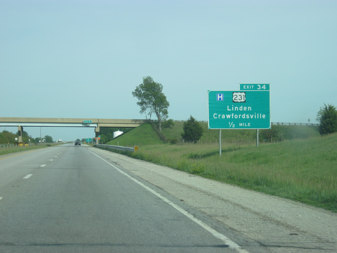
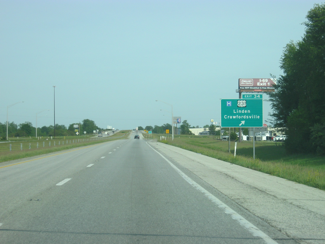
| Approaching the Crawfordsville area and the folded diamond interchange (Exit 34) with U.S. 231 on I-74 east. 05/28/12 |
|
| U.S. 231 joins downtown Crawfordsville with Interstate 74 via Lafayette Road to the south and with Linden some seven miles to the north. The US Route travels 297 miles in Indiana between St. John, its northern terminus, and the Kentucky state line near Rockport. 05/28/12 |
|
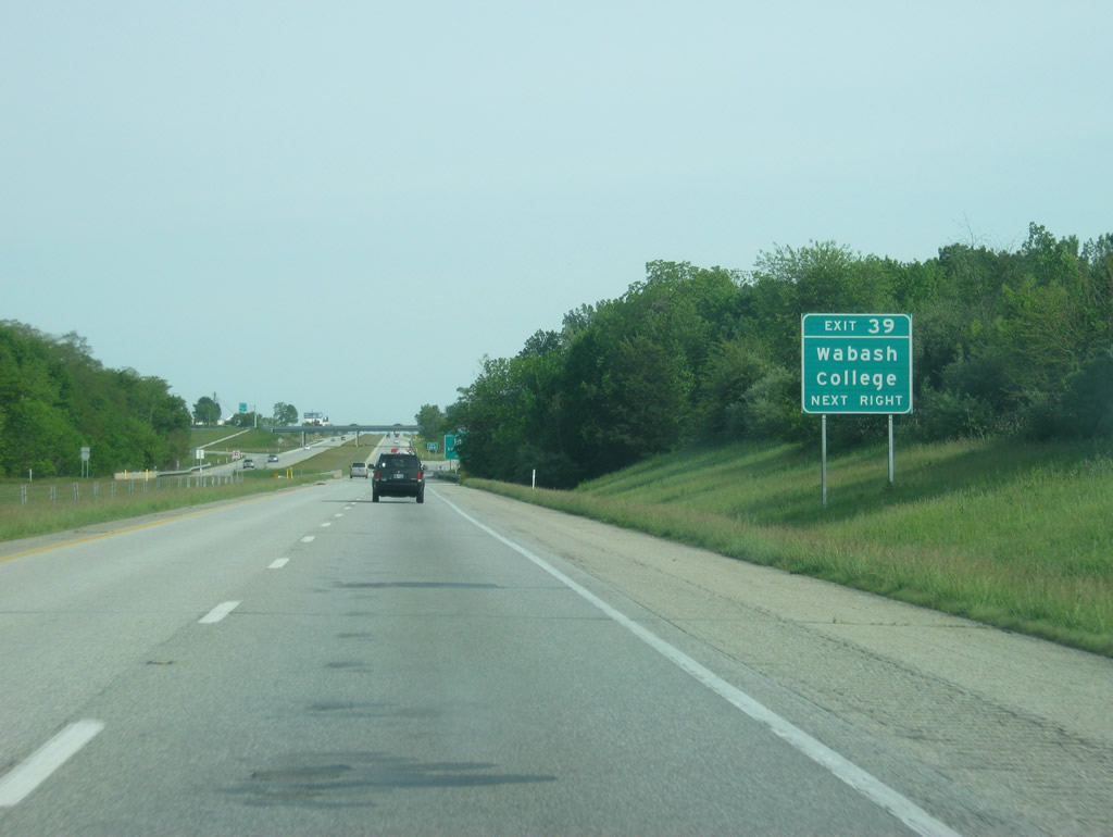
| Wabash College, a small, private liberal arts college for men, is located in the heart of Crawfordsville, a couple of miles to the south of Interstate 74. 05/28/12 |
|
| Exit 34 turns off to U.S. 231 from Interstate 74 east. U.S. 231 heads south from downtown Crawfordsville with SR 32 and 47 to South Boulevard. There SR 32 turns west to Yountsville and SR 47 southwest to Waveland. U.S. 231 continues south to Greencastle. 05/28/12 |
|
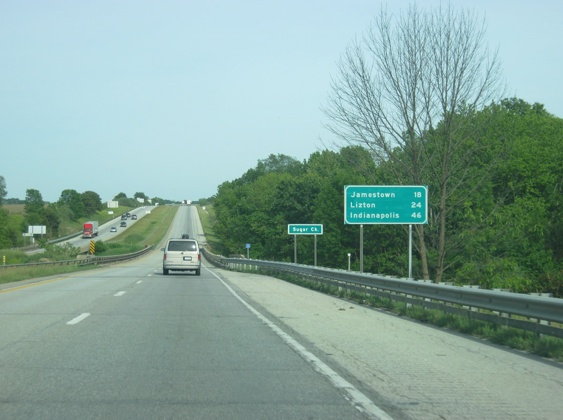
| Lowering into a valley to span Sugar Creek, Jamestown is 18 miles away via Interstate 74. Lizton is 24 miles away and Indianapolis is 46 miles off. 05/28/12 |
|
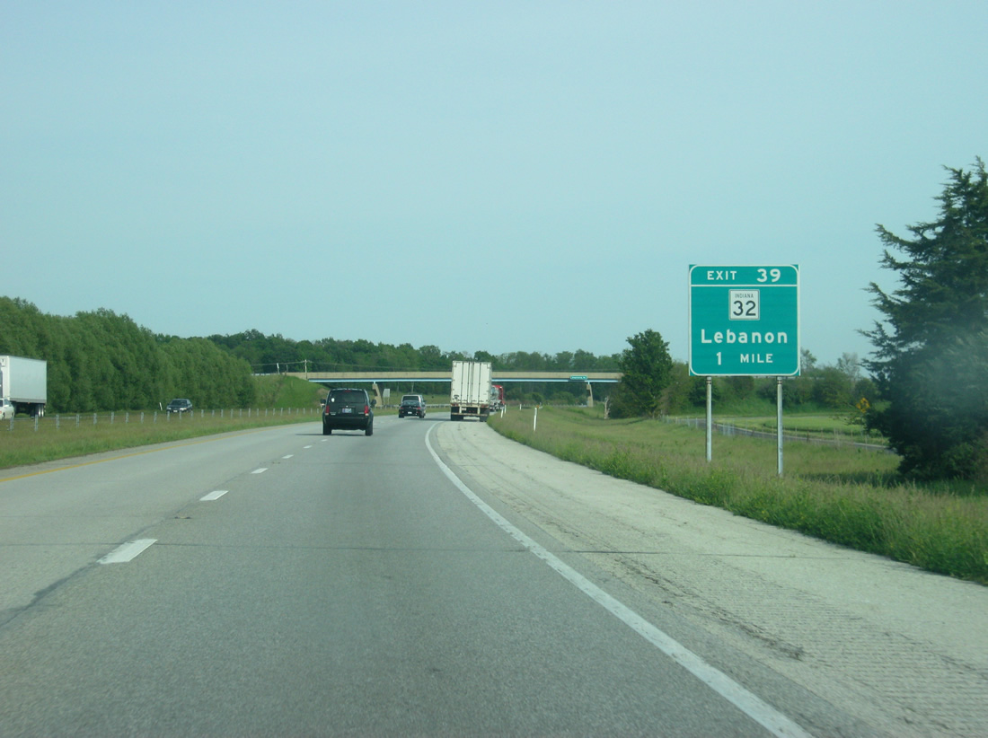
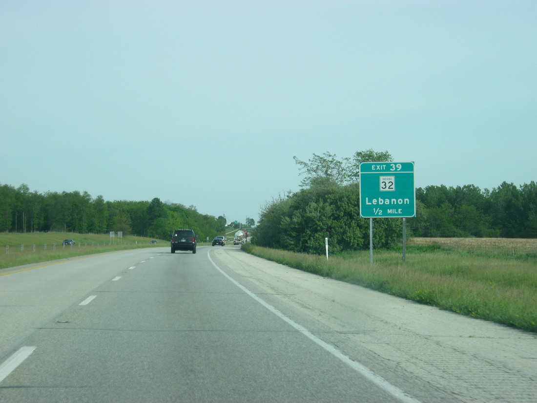
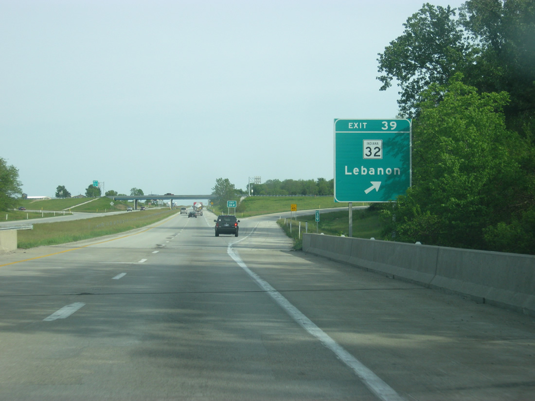
| SR 32 parallels Little Sugar Creek west from Shannondale to meet Interstate 74 at Exit 39 near Smartsburg in one mile. 05/28/12 |
|
| Heading east, SR 32 leaves Exit 39 for Lebanon, 22 miles away via the towns of Shannondale and Dover. 05/28/12 |
|
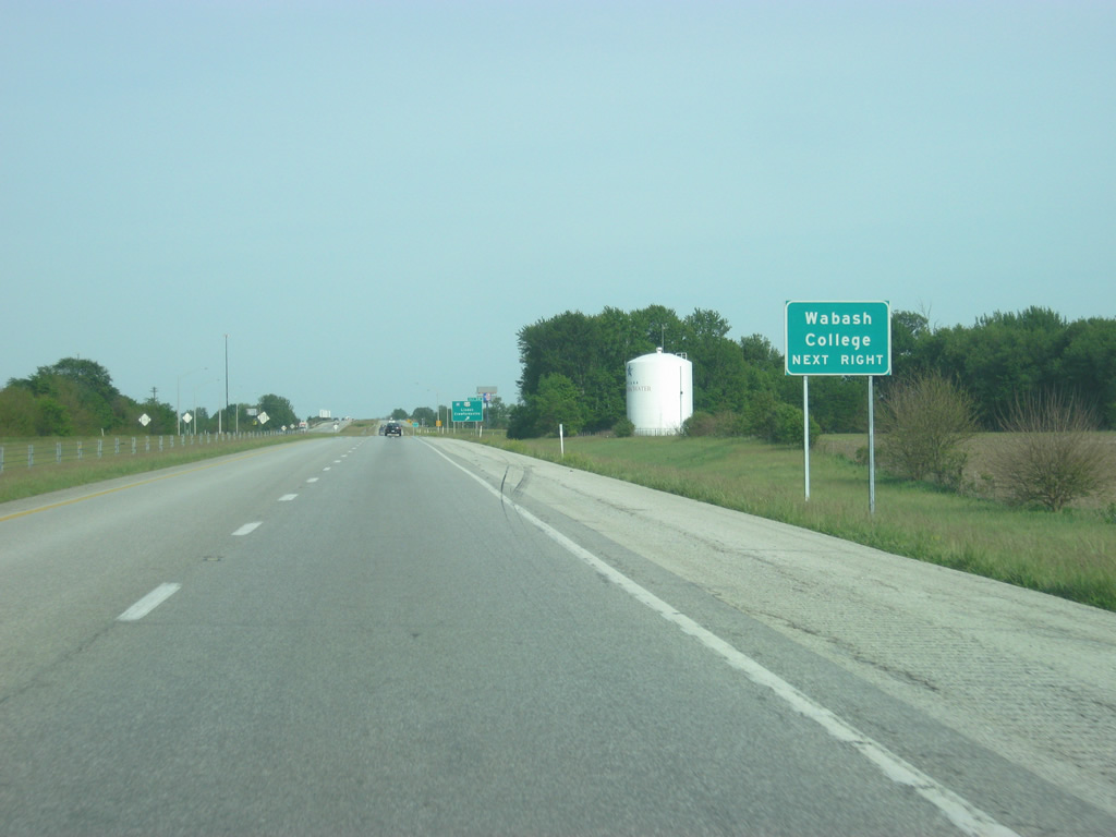
| Another guide sign for Wabash College, which can be reached via SR 32 to the west back into Crawfordsville. 05/28/12 |
|
| SR 32 comprises a 156.8 mile cross-state route west from Crawfordsville to Perrysville and the Illinois state line and east to Lebanon, Westfield, Noblesville, Anderson, Muncie, Winchester, and the Ohio state line at Union City. 05/28/12 |
|
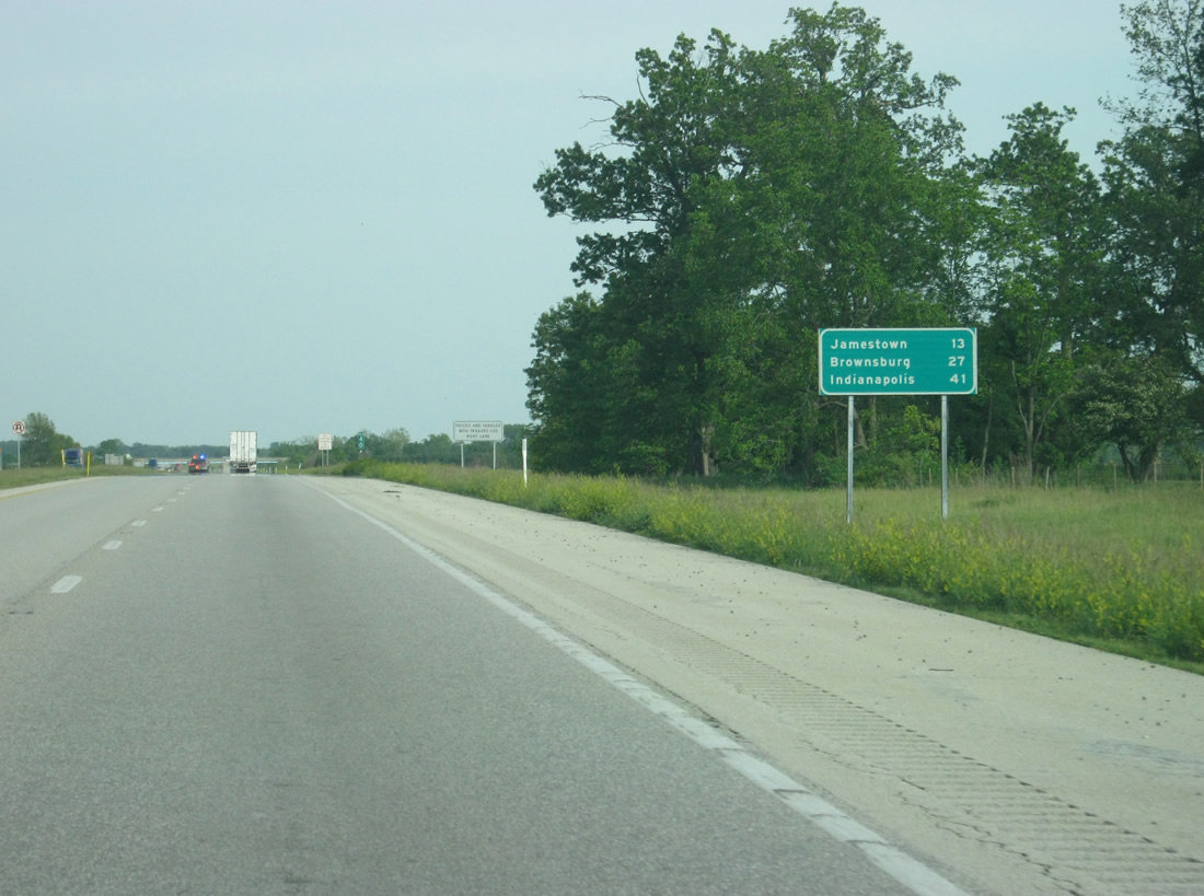
| Jamestown is now the next town at a distance of 13 miles. Brownsburg, part of the Indianapolis western suburbs, is 27 miles away with Indianapolis at a distance of 41 miles. 05/28/12 |
|
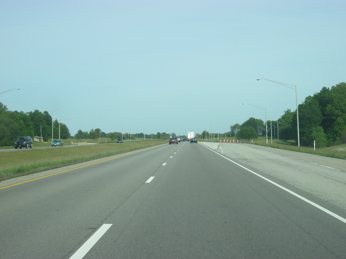
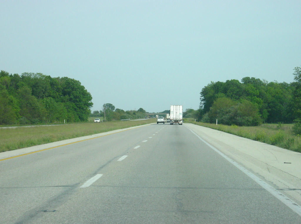
| Scenes from Interstate 74 as it crosses eastern Montgomery County en route toward the Greater Indianapolis area. 05/28/12 |
|
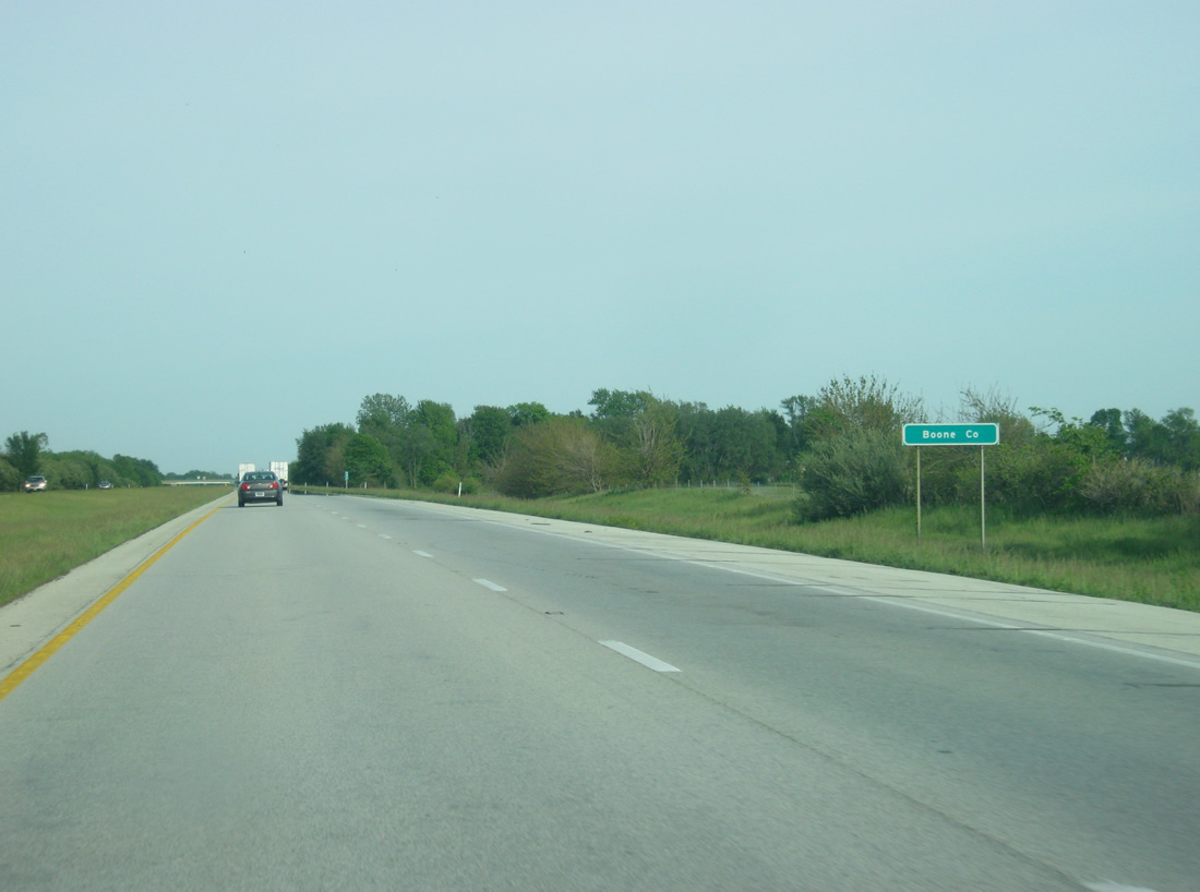
| Interstate 74 travelers enter the southwestern corner of Boone County. 05/28/12 |
Page Updated 02-27-2013.

 East
East