|
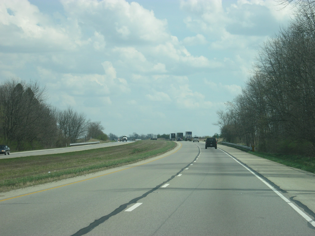
| Now within Decatur County, Greensburg is 12 miles away. Cincinnati is now about an hour away. 03/19/12 |
|
| I-74/U.S. 421 south continue toward the southeast as they descend into the valley of Clifty Creek en route to Greensburg. 03/19/12 |
|
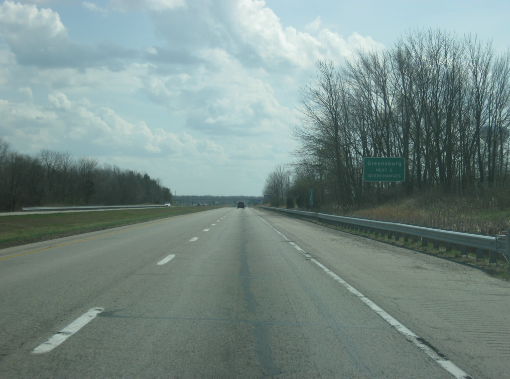
| Nearing the central part of Decatur County, the next two exits serve the county seat of Greensburg, which is typically viewed as the midway point between Indianapolis and Cincinnati along Interstate 74. 03/19/12 |
|
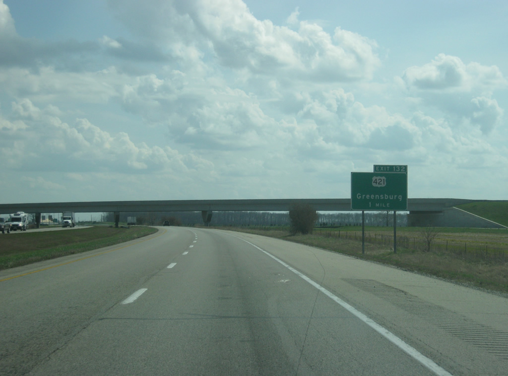
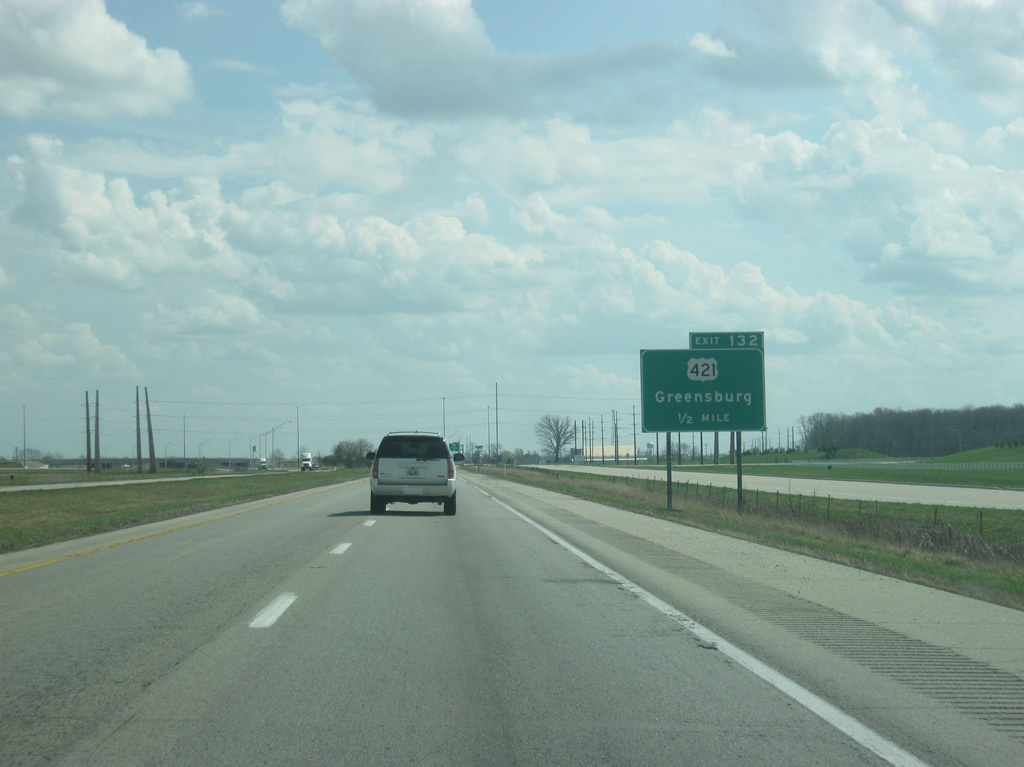
| U.S. 421 will break off from Interstate 74 in one mile at Exit 132 on the northwest side of Greensburg. Construction reconfigured Exit 132 into a six-ramp parclo interchange on July 9, 2008 with new Overpass Road looping north and west from U.S. 421 to serve a Honda auto assembly plant built to the west. 03/19/12 |
|
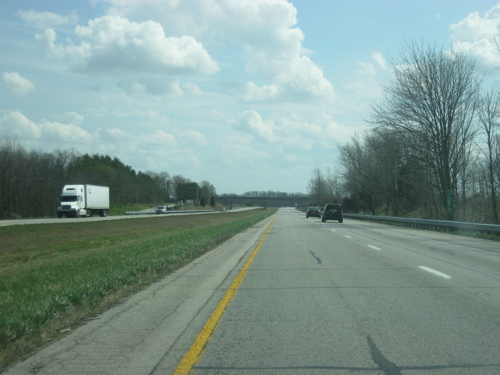
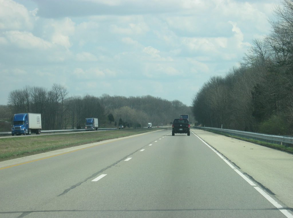
| U.S. 421 heads southeast from Interstate 74 to a southerly course between Greensburg, Versailles and Madison. The US highway totals 232 miles in Indiana overall between the Ohio River and a northern terminus at Michigan City. Old U.S. 421, rebuilt to serve the Honda plant, is seen to the right. The new Honda plant looms in the distance to the west of the interstate. 03/19/12 |
|
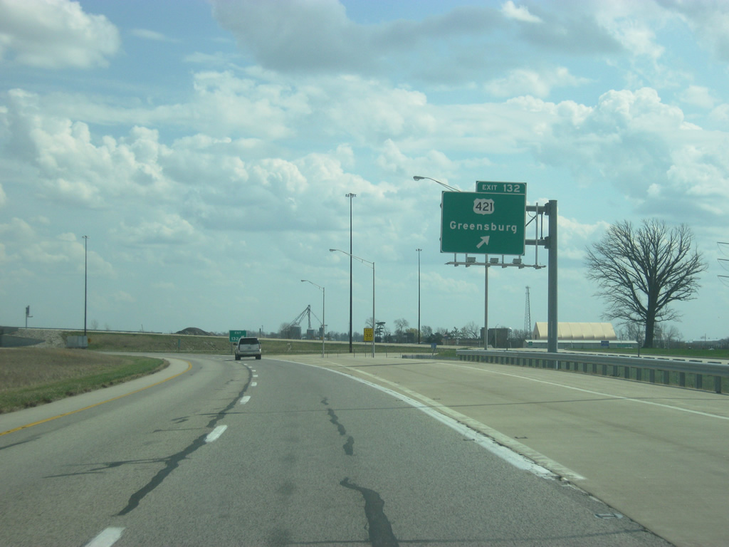
| Exit 132 breaks off for U.S. 421 at Overpass Road, which links to Michigan Road before heading southeast into the city of Greensburg. The interchange original consisted of a directional Y interchange that could only be reached from eastbound Interstate 74 or from northbound U.S. 421. By July 9, 2008, the interchange had been reconfigured to a parclo. 03/19/12 |
|
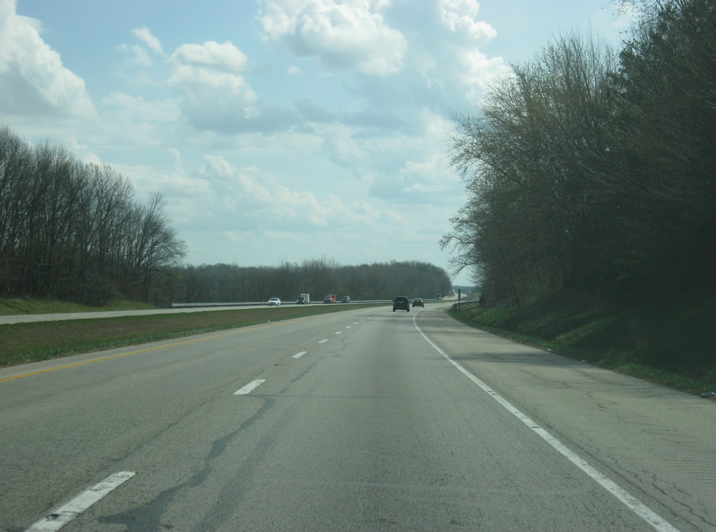
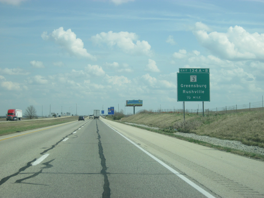
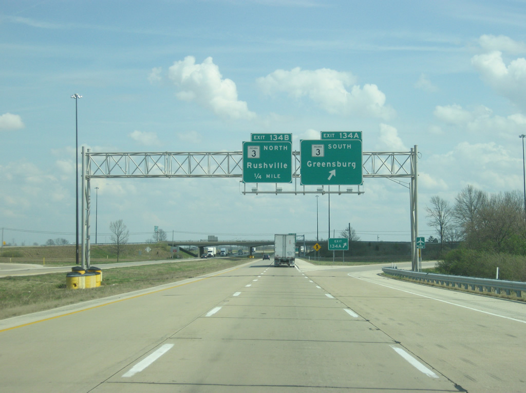
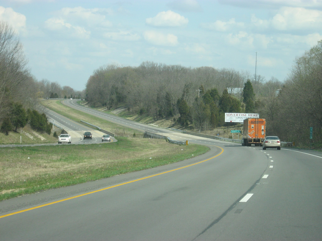
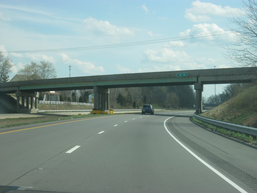
| One mile west of SR 3 along Interstate 74 east. SR 3 comprises a 7.1 mile expressway from Exit 134A to the split with SR 46 west near Ewington. SR 3 travels as a rural two lane road south from there to Westport and North Vernon. SR 46 follows Interstate 74 to the east of Greensburg to its eastern terminus at U.S. 52. 03/19/12 |
|
| SR 3 exists for 178.8 miles from Charlestown to Fort Wayne and again for 44.8 miles from Fort Wayne to Brighton. 03/19/12 |
|
| Exit 134A joins SR 3 south into a commercial area to Lincoln Street (old SR 3). SR 3 south & 46 west combine a West Main Street on the outskirts of town. Greensburg is most known for its famous courthouse tower, which has contained a growing tree at the top for most of the courthouse’s existence, giving the community the nickname of "Tree City." 03/19/12 |
|
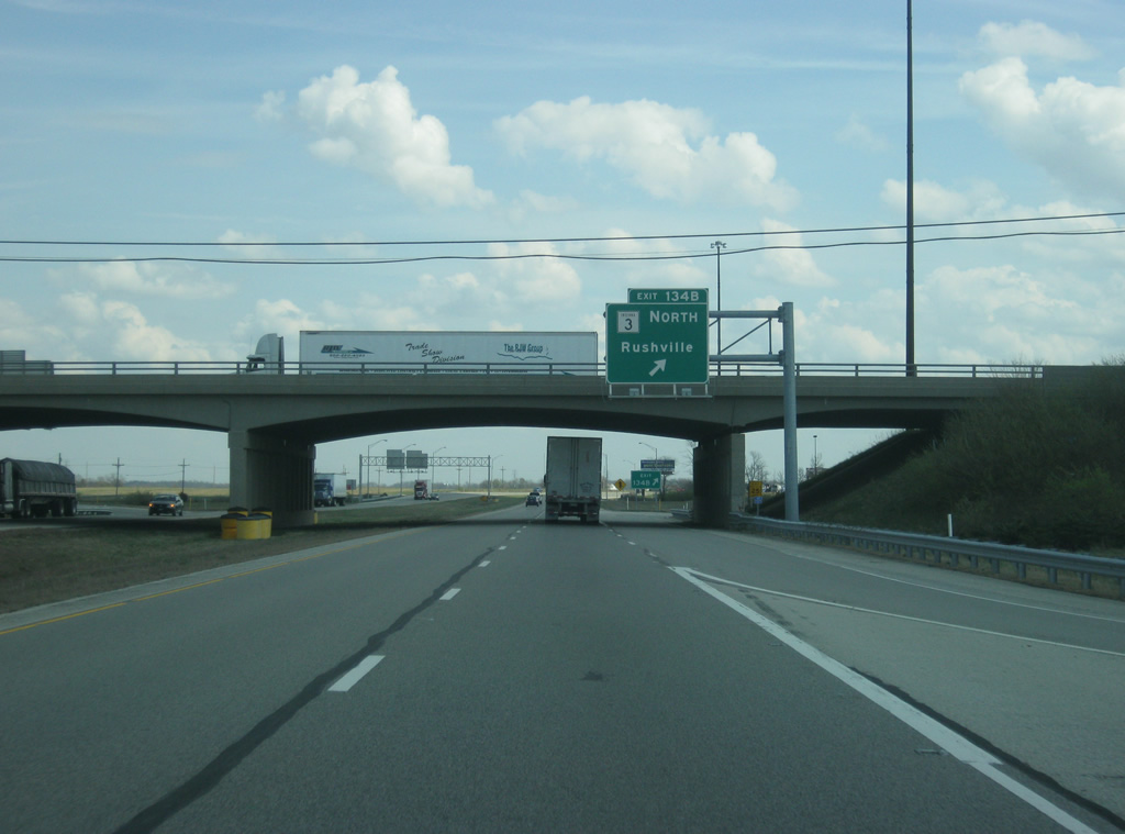
| Drivers bound for Sandusky or Rushville leave Interstate 74 east at Exit 134B for SR 3 north. The Rush county seat is a 17 mile drive to the north. 03/19/12 |
|
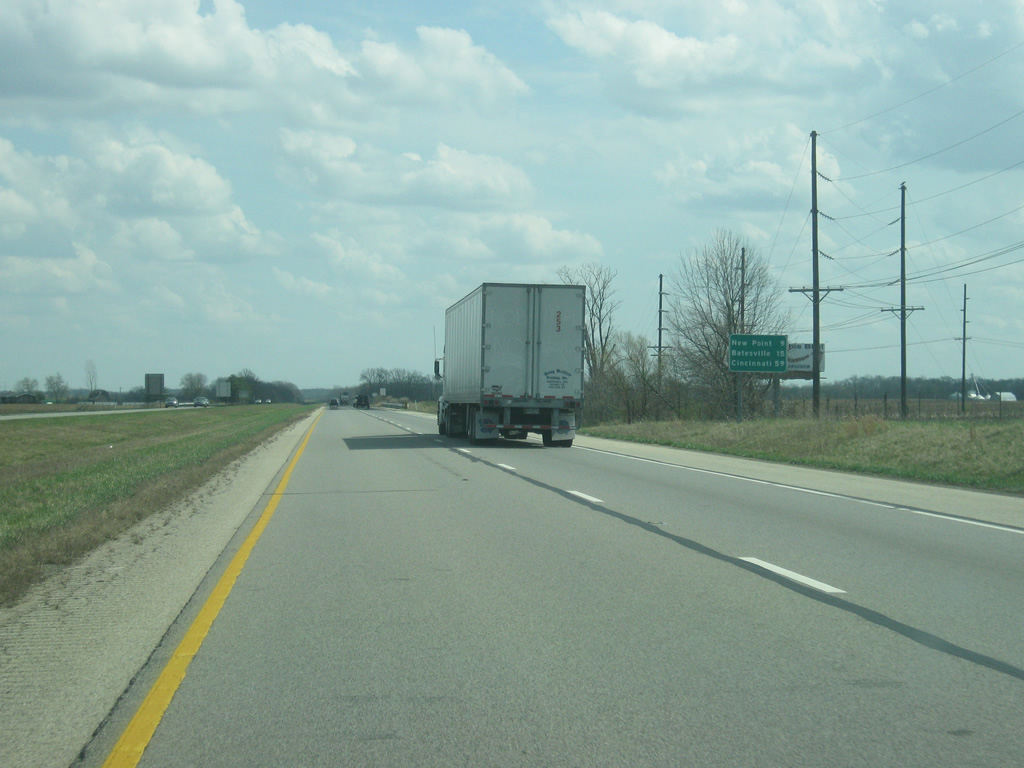
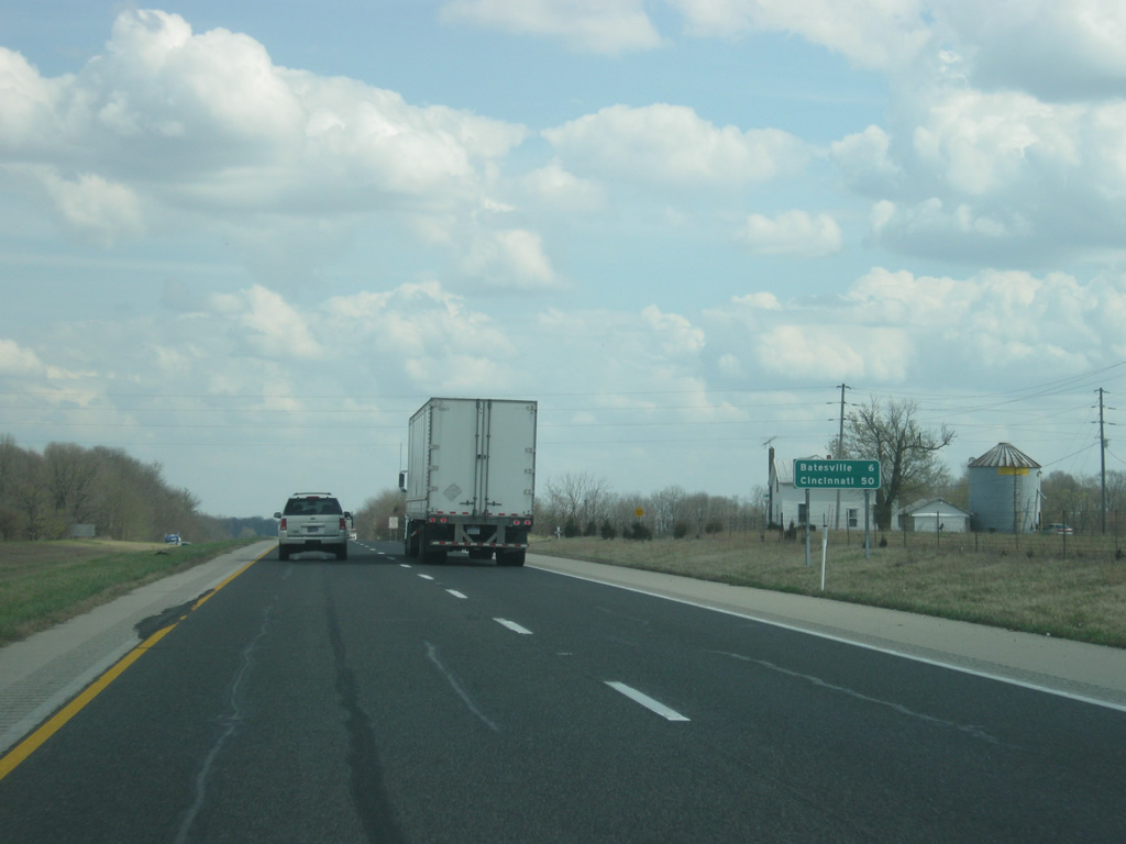
| East of Exit 134A-B and the Greensburg area, Interstate 74 is nine miles from New Point and 15 miles from Batesville. Cincinnati is 59 miles away. 03/19/12 |
|
| East of Greensburg, Interstate 74 begins to enter more wooded terrain as it heads for the hills of Southeast Indiana. From Eastern Decatur County, the agricultural fields that have been abutting the interstate since Illinois start to disappear for smaller farms and hilly terrain. 03/19/12 |
|
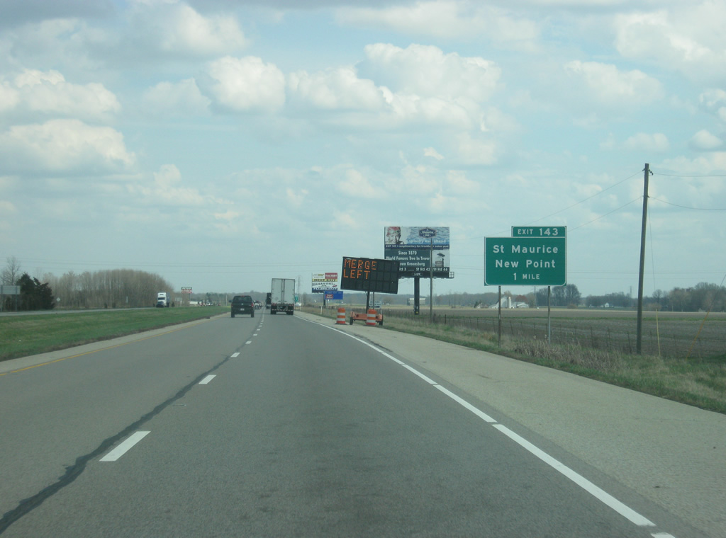
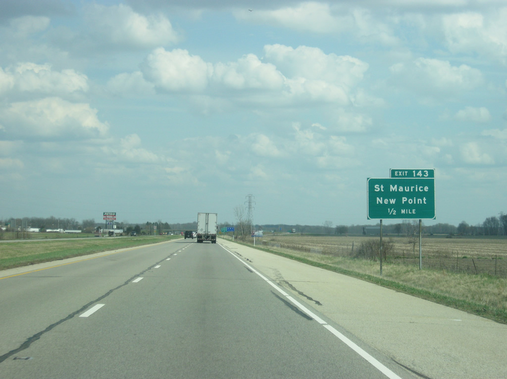
| County Road 850 East sees a diamond interchange (Exit 143) with Interstate 74 in one mile. The town of New Point lies just south of Exit 143 at County Road 850 and SR 46. Rossburg resides on the north side of the freeway. 03/19/12 |
|
| Interstate 74 at the half mile approach to the Exit 143 off-ramp to New Point. County Road 850 meanders north to St. Maurice and County Road 400 North near Lake Santee. 03/19/12 |
|
| Past Exit 143, Batesville is six miles away with Cincinnati at 50 miles. 03/19/12 |
|
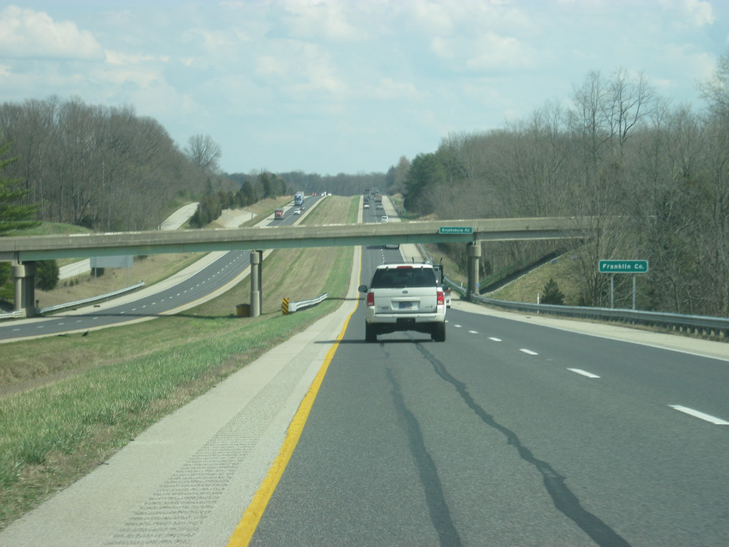
| At the Enochsburg Road overpass, Interstate 74 enters Franklin County. From there, the highway will cross the southwest corner of the county for the next four miles. 03/19/12 |
|
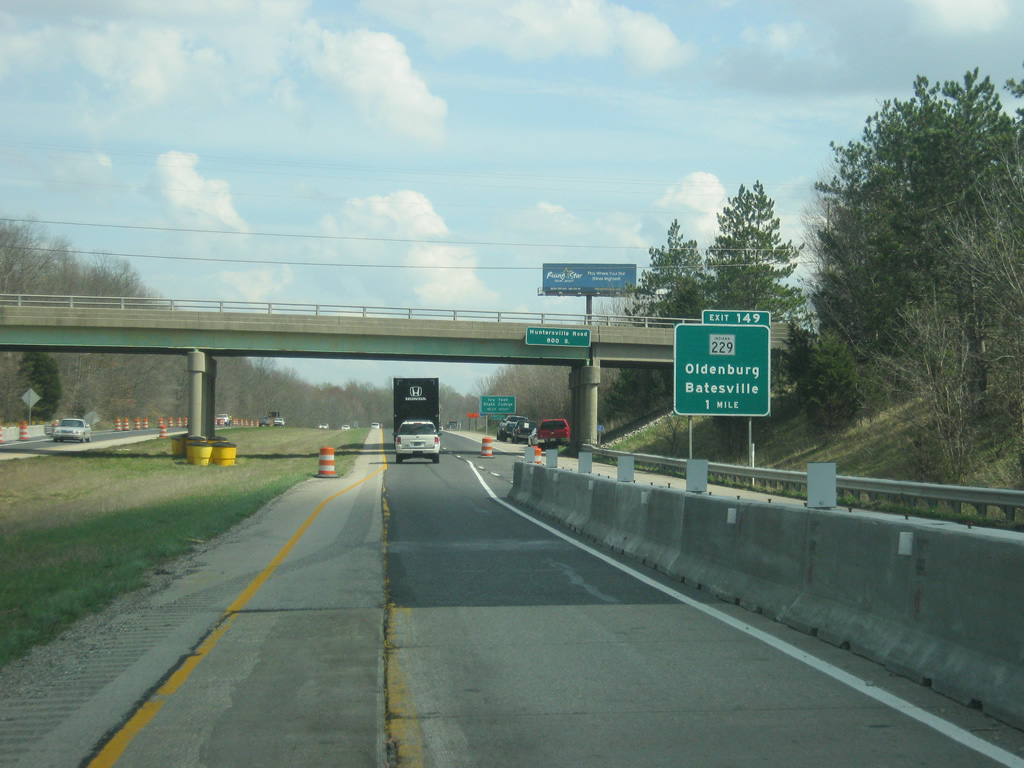
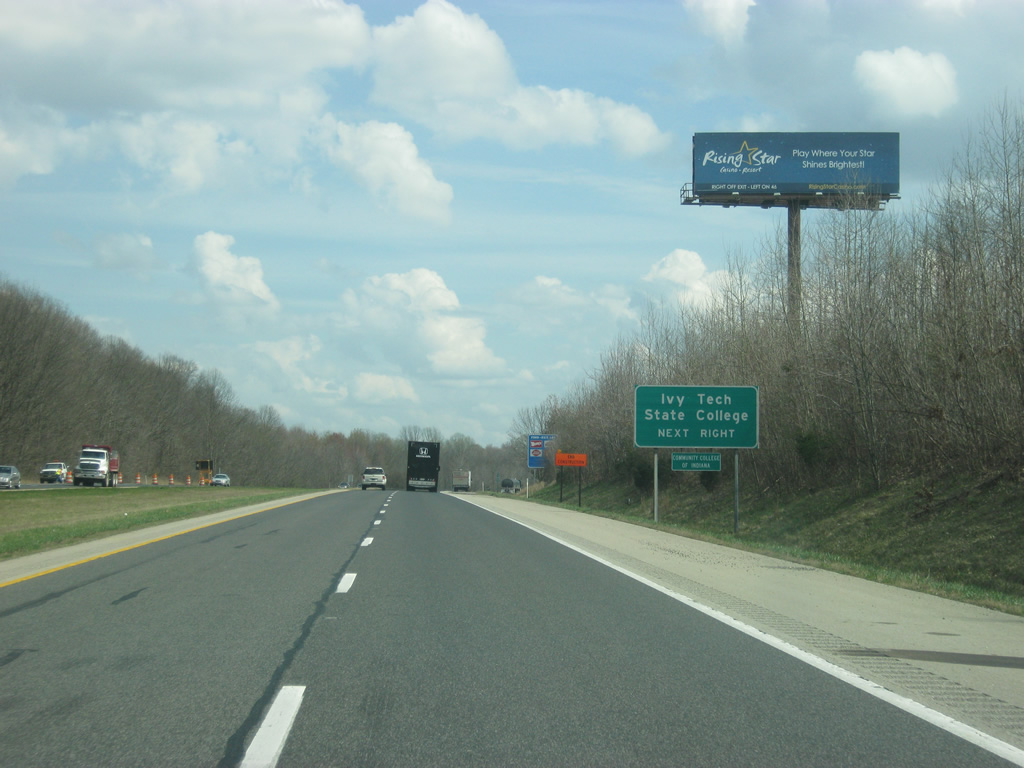
| Continuing east, Interstate 74 advances one mile to a diamond interchange (Exit 149) with SR 229 (Walnut Street south). Ivy Tech Community College has a campus located in Batesville off of Exit 149. 03/19/12 |
|
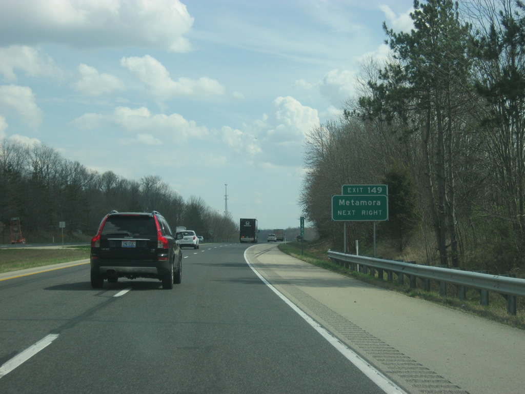
| SR 229 travels 21 miles overall between U.S. 421 at Napoleon to the south and U.S. 52 near Metamora to the north. The historic canal town of Metamora is located 13 miles to the north via SR 229 and U.S. 52. 03/19/12 |
|
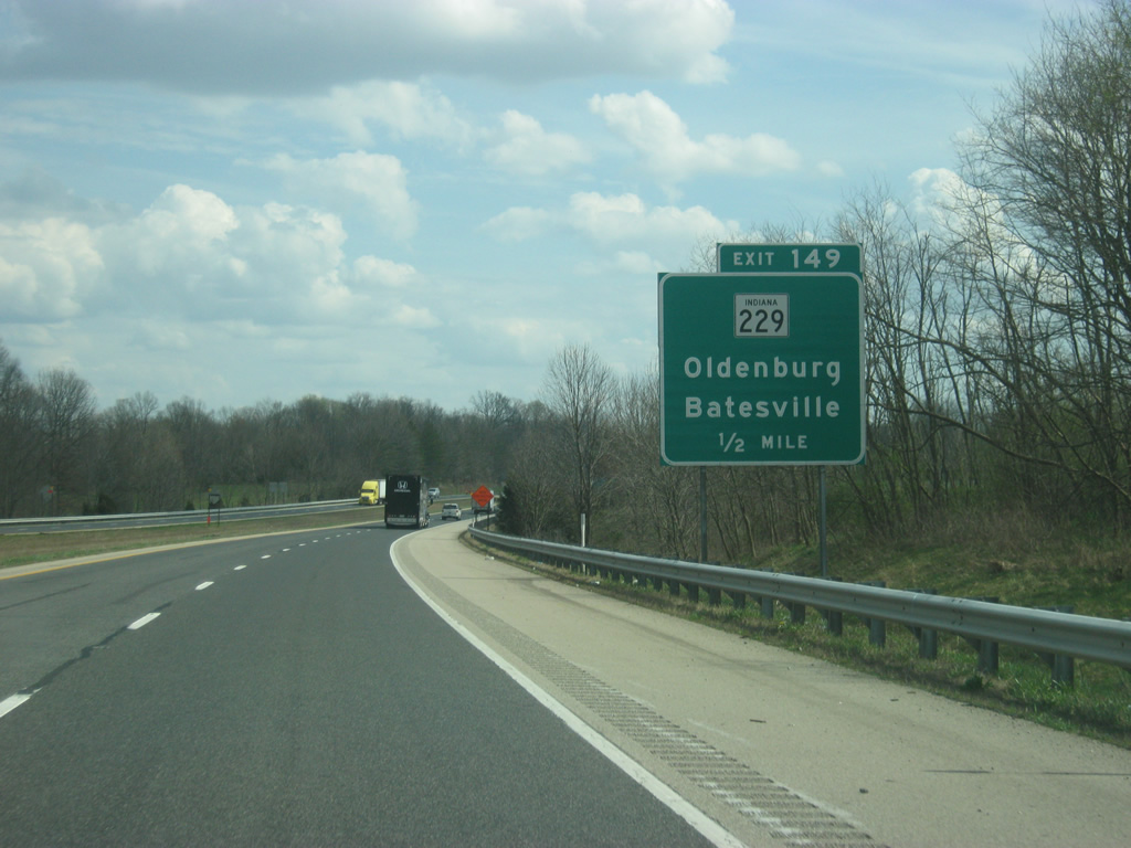
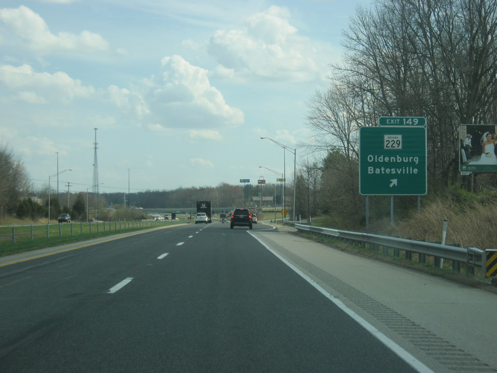
| Exit 149 departs Interstate 74 east for SR 229. Heading north, SR 229 leaves a commercial strip surrounding the freeway on a 2.6 mile drive to Oldenburg. Walnut Street carries the state route south to downtown Batesville and a one block dog leg of Boehringer Street to Main Street. At the SR 229 overpass, Interstate 74 enters northern Ripley County. 03/19/12 |
|
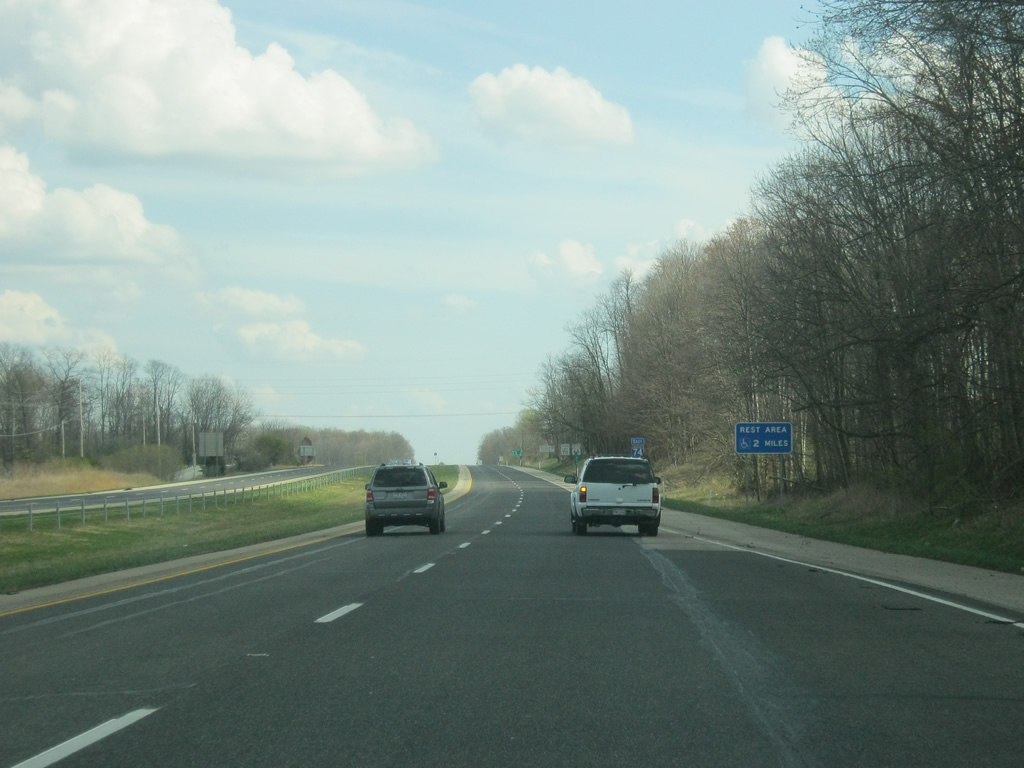
| East of the on-ramp from Exit 149, Interstate 74 is two miles away from the first rest area since the Lizton area west of Indianapolis. There is a 104 mile gap between the two sets of rest areas along Interstate 74. 03/19/12 |
|
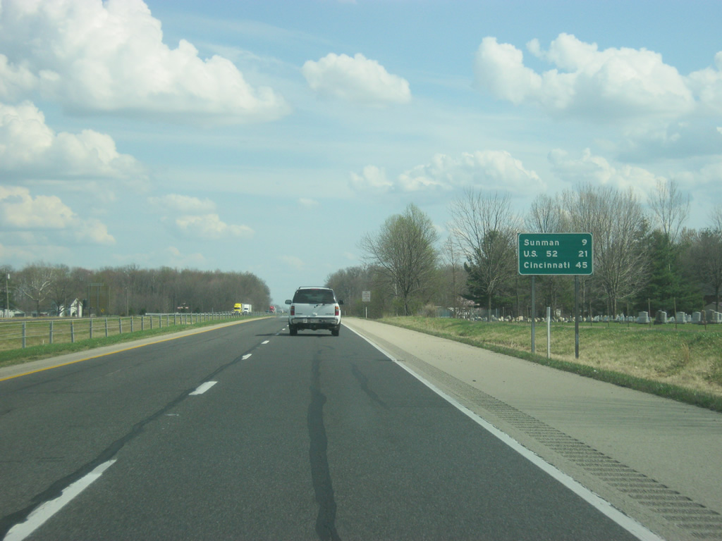
| From east of Exit 149, Sunman is nine miles away. U.S. 52 (Interstate 74's last exit in Indiana) is 21 miles off while Cincinnati is now 45 miles away. 03/19/12 |
|
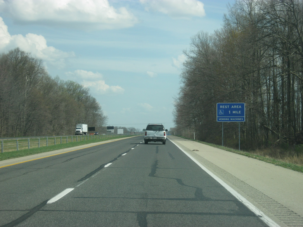
| A mile away from the Batesville rest area, which serves as the final rest area for the Midwestern stretch of Interstate 74 going east. 03/19/12 |
|
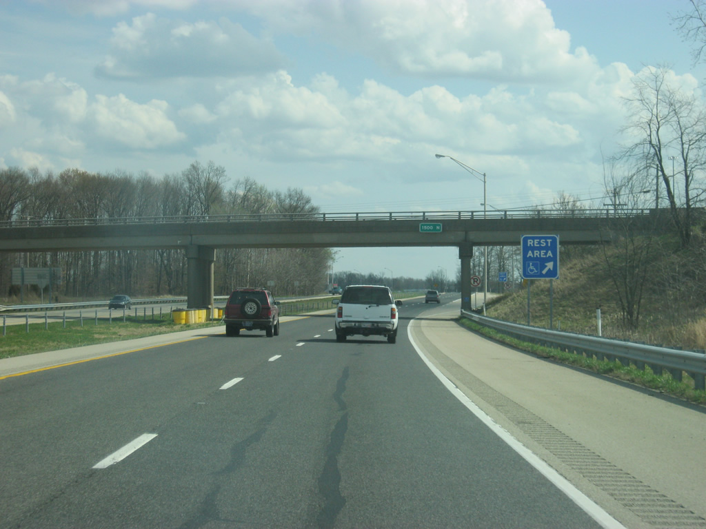
| At the County Road 1500 North overpass, the off ramp to the Batesville rest area leaves Interstate 74 east. On the other side of the highway is the Indiana welcome center, serving westbound Interstate 74 travelers. Both rest areas were rebuilt in 2005. 03/19/12 |
|
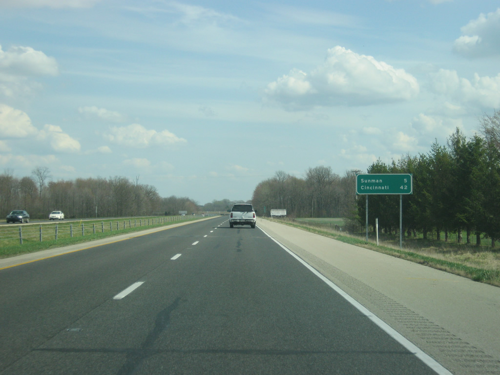
| Another distance sign east of the Batesville rest area gives the distances to Sunman (six miles) and Cincinnati (42 miles). 03/19/12 |
|
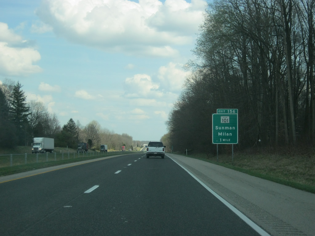
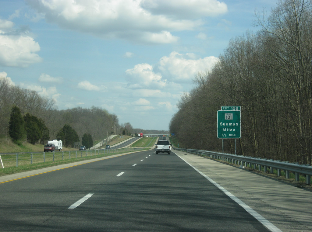
| SR 101 north and St. Mary Road south come together at the Exit 156 diamond interchange with Interstate 74 in one mile. 03/19/12 |
|
| Consisting of four segments, SR 101's southern portion connects Interstate 74 with Sunman, Milan and U.S. 50 along a 17.5 mile route. Two other sections exist to the north: Brookville to Liberty (16.5 miles) and SR 124, east of Monroe, to SR 1 northeast of Fort Wayne (45 miles). A fourth section briefly exists in Switzerland County as a connector between SR 156 and Kentucky 1089 across the Markland Dam over the Ohio River. 03/19/12 |
|
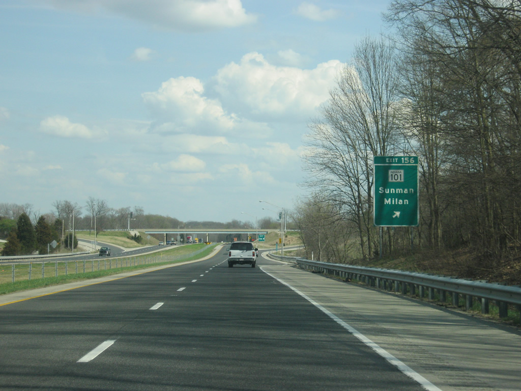
| Eastbound Interstate 74 at the Exit 156 ramp departure to SR 101 south and St. Mary Road north. Penntown (SR 46) lies nearby. St. Mary Road north otherwise splits with Rosfeld Road to Pine Road near the settlement of St. Peter. 03/19/12 |
|
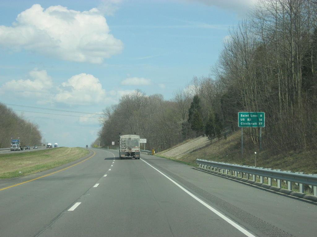
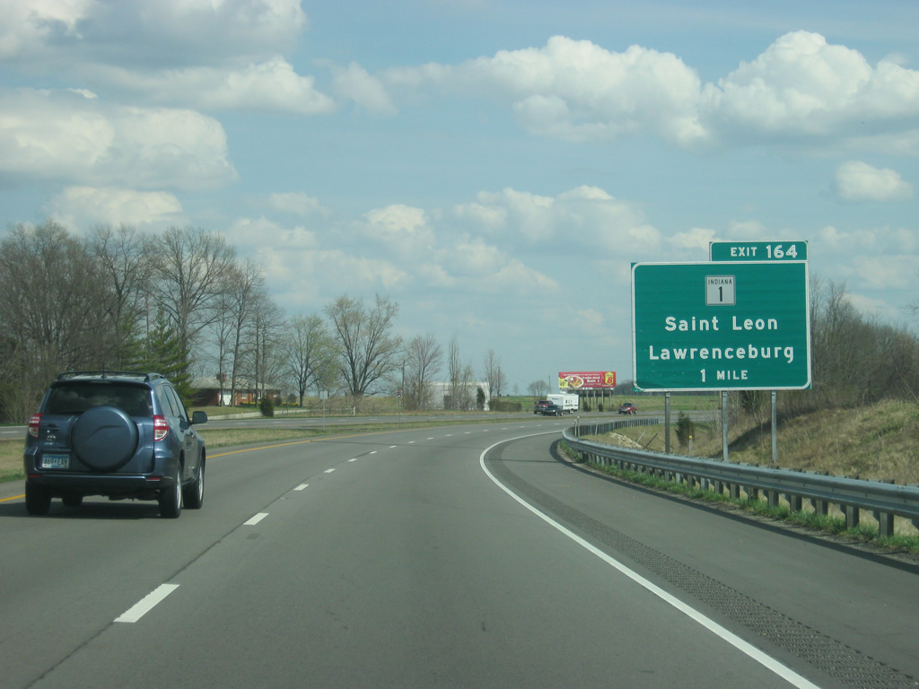
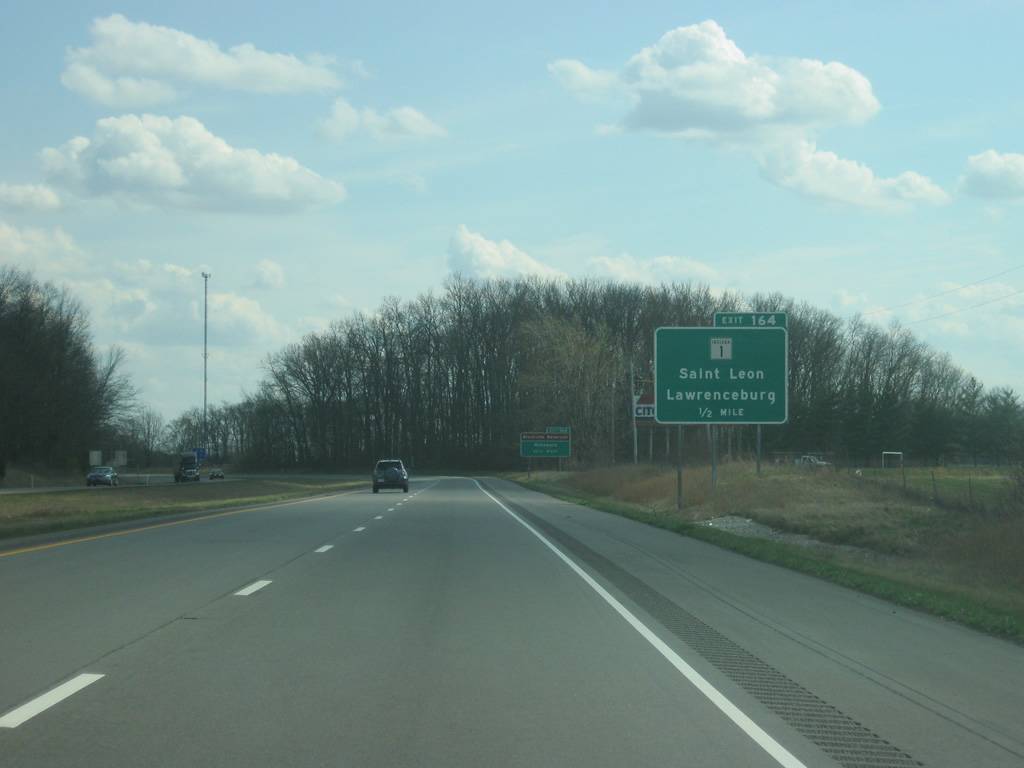
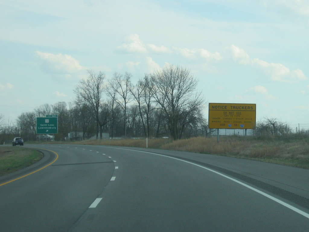
| The Dearborn County of St. Leon (at Exit 164 with SR 1) is eight miles away with U.S. 52 at 16 miles. Cincinnati is 37 miles away. 03/19/12 |
|
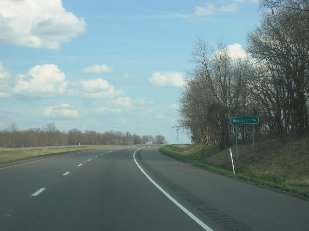
| Interstate 74 winds its way through the hills as it enters its final Indiana county, Dearborn County. Crossing into Dearborn County, Interstate 74 enters the Cincinnati metropolitan area that spans the states of Ohio, Kentucky and Indiana. 03/19/12 |
|
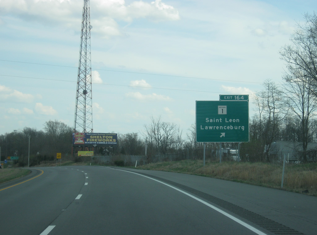
| Meeting Interstate 74 next is SR 1, a two-segment route stretching 139.8 miles from Lawrenceburg to Fort Wayne and for 40.7 miles between Fort Wayne and Ellis. 03/19/12 |
|
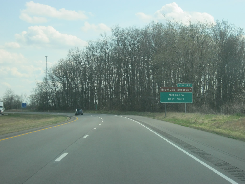
| Curving to the southeast, Interstate 74 and SR 46 swap sides as the freeway enters the St. Leon area near Exit 164. Brookville Reservoir is reached via SR 1 north to U.S. 52 and the Franklin County seat of Brookville, 12 miles to the north. 03/19/12 |
|
| One half mile west of the Exit 164 diamond interchange with SR 1 on Interstate 74 east. SR 1 leads 15.3 miles southeast through Dover to end at U.S. 50 in Lawrenceburg. An advisory sign warns truckers not to use SR 1 as a way to get to the Interstate 275 beltway in Lawrenceburg due to the windy nature of SR 1 from Interstate 74 to Lawrenceburg. 03/19/12 |
|
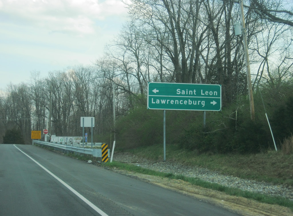
| North from SR 46 in adjacent Saint Leon, SR 1 continues 6.3 miles to merge with U.S. 52 west near Cedar Grove to Brookville. SR 1 continues from there to Connersville. 03/19/12 |
|
| A button-copy guide sign directs traffic on the off ramp onto SR 1 toward the town of St. Leon (where SR 1 and SR 46 meet) just north of the interchange and the Dearborn County seat of Lawrenceburg 14 miles to the south. The Perfect North Slopes ski resort and Hollywood and Rising Star casinos (in Lawrenceburg and Rising Sun) can all be reached by taking SR 1 to the south. 03/19/12 |
|
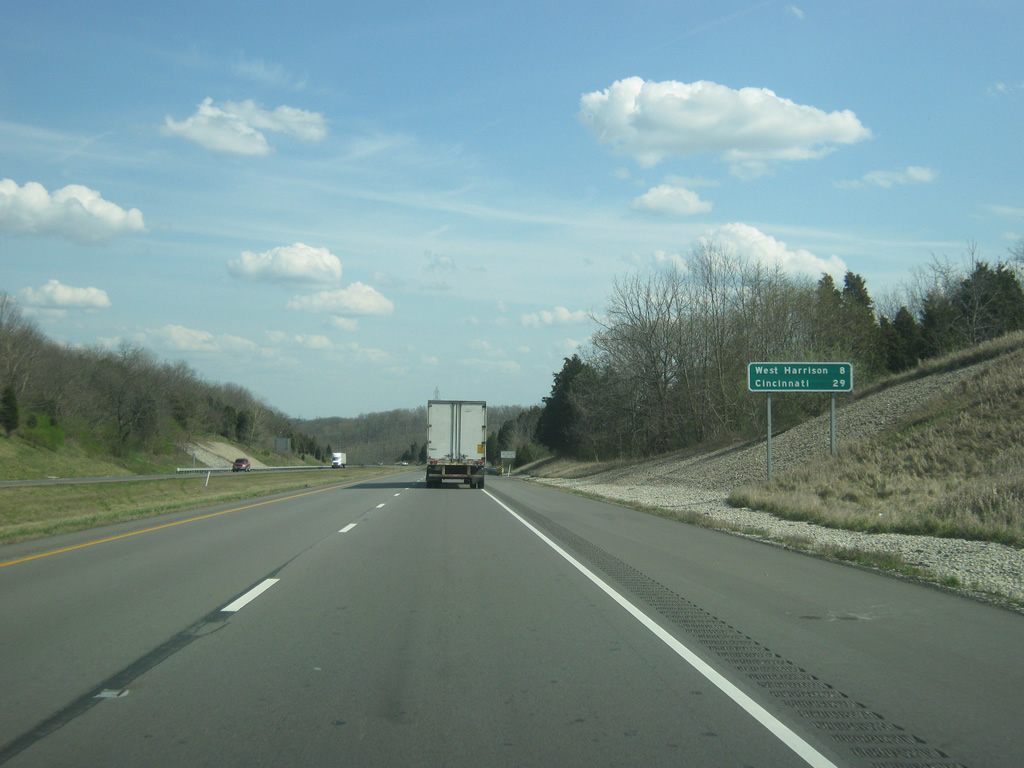
| West Harrison, the last town in Indiana along Interstate 74, is eight miles away with Cincinnati following at 29 miles. 03/19/12 |
|
| Interstate 74 slices through hills south of Logan Creek in northern Dearborn County. The hilly landscape gets more profound as one heads closer to the Queen City of Cincinnati, Ohio. 03/19/12 |
|
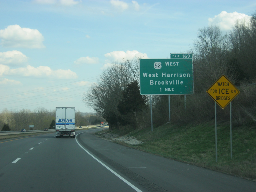
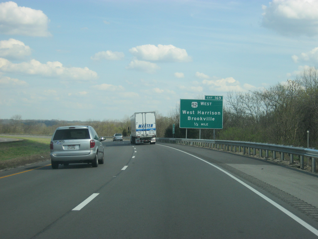
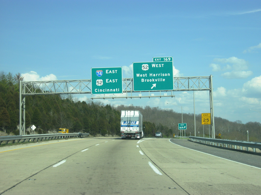
| U.S. 52 joins Interstate 74 east from the northwest at Exit 169 (Harrison Brookville Road) in one mile. Harrison Brookville Road east connects the freeway with West Harrison and Harrison, Ohio. 03/19/12 |
|
| Eastbound drivers span the Whitewater River along 1962-built bridges near the half mile approach to Exit 169 (Harrison Brookville Road). 03/19/12 |
|
| Venturing northwest, U.S. 52 crosses the Franklin County line near Braysville for New Trenton, Cedar Grove, the county seat of Brookville and Metamora. U.S. 52 continues to Rushville and New Palestine before joining the Indianapolis Beltway. 03/19/12 |
|
| Exit 169 loops south from Interstate 74 east to Harrison Brookville Road. U.S. 52 meets the east end of SR 46 nearby, as SR 46 begins and parallels I-74 to the west. U.S. 52 joins Interstate 74 for the last 21 miles of the freeway to Interstate 75 in Cincinnati. From there, the U.S. highway continues to Downtown Cincinnati before resuming east along its own alignment beyond Cincinnati. 03/19/12 |
|
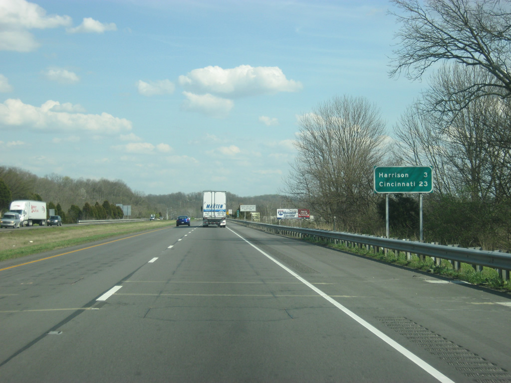
| East of Exit 169, I-74/U.S. 52 line a plain parallel to old U.S. 52 (Harrison Brookville Road) and the Whitewater River between hills to the north and south. The town of Harrison, Ohio is three miles away across the state line. Downtown Cincinnati is only 23 miles away. 03/19/12 |
|
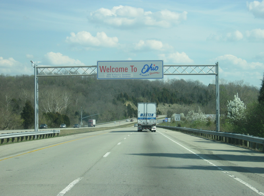
| After 170 miles across Indiana, I-74/U.S. 52 enter the Buckeye State of Ohio. 03/19/12 |
Page Updated 08-07-2012.

 east &
  south
south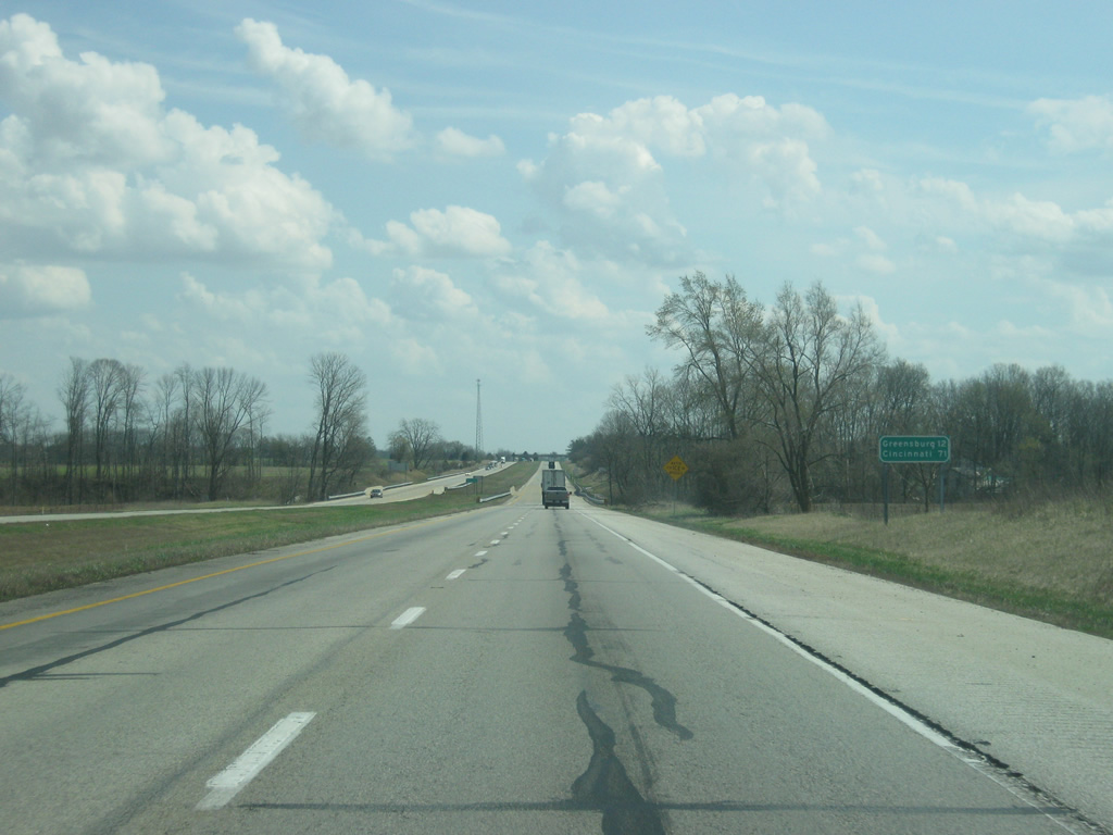


 East
East