|
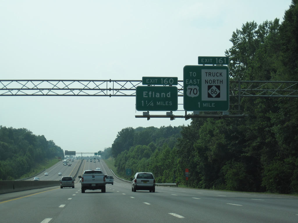
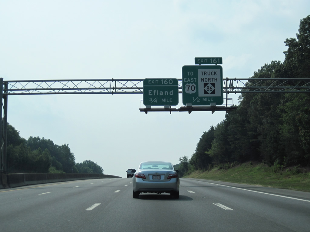
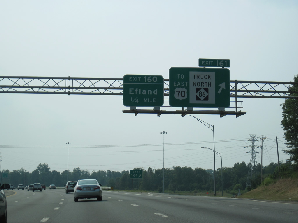
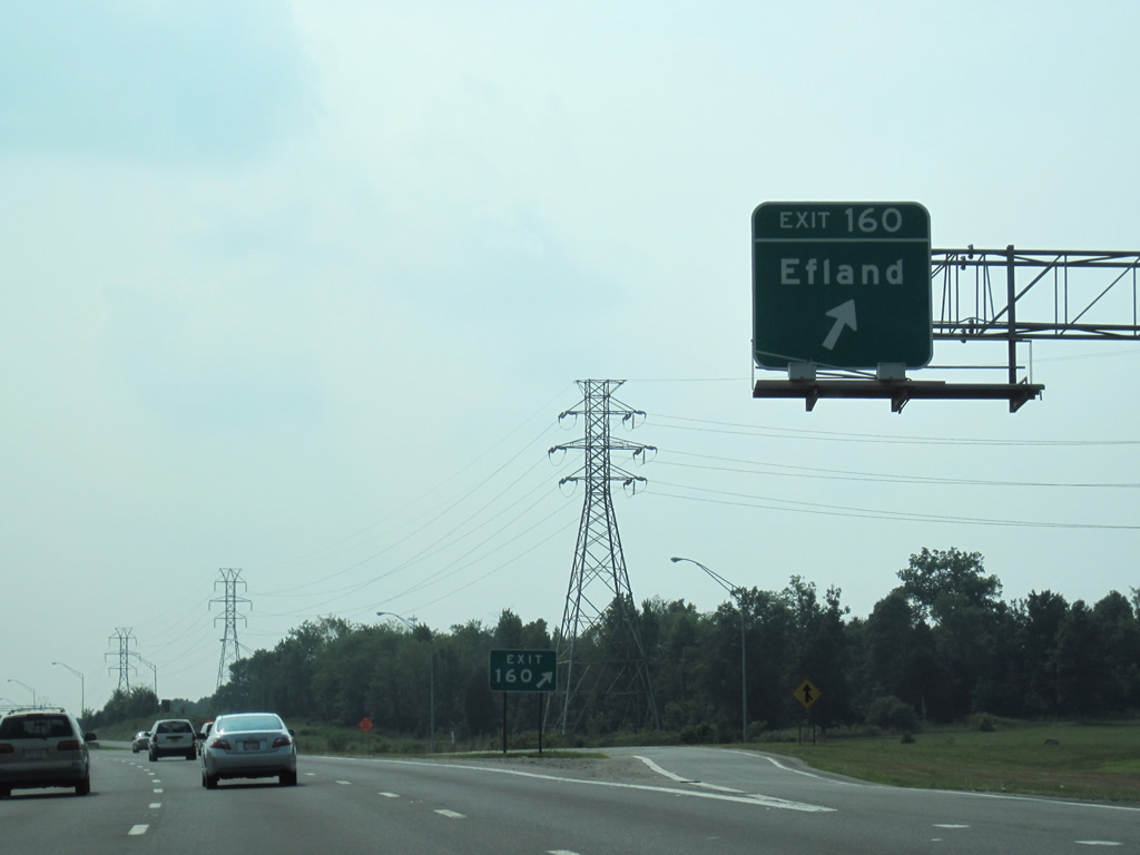
| Heading northwest I-40/85 lower to cross Sevenmile Creek ahead of the split diamond interchange (Exits 161/160) with the I-85 US 70 Connector (SR 1239) north and Mt. Willing Road (SR 1120) at Efland. 07/09/10 |
|
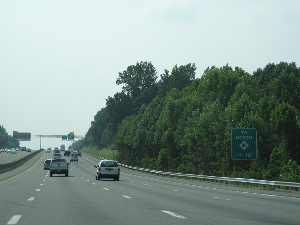
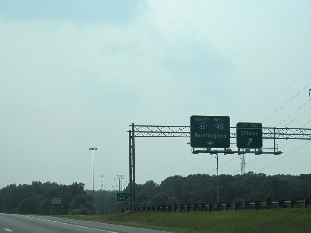
| The truck route for NC 86 north to Yanceyville leaves I-40/85 along the I-85 US 70 Connector to U.S. 70 (Cornelius Street) east. 07/09/10 |
|
| The I-85 US 70 Connector (SR 1239) previously merged with I-40/85 west at a wye interchange. Ben Johnson Road (SR 1144) stems east from SR 1239 nearby to Hillsborough. 07/09/10 |
|
| SR 1239 / NC 86 Truck tie into U.S. 70 at a wye interchange 1.13 miles to the northeast near the Eno River. Unincorporated Efland lies north of Exit 160 at Mt. Willing Road (SR 1120) and Forest Avenue (SR 1322). 07/09/10 |
|
| Exit 160 joins an access road linking SR 1239 with Mt. Willing Road (SR 1120). The old exit for Mt. Willing Road departed the freeway immediately after the I-85 US 70 Connector on-ramp, resulting in a weaving traffic configuration. 07/09/10 |
|
| Mt. Willing Road curves southwesterly from I-40/85 and Efland through forested hills to Buckhorn and Oak Grove Church Road (SR 1117) near the Alamance County line. 07/09/10 |
|
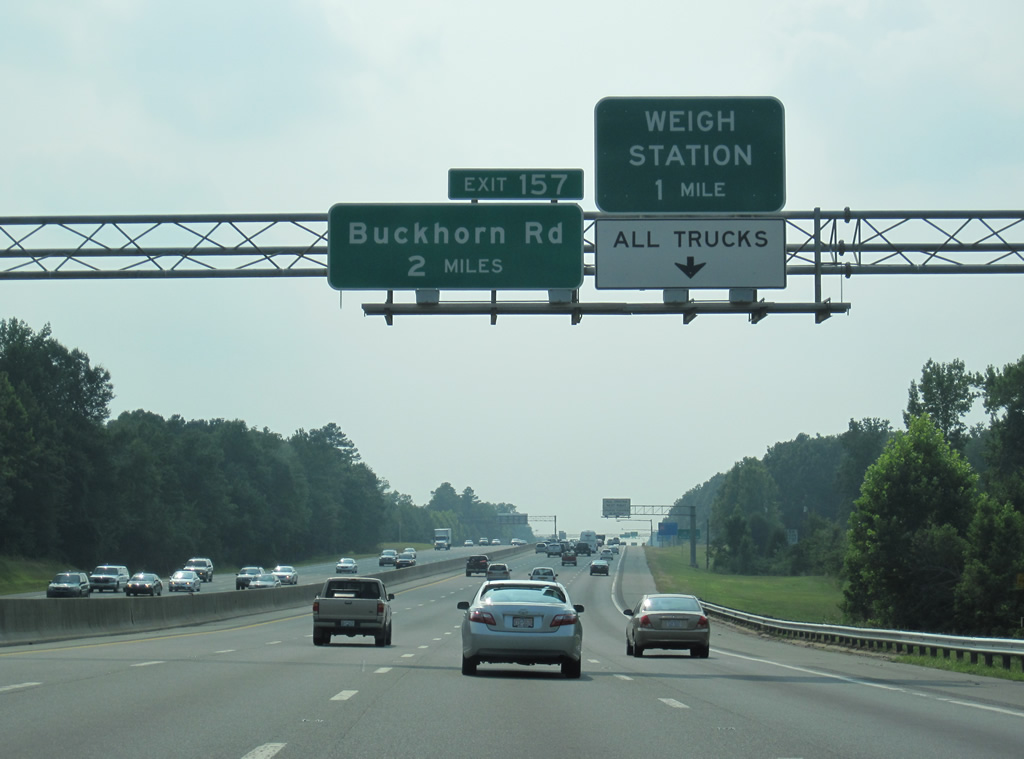
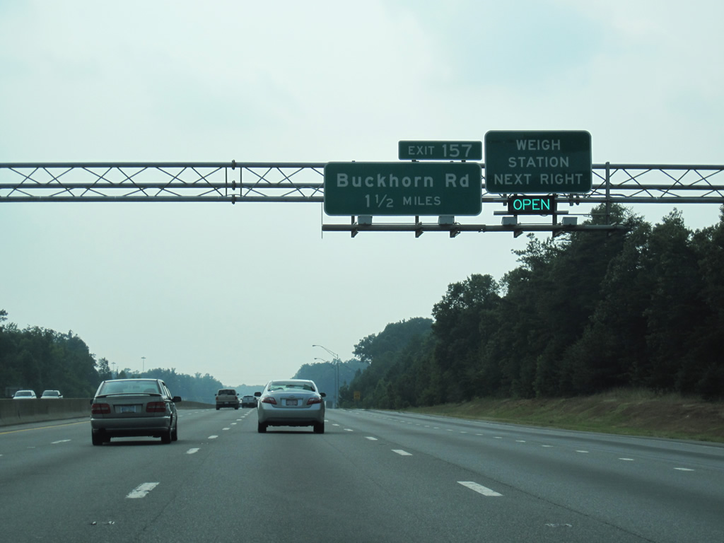
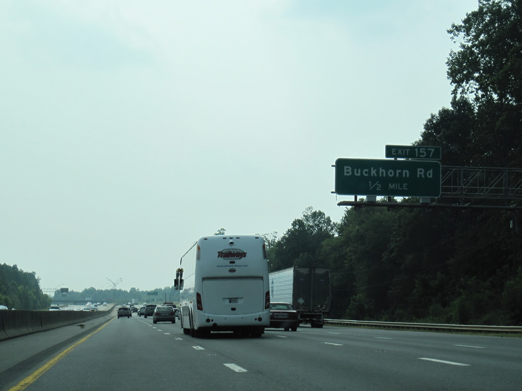
| Buckhorn Road (SR 1114) crosses paths with I-40/85 two miles west of Efland at Exit 157. 07/09/10 |
|
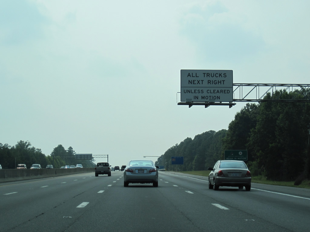
| Weigh stations line both sides of I-40/85 east of Exit 157. The scales replaced original rest areas. 07/09/10 |
|
| Forthcoming Buckhorn Road connects the freeway with parallel U.S. 70 at Miles and West Ten Road (SR 1146) at Cheeks Crossroads. 07/09/10 |
|
| Buckhorn Road (SR 1114) ventures south from U.S. 70 to the rural settlements of Buckhorn and Orange Grove. 07/09/10 |
|
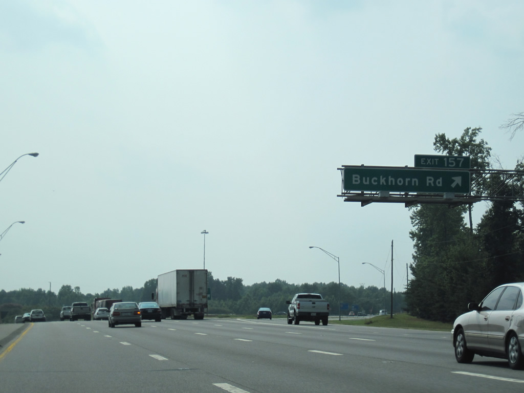
| Westbound I-40/85 at the diamond interchange (Exit 157) with Buckhorn Road. West from Buckhorn Road ,U.S. 70 heads into the city of Mebane along Center Street. 07/09/10 |
|
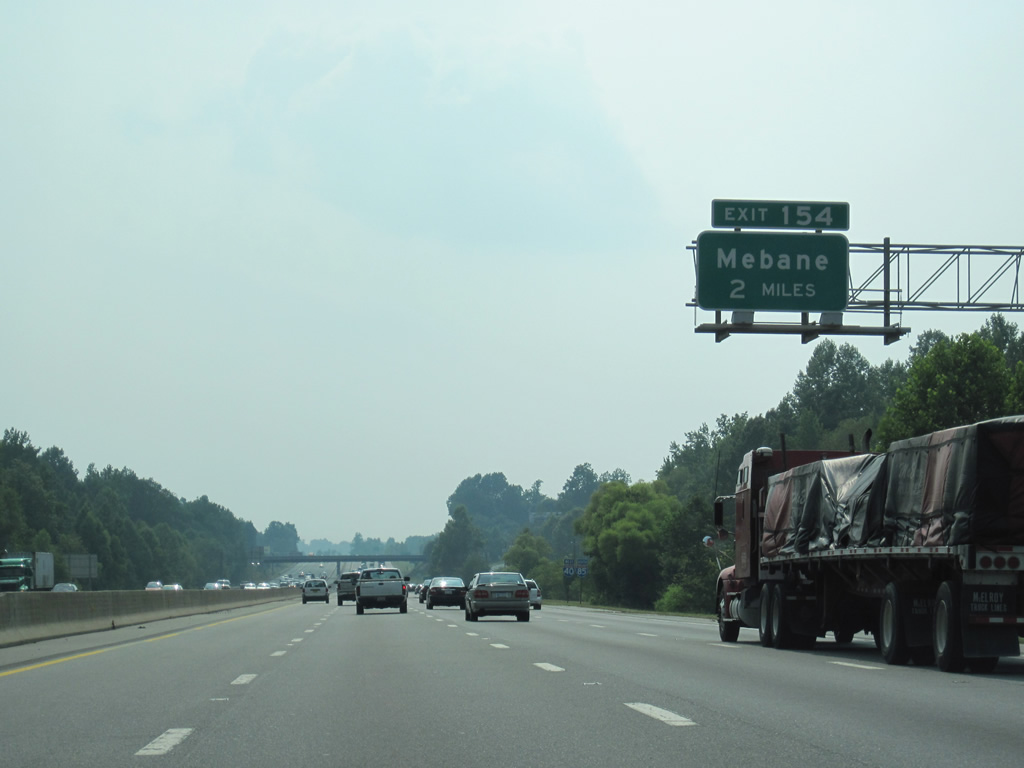
| I-40/85 pass through southern reaches of the Mebane city limits to Exit 154, 153 and 152. 07/09/10 |
|
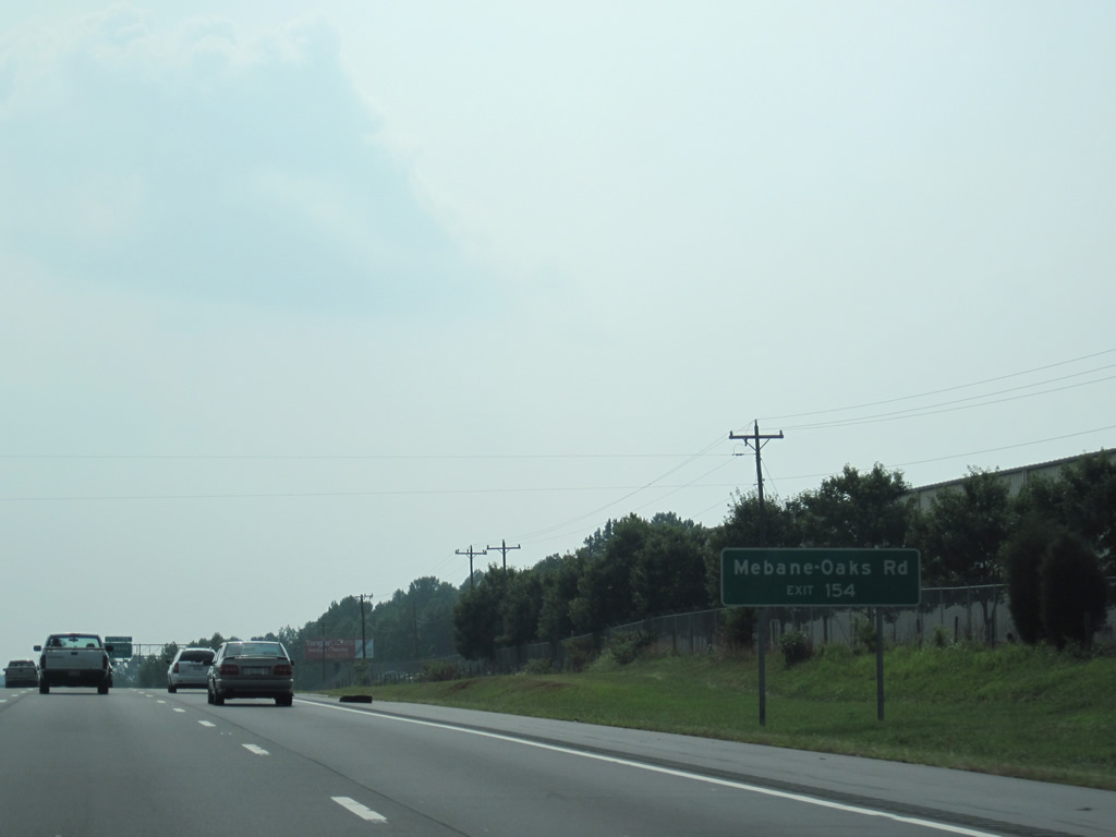
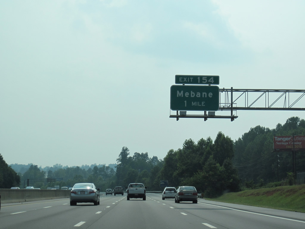
| Mebane-Oaks Road (SR 1007) joins I-40/85 with the south side of Mebane and nearby NC 119 (5th Street) north into the city center. 07/09/10 |
|
| A number of traveler services, retail and a Tanger Outlets center fall within the immediate vicinity of Exit 154 on both Mebane-Oaks Road and parallel Arrowhead Boulevard (SR 2033). 07/09/10 |
|
| I-40 west / I-85 south cross the Alamance County line just ahead of the diamond interchange (Exit 154) with Mebane-Oaks Road. 07/09/10 |
|
| Mebane-Oaks Road (SR 1007) leads south 8.9 miles from NC 119 along the Orange / Alamance County line to NC 54 at the community of Oaks. The succeeding exit joins with I-40/85 with NC 119 (5th Street) directly in 1.5 miles. 07/09/10 |
|
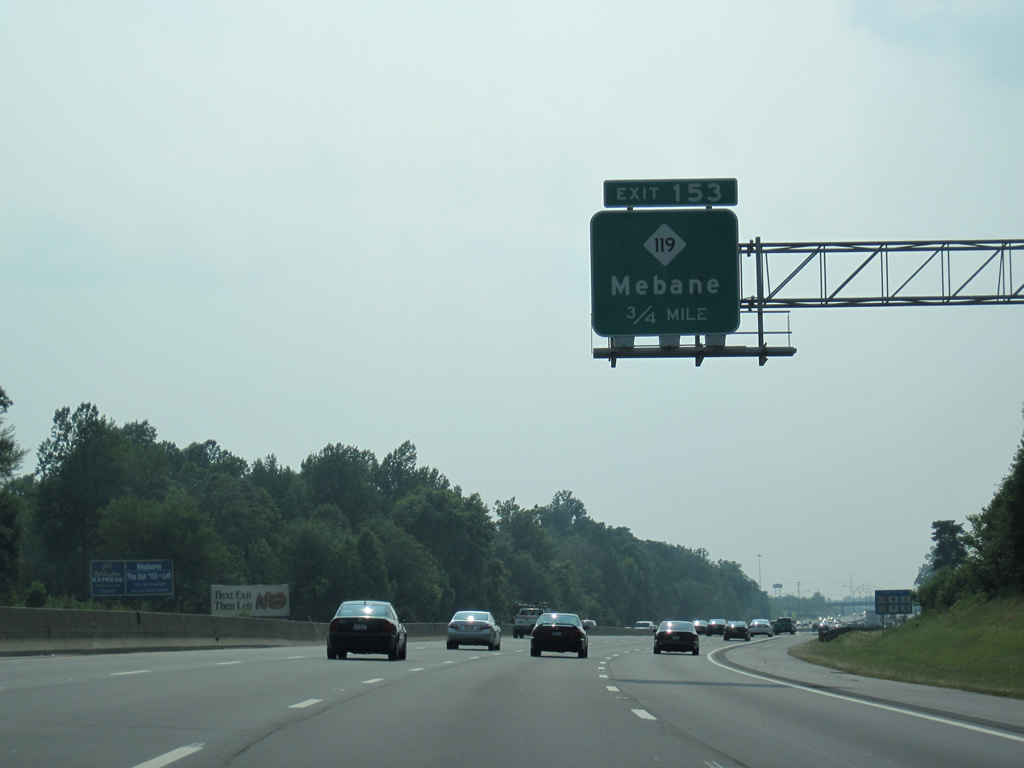
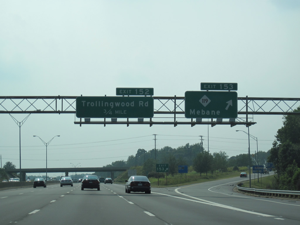
| I-40/85 vacate the Mebane city limits west of Exit 154 and reenter them at NC 119. 2018-19 construction at forthcoming Exit 153 converted the exchange into a DDI. 07/09/10 |
|
| NC 119 is a 43 mile route from NC 54 at Swepsonville to Virginia Route 119 near Semora. NC 119 follows 5th Street northeast to U.S. 70 (Center Street) in Downtown Mebane. A two-stage project started in 2018 relocates NC 119 onto a new arterial bypass to the west. 07/09/10 |
|
| NC 119 connects I-40/85 with Swepsonville, 4.1 miles to the southwest. Exit 153 also serves a large business park with a number of warehouses and other industrial businesses to the north. The NC 119 relocation (Segment A) lines the east side of the park northward to U.S. 70 at Edgewood Church Road (SR 1949). 07/09/10 |
|
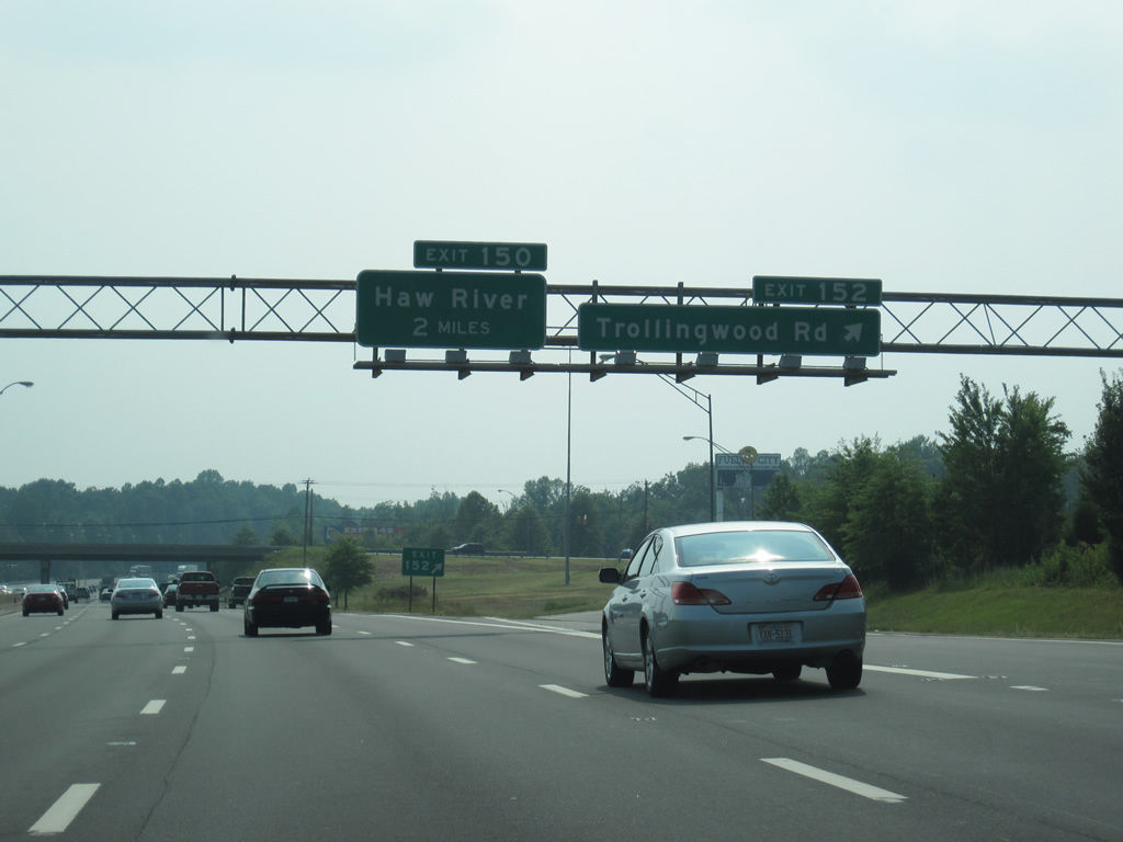
| Trollingwood Road (SR 1981) angles northwest from NC 119 at Old Hillsborough Road (SR 2126) and Hawfields to a diamond interchange (Exit 152) with I-40/85. SR 1981 continues northwest to Stone Street Extension (SR 1936), which winds west into the town of Haw River. 07/09/10 |
|
| I-40 west / I-85 south leave Mebane for a hilly stretch south Graham. 07/09/10 |
|
| Jimmie Kerr Road (SR 1928) is the first of three exits for the city of Graham along I-40 west / I-85 south. SR 1928 lines a combination of Jimmie Kerr, Trollingwood and Wilkins Roads northward into the town of the Haw River. 07/09/10 |
|
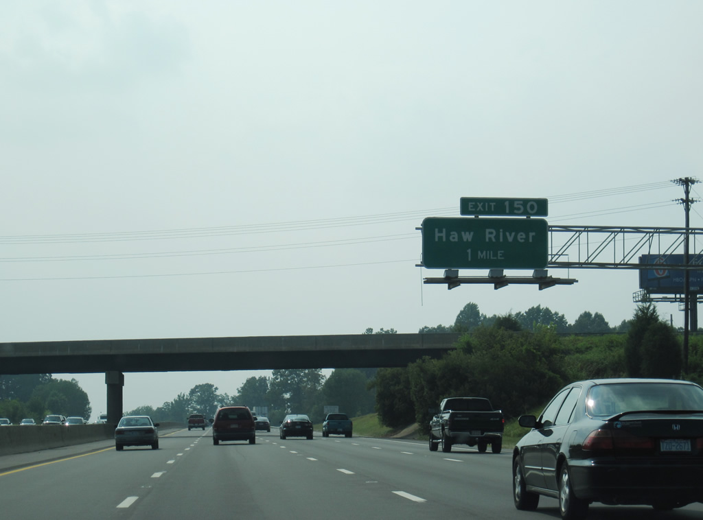
| Westbound at the diamond interchange (Exit 150) with Jimmie Kerr Road (SR 1928). SR 1928 connects I-40/85 with U.S. 70 west to Burlington and NC 49 (Roxboro Street) north to Green Level. Southward Jimmie Kerr Road serves Alamance Community College en route to Swepsonville. 07/09/10 |
|
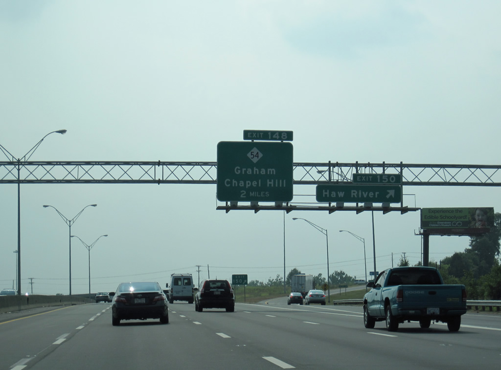
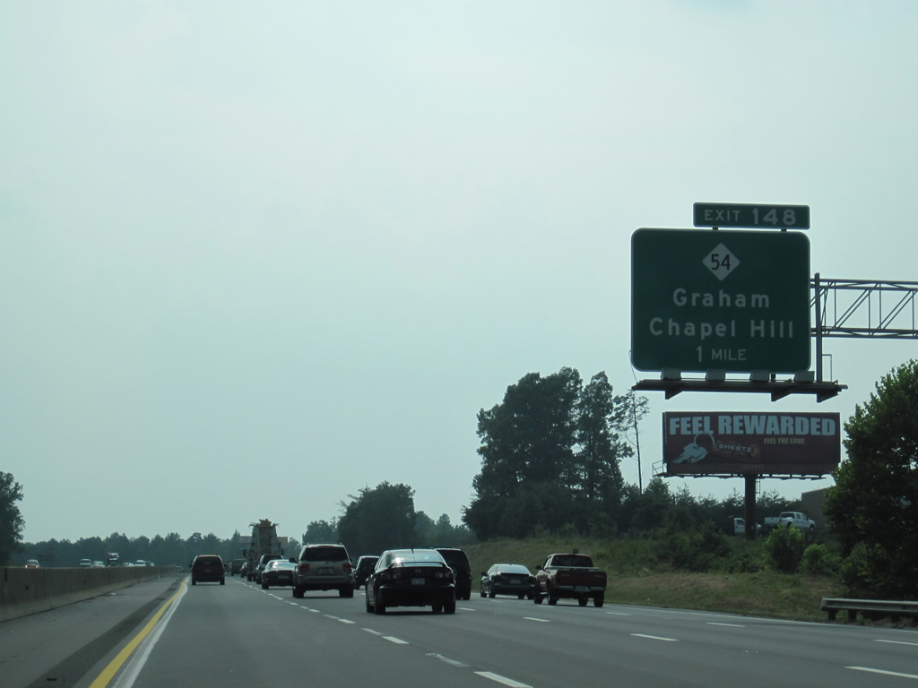
| NC 54 and I-40/85 come together west of the Haw River at a diamond interchange (Exit 148). The state route enters Graham by way of Swepsonville, following Harden Street northwest to Downtown. 07/09/10 |
|
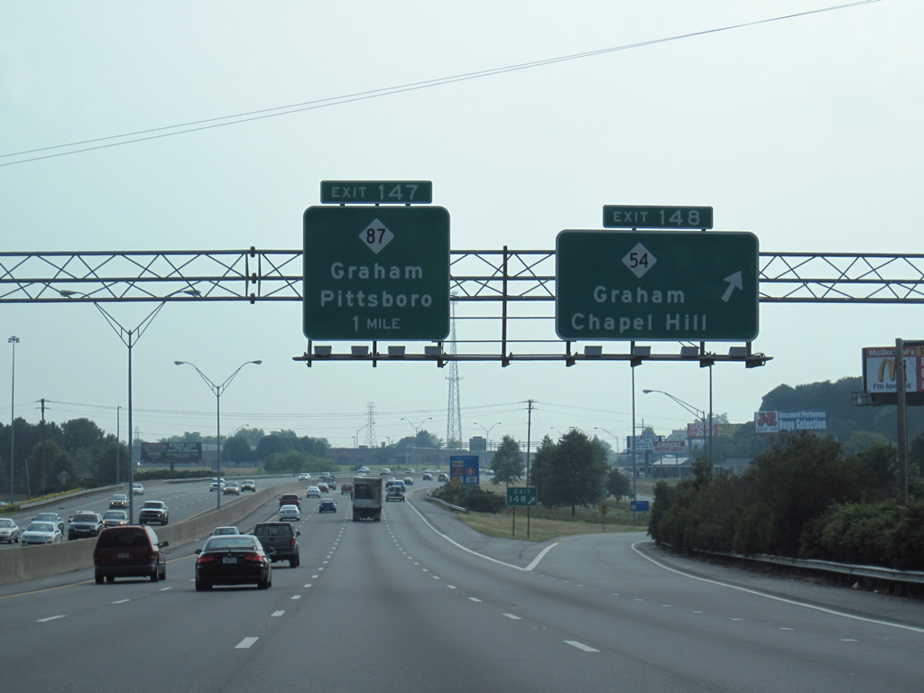
| NC 54 travels 55 miles overall from U.S. 70/NC 62 in west Burlington southeast to Chapel Hill and I-440 at Raleigh. NC 87, which meets I-40/85 in one mile, combines with NC 49/54 west for a half mile from Downtown Graham to Elm Street and the city of Burlington. 07/09/10 |
|
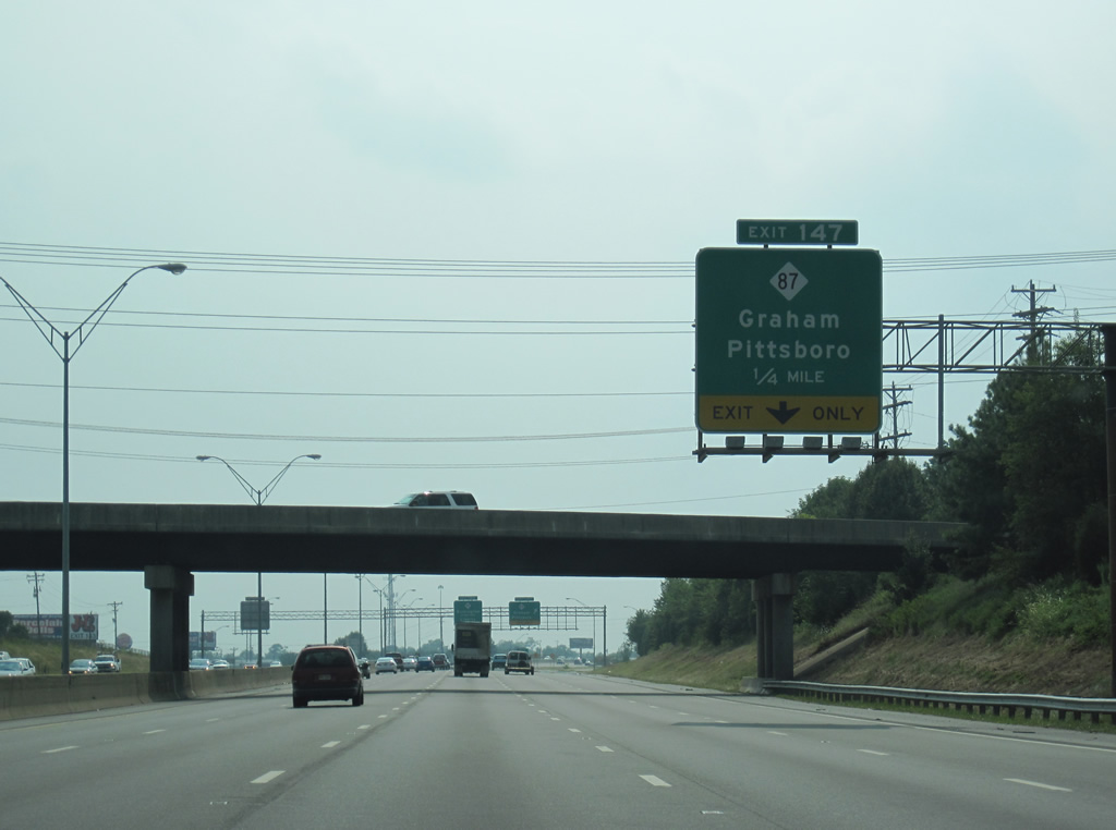
| I-40/85 carry ten overall lanes between NC 54 and NC 87 (Exit 147). NC 87, a 237 mile route south to Fayetteville and Southport and north to Reidsville and Eden, meets the freeway at a parclo interchange (Exit 147) just south of the Graham business district. 07/09/10 |
|
| NC 87 (Main Street) connects Graham with the Chatham County seat of Pittsboro, 27 miles to the south. Northward NC 87 follows Elm Street / Webb Avenue from NC 49/54 (Harden Street) to Downtown Burlington. 07/09/10 |
|
| Maple Street (SR 2424) in Graham passes over I-40/85 west beyond this set of reassurance shields. Bowden Branch separates Graham and Burlington across the eight lane freeway. 07/09/10 |
|
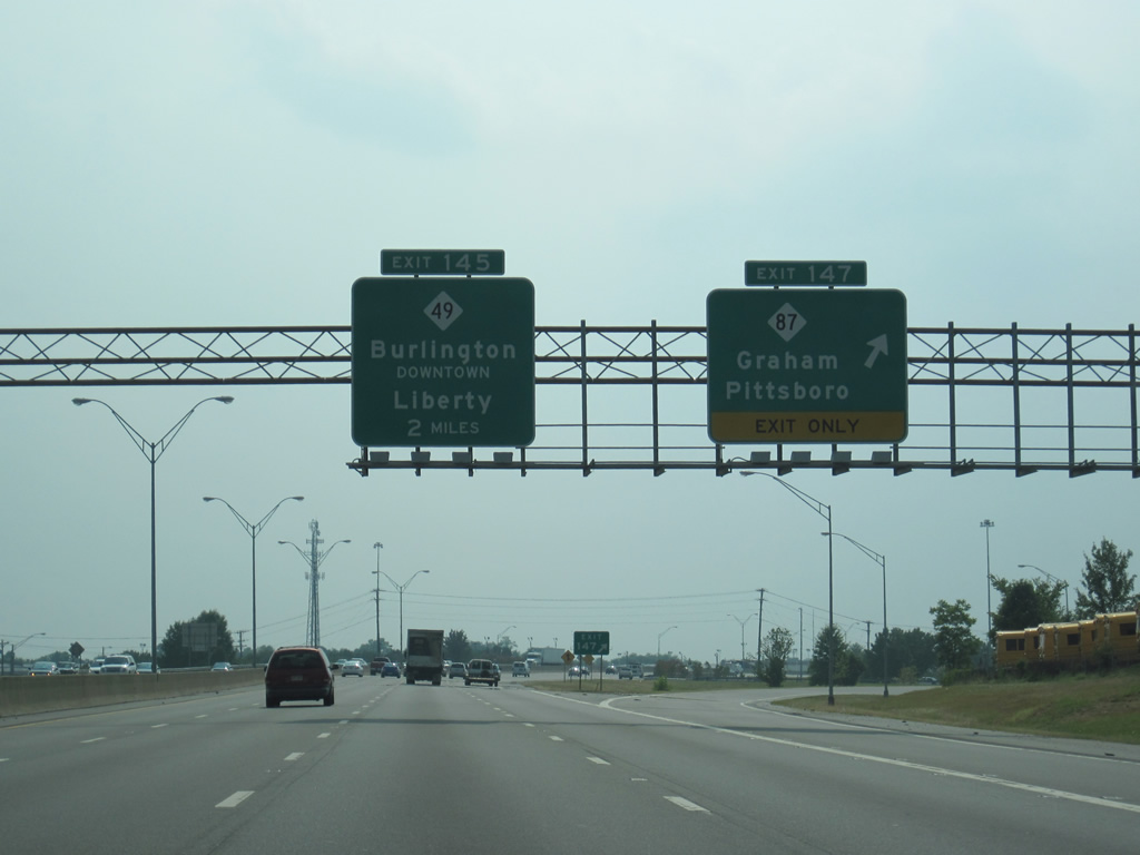
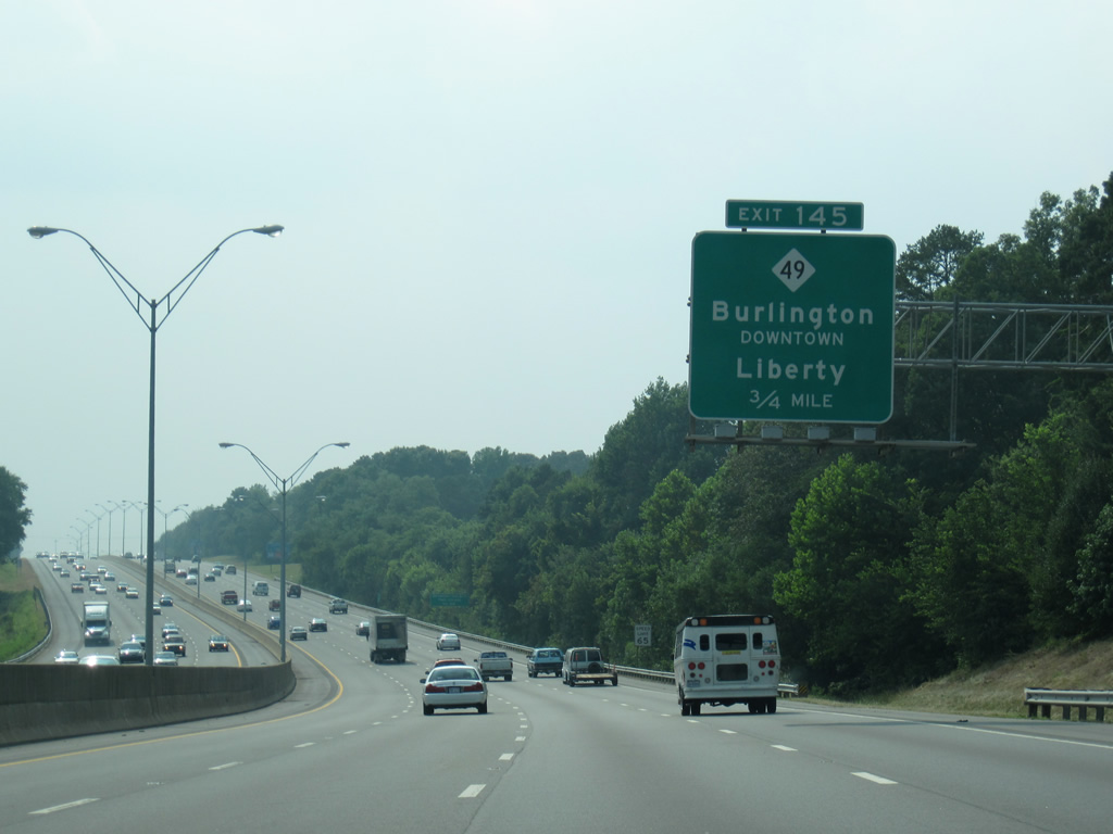
| Meeting I-40/85 amid an array of traveler services, aging shopping centers and an industrial park, NC 49 (Maples Avenue) at Exit 145 is the first of three interchanges for the city of Burlington. 07/09/10 |
|
| Entering the parclo interchange with NC 49 (Maple Avenue) on I-40/85. Forming a multi state route with S.C. 49 at Lake Wylie, NC 49 travels 178 miles across the Tar Heel to Virginia Route 49 at Virgilina. Locally NC 49 ventures south 18 miles to the city of Liberty and northward to adjacent NC 54 (Chapel Hill Road west / Harden Street east) at NC 100 (Maple Avenue) north. NC 100 leads to Downtown (via NC 87). 07/09/10 |
|
| I-40 west / I-85 south remain through or along the city limits of Burlington until Exit 138 with NC 61. 07/09/10 |
|
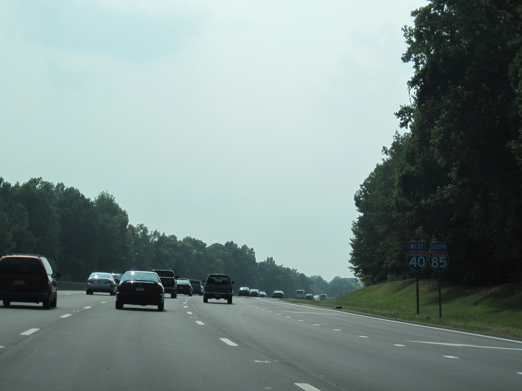
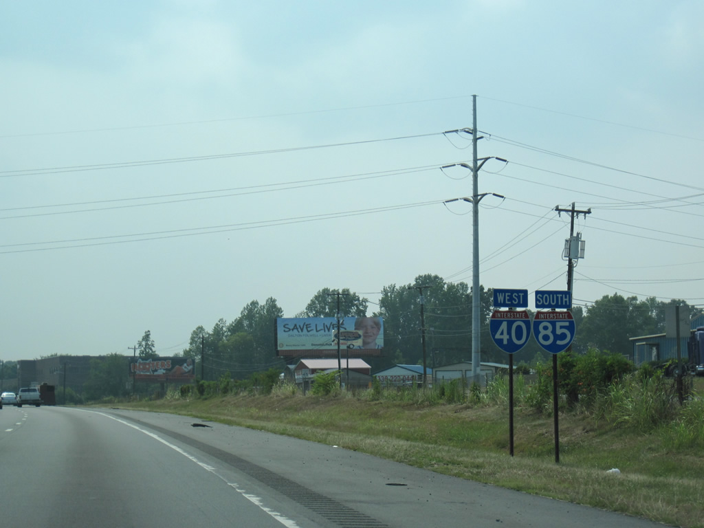
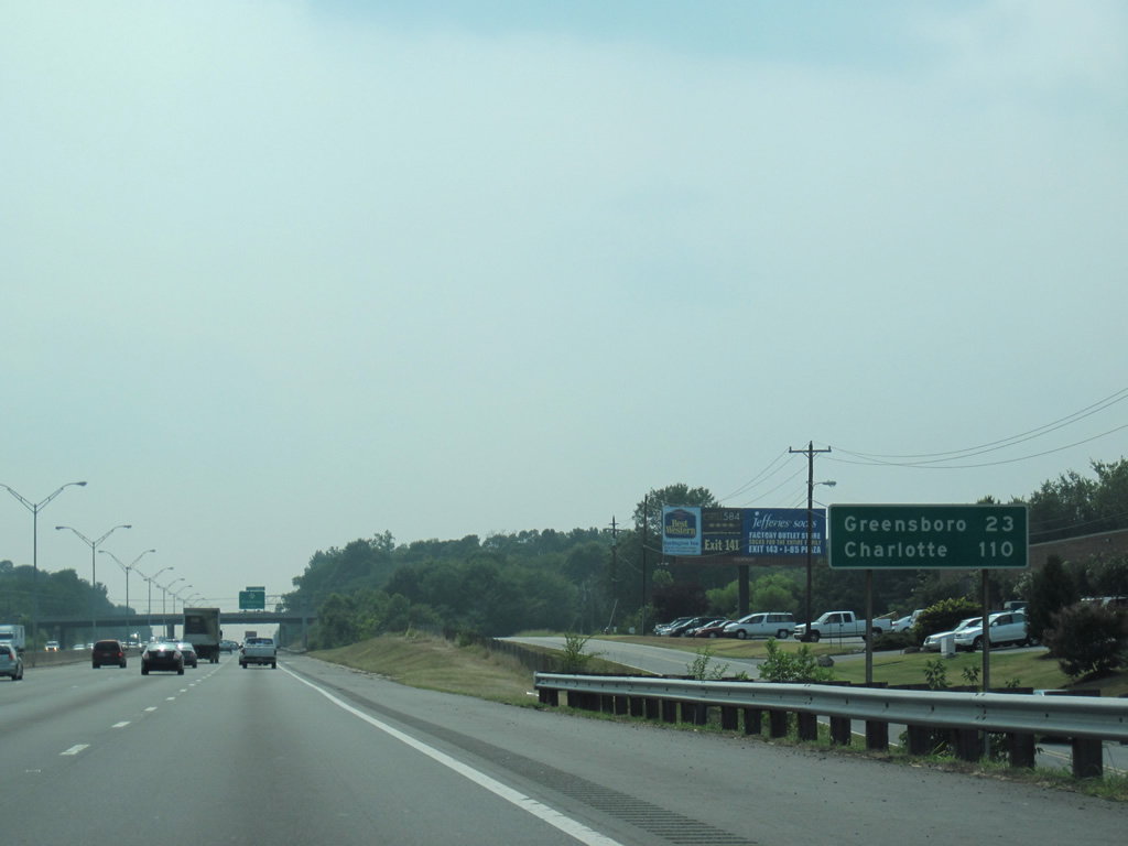
| The first distance sign posted along the I-40/85 overlap stands 23 miles east of Greensboro and 110 miles northeast from the Queen City of Charlotte. 07/09/10 |
|
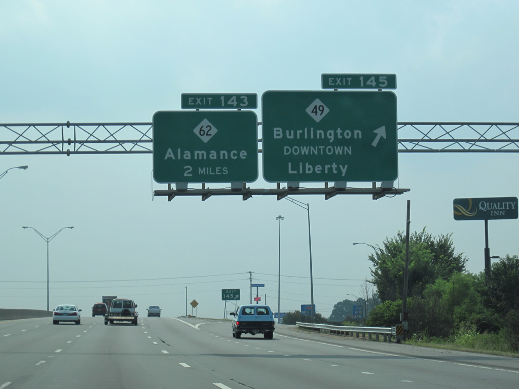
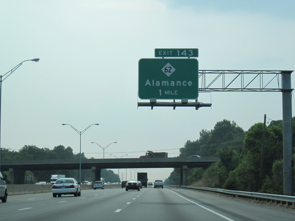
| NC 62 (Alamance Road) winds northeast from the village of Alamance by Burlington-Alamance Regional Airport (BUY) to converge with I-40/85 at a commercialized diamond interchange (Exit 143) in one mile. 07/09/10 |
|
| Exit 143 leaves I-40/85 west for NC 62 (Alamance Road) northeast to Downtown Burlington (via U.S. 70) and southwest to Alamance. The multi state route extends 84 miles south from Virginia Route 62 to Milton and NC 109 in Thomasville. 07/09/10 |
|
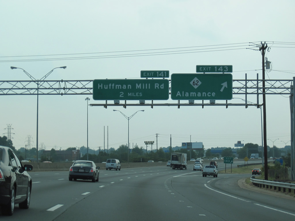
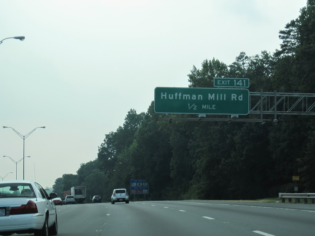
| Huffman Mill Road (SR 1158) branches southwest from U.S. 70 at Holly Hill Mall & Business Center to meet I-40/85 at a diamond interchange (Exit 141) in one mile. 07/09/10 |
|
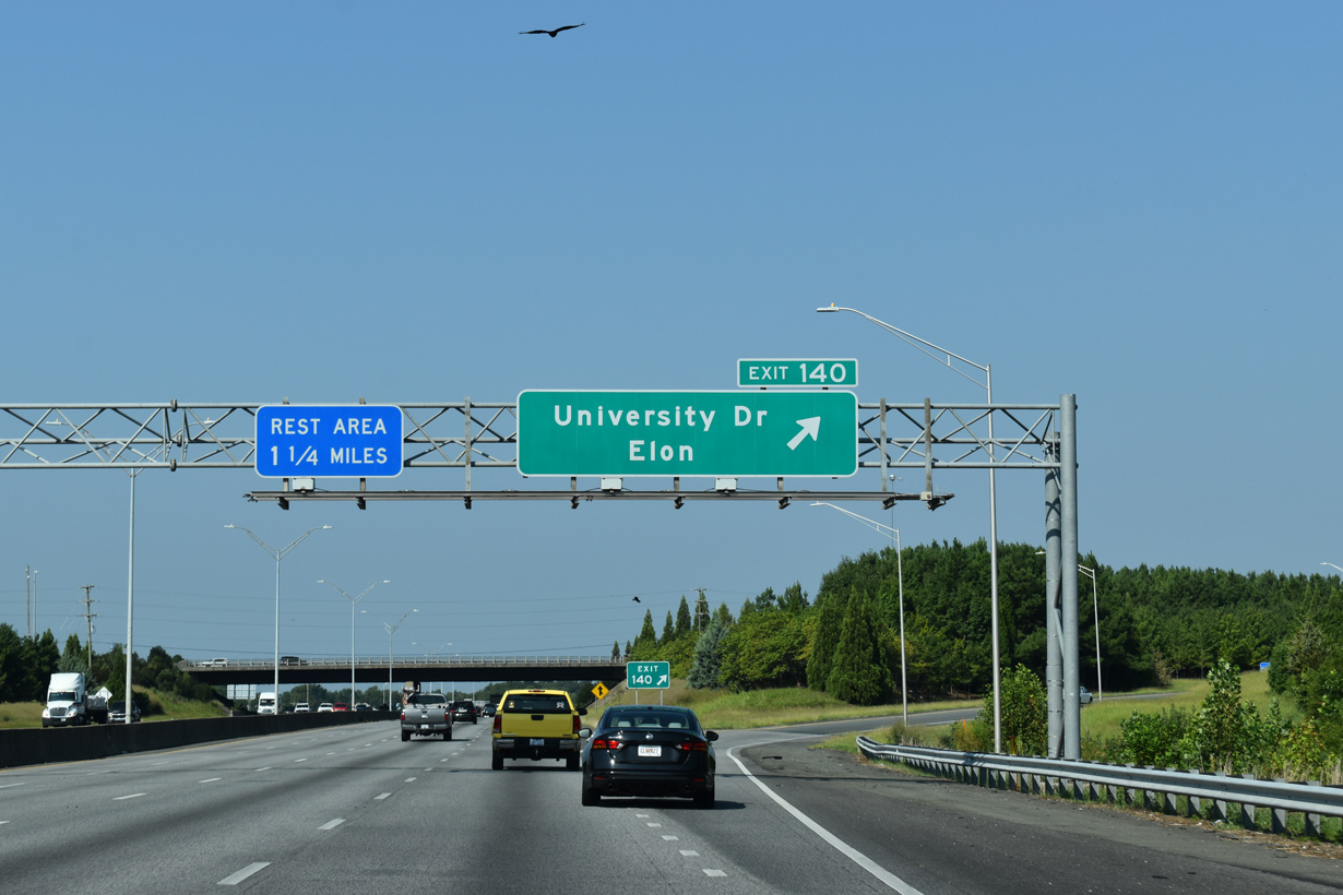
| South from Exit 141, Huffman Mill Road (SR 1158) continues to Alamance Regional Medical Center before exiting Burlington by way of Lake Mackintosh. University Drive (SR 1311) winds northward from the succeeding exit to NC 100 by Elon University.
07/09/10 |
|
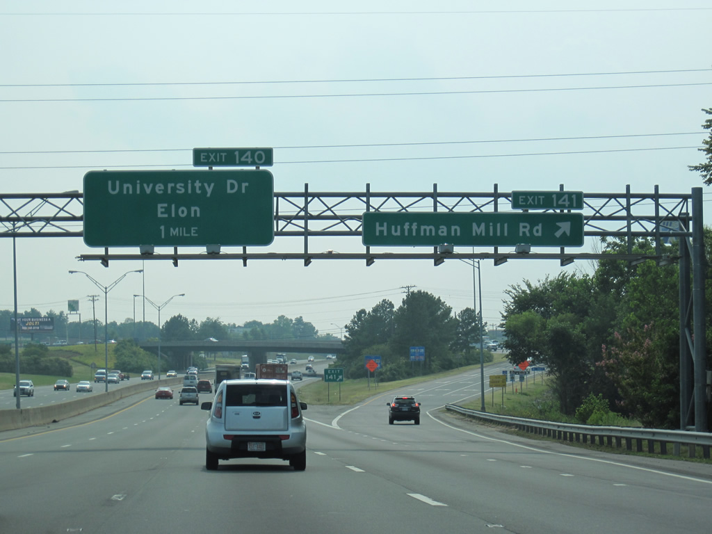
| Grand Oaks Boulevard (SR 1213/1226) and University Drive (SR 1226/1311) form an arterial beltway around Burlington west from NC 62 (Alamance Road) to Exit 140 and north along the Elon and Gibsonville town line to NC 100 (Burlington Street). 08/13/21 |
|
| I-40/85 run south of the Alamance Crossing retail complex between Exit 141 and 140. 08/23/21 |
|
| A six-ramp parclo interchange joins I-40/85 with University Drive (SR 1226) at Exit 140. The Elon bypass was partially completed at Haggard Avenue (old NC 100) in November 2012, which resulted in the relocation of NC 100 around Elon. 08/23/21 |
|
| I-40/85 vacate the Burlington city limits west beyond University Commons retail center at Rural Retreat Road (SR 1300). 08/18/21 |
|
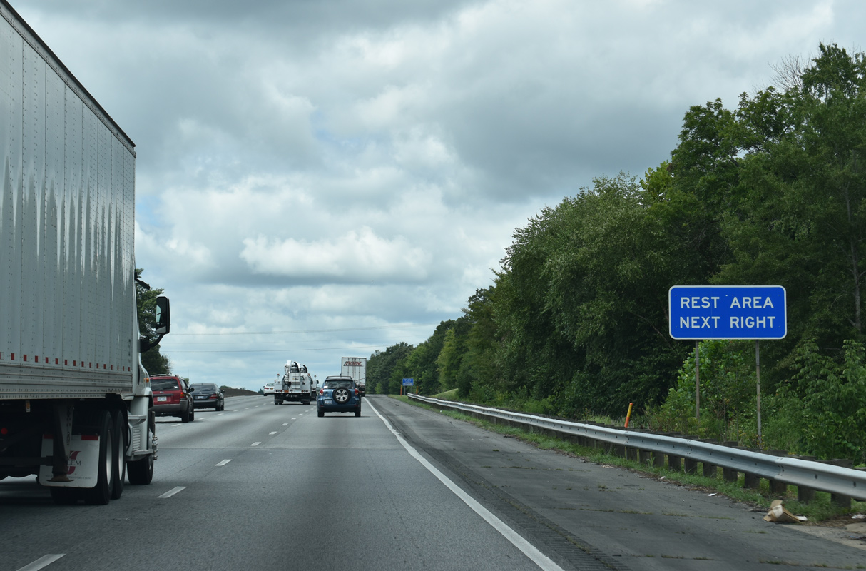
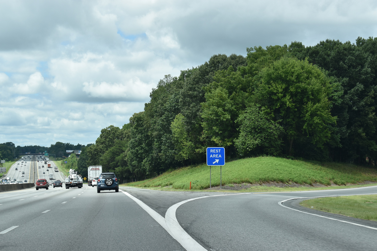
| A set of rest areas precede the Guilford County line along I-40/85 west. 08/18/21 |
|
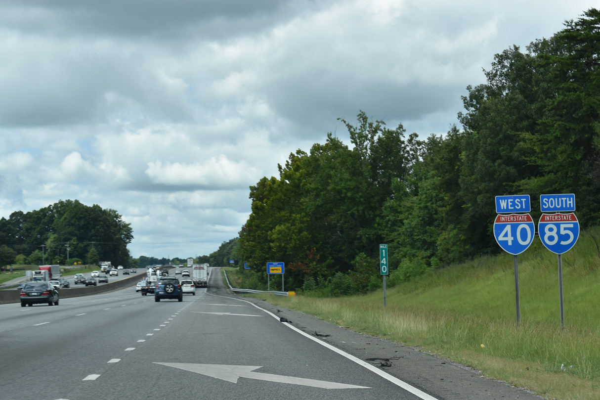
| Located at milepost 139, the Alamance County Rest Areas opened in 1983 and were renovated in 2005.1 08/18/21 |
|
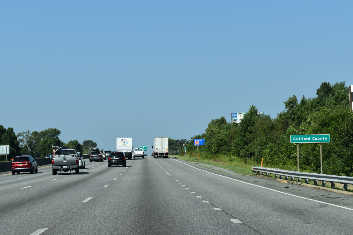
| Interstate 40 travels 29.59 miles west and I-85, 28.25 miles southwest across Guilford County. 08/21/21 |
|
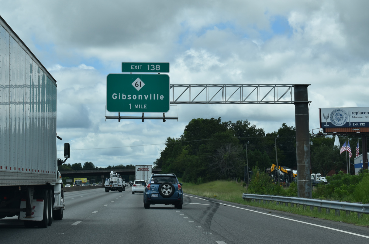
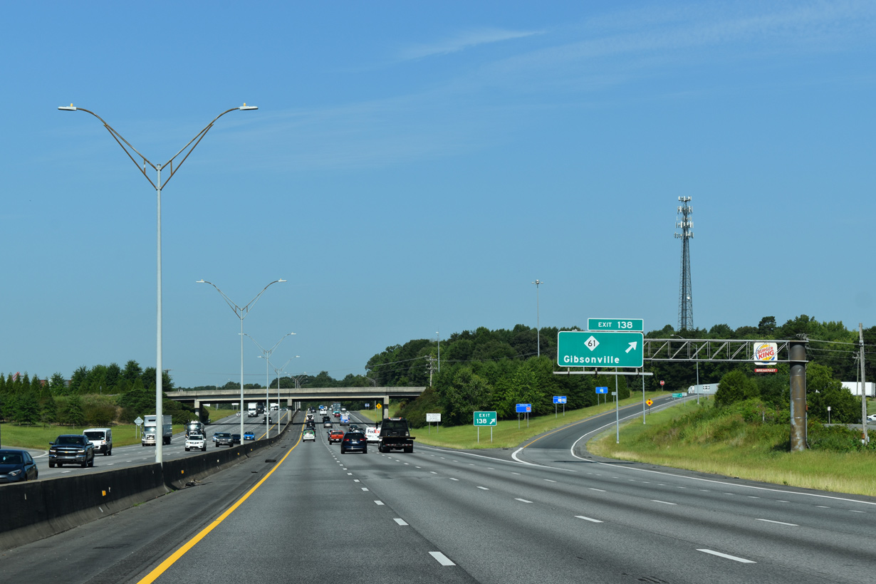
| NC 61 travels a relatively rural route northward from NC 62 to meet I-40/85 at a diamond interchange (Exit 138) in one mile. 08/18/21 |
|
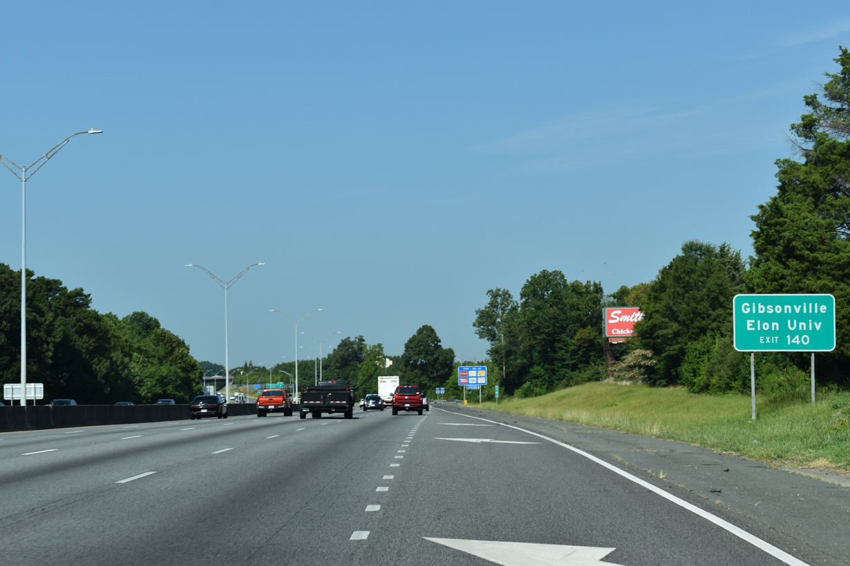
| NC 61 combines with NC 100 northeast 3.6 miles into Downtown Gibsonville. 08/13/21 |
|
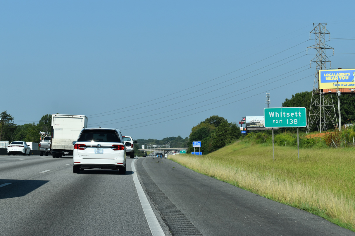
| The town of Whitsett spreads to the north of I-40/85 along NC 61 and parallel U.S. 70 (Burlington Road). 08/23/21 |
|
| A 19.75 mile long route, NC 61 leads north from Gibsonville through rural northeast Guilford County to NC 150 at Osceola. 08/13/21 |
|
| Confirming markers posted west of NC 61 and north of Little Alamance Creek and Judge Adams Road (SR 3224). 08/23/21 |
|
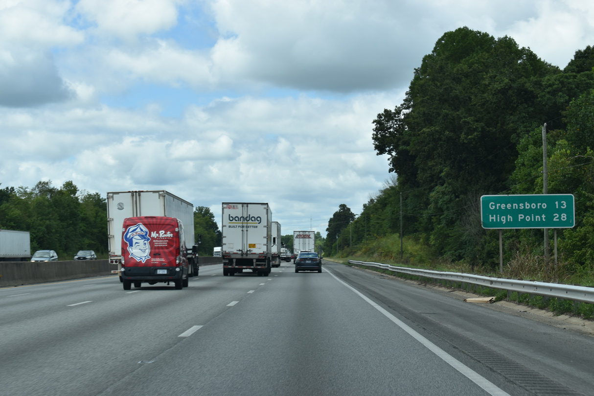
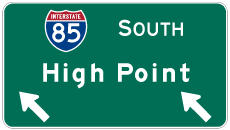
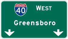
| Advancing west from Whitsett, I-40 reaches Downtown Greensboro in 13 miles and I-85 the city of High Point in 28 miles. 08/18/21 |
|
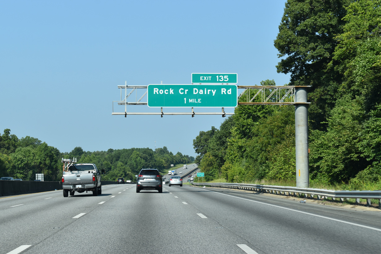
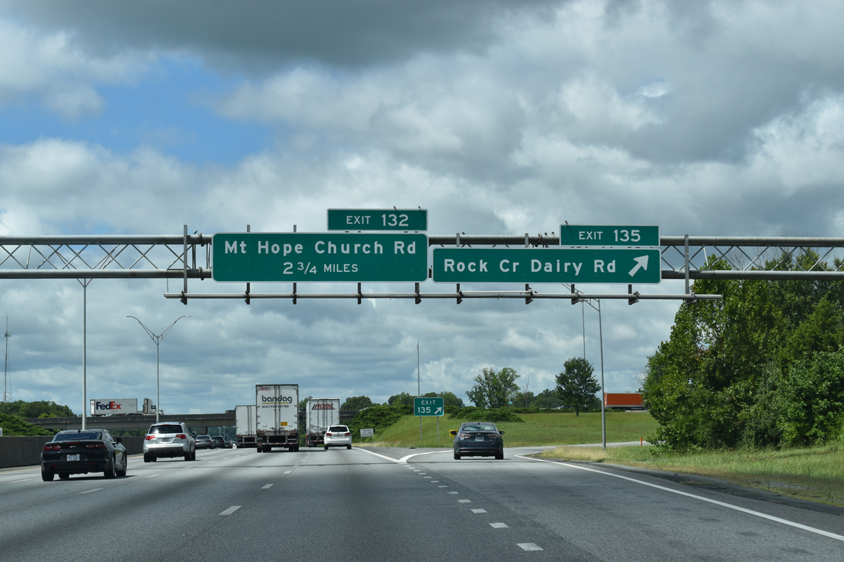
| The succeeding exit along I-40 west / I-85 south is with Rock Creek Dairy Road (SR 3056). Construction in 1994 upgraded the diamond interchange at Exit 135 into a parclo. 08/23/21 |
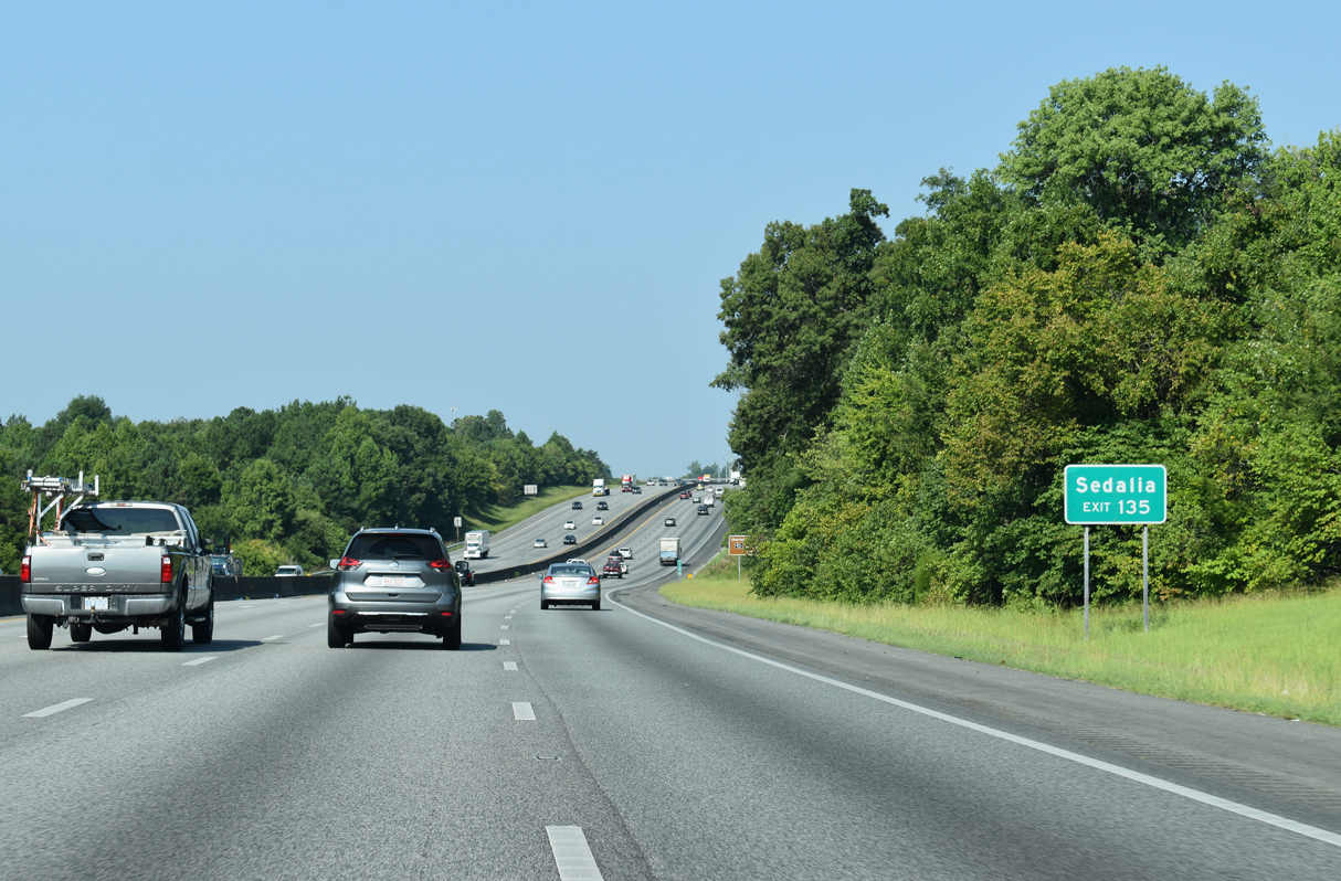
|
| Rock Creek Dairy Church Road (SR 3056) connects I-40/85 with adjacent U.S. 70 (Burlington Road) west into the town of Sedalia. 08/23/21 |
|
| Southward to Mt. Hope Church Road (SR 3045), Rock Creek Dairy Road (SR 3056) serves a crop of distribution businesses and subdivisions near Lake Mackintosh. 08/18/21 |
|
| I-40/85 traverse a rural area north of Little Alamance Creek on the ensuing stretch beyond Exit 135. 08/23/21 |
|
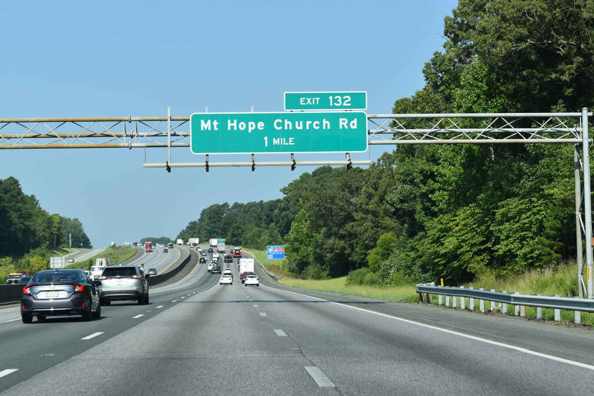
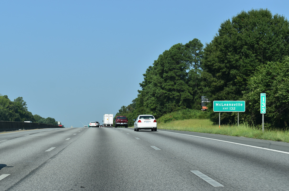
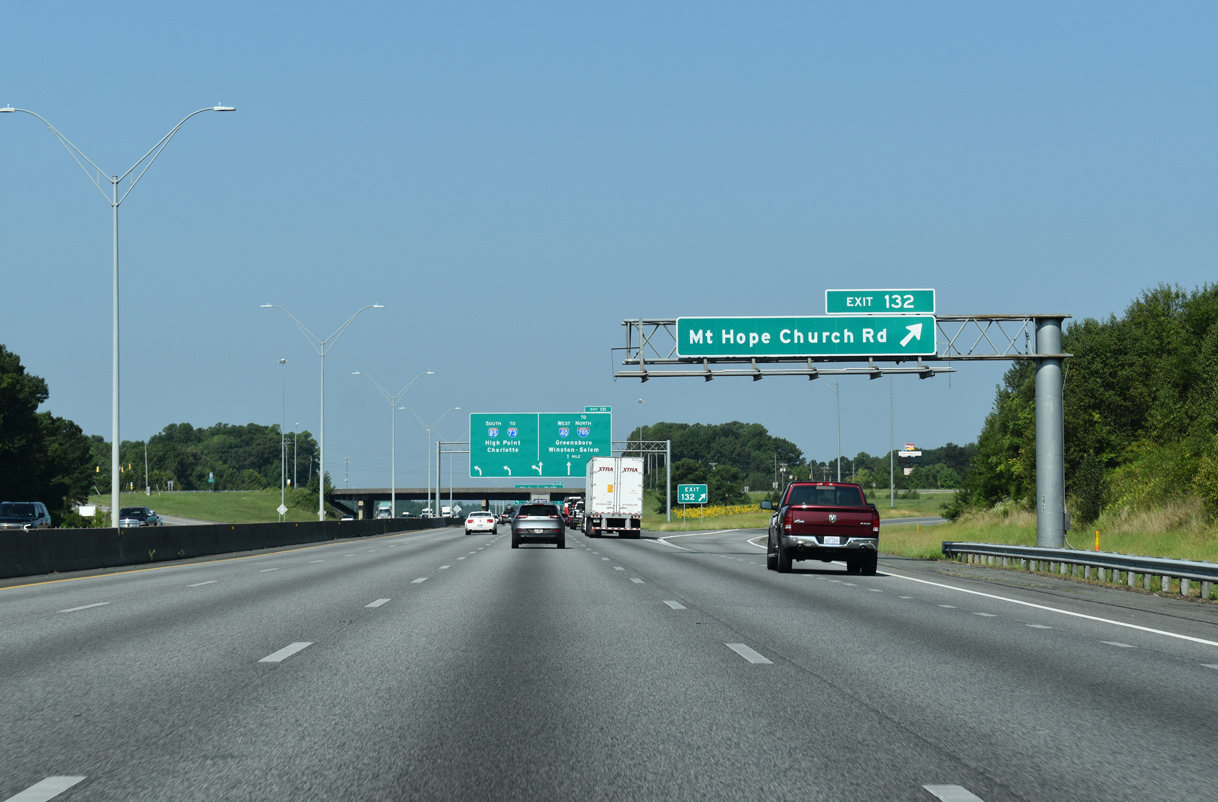
| Mt. Hope Church Road (SR 3045) winds northwest from a parclo interchange (Exit 132) with I-40/85 to U.S. 70 (Burlington Road) southwest of McLeansville and east of Bessemer. 08/23/21 |
|
| A diamond interchange previously joined SR 3045 with ramps utilizing parallel Knox Road (SR 3051) to the north and Millstream Road (SR 3143) to the south. The exchange was rebuilt in 2001 to eliminate weaving traffic between Exit 132 and the I-40/85 split. 08/23/21 |
|
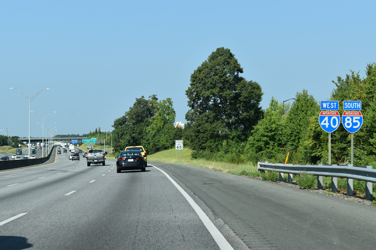
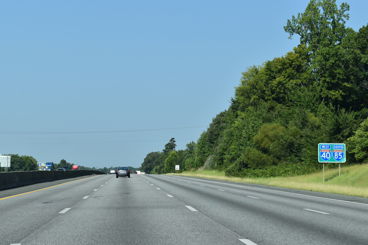
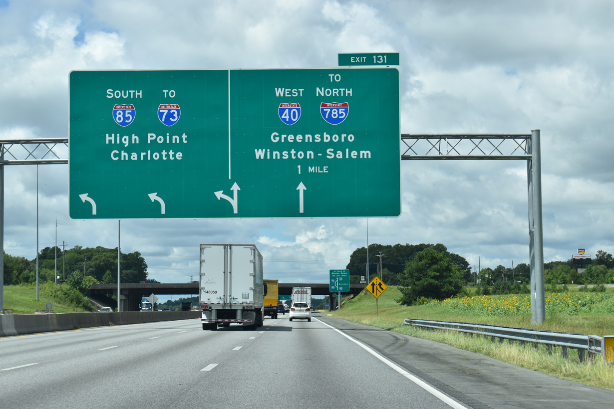
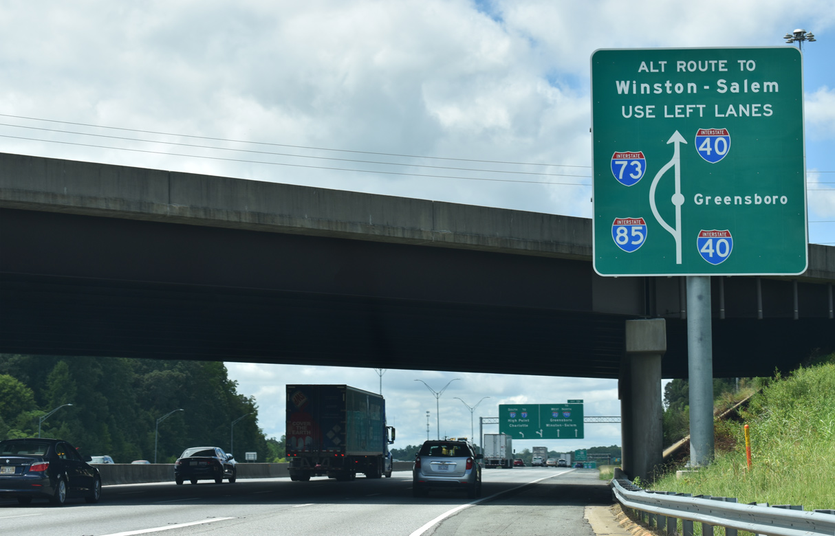
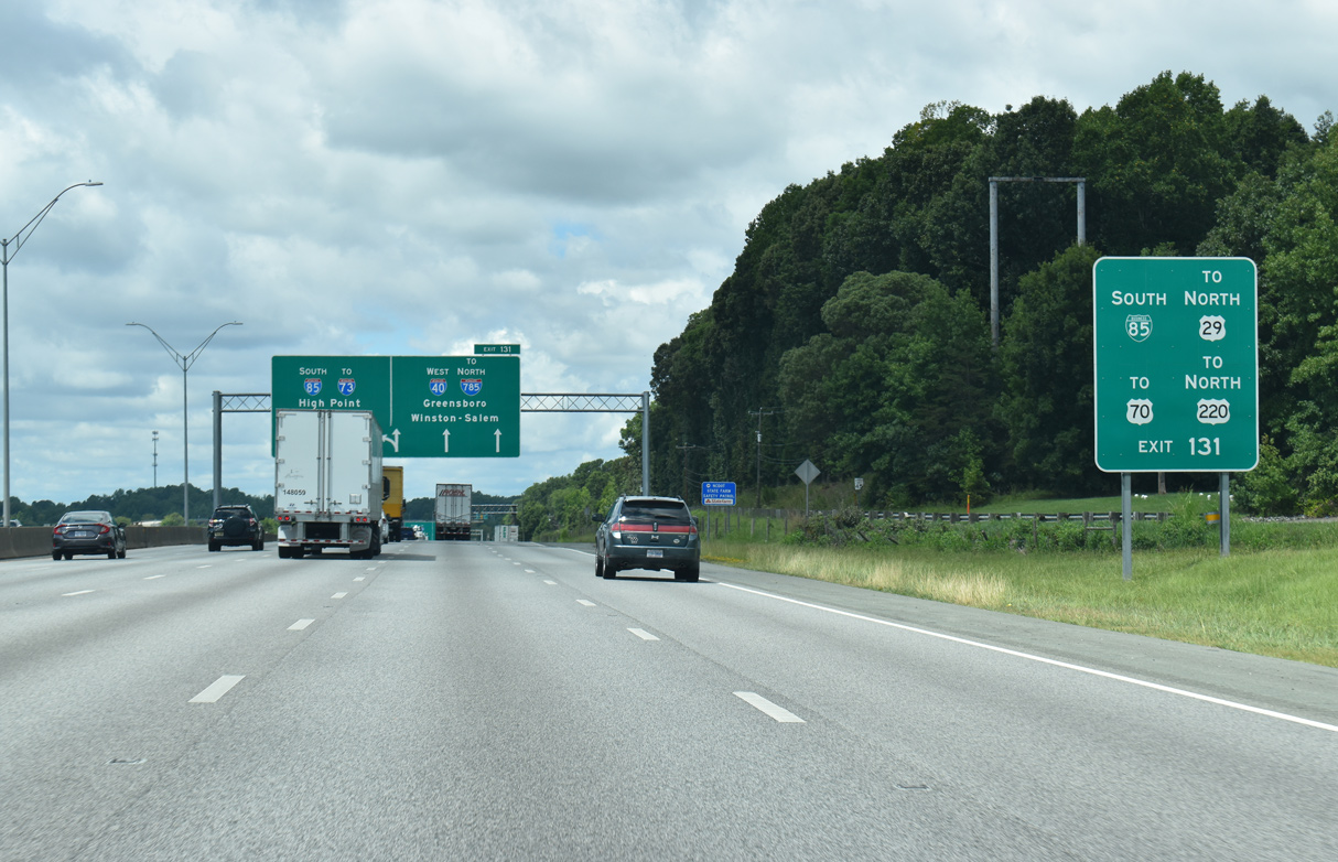
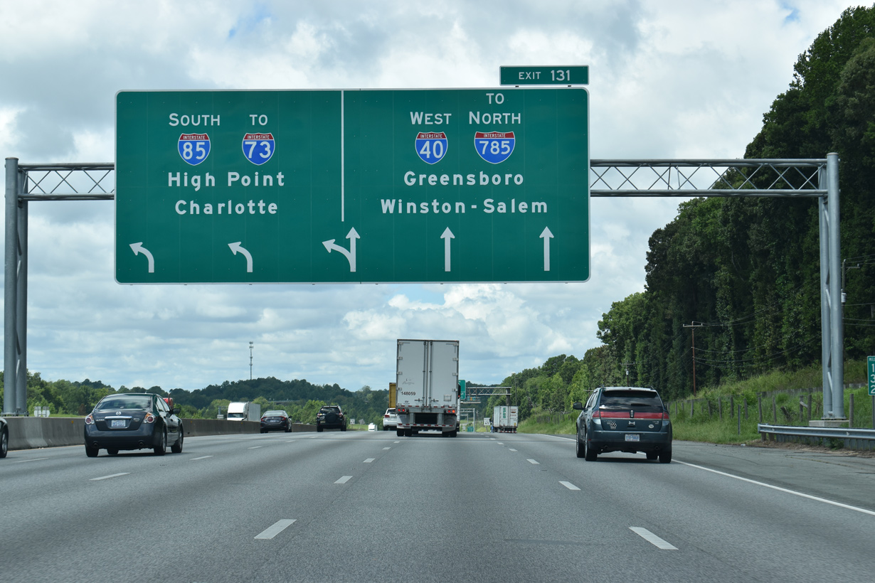
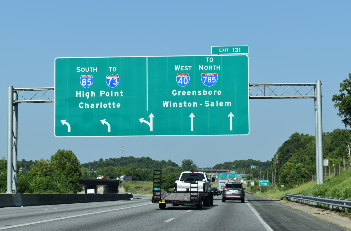
| I-85 separates from I-40 at a wye interchange (Exit 131) to bypass Greensboro to the south. Interstate 40 continues west to I-840/785 north and Downtown Greensboro. 08/18/21 |
|
| I-85 southwest to I-73/U.S. 220 and I-73/U.S. 421 northwest to I-840 provide a bypass around Greensboro for through traffic continuing west along Interstate 40 to Winston-Salem. 08/18/21 |
|
| Business Loop I-85 overlaps with I-40 west 7.57 miles to Left Exit 219 south of Downtown Greensboro, where it turns southwest alongside U.S. 29 toward High Point. 08/18/21 |
|
| I-40 connects I-85 with I-785/840 around the north side of Greensboro. I-73 was established along U.S. 220 south from I-85 to Asheboro and northwest to PTI Airport in 2008. 08/18/21 |
|
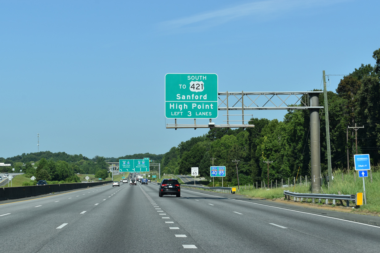
| U.S. 421 south joins Greensboro with Siler City and Sanford along a four lane corridor. U.S. 421 north combines with I-85 and I-73 to I-40 west from Greensboro toward Winston-Salem. Until September 2008, U.S. 421 followed Joseph Hunt, Jr. Expressway (SR 3762) north from Exit 126 to I-40/U.S. 29 west near the Rotherwood neighborhood. 08/13/21 |
|
| I-40/85 west enter outer reaches of the Greensboro city limits midway between Exit 132 and 131. 08/18/21 |
|
| Interstate 85 southwest from I-40 at Exit 131 to U.S. 29 southwest to High Point opened to traffic on February 21, 2004. Prior to that time, I-85 continued west alongside I-40 into central Greensboro to what was locally known as the Death Valley Interchange due to a high accident rate. 08/21/21 |
Page Updated 01-20-2023.

 West
West