|
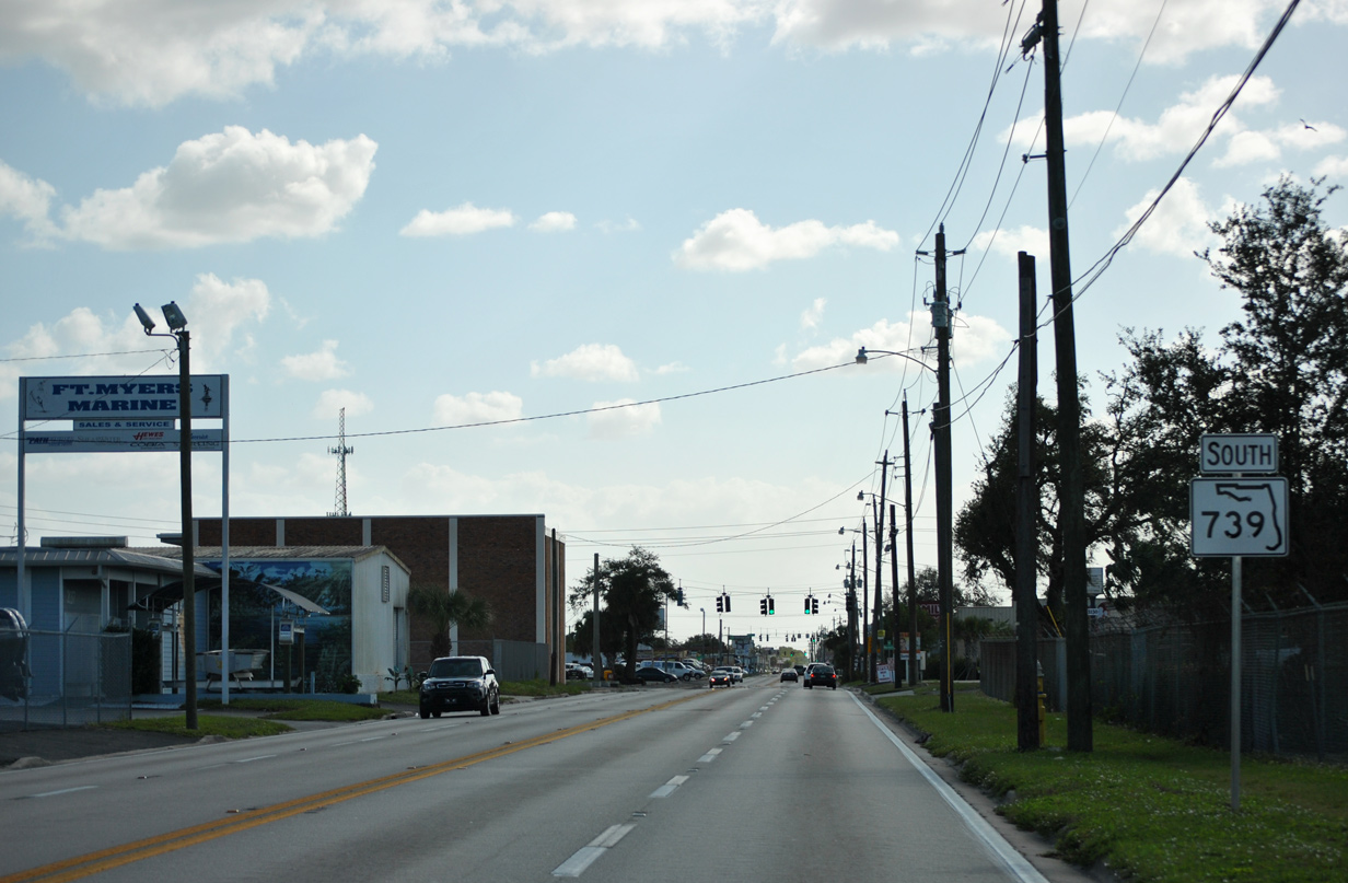
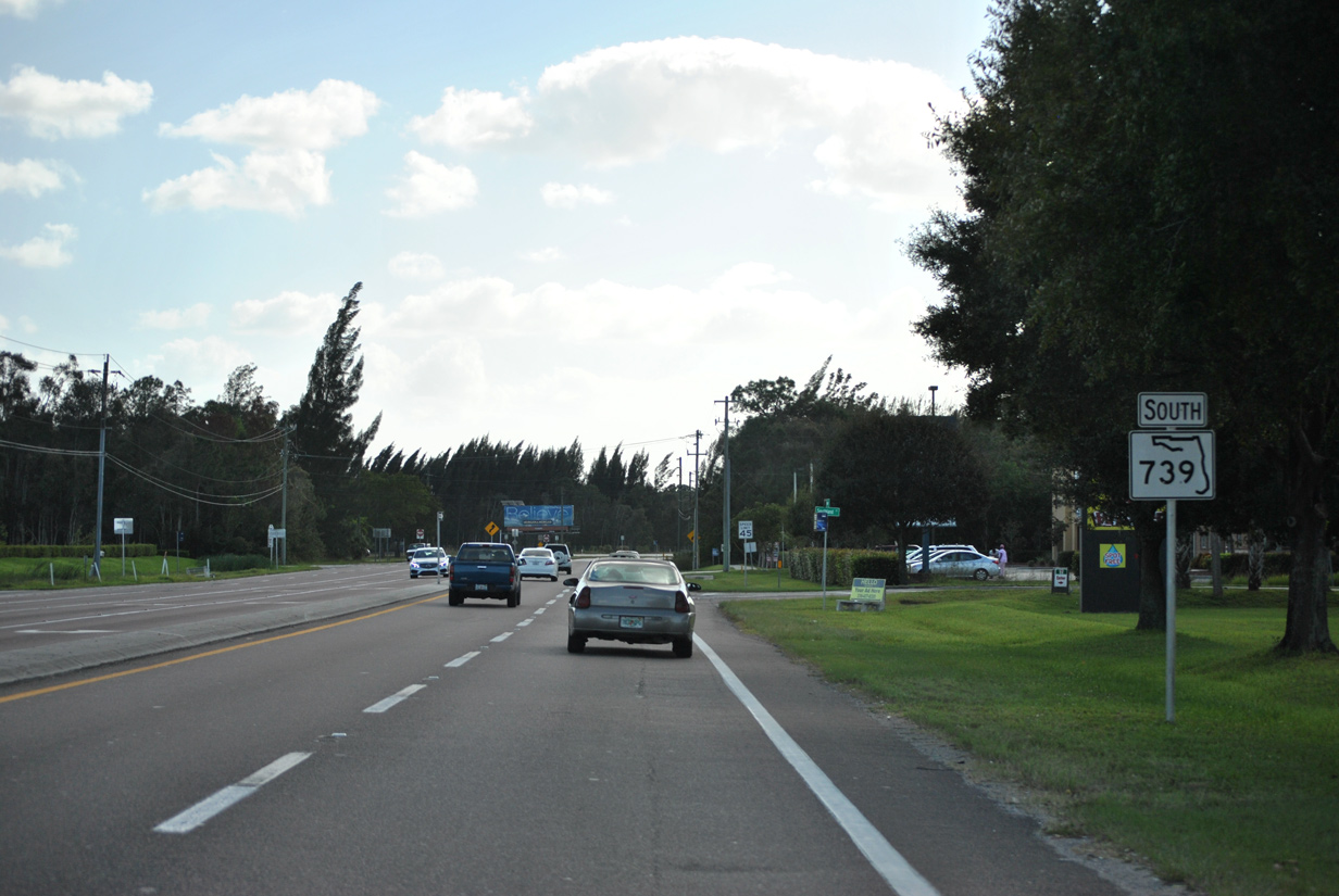
| SR 739 is initially posted along Fowler Street beyond the split with U.S. 41 Business and SR 80 (Second Street) west of downtown Fort Myers. The state road continues south on Fowler Street and Metro Parkway on a 11.2 mile course through Fort Myers. 11/26/15 |
|
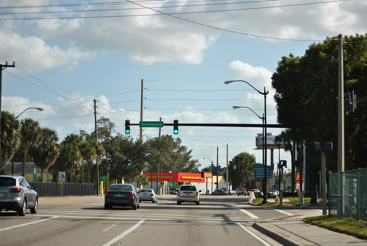
| Thompson Street constitutes a 0.4 mile connector between State Road 82 (Dr. Martin Luther King Jr. Boulevard) and U.S. 41 Business (Evans Avenue) north. 11/26/15 |
|
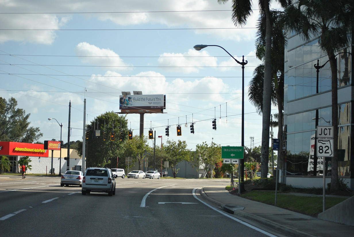
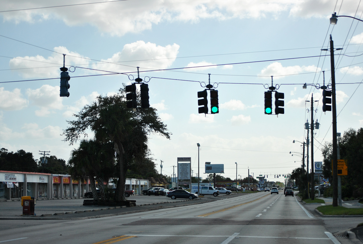
| Traffic advances one block south from Thompson Street to SR 82 (Martin Luther King Jr. Boulevard). SR 82 travels 29.9 miles on a southeast trajectory between U.S. 41 (Cleveland Avenue) near Downtown and SR 29 north of Immokalee in Collier County. 11/26/15 |
|
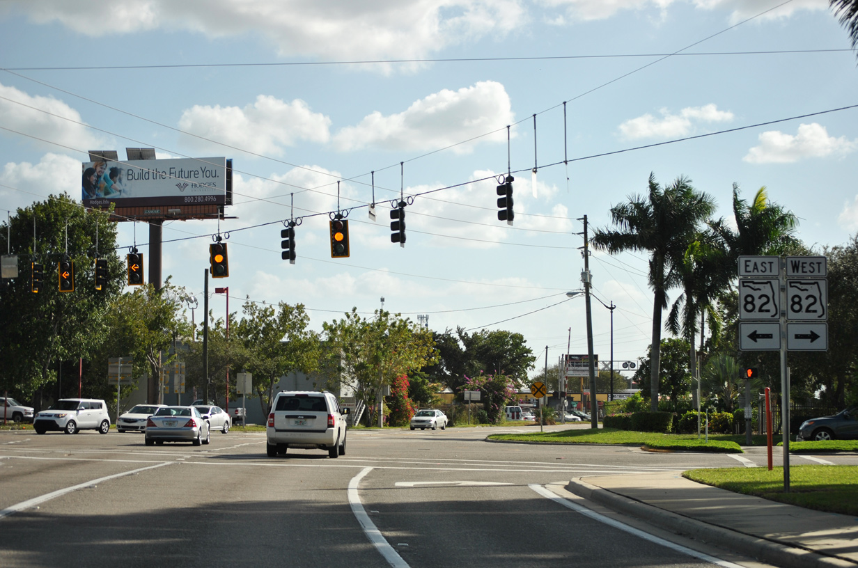
| SR 82 travels through Dunbar on its course southeast from downtown Fort Myers to Lehigh Acres, meeting SR 739 at this signalized intersection. 11/26/15 |
|
| This confirming marker for SR 739 stands along Fowler Street beyond the intersection with SR 82 (MLK, Jr. Boulevard). 11/26/15 |
|
| Market Street runs through the Fort Myers street grid between Central Avenue and Evans Avenue (SR 739) north. 11/26/15 |
|
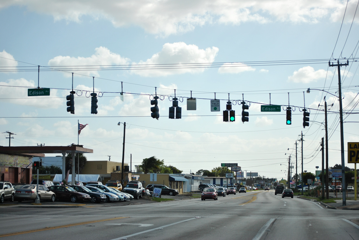
| SR 739 (Fowler Street) crosses Edison Avenue at this signalized intersection. Edison Avenue travels west to the City of Palms baseball park and U.S. 41 (Cleveland Avenue). Edison Avenue continues east into the Dunbar neighborhood and Veronica S. Shoemaker Boulevard. 11/26/15 |
|
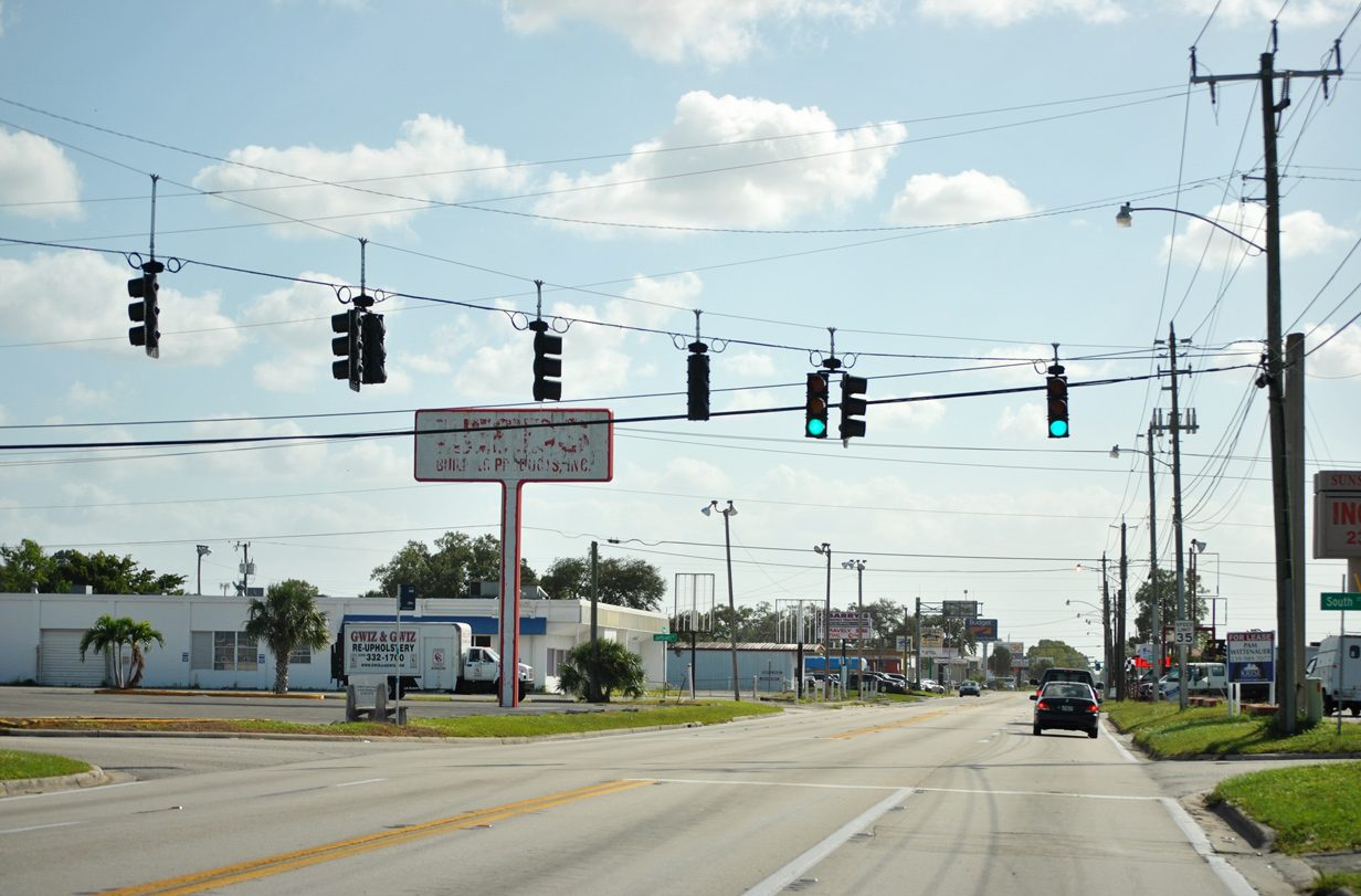
| South Street meets SR 739 (Fowler Street) south at the next signalized intersection. South Street spans across the street grid linking to U.S. 41 and Lee Memorial Hospital (west) and to the Southward Village neighborhood (east). 11/26/15 |
|
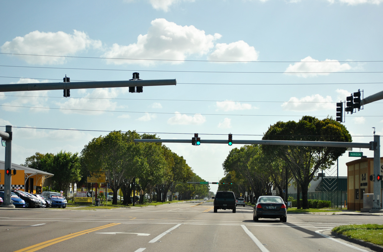
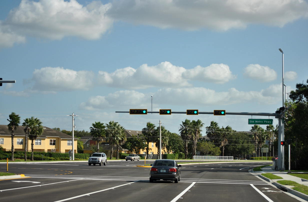
| State Road 739 (Fowler Street) next meets Hanson Street in central Fort Myers. Historically, SR 739 followed Hanson Street east to Old Metro Parkway south. 11/26/15 |
|
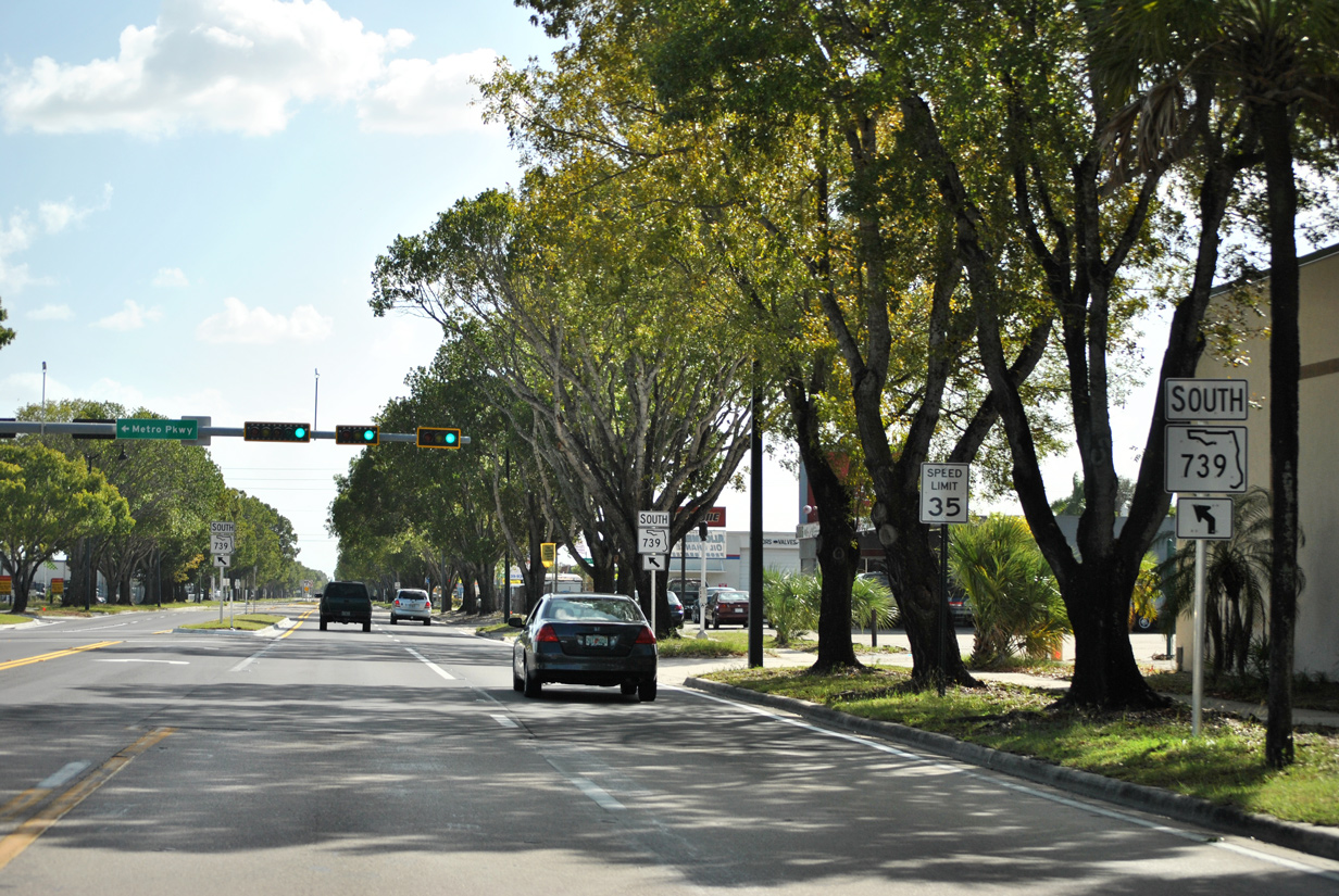
| These trailblazers alert drivers to the upcoming shift of SR 739 from Fowler Street to Metro Parkway. A $24 million project between 2012 and 2015 realigned Metro Parkway from north of Winkler Avenue to Evans and Fowler Streets. 11/26/15 |
|
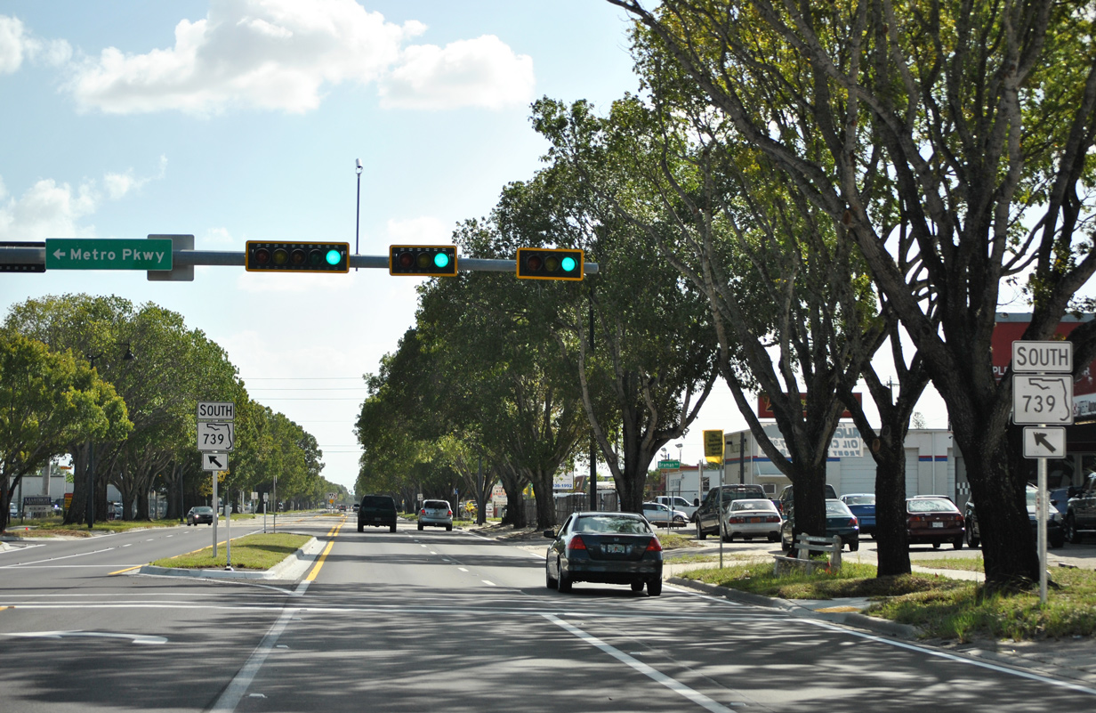
| Metro Parkway (SR 739) initially angles southeast from Fowler Street along a one way couplet to Evans Avenue. 11/26/15 |
|
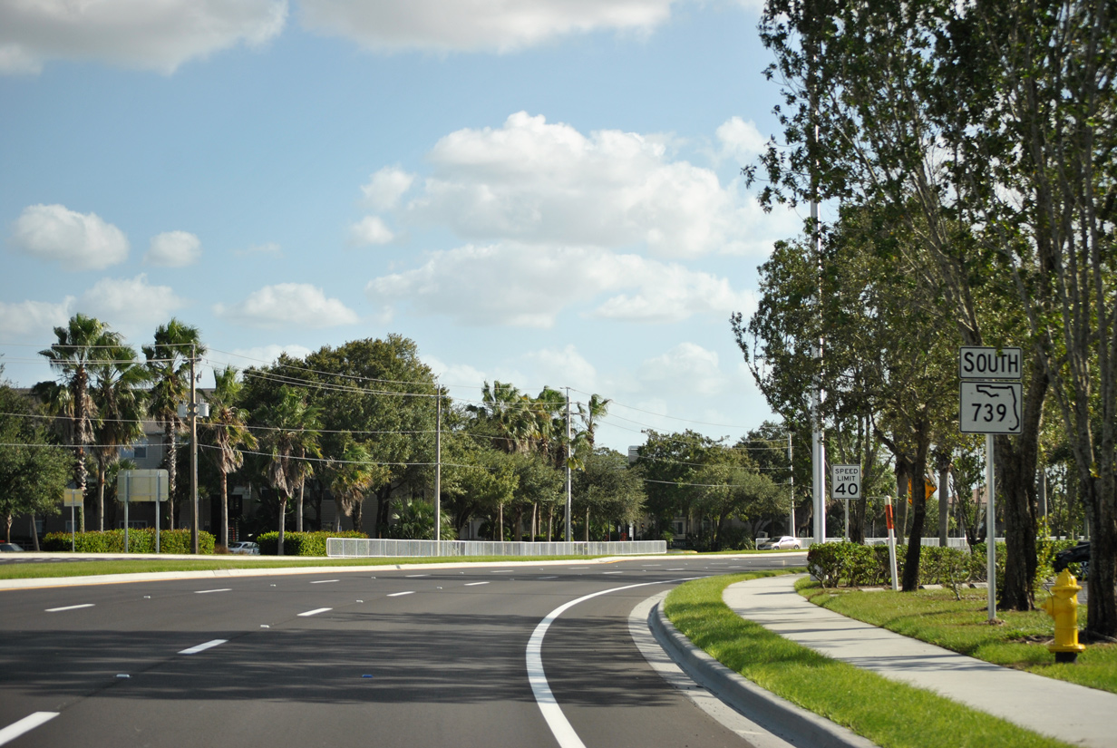
| SR 739 north overlays Evans Avenue along a one way couplet from this point to SR 80 (Second Street) near Dunbar. Metro Parkway continues southeasterly on a six lane divided boulevard to Winkler Avenue. 11/26/15 |
|
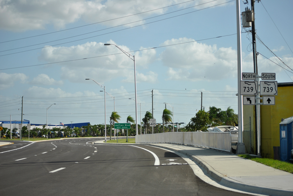
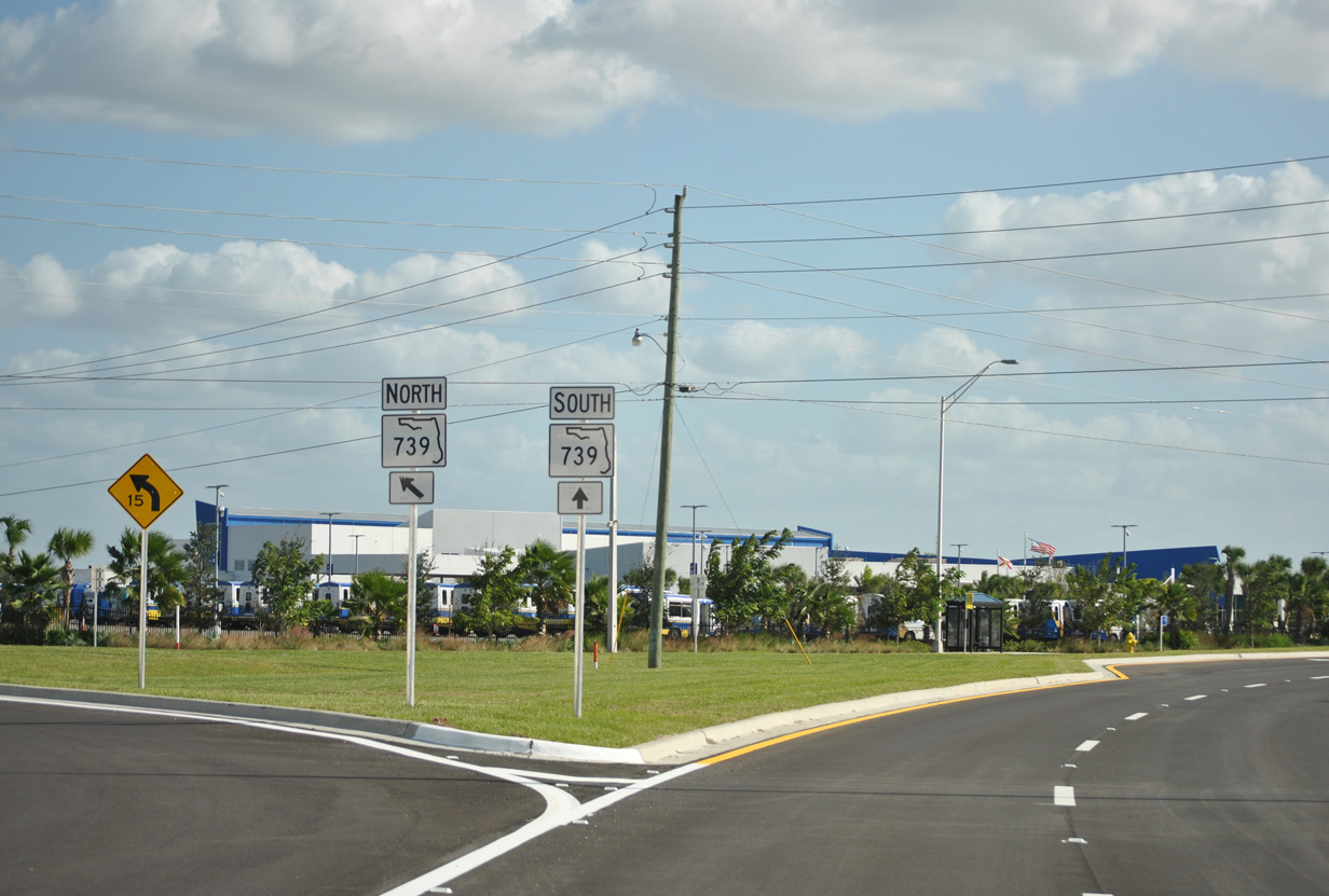
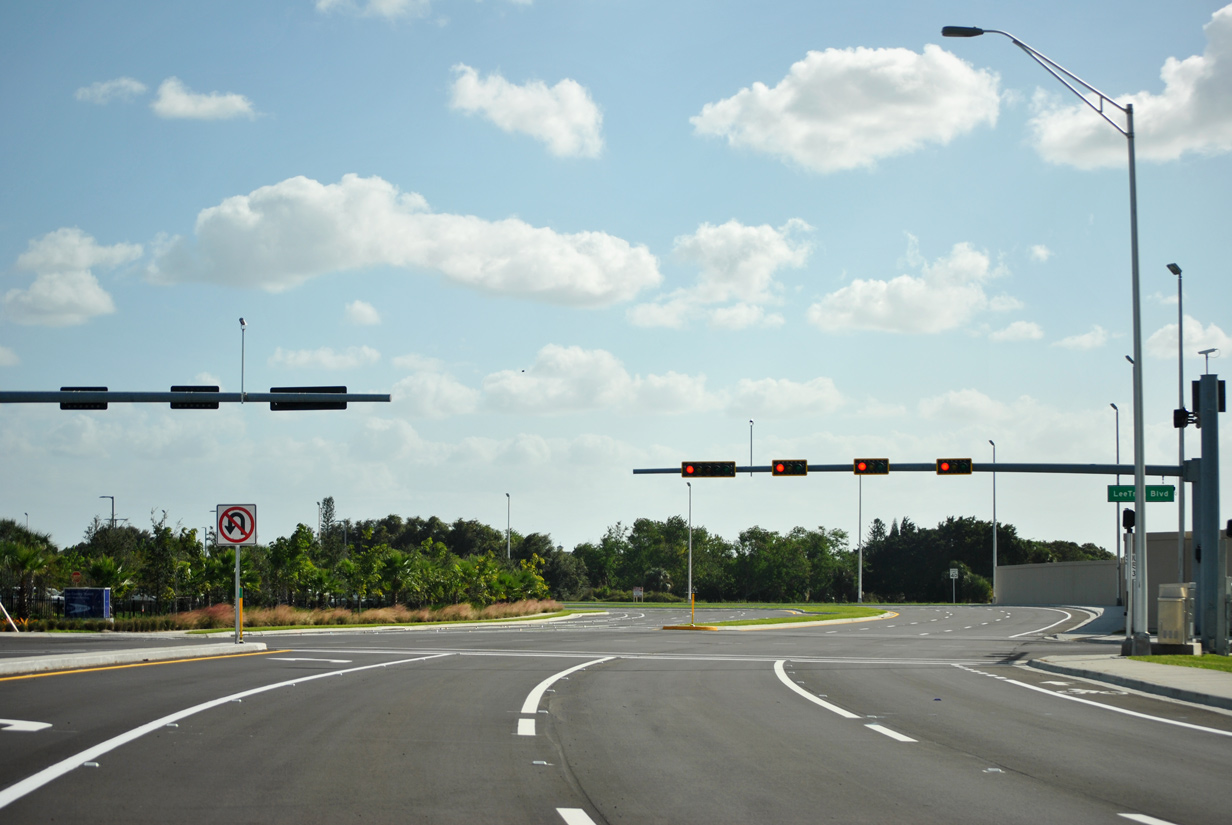
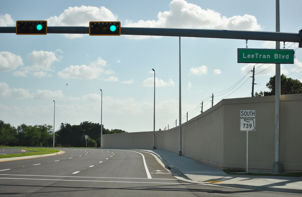
| Metro Parkway (SR 739) south next meets LeeTran Boulevard. LeeTran Boulevard was built in tandem with the realignment of SR 739 as a connector to Fowler Street.
The primary headquarters and hub for the Lee County Transit (LeeTran) system otherwise ties into the intersection from the east. 11/26/15 |
|
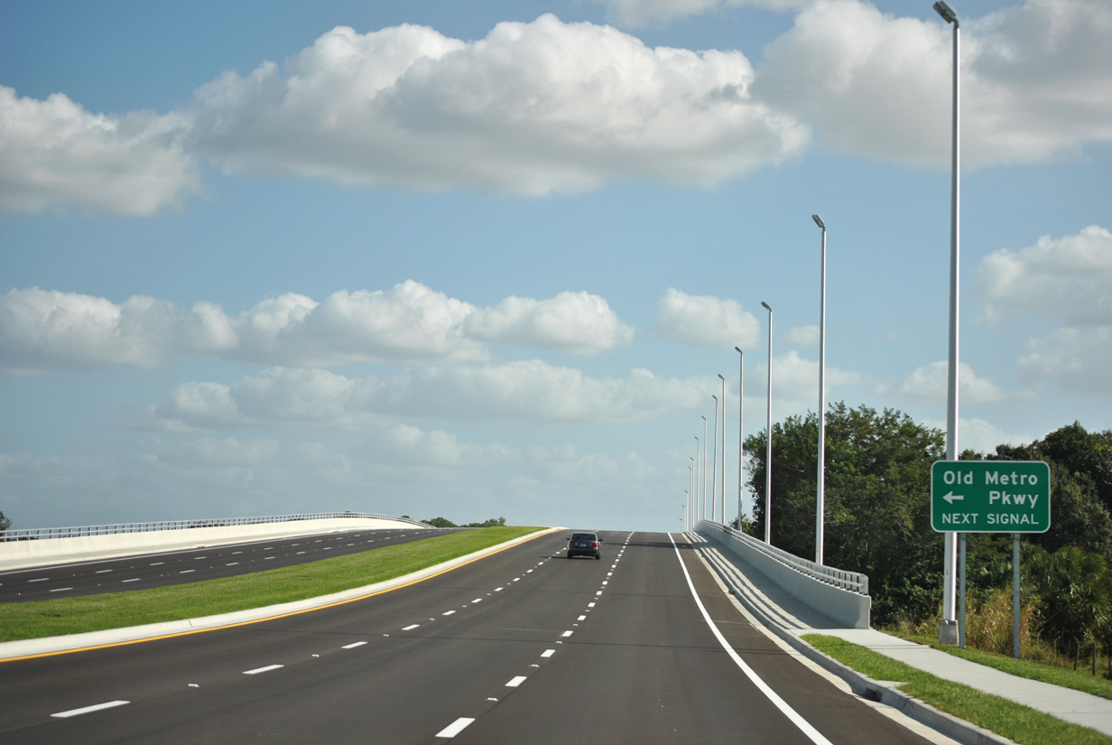
| SR 739 (Metro Parkway) re-curves southeast to span Palm Avenue, Ten Mile canal, and the Seminole Gulf Railway. Old Metro Parkway follows the overpass. 11/26/15 |
|
| Old Metro Parkway represents the former alignment of SR 739 prior to the November 2015 shift. The local road connects with Hanson Street to the north. 11/26/15 |
|
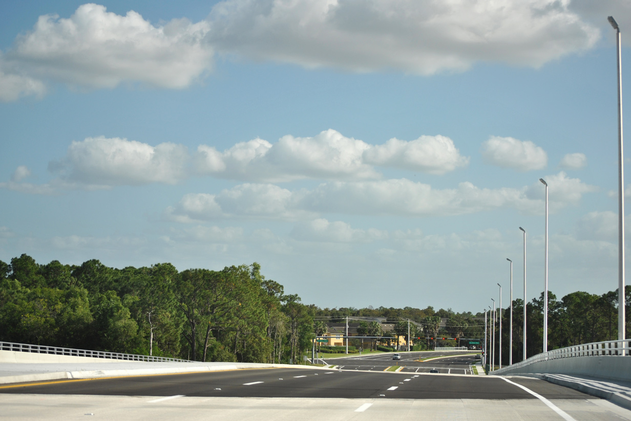
| SR 739 resumes a southward course beyond Old Metro Parkway. Winkler Avenue occurs next. 11/26/15 |
|
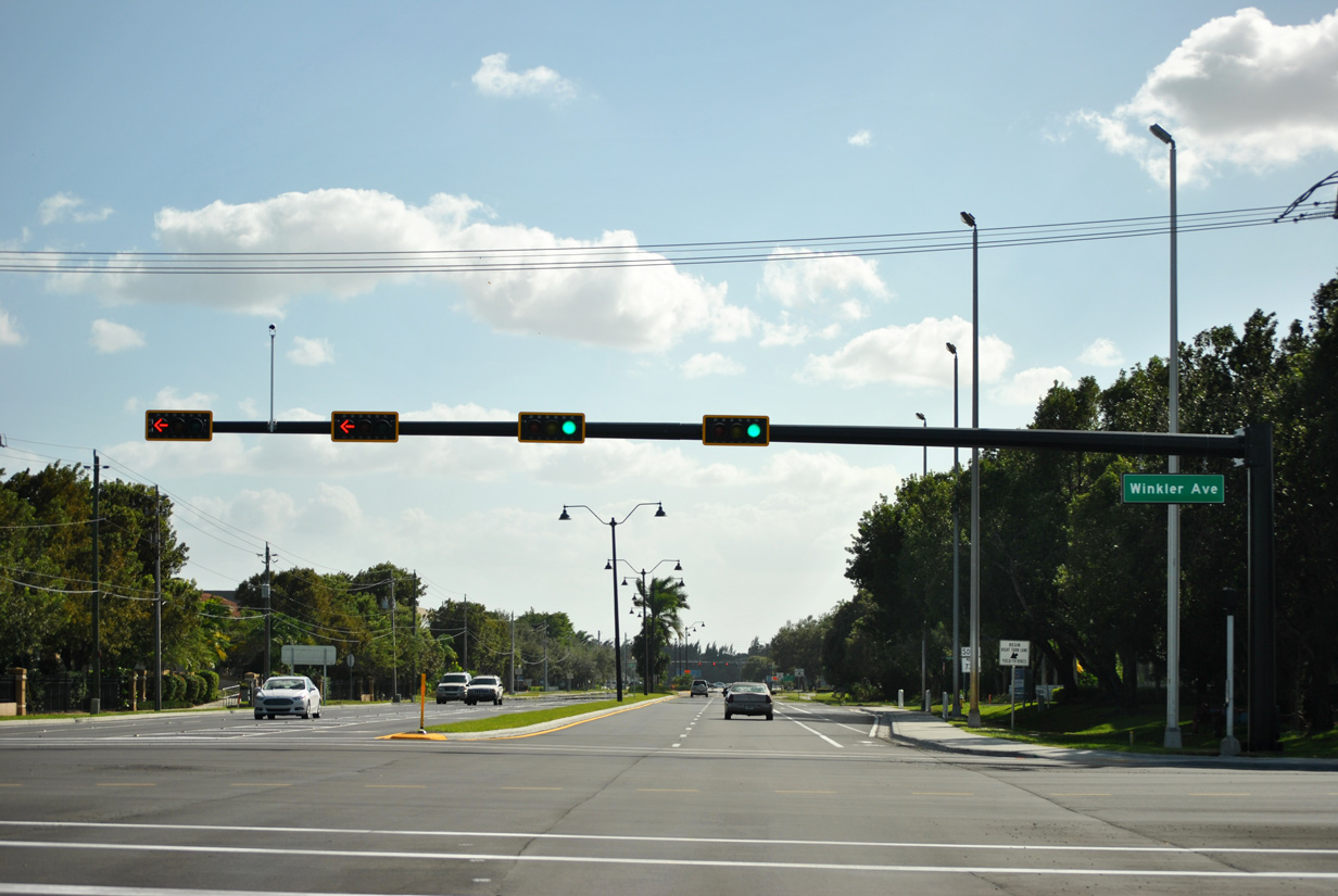
| Winkler Avenue is an urban arterial that stretches across central Fort Myers connecting SR 739 (Metro Parkway) with Cleveland Avenue (U.S. 41) to the west and Six Mile Cypress Parkway (CR 865) to the east. 11/26/15 |
|
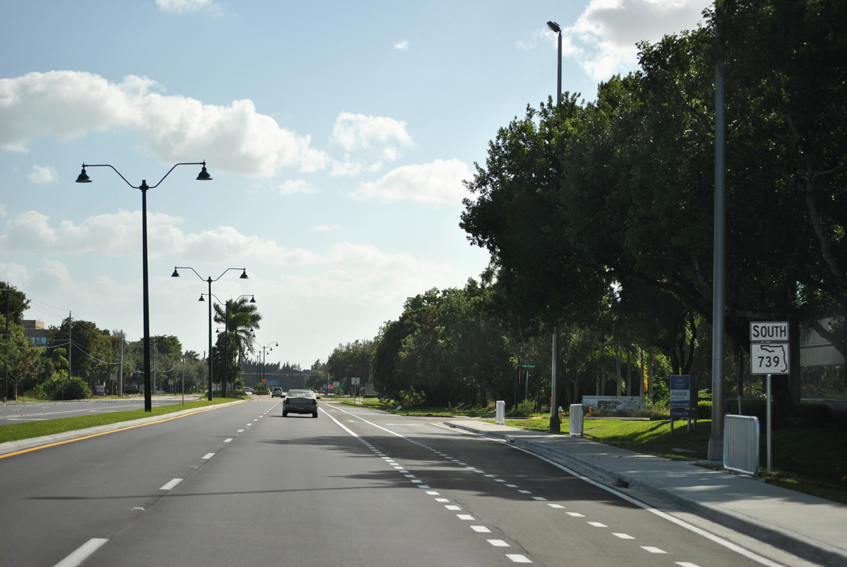
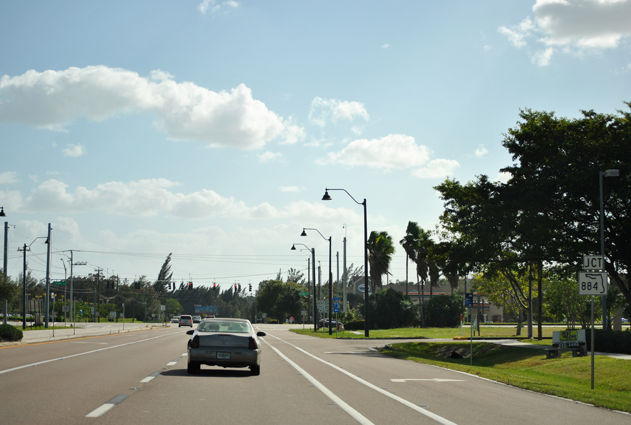
| The Metro Park business complex lines the western side of SR 739 between Winkler Avenue and upcoming SR 884 (Colonial Boulevard). 11/26/15 |
|
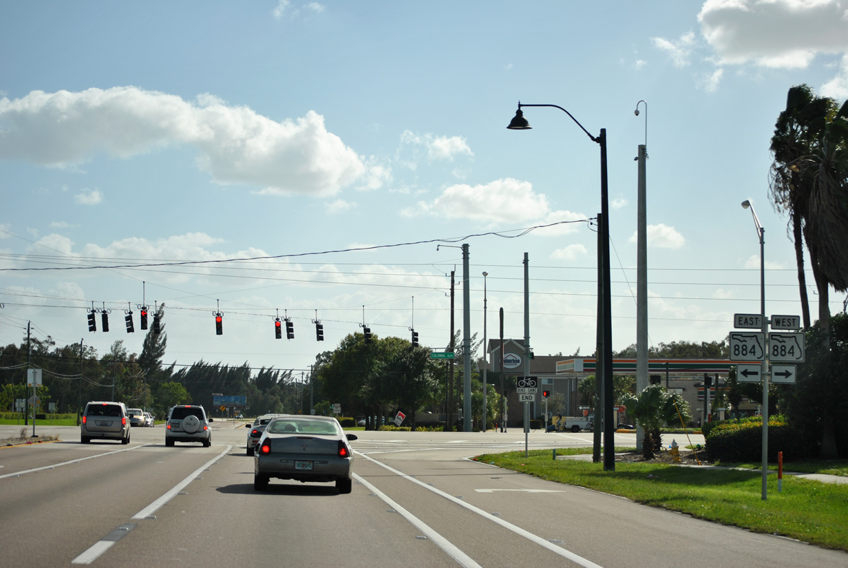
| SR 884 constitutes part of a major 37.6 mile thoroughfare joining SR 739 with I-75 and Lehigh Acres to the east and central Cape Coral to the west. 11/26/15 |
|
| SR 884 follows Colonial Boulevard between U.S. 41 (Cleveland Avenue) and Interstate 75 while CR 884 continues east to SR 82 and Lehigh Acres and west across the Midpoint Memorial Bridge into Cape Coral. 11/26/15 |
|
| SR 739 advances south from Colonial Boulevard into industrial areas of South Fort Myers. 11/26/15 |
|
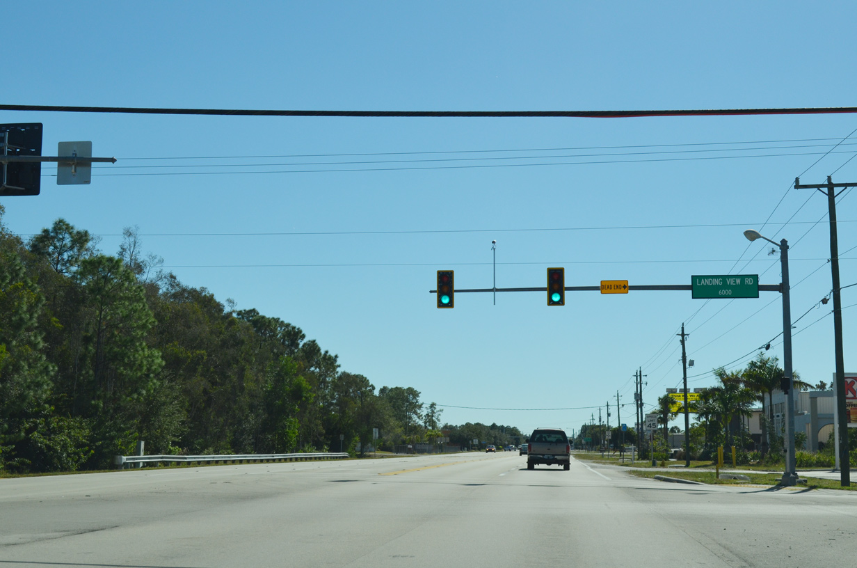
| Landing View Road is a short spur that dead ends at the east boundary of Page Field (FMY), providing no direct access to the airport. This stretch of Metro Parkway consists primarily of a five lane arterial with a continuous center turn lane to Daniels Parkway. 11/22/12 |
|
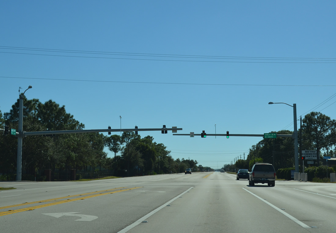
| The ensuing signal along SR 739 (Metro Parkway) south occurs at Danley Drive. Danley Drive lines the southern edge of Page Field before turning south to meet Beacon Manor Drive. 11/22/12 |
|
| Crystal Drive lines residential neighborhoods between Metro Parkway (SR 739)and U.S. 41 (Cleveland Avenue) to the west. Otherwise, Crystal Drive continues east to Plantation Road. 11/22/12 |
|
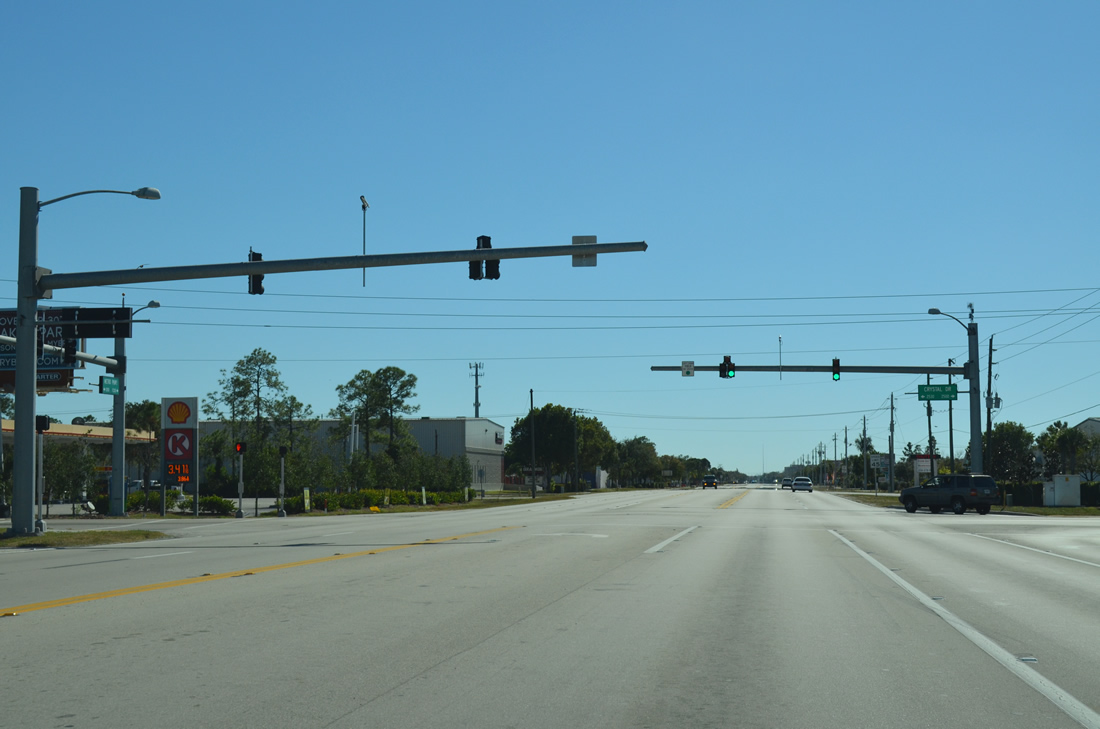
| Remnants of a traffic signal span Metro Parkway at Commerce Park Drive. SR 739 next crosses Lee County Road 876 (Daniels Parkway). 11/22/12 |
|
| Daniels Parkway (CR 876) represents another major east-west thoroughfare along SR 739 south, connecting the state road with areas of South Fort Myers, Lehigh Acres, and Southwest Florida International Airport (RSW). 11/22/12 |
|
| CR 876 is periodically signed along its entire stretch of Daniels Parkway. The six lane arterial is lined with commercial centers and residential neighborhoods on its course through southern reaches of Fort Myers. 11/22/12 |
|
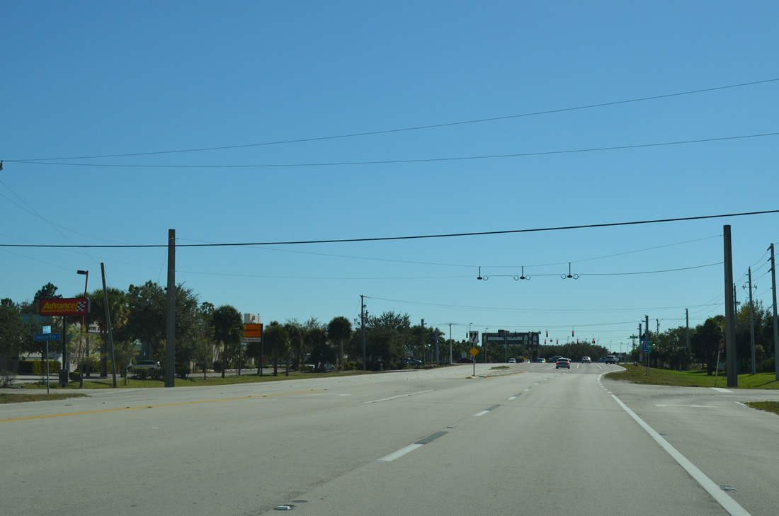
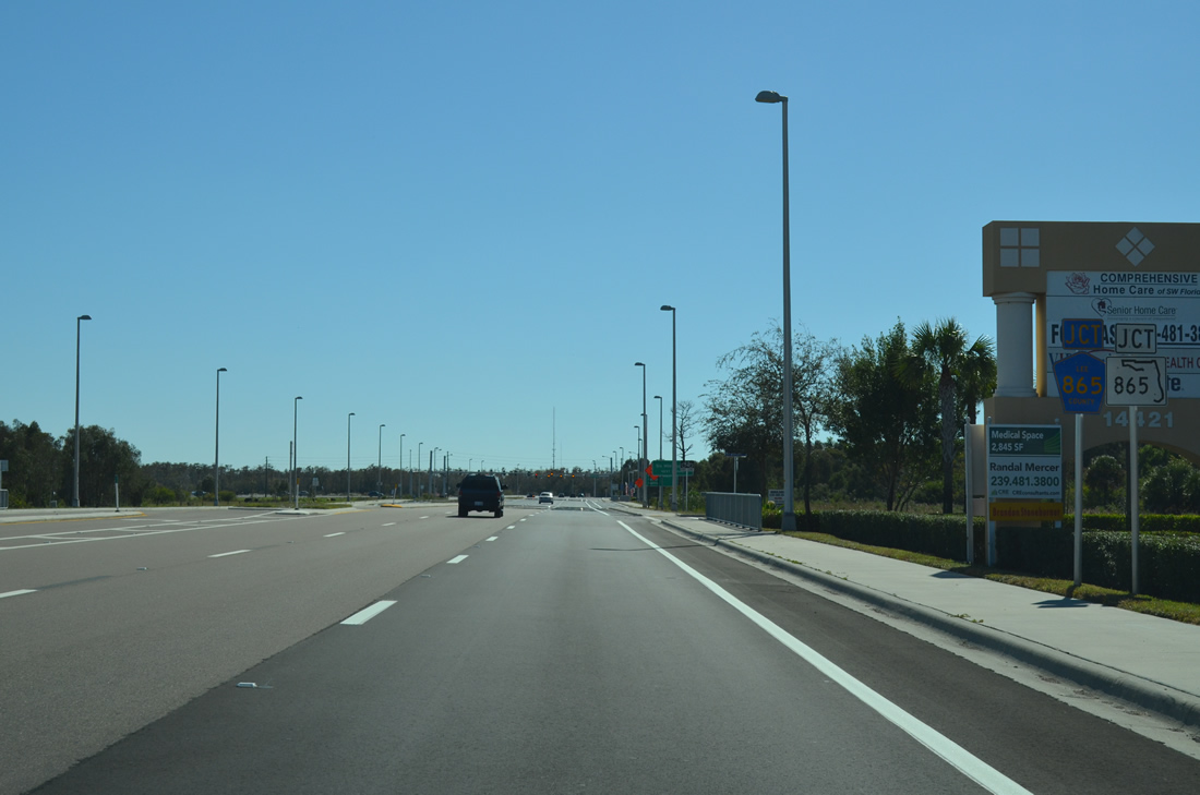
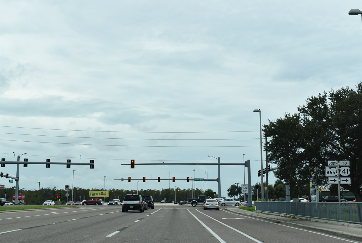
| SR 739 advances south from Daniels Parkway (CR 876) along a six lane arterial. SR 865 / CR 865 (Six Miles Cypress Parkway) crosses Metro Parkway 1.2 miles ahead. 10/03/20 |
|
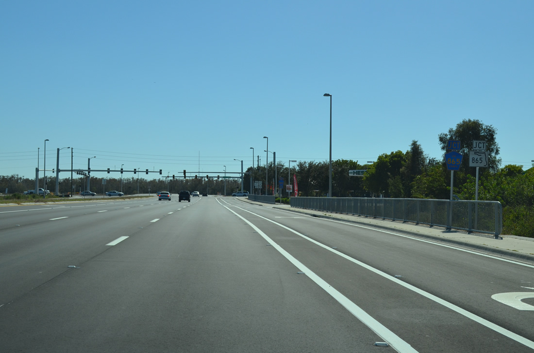
| The first of two assemblies for SR 865/CR 865 (Six Mile Cypress/Ben C. Pratt Parkway) is posted ahead of Krypton Lane. 10/03/20 |
|
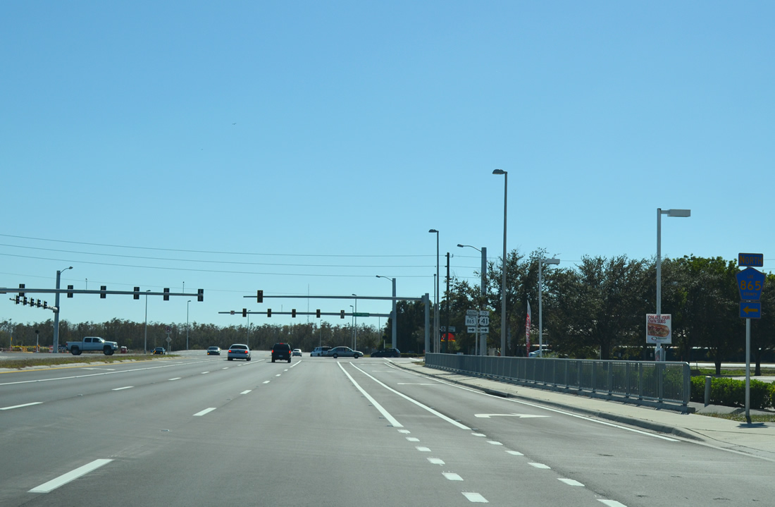
| SR 865/CR 865 joins SR 739 (Metro Parkway) directly with Fort Myers Beach while providing access to McGregor Boulevard (CR 867) to Sanibel and Captiva islands. 10/03/20 |
|
| SR 865/CR 865 follows a 38 mile course from Bonita Springs in south Lee County to Tice located east of Fort Myers. The route encompasses two state maintained portions, one between Fort Myers Beach and Iona with the other between U.S. 41 and SR 739. 10/03/20 |
|
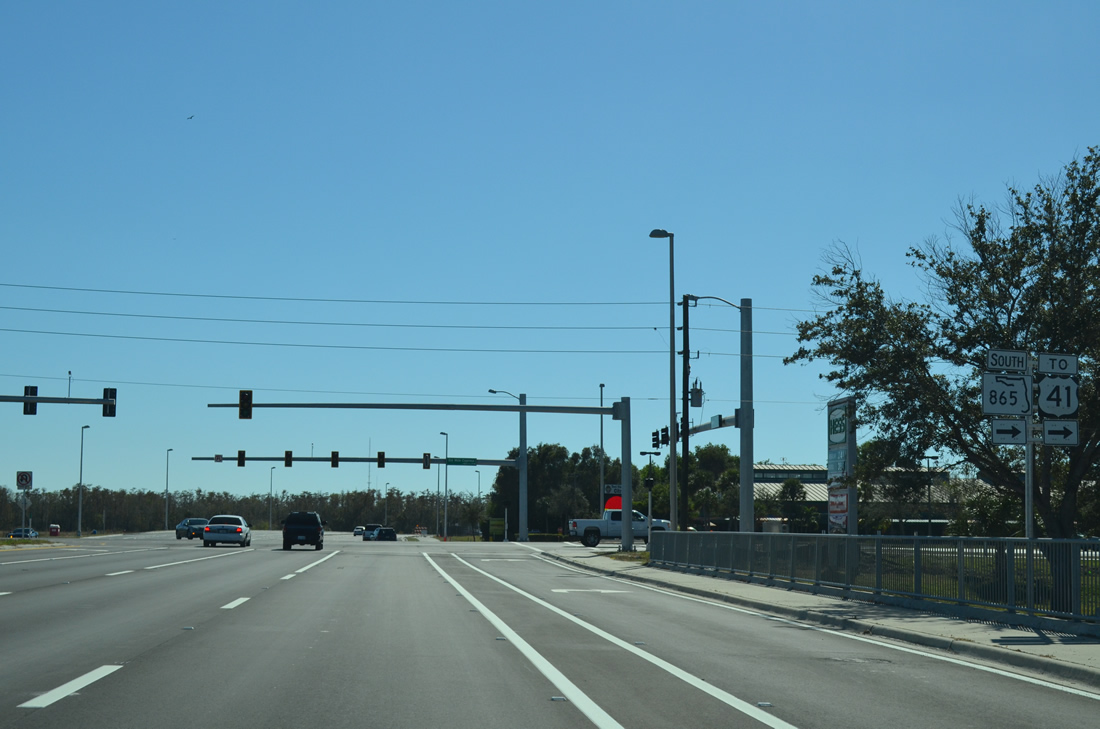
| CR 865 (Six Mile Cypress Parkway) arcs from SR 739 (Metro Parkway) to Daniels Parkway and SR 884 (Colonial Boulevard), ending at SR 80 (Palm Beach Boulevard) in Tice. 10/03/20 |
|
| SR 865 extends 1.16 miles west to U.S. 41 (S Tamiami Trail) near Lakes Regional Park. CR 865 continues from U.S. 41 along Gladiolus Drive to Harlem Heights and Iona. 10/03/20 |
|
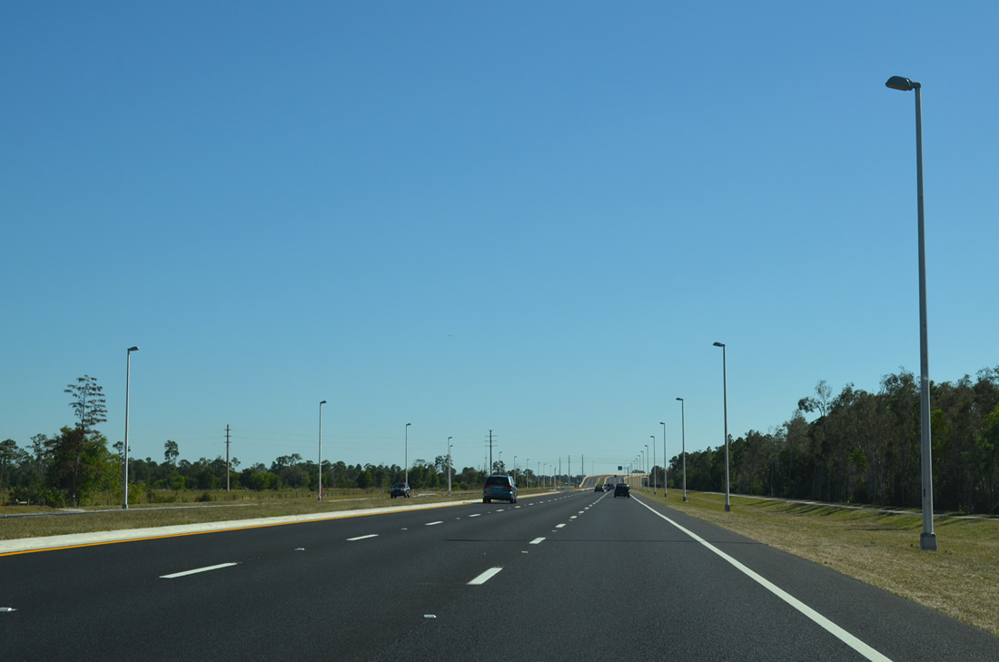
| The remaining 2.8 miles of SR 739 is known as the Michael G. Rippe Parkway. This final segment opened to traffic in October 2012 after 20 years of planning. 10/03/20 |
|
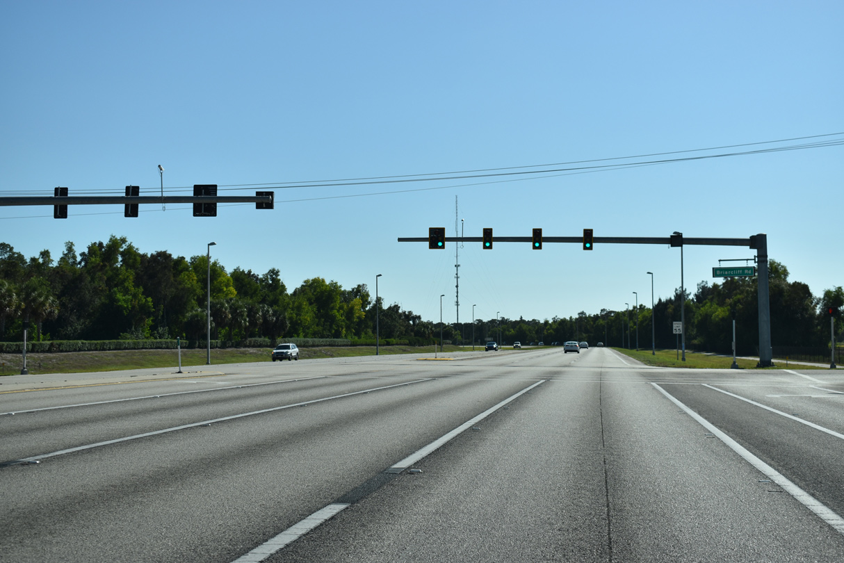
| Briarcliff Road is the lone crossing along the section of SR 739 between SR 865 and Alico Road/U.S. 41. 10/03/20 |
|
| Michael G. Rippe Parkway (SR 739) shifts southeast ahead of the connection to Alico Road east. 11/22/12 |
|
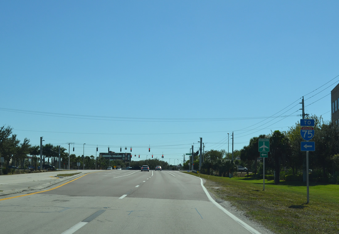
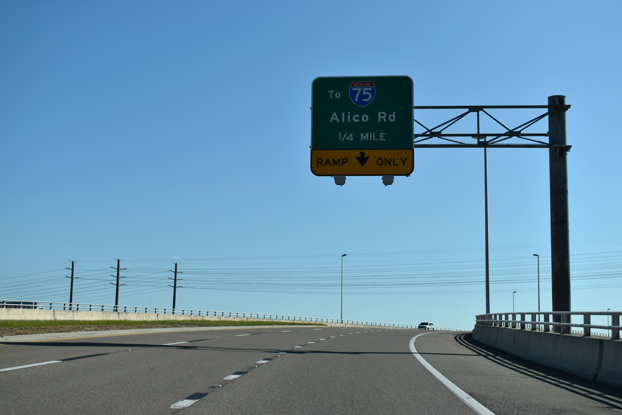
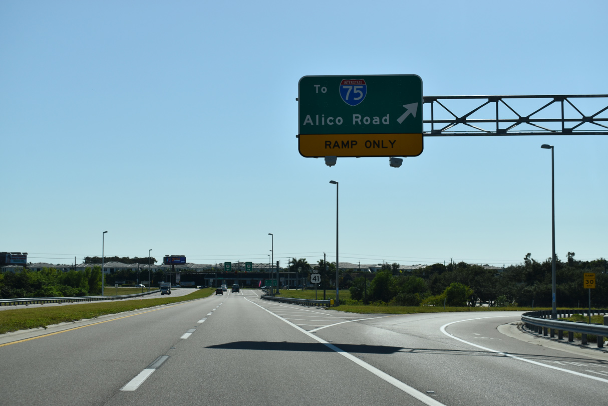
| SR 739 (Michael G. Rippe Parkway) south rises over a Seminole Gulf rail line and Alico Road (CR 840) as it bends south to meet U.S. 41 (Tamiami Trail). Alico Road connects U.S. 41 and SR 739 with Interstate 75 near RSW airport. 11/30/19 |
|
| A loop ramp joins Michael G. Rippe Parkway south with Alico Road (CR 840) east. Alico Road connects SR 739 with Florida Gulf Coast University (via Ben Hill Griffin Parkway) beyond I-75. 11/30/19 |
|
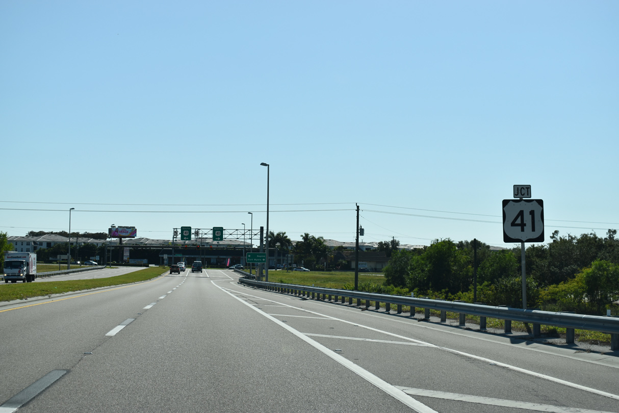
| Beyond the ramp to Alico Road east, SR 739 advances quickly to end at U.S. 41 (Tamiami Trail). 11/30/19 |
|
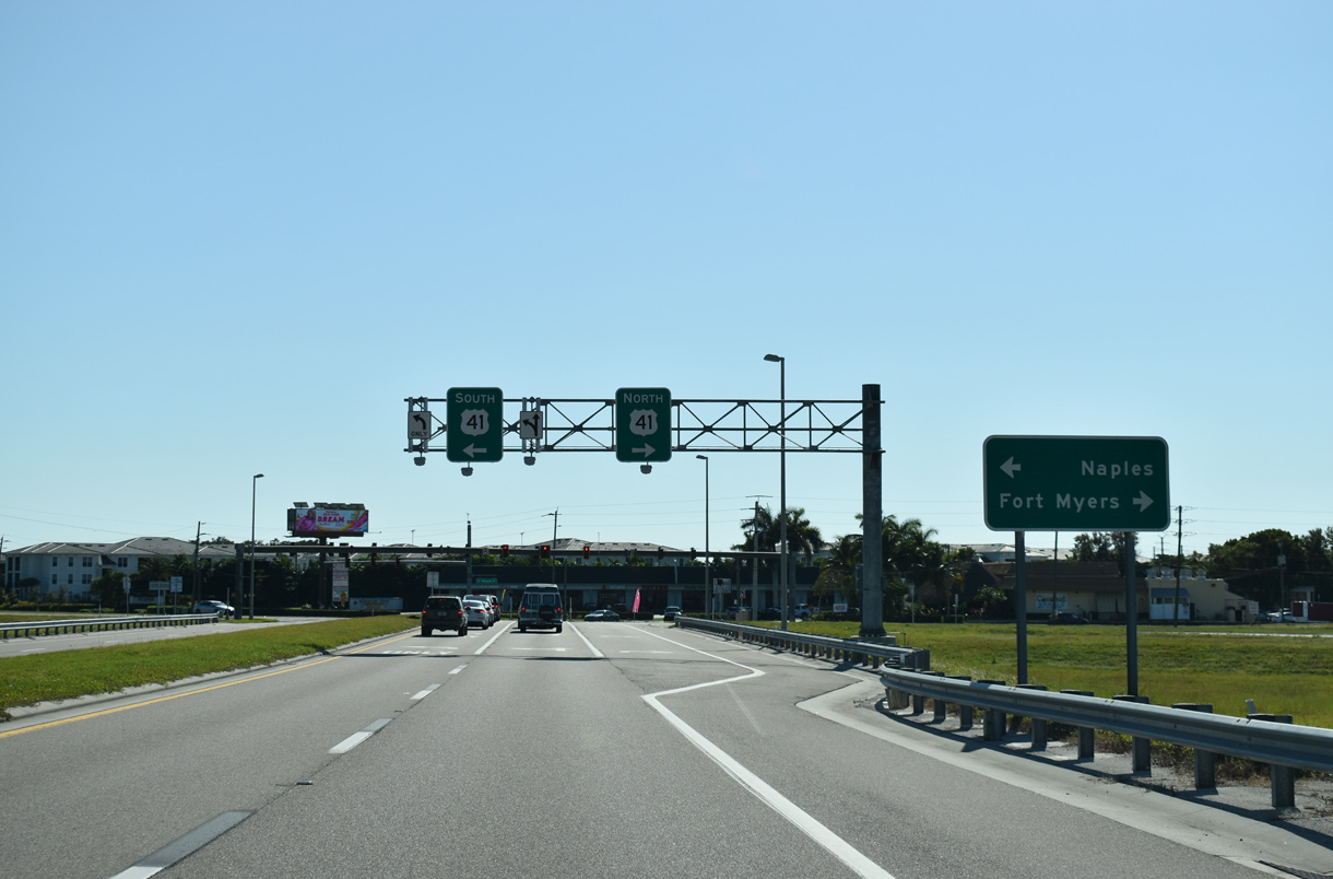
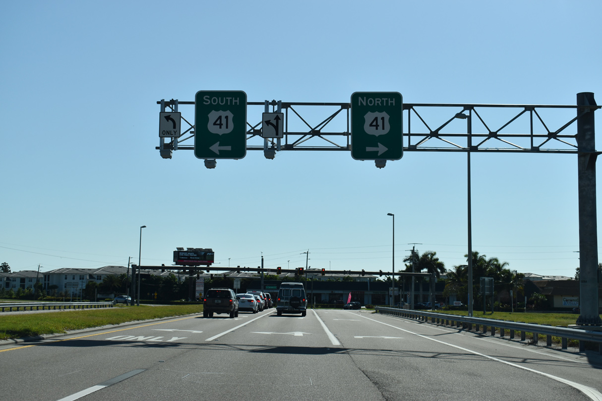
| SR 739 (Michael G. Rippe Parkway) south concludes as lanes partition for U.S. 41 north to Fort Myers and south to San Carlos Park, Estero, and Bonita Springs. 11/30/19 |
Page Updated 12-02-2019.

 South
South