|
| U.S. 25 splits with Poinsett Highway (U.S. 25 Connector) and stays east of Downtown Travelers Rest along a commercialized bypass. U.S. 25 Connector also provides a cut-off to U.S. 276 west to Renfrew. 07/10/10 |
|
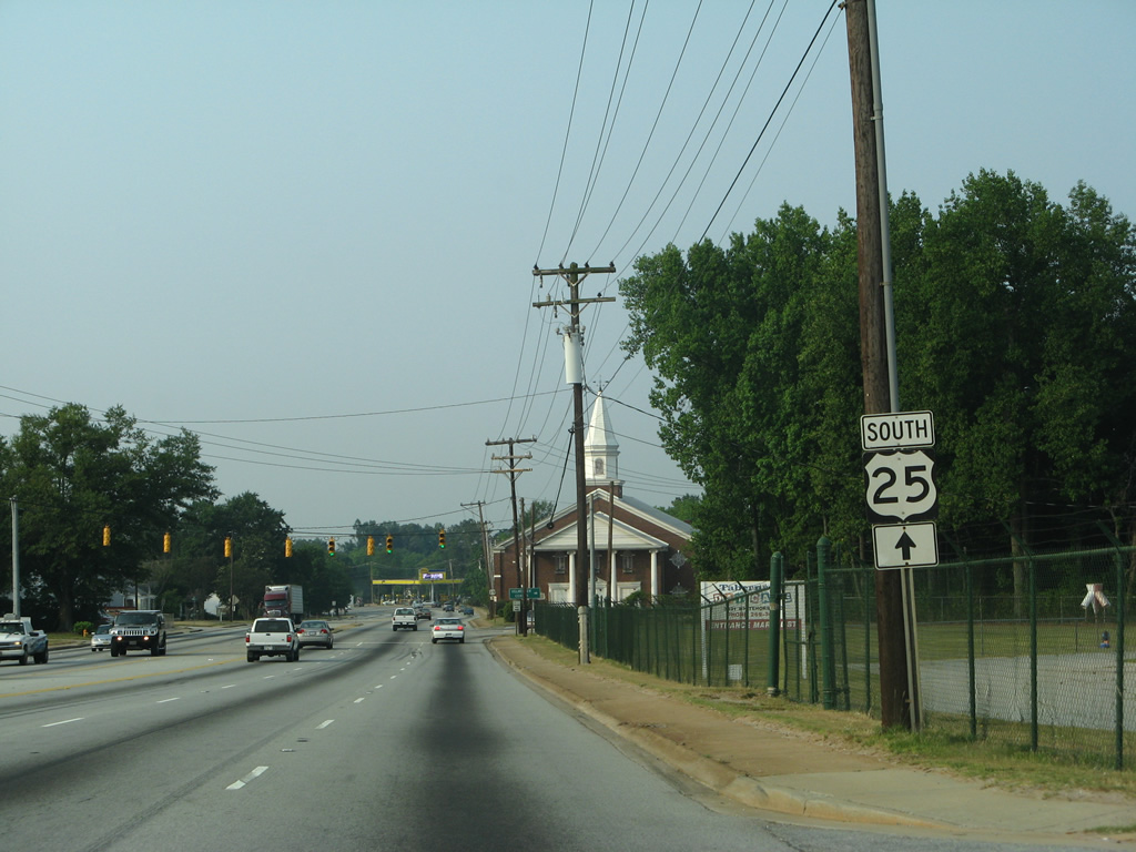
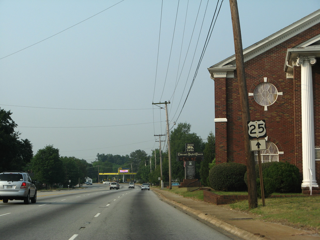
| Eastbound U.S. 276 combines with U.S. 25 south for 0.34 miles in southern reaches of Travelers Rest. Edwards Street ties into the two routes from parallel Old Buncombe Road. 08/04/16 |
|
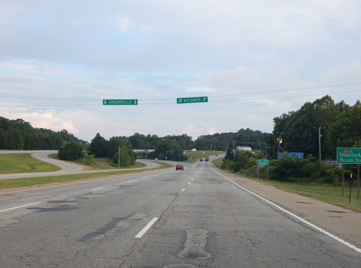
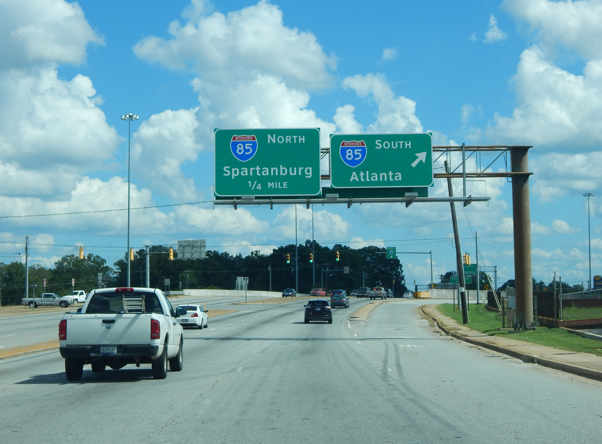
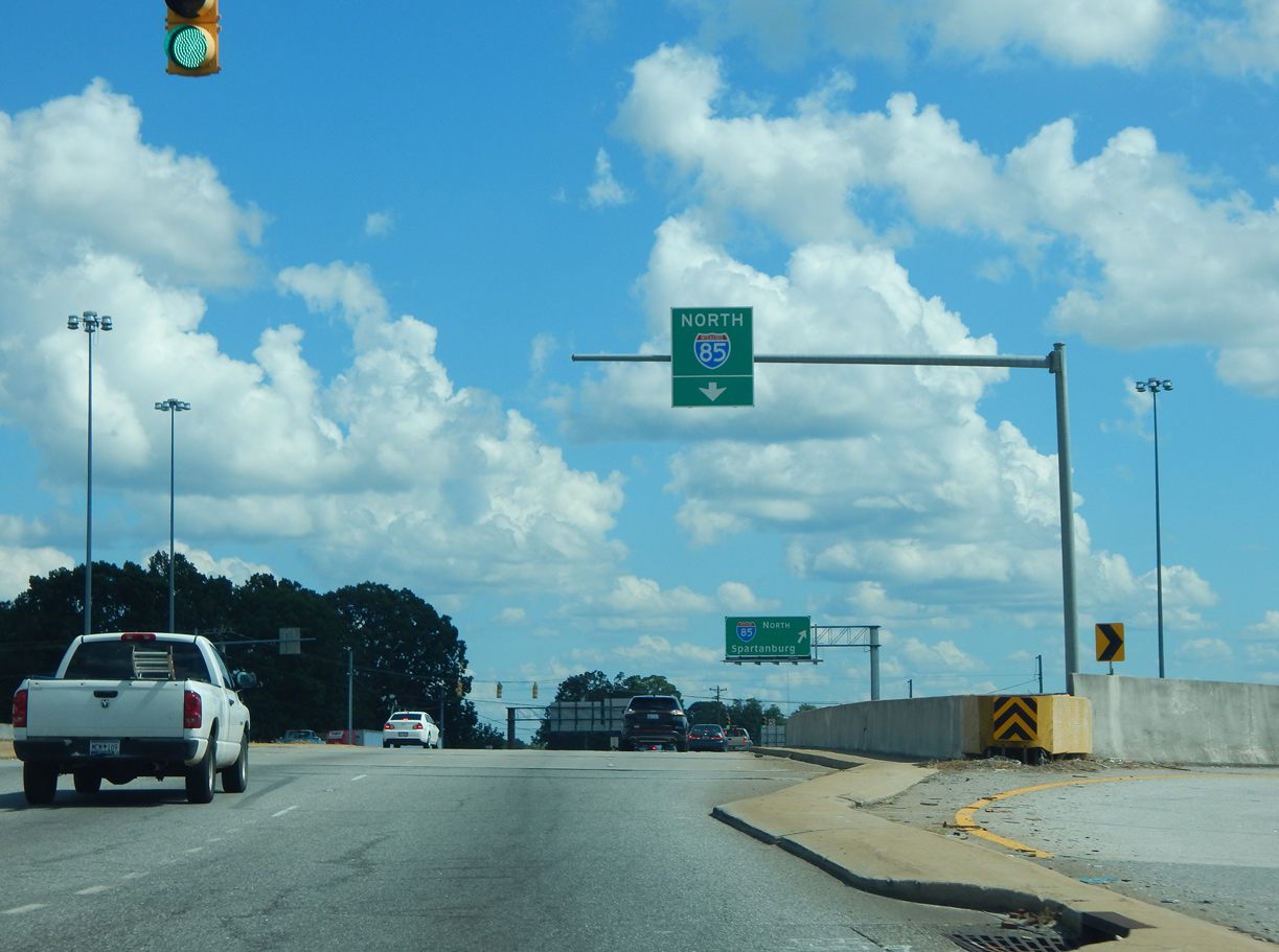
| U.S. 25 links I-26 south from Asheville, North Carolina to Atlanta, Georgia via Interstate 85 south from Greenville. 08/04/16 |
|
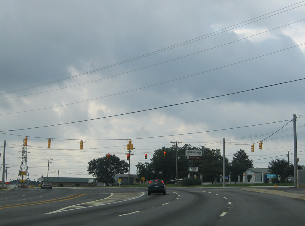
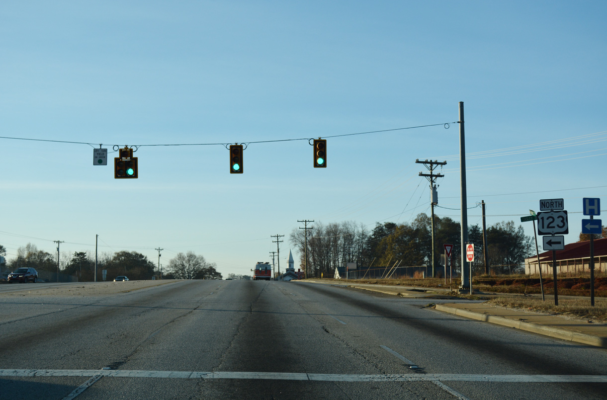
| U.S. 25 shifts westward from U.S. 276 at Travelers Rest along an arterial bypass of Greenville. Travelers headed to I-85 are directed onto U.S. 25 south for I-185/U.S. 29. 08/04/16 |
|
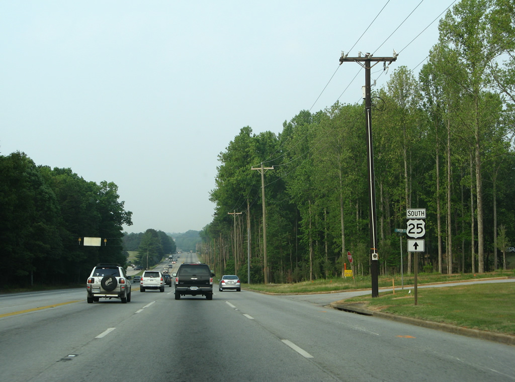
| U.S. 25 continues with two lanes southwest to the Berea area and White Horse en route to Greenwood while U.S. 276 overtakes Poinsett Highway southward to Furman University, Brutontown in Greenville and Rutherford Street to Downtown Greenville. 08/04/16 |
|
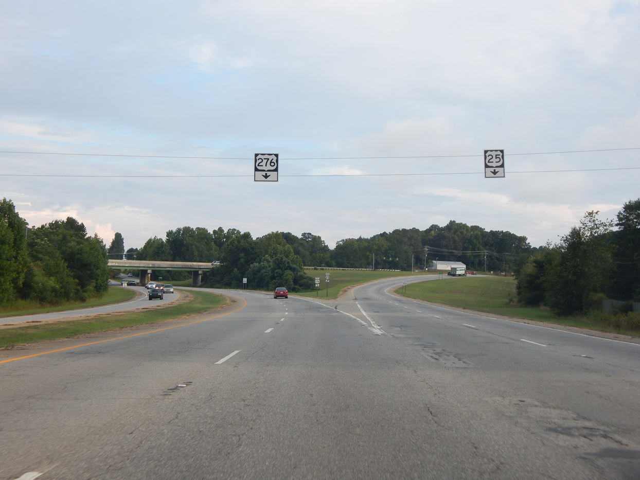
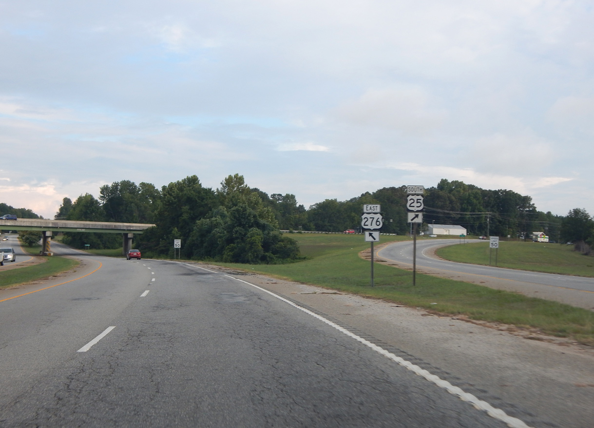
| U.S. 276 east and U.S. 25 south separate at a wye interchange. 08/04/16 |
|
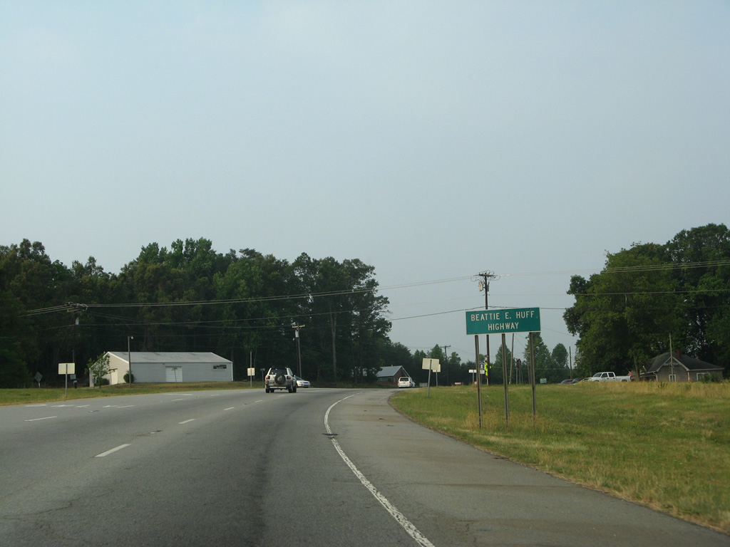
| Beyond the separation with U.S. 276 east, U.S. 25 immediately intersects Old Buncombe Road, a former alignment of both U.S. 25/276. This stretch of U.S. 25 is designated the Beattie E. Huff Highway. 06/01/07 |
|
| Roe Ford Road heads west from U.S. 276 (Poinsett Highway) and Old Buncombe Road to cross U.S. 25 ahead of the Stratford Forest neighborhood. 06/01/07 |
|
| U.S. 25 continues south from Roe Ford Road along the west side of Furman University Golf Club. 06/01/07 |
|
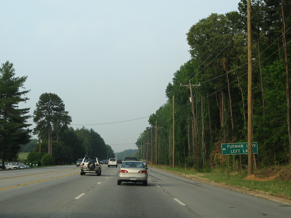
| Duncan Chapel Road angles southeast from U.S. 25 to Furman University and U.S. 276 at Old Buncombe Road. 06/01/07 |
|
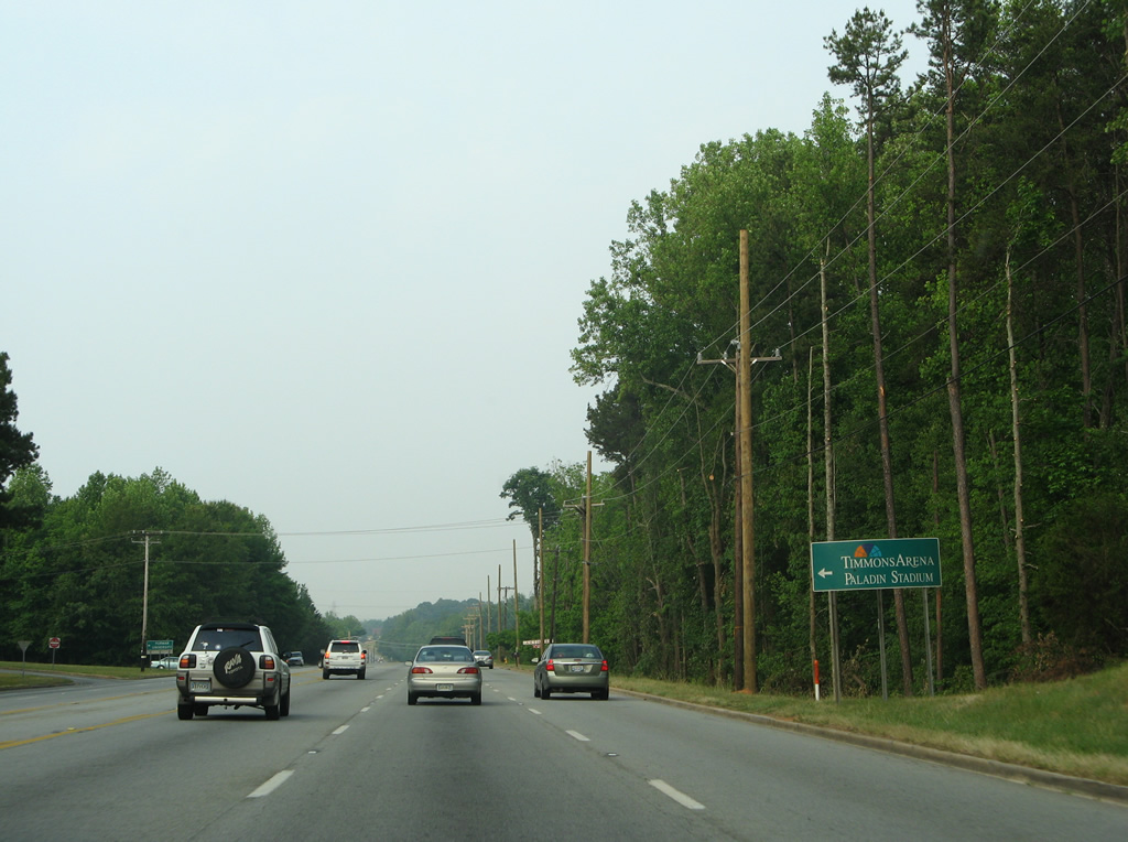
| Duncan Chapel Road lines the south end of Furman University to Timmons Arena and Paladin Stadium. 06/01/07 |
|
| U.S. 25 curves away from the intersection with Old White Horse Road ahead of Sharon Park. This stretch of White Horse Road was expanded into a seven-lane arterial. 06/01/07 |
|
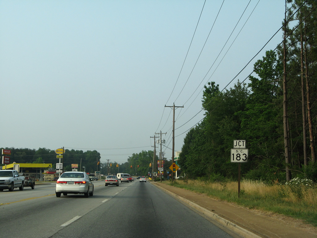
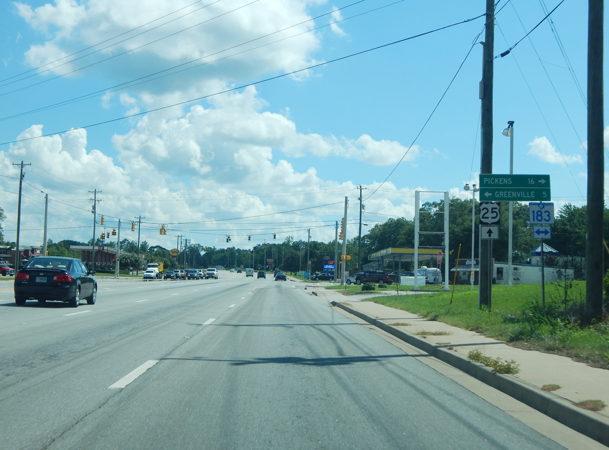
| A 53.71 mile route, S.C. 183 originates in Downtown Spartanburg and leads west through Riverside and Berea to meet U.S. 25 (White Horse Road) at a commercialized intersection. 06/01/07 |
|
| West from U.S. 25 (White Horse Road), S.C. 183 follows Farrs Bridge Road to Saluda Lake on the 16 mile drive to Pickens. The state highway concludes at U.S. 76/123 in Westminster. 08/16/16 |
|
| Reassurance shield for U.S. 25 posted south of S.C. 183 (Farrs Bridge Road) and north of White Horse Heights. 06/01/07 |
|
| Lily Street meets U.S. 25 (White Horse Road) at White Horse Heights west from Parker Road. 06/01/07 |
|
| Widening of White Horse Road in 2012 realigned Eastbourne Road to directly meet Cherrylane Drive. The local roads serve subdivisions and an elementary school. 07/12/05 |
|
| Saluda Dam Road winds east from Easley to the Crosswell area by Saluda Dam to U.S. 25 (White Horse Road). 07/12/05 |
|
| Retail frontage increases along U.S. 25 south to Marion Road. 07/12/05 |
|
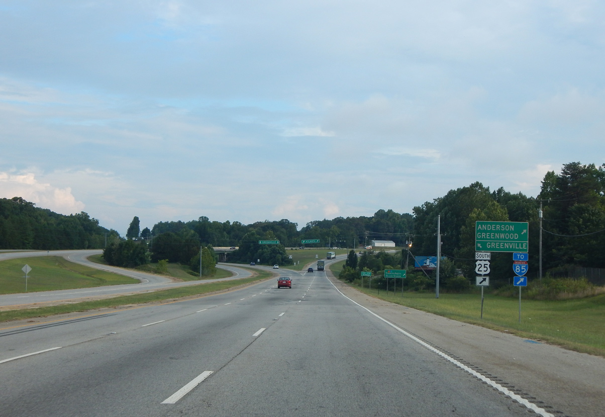
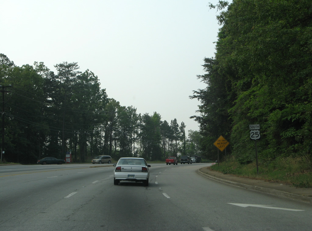
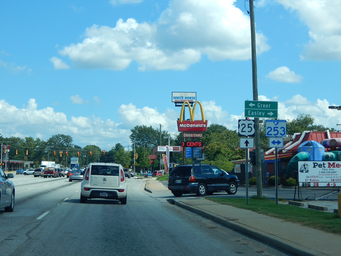
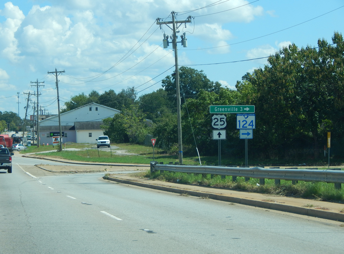
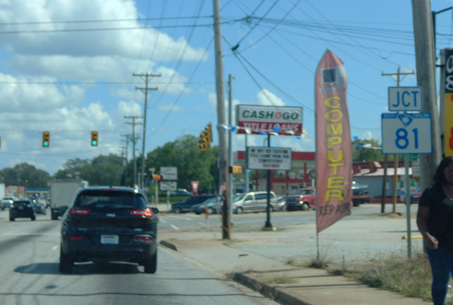
| S.C. 253 (Blue Ridge Drive) provides a cut-off from U.S. 25 south to S.C. 124 (Old Easley Highway) west to Easley. The state highway, along with S.C. 291, constitutes an arterial bypass of Greenville to U.S. 29 (Wade Hampton Boulevard) north to Greer. 08/16/16 |
|
| An Interstate 85 trailblazer appears beyond S.C. 253, directing travelers southward to White Horse and I-185/U.S. 29. 06/01/07 |
|
| U.S. 25 elevates across both a Norfolk Southern Railroad line and S.C. 124 (Old Easley Highway) a short distance south of Blue Ridge Drive. 06/01/07 |
|
| Construction of a new NS Railroad bridge along U.S. 25 at S.C. 124 in 2001 added a folded diamond interchange between the two highways. S.C. 124 follows the old alignment of U.S. 123 west on Old Easley Highway into Pickens County and east along Pendleton Street through the West Greenville neighborhood. 08/16/16 |
|
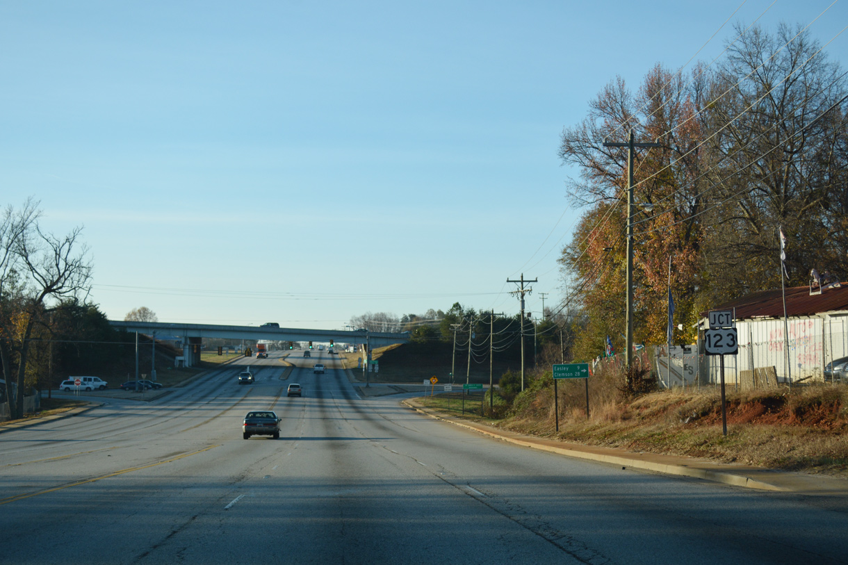
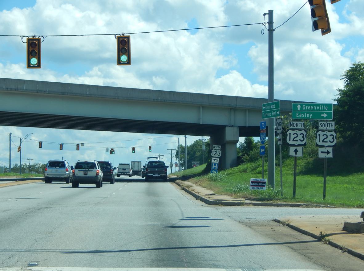
| U.S. 25 crosses paths with U.S. 123 (New Easley Highway) at a diamond interchange. 12/15/16 |
|
| U.S. 123 extends 75 miles westward from Greenville to Easley, Clemson, Seneca, Westminster and Toccoa, Georgia. 08/16/16 |
|
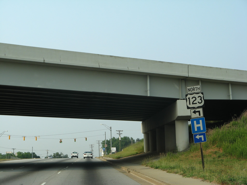
| U.S. 25 passes under U.S. 123 ahead of the northbound ramp for Easley Bridge Road to the Sterling neighborhood in Greenville. 06/01/07 |
|
| U.S. 123 follows Academy Street through West Greenville and Payne-Logan, encircling Downtown Greenville to conclude at East North Street (Business Spur I-385). 12/15/16 |
|
| Leaving the exchange with U.S. 123, U.S. 25 (White Horse Road) intersects Old Easley Bridge Road. 06/01/07 |
|
| Old Easley Bridge Road winds west from U.S. 25 to S.C. 153 at Powdersville Road while U.S. 25 turns eastward to White Horse. 06/01/07 |
|
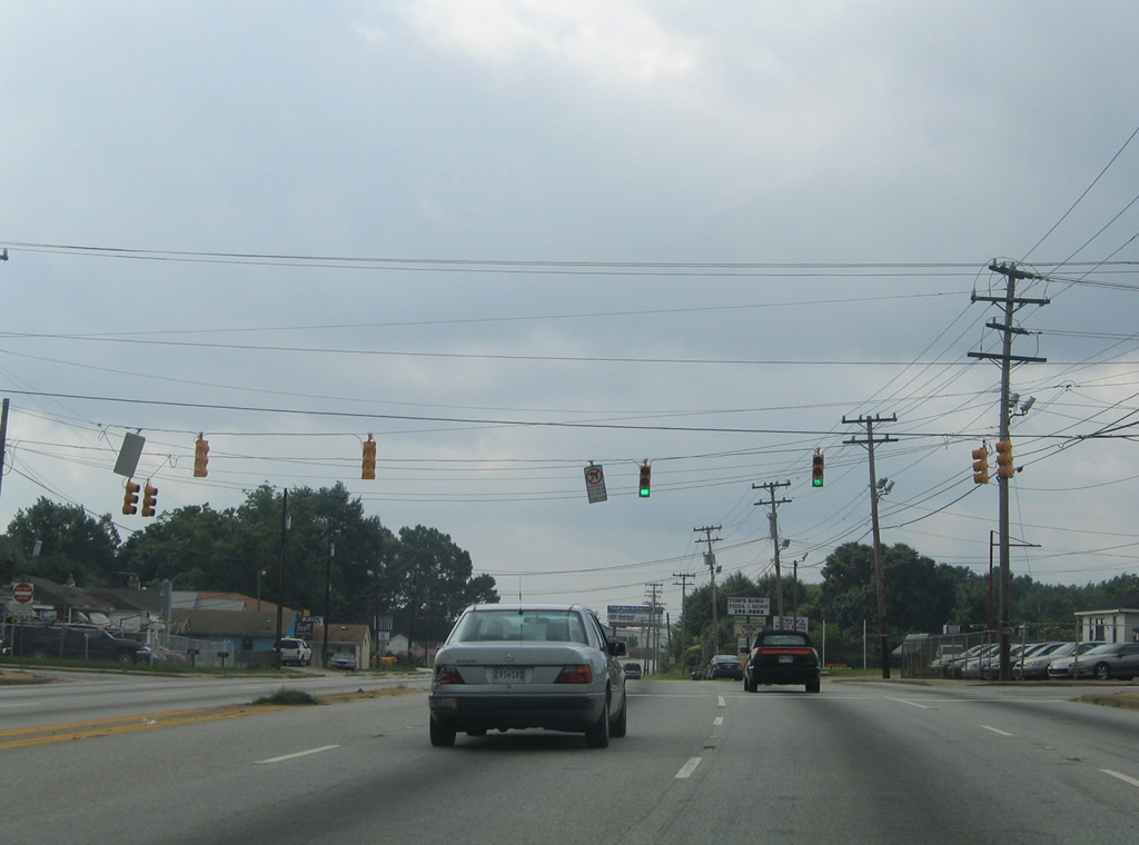
| The next set of signals along U.S. 25 south are at Welcome Road. 07/12/05 |
|
| S.C. 81 leads south out from the Sterling and Green Avenue neighborhoods in Greenville along Anderson Road to meet U.S. 25 at White Horse. 08/16/16 |
|
| S.C. 81 travels southwest from U.S. 25 to Powderville, Piercetown and ultimately Anderson. 07/12/05 |
|
| Staunton Bridge Road meanders southwest from U.S. 25 to a handful of subdivisions before meeting the I-85 frontage road system. 07/12/05 |
|
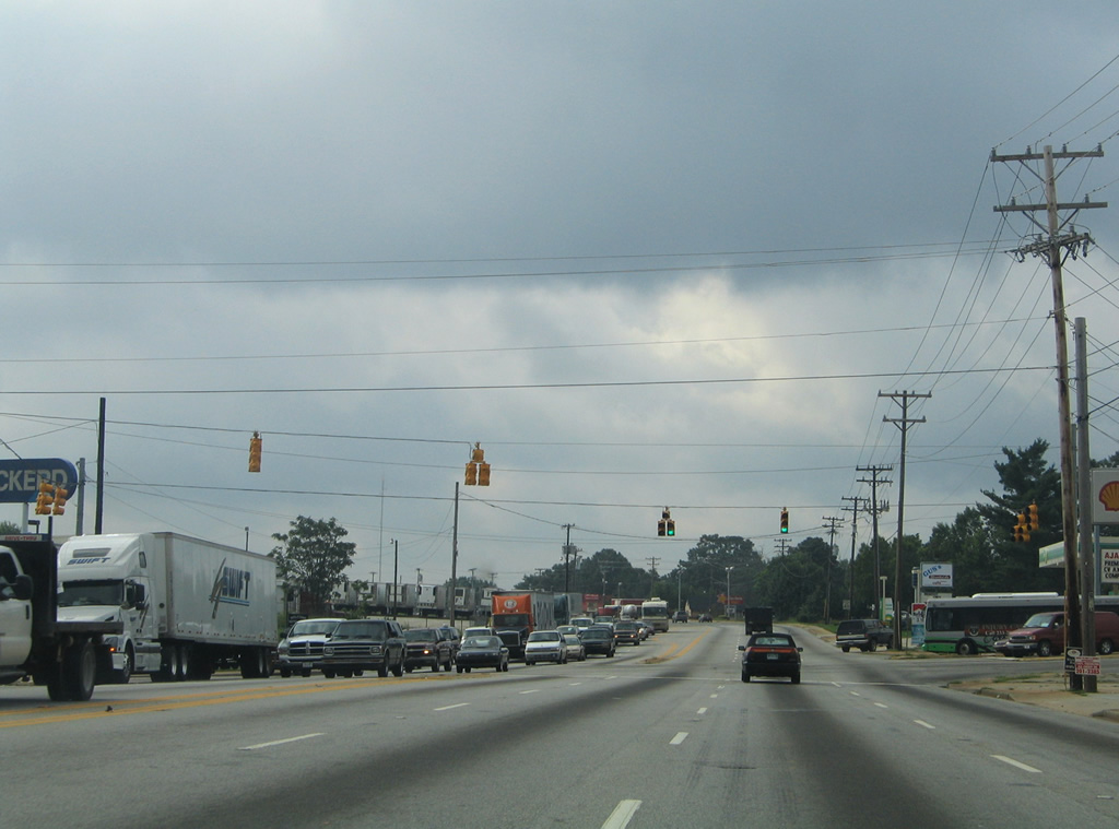
| Crossing a CSX Railroad line, U.S. 25 meets Two Notch Road east to Old Piedmont Highway through an industrial area. 07/12/05 |
|
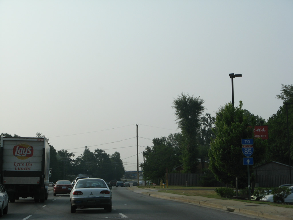
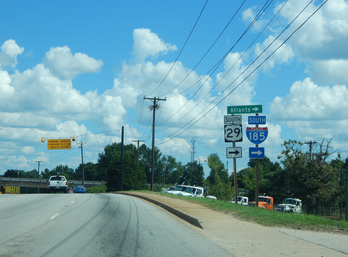
| A half diamond interchange joins U.S. 25 with I-185/U.S. 29 south from Greenville. I-185 next meets I-85, where it becomes the tolled Southern Connector to Mauldin. 08/16/16 |
|
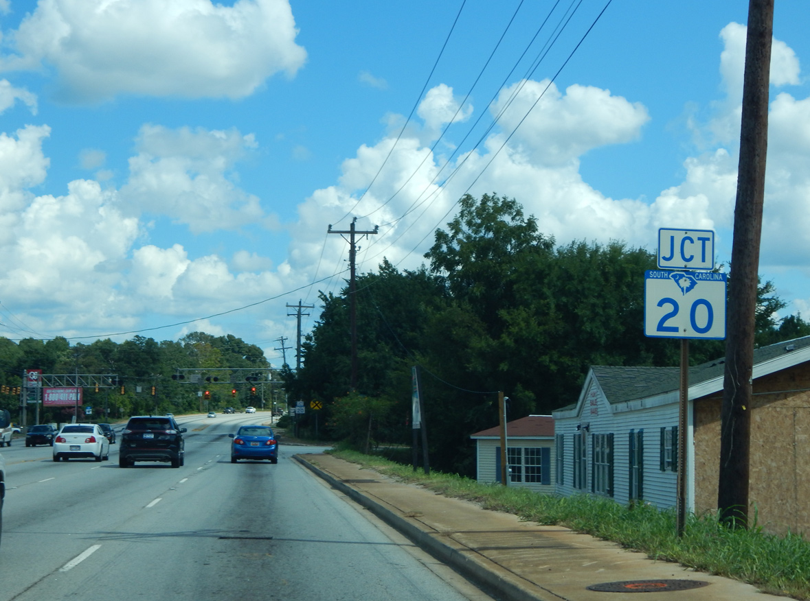
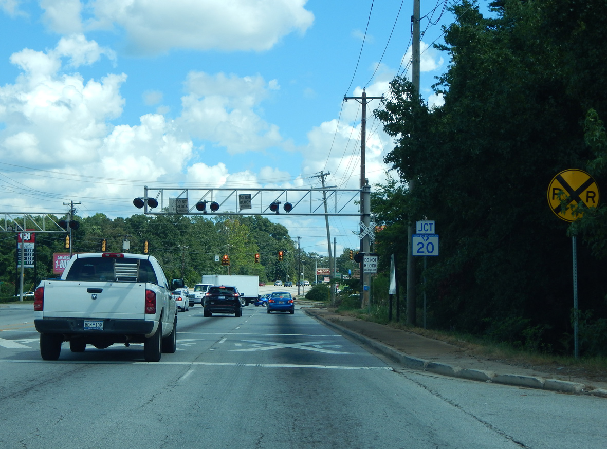
| U.S. 25 enters the community of Gantt at S.C. 20. S.C. 20 represents the pre-freeway alignment of U.S. 29 north into Greenville and south to Piedmont. 08/16/16 |
|
| S.C. 20 follows Grove Road north to Augusta Street and the Haynie-Sirrine neighborhood of the city. Southward Piedmont Highway carries the route to Lakeside, Golden Grove and Pelzer. 08/16/16 |
|
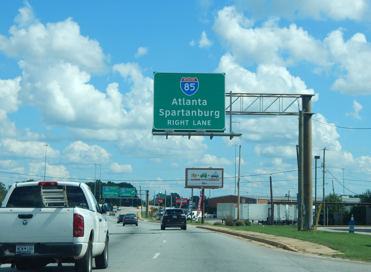
| A six ramp parclo interchange joins U.S. 25 (White Horse Road) with Interstate 85. 08/16/16 |
|
| S.C. 247 ties into U.S. 25 at Ware Place ahead of this shield assembly. 04/14/12 |
|
| Reassurance marker posted south of McCullough School Road in south Greenville County. 04/14/12 |
|
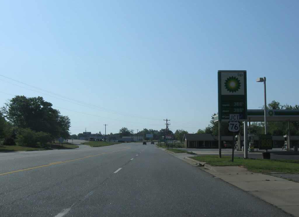
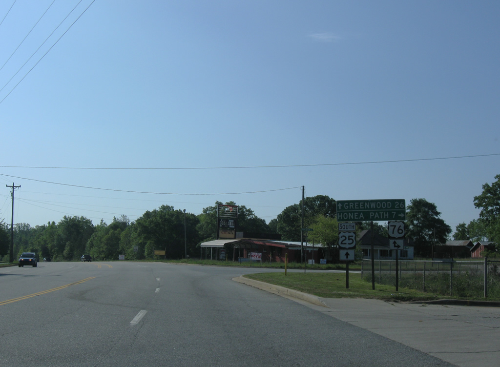
| U.S. 25 ties into U.S. 76 midway between Greenville and Greenwood. U.S. 76 (Princeton Highway) meanders southwest from the overlap seven miles to the town of Honea Path. 04/14/12 |
|
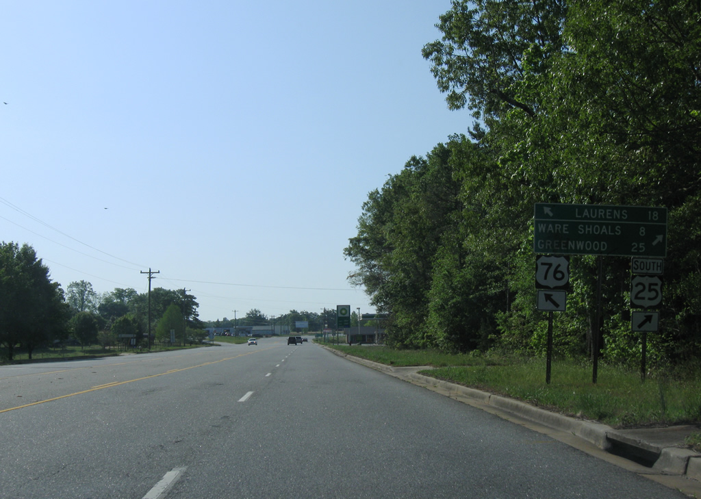
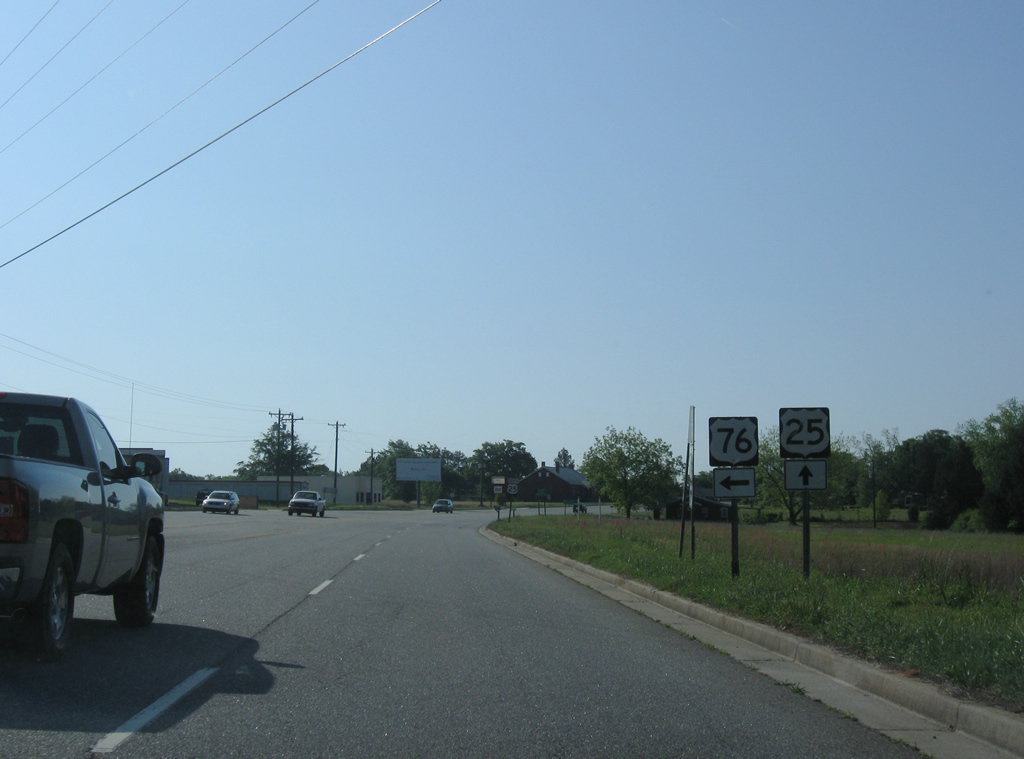
| U.S. 25 south and U.S. 76 east combine for 1.03 mile before parting ways at Princeton for Laurens and Greenwood. 04/14/12 |
|
| East from U.S. 25, U.S. 76 continues 18 miles to Laurens and 25 miles to Downtown Clinton. U.S. 25 stays southward 25 miles to Greenwood. The four lane highway bypasses Ware Shoals in eight miles. 04/14/12 |
Page Updated 08-26-2019.

 South
South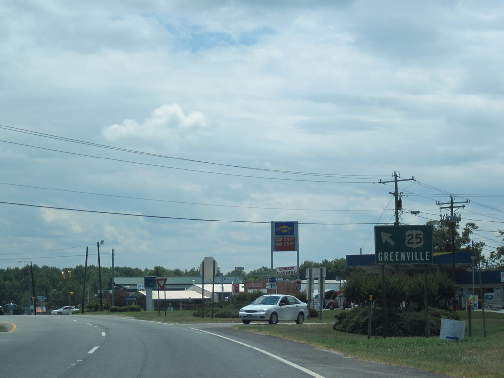
 East
East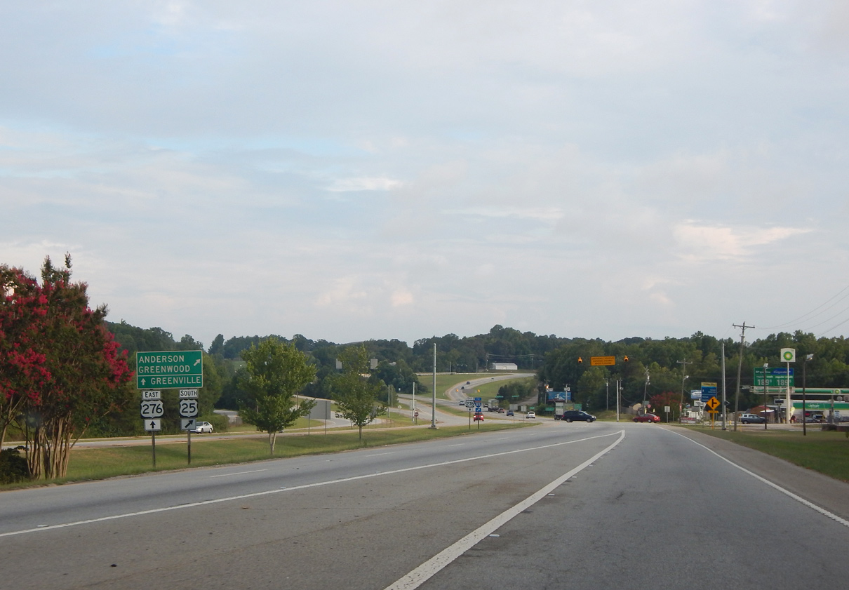


 East
East