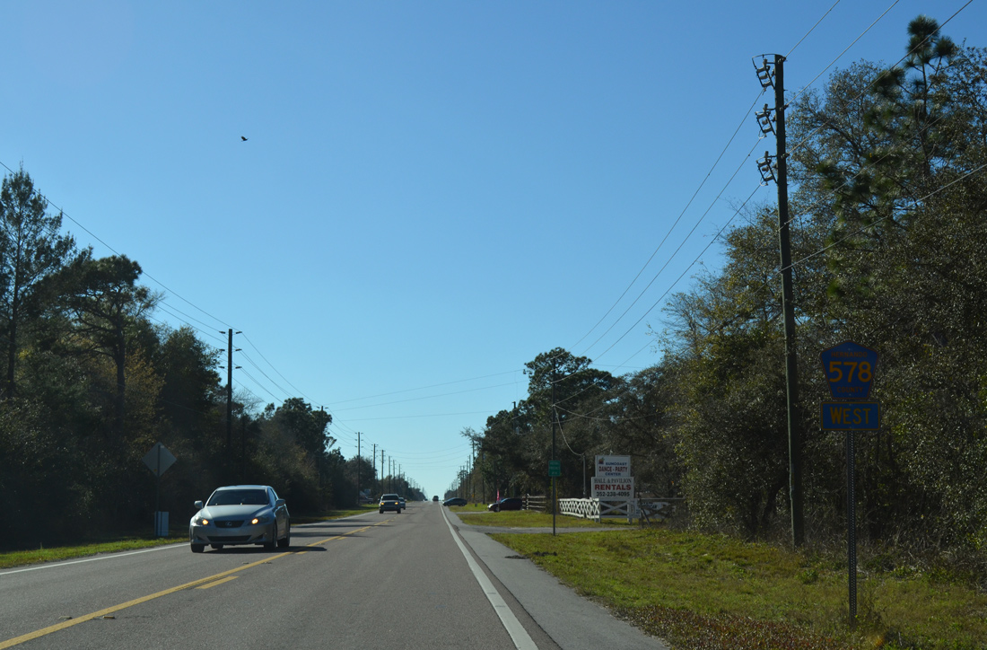
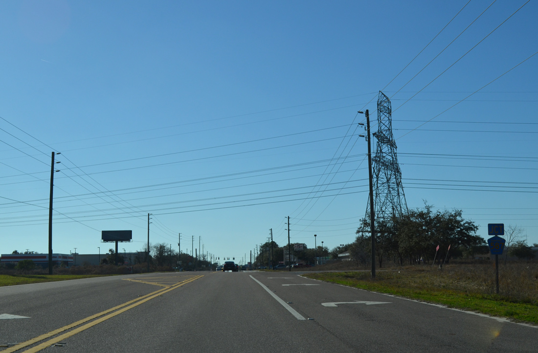
The westernmost of three County Road 578 segments, CR 578 in Hernando County bee lines east 10.82 miles from U.S. 19 (Commercial Way) to U.S. 41 (Broad Street) along the Pasco / Hernando County line. Suburban develop lines most of the route across Spring Hill, with remaining rural sections east toward Masaryktown. CR 578 is four lanes wide from U.S. 19 east to East Road, between Springtime Street and a point just east of CR 587 (Mariner Boulevard), and through the exchange with the Suncoast Parkway (SR 589). Separate projects will expand the remaining two lane sections into a four lane, divided arterial.
The Florida Department of Transportation (FDOT) Project 257298-3-52-01 will expand a 2.7 mile long section of CR 578 from east of East Road to Springtime Street. Right of way costs are $51 million and design costs $2.3 million. Construction was not funded as of 2021.
FDOT Project 257298-4-52-01 completes four lane expansion along CR 578 (County Line Road) from CR 587 (Mariner Boulevard) to SR 589 (Suncoast Parkway. Construction is was not funded as of 2021. Right of way costs are $31.8 million and design $2.8 million.
East of the Suncoast Parkway, the $20.2 million Ayers Road Extension project realigned CR 578 (County Line Road) to meet the new four lane alignment for CR 576 at Trillium Boulevard. The Ayers Road Extension, which takes CR 576 northeast around Masaryktown to U.S. 41 (Broad Street), opened to traffic north from County Line Road on September 21, 2021.
A second segment of Hernando County 578 zigzagged east from U.S. 41 at Masaryktown along a combination of Wilson Boulevard, Benes Road, Benes Roush Road and Philips Roads to CR 576 (Ayers Road). The eastern portion of this alignment is unpaved.
The other sections of County Road 578 serve Dade City. The eastern leg follows Lock Street between CR 41 (Blanton Road) and U.S. 98/301. The western portion lines St. Joe Road west from CR 41 (21st Street) to CR 581 (Bellamy Brothers Boulevard) near Darby.
|
| Waterfall Drive meanders north from County Line Road to Spring Hill Drive (CR 574) and Lake Theresa ahead of this eastbound shield assembly. 02/15/14 |
|
| A 7.88 mile long route to SR 50 (Cortez Boulevard), the south end of CR 587 (Martin Boulevard) ties into CR 578 (County Line Road) across from Shady Hills Road in Pasco County. 02/15/14 |
|
| CR 587 (Mariner Boulevard) comprises a four lane, divided arterial north to Linden Drive in Spring Hill, and a five lane boulevard from there to SR 50 (Cortez Boulevard). 02/15/14 |
|
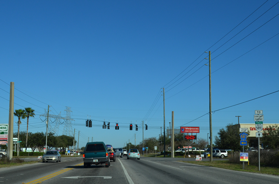
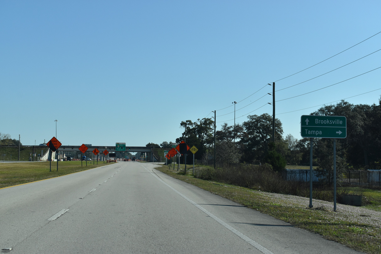
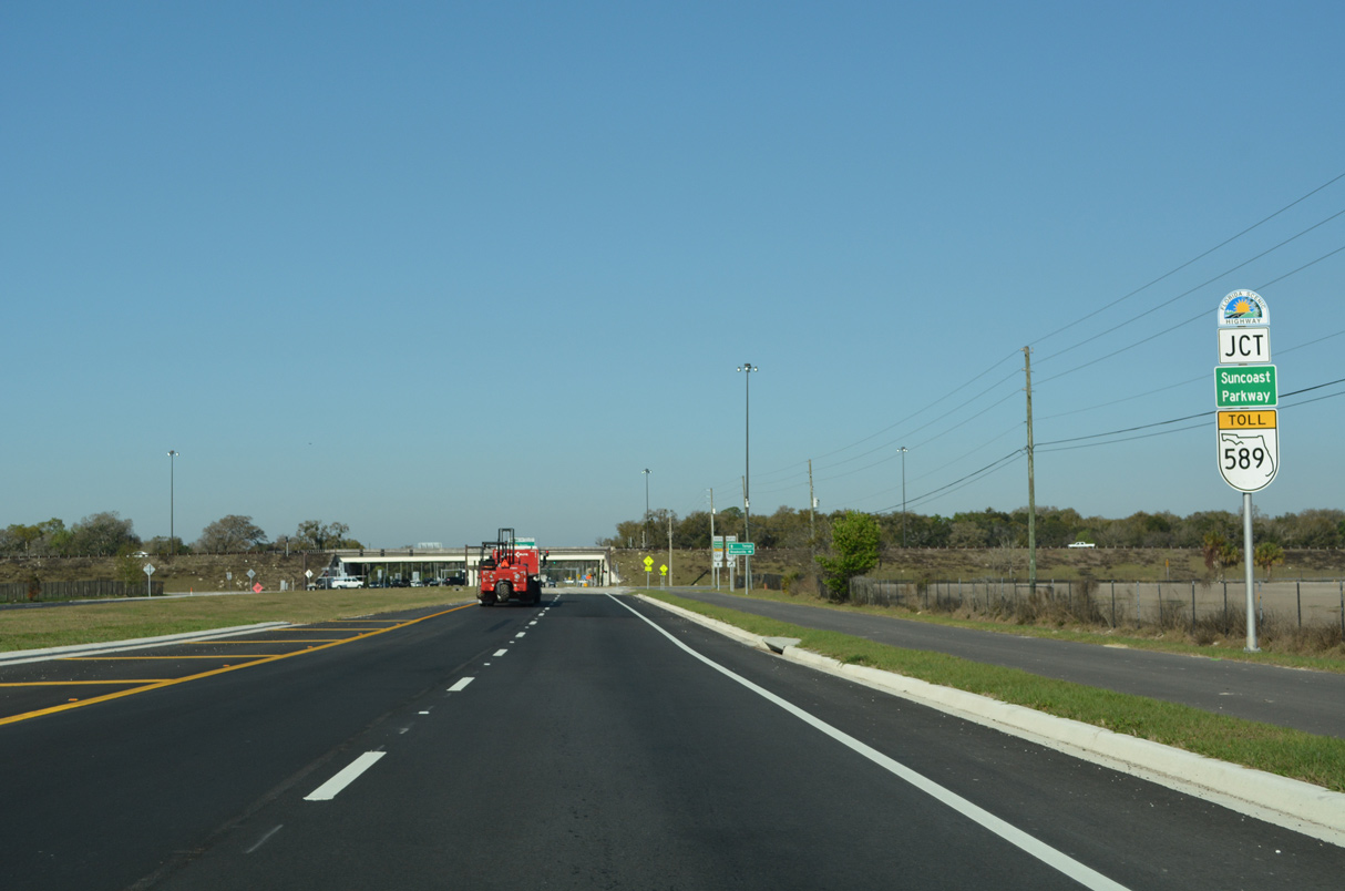
| CR 578 (County Line Road) expands to four lanes ahead of both CR 585 (Anderson Snow Road) north and the Suncoast Parkway. CR 585 stems 7.09 miles north through Spring Hill to SR 50 (Cortez Boulevard). 12/13/21 |
|
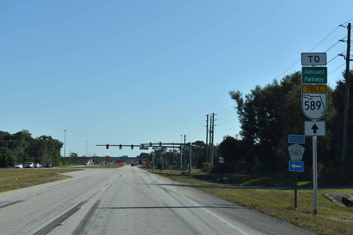
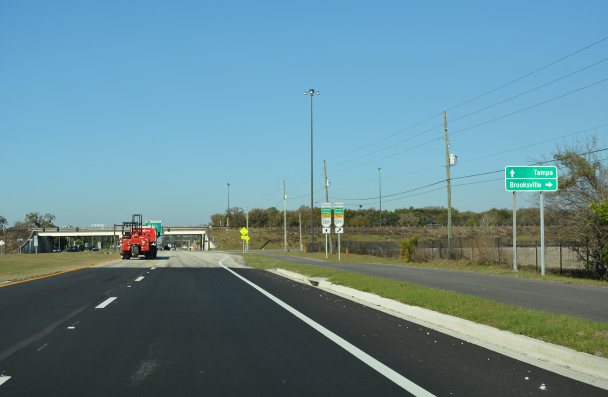
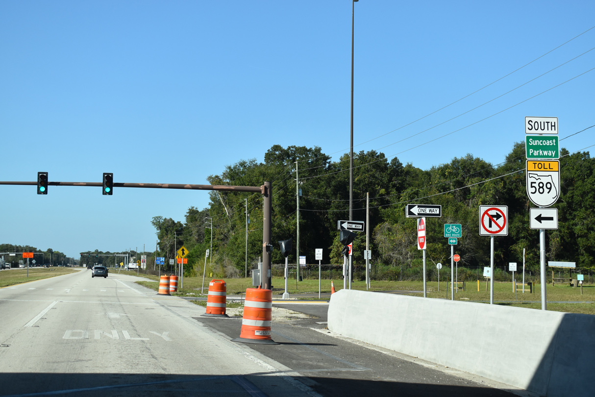
| A short distance east of CR 585 is a diamond interchange joining County Line Road with SR 589. 12/13/21 |
|
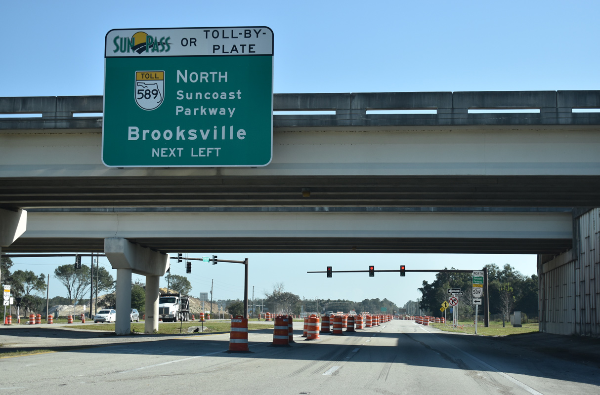
| The Suncoast Parkway is a toll road joining the Tampa Bay region with Brooksville and the Nature Coast. 12/13/21 |
|
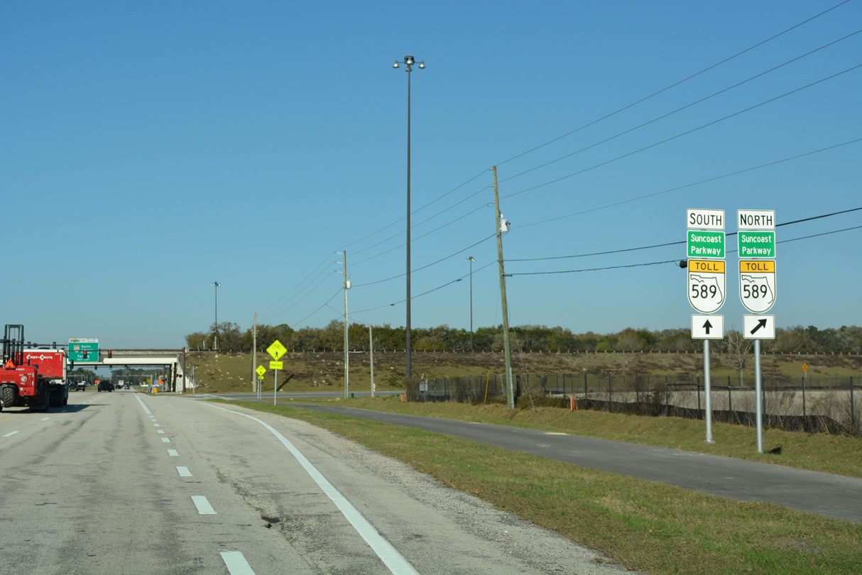
| The Suncoast Parkway (SR 589) heads 23.71 miles south through Pasco County to the Veterans Expressway (SR 568) at Lutz. 12/13/21 |
|
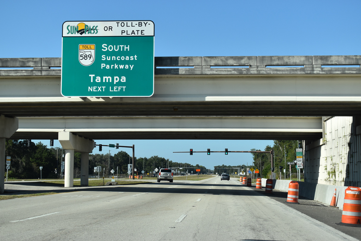
| SR 589 travels 36.07 miles south to SR 60 (Courtney Campbell Causeway / Memorial Highway) by Tampa International Airport (TPA). 12/13/21 |
|
| SR 589 (Suncoast Parkway) continues north from Spring Hill to SR 50 (Cortez Boulevard) west of Brooksville. 12/13/21 |
|
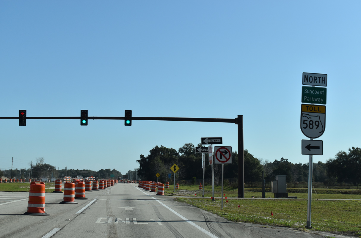
| The Suncoast Parkway extends 17.95 miles north from CR 578 (County Line Road) to U.S. 98 near Sugarmill Woods in Hernando County. SR 589 opened north from U.S. 98 to SR 44 at Lecanto on February 28, 2022. 12/13/21 |
|
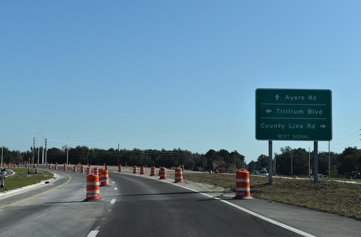
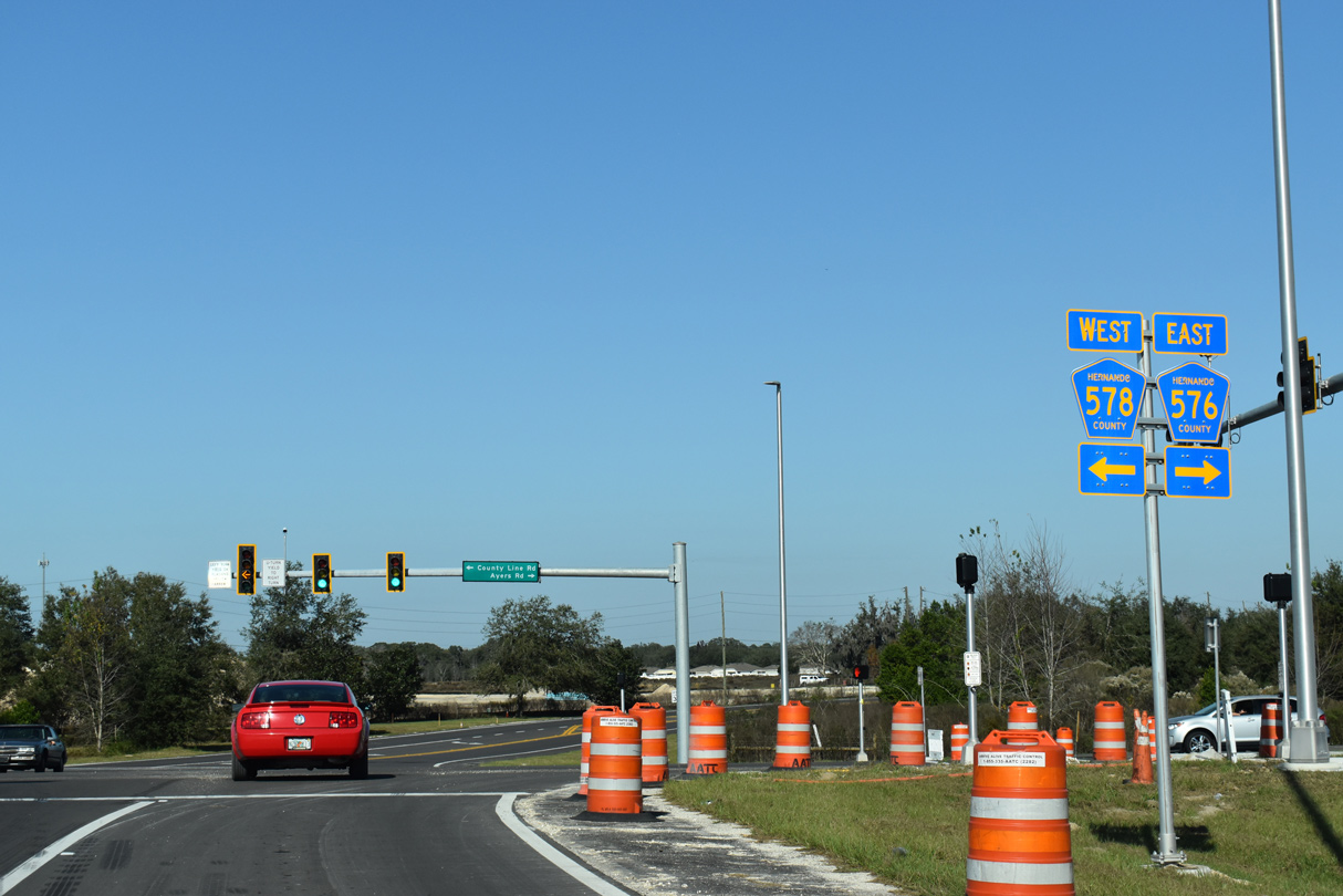
| County Line Road (CR 578) was realigned to provide a seamless transition onto CR 576 (Ayers Road) at Trillium Boulevard. A portion of the adjacent old alignment was repurposed as an access road to Kuka Lane. 12/13/21 |
|
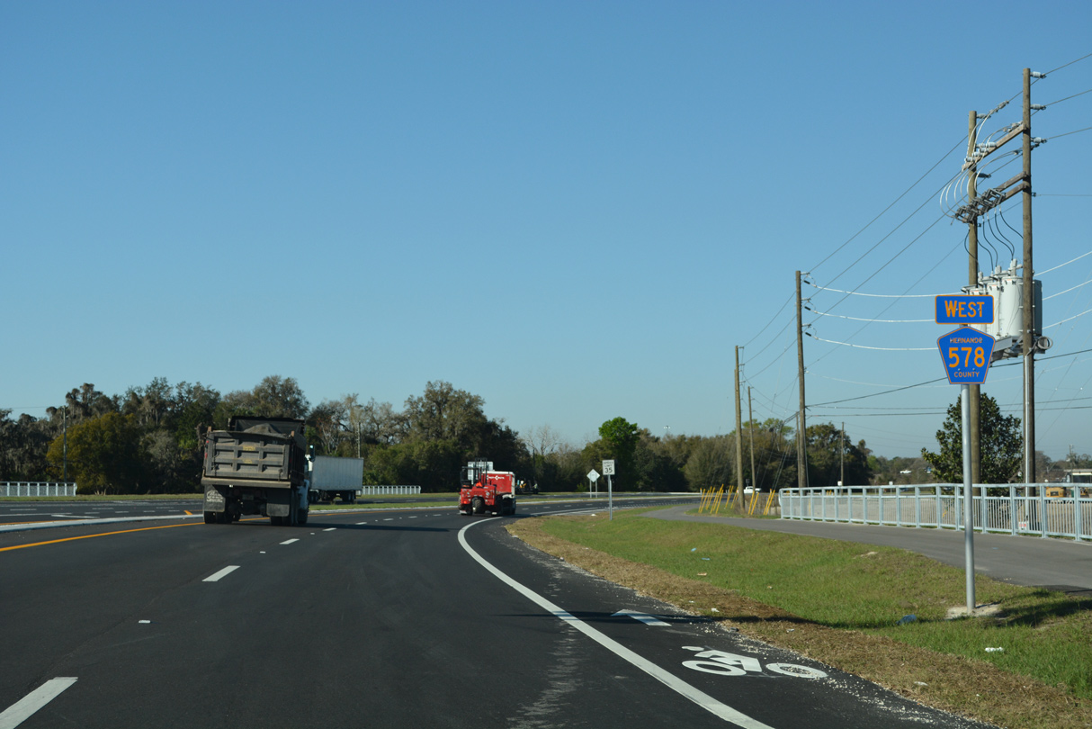
| County Line Road east from the Suncoast Parkway was expanded into a four lane arterial as part of the Ayers Road Extension project started in September 2019. 12/13/21 |
|
| CR 576 along the Ayers Road Extension opened north from CR 578 (County Line Road) to Trillium Boulevard on September 21, 2021. Bypassing Masaryktown to the north, the four lane arterial connects with U.S. 41 (Broad Street) at the former west end of CR 576. 12/13/21 |
|
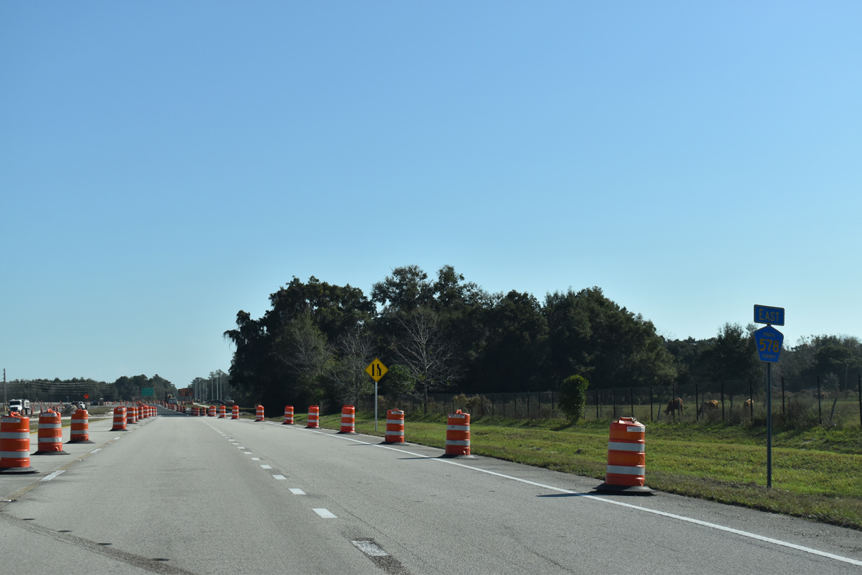
| County Line Road reduces to two lanes beyond CR 576 (Ayers Road). CR 578 advances 0.9 miles east to U.S. 41. 12/13/21 |
|
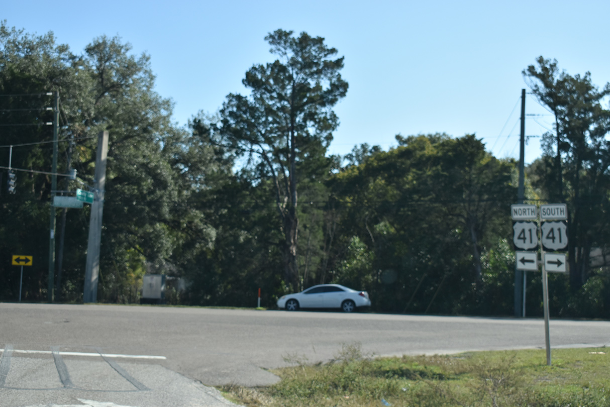
| U.S. 41 (Broad Street) heads northeast from the end of CR 578 (County Line Road) to Masaryktown and Brooksville and south to Gowers Corner and Land O' Lakes in Pasco County. 12/13/21 |
|
| The first confirming marker for CR 578 stands along County Line Road west of U.S. 41 at Masaryktown. 12/13/21 |
|
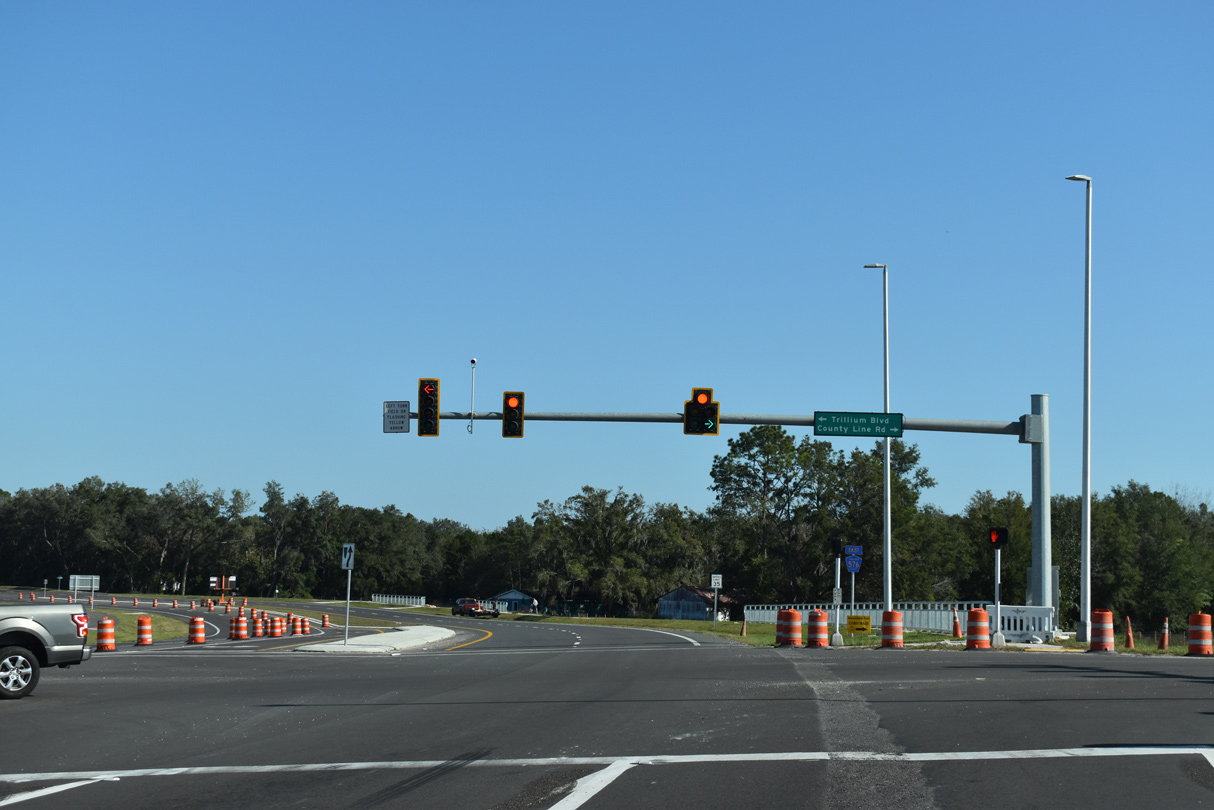
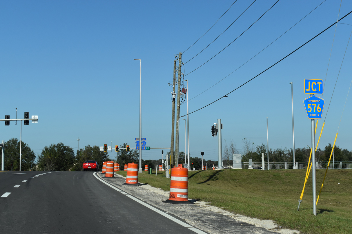
| Underway from September 2019 to Summer 2022, the Ayers Road Extension project included realigning CR 578 (County Line Road) and Trillium Boulevard to meet at a new signalized intersection with CR 576. 12/13/21 |
|
| Opened to traffic fully on September 21, 2021, CR 576 (Ayers Road) arcs northeast around Masaryktown 2.4 miles to U.S. 41 (Broad Street). Trillium Boulevard leads north from CR 578 to the Trillium development. 12/13/21 |
|
| CR 578 (County Line Road) overtakes the four lane arterial west from CR 576 (Ayers Road) beyond Trillium Boulevard. 03/02/22 |
|
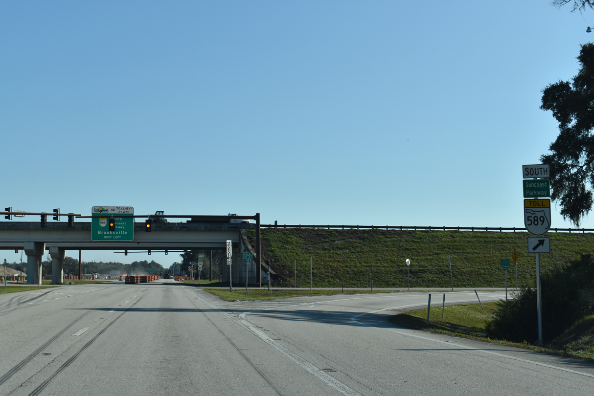
| County Line Road advances west to a diamond interchange with SR 589 (Suncoast Parkway). 03/02/22 |
|
| The Suncoast Parkway heads 7.2 miles north from CR 578 to SR 50 (Cortez Boulevard) west of Brooksville. 03/02/22 |
|
| With the February 28, 2022 opening of Suncoast Parkway 2 between U.S. 98 and SR 44 east of Crystal River, SR 589 extends 13 miles north into Citrus County. 03/02/22 |
|
| Traveling south from County Line Road toward Tampa, the Suncoast Parkway enters a semi-rural swath of northern Pasco County to SR 52. 12/13/21 |
|
| SR 589 extends south from the Suncoast Parkway onto the Veterans Expressway 37 miles to SR 60 (Memorial Highway) by Tampa International Airport (TPA). 12/13/21 |
|
| West from SR 589, CR 578 (County Line Road) continues to CR 585 (Anderson Snow Road) by the Shoppes at Avalon retail plaza. 12/13/21 |
|
| Paralleling the Suncoast Parkway northward through eastern reaches of Spring Hill, CR 585 (Anderson Snow Road) leads 7.09 miles to SR 50 (Cortez Boulevard). 12/13/21 |
|
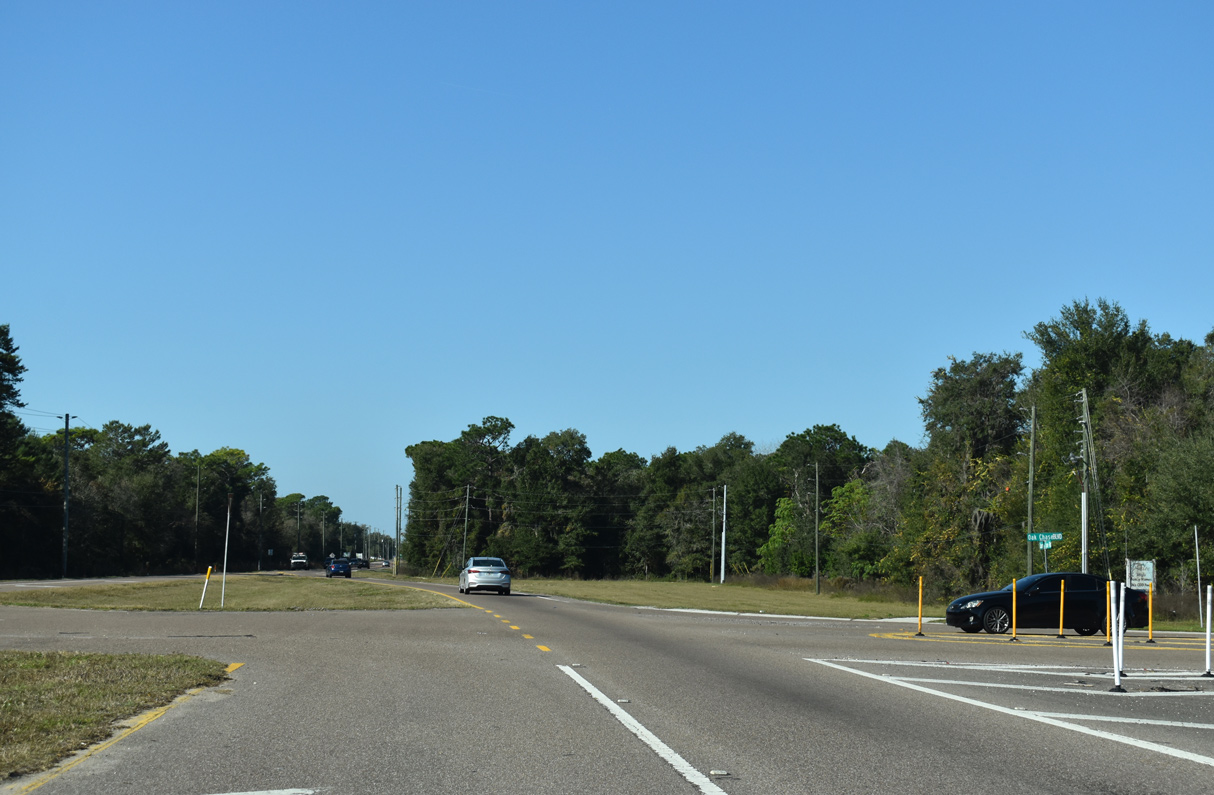
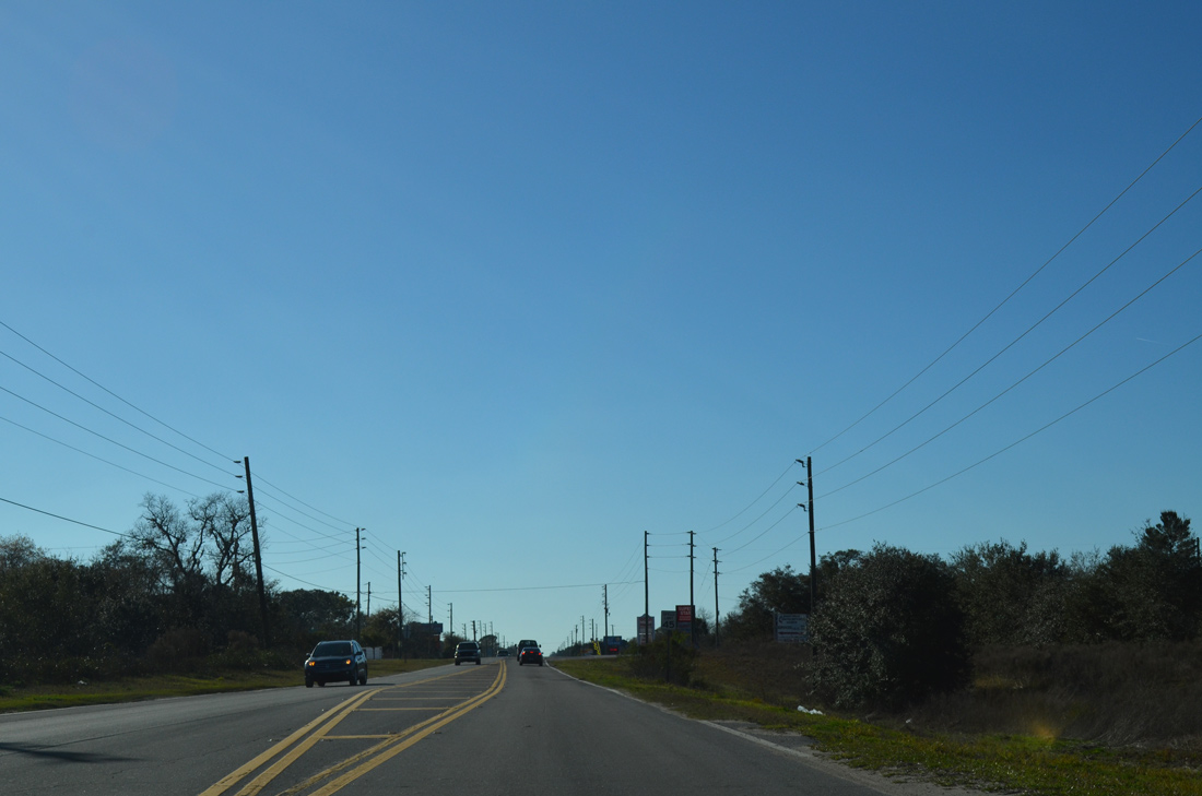
| County Line Road reduces back to two lanes west at Oak Chase Boulevard. 12/13/21 |
|
| A reassurance shield for CR 578 west appears after Sparks Road. 02/15/14 |
|
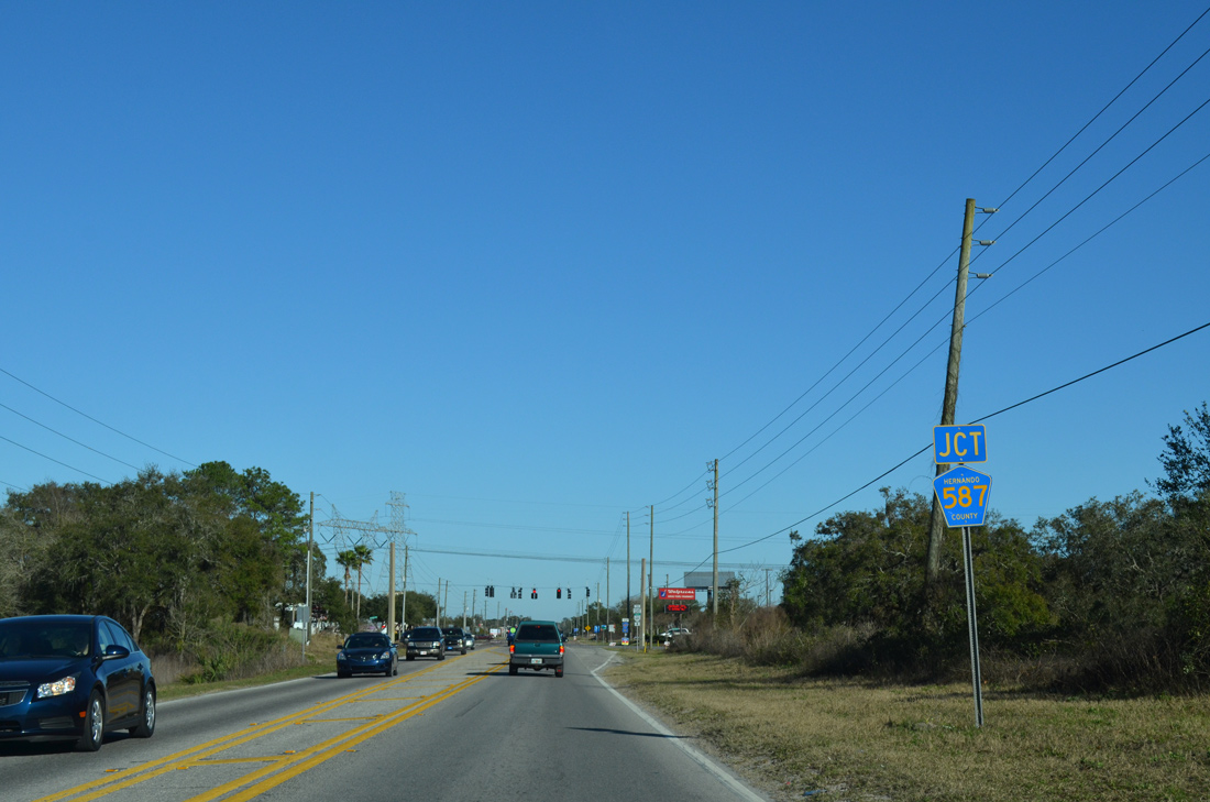
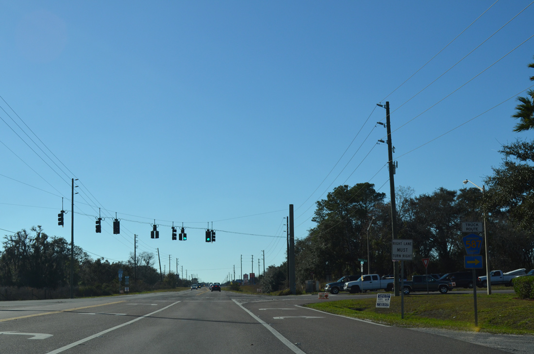
| County Line Road expands to four lanes west ahead of CR 587 (Mariner Boulevard) north and Shady Hills Road south. 02/15/14 |
|
| Measuring 7.9 miles in length to SR 50 (Cortez Boulevard), CR 587 (Mariner Boulevard) constitutes the main arterial north through Spring Hill. 02/15/14 |
|
| County Line Road proceeds west from CR 587 (Mariner Boulevard) through an area lined with industrial businesses and nurseries. 02/15/14 |
|
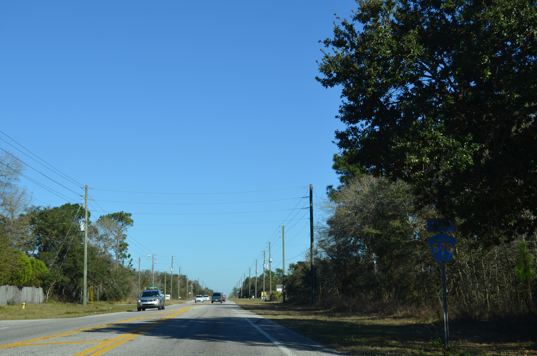
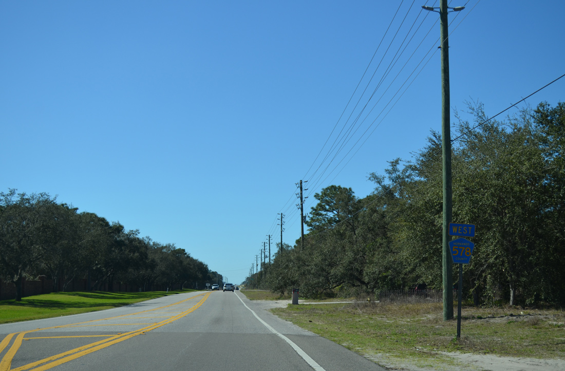
| A CR 578 reassurance marker stands west of Waterfall Drive north into Spring Hill and Winding Oaks Boulevard south. 02/15/14 |
|
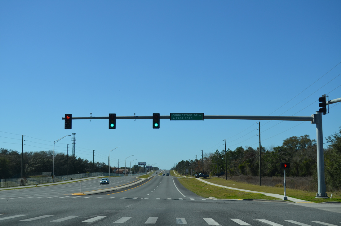
| Cobblestone Drive extends 1.24 miles north from CR 578 (County Line Road) at East Road to Spring Hill Drive (SR 574), a major arterial route across Spring Hill. 02/15/14 |
|
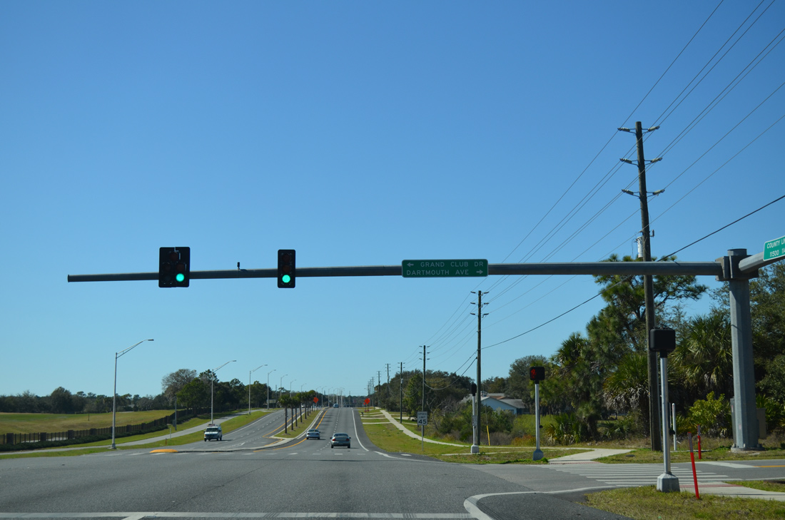
| Dartmouth Avenue south meets CR 578 (County Line Road) across from Grand Club Drive and the Heritage Pines golf course community. 02/15/14 |
|
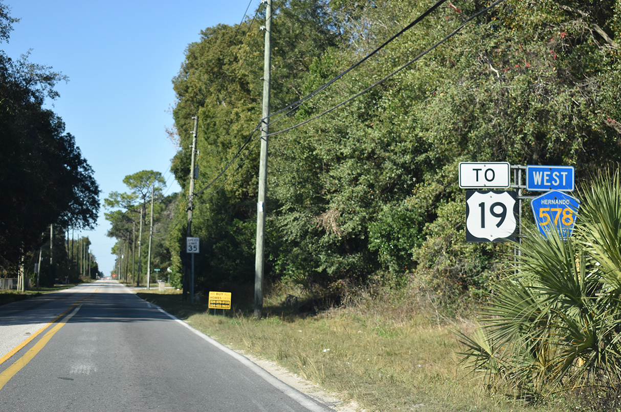
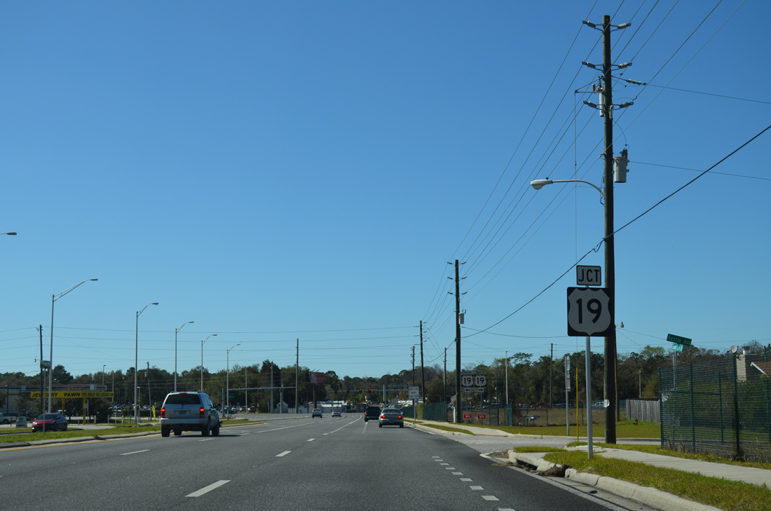
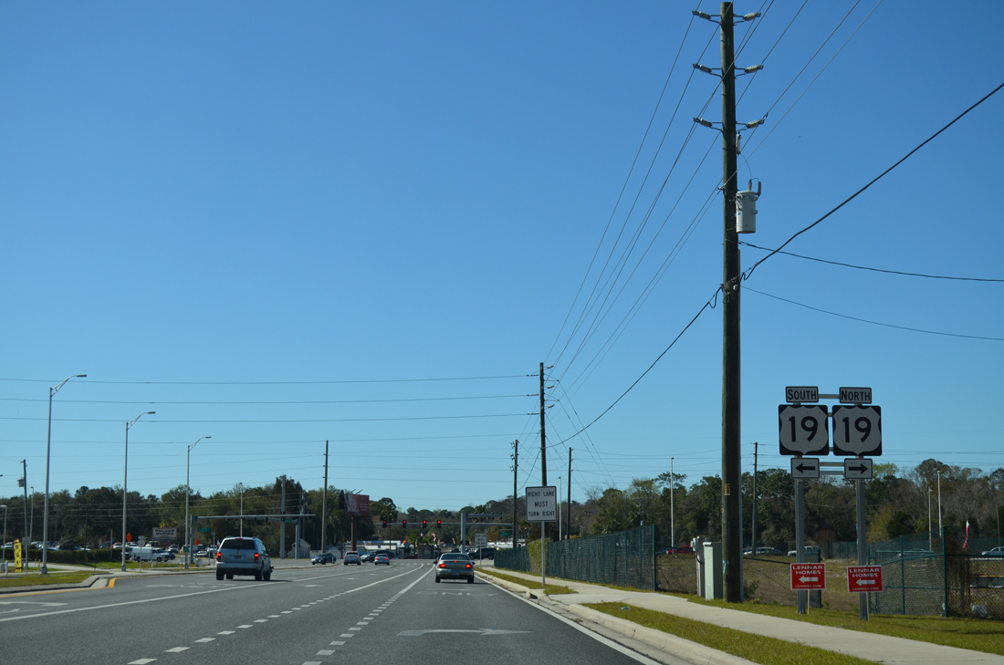
| County Road 578 ends at U.S. 19 (Commercial Way) across from Travel Park Drive. U.S. 19 travels southwest to Hudson and Port Richey in Pasco County en route to Clearwater. 02/15/14 |
|
| A six lane, commercial arterial, U.S. 19 (Commercial Way) angles northeast from County Line Road along the west side of Spring Hill to SR 50 (Cortez Boulevard) at Weeki Wachee. 02/15/14 |
Photo Credits:02/15/14, 12/13/21, 03/02/22 by AARoads
Connect with:
U.S. 19
U.S. 41
State Road 589 - Veterans Expwy / Suncoast Pkwy
Hernando County Road 585
Hernando County Road 587 - Mariner Boulevard
Page Updated 03-03-2022.

 East
East