Florida State Road 196 constitutes a short route along Bayfront Parkway and a portion of Main Street in Downtown Pensacola. Bayfront Parkway lines the north shore of Pensacola Bay from Bartam Park to the merge with U.S. 98 east. U.S. 98 splits into a one-way street couplet using a combination of Chase Street and Bayfront Parkway east and Gregory Street west. The portion of Bayfront Parkway concurrent with U.S. 98 east is signed as SR 196 in the westbound direction.
High waters from Hurricane Ivan in 2004 caused serious erosion along the Pensacola Bay shoreline from Pensacola Bay Bridge westward to downtown. Damage included the washout of most of Bayfront Parkway, rendering the road impassable. For a period of time rebuilding of Bayfront Parkway was an issue of debate. Rep. Holly Benson, R-Pensacola appealed to have Bayfront Parkway reopened as a two-lane roadway in place of the previous four-lane design. Her recommendation was based upon the concept of opening more of the waterfront for public use by reducing the width of State Road 196.1 Bayfront Parkway was reconstructed and reopened to traffic by the end of 2004 with four lanes overall, except for a reduction to a single westbound lane between Alcaniz and Tarragona Streets.
|
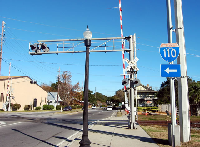
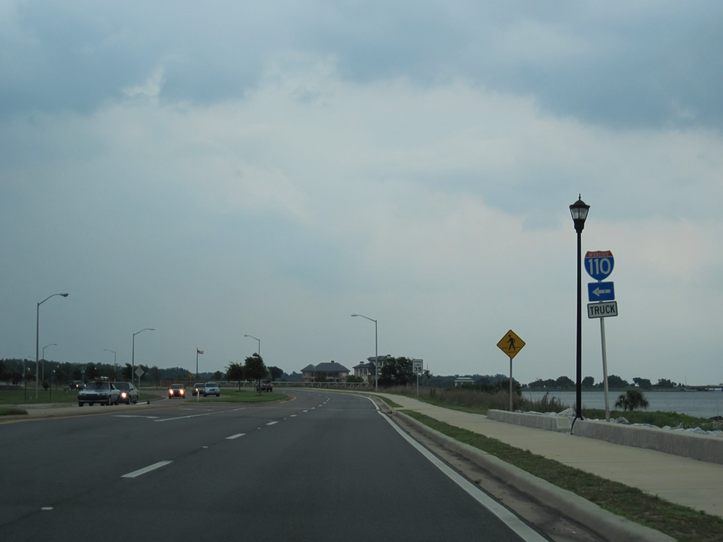
| Interstate 110 trailblazer, date stamped 1987, posted at the Main Street intersection with Tarragona Street. Tarragona Street travels seven blocks north from the beginning of SR 196 to the Chase Street on-ramp of Interstate 110. Railroad tracks line Tarragona Street from the Port of Pensacola northbound. 12/20/03 |
|
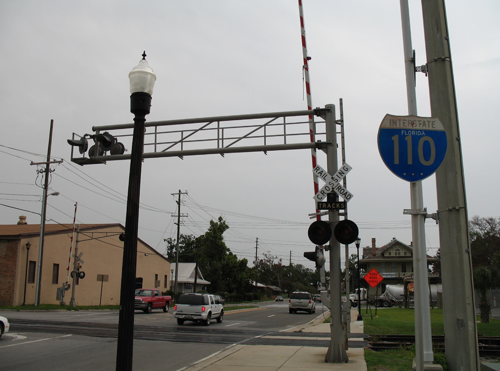
| The left arrow placard from the Interstate 110 shield assembly was removed by winds from Hurricane Ivan in 2004. This was one of two remaining state-named shields for the Pensacola freeway spur by 2012. 08/04/06 |
|
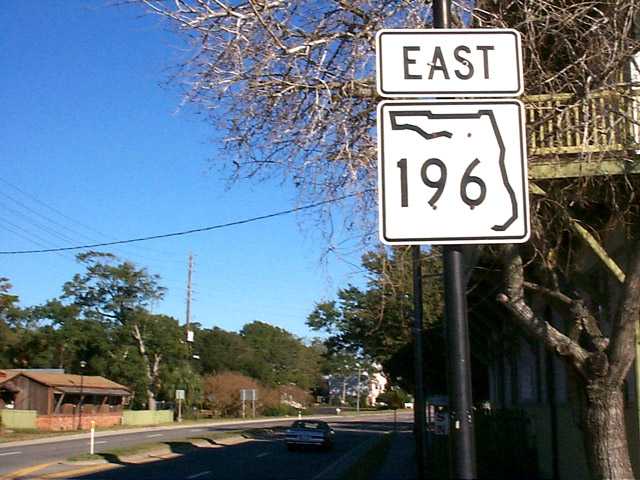
| What was the only shield for SR 196 in either direction was originally this assembly along Main Street east at Barracks Street. The sign was removed in 2004. 12/20/03 |
|
| A closer look at the SR 196 marker posted after the state road beginning on Main Street. There are no SR 196 shields posted along any of the intersecting streets or along U.S. 98. 11/27/99 |
|
| Main Street becomes Bayfront Parkway east of Alcaniz Street. The original configuration saw four overall lanes on Main Street east from Tarragona Street. Post-Hurricane Ivan reconstruction lengthened the turn lane onto Alcaniz Street north while reducing westbound to a single lane. An Interstate 110 trailblazer once directed motorists onto Alcaniz Street north. 12/20/03 |
|
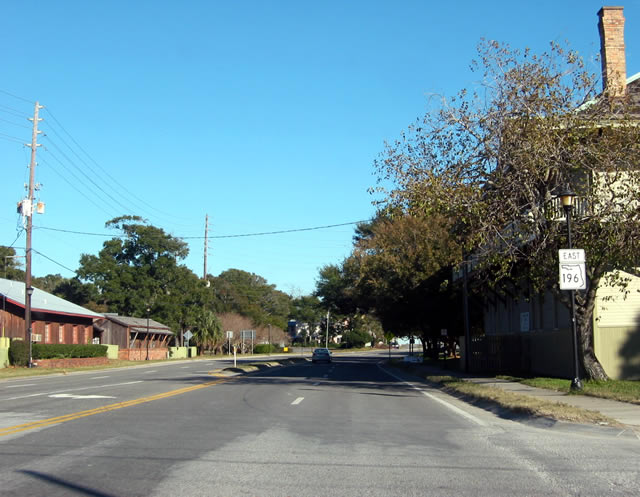
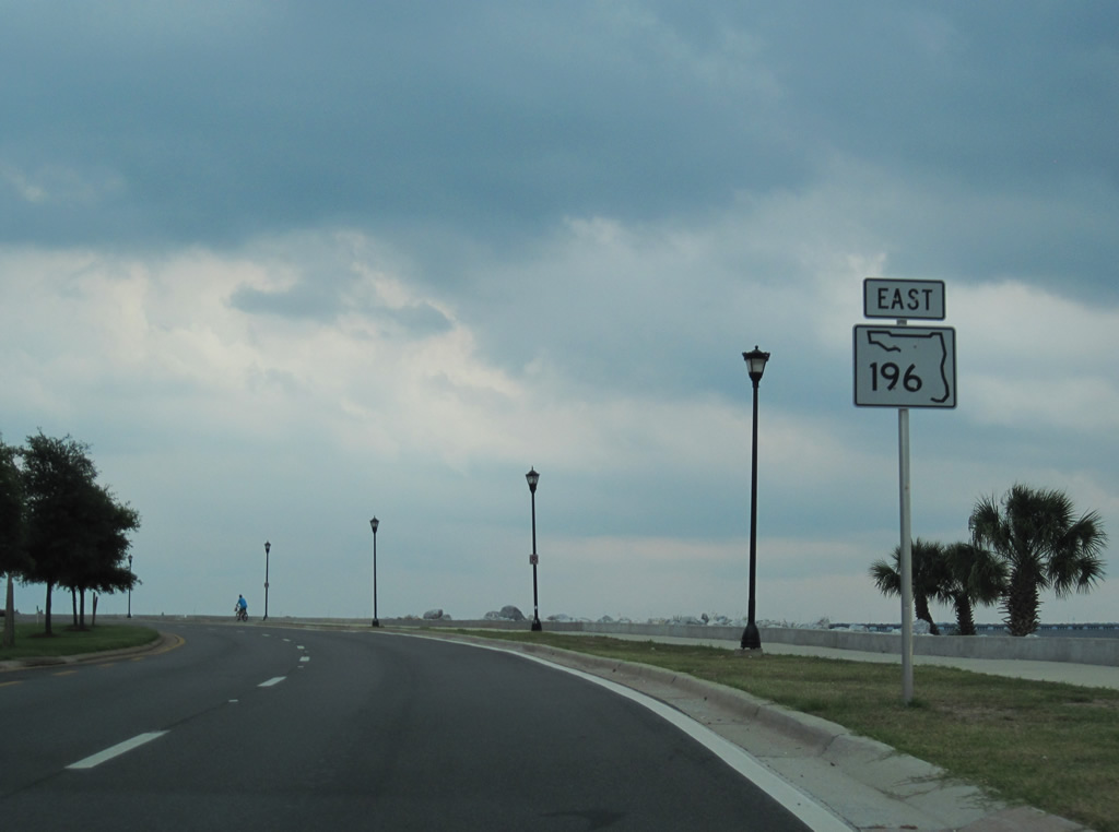
| The lone shield posted for SR 196 east appears after Alcaniz Street along Bayfront Parkway. 05/29/10 |
|
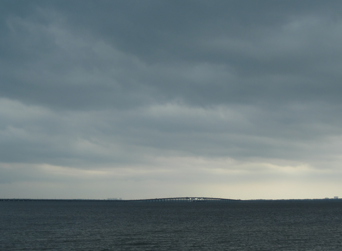
| Pensacola Bay opens to the southeast from Bayfront Parkway revealing the U.S. 98 Pensacola Bay Bridge to Santa Rosa County and condominium high rises at Pensacola Beach. 05/29/10 |
|
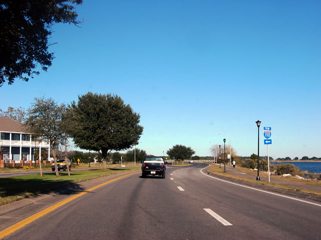
| Trucks to Interstate 110 are directed onto 9th Avenue north from SR 196 (Bayfront Parkway) east. 9th Avenue becomes SR 289 at Chase Street and U.S. 98 west between Gregory and Cerventes Streets. Interstate 110 begins just west of Ninth Avenue from U.S. 98 Business. 05/29/10 |
|
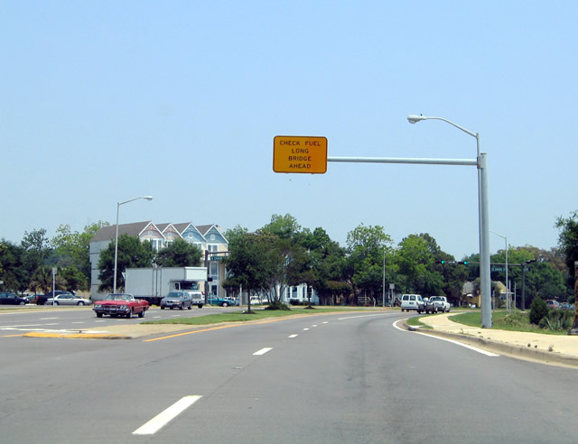
| An overhead advised eastbound motorists bound for the Three Mile Bridge to Gulf Breeze to check their fuel. The sign, since replaced with a ground-level assembly, was posted at the 12th Avenue intersection as Bayfront Parkway nears its merge with U.S. 98 (Chase Street) east. 05/09/04 |
|
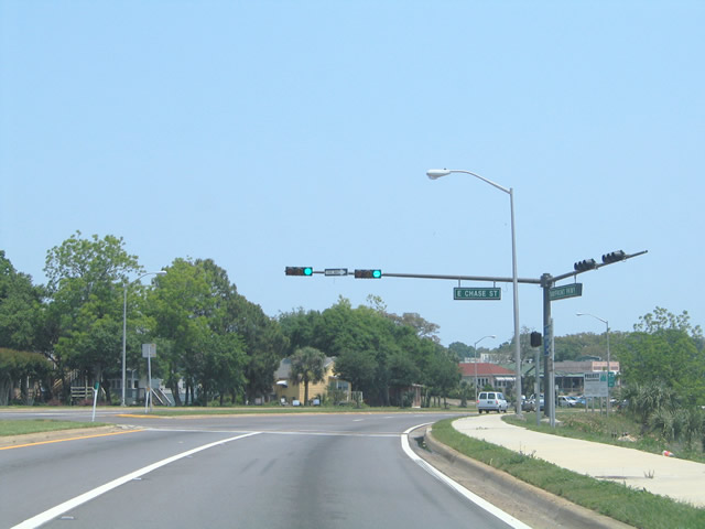
| SR 196 eastbound transitions into U.S. 98 eastbound at Chase Street. There is no end sign for SR 196 or shield posted for U.S. 98. Photo taken 05/09/04. 05/09/04 |
|
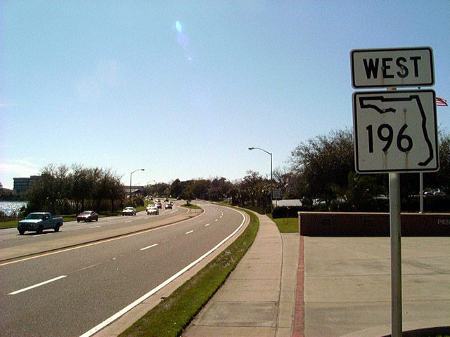
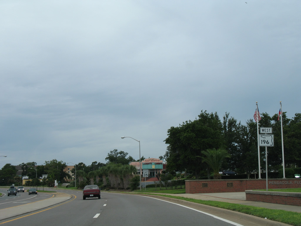
| The first and only westbound SR 196 shield lies along Bayfront Parkway just beyond the split from U.S. 98 (Gregory Street). The two-digit width shield for SR 196 pictured in 2002 was replaced by December 2003. 03/23/02, 07/15/07 |
|
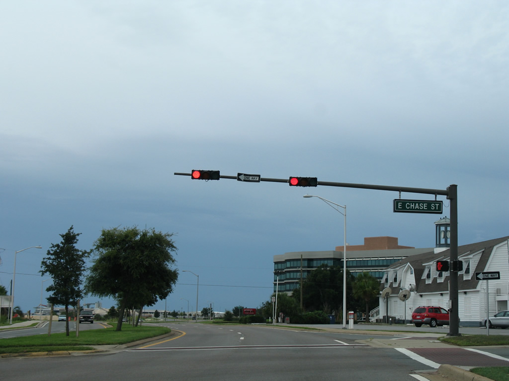
| SR 196 (Bayfront Parkway) westbound at the signalized intersection with Chase Street (U.S. 98 east). Eastbound U.S. 98 follows Bayfront Parkway to its merge with Gregory Street ahead of 17th Avenue and the Three Mile Bridge to Gulf Breeze. 07/15/07 |
|
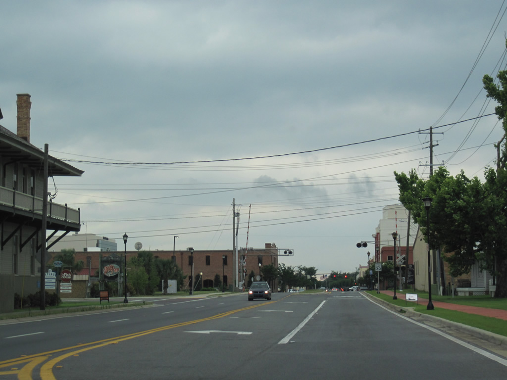
| Bayfront Parkway becomes Main Street west of Alcaniz Street leading into historic downtown Pensacola. Post-Hurricane Ivan reconstruction of SR 196 reduced westbound Main Street to a single lane from Alcaniz Street westward to Tarragona Street. This scene looks west at Barracks Street and the at-grade railroad crossing for a spur into the Port of Pensacola. 05/29/10 |
|
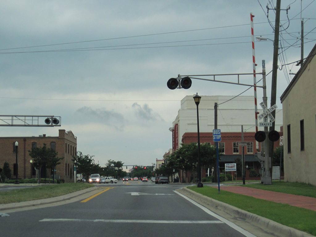
| SR 196 silently ends at Tarragona Street, which parallels the aforementioned railroad spur northward to a CSX Railroad mainline below the Interstate 110 viaduct. Main Street continues through southern reaches of downtown before widening into a four lane divided boulevard by Community Maritime Park, home of the Double A Pensacola Blue Wahoos Minor League Baseball team. 05/29/10 |
Page Updated 11-19-2012.