|
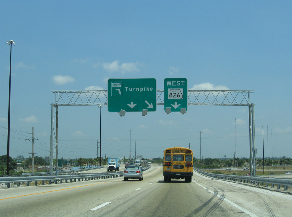
| A left side ramp partitions from Interstate 95 north for both SR 826 (Palmetto Expressway) south and Florida's Turnpike north as part of the Golden Glades Interchange. This roadway travels separately from the Turnpike beginning at NW 7th Avenue Extension and SR 826 from NW 167th Street. 05/07/06 |
|
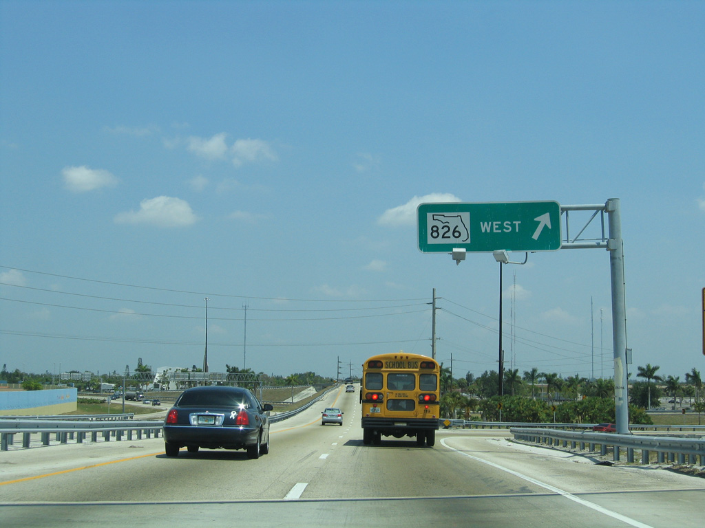
| A loop ramp joins the Turnpike northbound with SR 826 (Palmetto Expressway) leading west to Miami Lakes and Hialeah. A wye interchange follows with the SR 91 mainline. 05/07/06 |
|
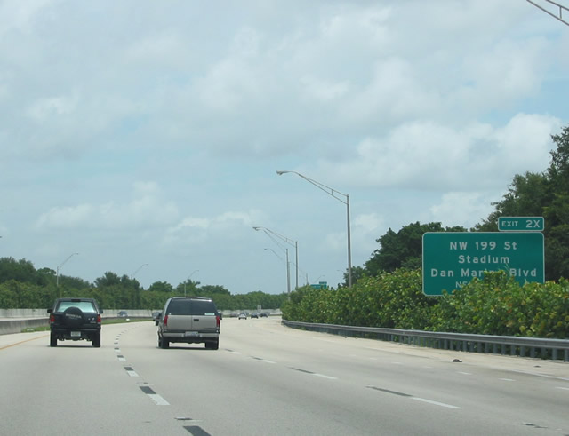
| State Road 91, the designation for Florida's Turnpike mainline, officially starts at the bridge across SR 826 (NW 7th Avenue Extension) in the Golden Glades Interchange. SR 91 angles northwest 3.34 miles to the Broward County line, meeting NW 199th Street (Dan Marino Boulevard) at Miami Gardens. 12/28/03 |
|
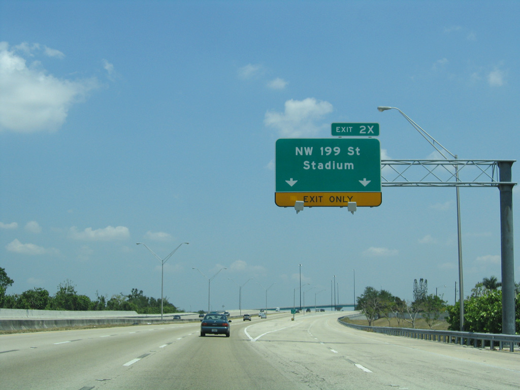
| A semi directional T interchange (Exit 2X) joins Florida's Turnpike with an access road to NW 199th Street (Dan Marino Boulevard) and adjacent Hard Rock Stadium, home of the National Football League Miami Dolphins. Dan Marino is a Hall of Fame quarterback who played for Dolphins from 1983 to 1999. 05/07/06 |
|
| The flyover ramps for NW 199th Street (Dan Marino Boulevard) are painted in the colors of the Miami Dolphins: orange and turquoise blue. 05/07/06 |
|
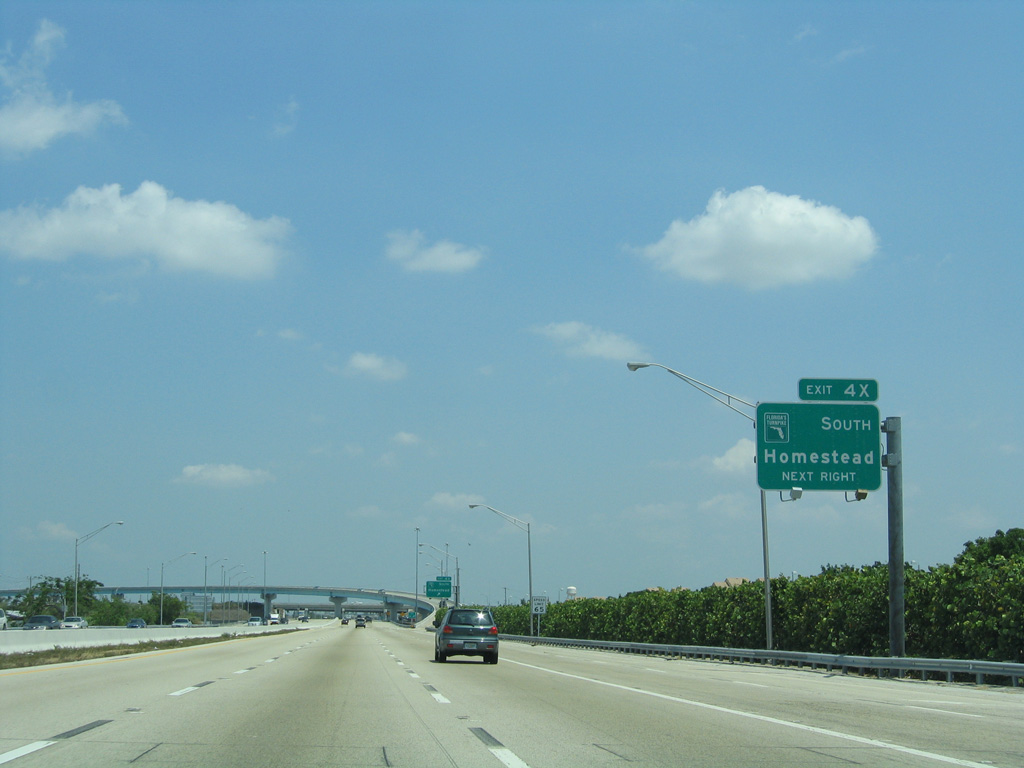
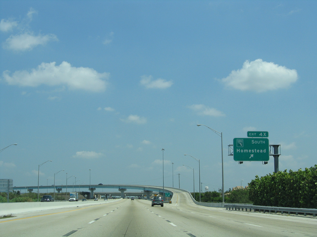
| Crossing Snake Creek Canal, the Turnpike mainline approaches the semi directional T interchange (Exit 4X) with the Homestead Extension (SR 821) west through Miramar and south back into Miami-Dade County. 05/07/06 |
|
| The Homestead Extension (HEFT) of Florida's Turnpike was completed in 1974. The exit numbering system of the Turnpike mainline was renumbered then to continue the sequence south from Broward County to Homestead and Florida City. 05/07/06 |
|
| Exit 4X comprises a lengthy flyover to the HEFT southbound ahead of SR 817 (NW 27th Avenue). SR 852, a 2.53 mile route along NW 215th Street between SR 817 and U.S. 441, passes through the exchange with the Turnpike mainline. On-ramps join NW 215th Street with both directions of the toll road. 05/07/06 |
|
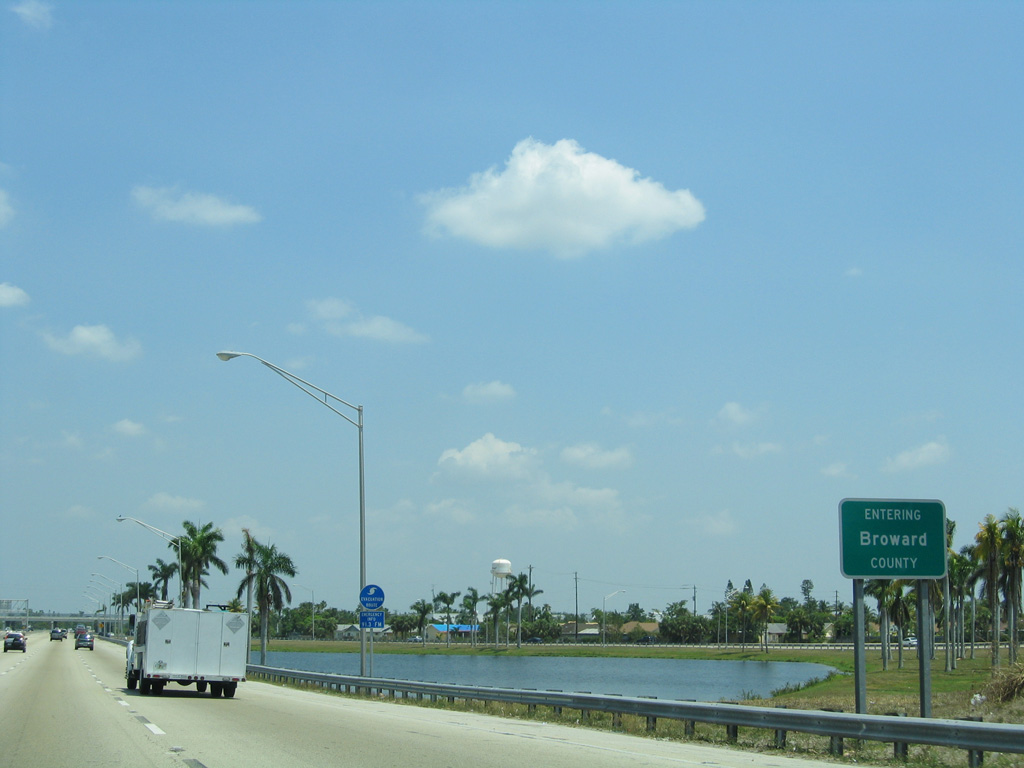
| SR 852 across the Turnpike doubles as County Line Road. SR 91 travels 25.91 miles north through Broward County. 05/07/06 |
|
| Continuing north from the merge with the Homestead Extension, Florida's Turnpike curves through eastern reaches of Miramar to Pembroke Road (SR 824). 05/07/06 |
|
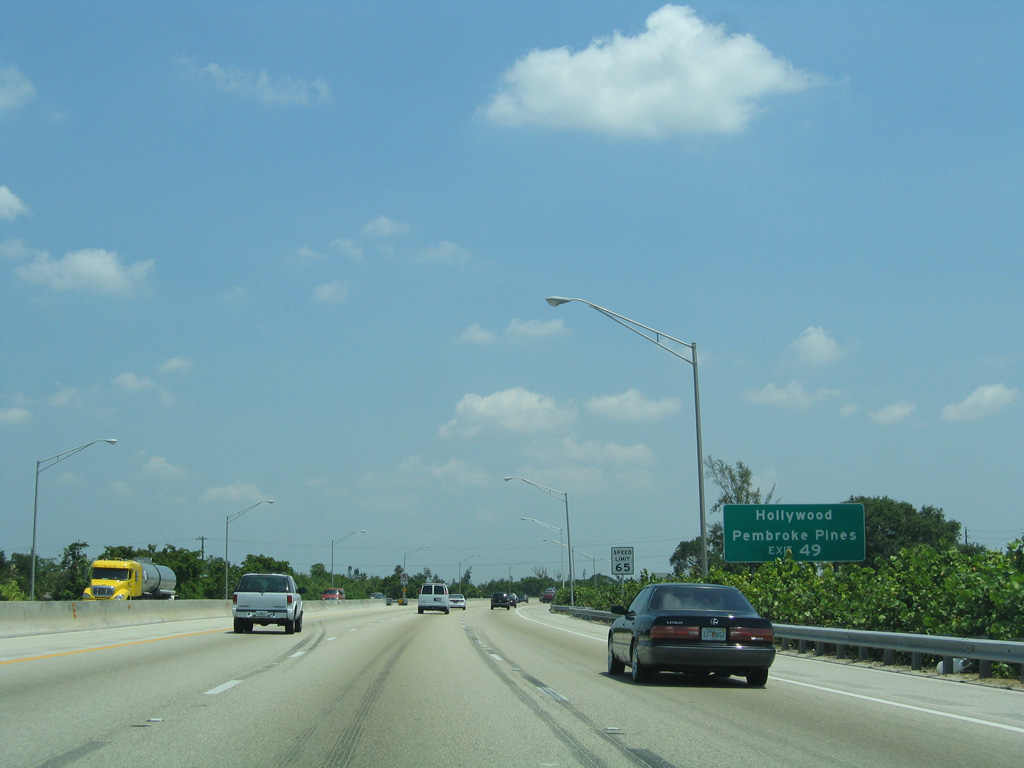
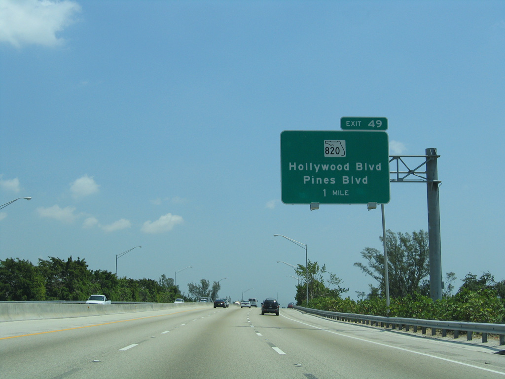
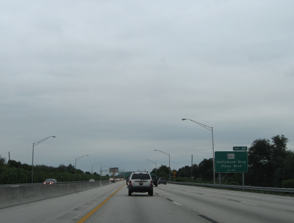
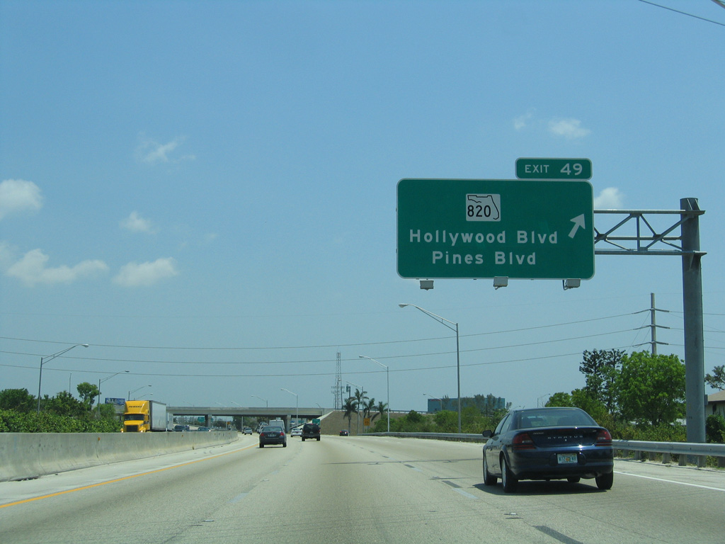
| Beyond the SR 824 underpass, Florida's Turnpike separates the cities of Pembroke Pines and Hollywood to Exit 49 with SR 820. 05/07/06 |
|
| SR 820 constitutes an east-west arterial totaling 19.96 miles from U.S. 27 in west Pembroke Pines to SR A1A (Ocean Drive) at North Hollywood Beach Park. 05/07/06 |
|
| SR 820 follows Pines Boulevard west through Pembroke Pines and Hollywood Boulevard east into Hollywood. 10/26/08 |
|
| Northbound at the trumpet interchange (Exit 49) and access road to SR 820. 05/07/06 |
|
| Florida's Turnpike briefly enters the Seminole Indian Reservation at Hollywood between Atlanta Street and Stirling Road. A casino is located on parallel U.S. 441 & SR 7 within the reservation. 05/07/06 |
|
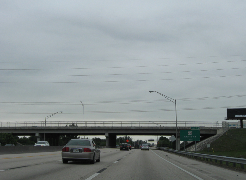
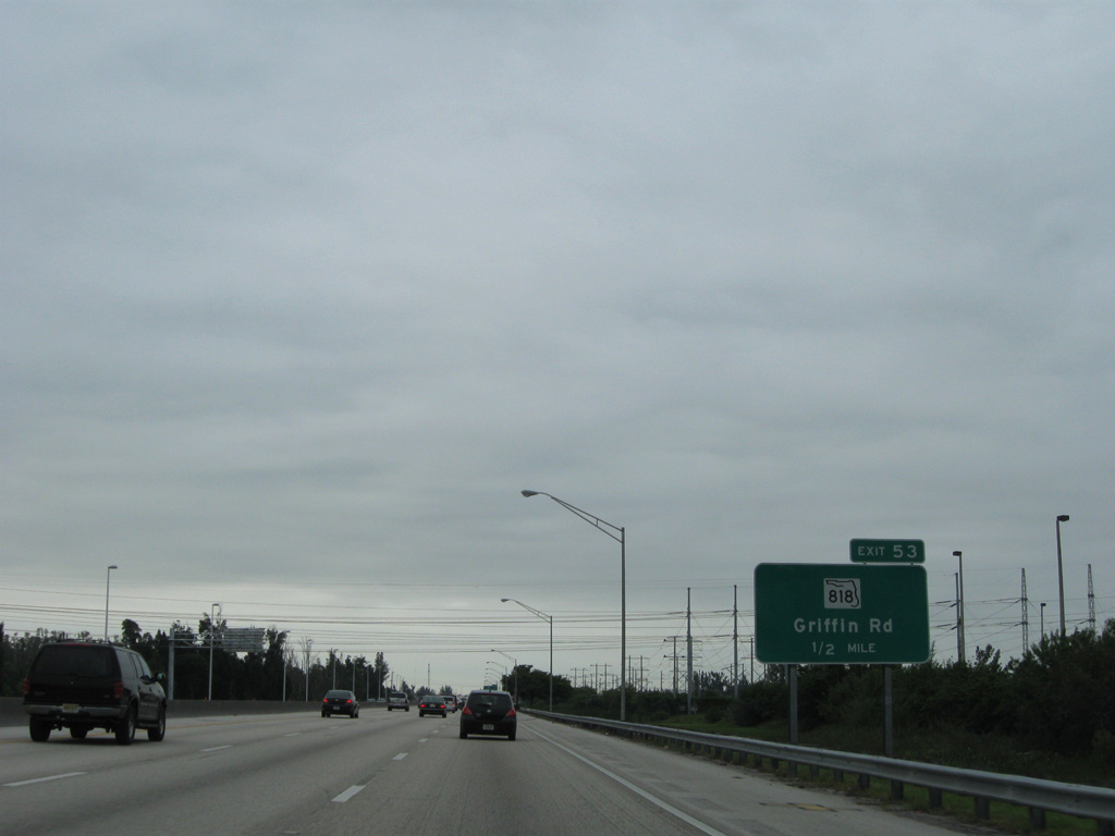
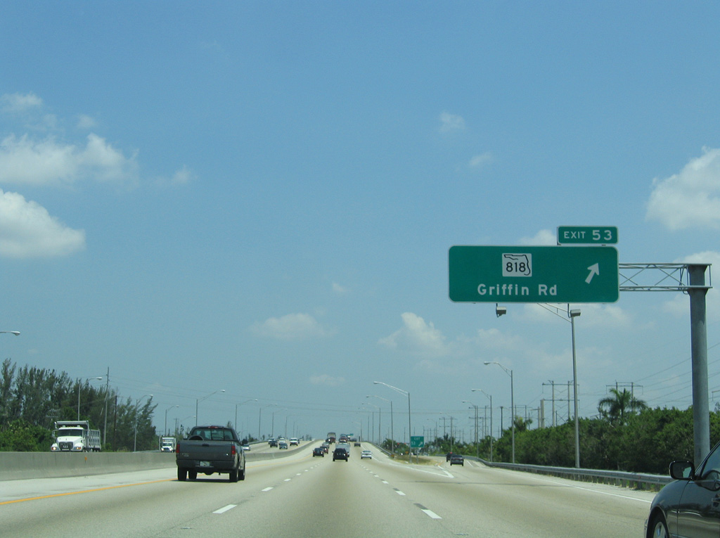
| Griffin Road (SR 818) is the first of three exits joining Florida's Turnpike with Fort Lauderdale to the east. 10/26/08 |
|
| Griffin Road doubles as SR 818 east from Exit 53 to U.S. 1 by Fort Lauderdale-Hollywood International Airport (FLL) and west to SR 823 (Flamingo Road). 05/07/06 |
|
| A diamond interchange (Exit 53) connects Florida's Turnpike with SR 818 (Griffin Road) at South New River Canal in the town of Davie. 05/07/06 |
|
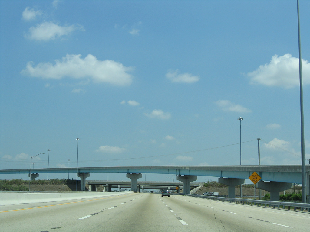
| 137,200 vehicles per day (vpd) were recorded by FDOT along the Turnpike ahead of SR 84 and I-595 in 2016. 10/26/08 |
|
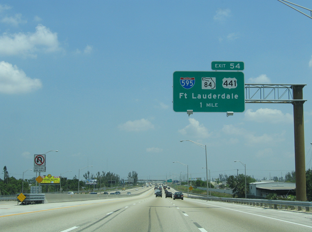
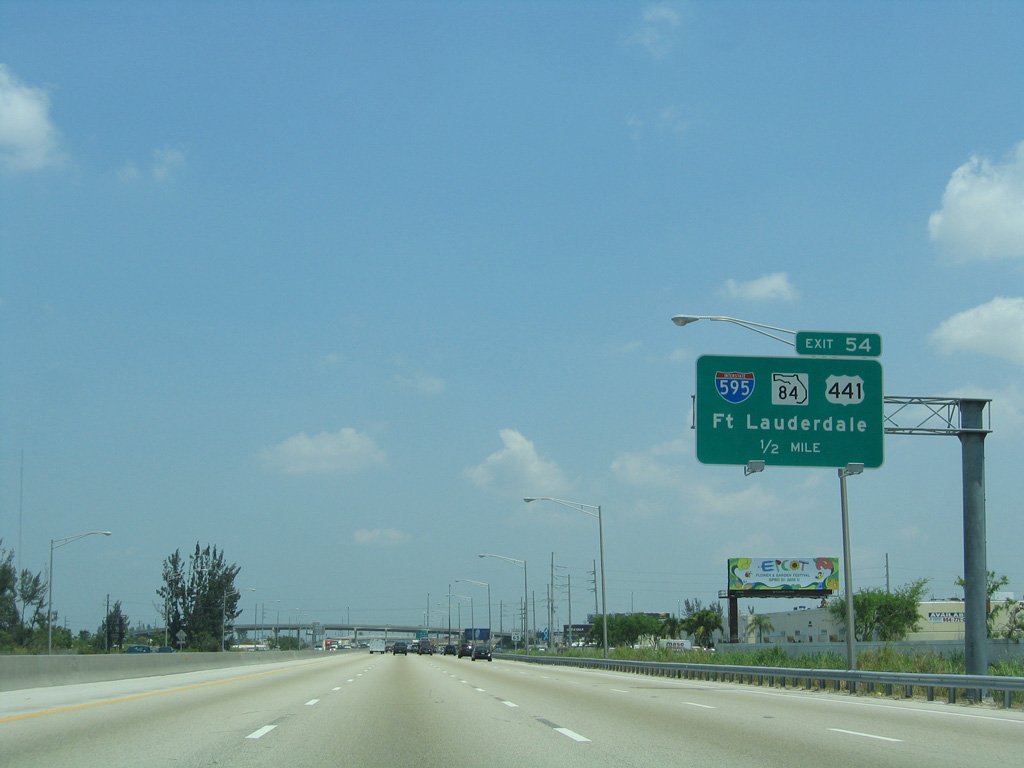
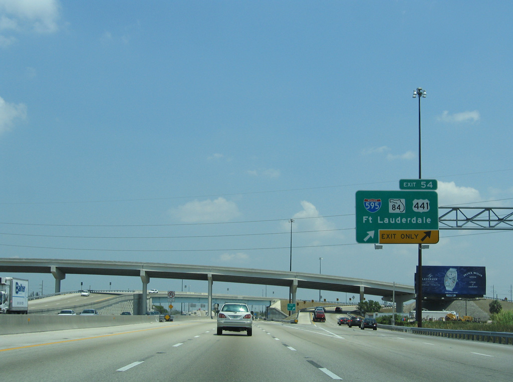
| Advancing north from SR 818 through Davie, back to back ramps (Exit 54) depart from Florida's Turnpike north for Interstate 595 (Port Everglades Expressway) and the I-595 Express Lanes. 05/07/06 |
|
| Exit 54 ties into a complicated ramp system extending east along Interstate 595 to adjacent U.S. 441 and with parallel SR 84, the Port Everglades Expressway frontage road system. 05/07/06 |
|
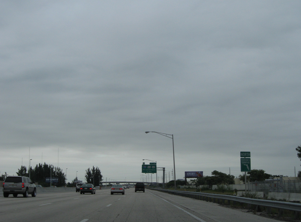
| Interstate 595 travels west from U.S. 1, south of Downtown Fort Lauderdale and west of Port Everglades to Sunrise and the western turn of I-75 through Weston and Alligator Alley. 05/07/06 |
|
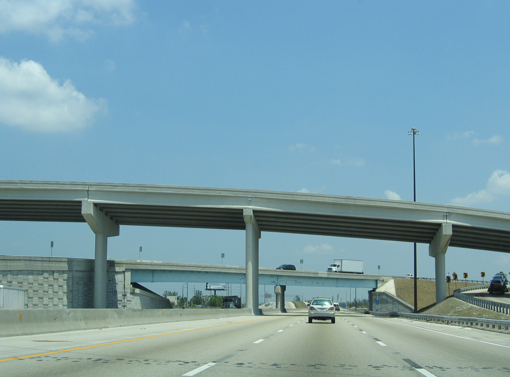
| Flyovers passe over the Turnpike, linking with the nearby semi directional T interchange with Interstate 595. Completion of the I-595 Express Lanes in March 2014 included the addition of flyover ramps from Florida's Turnpike to and from the toll lanes to the west. 05/07/06 |
|
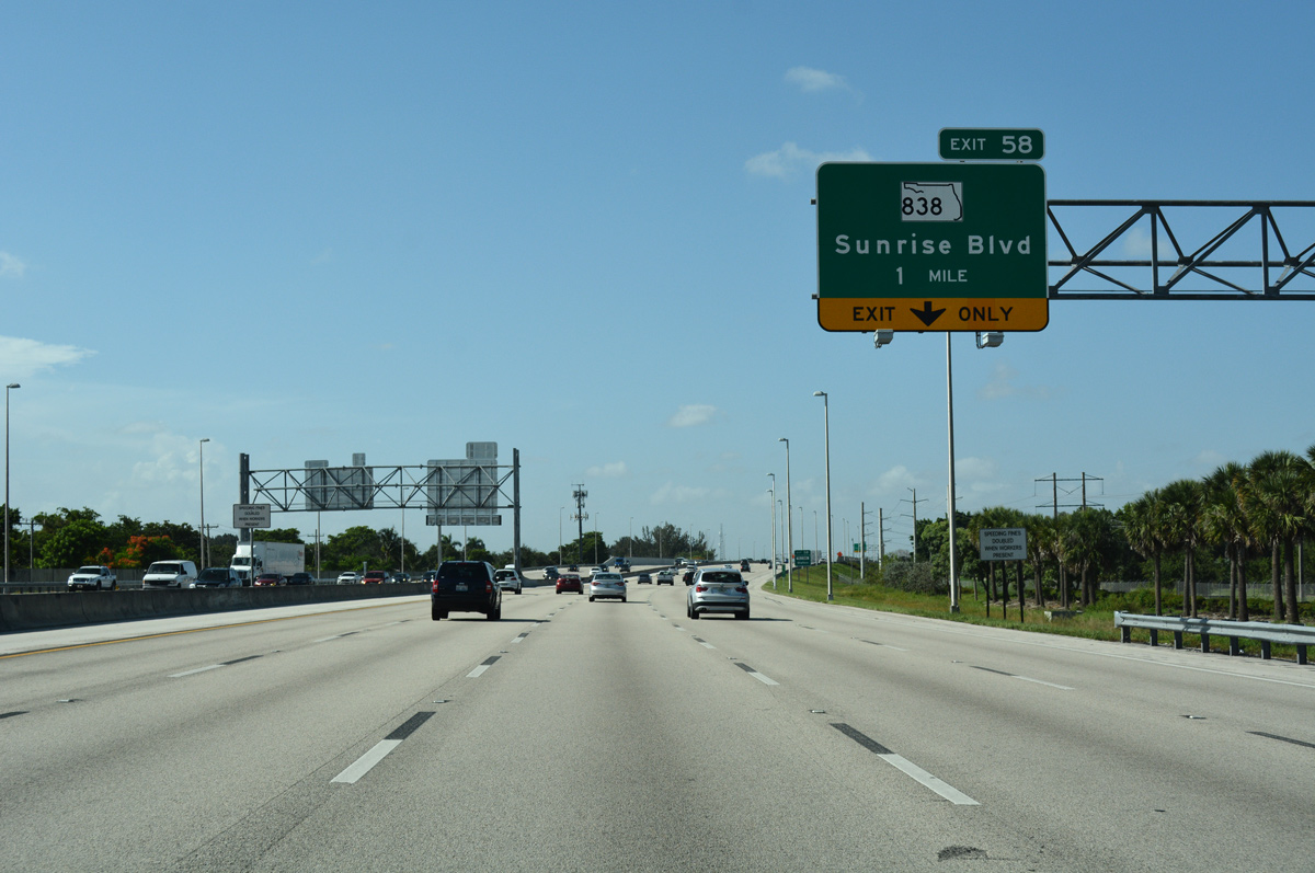
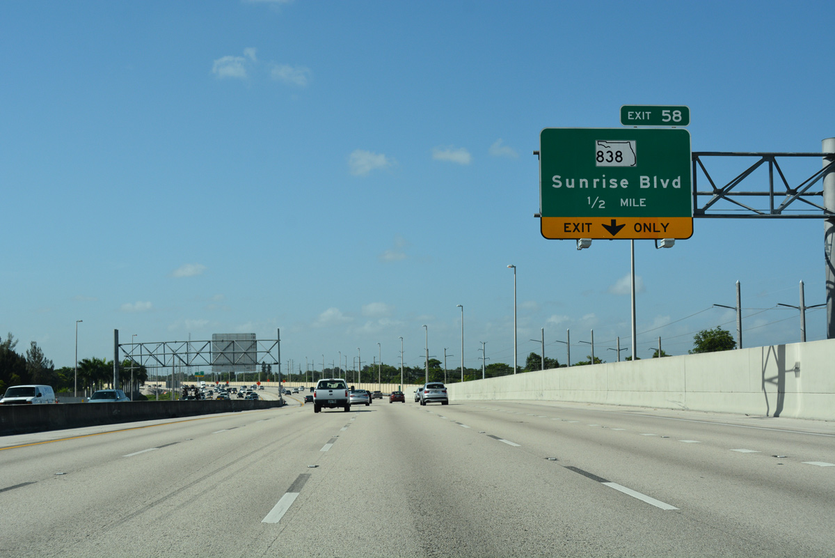
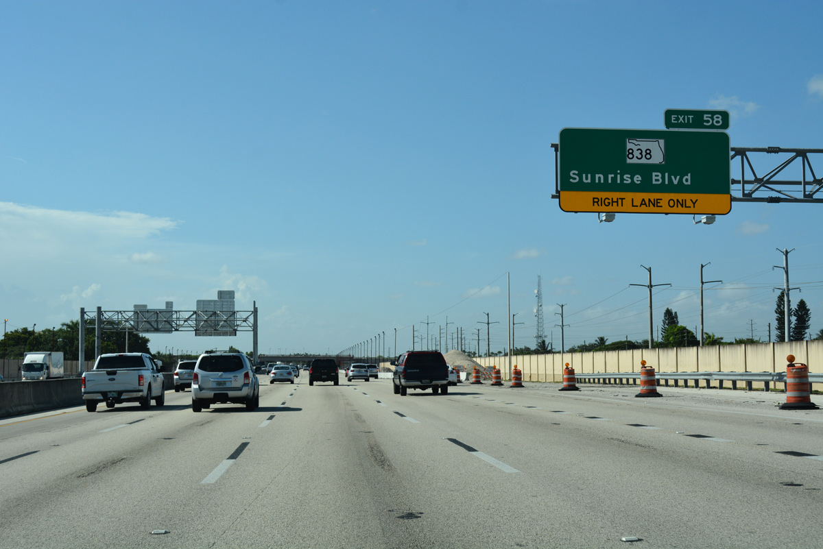
| Florida's Turnpike enters the Plantation city limits north ahead of the Peters Road underpass. The succeeding exit departs in one mile for SR 838 (Sunrise Boulevard). 07/26/17 |
|
| State Road 818 follows Sunrise Boulevard, a six lane arterial, 8.16 miles east from SR 817 (University Drive) in Plantation to U.S. 1 (6th Avenue) in Fort Lauderdale. 07/26/17 |
|
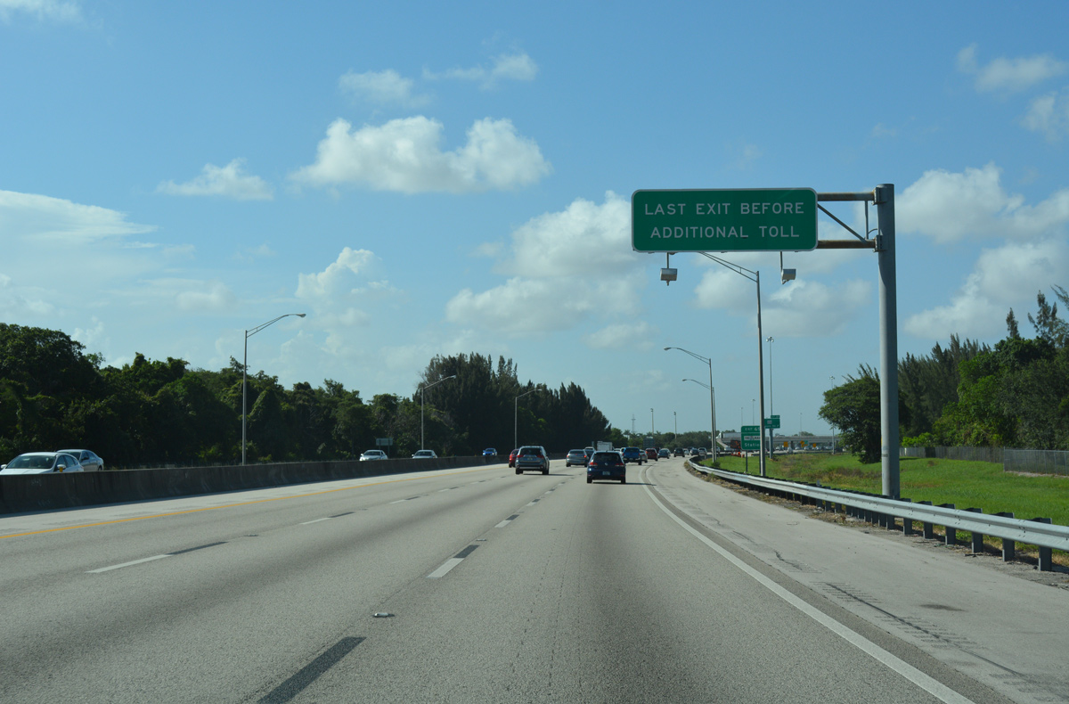
| A $50 million project through late 2019 expands Exit 58 to include a new northbound off-ramp to Sunrise Boulevard east and from Sunrise Boulevard east to the Turnpike south. Additional work includes replacing the SR 838 overpass and removing the existing ramp toll plaza and converting the exchange to use all-electronic tolling.1 07/26/17 |
|
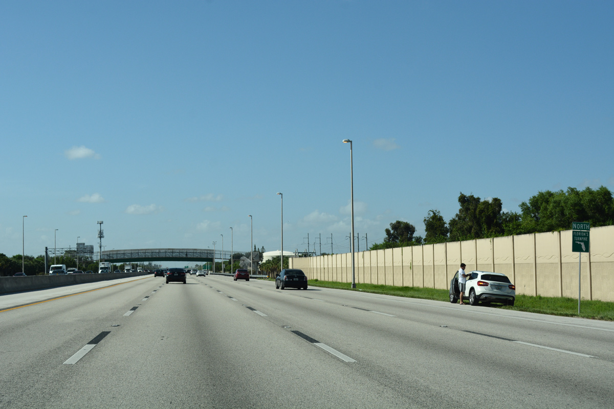
| Confirming marker for Florida's Turnpike north posted after Exit 58 in the city of Lauderhill. 07/26/17 |
|
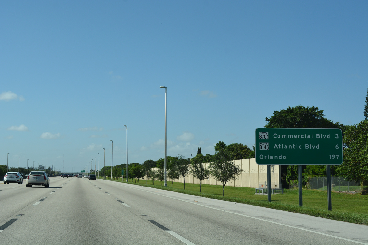
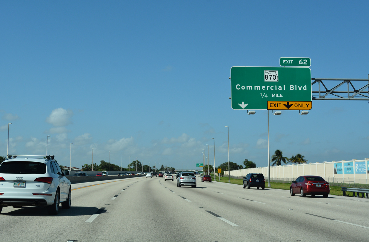
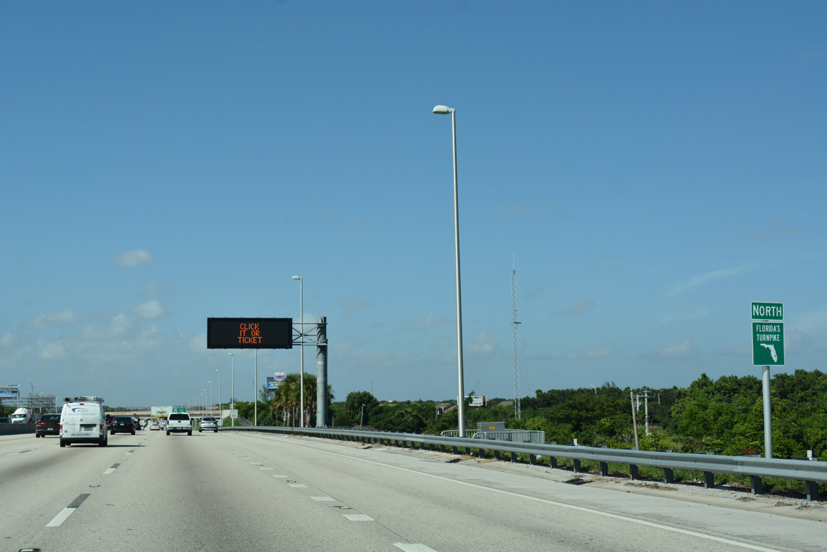
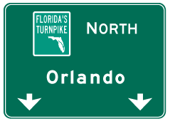
| Distance sign posted 197 miles south of Orlando. The Turnpike enters the city of Tamarac ahead of forthcoming Exit 62 with SR 870 (Commercial Boulevard). 07/26/17 |
|
| SR 870 joins the Tamarac and Florida's Turnpike with Fort Lauderdale Executive Airport (FXE) to the east and northern reaches of Lauderhill to the west. 07/26/17 |
|
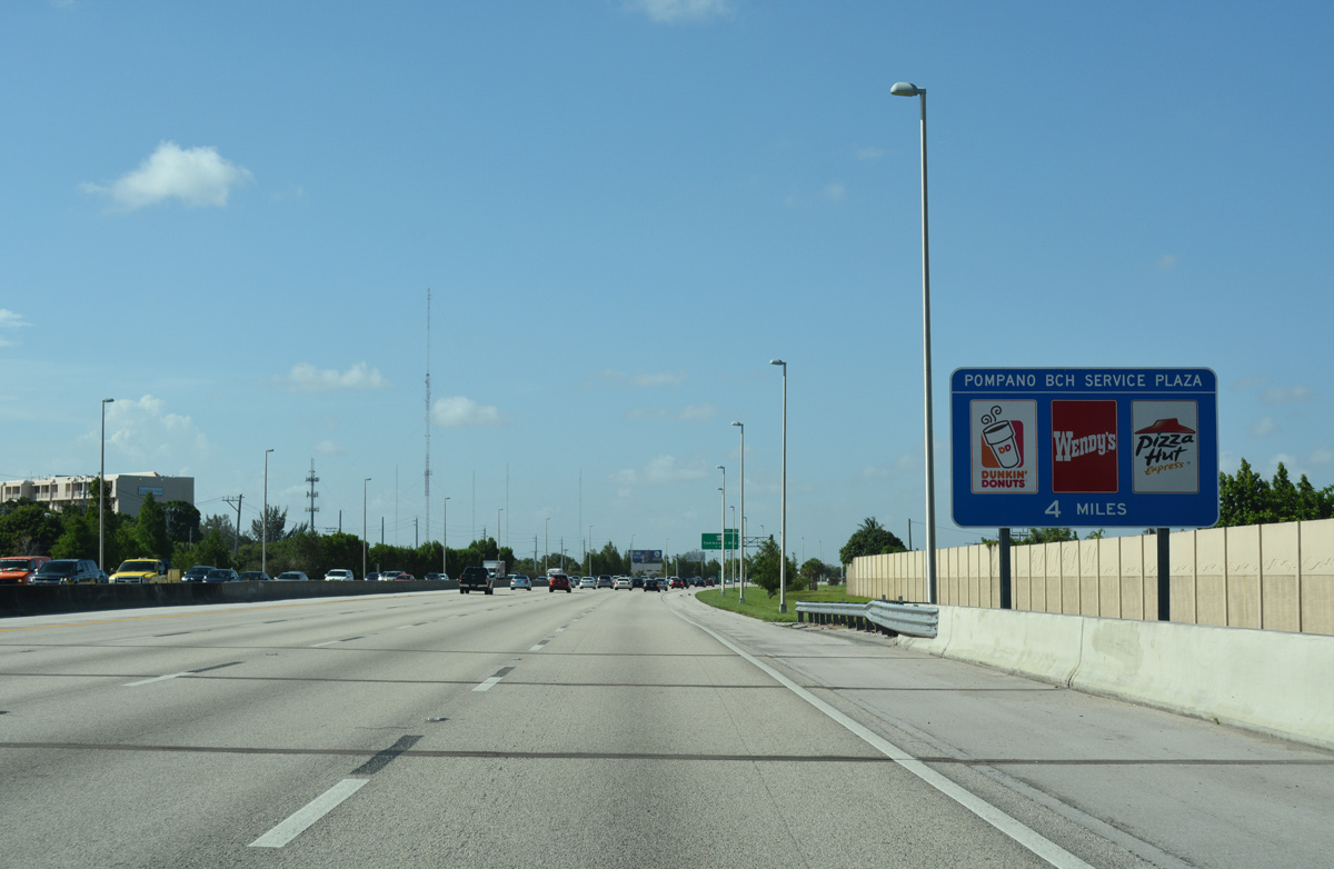
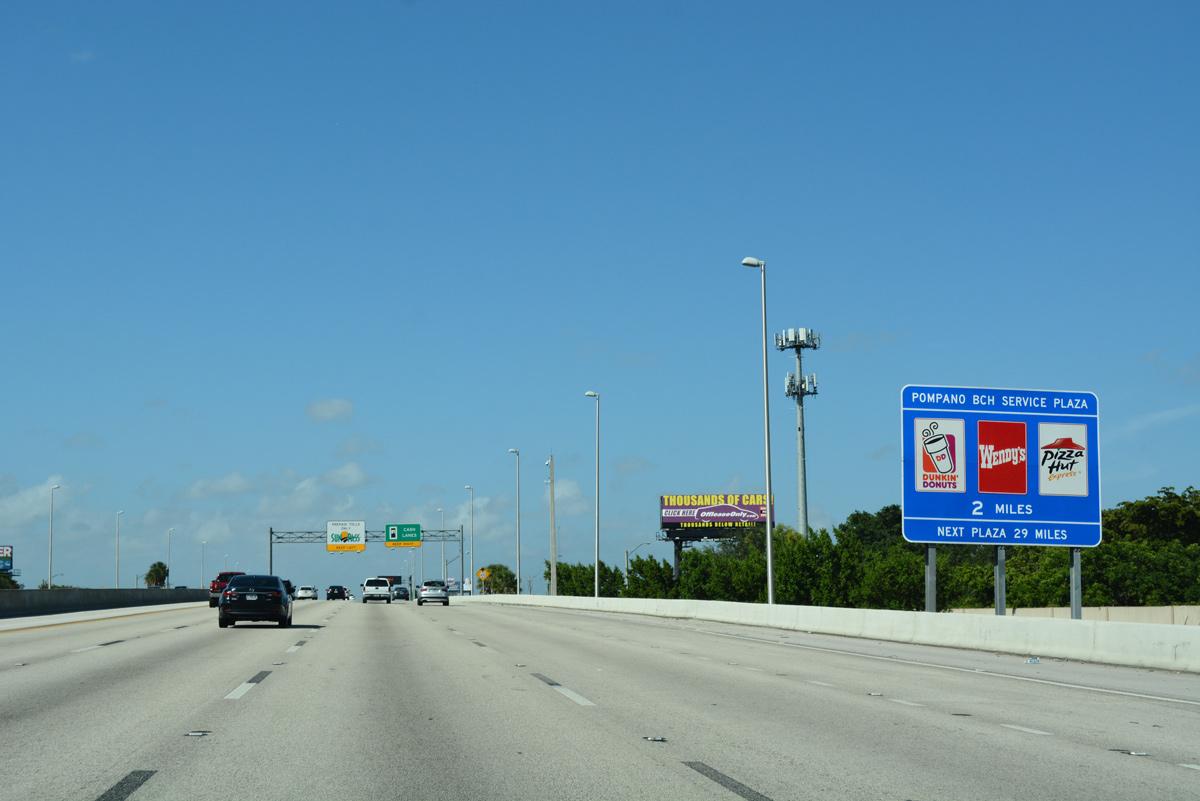
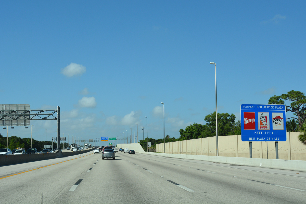
| The Pompano Beach Service Area, four miles ahead, lies midway between Exits 62 and 67 along Florida's Turnpike. 07/26/17 |
|
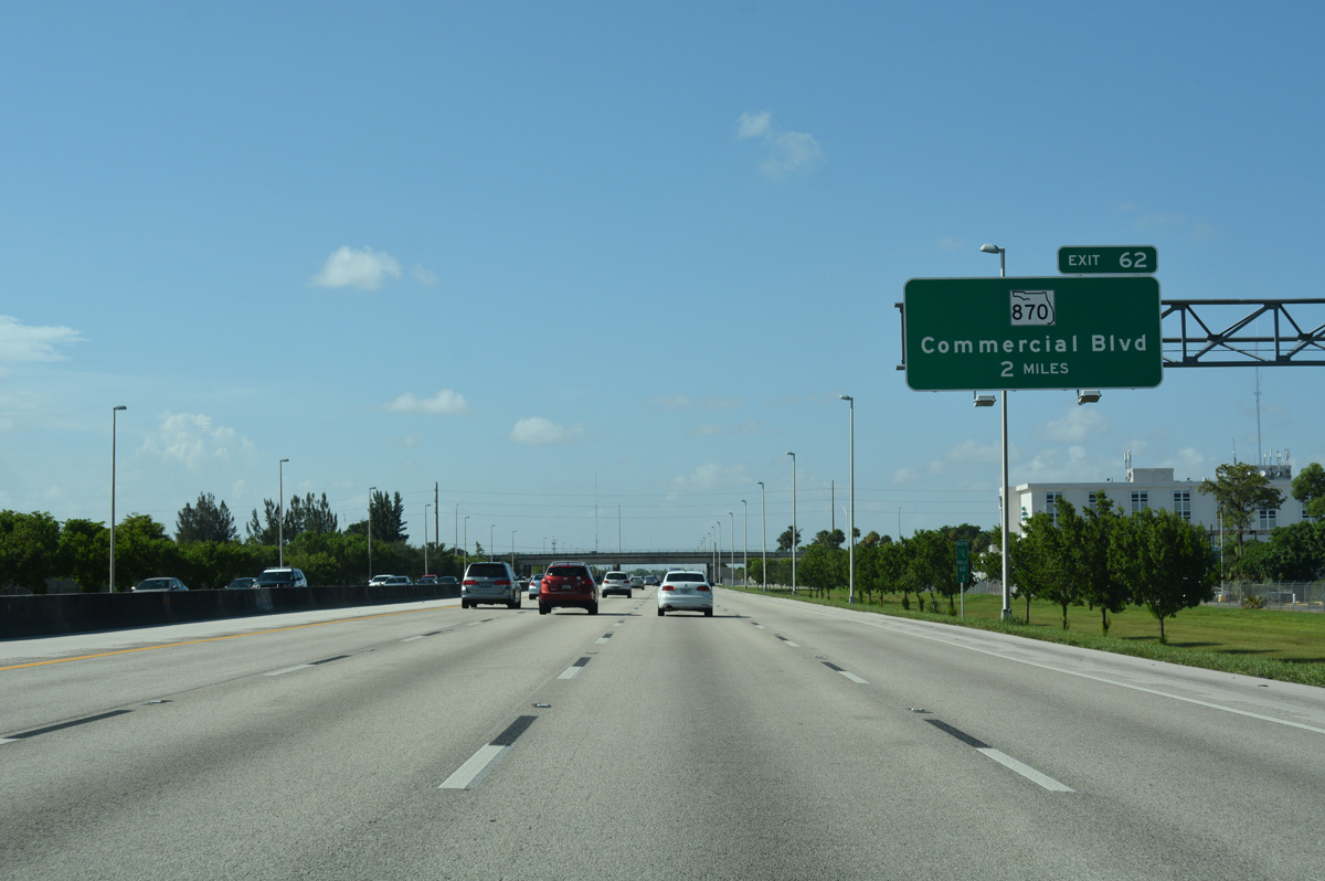
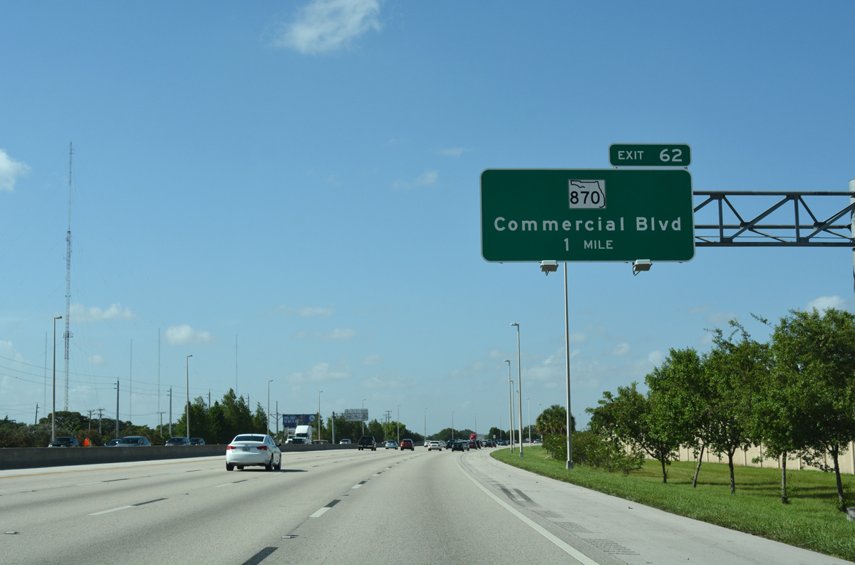
| Florida's Turnpike turns northeast into Tamarac on the one mile approach to Exit 62 with SR 870 (Commercial Boulevard). 07/26/17 |
|
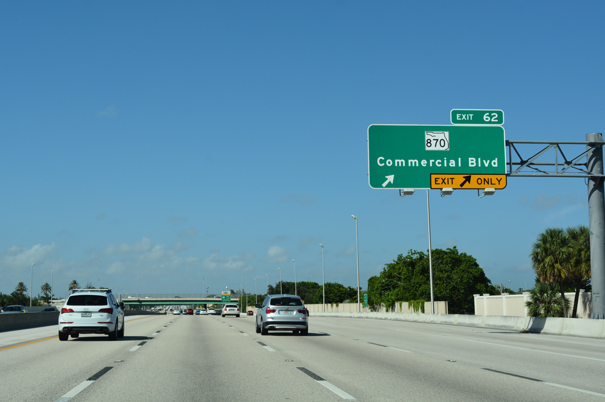
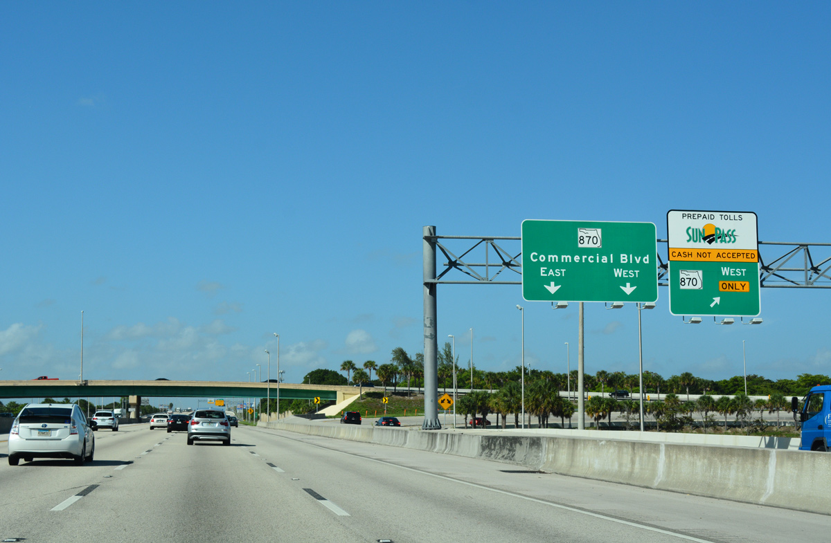
| Two lanes separate from the turnpike north for Exit 62. SR 870 travels 9.89 miles overall along Commercial Boulevard west to SR 817 (University Drive) and east to SR A1A (Ocean Boulevard) at Lauderdale-By-The-Sea. 07/26/17 |
|
| Exit 62 leads motorists east to Lauderdale Lakes and Oakland Park and west to northwest Sunrise. 07/26/17 |
|
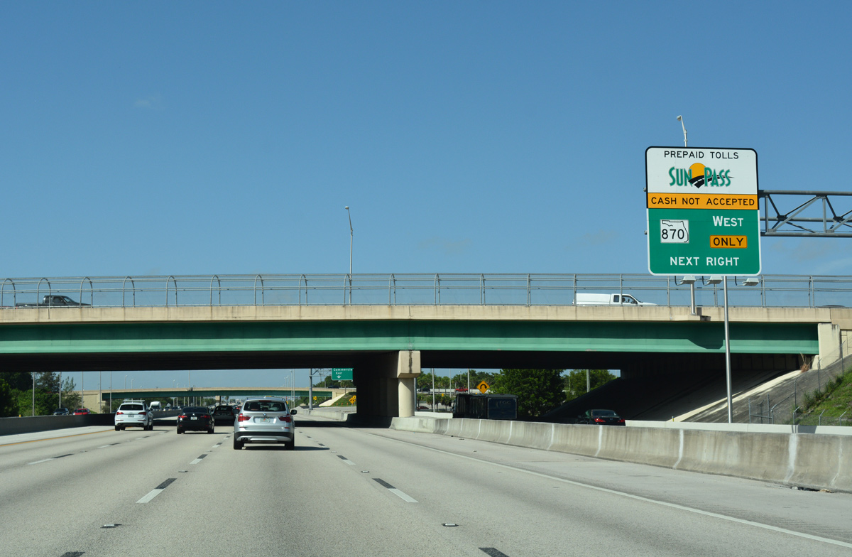
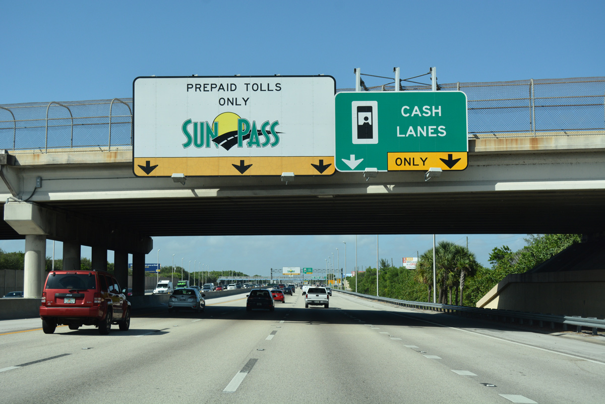
| A Sunpass dedicated lane bypasses the toll booths to join SR 870 (Commercial Boulevard) westbound. 07/26/17 |
|
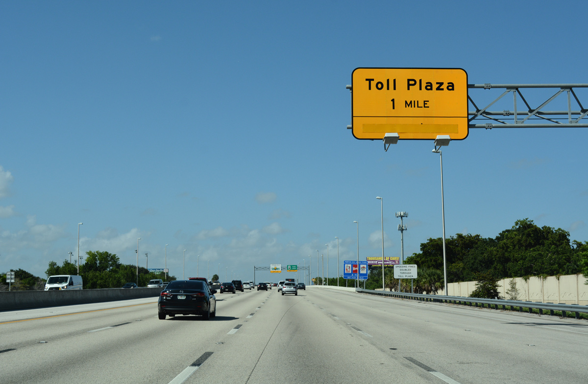
| Florida's Turnpike advances one mile northeast from Exit 62 to the main line toll plaza at Pompano Beach. 07/26/17 |
|
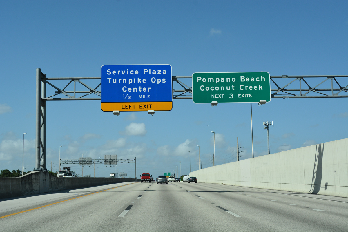
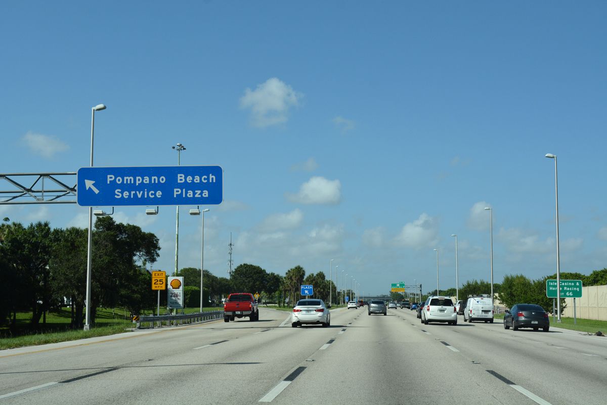
| Situated at Mile Post 65, the Pompano Beach Service Plaza is the second of eight along Florida's Turnpike northbound. 07/26/17 |
|
| U.S. 441 & SR 7 shift sides with Florida's Turnpike just ahead of this confirming marker. 07/26/17 |
|
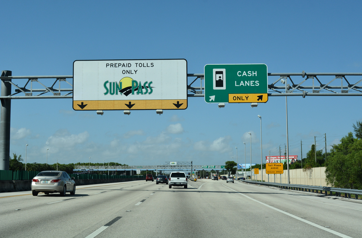
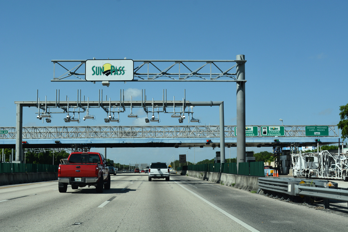
| Traffic partitions with three lanes maintaining speed below Sunpass transponder readers and two lanes departing for four toll booths. 07/26/17 |
|
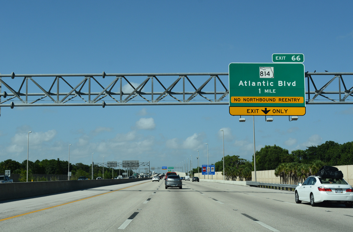
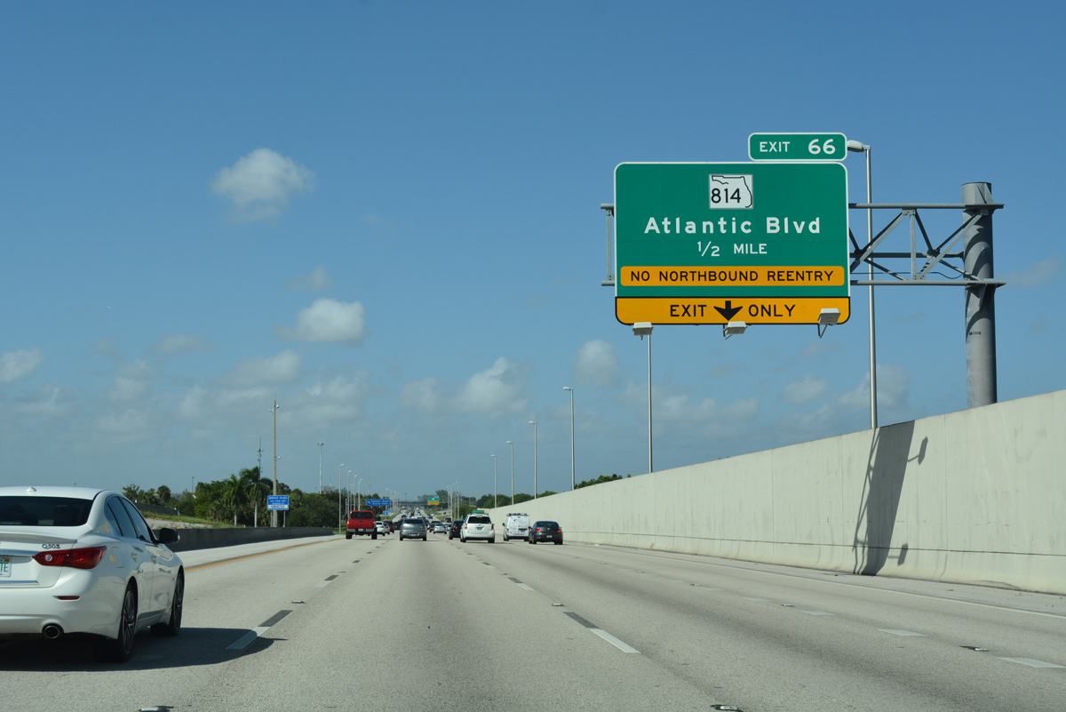
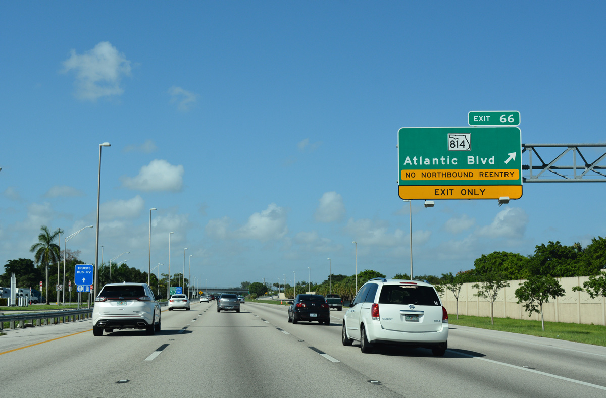
| A half diamond interchange (Exit 66) provides northbound access to SR 814 (Atlantic Boulevard) just beyond the Pompano Beach Service Plaza. 07/26/17 |
|
| The Pompano Beach Service Plaza offers motorists fast food options, a fuel station and a gift shop. The Pompano Operations Center for the Turnpike is also located on site. 07/26/17 |
|
| SR 814 follows Atlantic Boulevard west across the city of Pompano Beach from SR A1A (Ocean Boulevard) on the Atlantic coast. 07/26/17 |
|
| The left side ramp for Pompano Beach Service Area departs just ahead of Exit 66. 07/26/17 |
|
| Exit 66 constitutes a lengthy off-ramp crossing Cypress Creek Canal. SR 814 (Atlantic Boulevard) continues west from the Turnpike to Lyons Road in Coconut Creek and U.S. 441 in Margate. 07/26/17 |
|
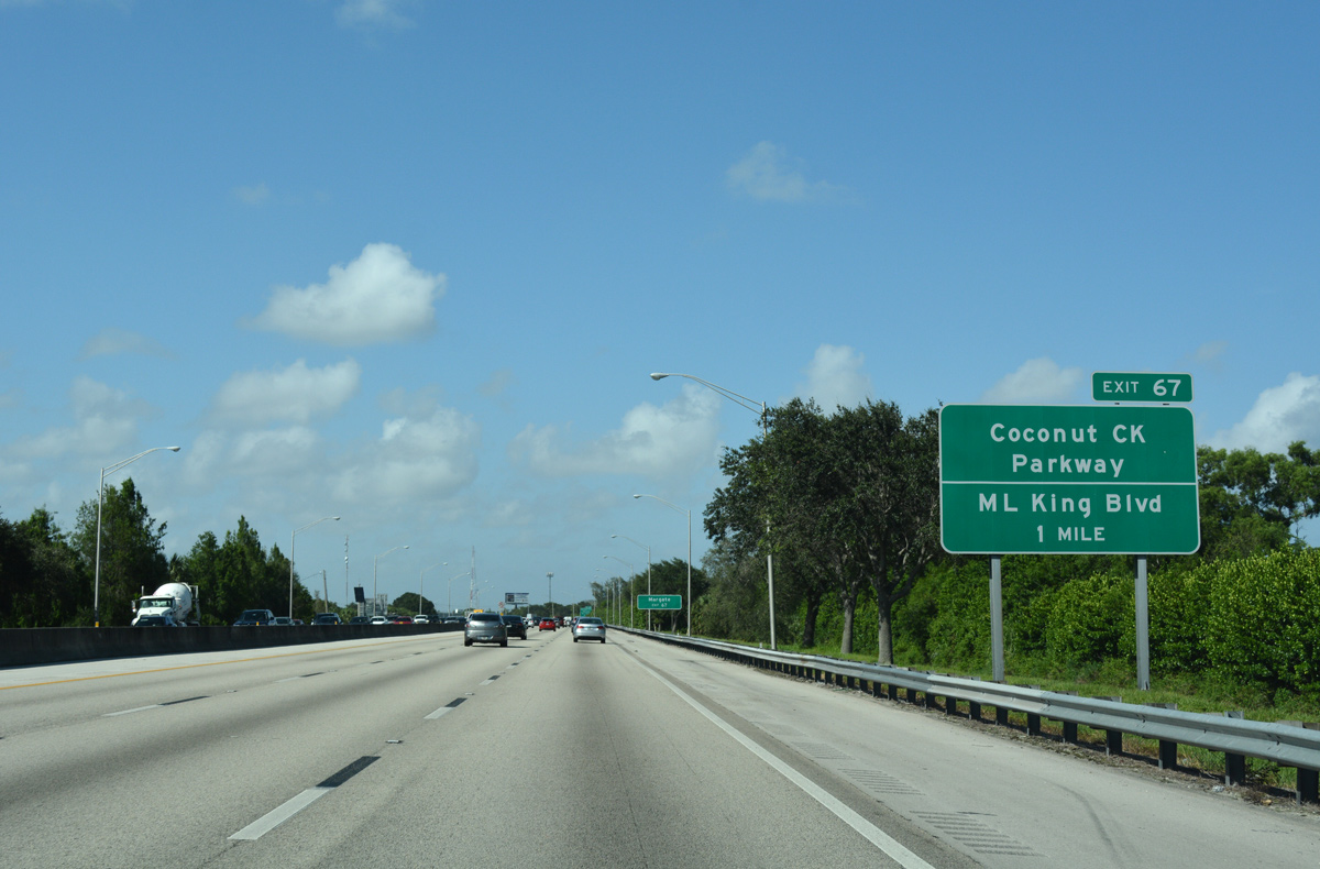
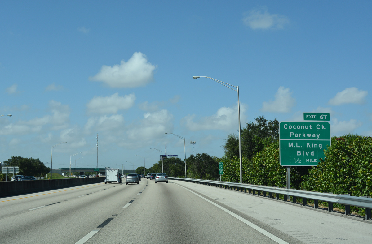
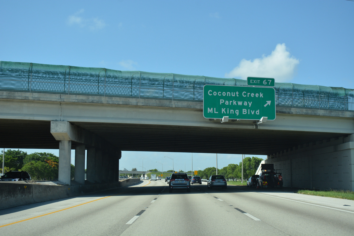
| Florida's Turnpike runs along the Coconut Creek and Pompano Beach city line north to Exit 67 with Coconut Creek Parkway east and Dr. Martin Luther King, Jr. Boulevard east. 07/26/17 |
|
| SR 849 (NW 31st Avenue) stems 0.96 miles south from the Exit 67 access road to SR 849 (Atlantic Boulevard) in Pompano Beach. 07/26/17 |
|
| Coconut Creek Parkway leads west from Dr. Martin Luther King, Jr. Boulevard to U.S. 441 in Margate. The commercial arterial was formerly SR 912. MLK Boulevard (Hammondville Road) extends the arterial southeast to NW 3rd Street in Pompano Beach. 07/26/17 |
|
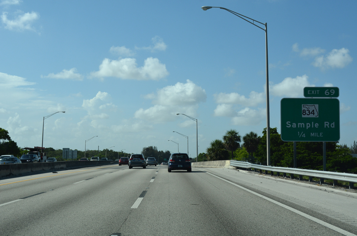
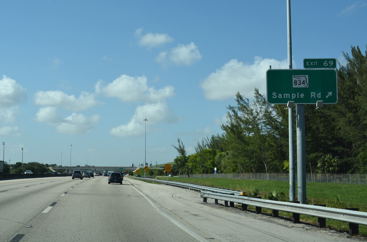
| Remaining north along the Coconut Creek and Pompano Beach city line, Florida's Turnpike spans Copans Road one quarter mile ahead of the trumpet interchange (Exit 69) and access road to SR 834 (Sample Road). 07/26/17 |
|
| Exit 69 is not tolled in the northbound direction of the Turnpike. 07/26/17 |
|
| A 9.49 mile route, SR 834 heads west from Exit 69 to Coral Springs and SR 817 (University Drive). East from the Turnpike, the state road takes Sample Road to U.S. 1 (Federal Highway) at Lighthouse Point. 07/26/17 |
|
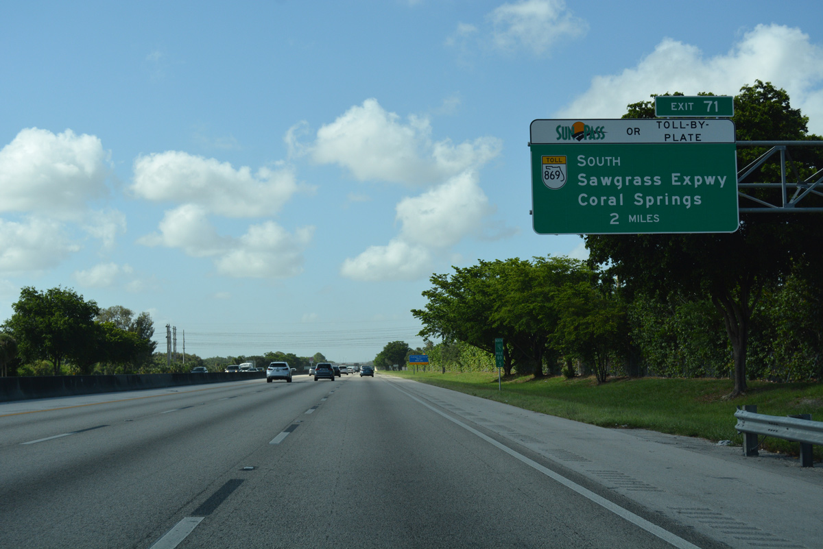
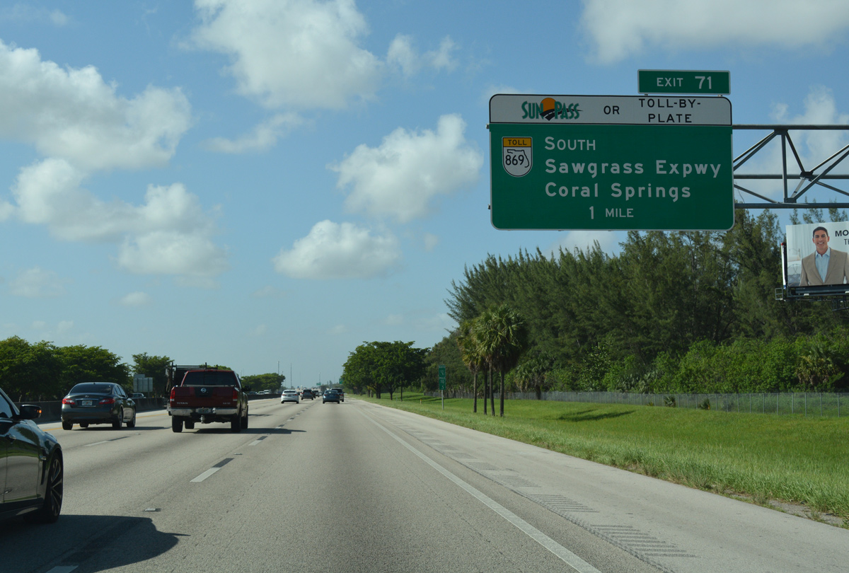
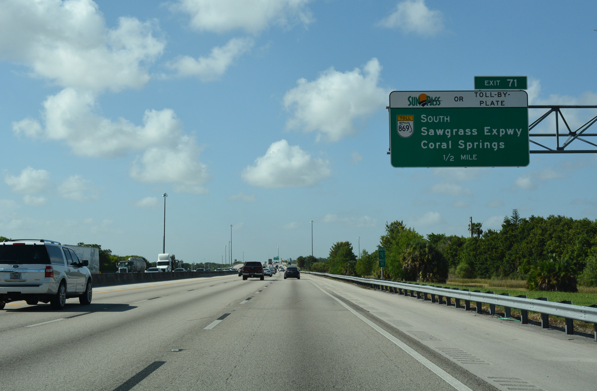
| Florida's Turnpike leads due north two miles from Sample Road to a parclo interchange (Exit 71) with SR 869 (Sawgrass Expressway). 07/26/17 |
|
| Exit 71 provides access from the Turnpike to SR 869 (Sawgrass Expressway) southbound only. SR 869 continues east onto SW 10th Street for 2.15 miles between SR 845 (Powerline Road) to Interstate 95. 07/26/17 |
|
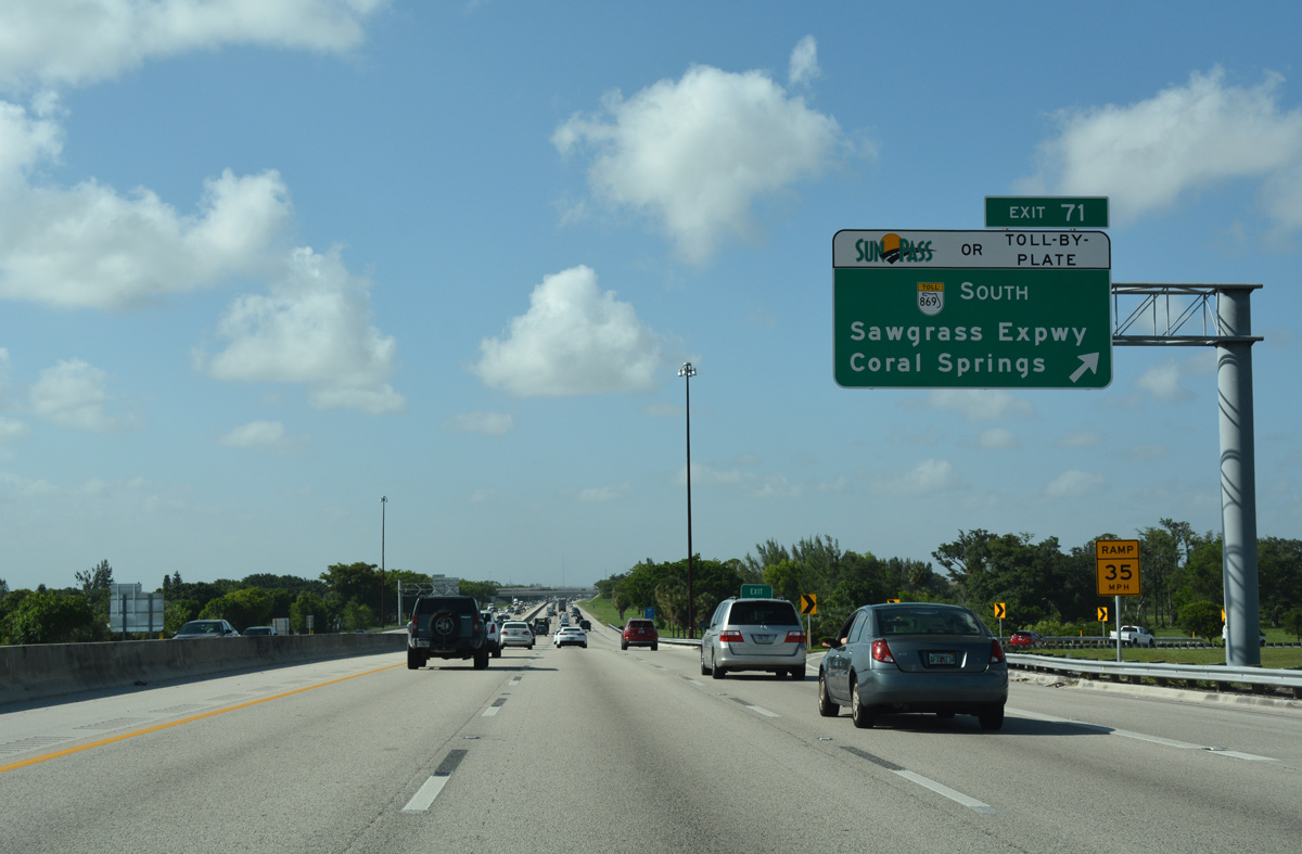
| The Sawgrass Expressway uses all electronic tolling for its 21.83 mile course west from Deerfield Beach to Coral Springs and south to I-75 and I-595 at Sunrise. 07/26/17 |
|
| Northbound at the loop ramp (Exit 71) for the Sawgrass Expressway west to Coconut Creek, Parkland and Coral Springs. 07/26/17 |
|
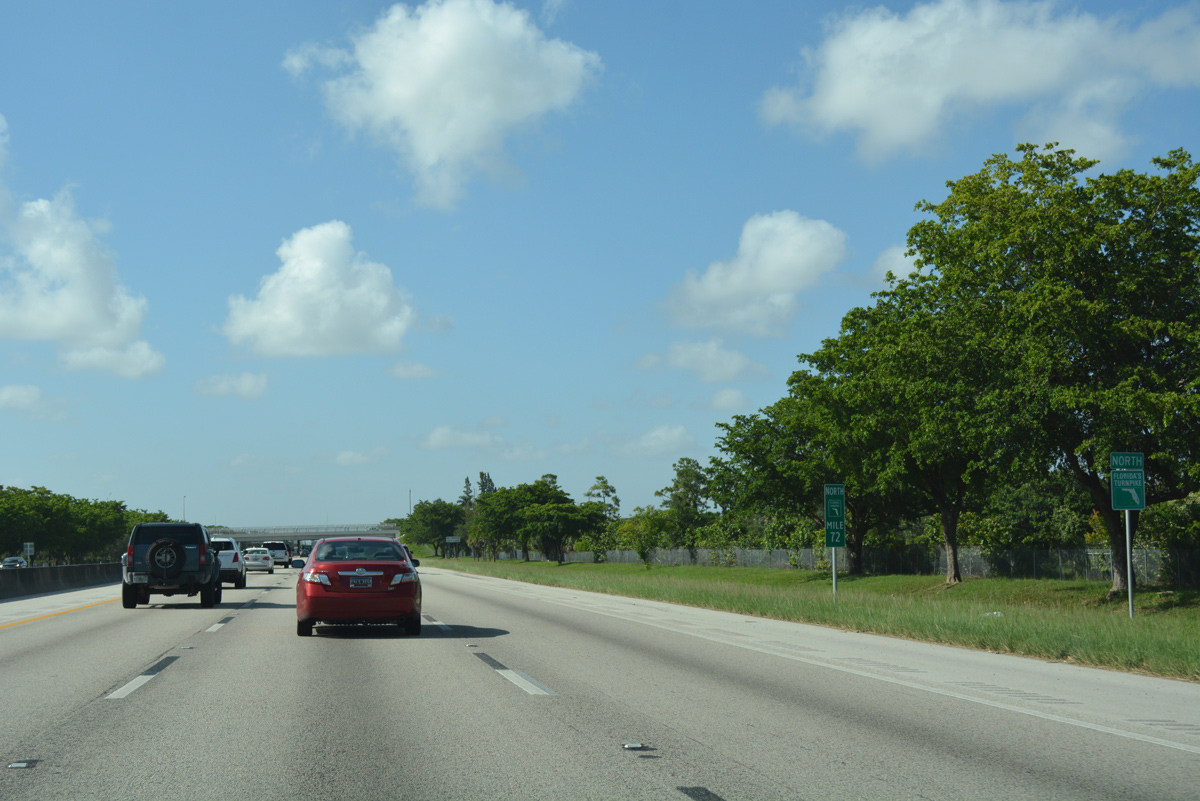
| Reassurance marker for Florida's Turnpike north, posted by Quiet Waters Park. 07/26/17 |
|
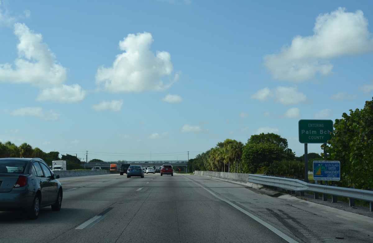
| Florida's Turnpike crosses Hillsboro Canal and the Palm Beach County line. 07/26/17 |
Page Updated 09-08-2017.