|
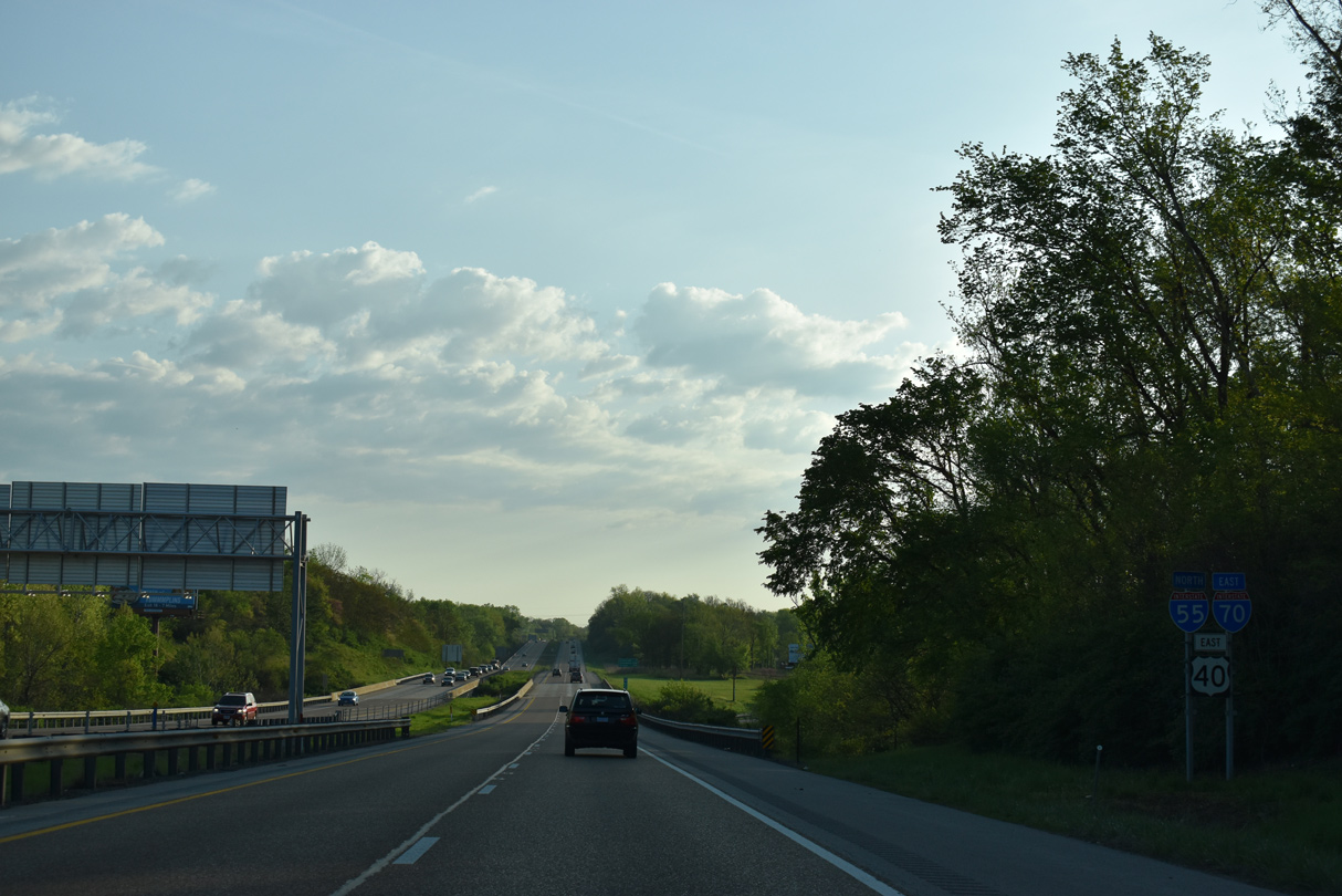
| I-55/70 overlap 15.65 miles northeast from East St. Louis. 05/24/18 |
|
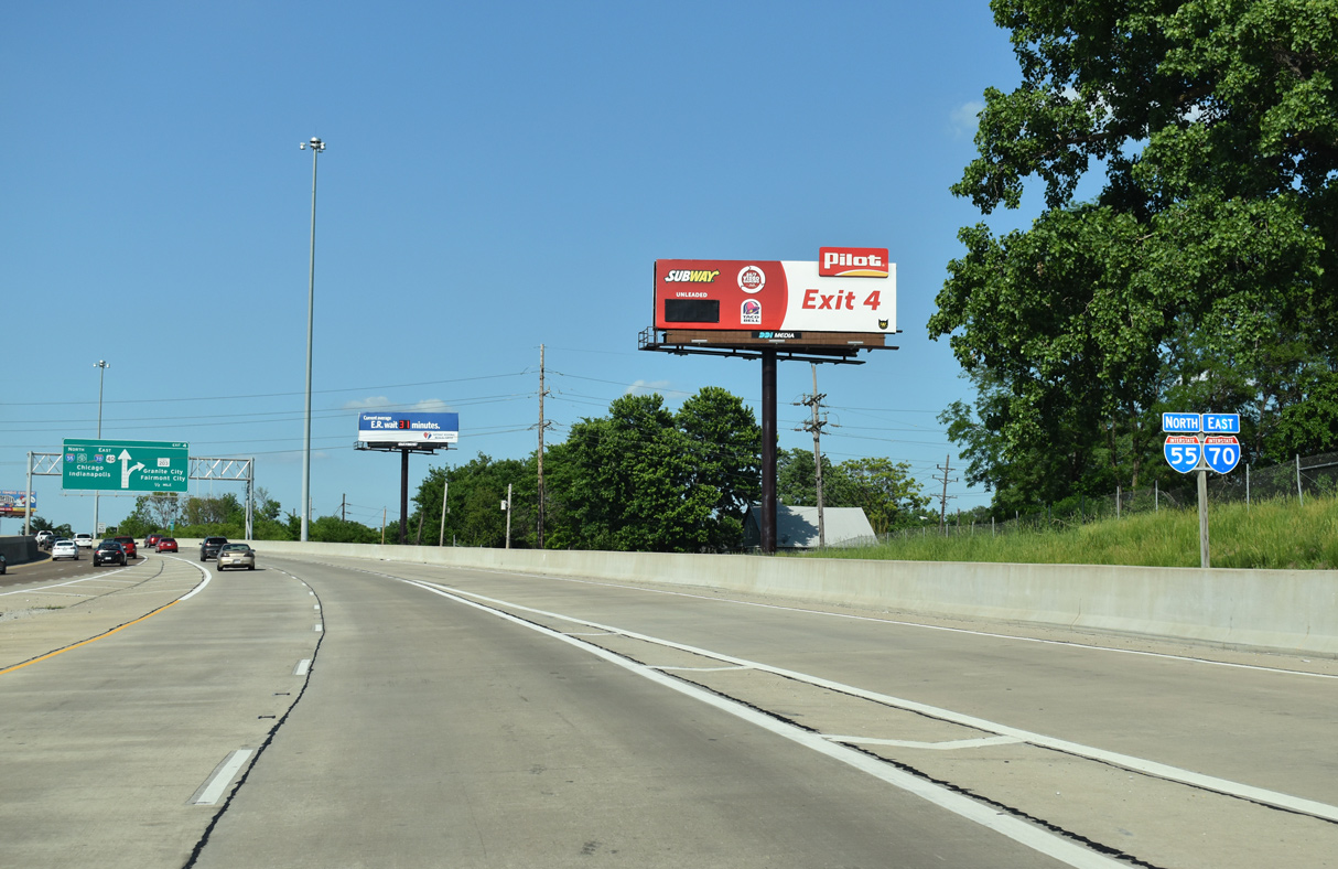
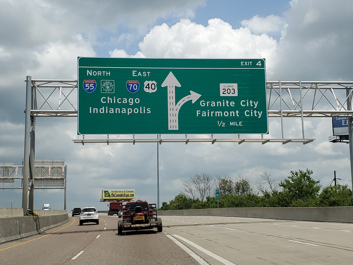
| I-55 north and I-70 east combine a half mile ahead of directional cloverleaf interchange (Exit 4) with IL 203 north at the city of Madison. 07/05/19 |
|
| Lowering from a viaduct over several railroads including the CSX, I-55/70 north has a lane drop at Exit 4 for IL 203. IL 203 travels 9.7 miles north from adjacent Collinsville Road (old U.S. 40/66) to I-270 at Granite City. 05/24/18 |
|
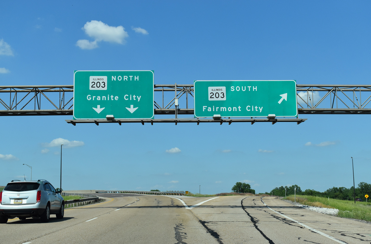
| Two lanes lower to pass under I-55/70 and join the left side of IL 203 north at World Wide Technology Raceway. Collinsville Road (former U.S. 40/66) continues east from the south end of IL 203 in Fairmont City. IL 203 replaced U.S. 67 Alternate northward into Madison. 05/24/18 |
|
| I-55/70-U.S. 40 east pass by a landfill and wetlands associated with Old Cahokia Creek through the Fairmont City limits. A future alignment of Interstate 70 will tie into I-55/U.S. 40 along this stretch. This segment was postponed due to funding from the original Mississippi River Bridge project. 05/24/18 |
|
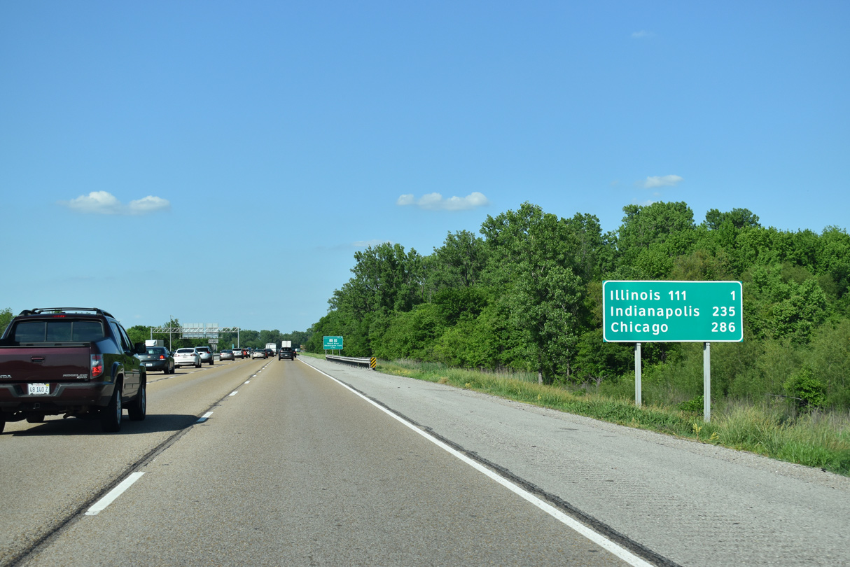
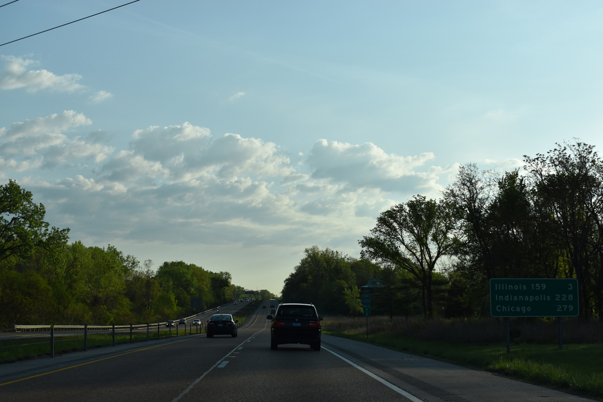
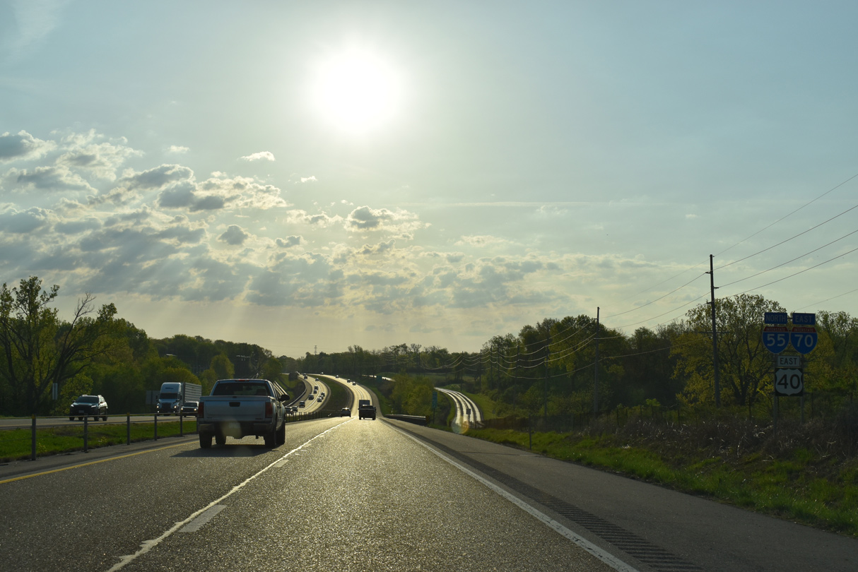
| Long distance travelers leaving St. Louis reach Chicago in 286 miles via I-55 north and Indianapolis in 235 miles along I-70 east. 05/24/18 |
|
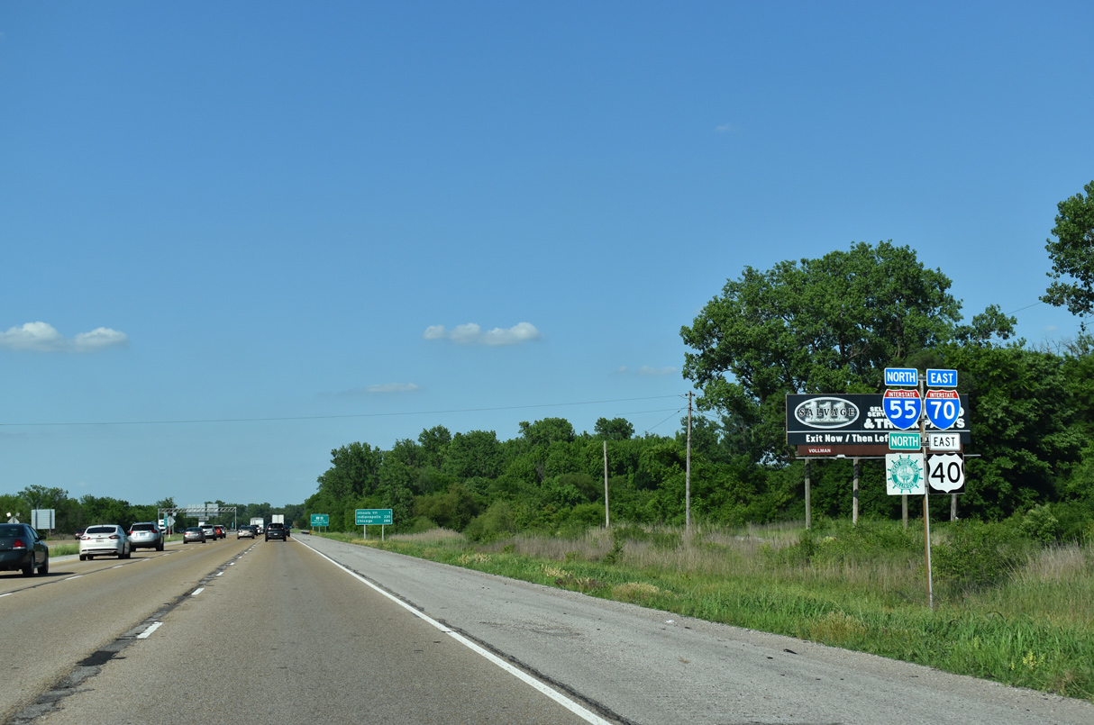
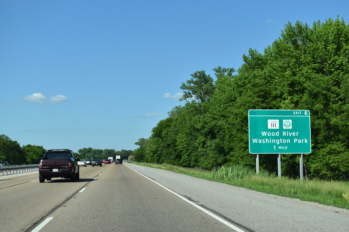
| IL 111 dog legs along Collinsville Road from Kingshighway west to a four lane alignment leading to I-55/70. The state route meets the freeway at a diamond interchange (Exit 6) on the north side of Fairmont City. 05/24/18 |
|
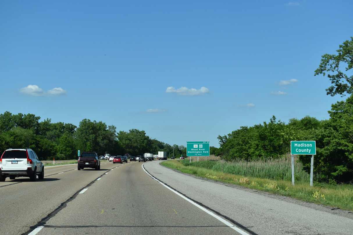
| Curving eastward, I-55/70-U.S. 40 east enter Madison County while paralleling Cahokia Canal. 05/24/18 |
|
| IL 111 travels 78 miles overall between Centreville in Cahokia Heights and Waverly. 05/24/18 |
|
| Locally IL 111 connects Fairmont City with Washington Park and adjacent Horseshoe Lake State Park in the village of Pontoon Beach. 05/24/18 |
|
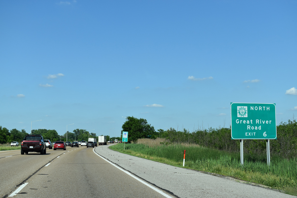
| Tthe Great River Road shifts north from I-50/70 along IL 111 to Pontoon Beach and I-270 west. The touring route joins IL 3 north from Granite City to Wood River. 05/24/18 |
|
| Exit 6 departs I-55/70-U.S. 40 east for IL 111 at Fairmont City. The state route runs north from Pontoon Beach to west Edwardsville, Roxana and Wood River. IL 111 was vastly replaced in importance by completion of the freeway on IL 255 north to Alton 05/24/18 |
|
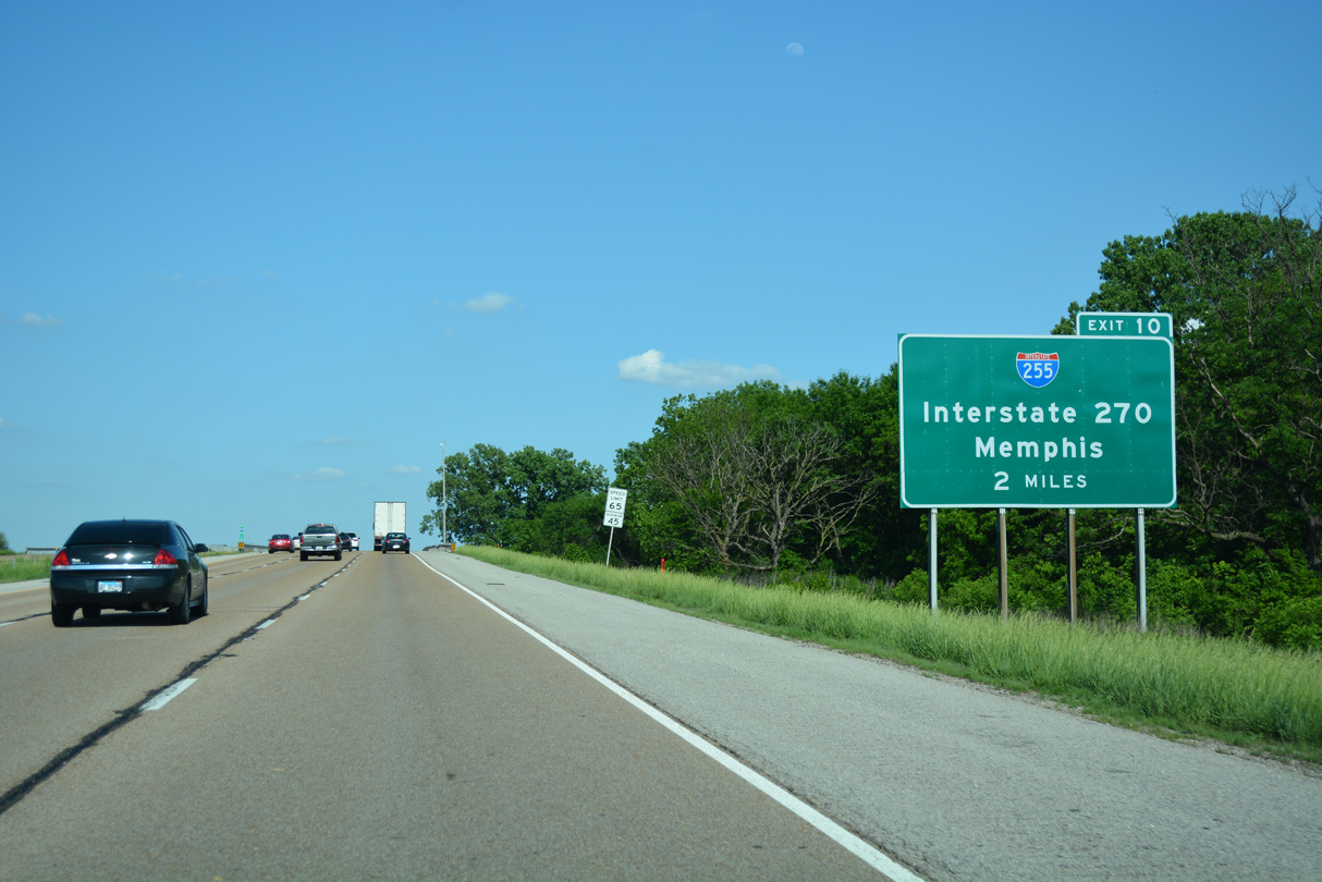
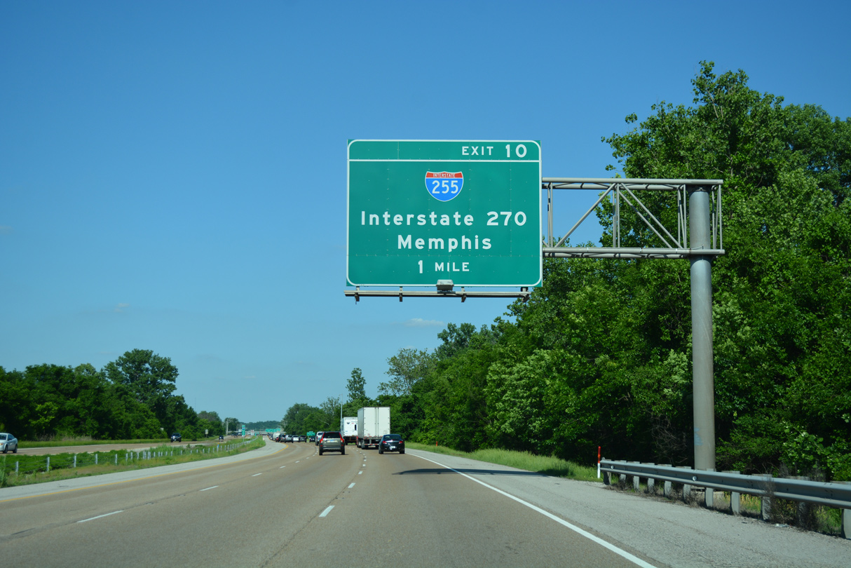
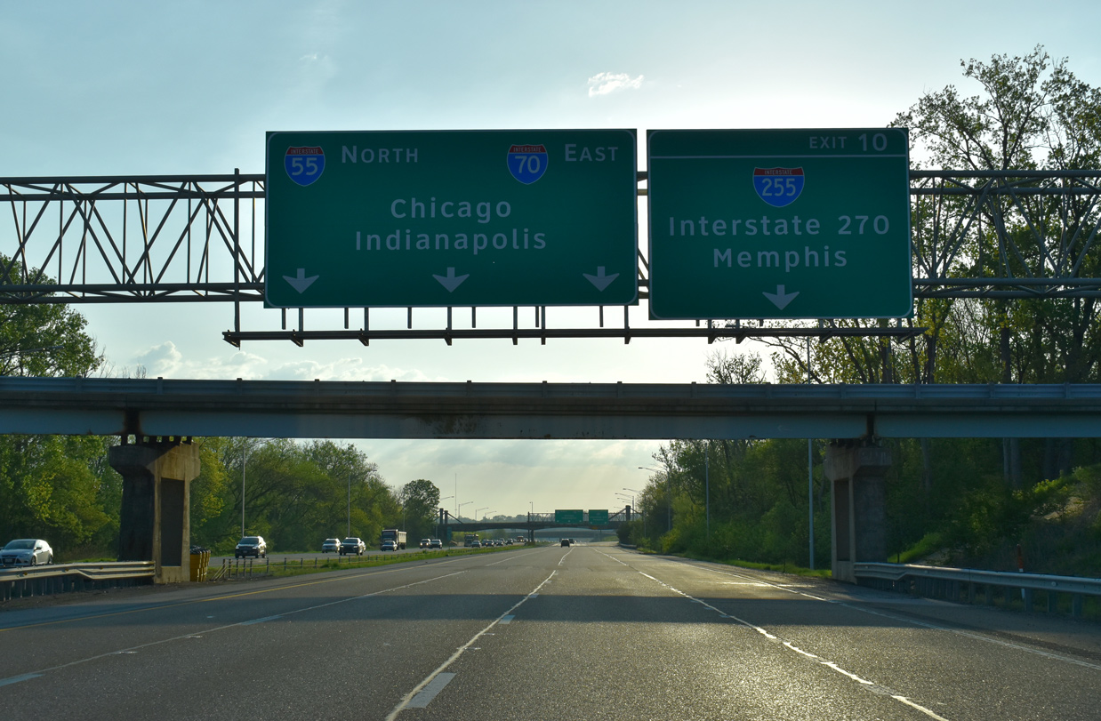
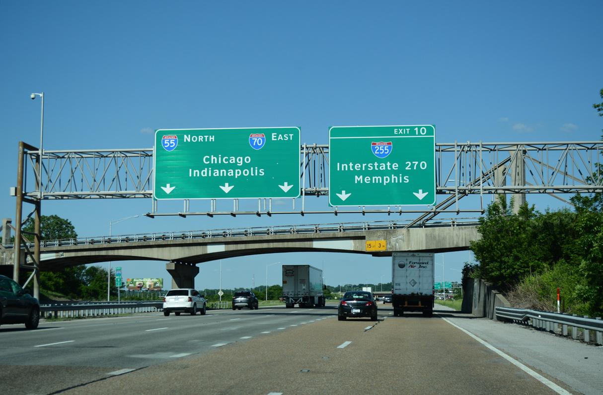
| The cloverstack interchange (Exit 10) joining I-55/70 with Interstate 255 follows the Alton Southern Railroad underpass in two miles. 05/24/18 |
|
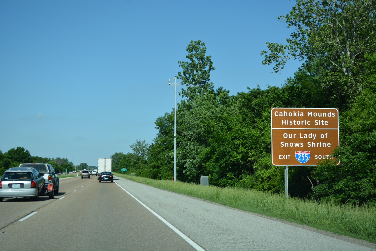
| Confirming markers posted where the freeway lines Cahokia Mounds State Historic Site west of Sand Prairie Road. 05/24/18 |
|
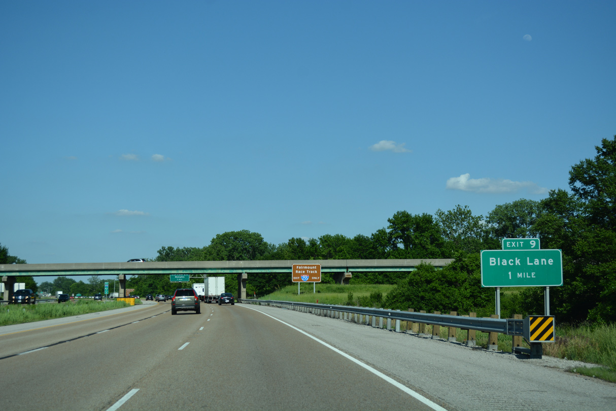
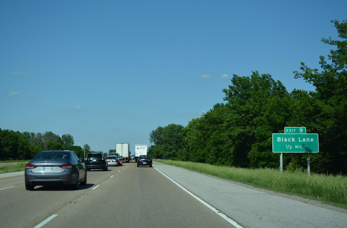
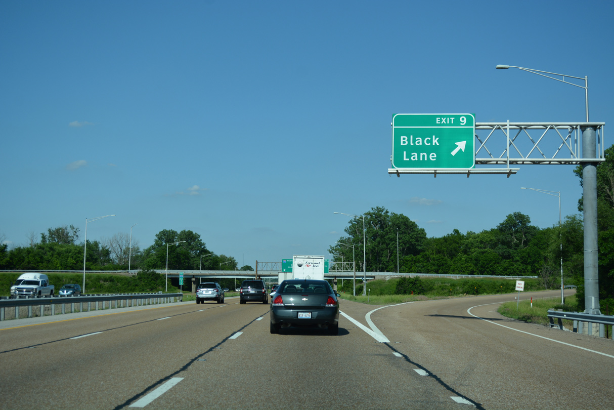
| Next along I-55/70 eastbound is the wye interchange (Exit 9) with Black Lane (Fairmont Avenue) south to the State Park Place community. 05/24/18 |
|
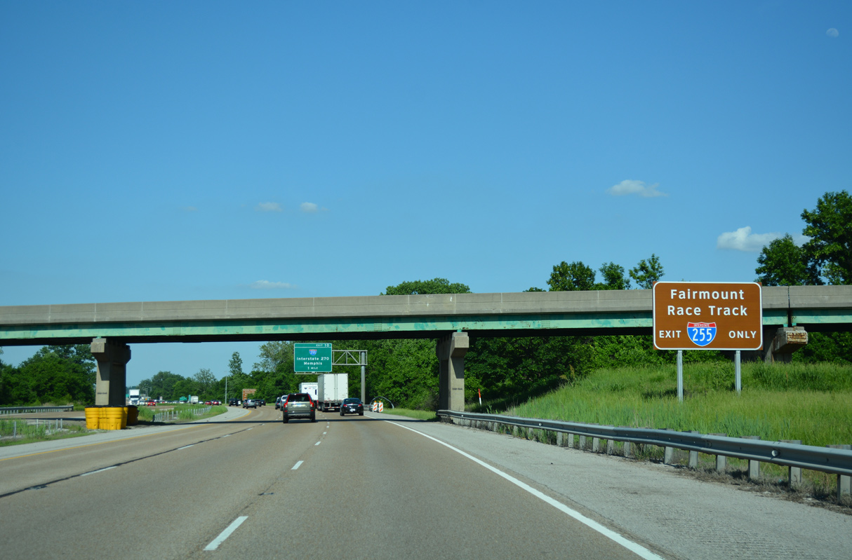
| Travelers bound for Fairmount Park Race Track are directed onto Interstate 255 south to Collinsville Road (old U.S. 40/66). The horse racing facility is just west of I-255 and east of State Park Place. 05/24/18 |
|
| Interstate 255 forms the eastern third of the St. Louis beltway system, measuring 30.82 miles from I-270 at Pontoon Beach to the north, and I-55/270 at Mehlville, Missouri to the southwest. The commuter route is both suburban and rural, traversing the American Bottoms low lying area east of the Mississippi River. 05/24/18 |
|
| I-255 south serves Cahokia Mounds Historic Site (located along Collinsville Road west of State Park Place). Interstate 255 south also leads to Our Lady of Snows Shrine, which is located east of Exit 17 A along IL 15 at Belleville. 05/24/18 |
|
| Black Lane (Fairmont Avenue) becomes County Route P64 south from Collinsville Road to Bunkum Road (CR H56) in the city of Caseyville. 05/24/18 |
|
| Eastbound at Exit 9 for Black Lane (Fairmont Avenue) south. Fairmont Avenue carries four lanes to Collinsville Road and CR P64 (Black Lane). No trailblazers for I-55/70 appear along the route, hinting that the exit is for local traffic only. 05/24/18 |
|
| Interstate 255 converges with I-55/70 northeast of Fairmount Park en route to Pontoon Beach, I-270 and IL 255 near Edwardsville. IL 255 extends the freeway north to Godfrey as the first leg of a long distance route to the Quad Cities via U.S. 67. 05/07/18 |
|
| The control cities for I-255 use Memphis for the connection with I-55 south in Missouri and Interstate 270 for the north end. The use of text in place of a shield for I-270 is somewhat unusual, though since the I-255 designation concludes there, that is the IDOT standard. Another example is where I-24 west from Kentucky uses Interstate 57 in text as the control point. 05/24/18 |
|
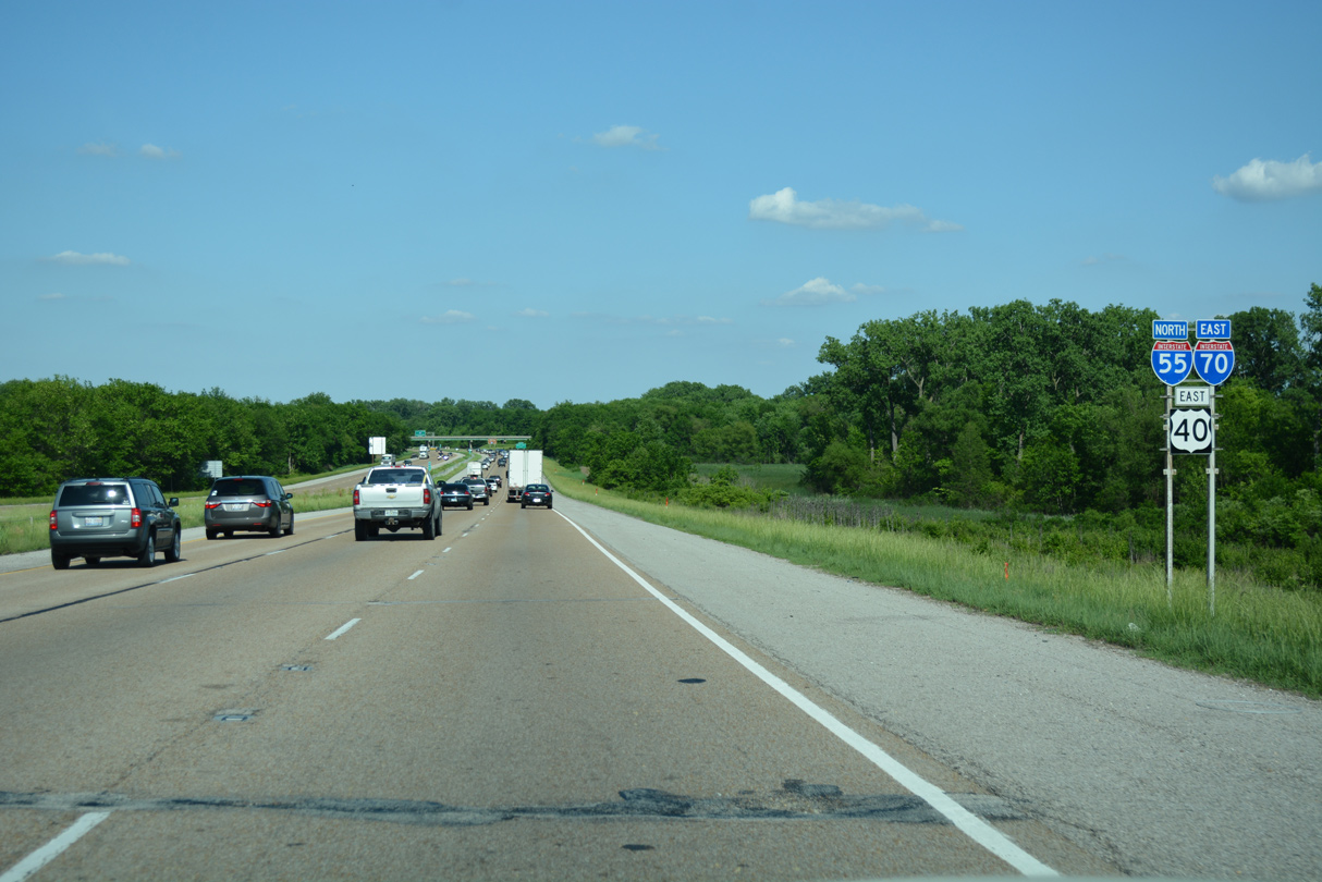
| All traffic leaves I-55/70-U.S. 40 east in unison for I-255 north to IL 255 for Wood River, Alton and Godfrey and I-255 south to Cahokia Heights, Dupo and Columbia. 05/24/18 |
|
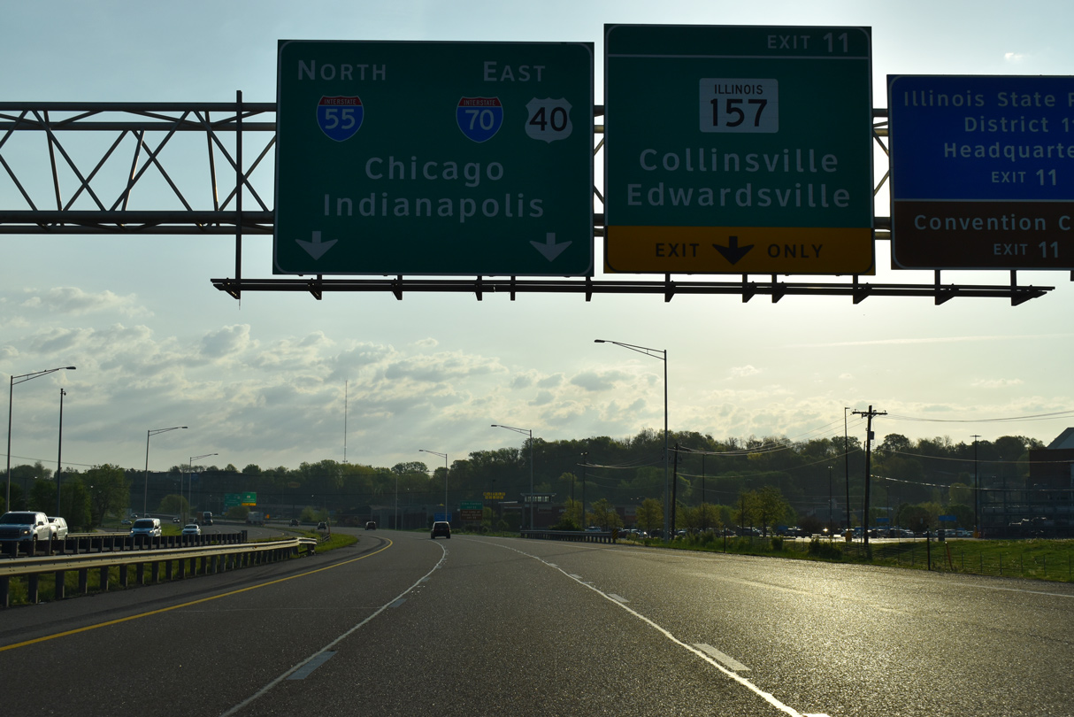
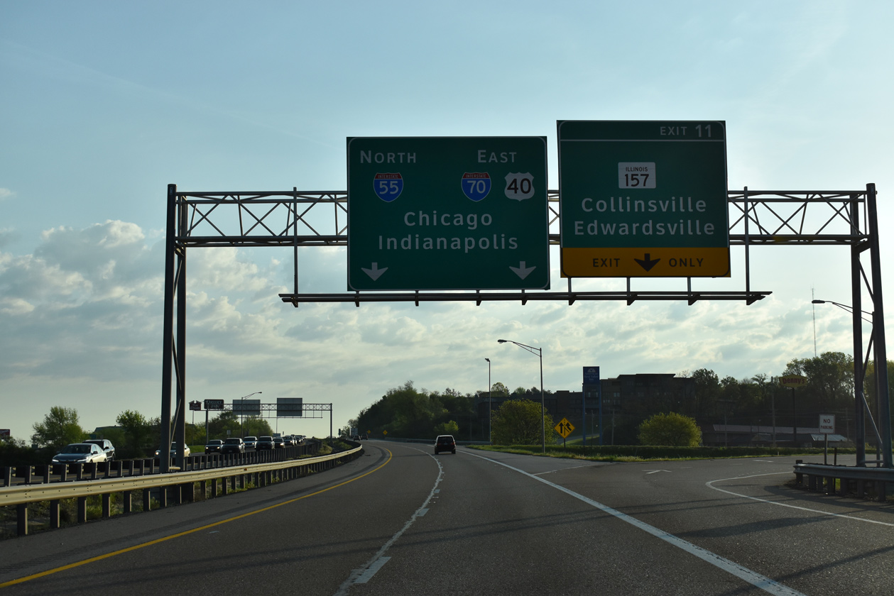
| Advancing northeast through Collinsville, the third northbound lane on I-55/70 drops at Exit 11. 05/07/18 |
|
| IL 157 runs along the bluff line rising east of American Bottoms southwest through Caseyville to IL 13 at Centreville and northeast to Glen Carbon and Edwardsville. 05/07/18 |
|
| I-55/70-U.S. 40 gradually gain elevation east from the folded diamond interchange (Exit 11) with IL 157. The freeway spans Beltline Road (historic historic U.S. 40/66) ahead of the Meadow Heights community. 05/07/18 |
|
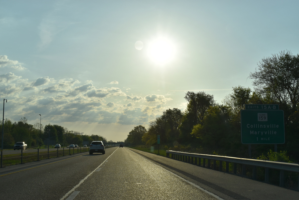
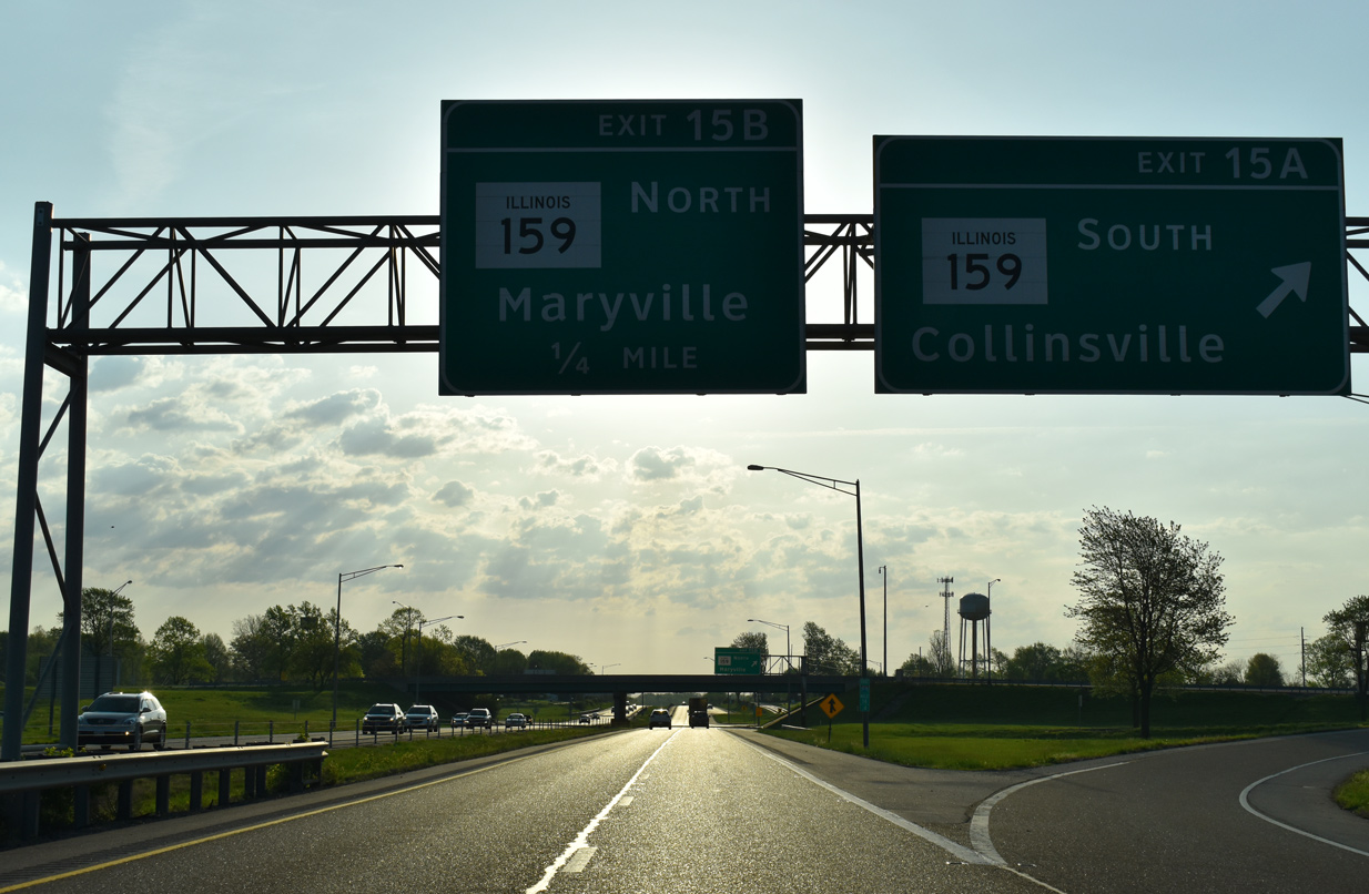
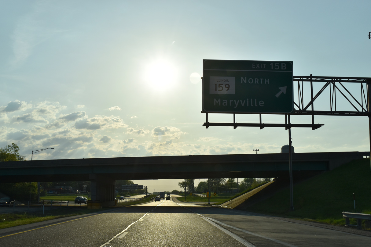
| Trending eastward, I-55/70-U.S. 40 travel between Collinsville and Maryville on the three miles preceding Exit 15 for IL 159. 05/07/18 |
|
| IL 159 heads north through Belleville, Swansea and Fairview Heights to cross the Madison County line at Collinsville. The four to five lane boulevard follows Vandalia Street from Downtown to I-55/70. 05/07/18 |
|
| A cloverleaf interchange joins I-55/70-U.S. 40 with IL 159 (Vandalia Street) south into Collinsville and Center Street north into the village of Maryville. 05/07/18 |
|
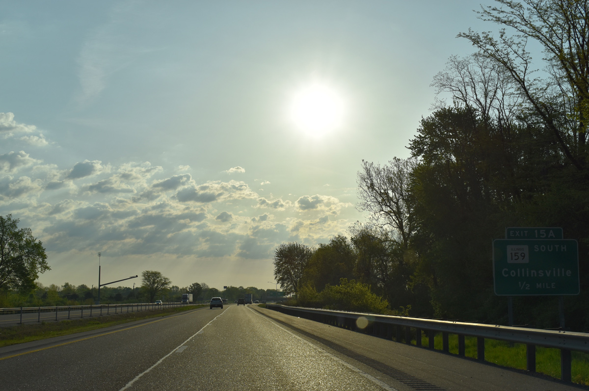
| Exit 15 A leaves I-55/70-U.S. 40 east for IL 159 south. IL 159 travels 62 miles overall from IL 3 and IL 154 at Red Bud to IL 16 north of Bunker Hill. 05/07/18 |
|
| IL 157 (Center Street) continues north from Exit 15 B through the Maryville village center to Glen Carbon and Edwardsville. Historically, the route south into Collinsville was U.S. 40/66. 05/07/18 |
|
| I-55/70 directly overlaid Historic U.S. 40-66 east from IL 157 at Troy Crossing to Wilson Heights and Collinsville Road. 05/07/18 |
|
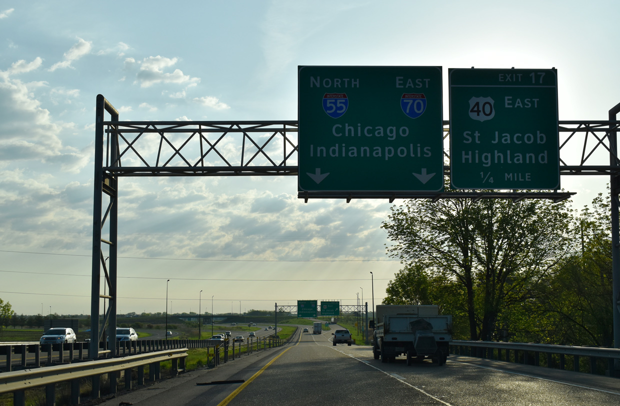
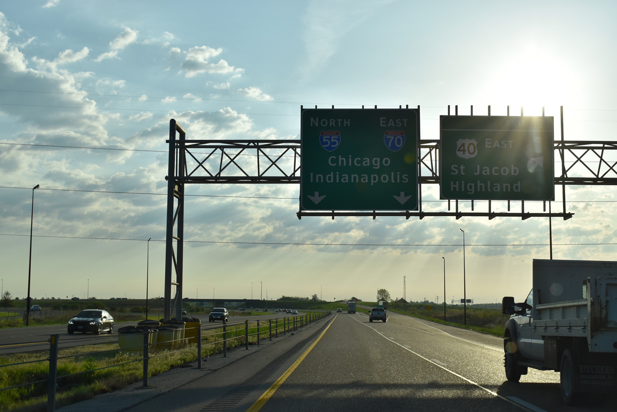
| The forthcoming trumpet interchange (Exit 17) with U.S. 40 east was constructed directly over the original split of U.S. 40/66. 05/07/18 |
|
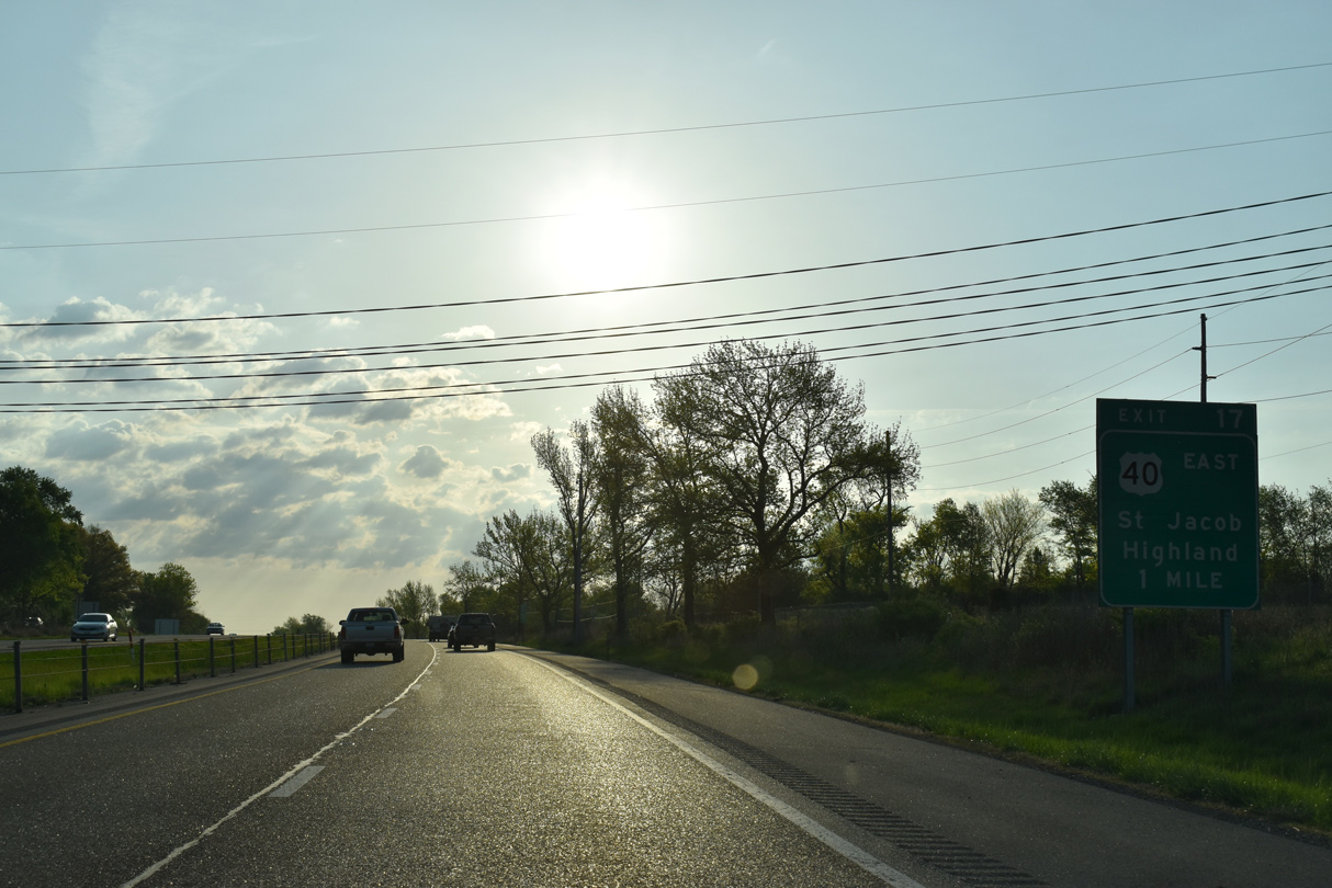
| Crossing over Wilson Heights Road, one quarter mile ahead of the I-55/70 and U.S. 40 separation on the outskirts of Troy. U.S. 40 bypasses the city to the south en route to the village of St. Jacob. 05/07/18 |
|
| Exit 17 departs from I-55/70 north for U.S. 40 east through Troy. U.S. 40 stays south of I-70 along a 17.5 mile loop through Highland. The two recombine east from there to Pocahontas. 05/07/18 |
|
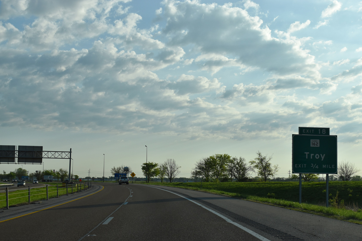
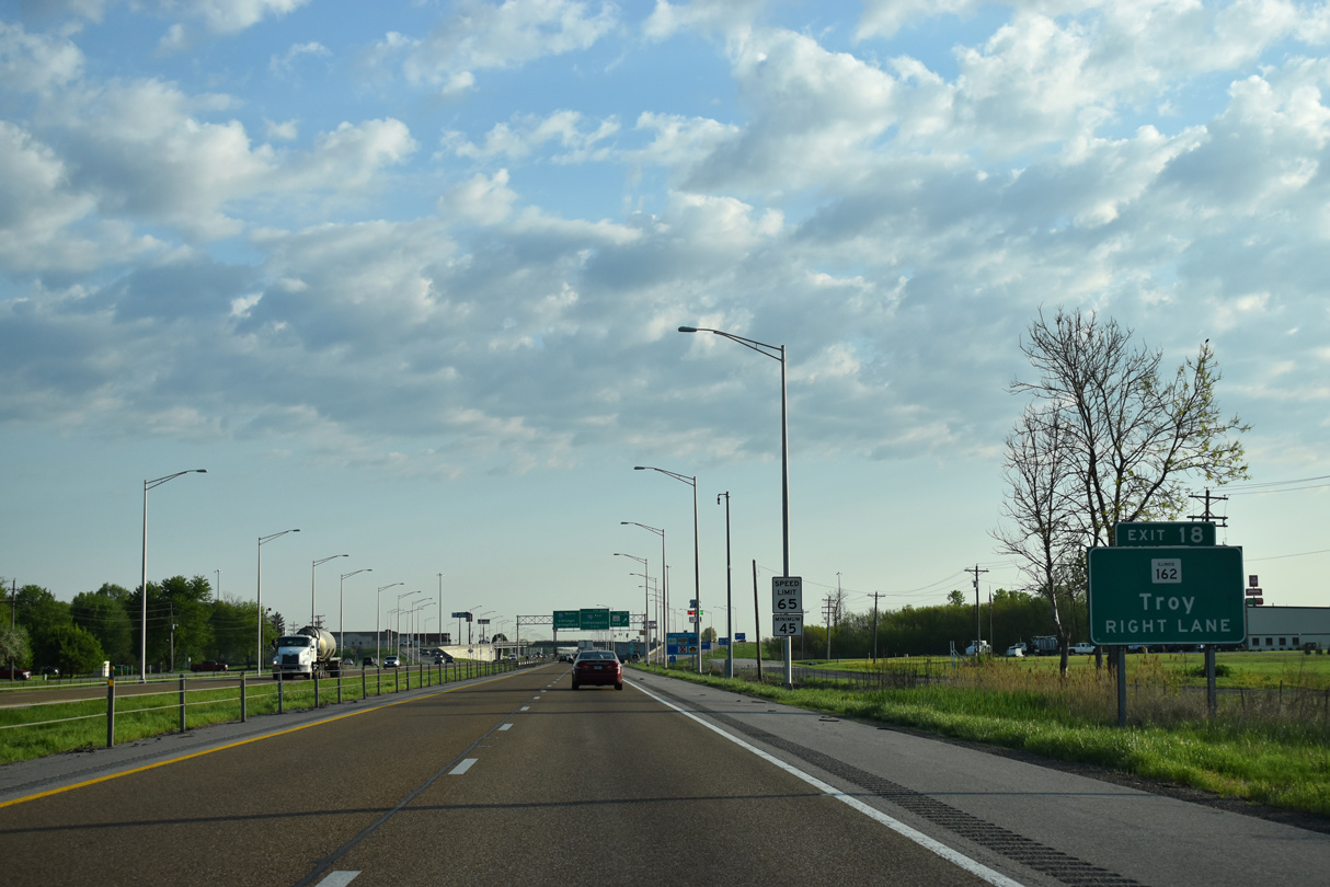
| I-55/70 turn more northerly across the west side of Troy, next meeting IL 162 at a single point interchange (Exit 18). 05/07/18 |
|
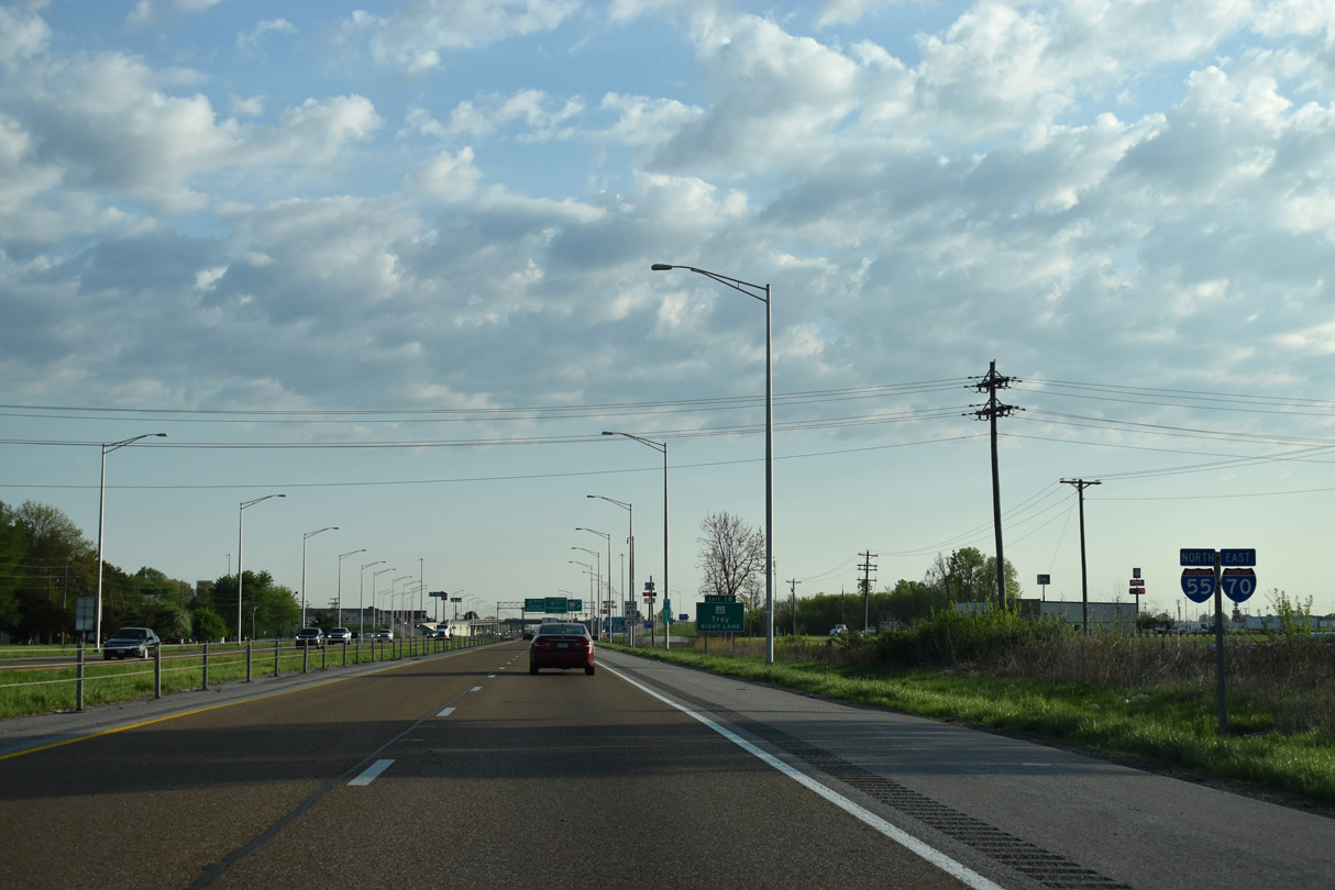
| Confirming markers for I-55 north and I-70 east posted after U.S. 40. The freeway north to their split was previously a four lane expressway for Historic U.S. 66. 05/07/18 |
|
| IL 162 (Edwardsville Road) connects I-55/70 with Downtown Troy, 1.6 miles to the east and northern reaches of Maryville to the west. 05/07/18 |
|
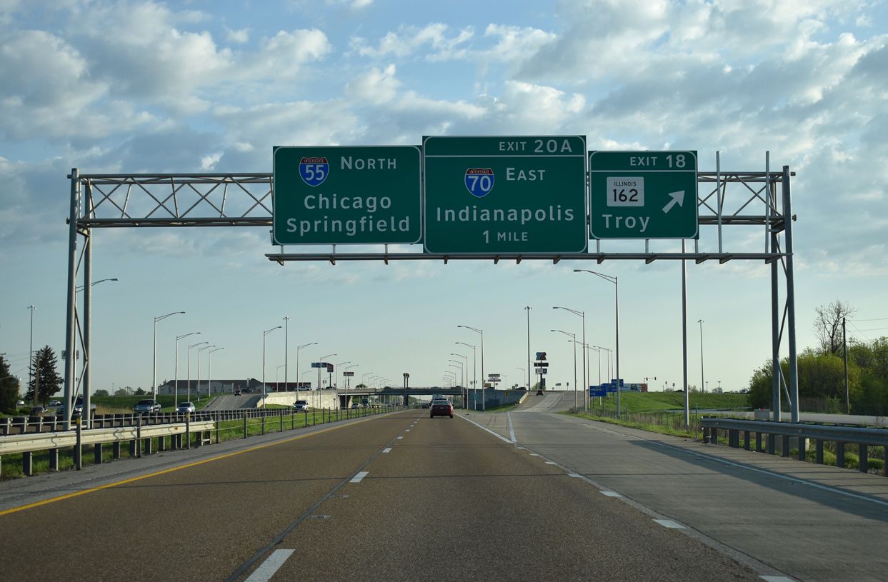
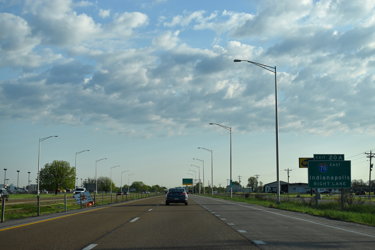
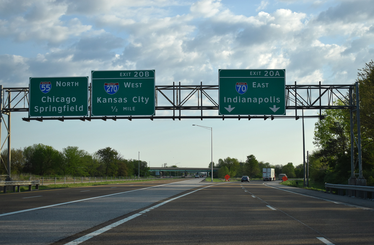
| Interstate 70 splits with I-55 north at Exit 20A in one mile. An American Recovery and Reinvestment Act (ARRA) project underway in August 2009 reconfigured Exit 18 from a diamond interchange into a SPUI. IL 162 represents the historic alignment of U.S. 40 Bypass. 05/07/18 |
|
| An auxiliary lane north to Exit 20A was constructed after the SPUI with IL 162 was completed in 2011. 05/07/18 |
|
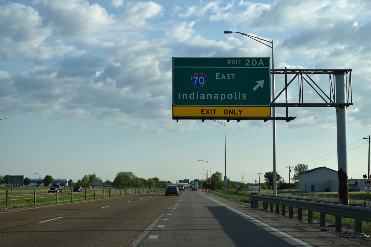
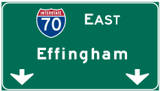
| A pair of wye interchanges connect I-70 with I-55 and the east end of I-270. Interstate 70 transitions into a rural freeway east to Greenville, Vandalia and Effingham. 05/07/18 |
|
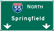
| I-70 parts ways with I-55 north for Indianapolis. I-55 continues north to a loop ramp (Exit 20 B) with Interstate 270 west back into Missouri. It also transitions into a rural route northward to Litchfield and Springfield. 05/07/18 |
Page Updated 01-12-2024.


 North
North 
 East
East