|
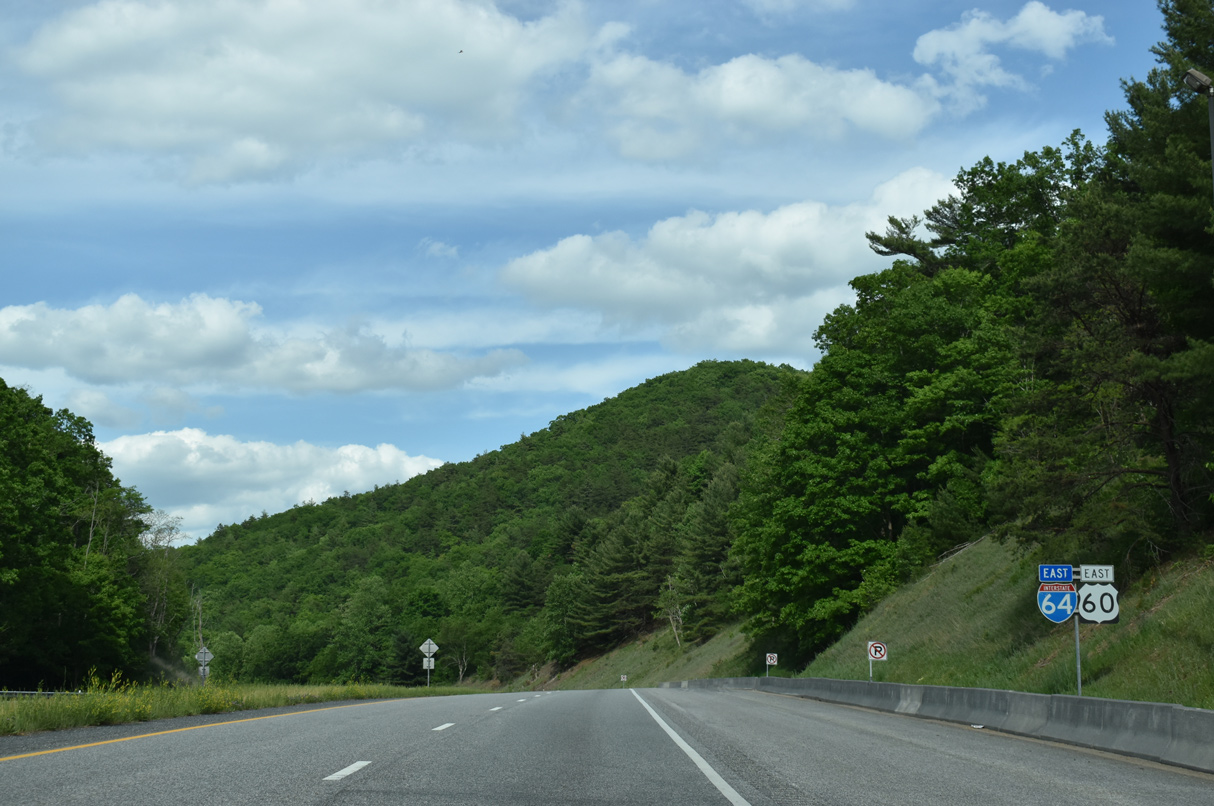
| The Virginia welcome sign stands just beyond milepost zero and the state line along I-64/U.S. 60 east. 05/27/21 |
|
| U.S. 60 continues alongside I-64 east to Exit 10. 05/27/21 |
|
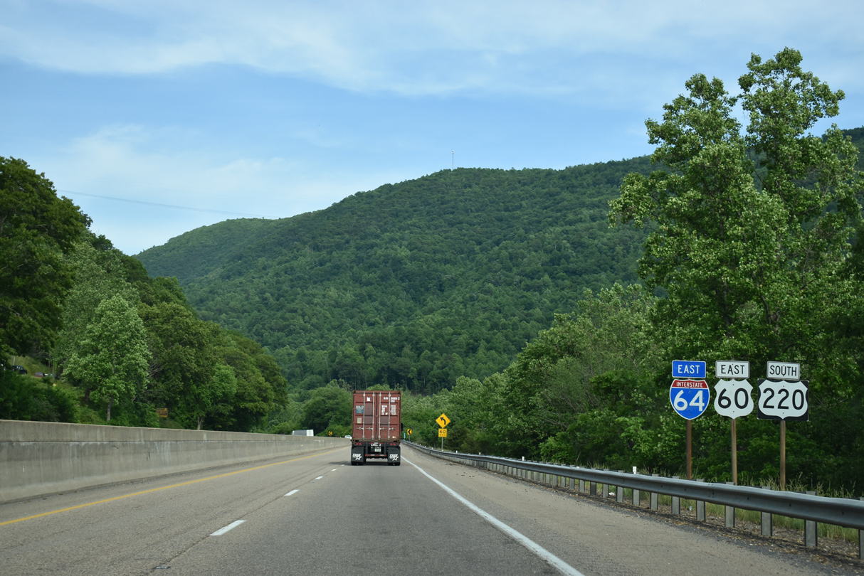
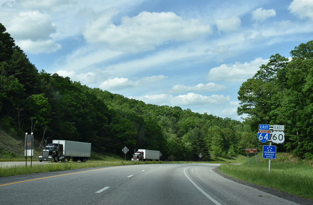
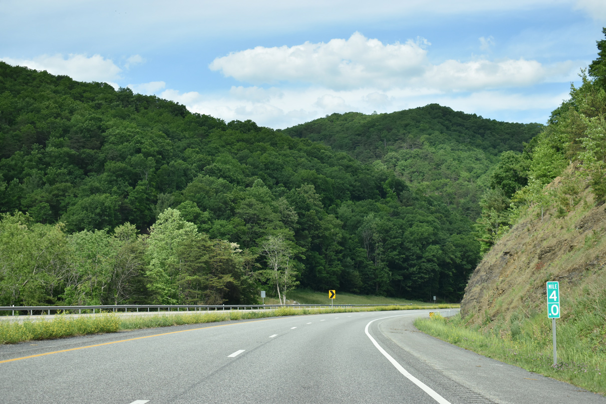
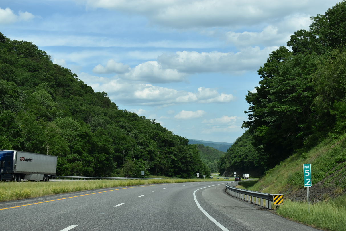
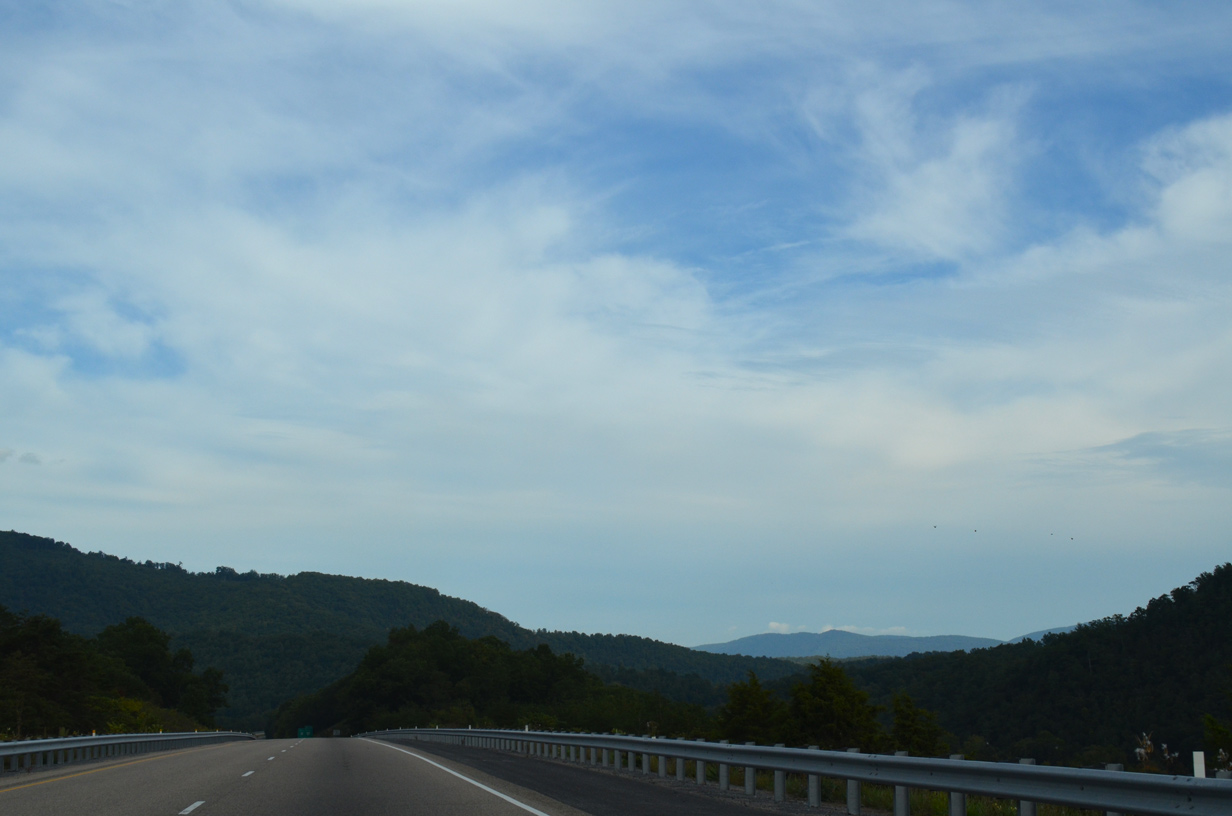
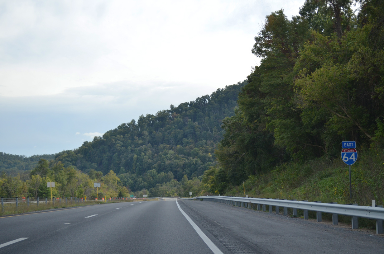
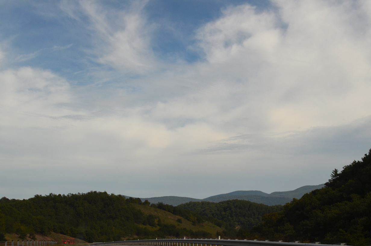
| Interstate 64 winds across George Washington National Forest from the state line to just east of Exit 43. 09/23/14 |
|
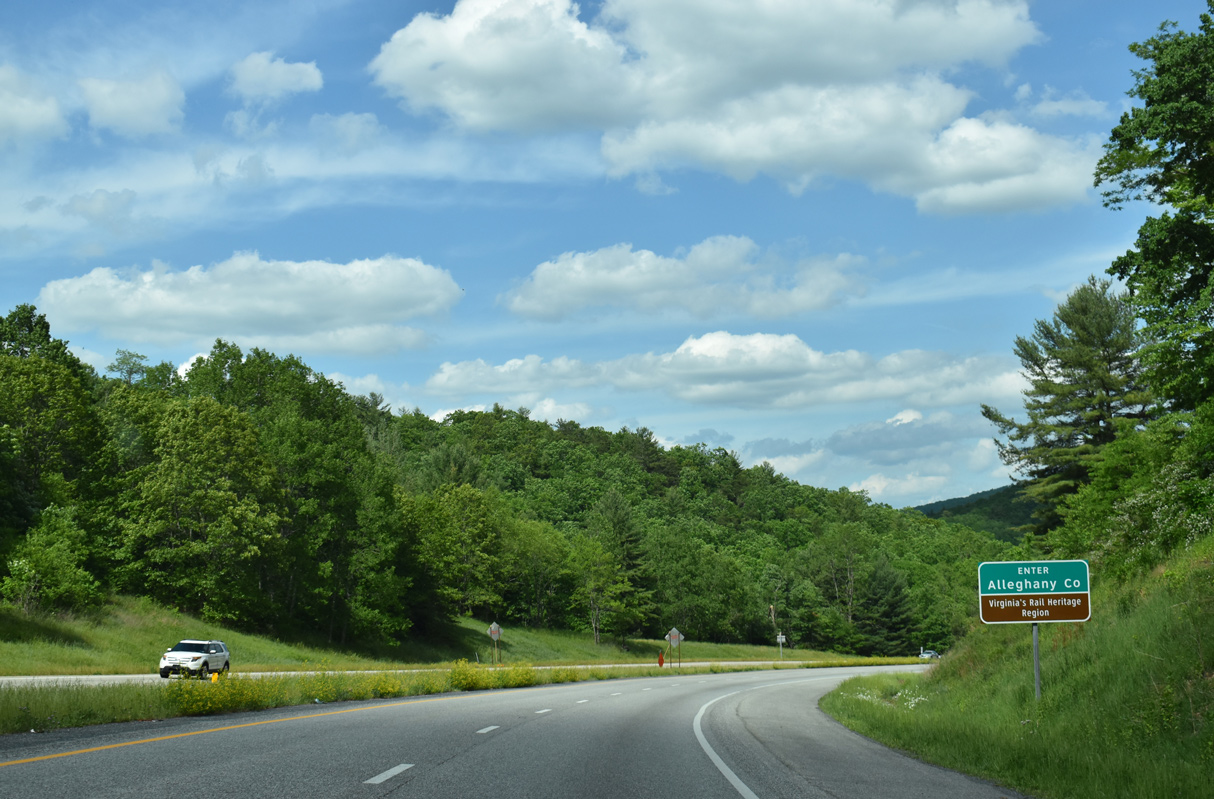
| Outside of the independent cities of Covington and Clifton Forge, Interstate 64 runs 40.99 miles east through Alleghany County. 05/27/21 |
|
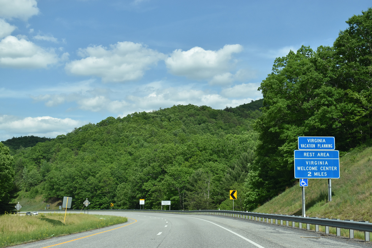
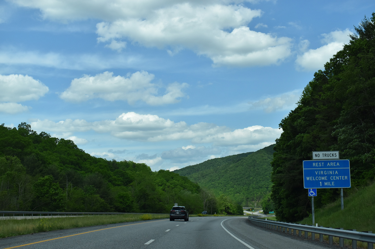
| A tourist information center and rest area lie two miles ahead along I-64/U.S. 60 east. 05/27/21 |
|
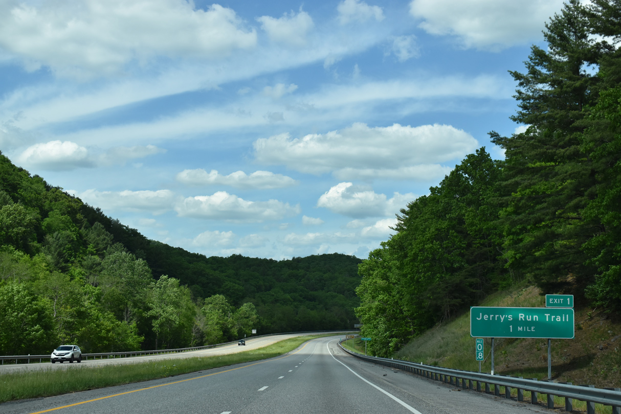
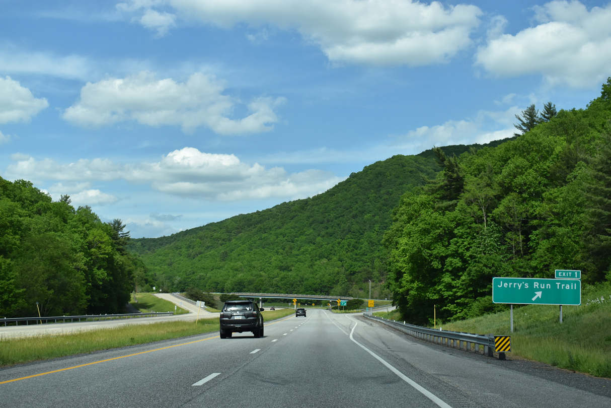
| Jerry's Run Trail spurs south and east from Hope Road and forthcoming Exit 1 onto Brushy Mountain. 05/27/21 |
|
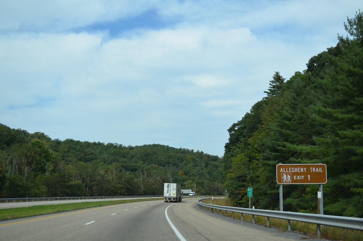
| The 330 mile long Allegheny Trail travels northeast to Preston County, West Virginia and southwest to Monroe County, West Virginia, mostly along the Eastern Continental Divide. 09/23/14 |
|
| The aforementioned rest area and welcome center lies just a half mile beyond Jerry's Run Trail. 05/27/21 |
|
| Exit 1 departs I-64/U.S. 60 east for Jerry's Run Trail south and Hoke Road. Hoke Road lines the north side of the freeway within the vicinity of Hickory Knob (el. 3,304 ft). 05/27/21 |
|
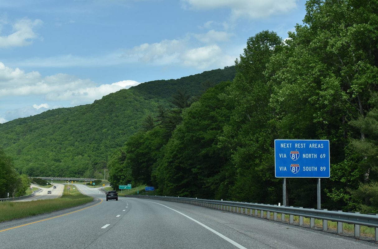
| 31 miles to the east, the succeeding rest area beyond the Virginia welcome center is for trucks only. Facilities for passenger vehicles are located along the overlap with I-64/81 north or Interstate 81 south. 05/27/21 |
|
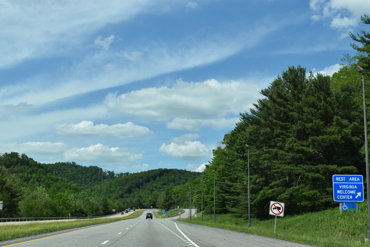
| I-64/U.S. 60 curves alongside the South Fork of Ogle Creek at the Virginia welcome center. 05/27/21 |
|
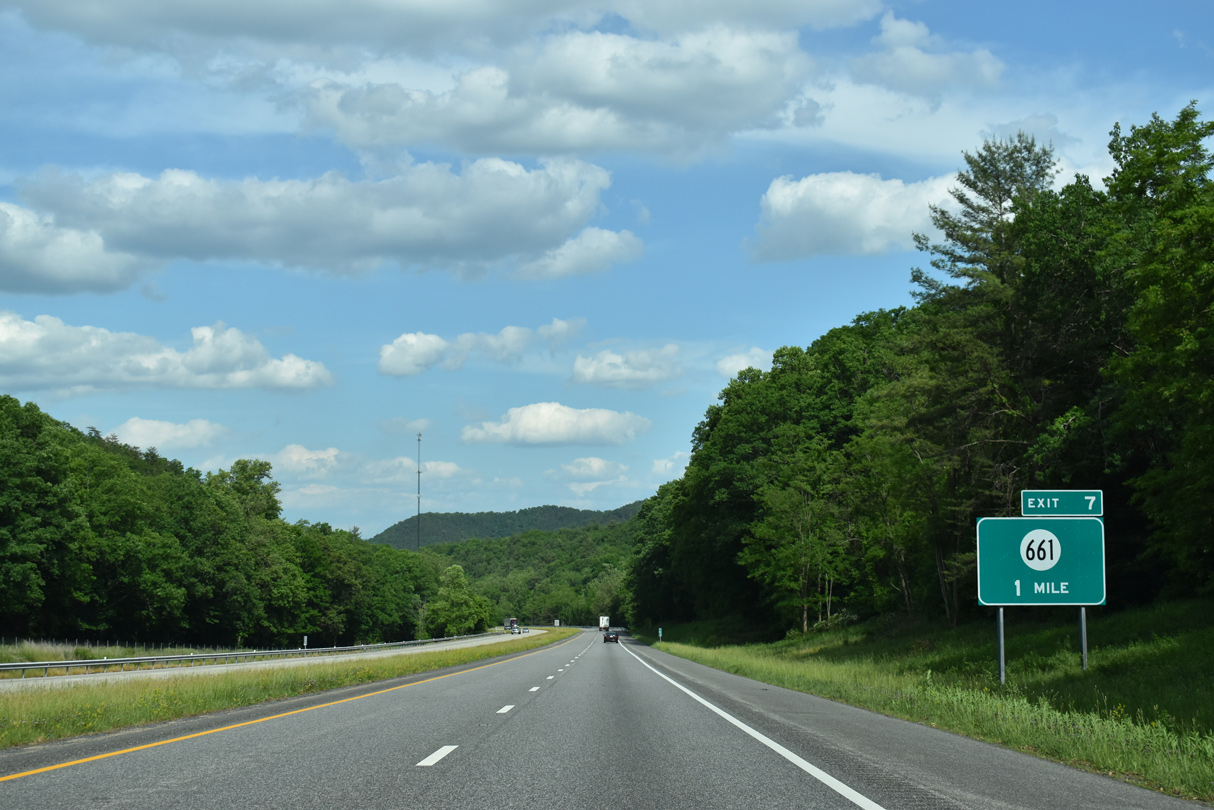
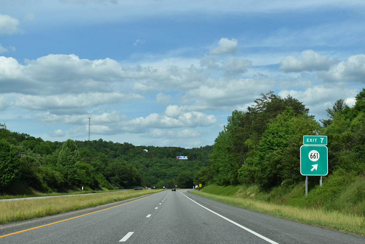
| Interstate 64 remains directly over the old two lane alignment of U.S. 60 to Exit 7. 05/27/21 |
|
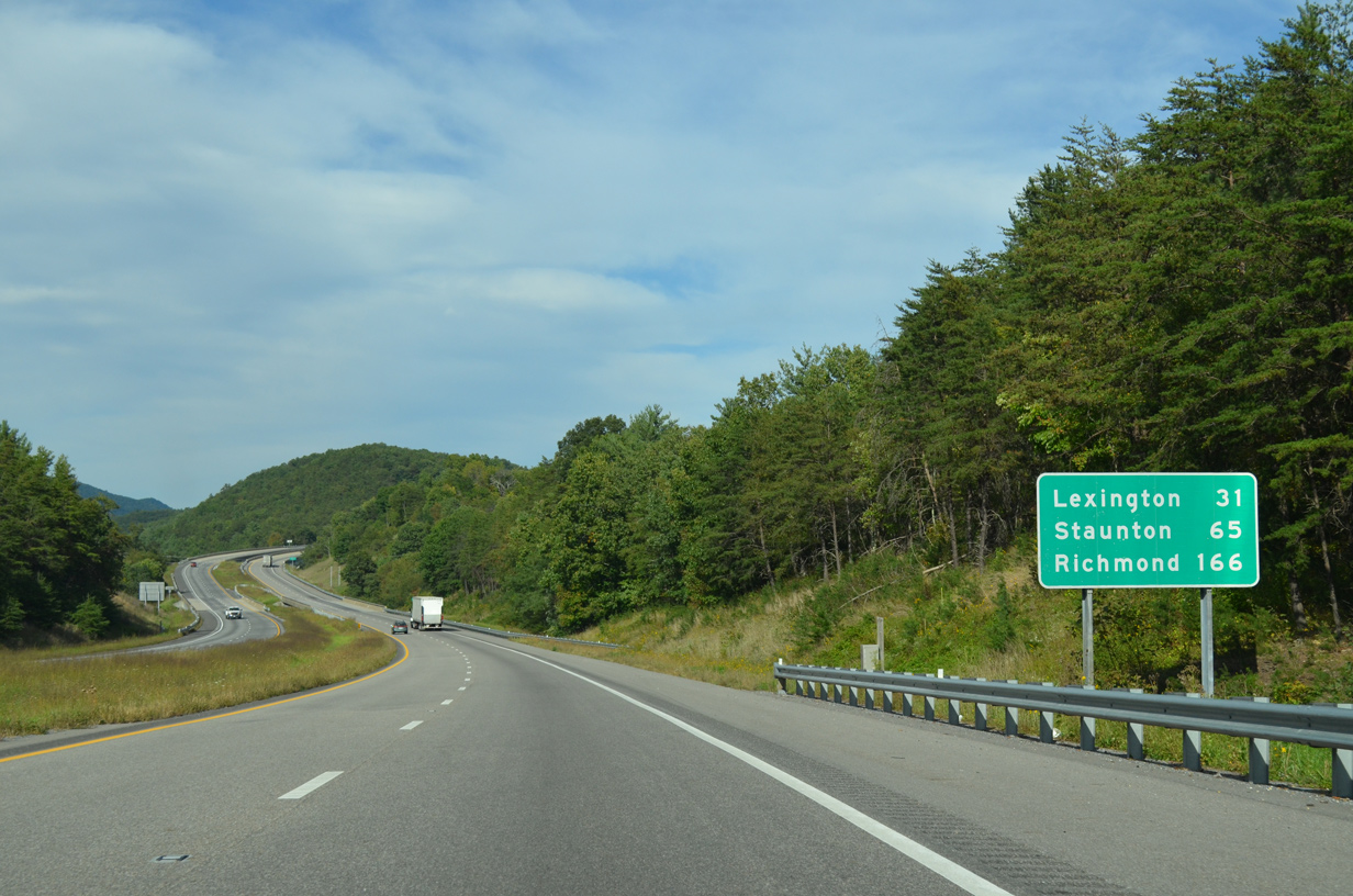
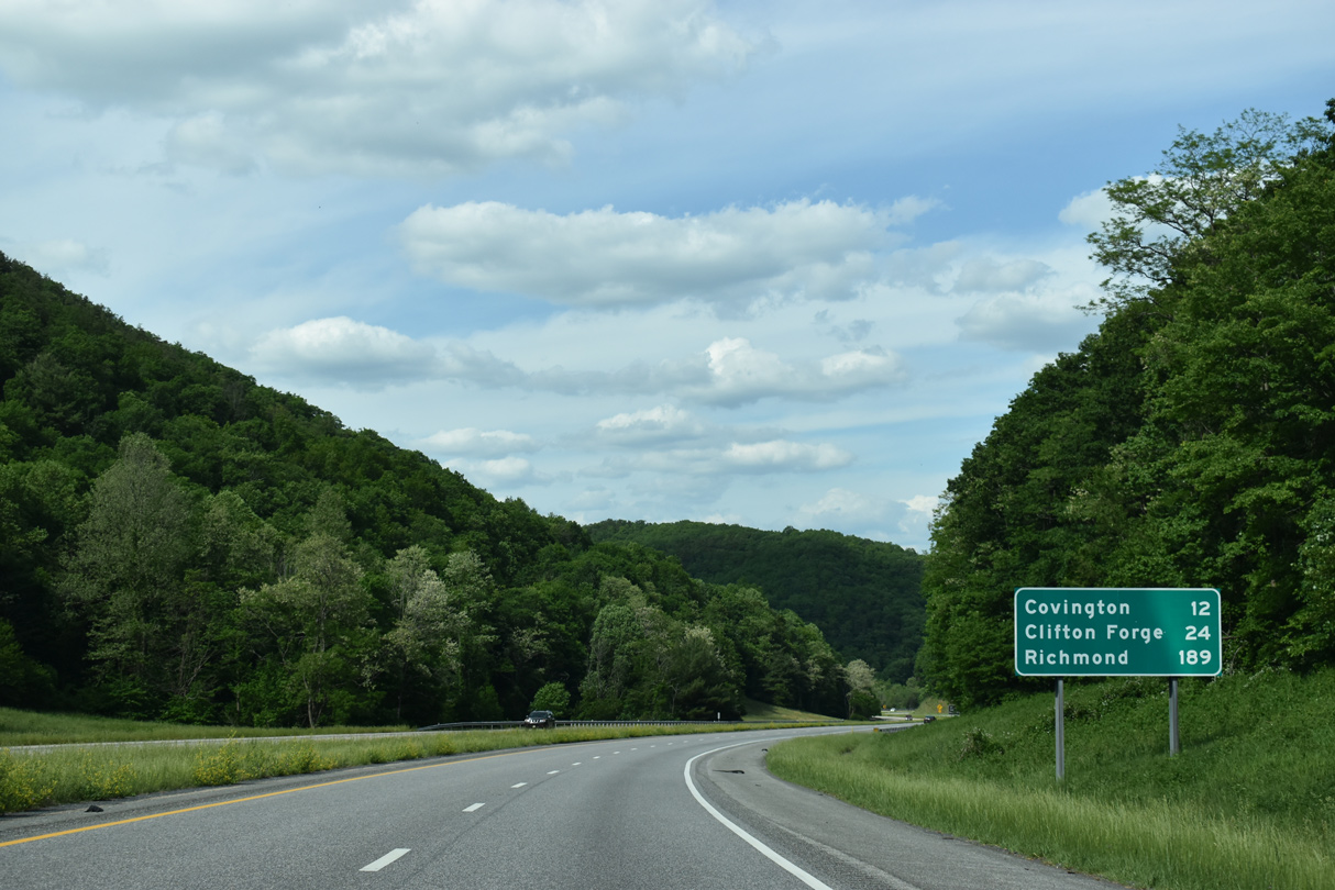
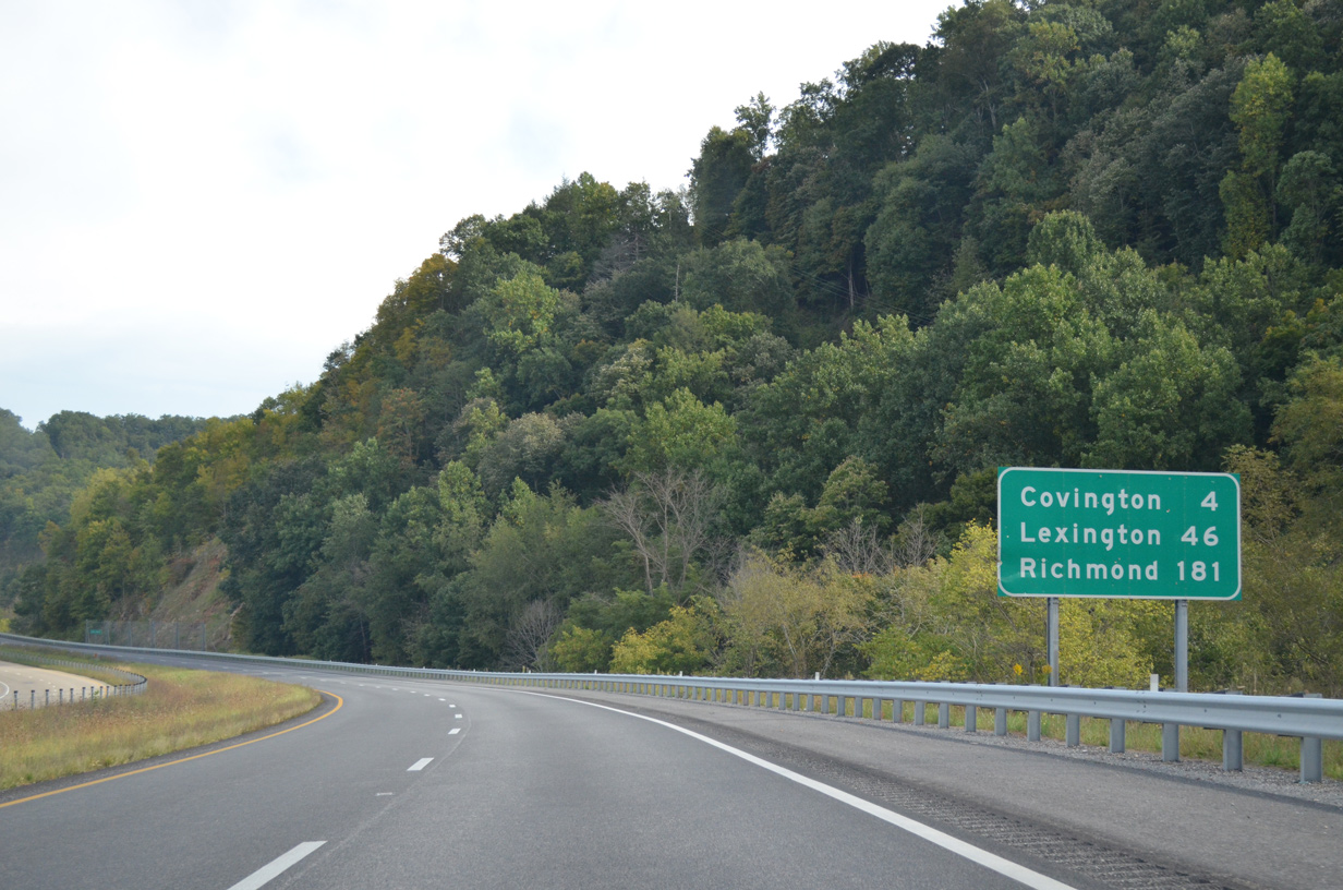
| Covington is 12 miles ahead, followed by the independent city of Clifton Forge in 24 miles. Richmond debuts to I-64 travelers at 189 miles out. 05/27/21 |
|
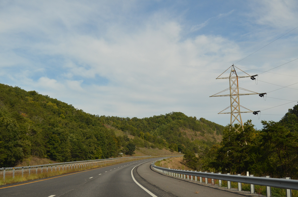
| One of many S-curves along I-64/U.S. 60 east between Panther Ridge and Brushy Mountain. 05/27/21 |
|
| SR 661 (Ogle Creek Road) ties into I-64/U.S. 60 at a diamond interchange (Exit 7) in one mile. 05/27/21 |
|
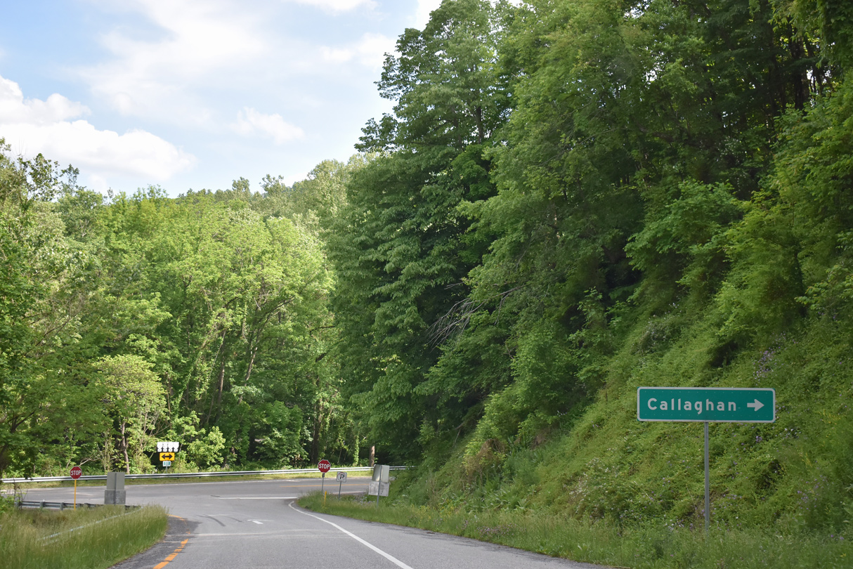
| SR 661 meanders north alongside Ogle Creek to SR 781 ahead of Rucker Gap into West Virginia. Midland Trail (old U.S. 60) emerges from below I-64/U.S. 60 on the south side of Exit 7 to parallel Ogle Creek east to Callaghan. 05/27/21 |
|
| Waits Mountain (el. 3,205 ft) appears along the eastern horizon from the Rich Patch Mountains in this scene along I-64/U.S. 60 east. 09/23/14 |
|
| U.S. 60 rejoins Midland Trail from Exit 10 east to Monroe Avenue through Covington. 05/27/21 |
|
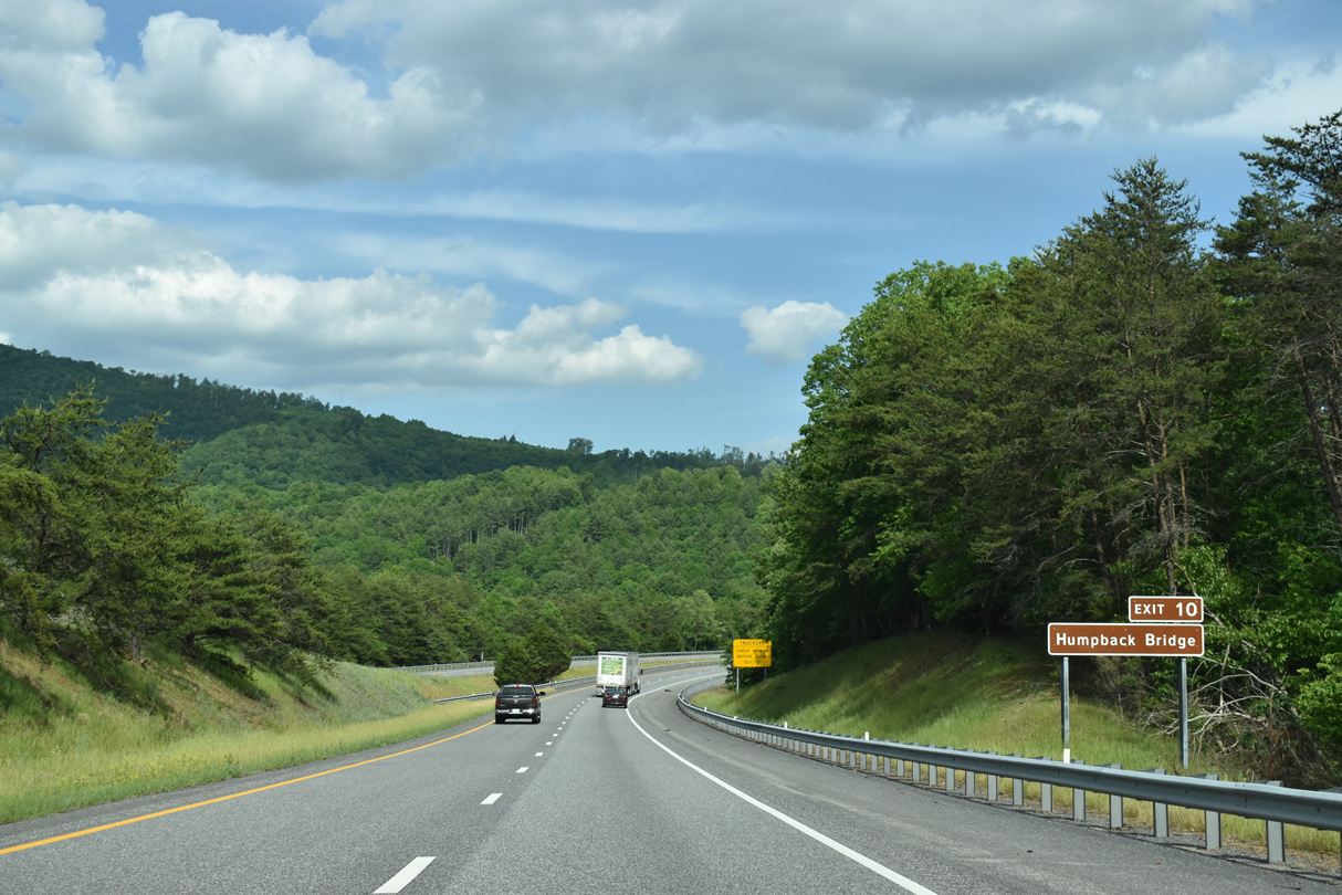
| Located 1.3 miles east of Exit 10, the Humpback Bridge is the oldest covered bridge in Virginia. Dating from 1857, the 100 foot long, arched crossing spans Dunlap Creek just south of U.S. 60 (Midland Trail).1 05/27/21 |
|
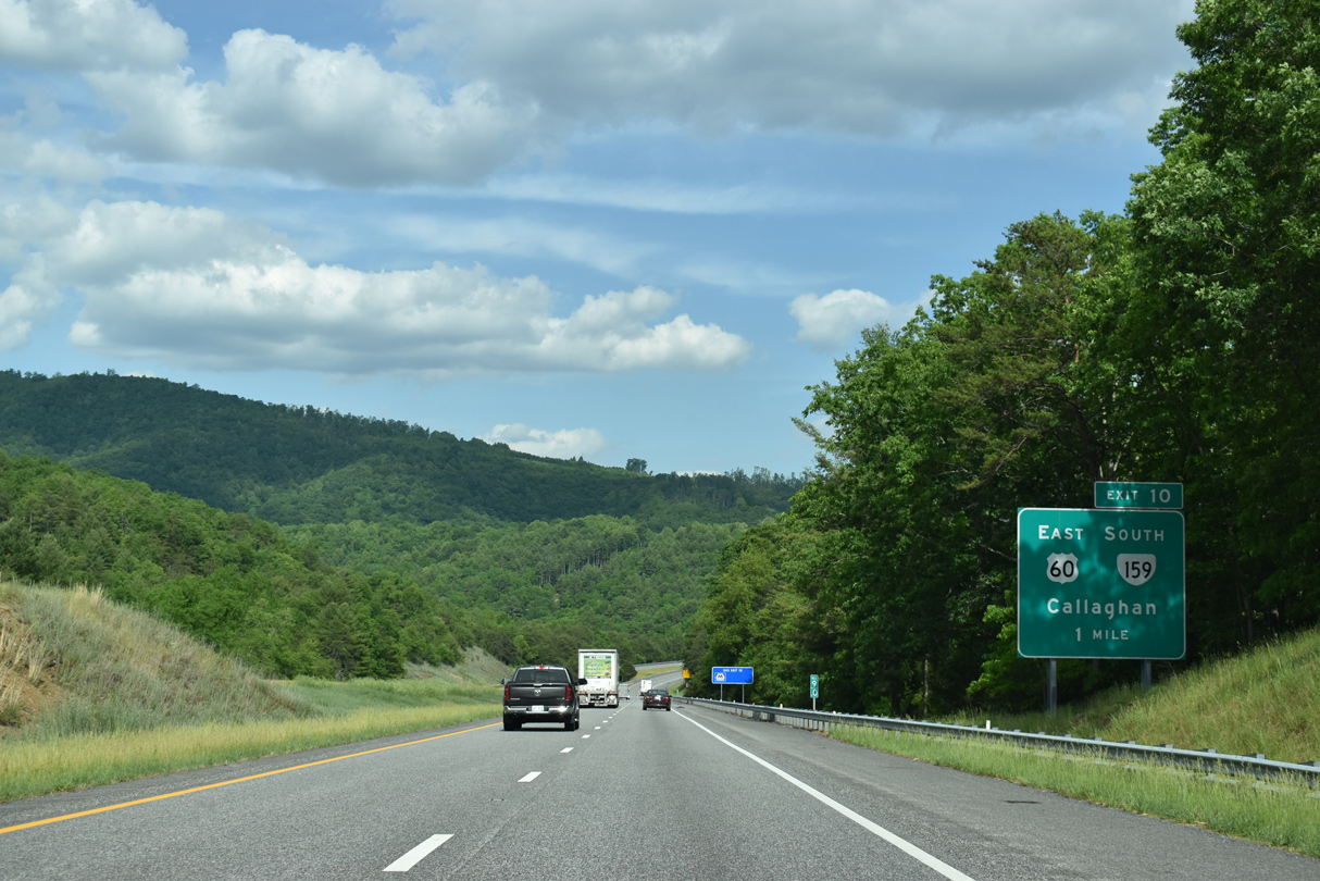
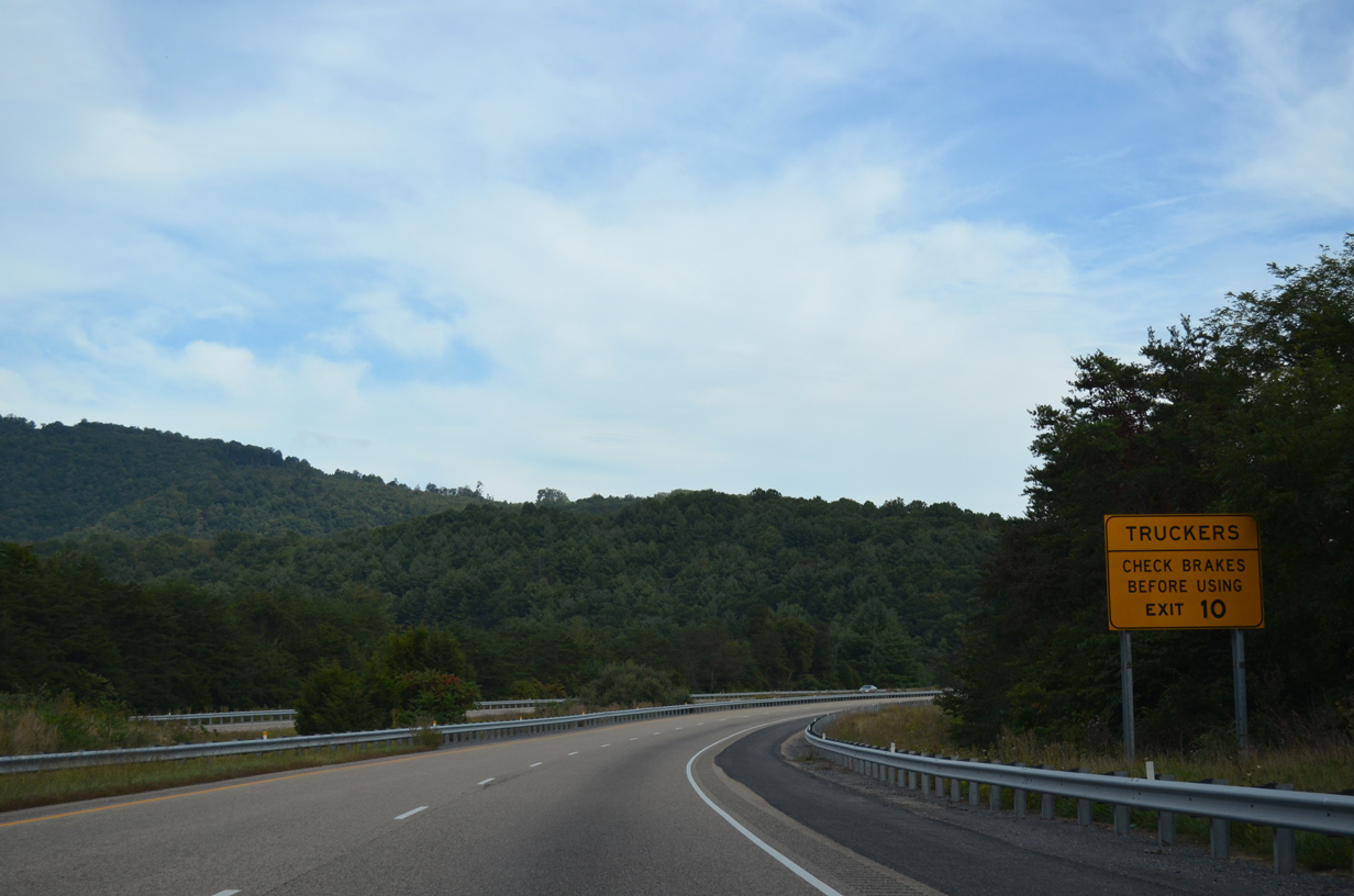
| Exit 10 drops steeply from Interstate 64 east ahead of Dunlap Creek. Truckers are advised to check brakes before using the ramp to U.S. 60 east or SR 159 (Dunlap Creek Road) south. 09/23/14 |
|
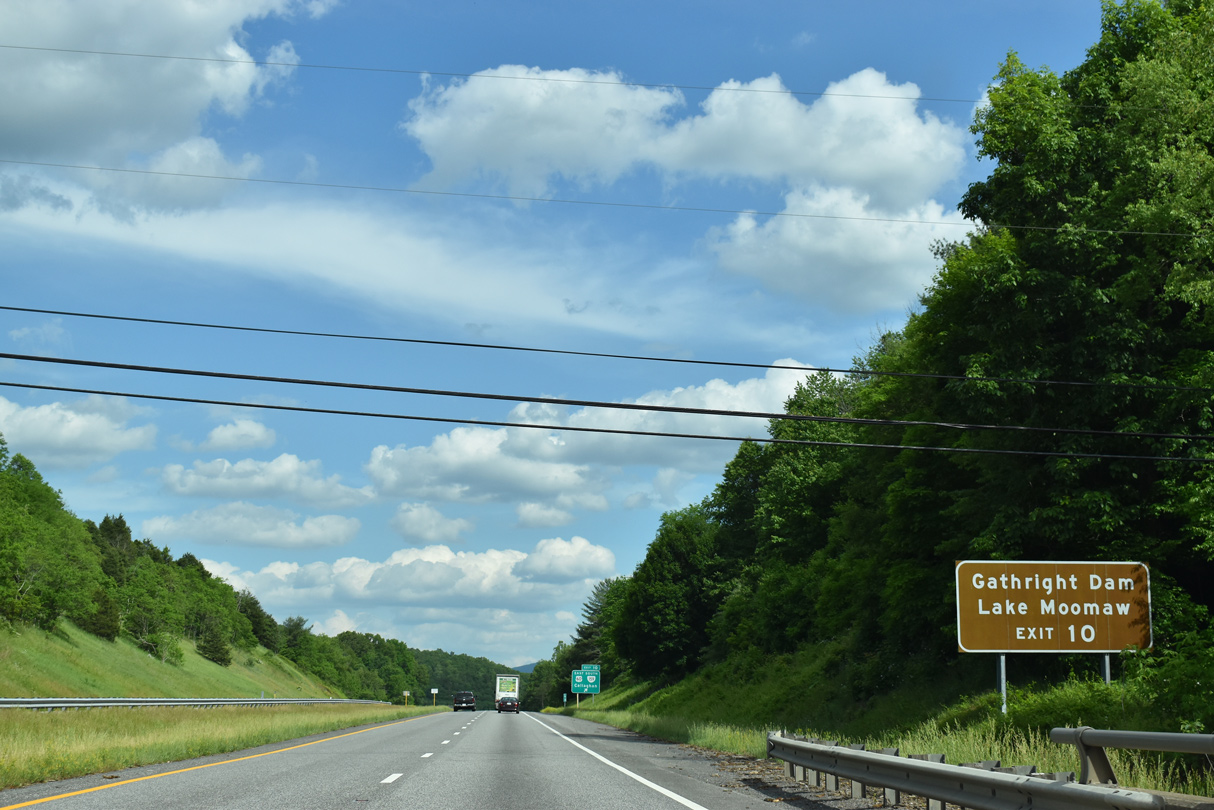
| SR 159 south to nearby SR 600 (Indian Draft Road) leads north toward Gathright Dam, which impounds water along the Jackson River creating Lake Moomaw. 05/27/21 |
|
| Entering the parclo interchange (Exit 10) with Midland Trail along I-64/U.S. 60 east. 05/27/21 |
|
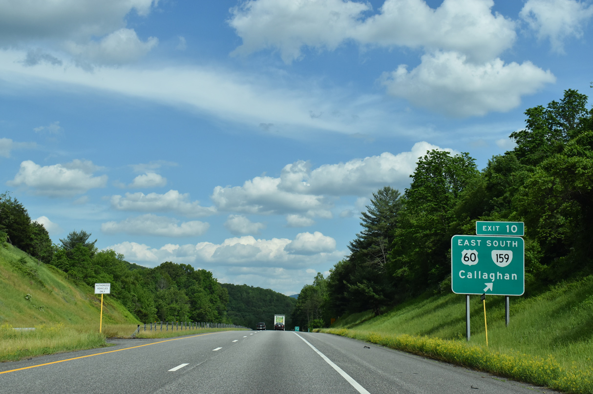
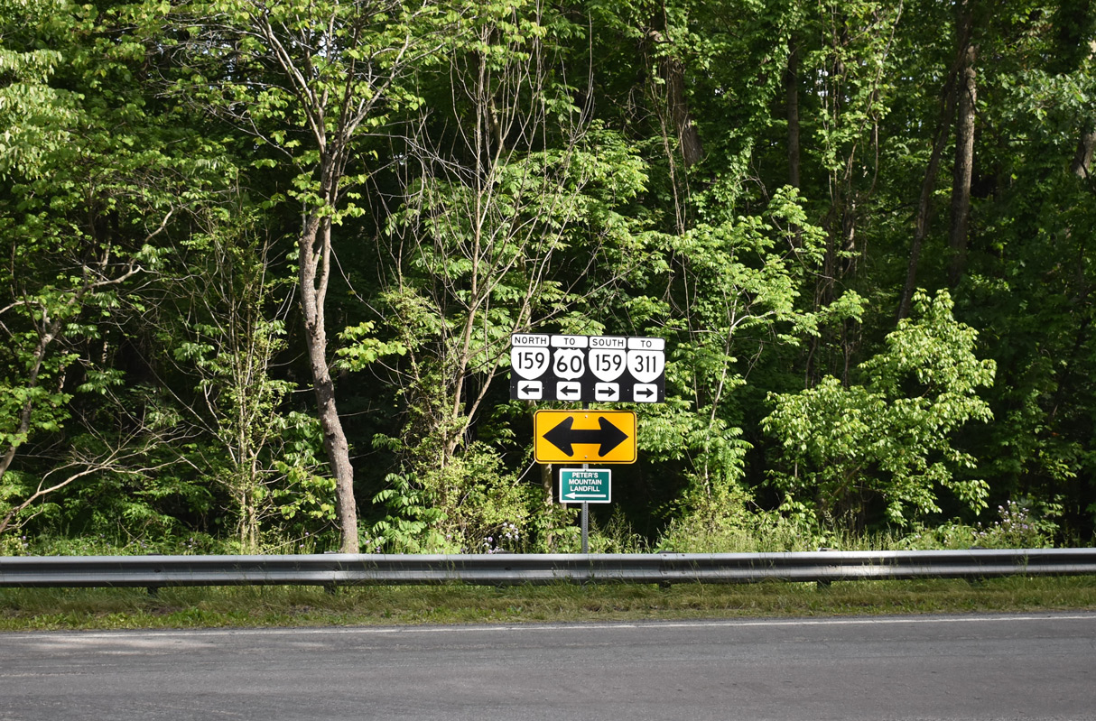
| Midland Trail (SR 600) ties into SR 159 (Dunlap Creek Road) from Callaghan just to the west. 05/27/21 |
|
| SR 159 commences an 11.33 mile route southwest to Moss Run, Hematite and SR 311 at Crows. 05/27/21 |
|
| Interstate 64 angles southeast from Dunlap Beach to the city of Covington. 09/23/14 |
|
| Lexington reappears on distance signage at 46 miles out. Richmond is 181 miles away. 09/23/14 |
|
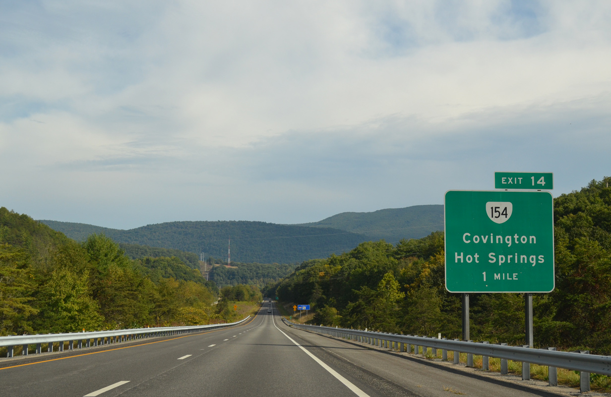
| Horse and Fore Mountains rise to the east of Covington's Valley as Interstate 64 lowers toward Exit 14. 09/23/14 |
|
| A transmission line corridor parallels Interstate 64 eastward to Covington, Clifton Forge and California. 09/23/14 |
|
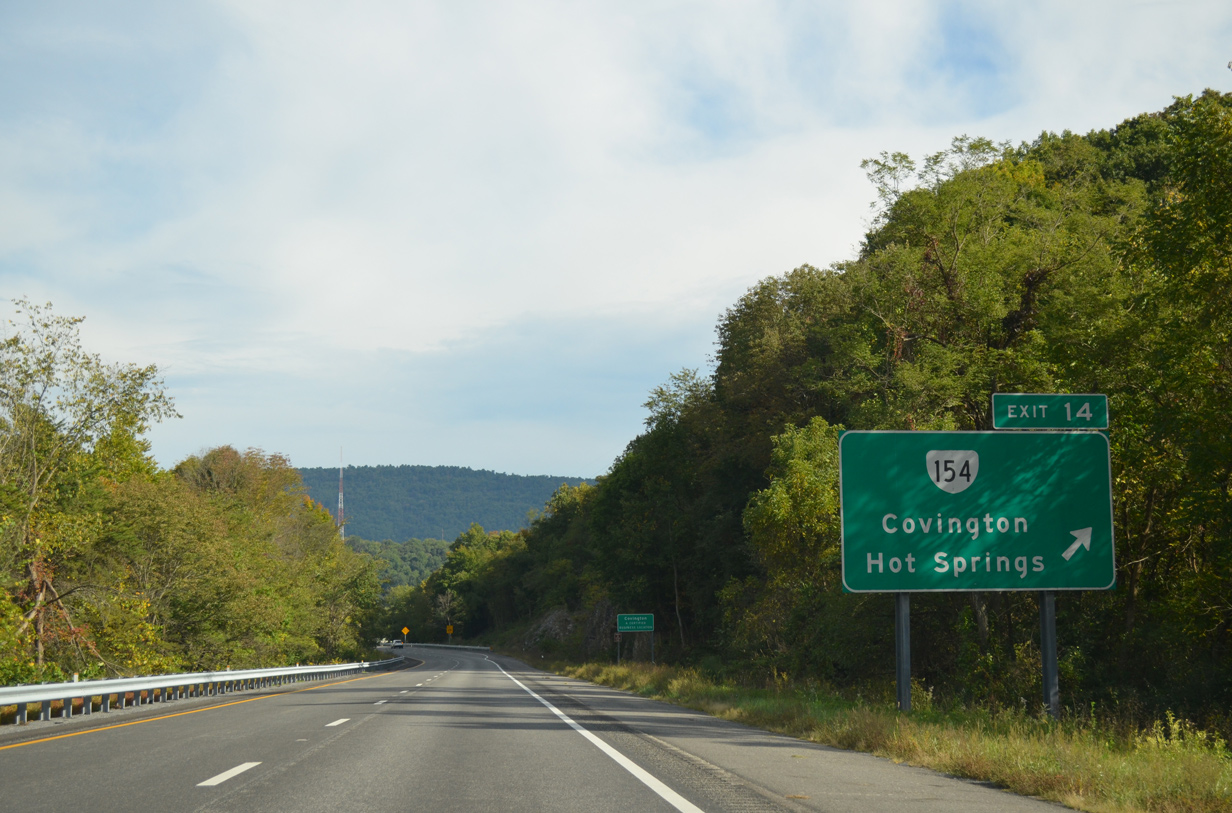
| SR 154 (Durant Road) runs 1.92 miles north from Exit 14 to U.S. 220 (North Alleghany Avenue) wholly within the city of Covington. The route is unmarked outside of Interstate 64. 09/23/14 |
|
| Durant Road extends south from the folded diamond interchange (Exit 14) with I-64 to Jackson Avenue through the Rayon Terrace community. SR 154 through the Covington street grid provides a more direct route to U.S. 220 leading north to Hot Springs. 09/23/14 |
|
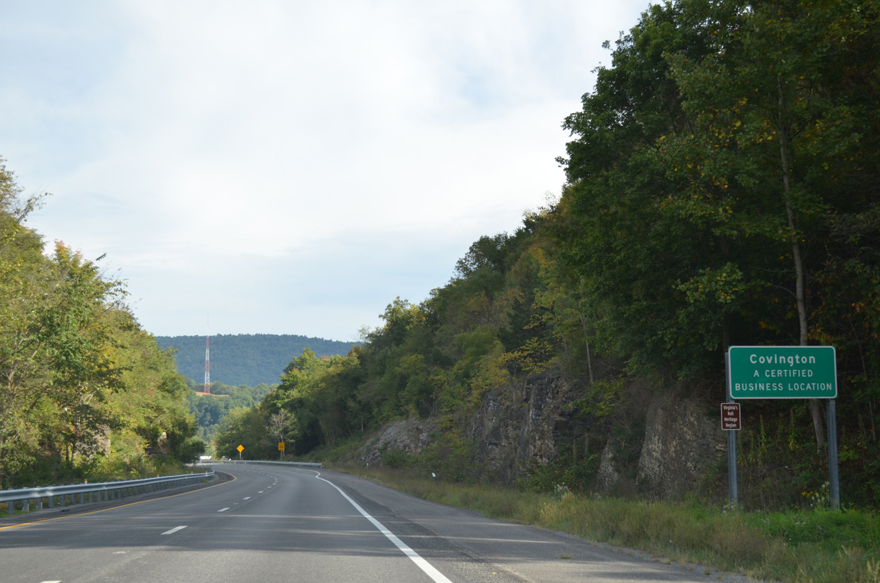
| Interstate 64 cuts across the independent city of Covington for 1.4 miles. 09/23/14 |
|
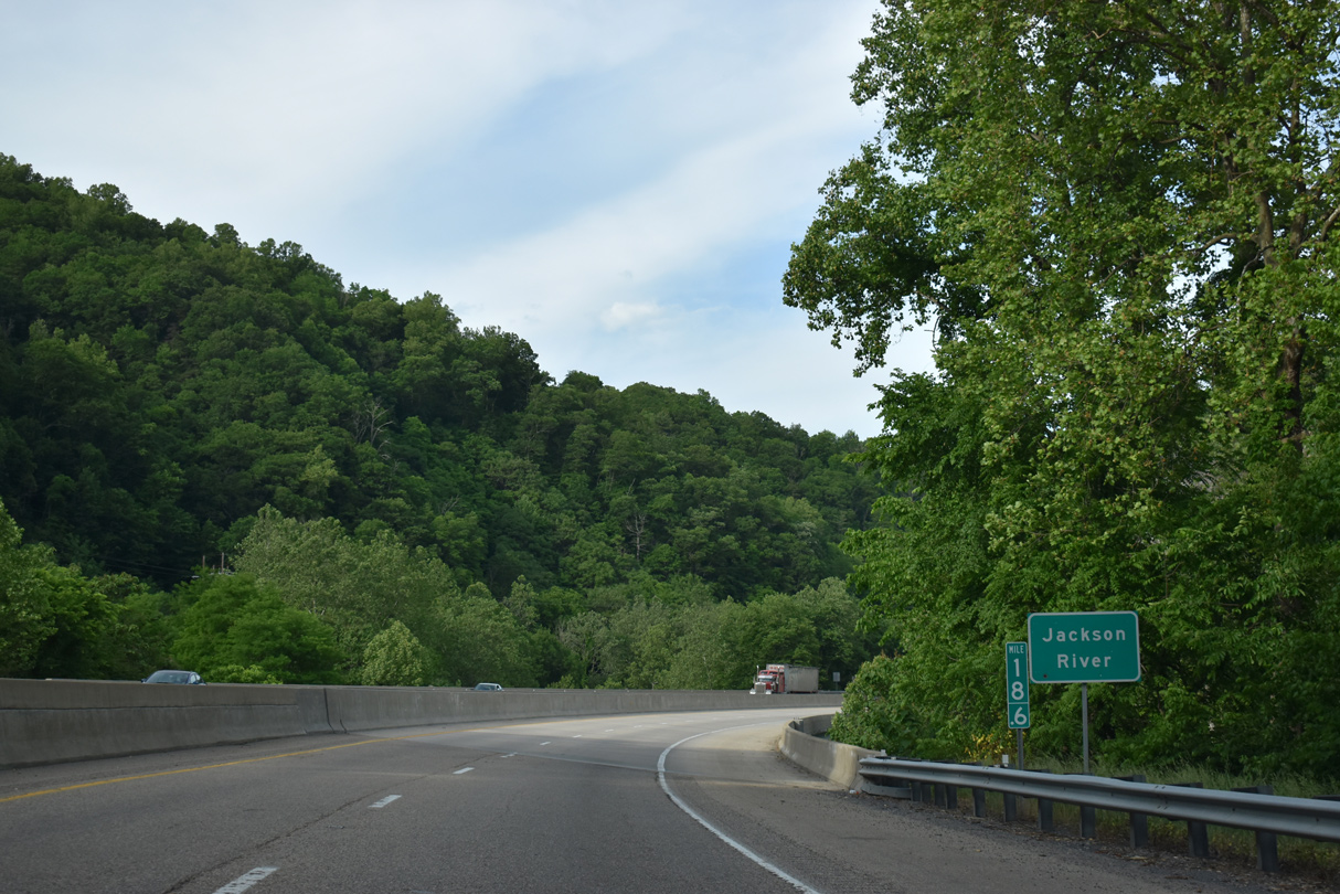
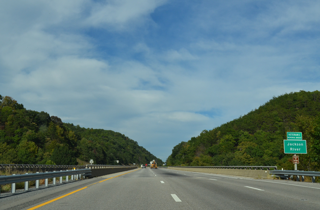
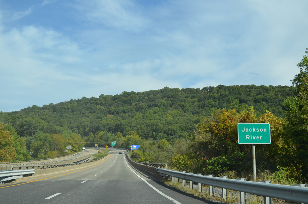
| The Jackson River flows 96.4 miles from mountains in Highland County south to Covington and east to Iron Gate, where it combines with the Cowpasture River to form the James River. 09/23/14 |
|
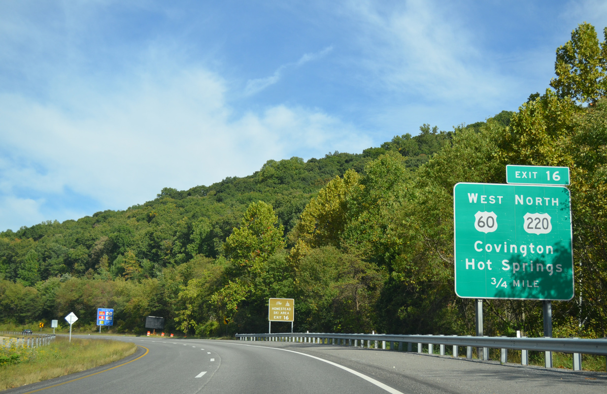
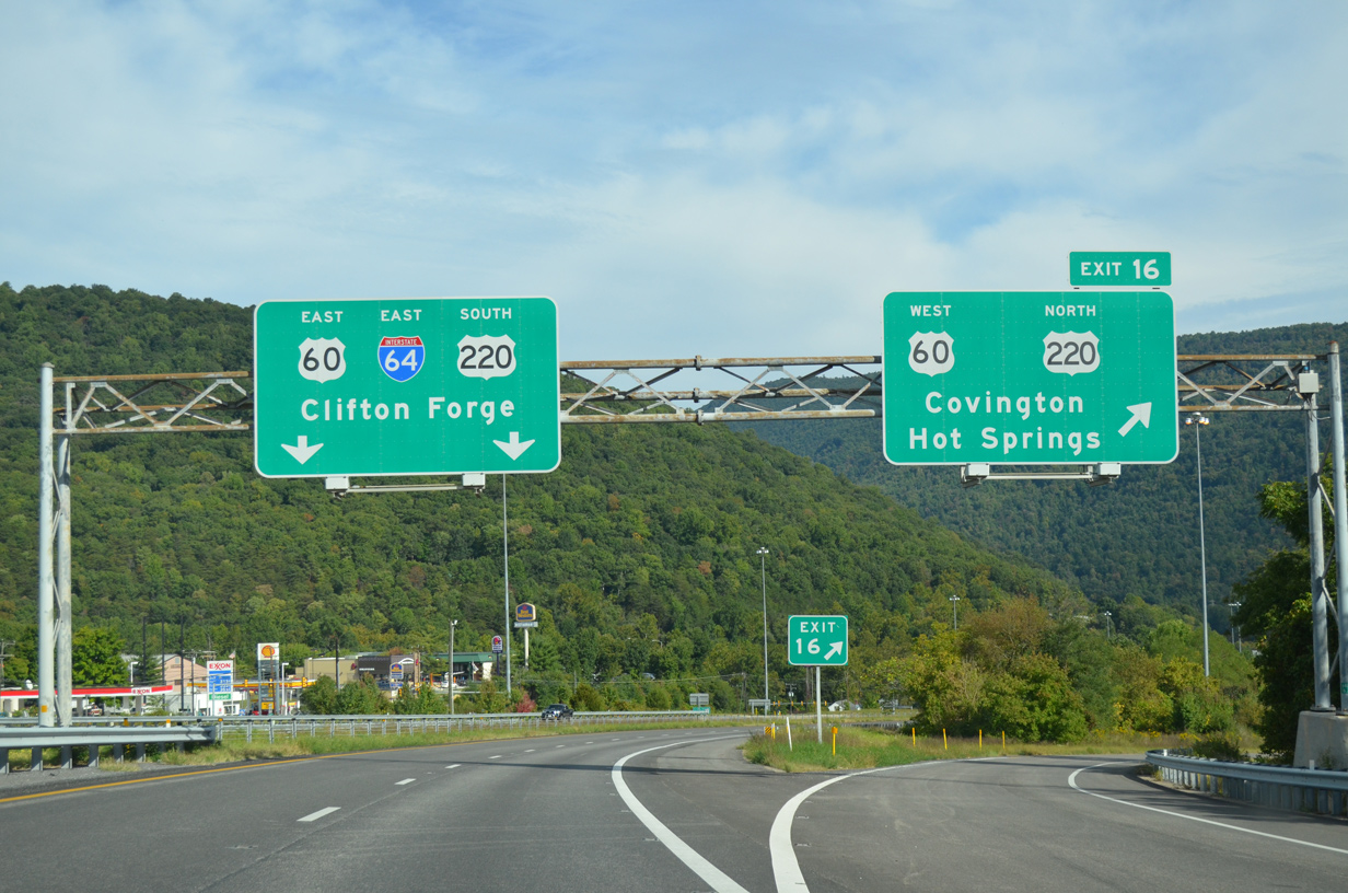
| U.S. 60 east / U.S. 220 south combine along Madison Street in Covington to combine with Interstate 64 at a modified diamond interchange (Exit 16) in 0.75 miles. 09/23/14 |
|
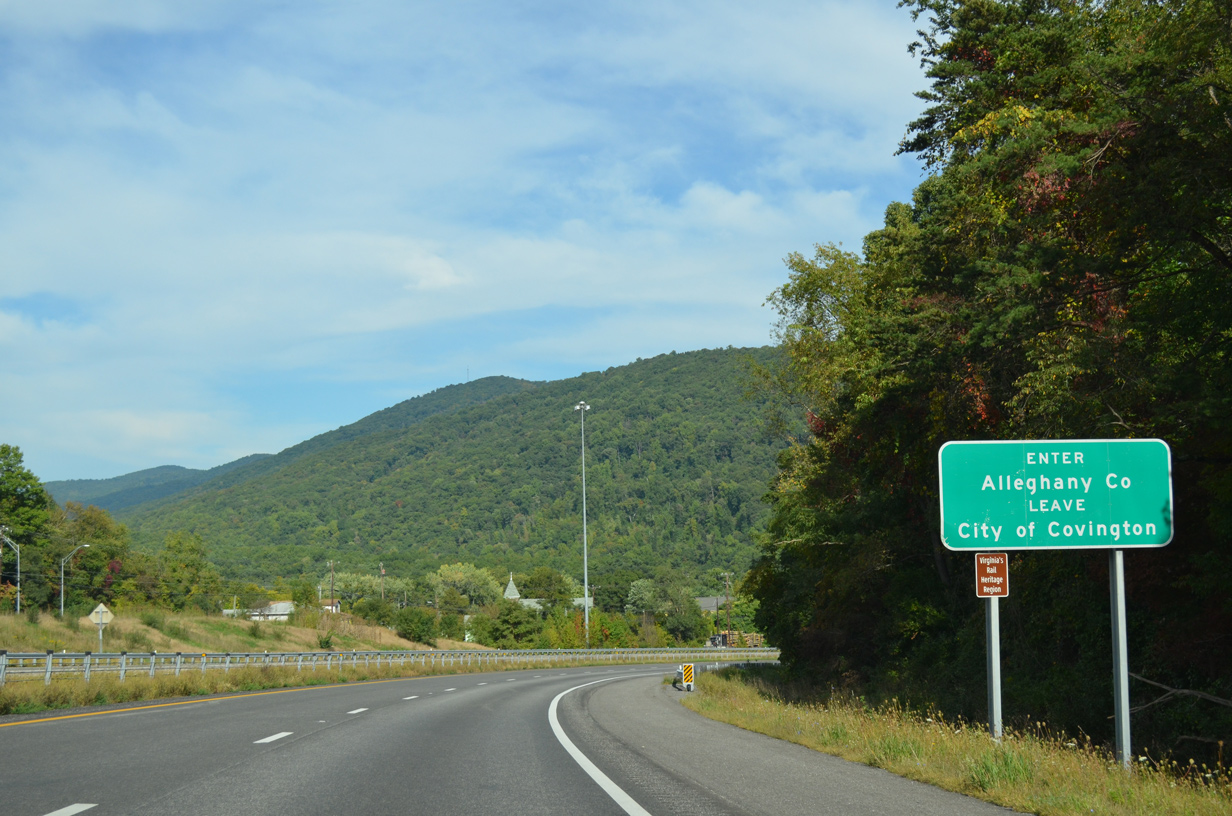
| Interstate 64 reenters Alleghany County just ahead of Exit 16 and Fore Mountain. 09/23/14 |
|
| Exit 16 departs I-64 east for Madison Street leading back into Covington and SR 647 southwest to Mallow and Edgemont. U.S. 220 enters Covington from Hot Springs, Warm Springs and Monterey from eastern West Virginia. 09/23/14 |
|
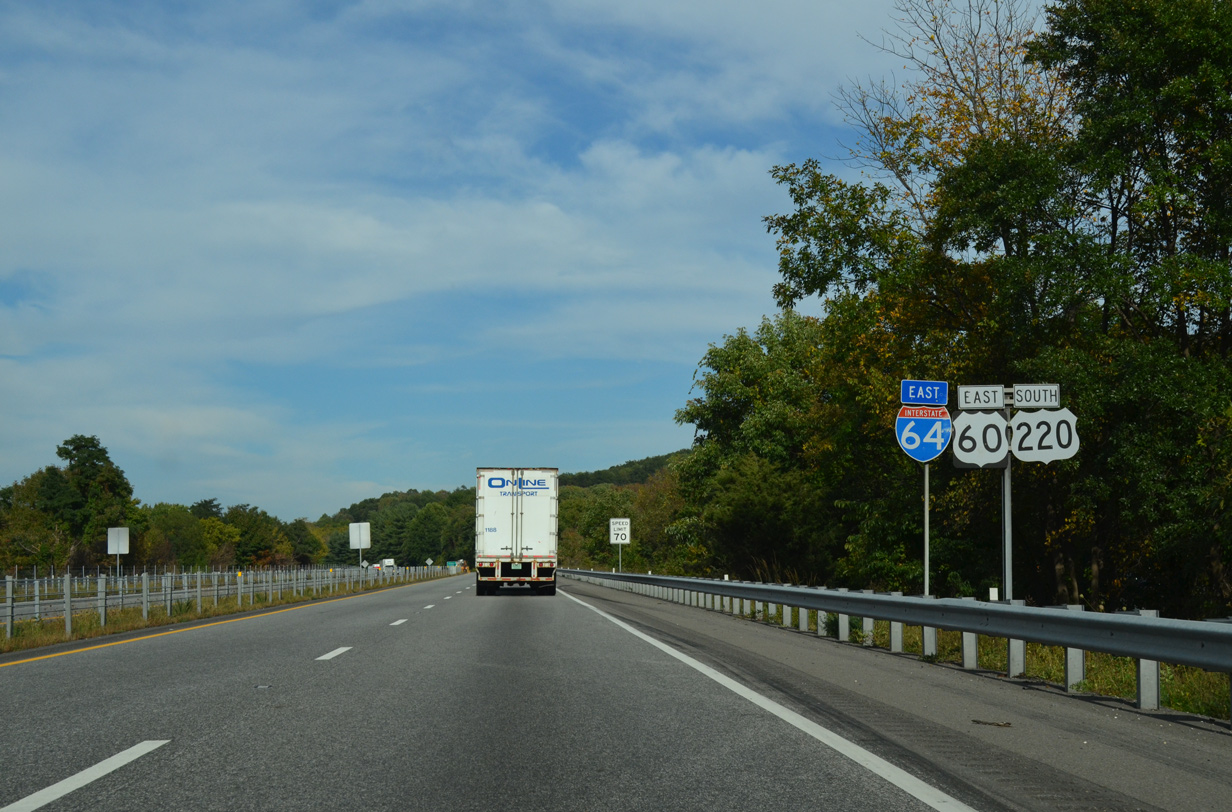
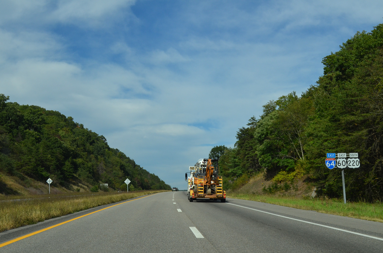
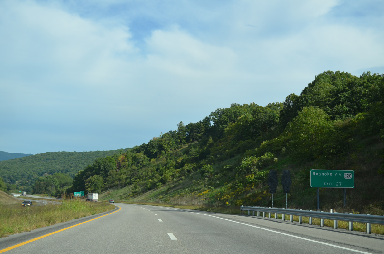
| Interstate 64 again overlays the former alignment of U.S. 60 from Exit 21 east to Low Moor. U.S. 220 combines with the freeway for 10.81 miles to Exit 27 at Cliftondale Park. 05/27/21 |
|
| The freeway crosses the Jackson River for the second of three times between Horse and Fore Mountains. 05/27/21 |
|
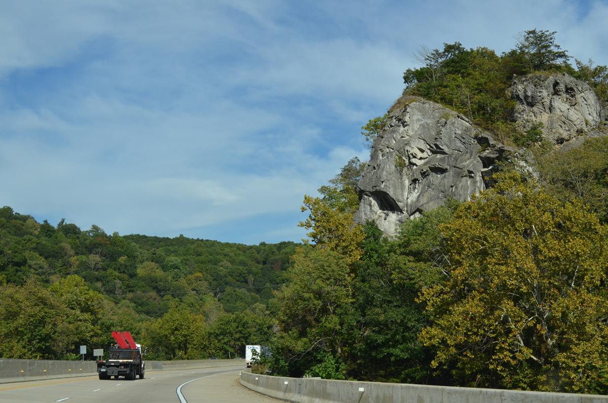
| A pronounced rock formation appears along the south side of I-64/U.S. 60-220 at the Jackson River. The waterway parallels to the north to Clifton Forge. 09/23/14 |
|
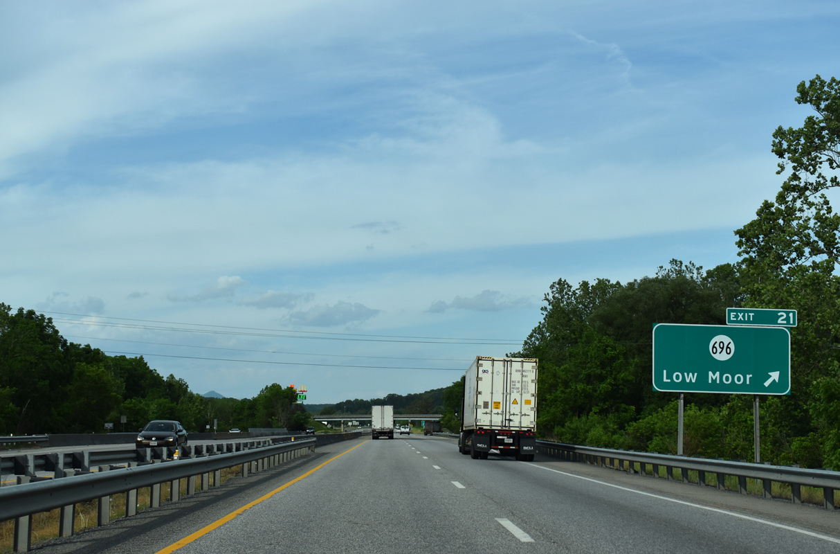
| SR 696 (Selma Low Moor Road) loops east through Low Moor and Selma from upcoming Exit 21. The route follows old U.S. 60-220 from Karnes Road east to Ridgeway Street by Exit 24. 05/27/21 |
|
| Crossing Karnes Creek, I-64/U.S. 60-220 east reaches Exit 21 to SR 696 (Selma Low Moor Road). Winterberry Avenue (SR F205) ties in from the north to serve adjacent industrial businesses. SR 616 spurs southwest from Low Moor to Rich Patch. 05/27/21 |
|
| I-64/U.S. 60-220 travel east between the Jackson River and CSX Railroad tracks. 09/23/14 |
|
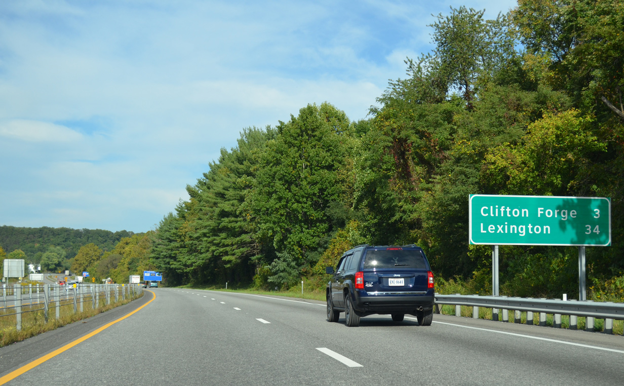
| Clifton Forge lies three miles ahead with Lexington now a half hour away. 09/23/14 |
|
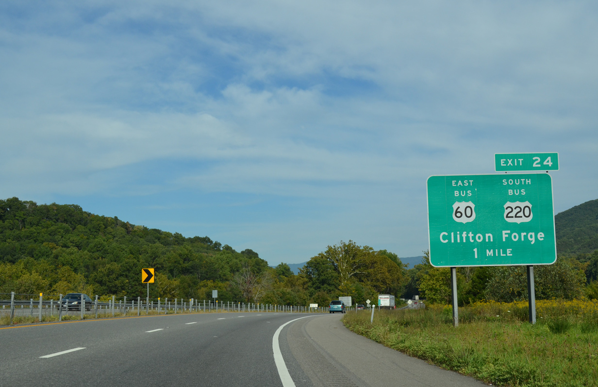
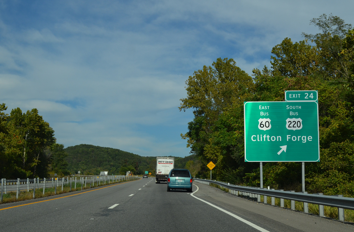
| A diamond interchange joins I-64/U.S. 60-220 with Ridgeway Street east and SR 384 west at Exit 24. Ridgeway Street doubles as U.S. 60-220 Business leading east to Main Street through Downtown Clifton Forge.
SR 384 constitutes a 0.56 mile long spur north from Exit 24 to Dabney S. Lancaster Community College. 09/23/14 |
|
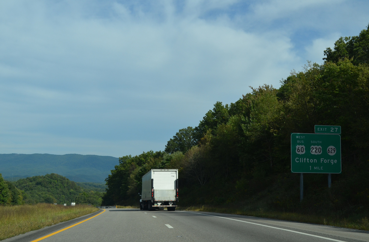
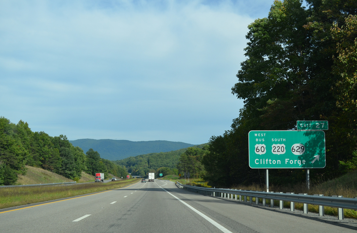
| Exit 27 leaves Interstate 64 east. U.S. 60 Business follows Main Street east to Grafton Street and Exit 27. U.S. 220 Business turns south across the Jackson River along A Street to Verge Street east to combine with the U.S. 220 mainline at Rainbow Gap. 09/23/14 |
|
| I-64/U.S. 64-220 curve north to circumvent Clifton Forge from the Jackson River to Cliftondale Park. 09/23/14 |
|
| Staunton appears on distance signage at 65 miles out. The city represents the north end of the overlap between I-64/81. Richmond lies 100 miles further east along I-64. 09/23/14 |
|
| Interstate 64 briefly enters the city limits of Clifton Forge on the one mile approach to Exit 27 with U.S. 60 Business west / U.S. 220 (Grafton Street) south and SR 629 (Douthat Road) north. 09/23/14 |
|
| Leading away from Clifton Forge, U.S. 220 provides a direct route south to combine with I-81 and I-581 to Roanoke. 09/23/14 |
|
| Eastbound at the diamond interchange (Exit 27) with Grafton Street south back toward Clifton Forge and SR 629 north to Douthat State Park. U.S. 220 south bypasses Clifton Forge to the east along a short expressway bypass to Rainbow Gap. The route travels south to Iron Gate, Fincastle and Daleville. 09/23/14 |
Page Updated 08-13-2021.


 East
East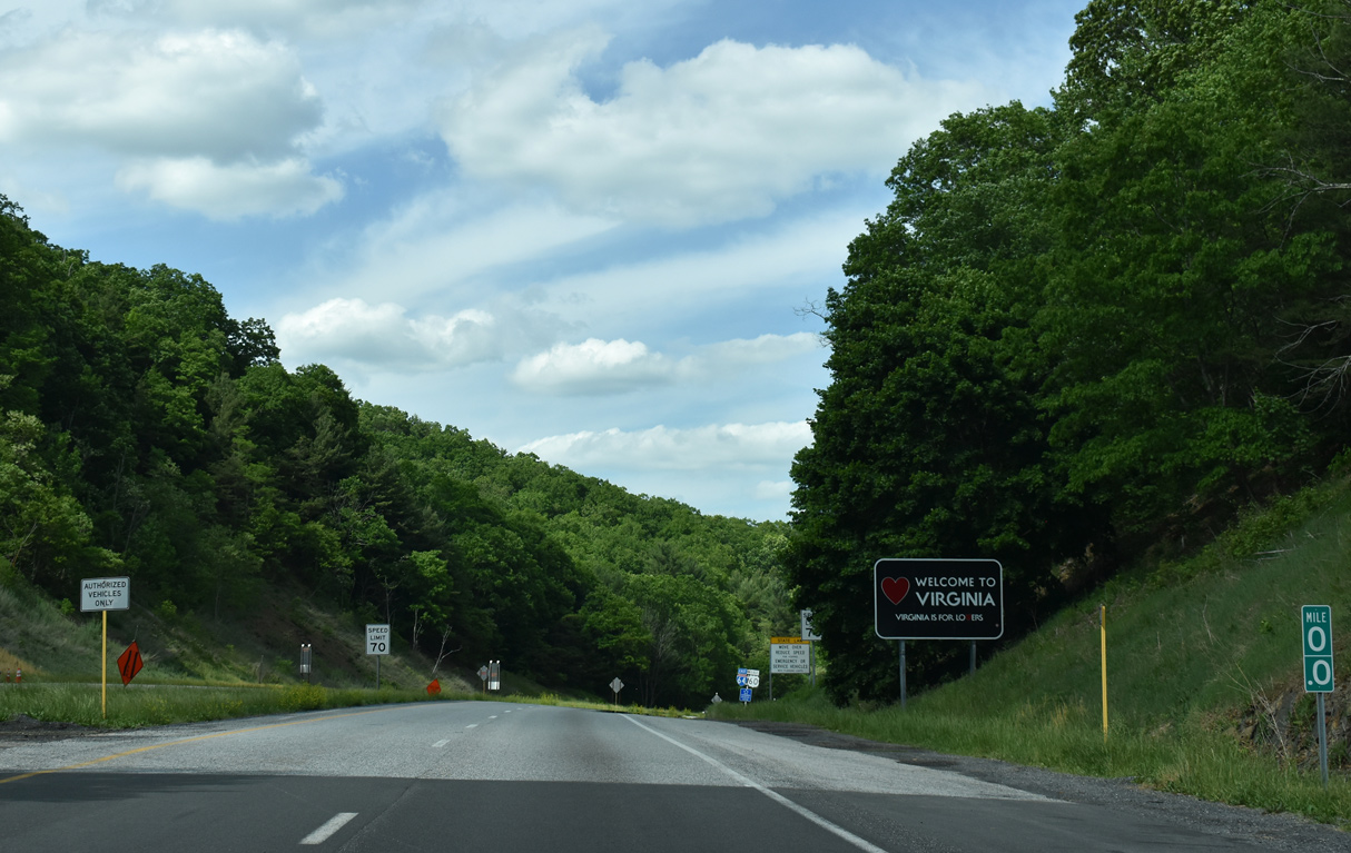
 South
South