|
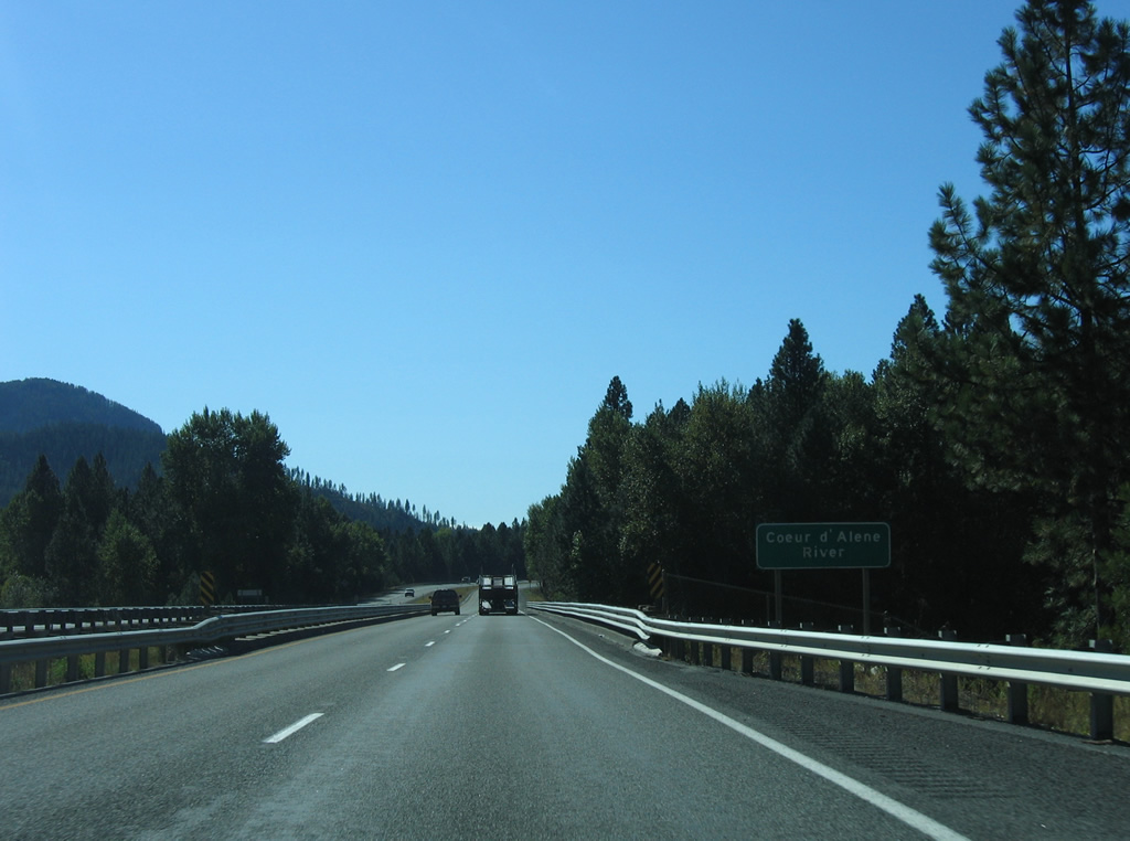
| Interstate 90 spans the Coeur d'Alene River on a pair of 1964-built bridges immediately west of the Cataldo on-ramp. 09/01/06 |
|
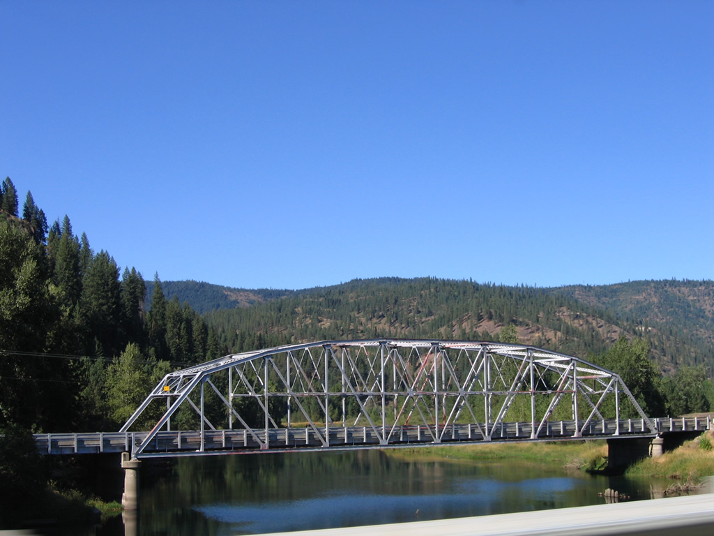
| A 1936 truss bridge carries Canyon Road across the Coeur d'Alene River just north of Interstate 90. This was the former route of U.S. 10 around the Mission Flats. 09/01/06 |
|
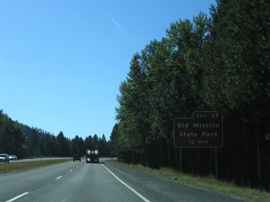
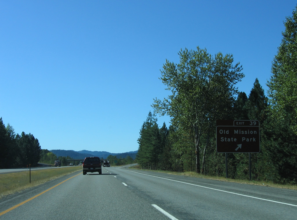
| Exit 39 joins Interstate 90 with Dredge Road and Old Mission State Park in one half mile. 09/01/06 |
|
| Old Mission Park contains Cataldo Mission, a National Historic Landmark and the oldest standing building in Idaho. 09/01/06 |
|
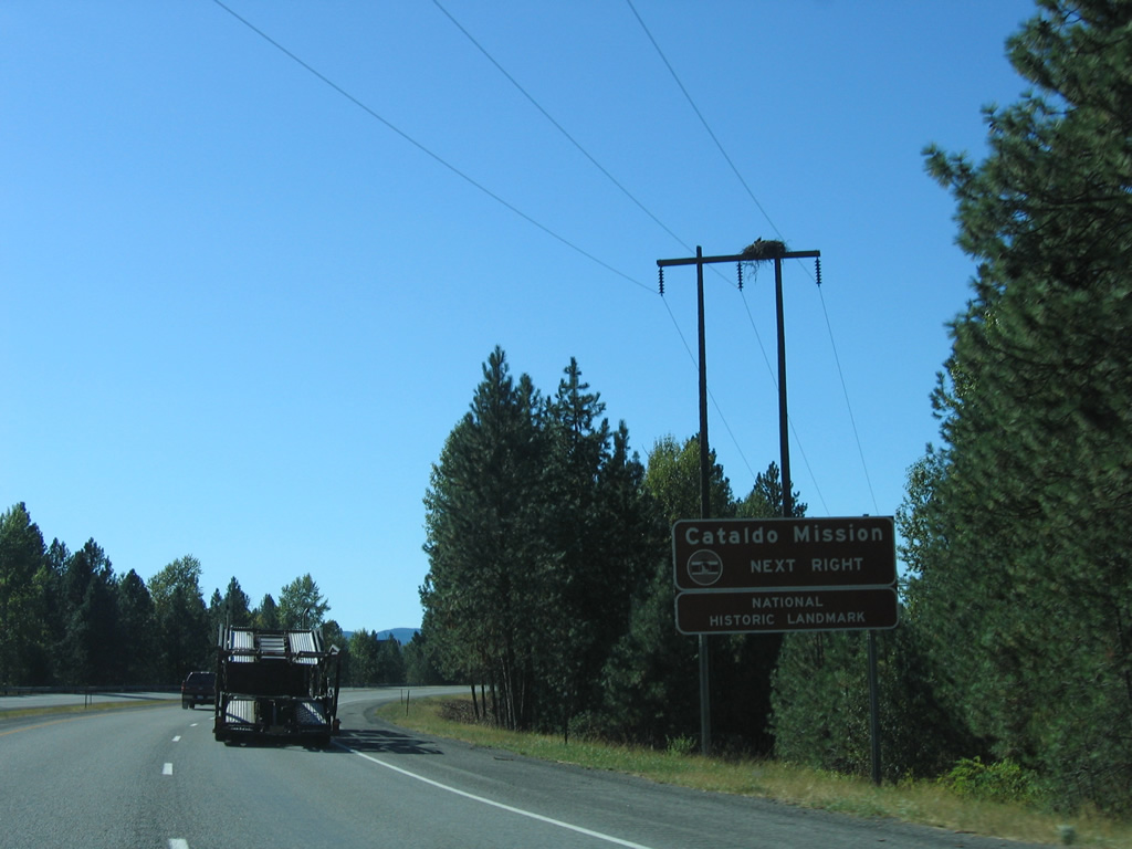
| Westbound Interstate 90 at Exit 39 for Old Mission State Park. Dredge Road connects the state park with Canyon Road (old U.S. 10) to the north. 09/01/06 |
|
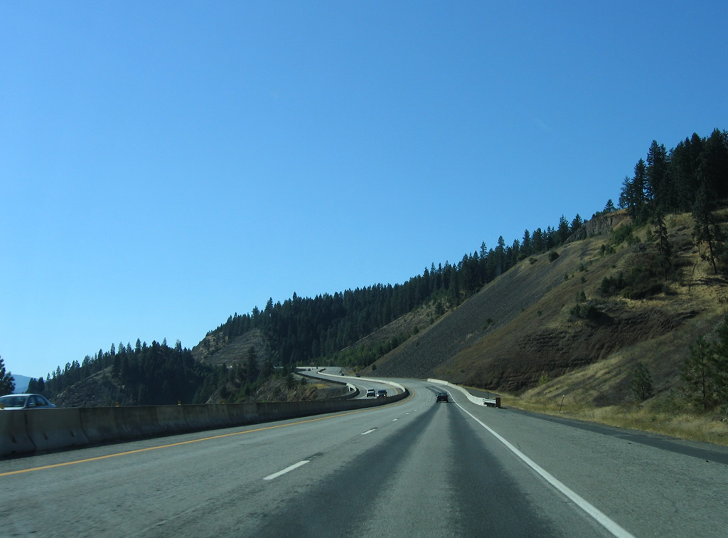
| Interstate 90 traverses the Mission Flats northwest from Old Mission State Park. The flats is an area of marshlands extending north from the Coeur d'Alene River to Canyon Road. 09/01/06 |
|
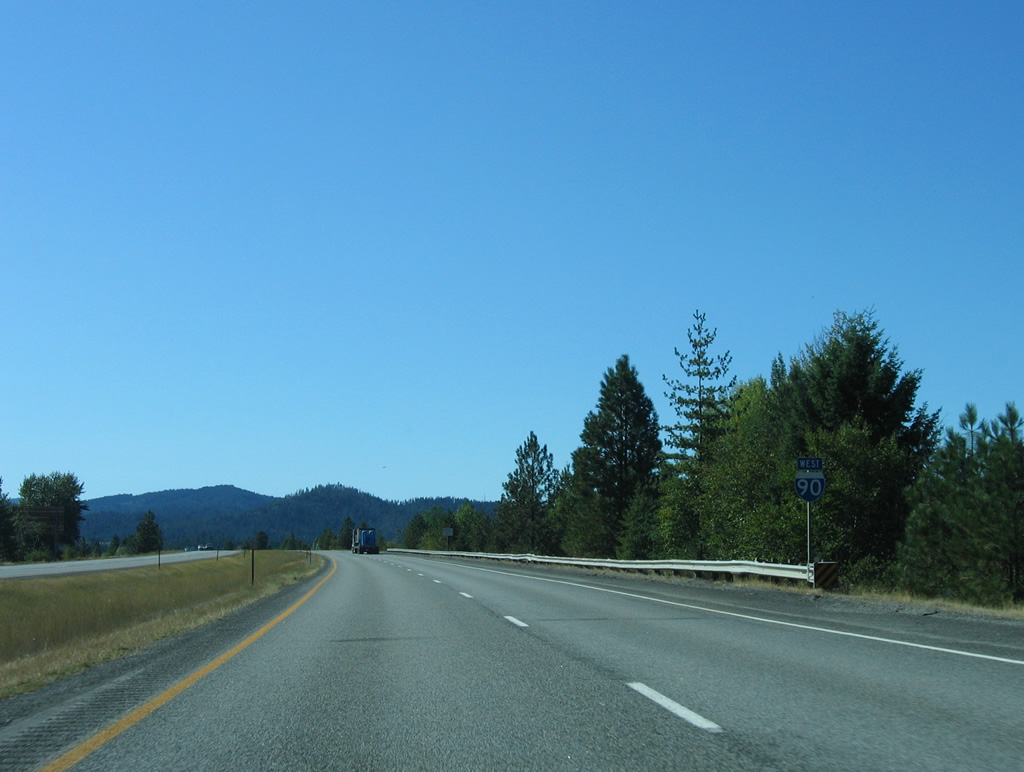
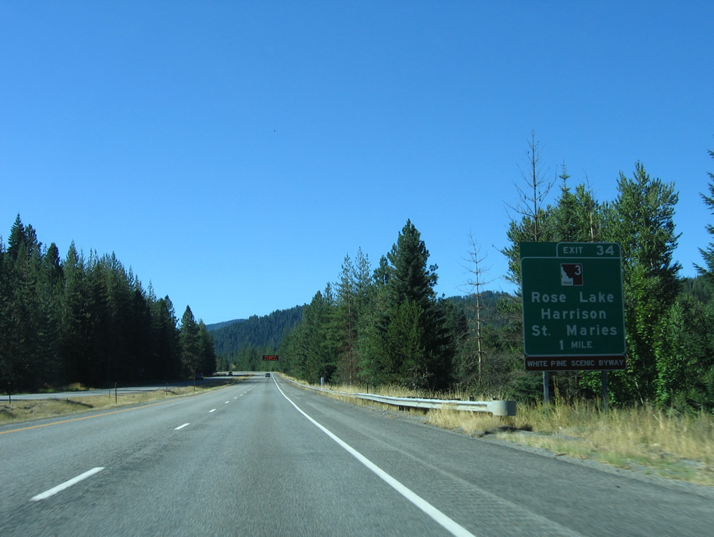
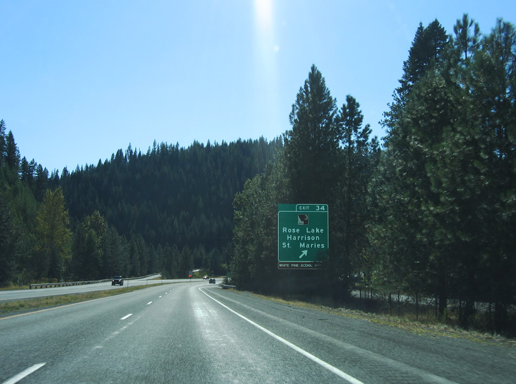
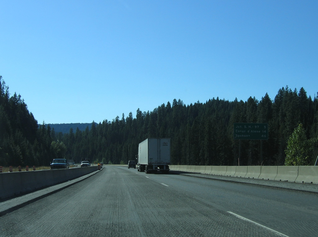
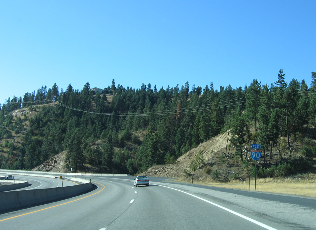
| Only the second state highway encountered by Interstate 90 west so far in Idaho, SH-3 stretches for 117.68 miles southwest from Exit 34 to U.S. 12 in Nez Perce Indian Reservation east of Lewiston. 09/01/06 |
|
| SH-3 (White Pine Scenic Byway) heads south from a diamond interchange (Exit 34) with Interstate 90 to Rose Lake, Lane and Cave Lake before curving eastward to the Benewah County seat of St. Maries. Connections with SH-97 north from within Coeur d'Alene Indian Reservation lead motorists from ID 3 to Harrison on Coeur d'Alene Lake. 09/01/06 |
|
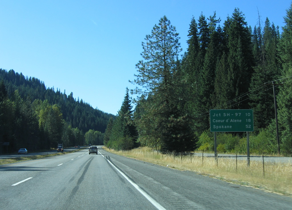
| SH-97 continues north from Harrison 28 miles to end at Interstate 90 in ten miles. Coeur d'Alene is just eight miles west from there. Spokane, the largest city in eastern Washington, is 52 miles away. 09/01/06 |
|
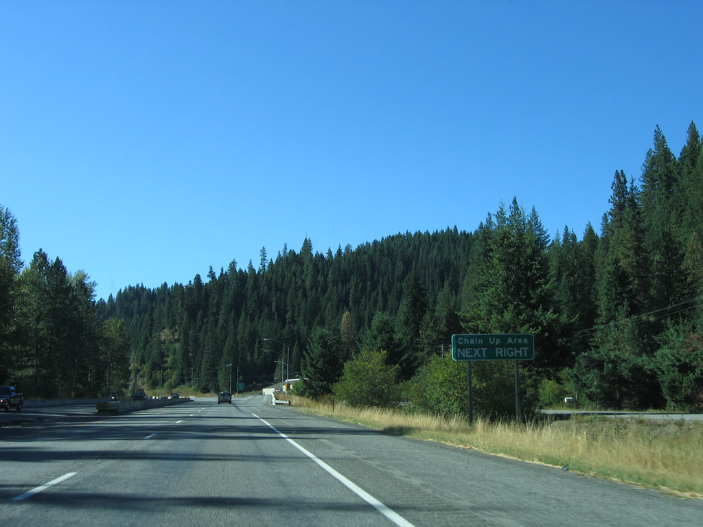
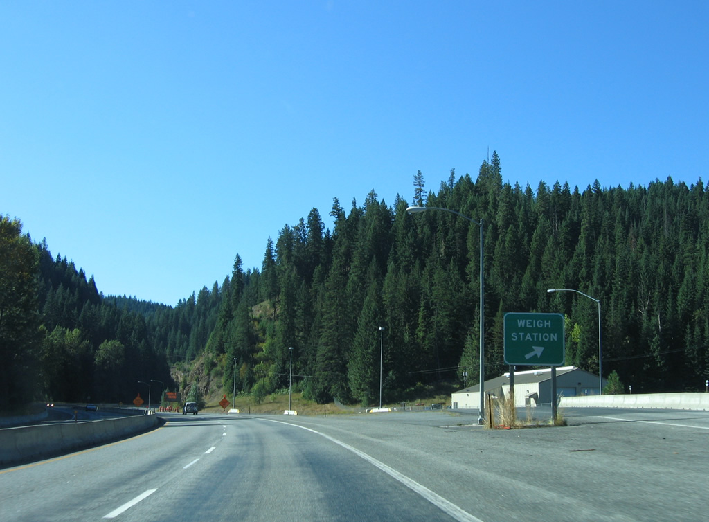
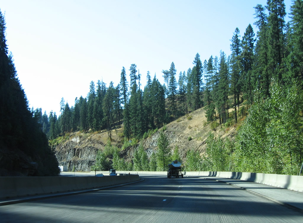
| The next six miles of Interstate 90 take travelers through Fourth of July Canyon and an increase in elevation of almost 900 feet. The stretch includes a weigh station and chain up area located just over a mile from SH-3. 09/01/06 |
|
| Climbing through Fourth of July Canyon to Fourth of July Summit (elevation 3,081 feet). 09/01/06 |
|
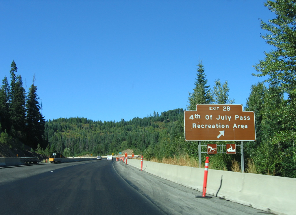
| Exit 28 departs Interstate 90 west for National Forest Road 614 and Alder Creek Road at 4th of July Pass Recreation Area. The diamond interchange serves a stretch of the historic Mullan Road and the Mullan Tree Historic Site. 09/01/06 |
|
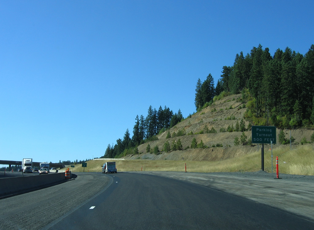
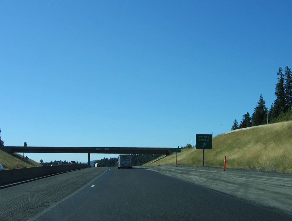
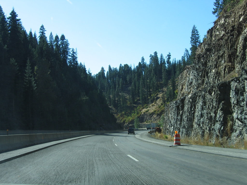
| Interstate 90 lowers 1,000 feet in elevation from Fourth of July Summit to Wolf Lodge Bay. The descent includes a 6% grade just west of the Alder Creek Road on-ramp. A truck parking turnout precedes the stretch at the NF-614 overpass. 09/01/06 |
|
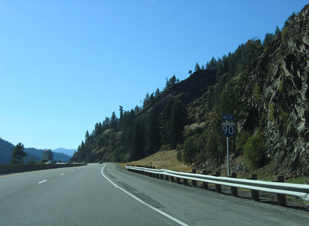
| SH-97 is the next westbound exit in five miles near Wolf Lodge. I-90 proceeds from there along the periphery of Coeur d'Alene Lake into Coeur d'Alene, 14 miles away. 09/01/06 |
|
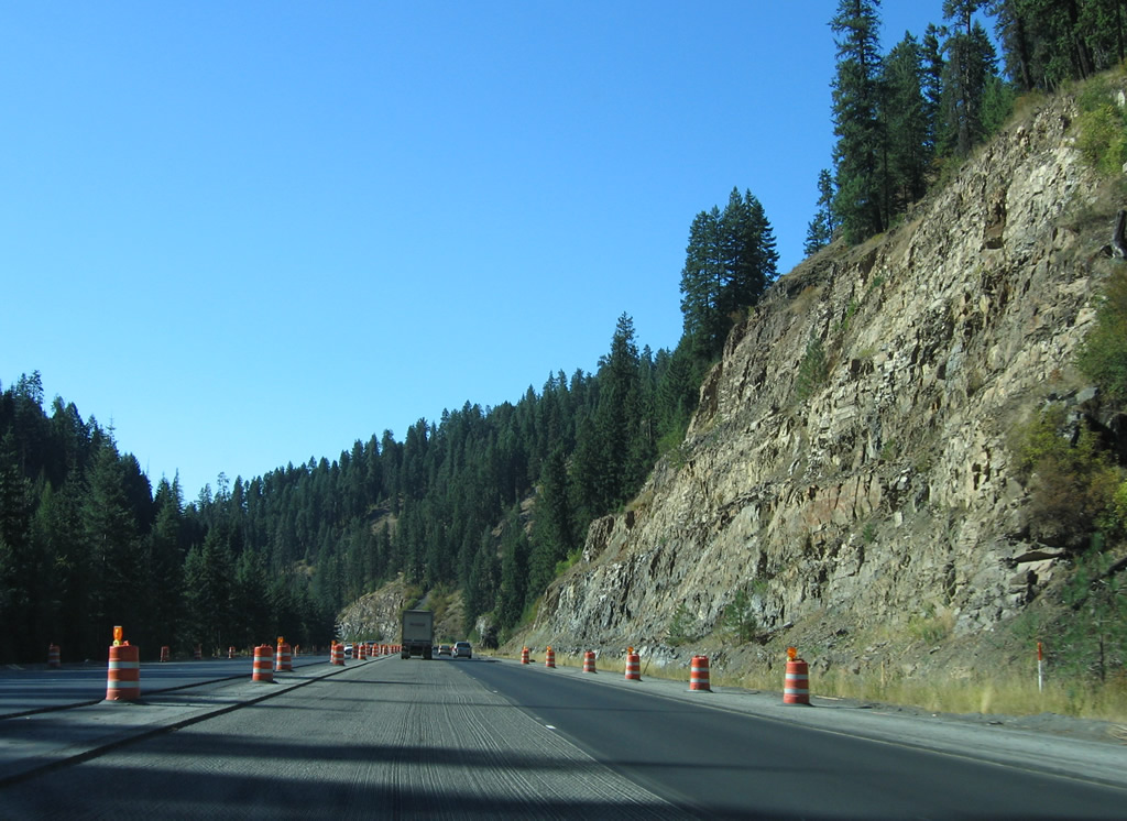
| Interstate 90 takes a number of S-curves on the descent to Wolf Lodge Bay. The four lane freeway sees a barrier median and many rock cuts as it parallels Cedar Creek to a valley south of Wolf Lodge. 09/01/06 |
|
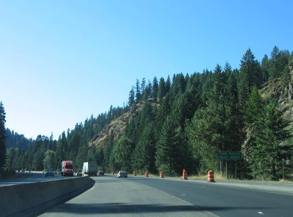
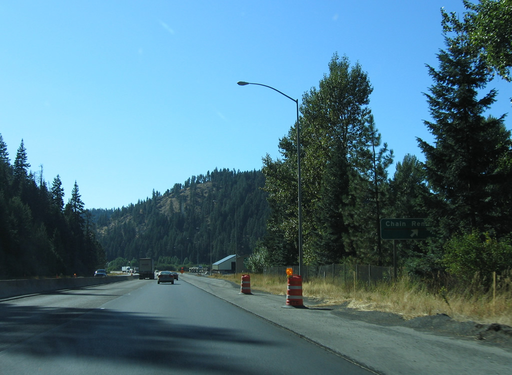
| A chain removal area lies along the westbound lanes of Interstate 90 as it leaves the Cedar Creek canyon and flattens in grade at just over 2,100 feet. 09/01/06 |
|
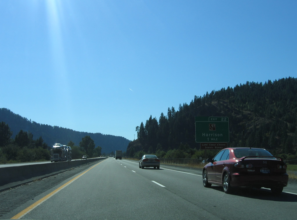
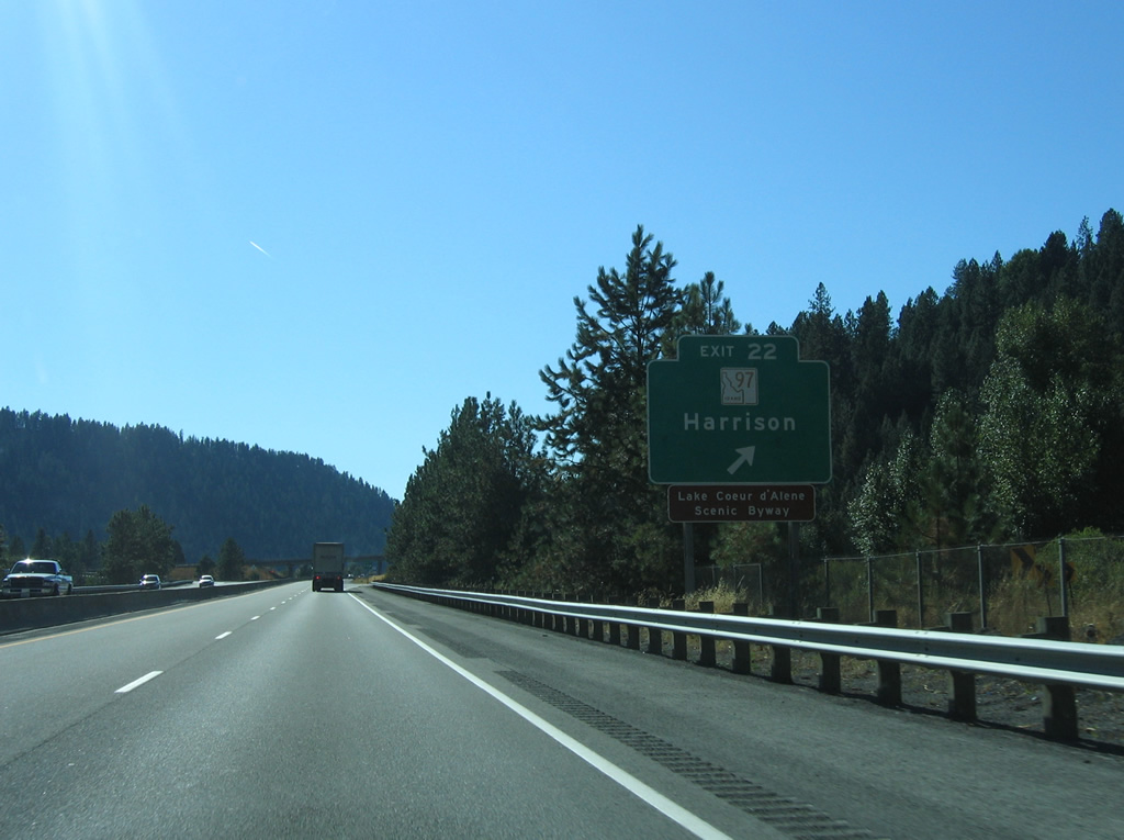
| SH-97, a 35.75 mile route from Exit 22 of I-90 to SH-3, follows the Lake Coeur d'Alene Scenic Byway along eastern reaches of the lake to Harrison. SH-97 also was once a part of the routing of U.S. 95 Alternate. 09/01/06 |
|
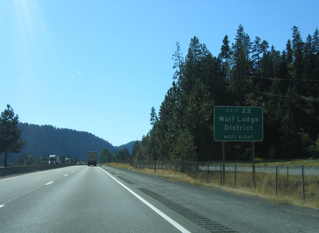
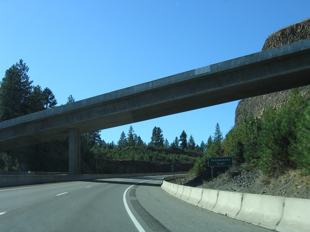
| Yellowstone Trail and E Frontage Road tie into the north end of the diamond interchange at Exit 22 from the Wolf Lodge District. 09/01/06 |
|
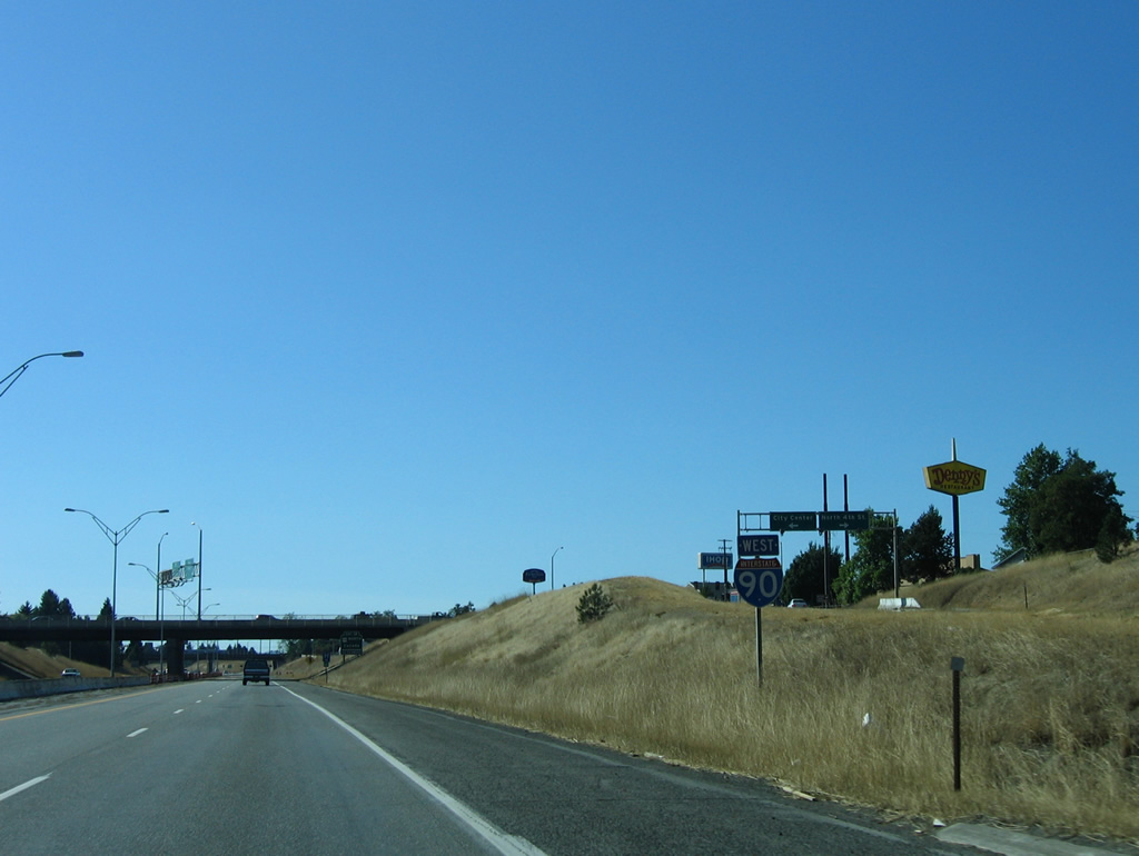
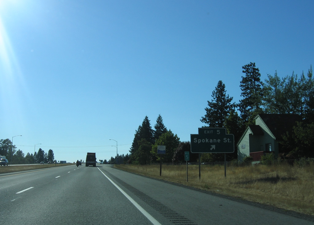
| Exit 22 leaves Interstate 90 west for SH-97 (Lake Coeur d'Alene Scenic Byway) south to Harrison and SH-3 south to St. Maries. 09/01/06 |
|
| Reassurance shield and distance sign posted eight miles east of Coeur d'Alene and 40 miles from Spokane. U.S. 95, the major north-south route through the Idaho panhandle, crosses paths with I-90 in ten miles as well. 09/01/06 |
|
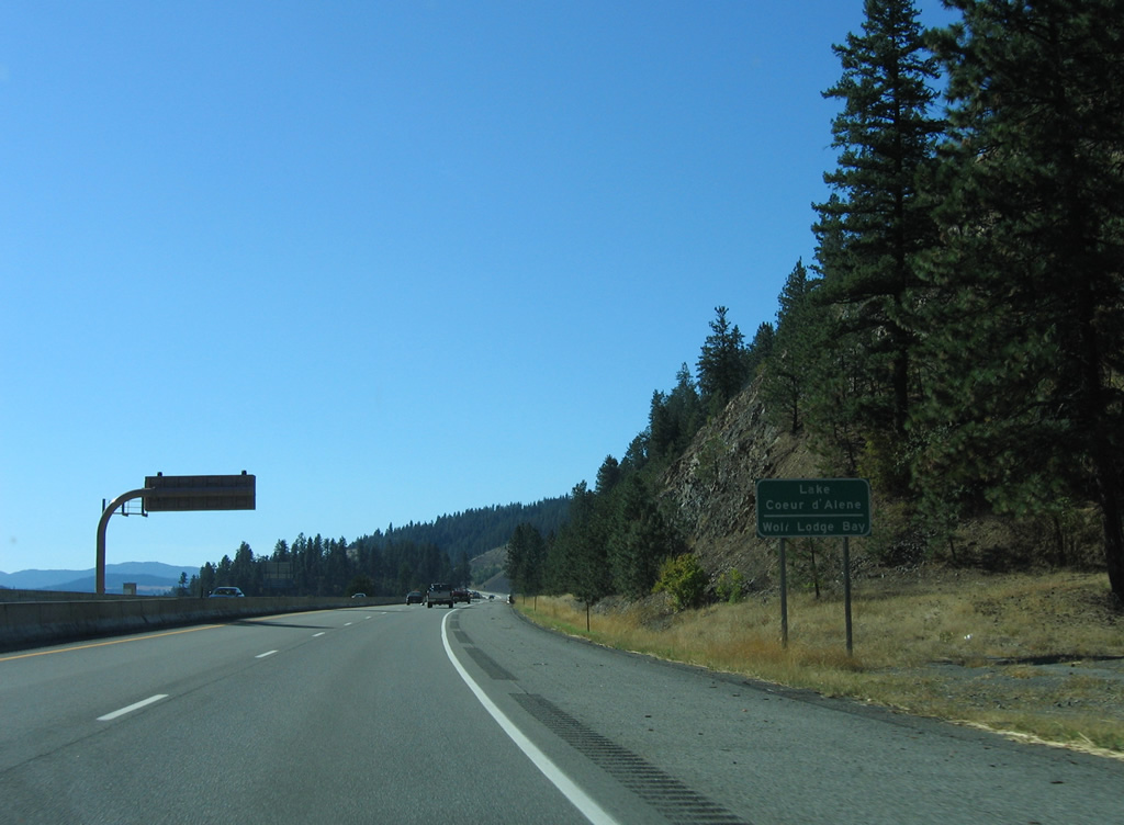
| Interstate 90 straddles the north shore of Wolf Lodge Bay of Lake Coeur d'Alene to Blue Creek Bay. 09/01/06 |
|
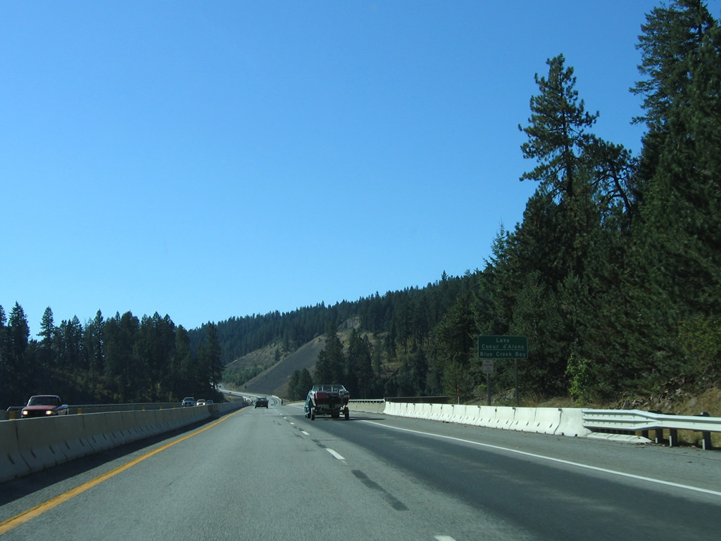
| Blue Creek Bay comprises an arm of Lake Coeur d'Alene fed by Blue Creek. Interstate 90 spans the waterway on a 1951-built westbound bridge and a 1972-completed eastbound bridge. 09/01/06 |
|
| Interstate 90 clings to the hillside north of Wolf Lodge Bay and recreation areas along Coeur d'Alene Lake Drive (the former path of I-90 and U.S. 10). An interchange was proposed here in the 1970s to give access to the U.S. Forest Service near the lake. Earthmoving for the new exit was undertaken as part of a $12.3 million contract to build a two mile segment of I-90 in 1990, but problems with slides resulted in separate incidents where rocks and soil slid into the lake, including two pieces of equipment and one worker. These slides halted work, ultimately leading to cancellation of the interchange project.1 09/01/06 |
|
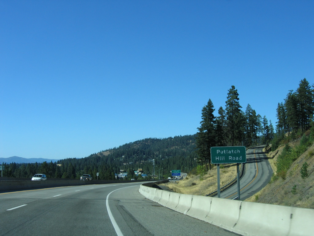
| Interstate 90 passes under Yellowstone Trail at an elevation of around 2,400 feet. The freeway turns northward parallel to Lake Coeur d'Alene to Potlatch Hill. 09/01/06 |
|
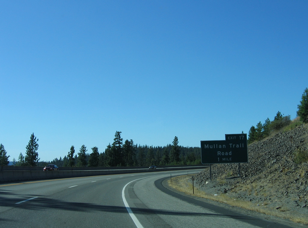
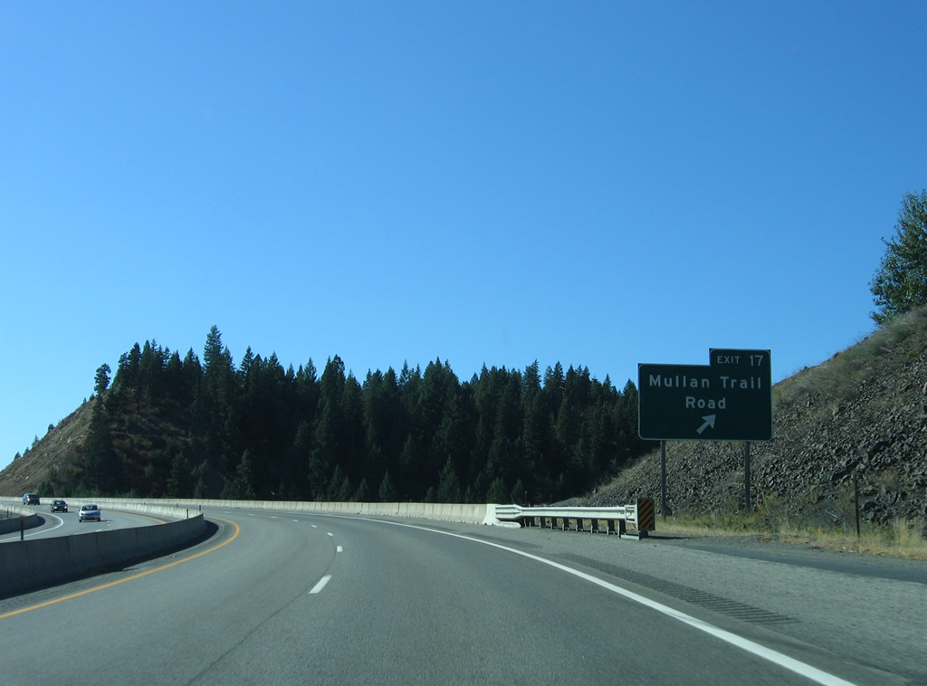
| The five mile stretch of Interstate 90 between Blue Creek Bay and Sherman Avenue was completed in 1992 to relocate Interstate 90 away from the Lake Coeur d'Alene shoreline. The $50 million contract included construction of the Exit 17 diamond interchange and the Veterans Memorial Bridge above Bennett Bay.1 09/01/06 |
|
| Exit 17 joins Interstate 90 with Mullan Trail Road, a residential road winding west from Sunnyside Road to an adjacent subdivision. 09/01/06 |
|
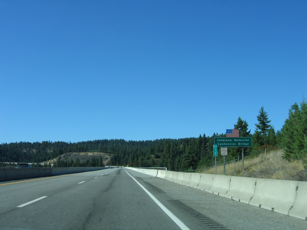
| The Veterans Memorial Centennial Bridge travels 246 feet above a ravine opening into Bennett Bay. The 1,730-foot long post-tension concrete segmented span was originally named the Bennett Bay Centennial Bridge to commemorate the 1990 Idaho centennial celebration. The $15.7 million bridge was renamed to honor Idaho war veterans in 1992.2 09/01/06 |
|
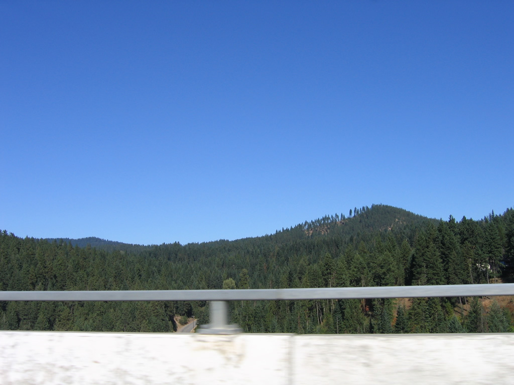
| Looking east from the Veterans Memorial Centennial Bridge at Sunnyside Road and Kern Butte, which rises to 2,996 feet above sea level. 09/01/06 |
|
| The Bennett Bay bridge, completed in 1991, was one of six winners of the American Concrete Institute Award of Excellence in the 1990 Concrete Bridge Awards competition.3 09/01/06 |
|
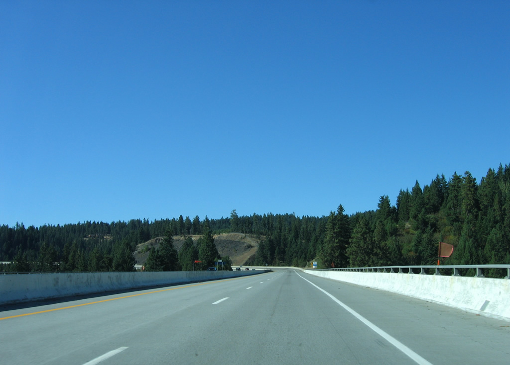
| Curving westward toward Potlatch Hill, Interstate 90 reaches the Exit 17 off-ramp for Mullan Trail Road. Local roads can be used from Mullan Trail Road to reach Coeur d'Alene Lake Drive at Silver Beach. 09/01/06 |
|
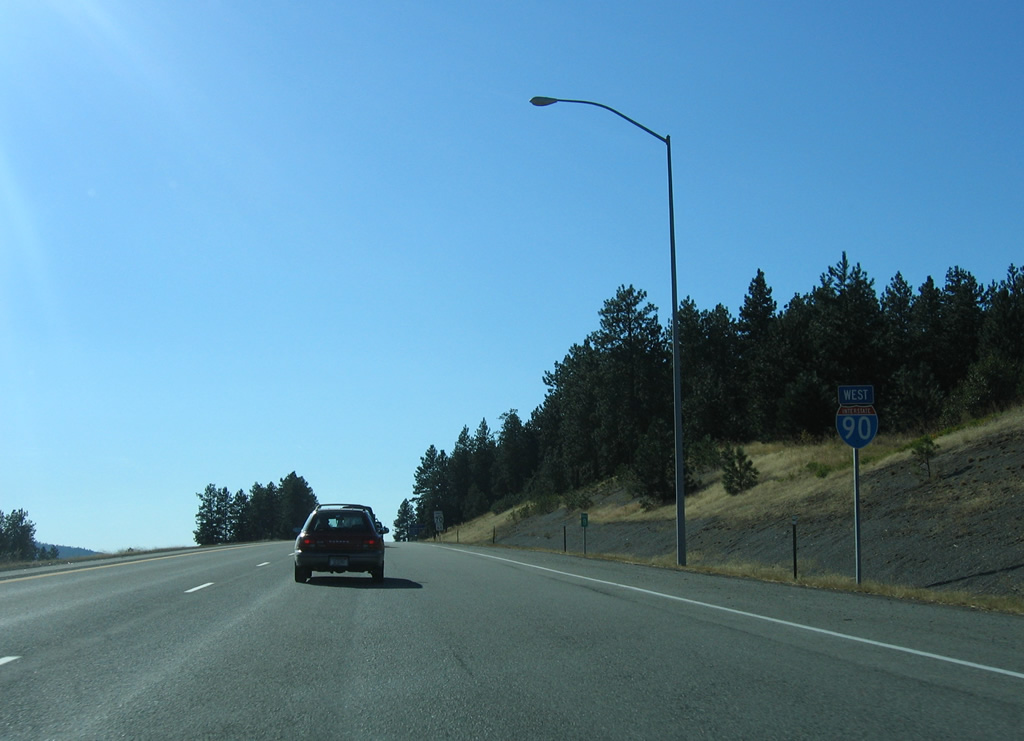
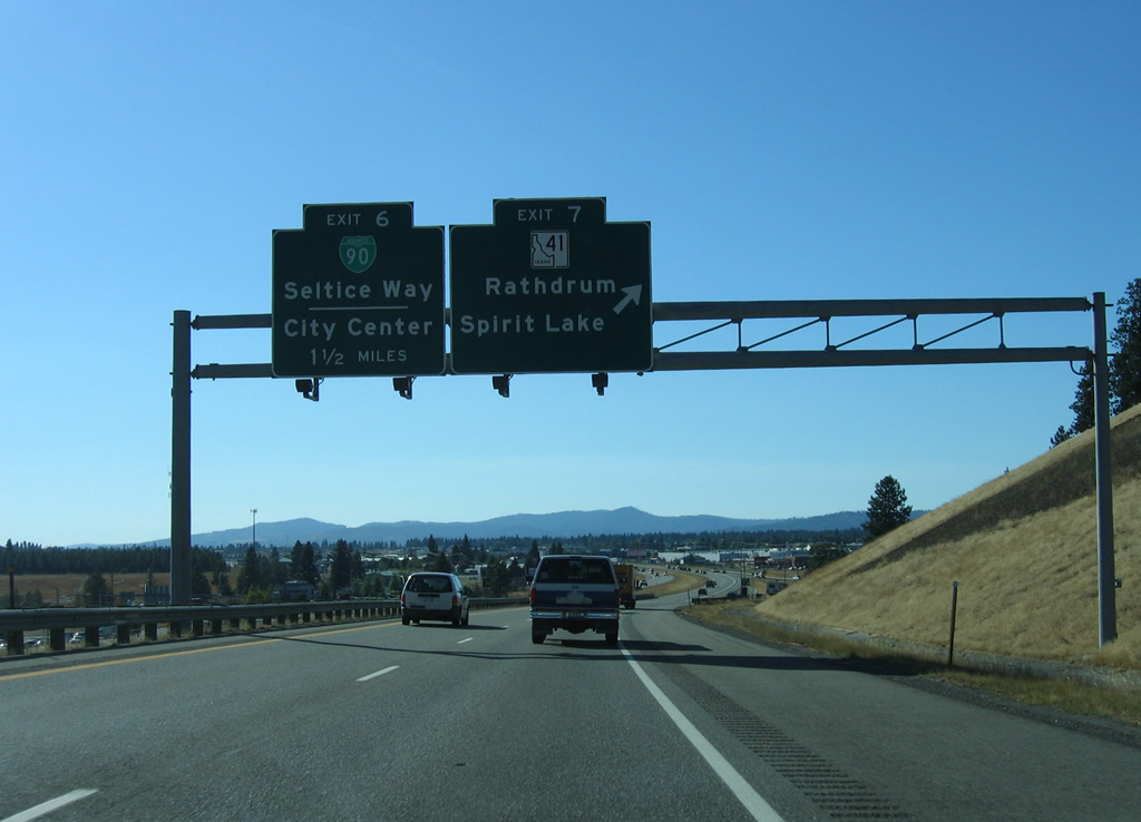
| 15,000 vehicles per day (vpd) were recorded on this stretch of Interstate 90 by ITD in 2011. Traffic counts top out at 49,000 vpd between the East Post Falls (Exit 6) and Rathdrum (Exit 7) interchanges. 09/01/06 |
|
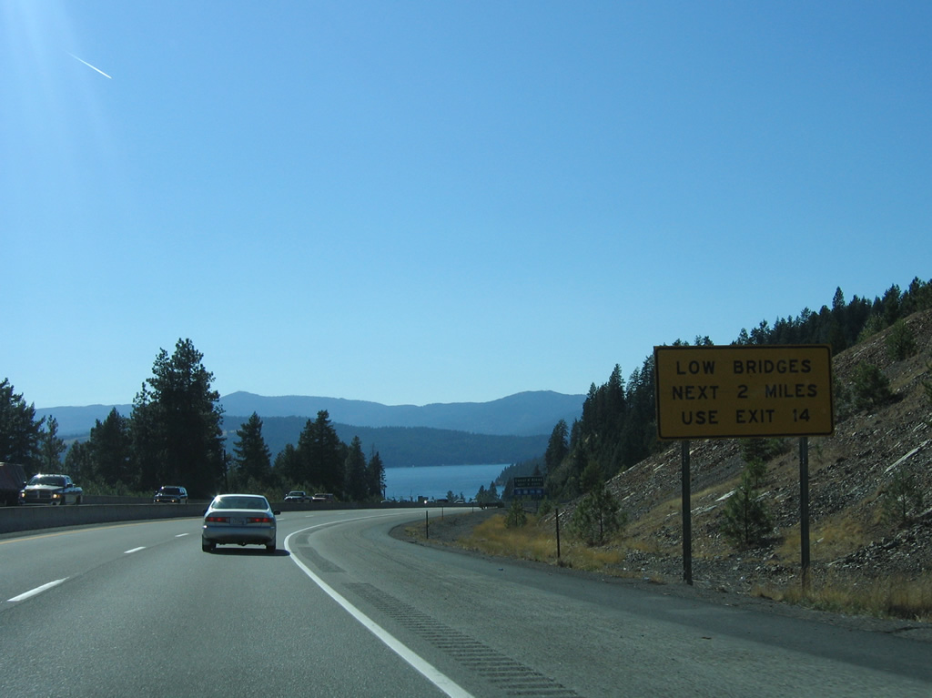
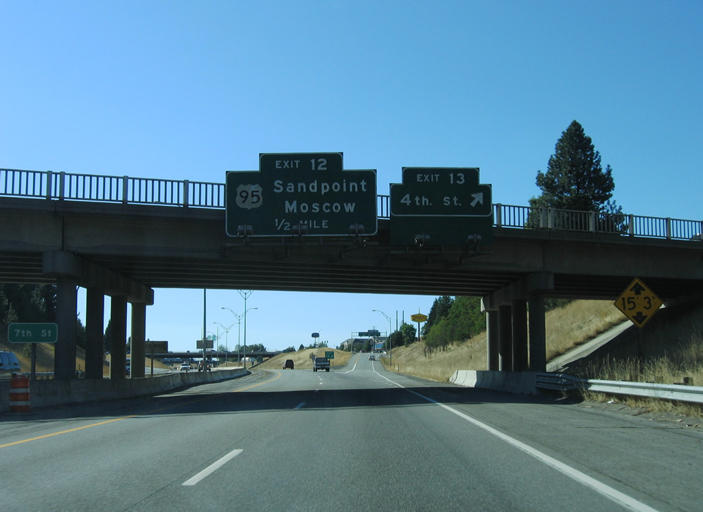
| Truckers were advised to use Exit 14 due to the low clearance at the 5th Street (14 foot 5 inches at the time) and 9th Street (15 foot 3 inches) overpasses. The Ninth Street overpass was struck twice in 2006, which led to the $1.1 million replacement of two spans at the crossing with new steel structures between April 24 and July 18, 2008.4 09/01/06 |
|
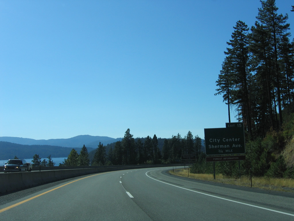
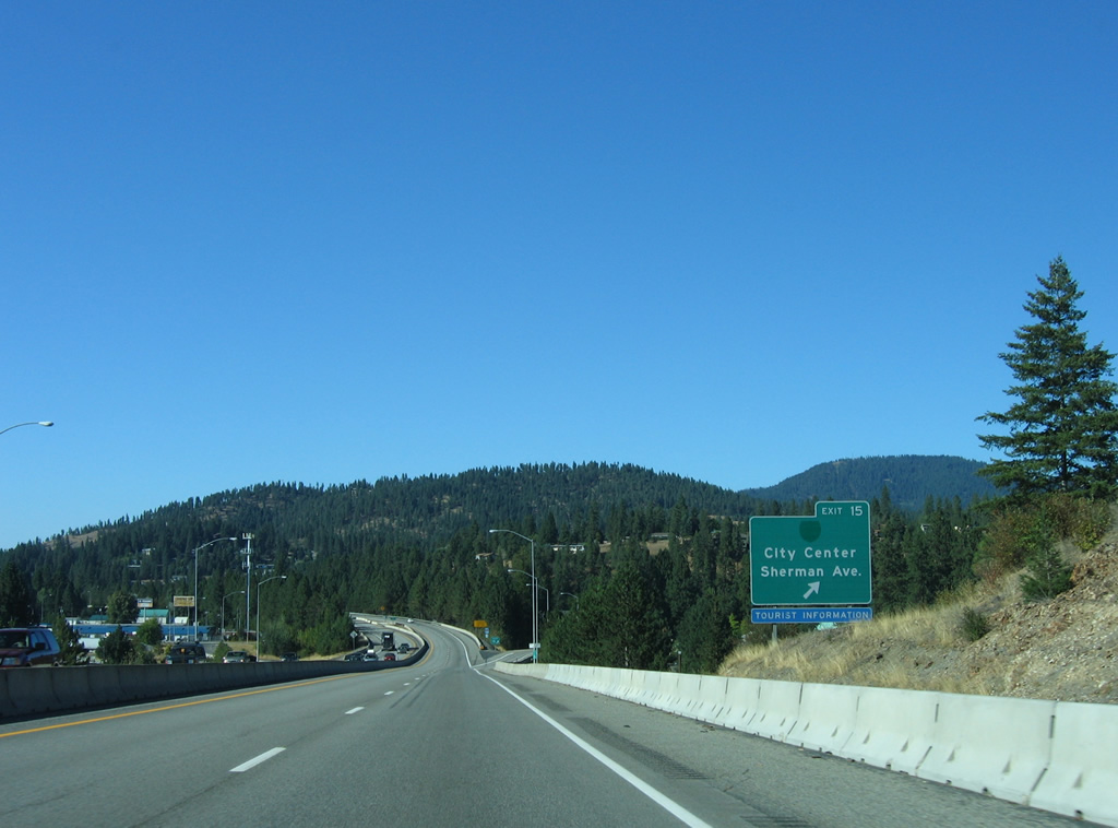
| Five interchanges serve the city of Coeur d'Alene from Interstate 90, starting with Sherman Avenue (Exit 15) in one mile. The freeway encircles the city core along a 1960-completed bypass to Northwest Boulevard. 09/01/06 |
|
| Sherman Avenue west from forthcoming Exit 15 doubled as both U.S. 10 and Business Loop I-90 at one point. Now the road is locally maintained as it joins Interstate 90 with the city center, Lake Coeur d'Alene Recreation Site and North Idaho College. 09/01/06 |
|
| Potlatch Hill Road passes under Interstate 90 as the freeway turns northward ahead of Sherman Avenue. The original lakeside stretch of I-90 transitioned to the original Coeur d'Alene belt route at this location. Construction between 1990 and 1992 rebuilt the Sherman Avenue exit to accommodate the new alignment, which led eastbound traffic detoured through a signalized at-grade intersection with Sherman Avenue for a two-year time period.5 09/01/06 |
|
| Exit 15 parts ways with Interstate 90 west for Sherman Avenue (old Business Loop I-90) west to downtown and east to Fernan Lake. The former business loop followed old U.S. 10 to Northwest Boulevard and I-90 at Exit 11. 09/01/06 |
|
| Still within Exit 15, a westbound reassurance shield preceded an over height detector for trucks exceeding the vertical clearance at 9th Street. The shield is no longer posted as of 2012 and the detector no longer necessary due to the 2008 project that increased the bridge clearance at 9th Street. 09/01/06 |
|
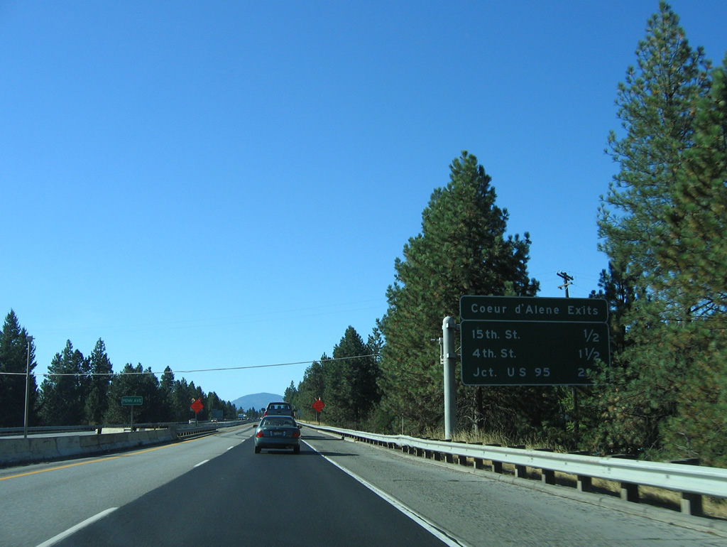
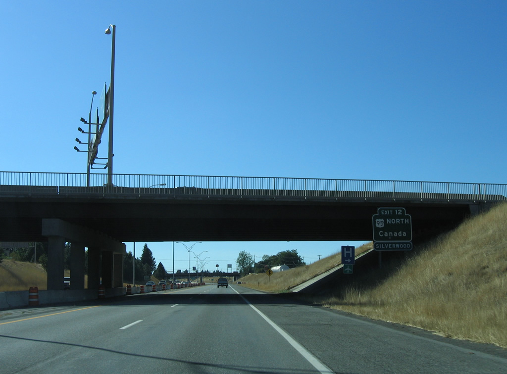
| Angling northwest alongside the Coeur d'Alene street grid, Interstate 90 travelers see an interchange sequence sign for 15th Street (Exit 14), 4th Street (Exit 13) and U.S. 95 (Exit 12). Motorists bound for the Kootenai County Fairgrounds are directed onto U.S. 95 north. 09/01/06 |
|
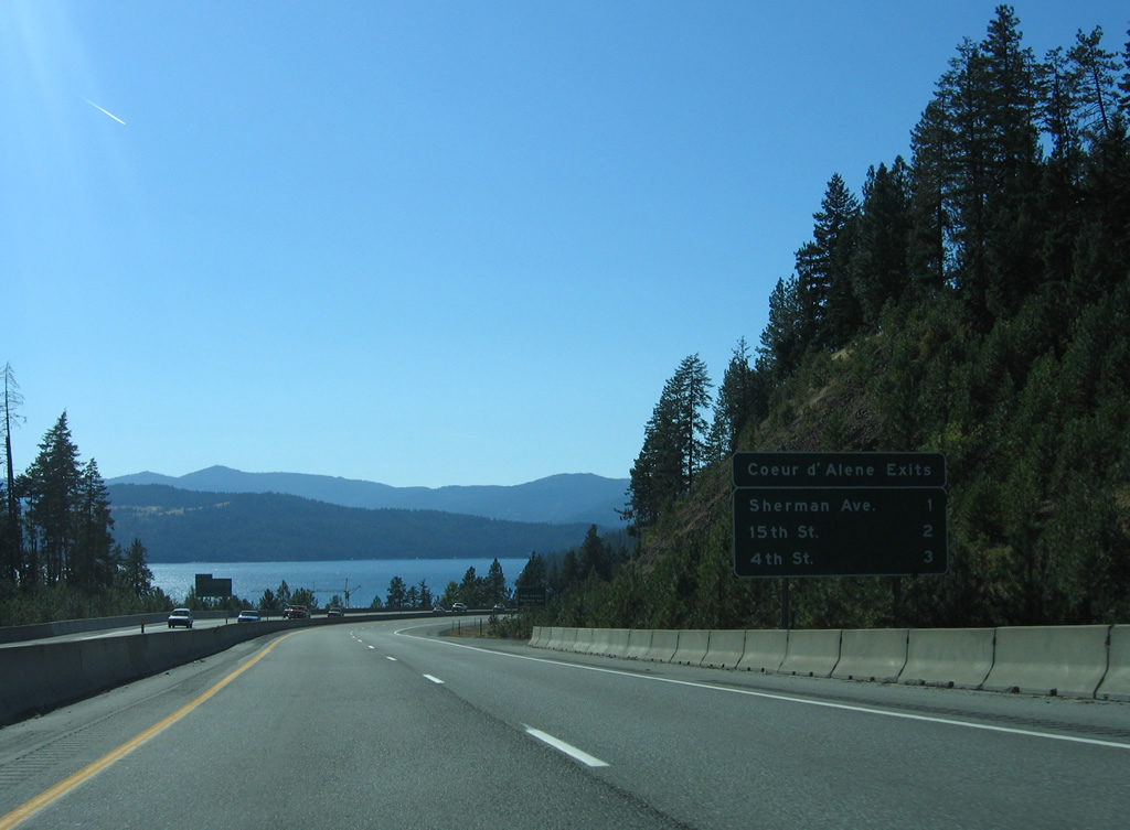
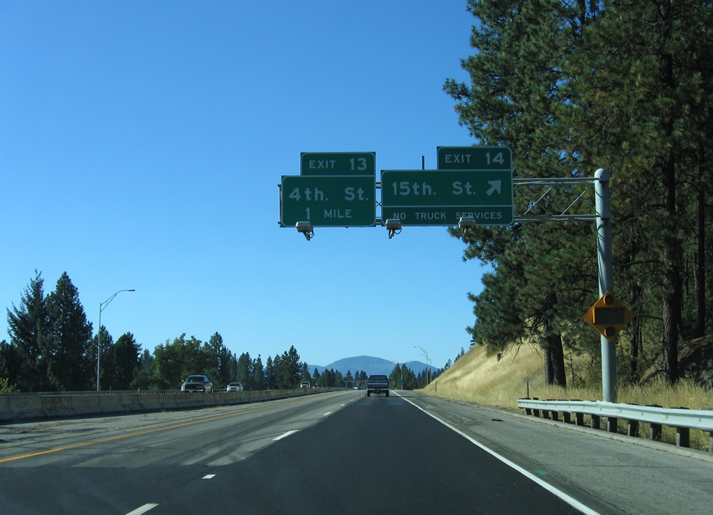
| Interstate 90 west at the Exit 14 ramp departure for 15th Street. 15th Street leads north from the Sanders Beach area to suburban areas to Dalton Gardens and Hayden Lake. 09/01/06 |
|
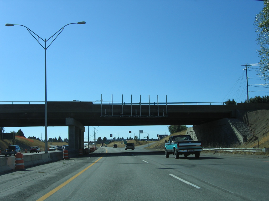
| 4th Street crosses paths with Interstate 90 at a diamond interchange (Exit 13) in one quarter mile. U.S. 95 also sees a diamond interchange with the freeway. 09/01/06 |
|
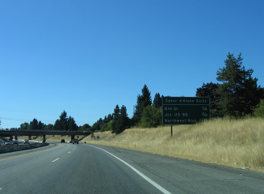
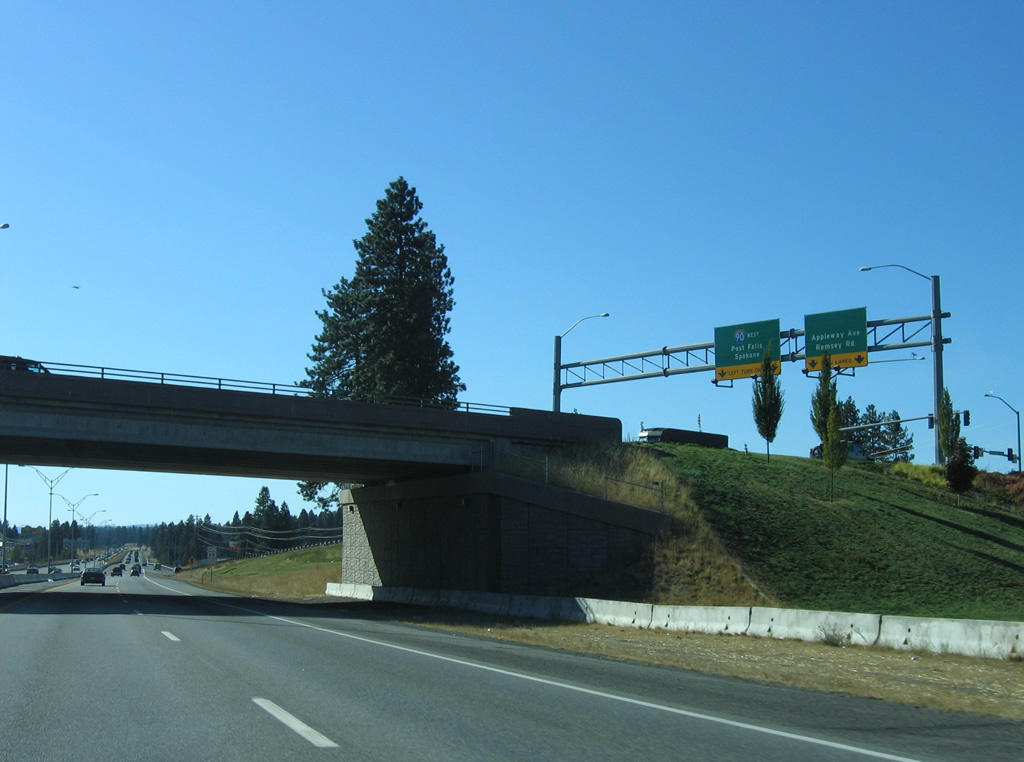
| 4th Street forms a one way couplet with 3rd Street from Interstate 90 south into the city center. Northward the street serves a commercial area stretching westward along Appleway Avenue to Ramsey Road.
Exit 12 follows in quick succession for U.S. 95 north to Sandpoint and south to Moscow. 09/01/06 |
|
| Exit 11 ascends to meet 4th Street as Interstate 90 mainline drivers pass by a reassurance marker. 09/01/06 |
|
| U.S. 95 travels 107 miles north from Coeur D'alene to the Canadian border between Eastport and Kingsgate, British Columbia. 09/01/06 |
|
| Signs for Exits 12 and 11 were missing at the Government Way overpass at the time of this photo. Exit 12 leaves beyond the over crossing for U.S. 95. The US route constitutes a busy commercial arterial north through Dalton Gardens and Hayden before turning eastward from Garwood to Sagle along a 31.5 mile stretch being upgraded to limited access standards. Southward the route follows Lincoln Way to Walnut Avenue, where U.S. 95 turns west to Blackwell Island. 09/01/06 |
|
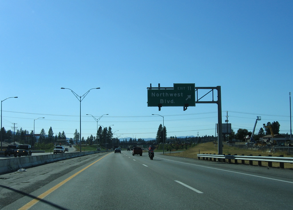
| Northwest Boulevard links the city center with North Idaho College, Lewis-Clark State College and the University of Idaho en route to a diamond interchange (Exit 11) with Interstate 90. The former alignment of both U.S. 10 and Business Loop I-90 ties directly into Ramsay Road, a suburban road leading to Coeur d'Alene Airport (COE). 09/01/06 |
|
| A new seven-lane overpass was constructed for Northwest Boulevard as part of a $9.8 million overhaul of Exit 11 in 2001 that included the relocation of Appleway Avenue northward to intersect Ramsay Road away from the ramps with Interstate 90.6 The original westbound off-ramp connected with Appleway Avenue ahead of Ramsay Road, with a loop ramp providing westbound access from the end of Northwest Boulevard. 09/01/06 |
|
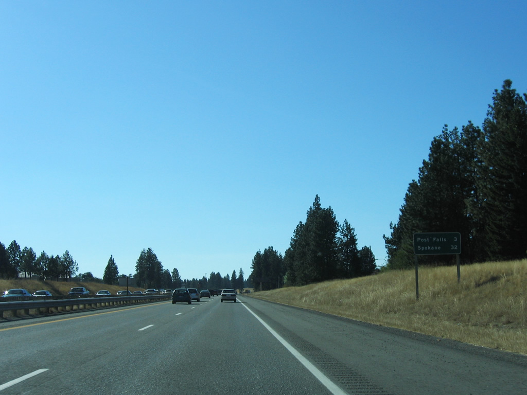
| The city of Post Falls (population 27,572 per the 2010 census) is the final city along Interstate 90 west in three miles. Spokane is now 32 miles away. 09/01/06 |
|
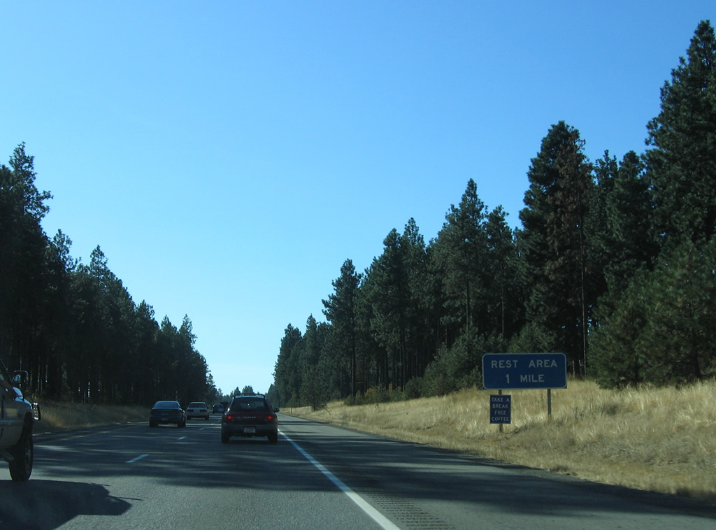
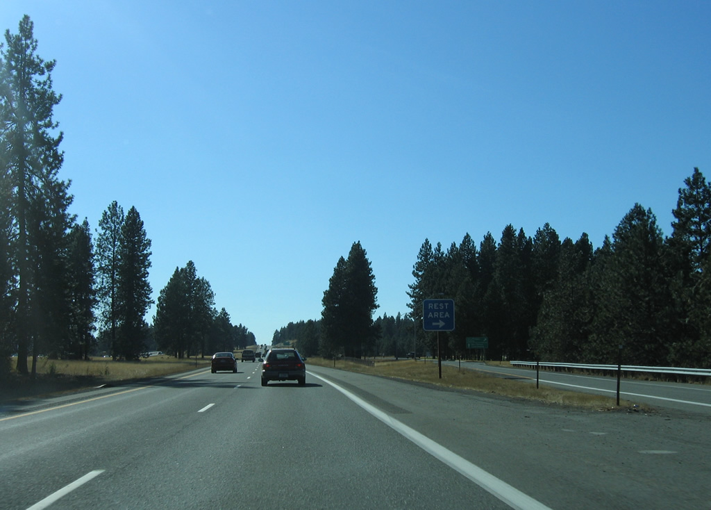
| The Huetter Rest Area is the lone rest area of Interstate 90 in the state of Idaho. Separate facilities reside in each direction above parallel Seltice Way (former U.S. 10) to the south and a remaining agricultural area to the north. 09/01/06 |
|
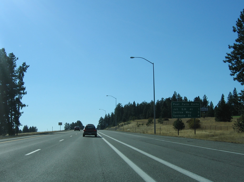
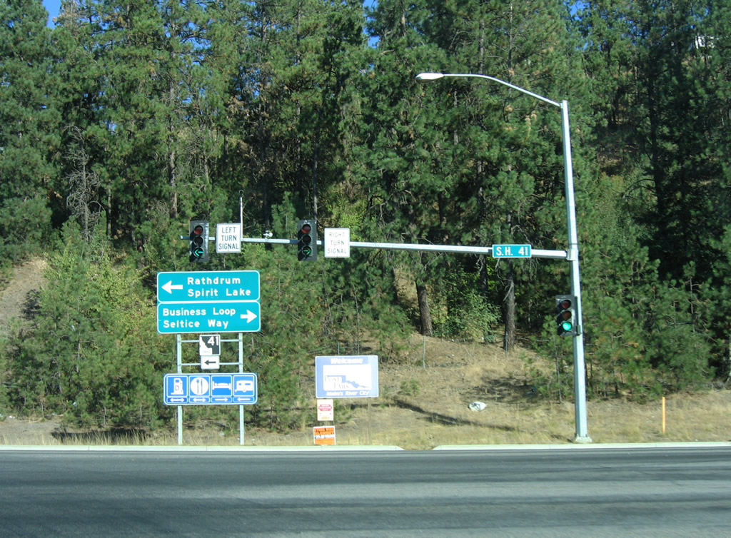
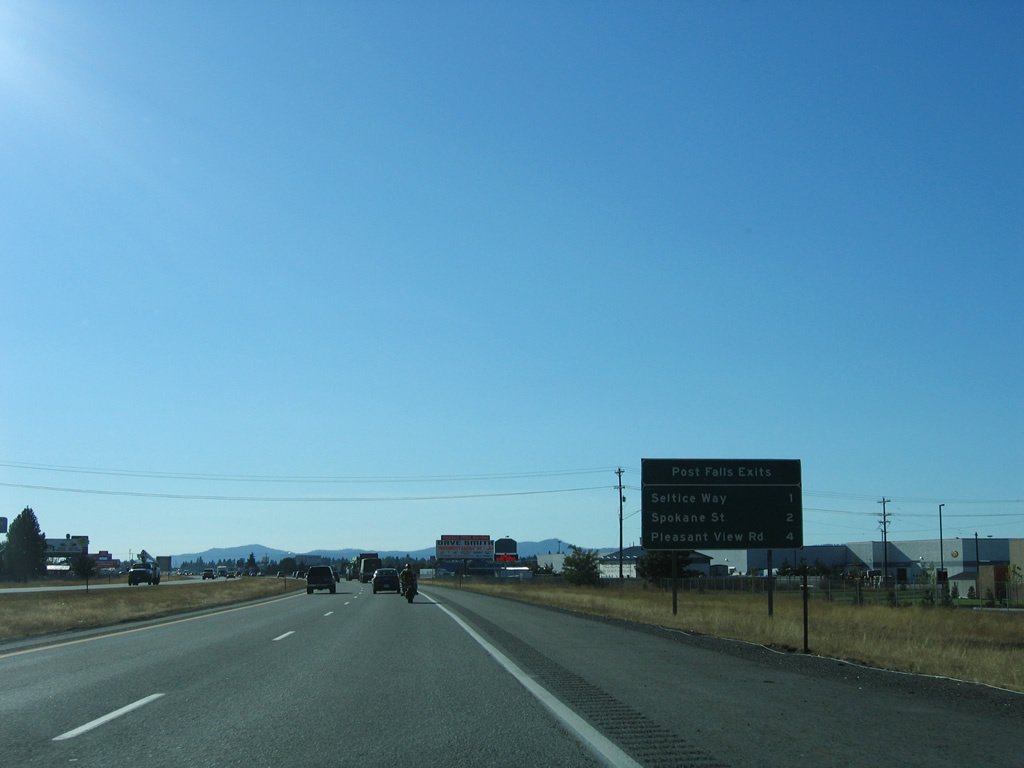
| Three interchanges are found along Interstate 90 within the next four miles for Post Falls, starting with Exit 7 at SH-41. ID-41 begins at the intersection of Ross Point Road and Seltice Way on the south side of Interstate 90. The state route connects Post Falls with Rathdrum (ID-53), 7.7 miles to the north. 09/01/06 |
|
| A reassurance marker follows the rest area on-ramp near Huetter. 09/01/06 |
|
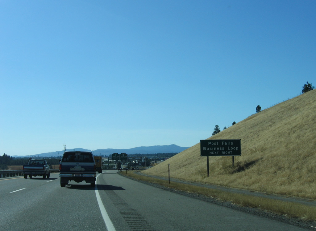
| Interstate 90 enters the Post Falls city limits a half mile out of the Exit 7 parclo interchange with SH-41 (Ross Point Road). The forthcoming exit represents the east end of the Post Falls Business Loop, which follows Seltice Way west from Ross Point Road. 09/01/06 |
|
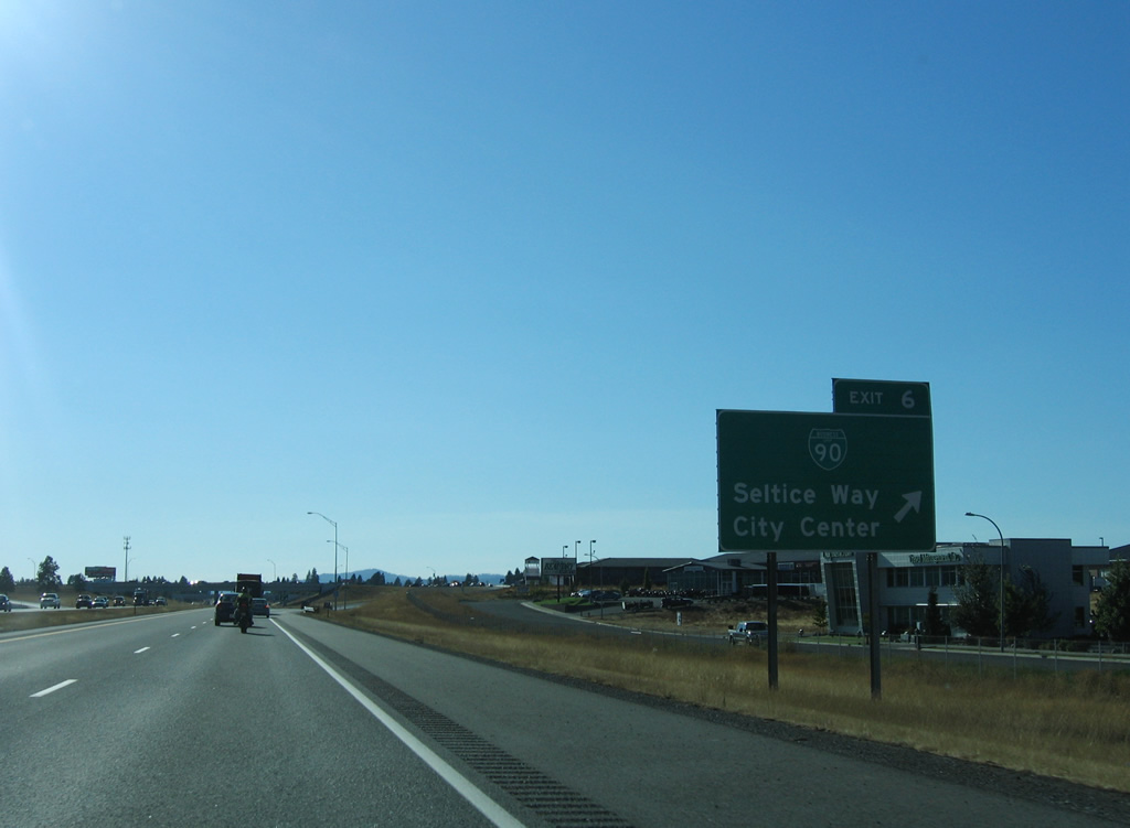
| Exit 7 loops away from Interstate 90 west for SH-41 (Ross Point Road) north. Business I-90 begins a 1.11 mile loop through Post Falls in 1.5 miles at Exit 6. 09/01/06 |
|
| SH-41 totals 39.06 miles overall between Post falls and U.S. 2 at Oldtown. The state route joins Post Falls with Rathdrum and Spirit Lake while Ross Point Road south to Seltice Way connects I-90 with a number of subdivisions north of the Spokane River. 09/01/06 |
|
| Interstate 90 remains within the city of Post Falls to new Exit 1, which opened on November 22, 2012. Seltice Way (former U.S. 10) switches sides with the freeway at the upcoming half diamond interchange of Exit 6. 09/01/06 |
|
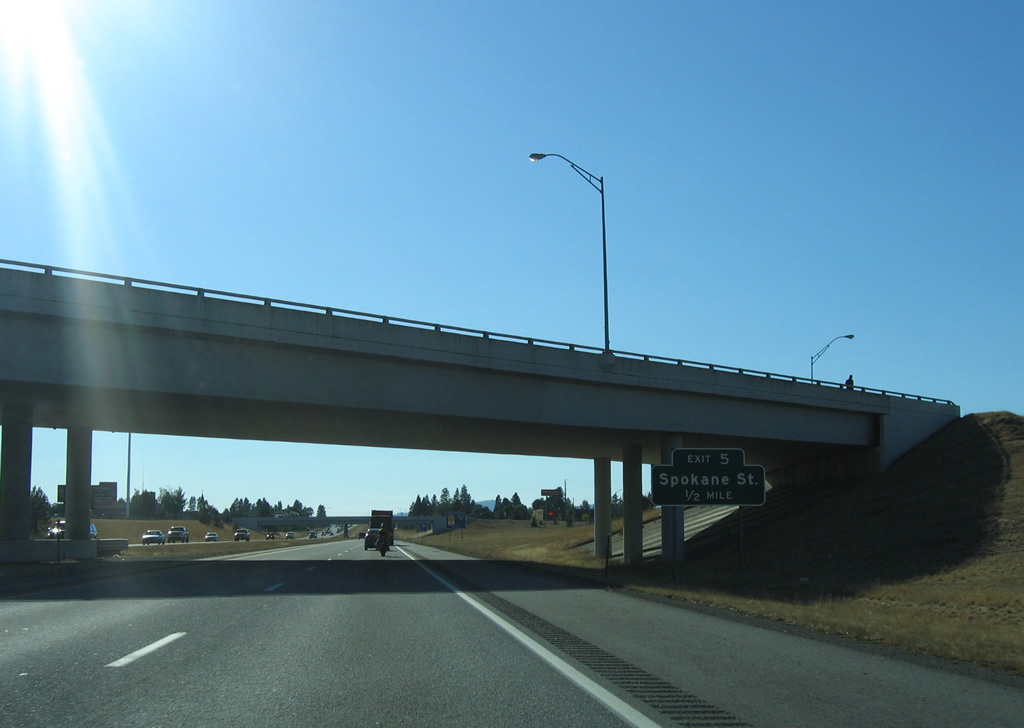
| Business Loop I-90 follows Seltice Way west to the Post Falls city center, returning southward to I-90 via Spokane Street to Exit 5. 09/01/06 |
|
| A diamond interchange follows in one half mile for Spokane Street north to the city center and south across the Spokane River to Blossom Mountain (elevation 4,377 feet). 09/01/06 |
|
| Ramps along the east side of Spokane Street, including the Exit 5 off-ramp, were added to Interstate 90 in 1988. Use Exit 5 for the Treaty Rock historical site. 09/01/06 |
|
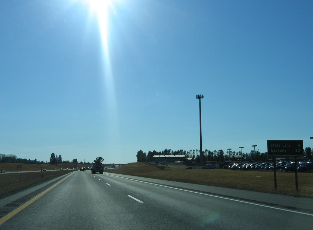
| Four miles of Interstate 90 remain within the Gem State. Commuting traffic adds to the counts along the freeway leading west another 22 miles into the Spokane city center. 09/01/06 |
|
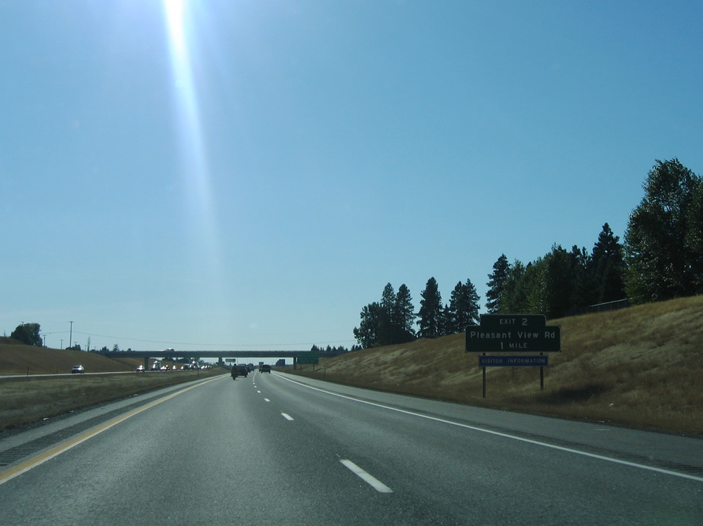
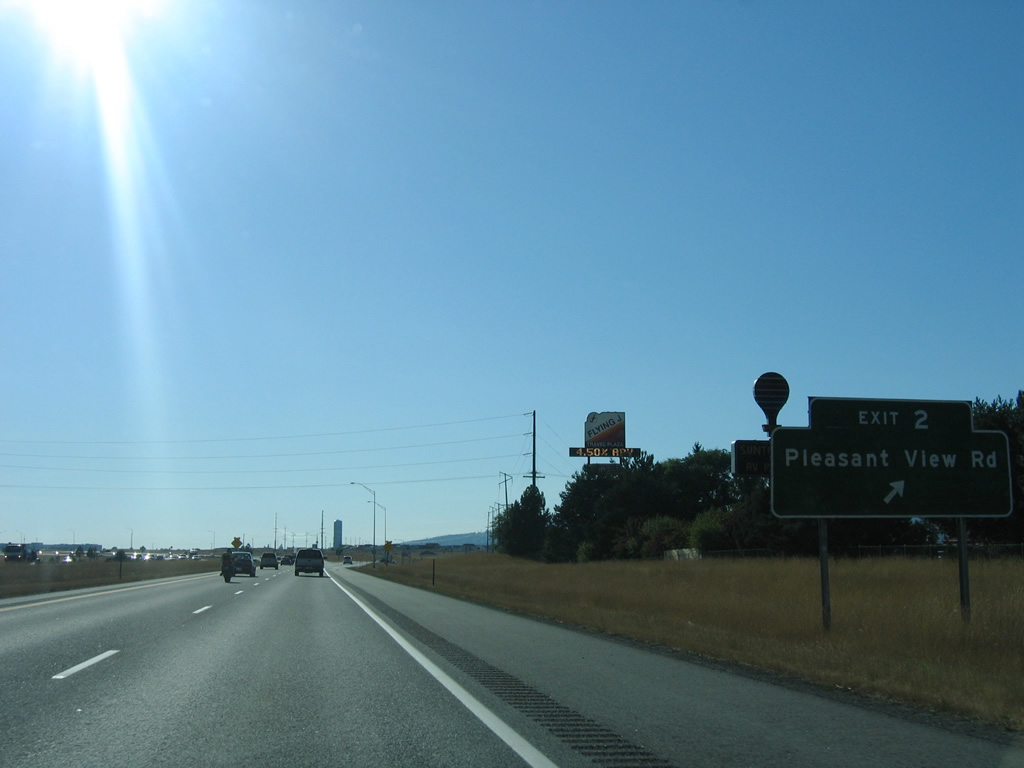
| Pleasant View Road meets Interstate 90 at a diamond interchange (Exit 2) in one mile. The exit serves the adjacent University of Idaho Research Park and Greyhound Park and Event Center. 09/01/06 |
|
| Pleasant View Road leads south from Exit 2 to the Spokane River and three miles north across Rathdrum Prairie to SH-53. The road used to span the Spokane southward to Riverview Drive at Pleasant View. 09/01/06 |
|
| What was the last mainline state-named shield posted for Interstate 90 within Idaho. This shield precedes the new diamond interchange with Point Parkway west and Beck Road north. That exit opened to serve new retail development between I-90 and Seltice Way (former U.S. 10) on November 22, 2012. 09/01/06 |
|
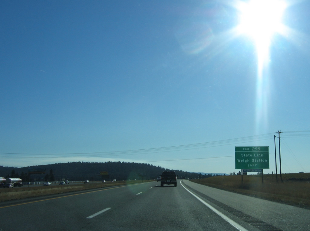
| The one mile guide sign for Exit 299 was posted where the new Exit 1 on-ramp is now located. The first Evergreen State interchange joins Interstate 90 with Spokane Bridge Road, which connects with Appleway Avenue west to Liberty Lake and Appleway Lane east to State Line, Idaho. 09/01/06 |
Page Updated 07-10-2013.

 West
West