|
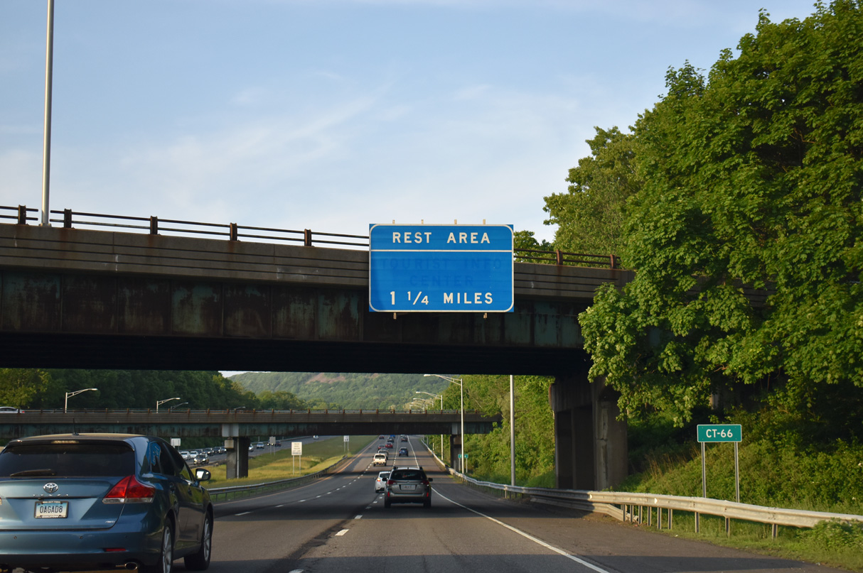
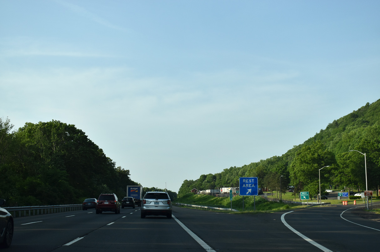
| Interstate 91 advances 1.25 miles from the exchange with I-691/Route 66 (Exit 18) to the Middletown Rest Area. 05/30/22 |
|
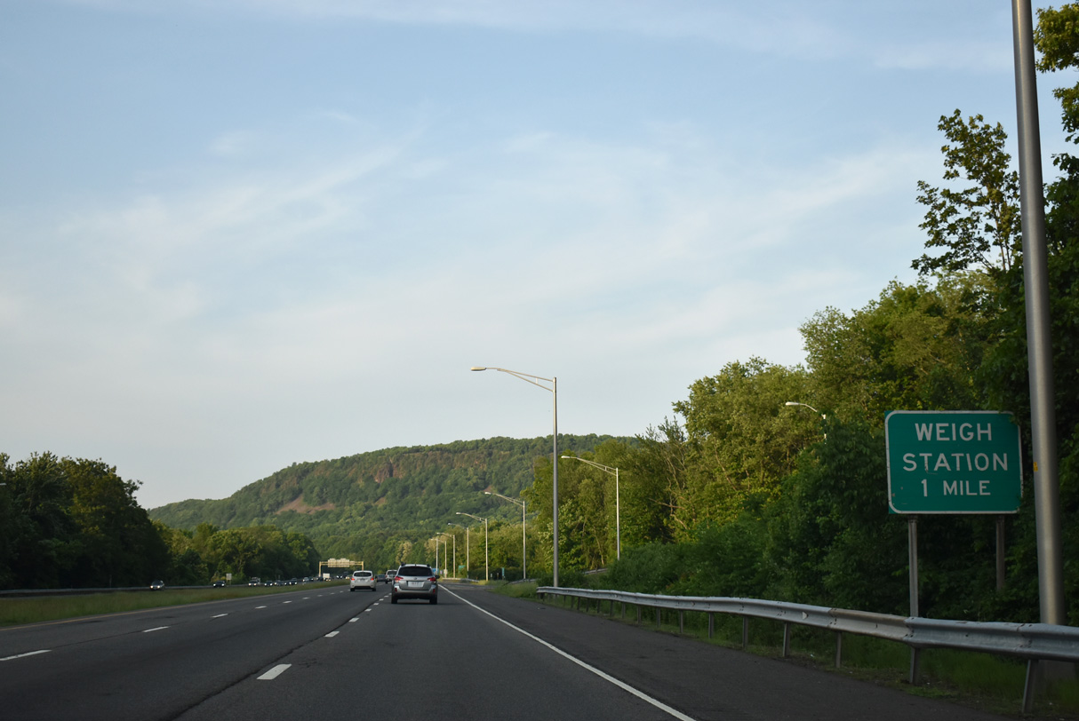
| The Middletown Rest Area doubles as a weigh station for northbound commercial traffic along I-91. 05/30/22 |
|
| This confirming marker precedes the Baldwin Avenue over crossing along I-91 north. Baldwin Avenue joins I-91 southbound at a half diamond interchange (Exit 19). 05/30/22 |
|
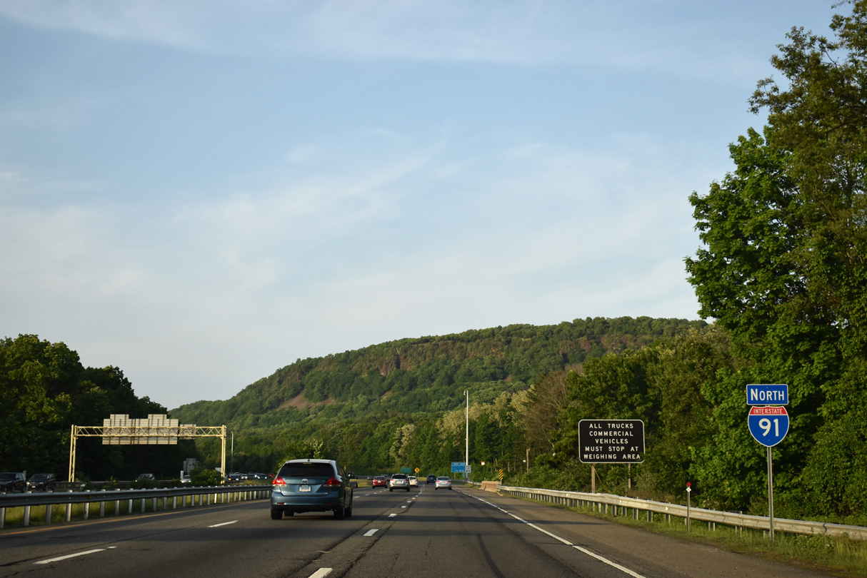
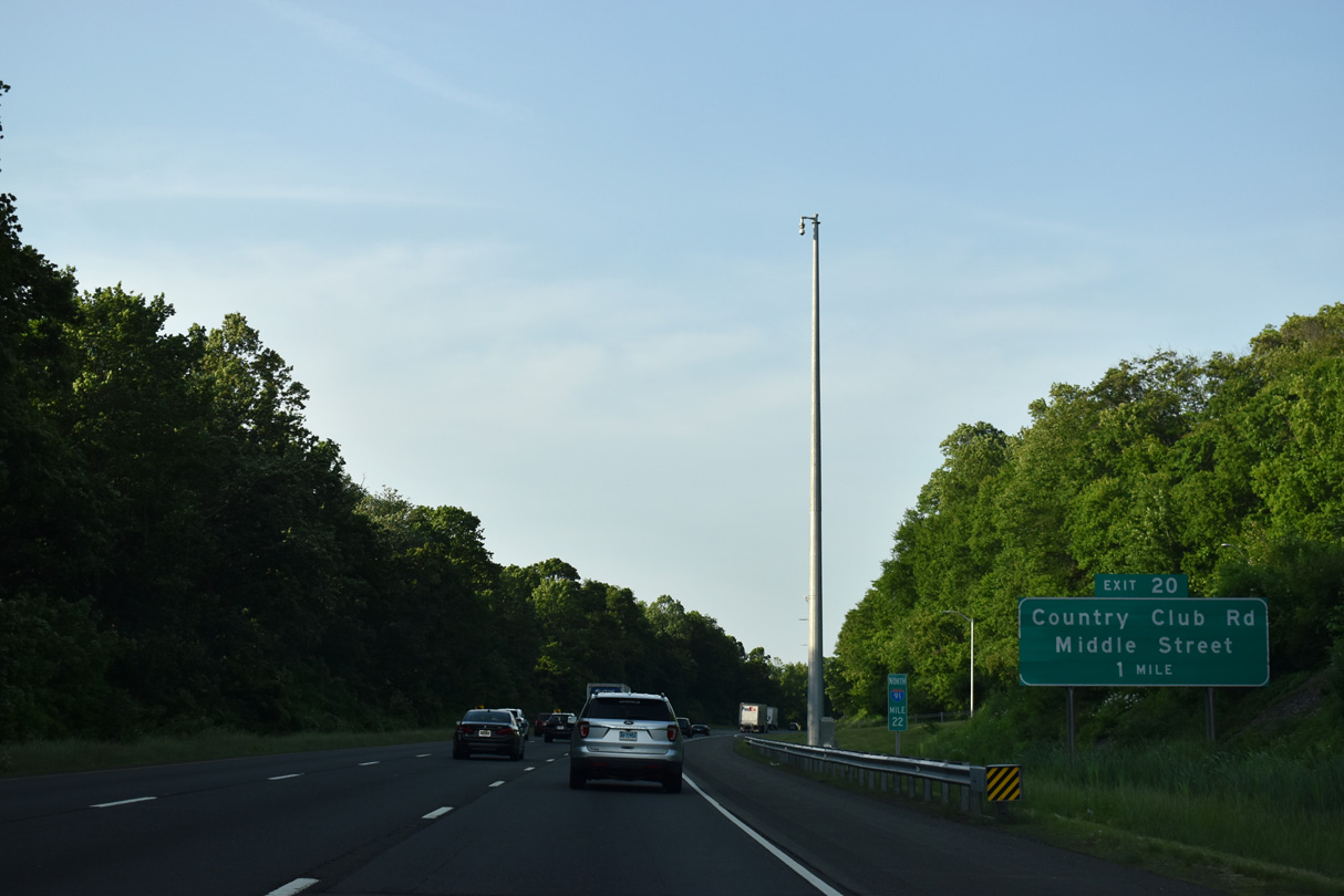
| I-91 crosses the Meriden/Middletown city and Middlesex County lines ahead of Exit 20 while Higby Mountain rises to the east. 05/30/22 |
|
| The Middletown Rest Area is the only facility along I-91 north in the Constitution State. 05/30/22 |
|
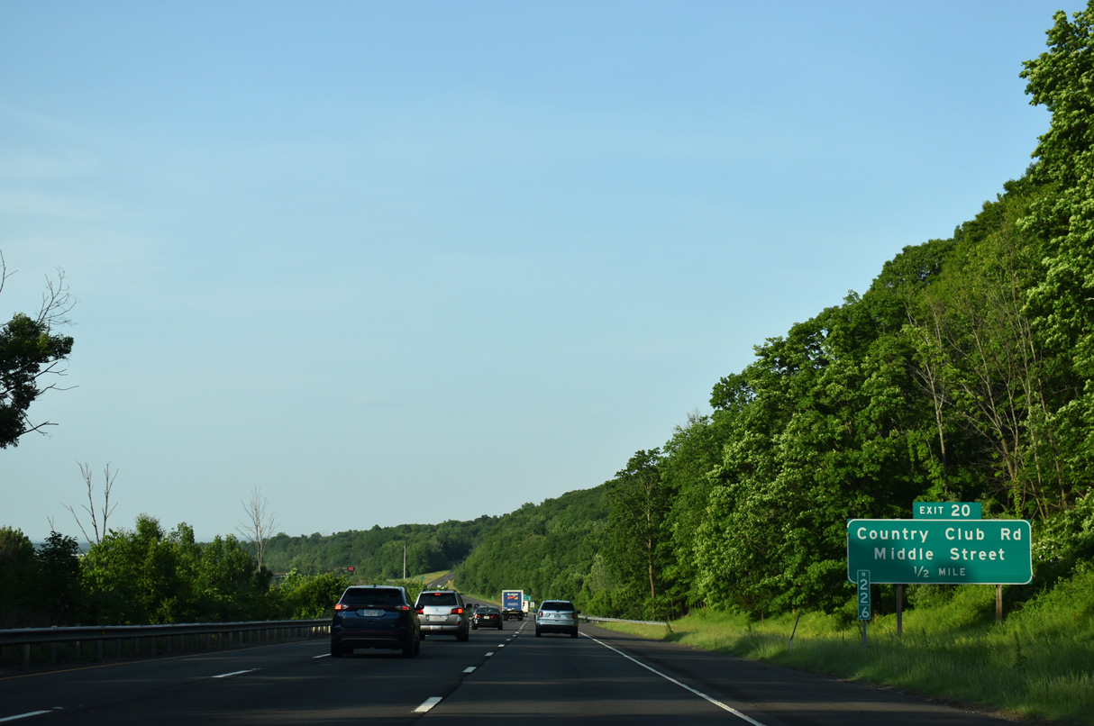
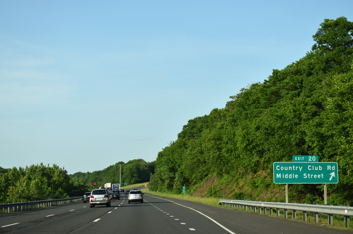
| The first of three exits to Middletown from I-91 is the modified diamond interchange with Country Club Road and Middle Street. 05/30/22 |
|
| Middle Street stems north from Country Club Road along the west side of Interstate 91 to Main Street in East Berlin. 05/30/22 |
|
| Country Club Road extends east from Westfield Road at the Meriden ciry line to Route 217 (Ballfall Road / East Street) at Westfield Street in Middletown. 05/30/22 |
|
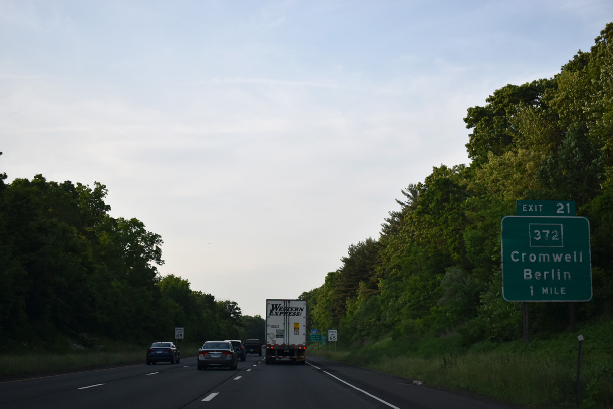
| Interstate 91 advances northeast to Route 372 (Berlin Road) next. 05/30/22 |
|
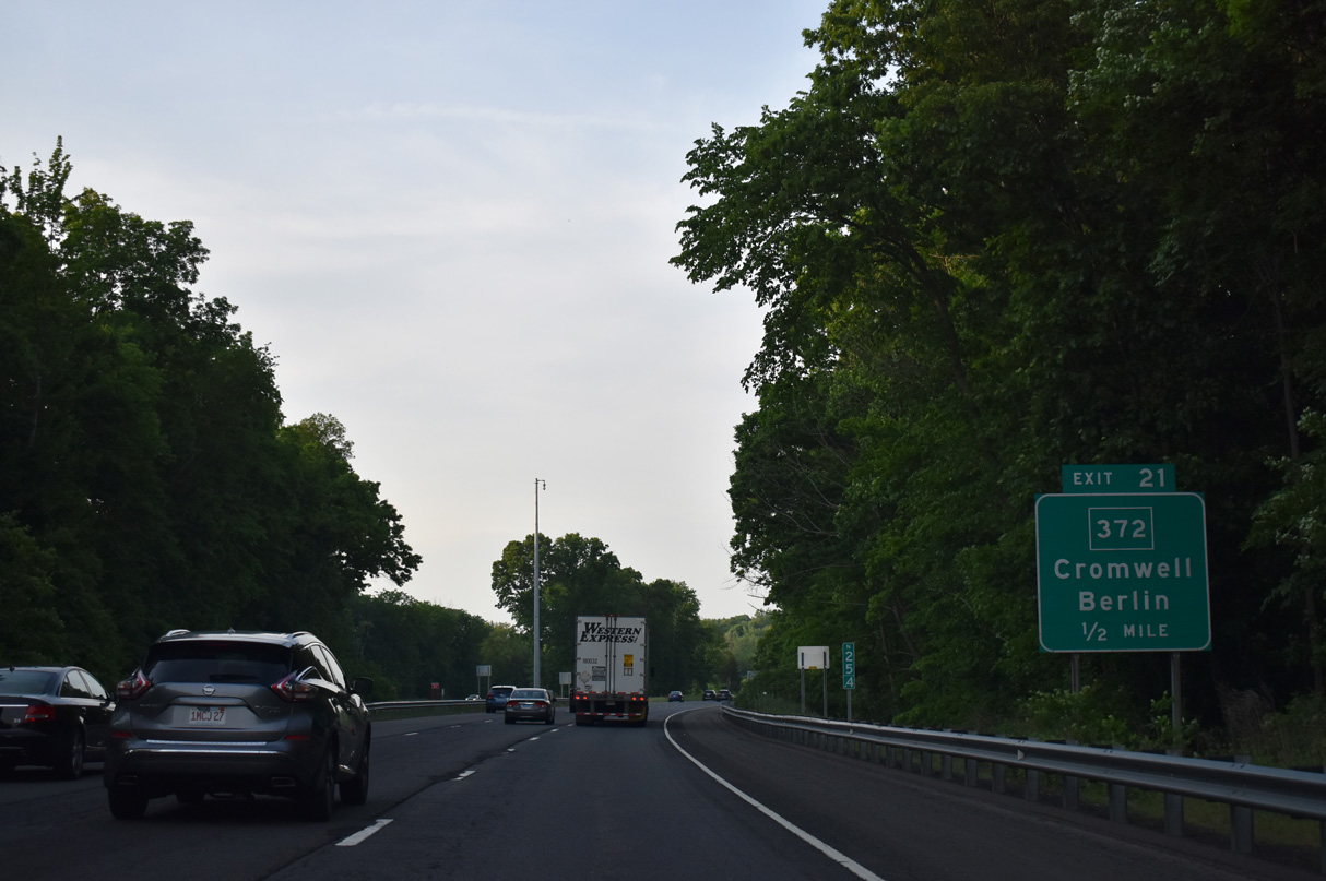
| Route 372 (Berlin Road) meets Interstate 91 next at a folded diamond interchange (Exit 21). Route 372 joins Mill Street in the town of Berlin with the town of Cromwell to the east. 05/30/22 |
|
| Route 372 comprises a 14.95 mile long highway between Route 72 at New Britain eastward to Route 99 (Main Street) at Cromwell. 05/30/22 |
|
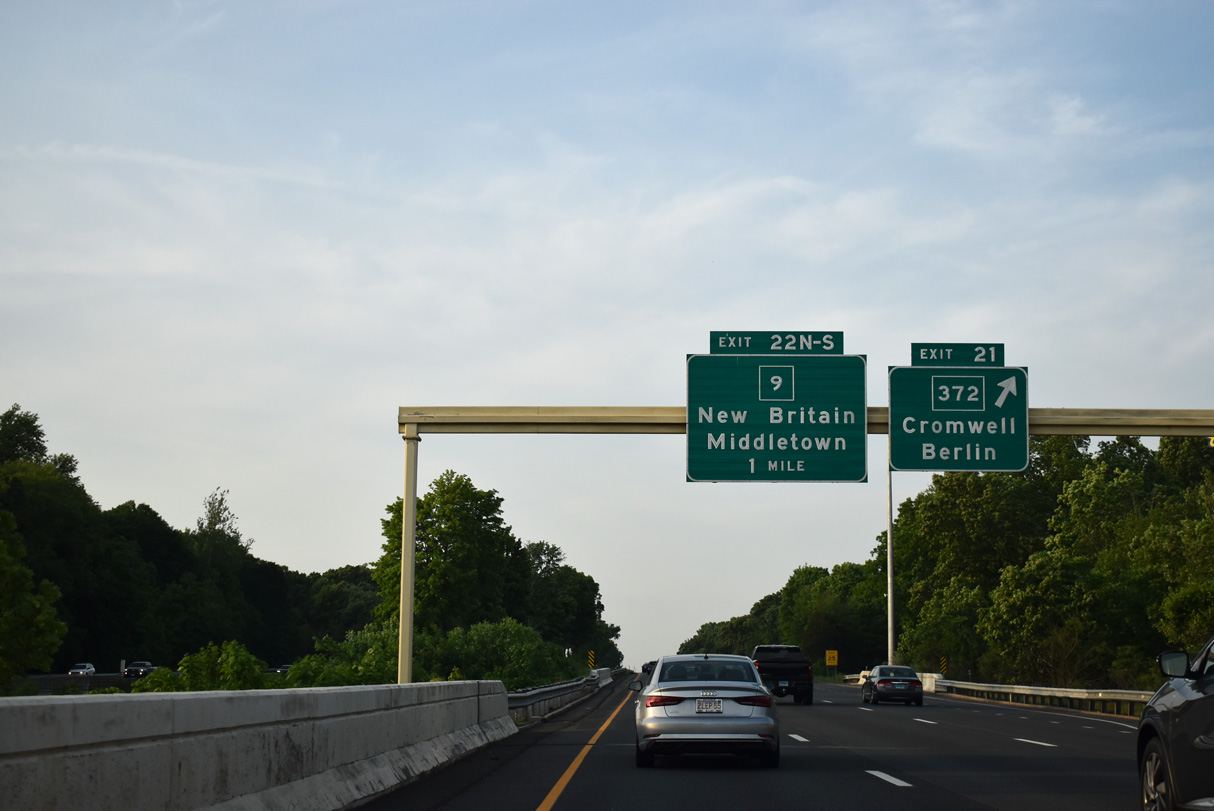
| I-91 spans the Motabesset River ahead of Exit 21 to Route 372 (Berlin Road). Berlin Road intersects both Route 217 (East Street) and Route 3 (Shunpike Road) over the course of 1.4 miles to an interchange with Route 9. 05/30/22 |
|
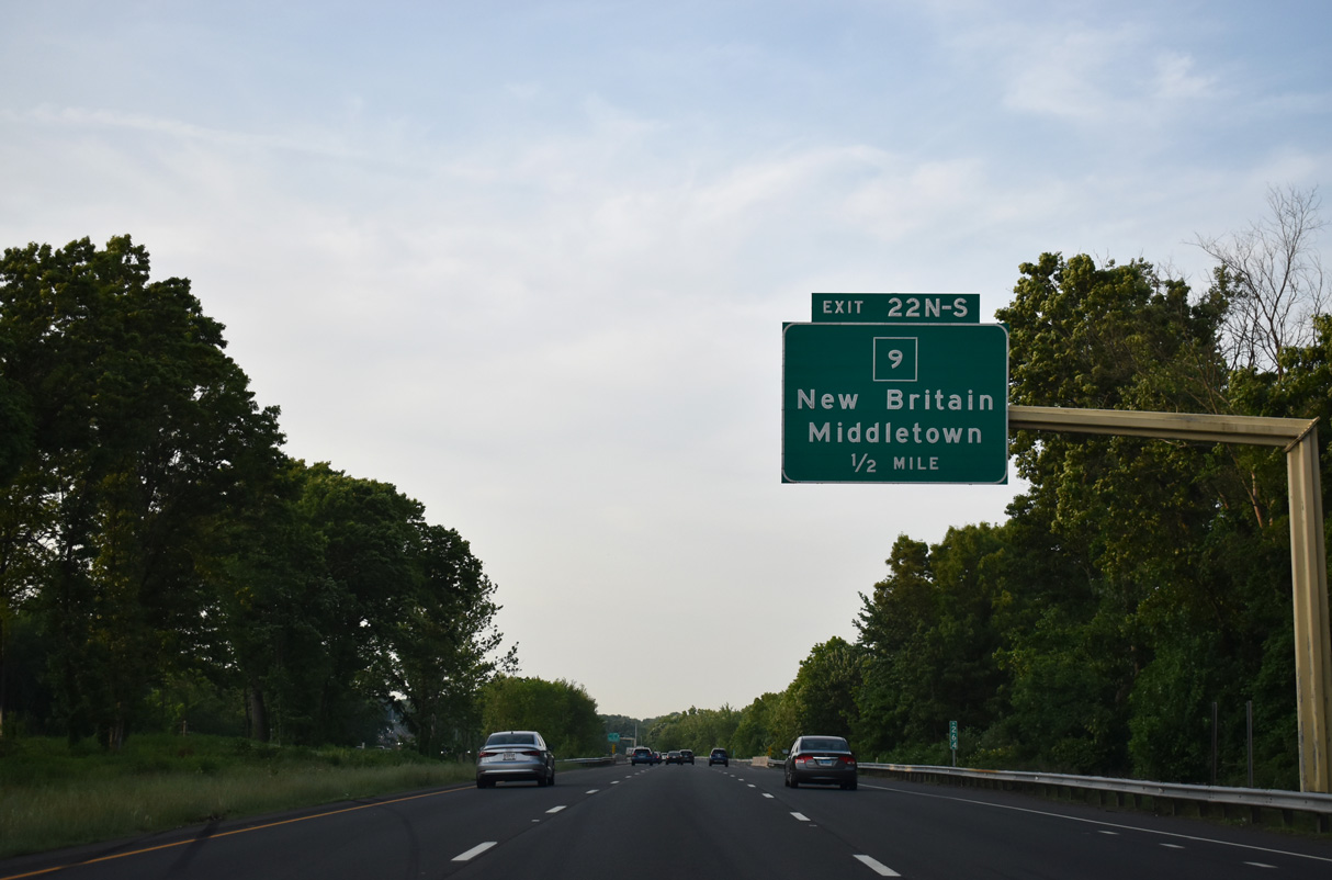
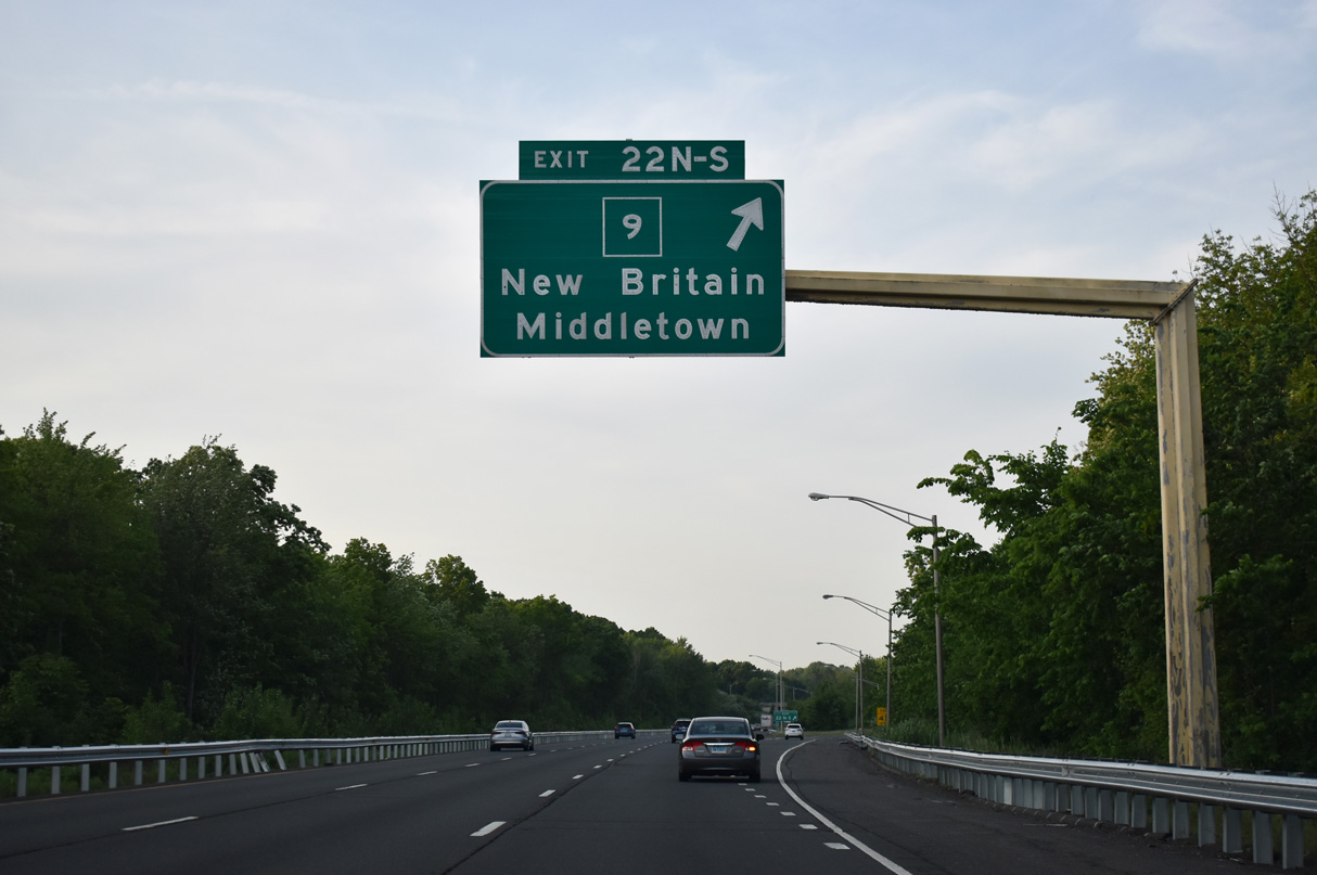
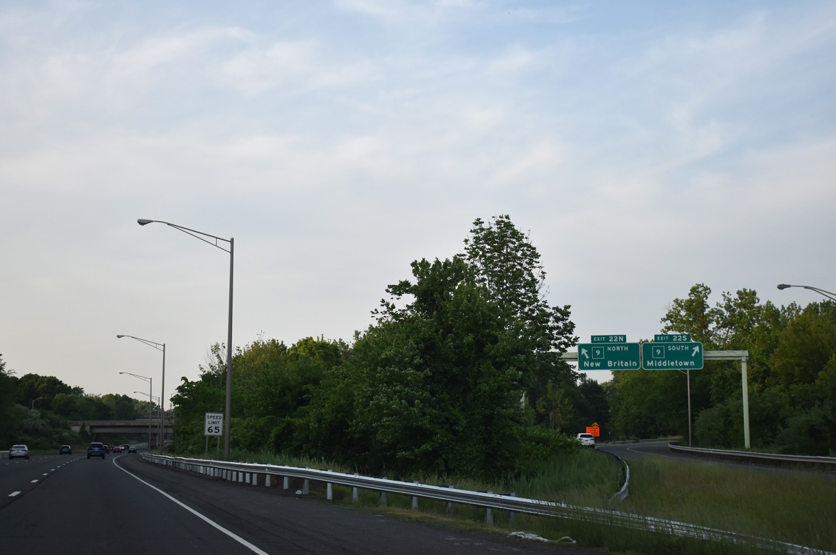
| The freeway along Route 9 meets Interstate 91 at a directional cloverleaf interchange (Exit 22). 40.89 miles in length, Route 9 runs north to I-84/U.S. 6 at West Hartford and south to Interstate 95 at Old Saybrook. 05/30/22 |
|
| Exits 22 N/S depart in unison from I-91 northbound for Route 9 northwest to Berlin, New Britain and West Hartford and south into Downtown Middletown. 05/30/22 |
|
| Route 9 ends 28.7 miles to the south of the multi level exchange with I-91 at Interstate 95 (Connecticut Turnpike). 05/30/22 |
|
| This marker for I-91 precedes the ramp from northbound Route 9. 05/30/22 |
|
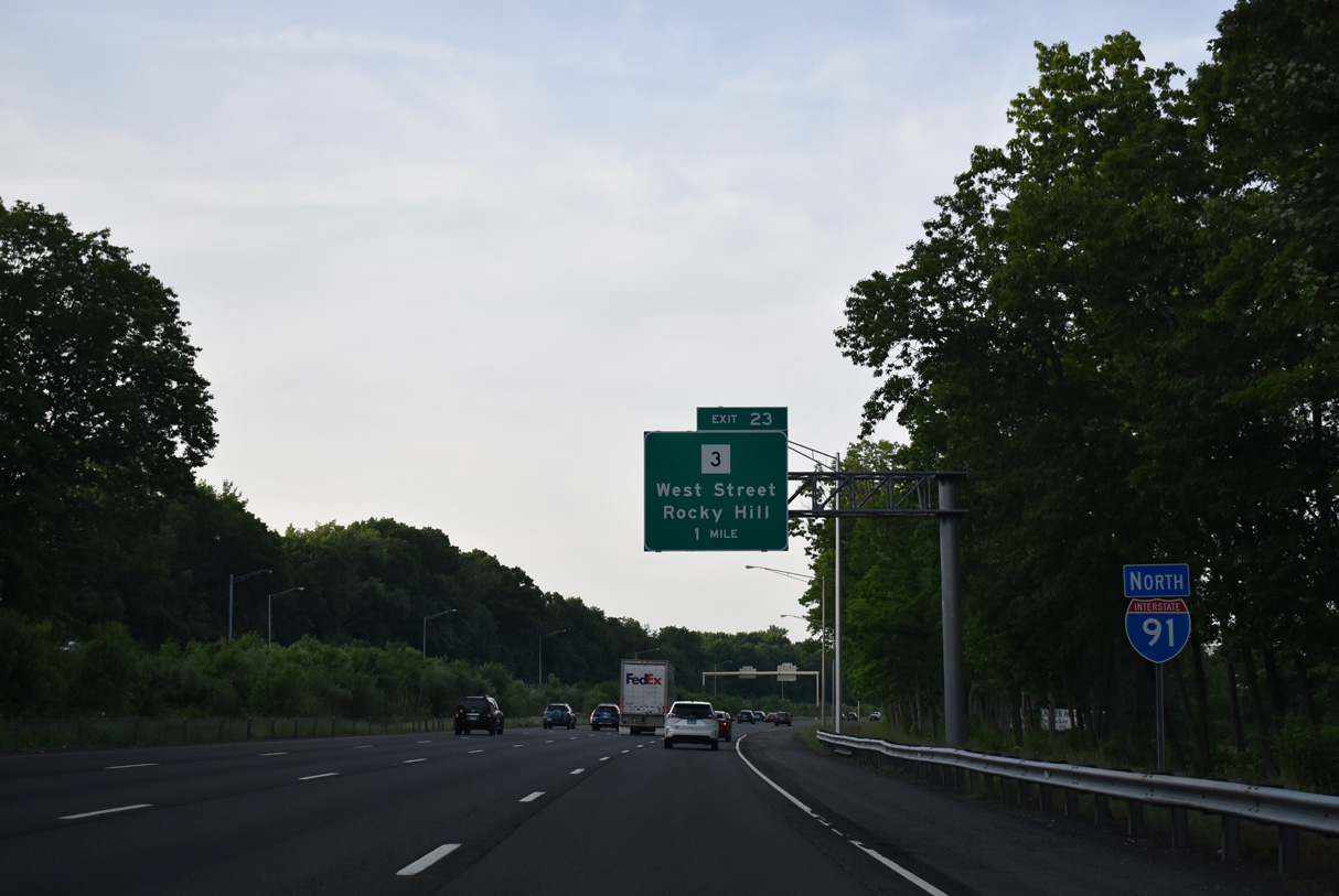
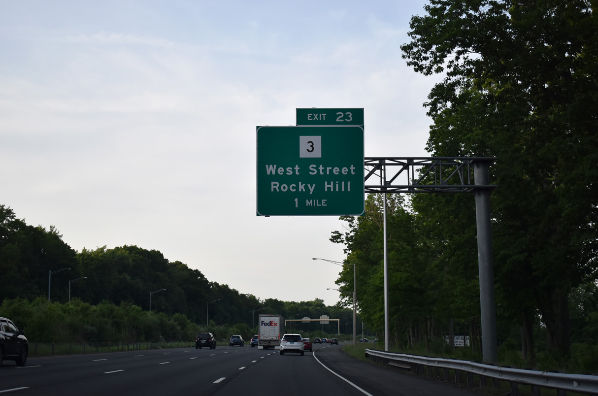
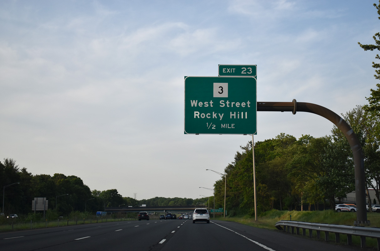
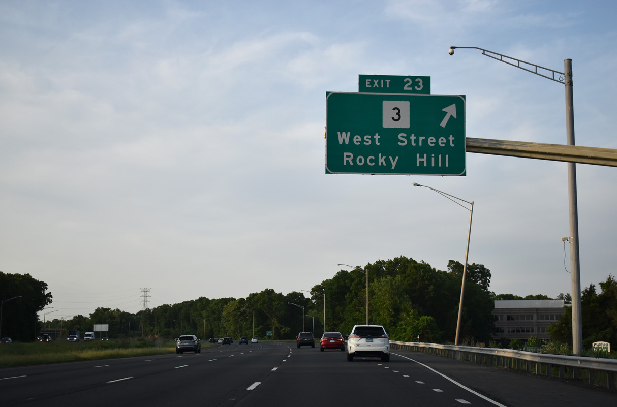
| Interstate 91 enters Hartford County ahead of Route 3 (Cromwell Avenue) and the parclo interchange (Exit 23) with West Street. 05/30/22 |
|
| West Street stems east from Route 3 (Cromwell Avenue) nearby to Route 99 (Main Street) in Rocky Hill. 05/30/22 |
|
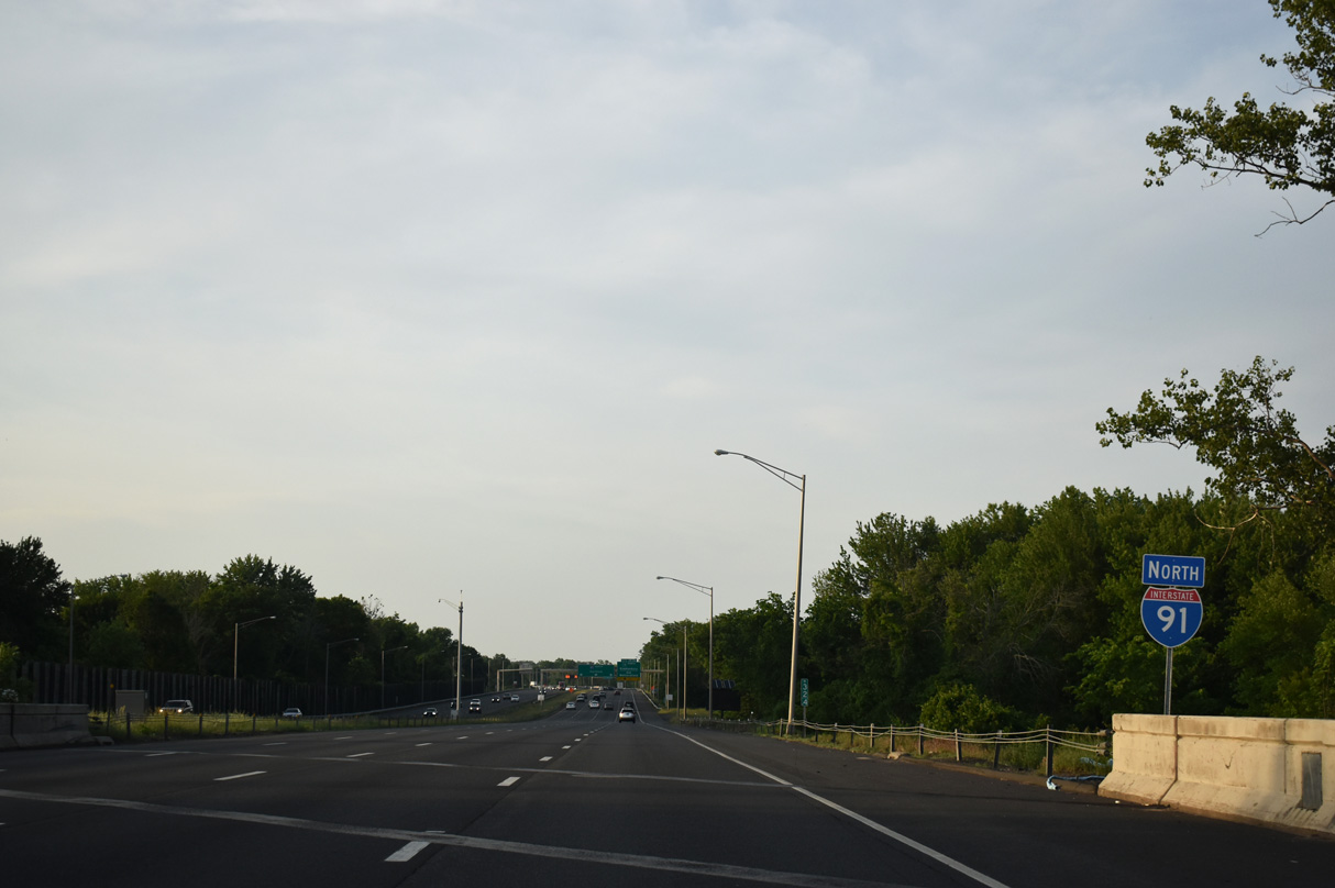
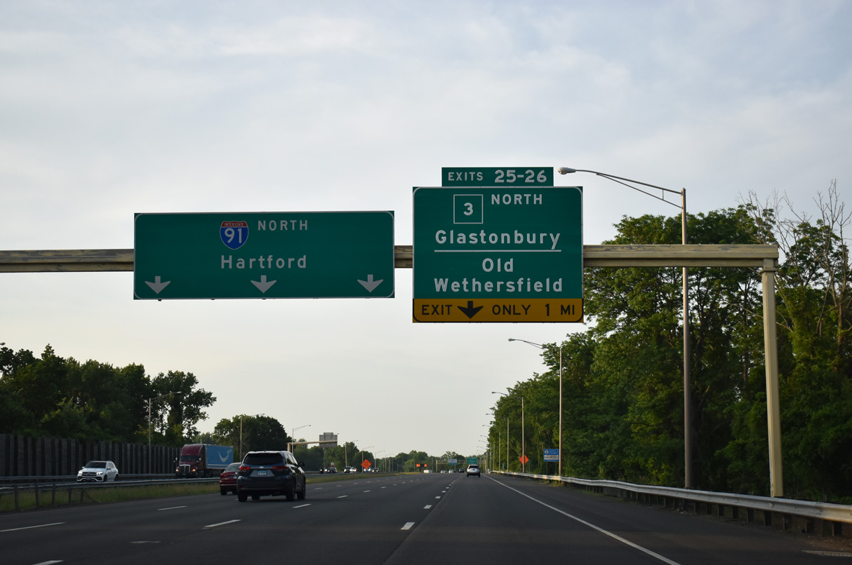
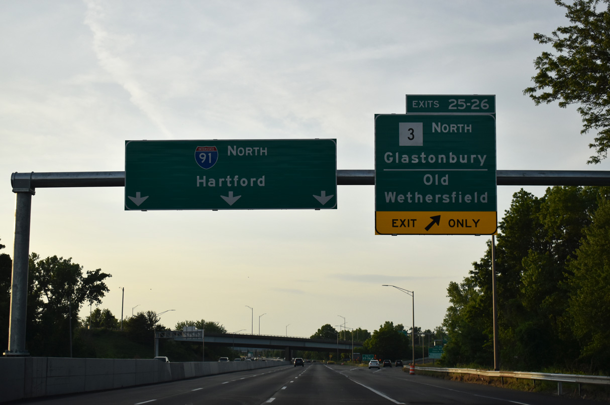
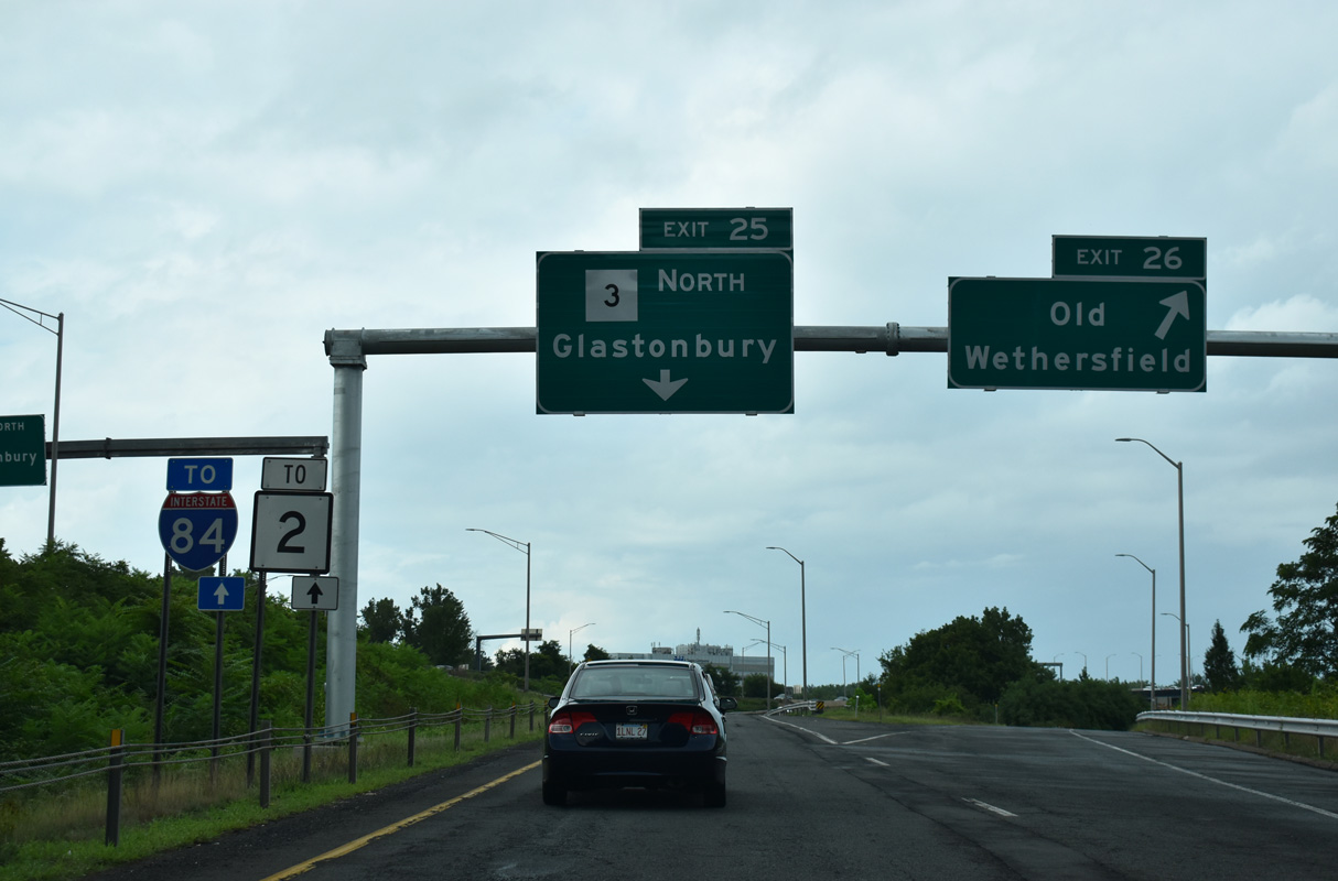
| Route 3 measures 14.48 miles in length between Route 66 in Middletown and Route 2 at Glastonbury. The state route meets Interstate 91 directly at Exit 25. 05/30/22 |
|
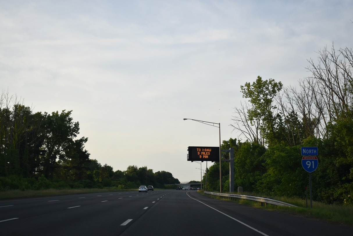
| Interstate 91 meets I-84 west (Left Exit 32 A) to Waterbury and Danbury nine miles ahead near Downtown Hartford. 05/30/22 |
|
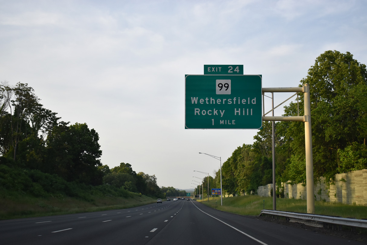
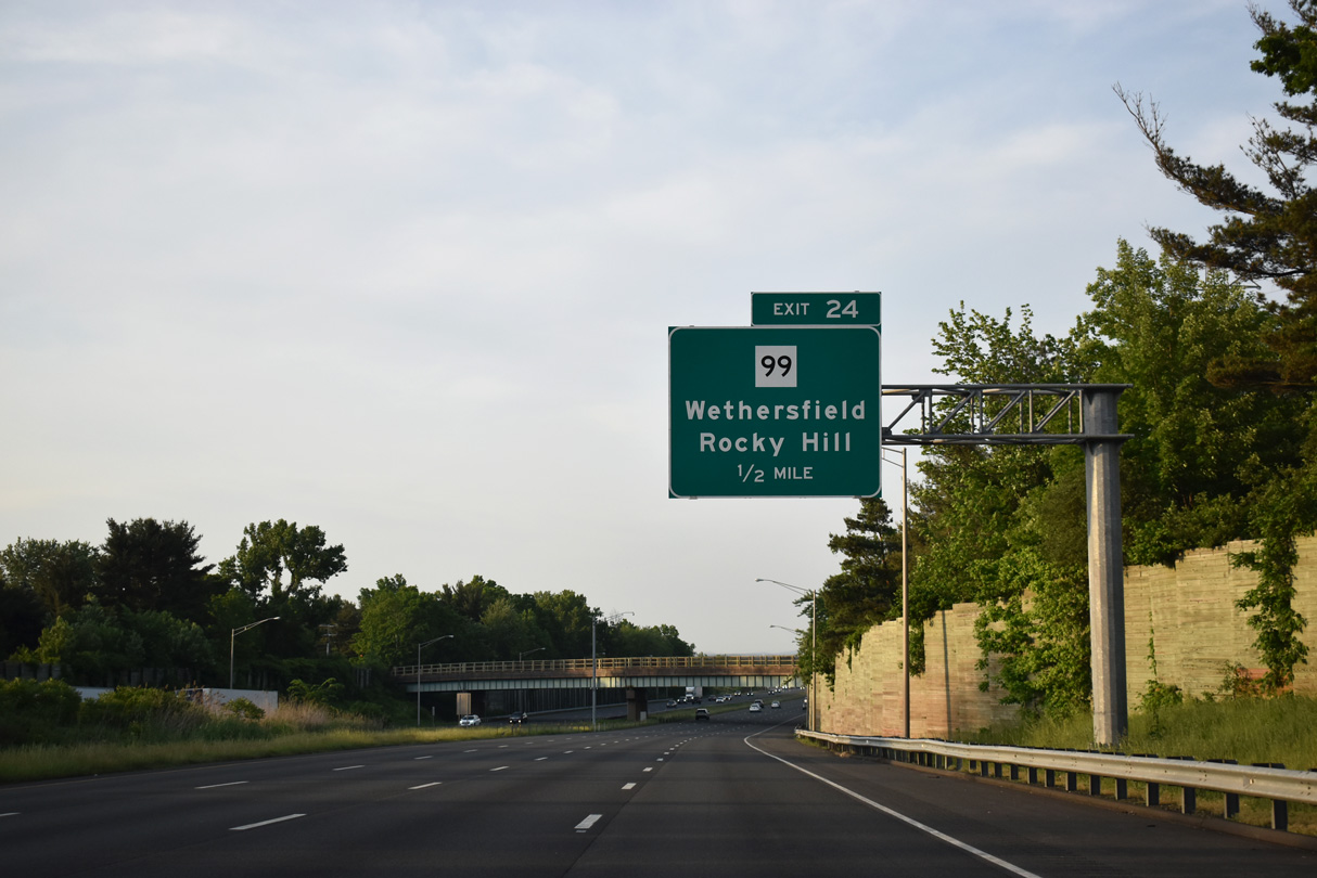
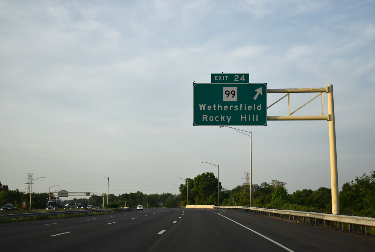
| Continuing northeast, I-91 passes by a pair of abandoned ramps leftover from unconstructed Interstate 291. The succeeding exit is with Route 99 (Silas Deane Highway) north from Cromwell and Rocky Hill. 05/30/22 |
|
| Orchard Street passes over I-91 a half mile from the parclo B2 interchange (Exit 24) with Route 99 (Silas Deane Highway). 10.64 miles long, Route 99 runs through the Connecticut River Valley between Route 9 at Middletown and Route 15 at Wethersfield. 05/30/22 |
|
| Route 99 (Silas Deane Highway) travels through a commercialized stretch of Rocky Hill northward to South Wethersfield nearby. 05/30/22 |
|
| Middletown Avenue passes below Interstate 91 on the ensuing stretch to Route 3 (Exit 25). 05/30/22 |
|
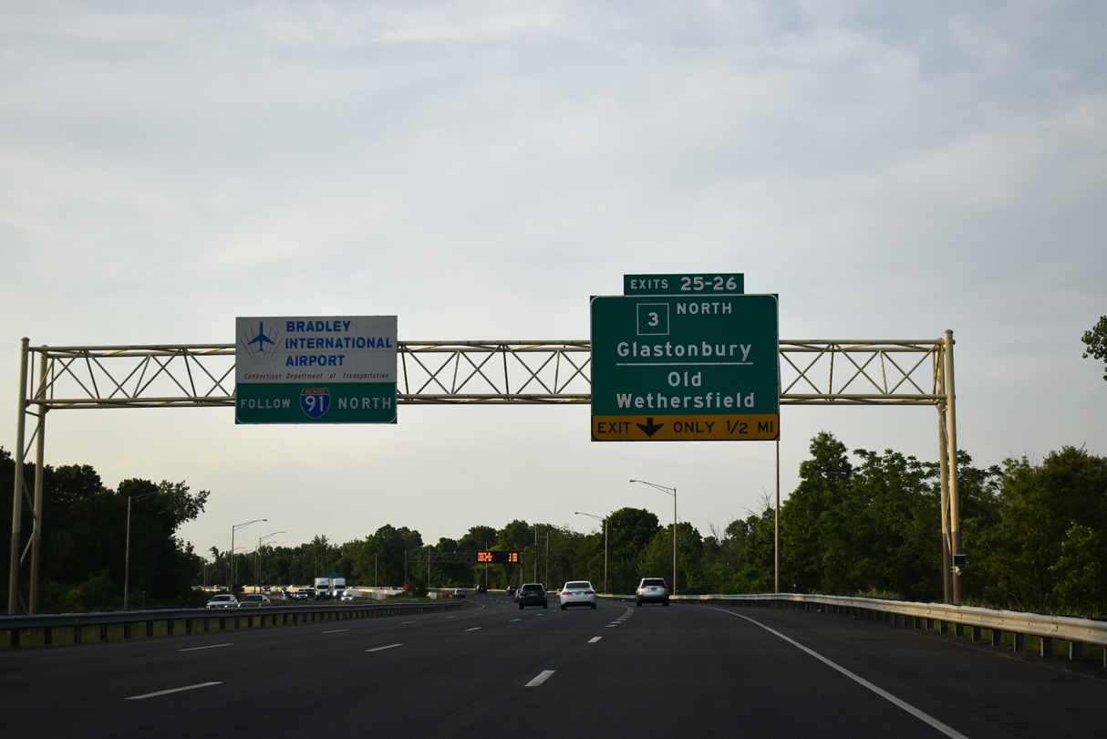
| Interstate 91 enters the town of Wethersfield ahead of Exit 25 with Route 3 north to Glastonberry and Exit 26 to Great Meadow Road for East Wethersfield. 05/30/22 |
|
| Bradley International Airport (BDL) lies beyond Hartford at Windsor Locks. Route 3 follows a short freeway northeast from Interstate 91 to Route 2 at Glastonberry. 05/30/22 |
|
| The freeway along Route 3 was formerly Interstate 491, a planned bypass to I-84 at East Hartford. I-491 was eventually renumbered as the westernmost segment of Interstate 86. The connection between Route 2 and I-84 however, was never completed. 05/30/22 |
|
| Exit 26 ties into Great Meadow Road from the connection to Route 3 north (Exit 25). Great Meadow Road west to Marsh Street leads to the Old Wethersfield Historic District. 08/19/21 |
|
| U.S. 5 / Route 15 north join I-91 with I-84 to East Hartford and Massachusetts in two miles while a direct connection ties I-91 to I-84 west near Downtown. 05/30/22 |
|
| Traffic from Marsh Street joins Interstate 91 ahead of this confirming marker. Marsh Street meets I-91 south at a diamond interchange (Exit 26) with no access from I-91 north. 05/30/22 |
|
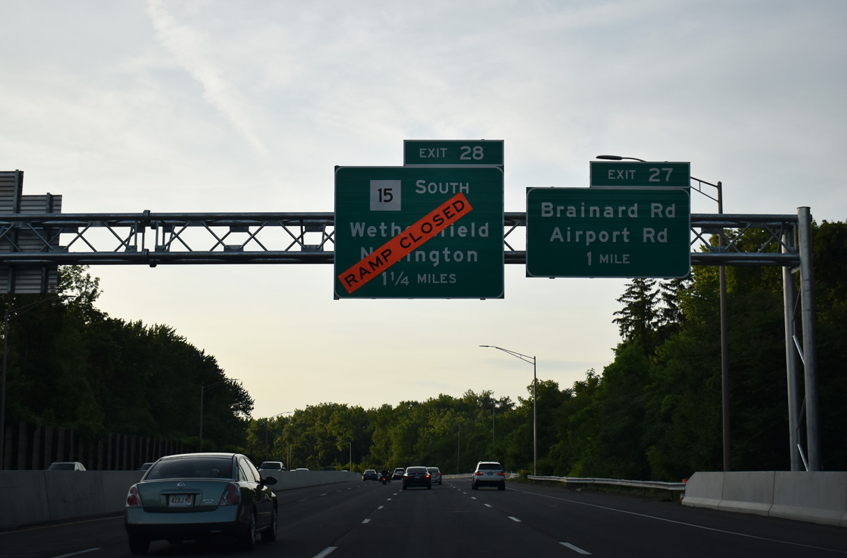
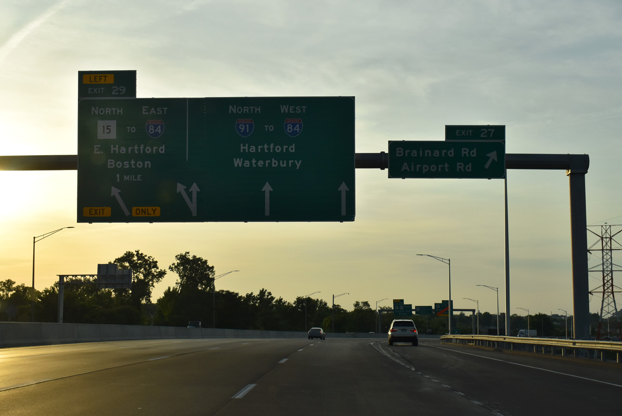
| Continuing northward, Exit 27 departs from I-91 next for Brainard Road and Hartford-Brainard Airport (HFD). Brainard Road parallels I-91 alongside Hartford-Brainard Airport to Murphy, Airport and Maxim Roads. 05/30/22 |
|
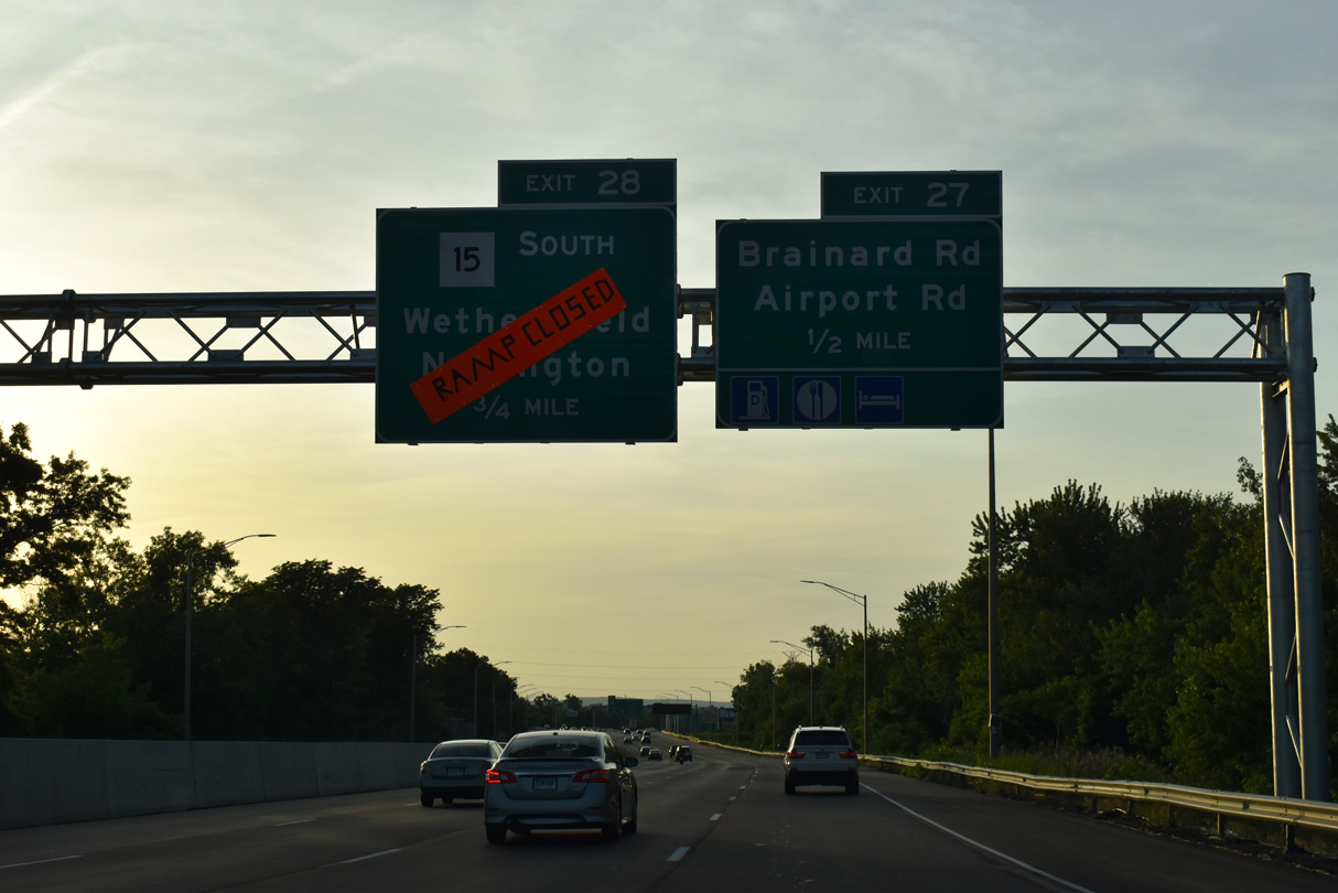
| U.S. 5/Route 15 converge with I-91 at Exit 28. Route 15 is a freeway from Berlin Turnpike in Wethersfield north to the Charter Oak Bridge across the Connecticut River into East Hartford. 05/30/22 |
|
| Exit 27 ties into Brainard Road at Murphy Road east to Hartford-Brainard Airport (HBD). Airport Road (Route 530) stems west from Brainard Road nearby to Brown Street and Wethersfield Avenue within the city of Hartford. 05/30/22 |
|
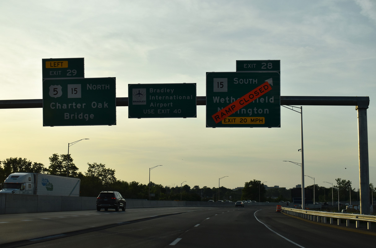
| Exit 28 loops onto the freeway spur taking U.S. 5/Route 15 southwest to Berlin Turnpike at Wethersfield. Route 175 (Cedar Street) leads west from Berlin Turnpike to the town of Newington.
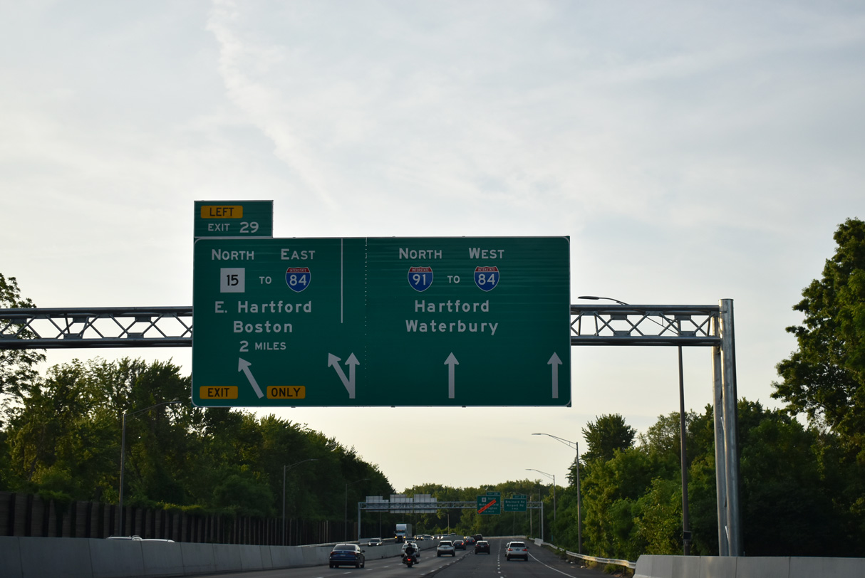
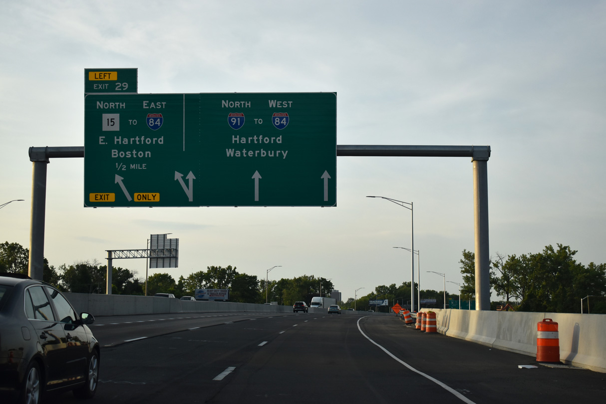
Left Exit 29 follows in one mile for U.S. 5/Route 15 north to I-84 east for Sturbridge and Boston, Massachusetts. 05/30/22 |
|
| The roadways of I-91 separate to accommodate ramps with parallel U.S. 5/Route 15. Route 15 continues Wilbur Cross Highway across the Connecticut River to Interstate 84 at East Hartford. I-91 meets I-84 directly in 1.50 miles at Downtown Hartford. 05/30/22 |
|
| U.S. 5/Route 15 (Wilbur Cross Highway) branch northeast from I-91 at Exit 29 across the Charter Oak Bridge. Wilbur Cross Highway follows I-84 east to the Massachusetts border at Union. The ensuing three left exits connect I-91 to the Hartford central business district. 05/30/22 |
|
| Left Exit 29 A joins I-91 with the White Head Highway into Downtown Hartford. The short freeway spur was planned to be part of Interstate 484, a loop northwest to I-84 near Bushnell Park and the Connecticut State Capitol. 05/30/22 |
|
| White Head Highway links Interstate 91 and Pulaski Circle. The older freeway is unsigned Route 598. I-484 was approved in 1968 and cancelled in 1983.1 05/30/22 |
|
| Left Exit 29 A joins I-91 to both the Connecticut Convention Center and Science Center via Columbus Boulevard. 05/30/22 |
|
| Entering the three-wye interchange (Left Exit 29 A) with White Head Highway west on I-91 north. Elm Street west from Pulaski Circle leads to the Connecticut State Capitol complex. 05/30/22 |
|
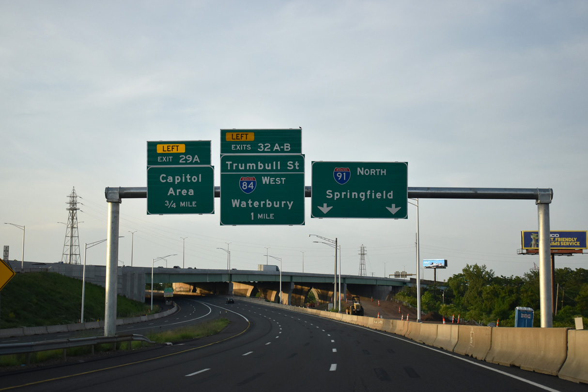
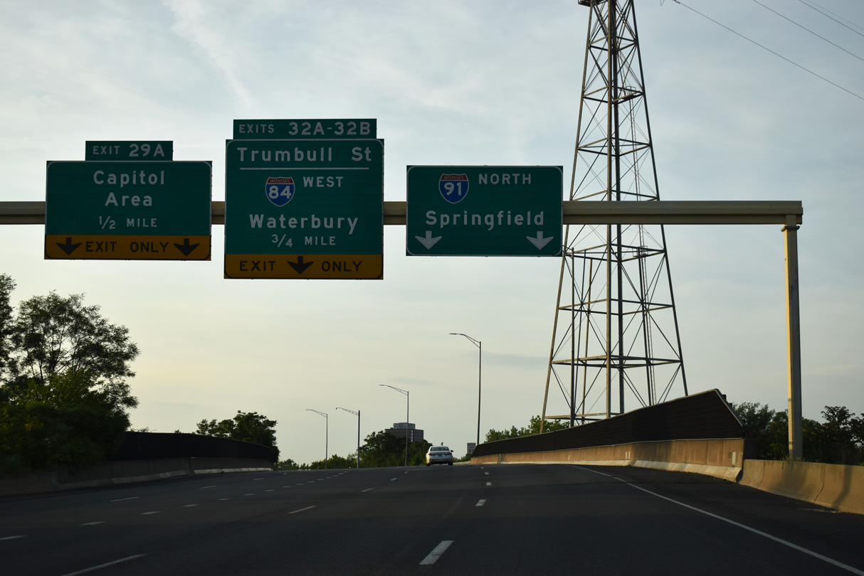
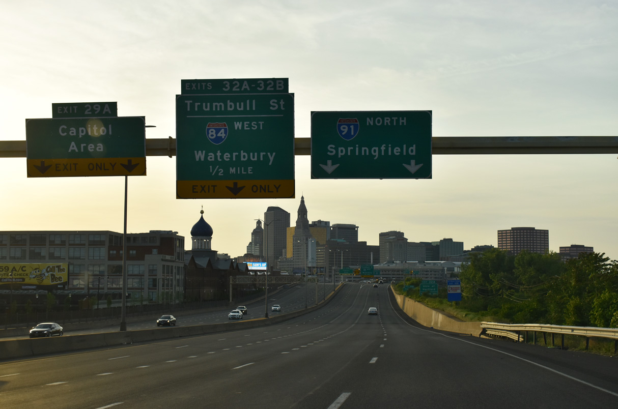
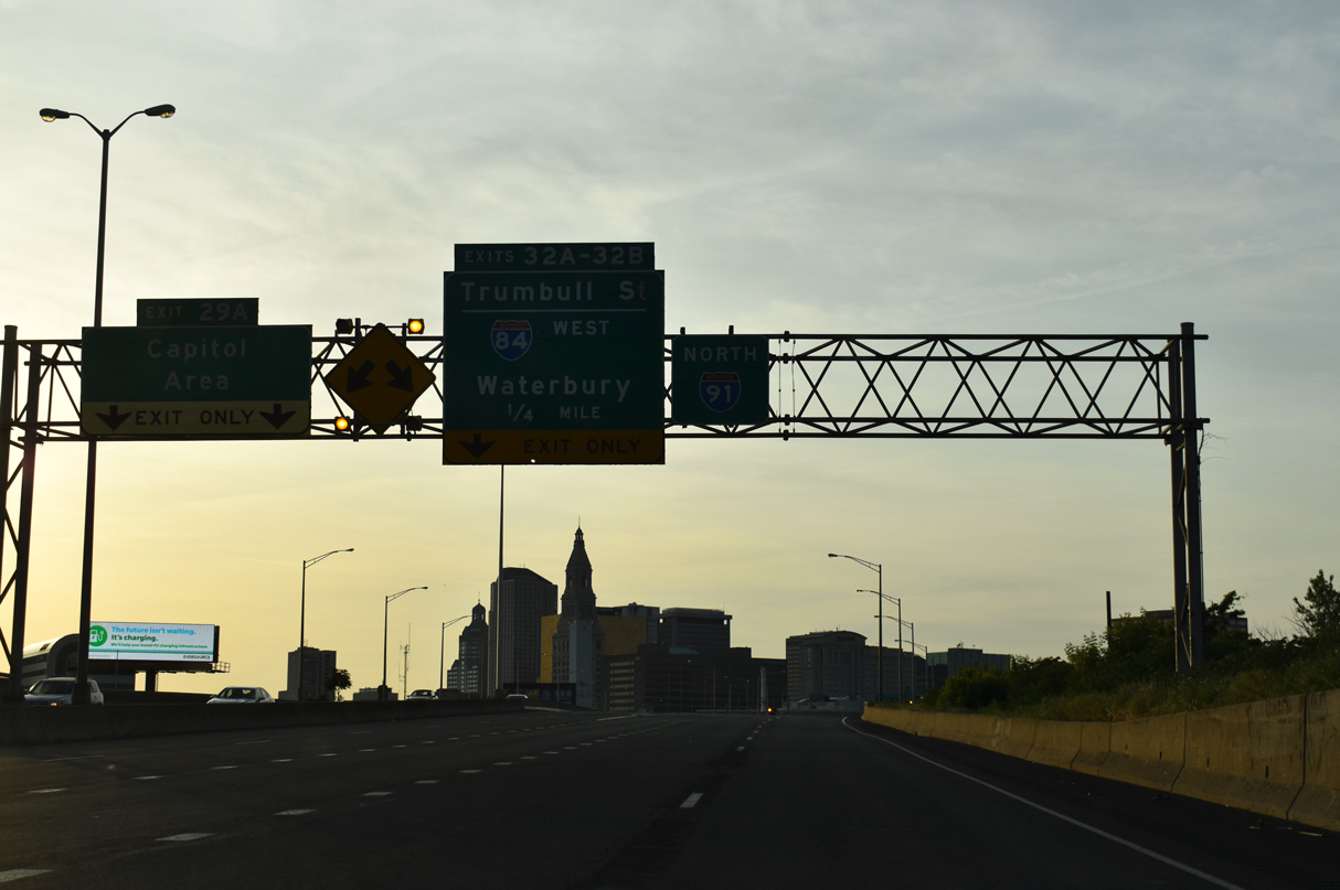
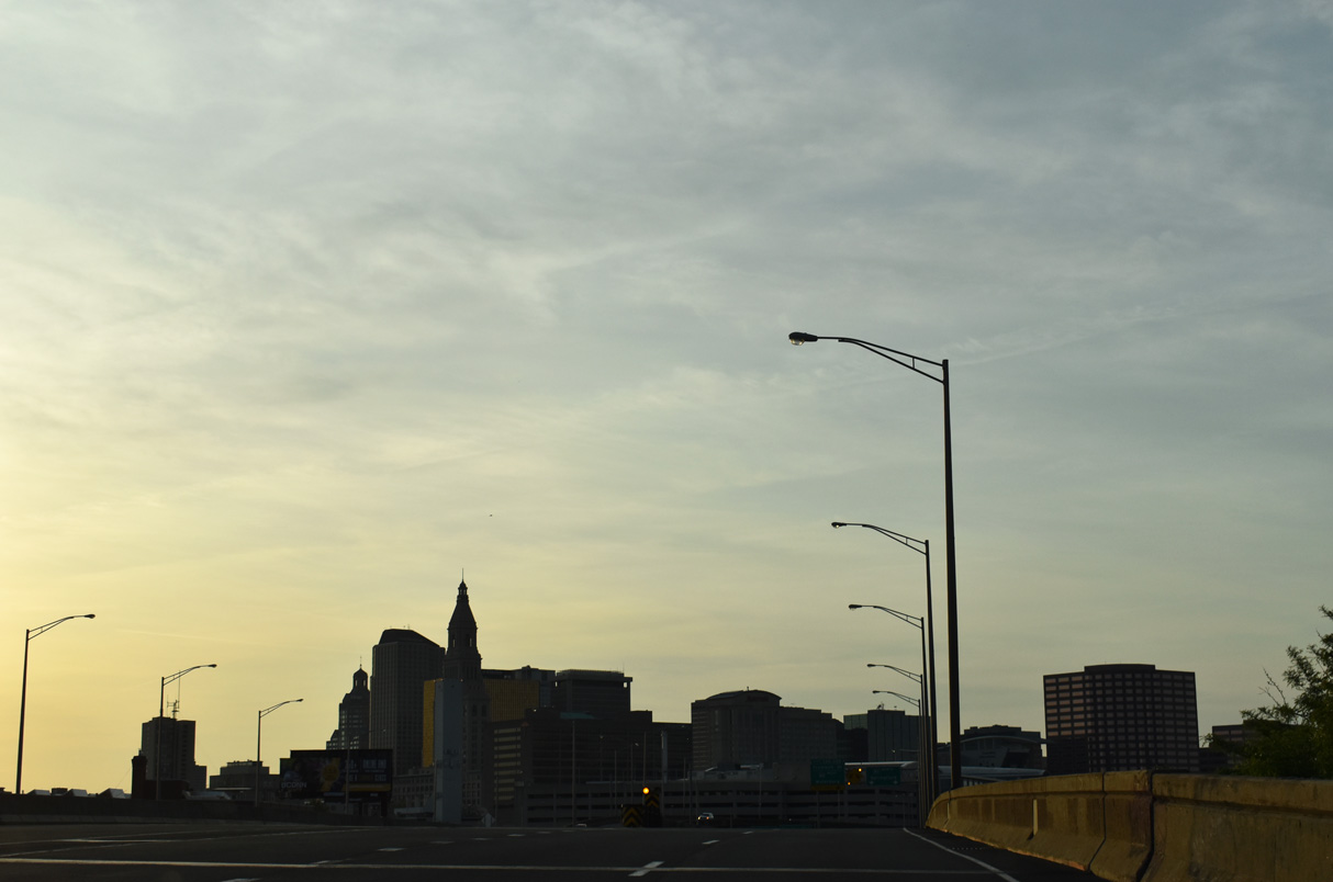
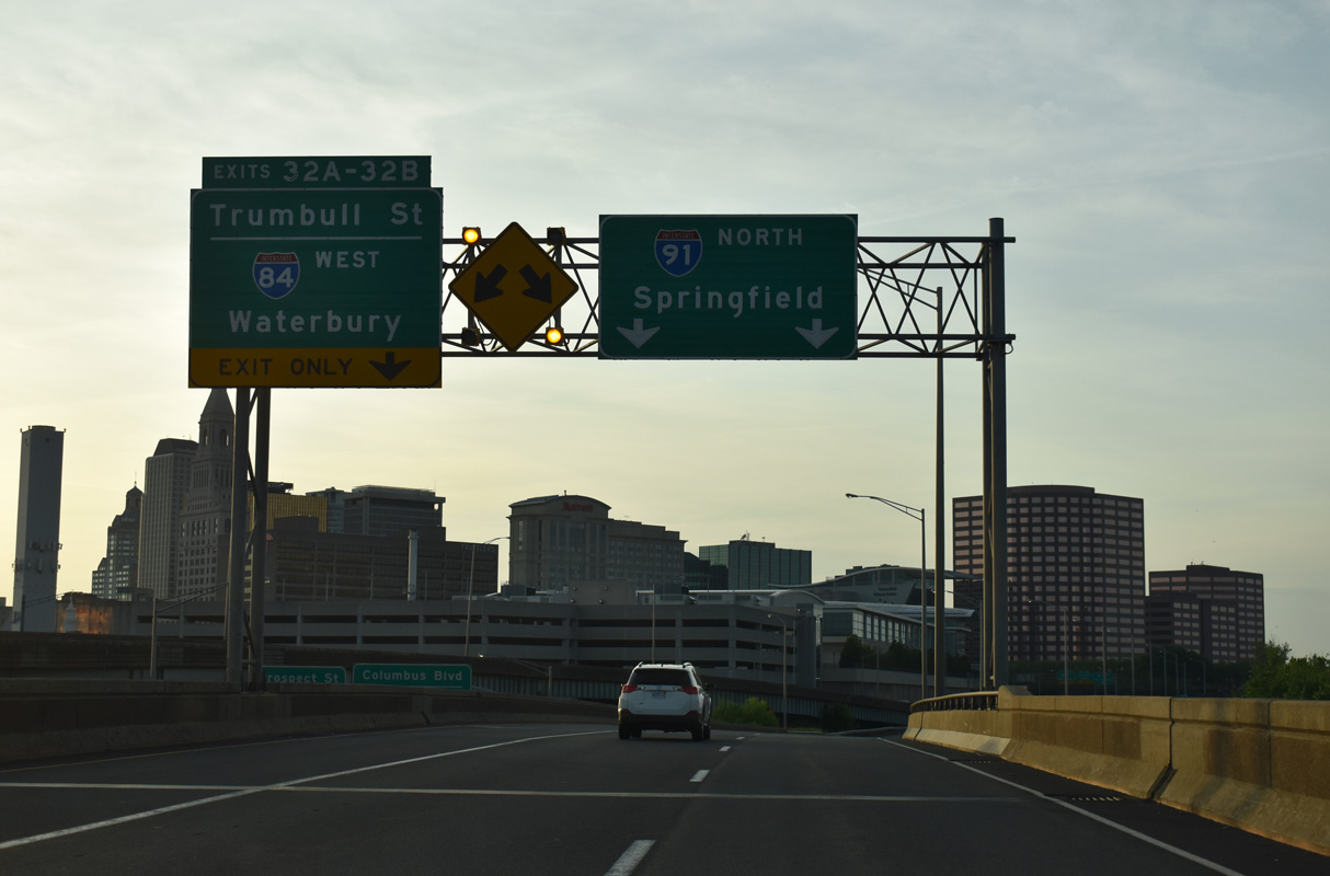
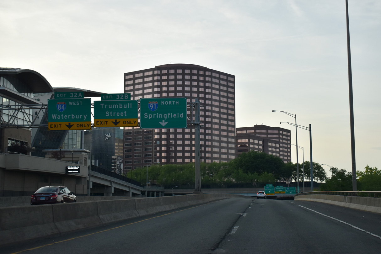
| The Downtown Hartford skyline comes into view from I-91 northbound ahead of the collector distributor roadway system (Left Exit 32) for both Trumbell Street and Interstate 84 west. 05/30/22 |
|
| A lane drop occurs at Left Exit 32 for Trumbell Street and Interstate 84 west. Trumbell Street arcs southwest from U.S. 44 (Main Street) through Downtown Hartford to Bushnell Park. 05/30/22 |
|
| I-84/U.S. 6-44 cross the Connecticut River west from East Hartford into Downtown Hartford. U.S. 44 shifts north at Exit 50 onto adjacent Morgan Street. U.S. 6 remains west along Interstate 84 to West Hartford and Farmington. 05/30/22 |
|
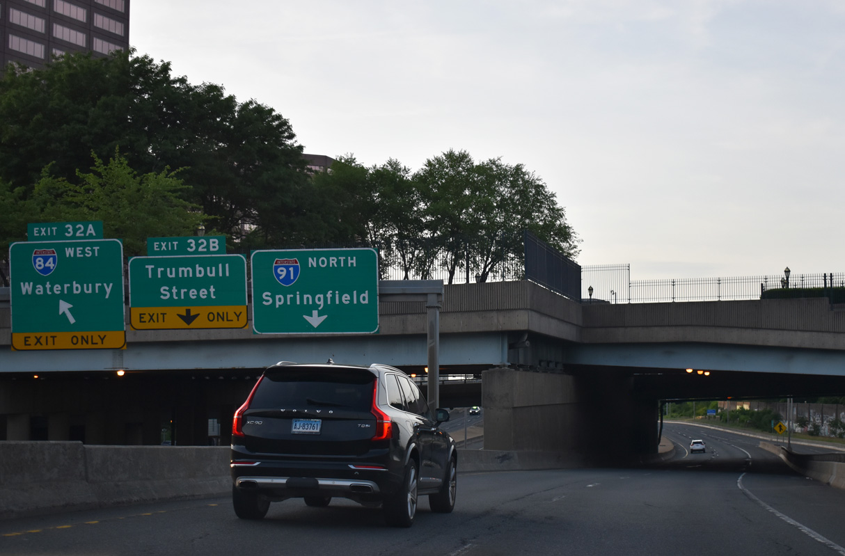
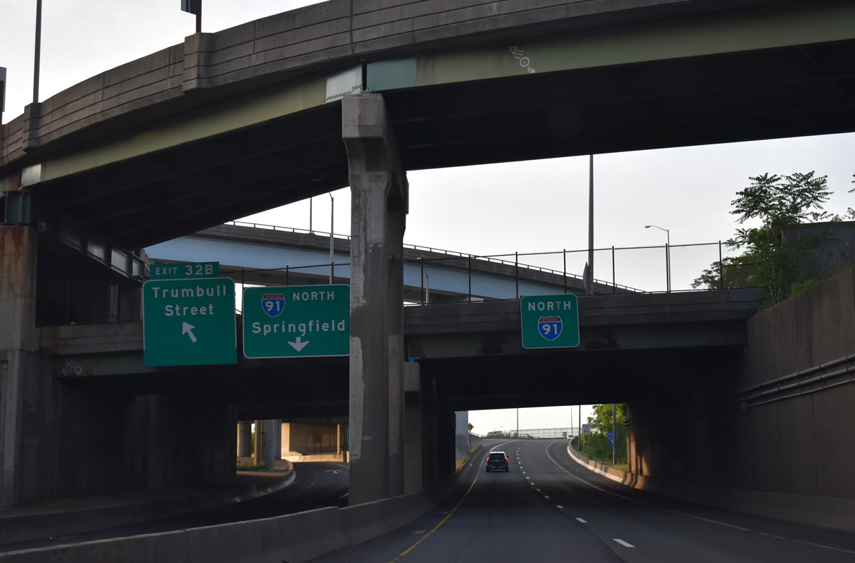
| Exit 32 A curves westward onto I-84/U.S. 6 for New Britain, Waterbury and Danbury. Exit 32 B passes below I-84/U.S. 6-44 before tieing into the intersection at Trumbell and Market Streets. 05/30/22 |
|
| A multilevel interchange joins Interstate 91 with I-84/U.S. 6-44 at the west end of the Morgan G. Bulkeley Bridge across the Connecticut River. 05/30/22 |
|
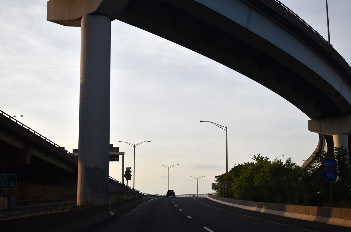
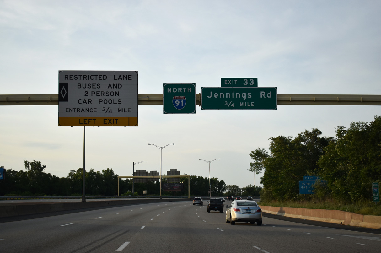
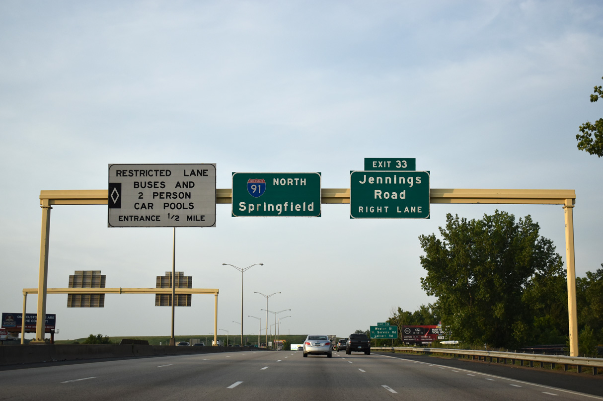
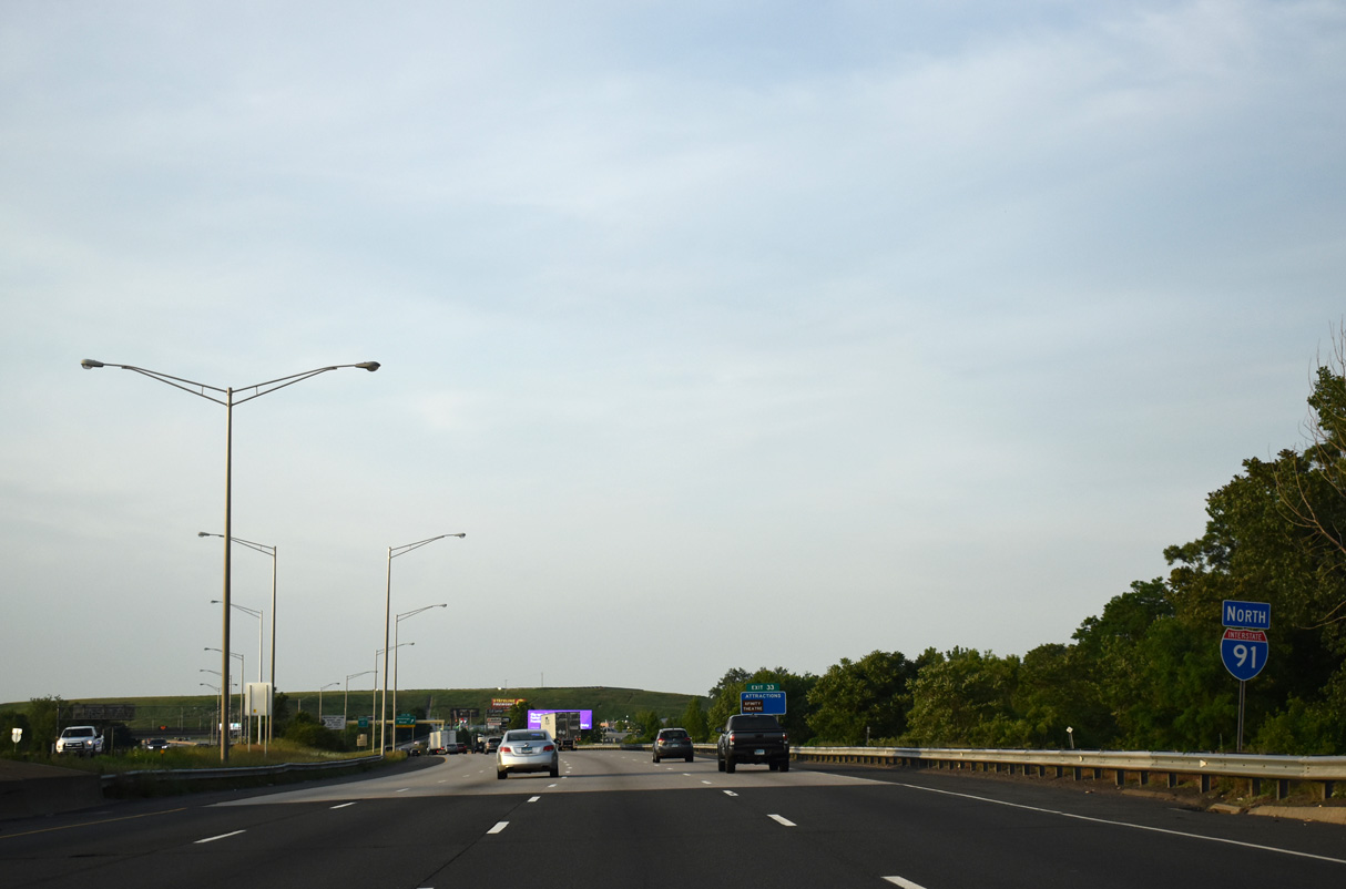
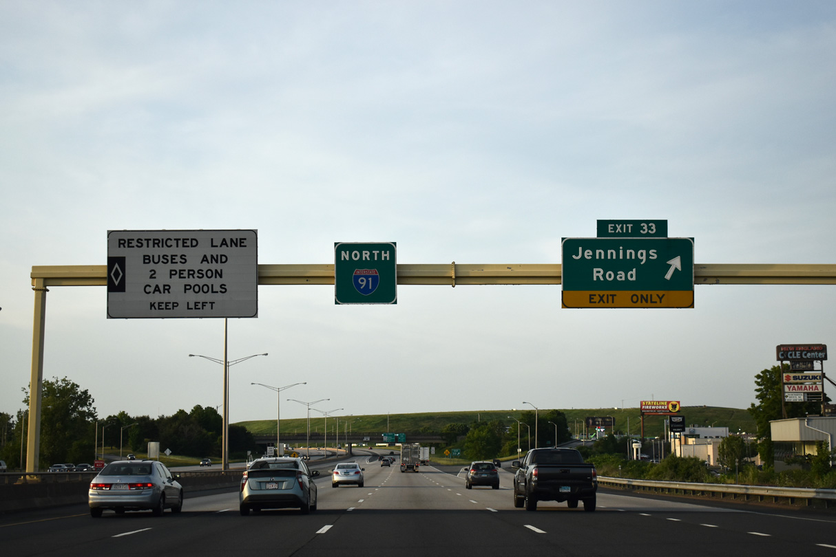
| I-91 leaves Downtown Hartford alongside Riverside Park and the Connecticut River. A carpool lane (HOV-2) separates from the northbound mainline ahead at the diamond interchange (Exit 33) with Jennings Road. 05/30/22 |
|
| Jennings Road travels west from the Connecticut River and Exit 33 to the intersection of Weston Street and Boce Barlow Way. 05/30/22 |
|
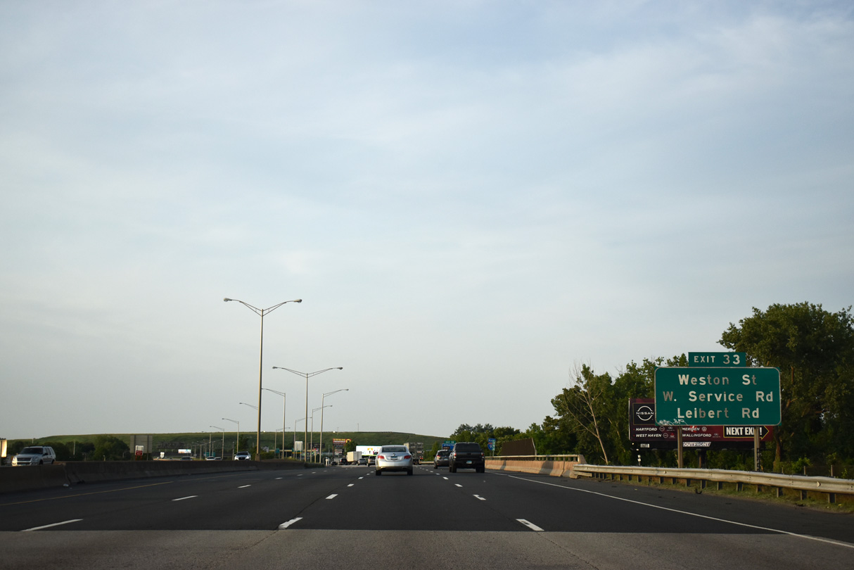
| Jennings Road connects with Weston Street, W Service Road and Leibert Road. Leibert Road loops north from Weston Street underneath I-91 to the E Service Road near Riverside Park and Jennings Road. 05/30/22 |
|
| Interstate 91 spans a Connecticut Southern Railroad line ahead of this marker. 05/30/22 |
|
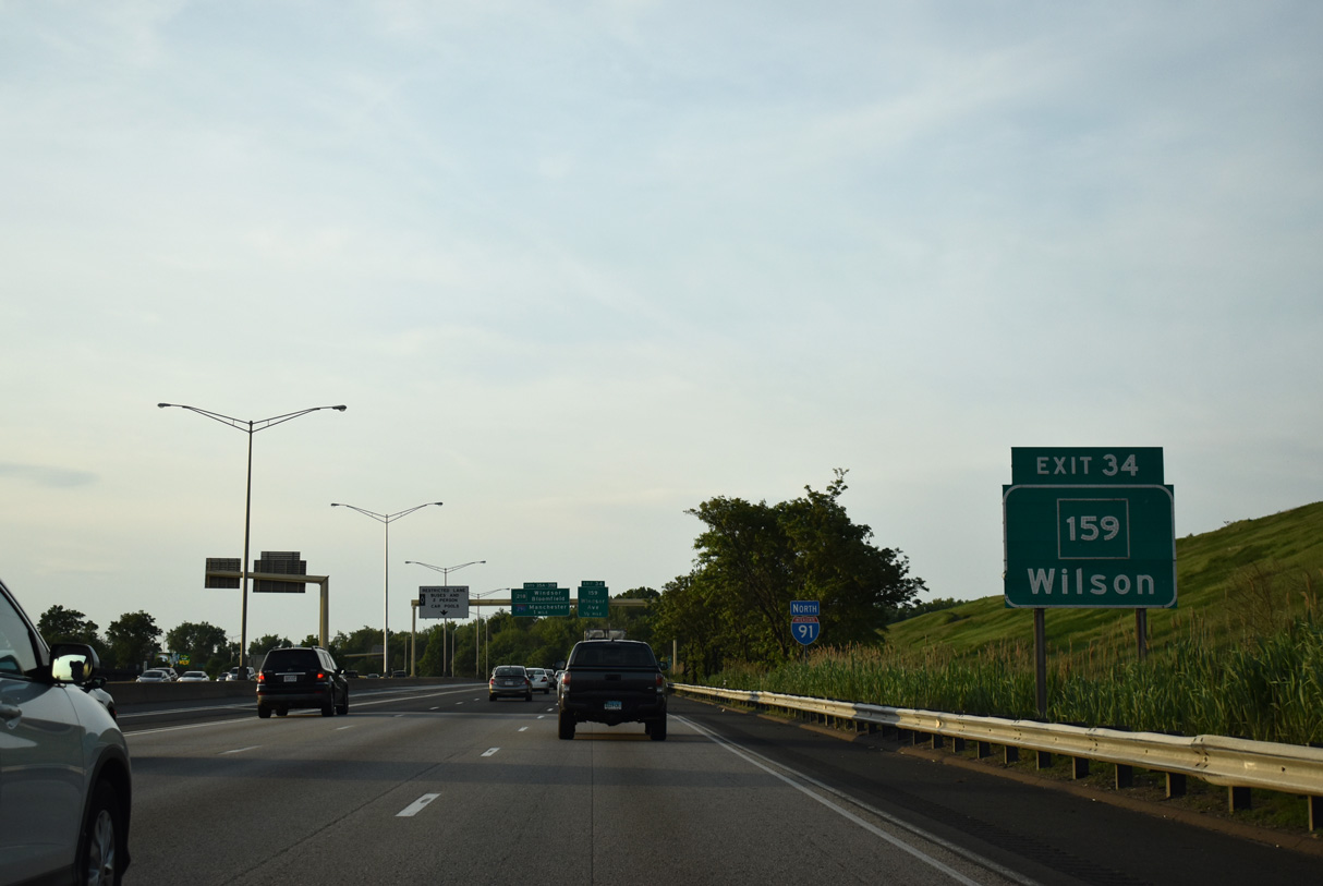
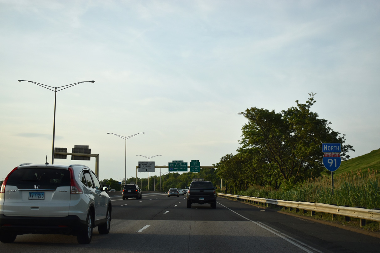
| West of Exit 33, Jennings Road and Boce Barlow Road lead toward Windsor Street and Main Street. Main Street becomes Route 159 at Exit 34. 05/30/22 |
|
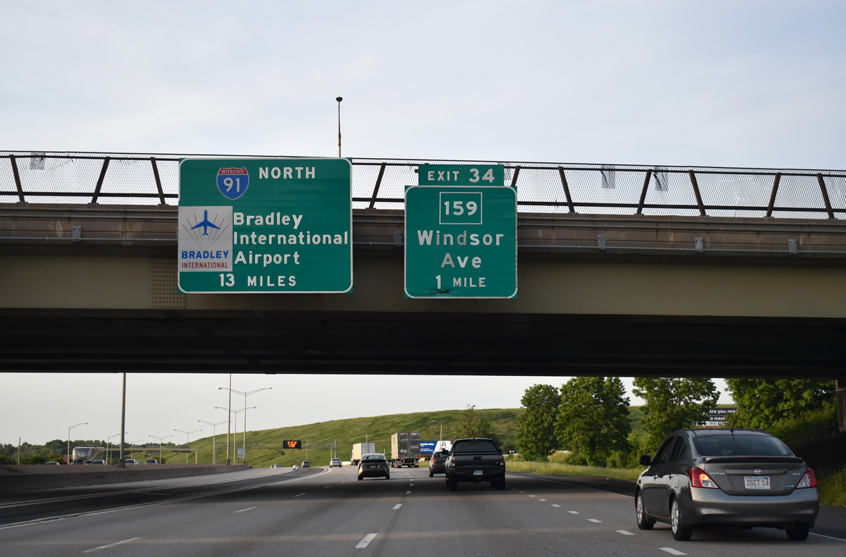
| I-91 proceeds one mile north from Jennings Road to Route 159 at Exit 34 and 13 miles to Bradley International Airport (BDL). Striping with lane changes prohibited separate the HOV-2 lanes along Interstate 91. 05/30/22 |
|
| Route 159 continues Main Street north of Interstate 91 from the nearby community of Wilson as Windsor Avenue into the town of Windsor. 05/30/22 |
|
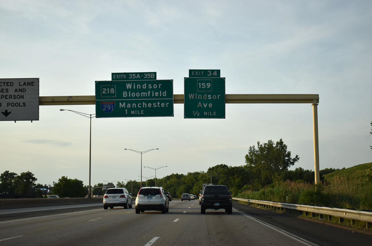
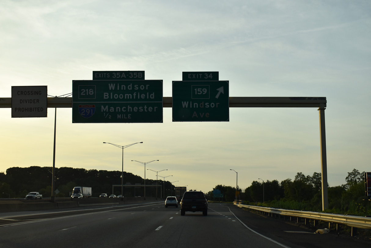
| A diamond interchange links I-91 and Route 159 (Main Street / Windsor Avenue) north at Exit 34. 05/30/22 |
|
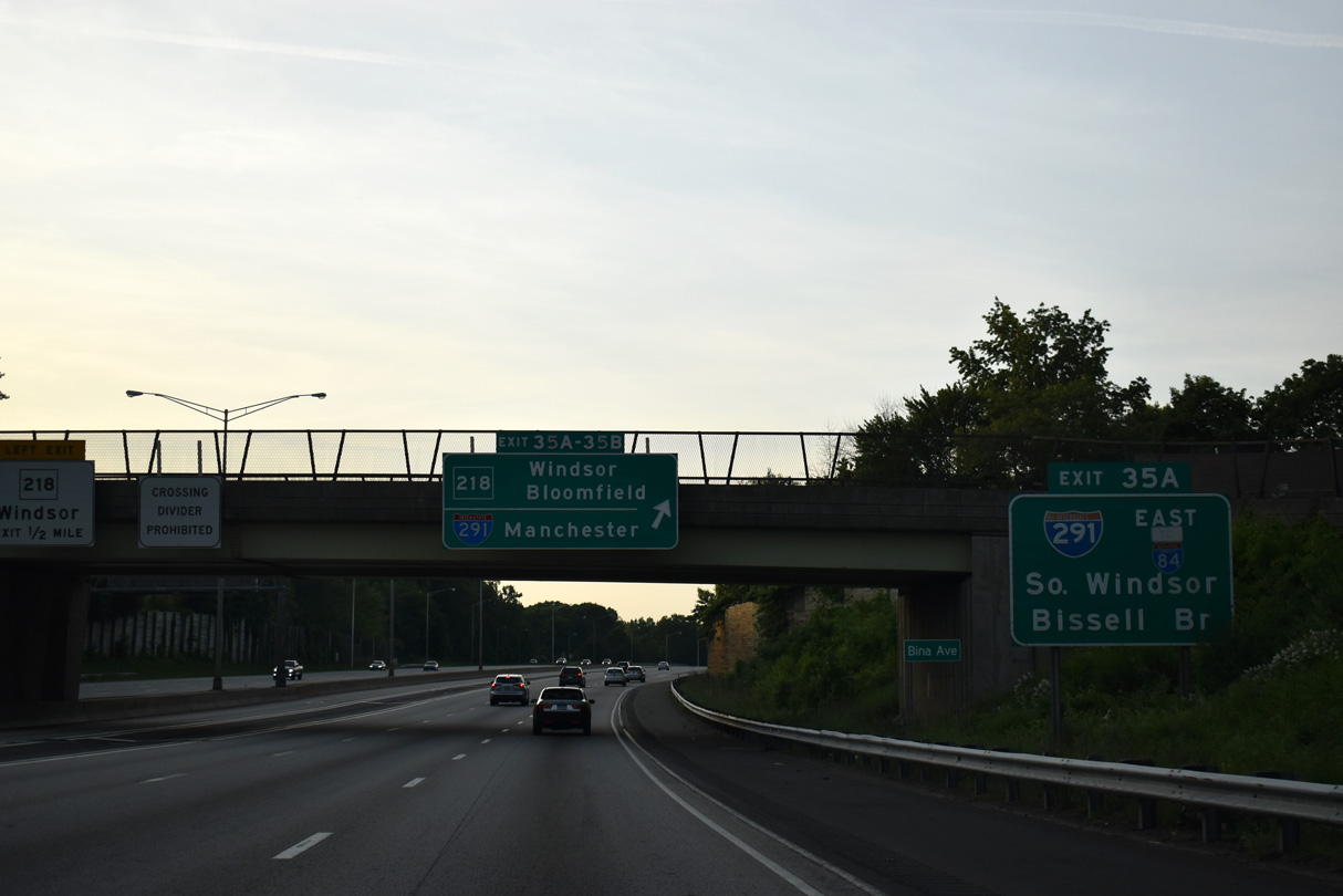
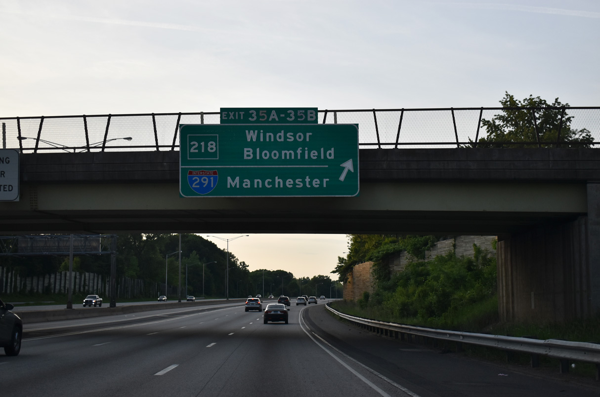
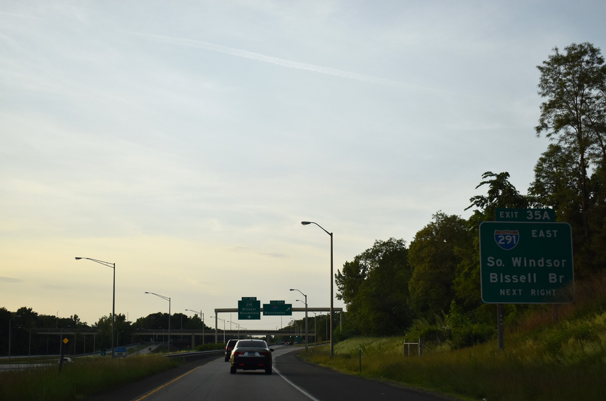
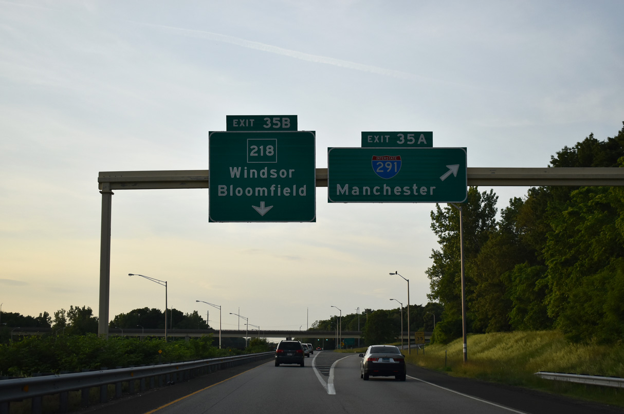
| Exit 35 A follows in one mile for the eastbound beginning of Interstate 291, which takes the Captain John Bissell Bridge across the Connecticut River. 05/30/22 |
|
| Route 159 (Windsor Avenue) travels 16.82 miles north from Windsor to Massachusetts Route 159 at the state line. Route 159 meets Interstate 91 again at Exit 42 in Windsor Locks.
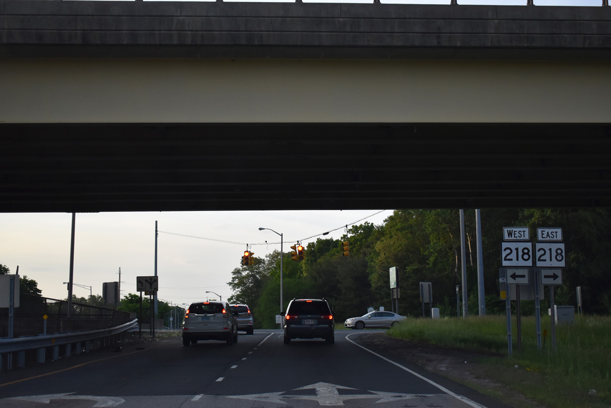
A left exit connects the HOV lane with Route 218 (Putnam Highway) just beyond Exit 35 to I-291 from the general travel lanes. 05/30/22 |
|
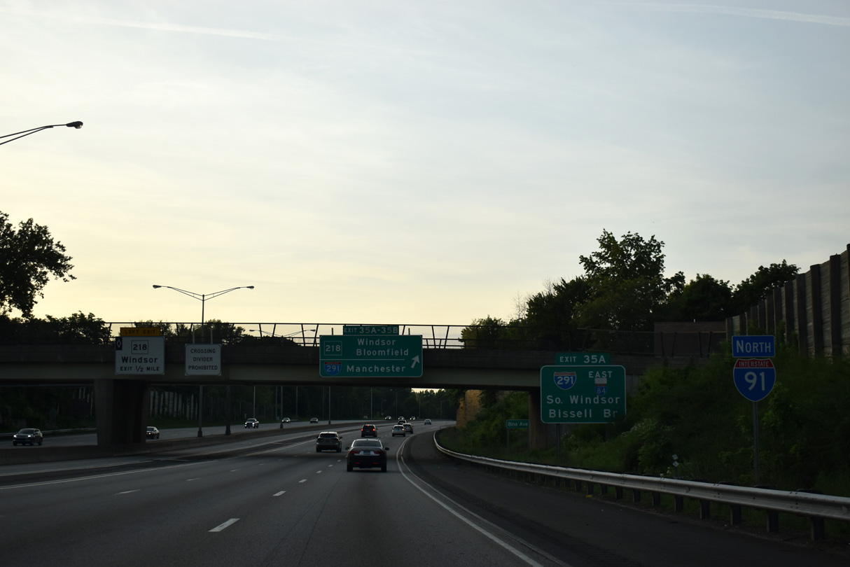
| This confirming marker precedes the Bina Avenue over crossing near Keney Park. 05/30/22 |
|
| I-291 provides a bypass route northeast of Hartford from Windsor to South Windsor and Manchester. I-291 spans the Captain John Bissell Bridge between Route 159 (Windsor Avenue) and U.S. 5 (John Fitch Boulevard). 05/30/22 |
|
| I-291 was previously planned as a three quarter beltway around the city of Hartford from Rocky Hill to West Hartford and Windsor. The bulk of these plans were canceled with the exception of Route 9 between I-84 and New Britain. I-291 west of I-91 was formally dropped by March 1979. The Bissell Bridge opened in 1959 and was designated Connecticut Route 291 until 1994.2 05/30/22 |
|
| Exit 35 A leaves the north distributor roadway for I-291 east to South Windsor and I-84/384 at Manchester. The diamond interchange at Exit 35 B follows with Route 218 (Putnam Highway). 05/30/22 |
|
| Route 218 arcs 7.00 miles west and south from Route 159 (Windsor Avenue) to U.S. 44 (Albany Avenue) at West Hartford. 05/30/22 |
Page Updated 03-19-2023.

 North
North