|
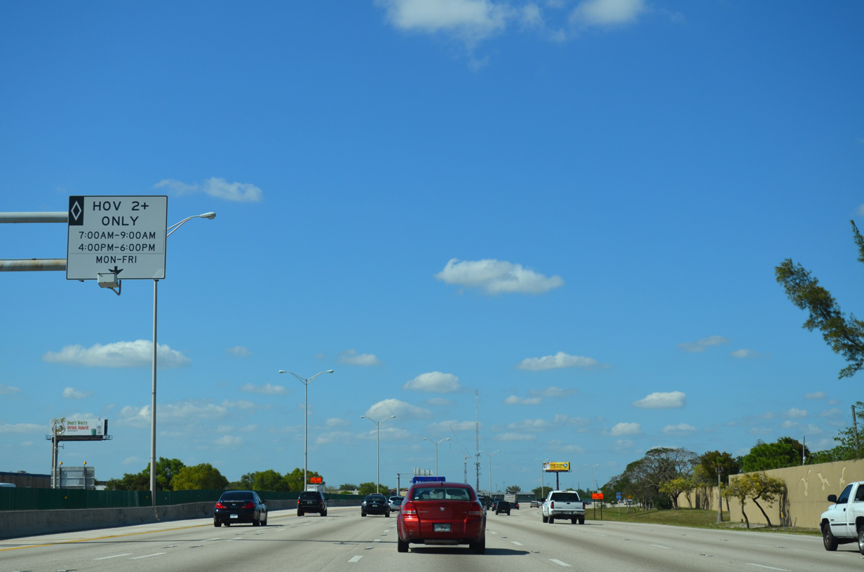
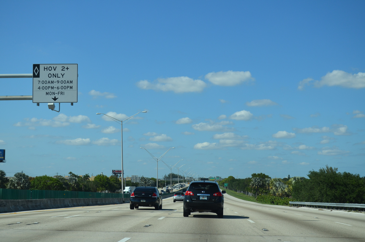
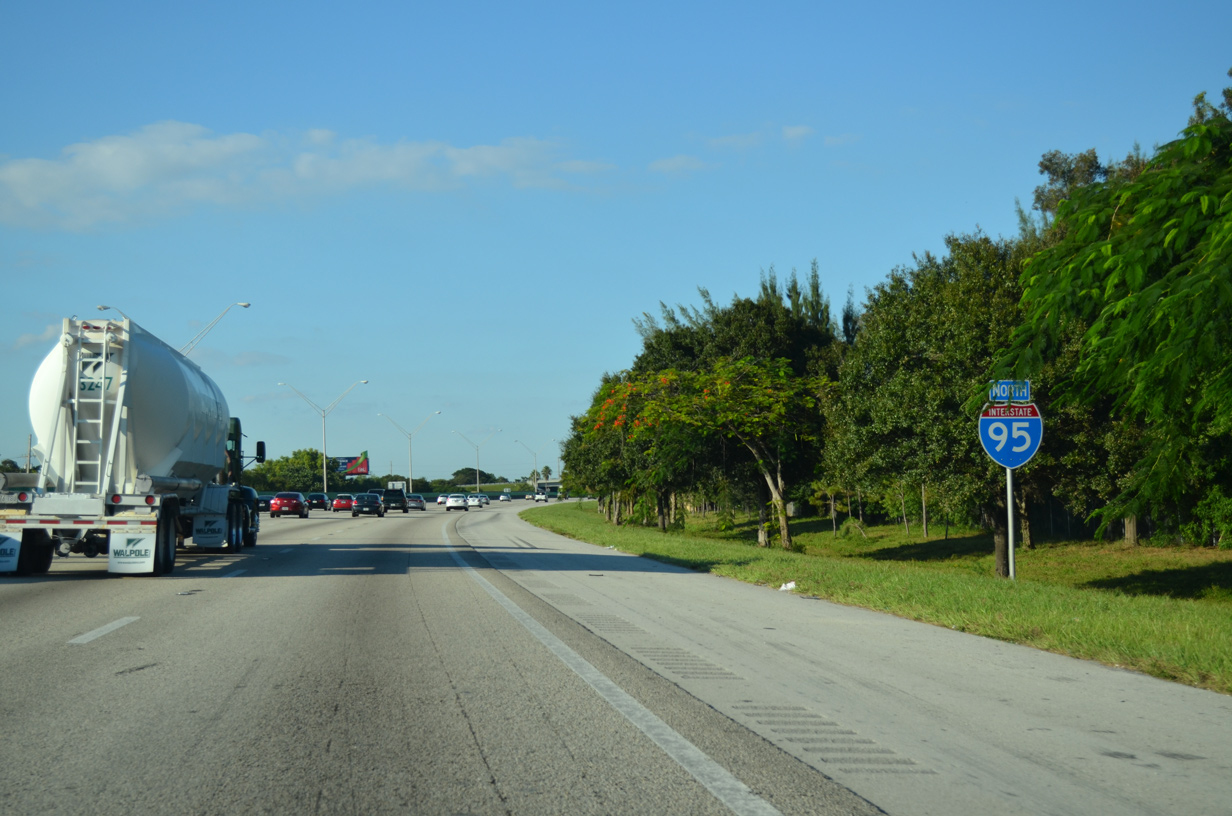
| The HOV-2 lane extends northward along Interstate 95 into Palm Beach County. The lane is restricted during the morning and evening peak hours. 04/01/14 |
|
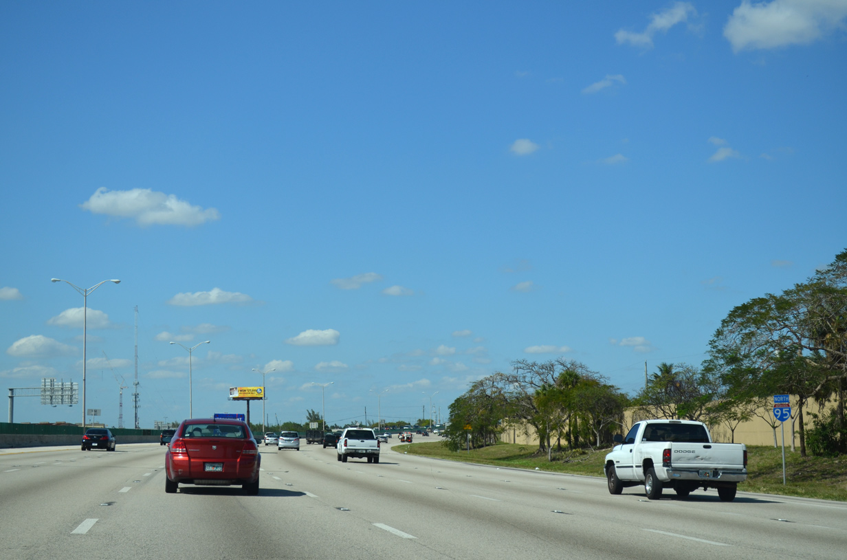
| Interstate 95 angles northeast to run alongside Mills Pond Park and the parallel TriRail. 04/01/14 |
|
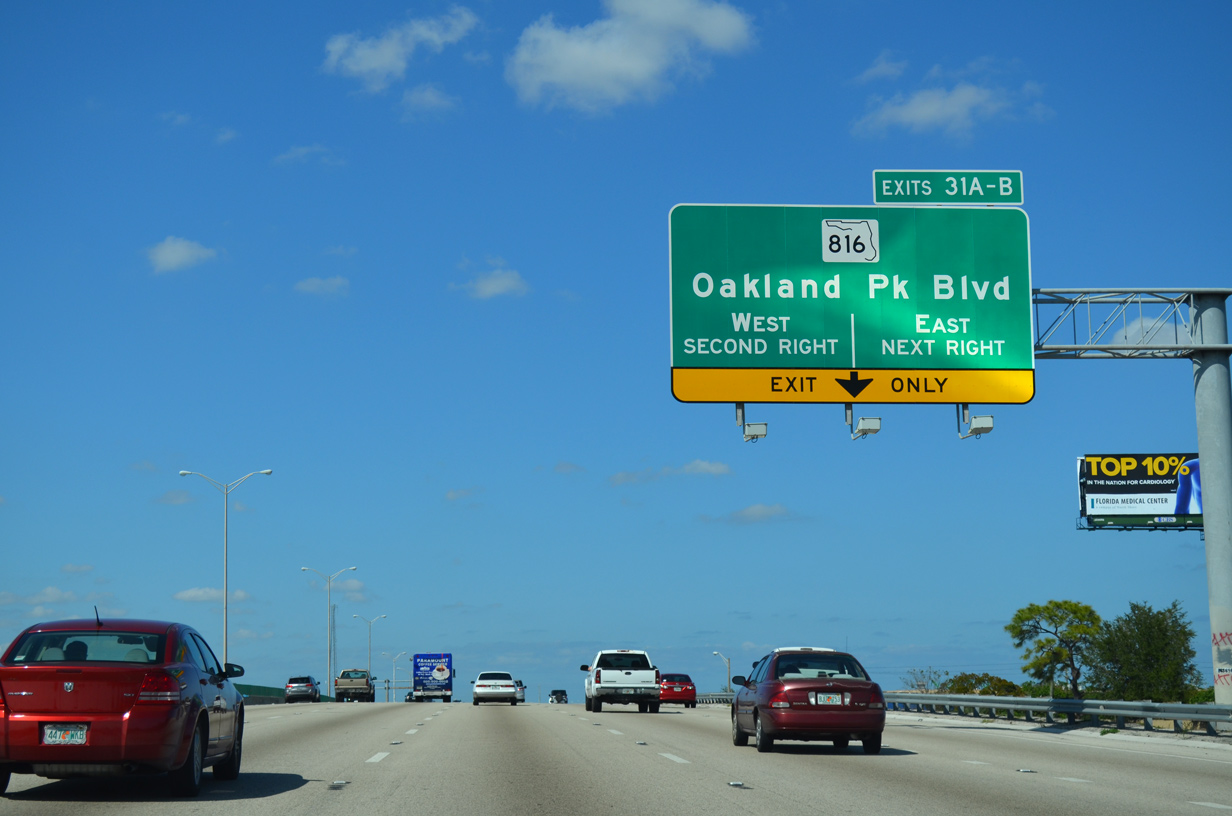
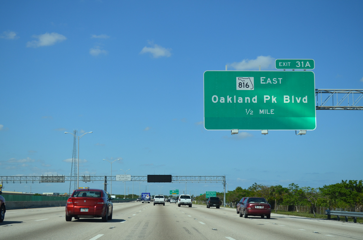
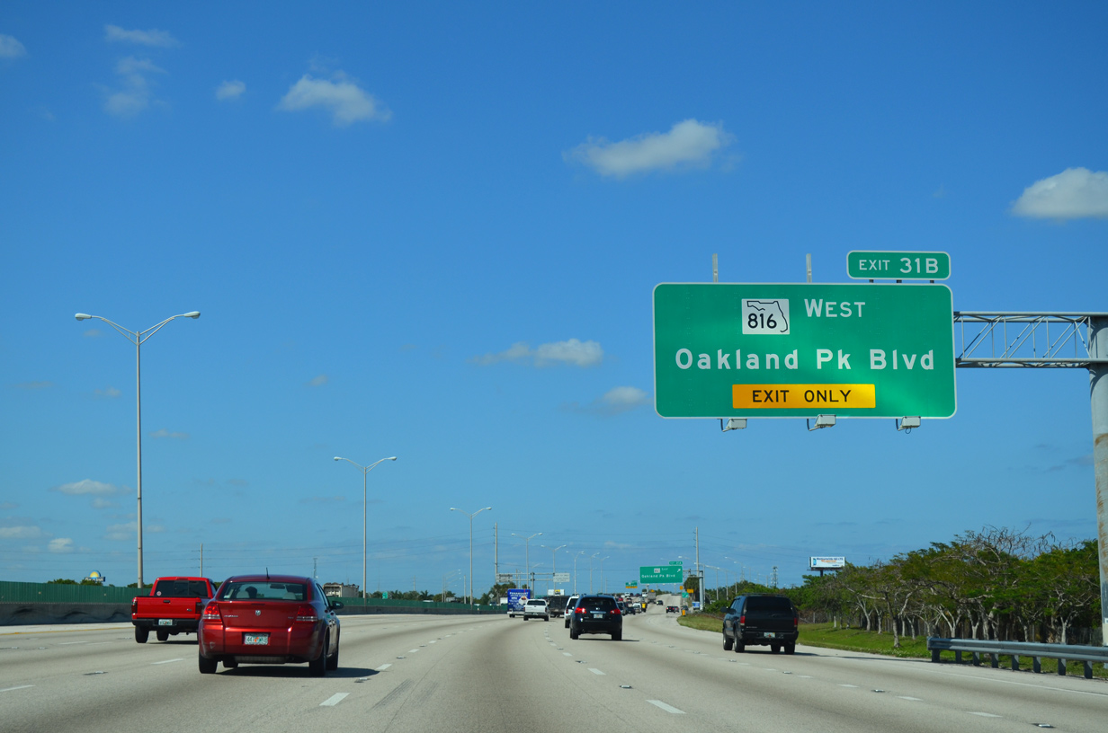
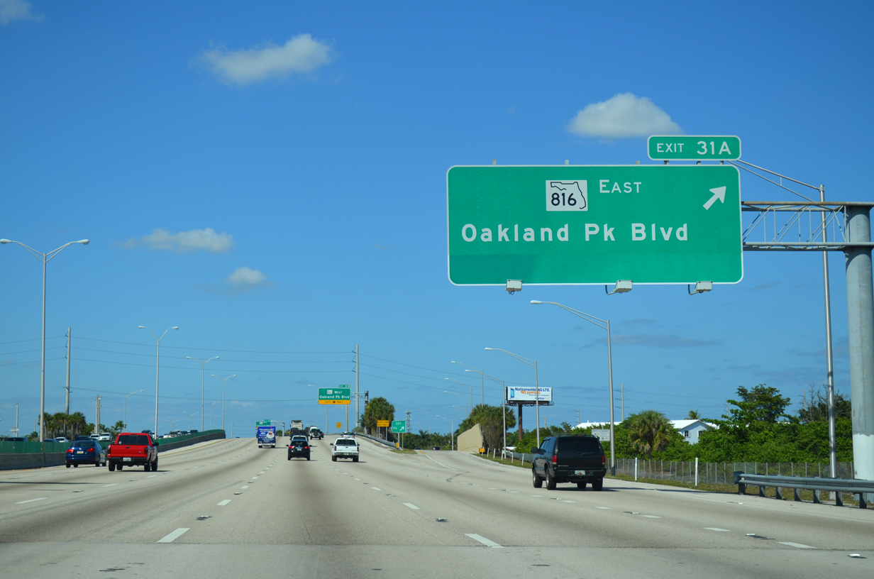
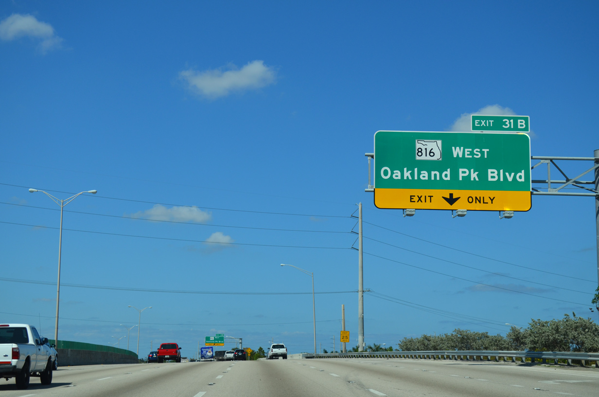
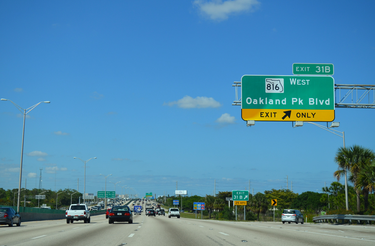
| SR 816 (Oakland Park Boulevard) meets I-95 at a six-ramp parclo interchange (Exits 31 A/B) at the Wilton Manors, Oakland Park and Fort Lauderdale city line. 04/01/14 |
|
| SR 816 (Oakland Park Boulevard) extends west from Oakland Park to Lauderdale Lakes, Lauderhill and Sunrise. 04/01/14 |
|
| Exit 31 B connects I-95 north with SR 816 (Oakland Park Boulevard) east along the Oakland Park and Wilton Manors city line to northern areas of Fort Lauderdale. Oakland Park was founded in 1929 and home to over 41,000 residents as of the 2010 census. 04/01/14 |
|
| The 9.72 mile long route of SR 816 concludes at SR A1A just east of the Intracoastal Waterway. 04/01/14 |
|
| Oakland Park Boulevard comprises a commercial arterial west to U.S. 441 in Lauderdale Lakes. Beyond the state road end at SR 817, the boulevard runs through Sunrise to Exit 2 of the Sawgrass Expressway. 04/01/14 |
|
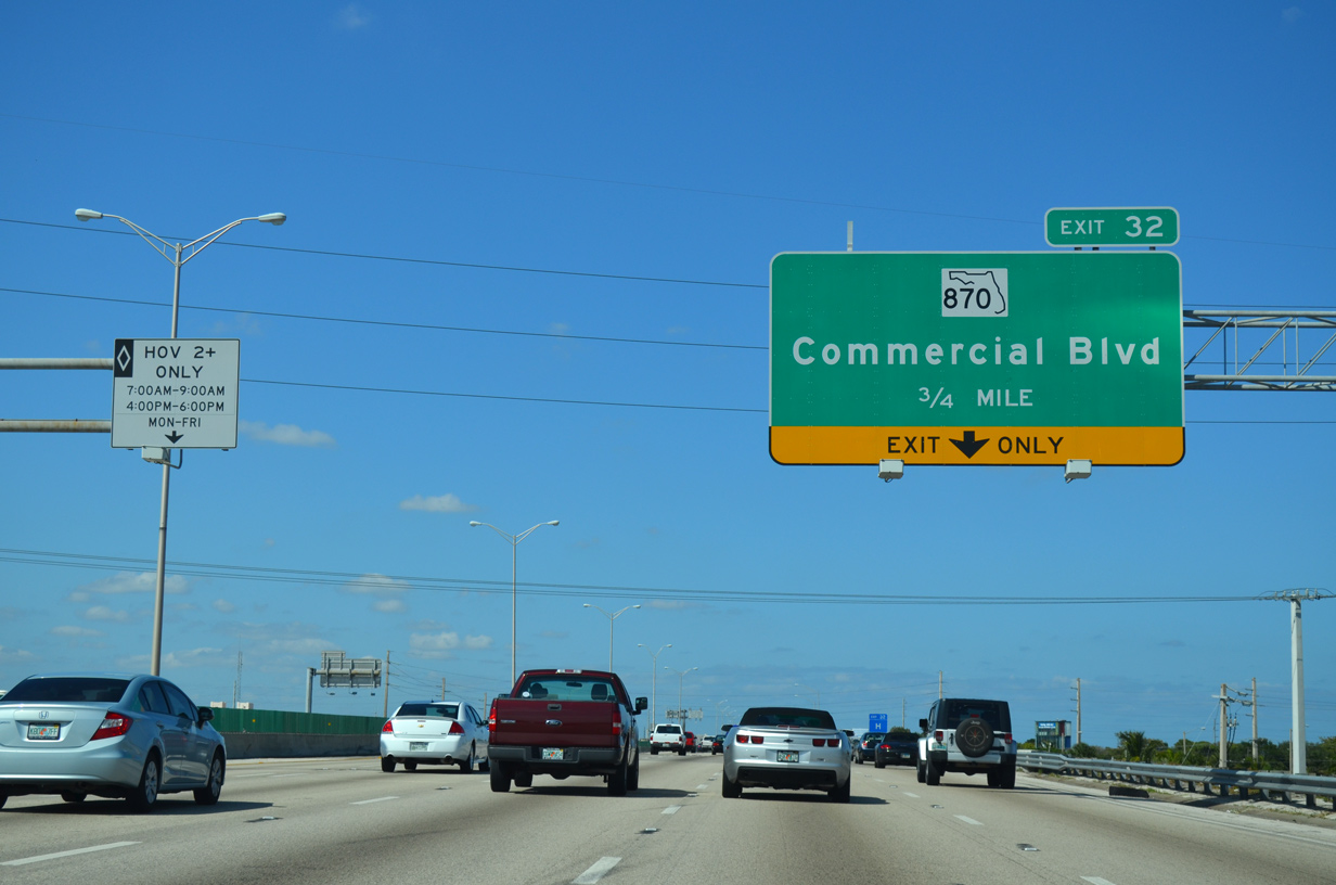
| Interstate 95 continues northeast through Oakland Park to Exit 32 with Commercial Boulevard and Exit 33 with Cypress Creek Road. 05/17/08 |
|
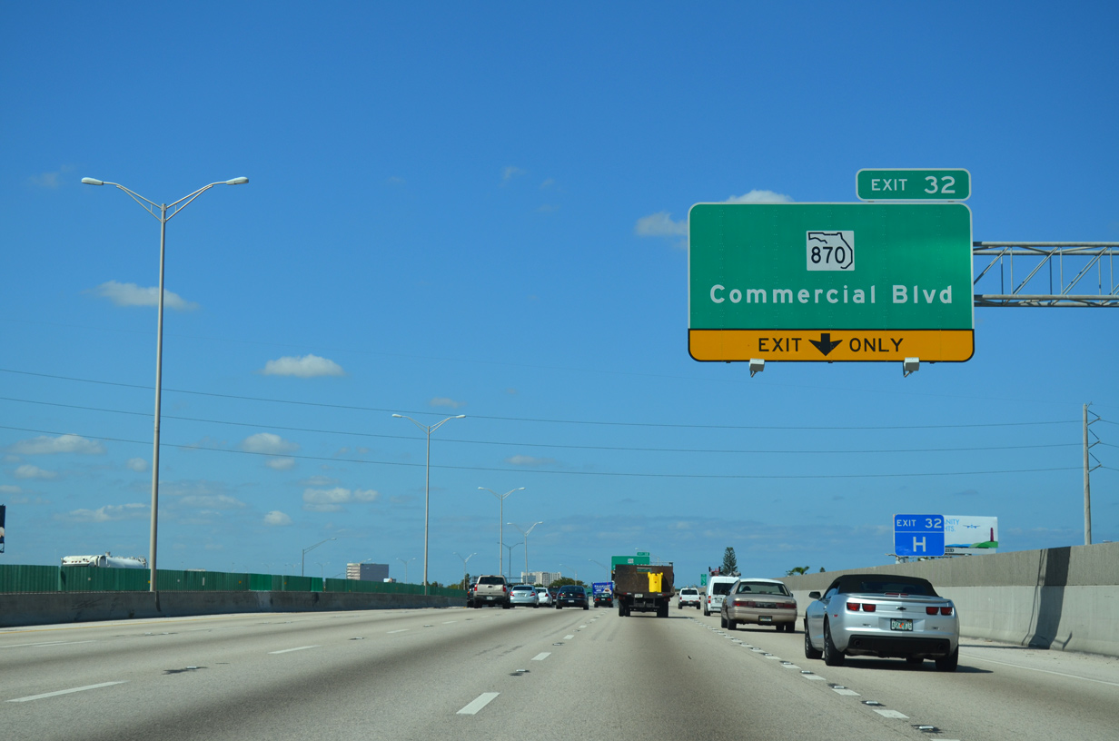
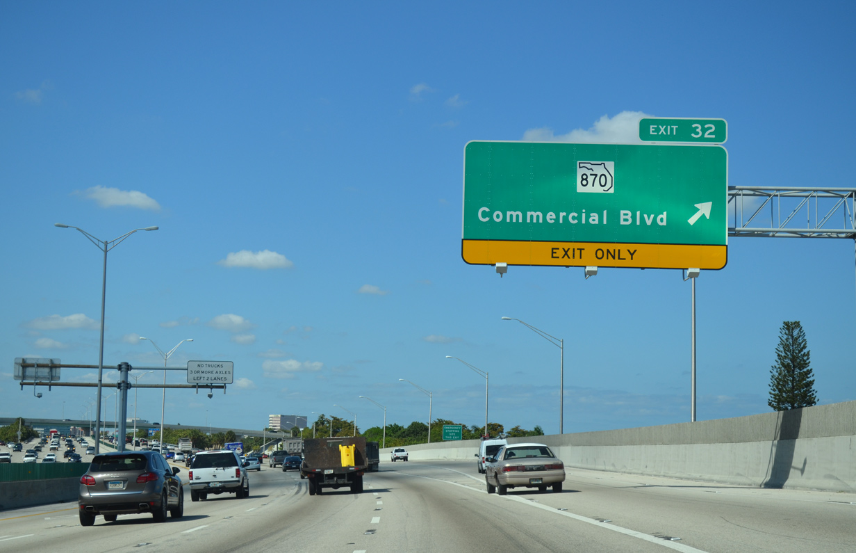
| A diamond interchange (Exit 32) with an added flyover from SR 870 west to I-95 south joins the freeway with Commercial Boulevard in 0.75 miles. 04/01/14 |
|
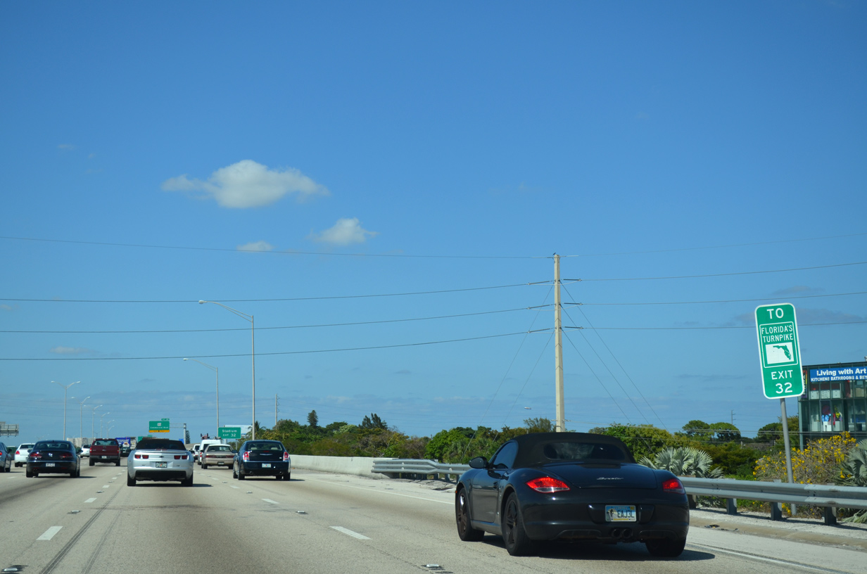
| SR 870 provides another connection between Interstate 95 and Florida's Turnpike at Tamarac. 04/01/14 |
|
| 9.89 miles in length, SR 870 (Commercial Boulevard) goes east from Exit 32 to Lauderdale-By-The-Sea and west to SR 817 at Tamarac. 04/01/14 |
|
| SR 870 (Commercial Boulevard) west connects I-95 with Fort Lauderdale Executive Airport (FXE) and Fort Lauderdale Stadium in northwest Fort Lauderdale. 04/01/14 |
|
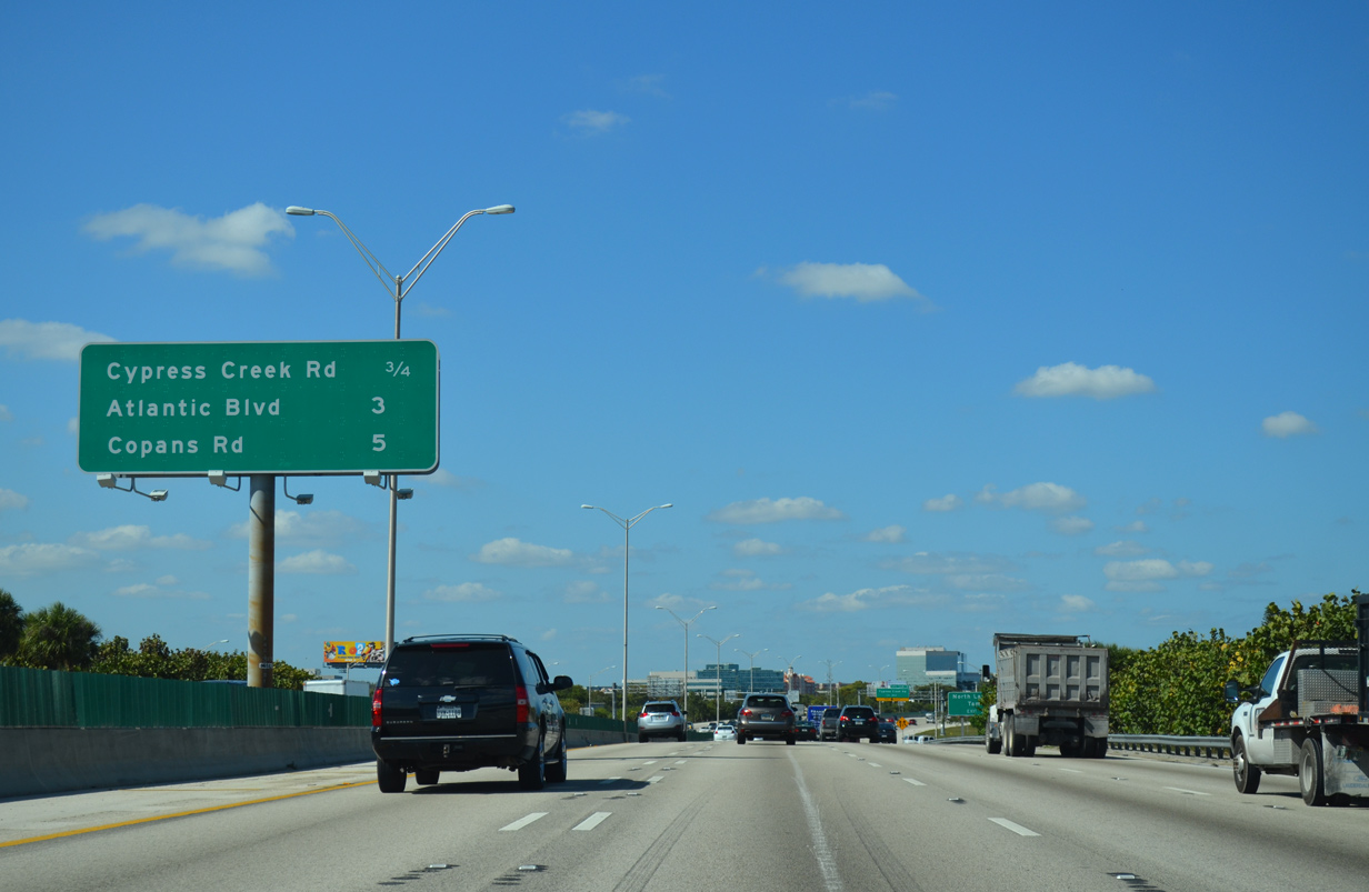
| I-95 winds northeast to depart Oakland Park for the city of Pompano Beach beyond forthcoming Exit 33 with Cypress Creek Boulevard. Unlike distance signs in Miami-Dade County, this sign does not reference the intersecting state roads. 04/01/14 |
|
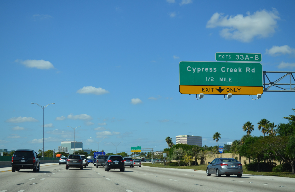
| Cypress Creek Road runs east-west between North Lauderdale and northeast Fort Lauderdale. A six-ramp parclo interchange (Exits 33 A/B) joins the arterial with I-95 in a half mile. 04/01/14 |
|
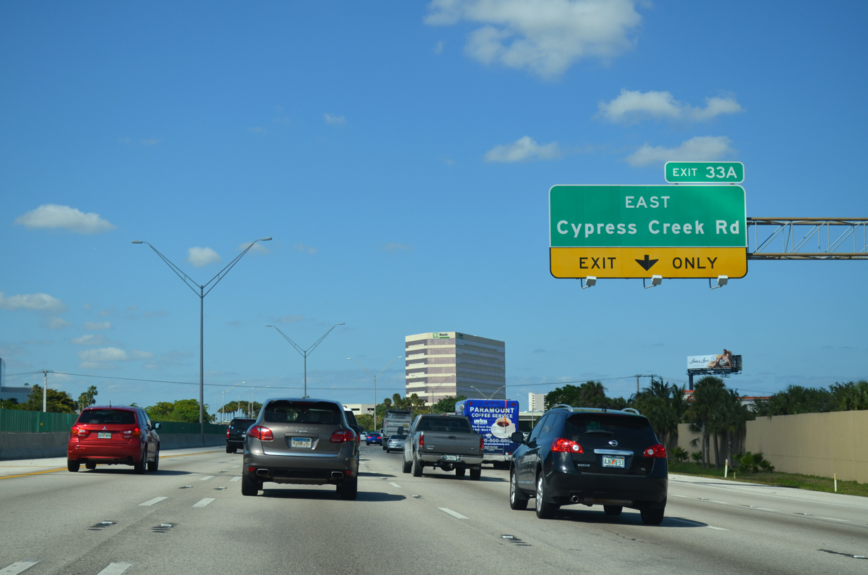
| Exit 33 A leads east onto Cypress Creek Road to SR 811 (Dixie Highway) and NE 18th Avenue by Pine Crest High School. 04/01/14 |
|
| N Andrews Avenue spans I-95 at Exit 33 A for Cypress Creek Road east. The arterial transitions into a residential street, NE 62nd Street, to U.S. 1. 04/01/14 |
|
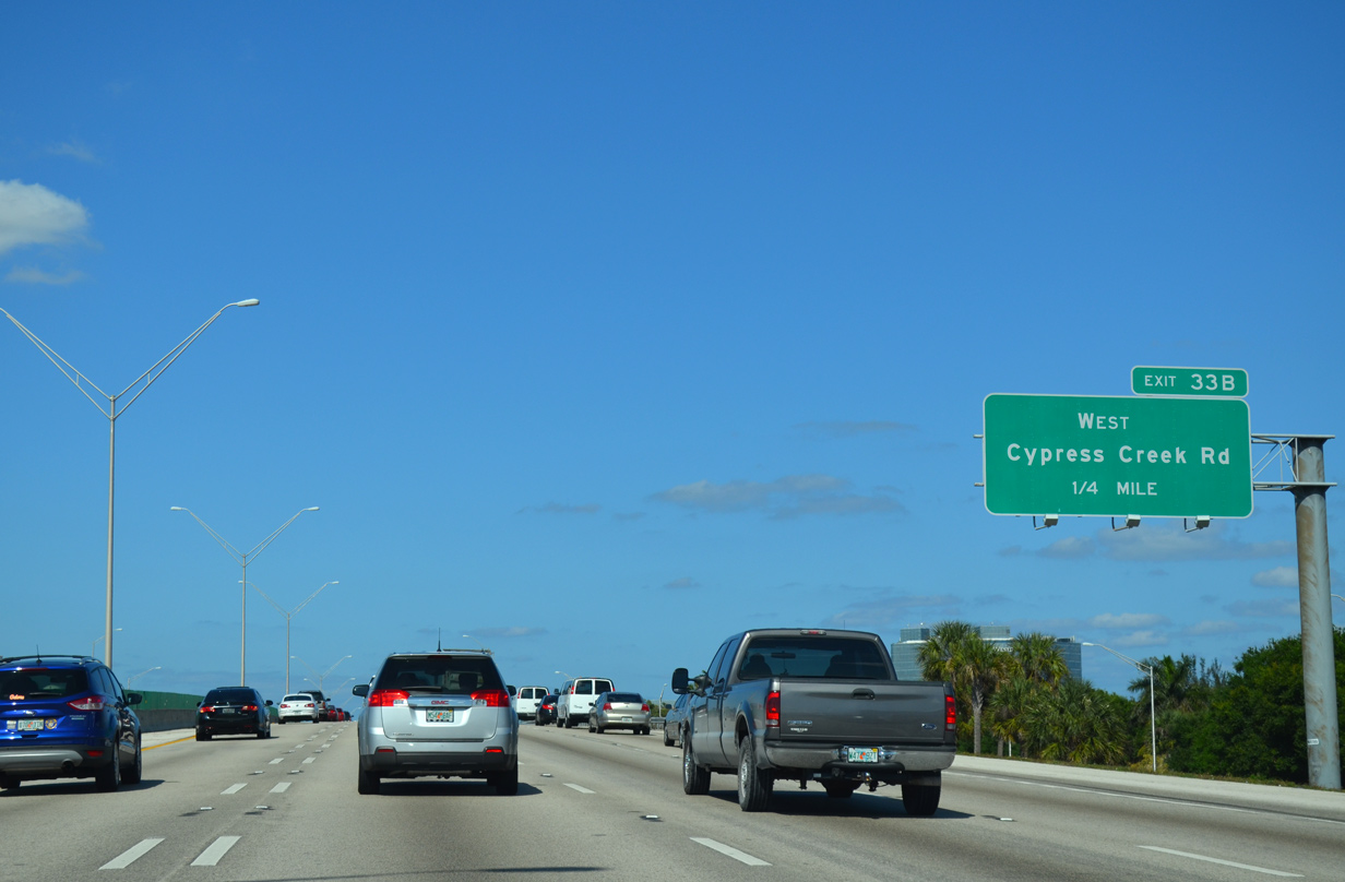
| Exit 33 B loops onto Cypress Creek Road west. The arterial runs along the north side of Fort Lauderdale Executive Airport (FXE) to NW 31st Avenue. 04/01/14 |
|
| Cypress Creek Road becomes 62nd Street / McNab Road west through North Lauderdale and Tamarac. 04/01/14 |
|
| Interstate 95 turns more northerly beyond Cypress Creek Canal through the city of Pompano Beach. The next three exits serve the city. 04/01/14 |
|
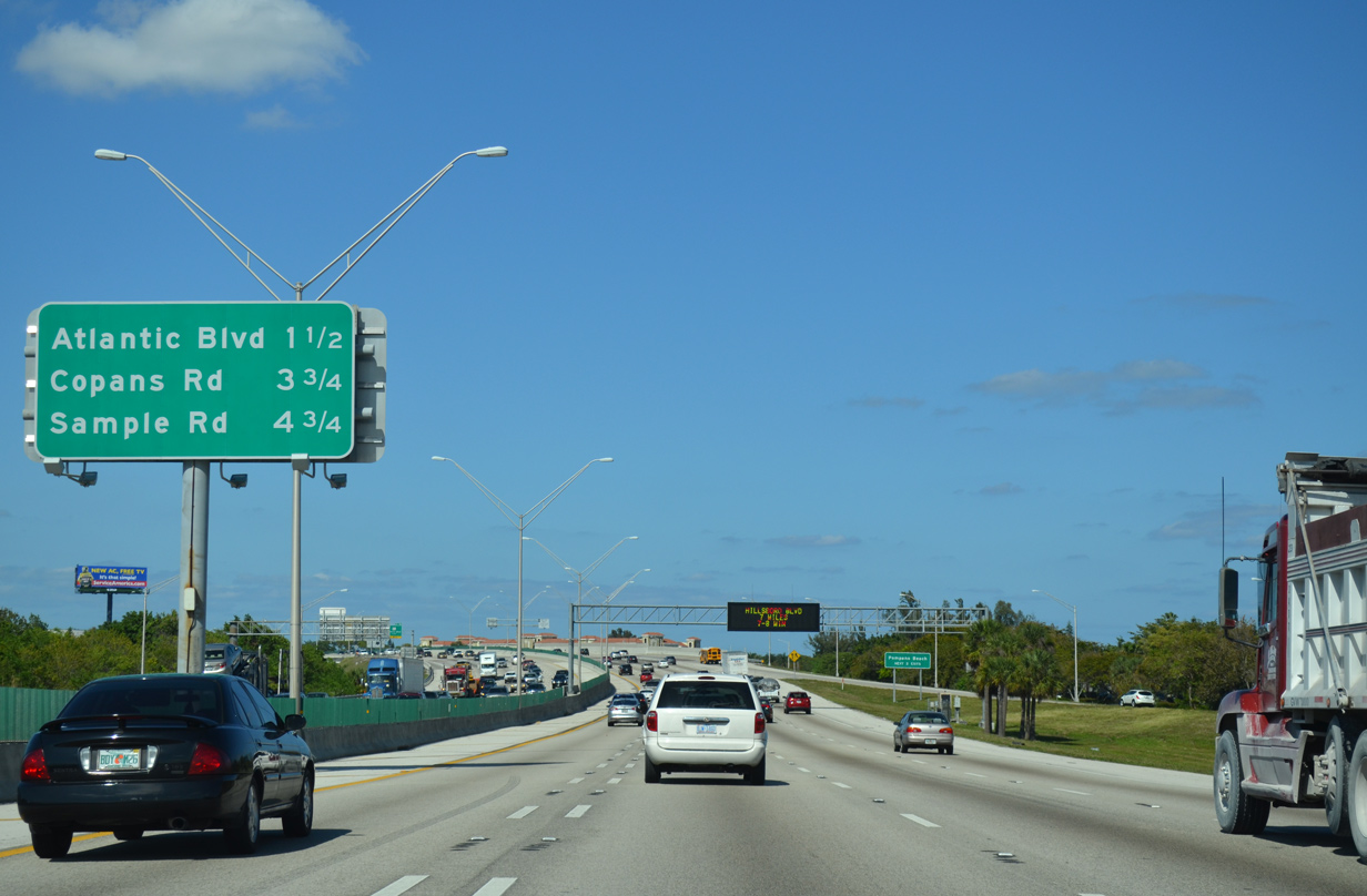
| Upcoming SR 814 (Atlantic Boulevard) bisects Pompano Beach as part of a 7.12 mile route between U.S. 441 in Margate and SR A1A on the barrier island. 04/01/14 |
|
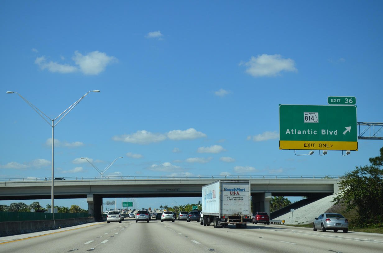
| Interstate 95 parallels an industrial area along Andrews Avenue northward to Exit 36. 04/01/14 |
|
| The fifth northbound lane defaults to SR 814 (Atlantic Boulevard) at Exit 36. Points of interest served by Exit 36 include Pompano State Farmers Market and Isle Casino & Horse Racing. 04/01/14 |
|
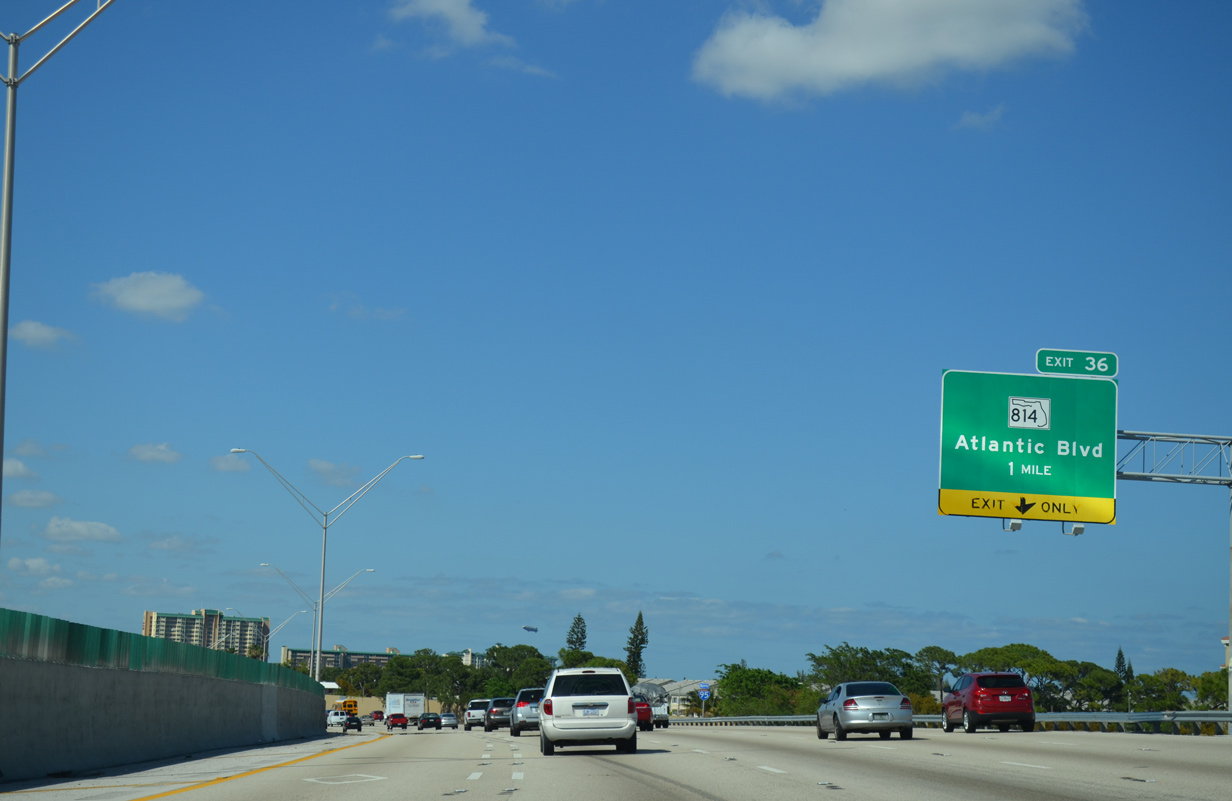
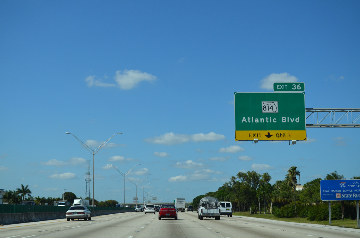
| Interstate 95 north reaches the six-ramp parclo interchange (Exit 36) with SR 814 (Atlantic Boulevard). Atlantic Boulevard extends beyond the SR 814 end at Margate through Coral Springs to Exit 6 of the Sawgrass Expressway. 04/01/14 |
|
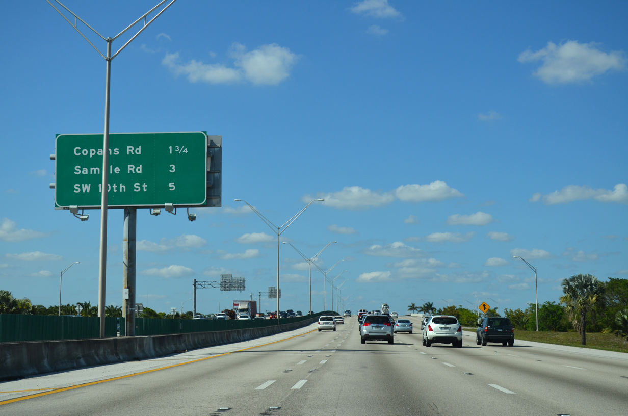
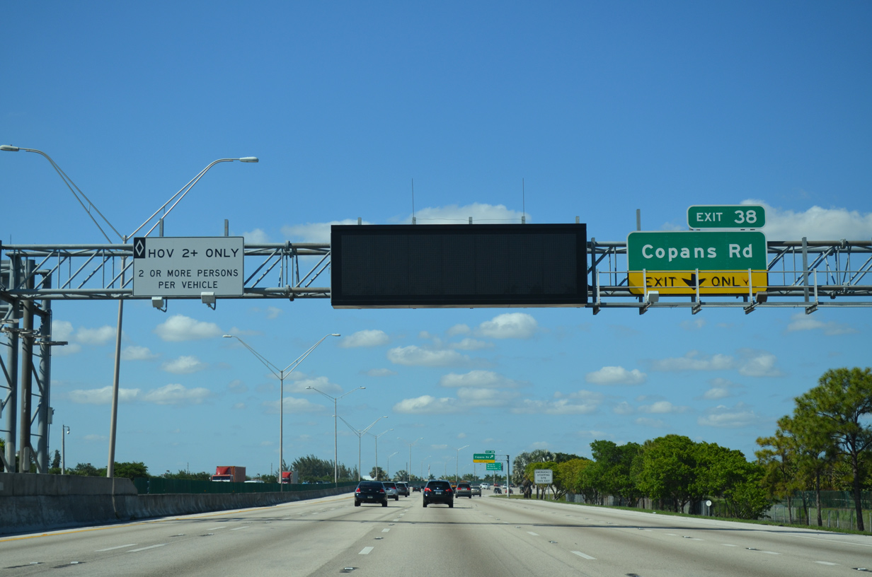
| Copans Road lies 1.75 miles ahead to the west of Pompano Beach Airpark (PMP). SR 834 (Sample Road) follows in three miles along the Pompano Beach city line. 04/01/14 |
|
| Copans Road constitutes a locally maintained arterial leading east to U.S. 1 (Federal Highway) in Pompano Beach and west to Coconut Creek. 04/01/14 |
|
| The left lane continues with a restriction of HOV-2 traffic during peak hours. The lane will eventually be converted to a HOT Lane as part of a future phase of the 95 Express Lanes. 04/01/14 |
|
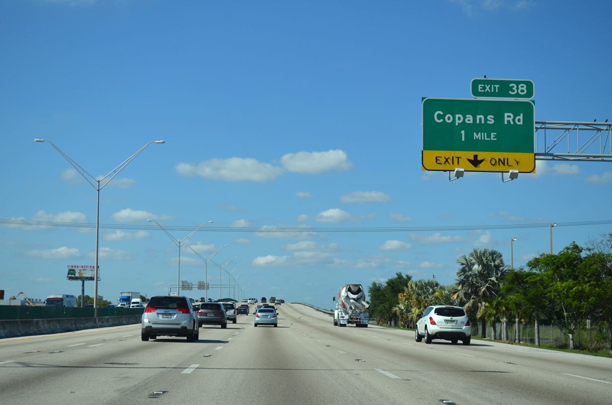
| One quarter mile ahead of the three-quarter cloverleaf interchange (Exit 38) with Copans Road on I-95 north. 04/01/14 |
|
| Exit 38 leaves I-95 north for Copans Road east to Pompano Beach Airpark (PMP) and west through an industrial area to Coconut Creek and Royal Palm Boulevard through Margate. 04/01/14 |
|
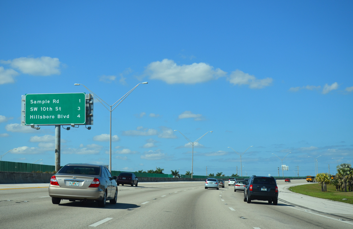
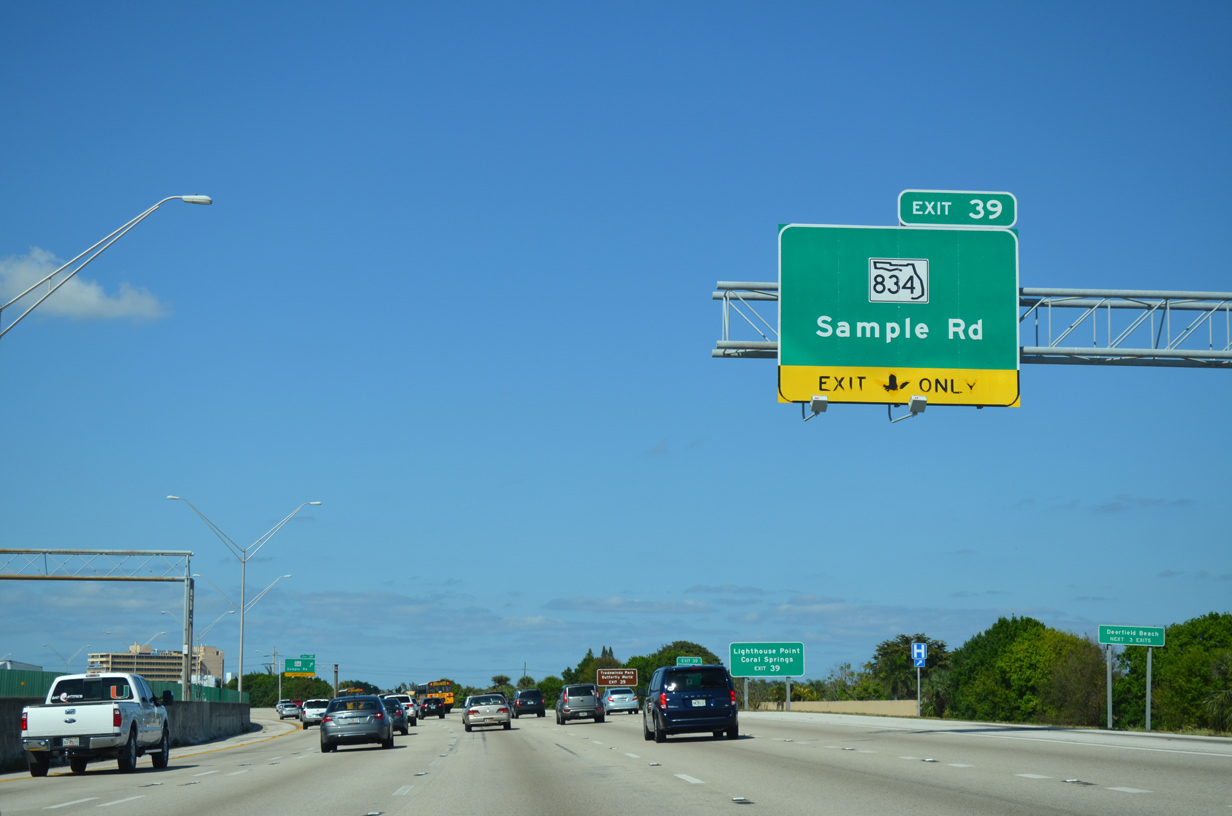
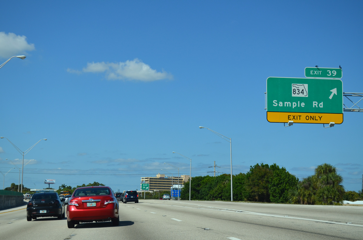
| Interstate 95 shifts northeastward again on the one mile approach to Sample Road (Exit 39). The subsequent two exits lie within Deerfield Beach. 04/01/14 |
|
| SR 834 runs 9.49 miles along Sample Road from SR 817 (University Drive) in Coral Springs to U.S. 1 (Federal Highway) at Lighthouse Point. 04/01/14 |
|
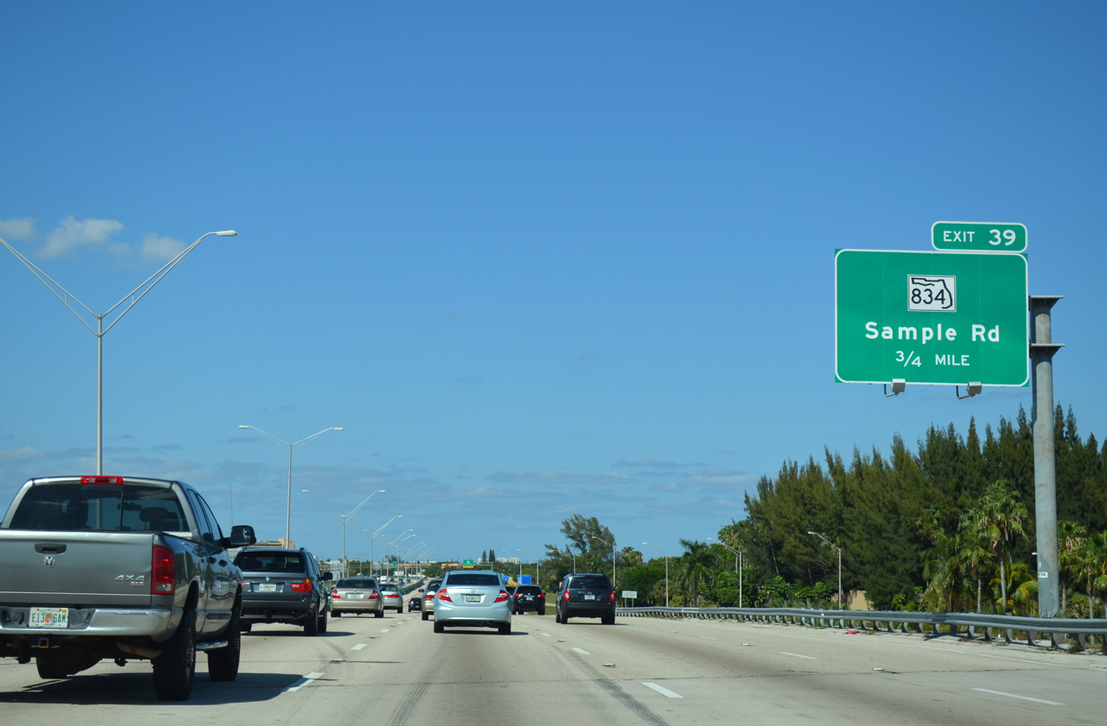
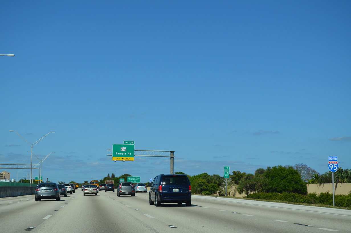
| Reassurance marker posted ahead of the six-ramp parclo interchange (Exit 39) with SR 834. A Turnpike trailblazer directs motorists west along Sample Road to Exit 69 of the toll road. 04/01/14 |
|
| Exit 39 claims the auxiliary lane gained from Copans Road for SR 834 (Sample Road) east to north Pompano Beach and west to Coconut Creek. 04/01/14 |
|
| Sample Road continues beyond the SR 834 end in Coral Springs to Exit 8 of the Sawgrass Expressway. 04/01/14 |
|
| The final two Broward County interchanges lie within the city of Deerfield Beach. Deerfield Beach is perhaps best known for its continuous public access walkway that parallels the beach front. Its beaches are very accessible and easy to reach without infringing on private property as a result of the walkway. 04/01/14 |
|
| A reassurance marker for I-95 north stands beyond a pedestrian bridge at NW 41st Street. 10/18/14 |
|
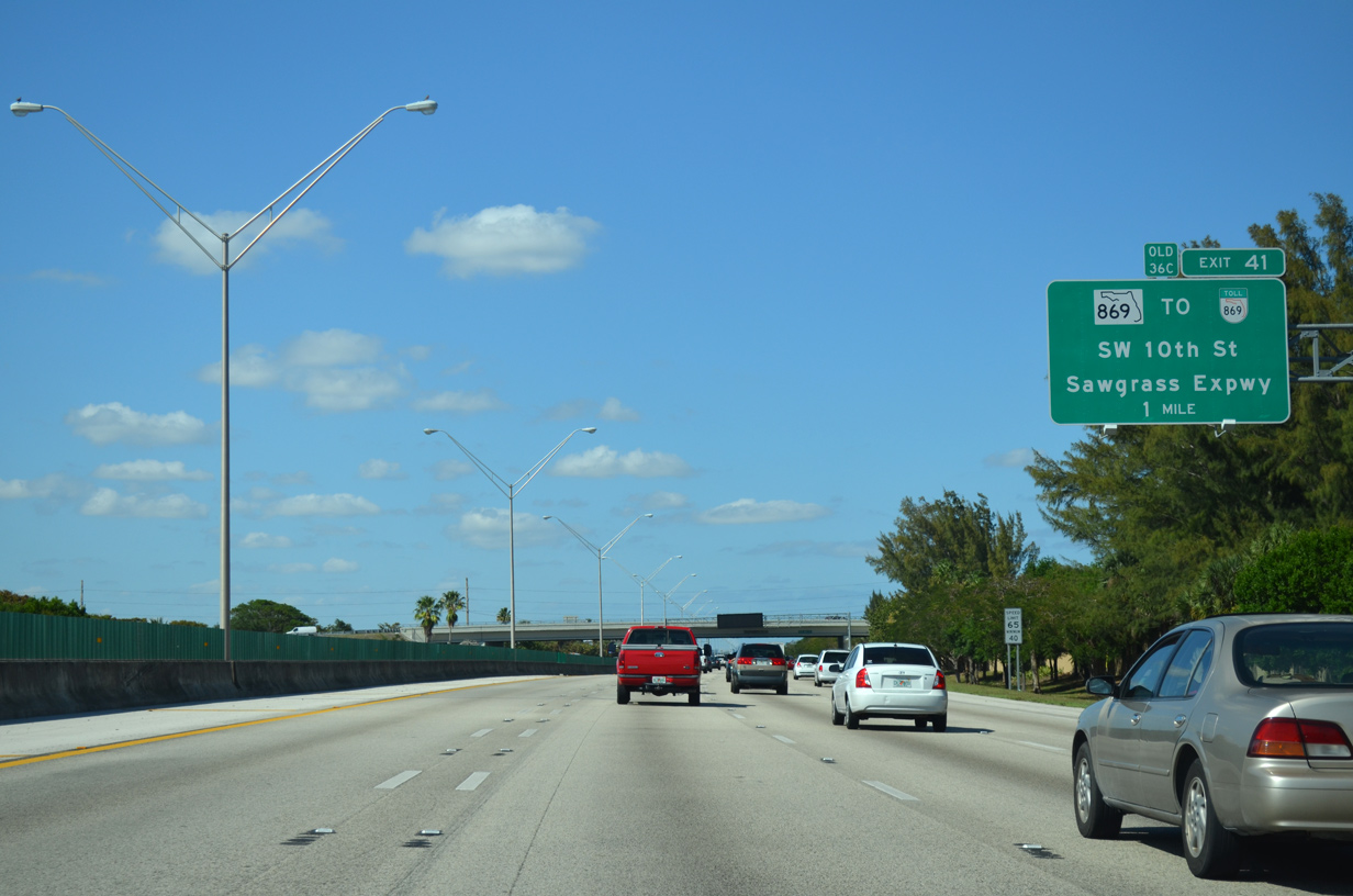
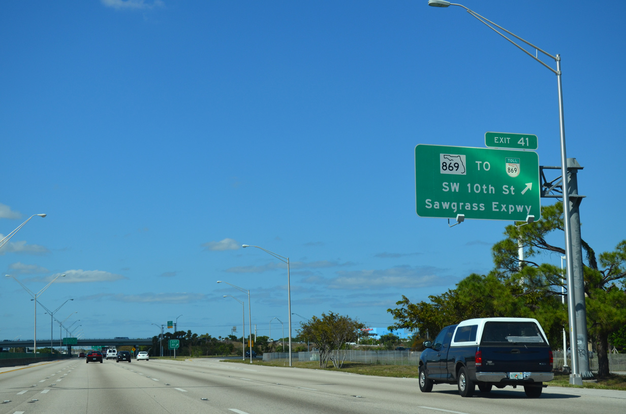
| One mile south of SR 869 SW 10th Street) west to the Sawgrass Expressway. The toll road separates developed Broward County from the undeveloped and uninhabited Everglades along the west side of Coral Springs, Tamarac and Sunrise. 04/01/14 |
|
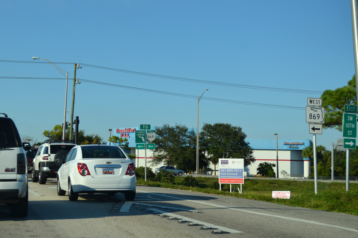
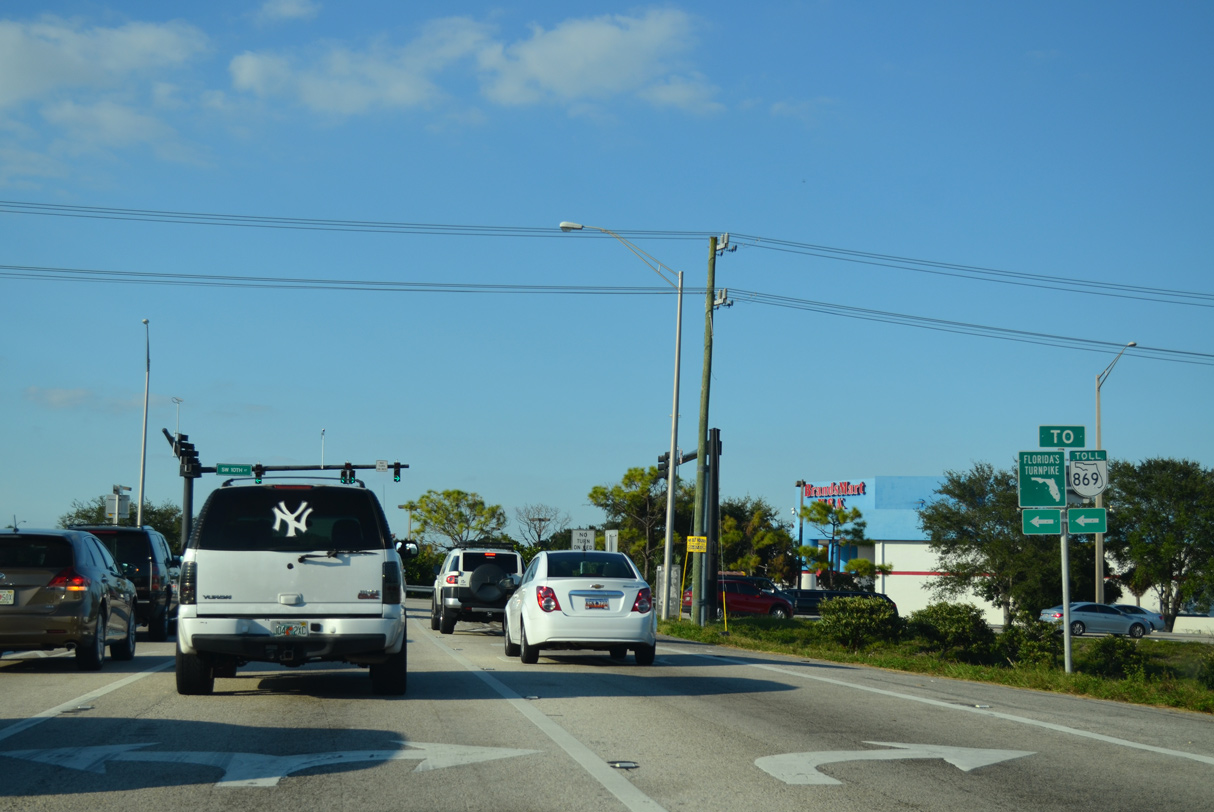
| Northbound I-95 reaches the parclo interchange with SR 869 (SW 10th Street). SR 869 is at grade arterial between I-95 and Florida's Turnpike; it becomes the Sawgrass Expressway after passing under the Turnpike. 04/01/14 |
|
| SW 10th Street continues east from SR 869 and I-95 through Deerfield Beach as a locally maintained road to the Intracoastal Waterway. 10/18/14 |
|
| SR 869 transitions onto the tolled Sawgrass Expressway 2.7 miles west of Exit 41. 10/18/14 |
|
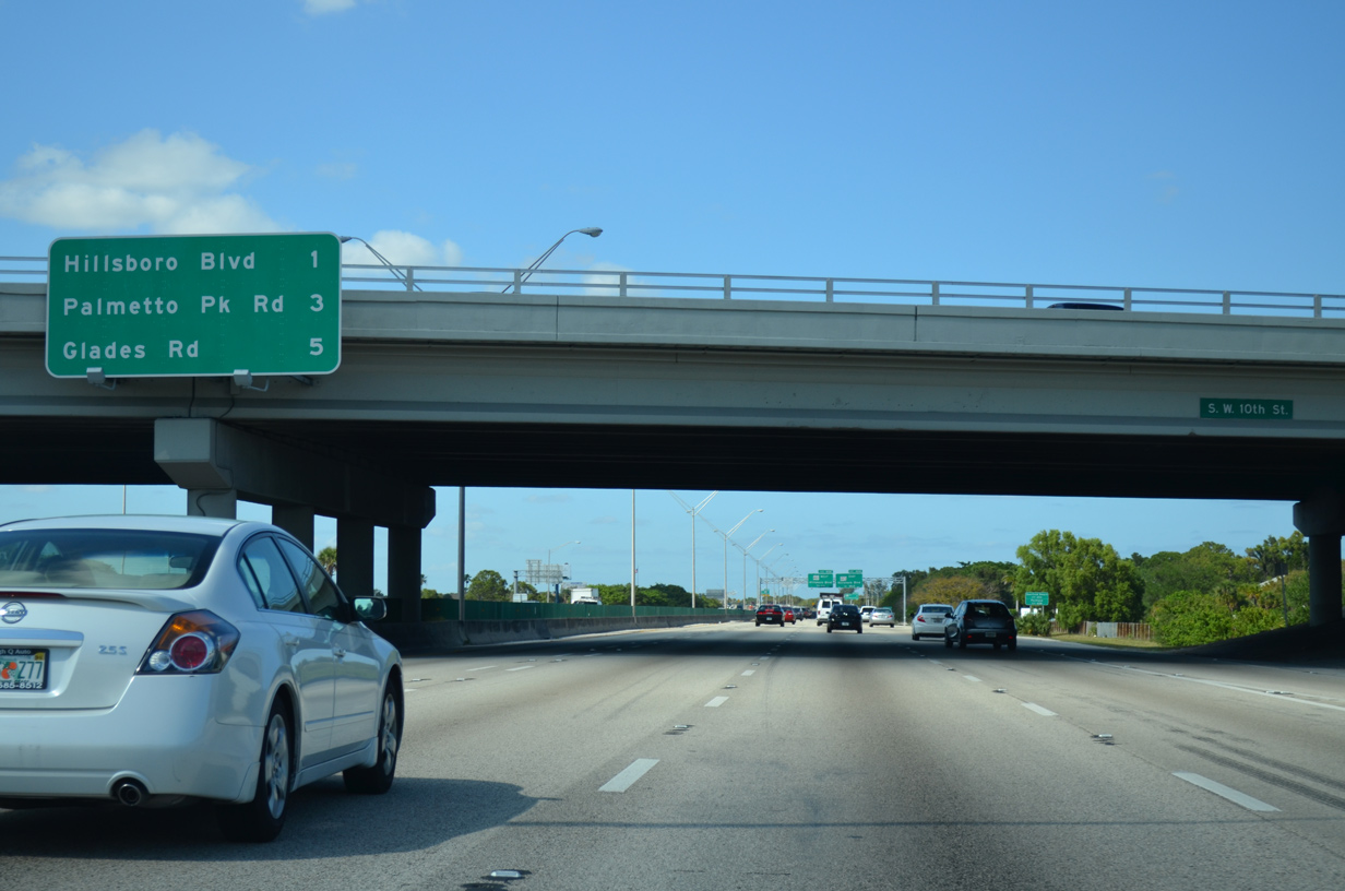
| Just one mile separates SW 10th Street (SR 869) with Exit 42 to SR 810 (Hillsboro Boulevard) in north Deerfield Beach. 04/01/14 |
|
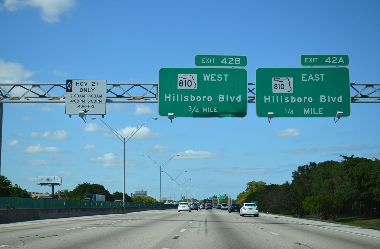
| A three quarter cloverleaf interchange (Exits 42 A/B) links Interstate 95 and (SR 810 (Hillsboro Boulevard) in one quarter mile. 04/01/14 |
|
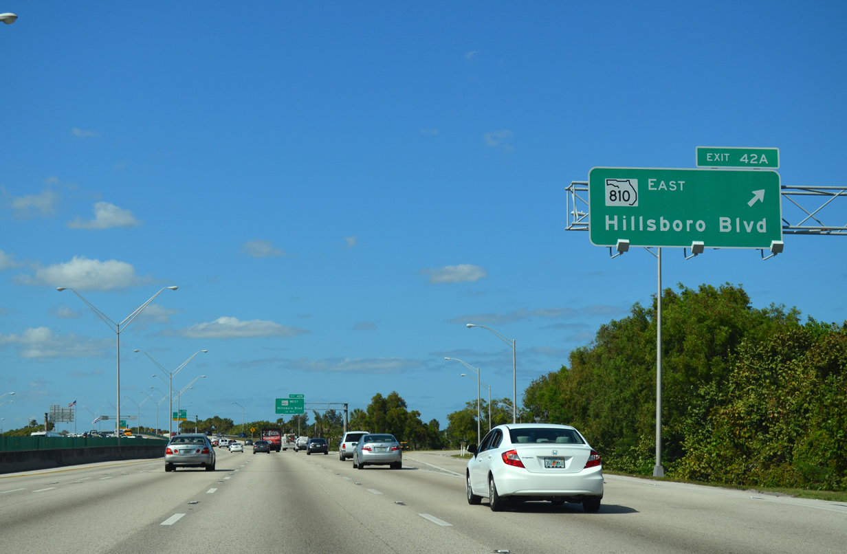
| Exit 42 A parts ways with I-95 north for SR 810 (Hillsboro Boulevard) east to SR A1A (21st Avenue) on Deerfield Beach portion of the Atlantic barrier island. 04/01/14 |
|
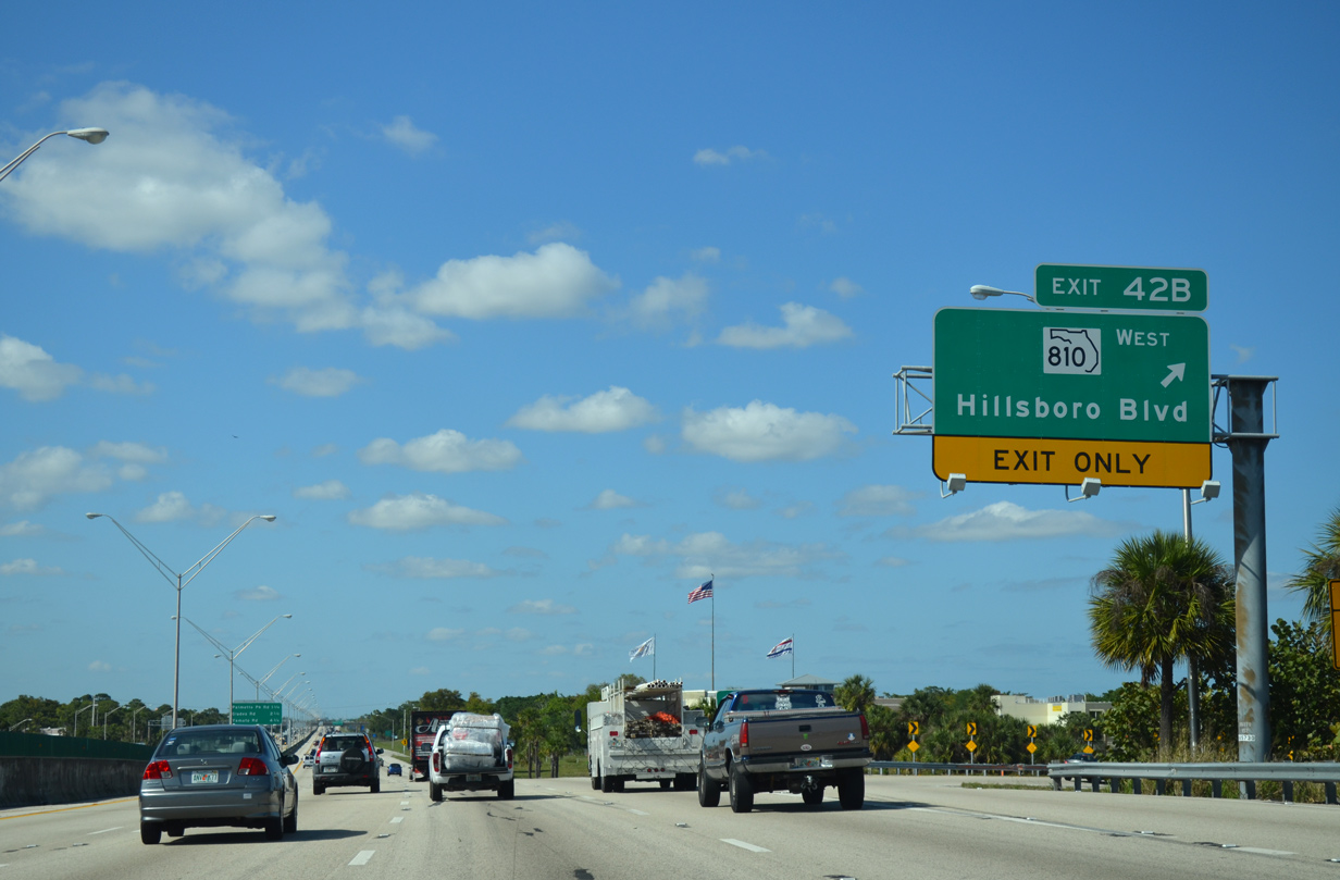
| Three signs precede the loop ramp for Exit 42 B onto SR 810 (Hillsboro Boulevard) west. 04/01/14 |
|
| West from Exit 42 B, SR 810 follows Hillsboro Boulevard across Deerfield Beach to Coconut Creek and U.S. 441 at the Parkland city line. 04/01/14 |
|
| SR 810 conclude a 7.82 mile route at U.S. 441, with Hillsboro Boulevard angling northwest a short distance further to Terramar Park in Parkland. 04/01/14 |
|
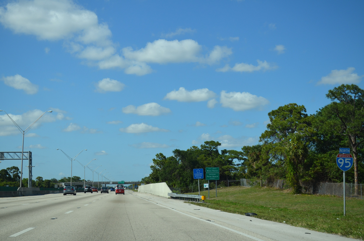
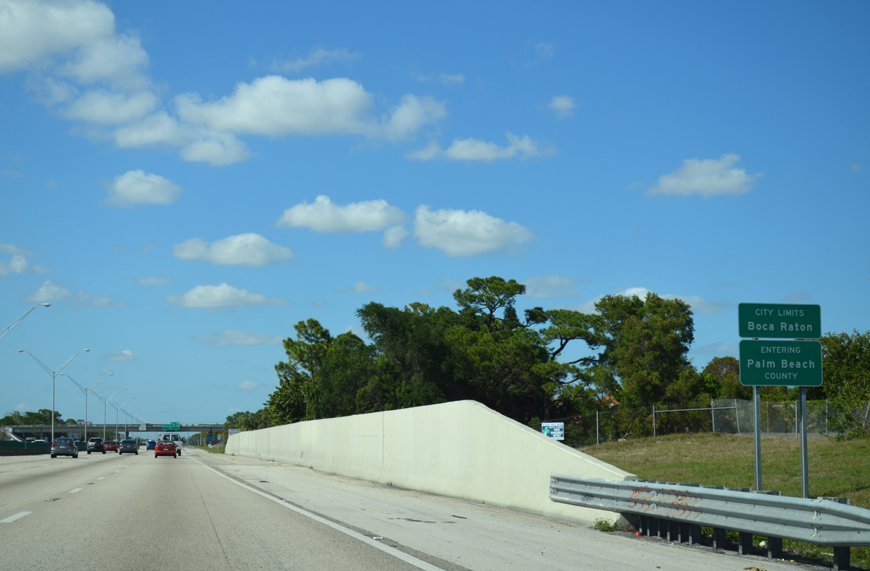
| The first three interchanges within Palm Beach County lie within the city of Boca Raton. 04/01/14 |
|
| Interstate 95 reassurance marker posted ahead of Hillsboro Canal. 04/01/14 |
|
| Crossing Hillsboro Canal, northbound travelers along I-95 enter Palm Beach County. Palm Beach County was founded in 1909, when it separated from Dade County. A few years later, in 1915, the southern tier of Palm Beach County and northern tier of Dade County became today's Broward County. Other portions of Palm Beach County later became parts of Okeechobee County in 1917 and Martin County in 1925. The first city to be incorporated in Palm Beach County was West Palm Beach, which did so in 1894.1 04/01/14 |
Page Updated 11-03-2018.

 North
North