|
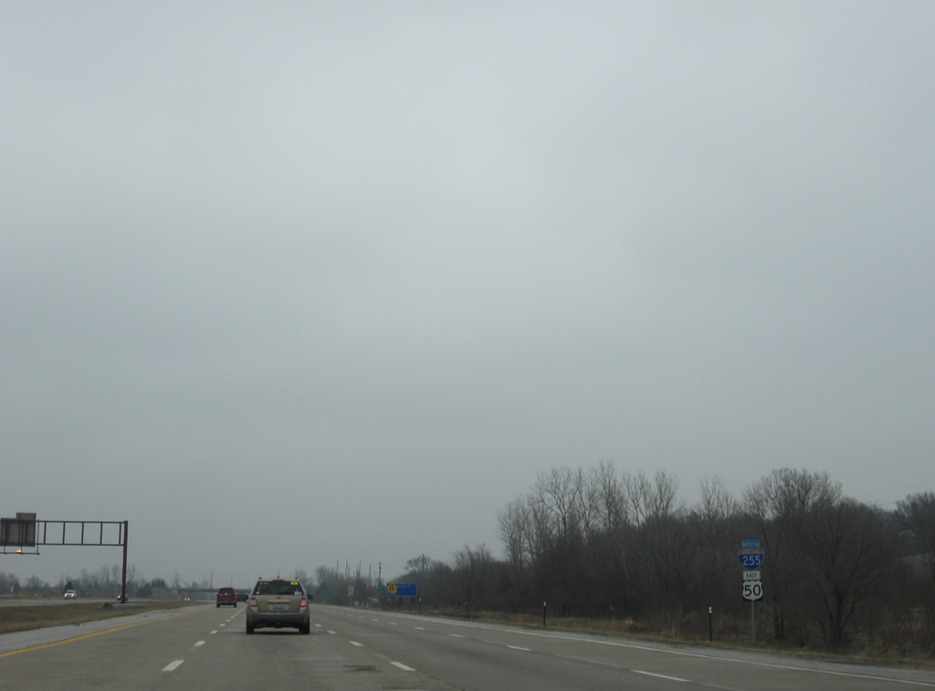
| IL 3 joins I-255/U.S. 50 for a 4.4 mile overlap from Columbia through Dupo. This set of shields omits the state route. 12/20/09 |
|
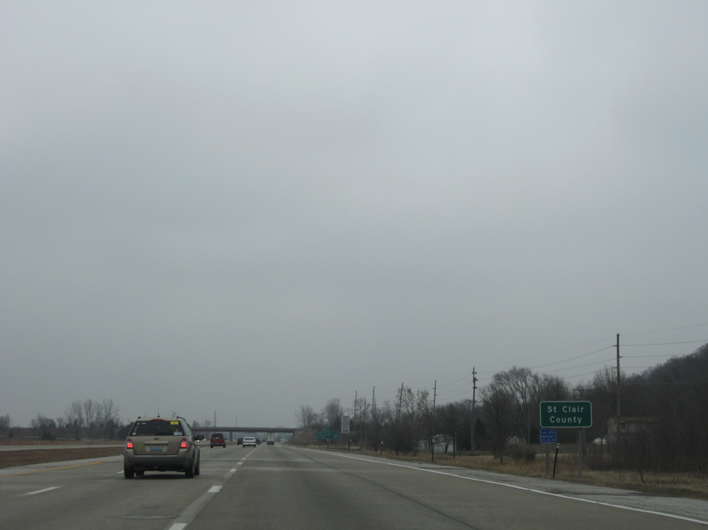
| Interstate 255 leaves the northern wedge of Monroe County for St. Clair County. Established in 1790 by Arthur St. Clair, first governor of the Northwest Territory, to incorporate the majority of what is now Illinois, the county was readjusted several times between 1803 and 1827 to its current dimensions.2 12/20/09 |
|
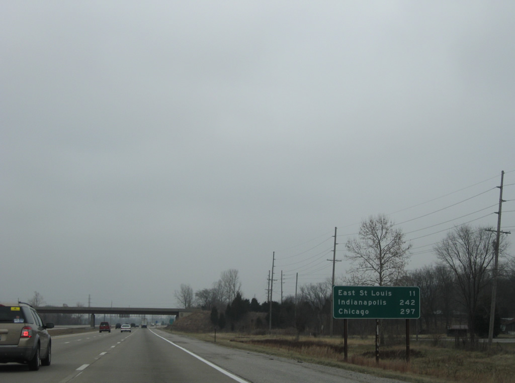
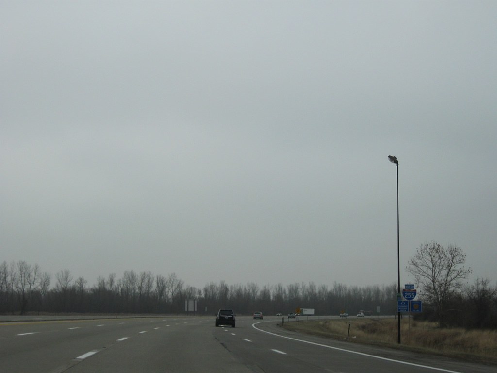
| Northbound distance sign posted ahead of the Davis St. Ferry Road overpass, referencing East St. Louis via IL 3 north, Indianapolis via Interstate 70 east and Chicago via Interstate 55 north. 12/20/09 |
|
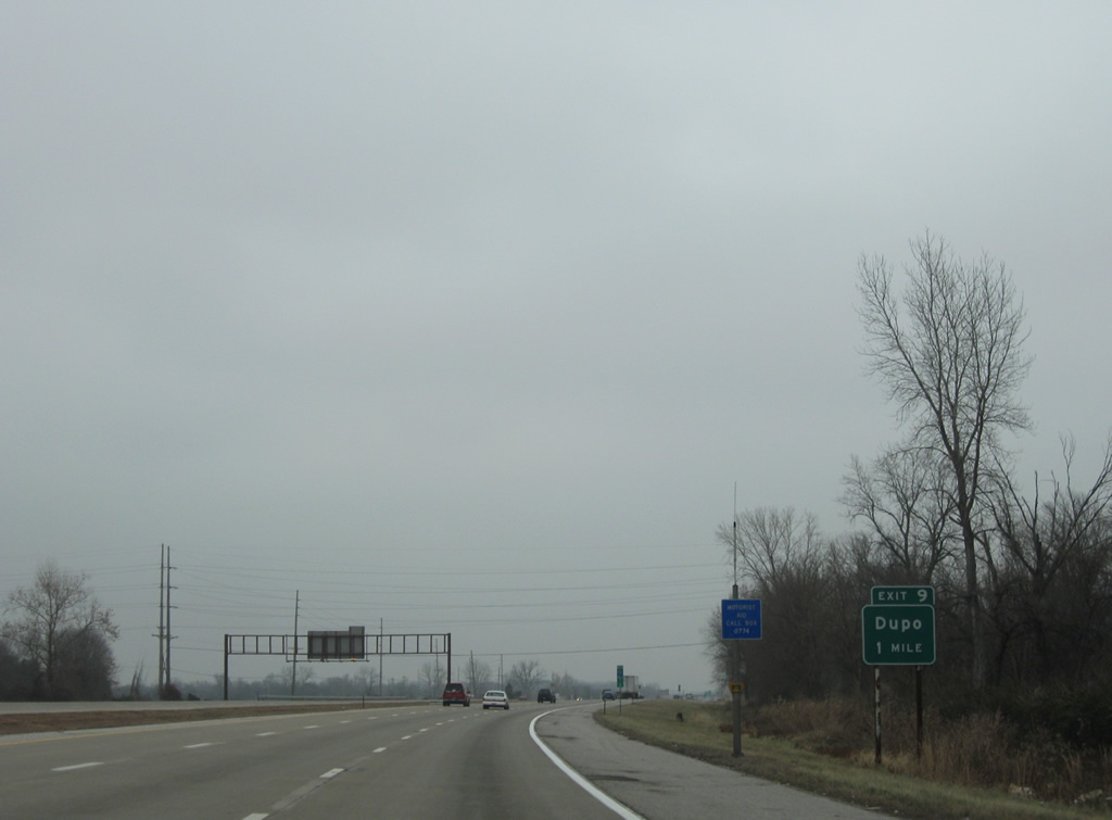
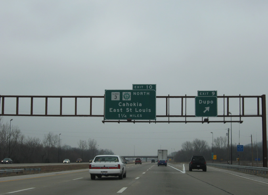
| Entering the village of Dupo, Interstate 255, U.S. 50, and IL 3 advance to a parclo interchange with S Main Street (Old IL 3). 12/20/09 |
|
| Visible along the east side of the freeway, Old Route 3 travels through Phelps and Sugarloaf Heights to become Main Street in Dupo. 12/20/09 |
|
| Exit 9 for Main Street through Dupo leaves I-255/U.S. 50-IL 3 north. IL 3 parts ways with the freeway at Exit 10 in 1.25 miles for Cahokia. Main Street reconnects with IL 3 by North Dupo. 12/20/09 |
|
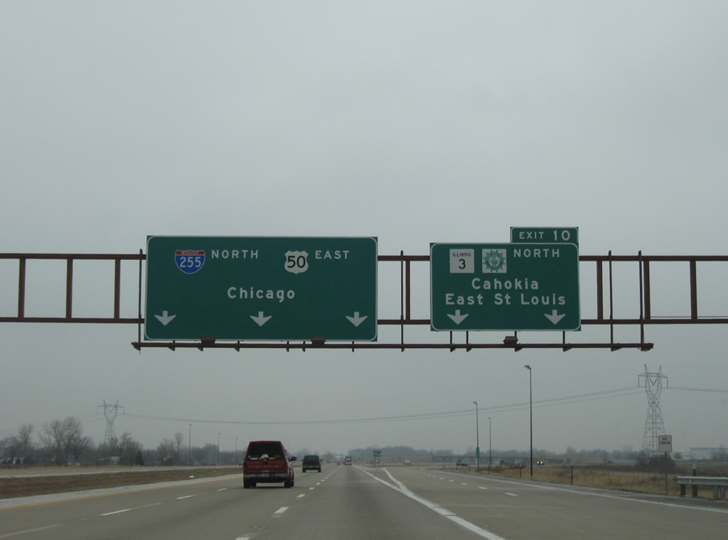
| The Great River Road leaves Interstate 255 and continues northward along IL 3 (Mississippi Avenue) through Cahokia and East St. Louis. 12/20/09 |
|
| Three lanes continue on northbound I-255/U.S. 50 from the trumpet interchange (Exit 10) with IL 3 at Dupo. IL 3 travels through East St. Louis to a short overlap with I-55/64 to St. Clair Avenue. 12/20/09 |
|
| I-255/U.S. 50 curve eastward to Centreville while IL 3 / Great River Road continue north into Cahokia via Exit 10. IL 3 north to IL 157 (Camp Jackson Road) east doubles as the former alignment of U.S. 50 Bypass. 12/20/09 |
|
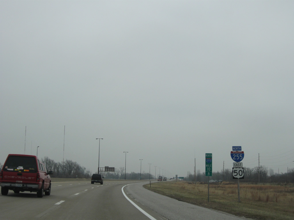
| Reassurance shields posted for Interstate 255 north / U.S. 50 east at Falling Spring. 12/20/09 |
|
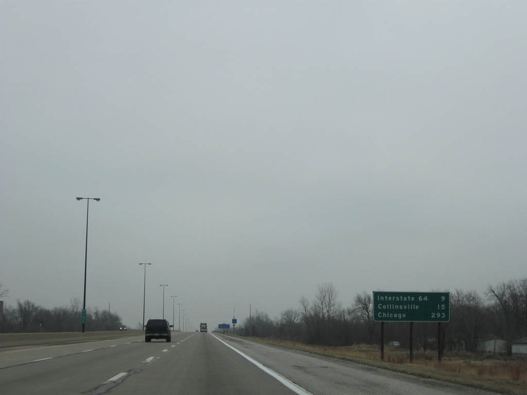
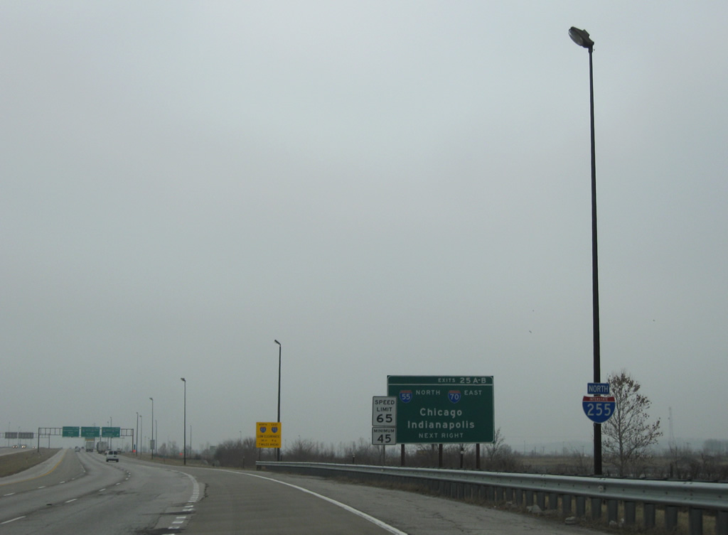
| Nine miles separate the I-255 split with IL 3 from Interstate 64. Collinsville, where I-255 meets I-55/70, follows in 15 miles, while Chicago is 293 miles to the northeast. 12/20/09 |
|
| I-255/U.S. 50 follow a causeway like roadway ahead of Prairie Du Pont Canal on the mile preceding IL 157 (Camp Jackson Road). 12/20/09 |
|
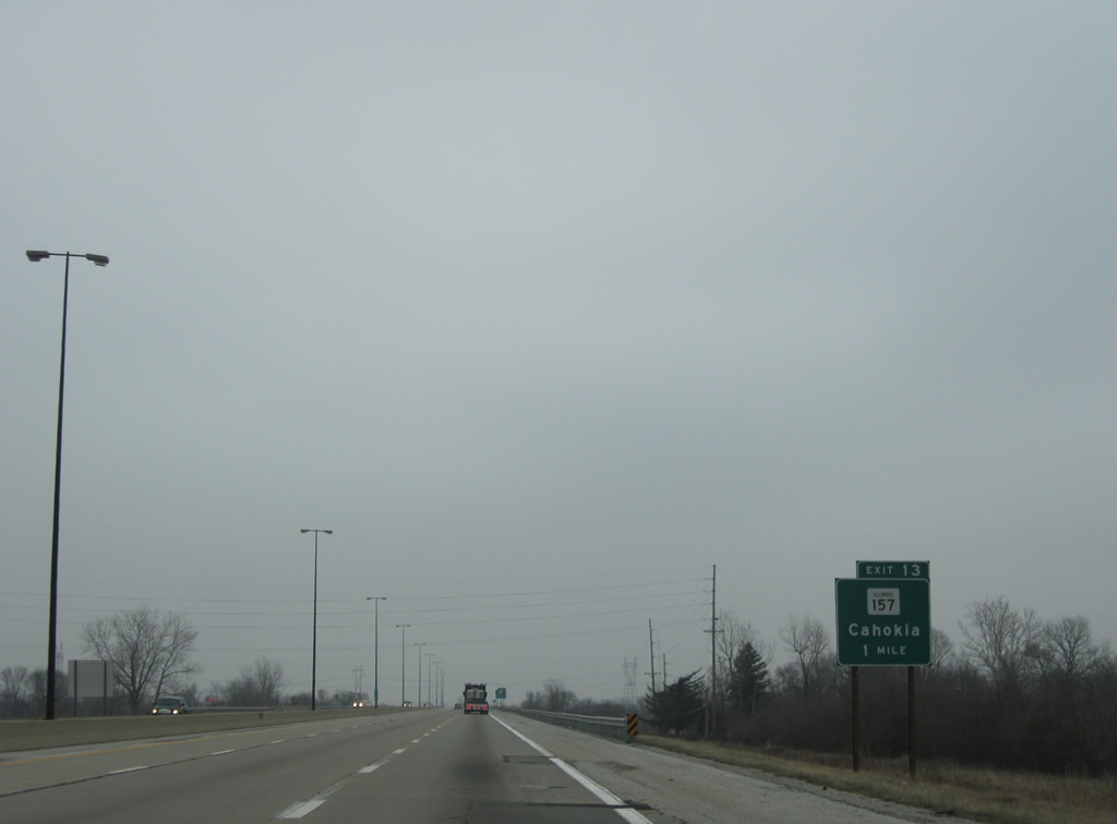
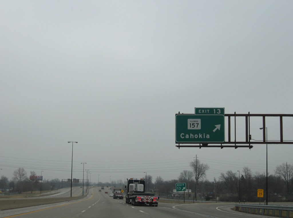
| Beginning at Water Street (IL 3) in Cahokia, IL 157 angles southeast to Exit 13 and northeast paralleling nterstate 255 through Fairview Heights, Caseyville, Collinsville and Glen Carbon.The state route concludes a 40 mile course at Hamel. 12/20/09 |
|
| Within eastern Cahokia, I-255/U.S. 50 east enter a parclo interchange (Exit 13) with IL 157 (Camp Jackson Road) and Triple Lakes Road. IL 157 follows Camp Jackson Road east to Old Missouri Avenue in adjacent Centreville while Triple Lakes Road spans Prairie Du Pont Canal south to Stolle and Bluffside. 12/20/09 |
|
| Continuing northeast, I-255/U.S. 50 leave Cahokia for Centreville. 12/20/09 |
|
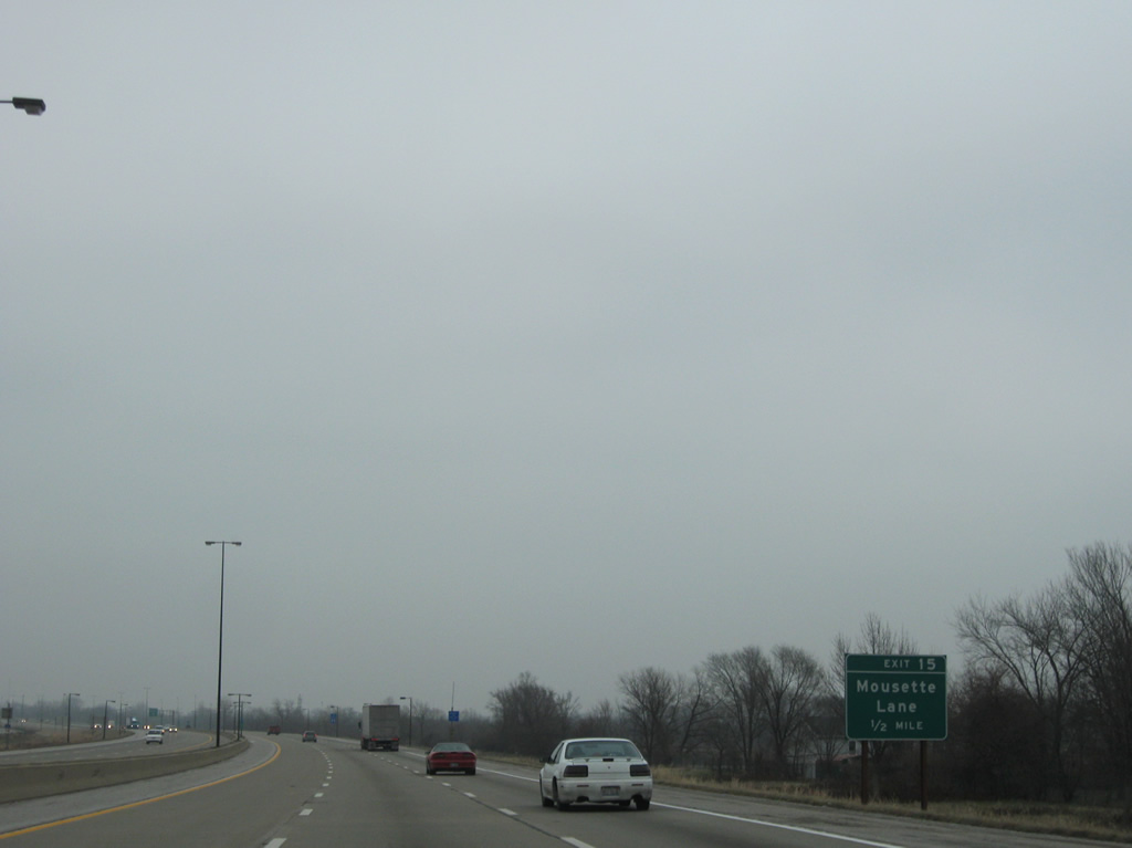
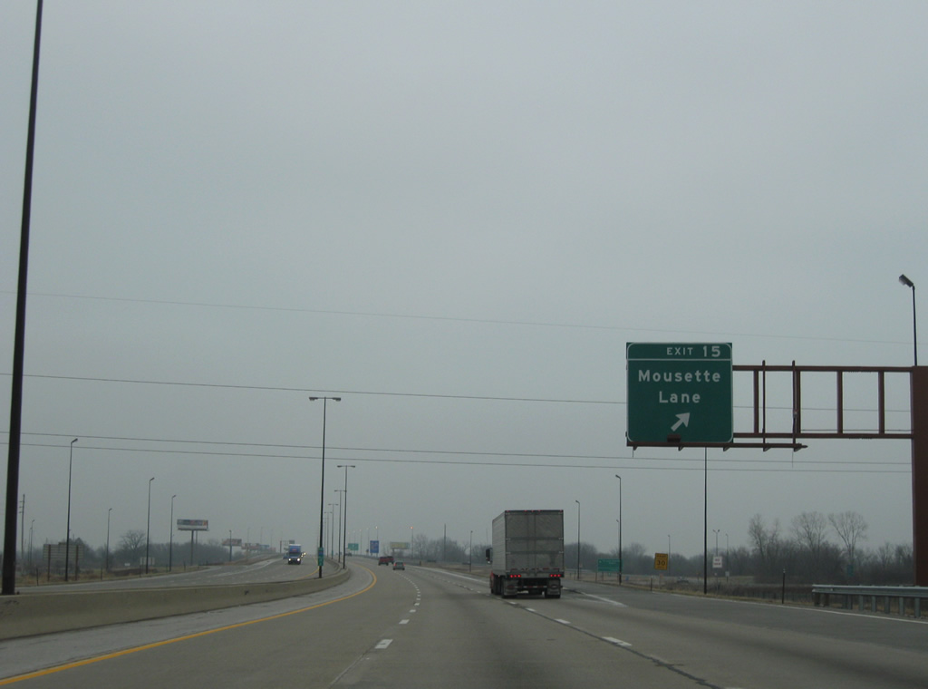
| The diamond interchange at Exit 15 connects Interstate 255 with Mousette Lane in one mile. 12/20/09 |
|
| St. Louis Downtown Airport (CPS) and GCS Ballpark lie just west of Exit 15. Opened in 2002, GCS Ballpark is home of the Gateway Grizzlies, a Frontier League baseball franchise. 12/20/09 |
|
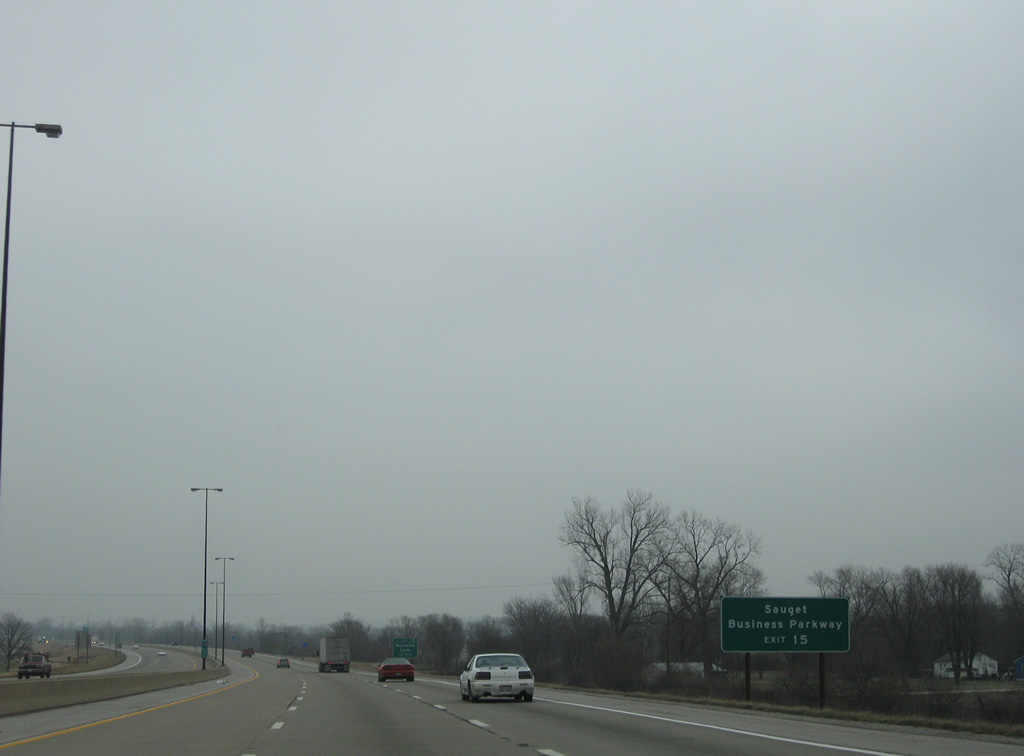
| Sauget Business Parkway stems west from Mousette Lane by I-255 to St. Louis Downtown Airport and an associated industrial park in Sauget. 12/20/09 |
|
| One half mile south of Exit 15 to Mousette Lane. Mousette Lane becomes Mousette Drive southward to Jerome Lane in Cahokia. 12/20/09 |
|
| Mousette Lane used to directly tie into 50th Street at Centreville. Construction of the exchange at Exit 15 in the 1990s altered the route to meet 50th Street at Goose Lake Road, a west side frontage road to I-255. 12/20/09 |
|
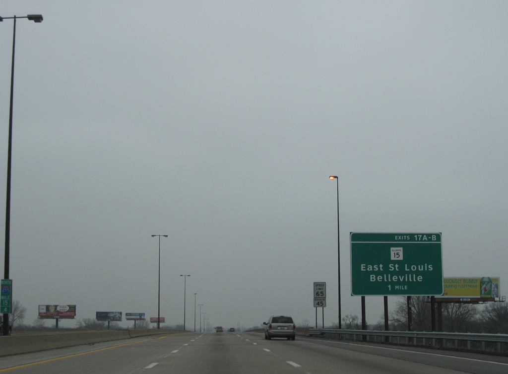
| I-255/U.S. 50 travel across the east side of Centreville to Exits 17 A/B with IL 15 (Missouri Avenue / New Missouri Avenue). 12/20/09 |
|
| S 52nd Street briefly comes into view by this set of shields for I-255/U.S. 50 northbound prior to a sound wall. 12/20/09 |
|
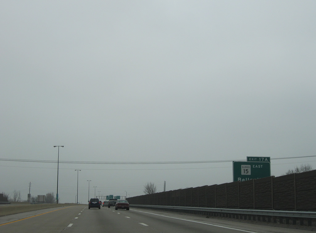
| Obscured by the sound wall in this view, I-255/U.S. 50 reach Exit 17 A to IL 15 (New Missouri Avenue) east in one half mile. IL 15 comprises an expressway type bypass of Belleville to Freeburg. 12/20/09 |
|
| The cloverleaf interchange between Interstate 255 and IL 15 lies just north of a Norfolk Southern Railroad line and IL 163 (Old Missouri Avenue). Construction of what was then U.S. 460 and later IL 15 along New Missouri Avenue replaced IL 163 and IL 13 (Old St. Louis Road) as the main route between Belleville and East St. Louis. 12/20/09 |
|
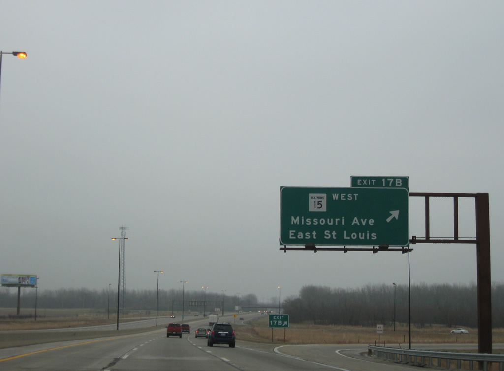
| Exit 17 B loops onto IL 15 (Missouri Avenue) west into Alorton. The state route meets the north end of IL 163 nearby and continues on an at grade route to Downtown East St. Louis and I-55/64. 12/20/09 |
|
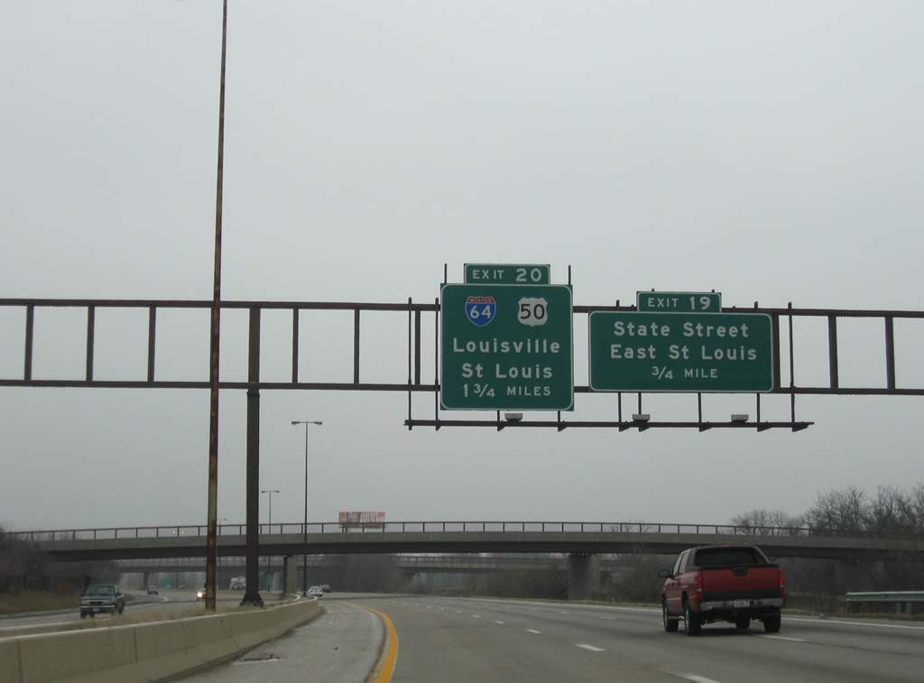
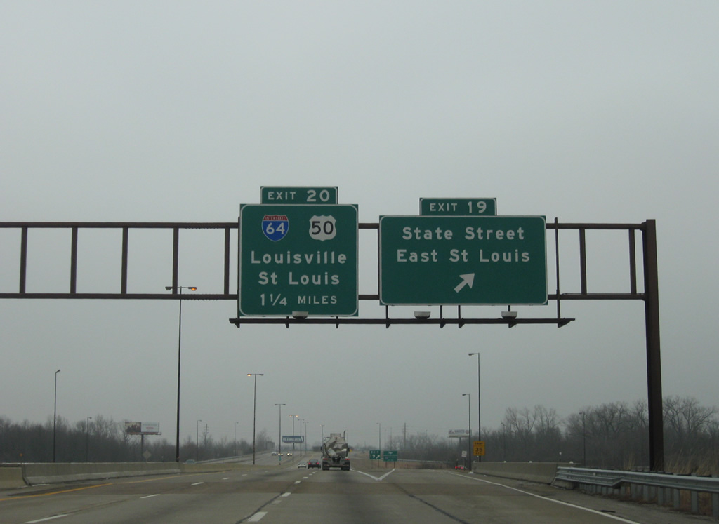
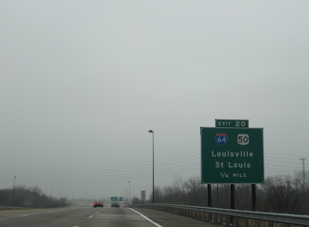
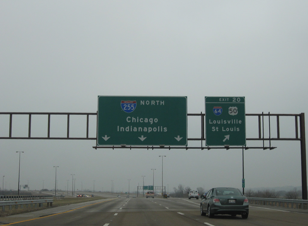
| The cloverleaf interchange (Exit 20) joining I-255/U.S. 50 with Interstate 64 lies one mile beyond Exit 19 to State Street. Interstate 255 passes under the Pocket Road overpass into a section of Frank Holten State Park. 12/20/09 |
|
| State Street leads east from Downtown East St. Louis to become Main Street through Belleville. State Street also represents the original alignment of IL 15. 12/20/09 |
|
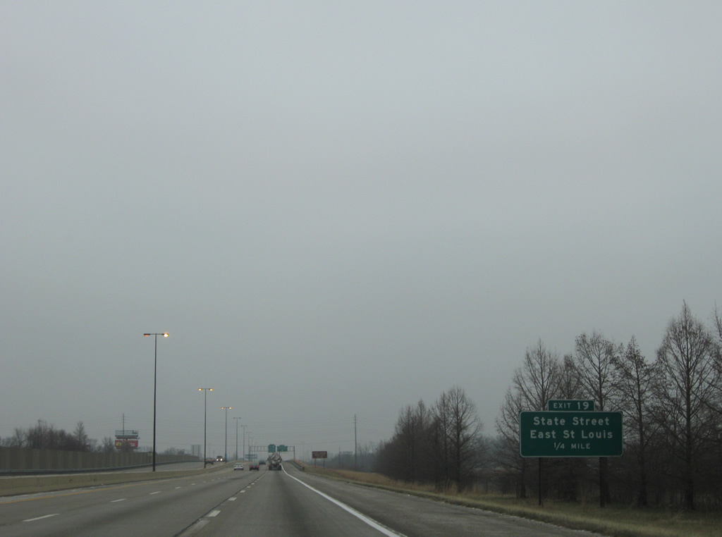
| Exit 19 departs I-255/U.S. 50 east within a folded diamond interchange to State Street in East St. Louis. Interstate 64 and the separation with U.S. 50 eastbound follows in 1.25 miles. 12/20/09 |
|
| Interstate 64 joins St. Louis with MidAmerica Airport (BLV), a facility opened in 1997 in eastern reaches of O' Fallon. The airport shares grounds with Scott Air Force Base. 12/20/09 |
|
| I-255 advances a quarter mile from St. Clair Avenue, the original alignment of U.S. 50 at East St. Louis, to Exit 20. 12/20/09 |
|
| A collector distributor roadway separates from I-255 to Interstate 64 at Exit 20. U.S. 50 joins I-64 east through Fairview Heights, O' Fallon and Shiloh. I-64 west enters Washington Park and East St. Louis ahead of the overlap with I-55 across the Poplar Street Bridge into St. Louis. 12/20/09 |
|
| Interstate 64 travels a vastly rural route from the St. Louis suburbs to Mount Vernon, the Evansville area, and Louisville, Kentucky. U.S. 50 bee lines east from Shiloh to Salem along the corridor originally envisioned for I-64 to Vincennes, Indiana. 12/20/09 |
|
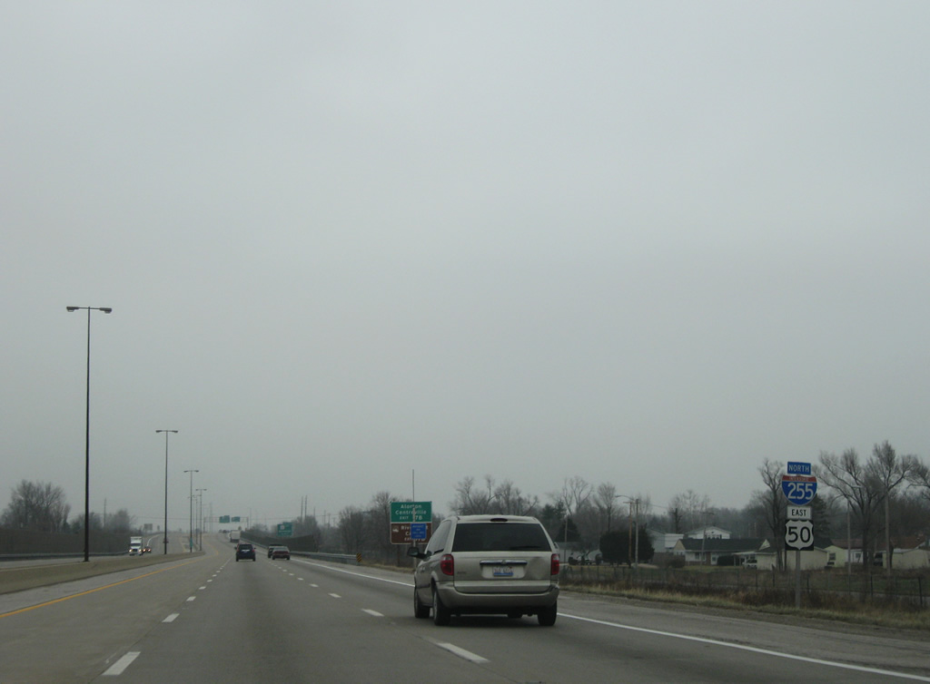
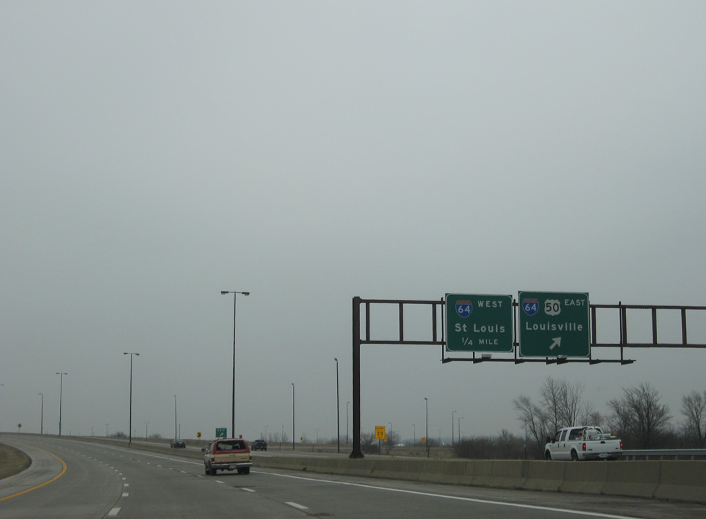
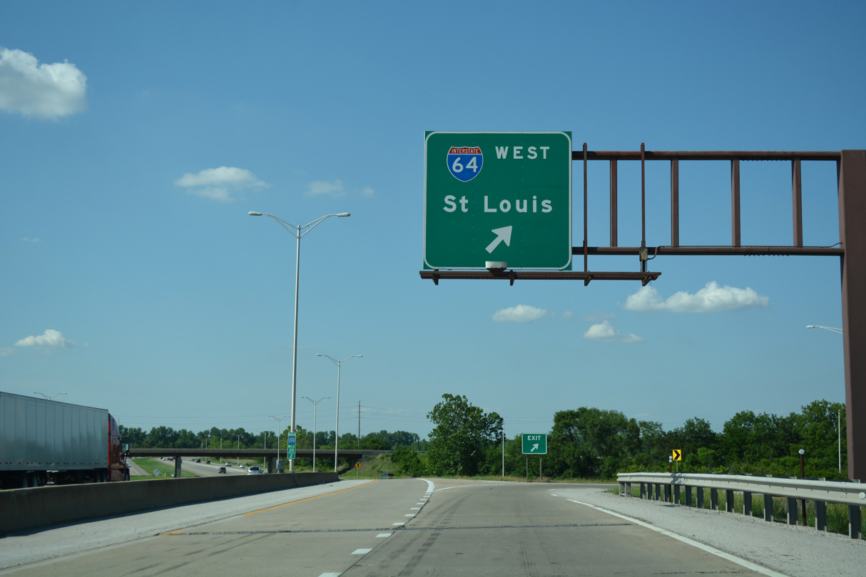
| Interstate 64 west combines with I-55/U.S. 40 in 4.3 miles. The three routes overlap 2.5 miles across the Mississippi River to I-44 at Downtown St. Louis. 05/24/18 |
|
| Interstate 255 northbound advances through western reaches of Caseyville beyond I-64/U.S. 50. 12/20/09 |
|
| Twin viaducts take Interstate 255 above a low lying area south of State Park Place. Traveling below the elevated roadway is Black Lane, the CSX Railroad, and a Conrail railroad line. Northbound traffic next meets Collinsville Road (old U.S. 40 and U.S. 66) in 1.25 miles and I-55/70 in 2.25 miles. 12/20/09 |
|
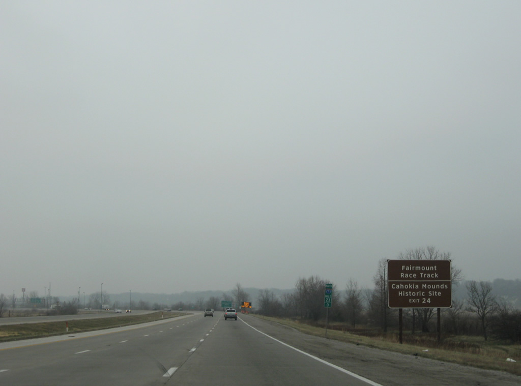
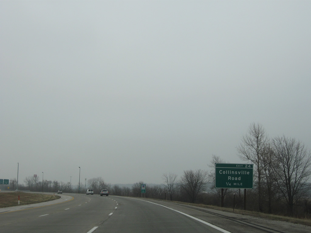
| Interstate 255 passes by Fairmount Park Racetrack at the parclo interchange at Exit 24. Renamed to Fanduel Sportsbook and Horse Racing in 2020, the venue lies along Collinsville Road west, as does Cahokia Mounds State Historic Site. 12/20/09 |
|
| U.S. 40/66 followed Collinsville Road east from 9th Street and East St. Louis to Bluff Road (IL 157) nearby. U.S. 40 was moved northward to I-55/70 while U.S. 66 was relocated onto I-55/70 westward from IL 159 until its decommissioning in 1979. 12/20/09 |
|
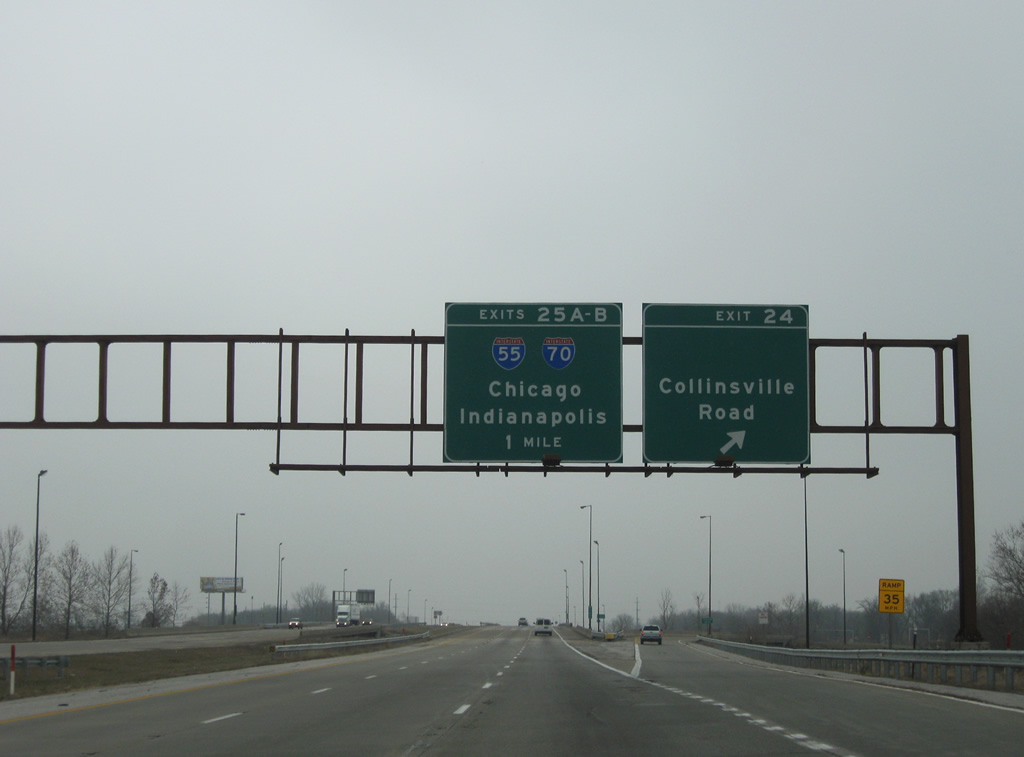
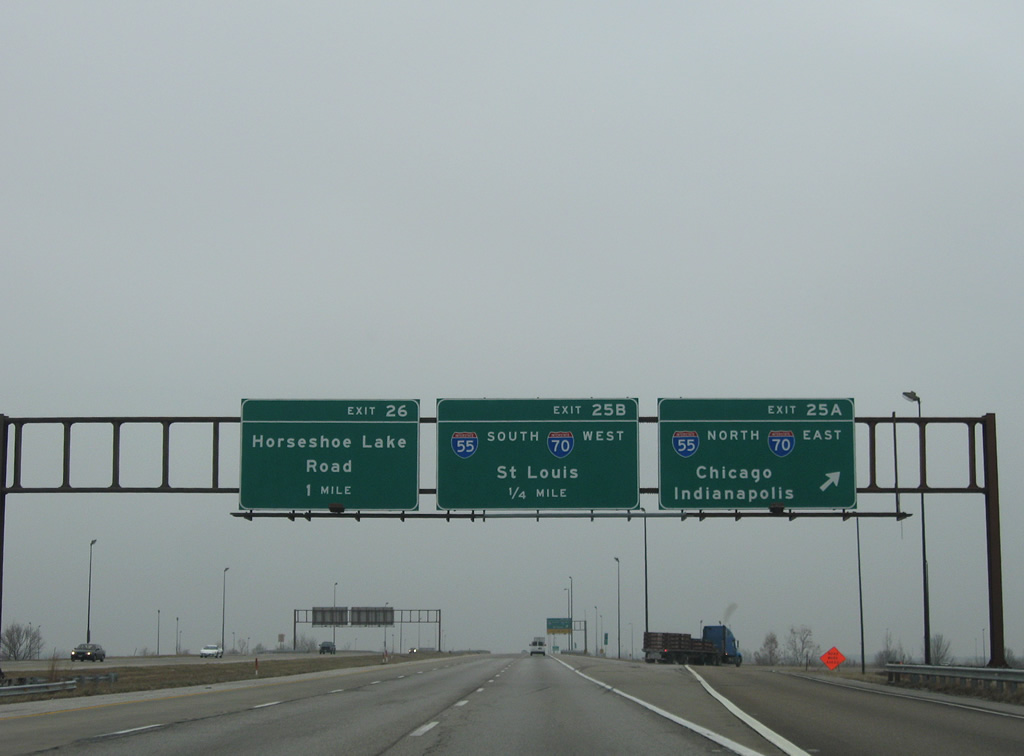
| Collinsville Road primarily serves local traffic between Collinsville and Fairmount City parallel to adjacent I-55/70. Interstate 255 and I-55/70 meet at a directional cloverleaf interchange (Exits 25 A/B) in one mile. 12/20/09 |
|
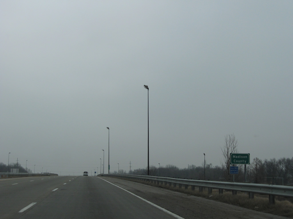
| Before leaving the exchange at Exit 24, Interstate 255 crosses into Madison County. 12/20/09 |
|
| Lands surrounding the cross roads of I-55, I-70 and I-255 are generally undeveloped as they fall within low lying areas. I-55/70 overlap for 15.5 miles from East St. Louis to Troy. 12/20/09 |
|
| An advisory sign referenced the substandard IL 162 overpass for truckers headed onto I-55/70 north. IDOT replaced this bridge as part of a $23.5 million reconstruction of the interchange (Exit 18) with IL 162 between August 2009 and July 2012. 12/20/09 |
|
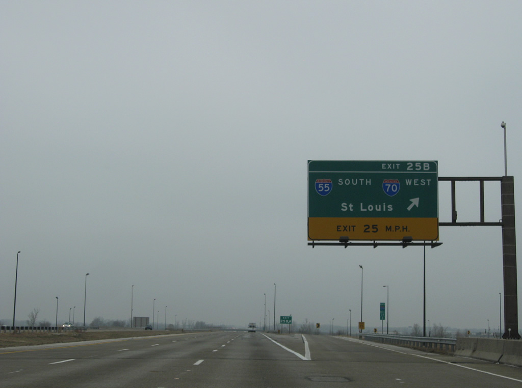
| I-55/70 part ways 9.4 miles north of Exit 25 A for respective courses to Springfield, Bloomington and Chicago and Effingham, Terre Haute and Indianapolis. 12/20/09 |
|
| Exit 25 B joins I-55/70 west to Fairmont City and East St. Louis. Omitted from guide signs is the overlap with U.S. 40; U.S. 40 follows I-55/70 east to Exit 17 at Troy and I-55 west across the Poplar Street Bridge to what was originally its own freeway (I-64) to the west St. Louis suburbs. 12/20/09 |
|
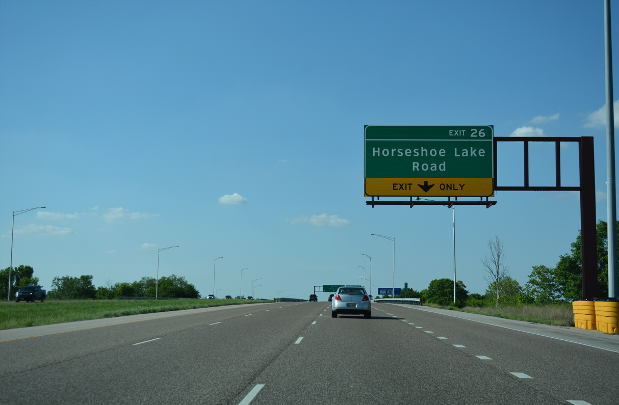
| Horseshoe Lake Road runs west from IL 157 (Bluff Road) in Collinsville to meet Interstate 255 at a folded diamond interchange (Exit 26). 05/24/18 |
|
| Interstate 255 maintains three northbound lanes as Exit 26 departs to Horseshoe Lake Road. Horseshoe Lake Road continues west to its namesake, a leftover body of water from a previous course of the Mississippi River. Horseshoe Lake State Park surrounds the body of water. 05/24/18 |
|
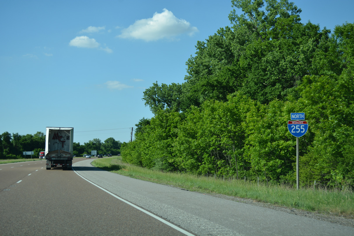
| Cahokia Canal lines the west side of Interstate 255 beyond this reassurance marker. 05/24/18 |
|
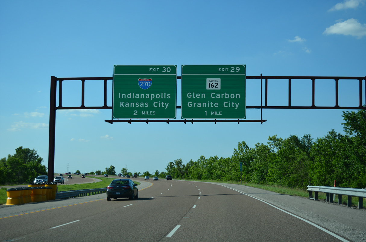
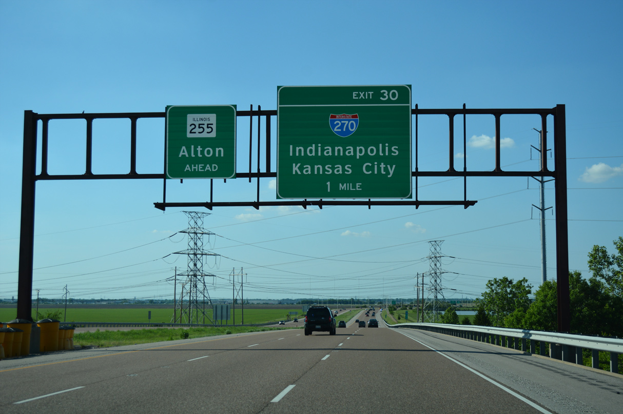
| Turning west to cross the canal, Interstate 255 next meets IL 162 on the outskirts of Pontoon Beach. I-255 concludes in two miles at Exit 30 / I-270/IL 255. 05/24/18 |
|
| IL 162 travels 15 miles overall between IL 203 in Granite City and U.S. 40 east of Troy. 05/24/18 |
|
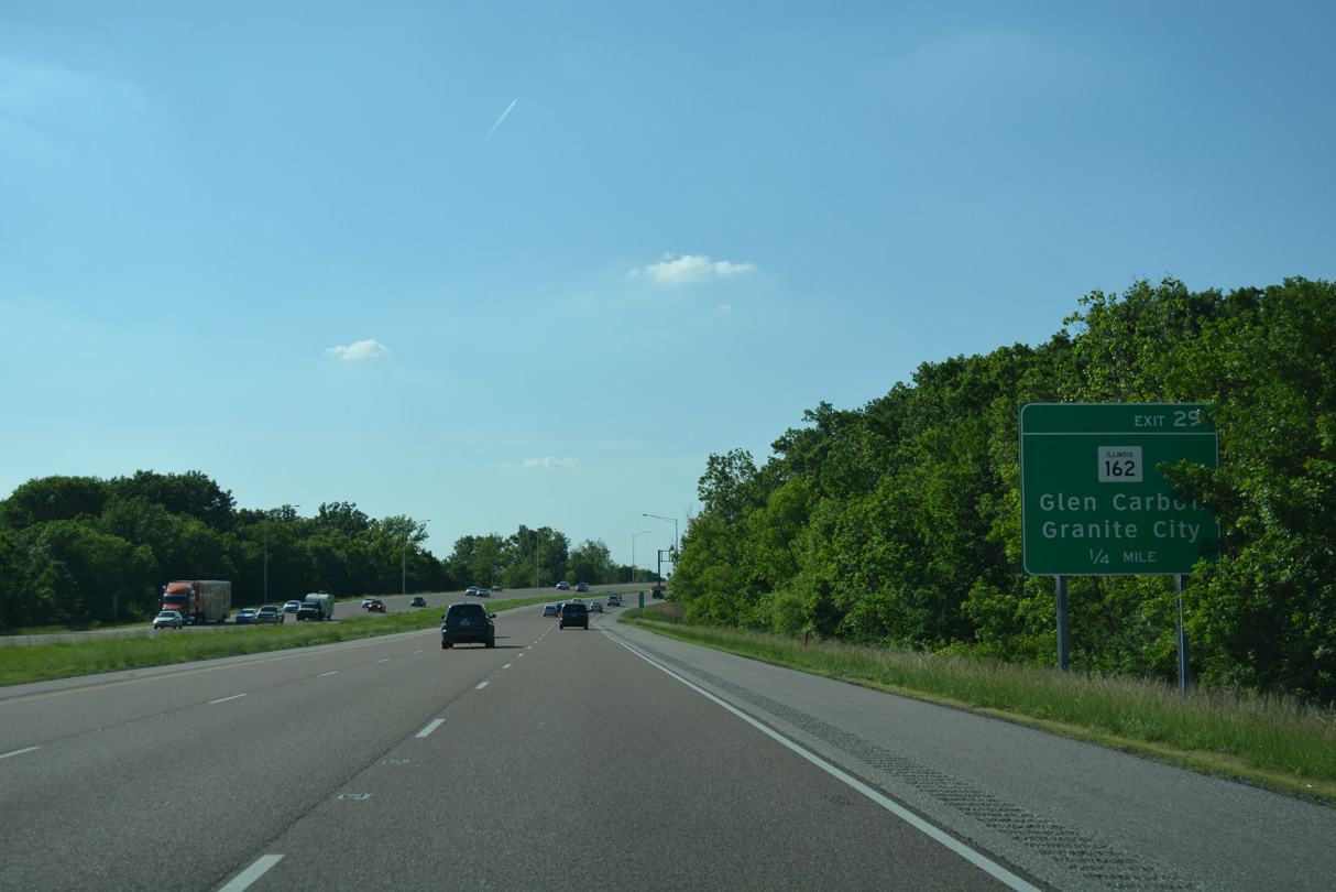
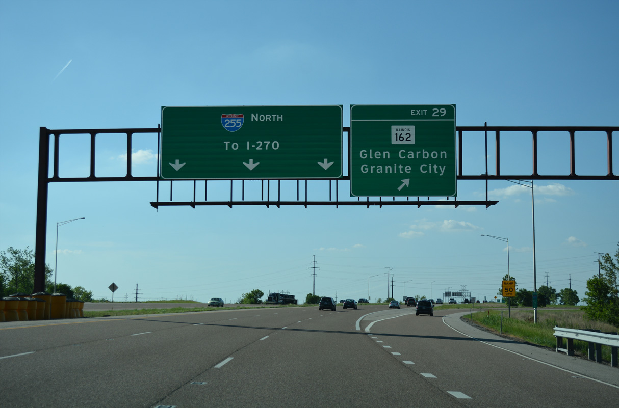
| A folded diamond interchange links I-255 and IL 162 south of the parallel Chicago & Northwestern Railroad lines. Glen Carbon is a short distance to the east; Stallings, an area of Pontoon Beach, lies just to the west. 05/24/18 |
|
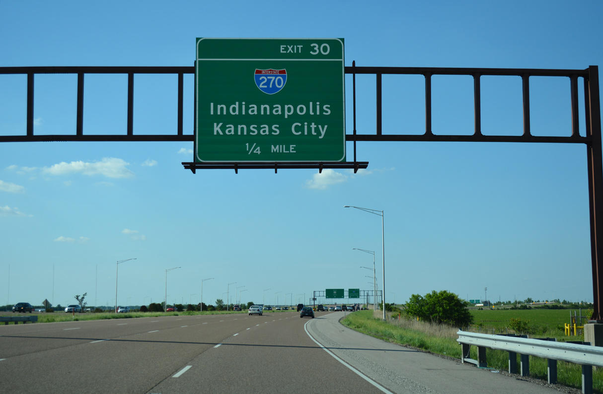
| One mile south of the directional cloverleaf interchange (Exit 30) with I-270 along I-255 north. IL 255 continues the freeway northward 20.50 miles to U.S. 67 in the village of Godfey. Completed in stages between October 1998 and July 2013,2,3 the control point for IL 255 changed from Wood River to Alton and ultimately Godfrey. 05/24/18 |
|
| Interstate 270 compliments the I-255 belt route along the northern and western periphery of St. Louis metro. The freeway leads west across the Chain of Rocks Bridge to Florissant, Hazelwood and I-70 at Bridgeton. Eastward I-270 travels 7.5 miles to the separation of I-55/70. 05/24/18 |
|
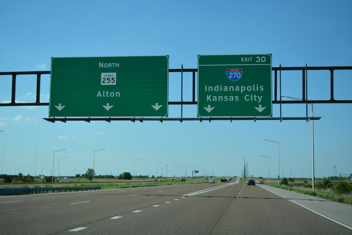
| I-255 northbound transitions to IL 255 while two lanes leave at Exit 30 to Interstate 270. IL 255 spurs north to Roxana, Wood River and Bethalto. IL 255 provides a high speed route to U.S. 67 leading north from Godfrey to Jerseyville. 05/24/18 |
|
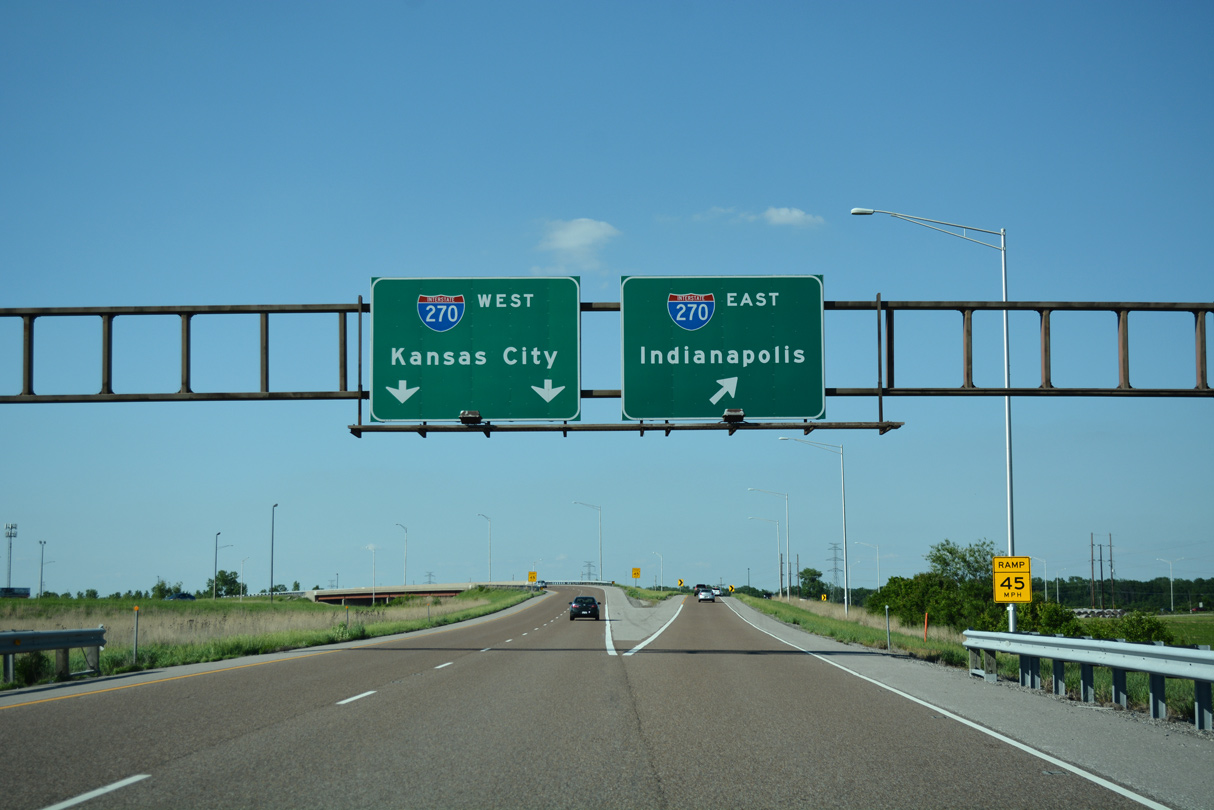
| Interstate 270 travels through Glen Carbon to become I-70 east to Indianapolis. Kansas City is referenced for I-70 west from I-270 at Maryland Heights, Missouri. I-270 continues south from there over what was I-244 to Kirkwood and the south end of I-255. 05/24/18 |
Page Updated 01-06-2024.


 North
North  East
East