
 East
East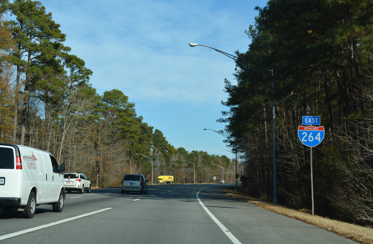
12/14/17
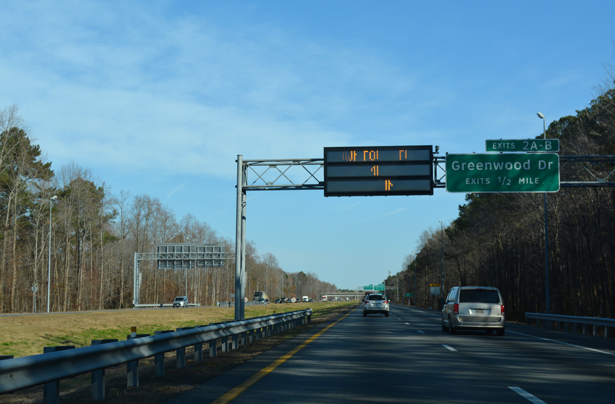
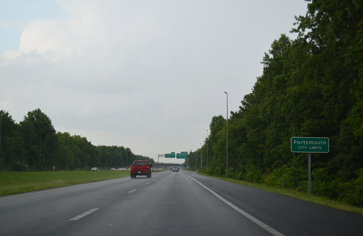
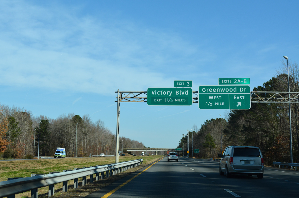
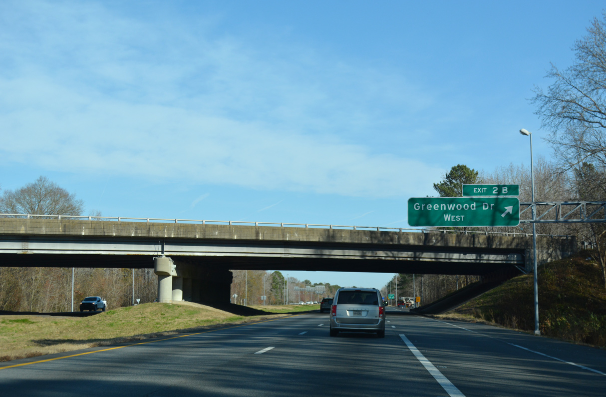
I-264 enters the city of Portsmouth ahead of the cloverleaf interchange (Exit 2) with Greenwood Drive.
12/14/17
07/28/13
12/14/17
12/14/17
12/14/17

12/14/17
The South Norfolk Jordan Bridge spans the Southern Branch of the Elizabeth River along SR 337 (Elm Avenue) east from SR 239 (Victory Boulevard).
07/28/13

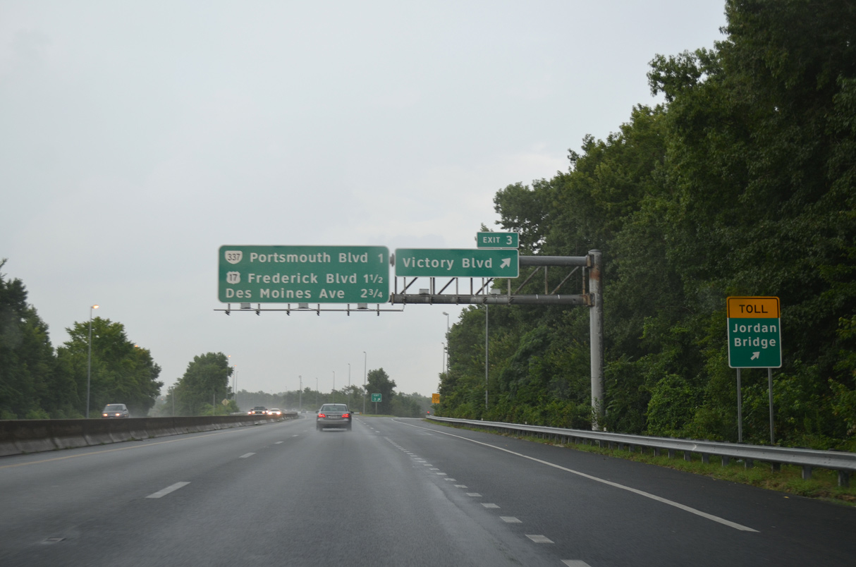
Unmarked at Exit 3, Victory Boulevard is SR 239, a 4.46 mile long loop south from SR 337 (Portsmouth Boulevard) to SR 337 at the Norfolk Naval Shipyard (NNSY).
12/14/17
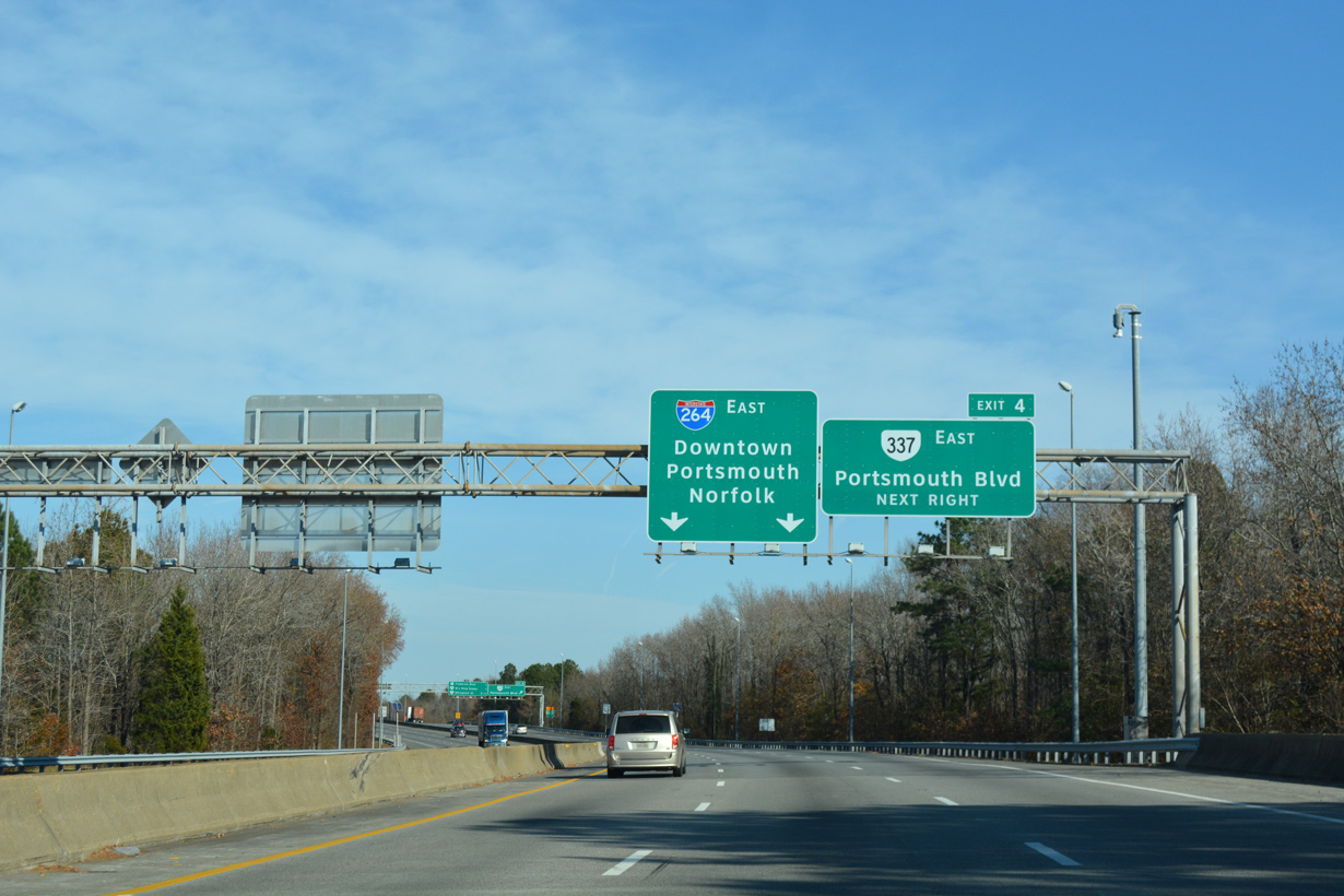
SR 337 and U.S. 460 ALT branch (Portsmouth Boulevard) branch east from Turnpike Road (SR 337 ALT) and U.S. 58 (Airline Boulevard) at Alexander Corner to meet I-264 at Exit 4.
12/14/17
Exit 4 links I-264 east with SR 337 (Portsmouth Boulevard) east at Douglas Park in Portsmouth. SR 337 continues 2.70 miles east to the tolled South Norfolk Jordan Bridge.
12/14/17
 East
East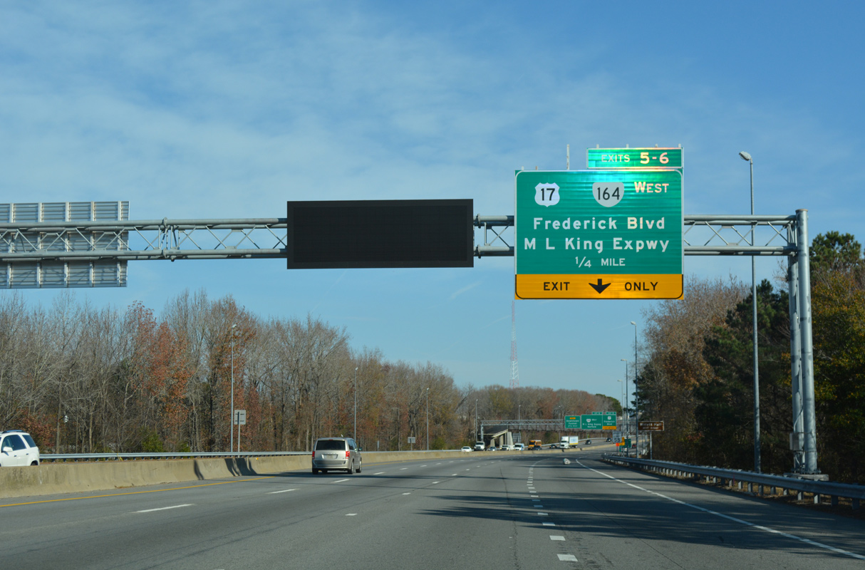
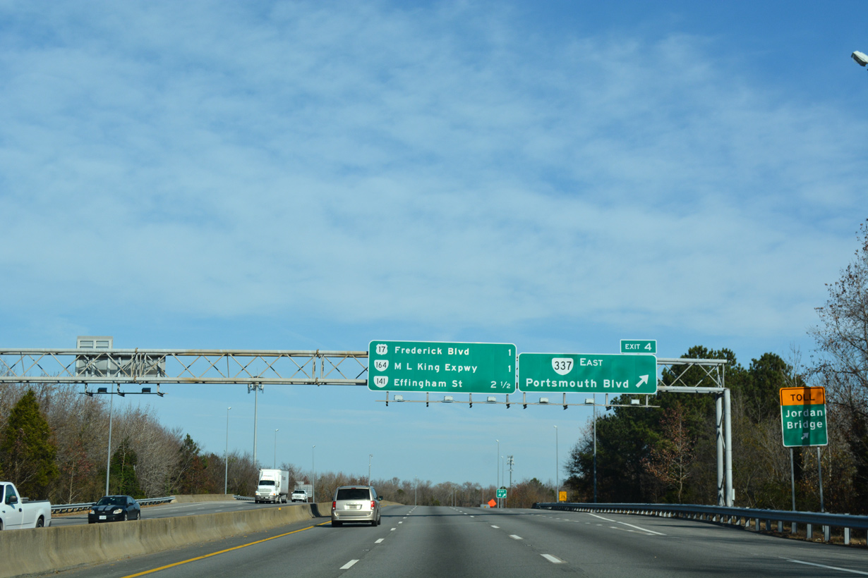
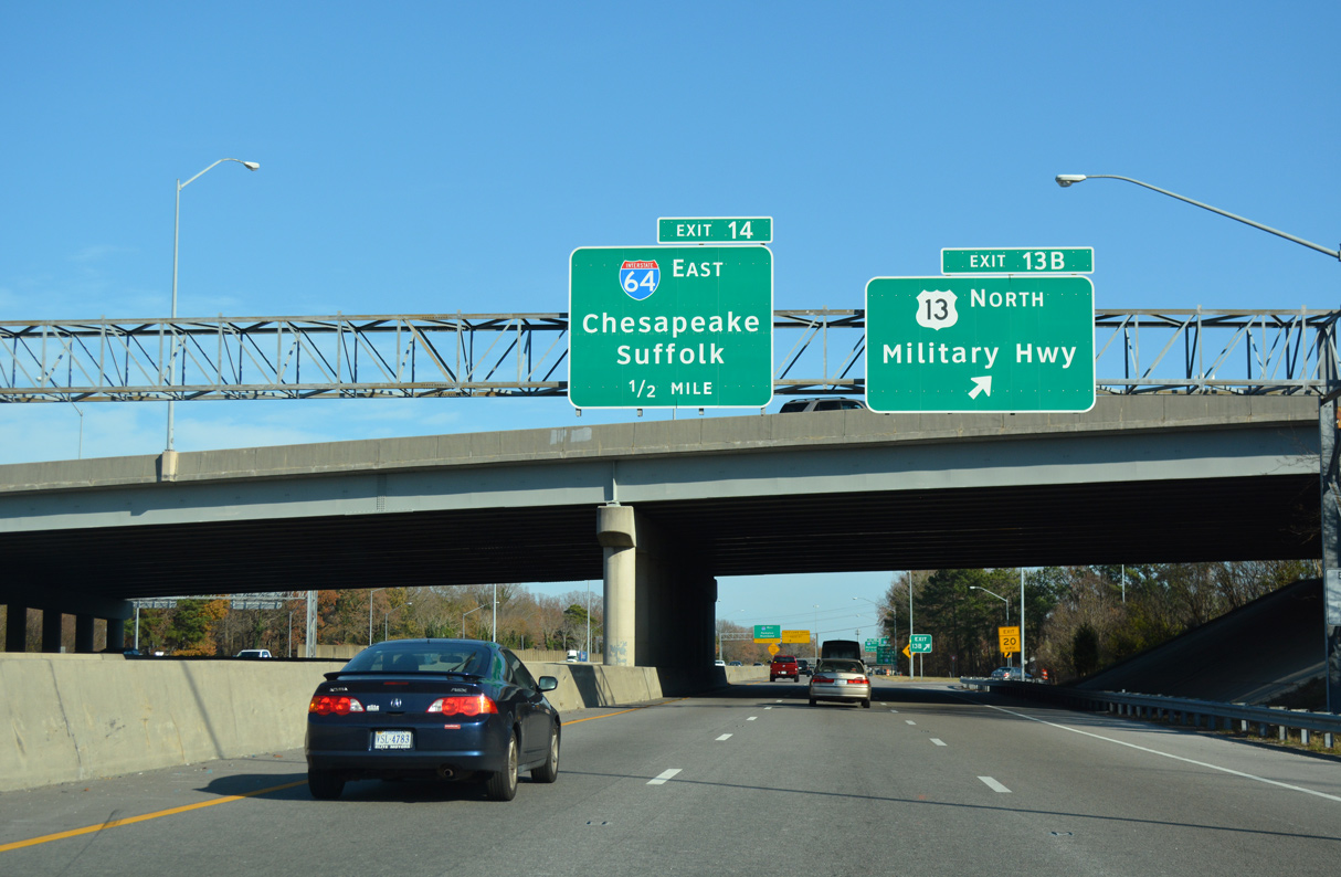
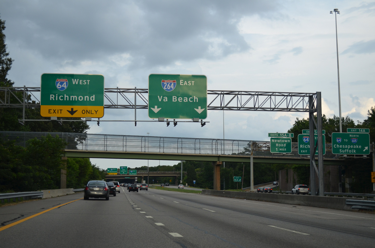
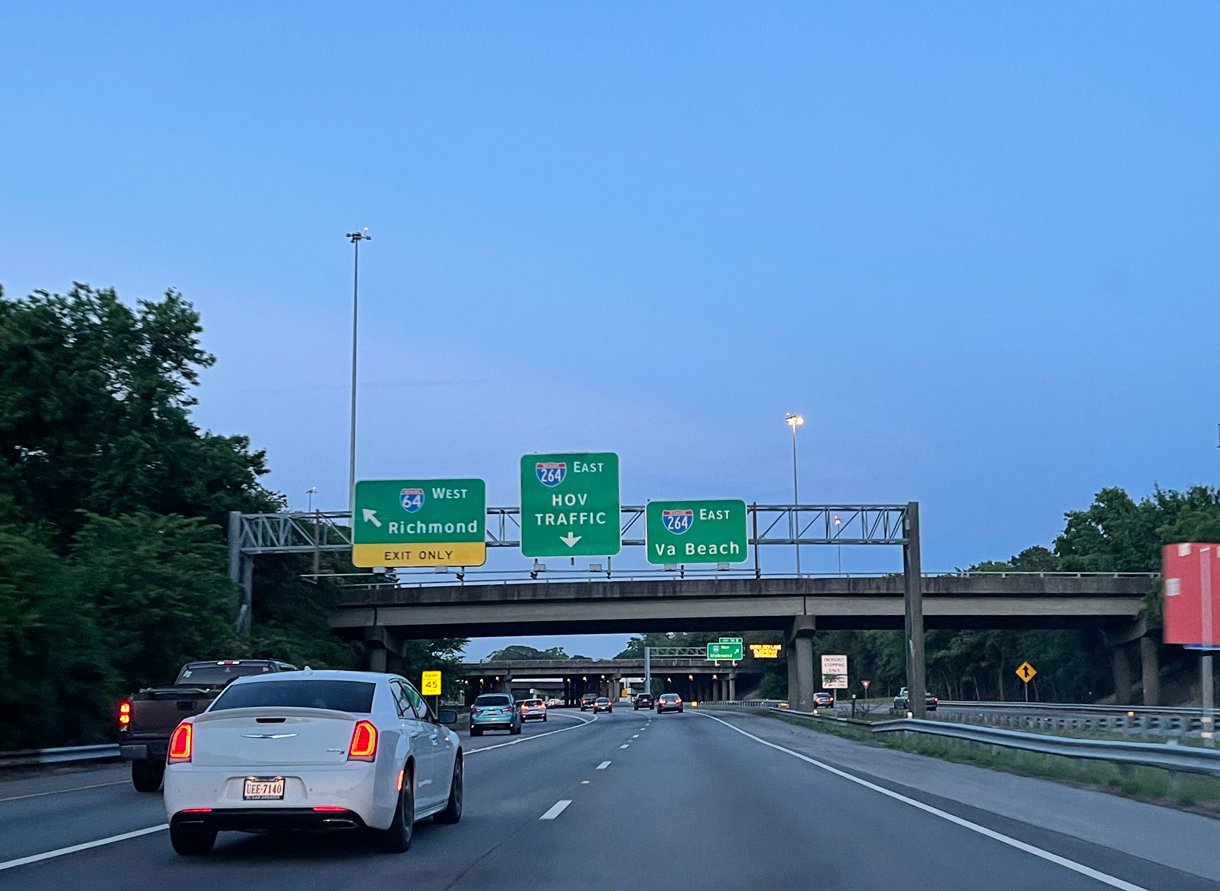
U.S. 460 ALT combines with I-264 east from SR 337 (Portsmouth Boulevard) ahead of the collector roadway for U.S. 17 (Frederick Boulevard) and SR 164 (Martin Luther King Expressway) west.
12/14/17
U.S. 17 follows Frederick Boulevard northwest from George Washington Highway (SR 141) to High Street in Portsmouth.
12/14/17
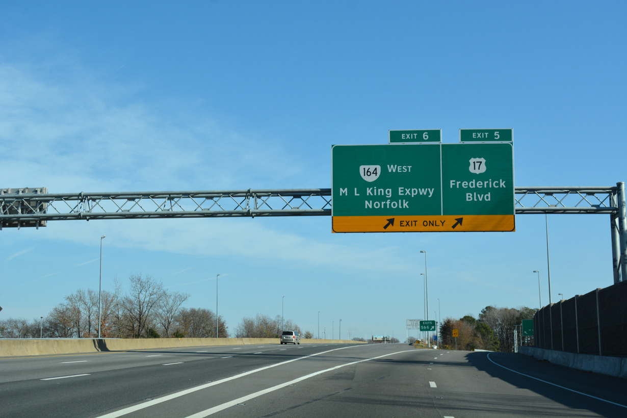
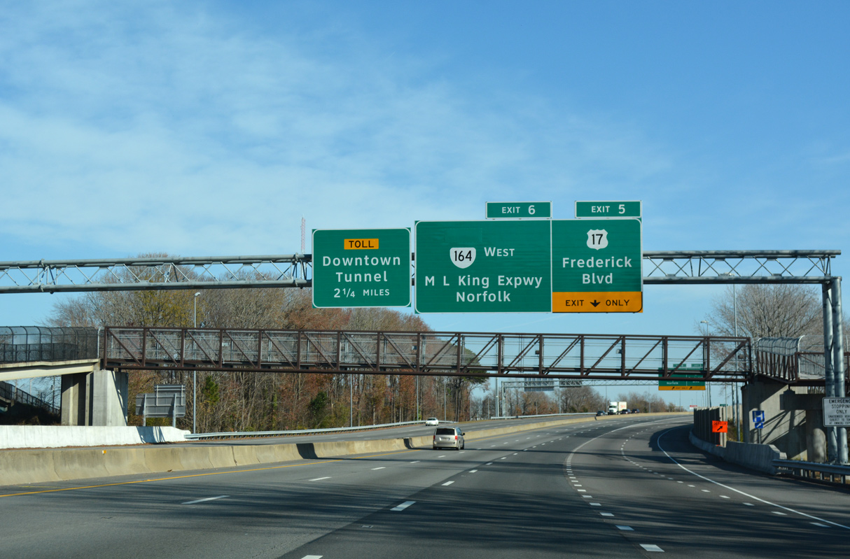
Two lanes separate from I-264/U.S. 460 ALT east at the directional cloverleaf interchange (Exit 5) with U.S. 17 (Frederick Boulevard).
12/14/17
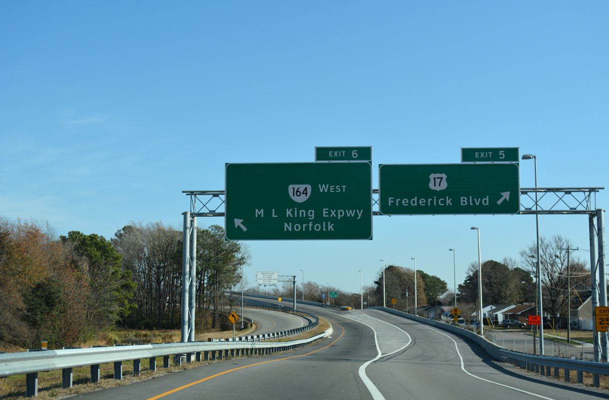
Exit 6 continues beyond the exchange with U.S. 17 (Frederick Boulevard) to the trumpet interchange with SR 164 (M.L. King Expressway) west to U.S. 58 (Midtown Tunnel) for Norfolk.
12/14/17
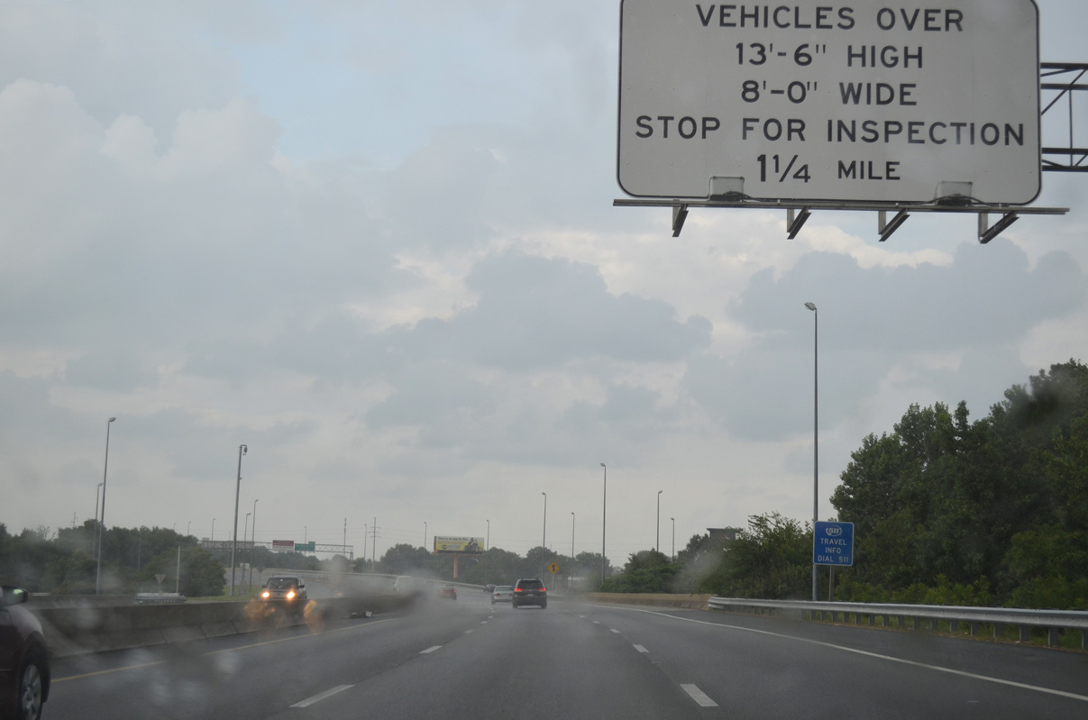
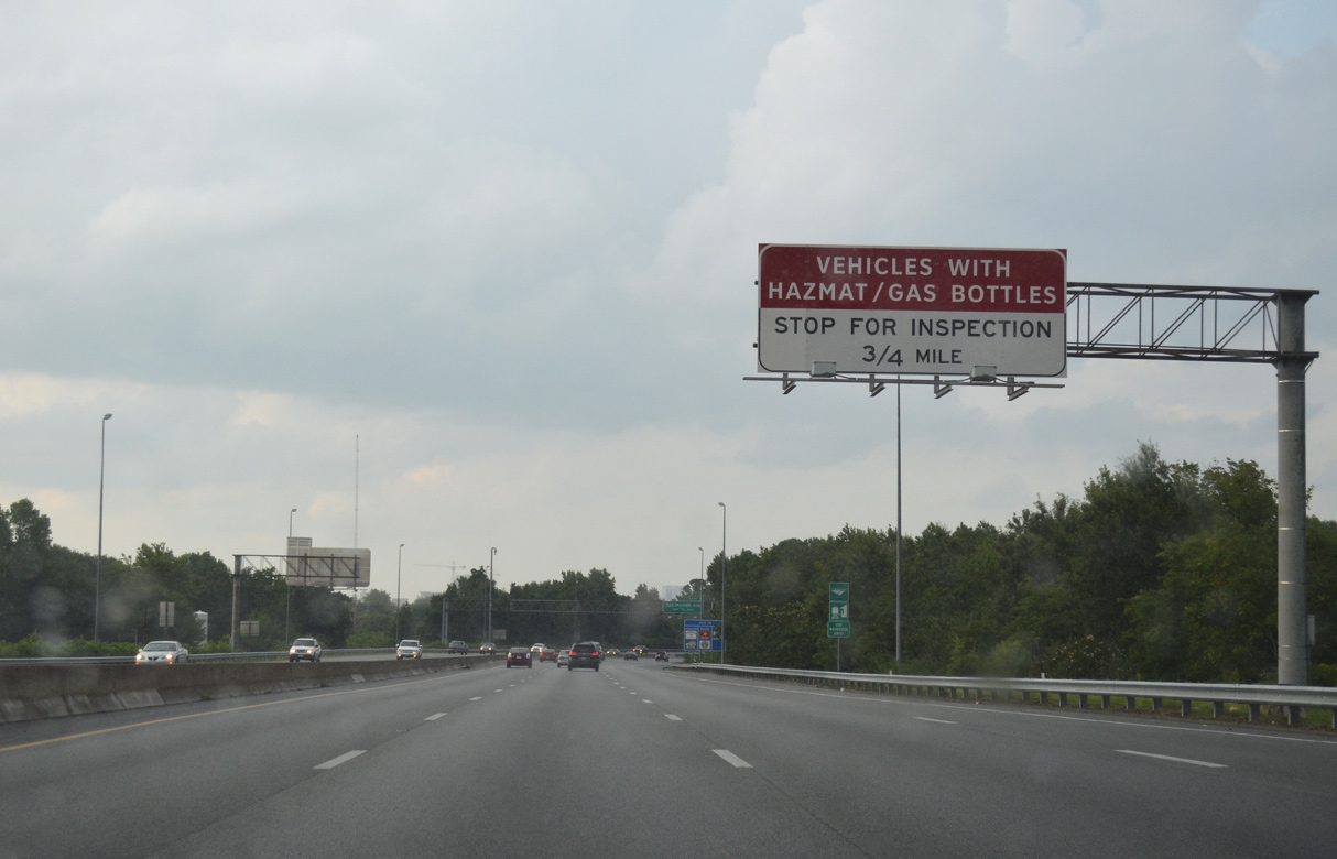
I-264/U.S. 460 ALT continue east from U.S. 17 to the inspection station for the Downtown Tunnel.
07/28/13
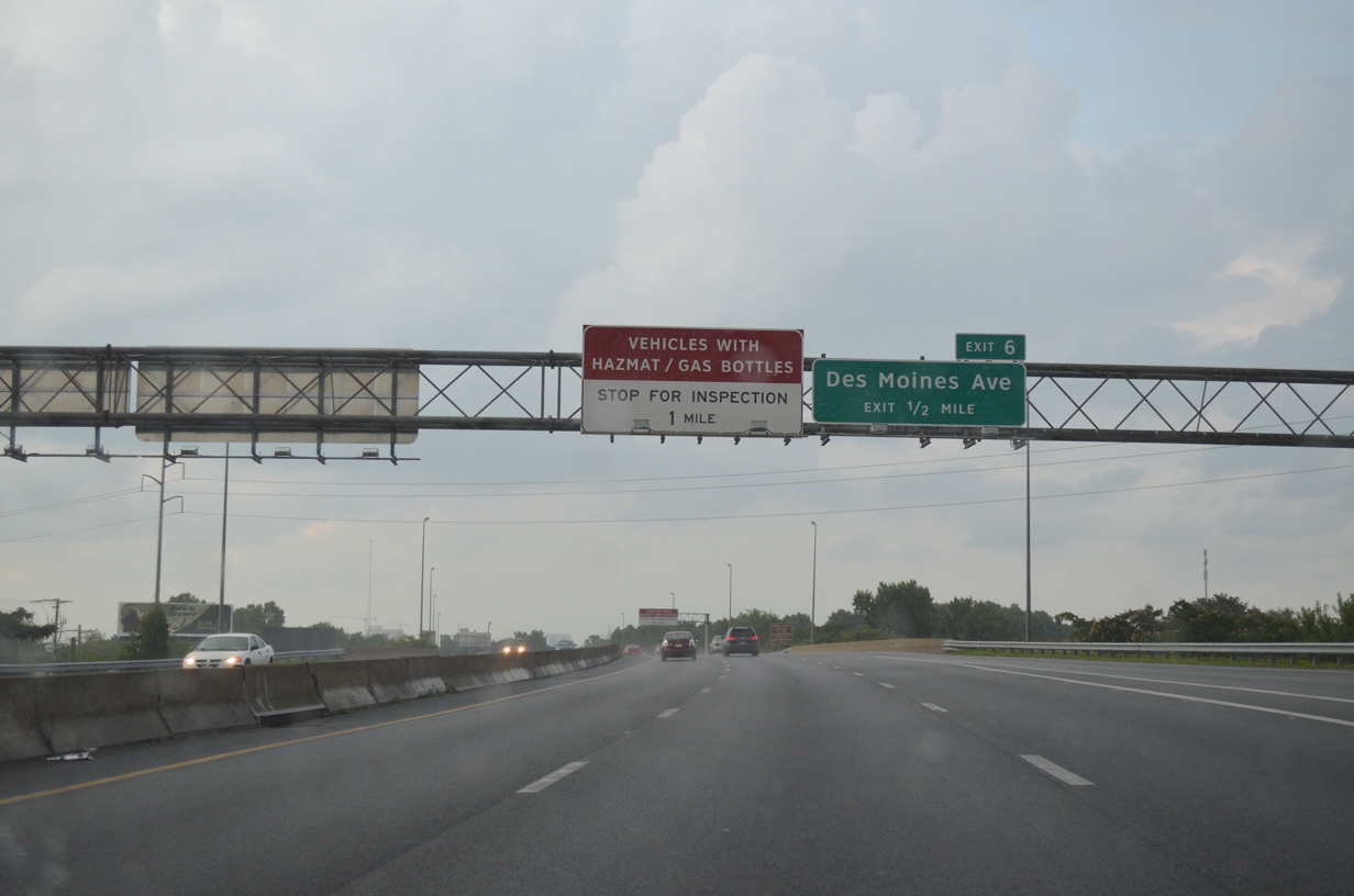
Construction of the M.K. King Expressway Extension south to I-264 at Exit 5 included the removal of Exit 6 to Des Moines Avenue.
07/28/13
The exchange with SR 164 (M.L. King Expressway) north was built 0.75 miles west of the Downtown Tunnel inspection station in 2014-16.
07/28/13
07/28/13
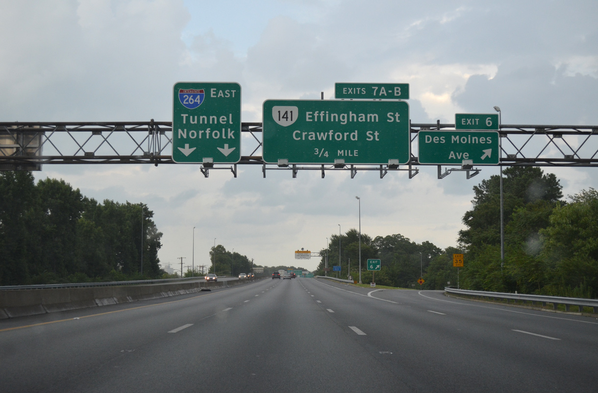
With the elimination of the Des Moines Avenue off-ramp, the succeeding exit east of SR 164 is for SR 141 (Effingham Street) to the Naval Shipyard and Naval Hospital.
07/28/13
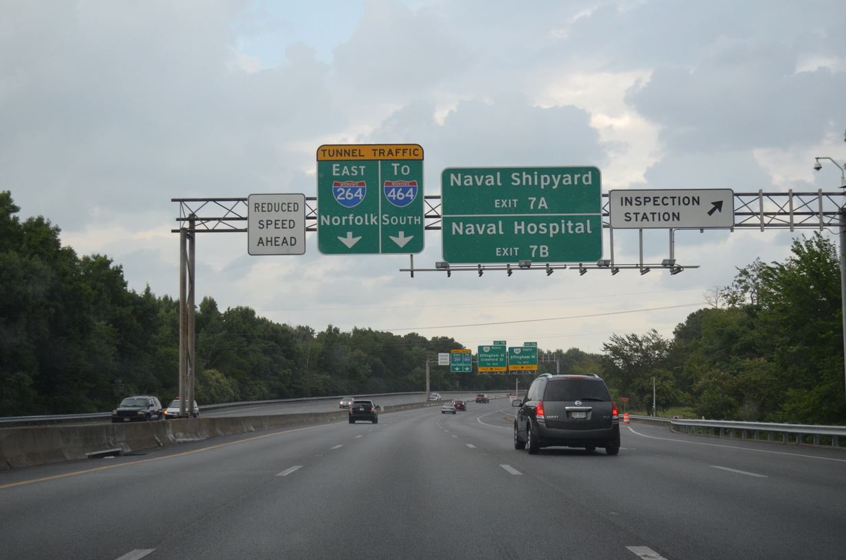
The inspection station for the Downtown Tunnel precedes the wye interchange (Exit 7A) for SR 161 (Effingham Street) south.
07/28/13
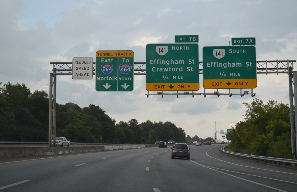
SR 141 lines Effingham Street south from London Boulevard outside Downtown Portsmouth to George Washington Highway at SR 337 (Portsmouth Boulevard) and the Norfolk Naval Shipyard (NNSY).
07/28/13
I-264/U.S. 460 ALT span SR 337 (Elm Avenue) ahead of Exit 7A. SR 141 constitutes a 3.30 mile long urban route from U.S. 17 (Frederick Boulevard) to the exchange joining U.S. 58 and SR 164 (MLK Expressway).
07/28/13
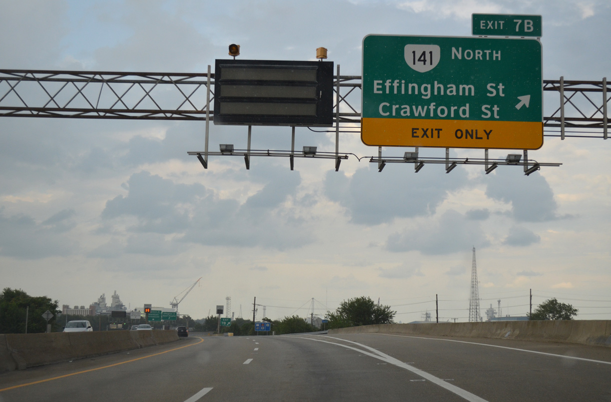
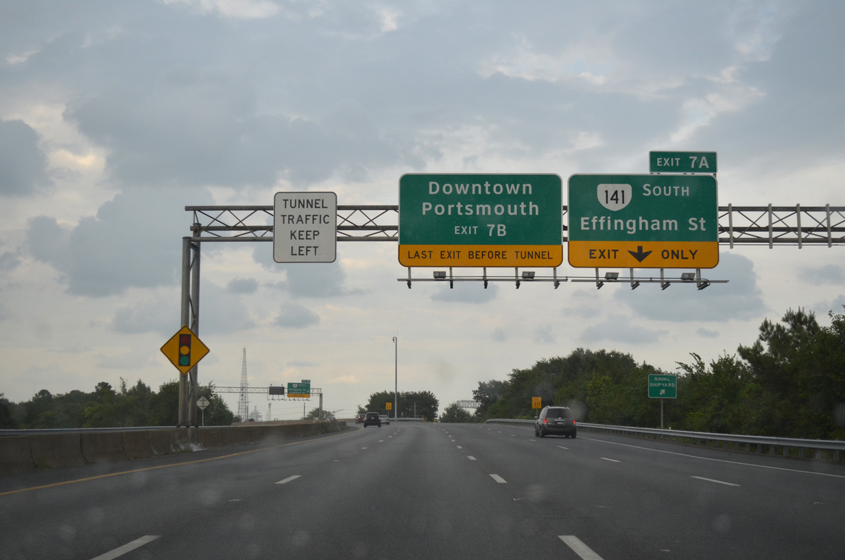
Exit 7B is the last departure point before the tolled Downtown Tunnel. Separate ramps connect with SR 141 (Effingham Street) north and Crawford Street east at Pavilion Drive and Court Street.
07/28/13
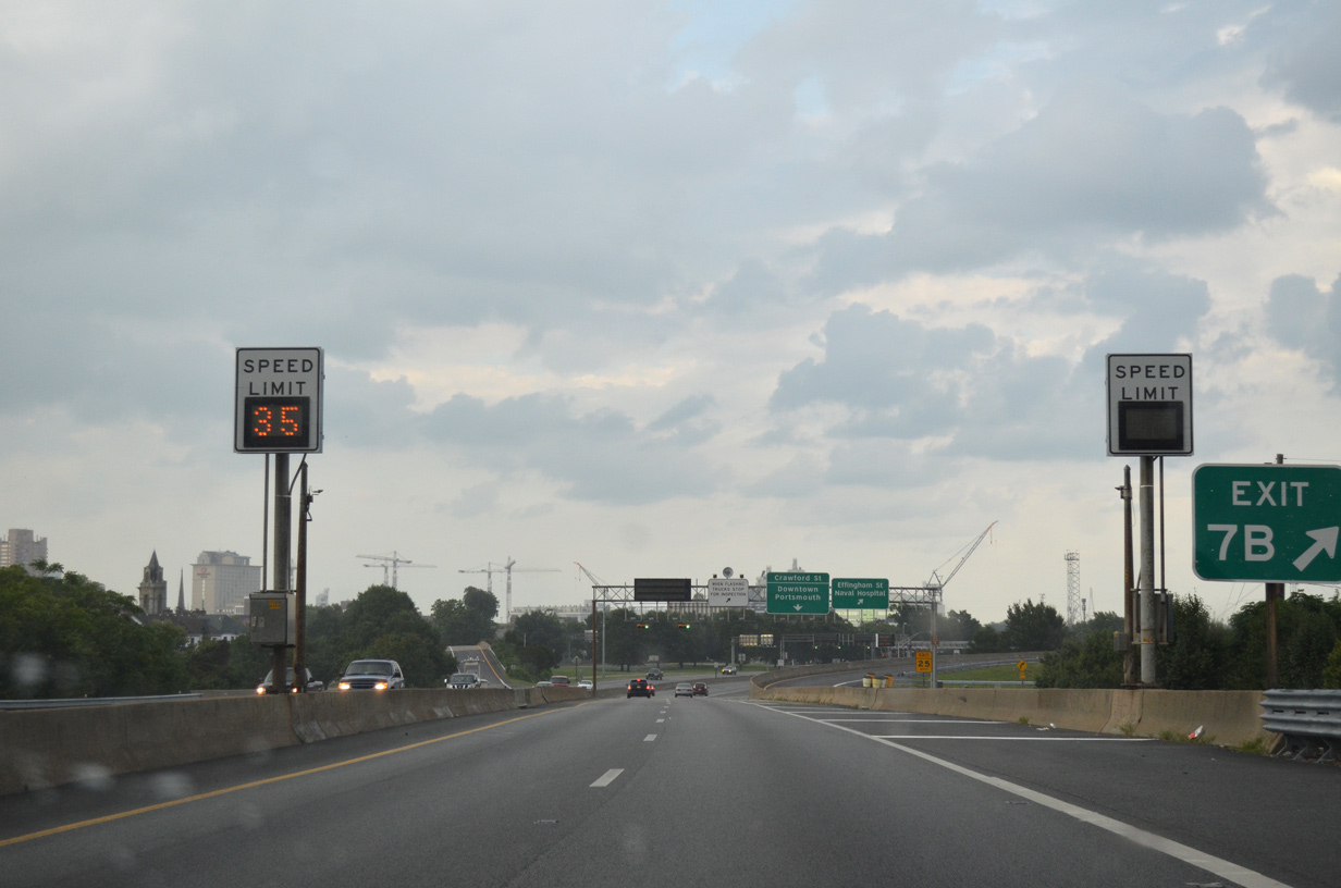
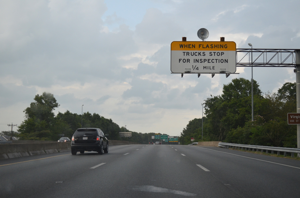
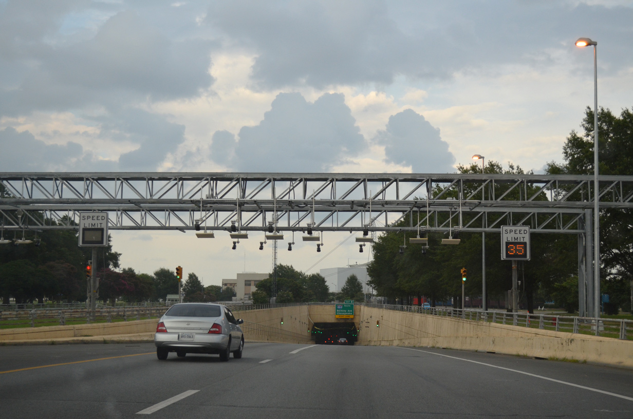
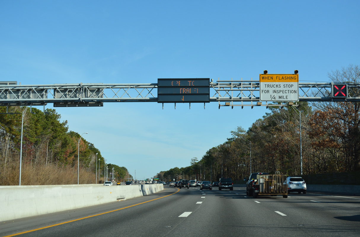
Variable speed limits are used along Interstate 264 at the Downtown Tunnel.
07/28/13
All electronic toll (AET) collection commenced for the Downtown Tunnel on February 1, 2014.
07/28/13
The eastbound tube at the Downtown Tunnel is the newer of the two, having opened on March 4, 1987.
07/28/13
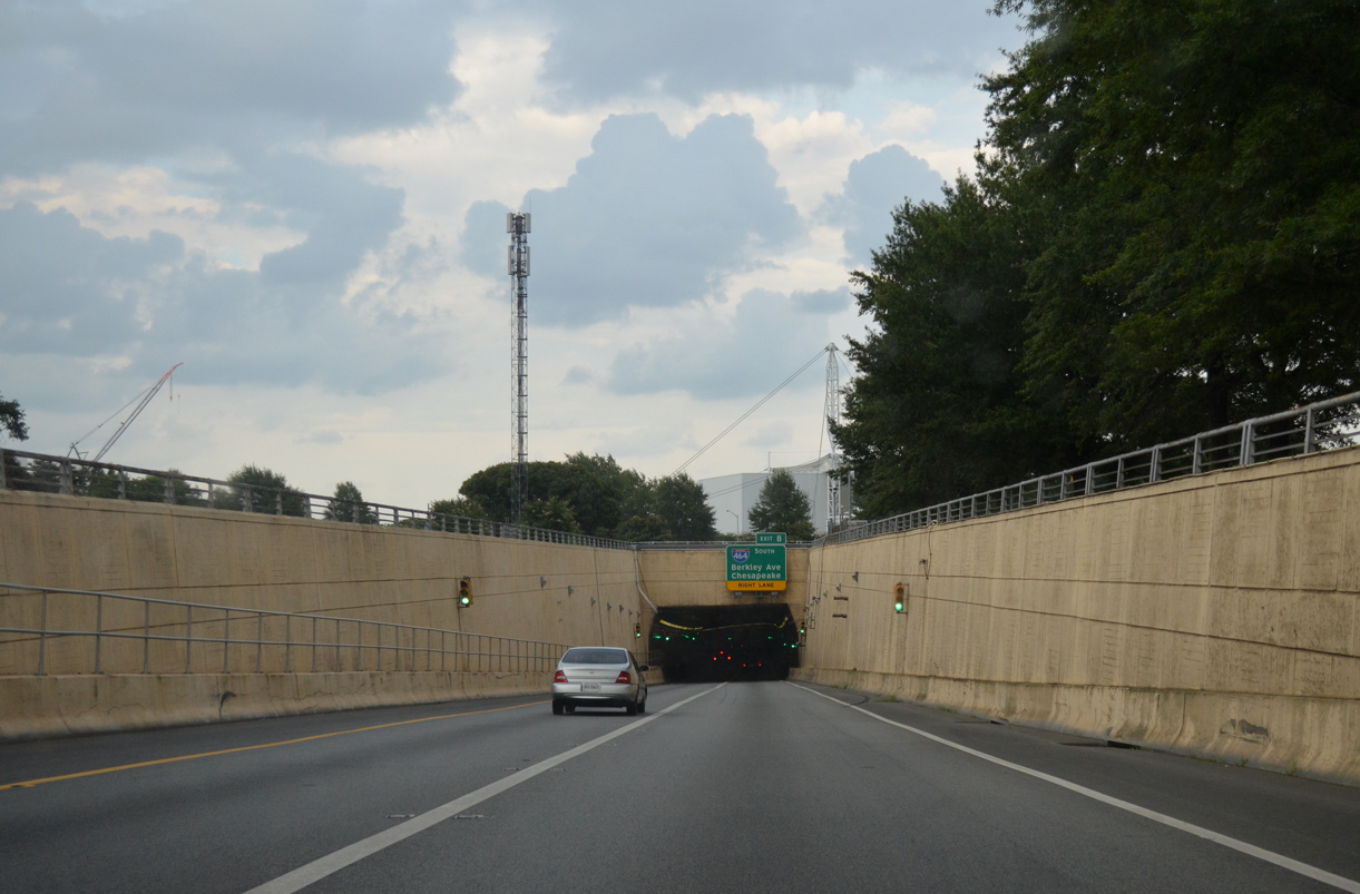
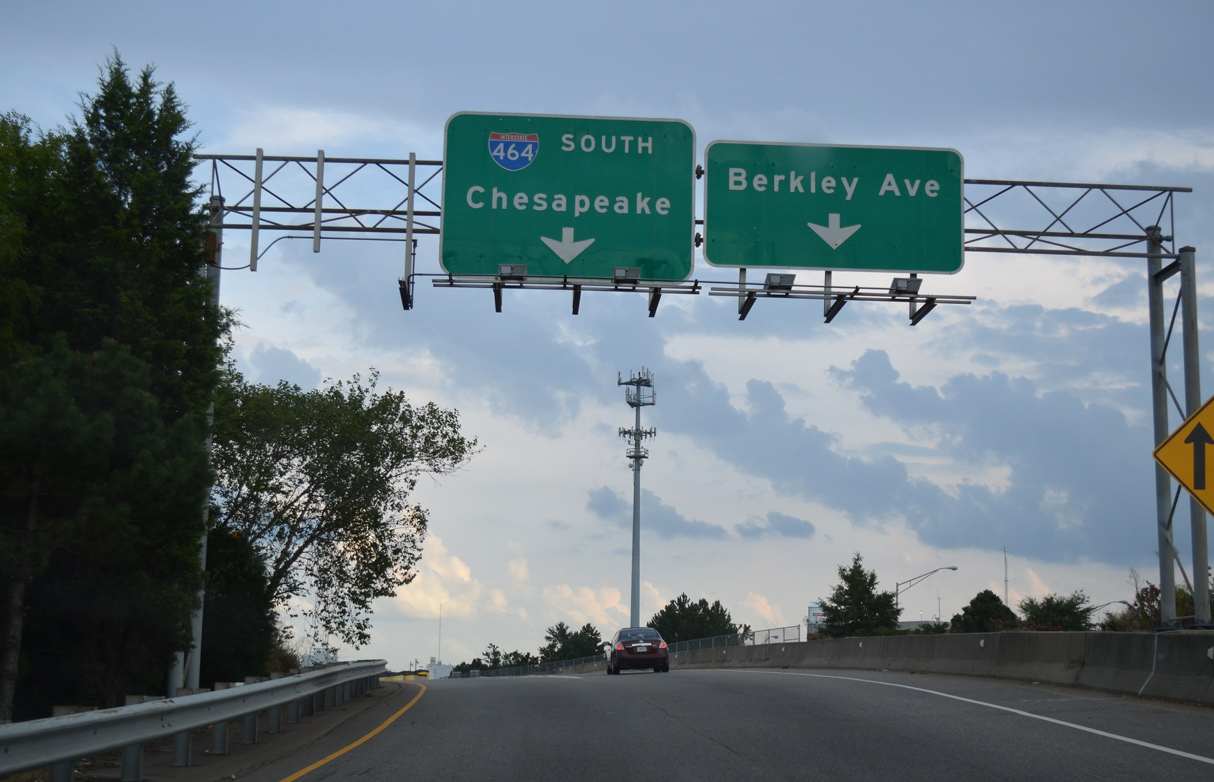
I-264/U.S. 460 ALT emerge from the Downtown Tunnel at the north end of Interstate 464 adjacent to Berkley Avenue.
07/28/13
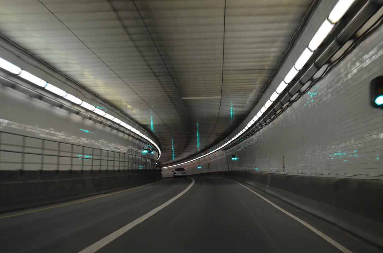
The Downtown Tunnel opened to traffic with one lane per direction in 1952.
07/28/13
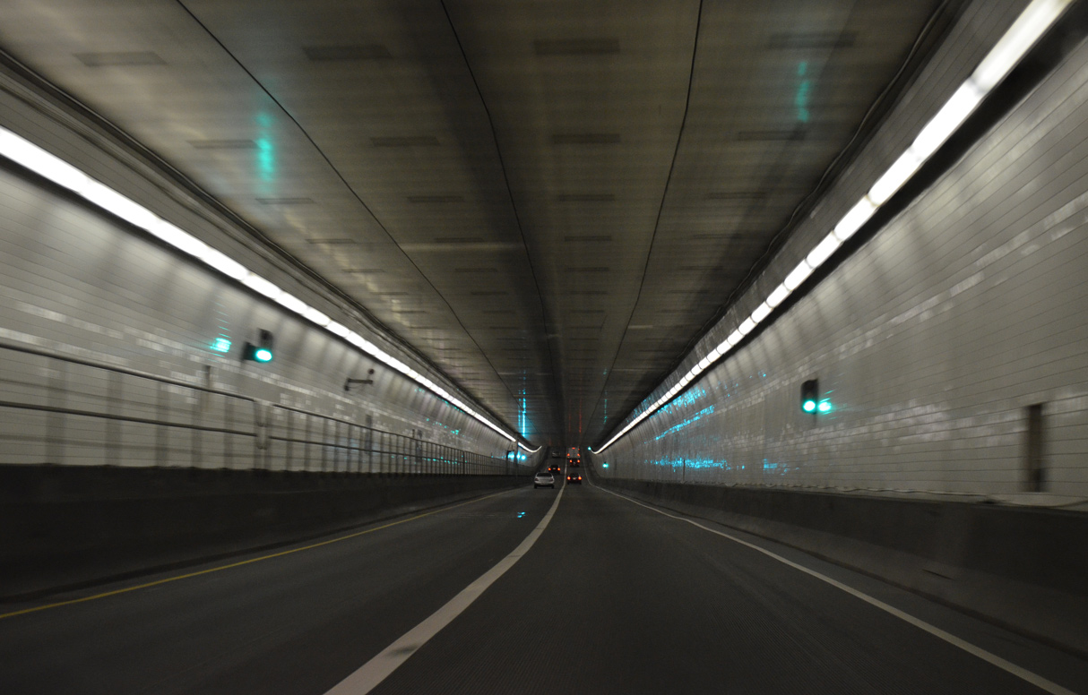
The Downtown Tunnel crosses the Southern Branch of the Elizabeth River east to Berkley in the city of Norfolk.
07/28/13
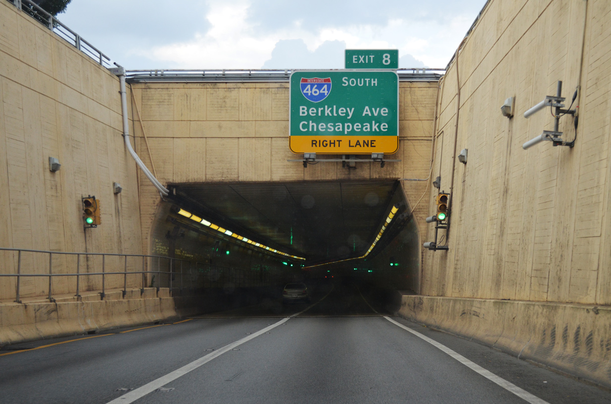
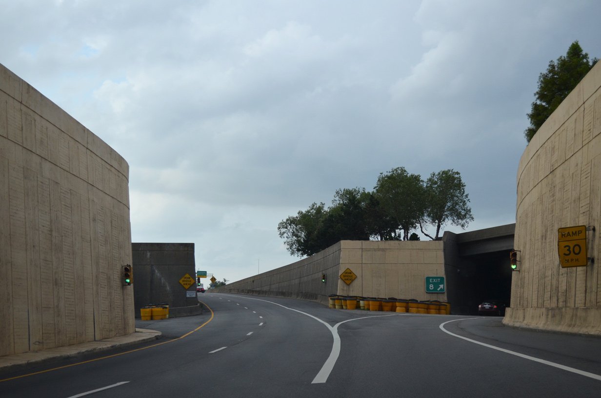
I-264/U.S. 460 ALT enter an inverted trumpet interchange (Exit 8) with I-464 south from the east portal of the Downtown Tunnel.
07/28/13
Interstate 464 runs 5.83 miles south from I-264 in Norfolk to the exchange joining I-64 with U.S. 17 (Dominion Boulevard) and SR 168 (Oak Ridge Connector) in the city of Chesapeake.
07/28/13
07/28/13
Exit 8 partitions with a slip ramp to Berkley Avenue before joining I-464 south from I-264 west.
07/28/13
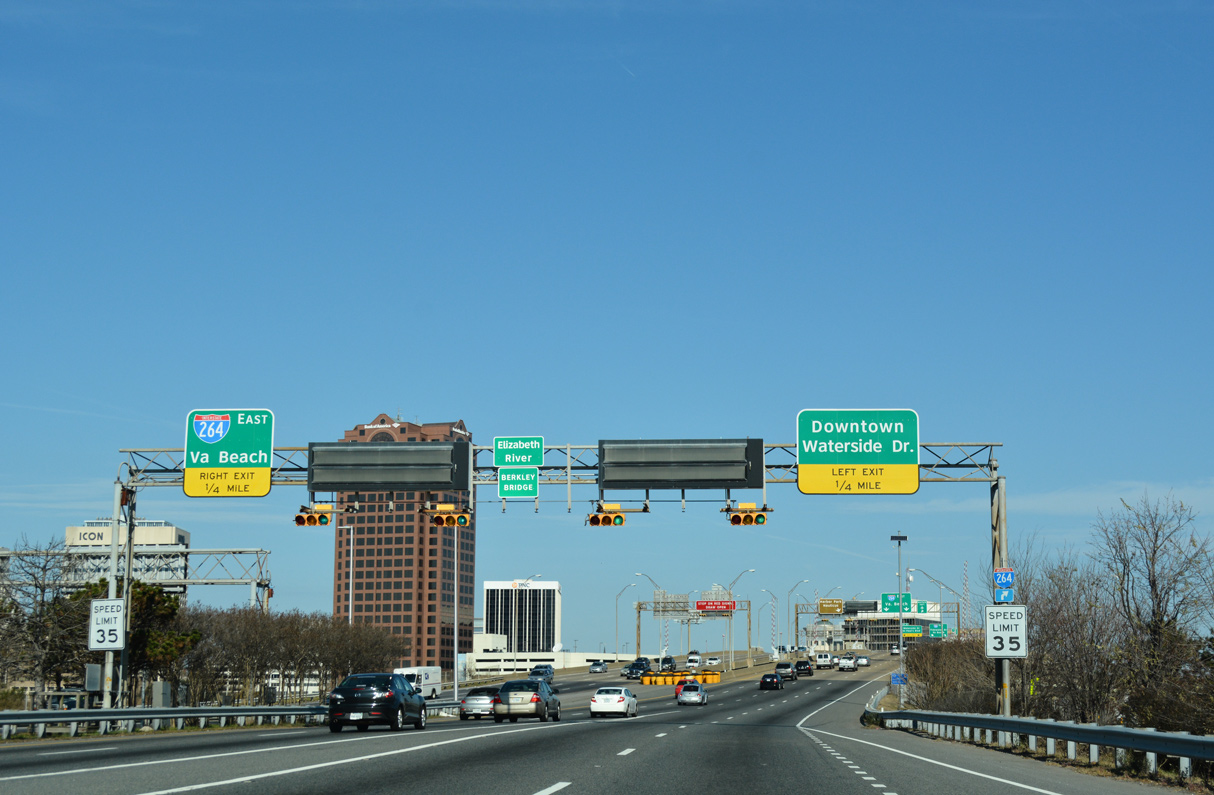
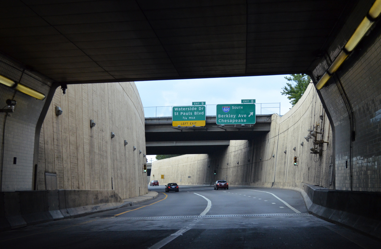
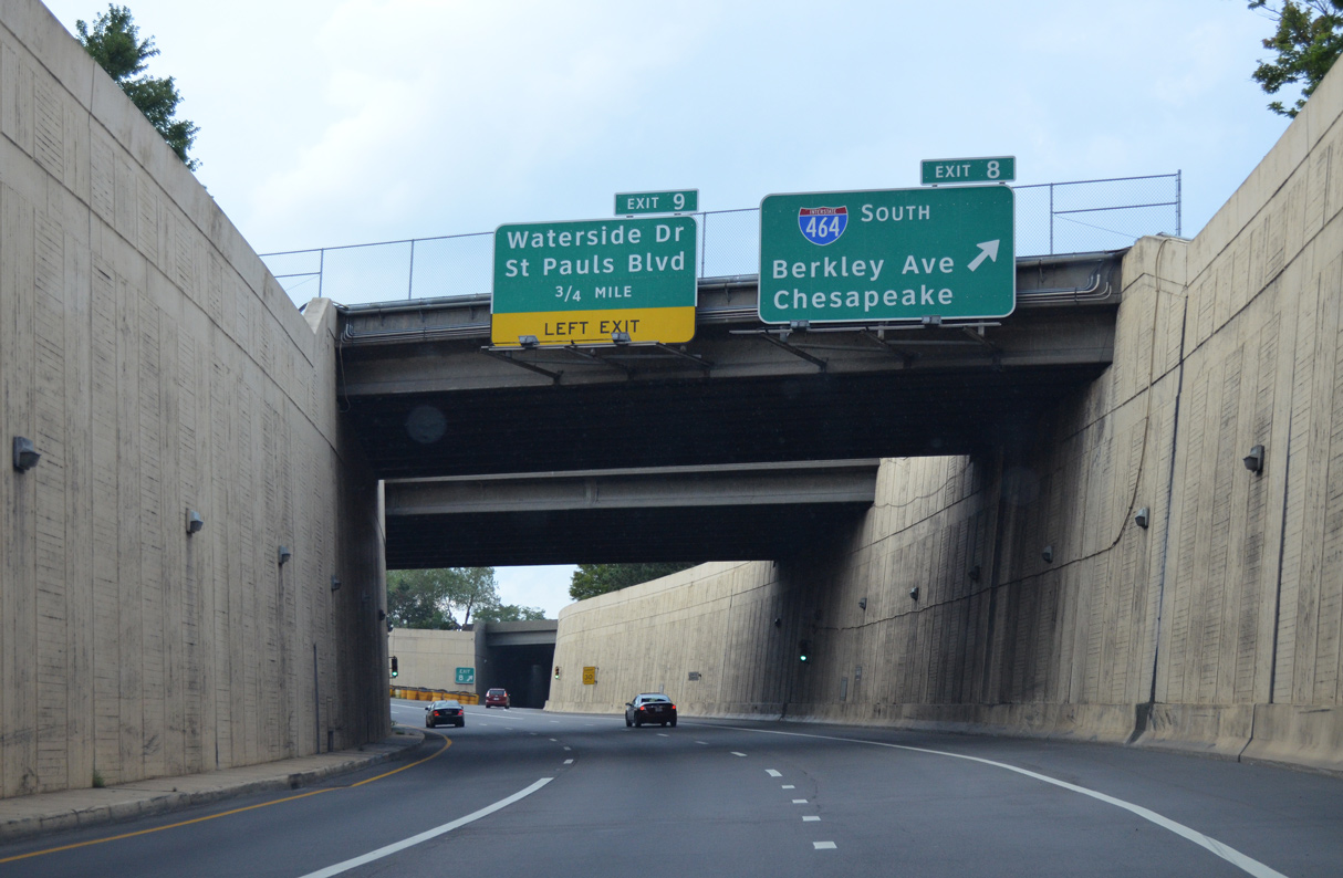
Traffic from I-464 north / SR 337 east expands I-264 eastbound to four lanes across the Berkley Bridge. A weaving traffic ensues northward to Left Exit 9 for Waterside Drive (SR 337 ALT) and U.S. 460 ALT on St. Paul's Boulevard.
12/14/17
The eastbound span at the Berkley Bridge is a bascule bridge opened to traffic on May 24, 1990. The westbound crossing was built in 1952.
07/23/13
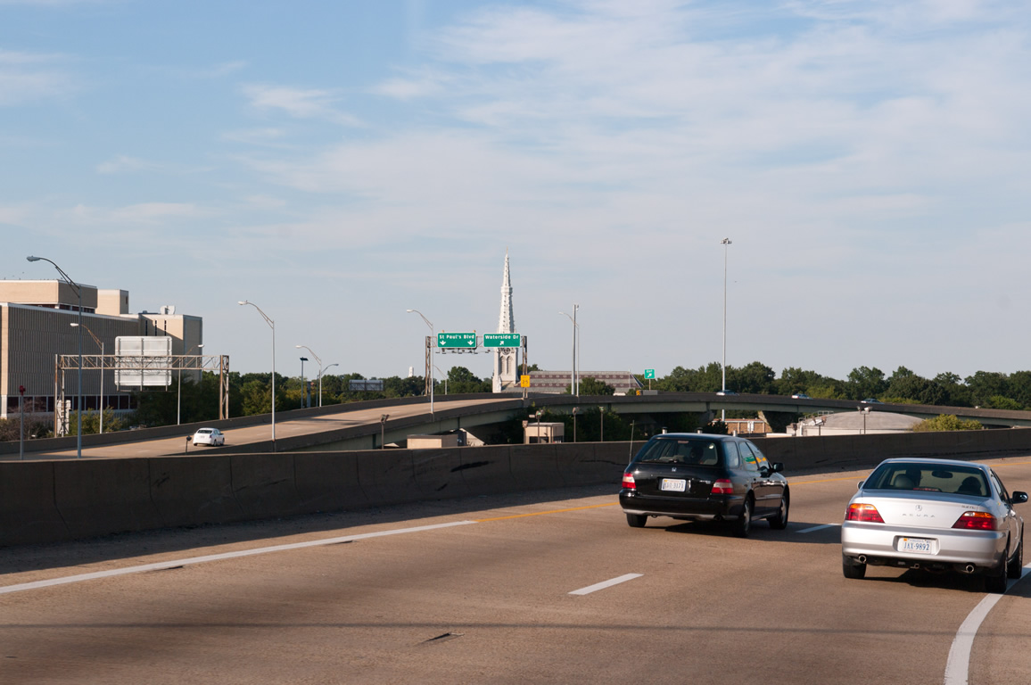
SR 337 ALT (Waterside Drive) encircles Downtown Norfolk west to Bousch Street at Nauticus, the Hampton Roads Naval Museum. SR 337 ALT follows Bousch Street north to U.S. 58/SR 337 (Brambleton Avenue).
12/14/17
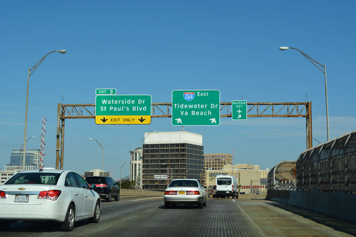
Unmarked on I-264, U.S. 460 ALT extends 0.51 miles from Left Exit 9 to St. Paul's Boulevard. U.S. 460 ALT navigates north 0.44 miles to SR 337 (Brambleton Avenue) at the Norfolk Scope Arena and east 0.31 miles to U.S. 460 at Church Street.
12/14/17
Exit 9 partitions into flyovers for U.S. 460 ALT (St. Paul's Boulevard) and Market Street west to MacArthur Center mall and Waterside Drive (SR 337 ALT) west.
09/05/10
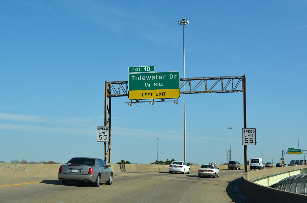
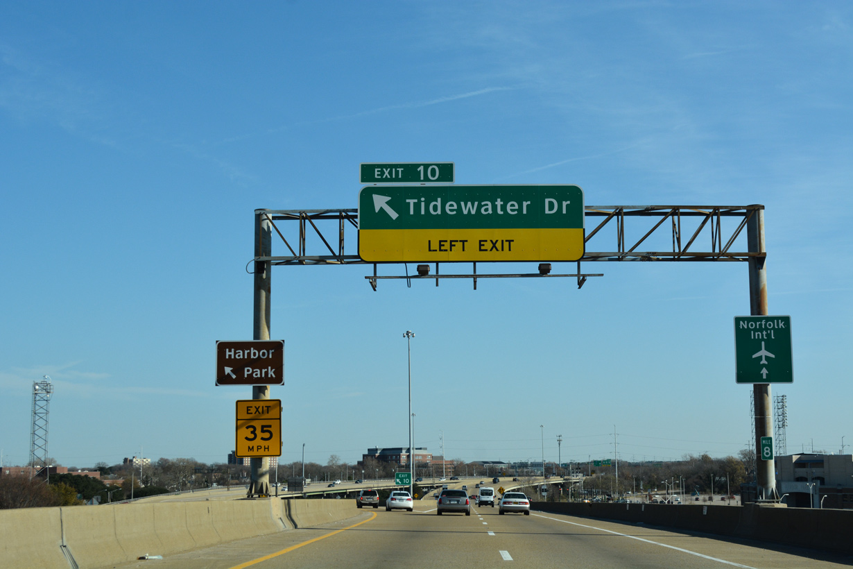
Tidewater Drive, an urban arterial with expressway segments, branches north from a wye interchange (Left Exit 10) between the elevated roadways along Interstate 264.
12/14/17
SR 337 separates from I-264 east along Tidewater Drive north 0.71 miles from Left Exit 10 to U.S. 460/SR 168 (Brambleton Avenue). SR 168 continues Tidewater Drive north to Huntersville and Willard Park.
12/14/17
East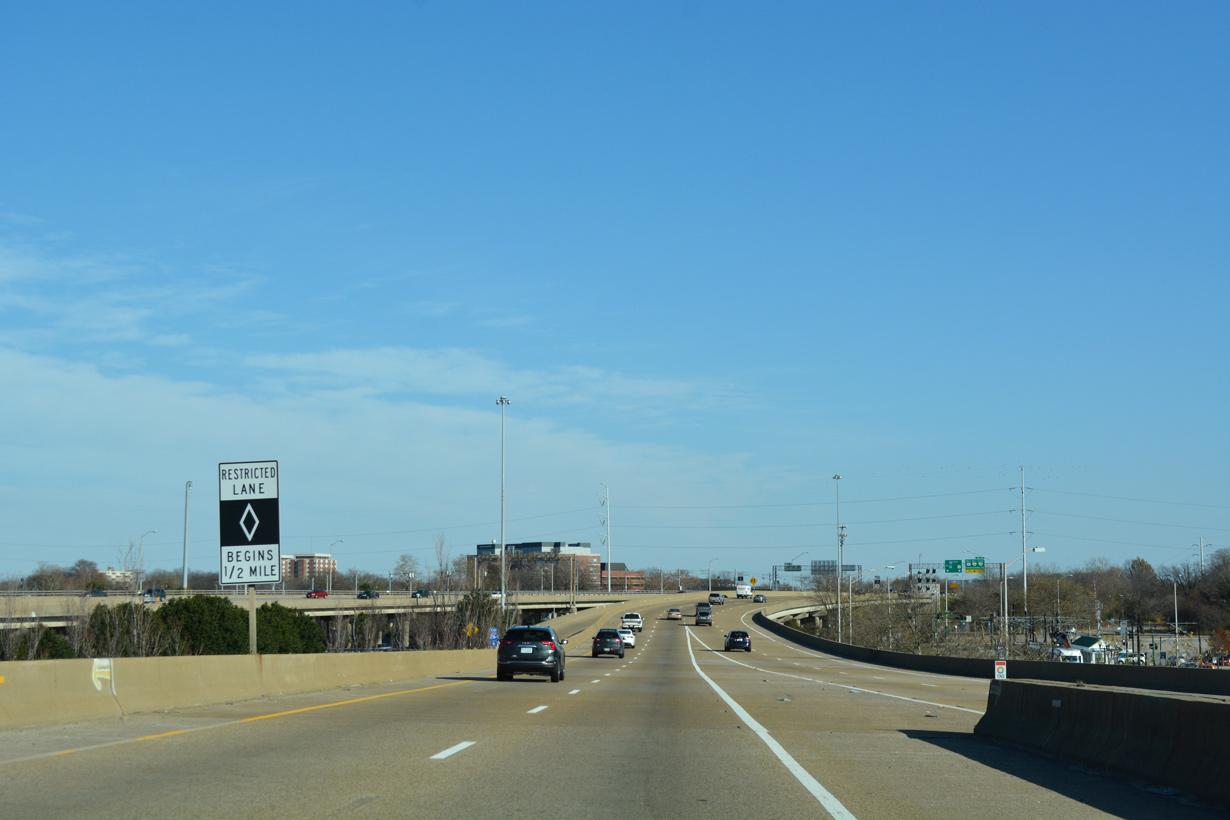
I-264 expands to an eight lane freeway east from the exchange with Waterside Drive (SR 337 ALT). HOV-2 lanes commence in a half mile.
12/14/17
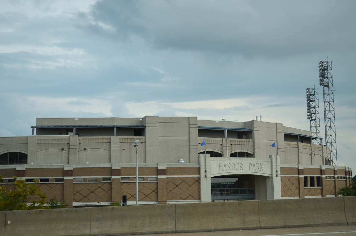
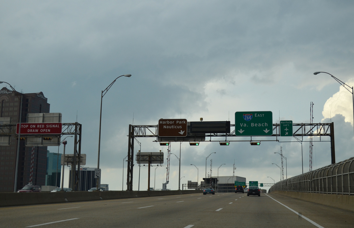
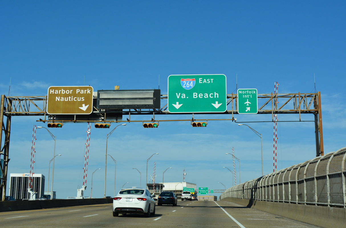
Interstate 264 passes just north of Harbor Park, home of the Norfolk Tides AAA Baseball team, along the Elizabeth River Eastern Branch.
07/23/13
A left side entrance ramp joins I-264 east from City Hall Avenue, one half mile ahead of the HOV-2 lane.
12/14/17
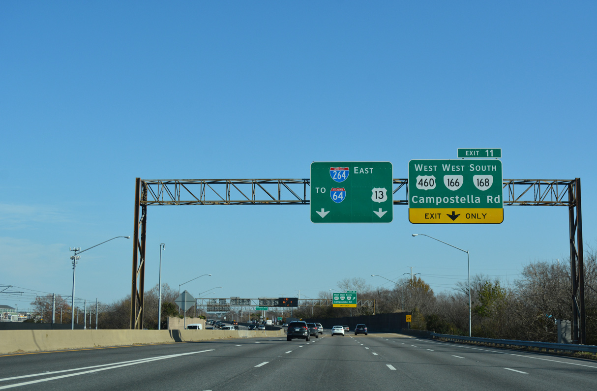
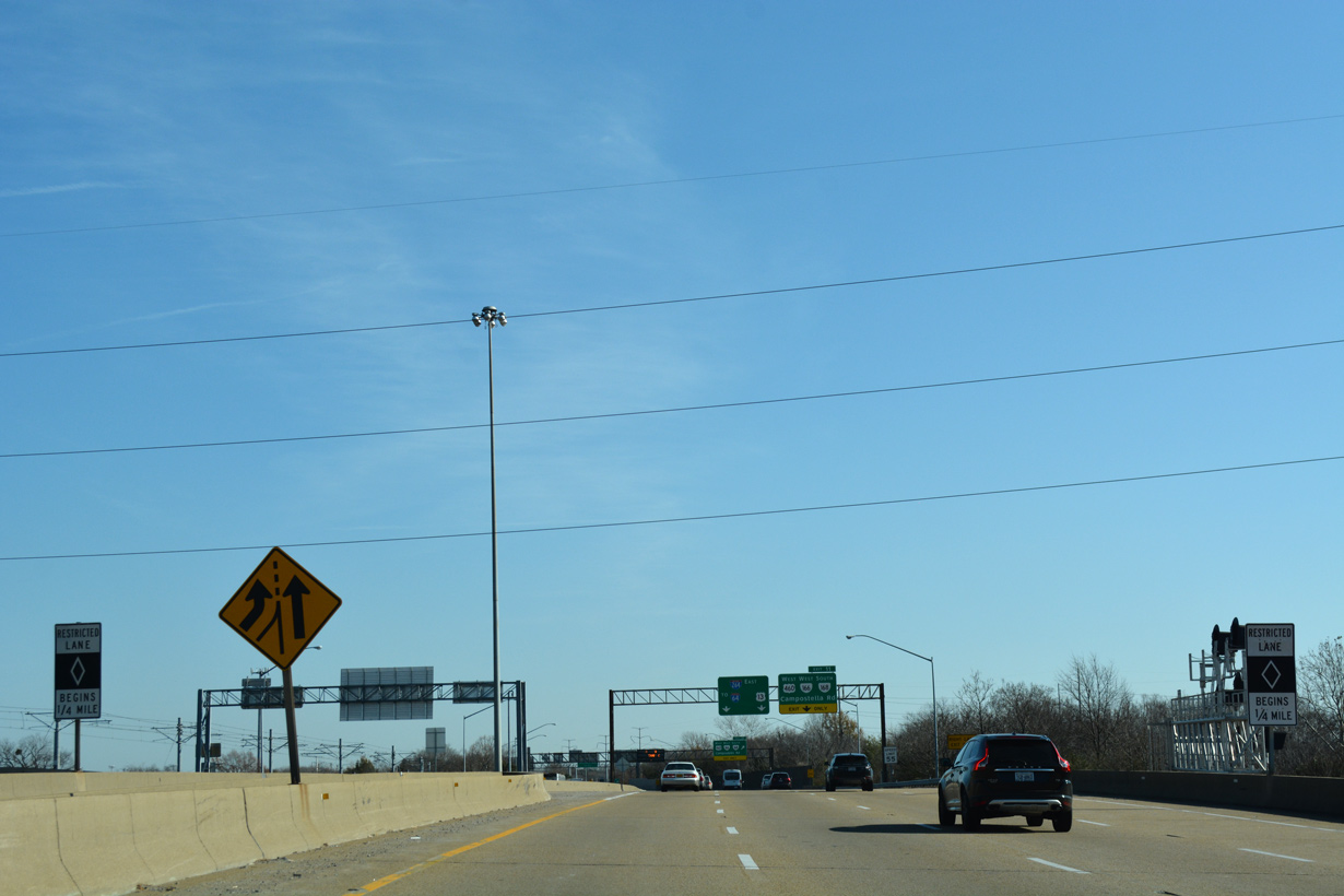
A six-ramp parclo interchange (Exit 11) joins I-264 with U.S. 460/SR 166 east and SR 168 south across the the 1986-built Campostella Bridge to Campostella Heights.
12/14/17
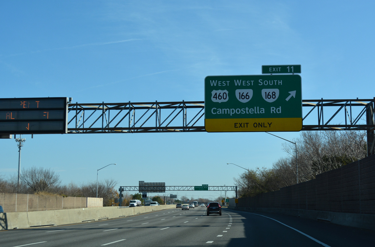
U.S. 460/SR 166-168 combine south from adjacent Brambleton and Park Avenues to Wilson Road at Campostella Heights. U.S. 460/SR 166 follow Wilson Road southwest to Cloverdale and Poindexter Street (SR 337) in Chesapeake. SR 168 extends south along Campostella Road to Atlantic Avenue.
12/14/17
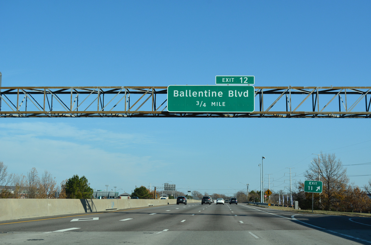
Ballentine Boulevard north 0.64 miles from I-264 at forthcoming Exit 12 to U.S. 58 (Virginia Beach Boulevard) was previously designated as SR 405.1
12/14/17
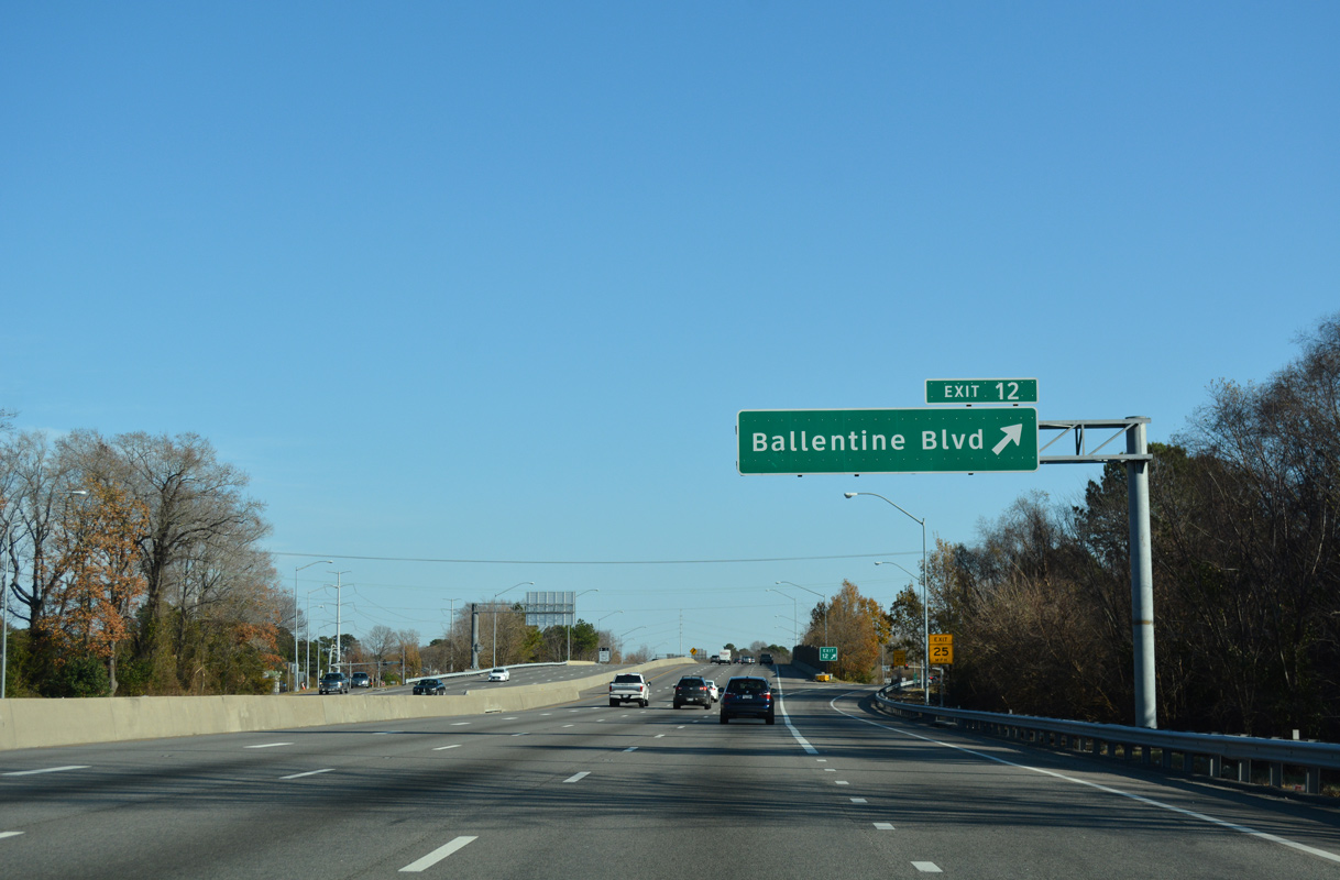
A diamond interchange (Exit 12) links I-264 with Ballentine Boulevard east beyond U.S. 460/SR 166-168 (Campostella Road).
12/14/17
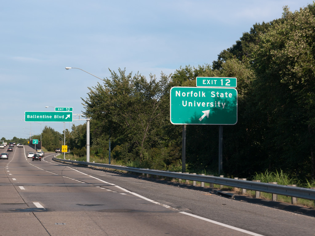
Norfolk State University lines the north side of Interstate 264 between Park Avenue (SR 166) and Ballentine Boulevard.
09/05/10
Merrimac Avenue originally connected with Exit 12 and Grandy Park. The development of the Middle Towne Arch neighborhood included an extension of Ballentine Boulevard north to SR 166 (Princess Anne Road).
12/14/17
12/14/17
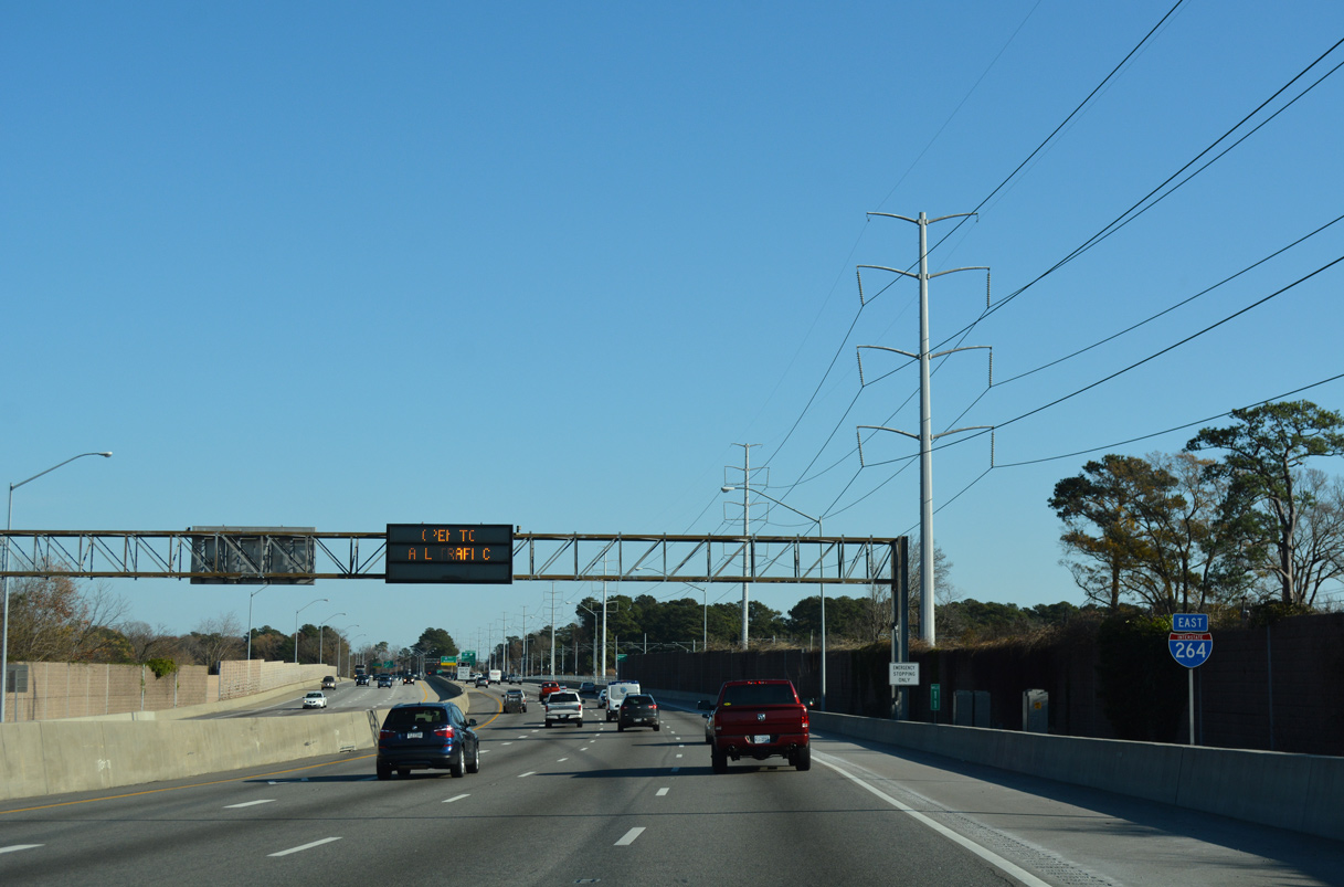
A 2.04 mile long c/d roadway separates from I-264 beyond the Ingleside and Ventosa neighborhoods for Exits 13, 14 and 15. An unnumbered left exit follows for I-64 west ahead of U.S. 13 (Northampton Boulevard) to the Chesapeake Bay Bridge Tunnel (CBBT).
12/14/17
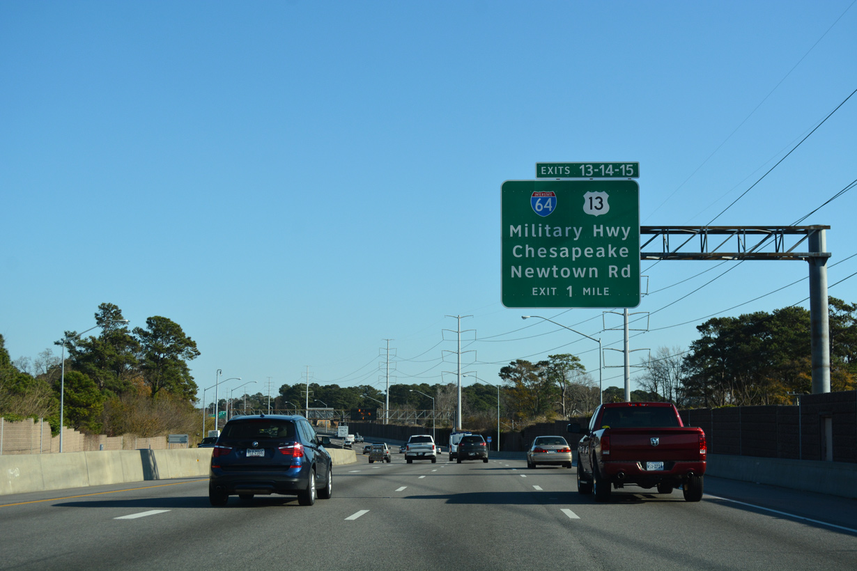
U.S. 13 (Military Highway) meets Interstate 264 at a cloverleaf interchange (Exit 13) next.
12/14/17
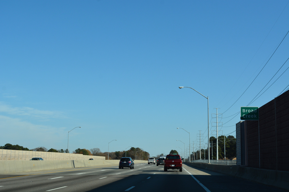
Interstate 264 east crosses Broad Creek beyond this confirming marker.
12/14/17
12/14/17
U.S. 13 (Military Highway) encircles Norfolk north to SR 165 (Northampton Boulevard) and SR 166 (Princess Anne Road) at Lansdale and southwest to Chesapeake.
12/14/17
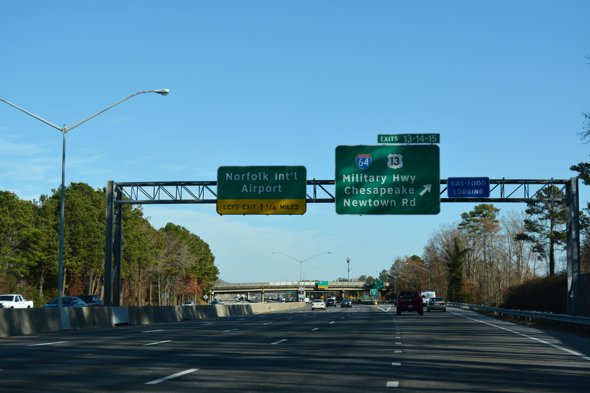
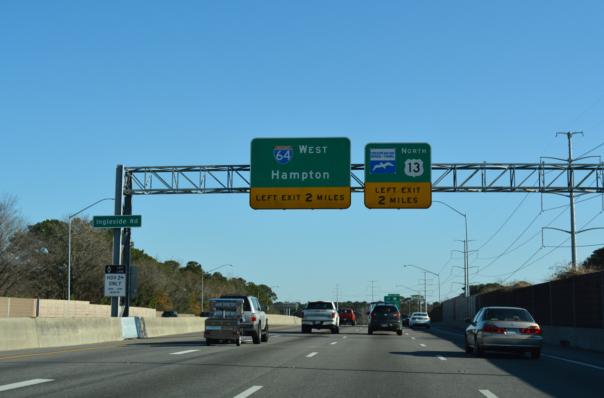
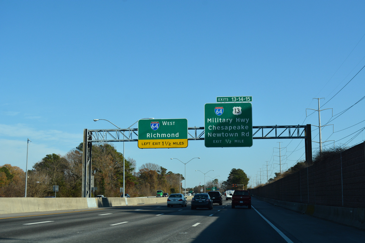
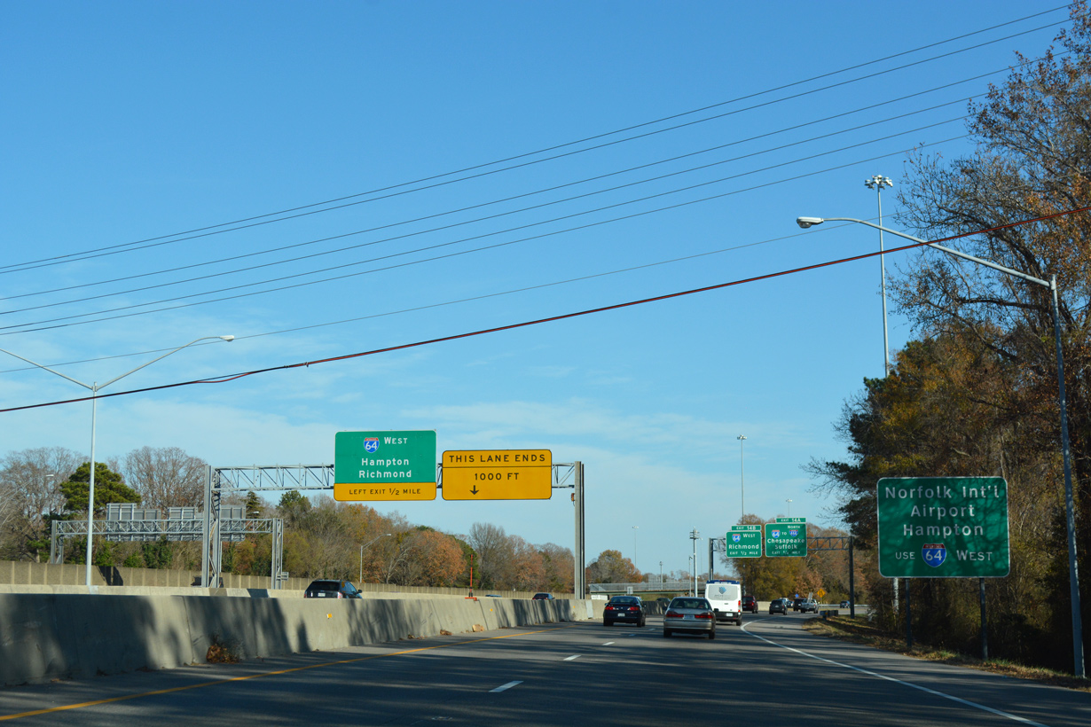
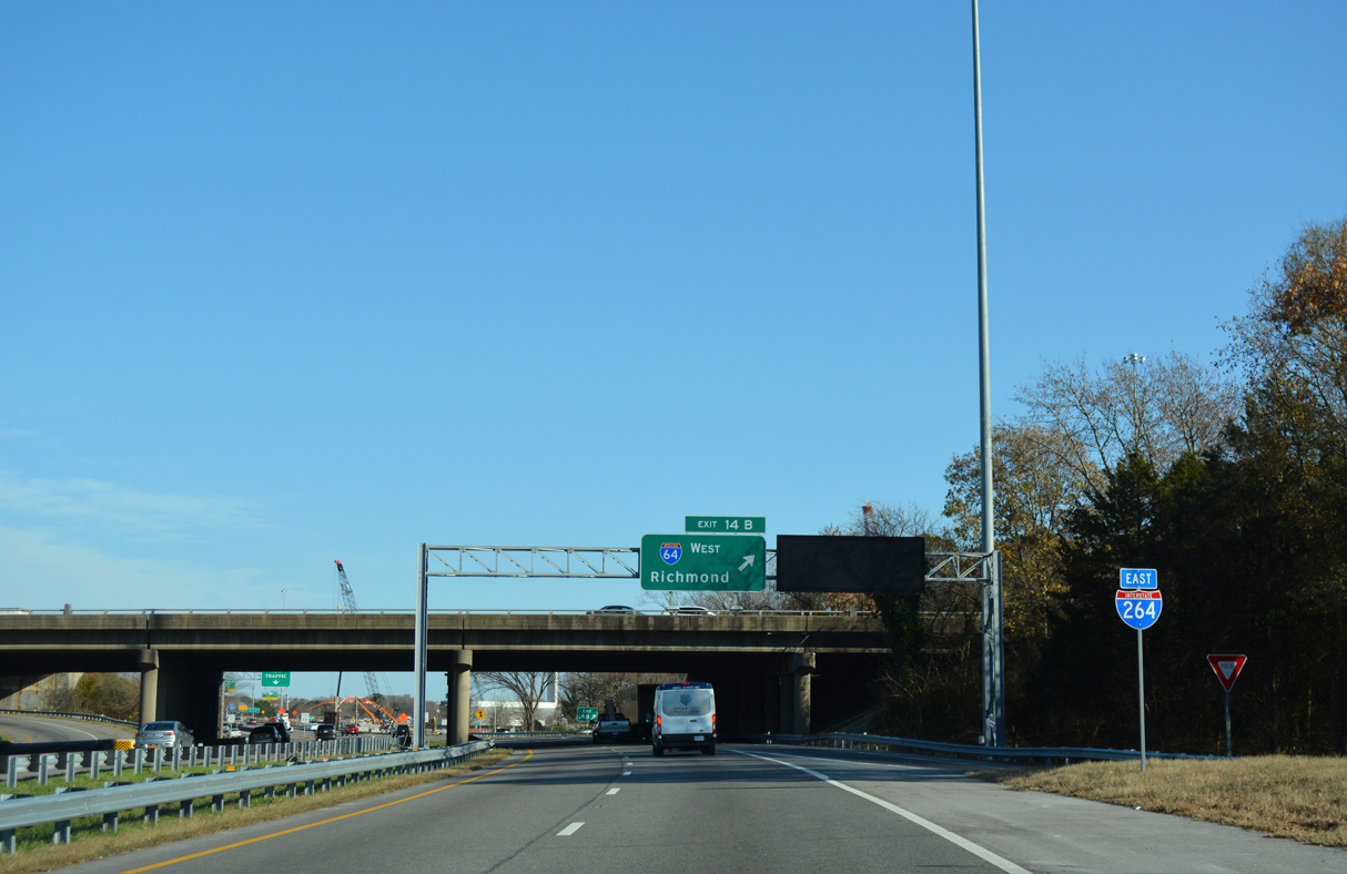
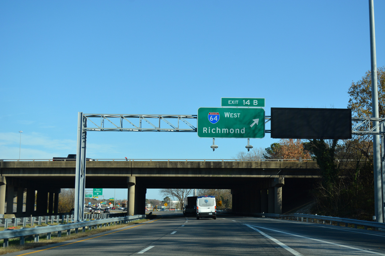
The c/d roadway for U.S. 13 (Military Highway) I-64 and Newtown Road (SR 403) departs. The left exit for I-64 west joins the Hampton Roads Beltway ahead of Norfolk International Airport (ORF) and 94 miles from Richmond.
12/14/17
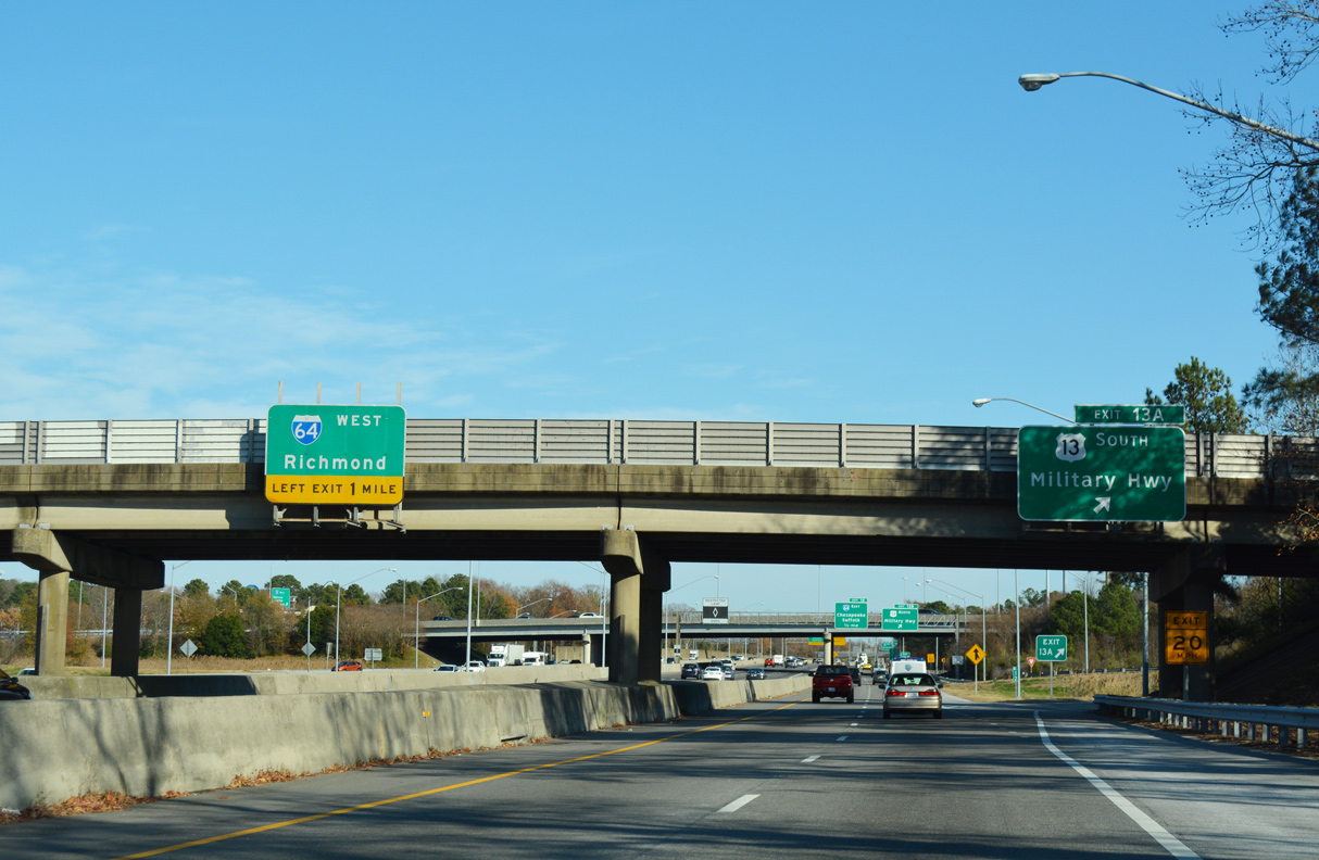
Exit 13A leaves the c/d roadway for U.S. 13 (Military Highway) southbound to Knob Hill in Virginia Beach and Indian River Park in Chesapeake.
12/14/17
Exit 13B loops onto U.S. 13 (Military Highway) north to Poplar Halls, Military Circle Mall and a SPUI with U.S. 58 (Virginia Beach Boulevard).
12/14/17
12/14/17
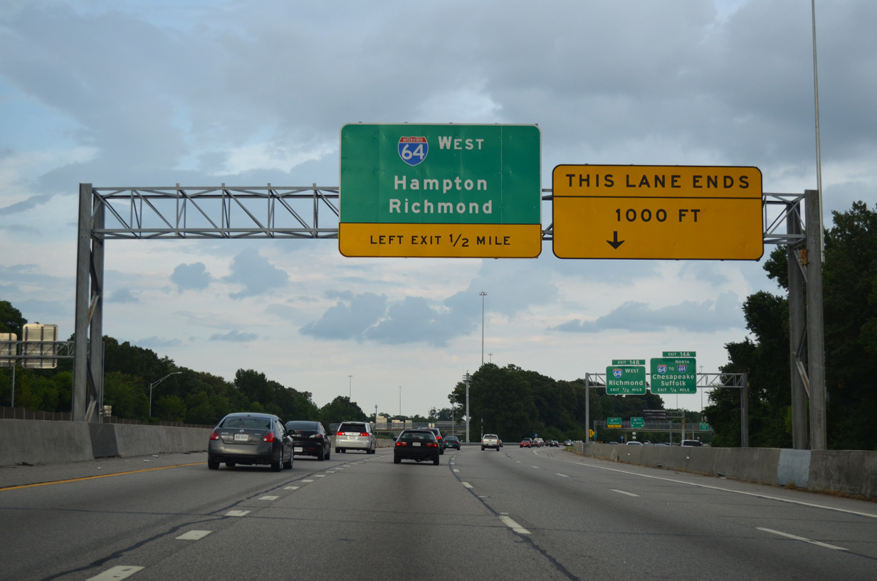
The eastbound main line for I-264 advances a half mile east from the exchange with U.S. 13 to the left exit for Interstate 64 west to Hampton.
07/23/13
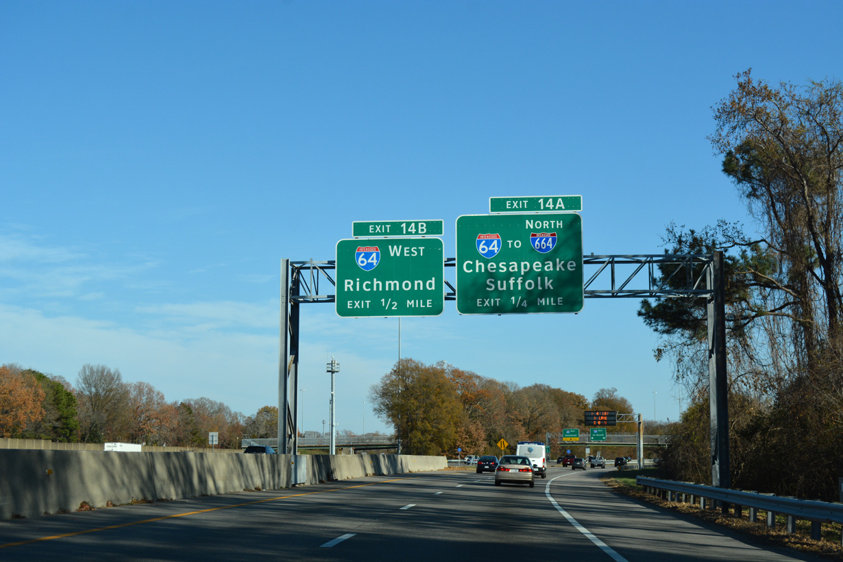
The c/d roadway continues east from U.S. 13 (Military Highway) to exit ramps for both directions of Interstate 64 (Hampton Roads Beltway).
12/14/17
I-64 west connects with U.S. 13 (Northampton Boulevard) to the CBBT in 2.1 miles and I-564 (Admiral Taussig Boulevard) west to Naval Station Norfolk in 7.4 miles.
07/23/13
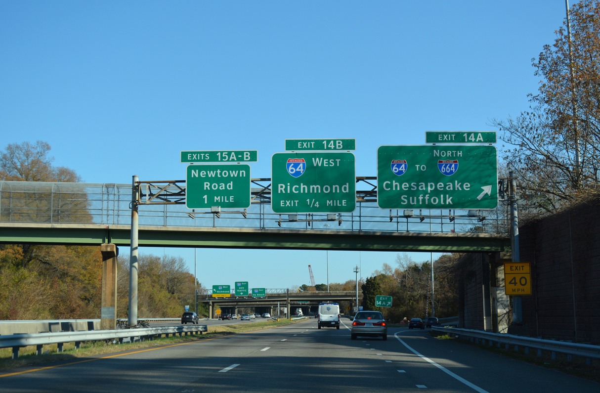
Interstate 64 curves southwesterly 15 miles from Exit 14A to I-264/664 at Bowers Hill in Chesapeake.
12/14/17
06/06/21
The HOV lane resumes along Interstate 264 east of Exit 14.
09/05/10
12/14/17
12/14/17
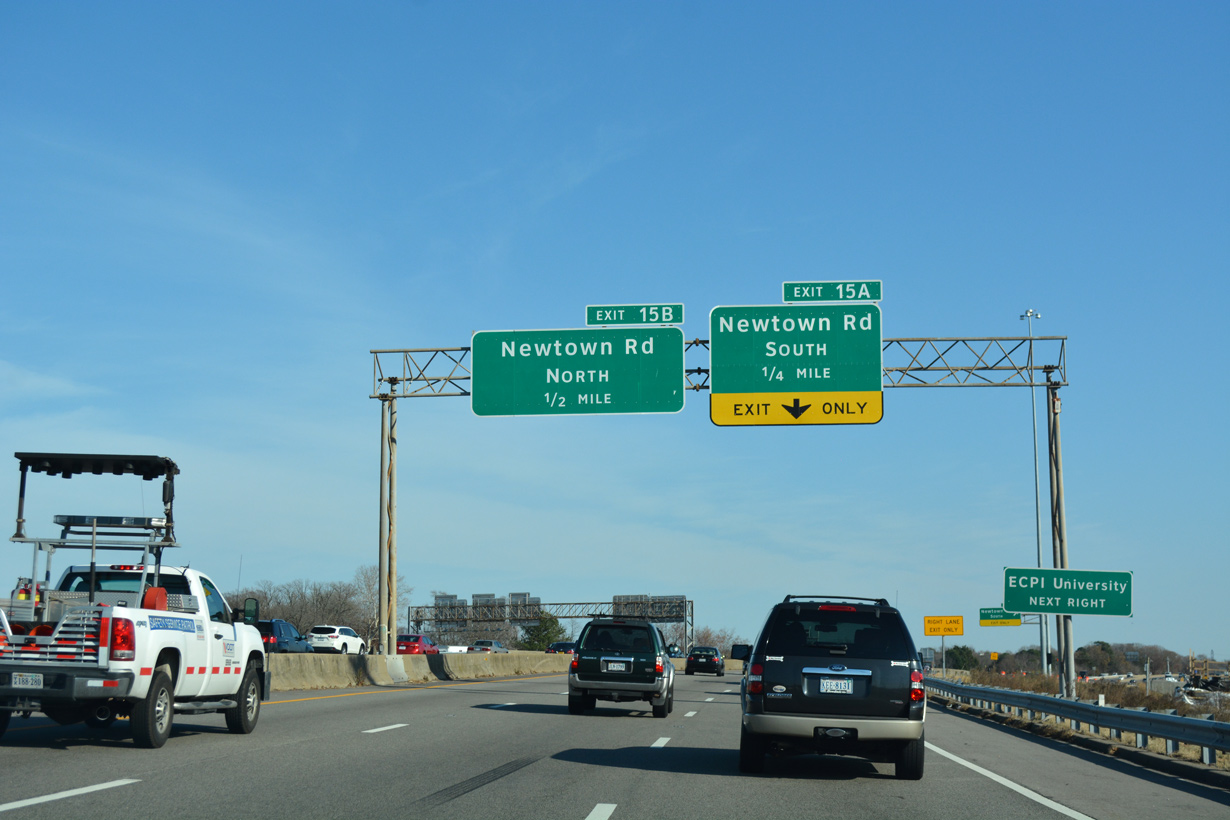
Exit 14B loops onto Interstate 64 west from the c/d roadway. A parclo interchange (Exit 15) with Newtown Road follows at the community of Greenwich.
12/14/17
East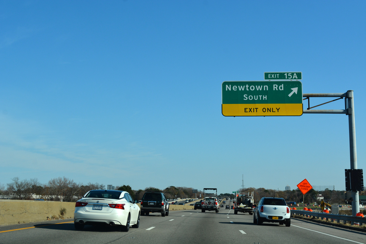
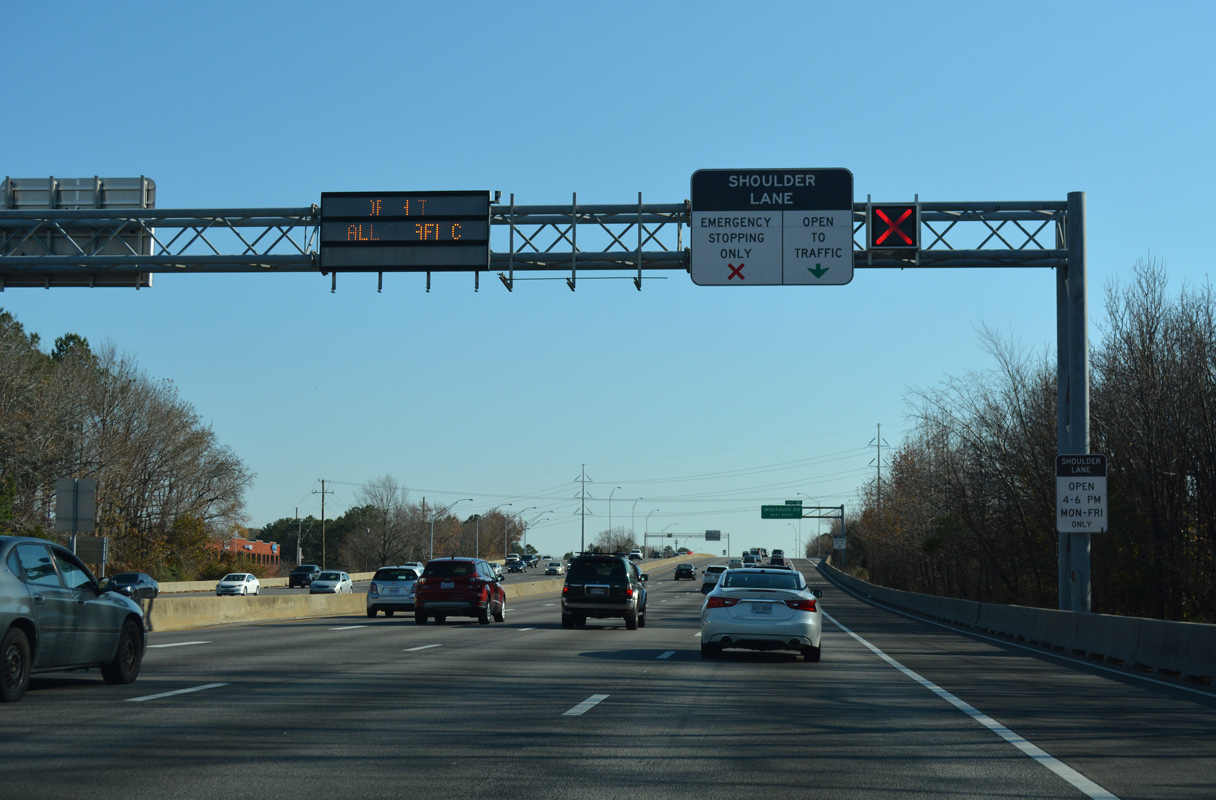
Completed in Fall 2019, Phase I of the I-64/I-264 Interchange Improvements Project realigned the c/d roadway from I-64 to Exit 15 with Newtown Road (SR 403). Newtown Road follows the Virginia Beach city line from the Elizabeth River Eastern Branch to Davis Corner.
12/14/17
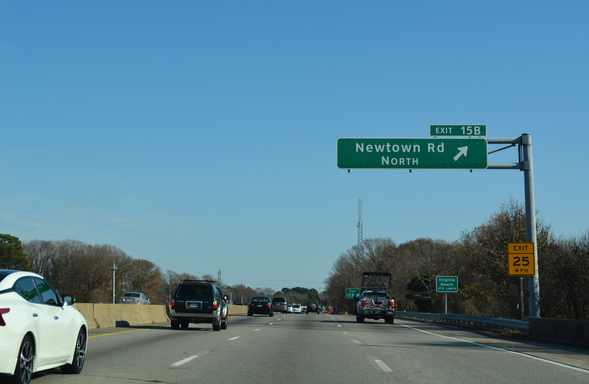
Phase II of the I-64/264 Interchange Improvements project from February 2018 to Fall 2021 replaces the loop ramp at Exit 15B for Newtown Road north to Fair Meadows and parallel U.S. 58 (Virginia Beach Boulevard).
12/14/17
Phase II work extends the c/d roadway east from the exchange with Greenwich Road to Exit 16 for Witchduck Road.
12/14/17
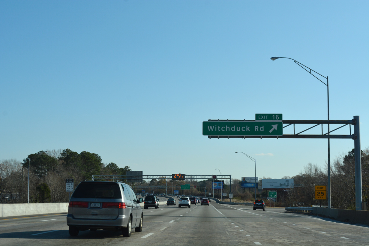
Costing $194.5 million, Phase II construction for the I-64/264 Interchange Improvements Project rebuilt the parclo interchange (Exit 16) with Witchduck Road and added a new flyover for Greenwich Road connecting with Cleveland Street.2
12/14/17
12/14/17
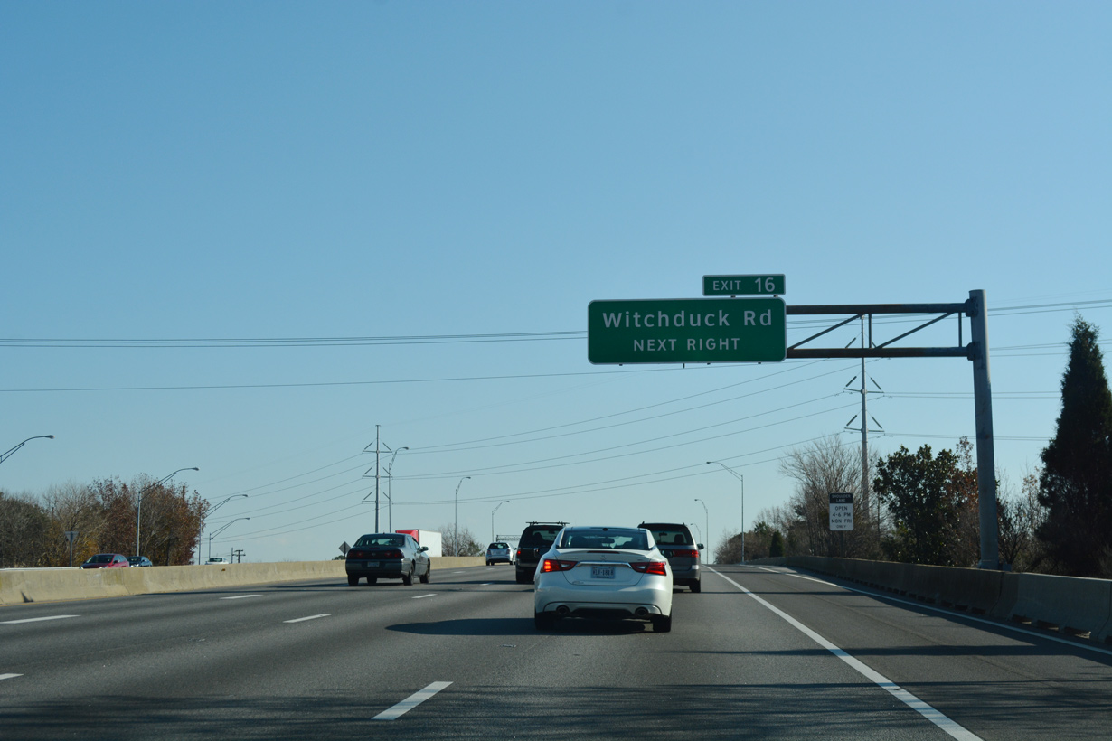
A new two lane exit ramp for Witchduck Road (SR 190) replaced a loop ramp further east.
12/14/17
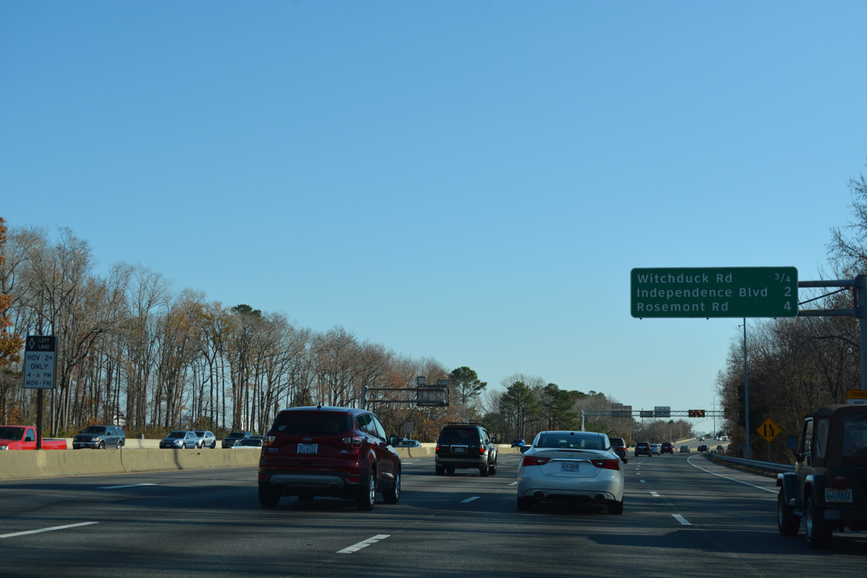
Unmarked on I-264, Witchduck Road is a part of SR 190 northeast to SR 225 (Independence Boulevard) and south to SR 165 (Princess Anne Road) at Kempsville Road. 15.43 miles long route, SR 190 encircles Norfolk through Virginia Beach and north Chesapeake.
12/14/17
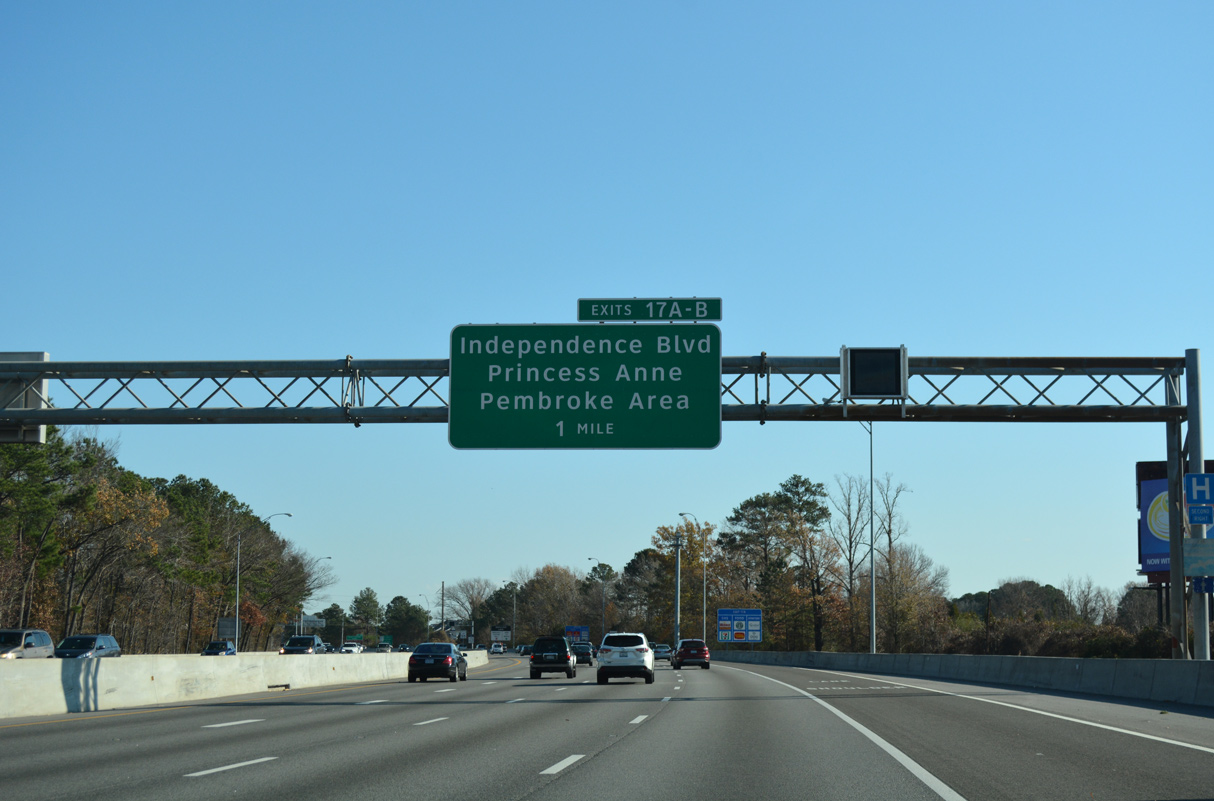
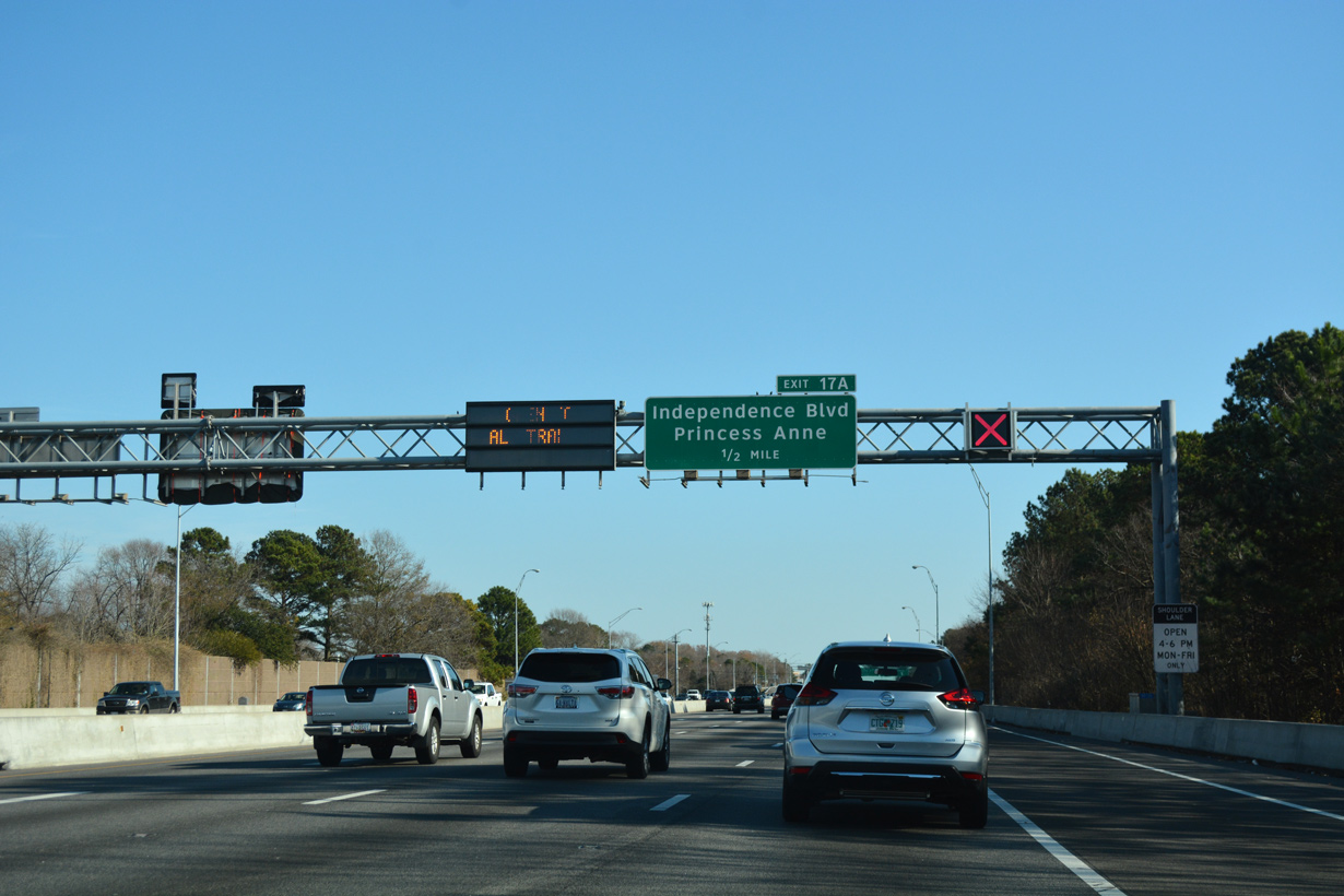
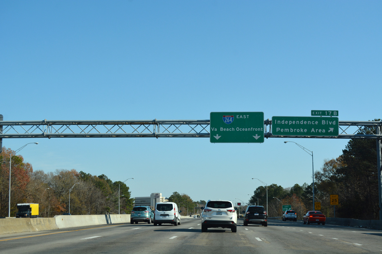
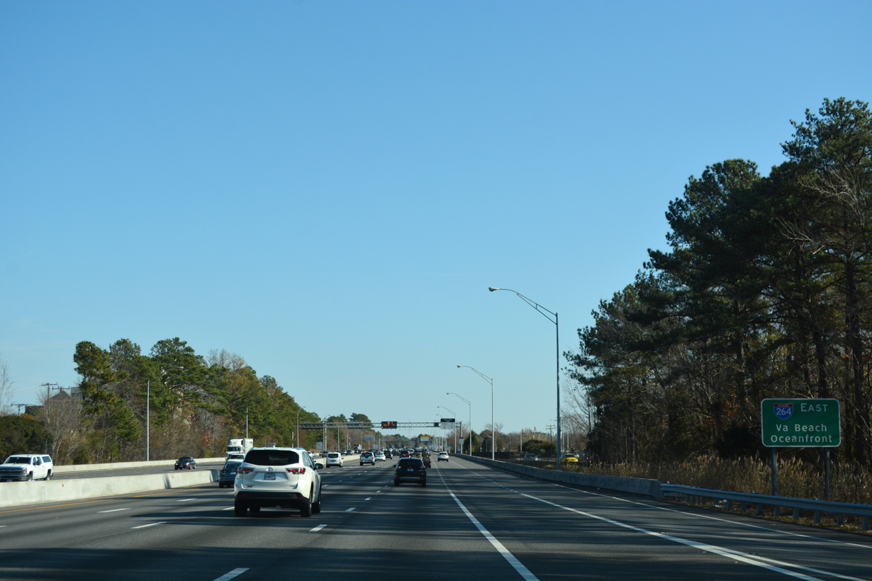
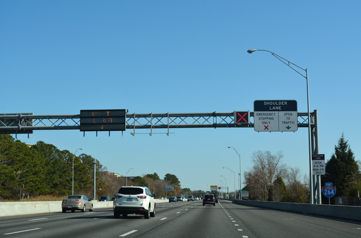
A cloverleaf interchange joins Interstate 264 with SR 225 (Independence Boulevard) at Exits 17A/B.
12/14/17
Independence Boulevard (SR 225) constitutes a 11.73 mile long loop south to Indian River Road (SR 407) and north to U.S. 60 (Shore Drive) at the Joint Expeditionary Base Little Creek - Fort Story Central.
12/14/17

Exit 17A includes a ramp to adjacent Alicia Drive and Baxter Road. Until 2001, Independence Boulevard south was also a part of unsigned SR 410 to Holland Road.1
12/14/17
12/14/17
12/14/17
12/14/17
12/14/17
12/14/17
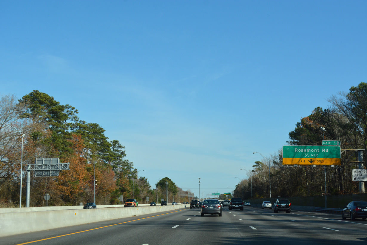
A six-ramp parclo interchange (Exit 18) joins I-264 with Rosemont Road (SR 411) at Princess Anne Plaza in Virginia Beach next.
12/14/17

An unsigned route, SR 411 follows Rosemont Road 3.98 miles north from Dam Neck Road at Landstown to adjacent U.S. 58 (Virginia Beach Boulevard).
12/14/17
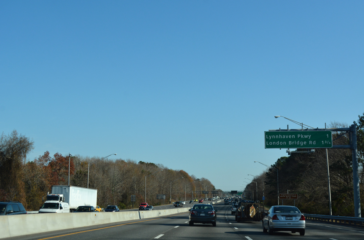
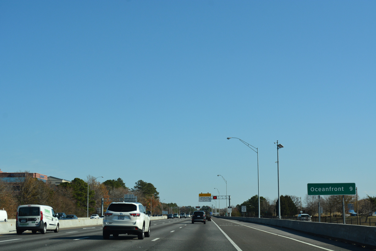
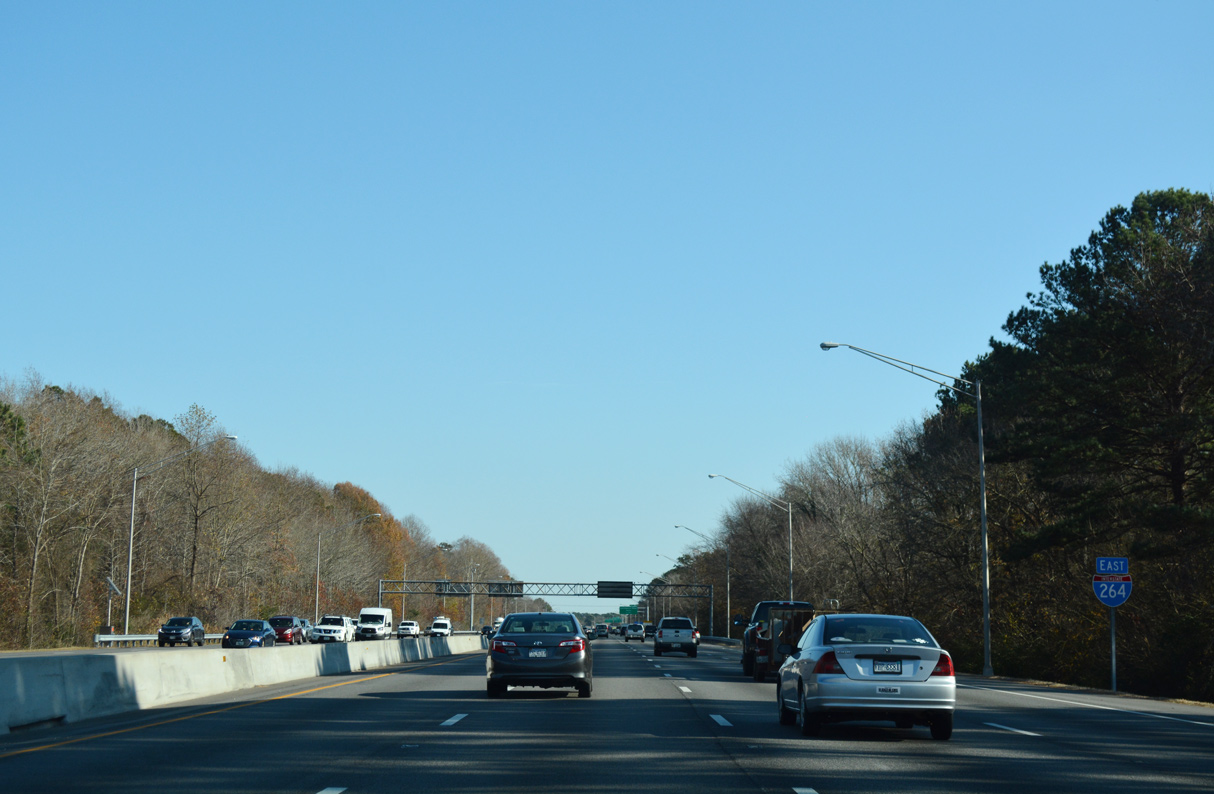
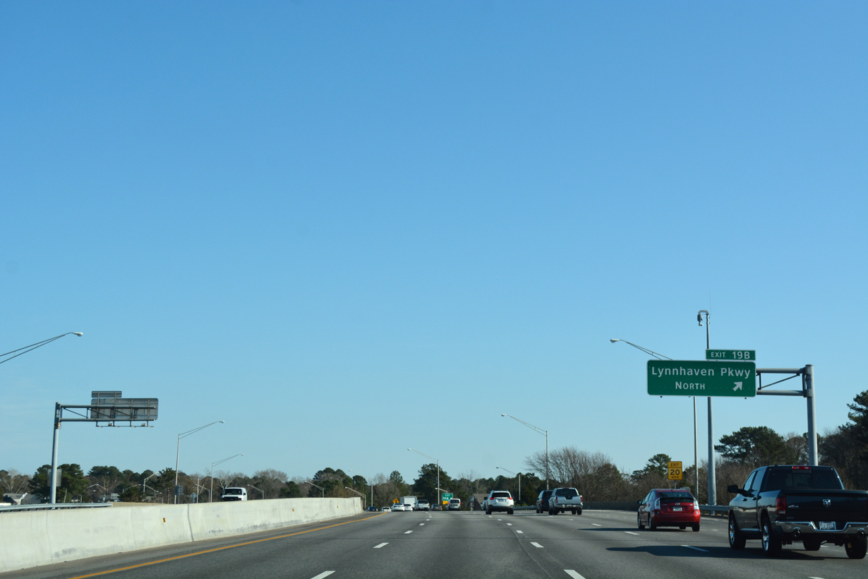
Lynnhaven Park (unsigned SR 414) meets Interstate 264 at a three quarter cloverleaf interchange (Exit 19) in one mile.
12/14/17
12/14/17
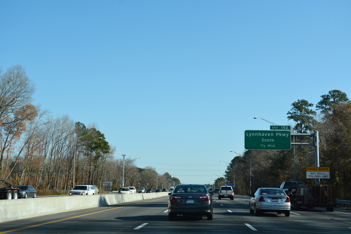
Lynnhaven Parkway stems south from U.S. 58 (Virginia Beach Boulevard) at Lynnhaven to Lynnhaven Mall.
12/14/17
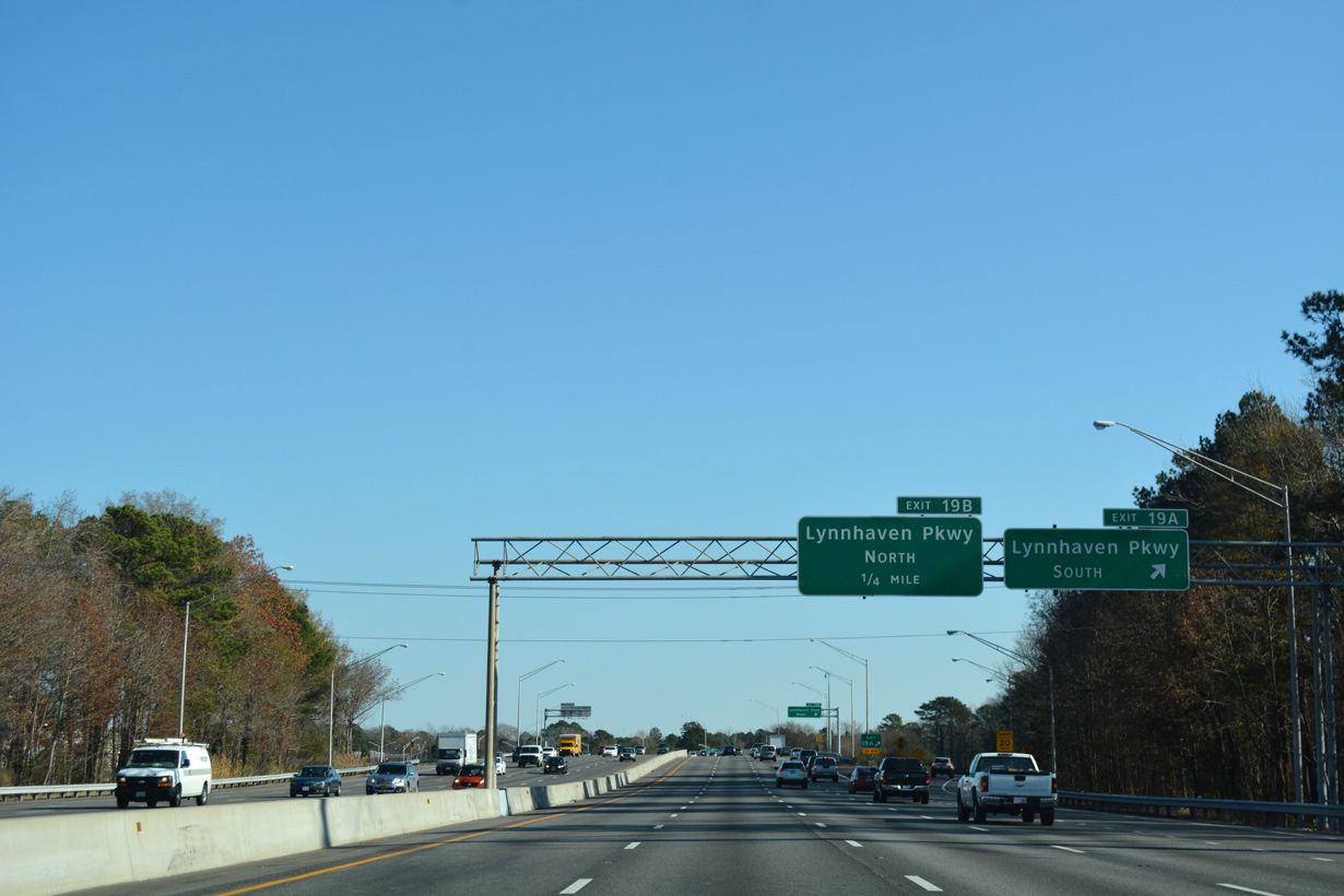
Unsigned SR 414 lines Lynnhaven Parkway southwest to Mapleton, Salem and the Chesapeake City line.
12/14/17
12/14/17
12/14/17
12/14/17
12/14/17
12/14/17
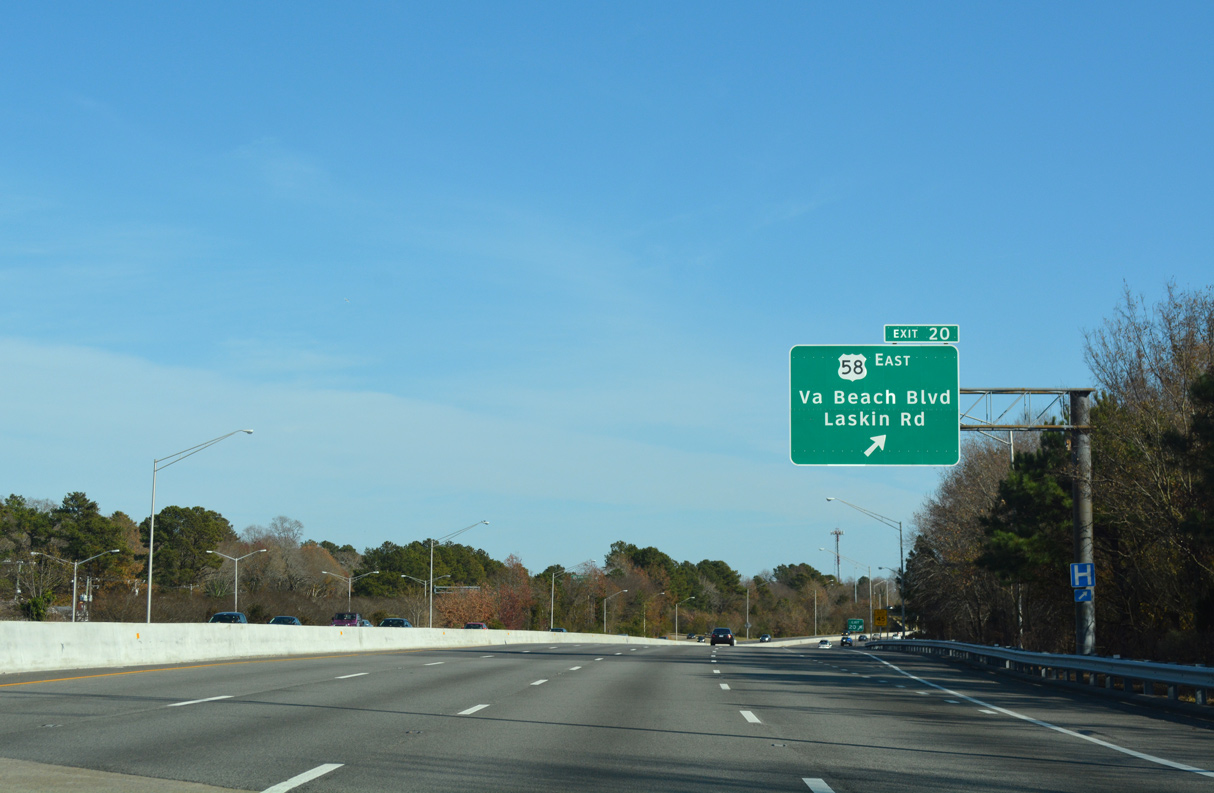
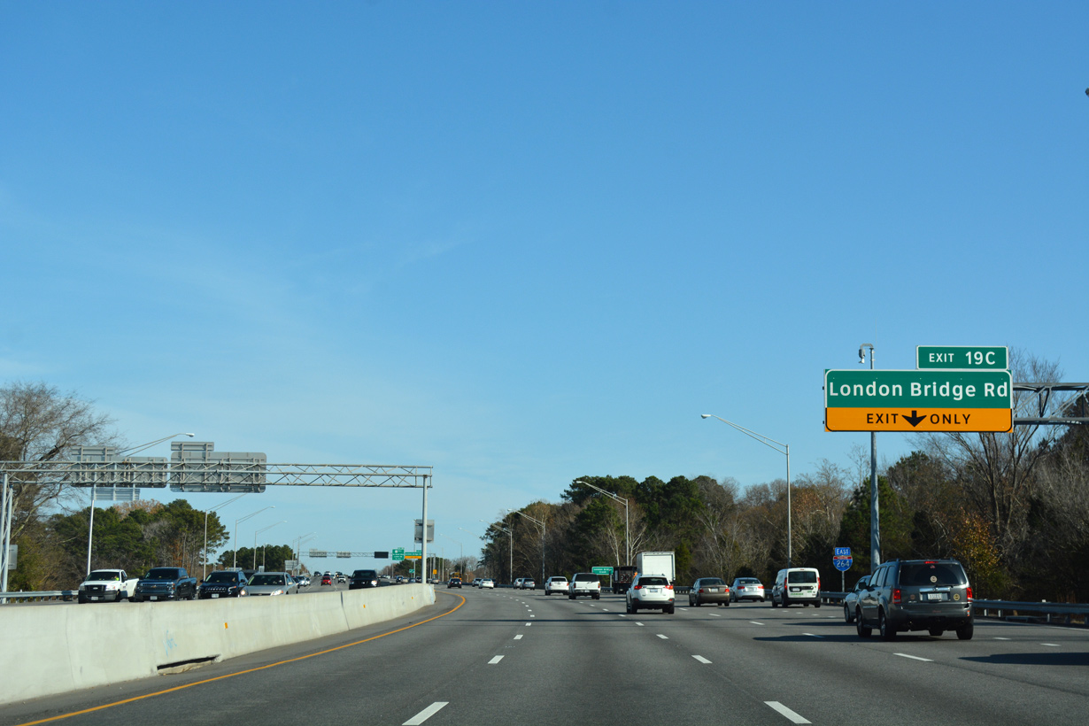
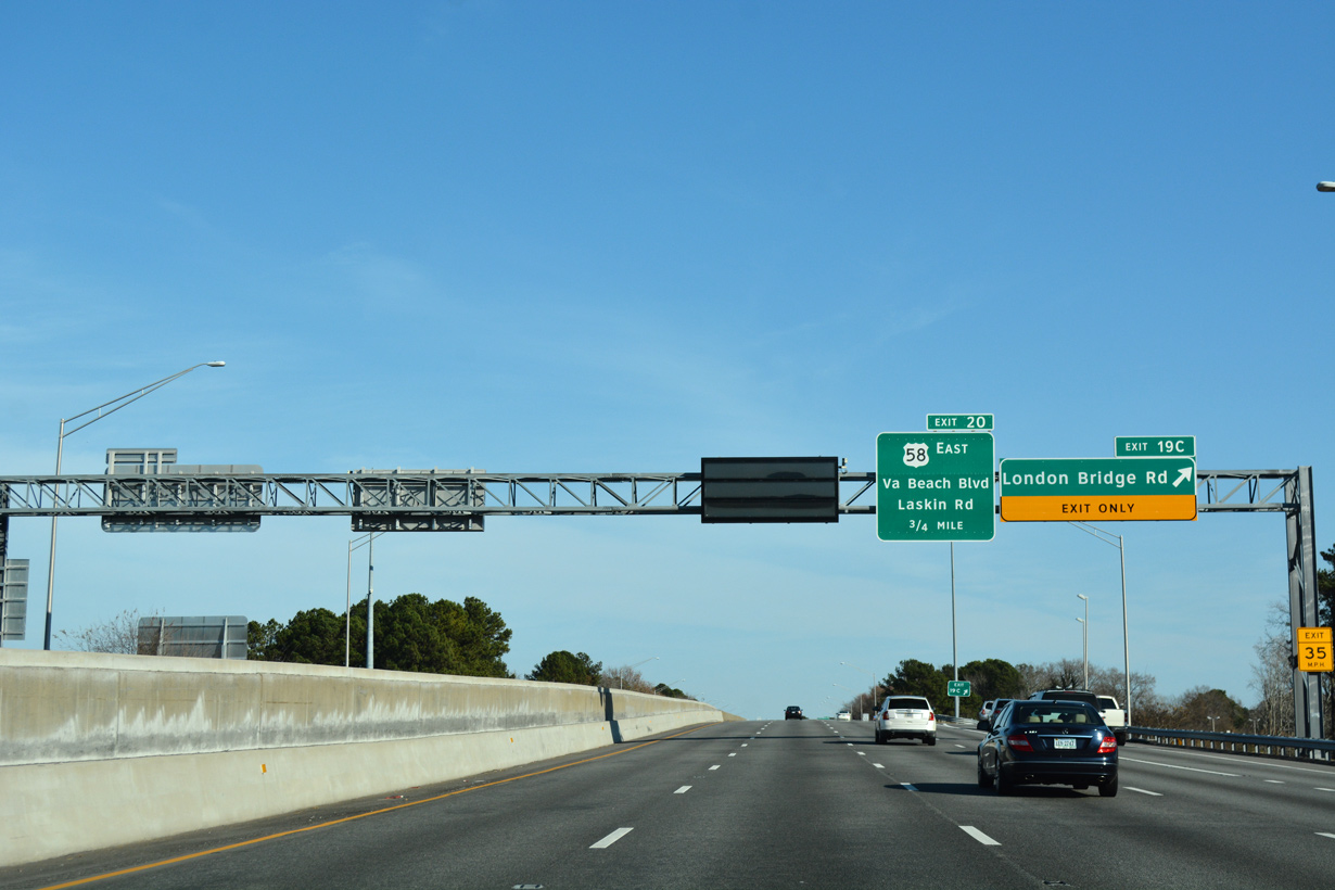
Adjacent U.S. 58 splits with U.S. 58 Business (Virginia Beach Boulevard) for Laskin Road. Exit 20 joins I-264 east with both routes.
12/14/17
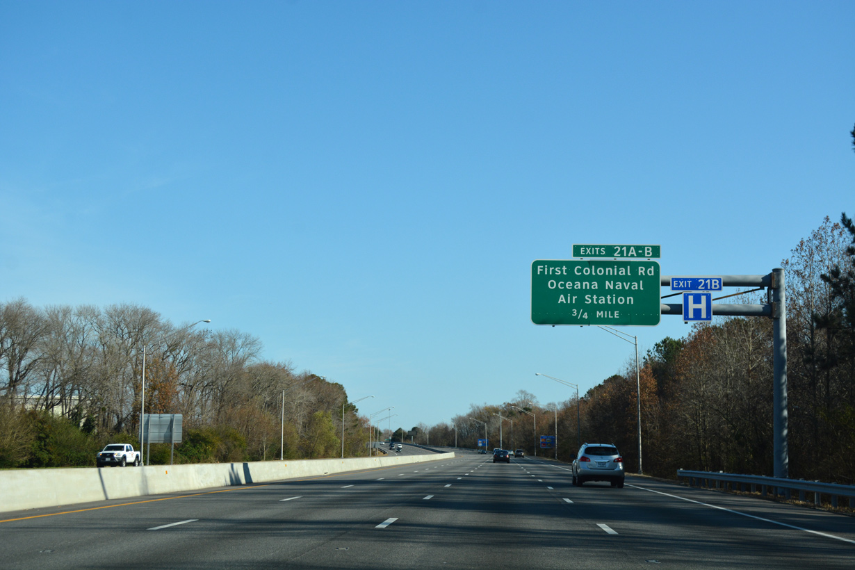
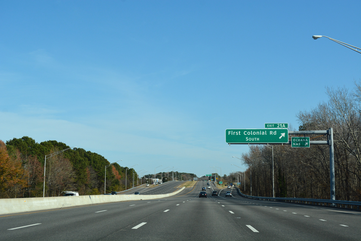
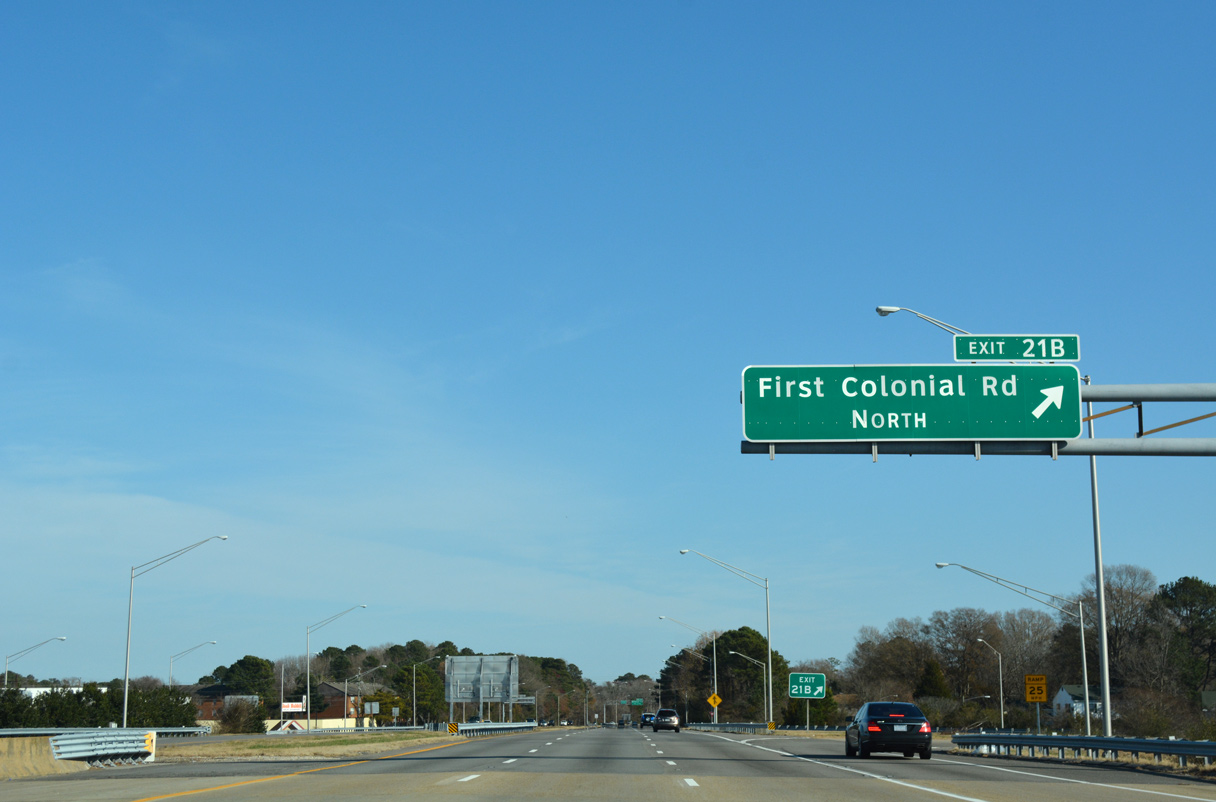
First Colonial Road (SR 408) branches 2.56 miles southeast from SR 279 (Great Neck Road) to U.S. 58 Business (Virginia Beach Boulevard) just south of Exit 21.
12/14/17
Oceana Boulevard extends the arterial south from First Colonial Boulevard along the east side of Naval Air Station Oceana to SR 149 (General Booth Boulevard).
12/14/17
12/14/17

Advancing east, Interstate 264 crosses Great Neck Creek ahead of a parclo interchange (Exit 22) with Birdneck Road.
12/14/17
12/14/17
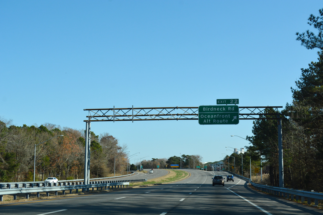
Birdneck Road leads south to U.S. 58 Business (Virginia Beach Boulevard) and Seatack and north to U.S. 58 (Laskin Road) near Bird Neck Point.
12/14/17
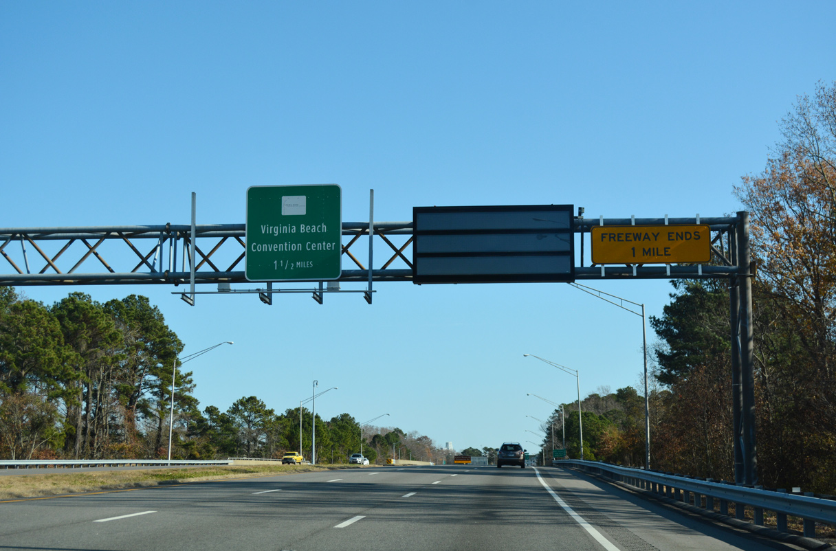
Interstate 264 transitions to 21st Street east to the Virginia Beach Oceanfront in a quarter mile.
12/14/17
12/14/17
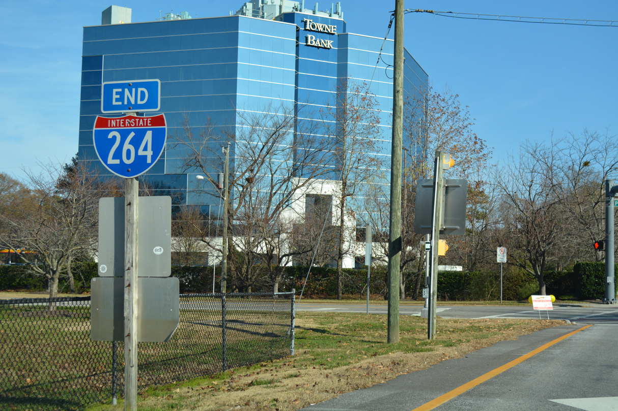
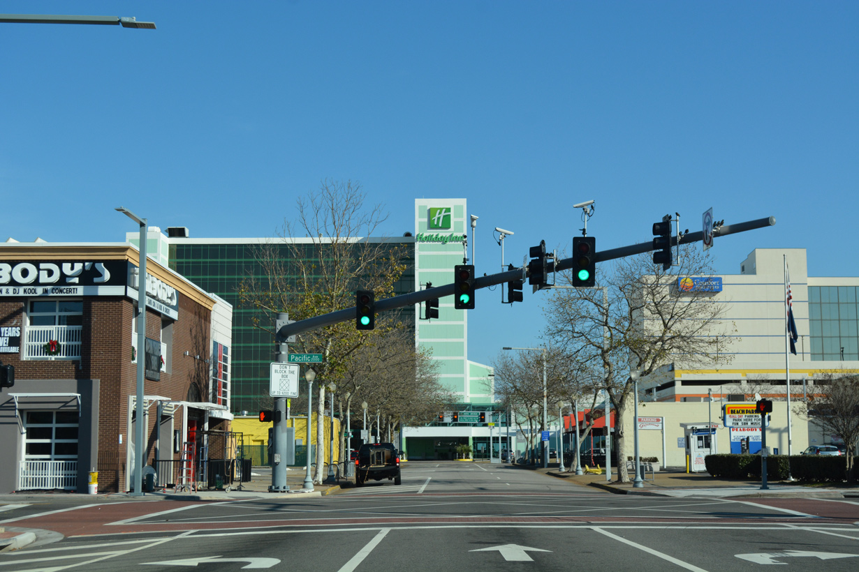
Interstate 264 ends at the intersection with Parks Avenue and 21st Street east, six blocks west of the Atlantic Ocean.
11/22/09
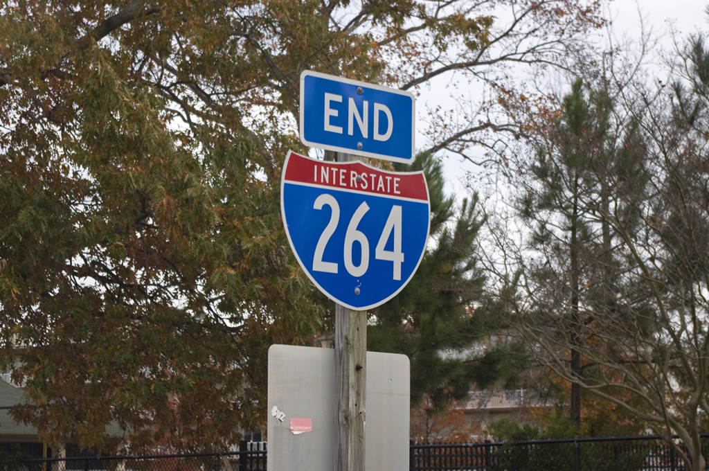
End shields appear along both sides at the intersection joining I-264 east with Parks Avenue. An SR 44 shield was posted with the I-264 assembly until at least November 29, 1999.3
11/22/09
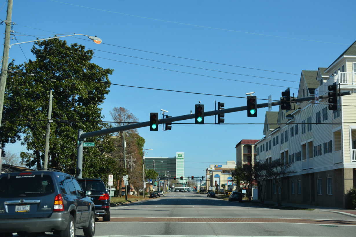
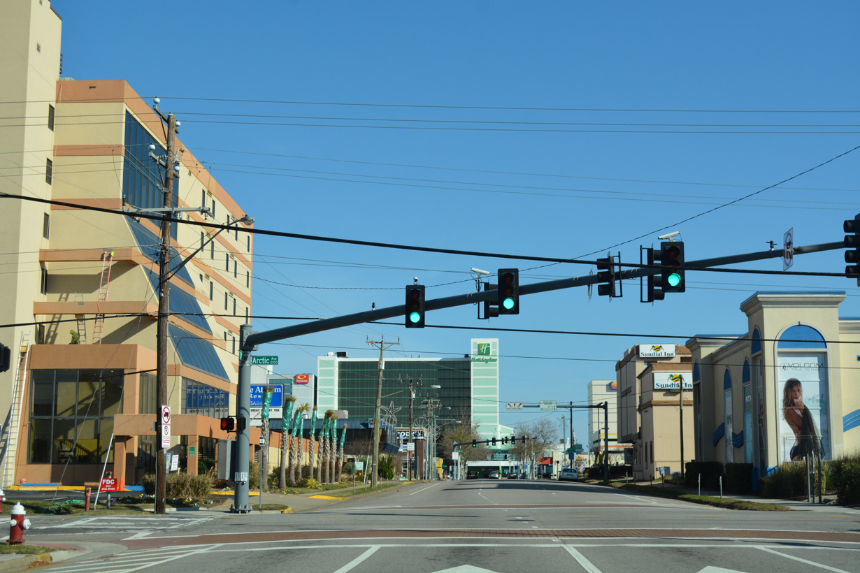
21st Street extends five blocks (0.53 miles) east to U.S. 60 (Pacific Avenue).
12/14/17
21st Street - East
12/14/17
12/14/17
12/14/17
12/14/17
Although unmarked, U.S. 60 follows Pacific Avenue south from the Virginia Beach Oceanfront from the Rudee Inlet Bridge and north onto Atlantic Avenue.
12/14/17
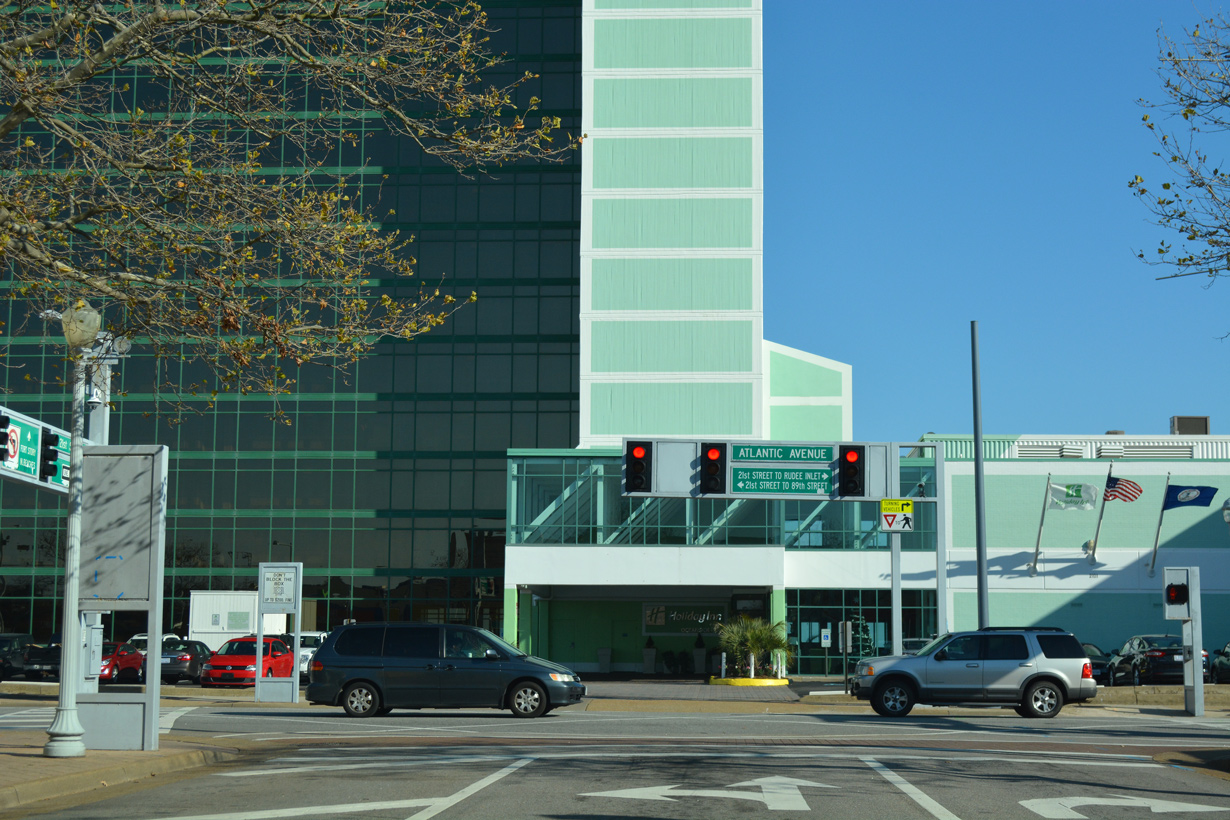
21st Street concludes at Atlantic Avenue, six blocks from the east end of Interstate 264.
12/14/17
Sources:
- VA 401 to 420. Virginia Highways Page.
- I-64/I-264 Interchange Improvements: Phase 2. Virginia Department of Transportation (VDOT), project web site.
- VA 221 to 240. Virginia Highways Page.
- Froehlig, Adam
Connect with:
Interstate 64
Interstate 464
U.S. 13
U.S. 17
U.S. 58
U.S. 460
State Route 337
Page Updated 04-08-2021.