The Inner Loop was constructed from the mid-1950s to 1965 at a cost of $34 million. The loop coincides with Interstate 490 south of downtown with the remaining course encircling the central business district as unsigned New York 940T.1
Construction removed two trenched stretches of the Inner Loop freeway from the NY 15 (Clinton Avenue) overpass near I-490, northward to East Main Street. The two-third mile long section of below grade freeway was filled to create a new urban boulevard. The two lane roadway was designed with provisions for bicyclists and pedestrians. At-grade intersections were created at Monroe Avenue (NY 31), for the Strong Museum, at Broad Street and at East Avenue while new roundabouts were added at both the merge with Union Street and at Charlotte Street. A $17.7 million TIGER grant was awarded in August 2013 to the city of Rochester toward the $23.6 million project. Three years of work started in Fall 2014.2
|
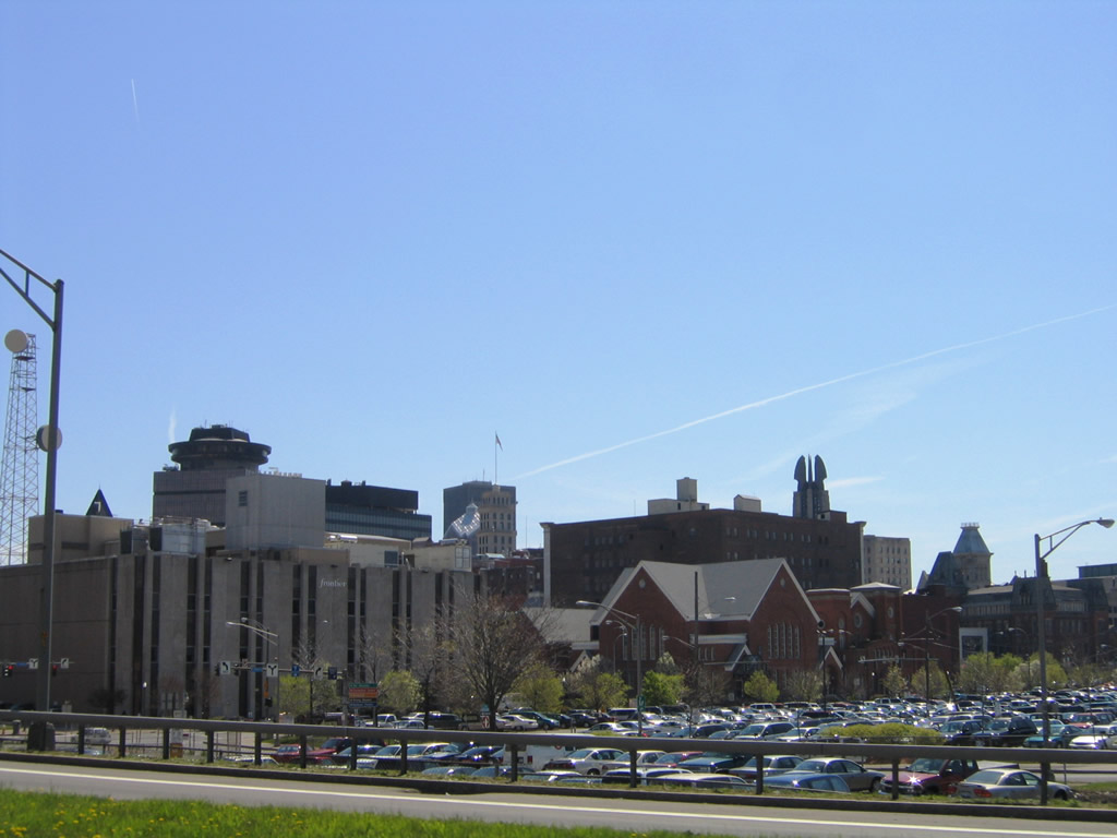
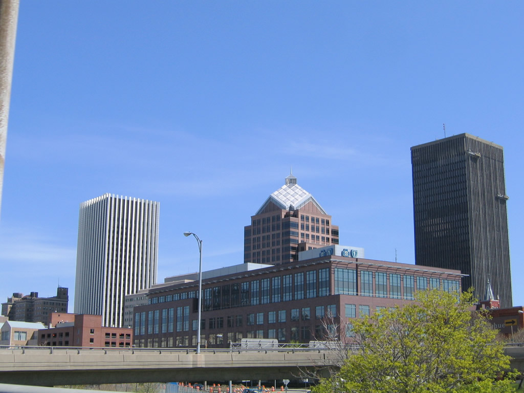
| An easterly view of the Rochester skyline from the Inner Loop northeast near Frontier Field. 05/09/05 |
|
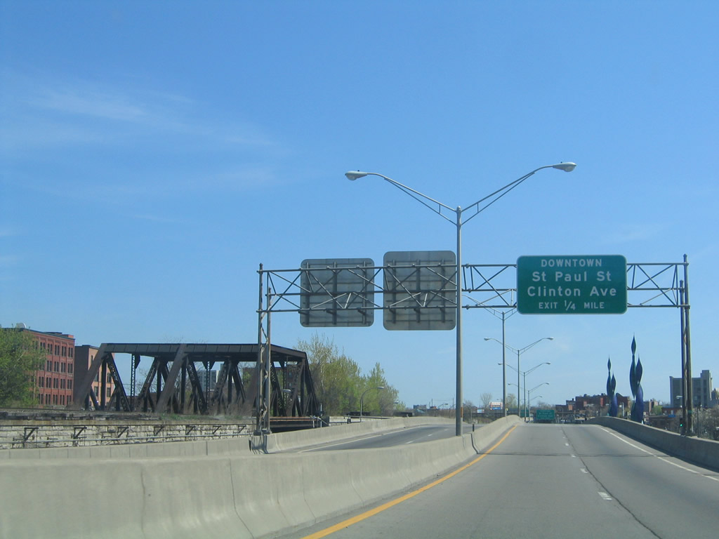
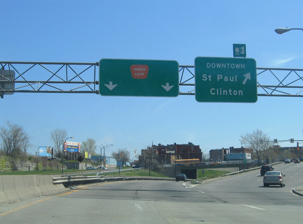
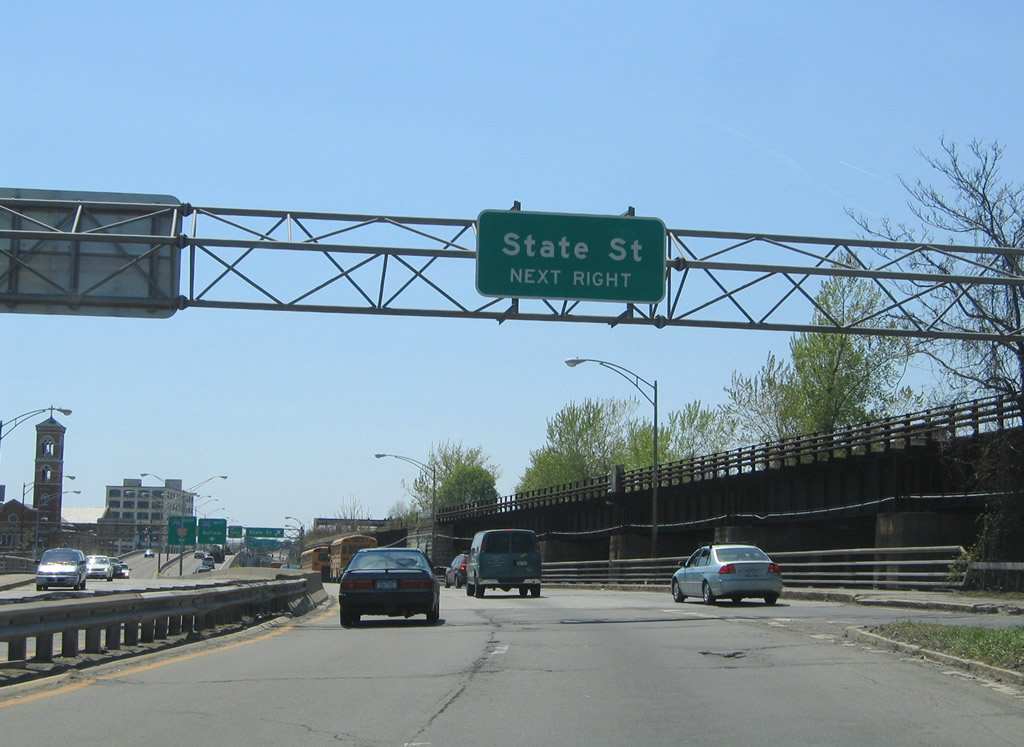
| Approaching the State Street underpass, the Inner Loop parallels a CSX Railroad line, which sees a truss bridge above the street below. The next exit connects the Inner Loop with St. Paul Street and Clinton Avenue. St. Paul and Clinton form a one way street couplet through downtown Rochester. 05/09/05 |
|
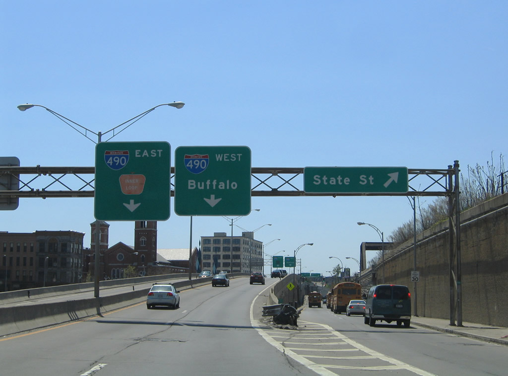
| An on-ramp joins the Inner Loop eastbound from Plymouth Avenue and State Street ahead of the Genesee River crossing. Cumberland Street connects the split diamond interchange between the loop, St. Paul Street, and Clinton Avenue. 05/09/05 |
|
| Looking southeast at the downtown skyline again with the Andrews Street bridge over the Genesee in the foreground. The Genesee River High Falls are just north of the Inner Loop and CSX Bridges. 05/09/05 |
|
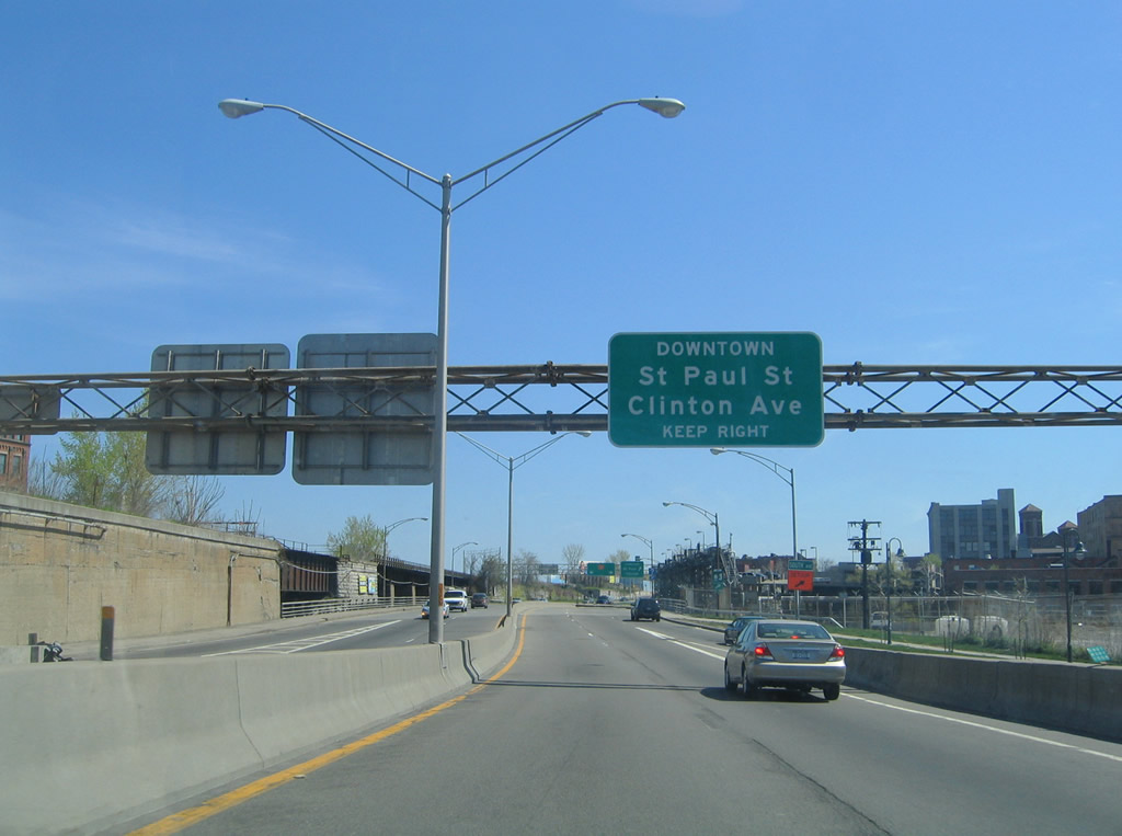
| Inner Loop eastbound at the St. Paul Street off-ramp. St. Paul Street heads north to the Genesee Brewery and Maplewood Park along the river. Clinton Avenue heads north as a commercial street to NY 104 (Keeler Expressway) and Irondequoit. 05/09/05 |
|
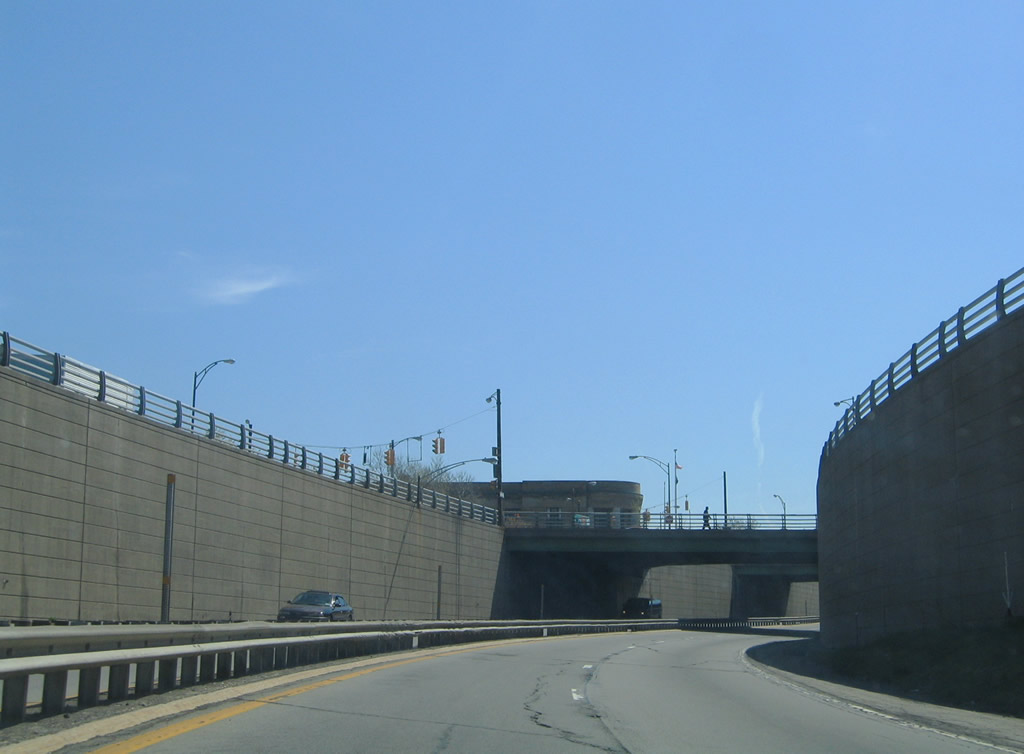
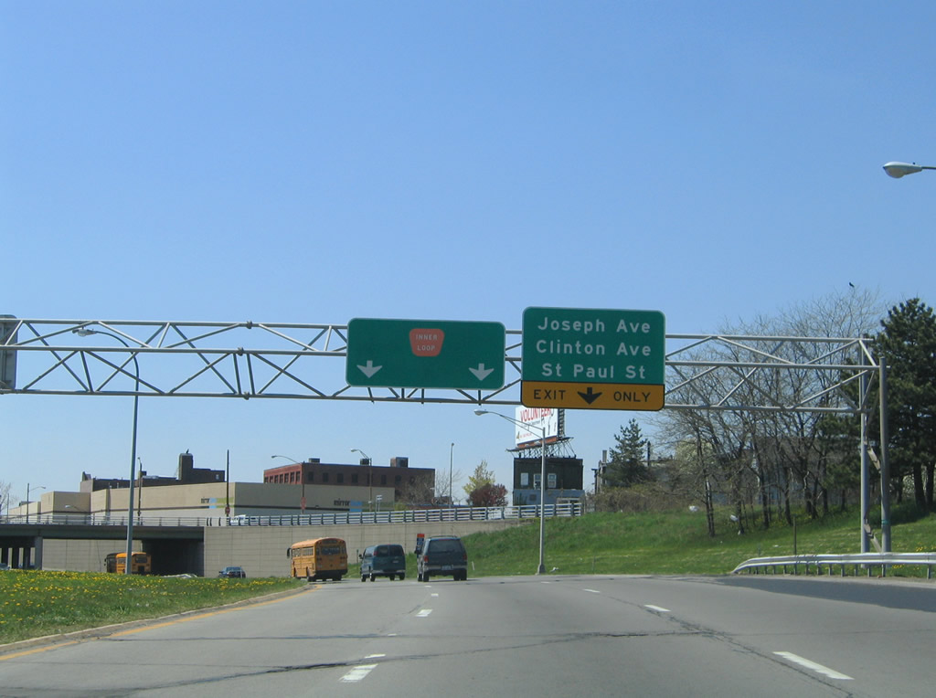
| The Inner Loop drops into a narrow trench from the Genesee River east to the North Street overpass. Pictured here are the Clinton and Joseph Avenue overpasses. 05/09/05 |
|
| Eastbound near the Scio Street half diamond interchange on the Inner Loop. Scio Street leads north from NY 96 (East Avenue) at Broadway Street to the freeway. 05/09/05 |
|
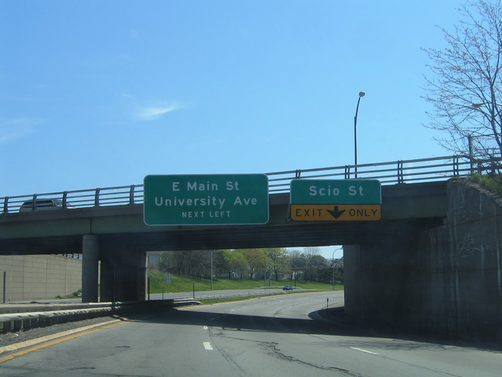
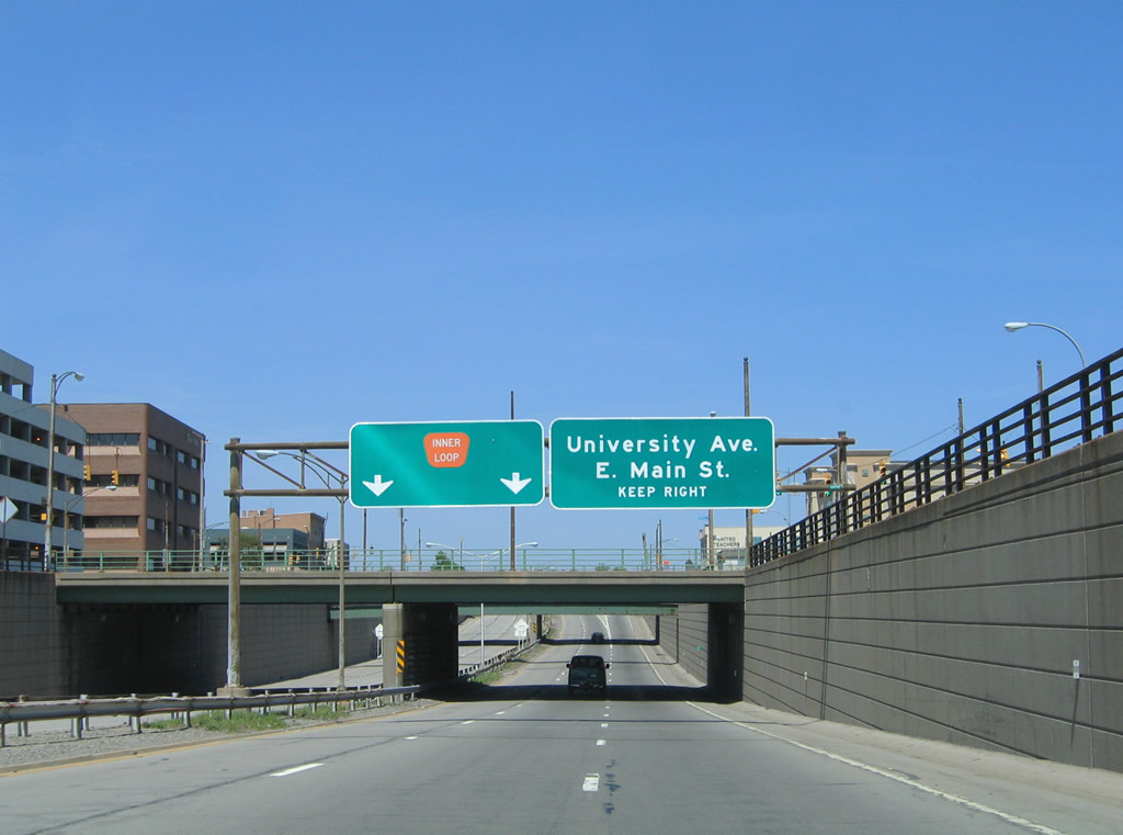
| Eastbound at the Scio Street off-ramp. Scio Street continues north from the Inner Loop to Central Park. A wye interchange departs next for University Avenue east to East Main Street. 05/09/05 |
|
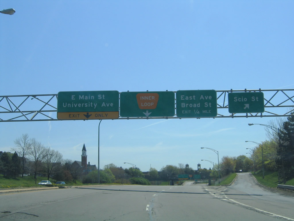
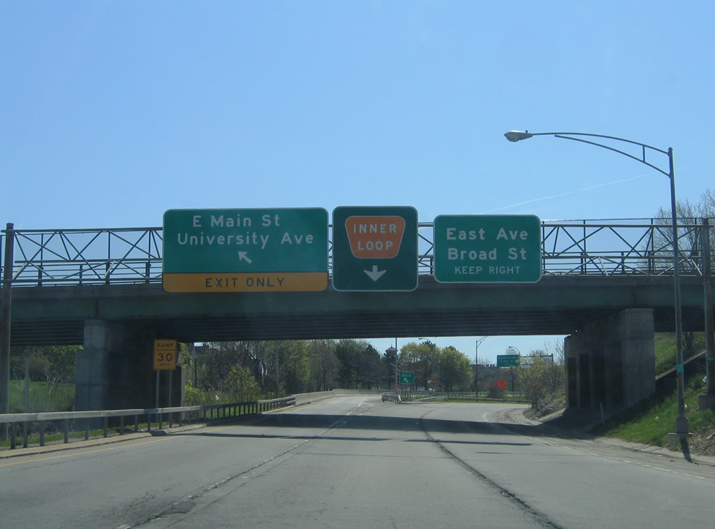
| Inner Loop turns southward at the University Avenue off-ramp. University Avenue begins and travels east to NY 96 (East Avenue) within the Can of Worms interchange framework. East Main Street branches eastward from the unsigned beginning of NY 96 (East Avenue) to industrial areas at Goodman Street and overall to Winton Road. 05/09/05 |
|
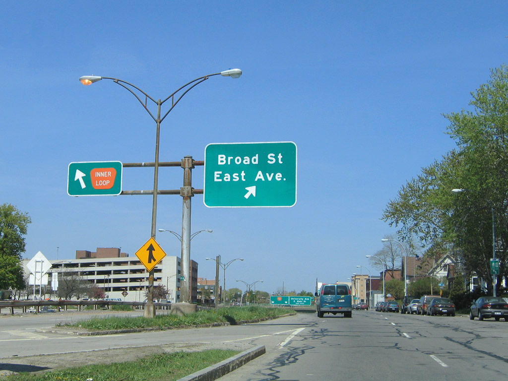
| Drivers next pass under East Main Street ahead of the East Avenue off-ramp onto adjacent Pitkin Street. NY 96 follows East Avenue in a relatively unsigned fashion from East Main Street to Winton Road and in signed fashion from Winton Road into Pittsford. Broad Street begins one block south of East Avenue from the Pitkin/Union Streets frontage streets west into downtown, becoming NY 31 at Chestnut Street. 05/09/05 |
|
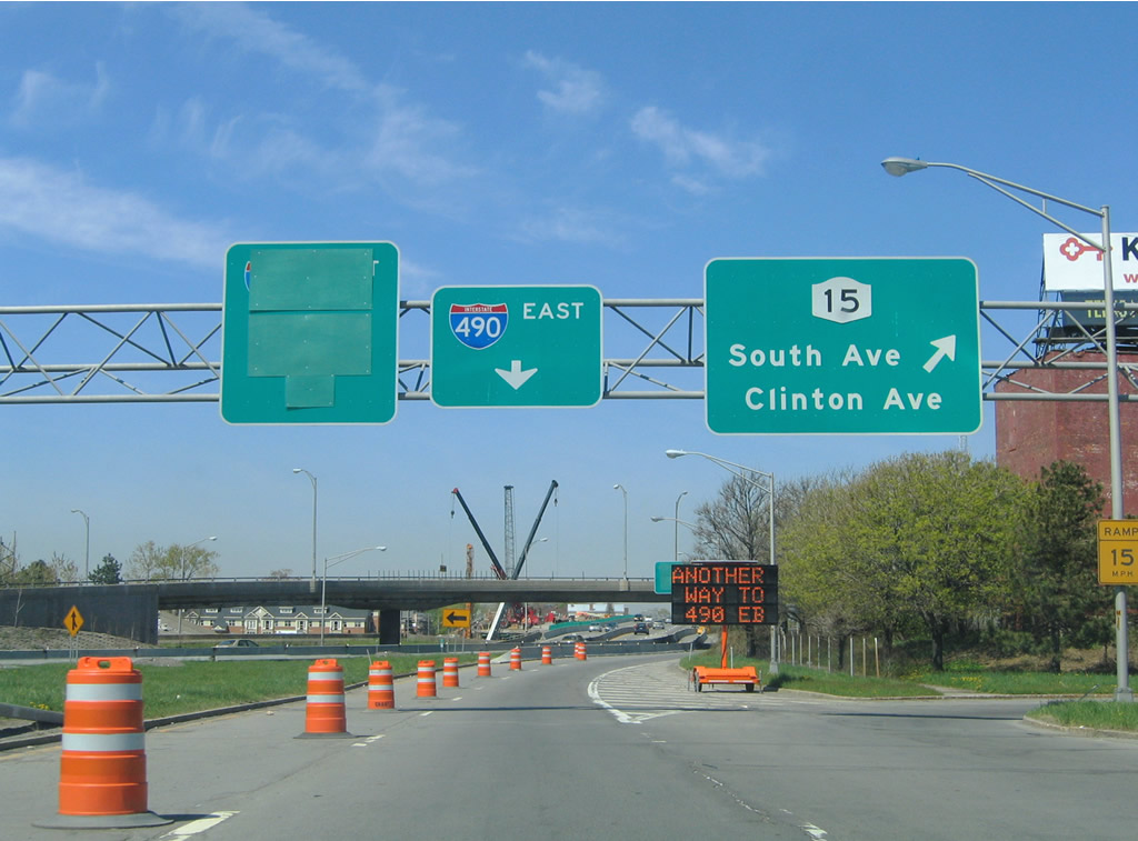
| One half mile north of the NY 31 off-ramp along the Inner Loop south. NY 31 travels a one way street couplet of Broad Street (west) and Court Street (east) through downtown to Chestnut Street south. 05/09/05 |
|
| A second trenched section of the Inner Loop carries motorists under East Avenue and Broad Street.
Missing from the forthcoming East Avenue overpass was the guide sign for NY 31 (Monroe Avenue). 05/09/05 |
|
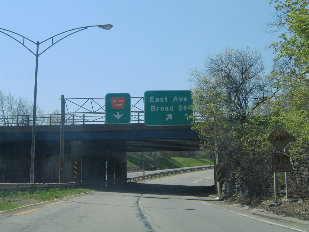
| A slip ramp joins parallel Pitkin Street south at the Strong National Museum of Play. Pitkin Street connects the Inner Loop with NY 31 (Monroe Avenue east / Chestnut Street north). The state route constitutes a commercial boulevard southeast to Twelve Corners and Interstate 590 in Brighton.
A roundabout will replace the current configuration of slip ramps between the adjacent frontage streets and Inner Loop mainline. 05/09/05 |
|
| The Inner Loop drops below grade again at the NY 31 (Monroe Avenue) over crossing. Construction present at the time of these photos focused on the new signature arch bridge for Interstate 490 above the Genesee River.
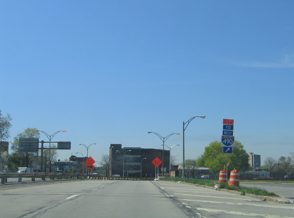
Construction scheduled for 2014-17 will replace this stretch of freeway with a four lane at-grade boulevard and intersection with Monroe Avenue. 05/09/05 |
|
| Drivers emerge from the final trench of the Inner Loop clockwise at the loop ramp onto NY 15 south. NY 15 follows Byron Street west one block from Clinton Avenue onto Mt. Hope Avenue at South Avenue. The former U.S. 15 routing continues southward along Mt. Hope Avenue to West Henrietta Road near Strong Memorial Hospital. 05/09/05 |
|
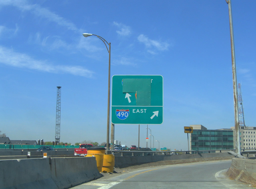
| A second loop ramp follows onto Interstate 490 east to East Chester, Pittsford, and Victor. 05/09/05 |
|
| The Inner Loop merges with Interstate 490 west at the second crossing of the Genesee River on the south edge of the central business district. Construction closed the ramp at the time of this photo. 05/09/05 |
|
| The Inner Loop curves northeast from NY 31 (Monroe Avenue) to a slip ramp with Union Street north. Union Street constitutes a frontage road north to University Avenue, connecting the freeway with the beginning of Broad Street and East Avenue (unsigned NY 96). 05/10/05 |
|
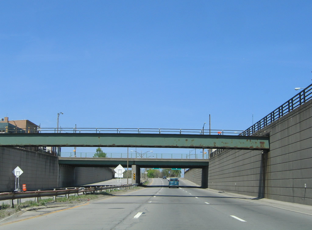
| Drivers drop below grade on the second of three trenched sections of Inner Loop freeway ahead of Broad Street. 05/10/05 |
|
| Nearing the second slip ramp onto Union Street north for University Avenue and East Main Street. University Avenue begins from the Inner Loop and heads east to NY 96 (East Avenue) within the Can of Worms interchange at Interstates 490 and 590. 05/10/05 |
|
| Midway between the Broad Street and East Avenue overpasses on the Inner Loop east. 05/10/05 |
|
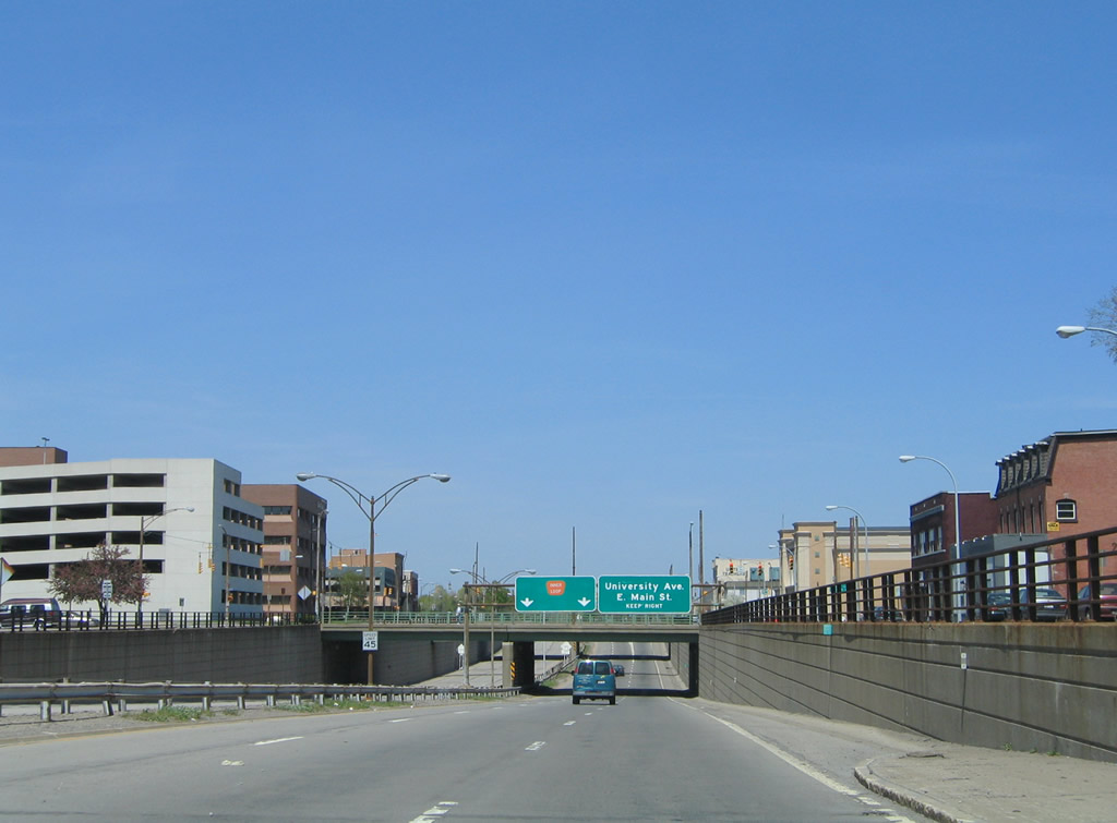
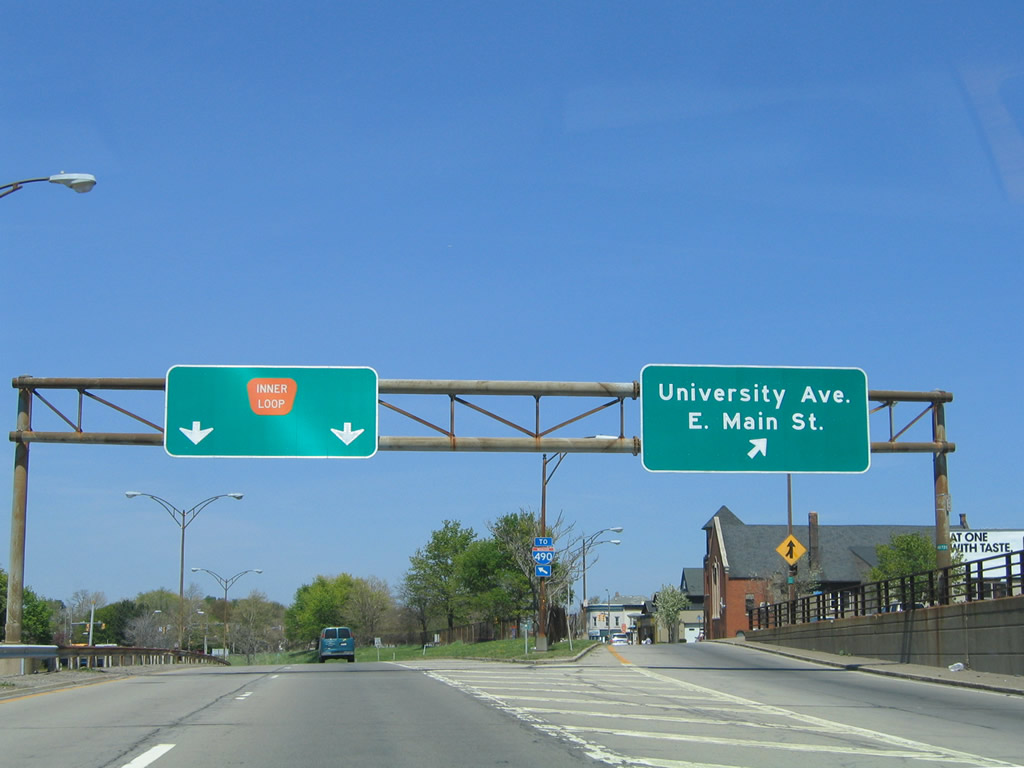
| Turning northwest on the Inner Loop at the University Avenue off-ramp. East Main Street ventures east from downtown Rochester to industrial areas at Goodman Street and overall to Winton Road. 05/10/05 |
|
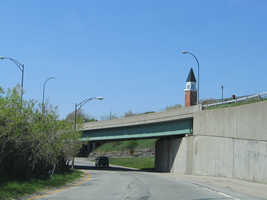
| A wye interchange brings the west end of University Avenue onto Inner Loop west ahead of the Scio Street overpass. 05/10/05 |
|
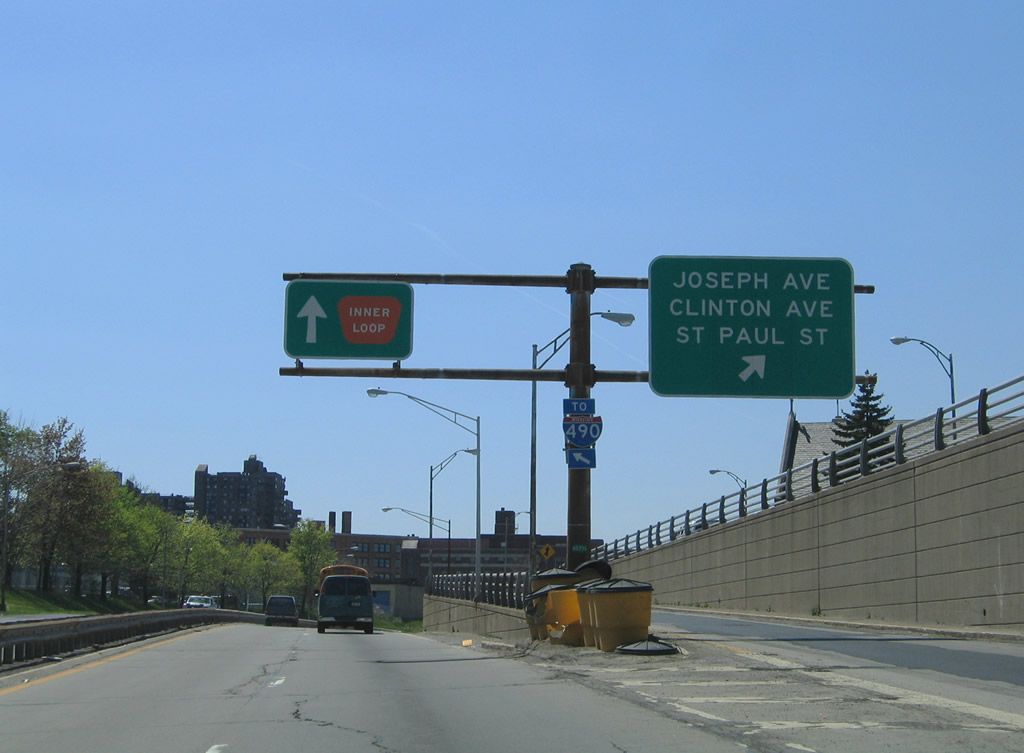
| Next in line for the Inner Loop west is the split diamond interchange with Joseph Avenue, Clinton Avenue, and St. Paul Street. 05/10/05 |
|
| The Inner Loop drops below grade again underneath the three north south streets. Joseph Avenue branches north from Clinton Avenue nearby with both streets heading toward Irondequoit. St. Paul Street travels northwest from downtown along the Genesee River to Maplewood Park and NY 104 (Keeler Expressway). 05/10/05 |
|
| Cumberland Street constitutes the east and westbound service roads between the on and off-ramps to Joseph Avenue, Clinton Avenue, and St. Paul Streets (all pictured above the trenched freeway). 05/10/05 |
|
| A CSX Railroad accompanies the Inner Loop across the Genesee River near the High Falls, followed by the State Street off-ramp. State Street serves Frontier Field, home of the AAA Baseball Rochester Red Wings. 05/10/05 |
|
| Westbound at the ramp departure for State Street. Central Avenue connects a split diamond interchange between State Street and Plymouth Avenue. THe Inner Loop otherwise prepares to merge onto Interstate 490 east. 05/10/05 |
|
| A truss bridge rises above State Street to carry the CSX Railroad adjacent to the Inner Loop. 05/10/05 |
|
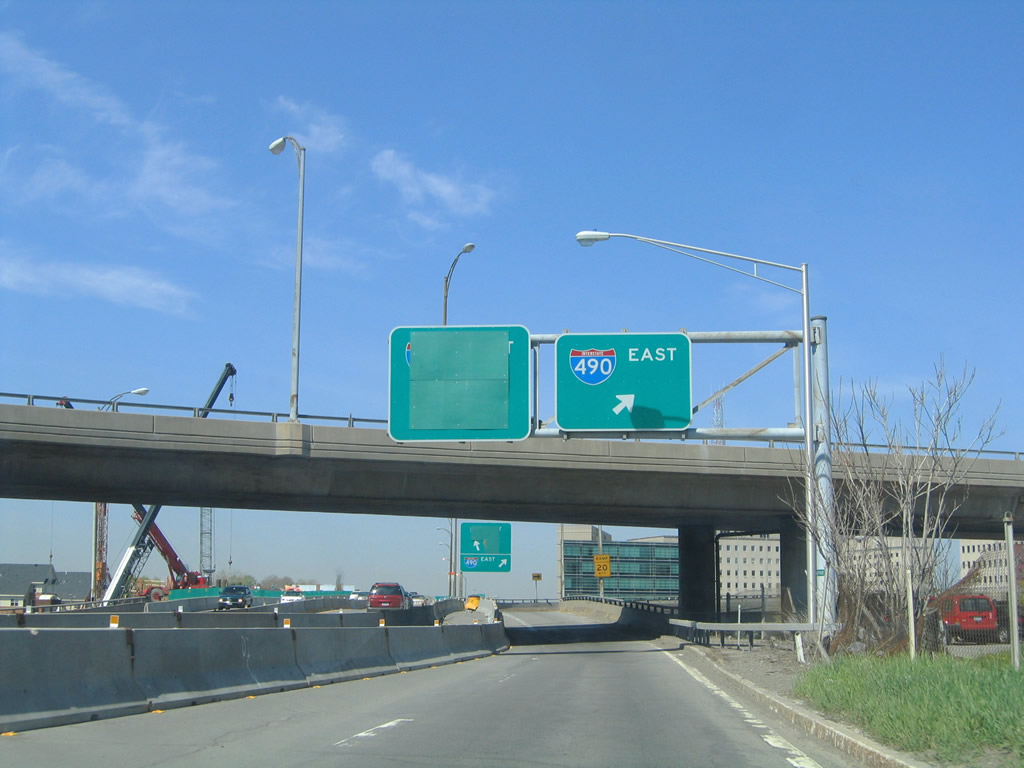
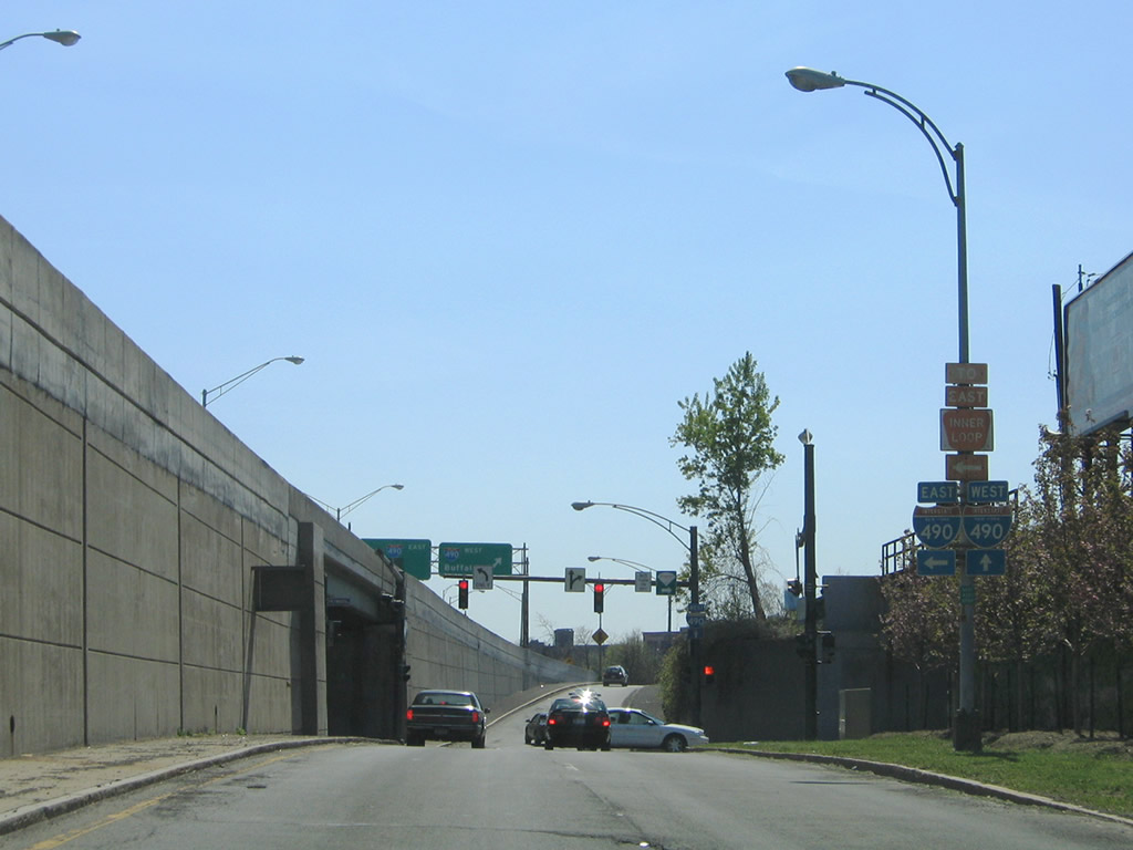
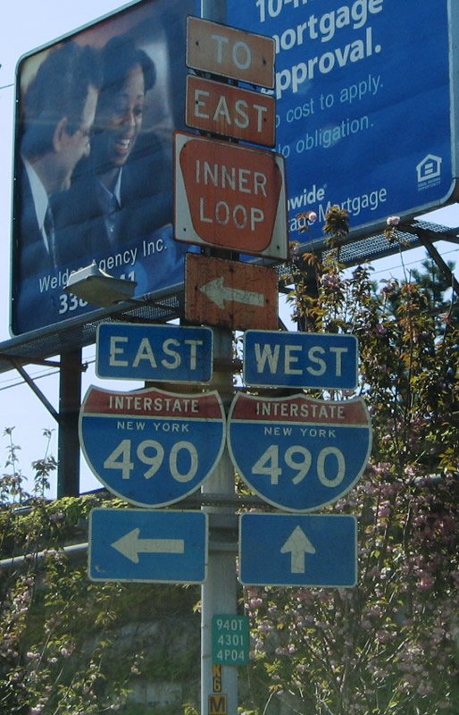
| A narrow viaduct approaches a tri-level stack interchange with Interstate 490. Interstate 490 connects downtown Rochester with Pittsford to the east and Chili and Gates to the west. 05/10/05 |
|
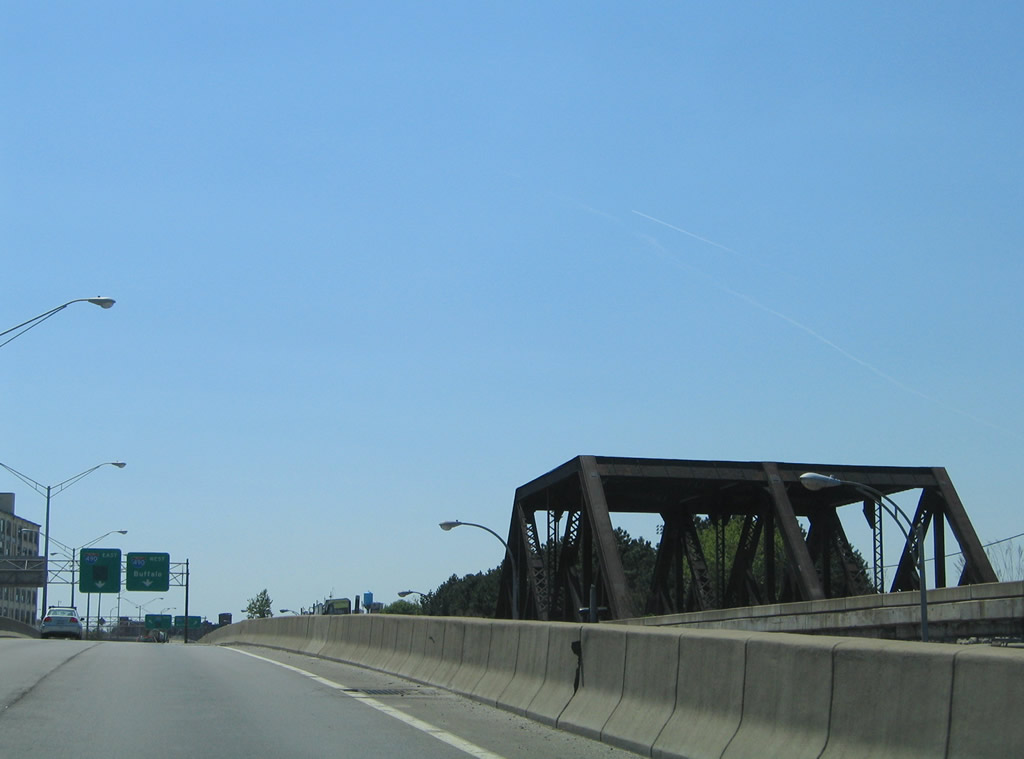
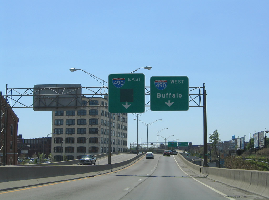
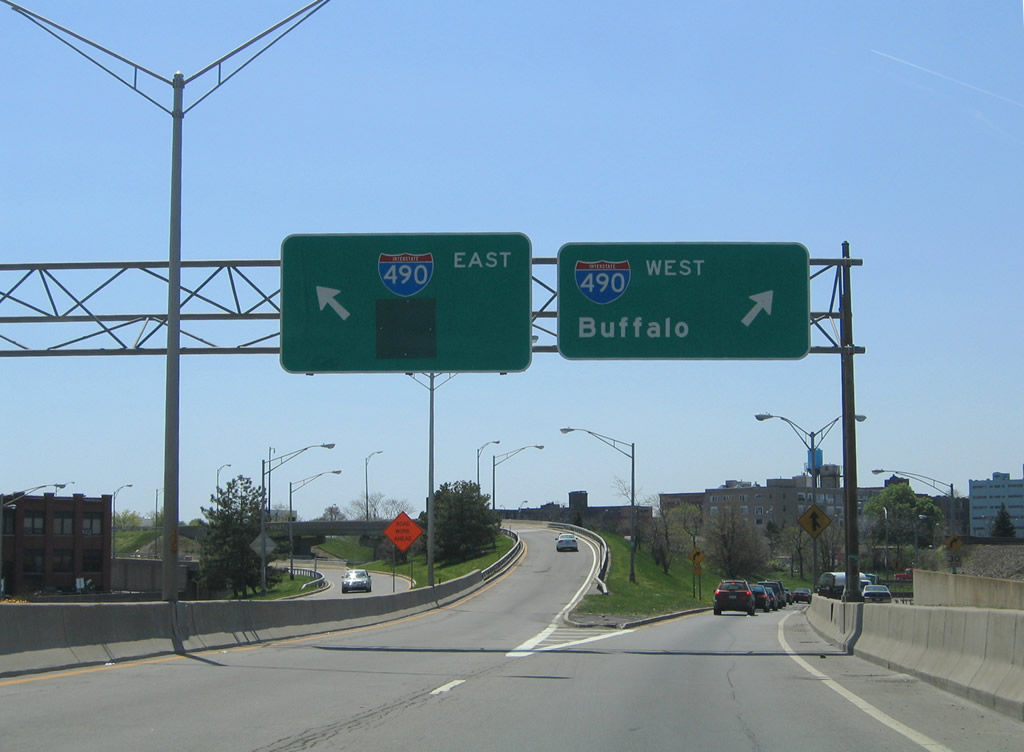
| The Inner Loop mainline joins Interstate 490 east across the Genesee River to the interchange with NY 15. Interstate 490 west continues all the way to the Thruway for interests west to Buffalo via Interstate 90. 05/10/05 |
|
| Central Avenue provides the connection between State Street and Plymouth Avenue along the Inner Loop freeway west near Frontier Field. Travelers originating from State Street follows Central Avenue west an on-ramp for the Inner Loop. Central Avenue east parallels the other side of the loop for access to the eastbound freeway. 05/10/05 |
|
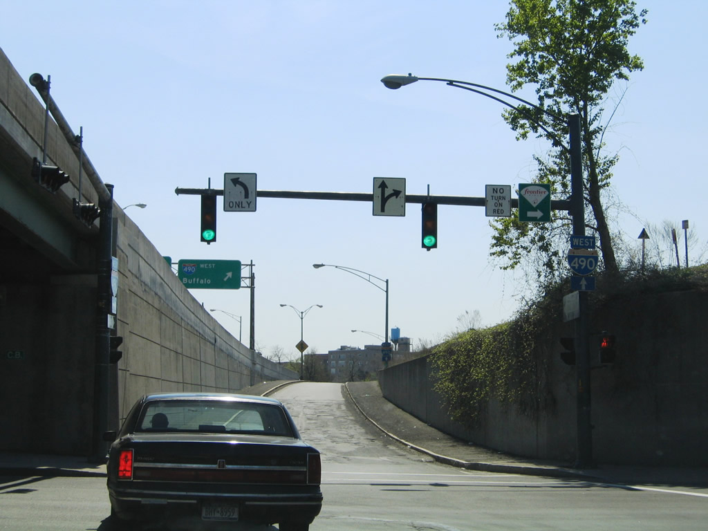
| Central Avenue west at Plymouth Avenue. Plymouth Avenue passes under the CSX Railroad and emerges at Frontier Field, home of the AAA Baseball Rochester Red Wings. Plymouth Avenue south heads into Downtown, providing access to I-490 east, while Central Avenue merges onto the Inner Loop westbound entrance ramp to I-490 west. 05/10/05 |
Page Updated 09-01-2013.