|
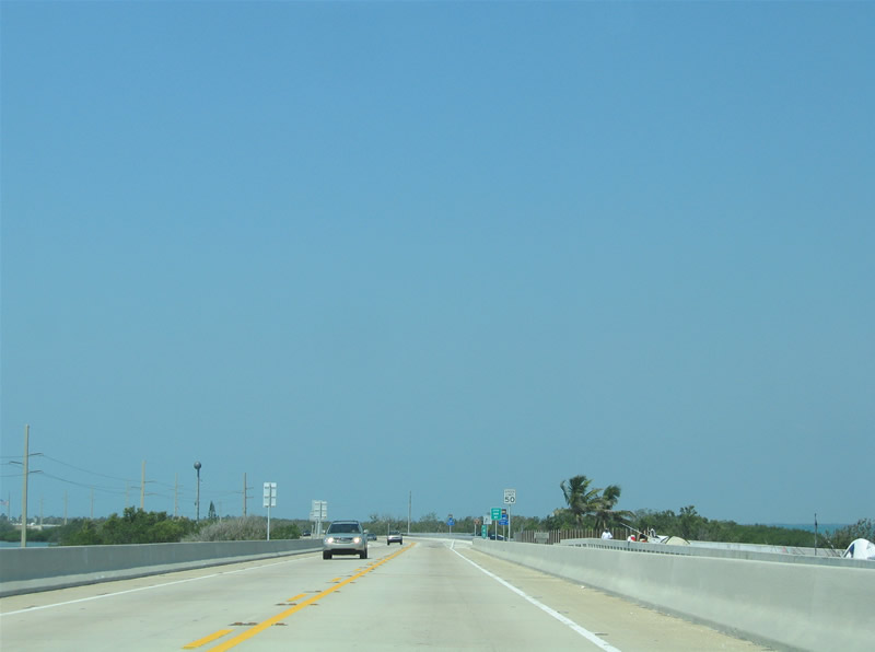
| U.S. 1 (Overseas Highway) leaves the Seven Mile Bridge and arrives at Little Duck Key. The parallel old bridge provides a fishing pier to the north of the bridge. Little Duck Key otherwise is inhabited. 05/07/06 |
|
| The Little Duck Missouri Channel separates Little Duck Key from the equally uninhabited Missouri Key. Note another parallel old Overseas Highway bridge to the right. 05/07/06 |
|
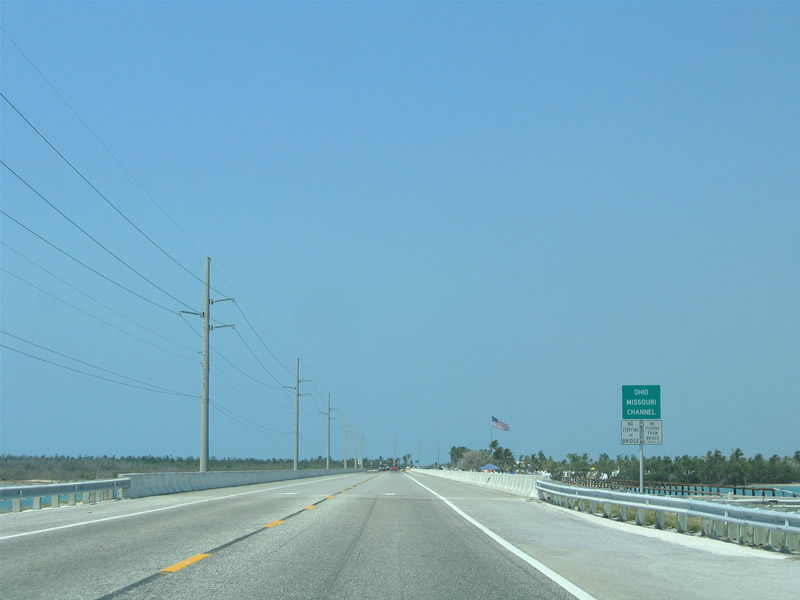
| Another two lane bridge carries the Overseas Highway across Ohio Missouri Channel toward Ohio Key. 05/07/06 |
|
| Ohio Key is home to Sunshine Key RV Resort. The mobile home community encompasses all land between U.S. 1 and Florida Bay. Pictured here is the Ohio Bahia Honda Channel bridge. 05/07/06 |
|
| U.S. 1 southbound enters Bahia Honda Key, a large island protected by Bahia Honda State Park. The Overseas Highway widens to four lanes for the next four miles. 05/07/06 |
|
| U.S. 1 south at Bahia Honda State Park. Activities popular within the state park include snorkeling, swimming, and fishing. The 524-acre island began transitioning into a state park with a 13-acre purchase by the state in 1961.1 05/07/06 |
|
| The Bahia Honda Bridge carries U.S. 1 west from Bahia Honda Key to the Spanish Harbor Keys. Paralleling the highway bridge to the south is the original 1912-completed Florida East Coast Railroad bridge. Rail service to Florida Key West ended when the Labor Day Hurricane of 1935 destroyed over 40 miles of track. The state purchased the right-of-way in 1936 and began constructing the original Overseas Highway. The 1938-opened roadway included the conversion of the Bahia Honda railroad truss bridge into use as a highway bridge. This entailed constructing a concrete deck on top of the existing superstructure.2 05/07/06 |
|
| Midway across the twin Bahia Honda Bridges on U.S. 1 southbound. Opened in 1972,2 the concrete bridges that carry U.S. 1 today replaced the aged two lane span to the south. The Bahia Honda Bridge spans the deepest channel in the Florida Keys at 35 feet.3 05/07/06 |
|
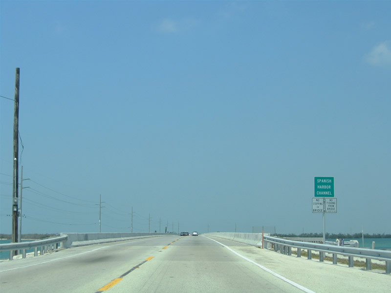
| Southbound travelers reach the uninhabited Spanish Harbor Keys. An abandoned structure and pipeline lie to the south of U.S. 1 at the west end of the severed Bahia Honda railroad Bridge. The four lane highway quickly reduces to two lanes ahead. 05/07/06 |
|
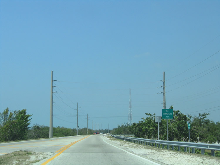
| The Overseas Highway passes between small stands of mangrove trees on West Summerland Key. 05/07/06 |
|
| U.S. 1 leaves West Summerland Key across the Spanish Harbor Channel ahead of the National Key Deer Refuge. 05/07/06 |
|
| Like most other bridges, the 1938-Overseas Highway bridge parallels the current Overseas Highway bridge close by as a fishing pier. Spanish Harbor lies to the north. U.S. 1 turns northwest at the west end of the bridge. 05/07/06 |
|
| Entering Big Pine Key and the National Key Deer Refuge on U.S. 1 south. U.S. 1 kinks northward toward the built-up areas of Big Pine Key. Big Pine Key, named for the pine trees that grow on the island, is just over 5,800 acres in area. Oolitic limestone comprises much of the island, and these rocky formations contain pockets of fresh water. Despite the small sized of the island, Big Pine Key is home to the most fresh water of any Florida Key.4 05/07/06 |
|
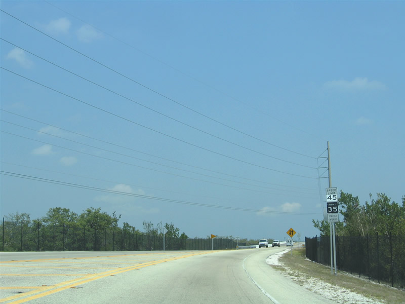
| Large caution signs lie at both entrances to the National Key Deer Refuge. Established in 1957, the wildlife refuge protects the endangered species Key Deer on both Big Pine and No Name Keys. There was an estimated 800 Key Deer alive in the mid-2000s, up from an estimated 27 in 1957. Key Deer are the smallest member of the Virginia white-tailed deer species. Bucks stand between 28-32" with an average weight of 80 lbs.5 05/07/06 |
|
| The speed limit varies between 45 mph during the day and 35 mph at night through the National Key Deer Refuge. A wildlife underpass allows the deer to cross from one side to another without interacting with U.S. 1. Metal fences line along the Overseas Highway right-of-way otherwise to protect the Key Deer from the busy road. 05/07/06 |
|
| U.S. 1 turns westward again after Beach Drive. A number of businesses and residences lie along the highway and in the adjoining street grid. 05/07/06 |
|
| Key Deer Boulevard (former CR 940) spurs northward from U.S. 1 (Overseas Highway) to northern Big Pine Key, with connections via the 1938-Overseas Highway (Watson Boulevard) to No Name Key. No Name Key lies east of Big Pine Key across the Bogie Channel. The island primarily is undeveloped and is part of the National Key Deer Refuge. There are a few beach houses however on the northwest corner of the island. 05/07/06 |
|
| Key Deer Boulevard stems north to the National Key Deer Visitor Center, Blue Hole (a freshwater pond created from an abandoned oolite quarry), and the Big Pine Road Prison. Watson Boulevard represents the original Overseas Highway east Pine Channel to Bahia Honda Channel on No Name Key. 05/07/06 |
|
| U.S. 1 leaves Big Pine Key and spans North Pine and South Pine Channels. A narrow causeway carries U.S. 1 between the two waterways. 05/07/06 |
|
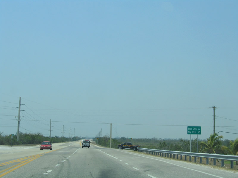
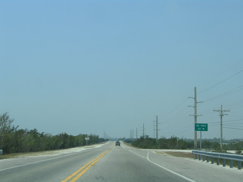
| Distance sign posted after U.S. 1 southbound enters Little Torch Key. Boca Chica, home to Naval Air Station Key West, lies 22 miles ahead. Pirates Road intersects the Overseas Highway ahead. The north-south road serves coastal residences along South Pine Channel. 05/07/06 |
|
| The 1938-Overseas Highway returns to U.S. 1 via SR-4A on Little Torch Key. The roadway spurs north to an RV park at Barracuda Drive adjacent to Pine Channel. There is no bridge between the Little Torch Key SR-4A and Watson Boulevard (old SR 4A) on Big Pine Key. 05/07/06 |
|
| U.S. 1 spans Torch Channel between Little Torch and Middle Torch Keys. Shallow waters give the water a very light color along the causeways that carry the Overseas Highway through the lower Keys. 05/07/06 |
|
| Once on Middle Torch Key, U.S. 1 intersects Middle Torch Road. Middle Torch Road ventures northward to Dorn Road for Big Torch Key. U.S. 1 crosses the Torch Ramrod Channel ahead onto Ramrod Key. 05/07/06 |
|
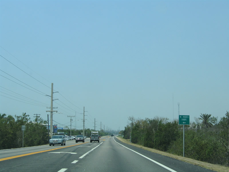
| U.S. 1 meets West Indies Drive on Ramrod Key. Development along the island is confined to Indies Drive to the south and along and north of old sections of SR-4A. Old SR-4A parallels the Overseas Highway nearby and is accessible via Mako, Munson and Coral Avenues. 05/07/06 |
|
| Continuing west toward the Niles Channel on Ramrod Key along U.S. 1 southbound. 05/07/06 |
|
| Niles Channel, a somewhat wide waterway, separates Ramrod and Summerland Keys. Two segments of the original U.S. 1 bridge remain in use as fishing piers along the south side of the channel crossing. 05/07/06 |
|
| U.S. 1 southbound arrives at Summerland Key. Meeting the Overseas Highway ahead is unsigned Monroe County Road 942 (East Shore Drive). East Shore Drive heads south from U.S. 1 to Ocean and West Shore Drives and south Summerland Key. Much of the land south of U.S. 1 is home to residences part of Summerland Key Cove. 05/07/06 |
|
| The Kemp Channel separates Summerland and Cudjoe Keys. At Cudjoe Key, U.S. 1 straddles the southern reaches of the island near Cudjoe Bay. Canal-lined streets comprise the residential neighborhoods on the south side of the island. Blimp Road meanwhile stems north to Valencia Road and Kemp Channel. 05/07/06 |
|
| Next in line for southbound motorists is the Bow Channel crossing to Sugarloaf Key. Paralleling the Channel bridge to the south is another segment of old U.S. 1 as a fishing pier. Once U.S. 1 enters Sugarloaf Key, the US highway meets another segment of the original Overseas Highway. The old road loops south and west along the original Overseas Highway alignment, meeting U.S. 1 again west of Harris Gap Channel. 05/07/06 |
|
| Tradfuc lights operate at U.S. 1 (Overseas Highway) and Crane Boulevard on Sugarloaf Key. Crane Boulevard travels north from the Overseas Highway through the built-up areas to Happy Jack Mangrove. 05/07/06 |
|
| U.S. 1 travels along a narrow causeway through the shallow waters of Upper Sugarloaf Sound. The Park Channel separates Sugarloaf Key from Park Key, a small undeveloped island. Then U.S. 1 spans North Harris and Harris Gap Channels ahead of west Sugarloaf Key. 05/07/06 |
|
| Sugarloaf Boulevard meets U.S. 1 at west Sugarloaf Key. Sugarloaf Boulevard ventures southeast through canal-lined neighborhoods to the old SR 4A. Old SR 4A travels west from Monroe County Road 939A to Sugarloaf Beach before petering out in
an undeveloped area. 05/07/06 |
|
| U.S. 1 continues southwest to South Point Drive and the Harris Channel Crossing north of Lower Sugarloaf Sound. 05/07/06 |
|
| Shallow waters surround the Harris and Lower Sugarloaf Channel bridges along the Overseas Highway. A small undeveloped island lies between
the two spans. Old U.S. 1 remains in use as a fishing pier parallel to the Lower Sugarloaf Channel bridge otherwise. 05/07/06 |
|
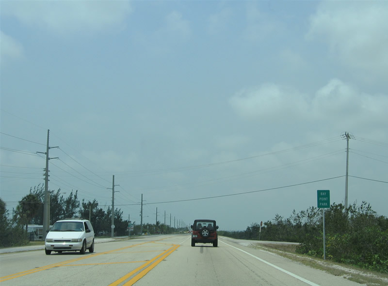
| A narrow strip of built-up land lies south of U.S. 1 at Bay Point Park along the west edge of Lower Sugarloaf Channel. East and West Circle Drives link the Overseas Highway with Bay Drive. 05/07/06 |
|
| Ankle deep waters lie to the north of U.S. 1 within the vicinity of Bay Point Park. Park Drive spurs south and splits with Blue Water Drive to serve two residential strips east of Saddlebunch Number Three Channel. 05/07/06 |
|
| The Overseas Highway follows a long series of interlaced causeway and bridge spans between Sugarloaf Key and Shark Key. Saddle Bunch Number Two through Seven Channels allow water to flow between the separated bodies of water. Additionally, the old U.S. 1 roadway and bridges remain in tact throughout the stretch between the two islands. 05/07/06 |
|
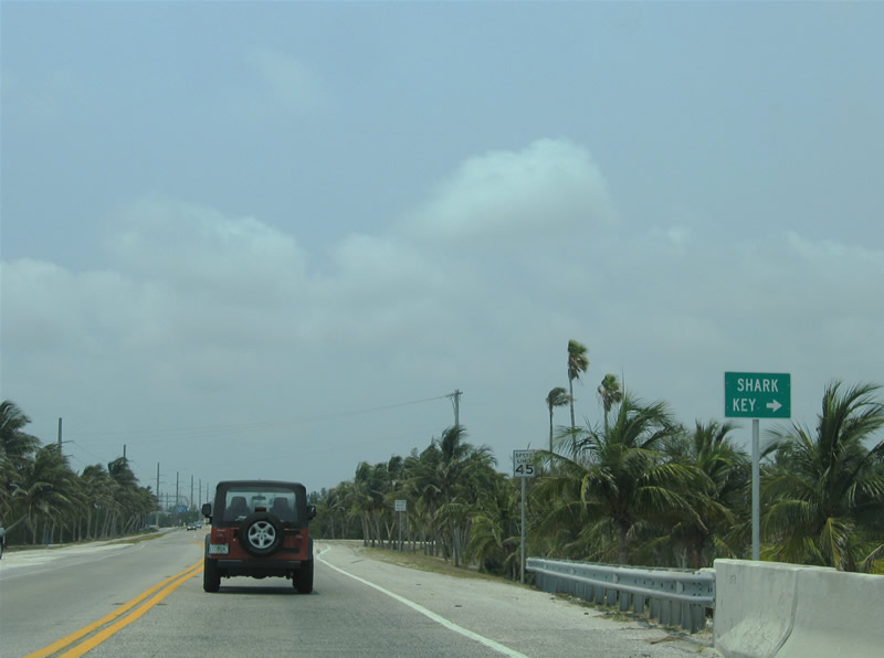
| U.S. 1 meets Cannon Royal Drive just west of Shark Channel. Cannon Royal Drive stems north through the Shark Key community from the Overseas Highway. 05/07/06 |
|
| U.S. 1 next enters Big Coppitt Key at its grid of streets. Departing to the south is Boca Chica Road. Boca Chica Road meanders south along the east and southern periphery of the island, serving residential areas before ending near Naval Air Station Key West. The original Overseas Highway followed the south coastline of Big Coppitt and Rockland Keys to Boca Chica Channel. 05/07/06 |
|
| Rockland Channel allows tidal waters to flow in and out of the enclosed sound between Big Coppitt and Rockland Keys. The U.S. 1 span over the inlet lies west of the intersection with 4th Street. 05/07/06 |
|
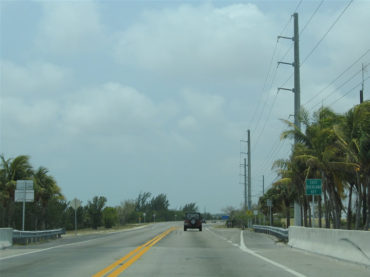
| U.S. 1 arrives at East Rockland Key, home of Naval Air Station Key West. Midway Avenue splits from the Overseas Highway ahead for Rockland Road and the Naval facility. U.S. 1 expands to four lanes ahead in anticipation of Key West. 05/07/06 |
|
| U.S. 1 (Overseas Highways) enters Boca Chica Key from Rockland Key ahead of the trumpet interchange with Saratoga Avenue south to Key West Naval Air Station. Key West Naval Air Station, a combat air training facility, occupies the majority of Boca Chica Key. 05/07/06 |
|
| Traffic destined for Naval Air Station Key West departs U.S. 1 south for Saratoga Avenue and the gate into the military base. 05/07/06 |
Page Updated 07-02-2014.


 South
South