|
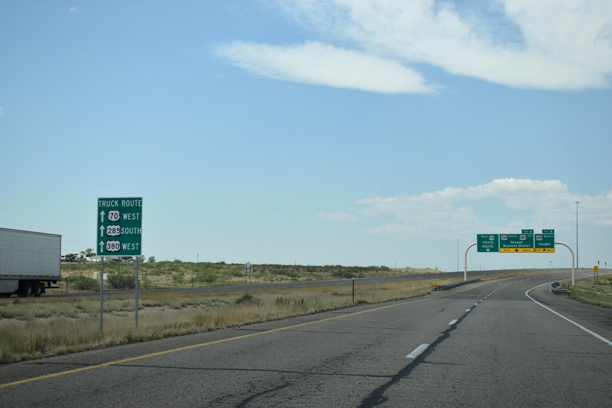
| U.S. 70 meets U.S. 285 / North Main Street and the Roswell Relief Route at a parclo interchange. The Roswell Relief Route constitutes a controlled access bypass and truck route around the west side of Roswell. 06/15/19 |
|
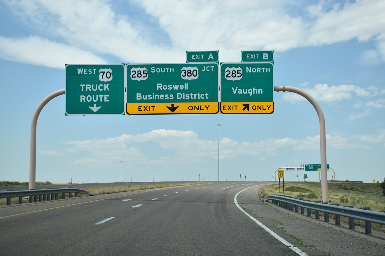
| Ramps from U.S. 70 westbound to U.S. 285 north to Vaughn and North Main Street (old U.S. 70/285) south into Roswell are designated Exits B/A. 06/15/19 |
|
| U.S. 285 constitutes a four lane highway with 70 to 75 mile per speed limits north from Roswell (Exit B) to Vaughn and Interstate 40 at Clines Corners. 06/15/19 |
|
| The loop ramp for North Main Street acknowledges former U.S. 285 south to U.S. 380 (2nd Street) in Downtown Roswell. Main Street is locally maintained through Roswell and classified by NMDOT as FL-4685. 06/15/19 |
|
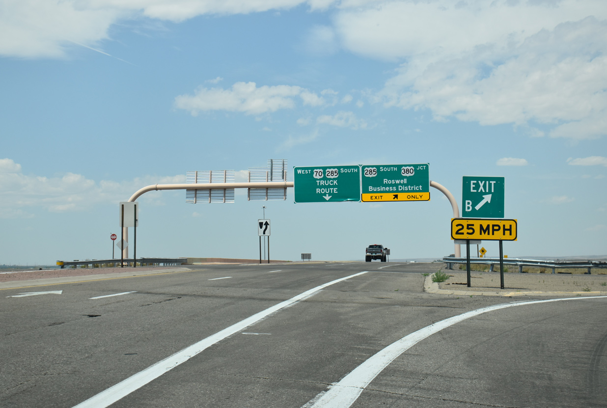
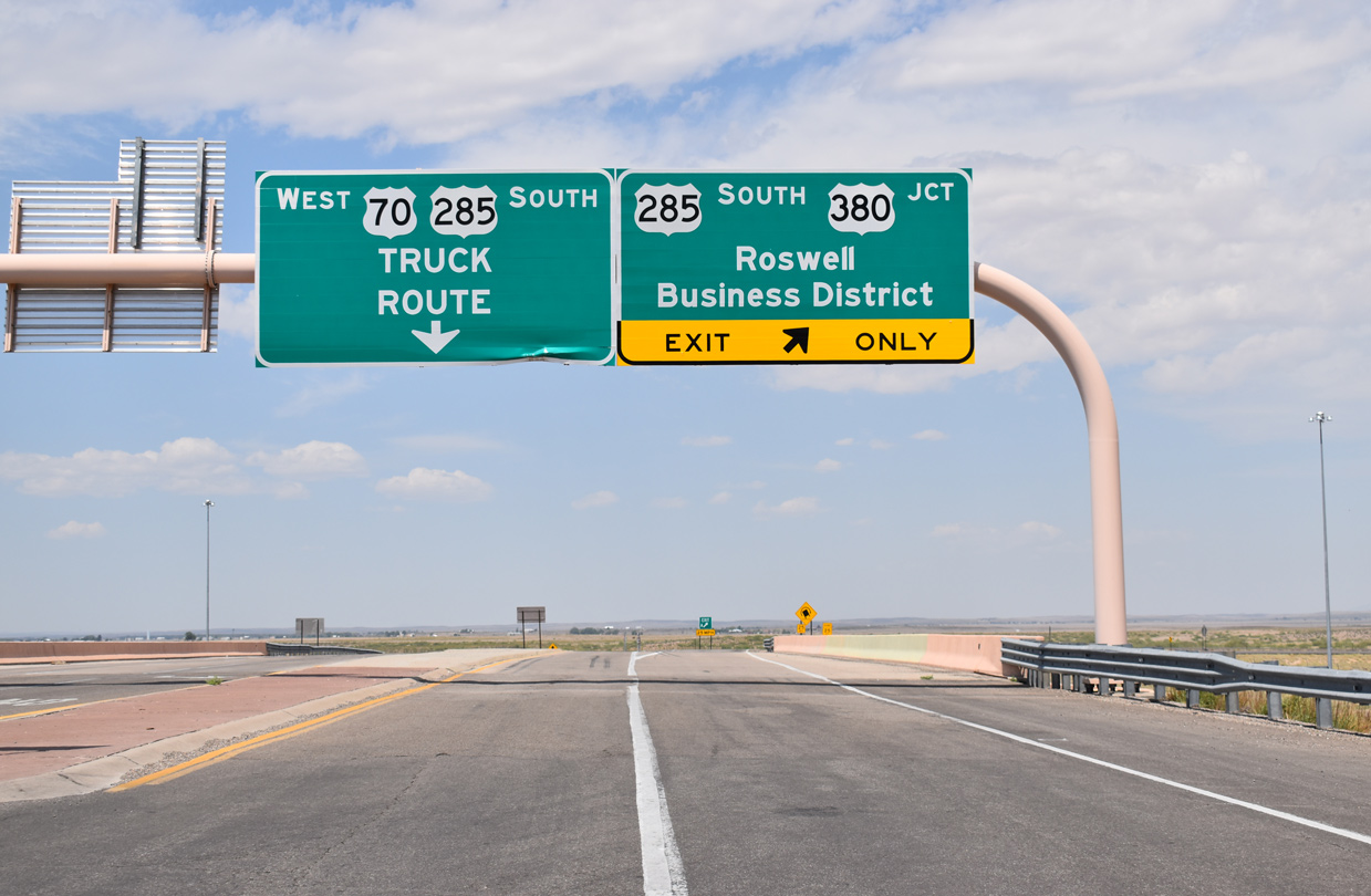
| U.S. 285 combines with U.S. 70 along the Roswell Relief Route to U.S. 380 (2nd Street) on the west side of Roswell. 06/15/19 |
|
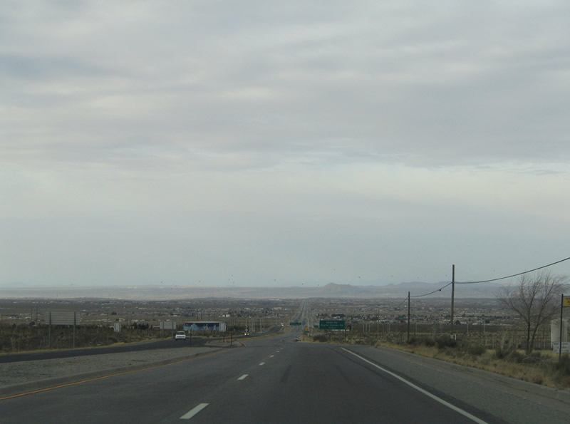
| U.S. 70 sinks toward the city of Las Cruces from San Augustin Peak and the community of Organ. 01/14/06 |
|
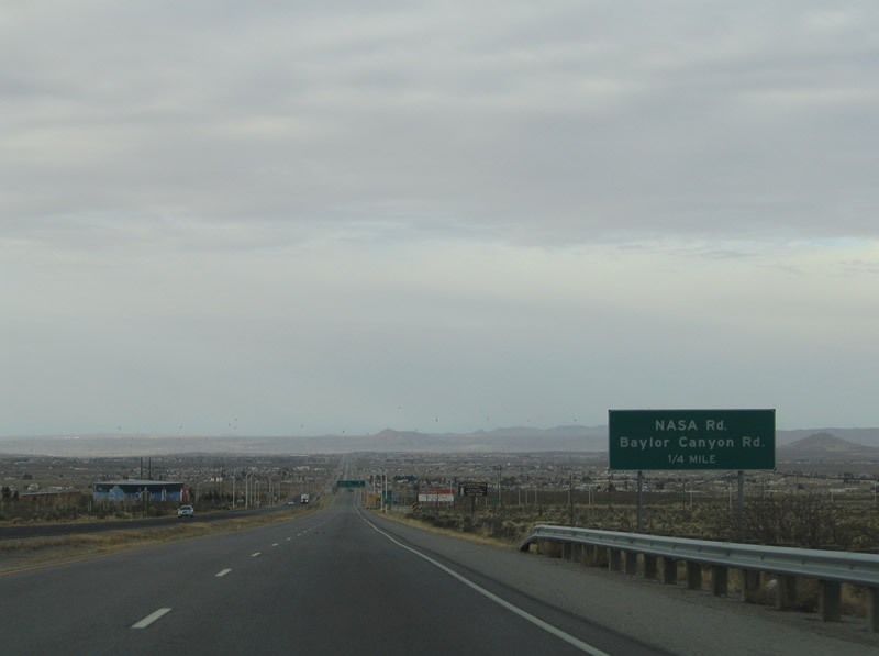
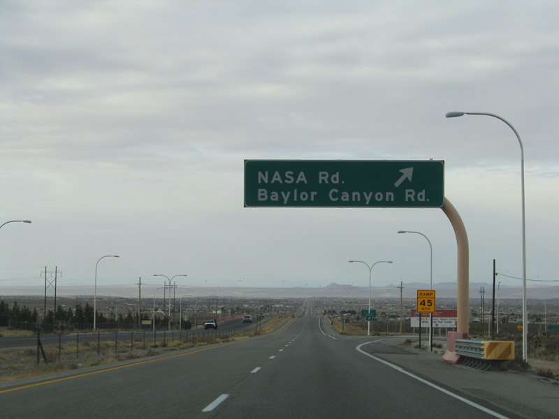
| U.S. 70 upgrades to a four lane freeway at the diamond interchange with NASA and Baylor Canyon Roads. Providing business access and connections with cross roads, a frontage road system accompanies the limited access highway westward to I-25. 01/14/06 |
|
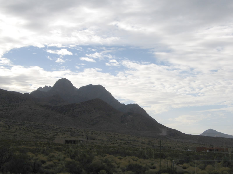
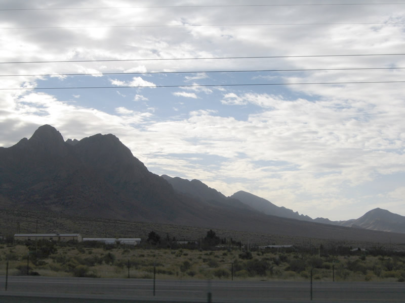
| Baylor Peak rises within the Organ Mountains to the immediate south of U.S. 70 at Organ. 01/14/06 |
|
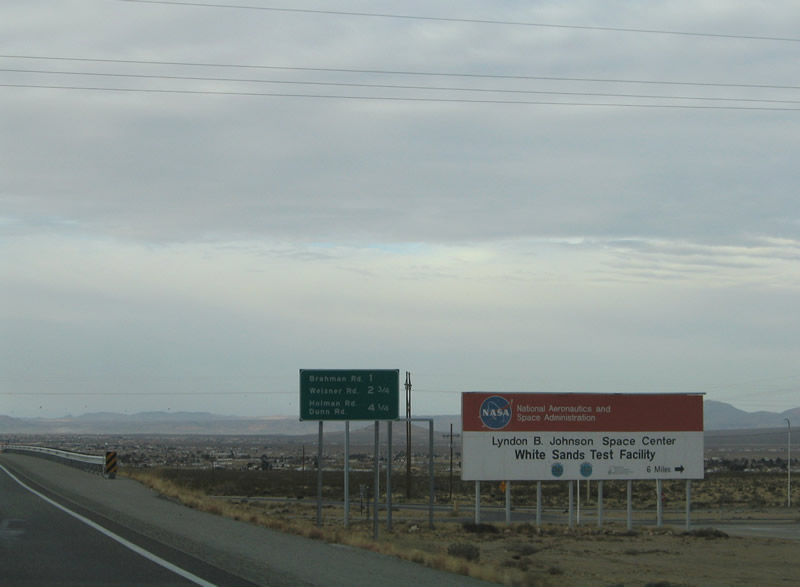
| Westbound at the off-ramp for NASA Road north to White Sands Space Center, Baylor Canyon Road south to Organ Mountains Desert Peaks National Monument, and the U.S. 70 frontage road system. 01/14/06 |
|
| The succeeding interchanges along U.S. 70 west join the freeway with Butterfield Park and Hacienda Acres. 01/14/06 |
|
| Mesilla Valley and the city of Las Cruces spread into view to the southwest. 01/14/06 |
|
| Looking south at the Organ Mountains from U.S. 70. U.S. 70 crosses St. Augustin Pass across the range from White Sands Missile Range. 01/14/06 |
|
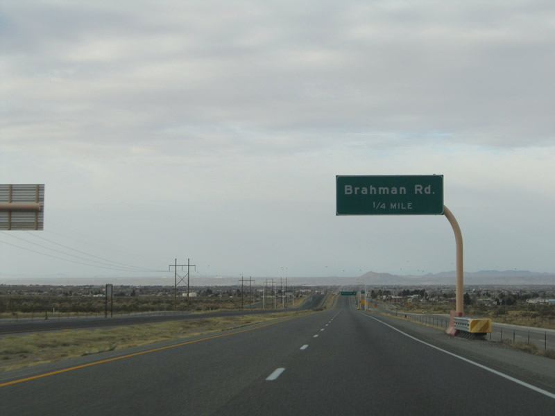
| Braham Road connects with U.S. 70 at a diamond interchange in one quarter mile. 01/14/06 |
|
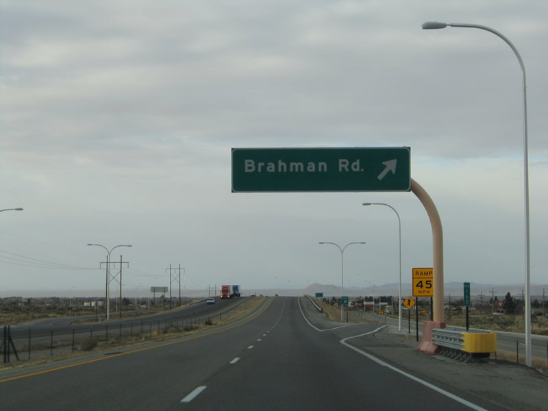
| Brahman Road ventures north from U.S. 70 (Bataan Memorial Highway) to Luna Vista and El Centro Roads, serving rural style homesteads. 01/14/06 |
|
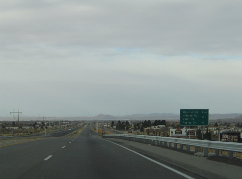
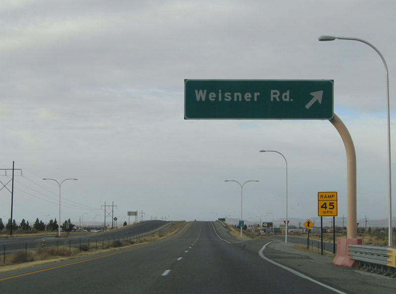
| U.S. 70 enters the Butterfield Park community on the 1.25 mile drive to Weisner Road. 01/14/06 |
|
| One half mile east of the diamond interchange with Weisner Road south to Balsam Road and Butterfield Park. 01/14/06 |
|
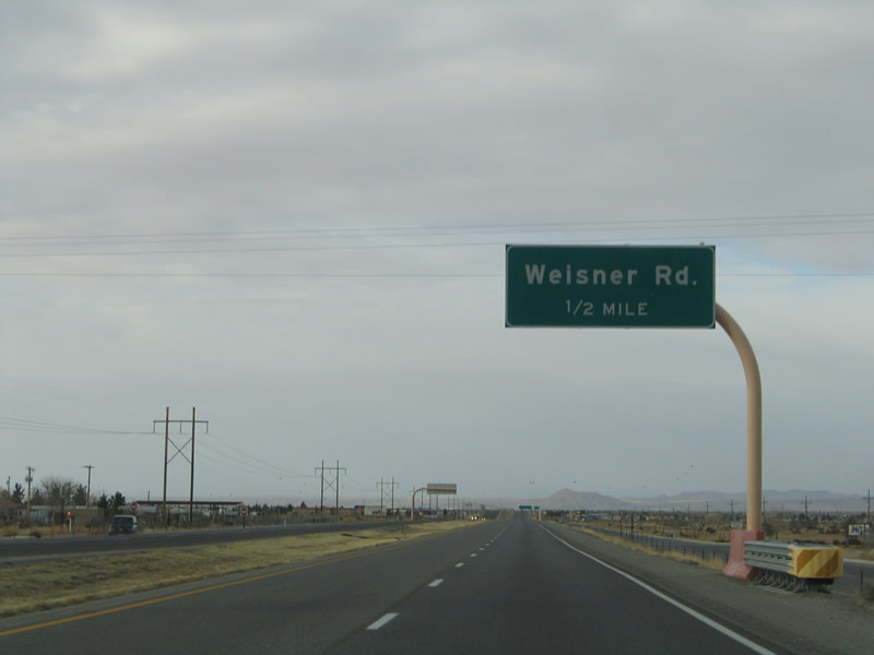
| Westbound U.S. 70 reaches the off-ramp for Weisner Road north to Arroyo Road. 01/14/06 |
|
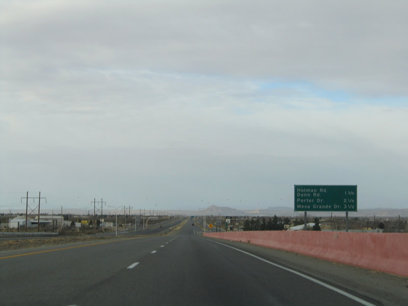
| Concrete barriers are painted red throughout the U.S. 70 freeway. Advancing west from the Weisner Road underpass, U.S. 70 travels 1.75 miles to Holman Road and Hacienda Acres. 01/14/06 |
|
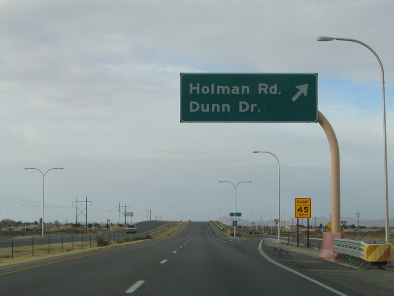
| Holman Road south and Dunn Drive north come together with the U.S. 70 freeway at a diamond interchange. 01/14/06 |
|
| Dunn Drive leads south to Cortez Drive and Hacienda Acres. Holman Road continues north to Peachtree Hills Road and far reaching subdivisions at El Centro Road. 01/14/06 |
|
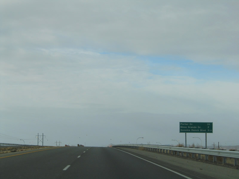
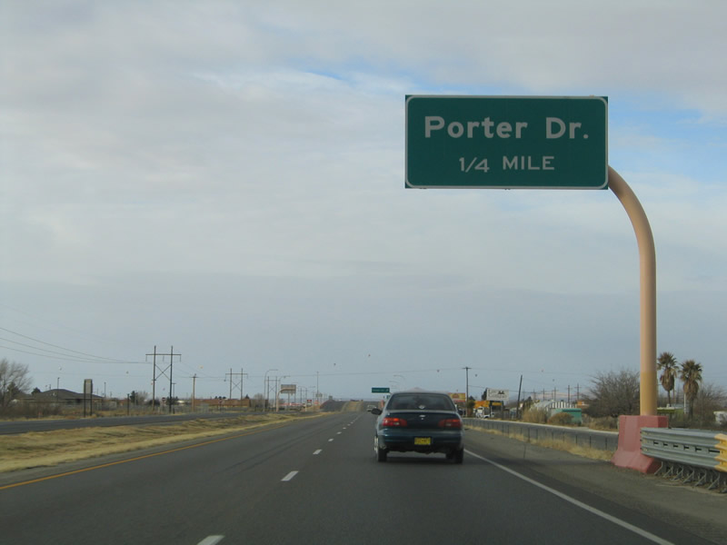
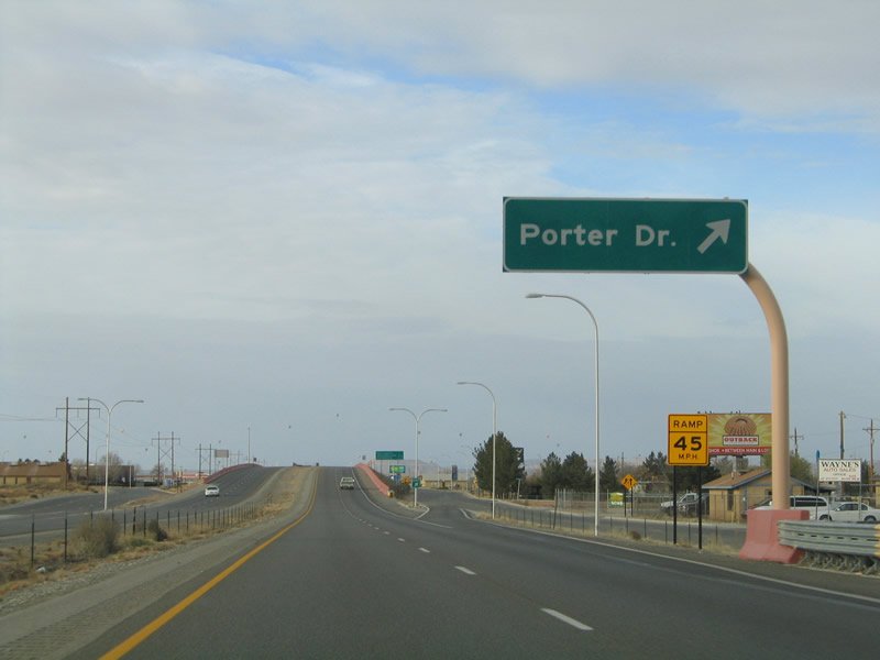
| U.S. 70 continues by Hacienda Acres to a diamond interchange with Porter Drive. 01/14/06 |
|
| Porter Drive leads south to Hacienda Acres at Reynolds and Cortez Drives. The road turns onto Alrich Road east for Dunn Drive. 01/14/06 |
|
| Porter Drive heads north 0.8 miles from U.S. 70 to Peachtree Hills Road, serving newer subdivisions along the way. 01/14/06 |
|
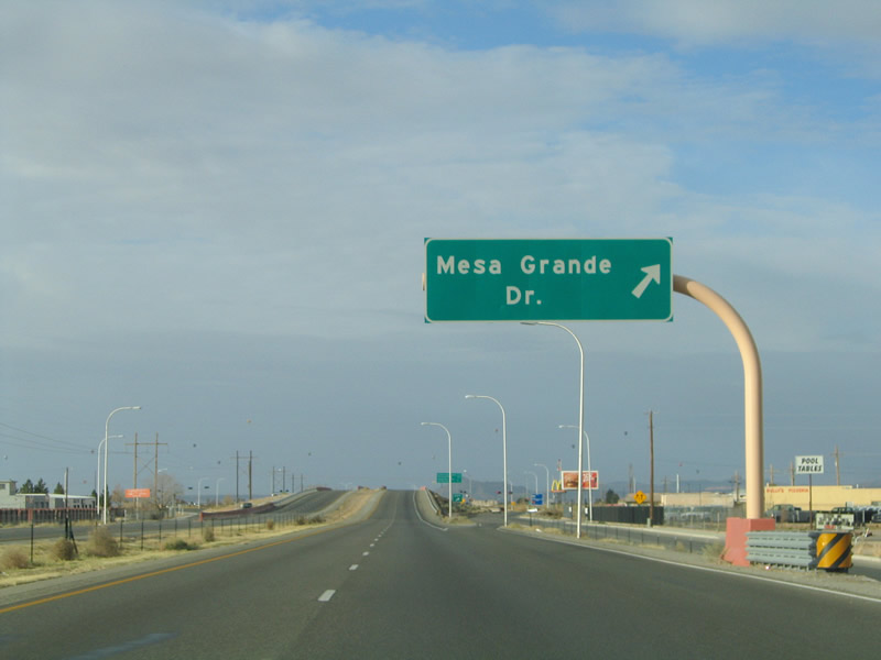
| Progressing west toward Las Cruces, U.S. 70 next meets Mesa Grande Drive near Onate High School. 01/14/06 |
|
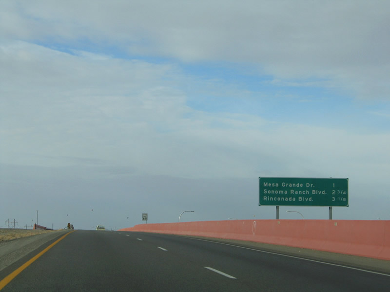
| Mesa Grande Drive ends south of Mesa Central Drive adjacent to the Mesa Grande Estates neighborhood. Northward, the boulevard extends from U.S. 70 to Peachtree Hills Road across an array of residential streets. 01/14/06 |
|
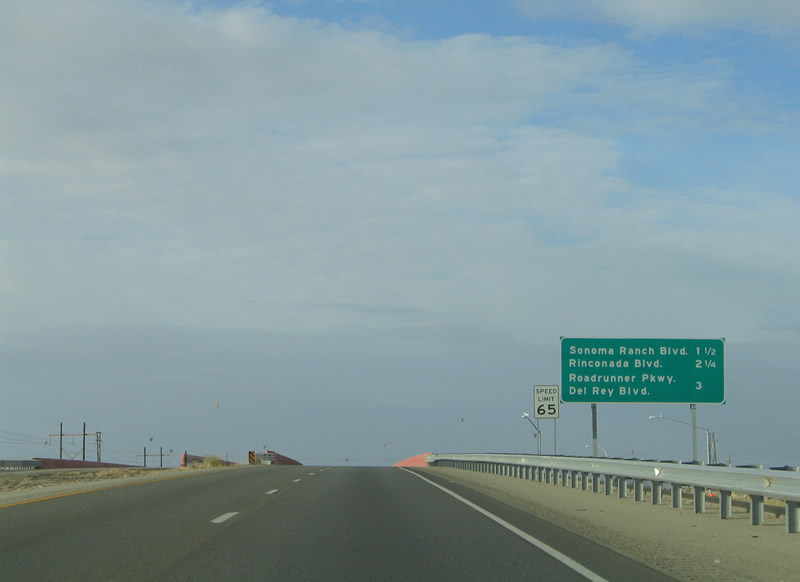
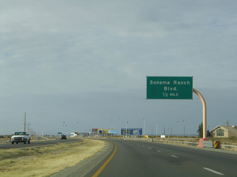
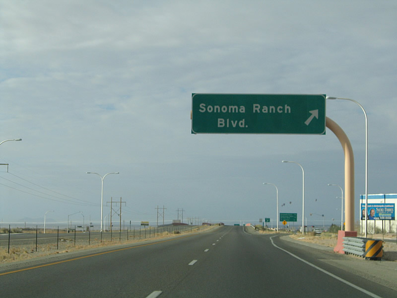
| Sonoma Ranch Boulevard meets U.S. 70 at a commercialized diamond interchange in 1.5 miles. 01/14/06 |
|
| Confirming marker posted beyond the westbound entrance ramp from Mesa Grande Drive and the parallel frontage road. 01/14/06 |
|
| Sonoma Ranch Boulevard constitutes an arterial belt route through eastern reaches of Las Cruces south to Dripping Springs Road and north to Peachtree Hills Road. 01/14/06 |
|
| Two miles of the U.S. 70 freeway west into Las Cruces remain. 01/14/06 |
|
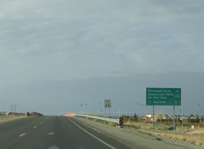
| An auxiliary lane opens along U.S. 70 westbound to Rinconada Boulevard. 01/14/06 |
|
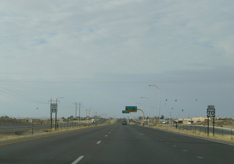
| The speed limit on U.S. 70 west drops to 55 miles per hour ahead of the diamond interchange with Rinconada Boulevard. 01/14/06 |
|
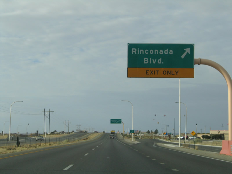
| Rinconada Boulevard connects U.S. 70 with Northrise Drive to the south by an array of retail businesses and with Settlers Pass and several subdivisions to the north. 01/14/06 |
|
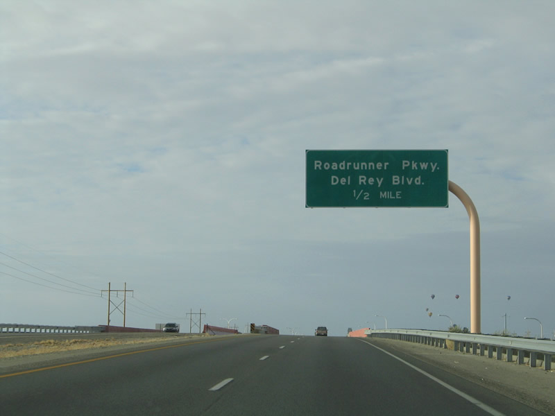
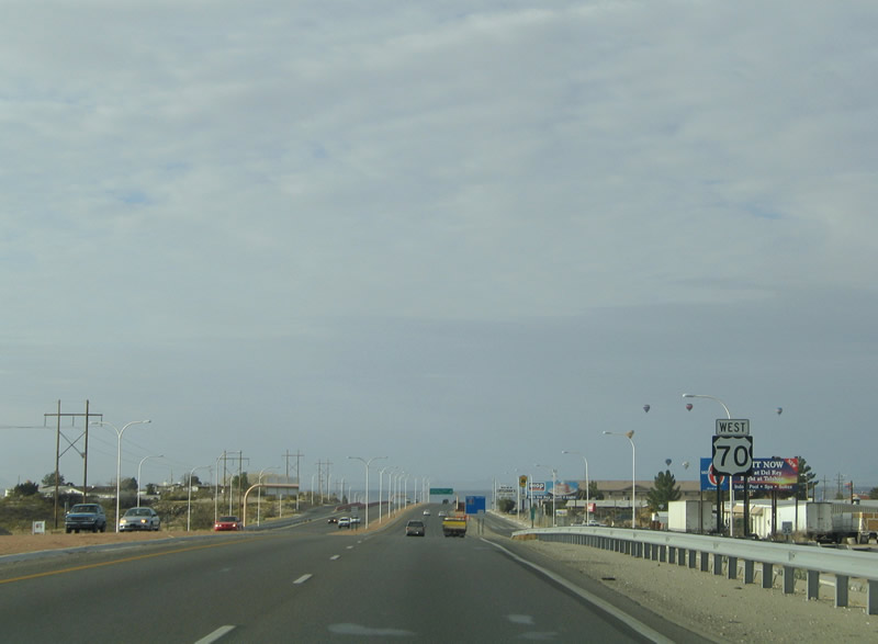
| A slip ramp departs from U.S. 70 westbound next onto the adjacent frontage road ahead of Roadrunner Parkway. Beyond this exit, the freeway defaults to Interstate 25 and Main Street into Las Cruces. 01/14/06 |
|
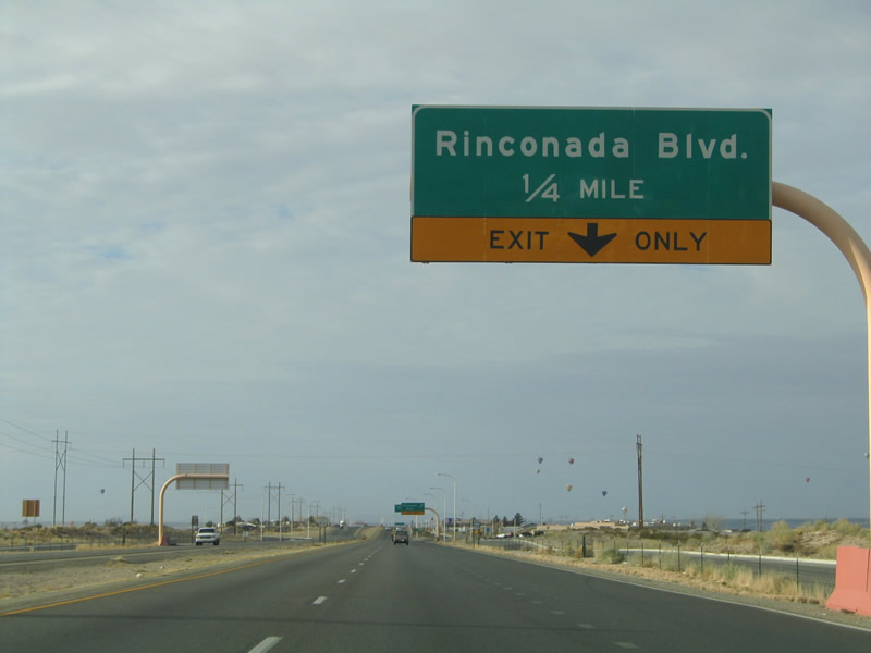
| U.S. 70 reassurance shield posted after the Rinconada Boulevard underpass. 01/14/06 |
|
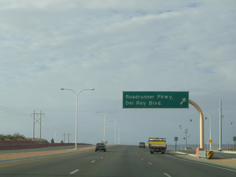
| Westbound at the ramp to Roadrunner Parkway and Del Rey Boulevard. Roadrunner Parkway constitutes a four lane arterial winding south to Lohman Avenue near Mesilla Valley Mall. Del Rey Boulevard stems north from Northrise Drive at Telshor Boulevard through northern reaches of the Las Cruces city limits. 01/14/06 |
|
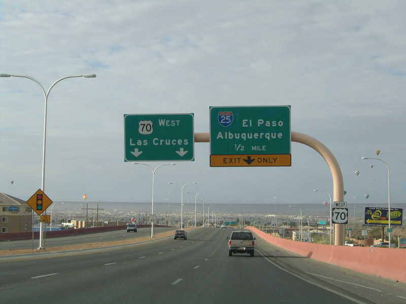
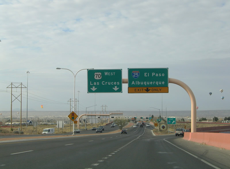
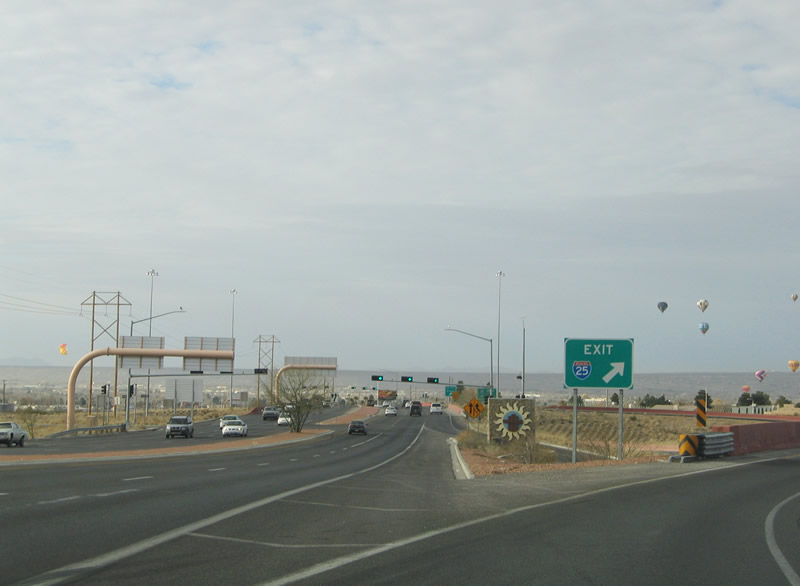
| Advancing southwest with three lanes, U.S. 70 approaches the directional cloverleaf interchange with Interstate 25. 01/14/06 |
|
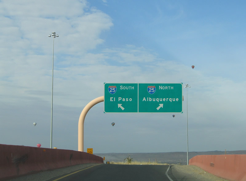
| A single ramp departs from U.S. 70 westbound for both directions of Interstate 25. 01/14/06 |
|
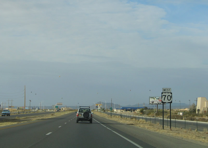
| U.S. 70 transitions into a commercial arterial along Main Street beyond the exchange with I-25. Main Street was a part of U.S. 82 and U.S. 85 until 1990. 01/14/06 |
|
| Single lane ramps partition for I-25 north to Truth or Consequences and Albuquerque and I-25 south to I-10 in Las Cruces. 01/14/06 |
Page Updated 06-28-2019.

 West
West