|
| U.S. 101 southbound prepares to cross the Wilson River and enter the city of Tillamook. 04/06/06 |
|
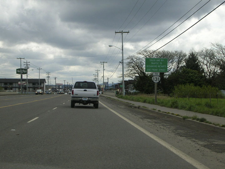
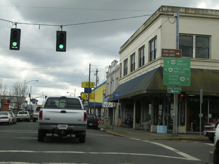
| This sign at the northern edge of Tillamook announces an upcoming junction with OR 131 (Netarts Highway), but advises RV and truck traffic to use Front Street to access the highway.
A small city of 4,675, Tillamook is home to the Tillamook County Creamery Association, makers of cheese, ice cream, and other dairy products. The company's Visitor Center and manufacturing plant, located along U.S. 101 in the north part of town, is a popular tourist draw.
Like most cities along the Oregon coast, Tillamook takes the brunt of weather systems moving off the Pacific; annual rainfall here tops 90 inches (compared to about 40 inches at Portland). Nevertheless, the overall climate is quite mild and snow and ice are extremely rare. 04/06/06 |
|
| Upon entering downtown Tillamook, U.S. 101 breaks up into the Main Avenue/Pacific Avenue one way couplet. Southbound traffic is routed down Main where it meets OR 6 eastbound and OR 131 westbound at Third Street. Eastbound Third Street is OR 6 (Wilson River Highway), which traverses the Coast Range before terminating at U.S. 26 northwest of Portland. Westbound 6th Street defaults to OR 131 (Netarts Highway), a short highway leading to Netarts Bay and the Pacific. 04/06/06 |
|
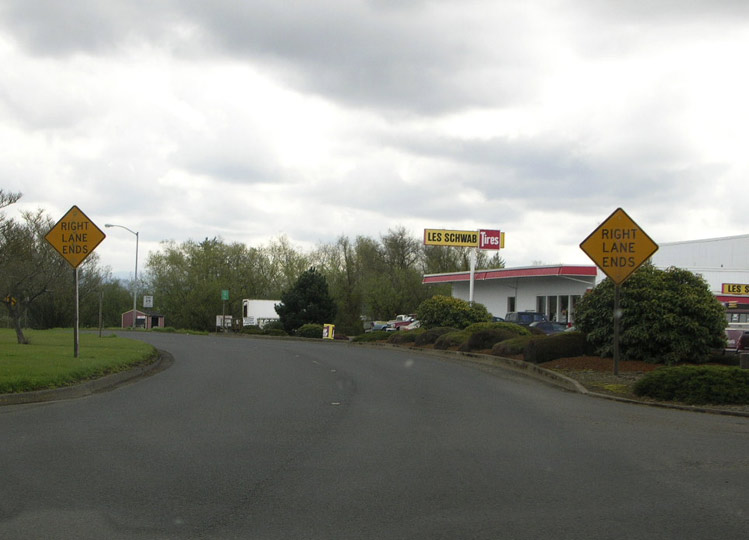
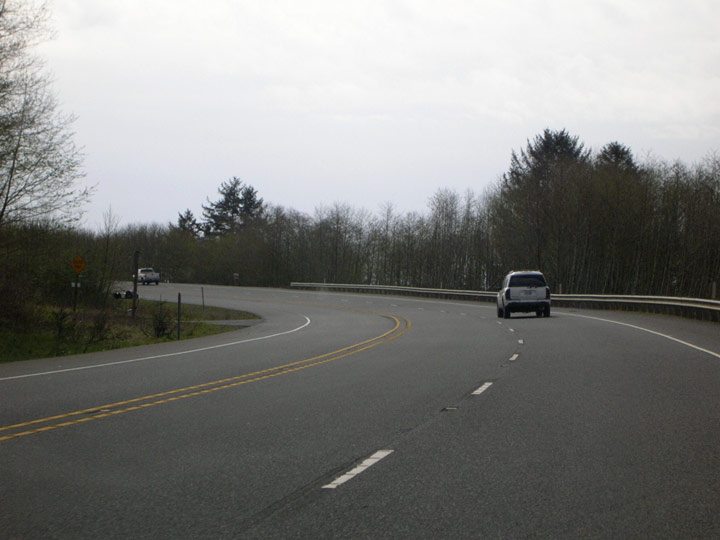
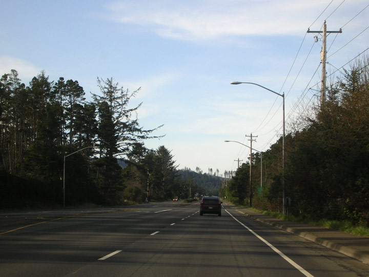
| The one way couplet comes to an end as southbound U.S. 101 prepares to leave Tillamook. Les Schwab Tires outlets, like the one in the background, are an omnipresent sight in the Pacific Northwest. Offering free flat repair (while you wait and eat popcorn, no less!), they can be a welcome sight to distressed motorists. 04/06/06 |
|
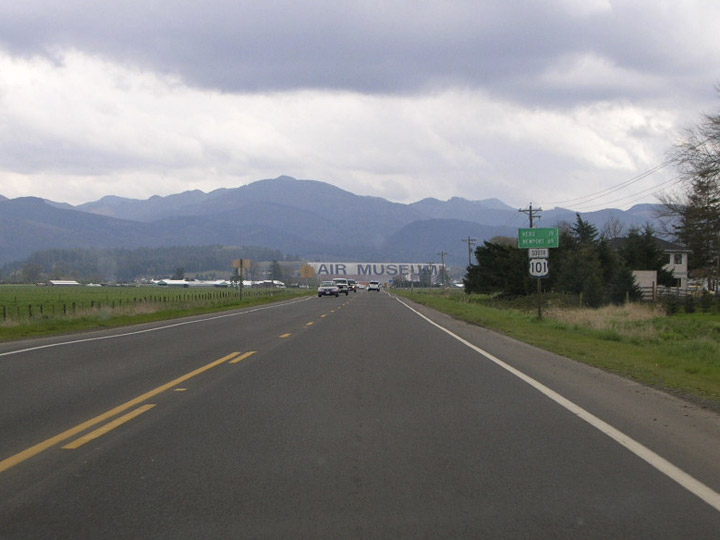
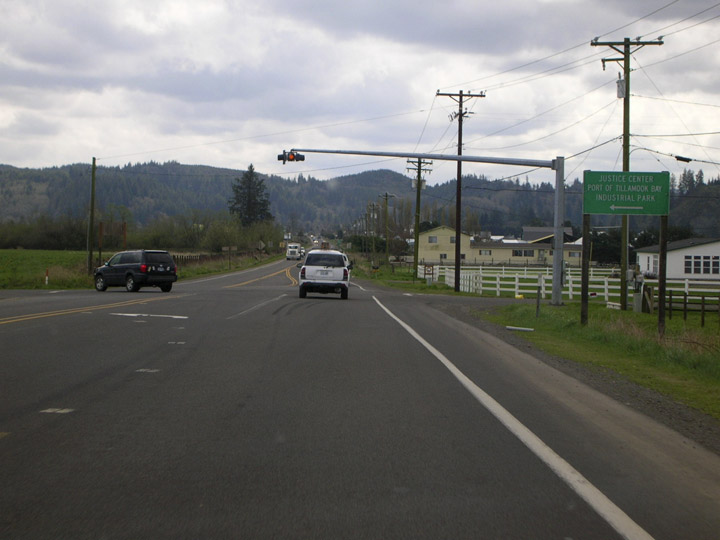
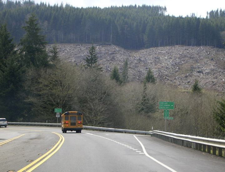
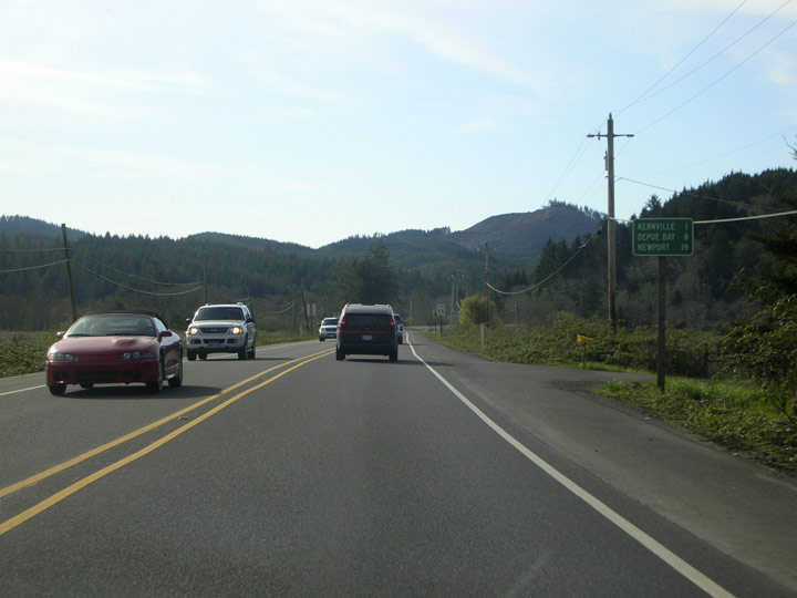
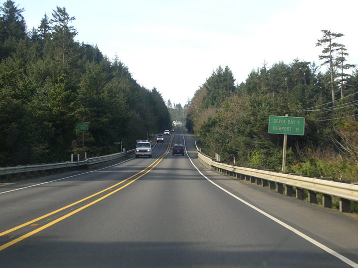
| Departing Tillamook, U.S. 101 swings inland and the Coast Range looms on the horizon as the highway heads in an easterly direction. A distance sign (first image) shows Newport to be 69 miles away. Hebo (19 miles) is at the junction of U.S. 101 and OR 22.
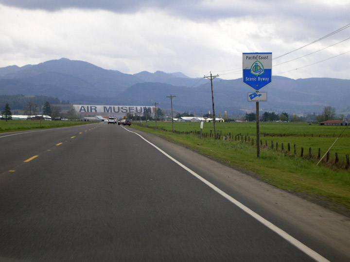
U.S. 101 is designated as a scenic byway, as this special shield indicates (second image). A former World War II blimp hangar visible in the background now houses the Tillamook Air Museum (it's that big gray thing that says "Air Museum"). 04/06/06 |
|
| A flashing amber caution light announces the intersection with Long Prairie Road. Turn left here for the Tillamook airport and the air museum. 04/06/06 |
|
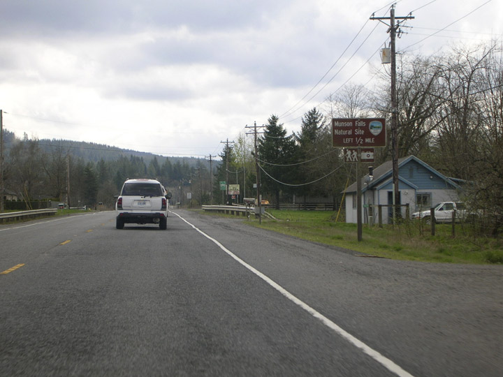
| Six miles south of Tillamook, U.S. 101 meets Munson Creek Road, which leads to Munson Creek State Natural Area. 04/06/06 |
|
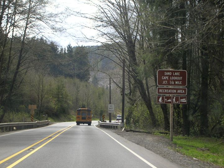
| Sandlake Road, which leads to Cape Lookout State Park, intersects the Oregon Coast Highway just north of the tiny town of Hemlock. This very scenic park, nestled between old growth forest and the rugged shoreline, offers campsites, cabins, and even yurts (but be sure to book ahead!). 04/06/06 |
|
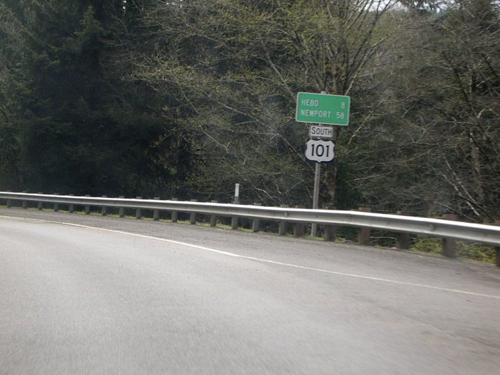
| Newport is still 58 miles away according to this sign posted just past the Sandlake Road junction. No mention is yet made of Lincoln City, which is a heck of a lot larger than Hebo. 04/06/06 |
|
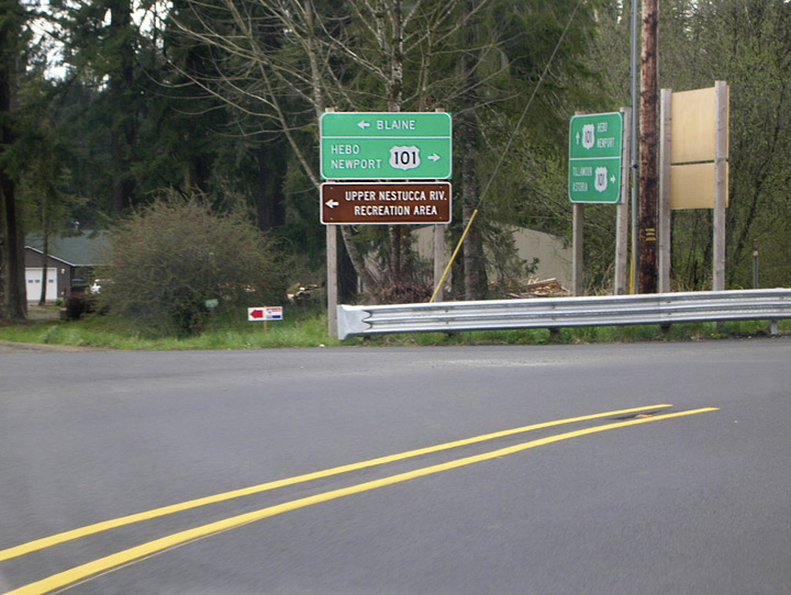
| Approaching Beaver (yep, another wide spot in the road), southbound U.S. 101 veers sharply right at the intersection of Blaine Road. Blaine Road leads to, well,...Blaine (go figure) and also to the more exciting Upper Nestucca River Recreational Area, an OHV park. 04/06/06 |
|
| After the Blaine Road junction, the US highway winds through Downtown Beaver. 04/06/06 |
|
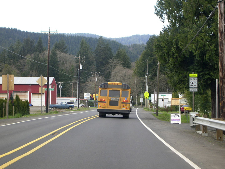
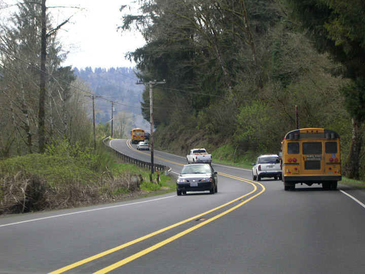
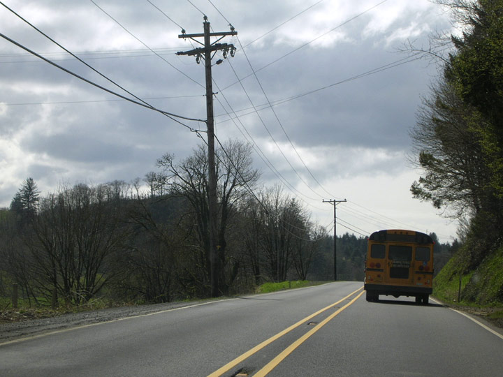
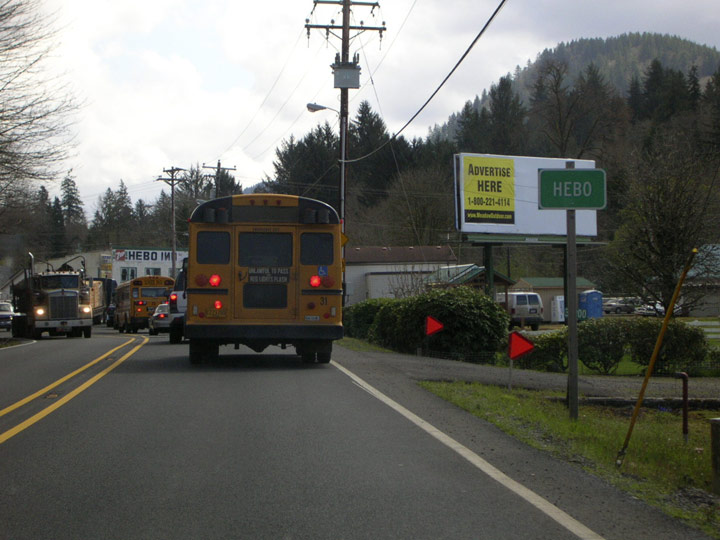
| U.S. 101 continues its narrow, winding route south on the approach to Hebo. A lot of yellow reflective paint was used to stripe this section of the highway. Traveler's tip: try not to get stuck behind a school bus along this stretch. 04/06/06 |
|
| Did I mention how narrow the highway is here? What passes for shoulders are laughable in spots. 04/06/06 |
|
| Shoulders aren't appreciably wider as U.S. 101 southbound approaches its junction with OR 22 at Hebo. 04/06/06 |
|
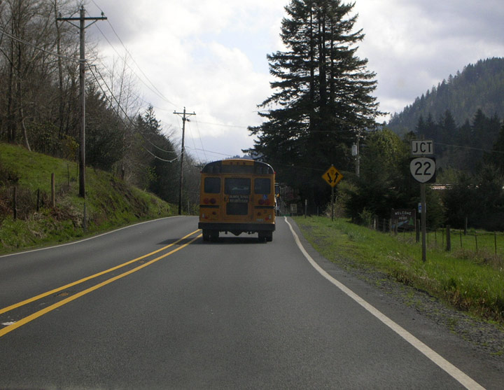
| U.S. 101 enters Hebo (drumroll please), which is announced on this typically small ODOT sign. 04/06/06 |
|
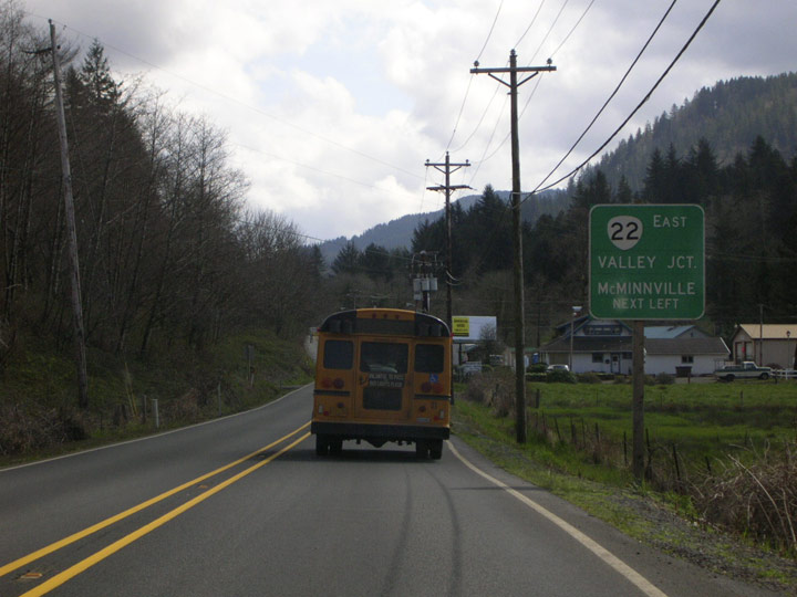
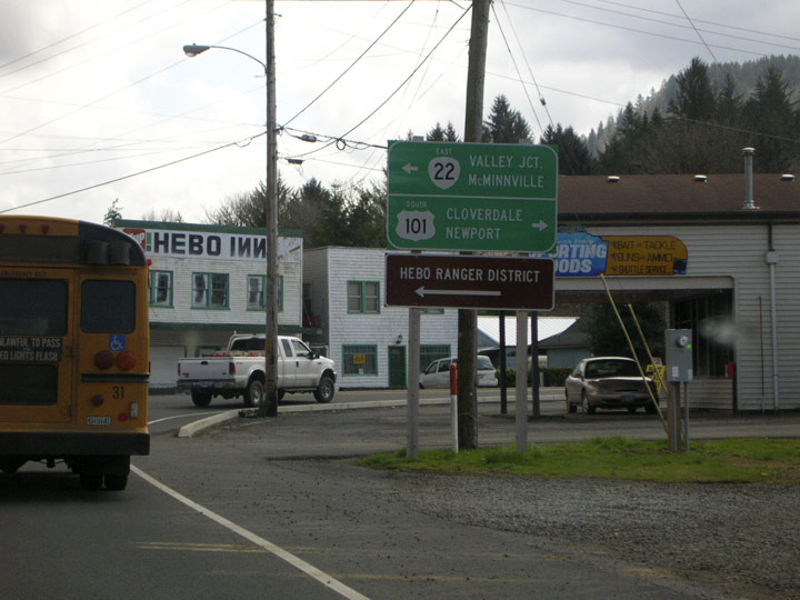
| Eastbound SR 22 branches off U.S. 101 at Hebo. McMinnville is actually located along SR 18, but SR 22 briefly joins SR 18 at Valley Junction. The backward "Ns" on the Hebo Inn sign had been that way for at least 30 years. 04/06/06 |
|
| U.S. 101 advances south two miles to Cloverdale. Newport is still 50 miles away. 04/06/06 |
|
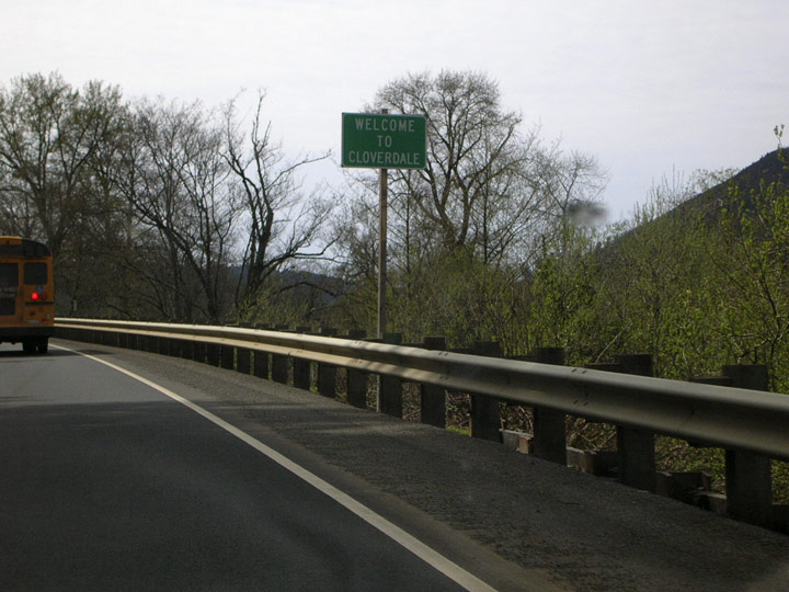
| Southbound U.S. 101 heads into the not-so-bustling unincorporated city of Cloverdale, home to roughly 250 people at last count. The double yellow stripe persists. 04/06/06 |
|
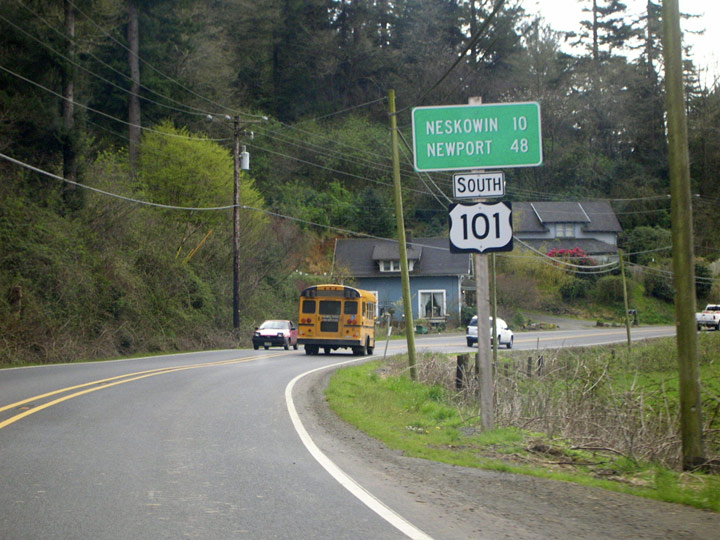
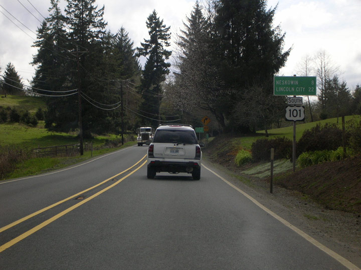
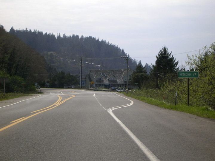
| Departing Cloverdale, the next place of note according to the distance sign is Neskowin, 10 miles distant. 04/06/06 |
|
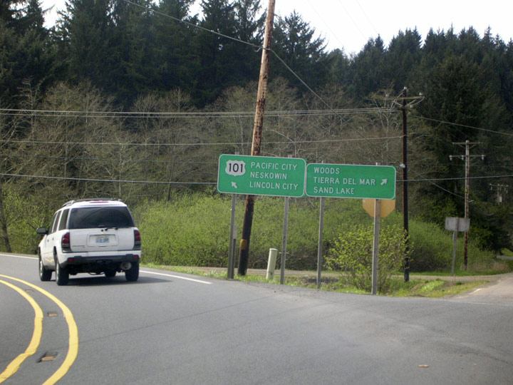
| Resort drive branches from the Oregon Coast Highway, heading westbound to Woods, Tierra Del Mar, and, in cased you missed the turn back at Hemlock, Sandlake. Resort Drive links up with the Three Capes Scenic Route between Woods and Tierra Del Mar. 04/06/06 |
|
| Lincoln City, now 22 miles away, is finally mentioned on a distance sign. Finally got rid of that school bus, too. 04/06/06 |
|
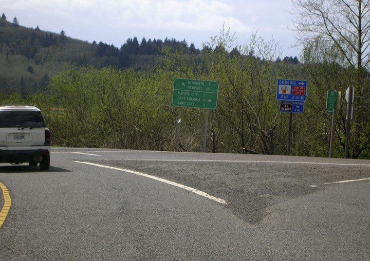
| Southbound U.S. 101 veers to the left yet again, this time at the junction with Brooten Road. Here's your last chance to link up with the Three Capes Scenic route that heads north up the coast back toward Tillamook. Pacific City (3 miles) offers lodging accommodations. Cape Kiwanda, at the north edge of the town, is probably one of the most photographed places on the Oregon Coast. 04/06/06 |
|
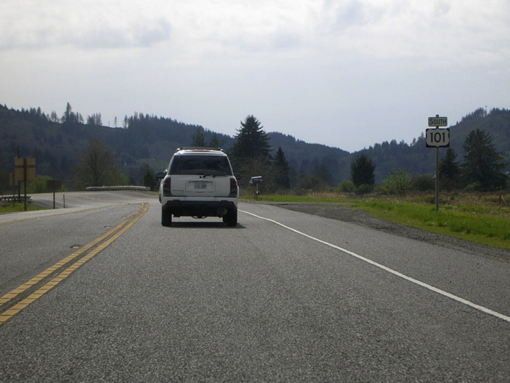
| U.S. 101 finally starts to widen a bit after the Pacific City junction. Could it be?...actual shoulders? 04/06/06 |
|
| Road-weary travelers stuck behind school buses and other slow movers will rejoice to see this passing lane provided north of Neskowin. 04/06/06 |
|
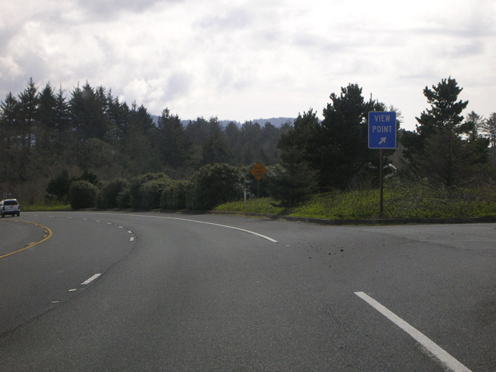
| Southbound 101 returns to the Pacific shore briefly and a viewpoint is offered. The passing lane ends just past the viewpoint (first image). The view (second image) is classic Oregon coast: rugged headlands covered with wind-whipped Sikta spruces. 04/06/06 |
|
| U.S. 101 narrows from four to two lanes after leaving the viewpoint. 04/06/06 |
|
| Southbound U.S. 101 approaches Neskowin and a right turn onto Hawk Street takes you into the tiny shoreside town. 04/06/06 |
|
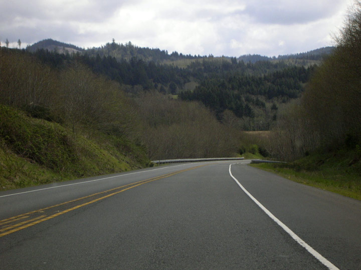
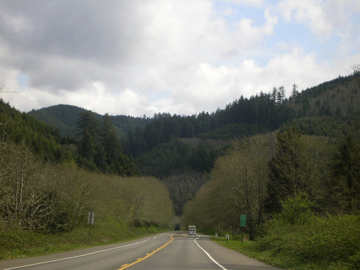
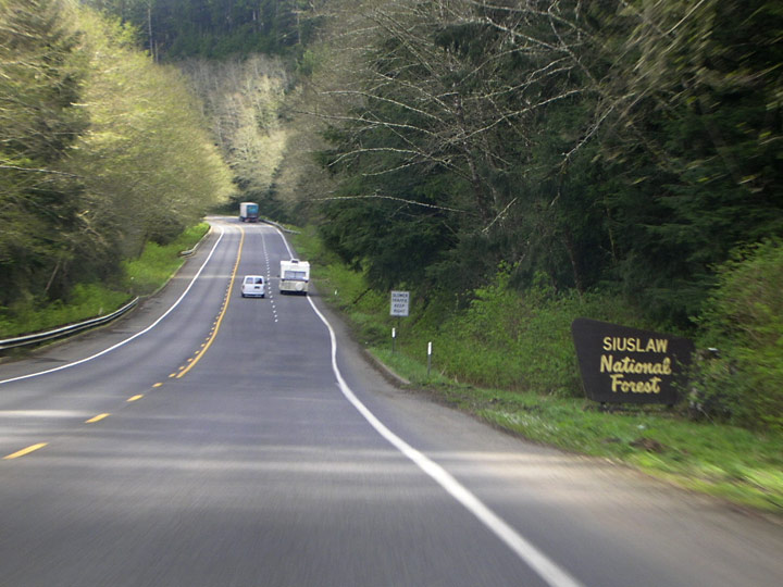
| Departing Neskowin, the US highway soon heads into the Siuslaw National Forest in southern Tillamook County. As the highway climbs several hundred feet in elevation, a passing lane is available for uphill traffic heading south. 04/06/06 |
|
| Departing Neskowin, the US highway soon heads into the Siuslaw National Forest in southern Tillamook County. As the highway will climb several hundred feet in elevation, a passing lane is available for uphill traffic heading south. 04/06/06 |
|
| Travelers along this stretch pass through a mosaic of mature and younger forests. They contain the typical coastal forest residents: Sitka spruce, western hemlock, Douglas-fir, western red-cedar, Oregon alder, and bigleaf maple. 04/06/06 |
|
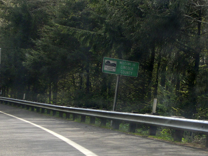
| Coming down the north slope of the hill, U.S. 101 enters Lincoln County. 04/06/06 |
|
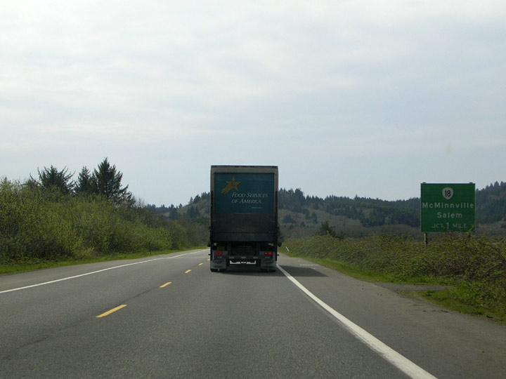
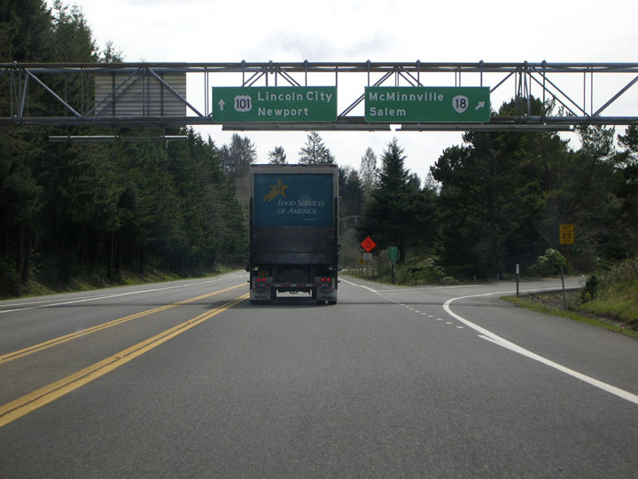
| As U.S. 101 closes in on Lincoln City, a large sign announces the impending junction with OR 18 (Salmon River Highway). 04/06/06 |
|
| A trumpet interchange handles the exchange of traffic between U.S. 101 and eastbound OR 18. The Salmon River Highway crosses the coast range and leads to the Willamette Valley town of McMinnville. To reach Salem, take OR 22 east from 18 at Willamina. Notice the lack of cardinal directions on the sign bridge. Perhaps ODOT assumed that drivers would know that they could only head east over OR 18. 04/06/06 |
|
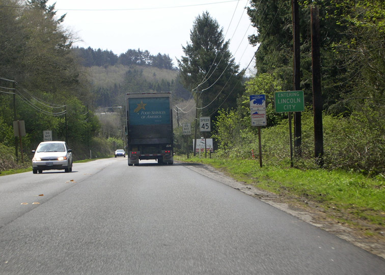
| U.S. 101 southbound reaches Lincoln City, the first town with over 1,000 residents encountered since leaving Tillamook. 04/06/06 |
|
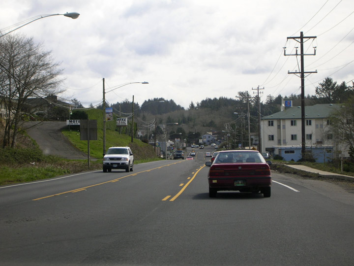
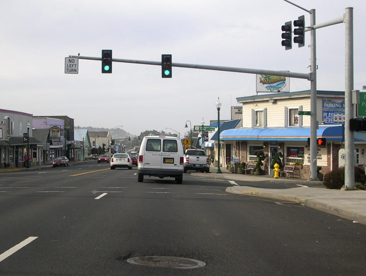
| Five separate towns consolidated to form Lincoln City in 1965. Neighborhoods and districts within the town retain the old names: Oceanlake, Delake, Nelscott, Taft, and Cutler City. The longish 7.5 mile drive through Lincoln City may not be the most scenic drive on the coast, but the town has made an effort to spruce up appearances in recent years. The city promotes itself primarily as a tourist and retirement community. 04/06/06, 04/07/06 |
|
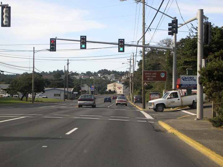
| Though this sign posted at the intersection of 6th Drive/6th Street points the way to Devils Lake State Park, the official Oregon State Parks web site now refers to the site as Devils Lake State Recreation Area. The park straddles Devils Lake; the portion referenced here, on the northwest shore, offers overnight camping. 04/05/07 |
|
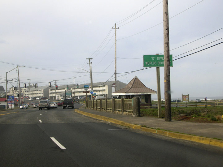
| One of Lincoln City's claims to fame is the D river, supposedly the "world's shortest river" as this sign along southbound 101 reports. The river flows approximately 120 feet from Devils Lake west to the Pacific. 04/07/06 |
|
| Shortly after crossing the D River, southbound 101 meets East Devils Lake Road. This road travels along the southern and eastern shore of the lake, offering access to the state recreation area's day use facilities. 04/07/06 |
|
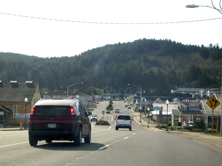
| U.S. 101 heads south into the Taft District at the southern end of town. Despite the small permanent population, a good deal more than 7,849 people are present in town at any one moment. 04/05/07 |
|
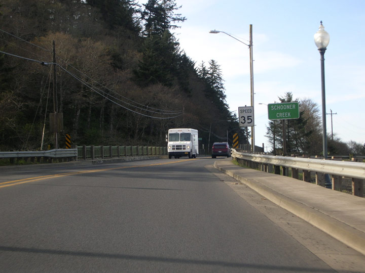
| Schooner Creek flows into Siletz Bay as 101 departs Lincoln City. 04/05/07 |
|
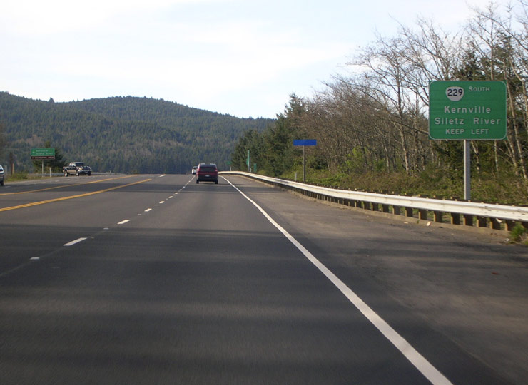
| Newport is now less than 20 miles south. Next up along southbound U.S. 101 is the junction with OR 229 (Siletz Highway) at Kernville (which is more a place-name than a town). OR 229 travels south, roughly following the Siletz River to U.S. 20 and Toledo. 04/05/07 |
|
| Past the OR 229 junction, U.S. 101 reverts to a two lane highway. 04/05/07 |
|
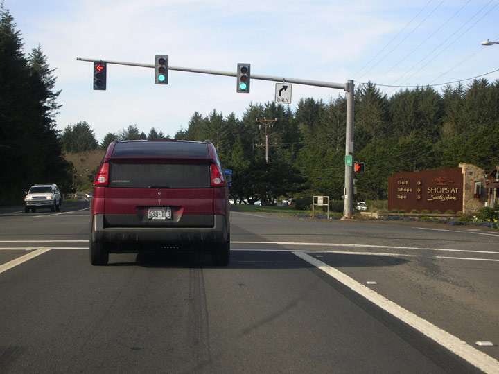
| Traffic lights aren't commonly seen along 101 outside of incorporated towns, but this one is posted at Salishan Resort near Gleneden Beach. The resort boasts a world-class golf course, three restaurants, lodging, tennis courts, and a spa, among other amenities. 04/05/07 |
|
| The US highway again widens to four lanes as it passes alongside vacation home developments in Coronado Shores and Lincoln Beach. 04/05/07 |
|
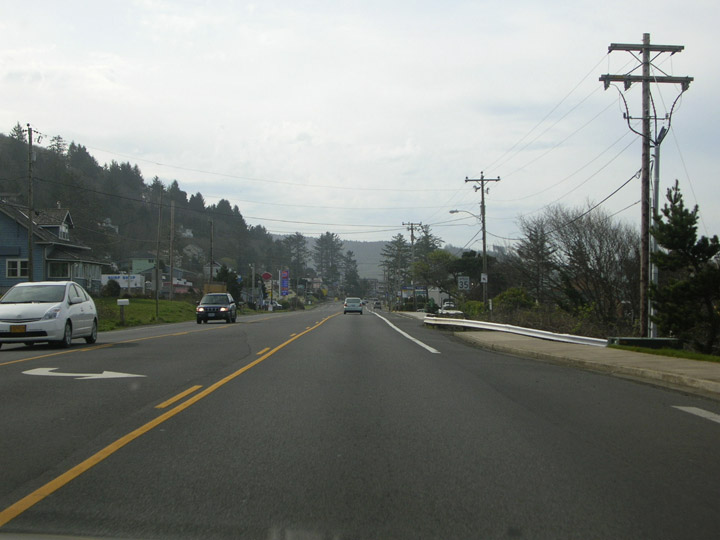
| U.S. 101 reverts to two lanes on the approach to Fogarty Creek State Recreation Area. The distance sign: Depoe Bay, 2; Newport, 15. 04/05/07 |
|
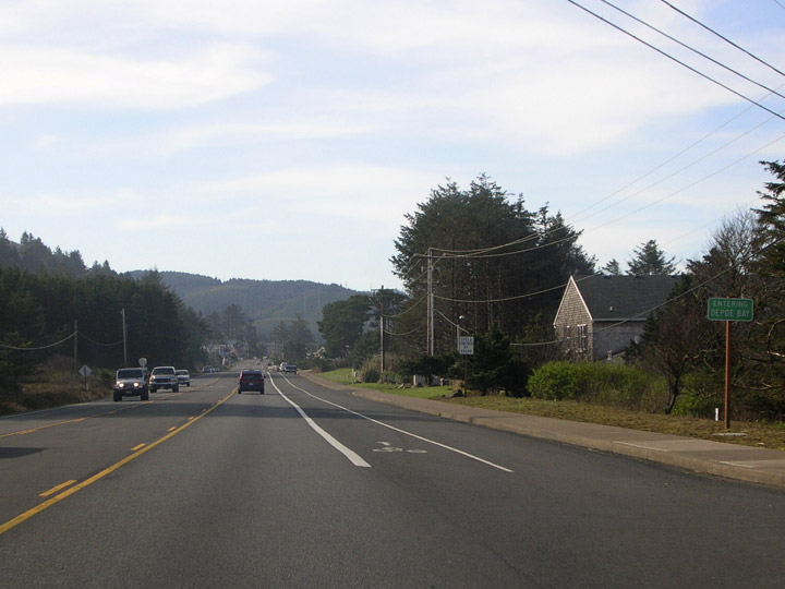
| Southbound U.S. 101 enters the small town of Depoe Bay (est. pop. 1,363 in 2005). A large sea wall runs parallel with the entire length of the downtown along 101, offering ocean views from downtown shops and sidewalks. 04/07/06, 04/05/07 |
|
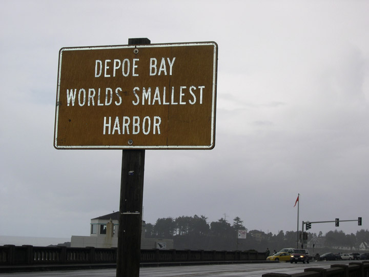
| Head-in parking in downtown Depoe Bay (first picture) literally faces the Pacific Ocean. Just south of the parking area, U.S. 101 crosses the entrance to Depoe Bay itself, billed as the world's smallest navigable harbor. The bridge at the 101 crossing was featured in a scene from the 1975 movie "One Flew Over The Cuckoo's Nest. 04/07/06 |
|
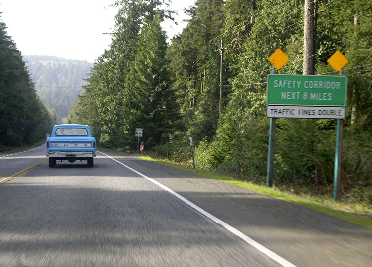
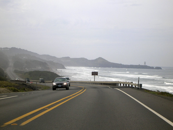
| Commissioned in 1996, a safety corridor stretches most of the distance between Depoe Bay and Newport. Though the sign indicates that it is 8 miles long, the ODOT master safety corridor list records it to be 9.1 miles in length. 04/07/06 |
|
| Southbound U.S. 101 heads through patches of lush coastal forest south of Depoe Bay. 04/07/06 |
|
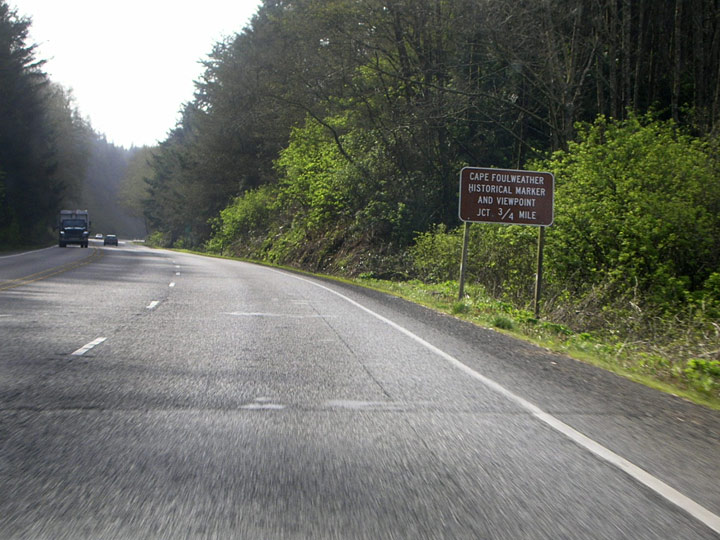
| U.S. 101 approaches the junction for Otter Crest State Scenic Viewpoint at--you gotta love this name--Cape Foulweather. (Visit this link at the ODOT website for interactive panoramic views of the site.) A short loop road connects the highway with the viewpoint. 04/07/06 |
|
| South of the viewpoint, U.S. 101 intersects with a side road that leads to yet another place on the Oregon Coast with a fun-sounding name, the Devils Punch Bowl. 04/07/06 |
|
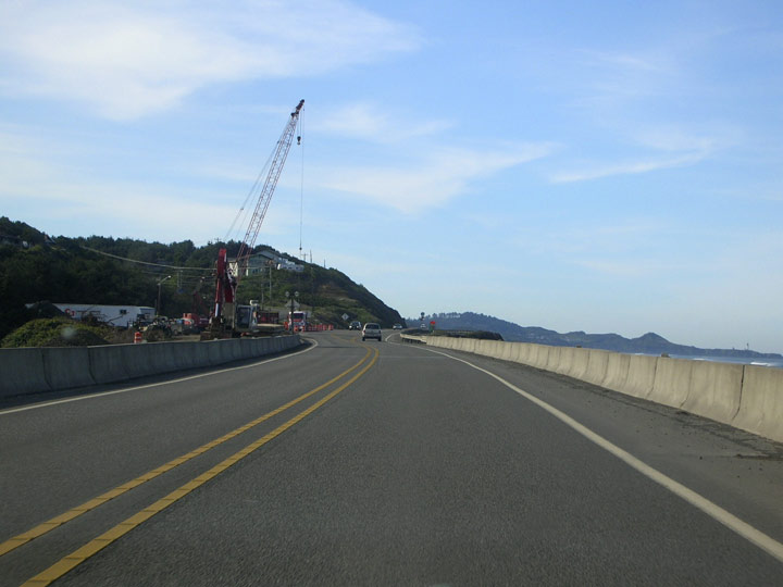
| Until the fall of 2008, this temporary bridge will carry U.S. 101 traffic across Spencer Creek at Beverly Beach State Park. Corrosion concerns closed the original 1946 structure. 04/05/07 |
|
| As southbound U.S. 101 closes in on Newport, the Yaquina Head Lighthouse, Oregon's tallest, can be seen on the headland at right. 04/07/06 |
|
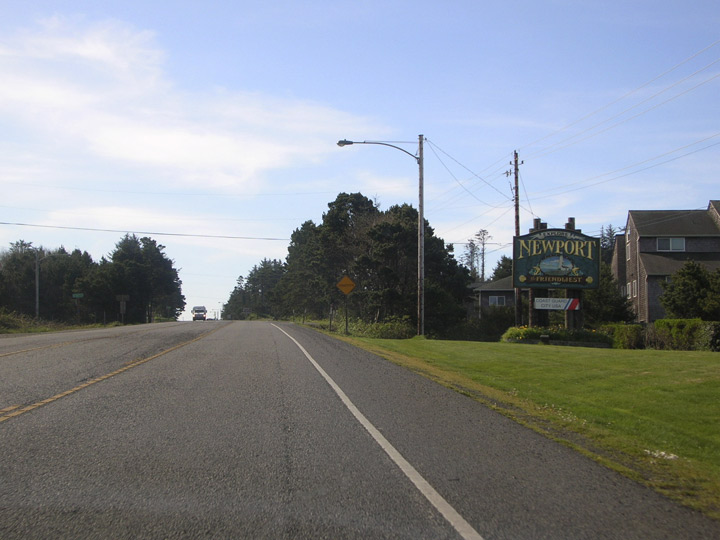
| The safety corridor ends as southbound 101 enters Newport (2005 est. pop. 9,833). A handsome sign at the entrance to town (second image) invites visitors to "Explore Newport, The Friendliest." It doesn't say the friendliest what. One would assume "town," but you never know. 04/05/07 |
|
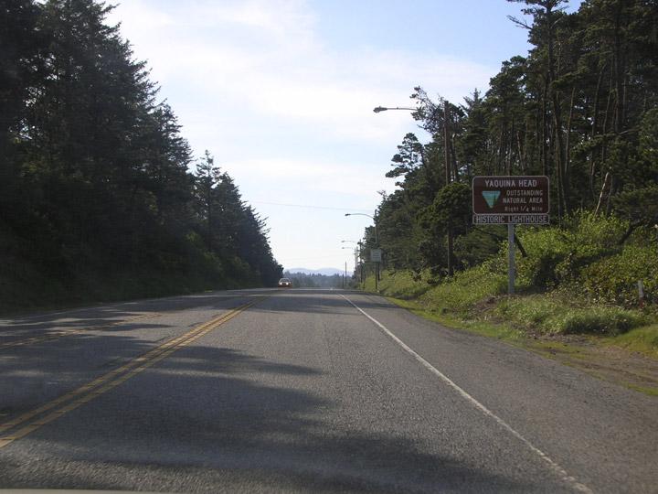
| Southbound U.S. 101 meets Lighthouse Drive which leads to Yaquina Head, proclaimed to be an "outstanding natural area." This Bureau of Land Management (BLM) site features spectacular ocean views from a craggy headland that juts into the Pacific at the north end of Newport. Also on site is a lighthouse dating from 1873, and shallow tide pools that are worth exploring (tip: wear waterproof clothes!). 04/05/07 |
|
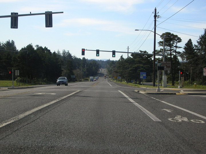
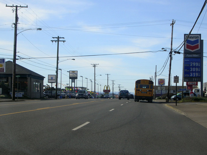
| Unfortunately, the trip that continues along south along 101 isn't terribly scenic, as the highway passes through a rather tedious commercial district en route to downtown Newport. Incorporated in 1882, the town is the namesake of Newport, Rhode Island. Primary industries are commercial fishing and tourism. 04/05/07 |
|
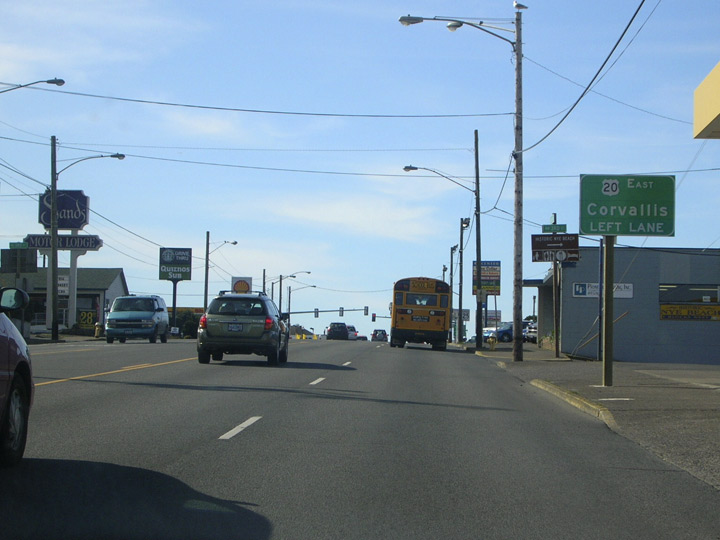
| The junction with U.S. 20 (eastbound to Corvallis) is announced as 101 approaches downtown. 04/05/07 |
|
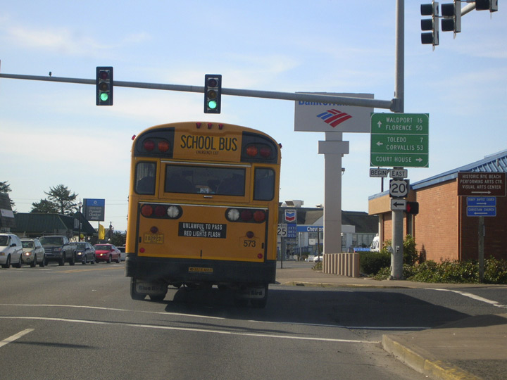
| The intersection of U.S. 101 and Olive street in downtown Newport marks THE western terminus of U.S. 20 for--gasp--the entire nation. Note the "begin" tab: this is unusual for an Oregon sign, but ODOT may have figured that since this is THE western terminus, there might as well be some sort of fanfare. 04/05/07 |
|
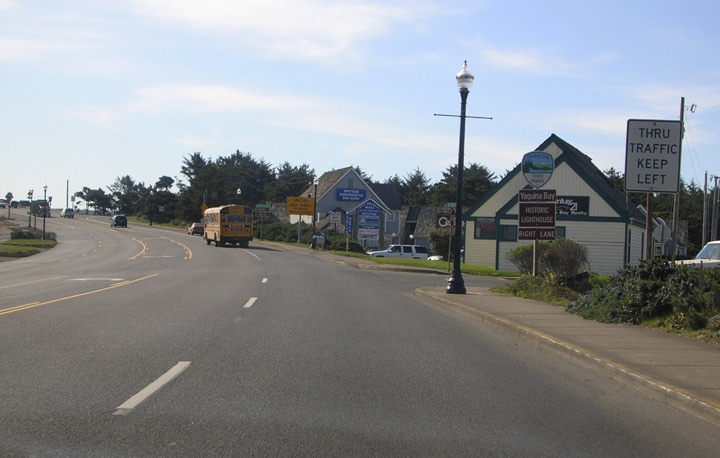
| You'll find another historic lighthouse at Yaquina Bay State Recreation Site, located on the north shore of Yaquina Bay. Just before crossing the bay the two southbound lanes diverge, with the right hand lane leading to the recreation site. Through traffic heading over the Yaquina Bay Bridge should stay in the left lane. 04/05/07 |
|
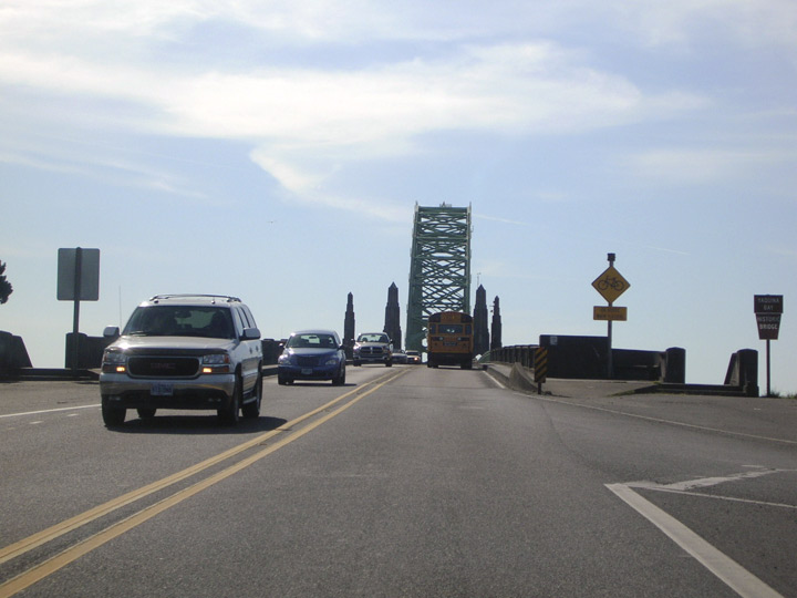
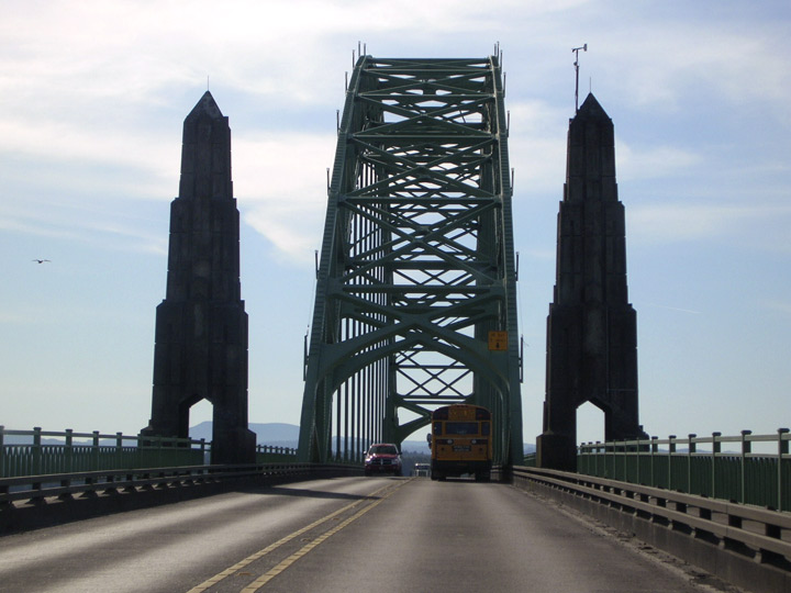
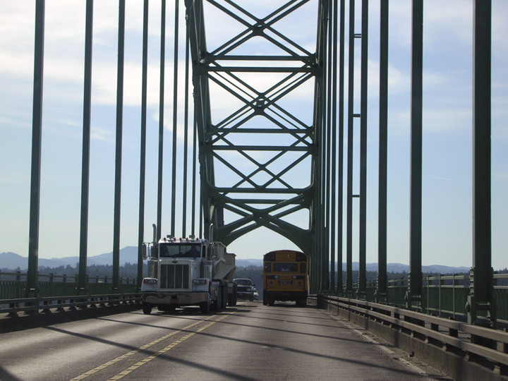
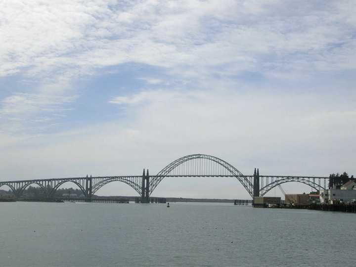
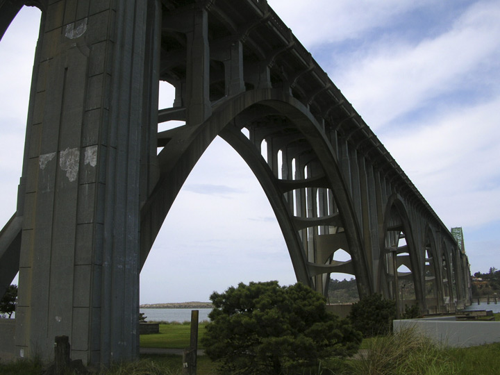
| An Oregon coast landmark, the 1936 Yaquina Bay Bridge carries U.S. 101 across Yaquina Bay at the south end of Newport. The 3,223-foot structure features a combination of both steel and concrete arches, with a 600-foot steel through arch main span being the bridge's most prominent feature. 04/05/07 |
|
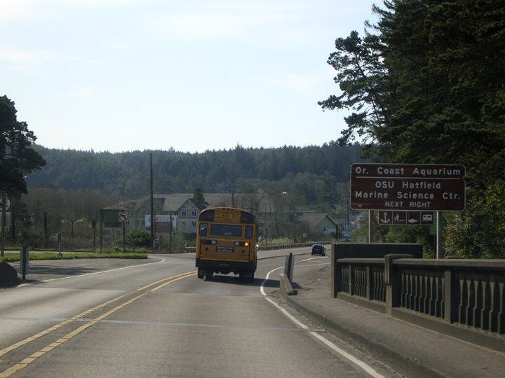
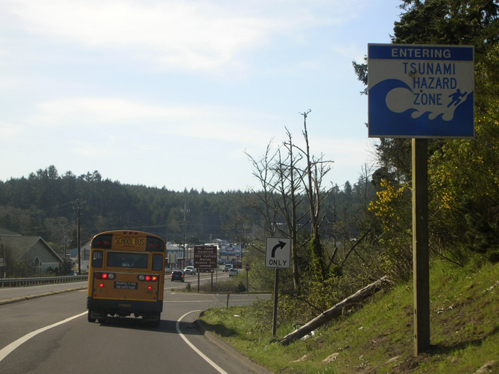
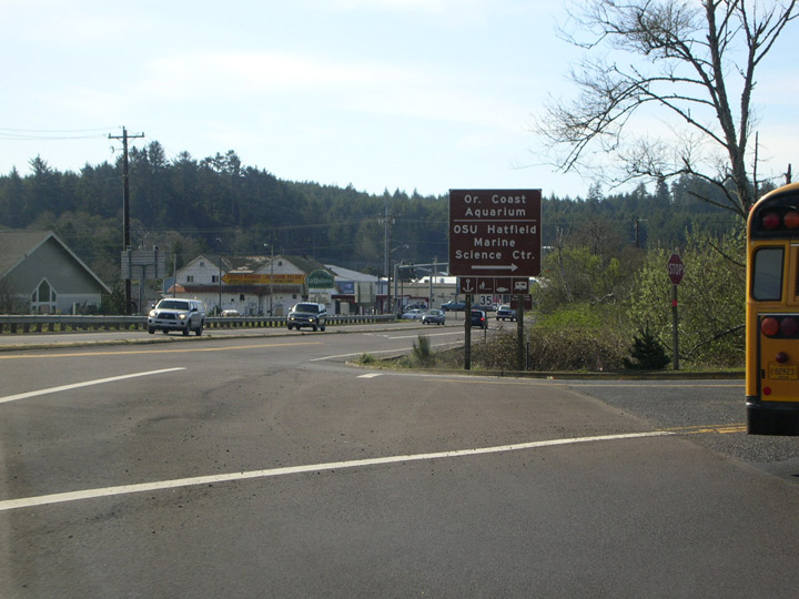
| A Tsunami warning sign (first image) is posted for southbound traffic exiting the bridge. Warning signs such as this are frequent all along U.S. 101 in low lying areas. The Oregon Coast Aquarium and Hatfield Marine Science Center are popular attractions residing on the south shore of Yaquina Bay. 04/05/07 |
|
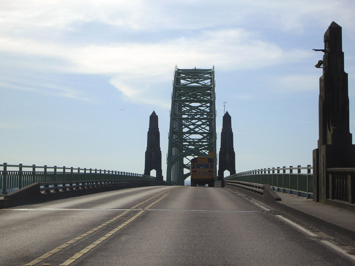
| Three views of the Yaquina Bay Bridge. Pictures 1 and 2 are looking from Newport Harbor. Picture 3, taken at the south end of the bridge, shows the gothic-style concrete arch supports. 04/05/07, 04/07/06 |
Page Updated 08-23-2007.


 south
south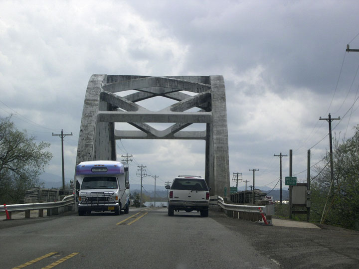


