|
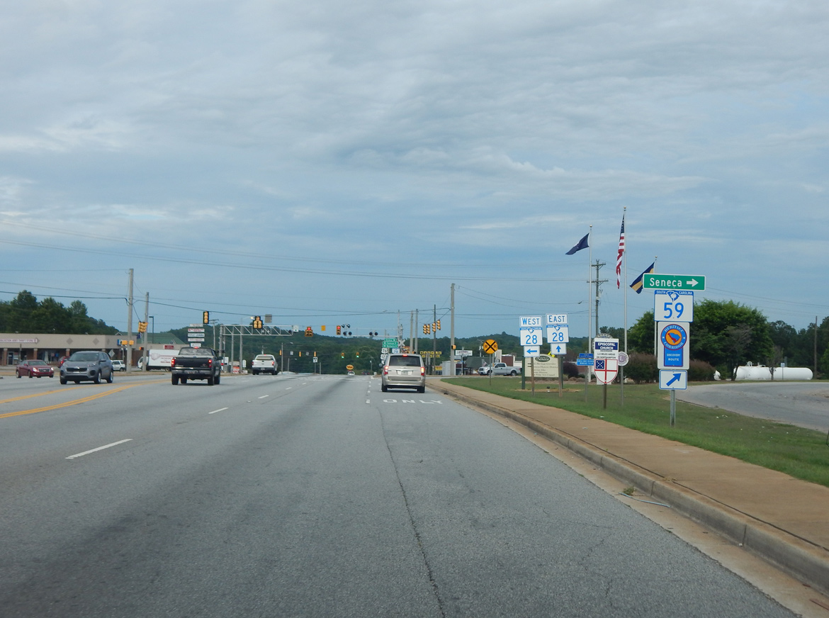
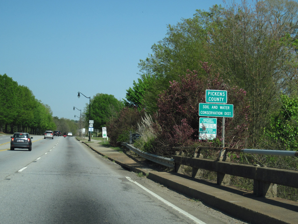
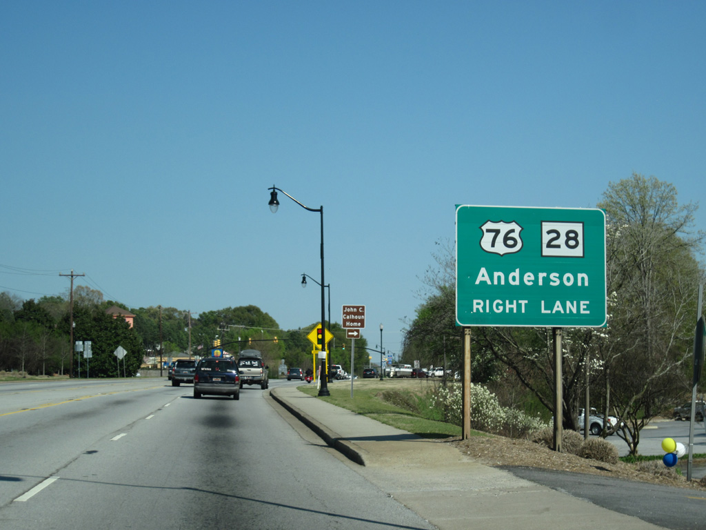
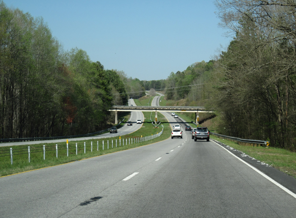
| U.S. 76/123 (Sandifer Boulevard) converge with S.C. 59 (North 1st Street) and S.C. 28 (Blue Ridge Boulevard) at a commercialized intersection along the Seneca city line. 06/04/17 |
|
| S.C. 59 angles southeast to S.C. 130 in Downtown Seneca. S.C. 28 runs northwest to West Union and Walhalla. 06/04/17 |
|
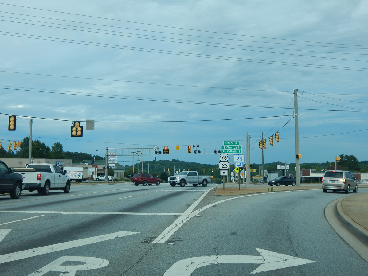
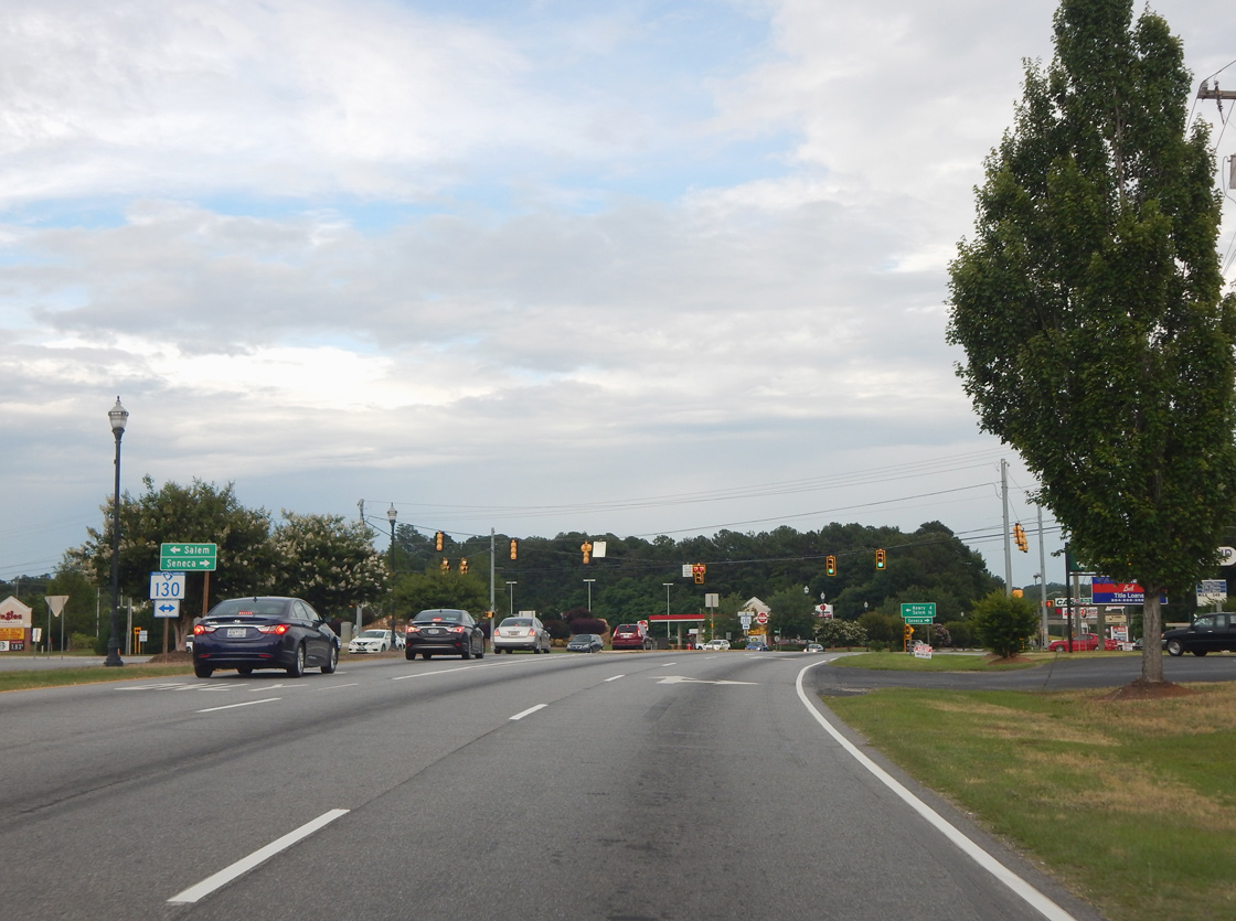
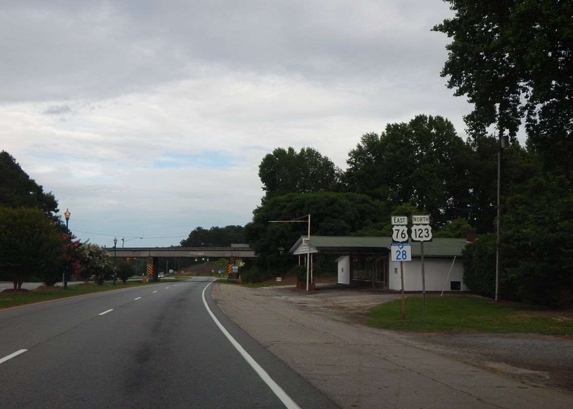
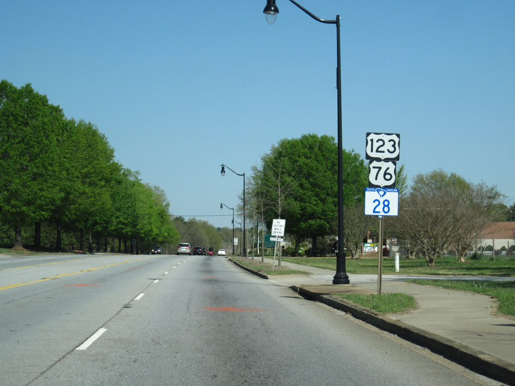
| S.C. 28 bypasses Seneca to the north alongside U.S. 76/123 east to S.C. 130 (North 1st Street / Rochester Highway). S.C. 130 straddles eastern reaches of Lake Keowee north to S.C. 183 en route to Salem. 06/04/17 |
|
| A Norfolk Southern Railroad line spans U.S. 76/123-S.C. 28 (Clemson Boulevard) east between S.C. 130 and Lindsay Road (Road 62). 06/04/17 |
|
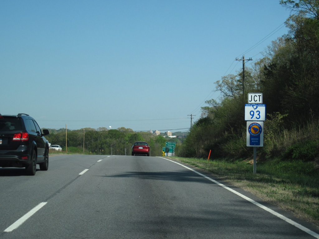
| Clemson University appears along the eastern horizon ahead of Pendleton Road (former S.C. 93) east. S.C. 93 was truncated east to Old Greenville Highway at U.S. 76 beyond the university. 04/12/14 |
|
| S.C. 93 looped 3.0 miles southeast along Pendleton Road and Old Greenville Highway to Clemson University and the Clemson city center while U.S. 76/123-S.C. 28 bypass the campus to the north. 04/12/14 |
|
| Pendleton Road (Road 4) angles 0.86 mile southeast across the Seneca River to the Pickens County line. S.C. 93 (Old Greenville Highway) links U.S. 76/S.C. 28 (Anderson Highway) with U.S. 123 (Tiger Boulevard) beyond their separation. 04/12/14 |
|
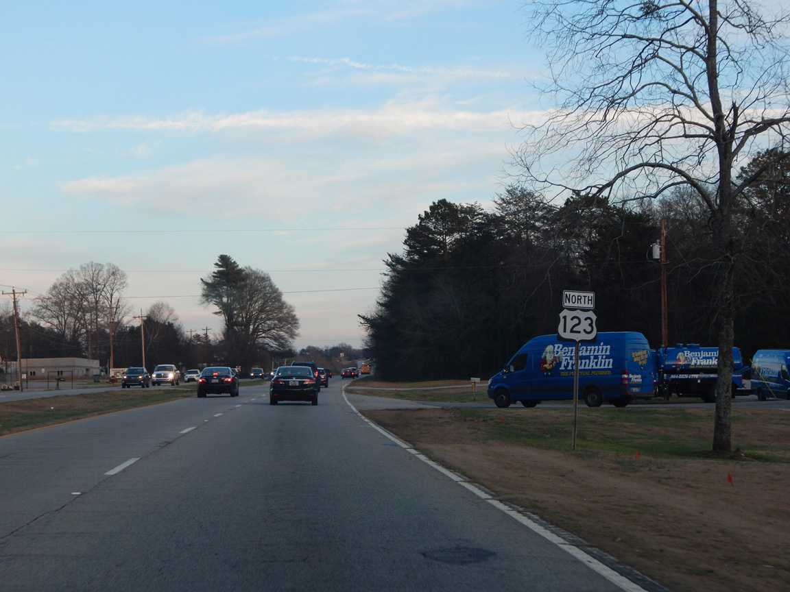
| The Hartwell Village retail complex was developed along the south side of U.S. 76-123/S.C. 28 between Pendleton Road (Road 4) and the Seneca River starting in late 2016. 04/12/14 |
|
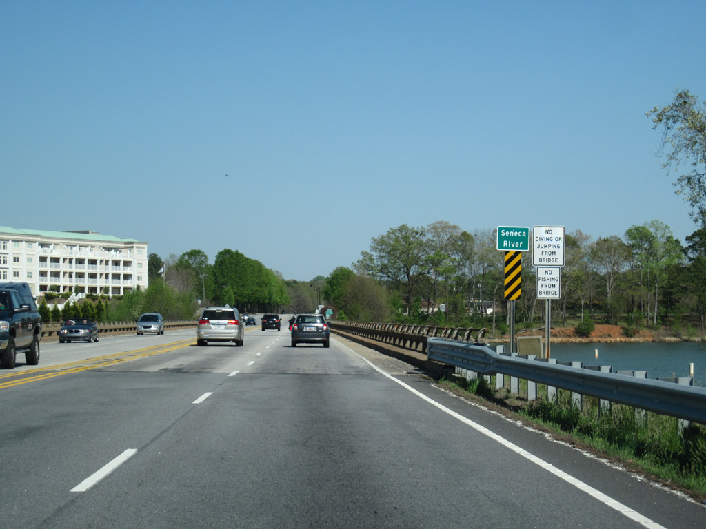
| U.S. 76-123/S.C. 28 crosses the Seneca River, which is part of the expansive Lake Hartwell. Waters from Twelvemile Creek flow into the reservoir from the northeast near here as well. 04/12/14 |
|
| The original course of the Seneca River marks the Pickens County line in the Clemson area. 04/12/14 |
|
| U.S. 76/123-S.C. 28 (Tiger Boulevard) transitions into a five lane commercial boulevard across the north side of Clemson. 04/12/14 |
|
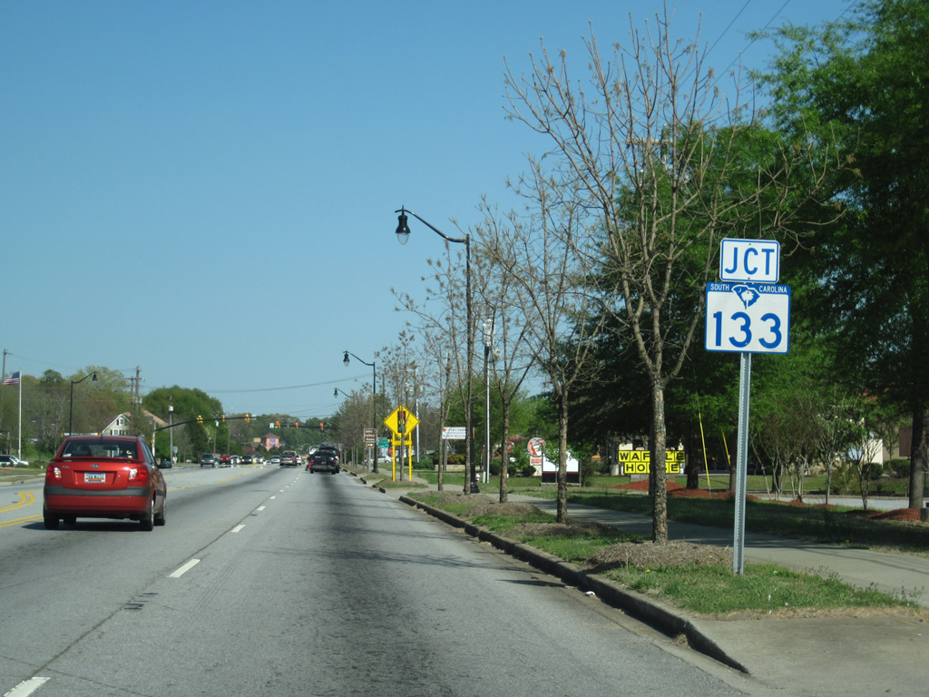
| A number of fast food franchises line U.S. 76-123/S.C. 28 leading to the intersection with S.C. 133 (College Avenue) north in Clemson. 04/12/14 |
|
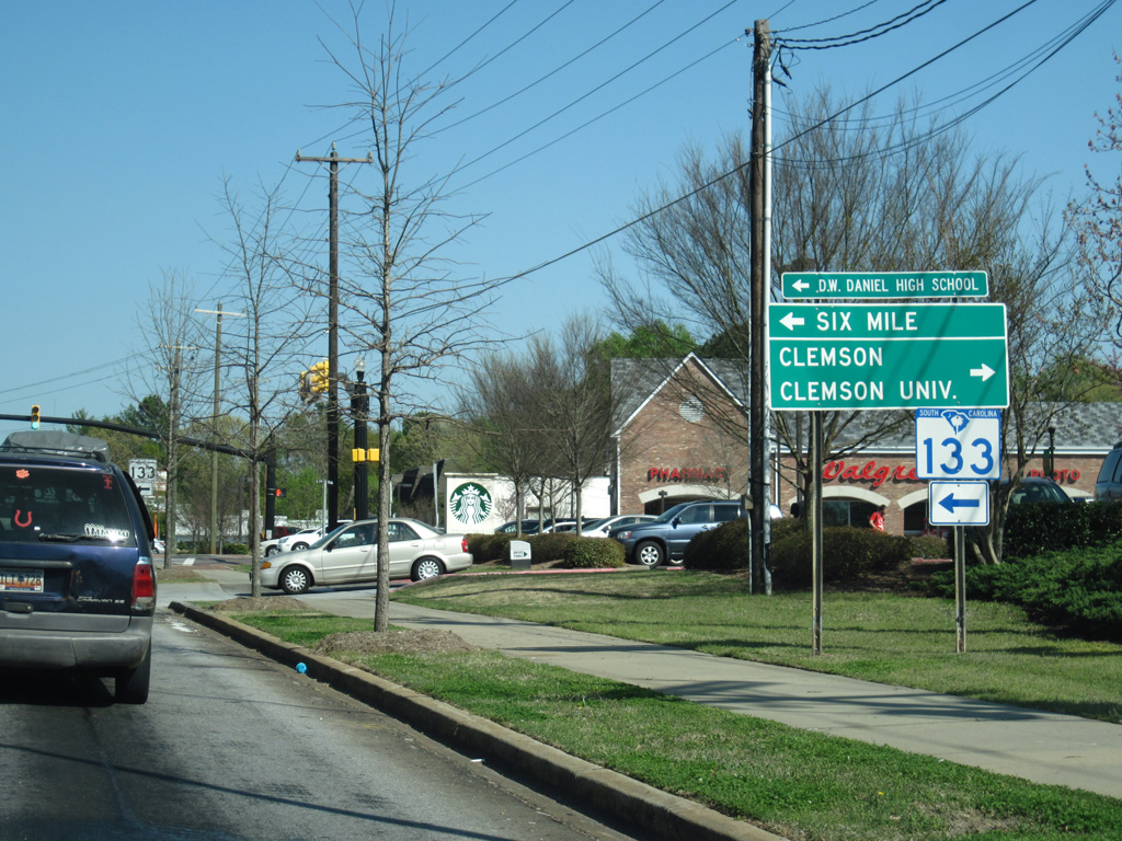
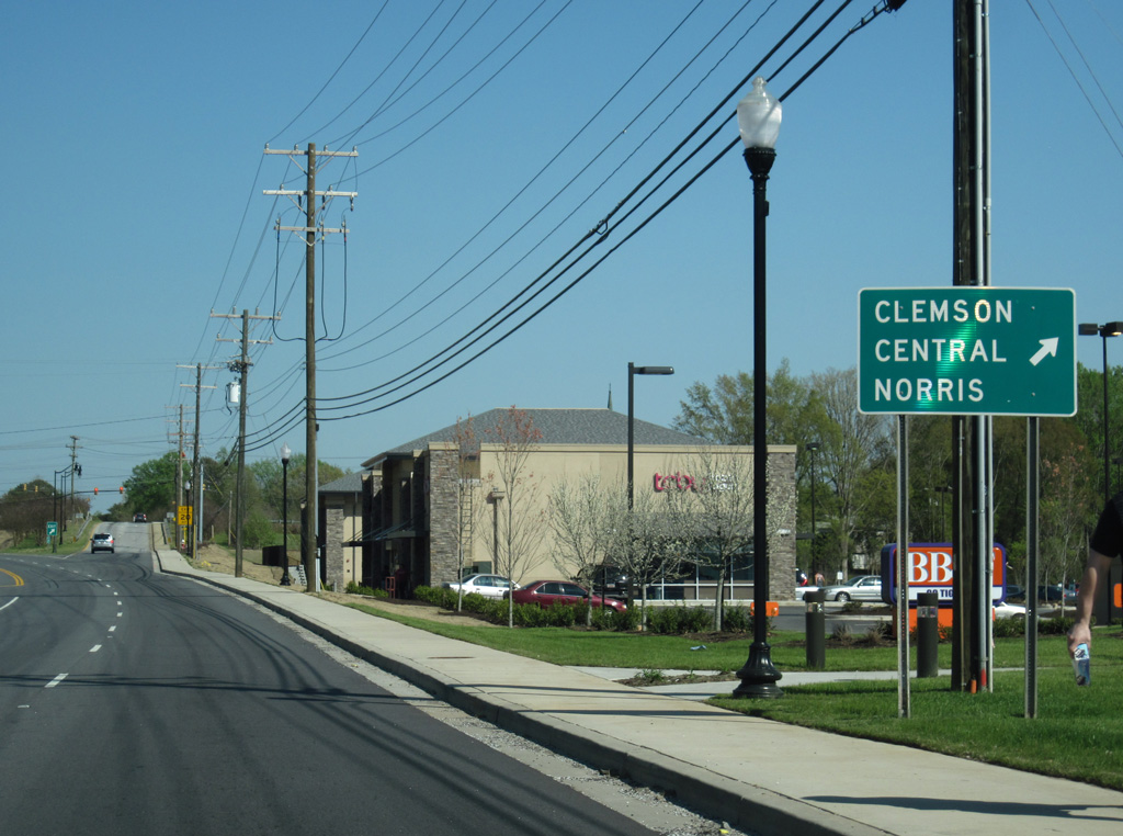
| S.C. 133 runs 20.54 miles north from Clemson to S.C. 11 (Cherokee Foothills Scenic Highway) west of Nine Times. College Avenue south extends from U.S. 76-123 as a local street to Walter T. Cox Boulevard (old S.C. 93) at Clemson University. 04/12/14 |
|
| College Avenue takes S.C. 133 north to a series of causeways and a bridge across the Twelve Mile Creek arm of Lake Hartwell. S.C. 133 overlaps with S.C. 137 through the town of Six Mile in 8.12 miles. This shield was replaced by 2015. 04/12/14 |
|
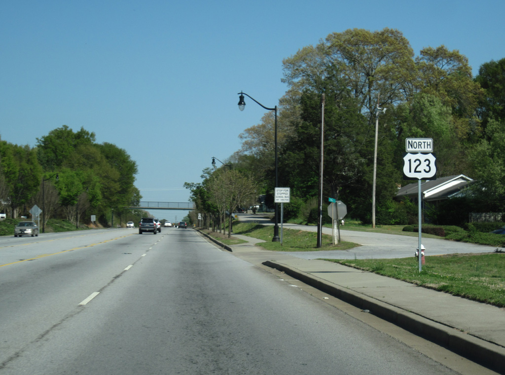
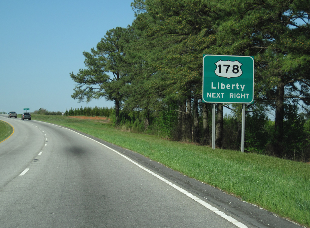
| U.S. 76 east / S.C. 28 south partition with U.S. 123 (Tiger Boulevard) north and continue south to adjacent Pendleton and the city of Anderson. 04/12/14 |
|
| U.S. 76 comprises a four lane highway southeast 11.1 miles to Interstate 85. South from there, S.C. 28 separates onto an at-grade bypass of Anderson while U.S. 76 advances to the city center alongside U.S. 178. 04/12/14 |
|
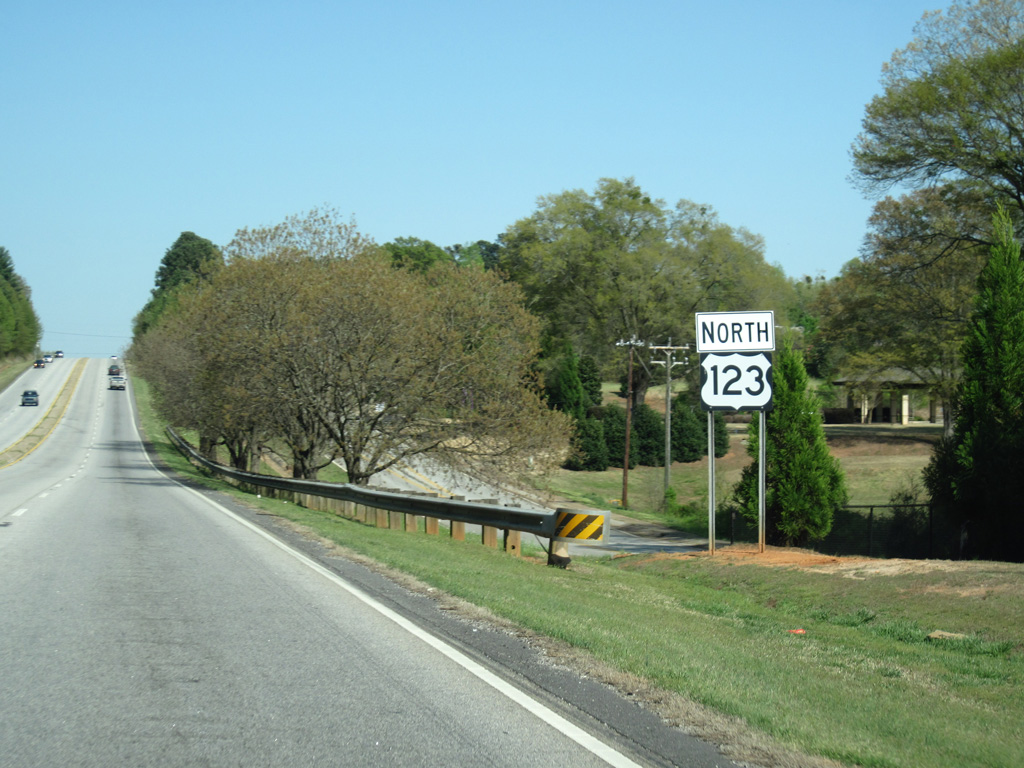
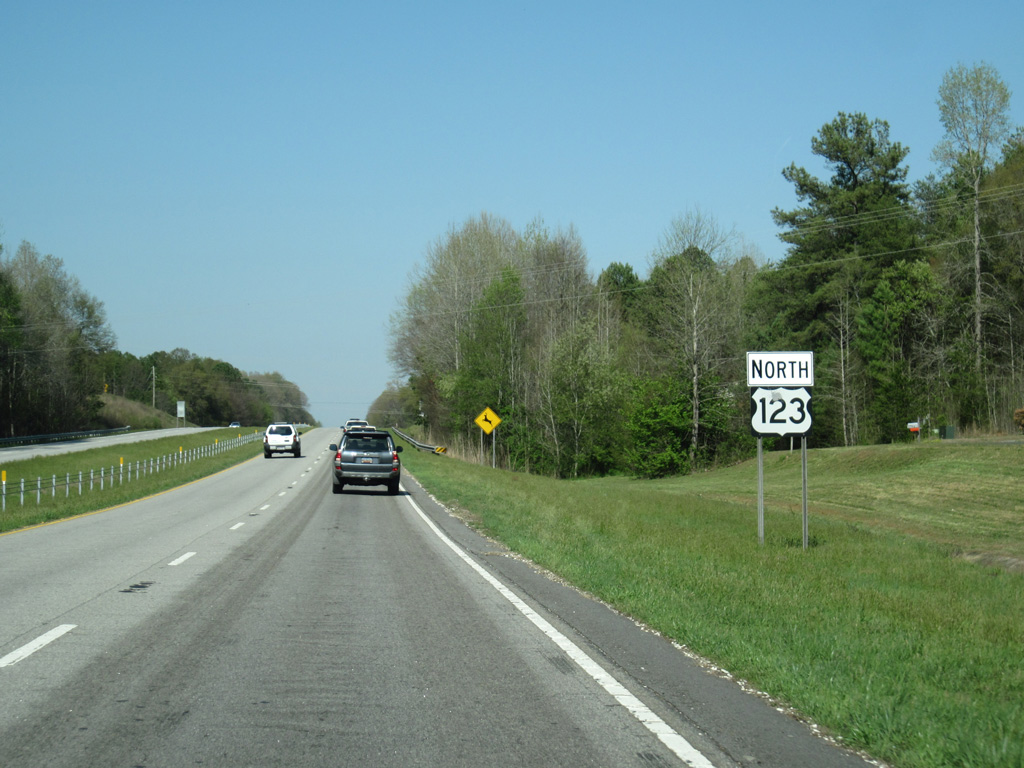
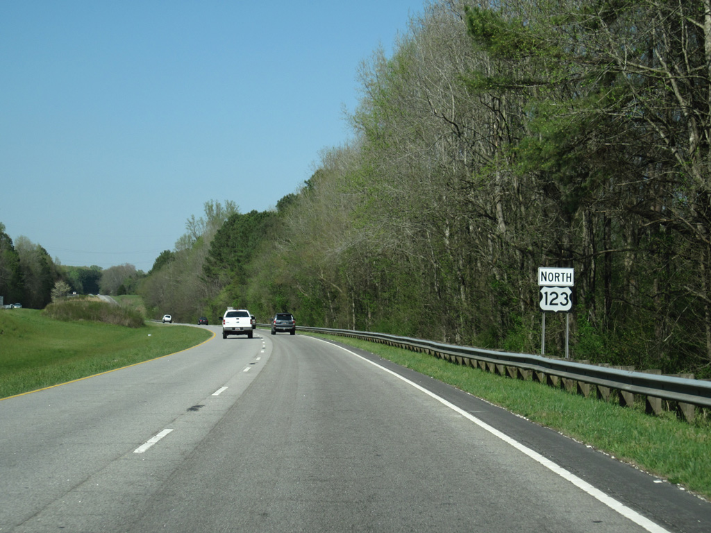
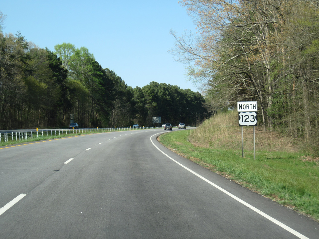
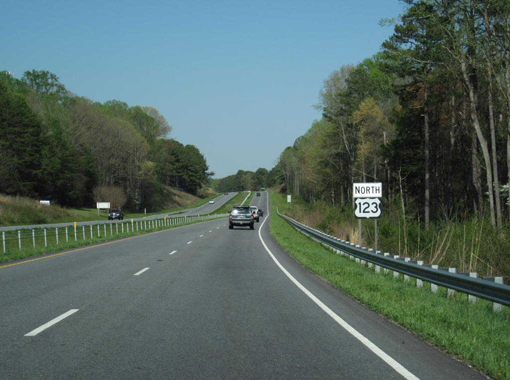
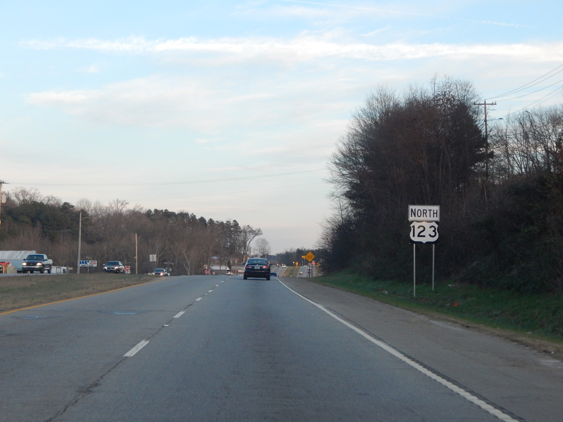
| U.S. 123 (Tiger Boulevard) north travels solo for the first time since Westminster, 17 miles to the west, as it advances through eastern reaches of Clemson. 04/12/14 |
|
| S.C. 93 (Main Street) angles northeast from U.S. 76/S.C. 28 near Clemson University to U.S. 123. The state highway follows the old alignment of U.S. 123 leading north through Central, Norris and Liberty. 04/12/14 |
|
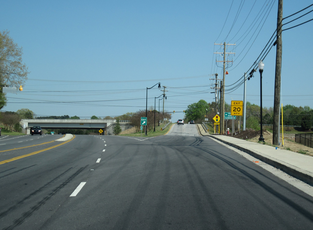
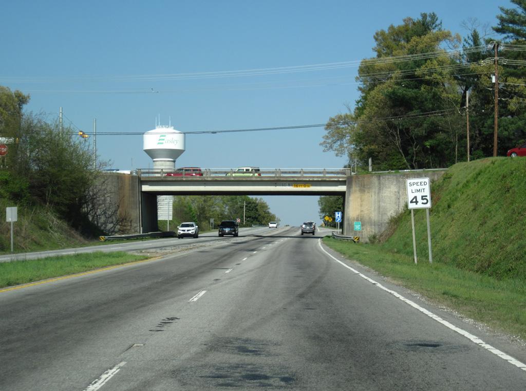
| The diamond interchange with S.C. 93 (Main Street) replaced a parclo interchange. U.S. 123 commences as a freeway east to Easley. 04/12/14 |
|
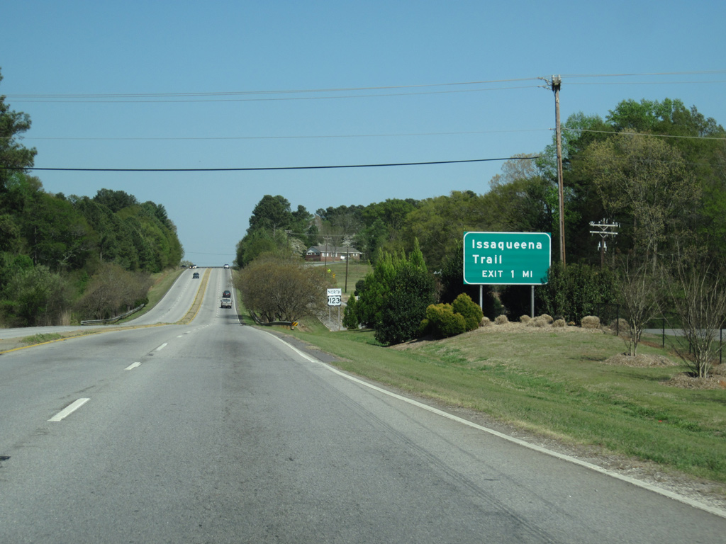
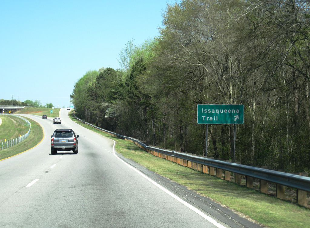
| U.S. 123 next meets Issaqueena Trail at a diamond interchange in one mile. 04/12/14 |
|
| A frontage road parallels the south side of U.S. 123 from S.C. 93 (Old Greenville Highway) to Berkeley Drive. A handful of residential streets are located nearby. 04/12/14 |
|
| Issaqueena Trail forms an arc around east Clemson north from S.C. 288 (Pendleton Road) to S.C. 93 in the city of Central. 04/12/14 |
|
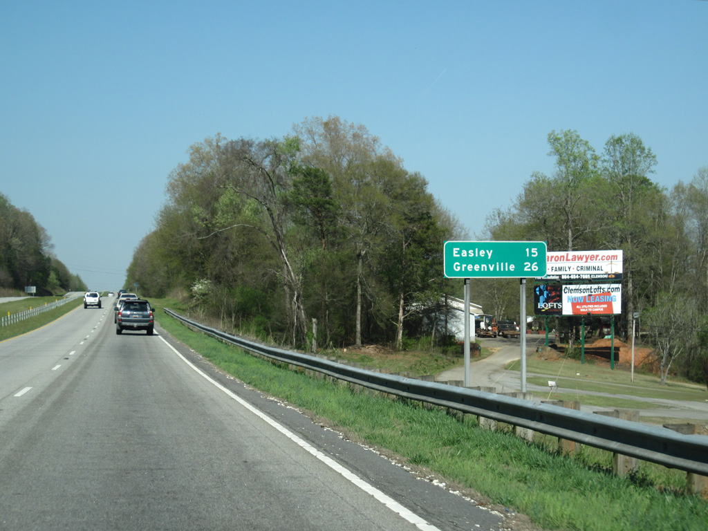
| The U.S. 123 freeway becomes more rural beyond the Clemson city line as the freeway parallels Eighteenmile Creek. 04/12/14 |
|
| The city of Easley lies 15 miles ahead, followed by Greenville in 26 miles. 04/12/14 |
|
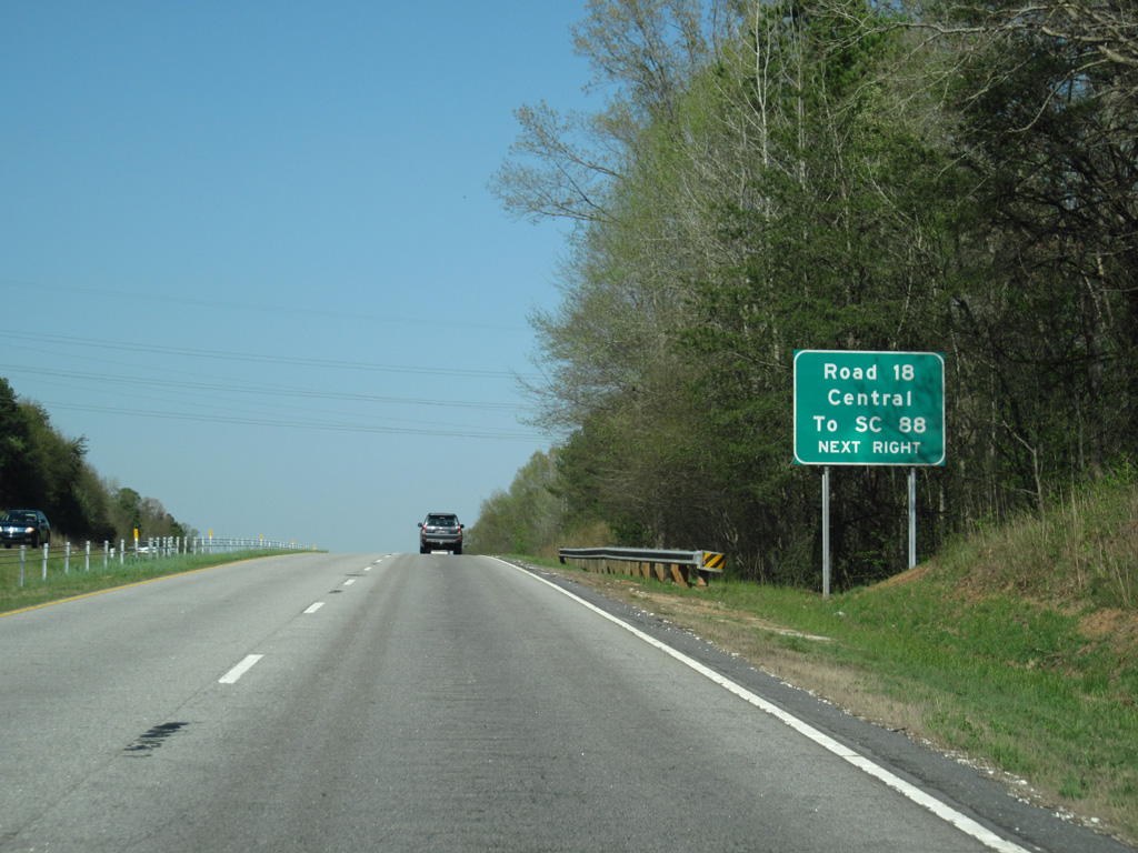
| Road 18 stems north from S.C. 88 along Eighteenmile Road to meet U.S. 123 at the Central city line. 04/12/14 |
|
| An antiquated diamond interchange joins U.S. 123 with Road 18. Road 18 takes Church Street north to Central, which is home to Southern Wesleyan University. 04/12/14 |
|
| U.S. 123 winds east through increasingly hilly terrain from Road 18. 04/12/14 |
|
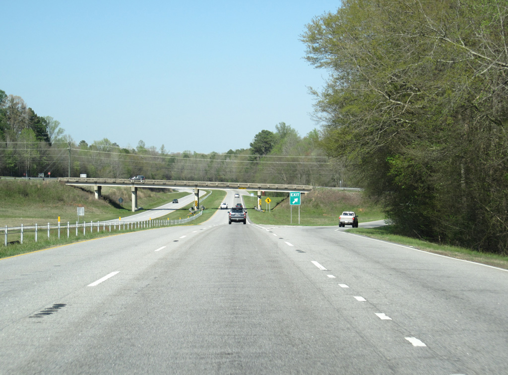
| Thick forest spreads both south and north of the U.S. 123 freeway as it passes under Road 44. Fifteenmile Creek flows along the north side of the US route here as well. 04/12/14 |
|
| U.S. 123 stays south of Norris and Liberty to the off-ramp with Road 27 (Ruhamah Road). 04/12/14 |
|
| Road 27 leads north from the diamond interchange at U.S. 123 to Calhoun Street in the city of Liberty and south to U.S. 178 at the Anderson County line. 04/12/14 |
|
| U.S. 123 remains rural as it stays beyond the outskirts of Liberty. 04/12/14 |
|
| U.S. 178 meanders north from Anderson to meet the U.S. 123 freeway near Five Forks and the Liberty city line. The highway connects U.S. 123 with Downtown Liberty. 04/12/14 |
|
| A nearly intrastate route, U.S. 178 runs 233 miles northwest from Ridgeville to Rosman, North Carolina. The bulk of the route consists of local two lane roads. 04/12/14 |
|
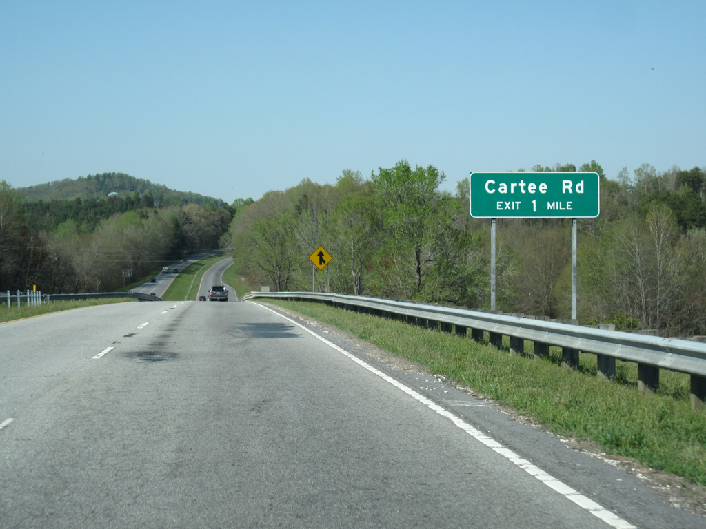
| Bogg Mountain appears to the north as U.S. 123 turns eastward to Cartee Road and the Pickens County Commerce Park. 04/12/14 |
|
| Reassurance marker posted after the on-ramp from U.S. 178. 04/12/14 |
|
| Cartee Road constitutes a local road leading northeast from U.S. 178 to a diamond interchange with U.S. 123 at the aforementioned commerce park. The road extends north to S.C. 93 (Greenville Highway). 04/12/14 |
|
| U.S. 123 passes to the south of the Whispering Pines community. Situated along the southbound lanes on this stretch is a stone monument for the John C. Calhoun Memorial Highway. 04/12/14 |
|
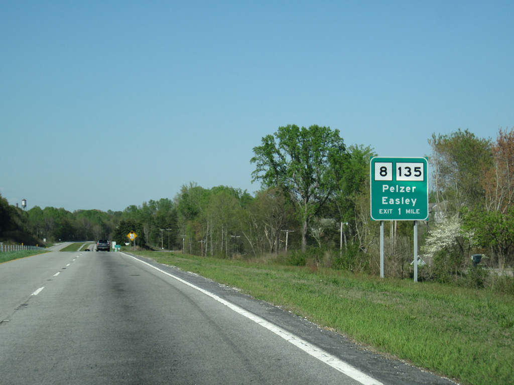
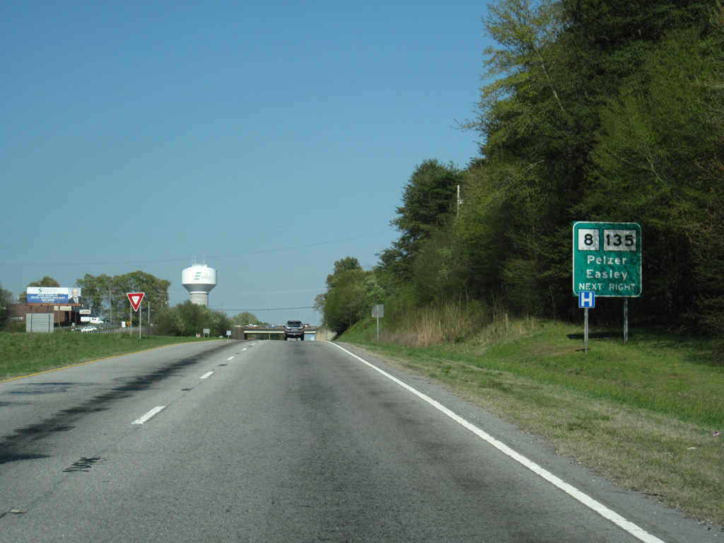
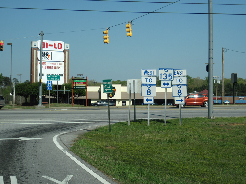
| S.C. 8/135 combine along Pendleton Street just south of U.S. 123 (Calhoun Memorial Highway) in one mile. S.C. 135 follows Pendleton Street north to Downtown Easley while S.C. 8 turns westward along 5th Street. 04/12/14 |
|
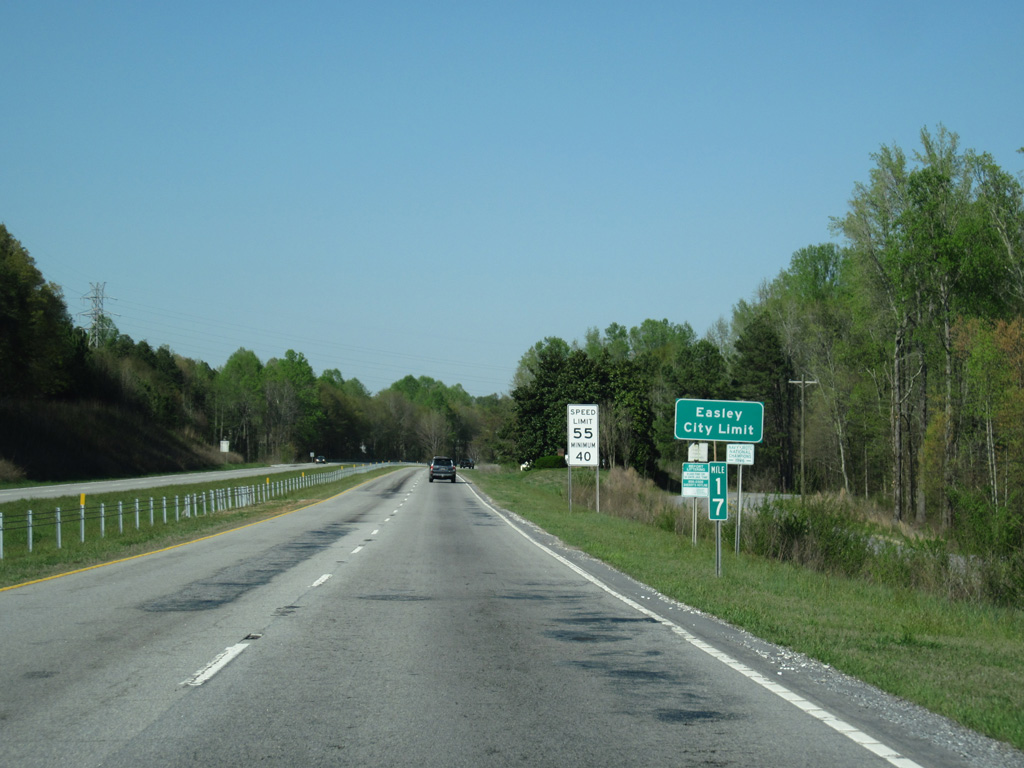
| Speed limits reduce to 55 miles per hour as U.S. 123 enters the city of Easley. 04/12/14 |
|
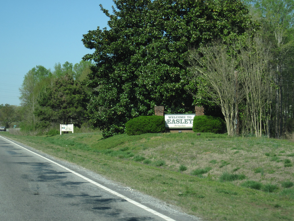
| A welcome sign for Easley follows as U.S. 123 approaches the wye interchange with Ross Avenue east. 04/12/14 |
|
| An antiquated diamond interchange joins U.S. 123 with S.C. 135 (Pendleton Street) at Ross Avenue. S.C. 135 forms a 20 mile route north from U.S. 178 to S.C. 8 near Pumpkintown. 04/12/14 |
|
| Motorists depart U.S. 123 north for S.C. 135 (Pendleton Street) beyond the 5th Street (S.C. 8) overpass. U.S. 123 transitions into a commercial arterial east from Pendleton Street. 04/12/14 |
|
| S.C. 8 travels 44.6 miles overall between U.S. 25 at Ware Place and U.S. 276 near Caesars Head. Pelzer is a 17 mile drive to the southeast. 04/12/14 |
|
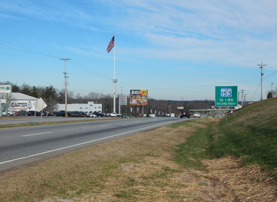
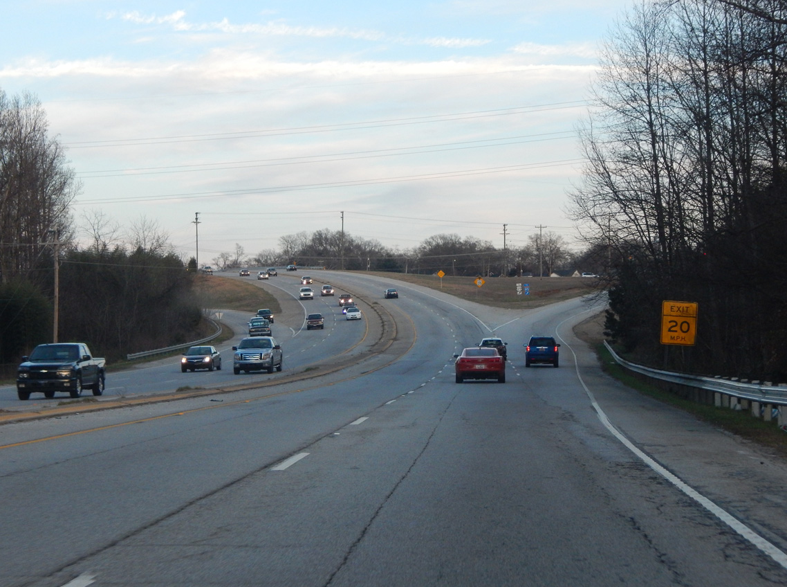
| Leaving the Easley commercial corridor, U.S. 123 approaches a parclo interchange with S.C. 153. S.C. 153 leads southeast along a four lane, divided highway to Interstate 85 and I-185 (Southern Connector). Future construction extends the route north and west to Prince Perry Road. 01/14/16 |
|
| U.S. 123 advances east from S.C. 153 by a number of industrial businesses. Intersecting the route next is Kay Drive south and Turner Hill Road north. 01/14/16 |
|
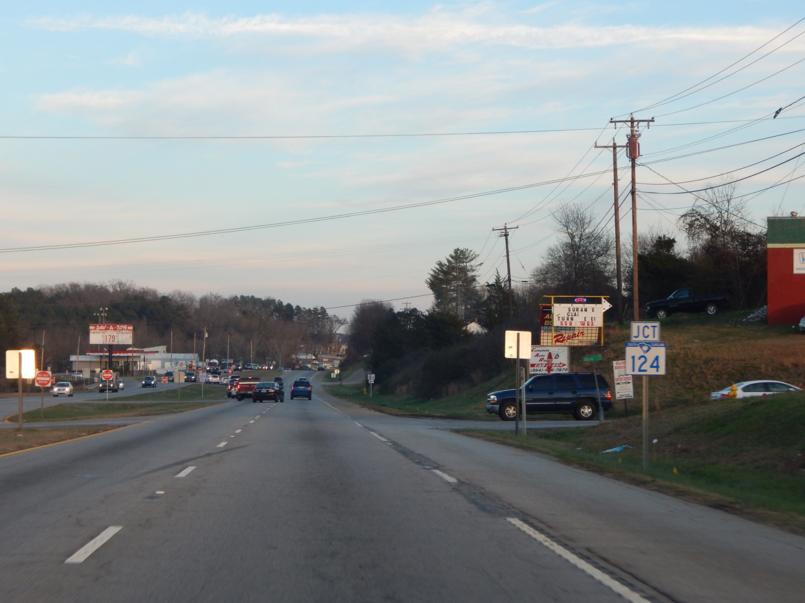
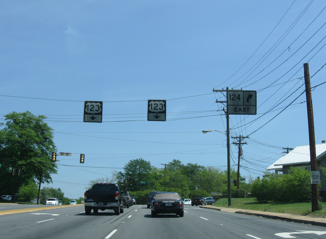
| S.C. 124 (Old Easley Highway) branches north from U.S. 123 near Greenville Pickens Speedway along the former route of U.S. 123 and U.S. 123 Alternate. 01/14/16 |
|
| A 5.5 mile route, S.C. 124 primarily serves local traffic to the city of Greenville. U.S. 123 meets the state highway again at Pendleton Street. 01/14/16 |
|
| U.S. 123 (Calhoun Memorial Highway) north next intersects Fishtrap Road. 01/14/16 |
|
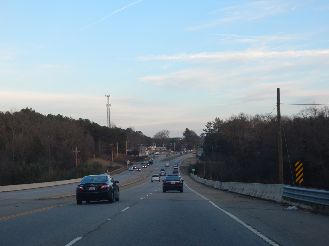
| Spanning the Saluda River east of Fishtrap Road on U.S. 123 north. 01/14/16 |
|
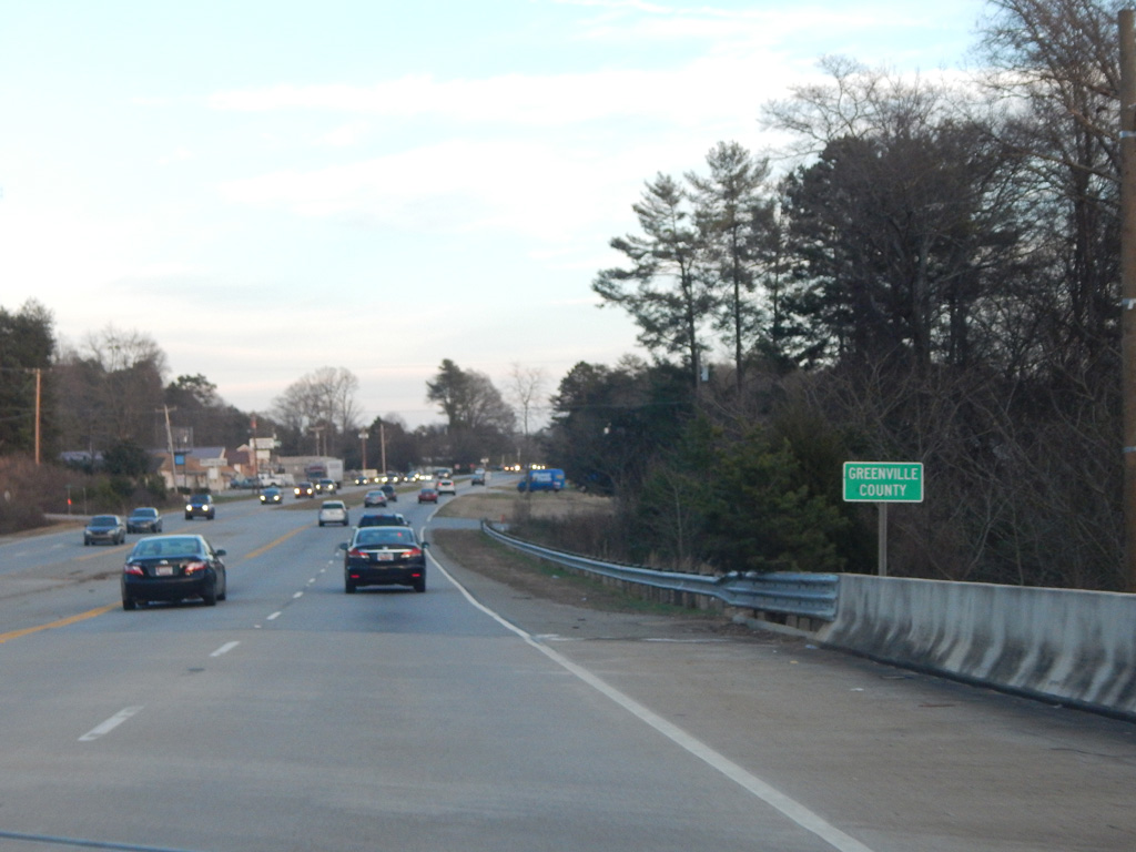
| U.S. 123 formally enters Greenville County at the Saluda River. 01/14/16 |
|
| Northbound U.S. 123 reassurance marker posted after the county line. 01/14/16 |
|
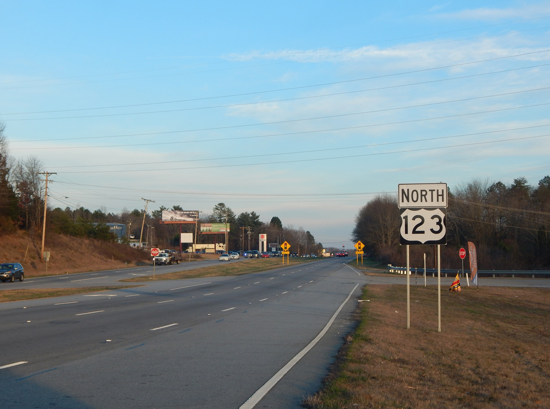
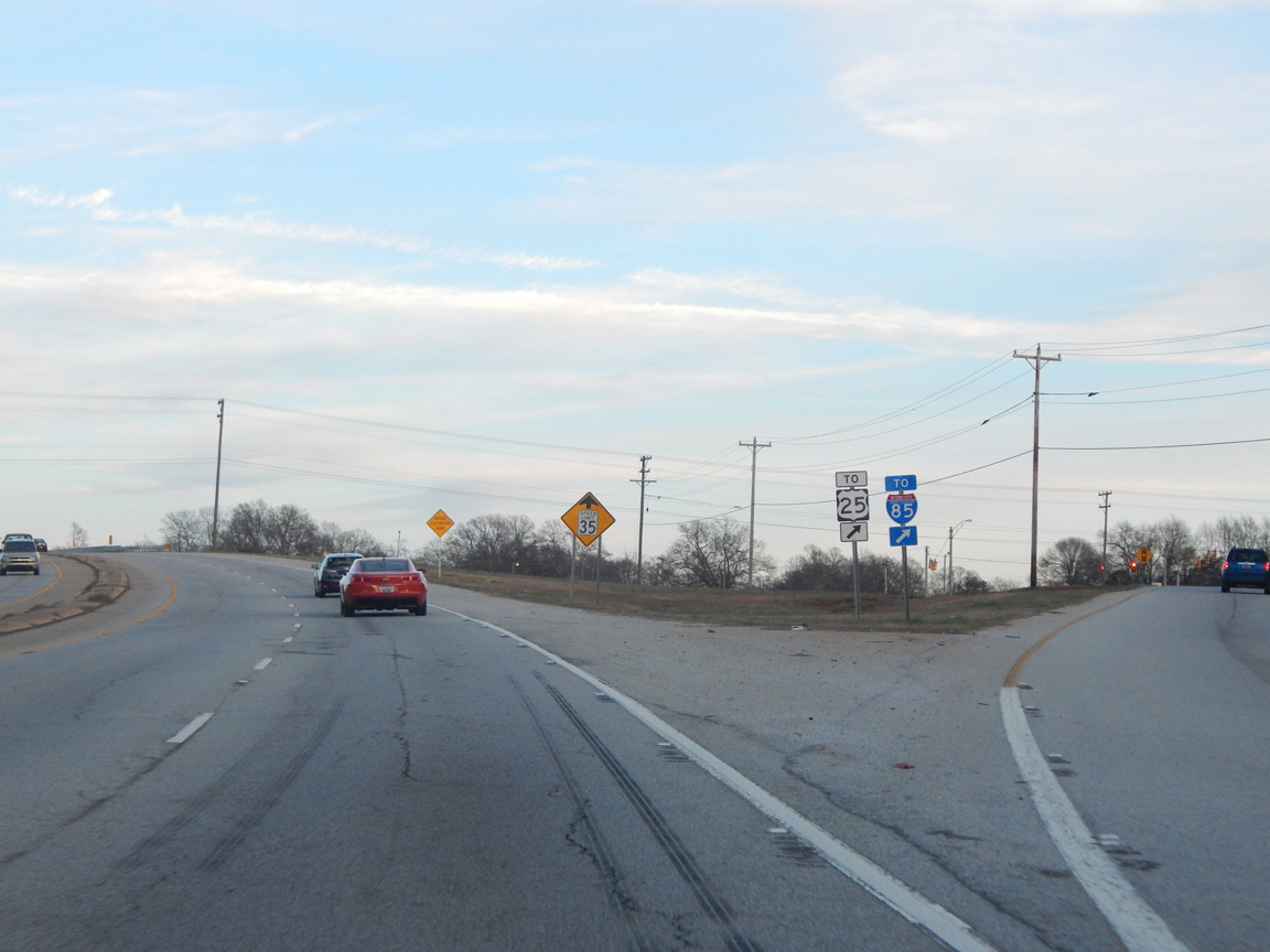
| U.S. 123/25 (White Horse Road) come together at a diamond interchange by the unincorporated community of Welcome. 01/14/16 |
|
| U.S. 25 travels an arterial-style bypass around the west side of Greenville from Gantt and White Horse north to U.S. 276 at Travelers Rest. 01/14/16 |
|
| U.S. 123 transitions into an urban boulevard east to the city of Greenville. Just beyond the city line is the second meeting with S.C. 124 (Pendleton Street). S.C. 124 concludes 0.49 miles to the east at the north end of S.C. 81 (Anderson Street). 04/14/12 |
|
| U.S. 123 (Academy Street) runs between McPherson Park and Springwood Cemetery to U.S. 29 (N Church Street), 0.23 miles from Business Spur I-385 (E North Street). 08/07/13 |
|
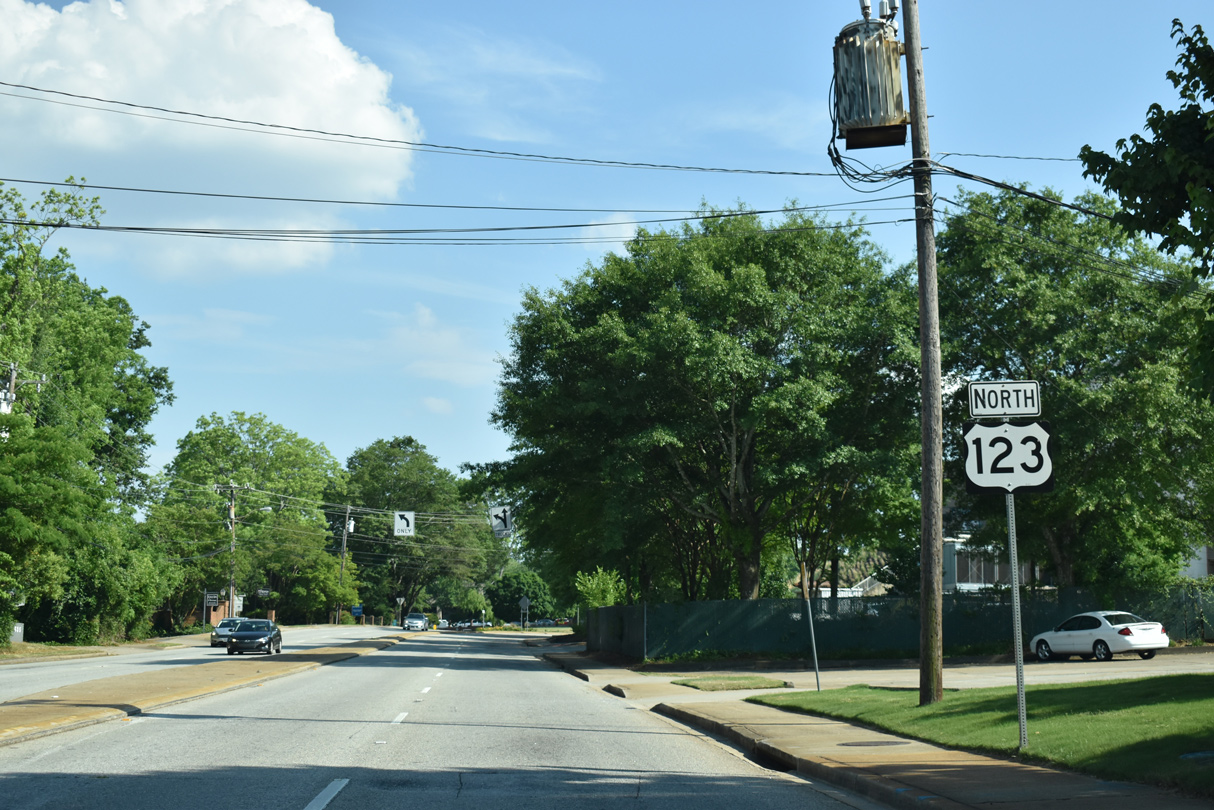
| The last confirming marker for U.S. 123 north stands just beyond U.S. 29 (N Church Street) and ahead of the Bon Secours Wellness Arena. 05/25/21 |
|
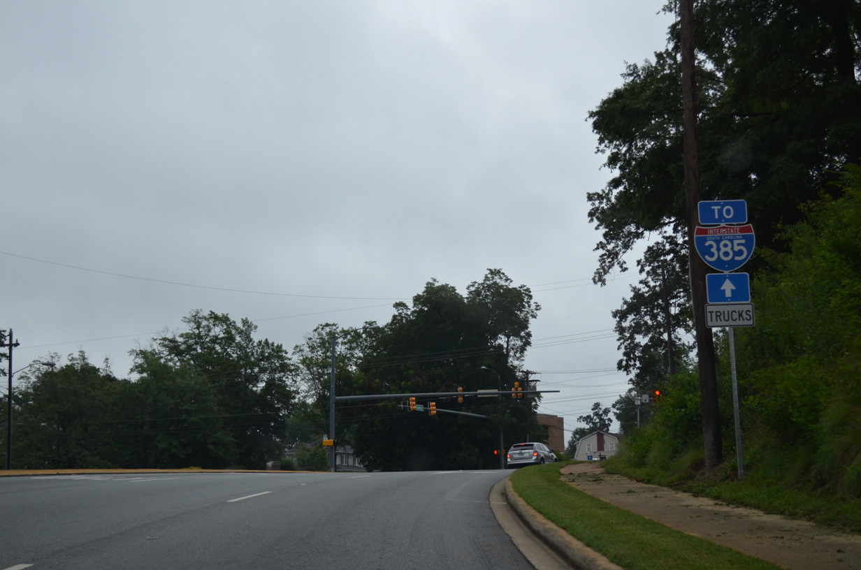
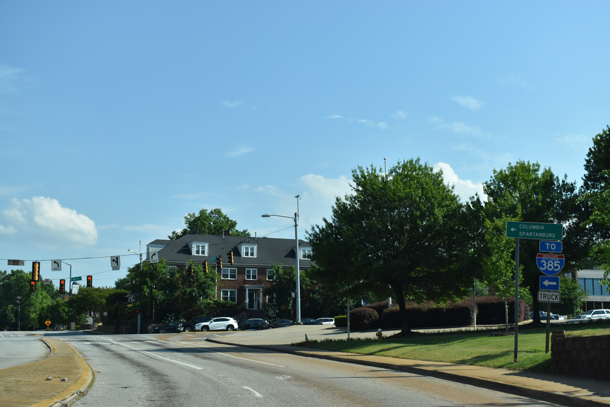
| U.S. 123 (Academy Street) ends at unsigned Business Spur I-385 (North Street) across from Williams Street. Beginning two blocks to the east, Interstate 385 is a 42.16 mile long route joining Greenville with Columbia via I-26 east and Spartanburg via I-85 north. 05/25/21 |
Page Updated 09-25-2021.

 East
East  North
North