|
| U.S. 290 travels southwest two miles from Burton to split with SH 237. SH 237 continues the southwest trajectory of U.S. 290 to Round Top, Warrenton and SH 159 near La Grange. 09/27/06 |
|
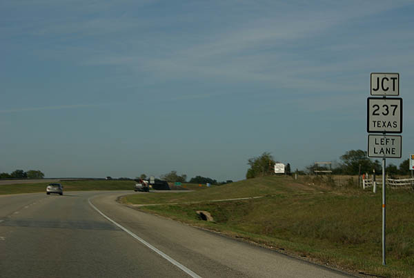
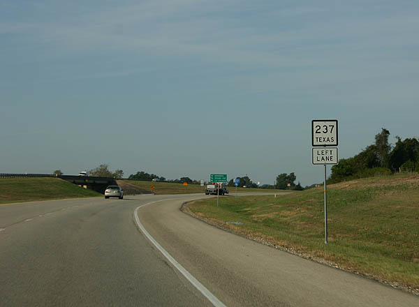
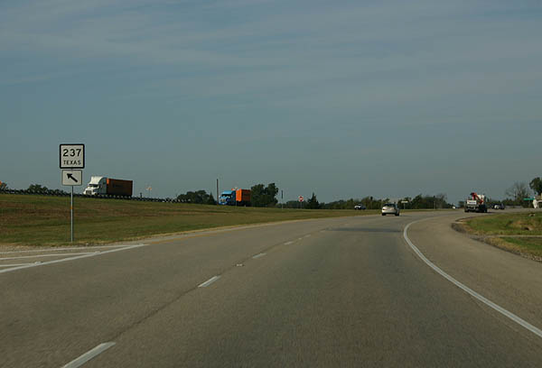
| SH 237 south departs from U.S. 290 west at a wye interchange. SH 237 heads 7.6 miles southwest to Round Top. La Grange is 22 miles away via SH 237 and 159. 09/27/06 |
|
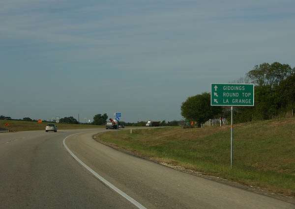
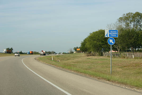
| The Texas Independence Trail follows SH 237 southwest to SH 159 and La Grange. 09/27/06 |
|
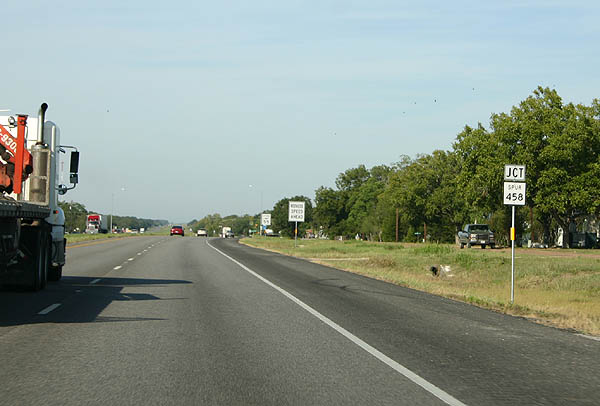
| Entering the city of Carmine, U.S. 290 crosses paths with the north end of Spur 458 at Celebration Street. Spur 458 provides a 2.41 mile connector between Carmine and SH 237. 09/27/06 |
|
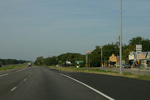
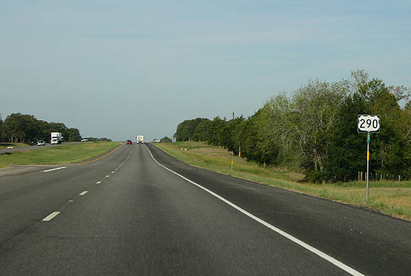
| U.S. 290 gains frontage roads briefly through Carmine as it crosses into Fayette County. Spur 458 provides a direct route between the city and Round Top via SH 237. Celebration Street stems north from the spur end to Hauptstrasse Street and rural northwest Washington County. 09/27/06 |
|
| Continuing west from Carmine, U.S. 290 advances 5.4 miles to Ledbetter. The highway nips two sections of Washington County on the drive. 09/27/06 |
|
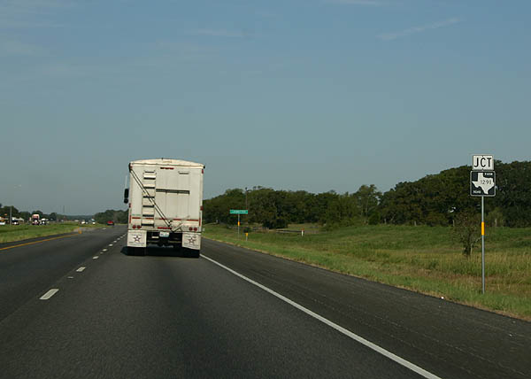
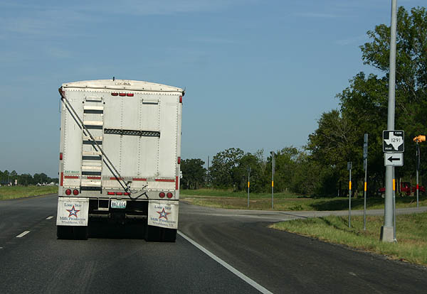
| FM 1291 meets U.S. 290 at the unincorporated community of Ledbetter. The north-south route joins the community with Waldeck 6.1 miles away. 09/27/06 |
|
| FM 1291 overall joins U.S. 290 at Ledbetter with Fayetteville (SH 159), 21 miles to the southeast. The highway serves Walhalla on the drive and ends at Frelsburg north of Columbus. 09/27/06 |
|
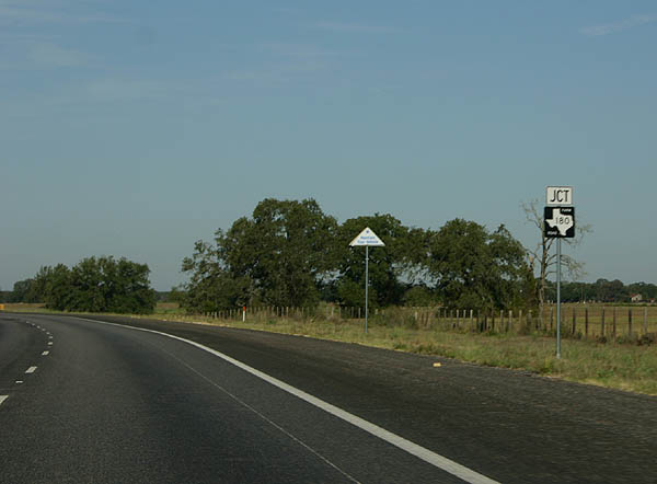
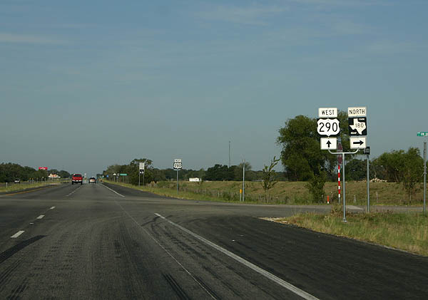
| Continuing west, U.S. 290 enters Lee County and approaches FM 180, a rural route straddling eastern Lee County between U.S. 290 and Somerville Lake. 09/27/06 |
|
| U.S. 290 west at FM 180. FM 180 begins and travels 13.1 miles northeast to the Nails Creek unit of Lake Somerville State Park. 09/27/06 |
|
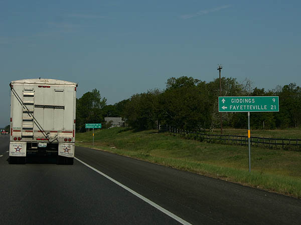
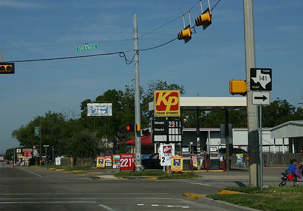
| Traveling across the city of Giddings, U.S. 290 (Austin Street) intersects FM 141 (Orange Street). FM 141 constitutes a 21 mile route northeast from Giddings to Dime Box and the Lake Somerville State Park area. 09/27/06 |
|
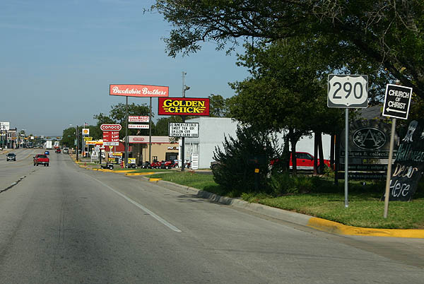
| Confirming marker for U.S. 290 (Austin Street) west posted after FM 141 (Orange Street). Austin Street is a five lane commercial arterial. 09/27/06 |
|
| U.S. 77 (Main Street) crosses paths with U.S. 290 (Austin Street) in Downtown Giddings. The U.S. route joins Giddings with La Grange 20 miles to the south and Lincoln nine miles to the north. 09/27/06 |
|
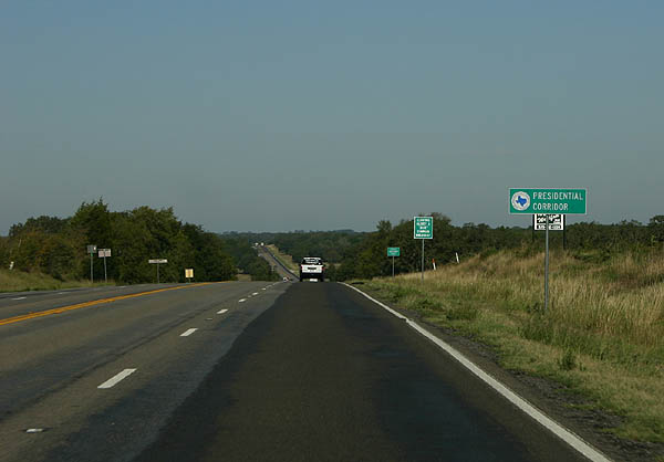
| U.S. 290 becomes part of the Presidential Corridor west of SHs 21, but a sign posted by the Bastrop County line indicates it is already a part of the corridor. Signed by legislation on September 1, 1997, the Presidential Corridor overlays U.S. 290 from IH 35 in Austin to SH 21, and SH 21 from U.S. 290 to SH 6 in Bryan.1 09/27/06 |
|
| U.S. 290 within Lee County is designated the Henry G. "Bud" Lehman Highway. 09/27/06 |
|
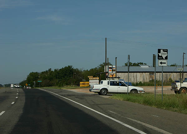
| Nearing the intersection with FM 2104 on U.S. 290 west at Paige. U.S. 290 expands into a four lane, divided highway through the unincorporated community. 09/27/06 |
|
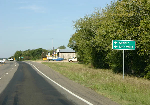
| FM 2104 meanders 12.49 miles south from U.S. 290 and Dallas Street in Paige to FM 153 near Lake Thunderbird and Smithville. FM 2239 stems east from the highway to Serbin. 09/27/06 |
|
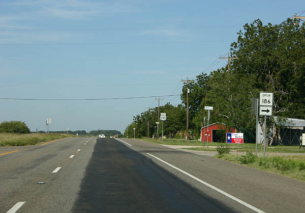
| Spur 186 overlaps a 0.176 mile segment of Gonzales Street northward from U.S. 290 to Old Highway 20 East. 09/27/06 |
|
| Gonzalez Street extends north from SS 186 and Old Highway 20 E to link U.S. 290 with SH 21. 09/27/06 |
|
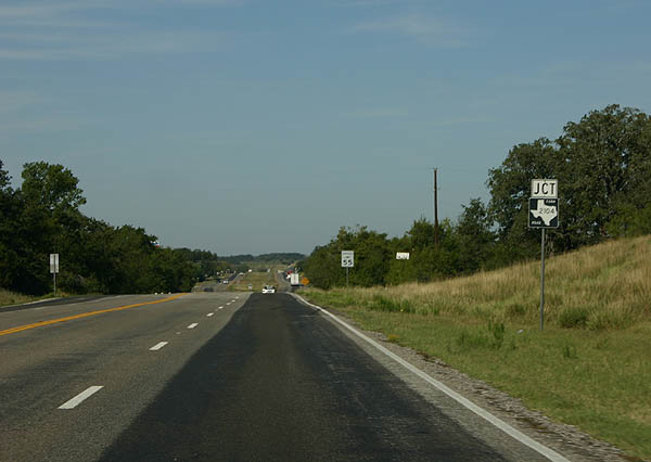
| SH 21 and U.S. 290 converge at a diamond interchange west of Paige. 09/27/06 |
|
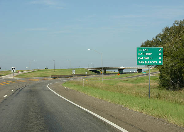
| Texas 21 travels northeasterly from U.S. 290 to Lincoln, Caldwell and Bryan. 09/27/06 |
|
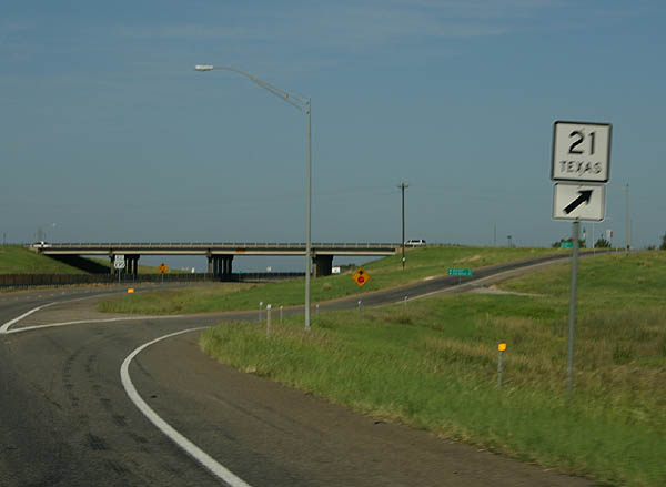
| Westbound U.S. 290 at the off-ramp for SH 21 west of Paige. SH 21 heads 13 miles west to merge with SH 71 at Bastrop. The state highway ends 59 miles to the southwest at San Marcos. 09/27/06 |
|
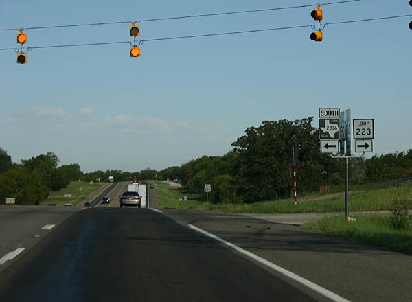
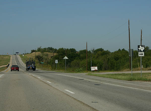
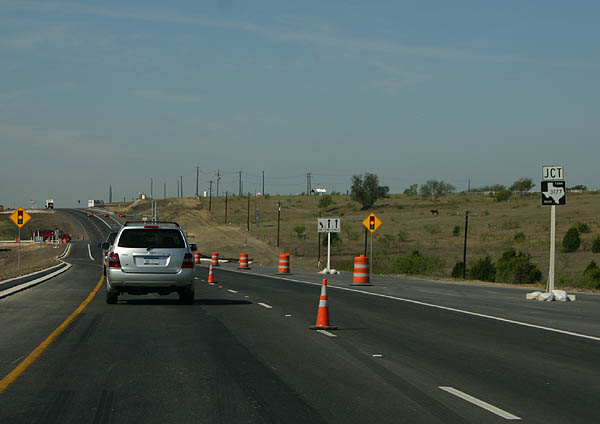
| U.S. 290 arcs northwest from SH 21 toward the community of McDade where the highway meets both Loop 223 and FM 2336. FM 2236 branches southwest around Camp Swift Military Reservation to SH 95 north of Bastrop. Loop 223 acts as a business route for U.S. 290 into the McDade business district. 09/27/06 |
|
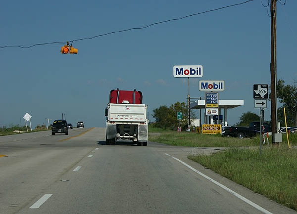
| U.S. 290 continues northwest from McDade to FM 696 near the community of Butler. FM 696 travels east 22 miles to U.S. 77 at Lexington. 09/27/06 |
|
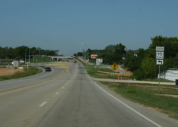
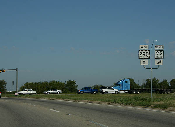
| U.S. 290 west combines with SH 95 north at a wide intersection on the east side of Elgin. SH 95 enters the city from Cedar Hills and the Texas National Guard Camp Swift area. The state highway travels 17 miles south to SH 21 & 71 in Bastrop. 09/27/06 |
|
| U.S. 290 west at SH 95 south and Martin Luther King Boulevard north in east Elgin. 09/27/06 |
|
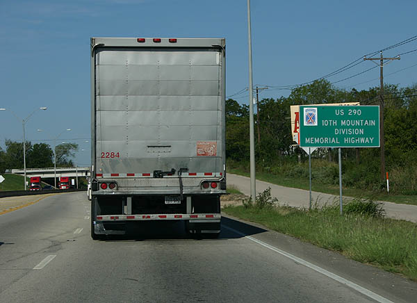
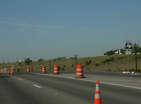
| U.S. 290 & SH 95 overlap for 1.9 miles along a bypass route south of central Elgin. The route doubles as the 10th Mountain Division Memorial Highway. Ahead the pair pass under the Union Pacific Railroad line and FM 1704 (Main Street). 09/27/06 |
|
| Loop 109 constitutes the main route through Downtown Elgin from both U.S. 290 and SH 95. The state highway also provides a connection to FM 1704 (Main Street) south, which heads ten miles southwest to FM 969 near Webberville. 09/27/06 |
|
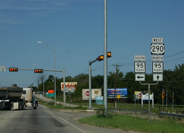
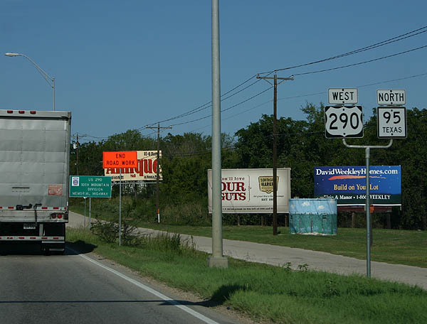
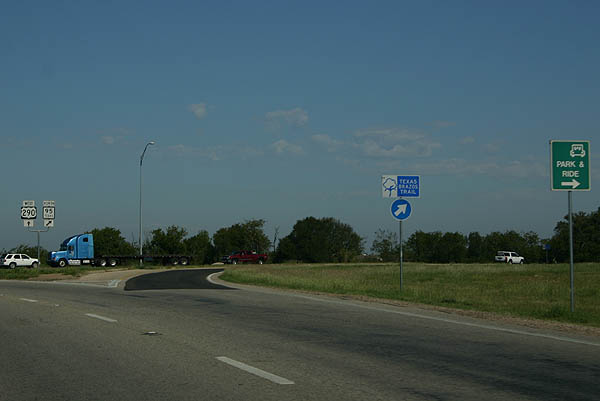
| Westbound at the partition with SH 95 on U.S. 290 west. SH 95 leaves at an at-grade intersection and resumes a northward course toward Coupland and Taylor. The state highway eventually ends in Temple. The Brazos Trail, like the Texas Independence Trail, utilizes a variety of U.S. and state highways along a full loop. SH 95 continues the trail northwest from U.S. 290 to Holland. 09/27/06 |
|
| Progressing through west Elgin, U.S. 290 enters Travis County an continues west 5.3 miles to FM 1100. FM 1100 loops west from SH 95 to Kimbro and south to U.S. 290. 09/27/06 |
|
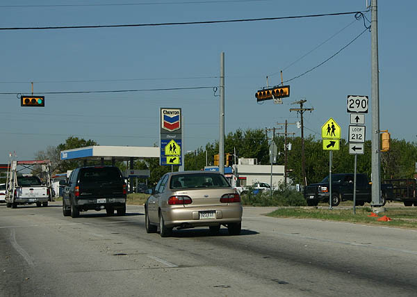
| Suburban development increases along U.S. 290 west through the city of Manor. SL 212 connects the arterial route with the city center along a 2.11 mile course. FM 973 heads northeast from the east end of SL 212, 19 miles to Taylor and U.S. 79. FM 973 also extends south from SL 212 in Downtown Manor to Lake Walter E. Long, Del Valle, Moores Crossing and U.S. 183 near Maha. 09/27/06 |
|
| Loop 212 returns to U.S. 290 via Lexington Street north and Murray Avenue west. Hill Lane stems northwest from their intersection to Manor High School and Manor Downs. 09/27/06 |
|
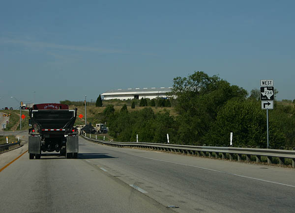
| U.S. 290 reaches the easternmost extent of Austin at FM 734 (Parmers Lane). Parmers Lane constitutes an east-west belt arterial through Austin, beginning at U.S. 290 and ending at FM 1431 (Whitestone Boulevard) at Cedar Park. 09/27/06 |
|
| Construction to add the express lanes for Toll 290 upgraded the intersection with FM 734 (Parmer Lane) into an interchange. U.S. 290 shifts onto the at-grade frontage roads while Toll 290 travels between.
FM 734 meanders northwest through growing suburbs to IH 35 at Exit 245. 09/27/06 |
|
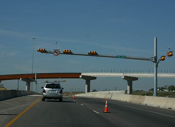
| U.S. 290 next crosses paths with SH 130, the tolled eastern bypass freeway for the Austin metropolitan area. Connections between U.S. 290 and SH 130 utilize the respective frontage roads of each route. 09/27/06 |
|
| Included in initial construction for the SH 130 toll road, a short segment of U.S. 290 was upgraded to an expressway between FM 734 (Parmers Lane) and FM 3177 (Decker Lane). Decker Lane leads the FM Road southwest to Lake Walter E. Long Metropolitan Park and FM 969. 09/27/06 |
|
| FM 3177 (Decker Lane) stems 4.68 miles south from U.S. 290 to FM 969 in east Austin. 09/27/06 |
|
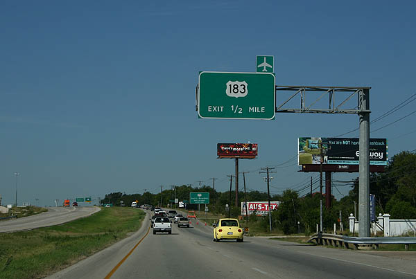
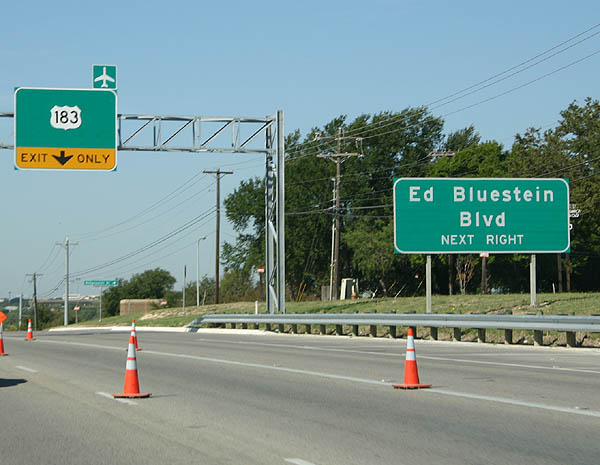
| U.S. 290 and U.S. 183 (Ed Bluestein Boulevard) converge at a four-level interchange. High speed ramps between the two routes are tolled as part of Toll 290 express lanes. 09/27/06 |
|
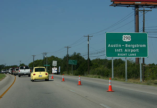
| U.S. 183 south from U.S. 290 to SH 71 leads to Austin-Bergstrom International Airport. Construction upgrades the arterial with express toll lanes. 09/27/06 |
|
| U.S. 183 arcs southward along Ed Bluestein Boulevard from the exchange with U.S. 290 / Toll 290 to Loop 111 (Airport Boulevard). North of U.S. 290, U.S. 183 follows a freeway alongside Anderson Lane to Loop 275 and Research Boulevard. 09/27/06 |
|
| U.S. 290 upgrades into a freeway west from U.S. 183 to IH 35. U.S. 183 extends northwest along a freeway to Research Boulevard and SH 45 N. U.S. 183 overall joins the Austin area with Lampasas and Briggs to the north and Mendoza and Luling to the south. 09/27/06 |
|
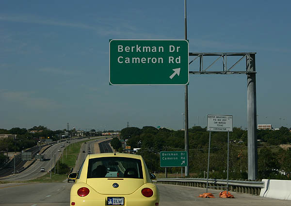
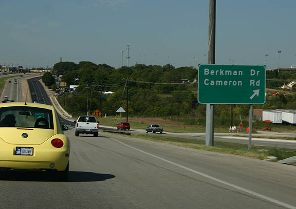
| A split diamond interchange joins the U.S. 290 freeway with Berkman Drive and Cameron Road adjacent to Reagan High School. Berkman Drive travels south to East 51st Street and north to St. Johns Avenue. 09/27/06 |
|
| An older Highway Gothic sign directing motorists onto the slip ramp for Berkman Drive and Cameron Road. Cameron Road follows a north-south arterial route between IH 35 at East 51st Street to U.S. 183 (Anderson Lane) and Dessau Road at Rundberg Lane. Cameron Road serves Capital Plaza Shopping Center and the Cameron Park neighborhood nearby. 09/27/06 |
|
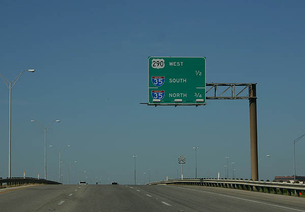
| Spanning Cameron Road, U.S. 290 advances one half mile west to the four-level interchange with IH 35. 09/27/06 |
|
| U.S. 290 turns south onto IH 35 for an eight mile overlap to bypass central Austin. 09/27/06 |
|
| A high speed flyover shuttles drivers from U.S. 290 west onto IH 35 south through Austin. IH 35 constitutes a heavily traveled and often congested route throughout the metropolitan area. 09/27/06 |
|
| The freeway from U.S. 290 continues as unmarked Spur 69 to Airport Boulevard and FM 2222 (Koening Lane). IH 35 travels north from Round Rock and Georgetown to Temple, Waco and Dallas-Fort Worth. 09/27/06 |
Page Updated 01-27-2018.