|
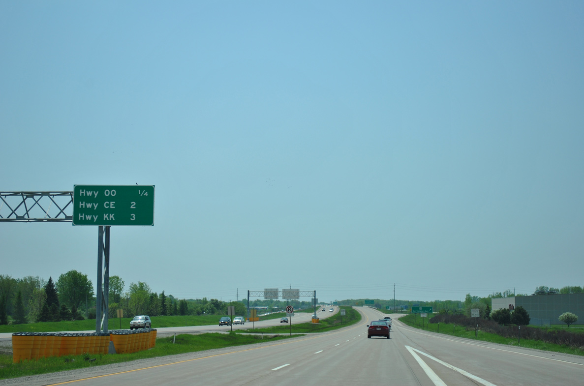
| Traffic from Interstate 41 combines just one quarter mile ahead of the diamond interchange with County OO. Two exits follow within three miles before Wis 441 crosses the Calumet County line. 05/30/11 |
|
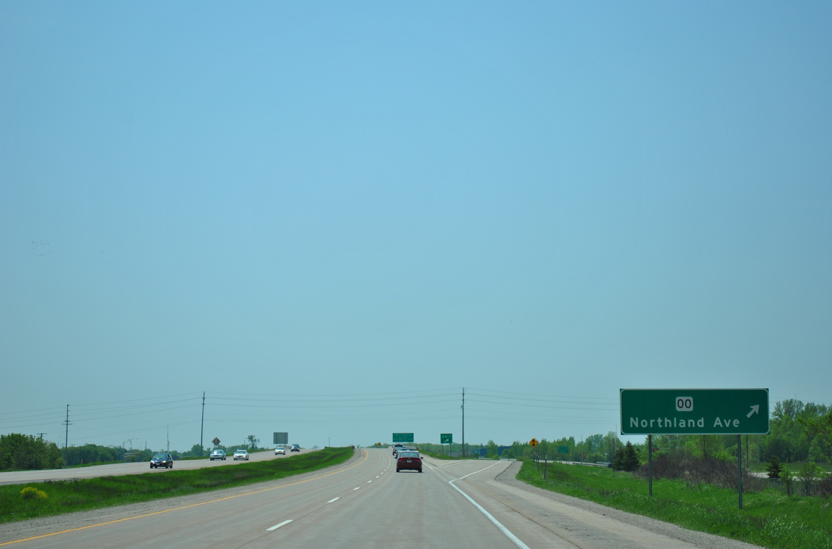
| County OO lines Northland Avenue west by an industrial park area into north Appleton. The country trunk highway east takes North Avenue through Little Chute by the Outagamie County Landfill to residential areas at Washington Street. 05/30/11 |
|
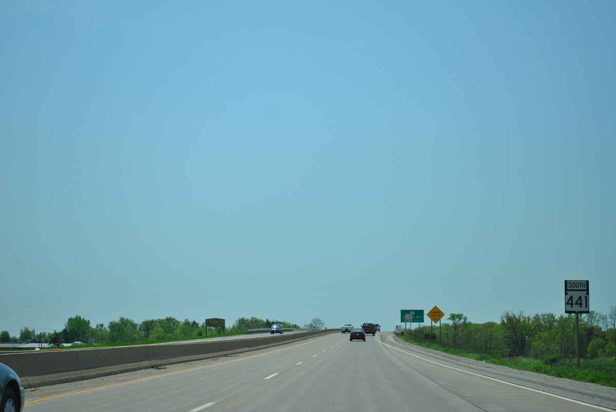
| Wis 441 south straddles the Appleton city and Little Chute village lines to the Fox River. 05/30/11 |
|
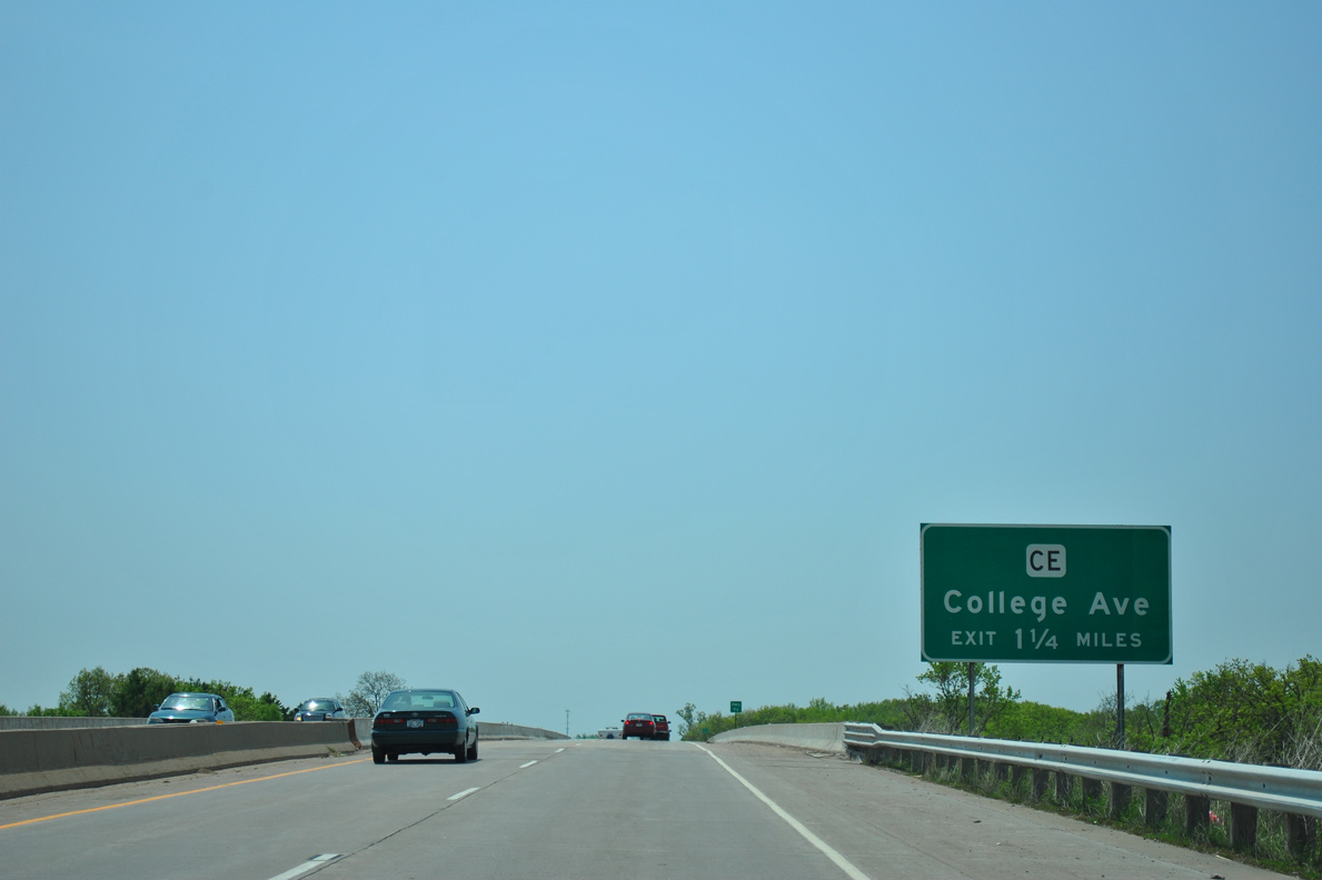
| The freeway elevates over a CN Railroad and Wis 96 (Wisconsin Avenue / Main Street) and next meets County CE (College Avenue) in 1.25 miles. 05/30/11 |
|
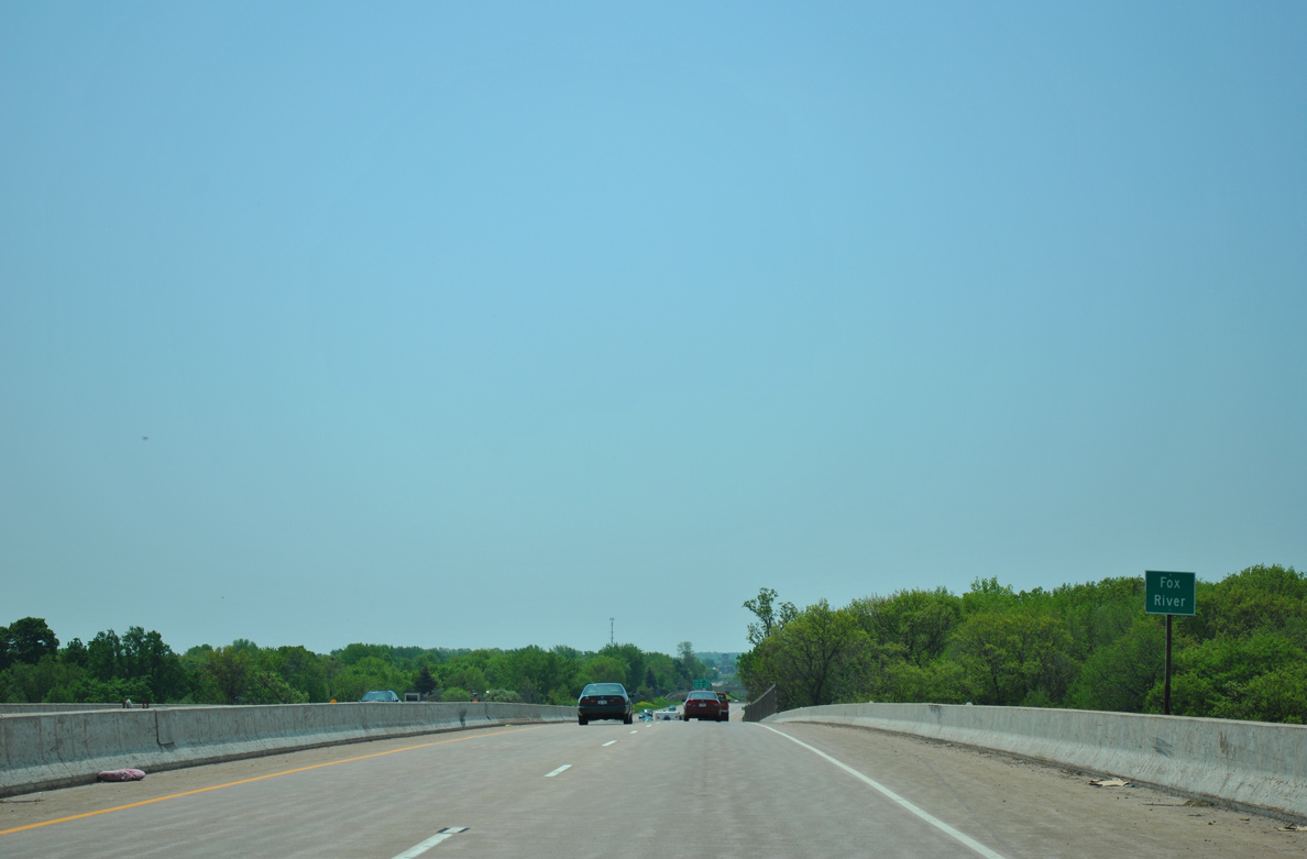
| Spanning the Fox River along Wis 441 south. The bridge opened in 1993. 05/30/11 |
|
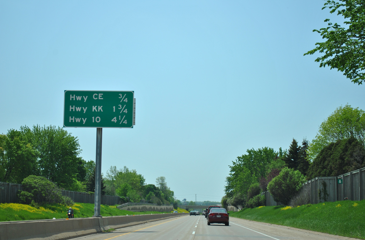
| Advancing south, STH-441 drops below grade between residential areas of east Appleton and west Kimberly on the 0.75 mile approach to County CE (College Avenue). U.S. 10 joins the freeway in 4.25 miles. 05/30/11 |
|
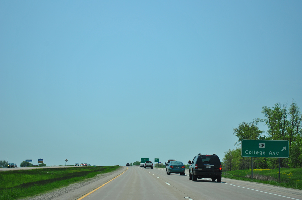
| Southbound STH-441 at the diamond interchange with CTH-CE (College Avenue). College Avenue leads west to cross the Fox River ahead of Lawrence University and Downtown Appleton. CTH-CE east comprises an expressway beyond the adjacent retail area to Wis 55 at Kaukauna. 05/30/11 |
|
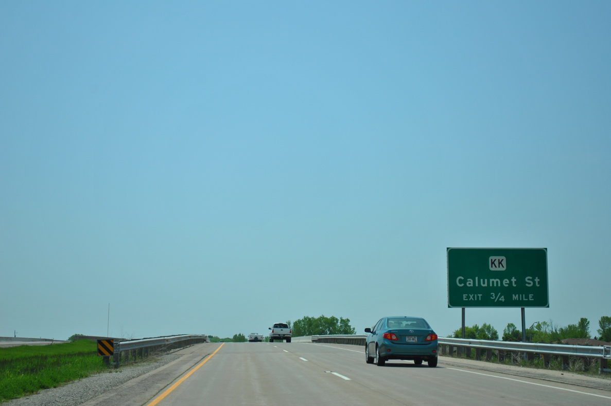
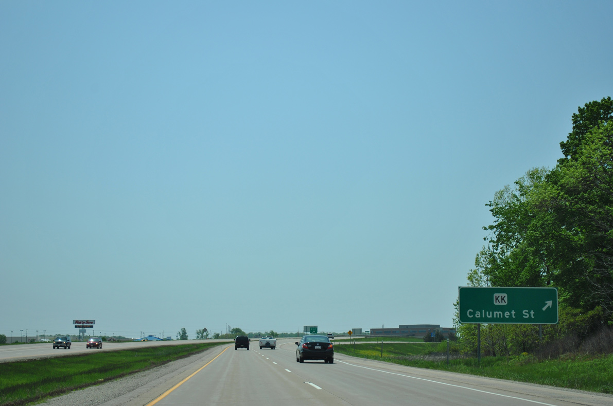
| The diamond interchange with County KK (Calumet Street) quickly follows along Wis 441 (Tri County Freeway) south. 05/30/11 |
|
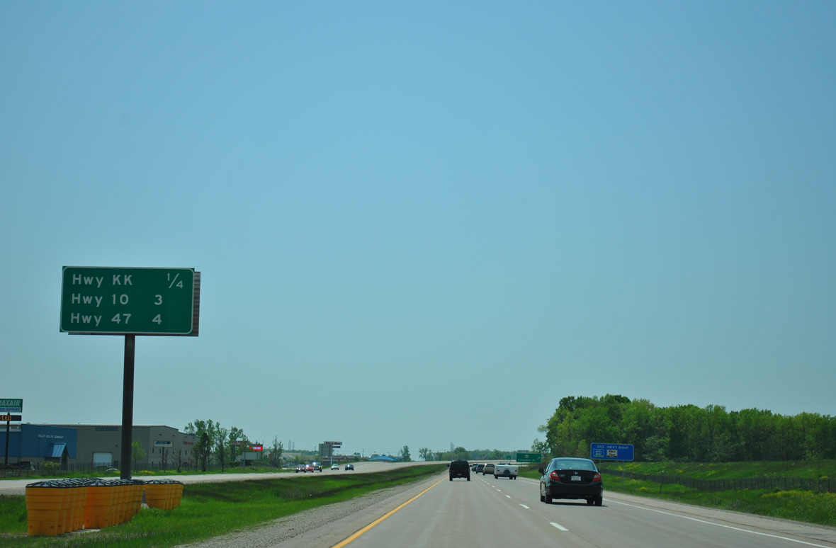
| Wis 441 turns west beyond County KK to merge with U.S. 10 in three miles and meet Wis 47 in four miles within Winnebago County. 05/30/11 |
|
| County KK straddles the Calumet County line east to Harrison, Wisconsin International Raceway and County D near Dundas. John Street angles the trunk highway northwest to end at College Avenue in Appleton. 05/30/11 |
|
| Wis 441 curves southwest between Calumet Street and Telulah Avenue and parallels County AP west through south Appleton. 05/30/11 |
|
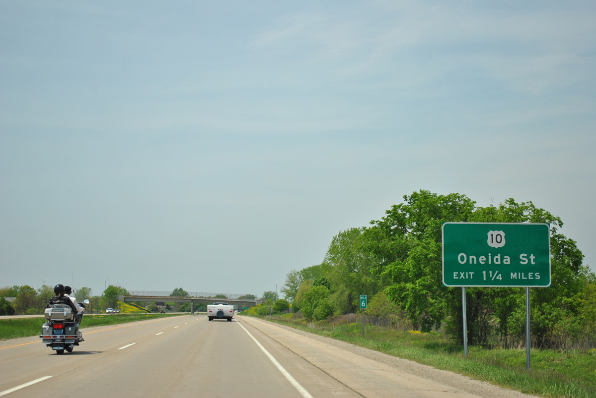
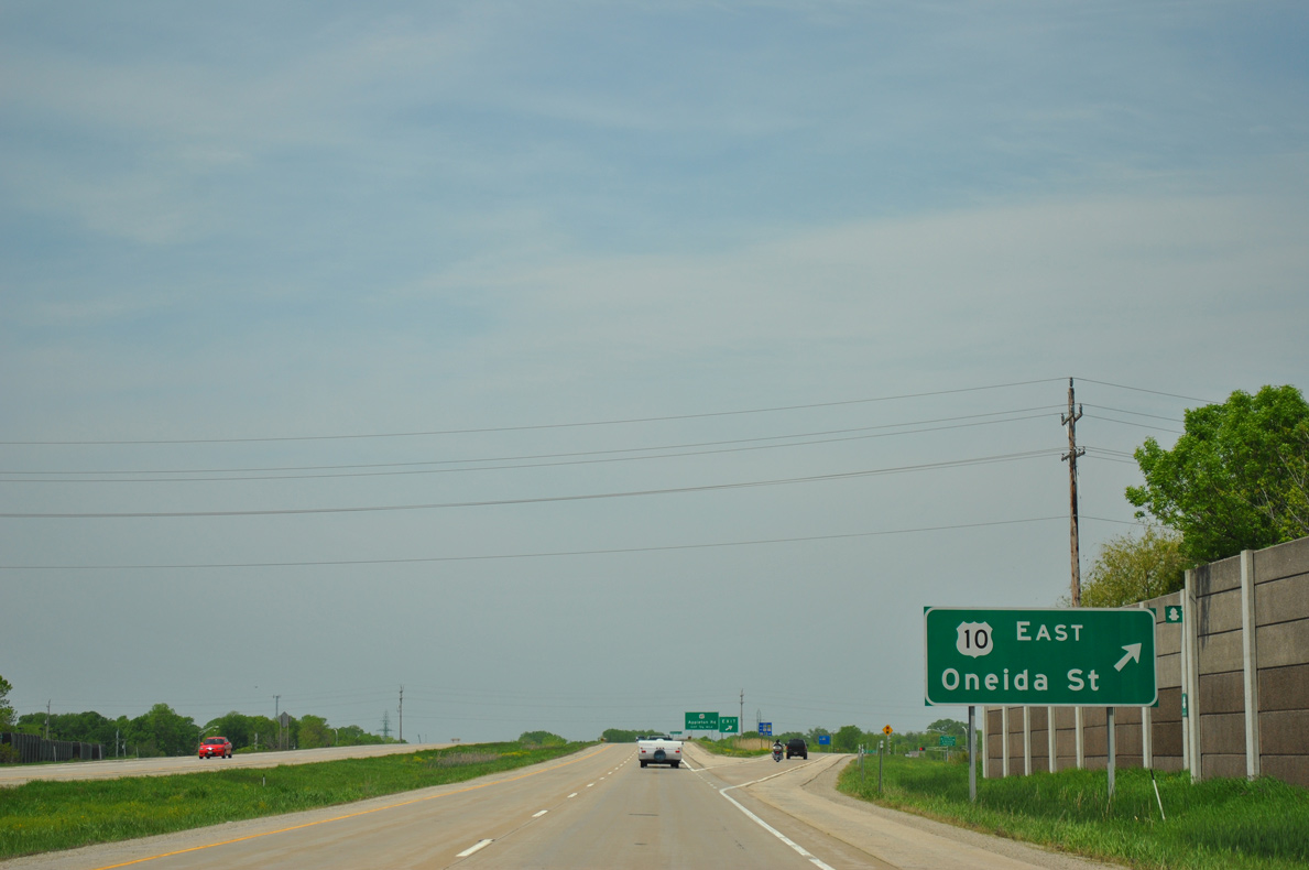
| U.S. 10 travels north along Oneida Street from Wis 114 through Menasha to a diamond interchange with Wis 441 in 1.25 miles. Future construction will redesign the exit into a diverging diamond interchange (DDI) in 2020-21. 05/30/11 |
|
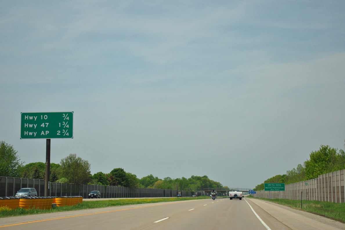
| Interchange sequence sign posted three quarters of a mile ahead of U.S. 10 (Oneida Street). Subsequent ramps join the freeway with Wis 47 and County AP in quick succession. 05/30/11 |
|
| Wis 441 south at the off-ramp to Oneida Street and U.S. 10 east. U.S. 10 leads east from Appleton to Brillion and Manitowoc. The route formerly traveled Oneida Street north, Seymour Street west, Memorial Drive north and Badger Avenue west to Wis 96 through the city. 05/30/11 |
|
| Drivers cross the Winnebago County line above Oneida Street as the initial guide sign for Wis 47 appears. Exit numbers along the concurrent section of U.S. 10 and Wis 441 were unnumbered until fall 2012. 05/30/11 |
|
| The lone set of shields for U.S. 10/Wis 441 west appear after the US highway joins the freeway. 03/02/16 |
|
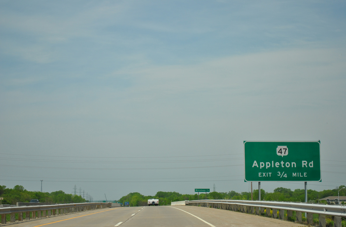
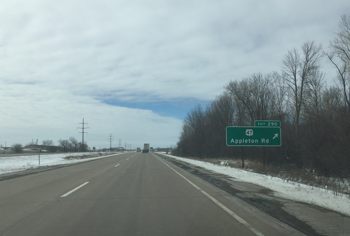
| A dumbbell interchange (Exit 290) quickly follows from U.S. 10/Wis 441 west for Wis 47 (Appleton Road). Wis 47 ends 2.3 miles to the south at Wis 114 (3rd Street) in Menasha. 03/02/16 |
|
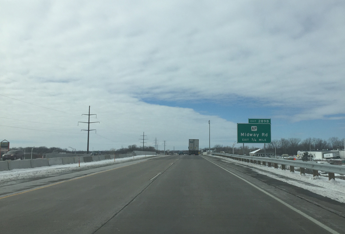
| Having paralleled most of the Appleton Beltway to the south, County AP (Midway Road) finally meets STH-441 directly at Exit 289B. 03/02/16 |
|
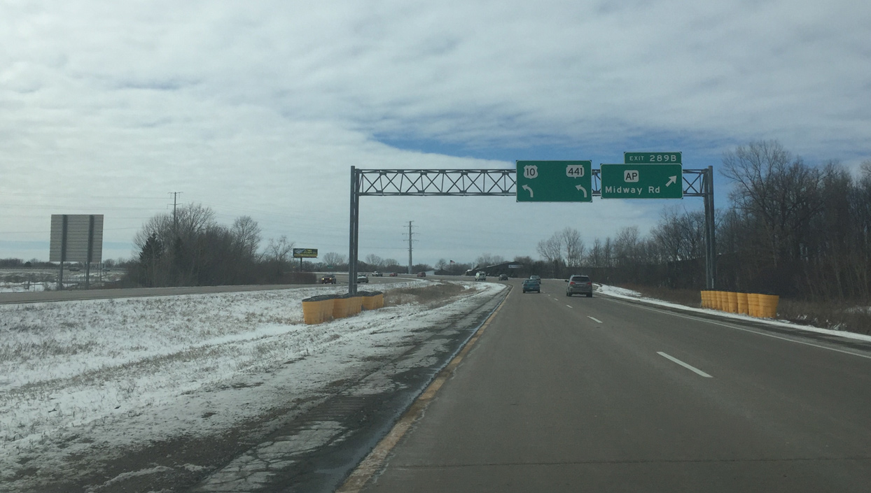
| The diamond interchange (Exit 289B) with County AP is busier than usual with the adjacent County P exit closed due to the WIS 441 Tri-County Project. 03/02/16 |
|
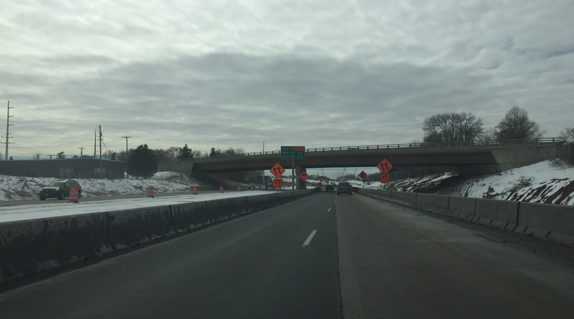
| U.S. 10/STH-441 turn south ahead of Exit 289A with CTH-P (Racine Road). Construction from 2015 to 2018 rebuilds the forthcoming interchange and bridges across Little Lake Butte des Morts. 03/02/16 |
|
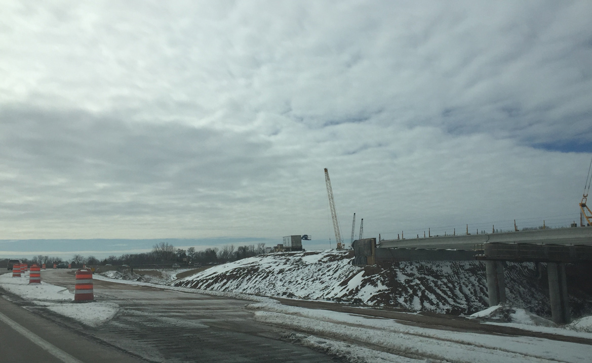
| The trumpet interchange (Exit 289A) with County P closed in summer 2015. The Tri-County Project rebuilds the exchange to a diamond interchange with a roundabout at the ramp terminus. Wis 441 ended at County P when the bridge over Little Lake Butte des Morts opened. 03/02/16 |
|
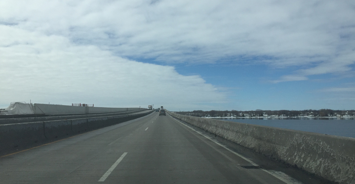
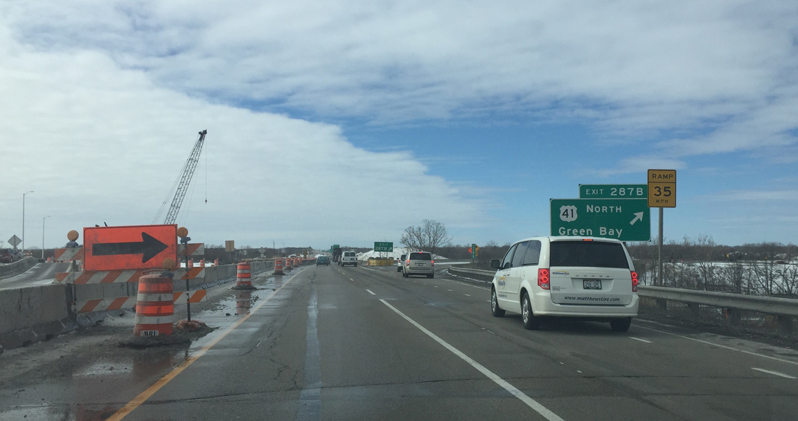
| U.S. 10/Wis 441 west pass over Tayco Road on the bridge leading west across Little Lake Butte des Morts. Exits 287B/A lie just west of the lake with Interstate 41. This sign still references U.S. 41 as it will not be replaced until construction is completed. 03/02/16 |
|
| Crossing Little Lake Butte des Morts, which feeds the Fox River to the north. This bridge will carry westbound traffic when the new eastbound bridge to the left is complete. Construction runs through 2018. 03/02/16 |
|
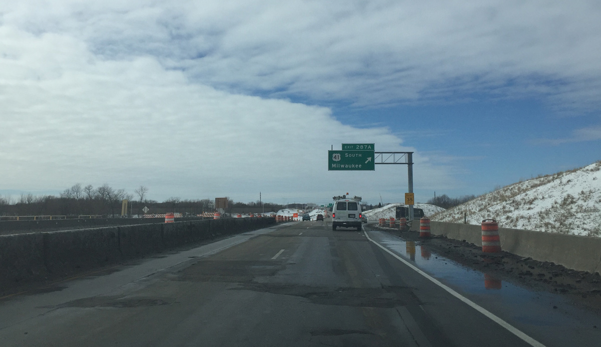
| A parclo interchange (Exits 287B/A) joins U.S. 10/Wis 441 west with Interstate 41. The Tri-County Project rebuilds the exchange into a systems interchange with two new flyovers. 03/02/16 |
|
| The loop ramp (Exit 287A) to Interstate 41 south to Oshkosh and Fond du Lac will be replaced by a new left side flyover by 2018. 03/02/16 |
|
| Wis 441 ends at I-41 as the freeway continues as U.S. 10 to Fremont. 03/02/16 |
Page Updated 04-27-2016.