|
| Toll 183 southbound on the approach to the Park Street Main Line toll gantry. Toll-by-plate collection rates are higher than those for TxTag account holders. 09/28/07 |
|
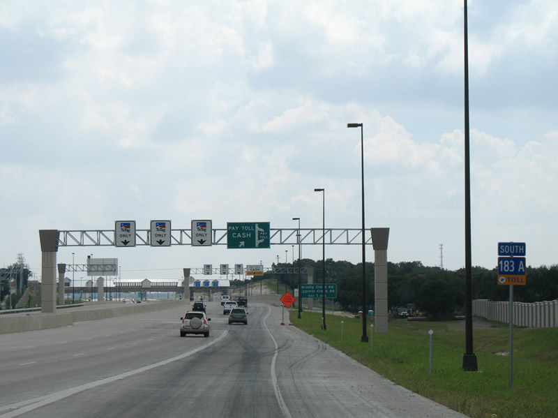
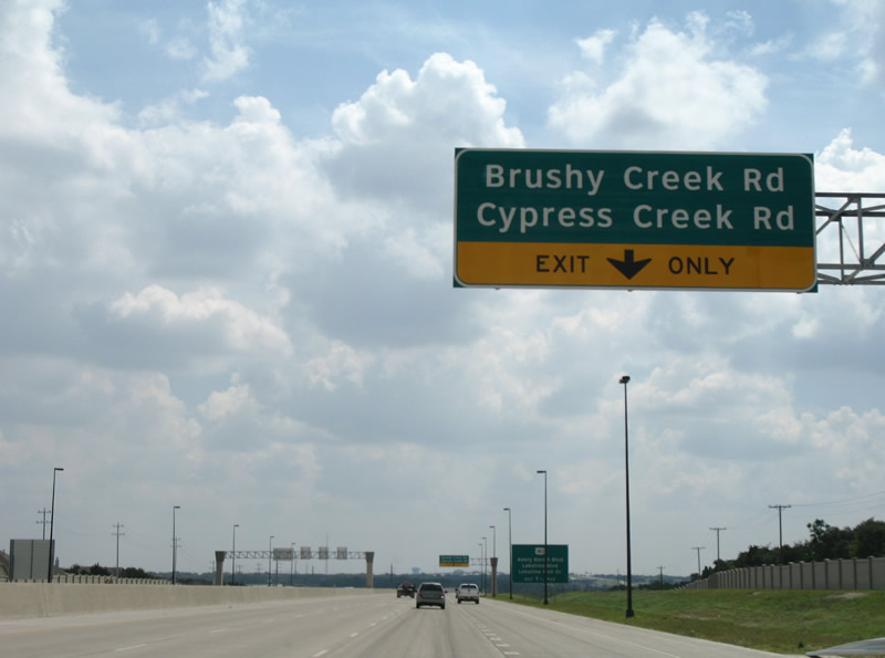
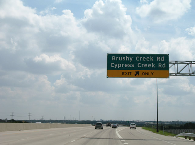
| Beyond the Park Street toll collection point is the off-ramp for Brushy Creek and Cypress Creek Roads. These east-west roads serve the Forest Oaks neighborhood east of the tollway. 09/28/07 |
|
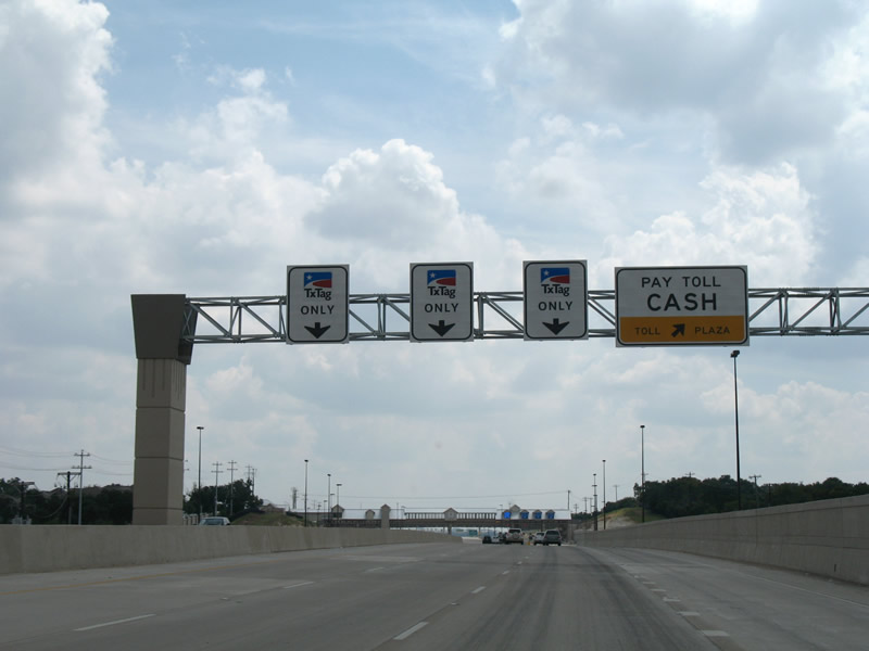
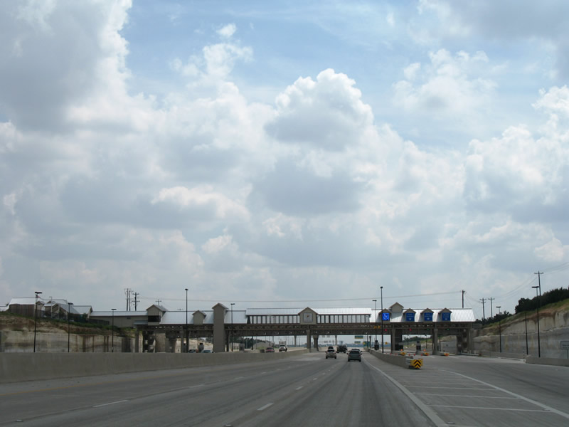
| Prior to December 1, 2008, traffic partitioned with TxTag account holders proceeding through the Park Street Main Line toll plaza at freeway speeds while all others departed to the right for conventional toll booths. 09/28/07 |
|
| Toll 183A drops below grade at the Park Street Main Line toll collection point. The plaza was named such because of the parallel Park Street overpass to the south. 09/28/07 |
|
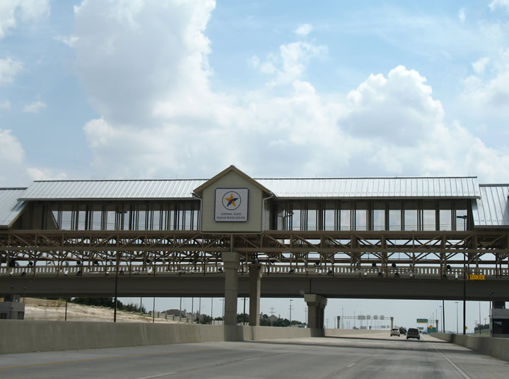
| The toll plaza prominently features the Central Texas Regional Mobility Authority logo. A pedestrian walkway lines the transponder reader gantry above. 09/28/07 |
|
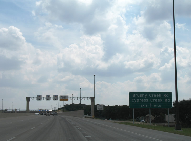
| Leaving the toll plaza, the right lane drops for the Brushy Creek Road off-ramp. Brushy Creek Road ventures east from Toll 183A, paralleling its name sake to FM 734 (Parmer Lane) at Brushy Creek Lake and Recreation Parks. 09/28/07 |
|
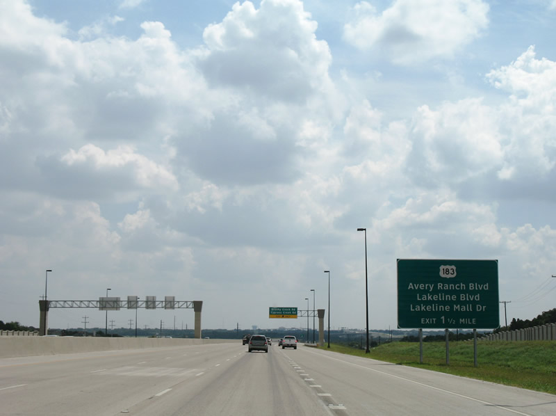
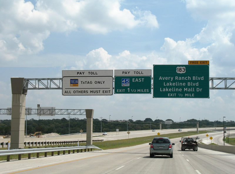
| Further south, Toll 183A advances to the merge with U.S. 183 (Bell Boulevard) near the Avery Ranch Road off-ramp. Avery Ranch Road links the toll road with parallel Bell Boulevard north of Lakeline Boulevard and Lake Mall Drive. 09/28/07 |
|
| Toll 183A South at the Cypress Creek and Brushy Creek Roads exit. Cypress Creek Road stems west from Brushy Creek Road at Toll 183A to U.S. 183 (Bell Boulevard) and southwest to the Cypress neighborhoods and Anderson Mill Road. 09/28/07 |
|
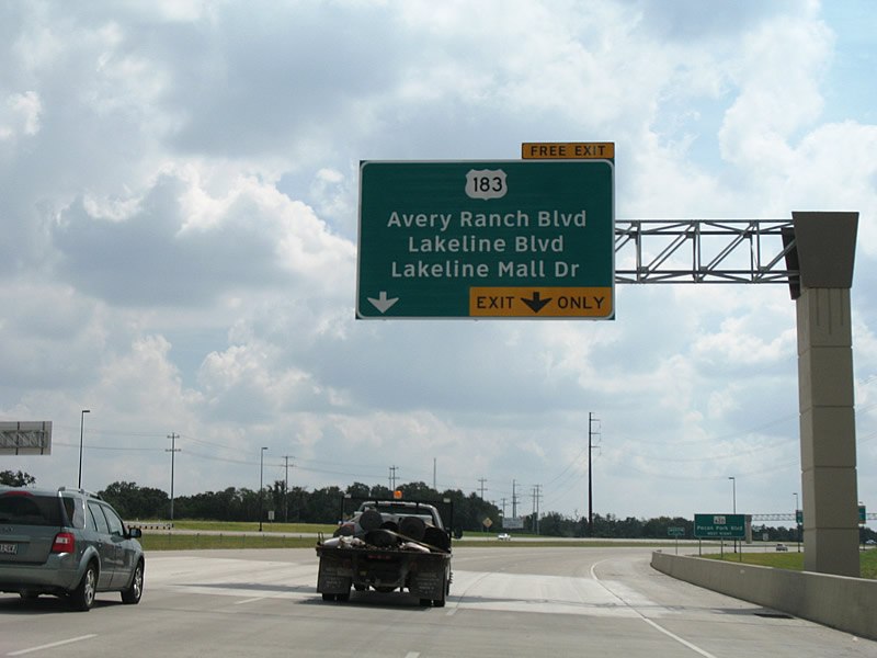
| Nearing the Avery Ranch Road off-ramp on Toll 183A south. Prior to December 1, 2007, drivers not enrolled in the TxTag electronic toll collection system were directed to exit at Avery Ranch Road. The upcoming Lakeline Main Line toll gantries utilizes AET collection. 09/28/07 |
|
| Parallel U.S. 183 serves the Lakeline Mall area on its course between Avery Ranch Road and RM 620. RM 620 represents the frontage roads of Toll 45 N east and the future path of Toll 45 N west. Lakeline Boulevard meanwhile encircles the suburban areas of west Cedar Park while Lakeline Mall Drive serves the nearby shopping complex. 09/28/07 |
|
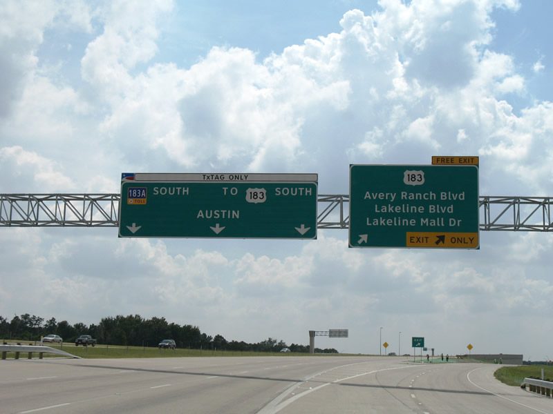
| Toll 183A proceeds south through the Lakeline toll collection point to Toll 45 N and the Research Boulevard freeway for U.S. 183. U.S. 183 follows the frontage road system (Research Boulevard) south to RM 620. Avery Branch Road provides the connection to adjacent U.S. 183 and Riviera Drive. 09/28/07 |
|
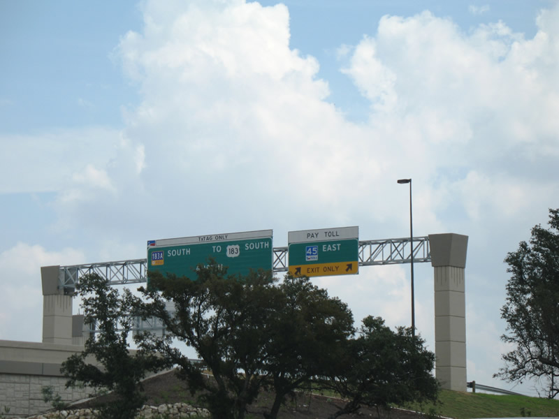
| A partially-built stack interchange connects the south end of Toll 183A, the present west end of Toll 45 N, and the north end the Research Boulevard freeway carrying U.S. 183 southeast to IH 35 in central Austin. This view looks at the Toll 183A southbound sign bridge for Toll 45 N. Toll 45 N heads east to the north end of Loop 1, IH 35 and the SH 130 east bypass of Austin. 09/28/07 |
Page Updated 10-29-2007.