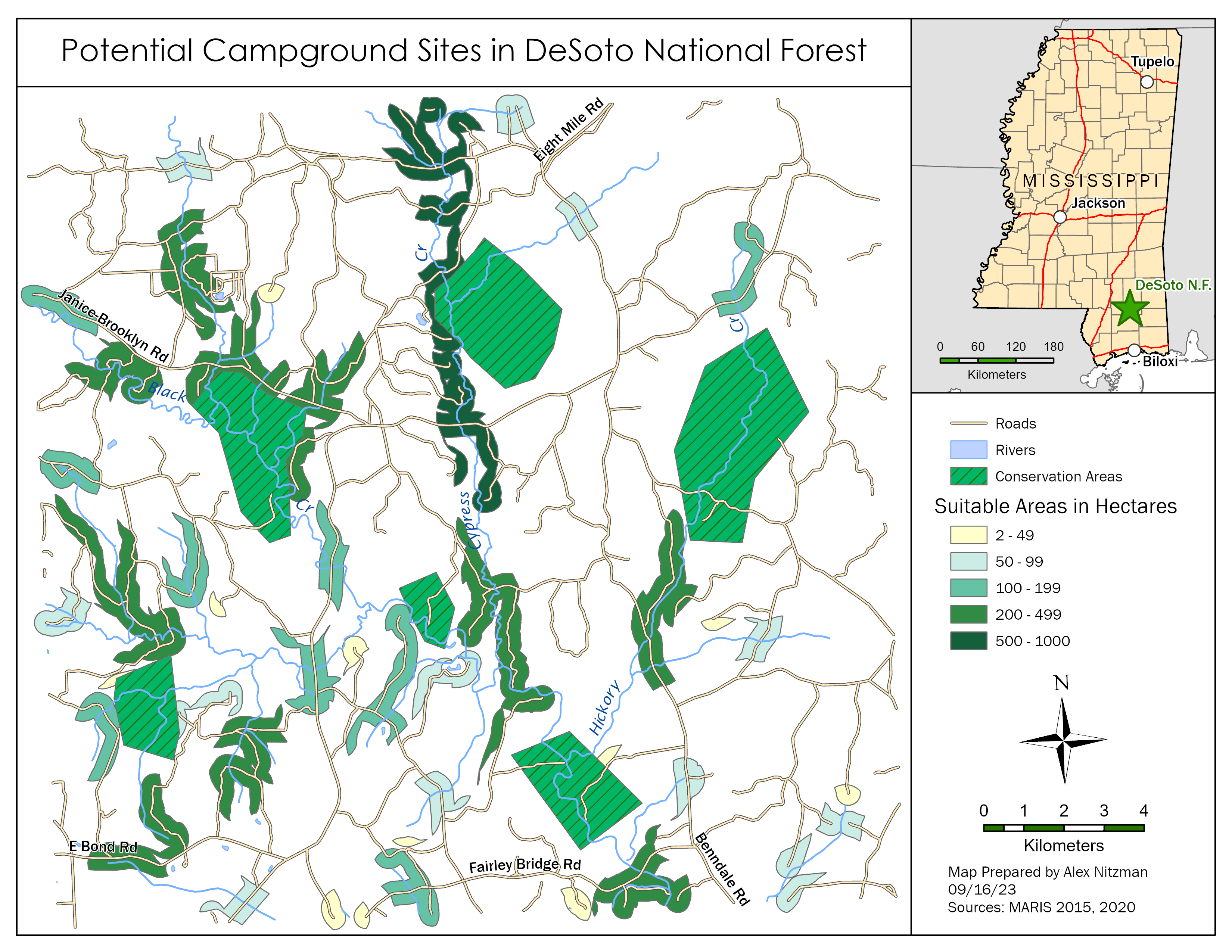
Buffer Analysis with Desoto National Forest data
This week's GIS Lab introduced spatial analysis and more specifically, the concept of buffers. Buffers in GIS can be applied to spatial data to conduct analysis on a specifically defined area surrounding the data in question. My last experience with buffers was back in 1998 at the University of Delaware. Our final project then used buffers as part of the analysis for the White Clay Creek Watershed in northern [...]