
Photos from the Alaska highway! Okay, well, first photos from flying to Seattle, and then driving to Dawson Creek, where the Alaska Highway begins.
Some photos in this post brought to you by Daniel Brim. We have an equitable arrangement: he provides talent at taking photographs, I run us off the road only occasionally.
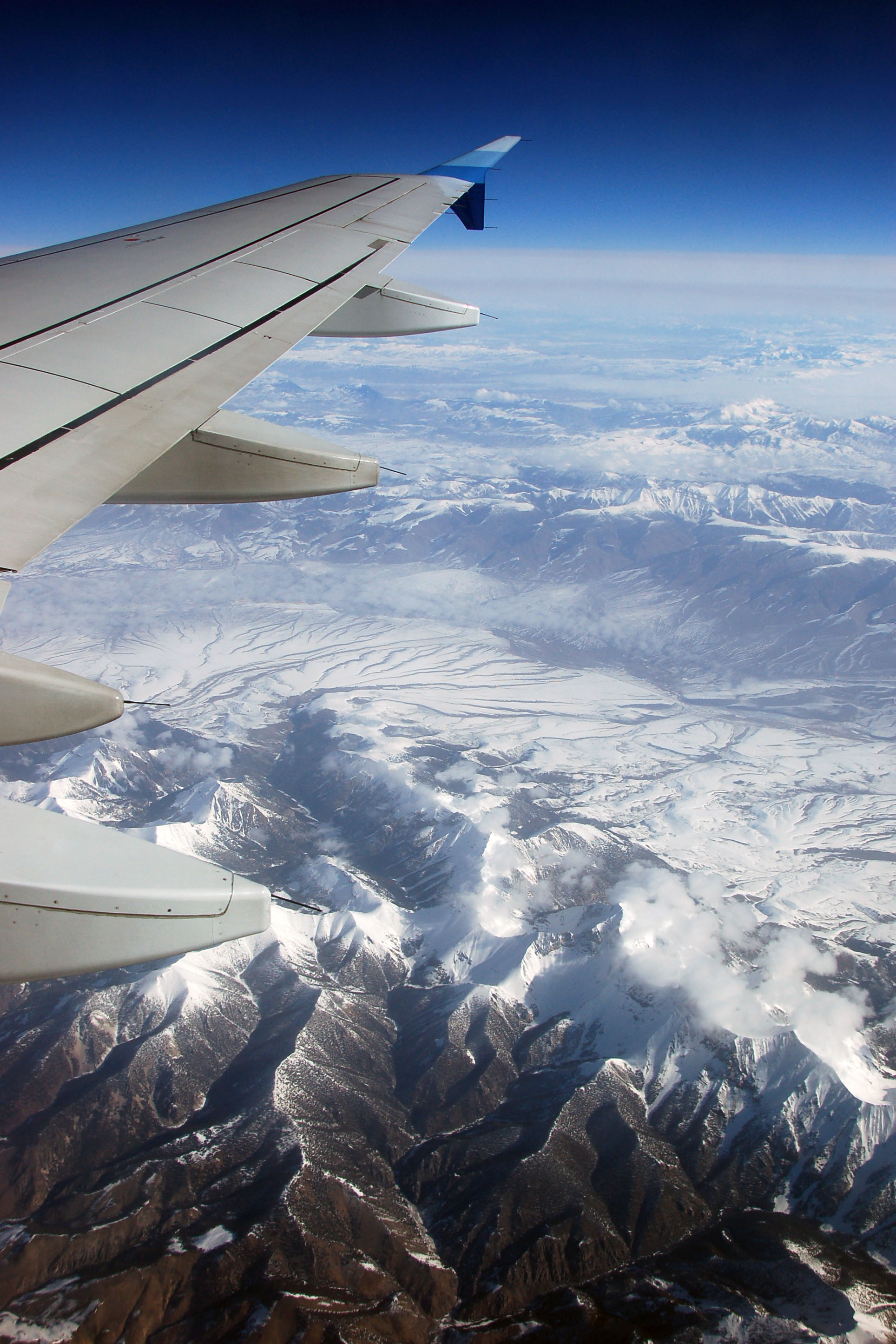
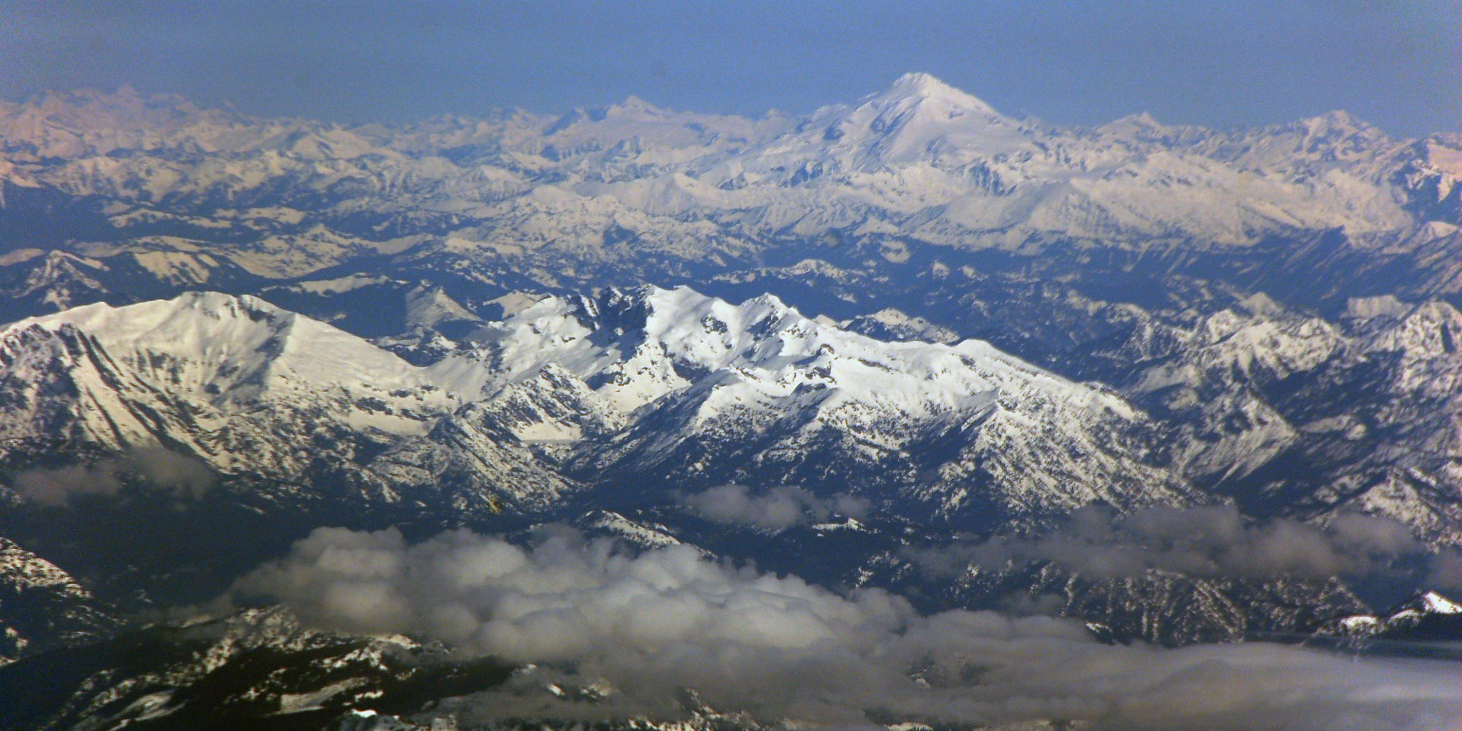
Somewhere over the Rockies. Between Denver and Seattle for sure.
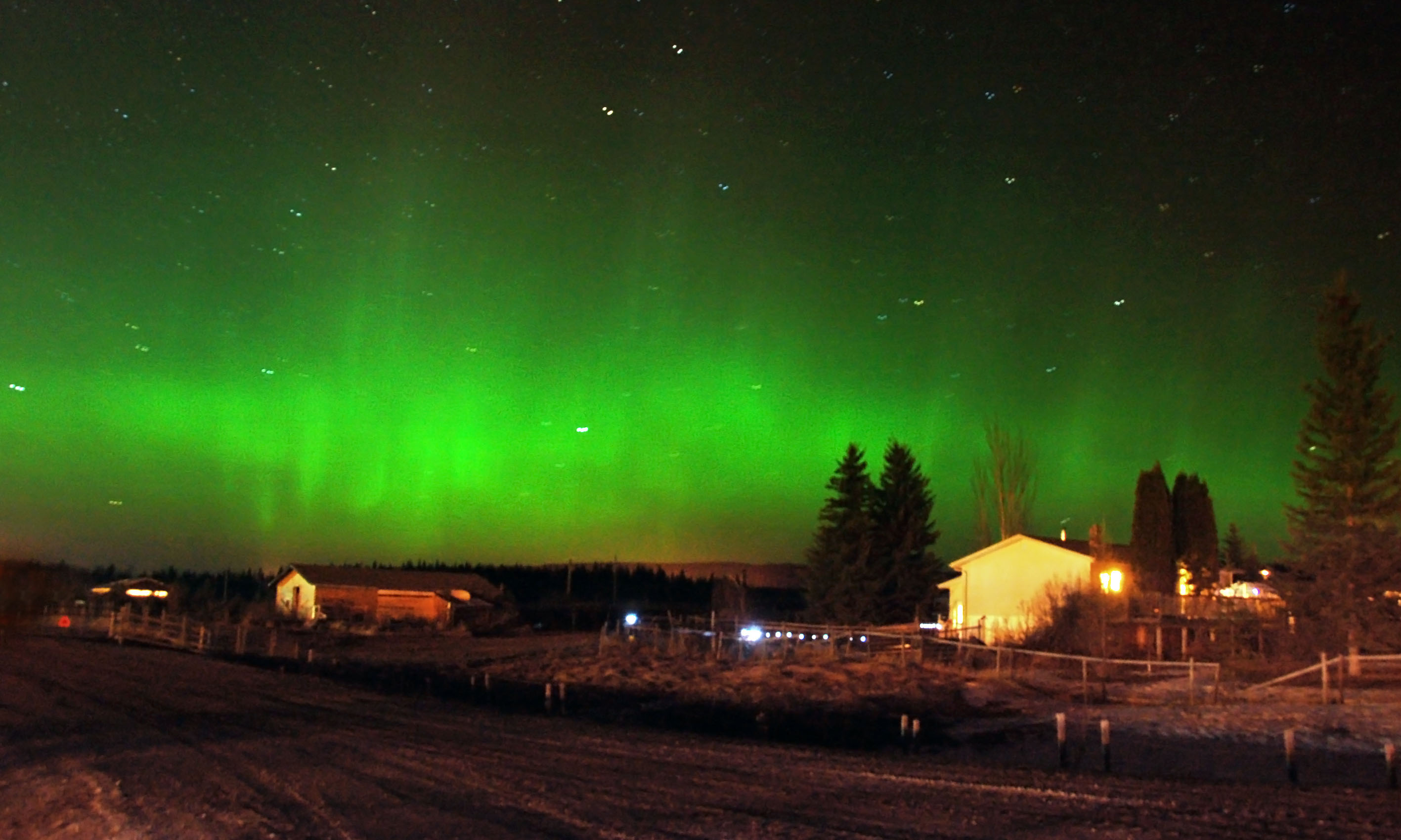
And here’s the northern lights! Just north of Prince George, British Columbia, which is well south of where such a strong display tends to usually appear. About twelve hours after landing … mission accomplished. Now all we had to do was drive the Alaska Highway!
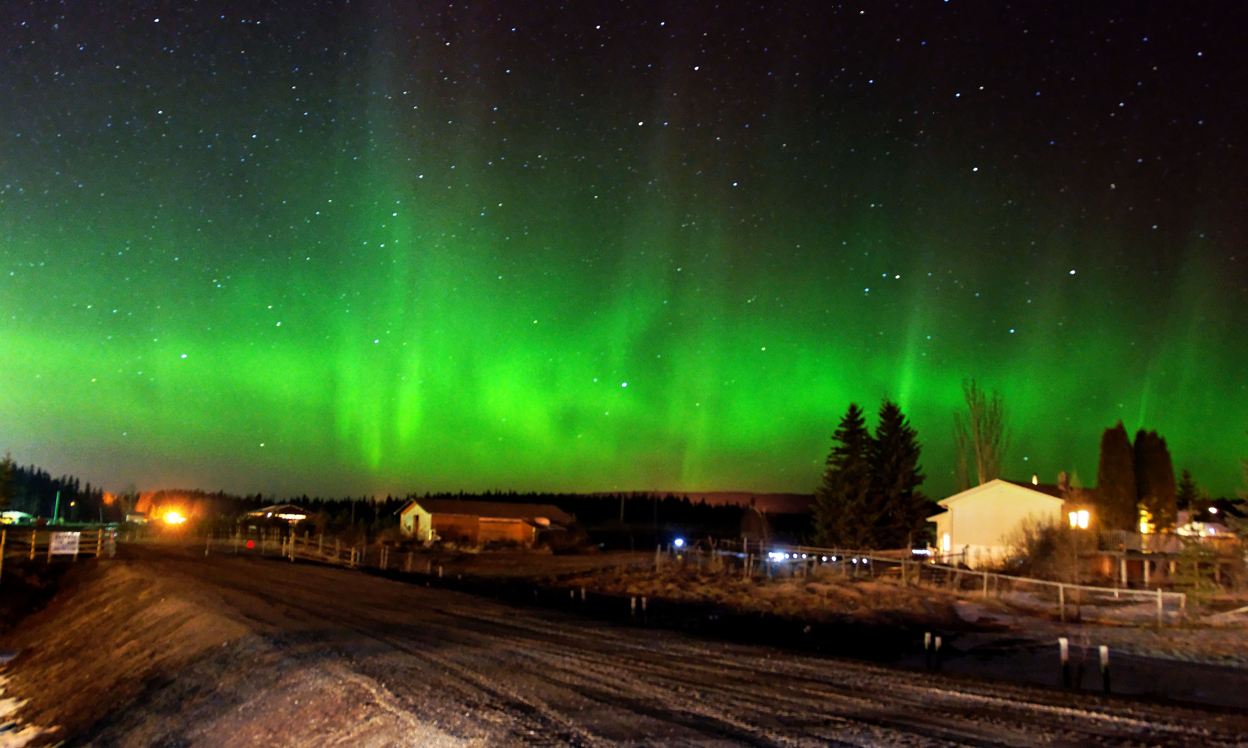
And one more northern lights photo, this time from Dan. Hmm, I wonder which one of us has a better camera!
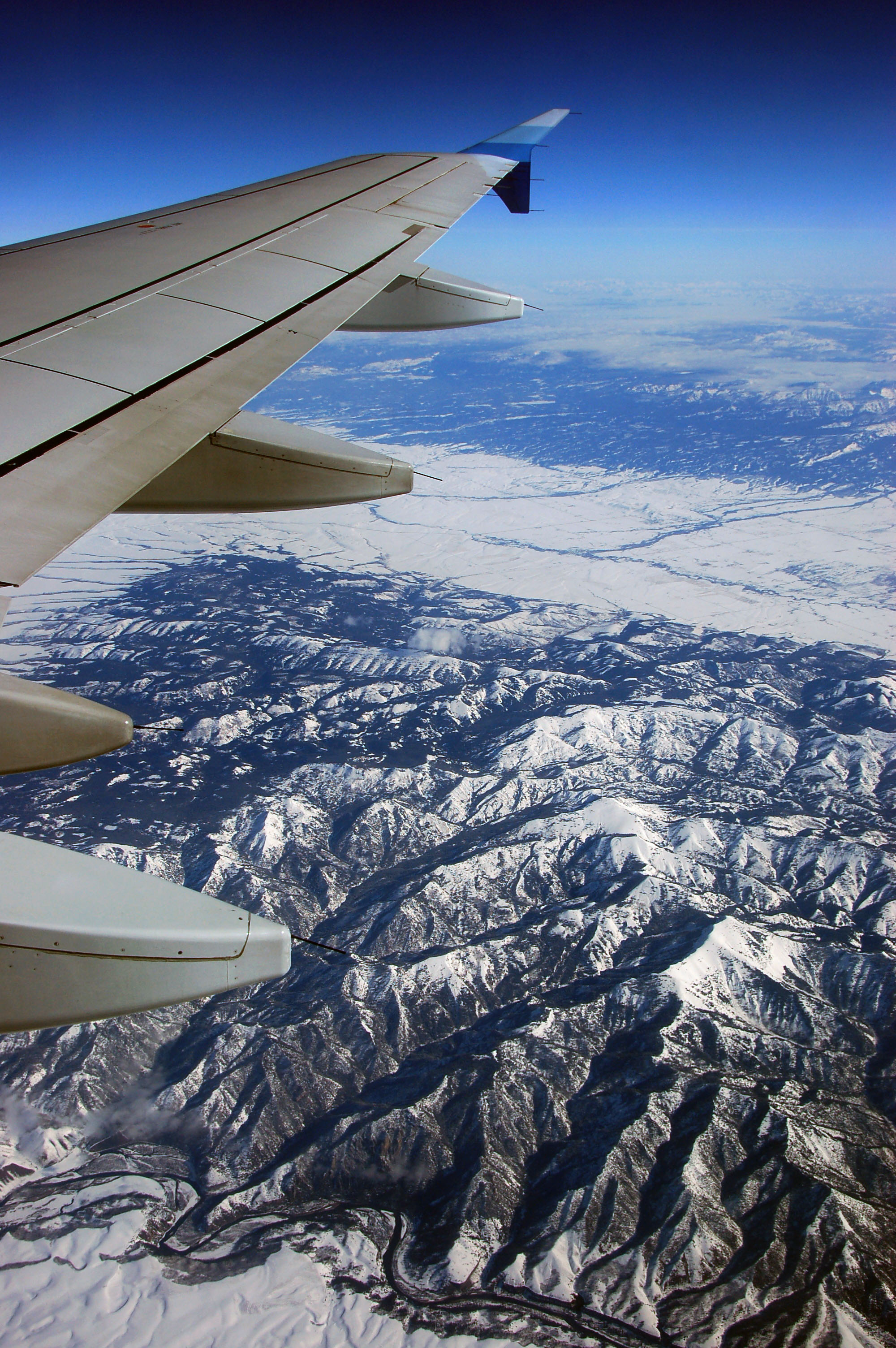
Utah, maybe?
My guess is I-15 and US-91 somewhere in Utah or Idaho.
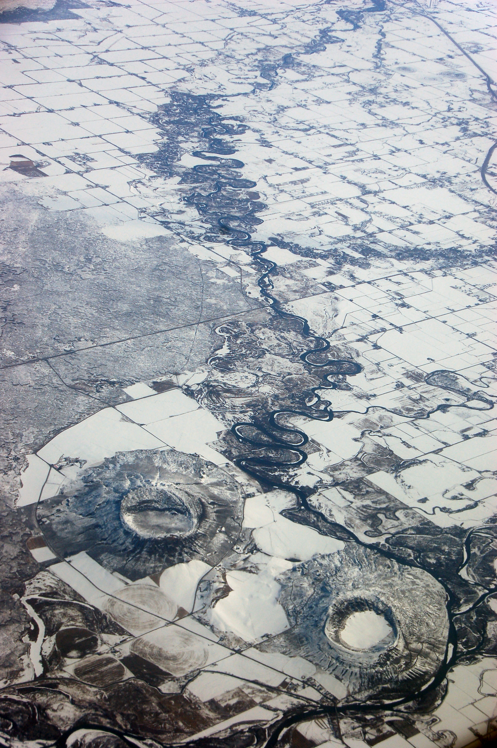
A pair of volcanoes.
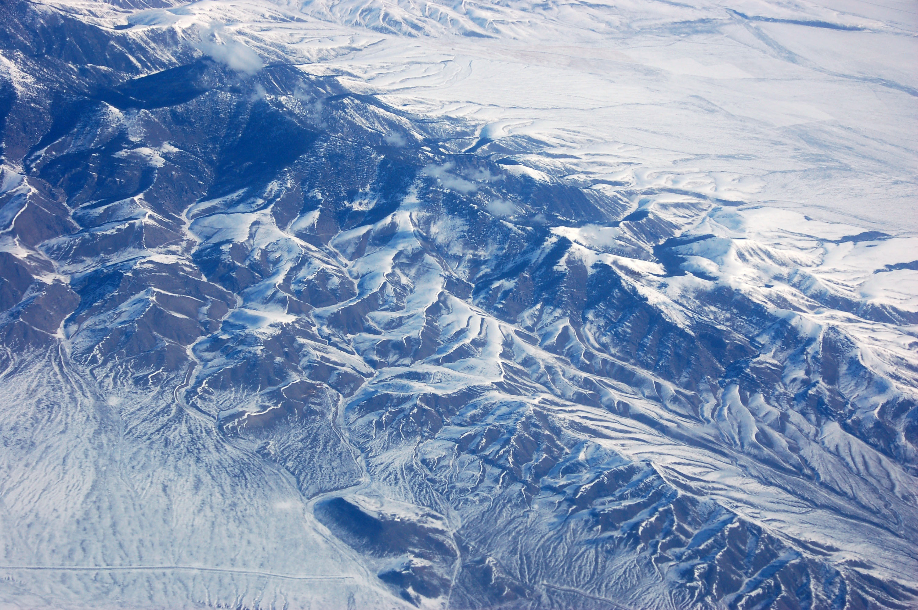
Heading up the Rockies.

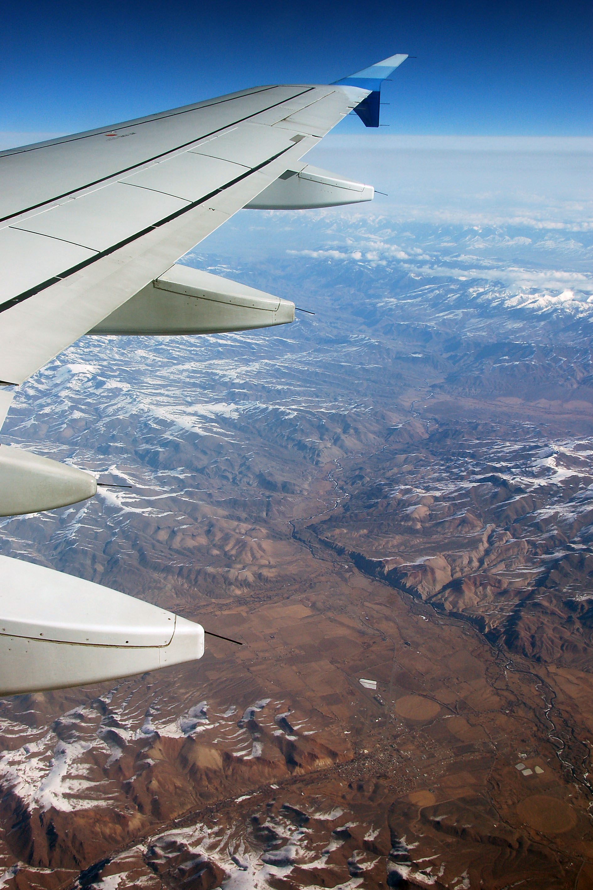
Further north in Idaho.
This definitely looks like the deserts of eastern Oregon.
Mount Baker on the horizon, about 100 miles north of Seattle – this is a very zoomed-in shot to the north.
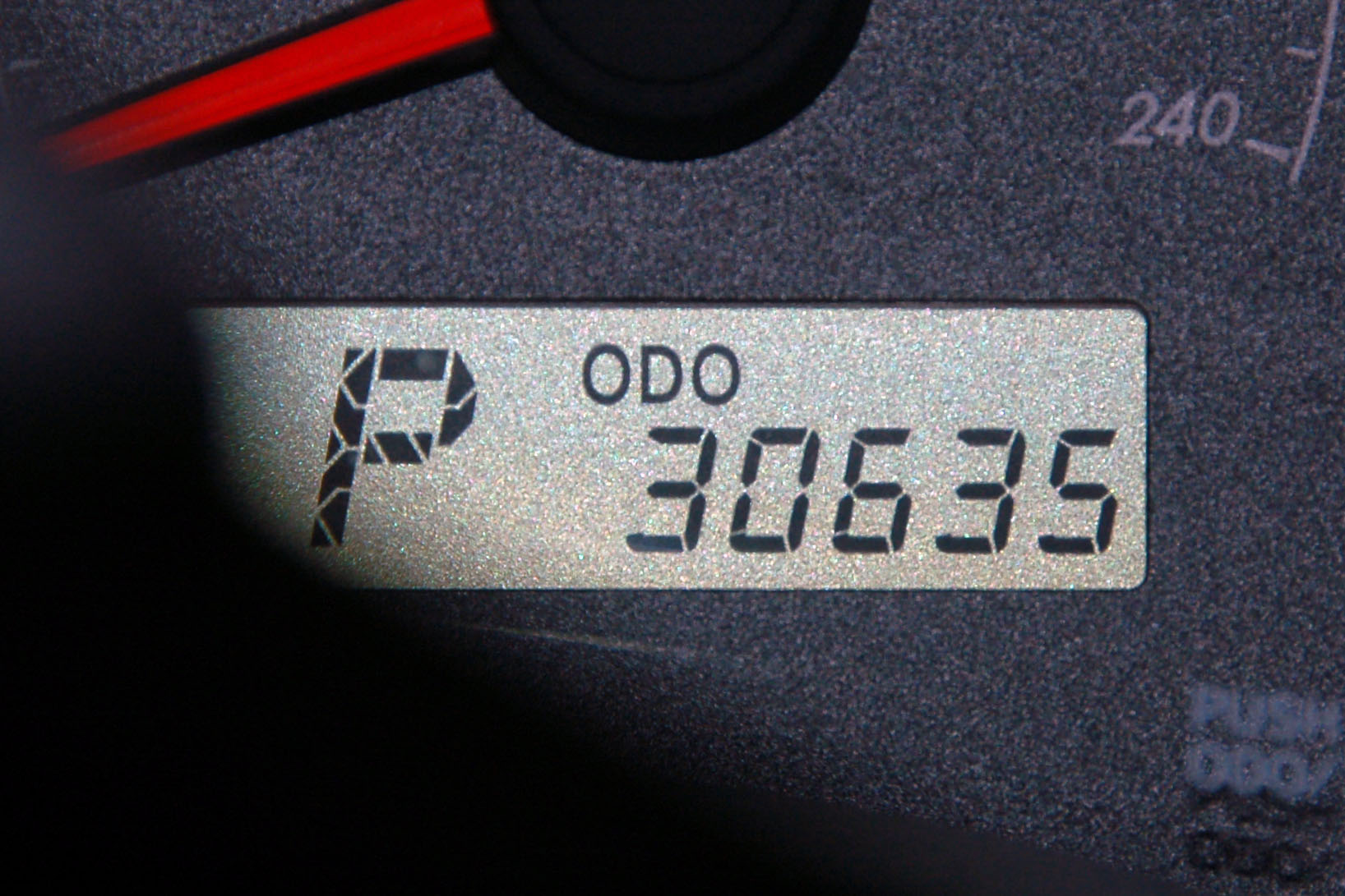
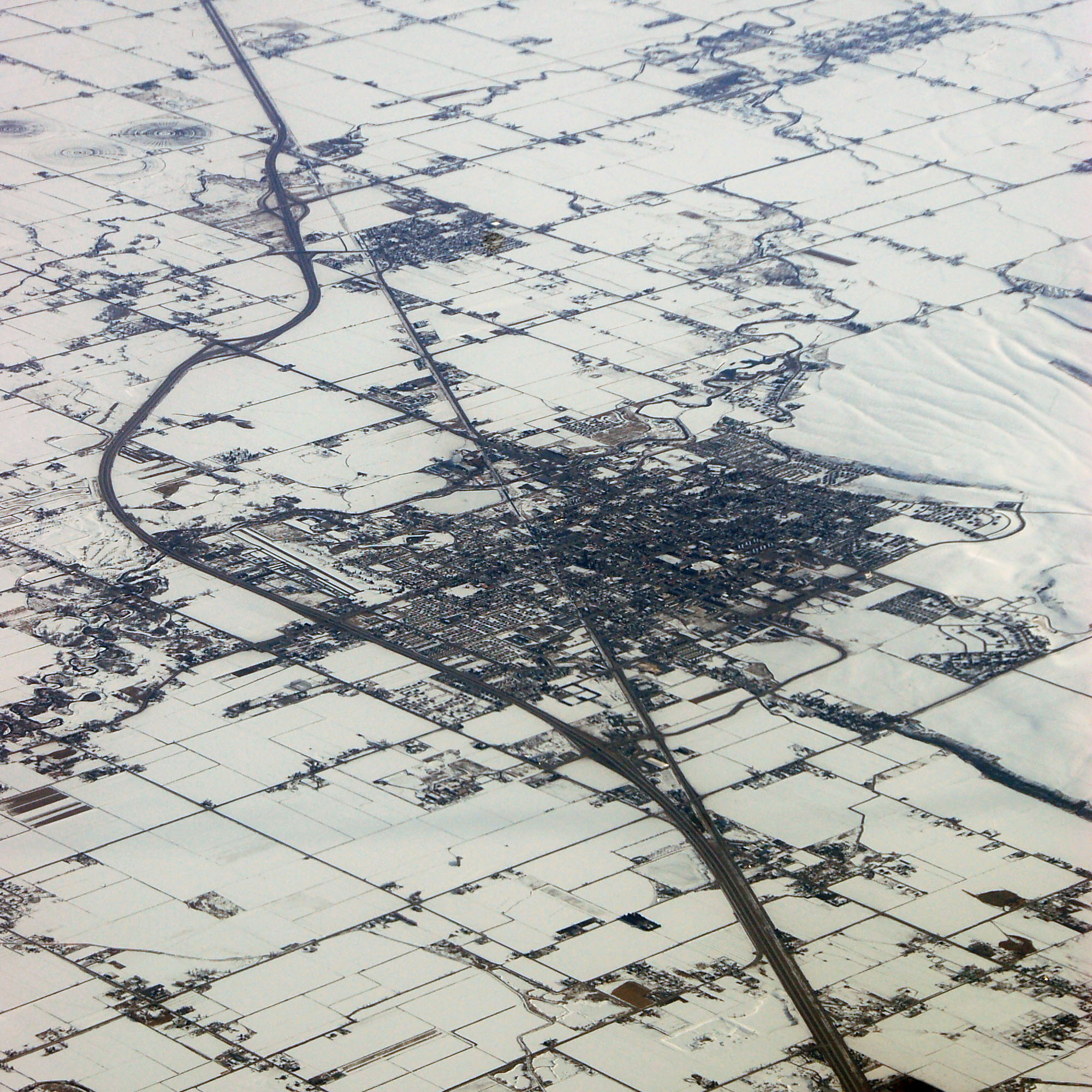
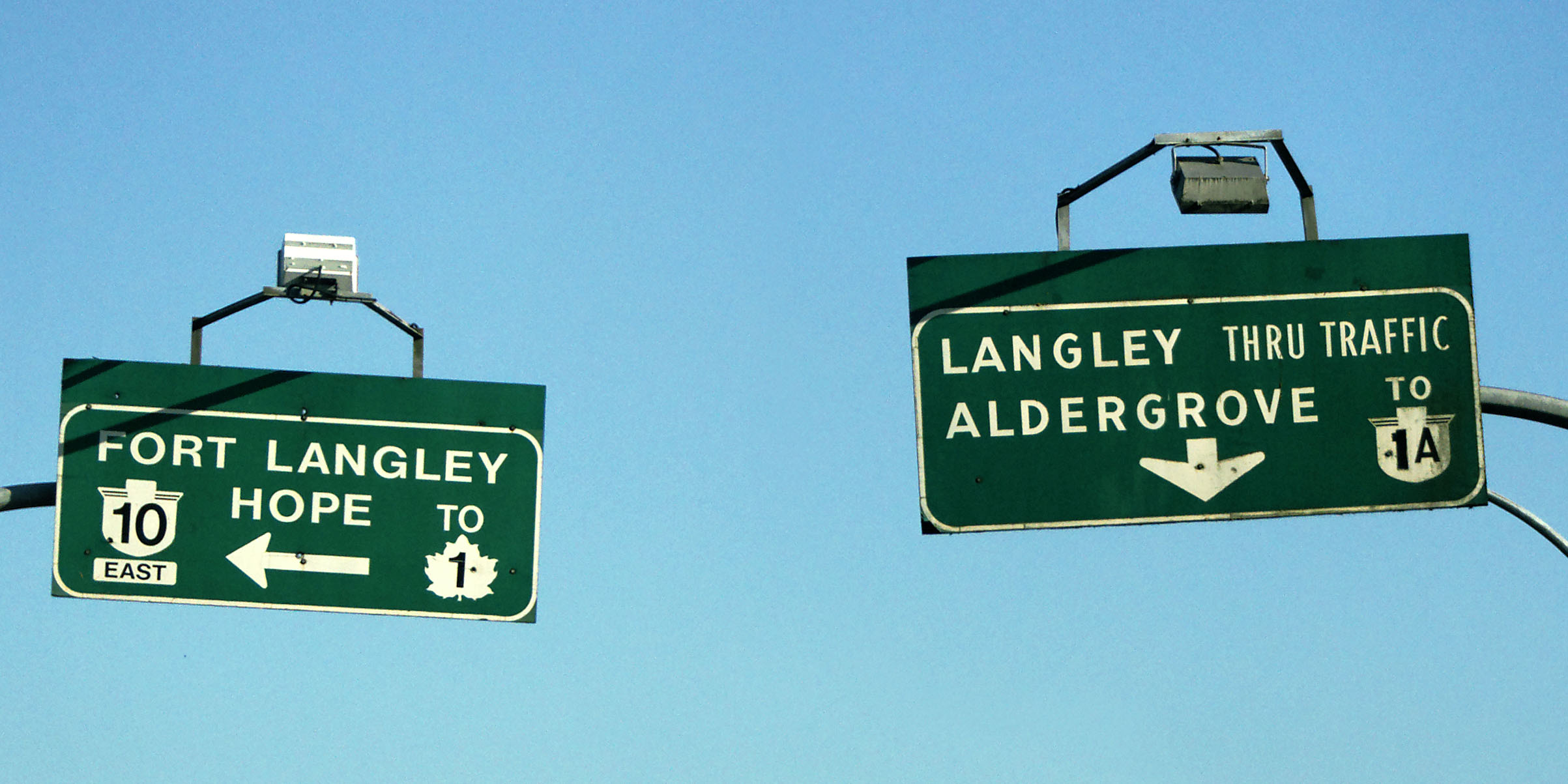
Remember this number well – we will add quite a bit to it.
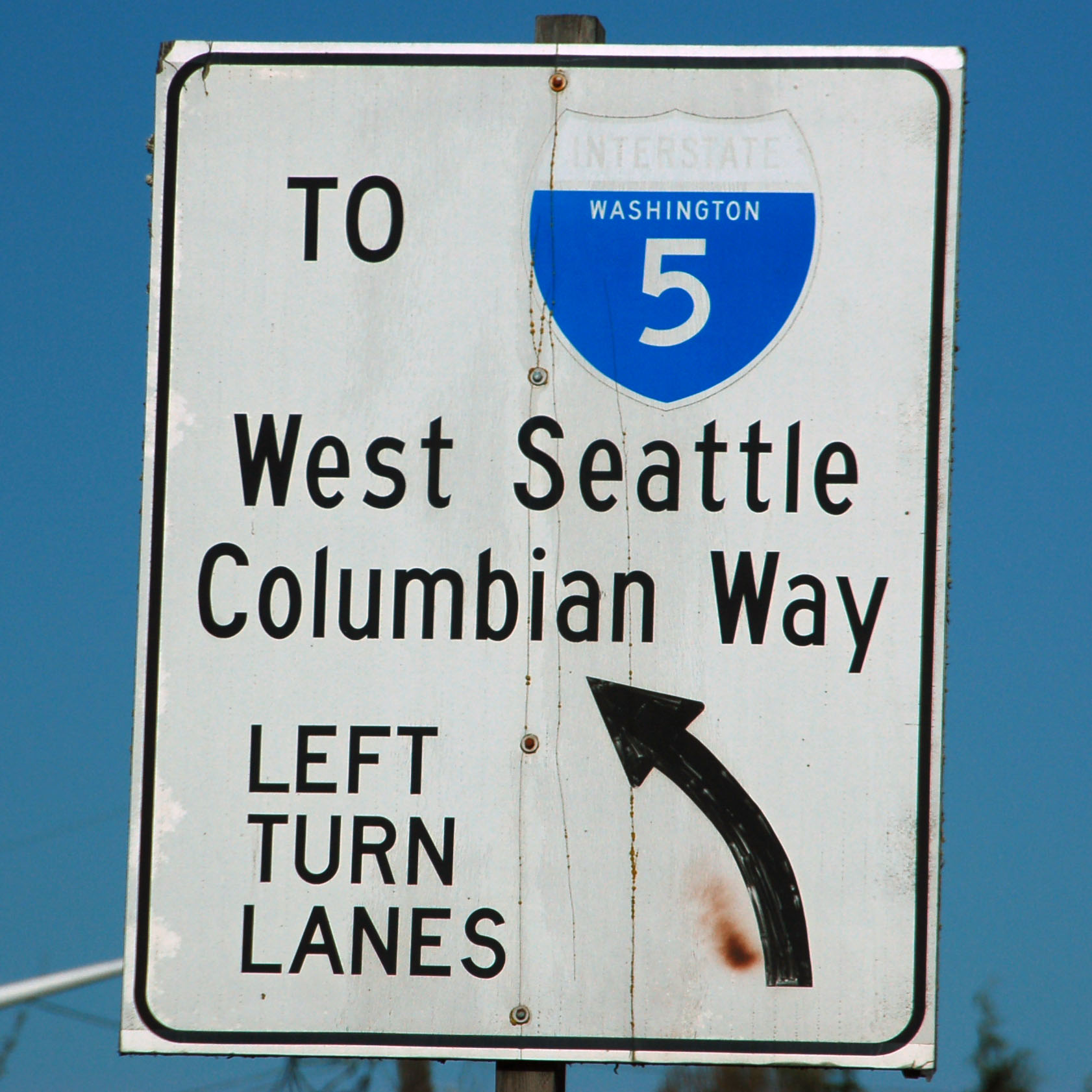
A very old white sign in Seattle.
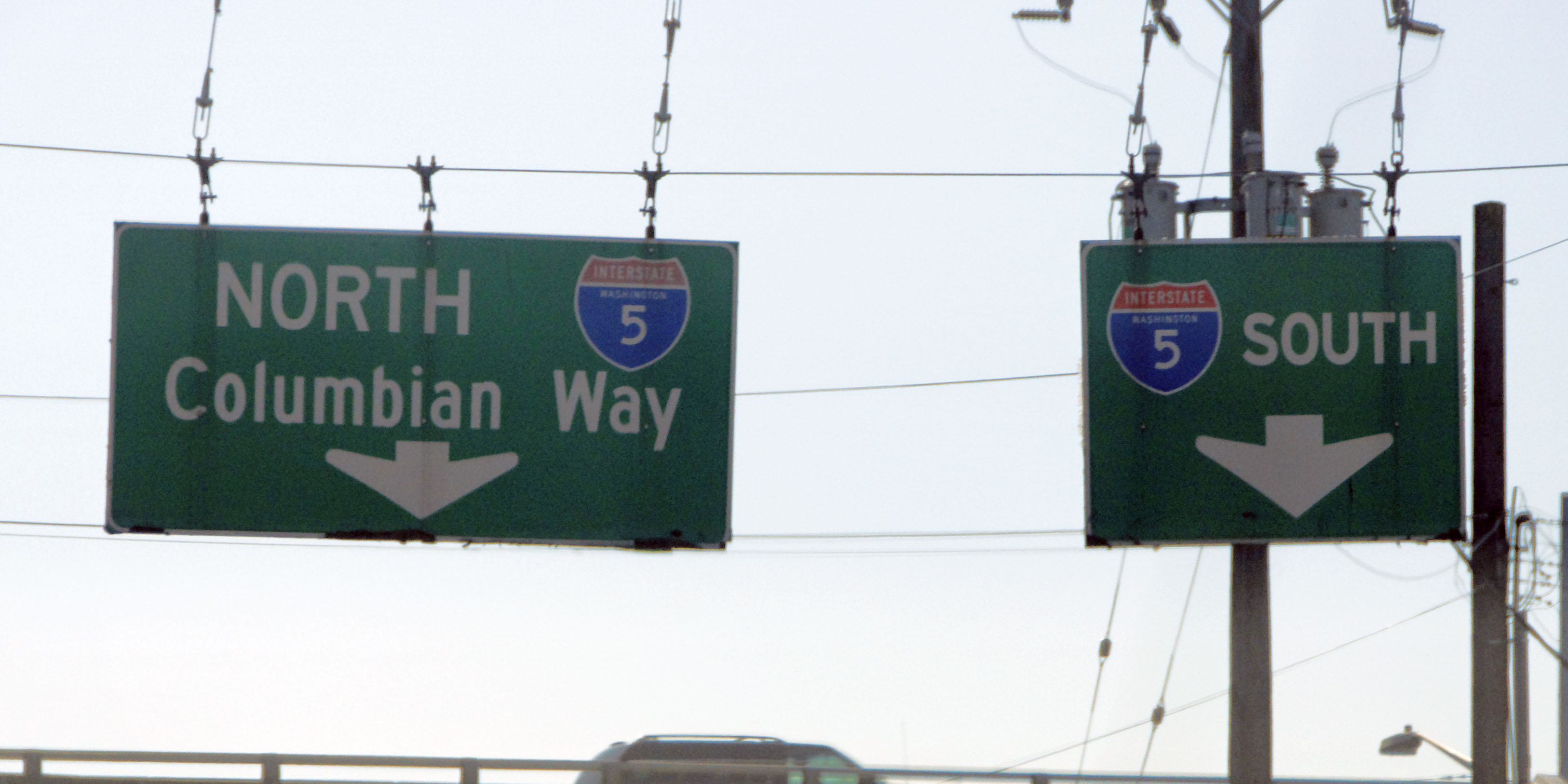
And some even older green ones. These square-corner signs with the narrow mixed-case font go back to the 60s.
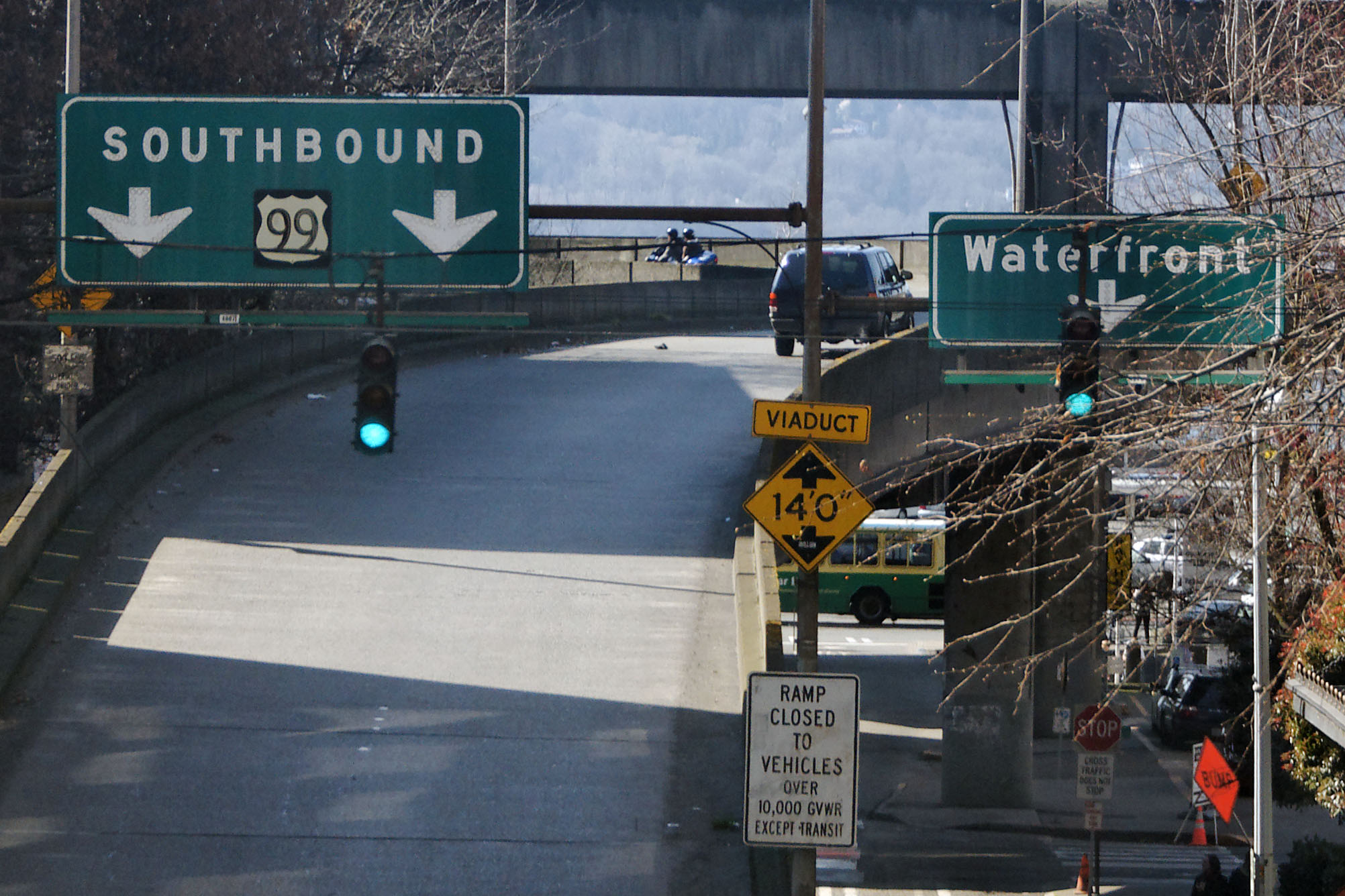
Here’s the last remaining US-99 shield in existence. Still surviving as an on-ramp sign to the Alaskan Way Viaduct. [Dan photo.]
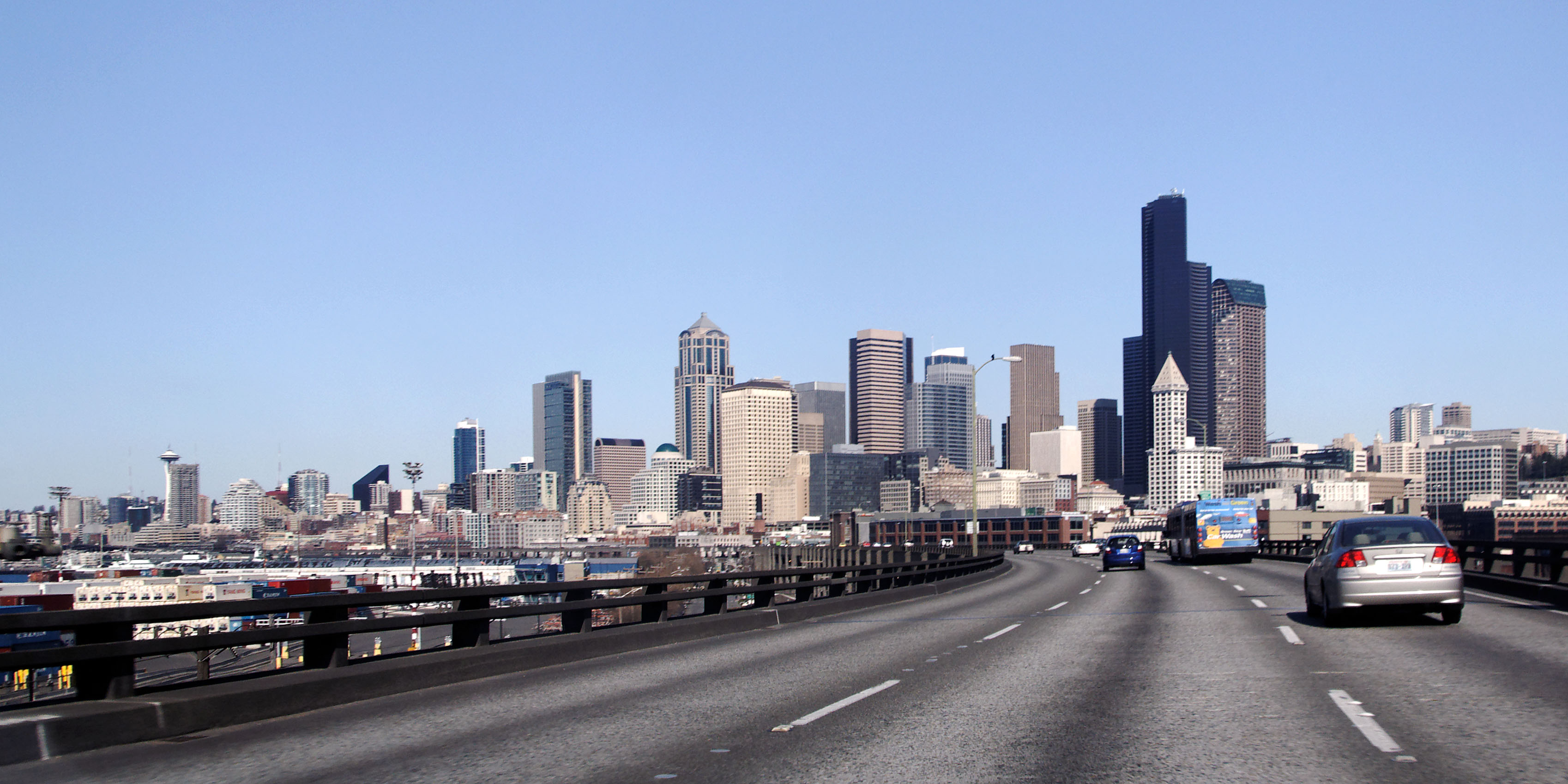
Seattle skyline, as seen from the Alaskan Way Viaduct northbound. The southbound lanes are directly underneath. This freeway was built in 1952 and is slated for replacement with something a tad more earthquake-proof. [Dan photo.]
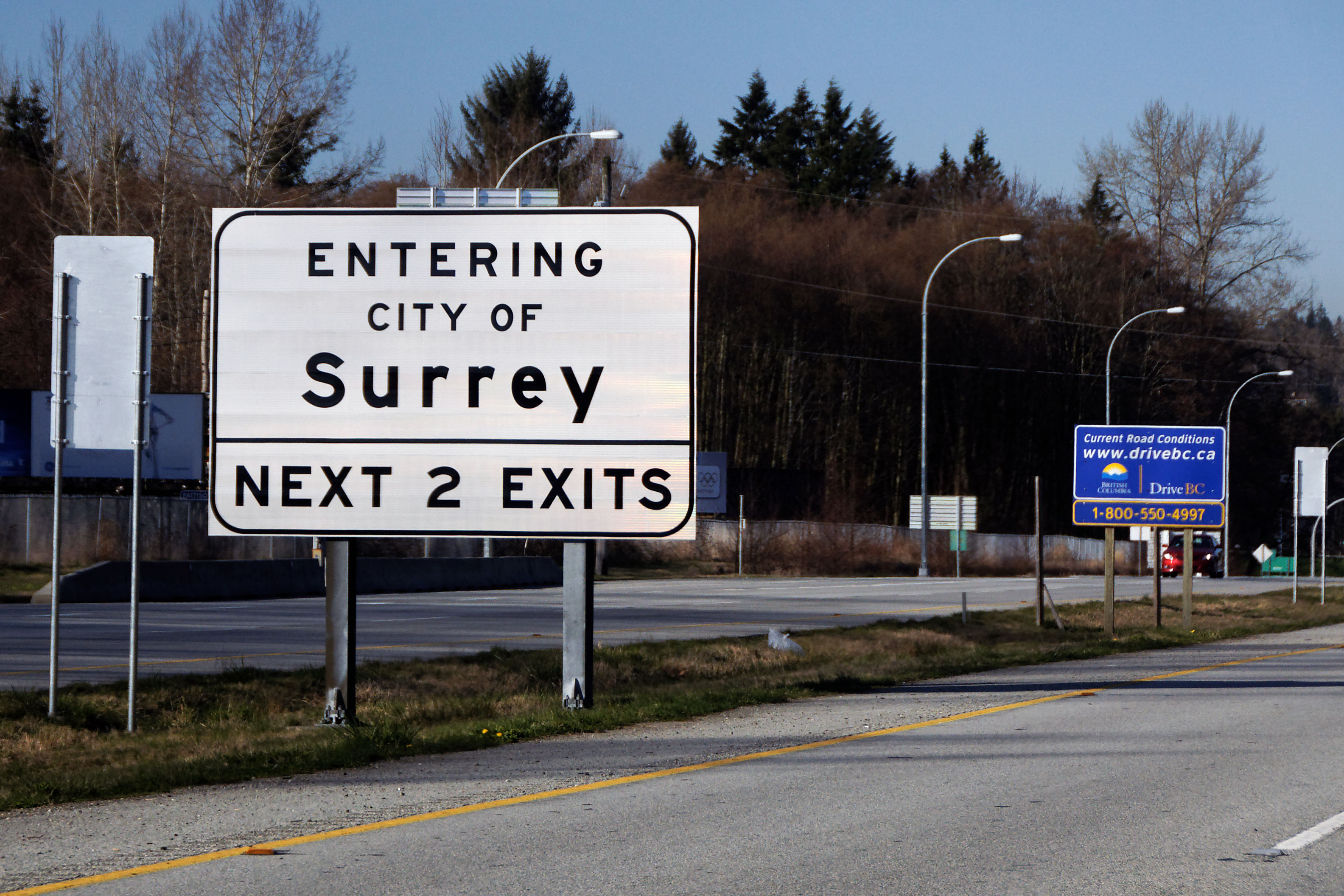
Look at that, we’re successfully in Canada, after minimal interference from the border patrol – most of the questioning based on the fact that we didn’t know the difference between Prince George and Prince Rupert. [Dan photo.]
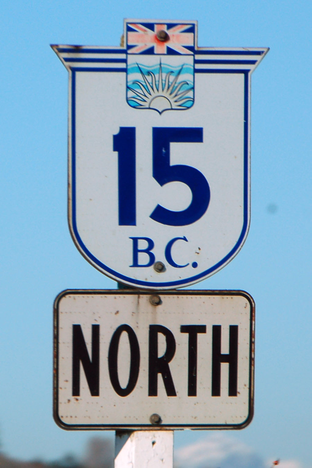
British Columbia uses cutout route markers. A lot of them have this classic font.

Others, unfortunately, use Arial. [Dan photo.]
One of each kind on this set of overhead green signs. Don’t ask me why they’re mounted diagonally. [Dan photo.]
British Columbia uses black signs in one context: weather advisory variable-message signs. [Dan photo.]
This older sign shows the narrowest of the British Columbia fonts – which looks nothing like the wider ones. And no, I have no idea what is underneath the greenout. [Dan photo.]
Older sign: all caps. (As seen in the Surrey photo several back, even the brand new town limit signs are white.) [Dan photo.]
Clearview also shows up on the newest signs.
Scenery, and more Clearview. The 3 shield (much more visible in the large version of the photo) has a crow on it, as 3 is the Crowsnest Trail – a Rocky Mountain pass.
An older non-crow sign. (All older guide-sign shields are black and white.) [Dan got this one through the back window!]
We start to go up the pass on highway 5. [Dan photo.]
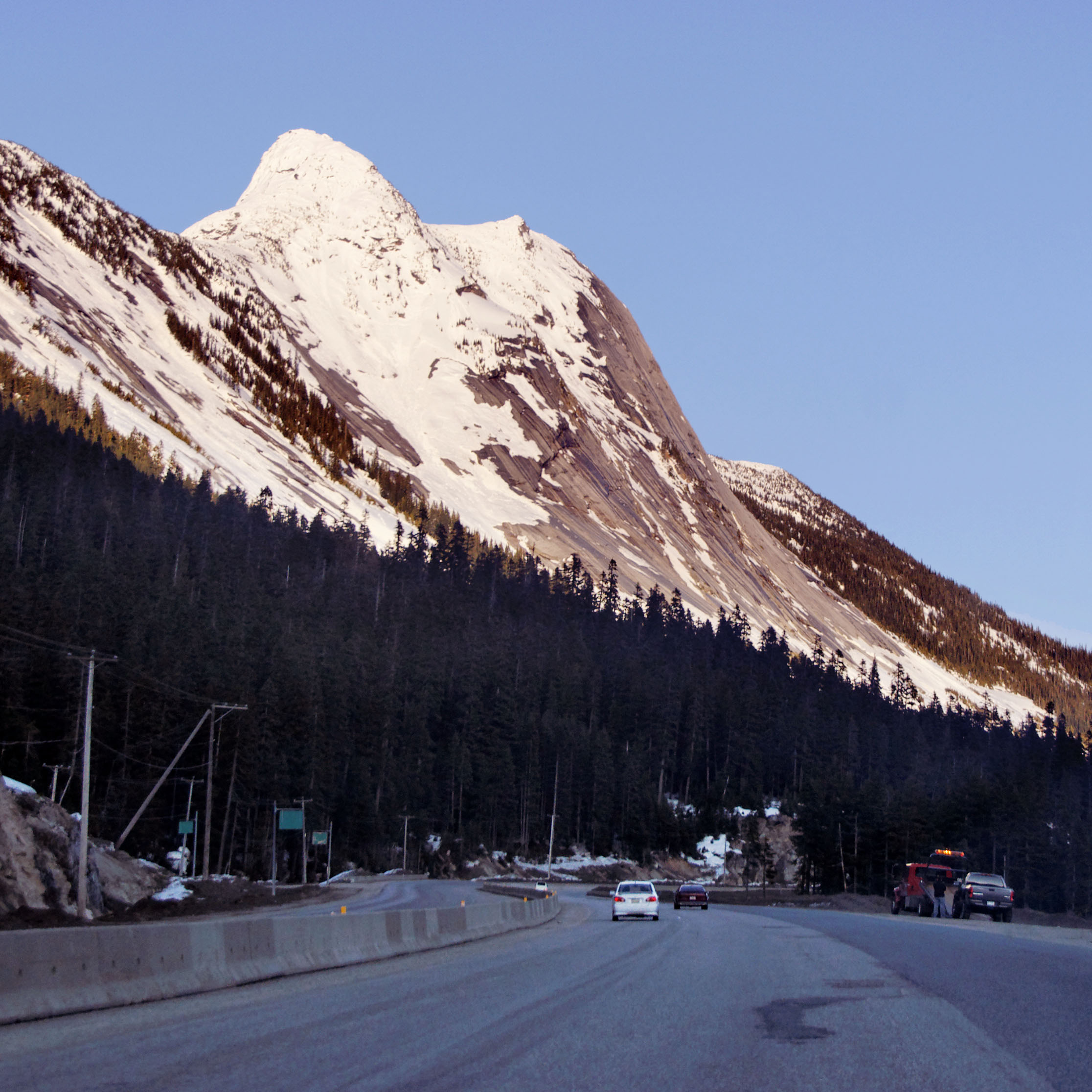
Getting near dark. [Dan photo.]
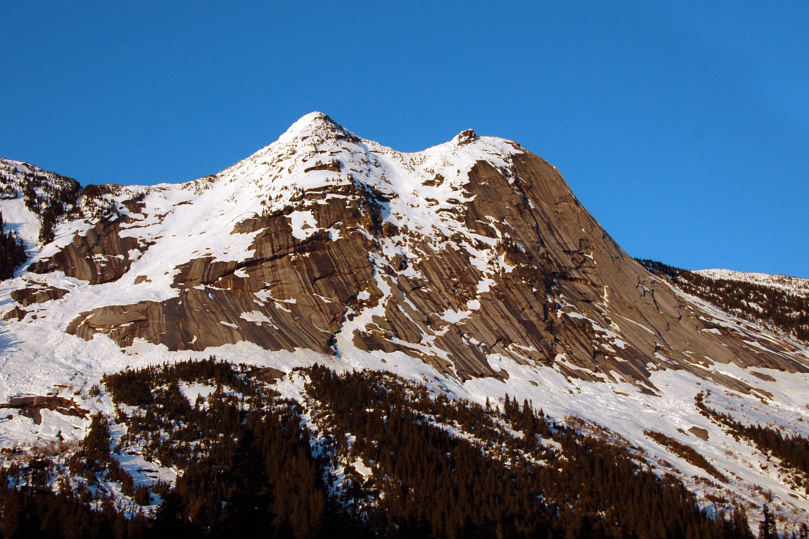
The same mountain, just a few minutes later when the sun is setting.
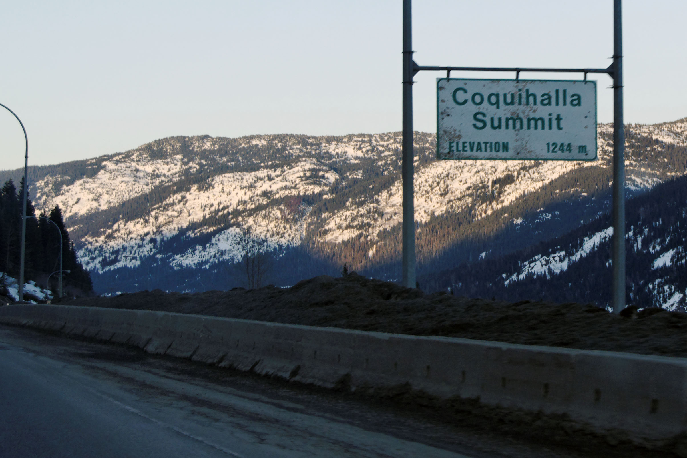
The top of the pass. [Dan photo.]

And here we see the wide style of British Columbia marker.
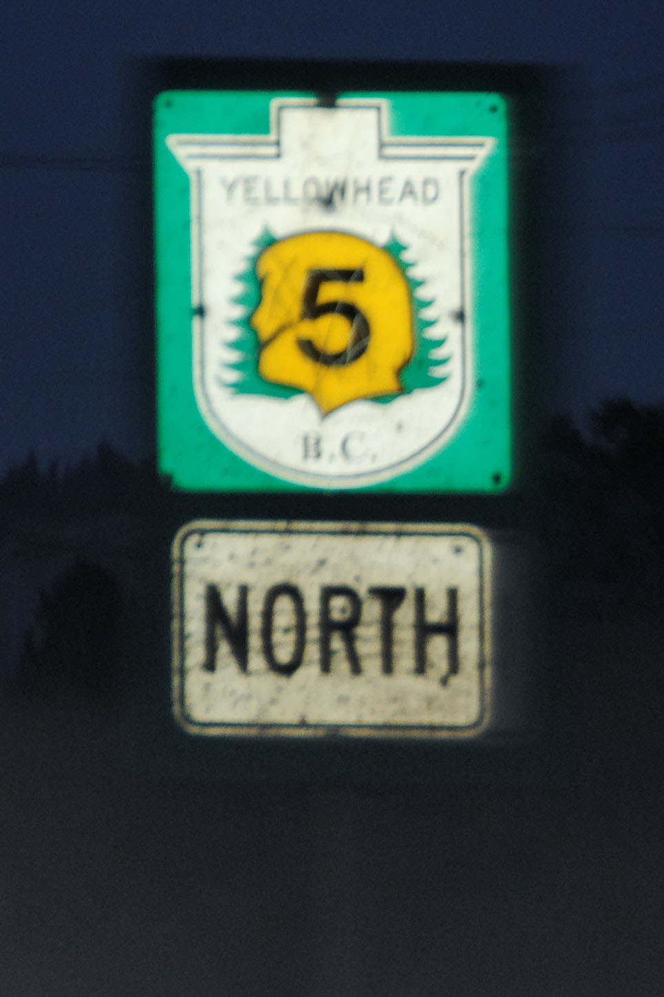
An infrequently seen non-cutout marker. The Yellowhead Highway splits into routes 16 and 5 on the British Columbia side of the Rockies – 16 proceeding to the coast at Prince Rupert, and 5 connecting with Trans-Canada 1 to head to Vancouver – and both branches are signed with distinctive markers. [Dan photo.]
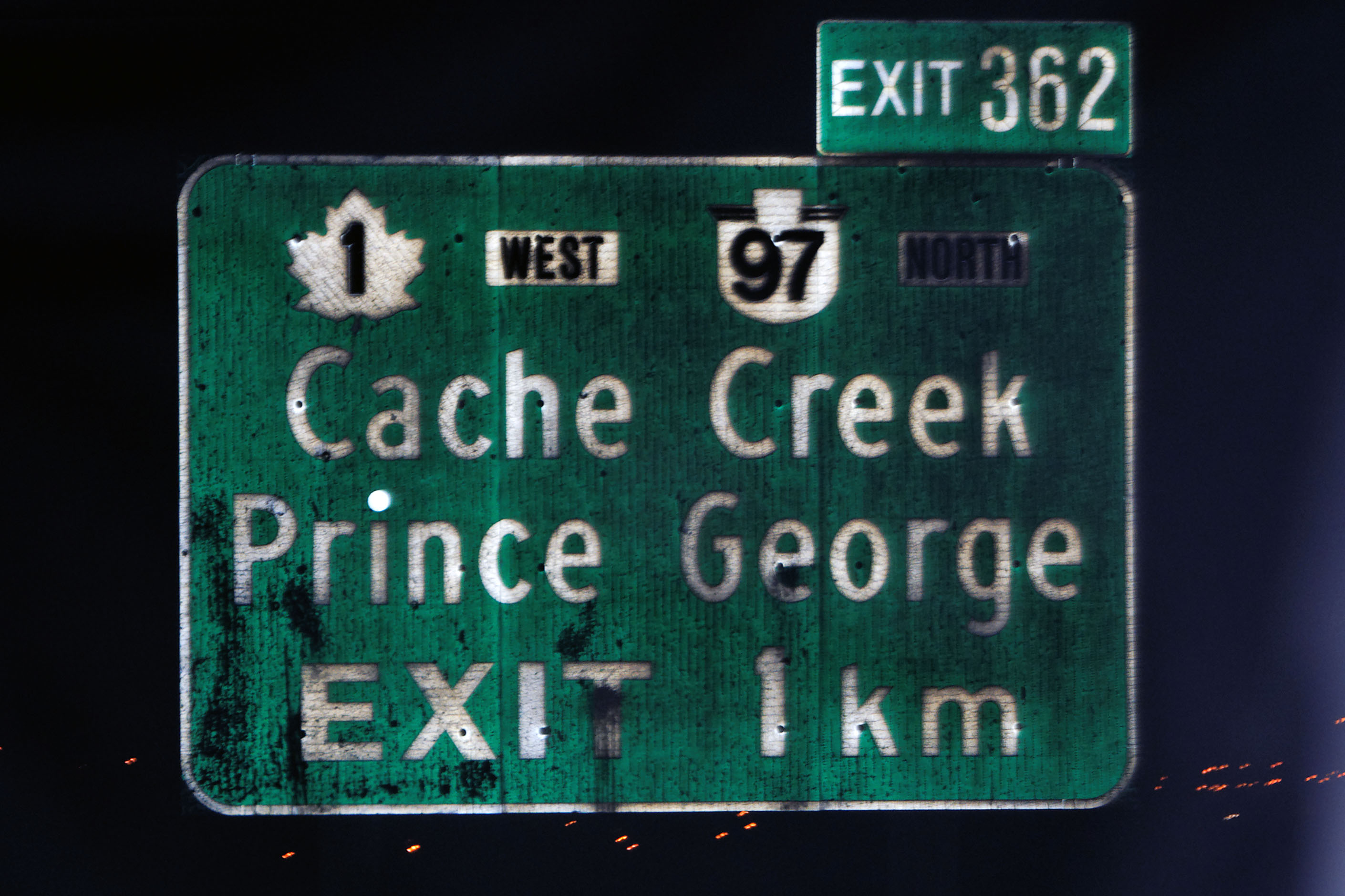
Dan manages to capture this old guide sign. How old? Note the striping – that’s indicative of 1960s Silver Scotchlite reflective sheeting! Also, this photo is notable as it is one of our first 97 shots. We will be seeing a lot of 97 as we proceed northward.
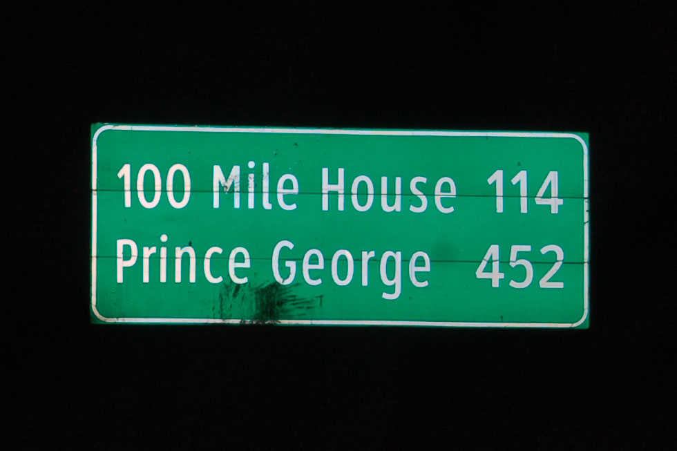
“100 Mile House” is one hundred miles from Vancouver on 99, and then 97.
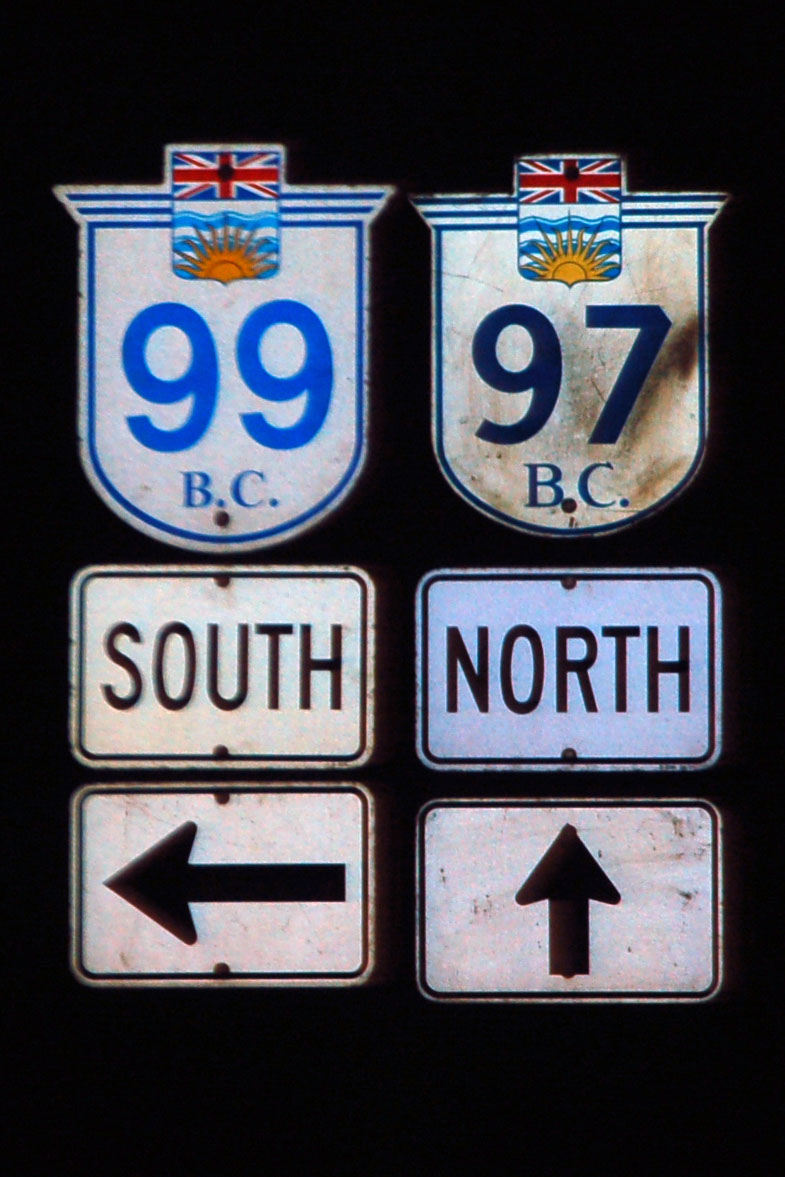
Here is the end of route 99, which at one point was the continuation of US highway 99 all the way up from Calexico, CA. For some reason, they chose 97 to be the route that continued all the way to Alaska, even though that route stops in Weed, CA at old US-99 – never mind that all the Mile Houses were numbered along the route that started as 99.
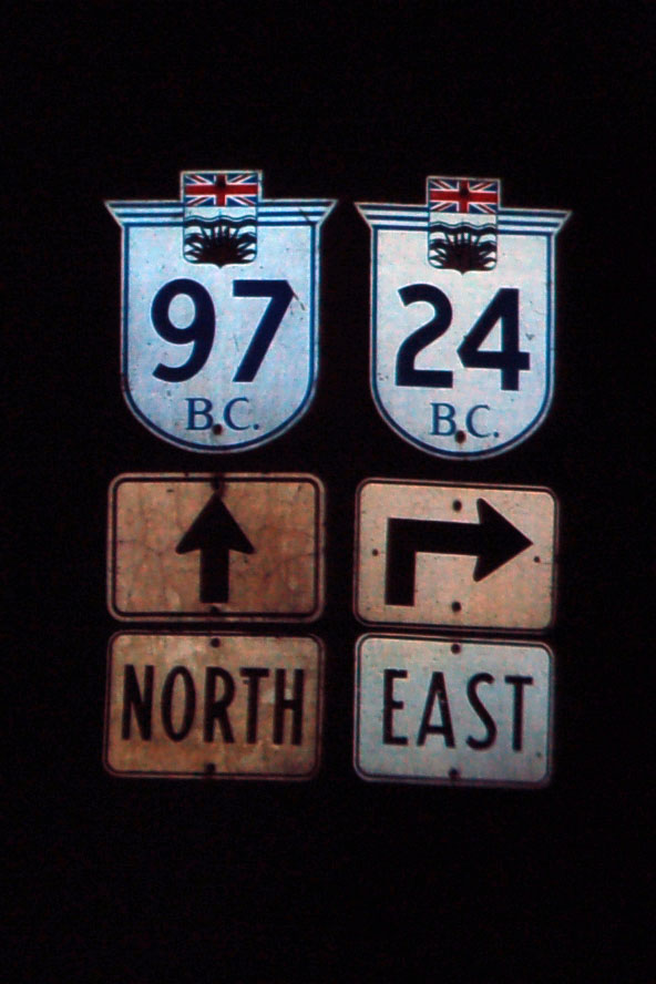
Just some classic old-font shields at the 24 junction.
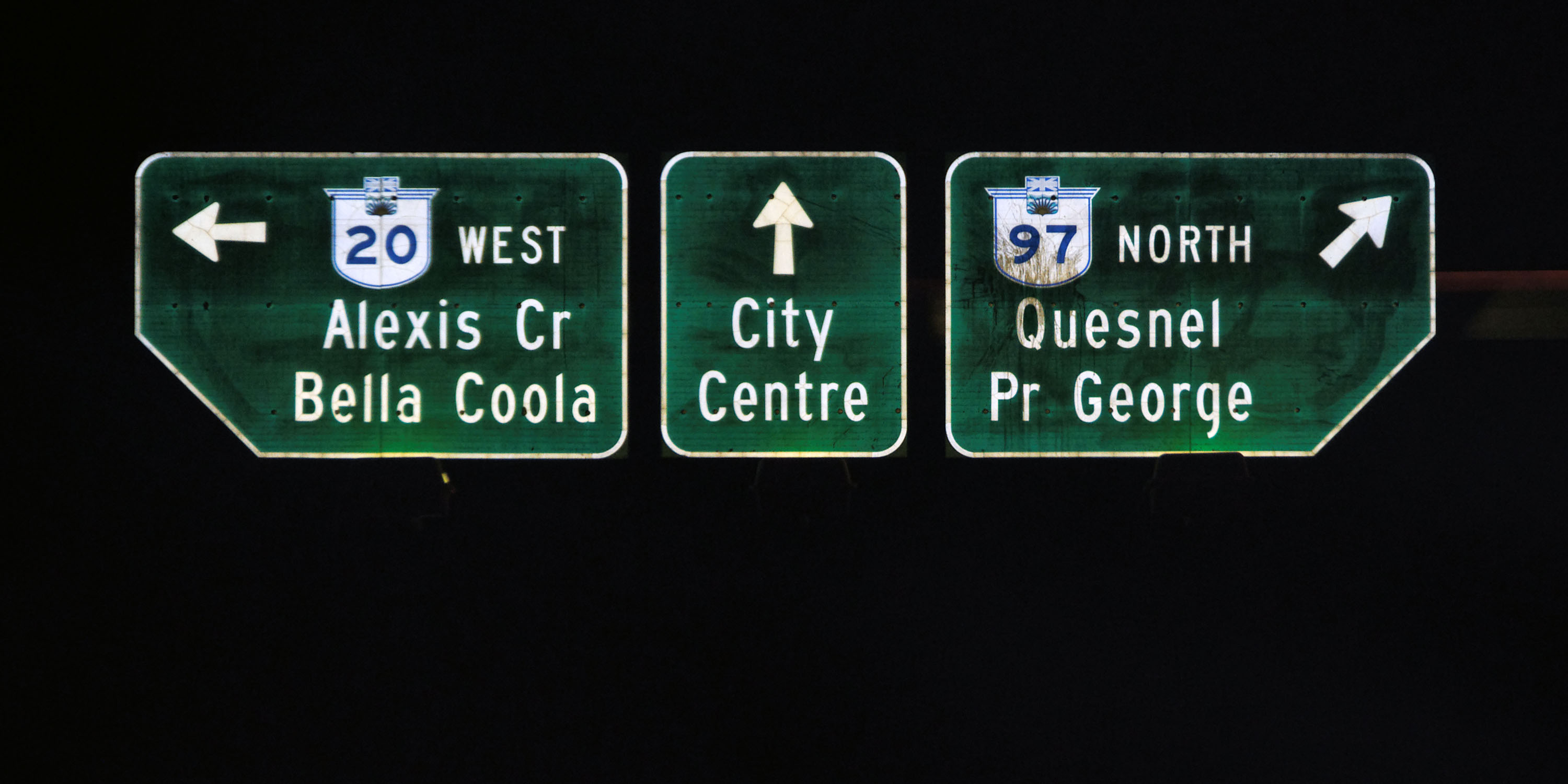
The town of Williams Lake (to which the city center is referring) is just past 150 Mile House. [Dan photo.]
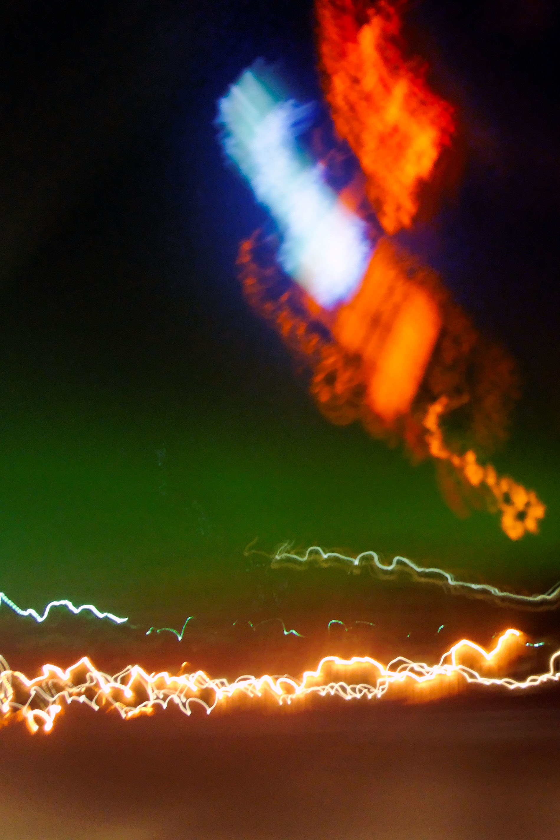
Testing for northern lights. This is Dan holding the camera relatively still and doing a 30 second exposure while I find a straight stretch of road. And indeed, there be the northern lights, past the various internal reflections from the dashboard.
And you’ve seen the rest of the photos from the night at the top of this post, so this is where we leave off. We reach Dawson Creek by dawn, and therefore start the Alaska Highway proper on the second day.
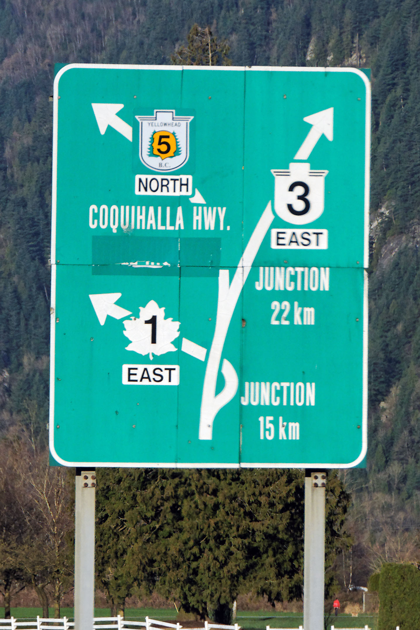
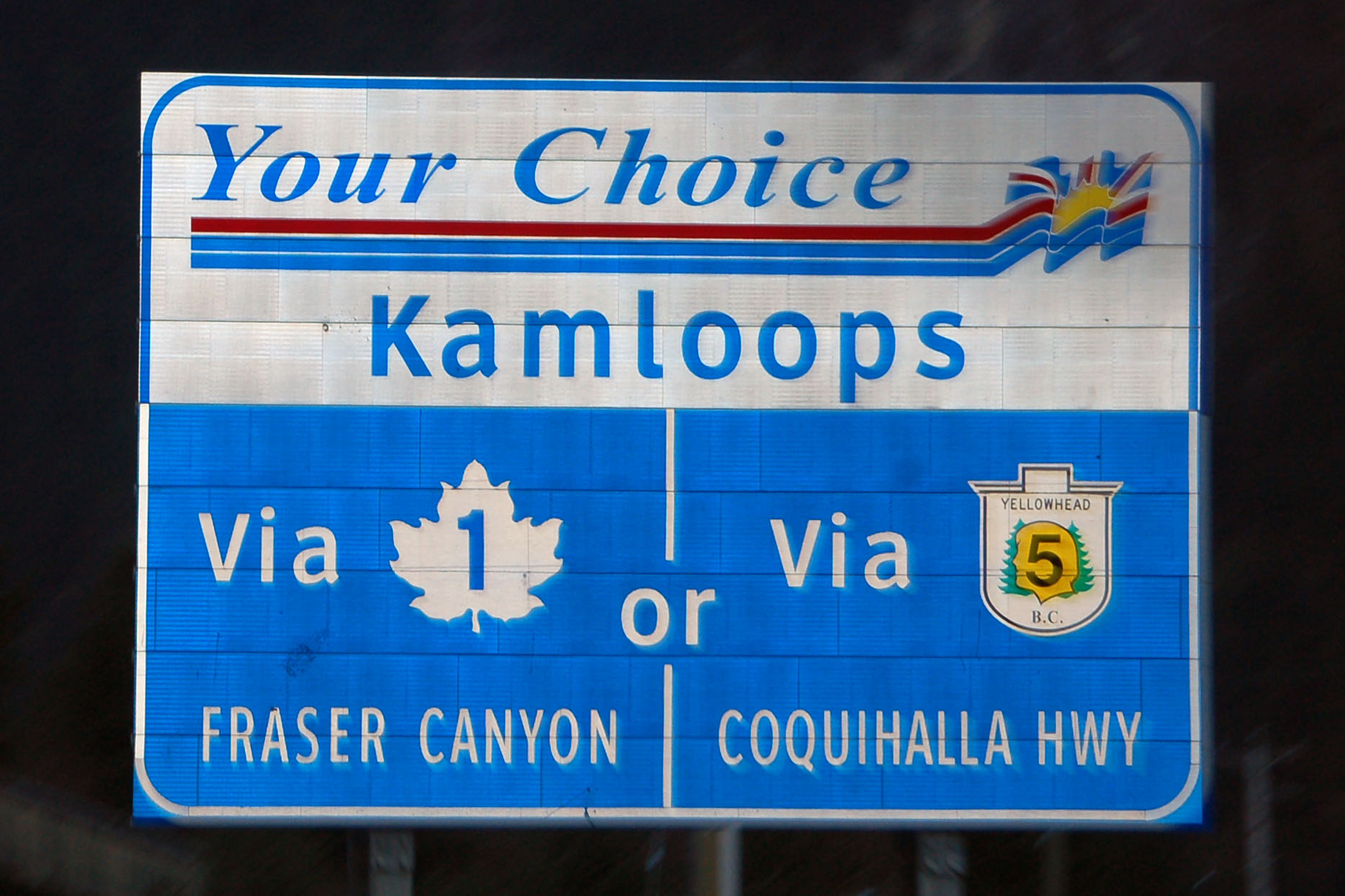
On the greenout: the Coquihalla Highway used to be a toll road, so I’m sure some phrase related to the tolling is what’s greened out. On the first sign, you can make out “TOLL” but I’m not sure what is next (“PLAZA” followed by a distance, maybe?). This also explains the “Your Choice” sign: take the free route to Kamloops or the faster (formerly tolled) one.
“Look at that, we’re successfully in Canada, after minimal interference from the border patrol – most of the questioning based on the fact that we didn’t know the difference between Prince George and Prince Rupert.”
Pray tell, what is the difference, and why does the Canadian border patrol care about it?
Also, I think you’ve got your overhead and black signs switched.
the Coquihalla was labeled as a toll road on my Rand McNally and we kept waiting for the tollbooths.
as for George vs Rupert, the Canadian border patrol wanted to know where we’d be stopping for the night. We had minimal intentions of doing so, but needed to come up with an answer quickly, so I named the first town I could think of that was supposedly on the way to Dawson. I guessed wrong.
Correction: 100 Mile House is considerably more than 100 miles from Vancouver. I believe the correct measurement is from Lilloet.
Also, you definitely would have saved an hour by going up 1 to Cache Creek, rather than taking the Coq.
oh, we saved plenty of time. We were stuck in Anchorage for an extra day and *still* had a day to spend in the US after finishing our planned itinerary.
The fifth picture, captioned “My guess is I-15 and US-91 somewhere in Utah or Idaho.” is most definitely Rexburg, ID, home of the LDS private school Brigham Young University–Idaho.
It is actually on US-20, about 30-40 miles east of I-15.
sure is! I just looked it up on Google Maps, and noticed that the old road through town was labeled “Route 191” – it hasn’t been US-191 in years! Wonder if any shields survive. I’ve only driven the bypass 20 through that section of the world.
The greenout on the Coquihalla sign reads “(TOLL HIGHWAY)”. From BC Highways, here is an older photo of the same sign:
http://www.bchwys.ca/TCH/1E_325.jpg
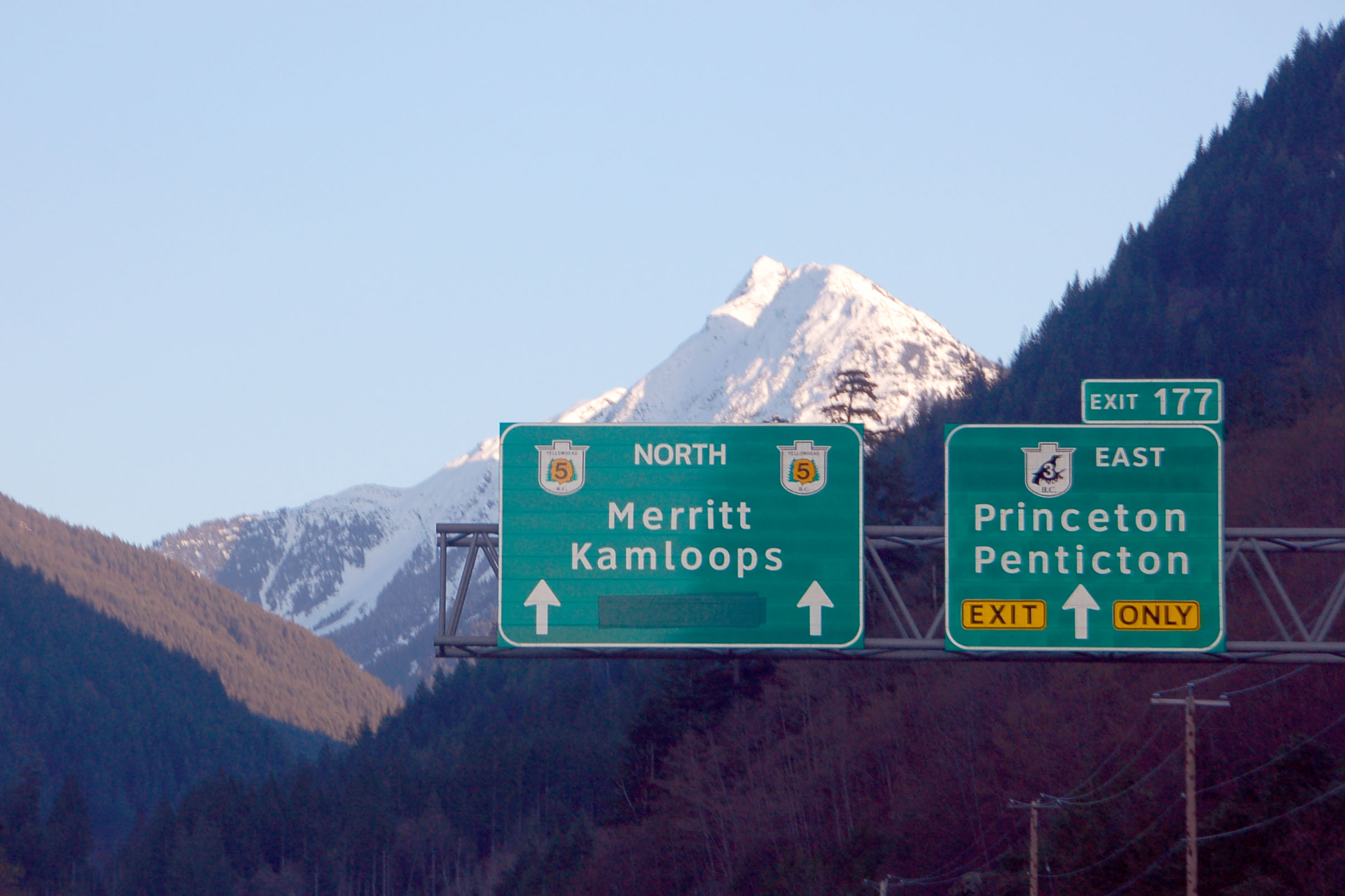
now the question is, what shield is under the Yellowhead 5? Is it an older style Yellowhead or just plain 5 shield?
On the BC 97-99 jct: originally 99 didn’t make it to this junction. It was only extended up there in 1992. Before that, BC 12 looped back to junction with 97 here. That partially explains why 97 got routed up the Cariboo, Hart and Alaska Highways.
that makes a lot of sense; thanks for the explanation! Did 99 previously end at 12?
99 previously ended at Pemberton, and what is now 99 between Pemberton and Lilloet was the unpaved Duffy Lake Road. I hear it’s quite the drive too, with a number of tight corners and ~13% grades–which is why despite being shorter, it isn’t the main route from Vancouver to the interior.
That’s actually quite the gap to fill. I wonder why they didn’t build it to 97 from the beginning – though there likely wasn’t much of a need, as a lot of British Columbia makes rural Nevada look densely populated!
Probably the shield under the Yellowhead 5 was just a plain BC 5 shield. The Yellowhead designation was only recently extended down the Coquihalla, and originally only went as far south as Kamloops. It was then extended in stages–first to Merritt, and then to Hope.
had we known that, we’d have been more vigilant in looking out for a remnant non-Yellowhead BC-5 shield.
It also explains why all the Yellowhead shields are in Arial font.
Almost certainly no need–the better route to metro Vancouver is still the route through the Fraser Canyon, so 99 mostly serves traffic to and from Whistler and area, which really boomed only in the last 10-20 years.
I have paid toll on the Coquihalla Highway, as of 2003. The toll was abolished with a change in provincial government some years later–2005? 2007? Back in 2003 the Coquihalla used Series E Modified more or less exclusively and U-turn routes were extensively signed.
Are the earthworks on the Coquihalla still as pouchy and saggy as they were back in 2003?
when we were there, the road was very nice and smooth. The only place we had rough roads was about the westernmost 100 miles of the Alaska Highway in Yukon, and a couple sections of the Cassiar Highway in BC.
2 and 3 pictures!!! very nice