|
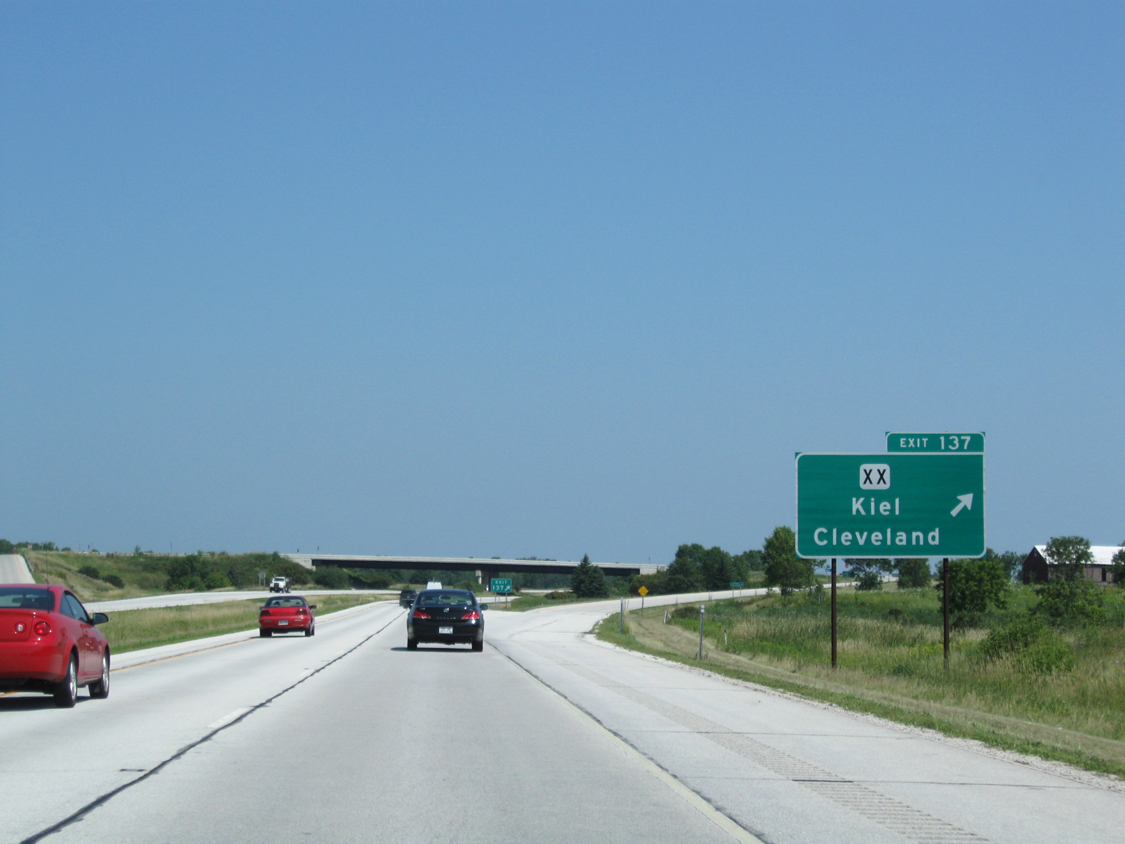
| Interstate 43 north passes under Cleveland Avenue one mile out from Manitowoc County XX (Exit 137). 08/12/09 |
|
| County XX follows North Avenue east from the diamond interchange (Exit 137) into Cleveland. Traveling west from I-43, County XX stairsteps across Manitowoc County to reach Kiel along the Wis 32 corridor. 08/12/09 |
|
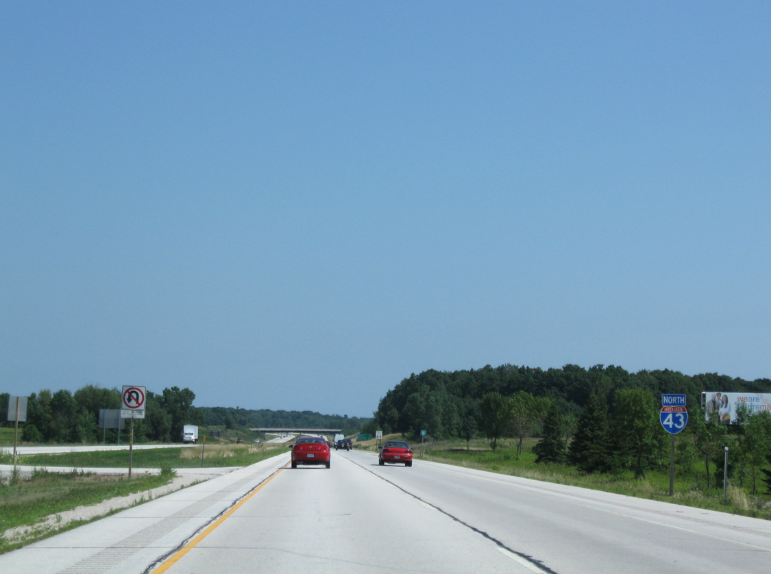
| Lakeshore Technical College lies to the east of this confirming marker along I-43 north. 08/12/09 |
|
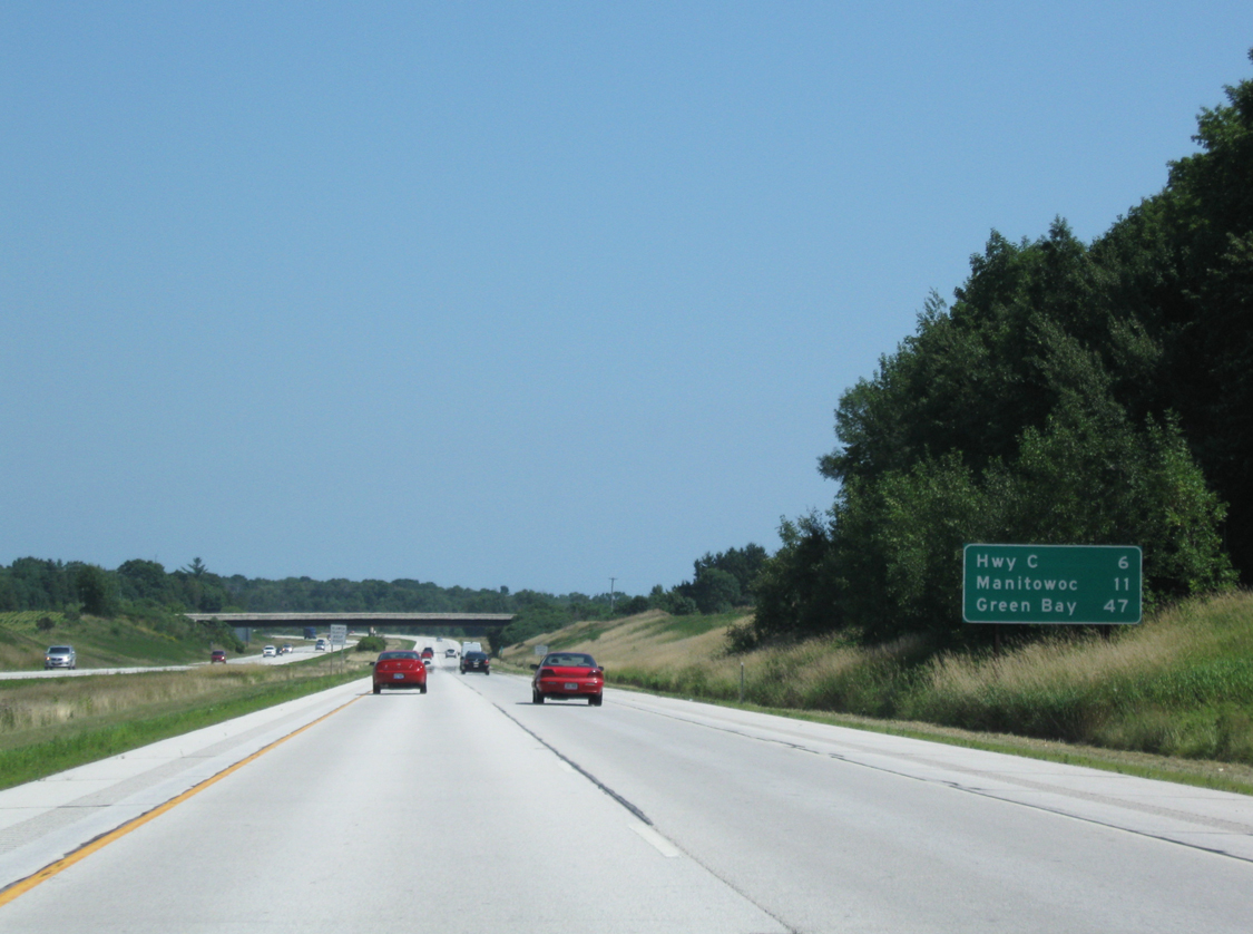
| 11 miles separate drivers from the Manitowoc County seat while a 47 mile drive remains to reach the northern terminus city of I-43. Exit 144 (CTH-C) connects with the freeway in six miles. 08/12/09 |
|
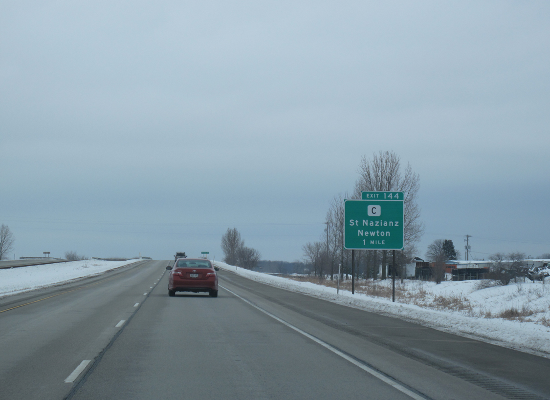
| Exit 144 (County C) ties I-43 with St. Nazianz and Newton in one mile. The town of Newton lies to the south of the upcoming interchange. 01/29/11 |
|
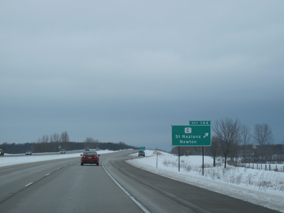
| Interstate 43 bends northeast as motorists leave for CTH-C (Exit 144). The village of Saint Nazianz sits due west and was founded in the mid 1850s by German immigrants intent on starting a religious commune.1 01/29/11 |
|
| Drivers continue beyond Exit 144 (County C) en route to Manitowoc. 09/21/16 |
|
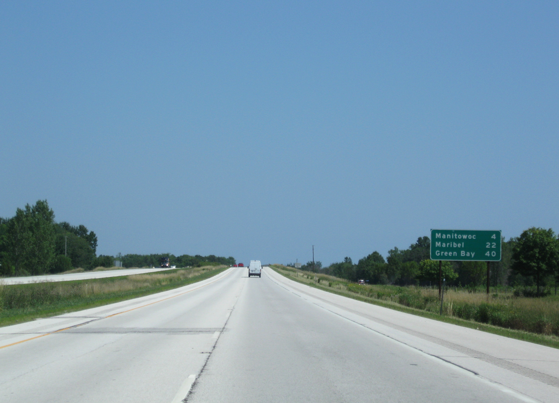
| I-43 north spans Carstens Lake Road 22 miles south of Maribel and 40 miles out from Green Bay. 08/12/09 |
|
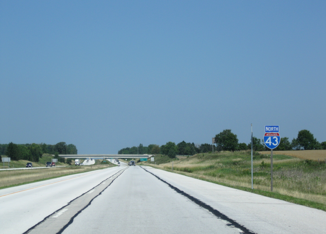
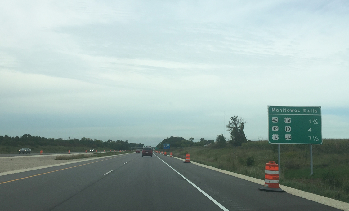
| Signs replaced by 2016 for Manitowoc area interchanges yielded the inclusion of highway shields in lieu of text. 08/12/09, 09/21/16 |
|
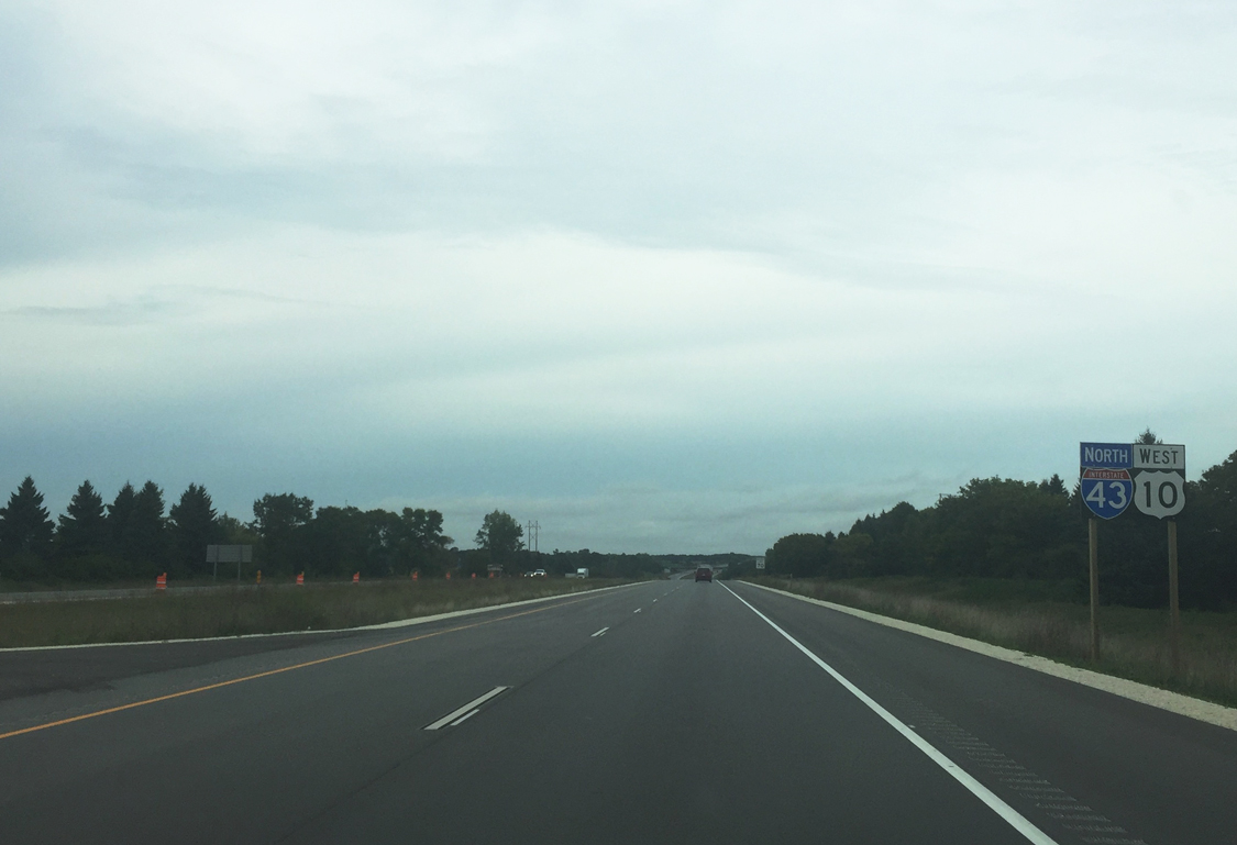
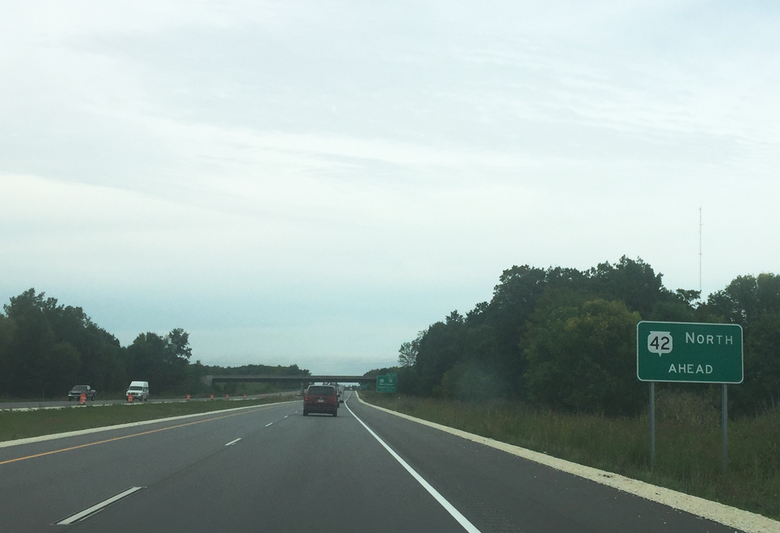
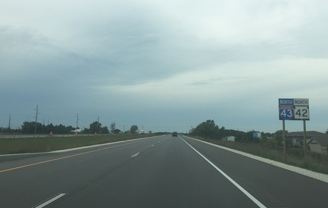
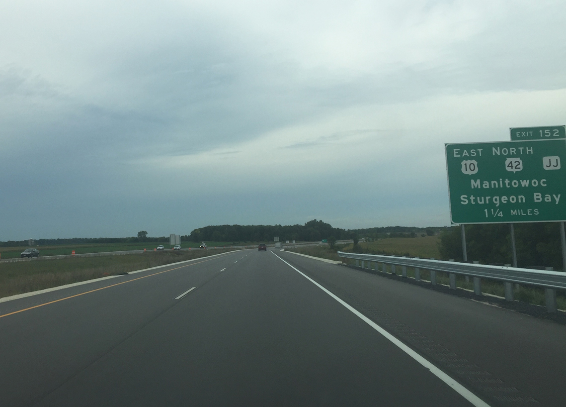
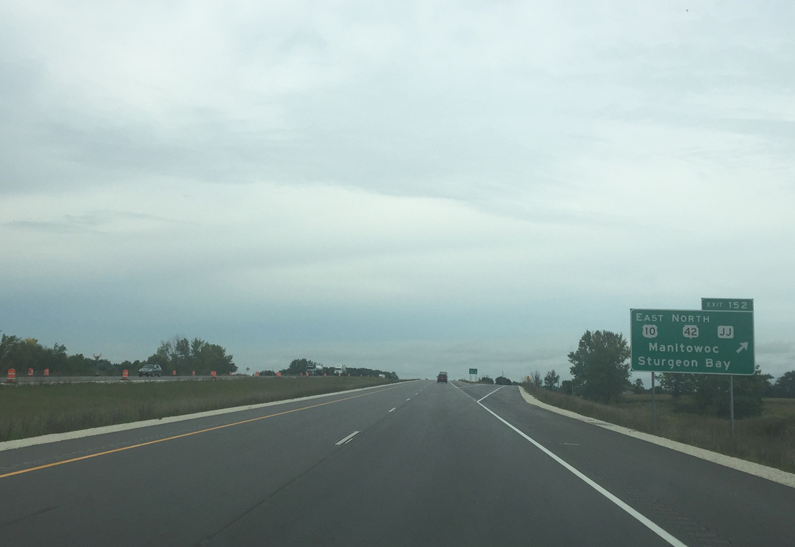
| Wis 42 will merge with Interstate 43 north for a brief overlap as the freeway skirts Manitowoc to the west. The state trunk highway will leave along U.S. 10 at Exit 152. 09/21/16 |
|
| U.S. 151 joins I-43 north directly with Downtown Manitowoc in 1.25 miles. Wis 42 Business travels northeast along with U.S. 151 to the US highways end at 8th Street (U.S. 10 west) near Downtown. 09/21/16 |
|
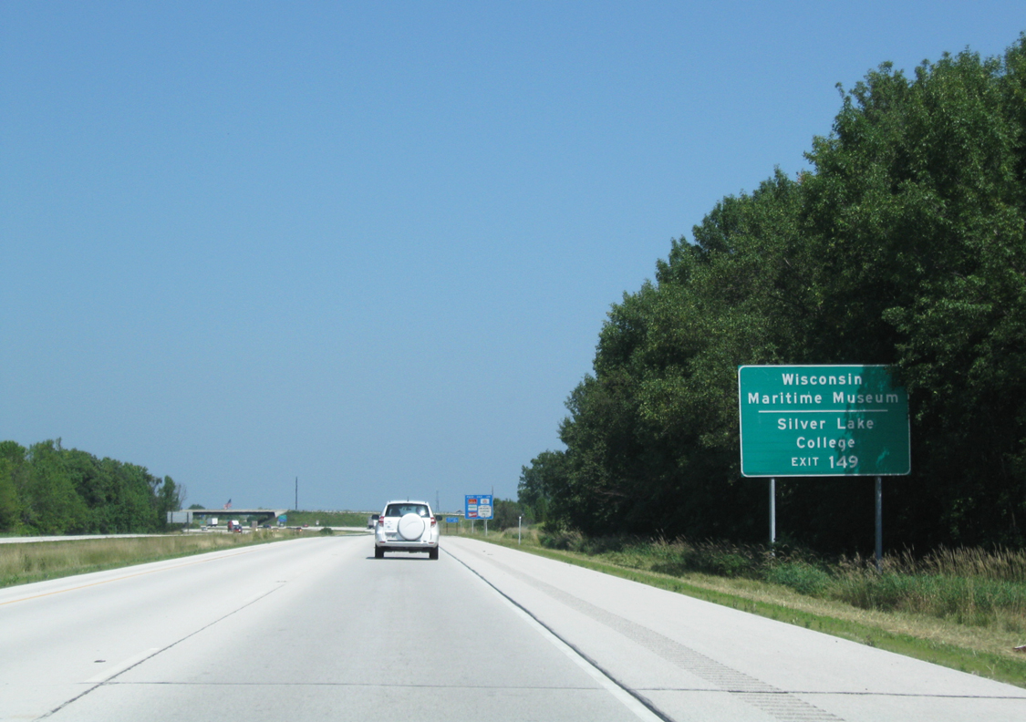
| Silver Lake College is a private college situated near Silver Lake along U.S. 151 (Calumet Avenue) south while the Wisconsin Maritime Museum is the permanent home to the USS Cobia (SS-245), a World War II submarine that was also built in the city. 08/12/09 |
|
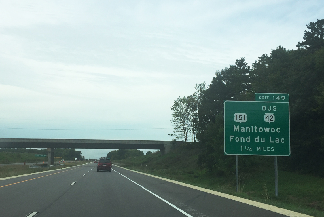
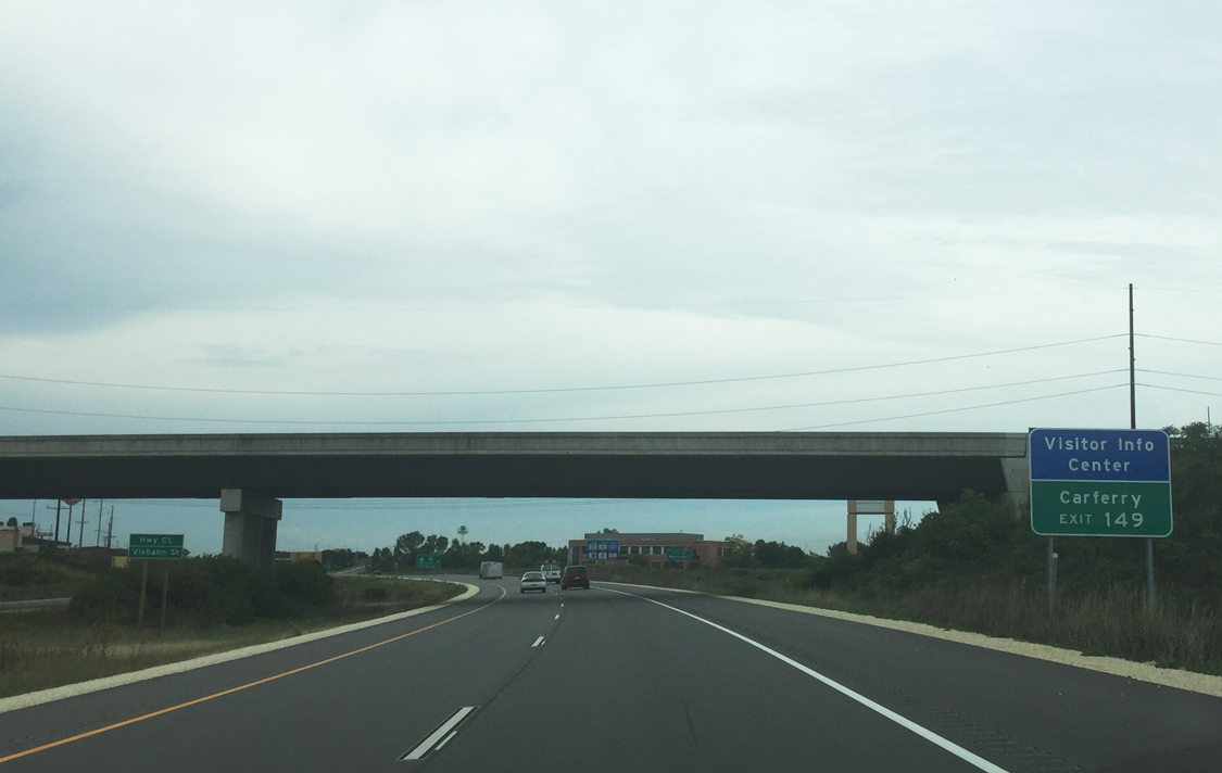
| Manitowoc County CL (Viebahn Street) spans the freeway as it curves northwest ahead of the diamond interchange (Exit 149) with U.S. 151 and STH-42 Business (Calumet Avenue). Access to the Carferry area is reached via U.S. 151 north. Carferry represents the western access point of the Manitowoc-Ludington, Michigan automobile-passenger ferry crossing of U.S. 10 across Lake Michigan. 09/21/16 |
|
| Drivers leave for U.S. 151 and Wis 42 Business (Exit 149) to Downtown. Both U.S. 151 and Wis 42 Business follow Calumet Avenue northeast through a commercial area before turning east on Washington Street to the central business district. Otherwise Wis 42 departs U.S. 151 south at Dufek Drive for Osman and Howards Grove. 09/21/16 |
|
| The Lake Michigan Circle Tour route also departs here, following STH 42 Business its entire length through Manitowoc. The tour route will briefly rejoin I-43 in Green Bay. 09/21/16 |
|
| I-43 and Wis 42 travel west of the Manitowoc County expo center and an apartment complex beyond the entrance ramp from Exit 149 (U.S. 151). 09/21/16 |
|
| U.S. 10 west will replace Wis 42 along I-43 in 1.25 miles (Exit 152) when the state trunk highway departs for U.S. 10 east to Sturgeon Bay. 09/21/16 |
|
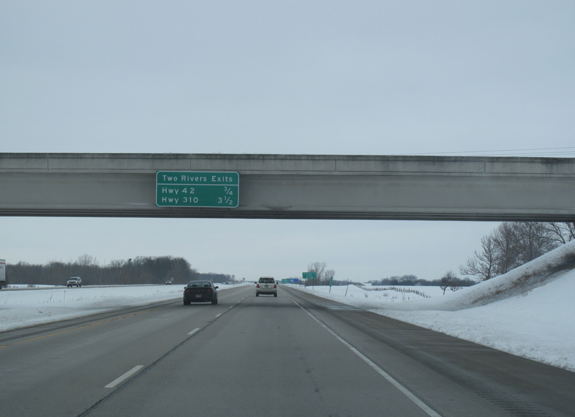
| Previous overhead signage mounted onto the Middle Road underpass alerted motorists of the approaching departure of STH-42 (0.75 miles) and STH-310 (3.5 miles). This sign has since been removed, but not replaced. 01/29/11 |
|
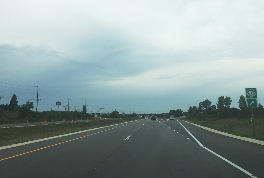
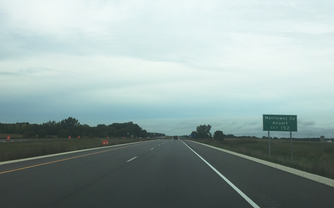
| Waldo Boulevard (U.S. 10 and Wis 42), a four lane thoroughfare through northern Manitowoc neighborhoods, joins Interstate 43 with Manitowoc County Airport (MTW) and the Lincoln Park Zoo. 09/21/16 |
|
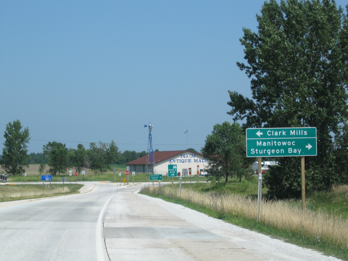
| A ramp leaves for Exit 152 to U.S. 10, STH-42 and County JJ. While US 10 east and Wis 42 north travel Waldo Boulevard toward Lake Michigan, CTH-JJ continues west from I-43 into rural Manitowoc County toward Clark Mills. U.S. 10 east follows 8th Street south into Downtown Manitowoc before looping back north to the Carferry area while Wis 42 travels the footprint of Lake Michigan to Two Rivers and Sturgeon Bay in Door County. 09/21/16 |
|
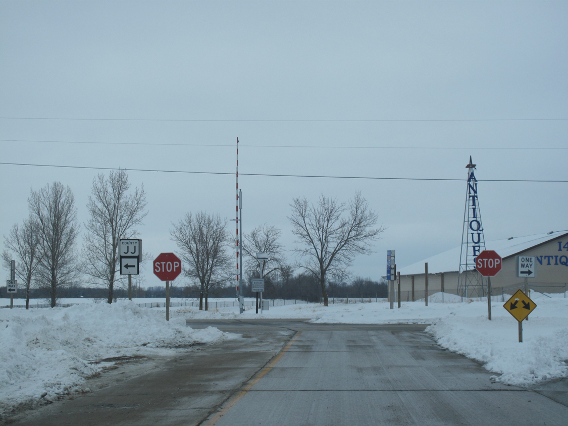
| Directional signage for Manitowoc County destinations and Sturgeon Bay are found along the off ramp from I-43 to U.S. 10/Wis 42. CTH-JJ stems west from Exit 152 to shadow the Manitowoc River on its course to Clark Mills and beyond. 08/12/09, 01/29/11 |
|
| U.S. 10 combines with I-43 for two miles before departing west for Whitelaw and Brillion. 09/21/16 |
|
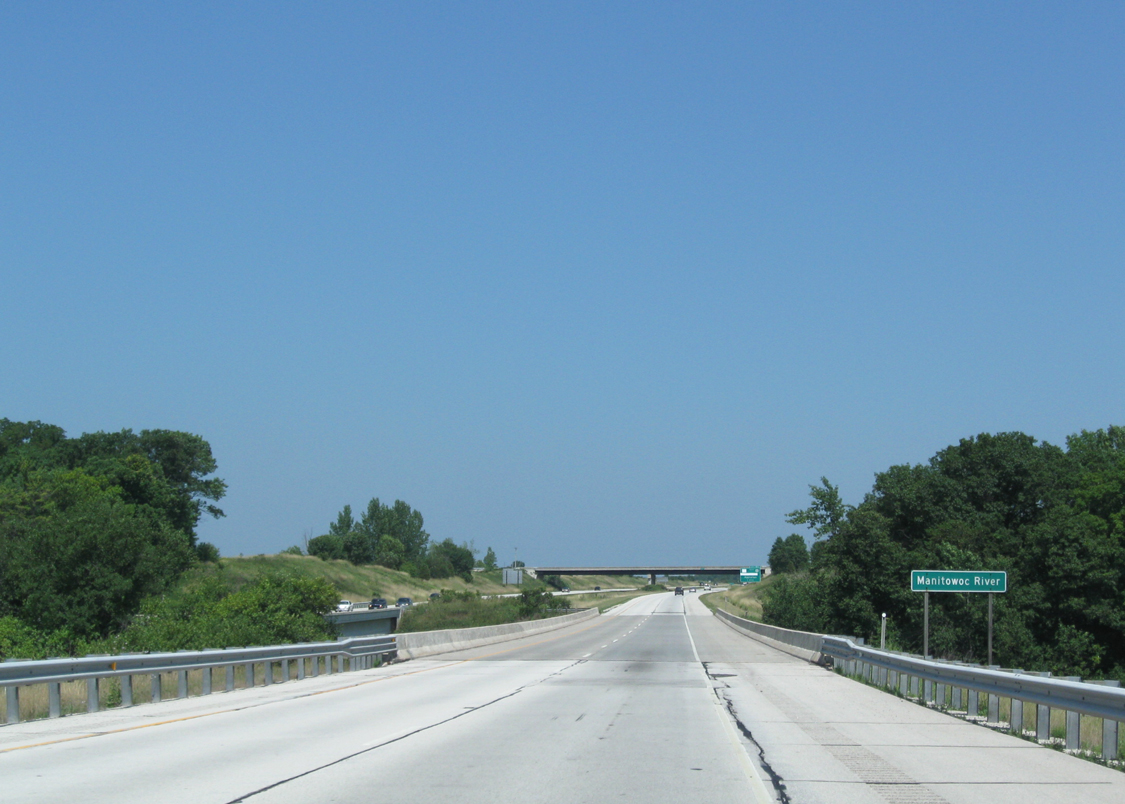
| Interstate 43 north spans the Manitowoc River half way between Exits 152 and 154. The river flows from two branches in eastern Calumet County toward Lake Michigan on a 36 mile course. 08/12/09 |
|
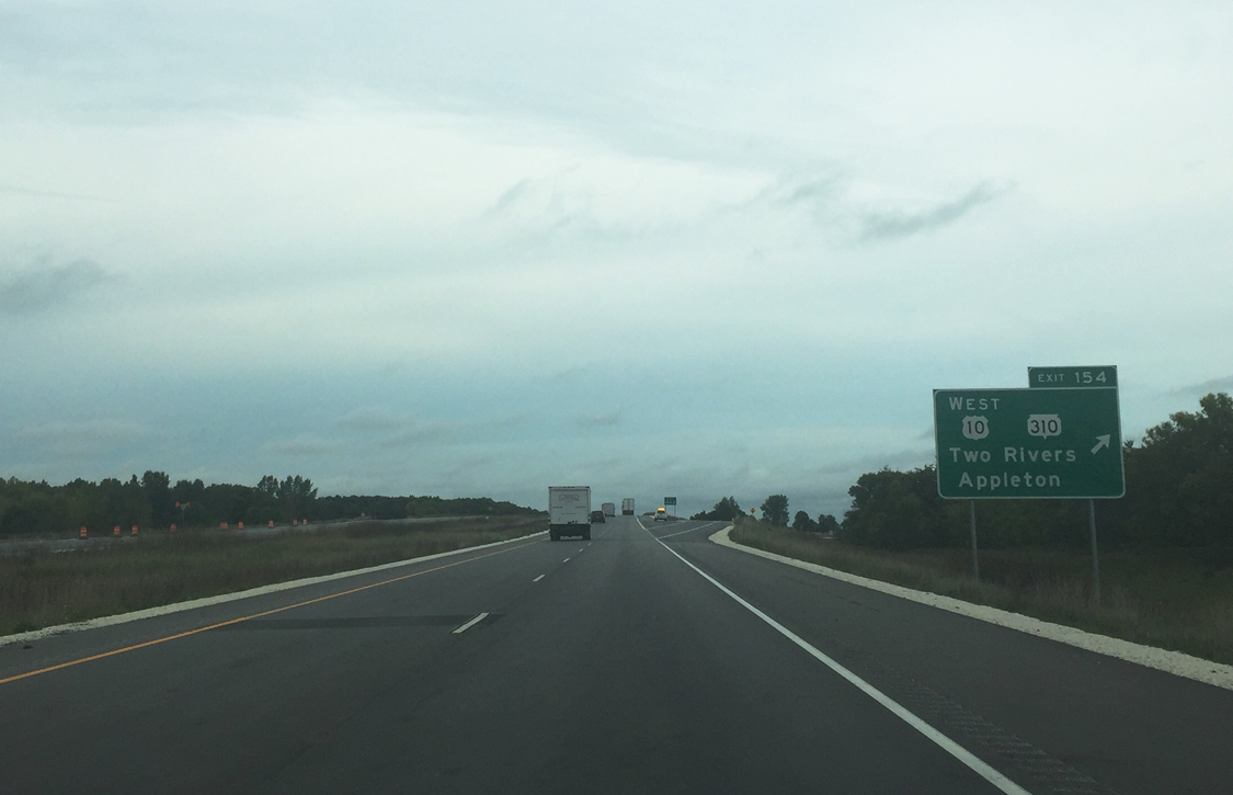
| Exit 154 represents the westbound departure of U.S. 10 to Appleton in one mile. Wis 310 stems east from the approaching diamond interchange to connect with Wis 42 in Two Rivers. 09/21/16 |
|
| Wis 310 travels 8.7 miles to join Two Rivers with I-43 at Exit 154. The state trunk highway was sanctioned in 1984 when a portion of U.S. 10 was rerouted onto the freeway and to provide a spur to Two Rivers.2 Otherwise U.S. 10 departs here for Brillion and Appleton (Interstate 41). 09/21/16 |
|
| Leaving the Manitowoc area behind Interstate 43 presses northward toward Green Bay (30 miles). 08/12/09 |
|
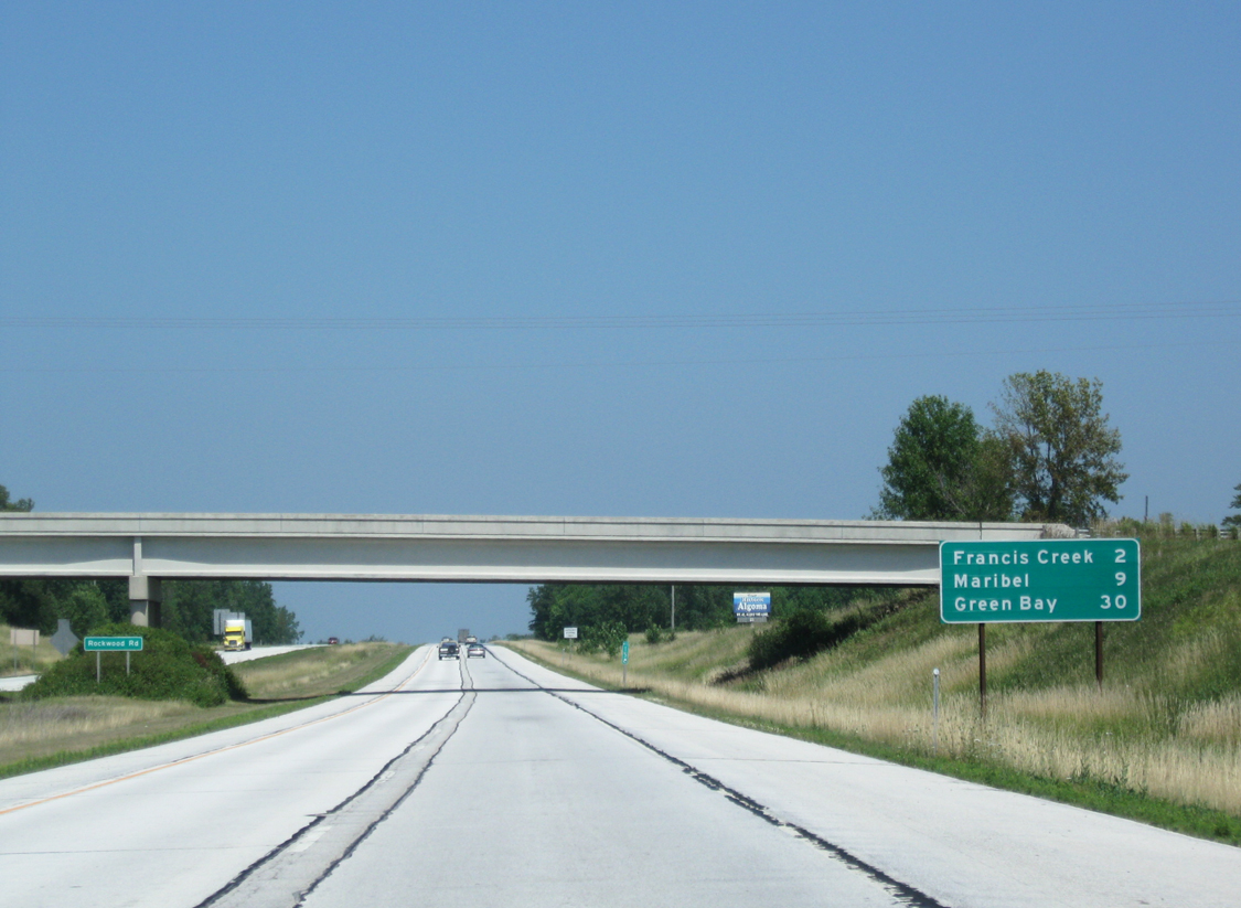
| Rockwood Road passes over the I-43 mainline two miles south of Francis Creek (Exit 157). 08/12/09 |
|
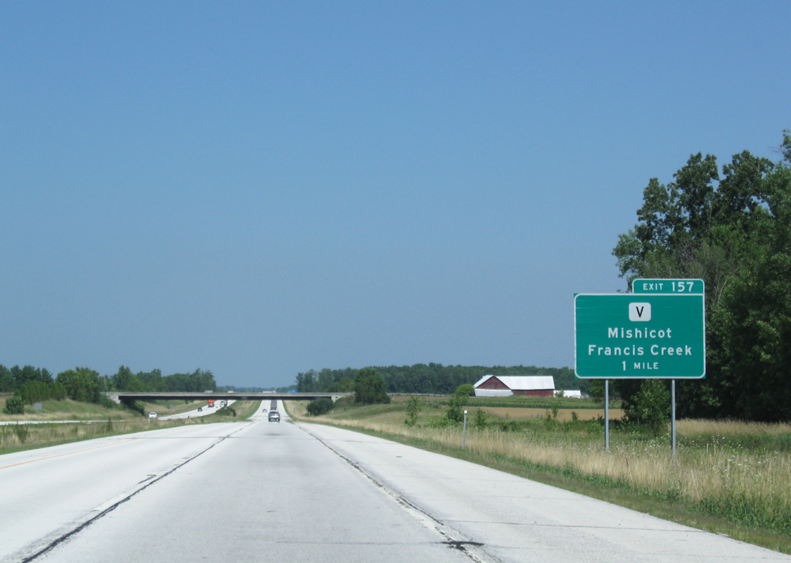
| County V (Hillcrest Road) will meet I-43 in one mile, joining the freeway with Francis Creek and Mishicot. 08/12/09 |
|
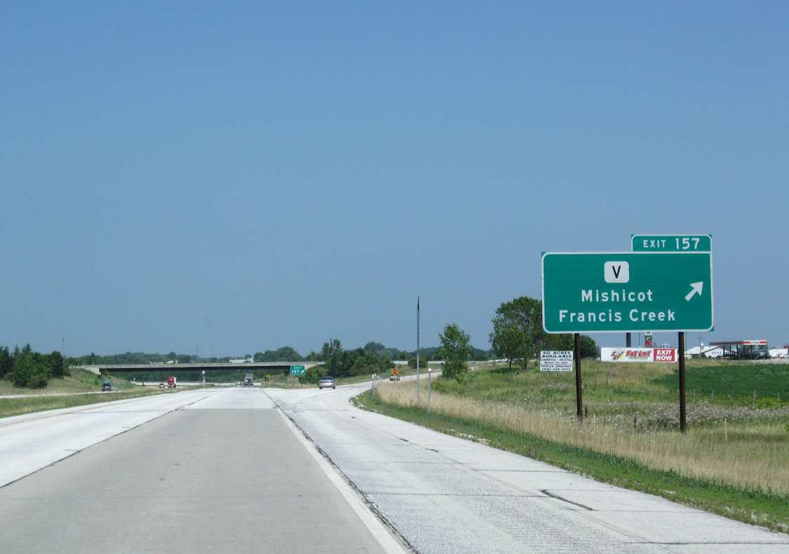
| The village of Francis Creek lies immediately east of the diamond interchange (Exit 157) while Mishicot is reached via County V (Forest Home Drive) and County B. 08/12/09 |
|
| A transmission line spans Interstate 43 as it veers northwest from Exit 157 (CTH-V). 08/12/09 |
|
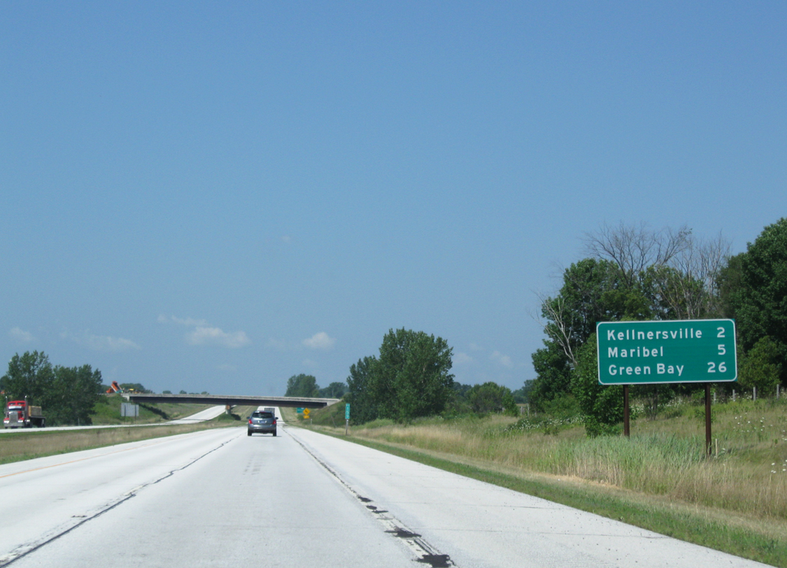
| The Polifka Road underpass is seen in the distance two miles from Kellnersville (Exit 160). Green Bay is now within a half-hour drive (26 miles). 08/12/09 |
|
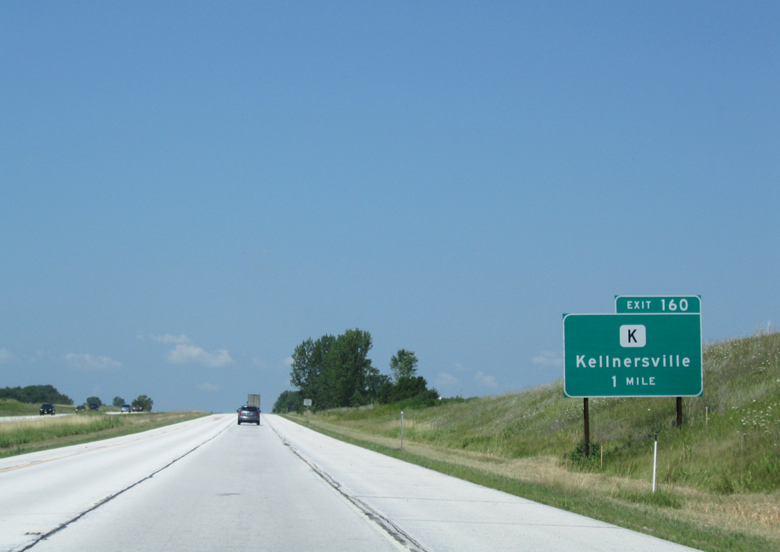
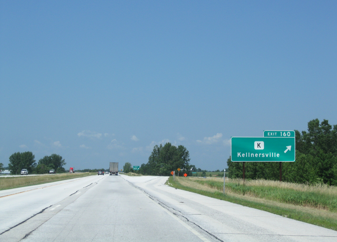
| Kellnersville lies 1.8 miles west of the forthcoming diamond interchange (Exit 160) with Manitowoc county K (Main Street). 08/12/09 |
|
| County K stems west from Packer Drive to meet I-43 before reaching Kellnersville. Beyond there, the county trunk highway continues across northern Manitowoc County to see an end at Wis 32 in eastern Calumet County. 08/12/09 |
|
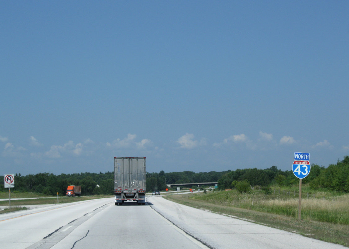
| Drivers once passed this confirming marker for I-43 north as the freeway recurves north to pass Maribel to the east. A newer assembly replaced this stand alone marker by 2013. 08/12/09 |
|
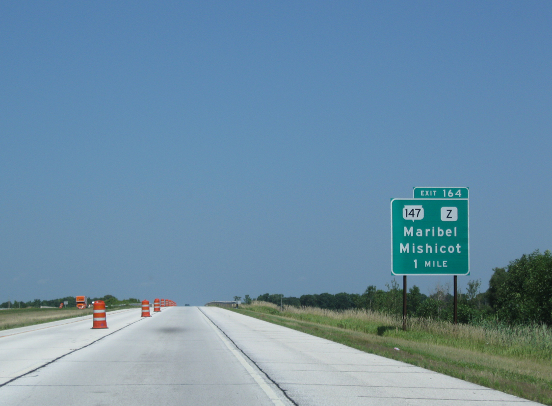
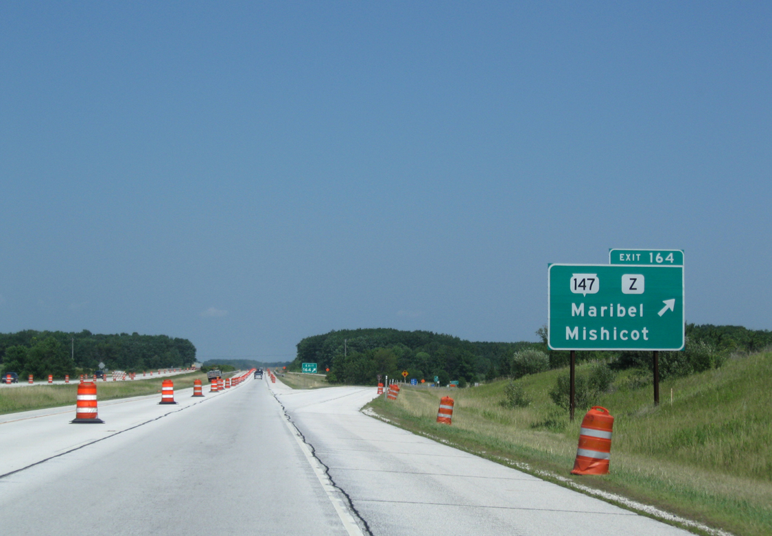
| Interstate 43 north rises with the surrounding terrain as it comes to within one mile of Wis 147 south and County Z west (Exit 164). Use the upcoming interchange to reach the nearby Hidden Valley ski area. 08/12/09 |
|
| Wis 147 travels east from I-43 on a 15 mile route to Two Rivers. The state trunk highway also provides an additional access point to Mishicot. County Z otherwise continues west into central Maribel. 08/12/09 |
|
| Another older style cutout marker found along I-43 north beyond the ramp from Exit 164 (Wis 147). Like other signage along this stretch, it was replaced by September 2013. 08/12/09 |
|
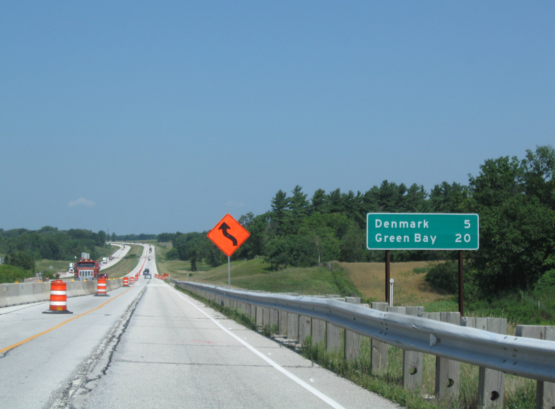
| Interstate 43 will skirt the village of Denmark in five miles while only 20 miles remain before the freeway enters Green Bay. 08/12/09 |
|
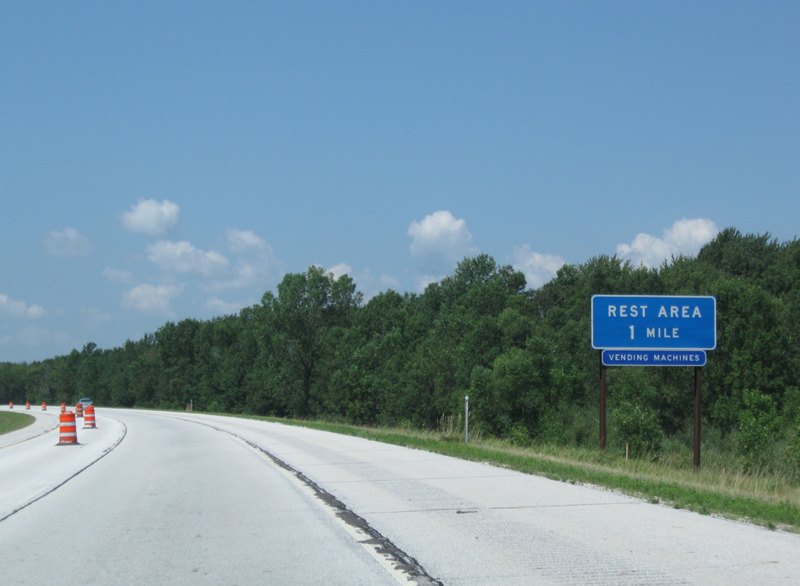
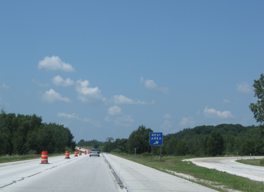
| Curving northwest beyond the Zander Road underpass, motorists approach the final rest area along I-43 north. 08/12/09 |
|
| A single ramp leaves for the Denmark rest area as Interstate 43 continues north toward Denmark and Green Bay. The rest area can accommodate up to 50 passenger vehicle and 20 commercial truck parking stalls.3 08/12/09 |
|
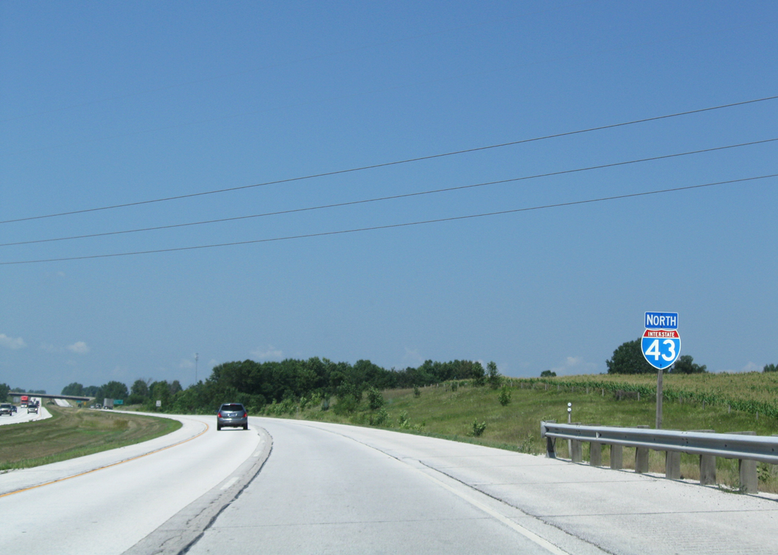
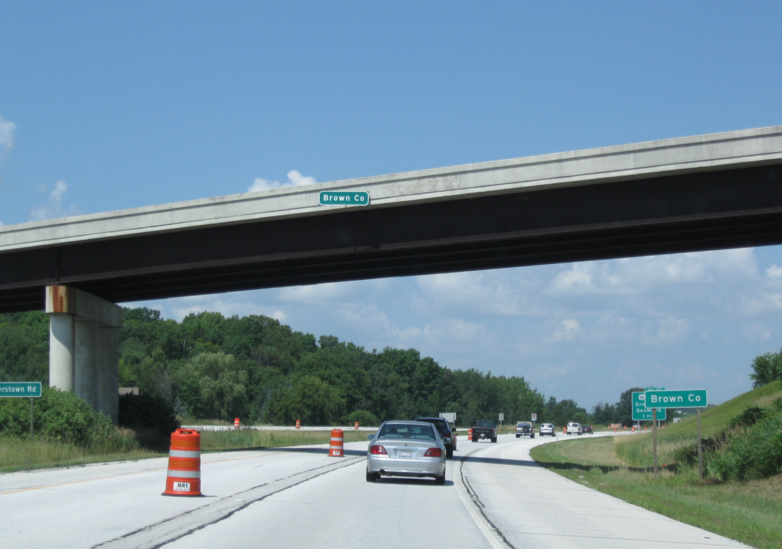
| AInterstate 43 formally enters Brown County as Cooperstown Road soars over the freeway mainline. Wis 96 (Exit 171) meets I-43 next for Denmark. 08/12/09 |
Page Updated 10-04-2016.

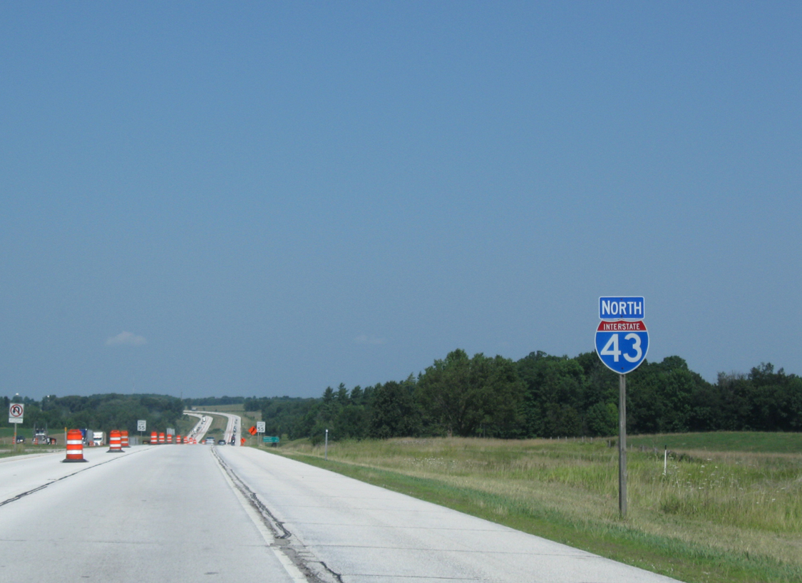
 North
North


 West
West