|
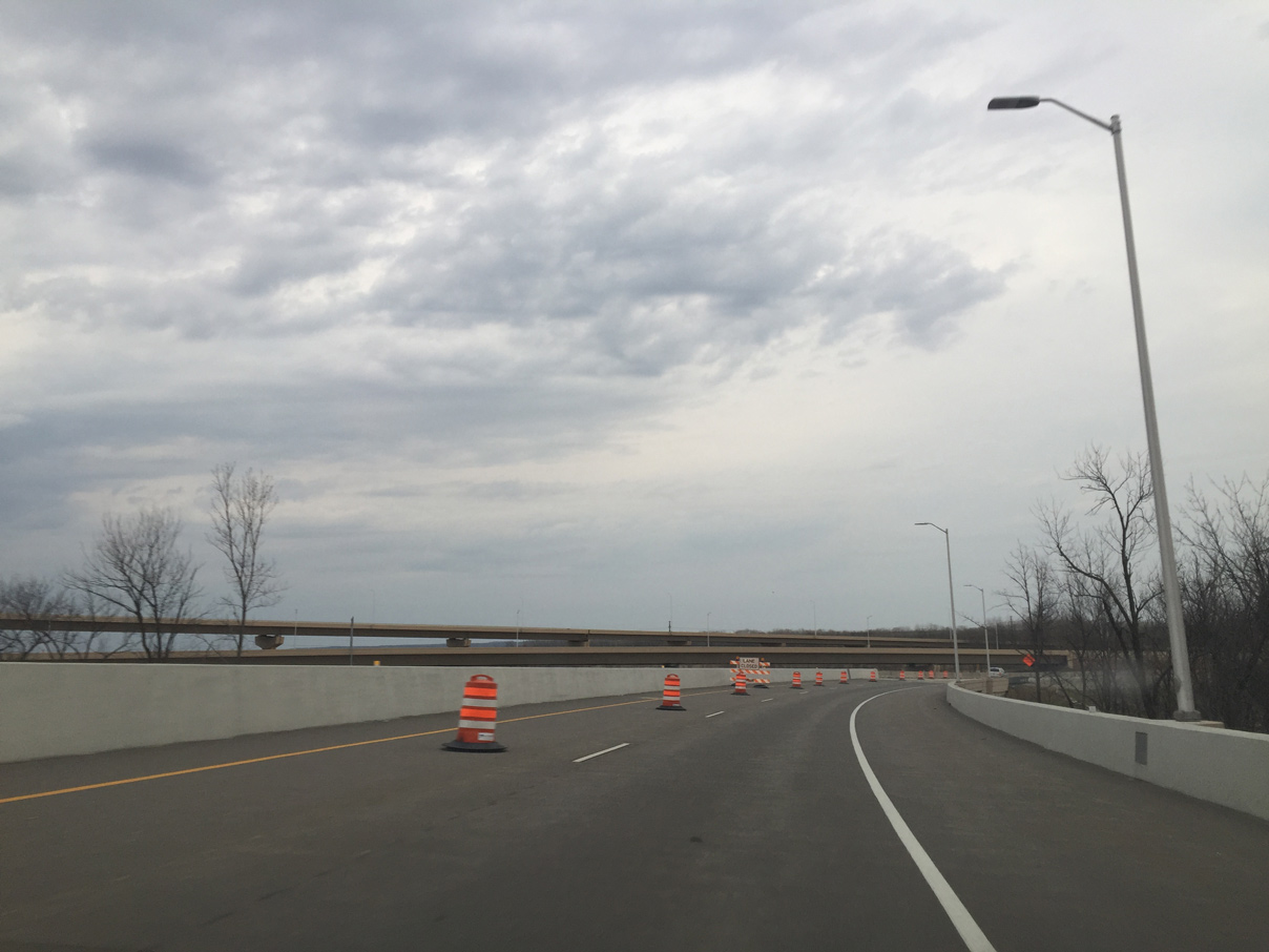
| A flyover takes motorists from Interstate 41 north to I-43 south over both U.S. 141 (Velp Avenue) and a CN Railroad line. 04/18/16 |
|
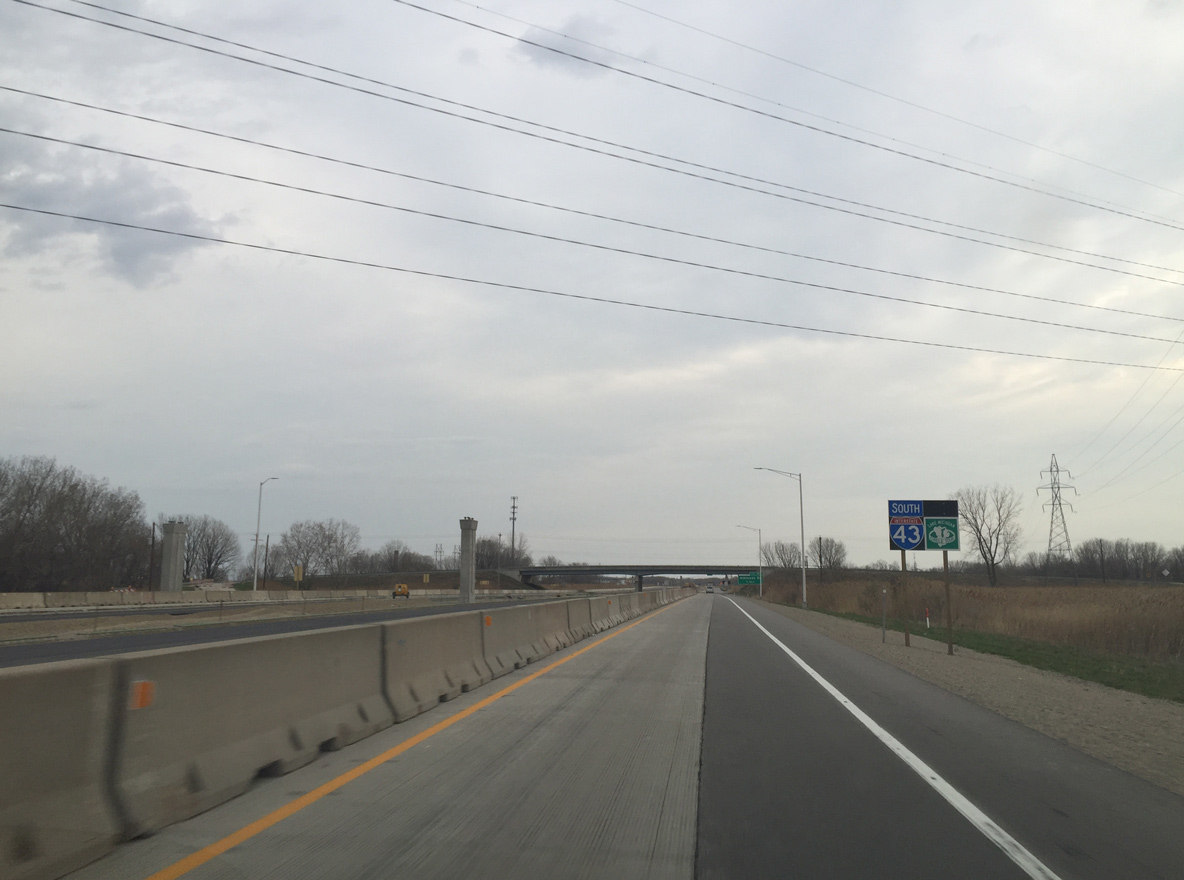
| First reassurance sign for Interstate 43, posted after both I-41 ramps merge. I-43 runs southeast along the periphery of Green Bay. 04/18/16 |
|
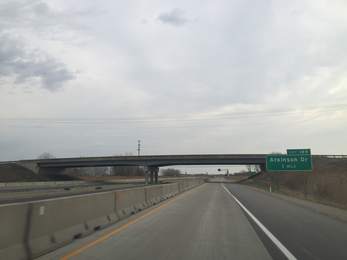
| Military Avenue passes over the freeway, one mile west of the parclo interchange (Exit 189) with Atkinson Drive. 04/18/16 |
|
| VMS board that informs traffic of conditions on the Frigo Bridge across the Fox River. 04/18/16 |
|
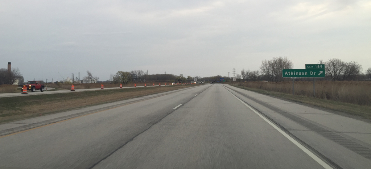
| Atkinson Drive connects I-43 with U.S. 141 (Velp Avenue) south near the Mather Heights and Fort Howard neighborhoods. U.S. 141 meanders east from Velp Avenue to Downtown Green Bay. 04/18/16 |
|
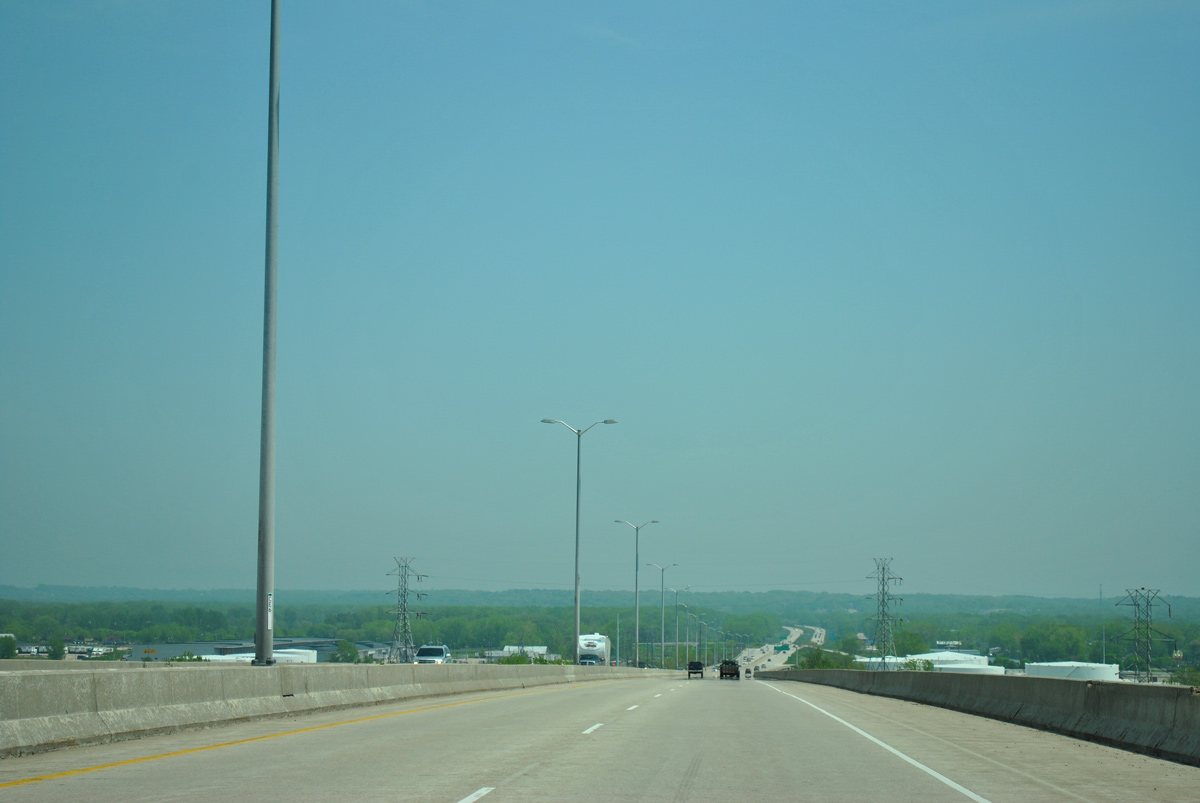
| The next three exits lie within the city of Green Bay as Interstate 43 rises to cross the Fox River. The freeway is part of the Lake Michigan Circle Tour between I-41 and Wis 57. 05/30/11 |
|
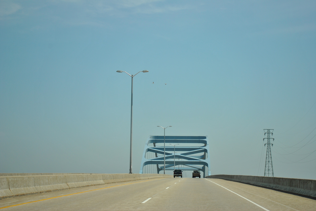
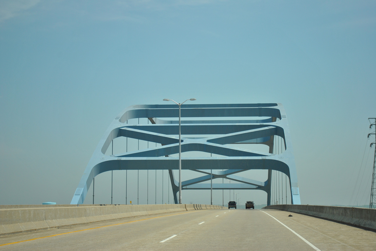
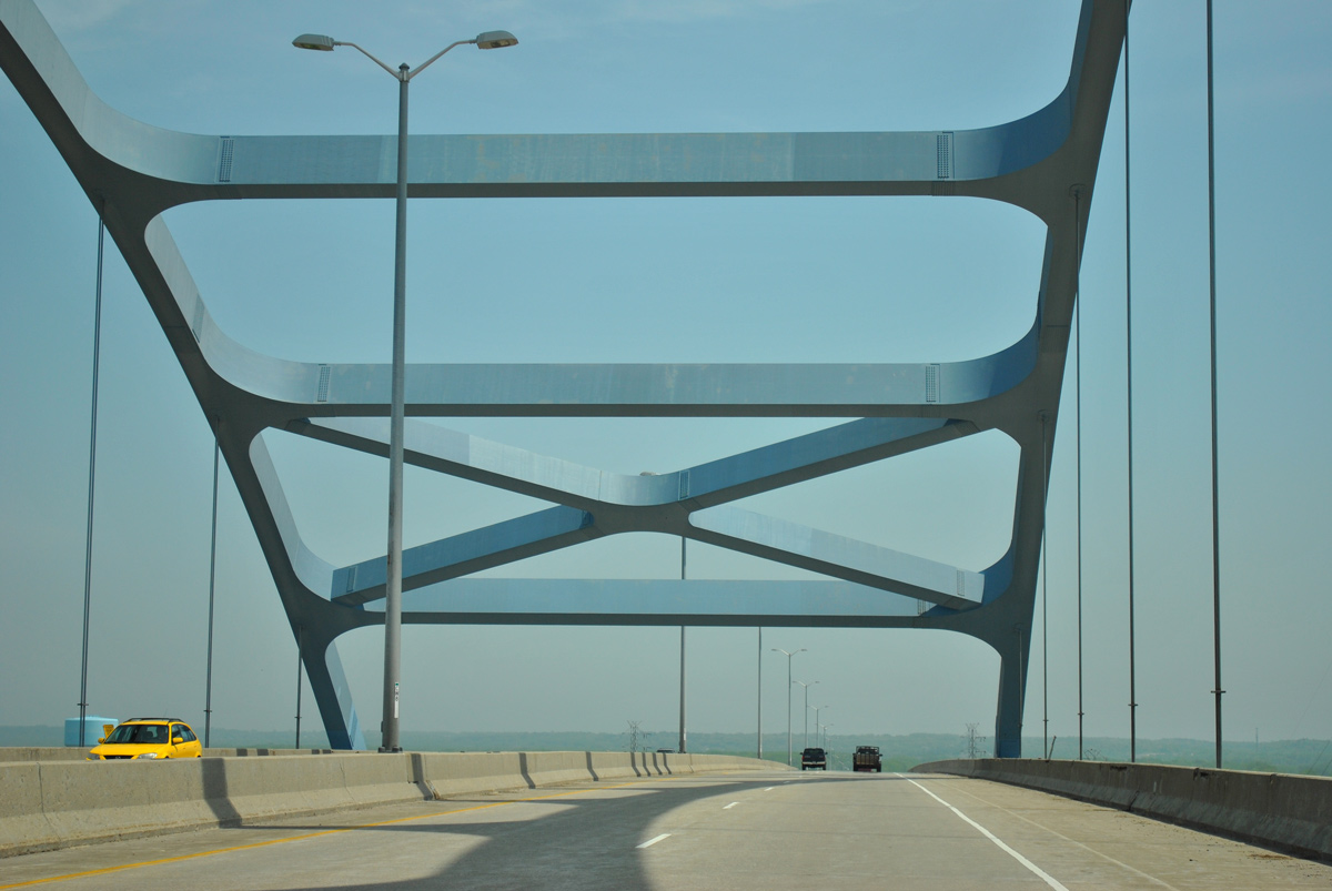
| The Leo Frigo Bridge spans the Fox River at a height of 120 feet above the Fox River. The steel tied arch bridge is 80.1 feet in width and 1.51 miles long.1 05/30/11 |
|
| A 400 foot section of the Leo Frigo Bridge sagged approximately 2 feet on September 25, 2013, leading to an emergency closure and a $15 million repair contract to level and reinforce the bridge deck.2 05/30/11 |
|
| Work on the Leo Frigo Bridge started on November 5, 2013. Repairs were completed on January 5, 2014, 12 days ahead of schedule. Investigations revealed that industrial byproducts in the soil caused underground steel supports to corrode and buckle. Five piers were affected.2,3 05/30/11 |
|
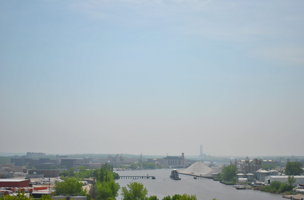
| Looking south from Interstate 43 at Downtown Green Bay and the Port of Green Bay along the Fox River. 05/30/11 |
|
| Interstate 43 lowers into an industrial area south of Bay Beach Park. The repaired portion of the Leo Frigo Bridge is located ahead near the Quincy Street underpass. 05/30/11 |
|
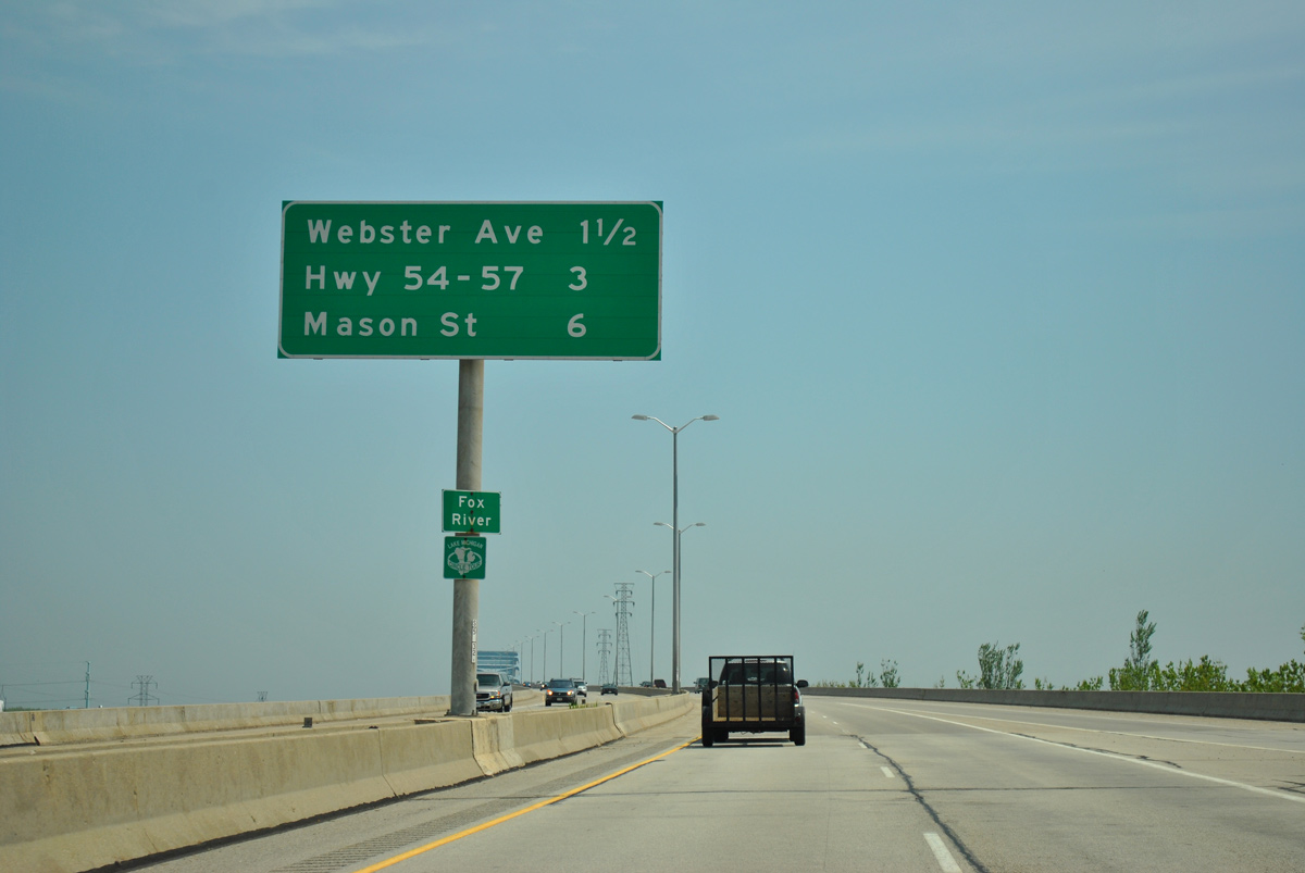
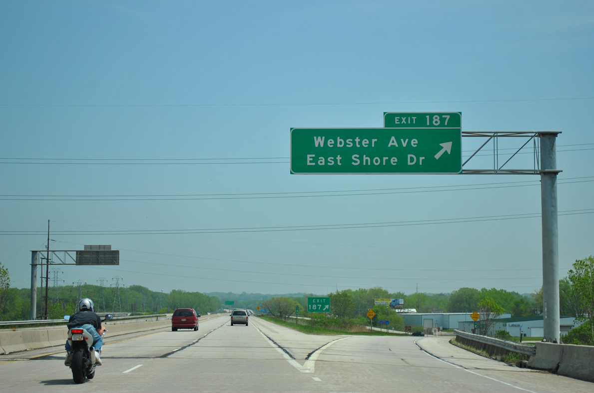
| A parclo interchange follows the Frigo Bridge along I-43 south for Webster Avenue and East Shore Drive. Webster Avenue leads south to the Olde North neighborhood of Green Bay, linking I-43 with Wis 54/57 (University Avenue) and U.S. 141/Wis 29 (Main Street) east of Downtown. 05/30/11 |
|
| Interchange sequence sign posted at the Irwin Avenue underpass on I-43 south. 05/30/11 |
|
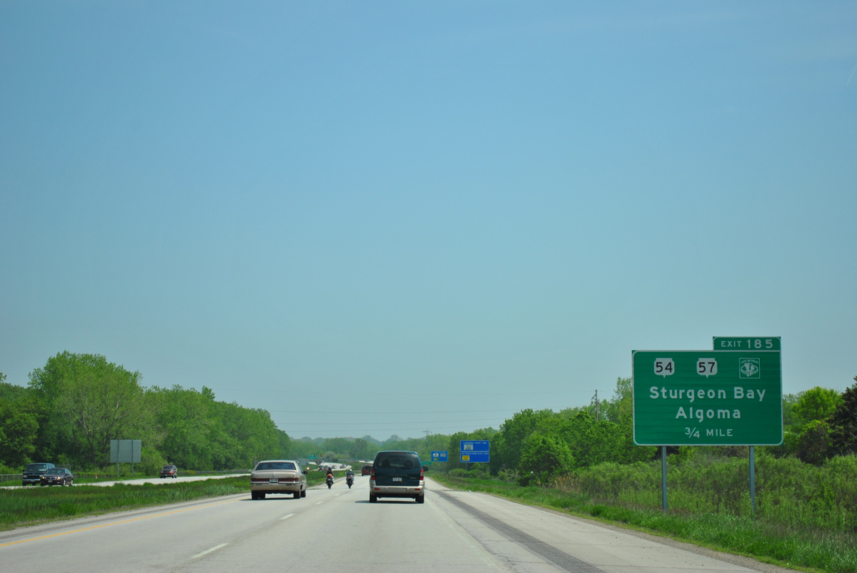
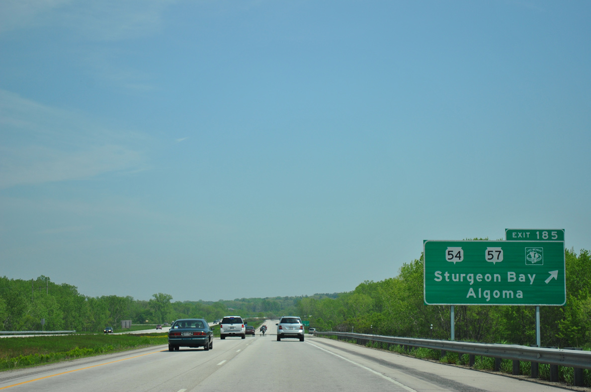
| Interstate 43 travels alongside the Bay Beach Wildlife Sanctuary on the 0.75 mile approach to Exit 185 with Wis 54 east to Algoma and Wis 57 north to Sturgeon Bay. 05/30/11 |
|
| All traffic bound for Wis 54/57 departs in unison at Exit 185. Wis 54 and 57 overlap for 8.2 miles from Downtown Green Bay to northeastern reaches of the city at County I. 05/30/11 |
|
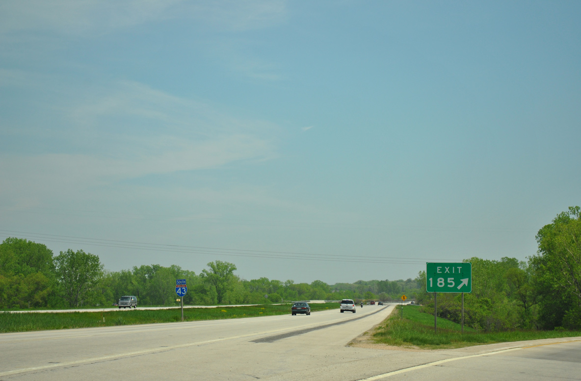
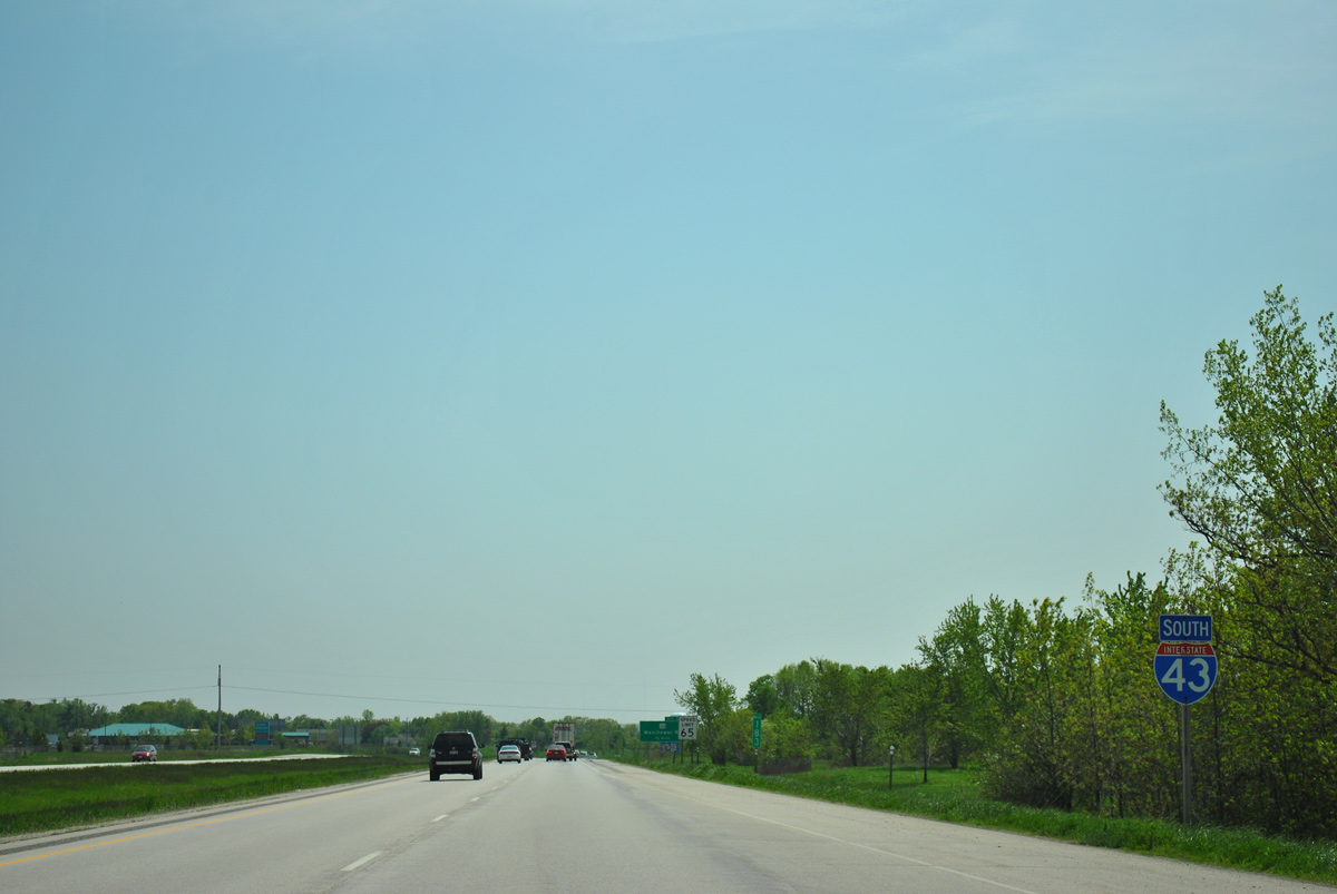
| A reassurance marker for Interstate 43 stands within the freeway median as drivers enter the directional cloverleaf interchange (Exit 185) with the Wis 54/57 expressway. 05/30/11 |
|
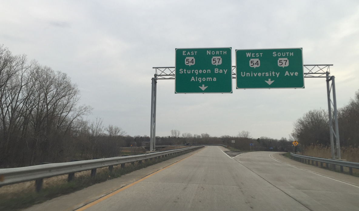
| New overhead signs placed in 2013.
Wis 54/57 travel west along University Avenue to the Three Corners neighborhood from adjacent County N. Wis 57 north extends the Great Lakes Circle Tour along an expressway to Dyckesville, Brussells and Wis 42 on the Door County peninsula. 04/18/16 |
|
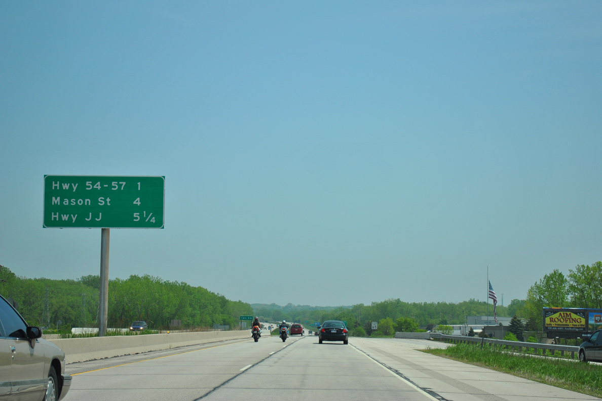
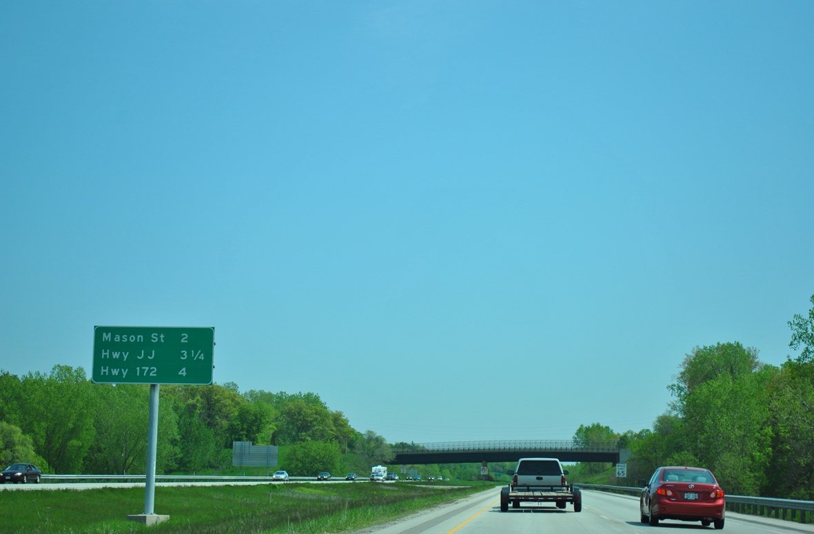
| Curving southward, Interstate 43 next meets County V (Mason Street) in two miles. Exits for County JJ and Wis 172 west follow within the village of Bellevue. 05/30/11 |
|
| Brown County V (Mason Street) comprises a controlled access arterial west to East Town Mall and U.S. 141/Wis 29 and east by the I-43 Business Center to Erie Road. 05/30/11 |
|
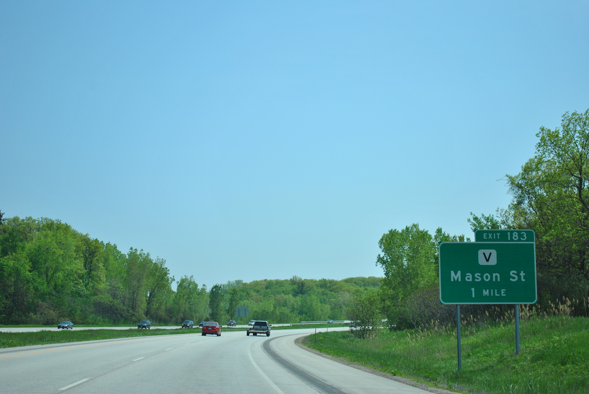
| A diamond interchange facilitates movement between Interstate 43 and CTH-V (Mason Street). Mason Street west separates the Preble Park and Wilder Park neighborhoods. The trunk highway east serves agricultural areas beyond the city line to CTH-P and CTH-IV in the town of Humboldt. 05/30/11 |
|
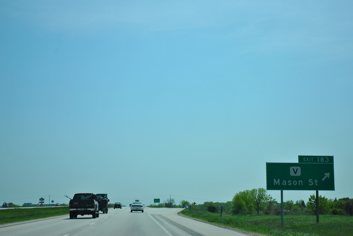
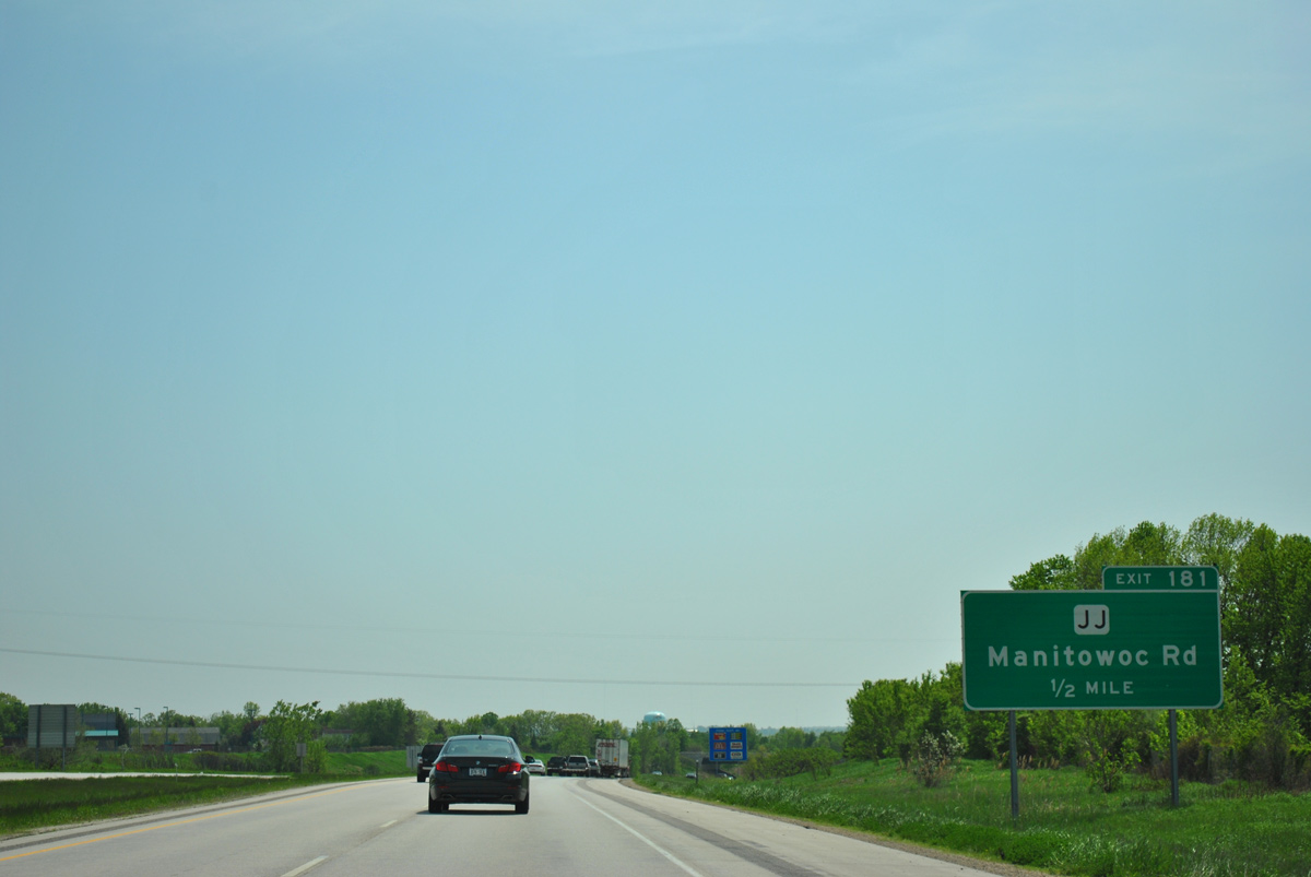
| Exit 181 with CTH-JJ (Manitowoc Road) lies 1.25 miles ahead in the village of Bellevue. The ensuing exit is with the Wis 172 freeway west to Allouez. 05/30/11 |
|
| Interstate 43 turns southwest between Wilder Park and the I-43 Business Center. 05/30/11 |
|
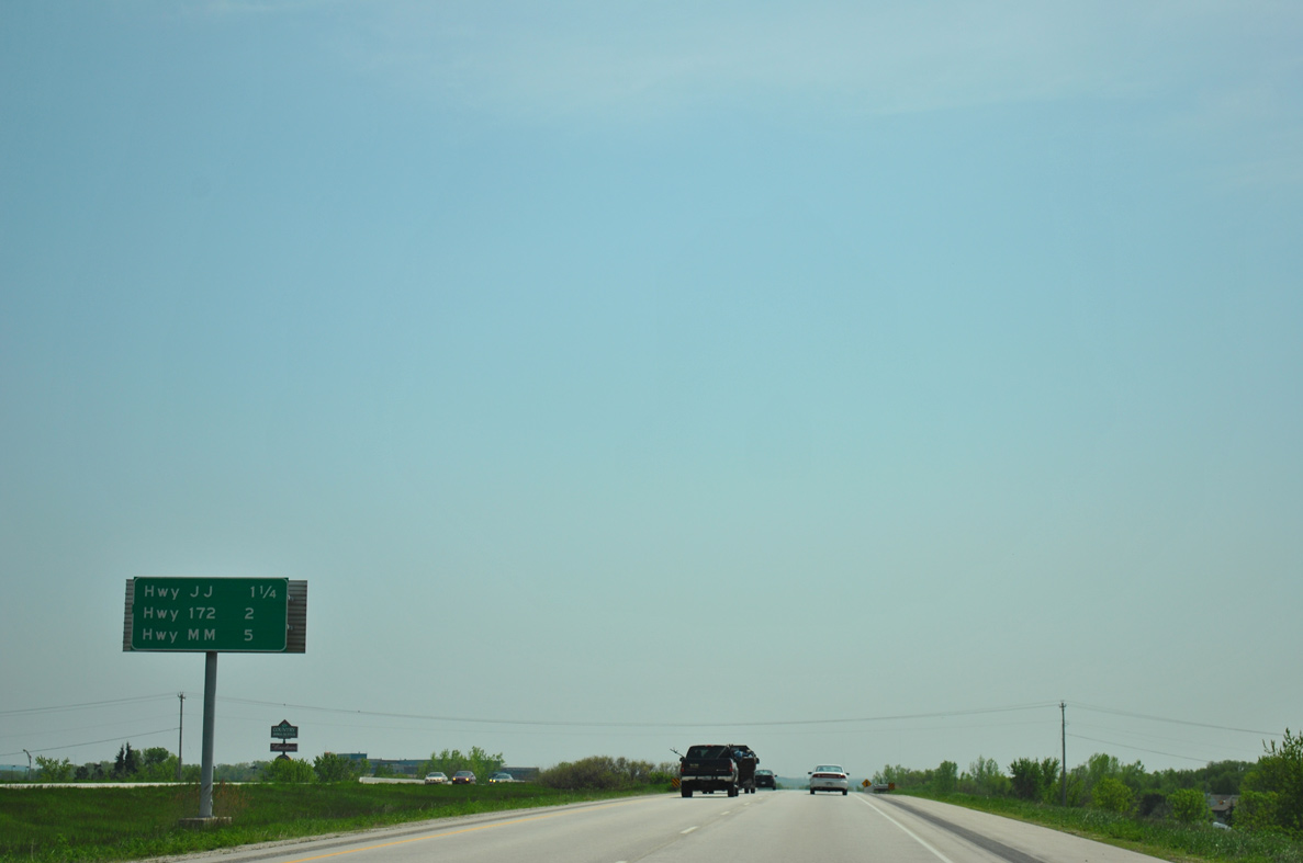
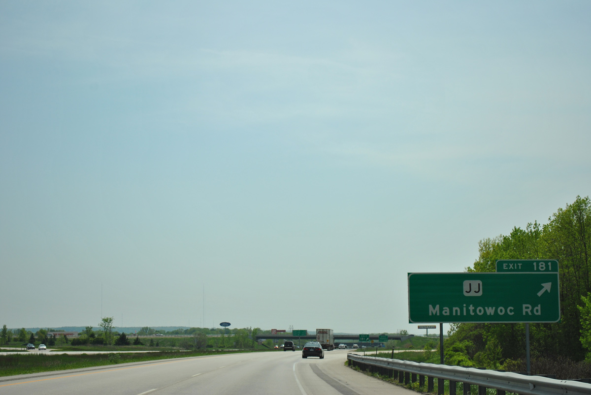
| Brown County JJ travels west from Exit 181 along Verlin Road to U.S. 141/Wis 29 (Main Street) and CTH-V (Lime Kiln Road). Eaton Road takes the trunk highway east to rural areas outside Bellevue. 05/30/11 |
|
| Entering the folded diamond interchange (Exit 181) with CTH-JJ (Manitowoc Road) on I-43 south. Manitowoc Road extends southeast by a number of subdivisions to Wis 29. 05/30/11 |
|
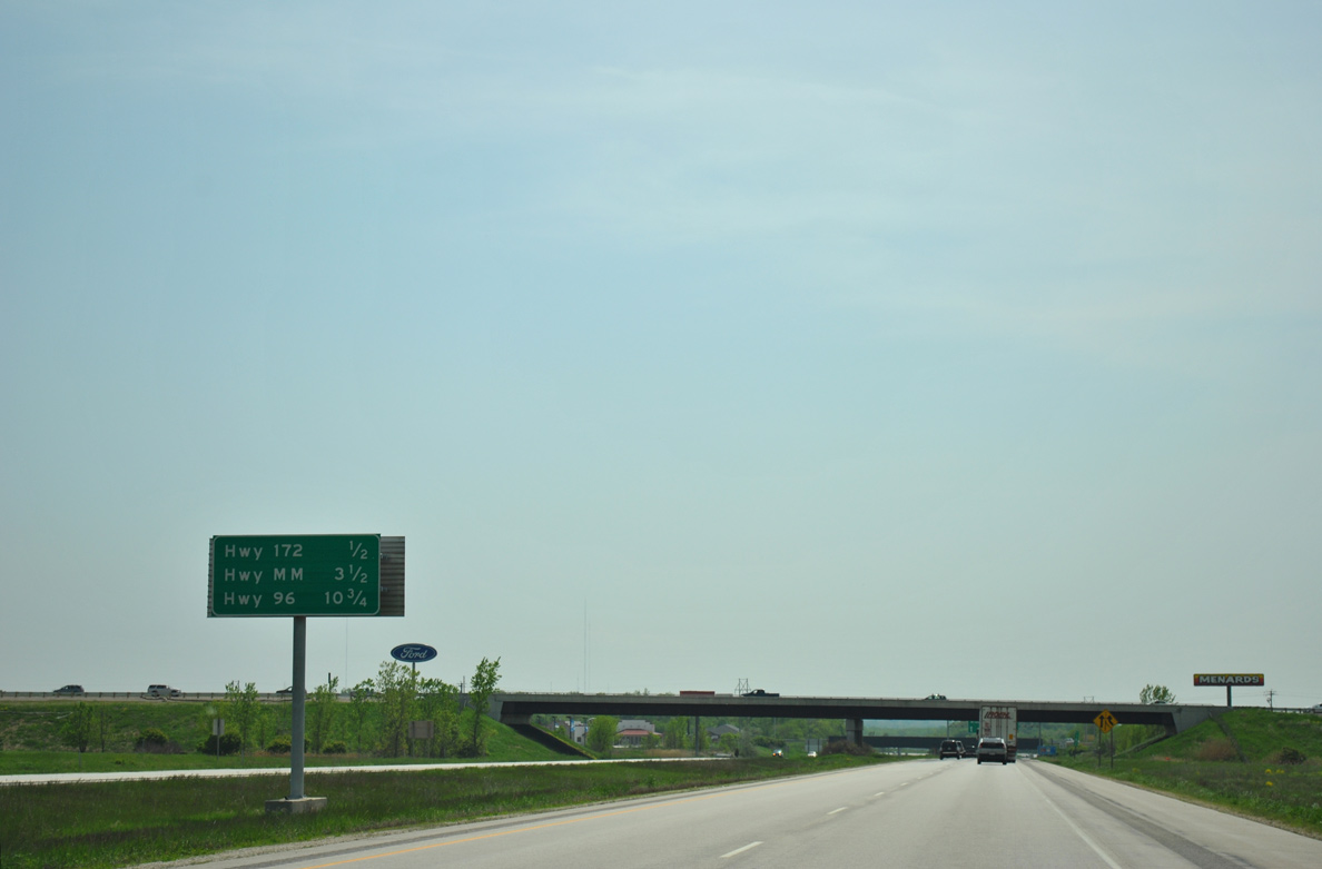
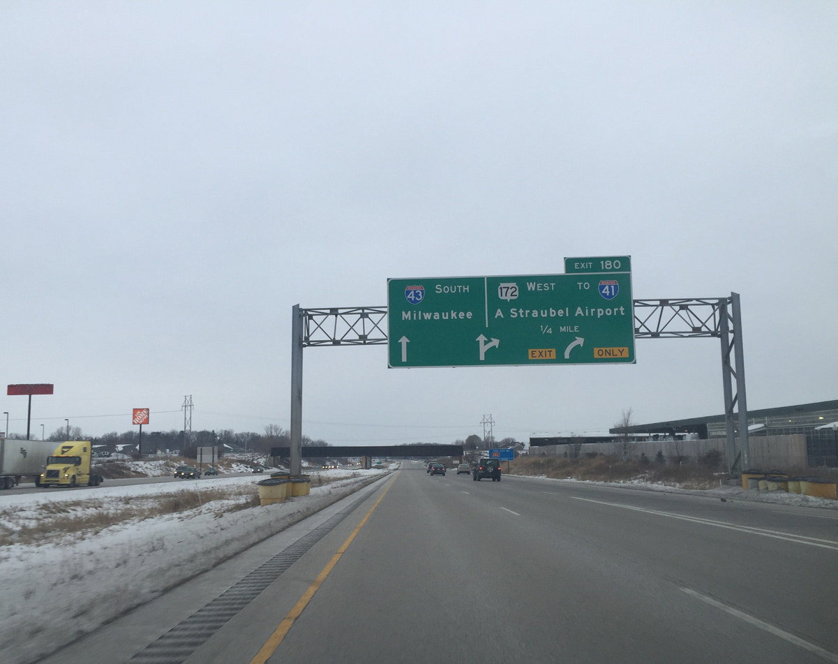
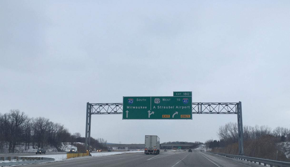
| Interstate 43 advances southwest one half mile to a three-wye interchange (Exit 180) with STH-172. One final exit remains in 3.5 miles before the freeway leaves the Green Bay area for Denmark. 05/30/11 |
|
| Wis 172 stems west from Exit 180 as a freeway to Ashwaubenon and Interstate 41 and as an expressway to Austin Straubel International Airport (GRB). The route serves Lambeau Field, Resch Center arena and the main shopping and entertainment area of Green Bay. 01/21/16 |
|
| Southbound I-43 at the two lane off-ramp (Exit 180) for Wis 172 west. Wis 172 provides a commuter route west through Allouez, Ashwaubenon and Hobart. The trunk highway ends 11.6 miles to the west at STH-54 and Oneida. 01/21/16 |
|
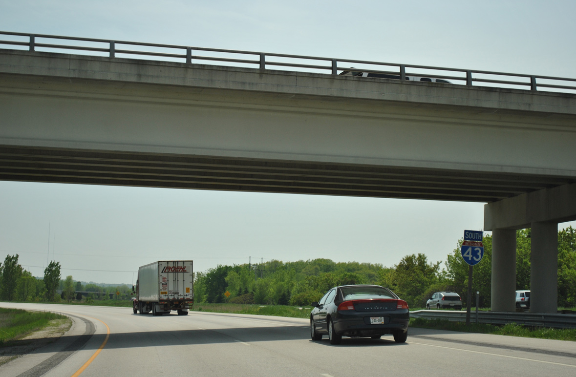
| Interstate 43 turns southeast from Wis 172 to leave the village of Bellevue. 05/30/11 |
|
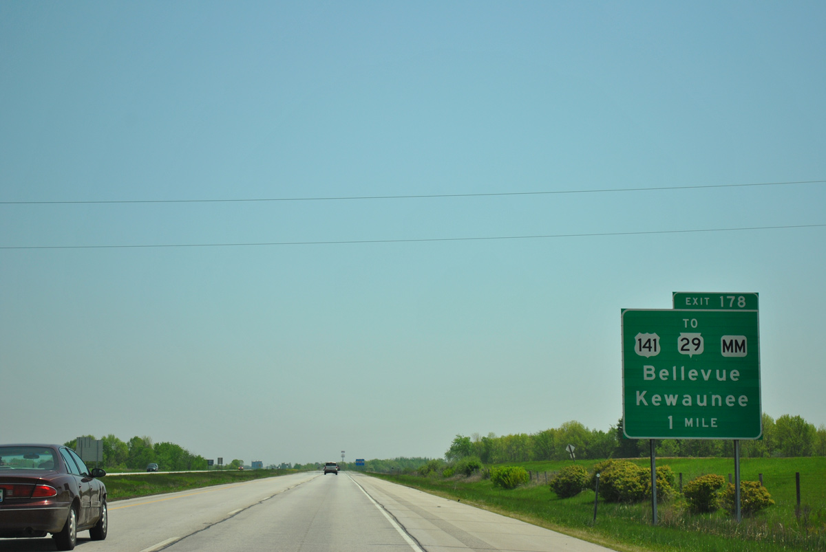
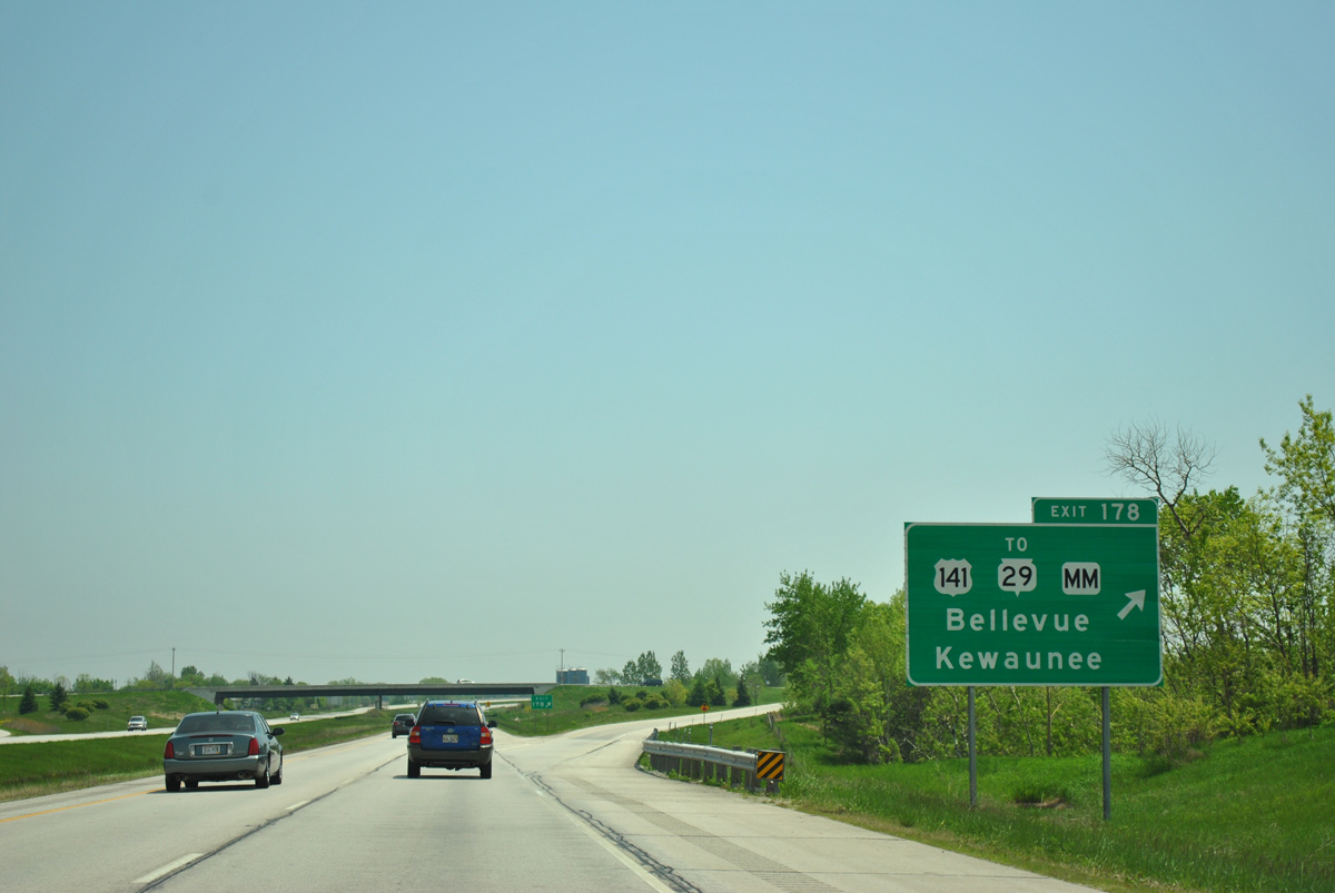
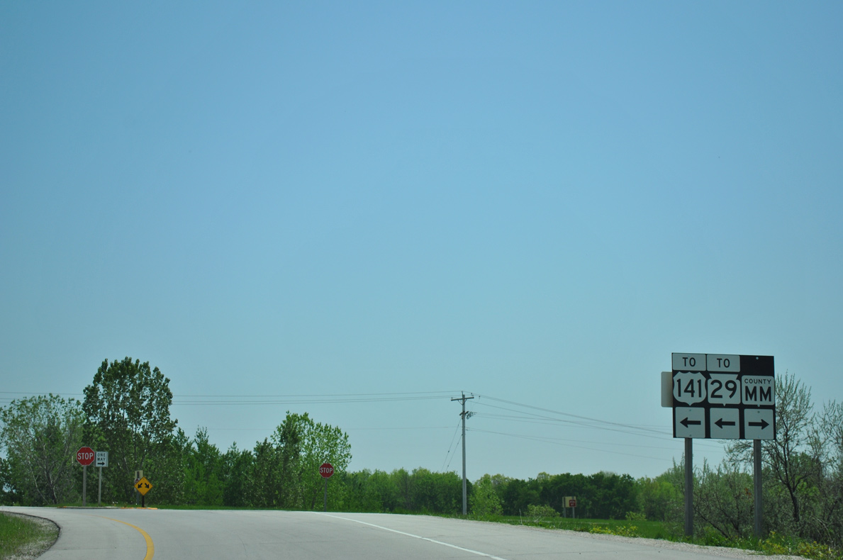
| U.S. 141 concludes a 169 mile route from Covington, Michigan south to Bellevue at Exit 178 with County MM in one mile. The remainder of U.S. 141 south to Milwaukee was replaced by Interstate 43 by 1981. 05/30/11 |
|
| Wis 29 splits with U.S. 141 just north of Exit 178 to run due east to Poland and Pilson. The trunk highway ends at Kewaunee in 22 miles. 05/30/11 |
|
| County MM extends south from the ending U.S. 141 along Dutchman Road to County G at Kolbs Corner in the town of Ledgeview. Old U.S. 141 runs southeast along County R to Pine Grove and Langes Corners. 05/30/11 |
|
| Angling more to the south, Interstate 43 crosses over Shadow Lane on the rural trek through southeast Brown County. 05/30/11 |
|
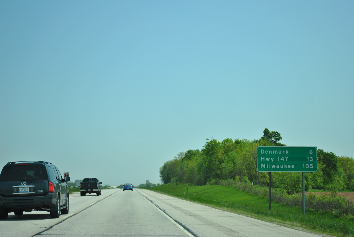
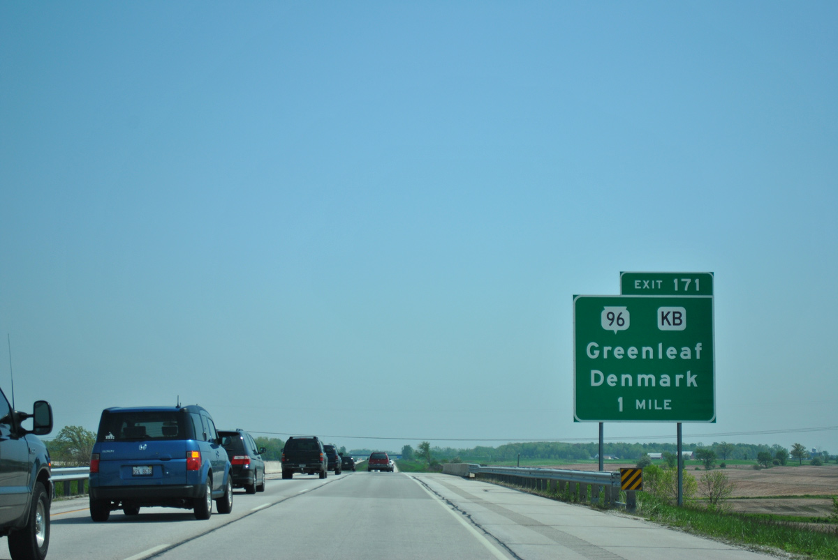
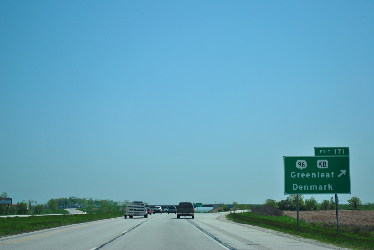
| The village of Denmark lies six miles ahead at Exit 171. The ensuing exit falls within Manitowoc County in 13 miles at Wis 147 while Milwaukee lies 92 miles further. 05/30/11 |
|
| Interstate 43 travels along the western outskirts of Denmark through a diamond interchange (Exit 171) with STH-96 west and CTH-KB (De Pere Road) east. 05/30/11 |
|
| Exit 171 departs I-43 south for Wis 96 and County KB. Wis 96 heads west five miles to Shirley, three miles south to Lark and seven miles to Wis 32/57 at Greenleaf. The trunk highway totals 56 miles from Denmark west to Appleton and Wis 110 outside Fremont. 05/30/11 |
|
| Confirming shield for Interstate 43 posted as drivers leave Denmark. 05/30/11 |
|
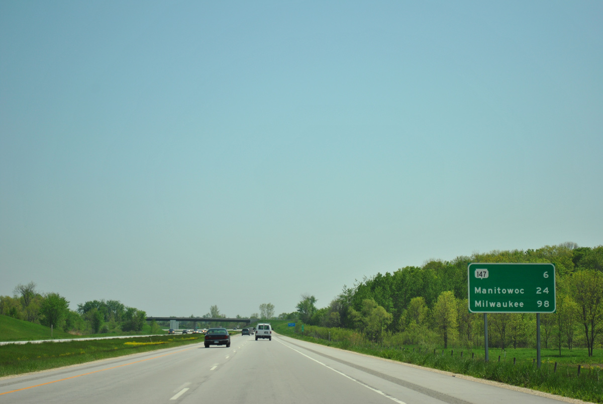
| A six mile exit less stretch takes I-43 south to Wis 147 near Maribel. Manitowoc follows in 24 miles. 05/30/11 |
|
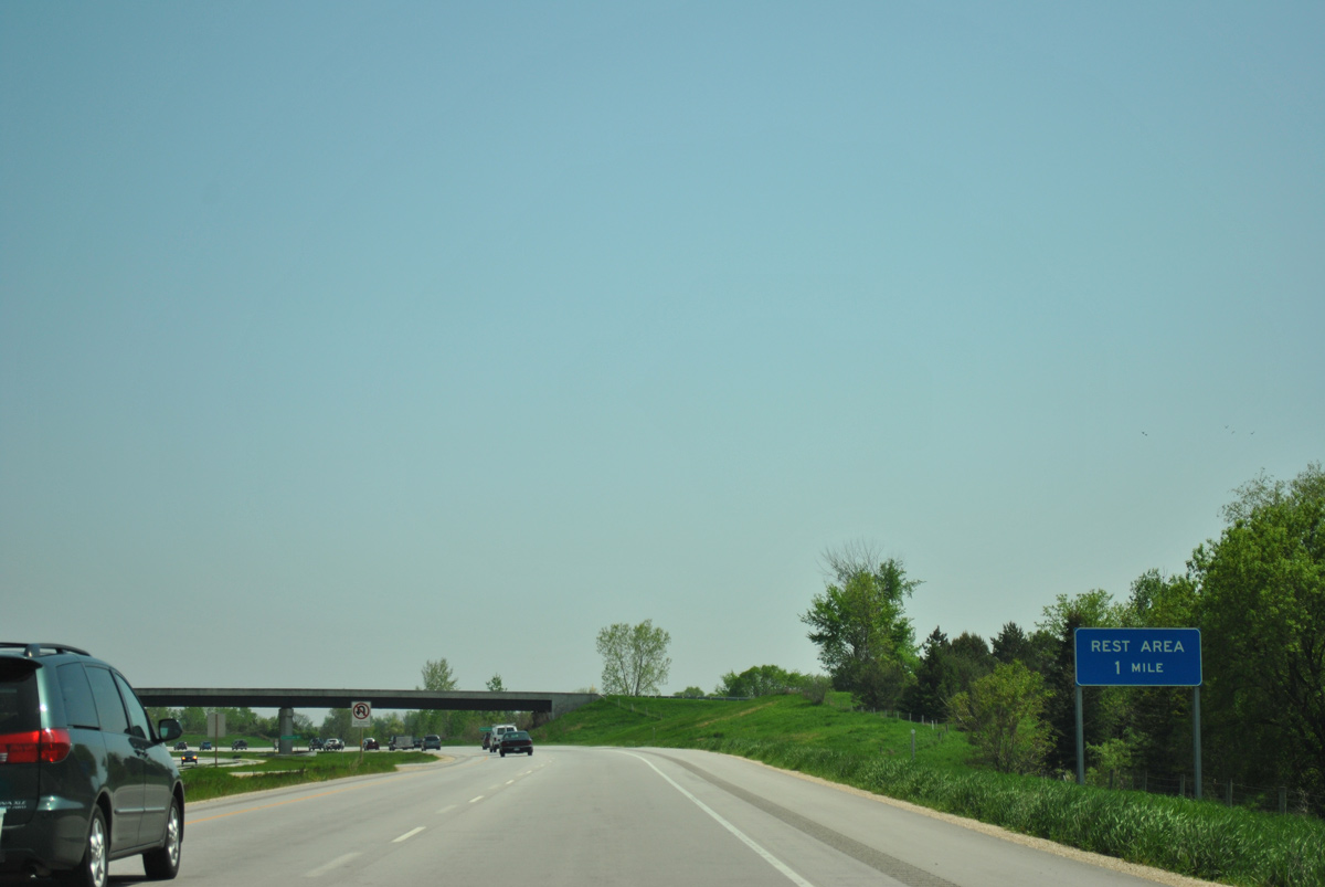
| The lone rest area along Interstate 43 south between Green Bay and Milwaukee lies just south of the county line. 05/30/11 |
|
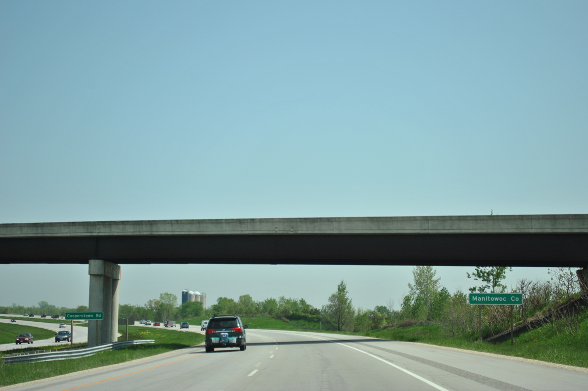
| Cooperstown Road spans Interstate 43 as travelers enter Manitowoc County. 05/30/11 |
Page Updated 04-20-2016.

 South
South