|
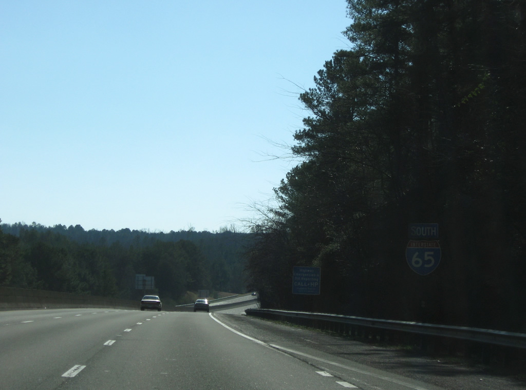
| Reassurance marker of Interstate 65 posted just south of the Blount County line. 12/28/09 |
|
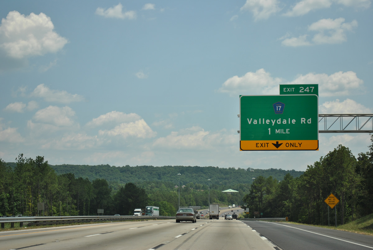
| Warrior appears for the second time on southbound distance signs as the freeway passes the city to the west. Warrior began in 1872 with the establishment of a post office. It is named after the Warrior coal fields that were named after the Black Warrior River. 11/07/11 |
|
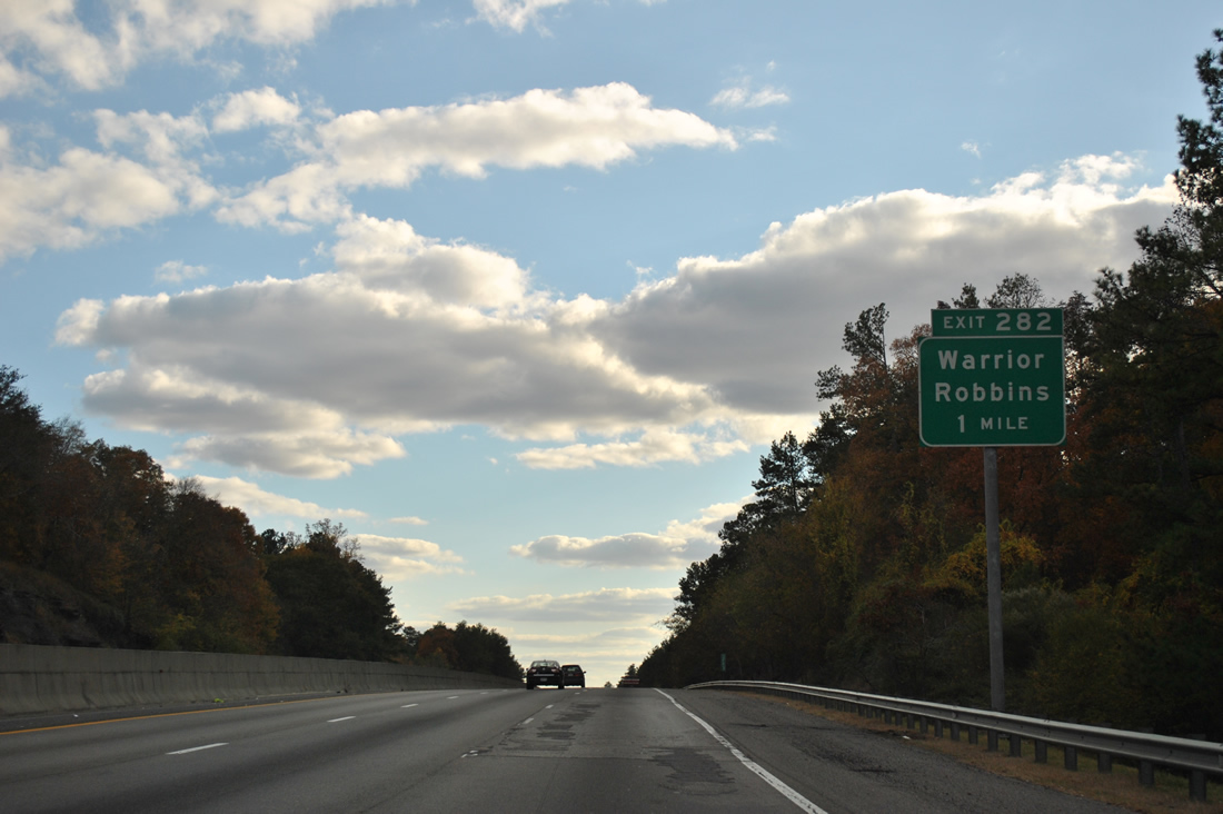
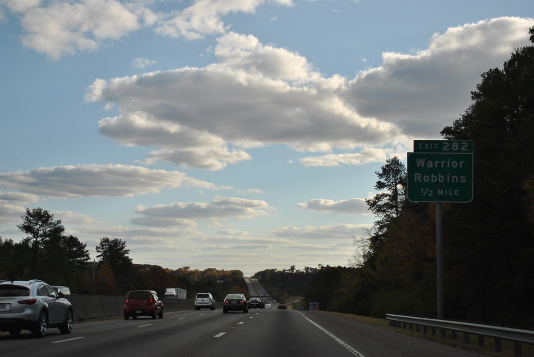
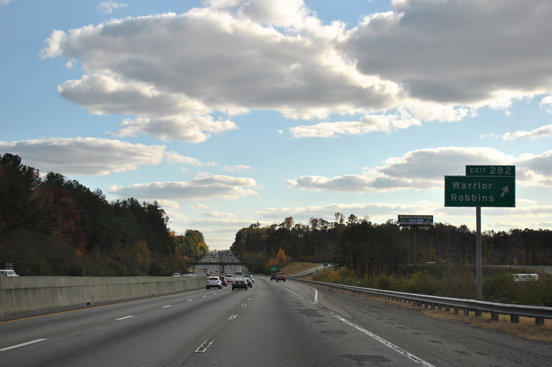
| The first of two Warrior area exits joins Interstate 65 with Warrior Jasper Road west and Cane Creek Road east at Exit 282. 11/07/11 |
|
| Cane Creek Road connects Interstate 65 with U.S. 31 (Louisa Street) near downtown Warrior. Warrior Jasper Road (County Road 140) continues the road west to Partridge Crossroads and SR 5 near Summiton. 11/07/11 |
|
| Entering the parclo interchange with Warrior Jasper and Cane Creek Roads along Interstate 65 south at Warrior. This stretch of I-65 was the first to open in the state when it did on December 10, 1959. 11/07/11 |
|
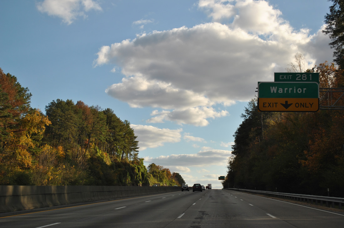
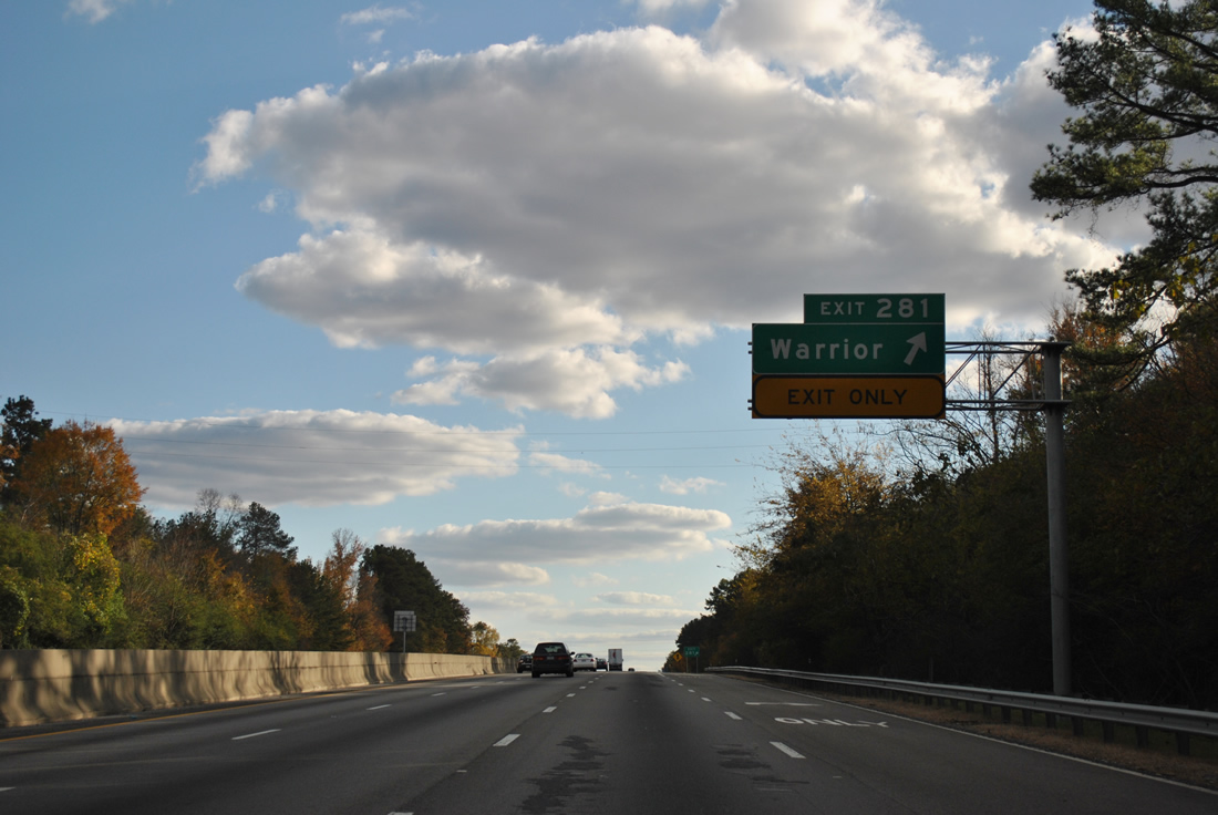
| A folded-cloverleaf interchange (Exit 281) quickly follows between Interstate 65 and Dana Road in south Warrior. 11/07/11 |
|
| An auxiliary lane follows Interstate 65 south between Exits 282 and 281 to Dana Road at Seloca. Dana Road simply connects subdivisions west of the freeway with U.S. 31 to the east. 11/07/11 |
|
| Interstate 65 continues through the Warrior city lines to the Black Warrior River. 11/07/11 |
|
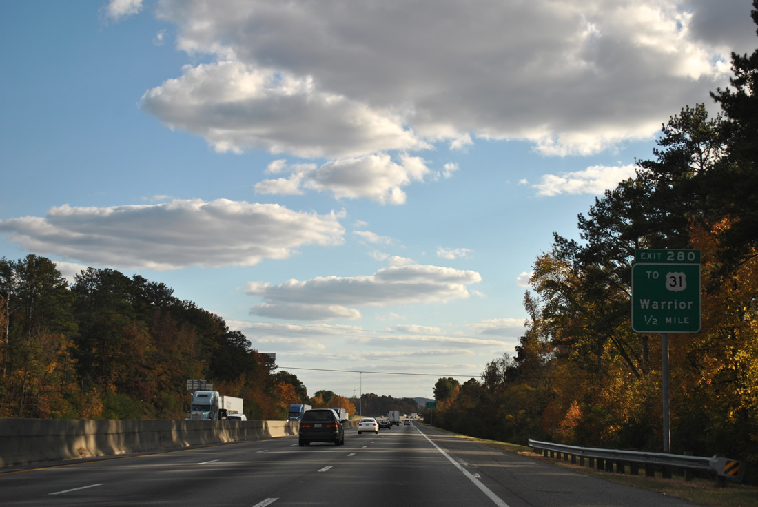
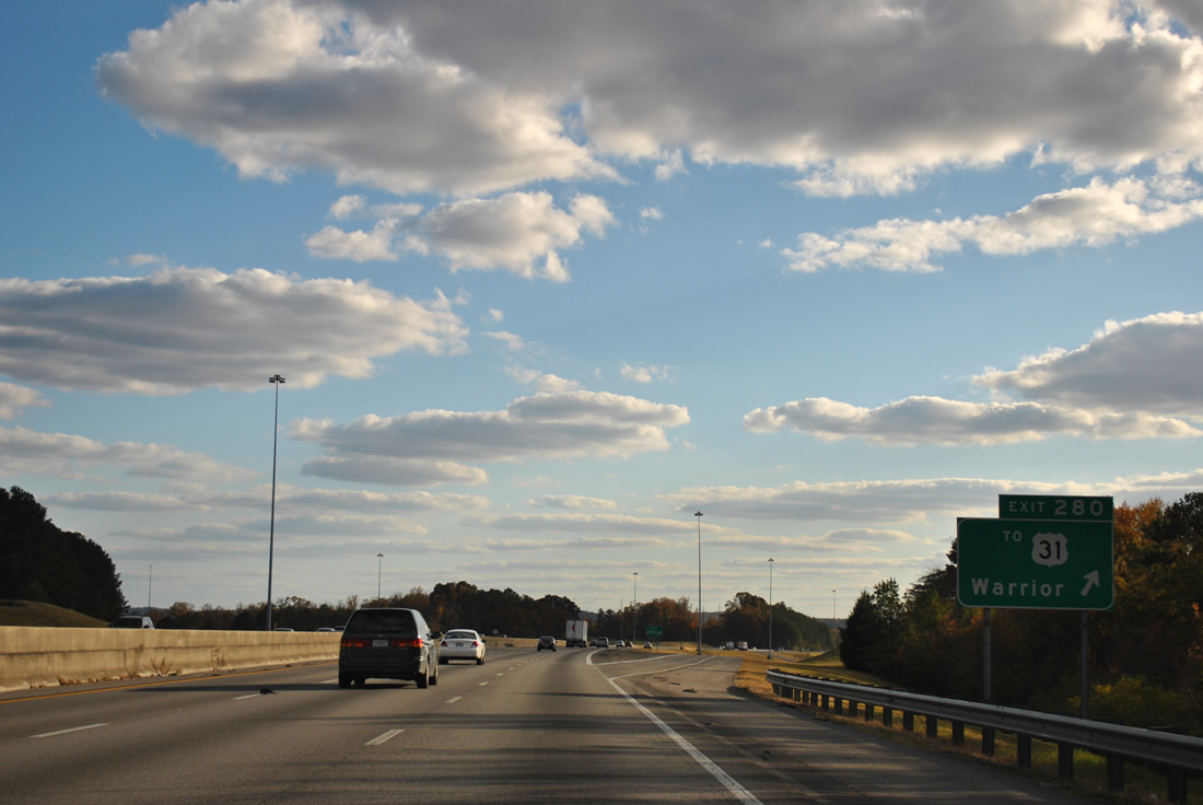
| Exit 280 follows as a diamond interchange with an access road to U.S. 31 as the highway curves eastward to Kimberly and Morris. 11/07/11 |
|
| A wye interchange originally dumped all traffic from Interstate 65 onto U.S. 31 leading into Kimberly. This changed when the freeway opened west of Morris in 1985. The original ramps were removed and replaced with the current Exit 280. 11/07/11 |
|
| Interstate 65 nips the western extent of the Kimberly municipal limits and otherwise bypasses Morris on the five mile drive to the next exit. Reaching Morris requires back tracking via U.S. 31 north. 11/07/11 |
|
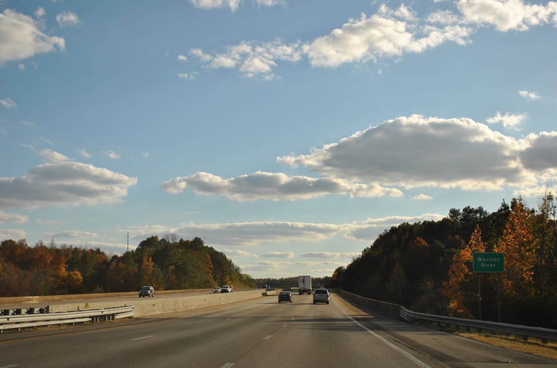
| Spanning the Locust Fork of the Black Warrior River along Interstate 65 southbound. The Black Warrior flows south and feeds into the Tombigbee River at Lake Demopolis. 11/07/11 |
|
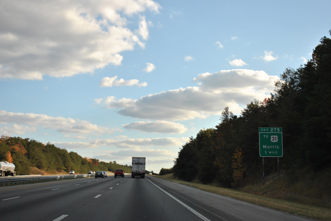
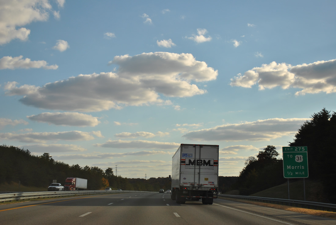
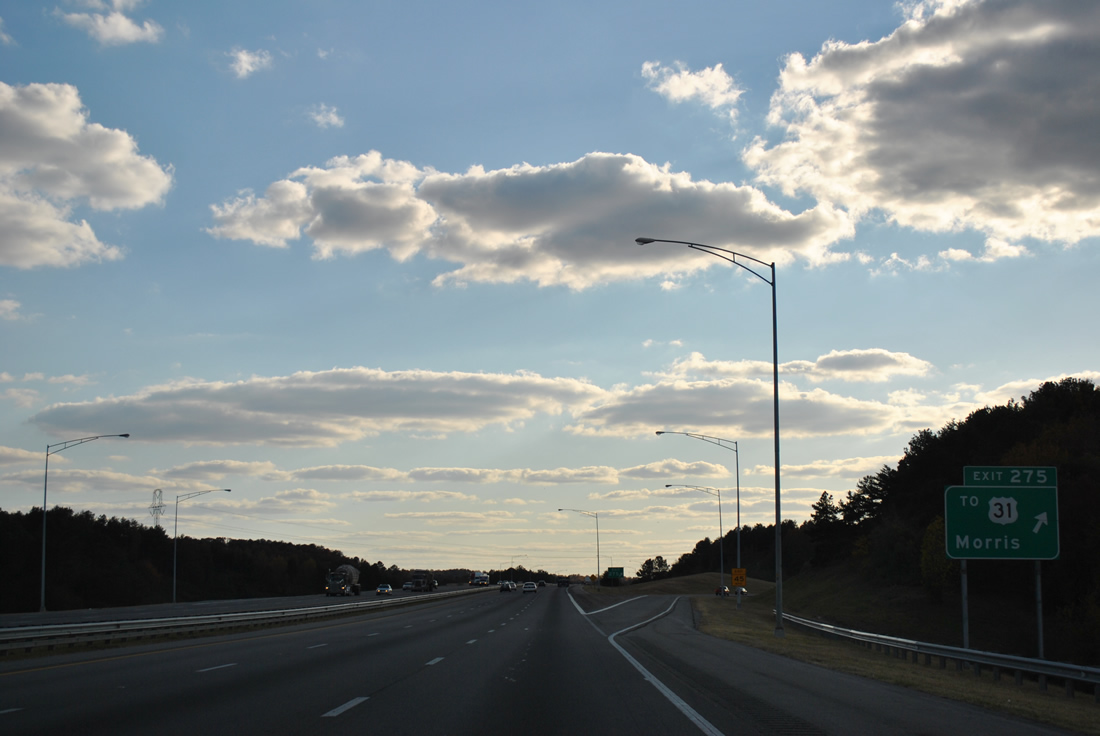
| U.S. 31 exits Morris and approaches Interstate 65 adjacent to the diamond interchange (Exit 275) with Mary Buckelew Parkway. 11/07/11 |
|
| Mary Buckelew Parkway was constructed by 1995 to connect Jefferson County 77 (Mt. Olive Road) with Interstate 65 and U.S. 31. 11/07/11 |
|
| Exit 275 leaves Interstate 65 south for Mary Buckelew Parkway west to suburban areas south along Mt. Olive Road and U.S. 31 north to Morris and south to Gardendale. 11/07/11 |
|
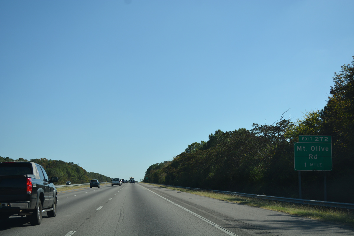
| Interstate 65 passes through northern reaches of Gardendale on the two mile approach to Exit 272 with Mt. Olive Road. Interstate 422, the Birmingham Northern Belt Line, is proposed to run east-west across north Gardendale. If built as envisioned, a four-level interchange with I-65 will tie into an adjacent diamond interchange with U.S. 31 along this stretch of freeway. 10/08/16 |
|
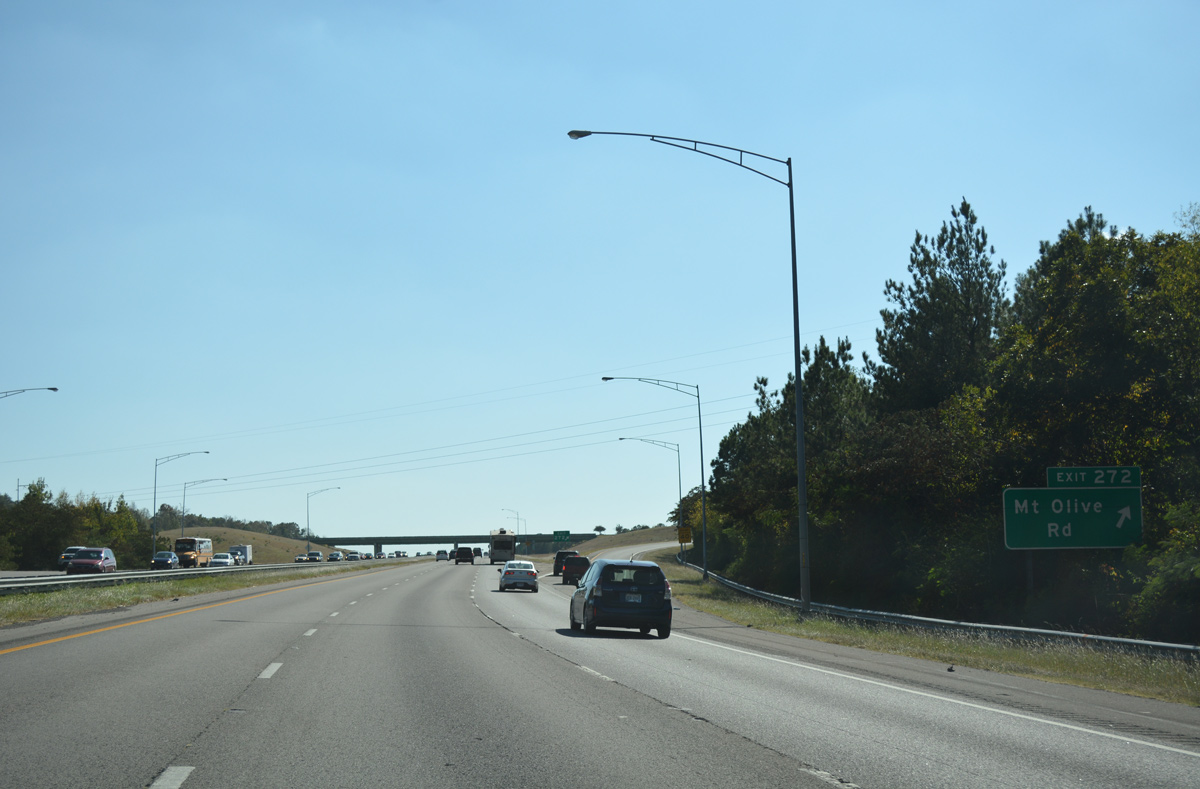
| A parclo interchange (Exit 272) joins Interstate 65 with Mt. Olive Road (Jefferson County 112) in one mile. 10/08/16 |
|
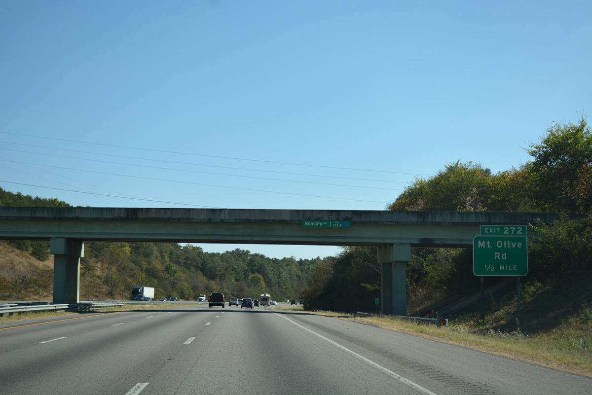
| Beasley Road spurs west from North Road and Gardendale to pass over Interstate 65 a half mile north of Exit 272. Mt. Olive Road stems west from U.S. 31 (Decatur Highway) and Moncrief Road as a four lane divided highway to meet the freeway. 10/08/16 |
|
| Continuing from Exit 272, Mt. Olive Road meanders northwest through Mount Olive to Partridge Crossroads in rural Jefferson County. A diamond interchange is proposed between County Road 112 and Interstate 422 near Newfound Road. 10/08/16 |
|
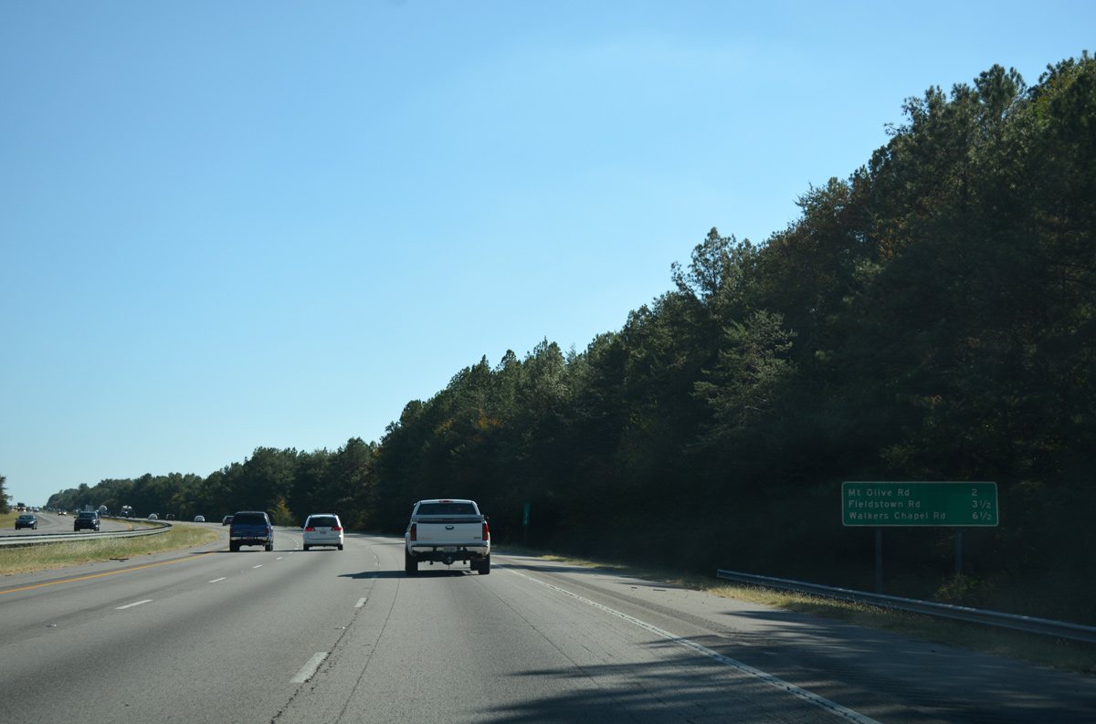
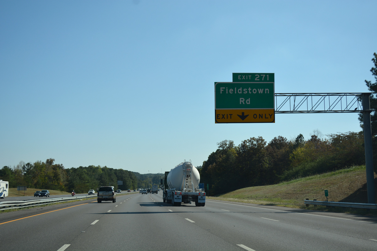
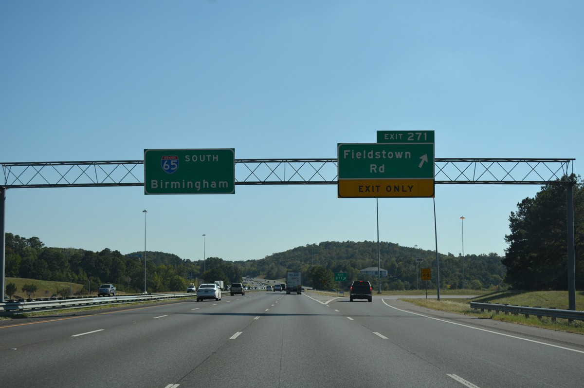
| Fieldstown Road (Jefferson County 118) provides access to Downtown Gardendale from Exit 271 in one mile. 10/08/16 |
|
| Interstate 65 carries four southbound lanes between Exits 272 and 271. 10/08/16 |
|
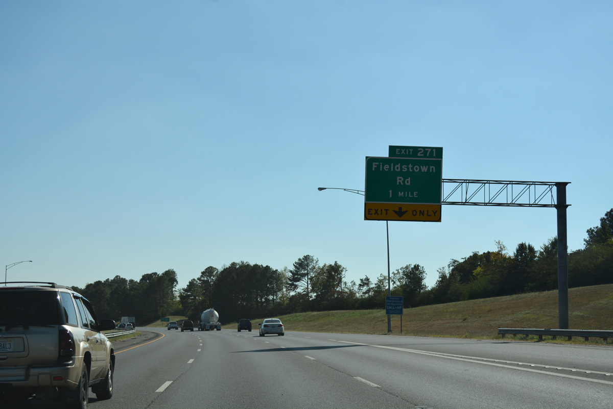
| One half mile ahead of the parclo interchange (Exit 271) with Fieldstown Road on I-65 south. Fieldstown Road joins U.S. 31 (Decatur Highway) with suburban areas at Coalburg Road (County Road 77) in western Gardendale. The road is named after the settlement of Fieldstown to the west. 10/08/16 |
|
| Southbound Interstate 65 at Exit 271 to Fieldstown Road (County Road 118). County Road 118 continues west from Fieldstown Road to Mineral Springs and County Road 105 (Cherry Avenue) in Brookside. 10/08/16 |
|
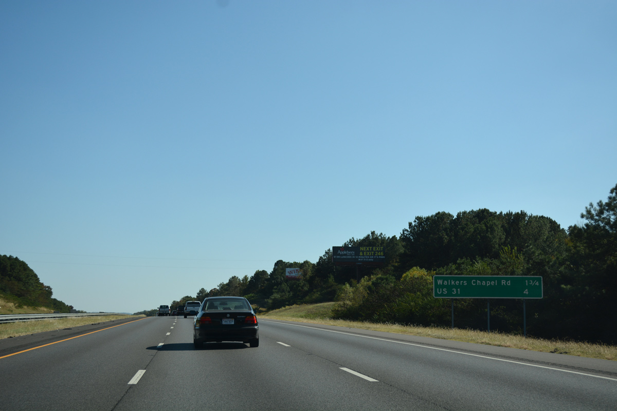
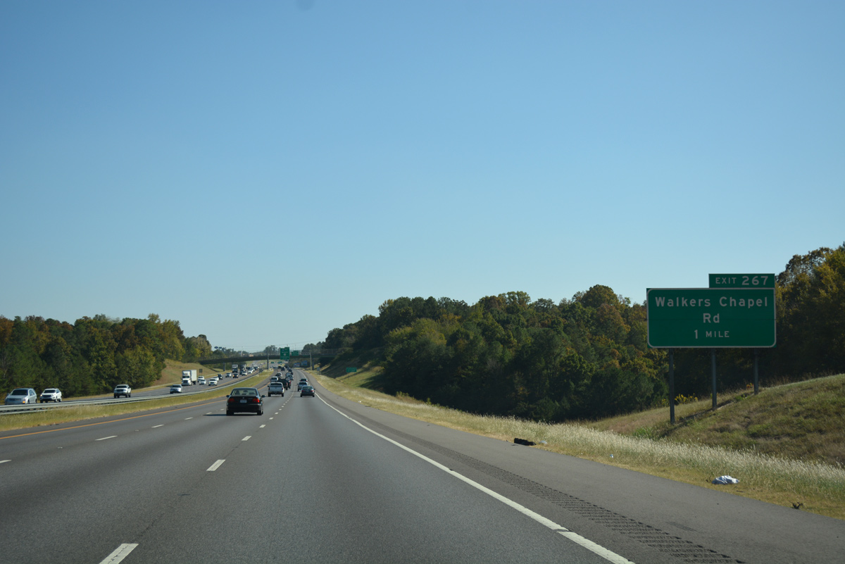
| Interstate 65 curves southeasterly and leaves Gardendale for the city of Fultondale on the 1.75 mile drive to Walker Chapel Road (Exit 267). U.S. 31 converges with the freeway again in four miles (Exit 266). 10/08/16 |
|
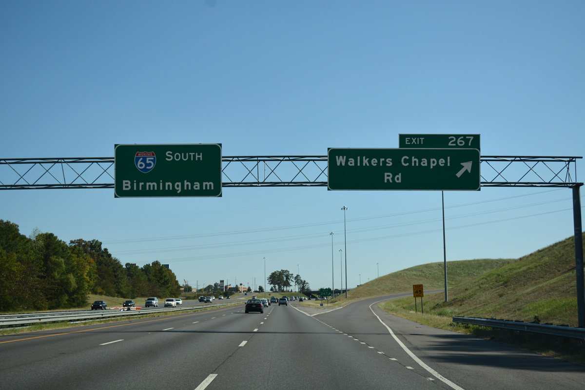
| Walker Chapel Road travels west from U.S. 31 (Decatur Highway) and Carson Road to meet Interstate 65 at a parclo interchange (Exit 267). 10/08/16 |
|
| Ridge Brook Road spans Interstate 65, a half mile ahead of Walker Chapel Road (Exit 267) and two miles from the collector distributor roadway for both U.S. 31 to Fultondale and Interstate 22 west. 10/08/16 |
|
| Drivers bound for Walker Chapel Road part ways with Interstate 65 south at Exit 267. Walkers Chapel Road serves the adjacent communities of Glendale and Walker Chapel within the city of Fultondale. Westward, the road ends at Shady Grove Road and the settlement of Upper Coalburg. 10/08/16 |
|
| Interstate 65 expands to eight overall lanes south from Walker Chapel Road. The freeway was expanded during work to complete Interstate 22 east from Jasper. 10/08/16 |
|
| Travel times are available to Interstate 65 motorists within the Birmingham metropolitan area. A dynamic message board precedes this reassurance shield as the freeway passes by Lewisburg in south Fultondale. 10/08/16 |
|
| U.S. 31 and Interstate 65 come together again at the end of the December 19, 1985-opened stretch of freeway leading south from Warrior. Prior to 1985, northbound traffic defaulted onto U.S. 31 into Fultondale. A direct ramp from northbound to northbound remains from that configuration. 10/08/16 |
|
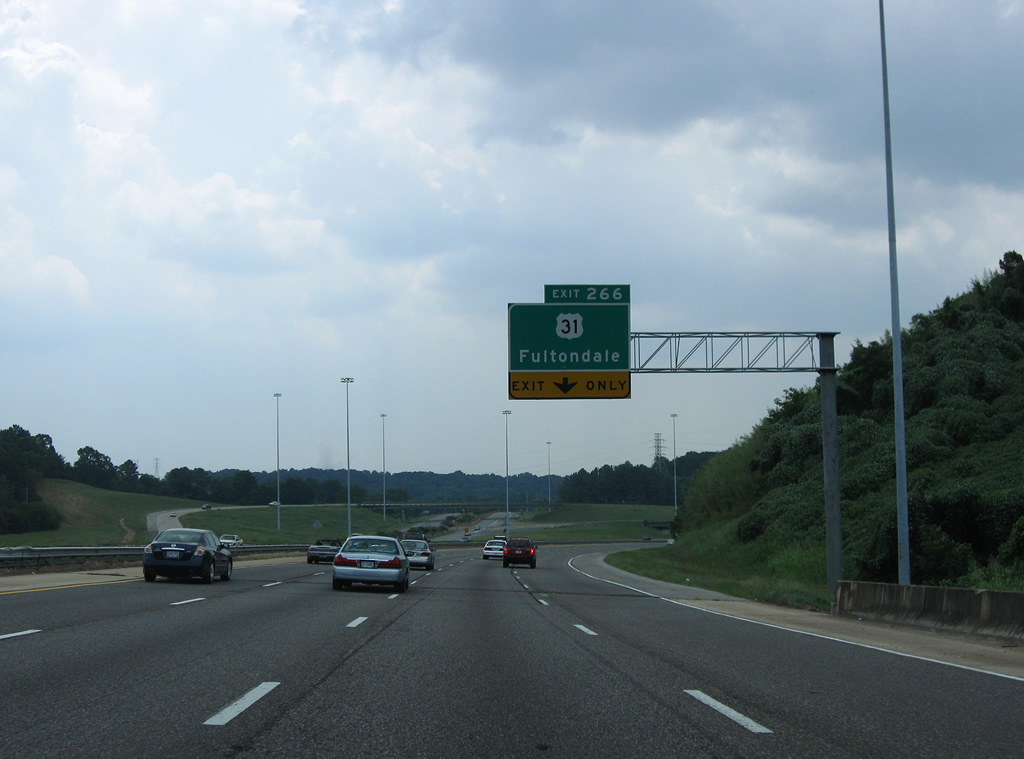
| Interstate 65 spans Five Mile Creek ahead of the Exit 266 trumpet interchange with U.S. 31 (Decatur Highway). A tornado raked across the Fultondale and Birmingham area on the evening of April 27, 2011, concluding a lengthy and devastating journey that commenced across Tuscaloosa and Northport. Sign fixtures and high-mast lighting structures were toppled or bent along this stretch of Interstate 65, including the half mile overhead for what was previously Exit 266 to just U.S. 31. 11/07/11, 08/08/10 |
|
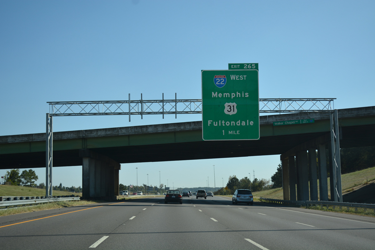
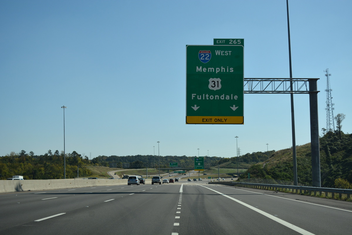
| Two lanes separate from the southbound mainline of I-65 at Fivemile Creek for the c/d roadway leading to adjacent U.S. 31 and Interstate 22 west to Jasper, Tupelo, Mississippi and Memphis, Tennessee. 10/08/16 |
|
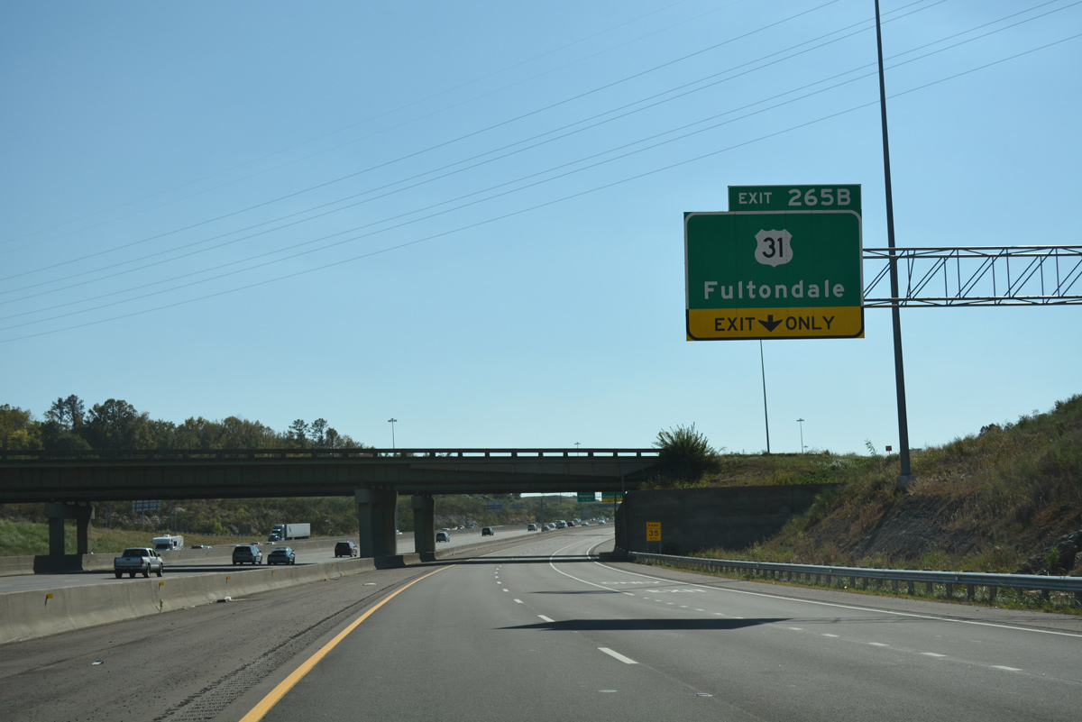
| U.S. 31 (Decatur Highway) angles southwest from Exit 265B to Park Place and North Birmingham from Lewisburg and Fultondale. 10/08/16 |
|
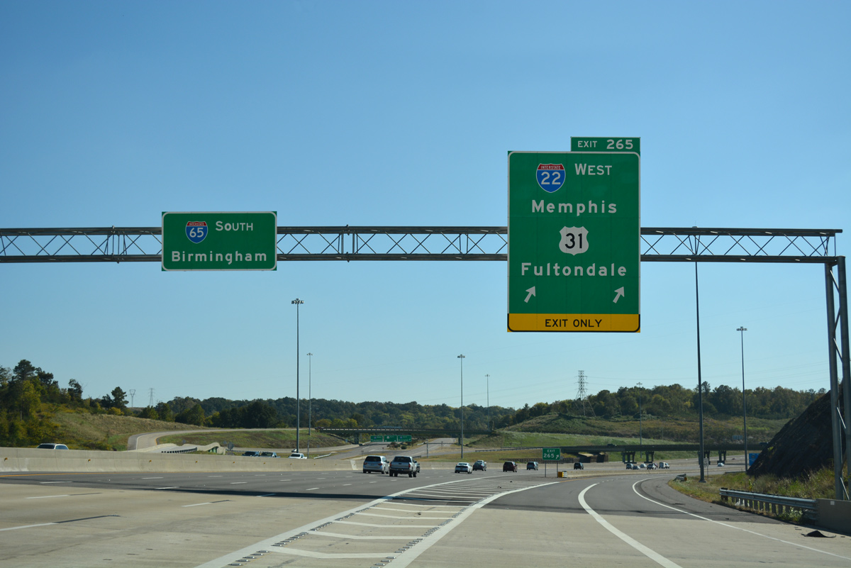
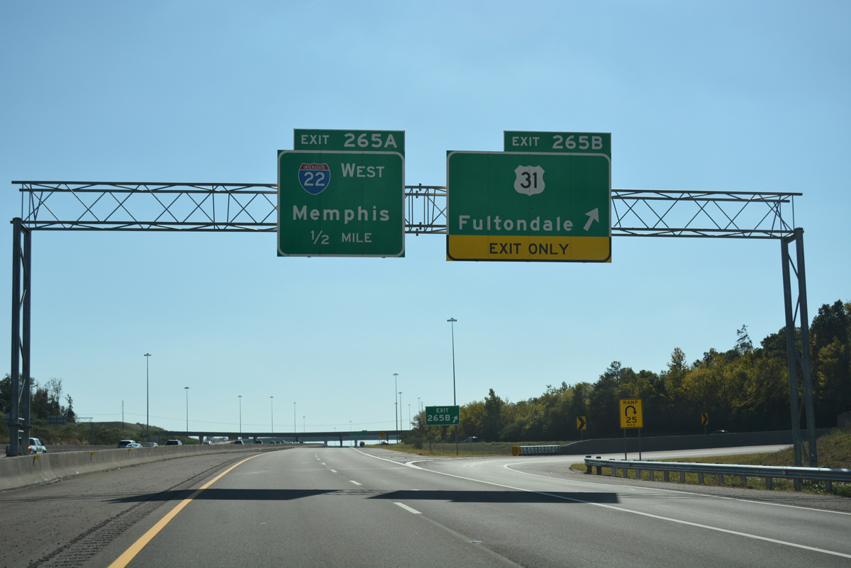
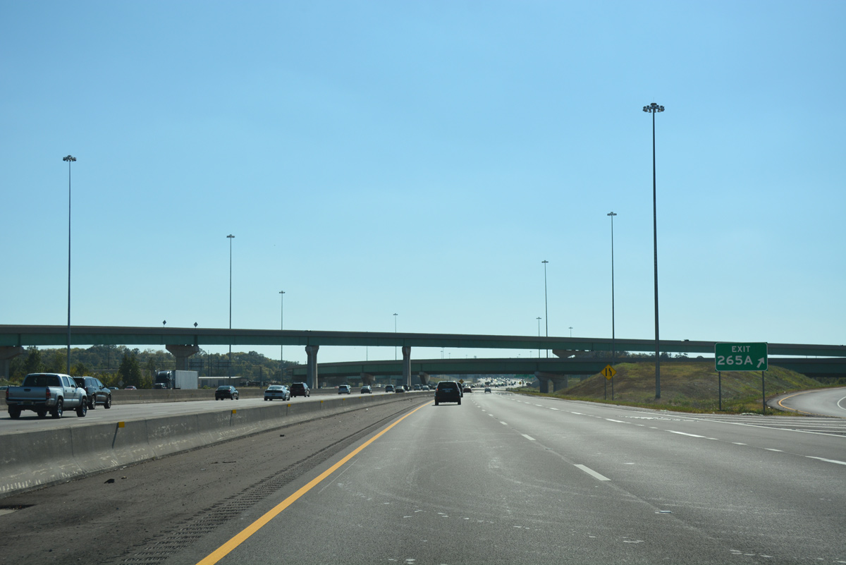
| Exit 265B loops onto an access road connecting Interstate 65 with parallel U.S. 31 (Decatur Highway). Exit 265A follows for Interstate 22 west to Adamsville, Graysville and other north Jefferson County suburbs. 10/08/16 |
|
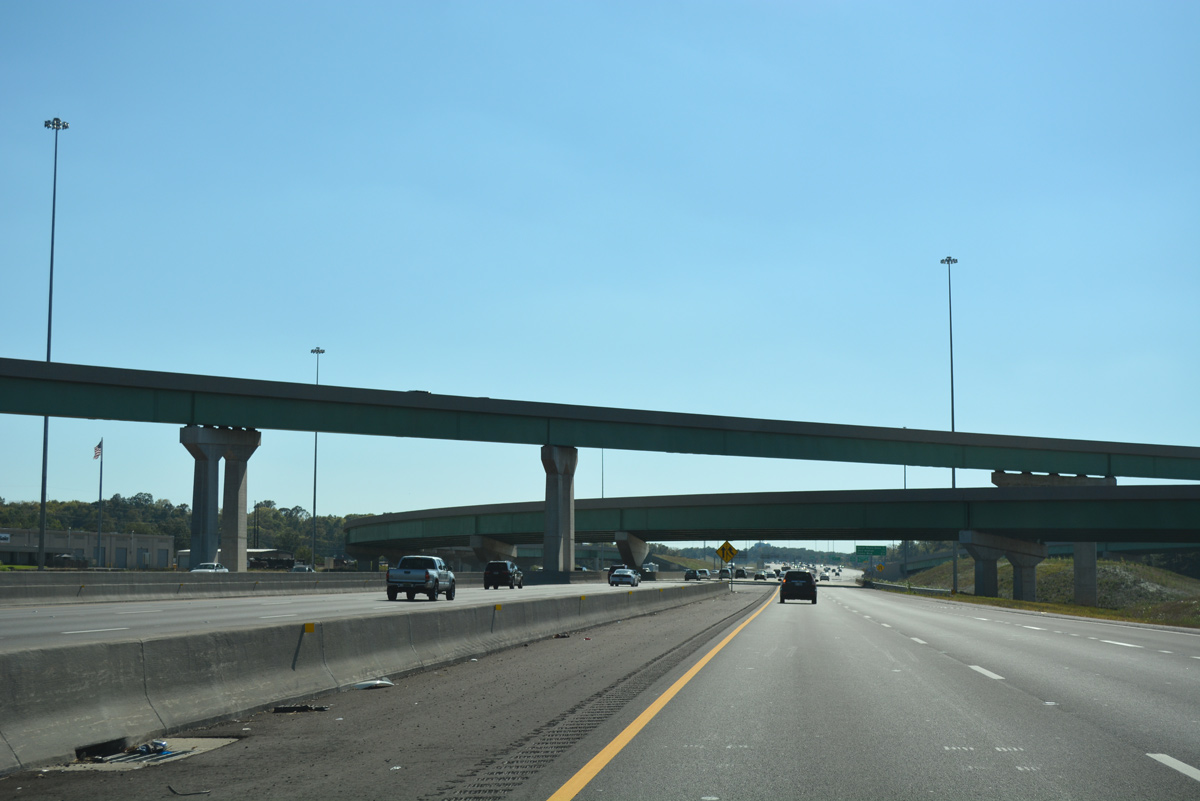
| Drivers along Interstate 65 south briefly enter the Birmingham city limits at the gore point for Exit 265. The freeway reenters the city just south of I-22. 10/08/16 |
|
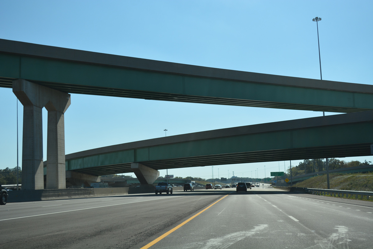
| The directional T interchange joining Interstates 22 and 65 was the largest project undertaken by ALDOT for Corridor X. The exchange was slated to open on October 15, 2014, but several delays hampered completion to spring 2016. 10/08/16 |
|
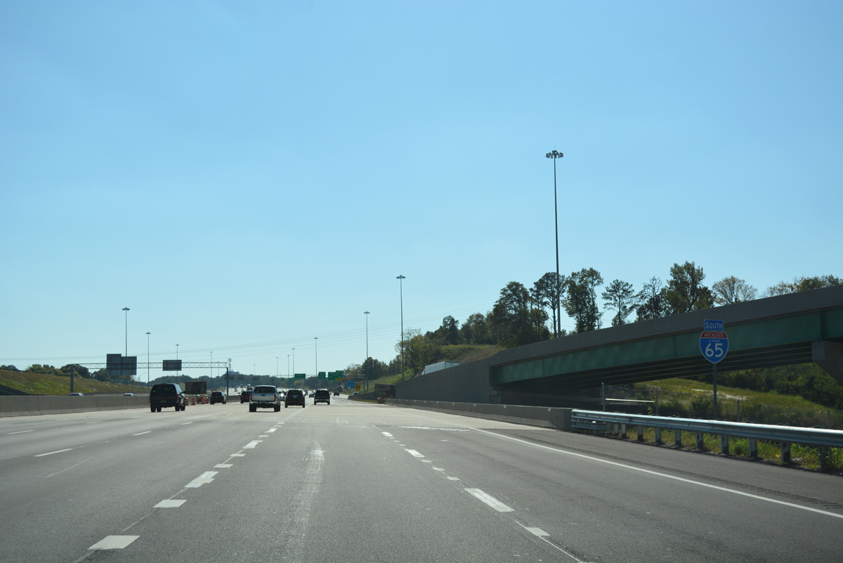
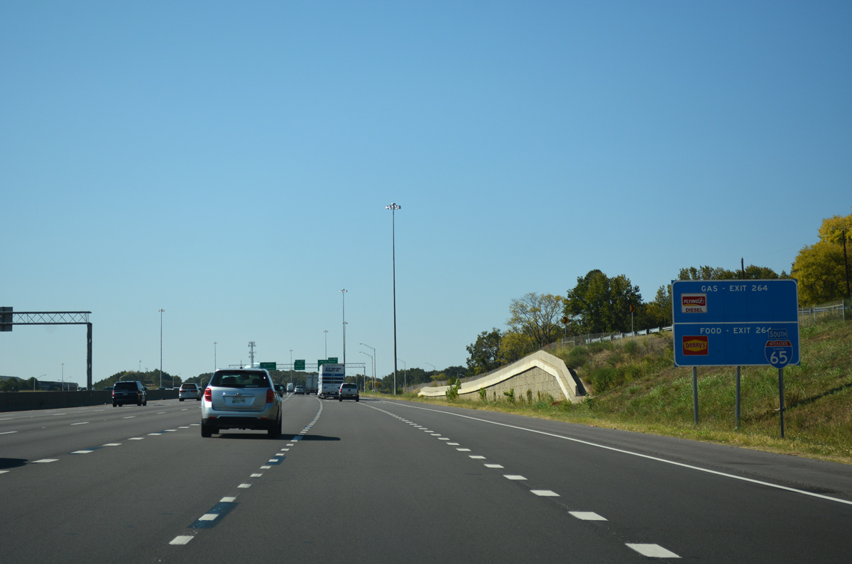
| The c/d roadway for I-22 merges onto the Interstate 65 mainline, 0.75 miles ahead of the parclo interchange (Exit 264) with Daniel Payne Drive. The succeeding three off-ramps serve the community of North Birmingham. 10/08/16 |
|
| A Norfolk Southern Railroad line passes under Interstate 65 by this reassurance shield. 10/08/16 |
|
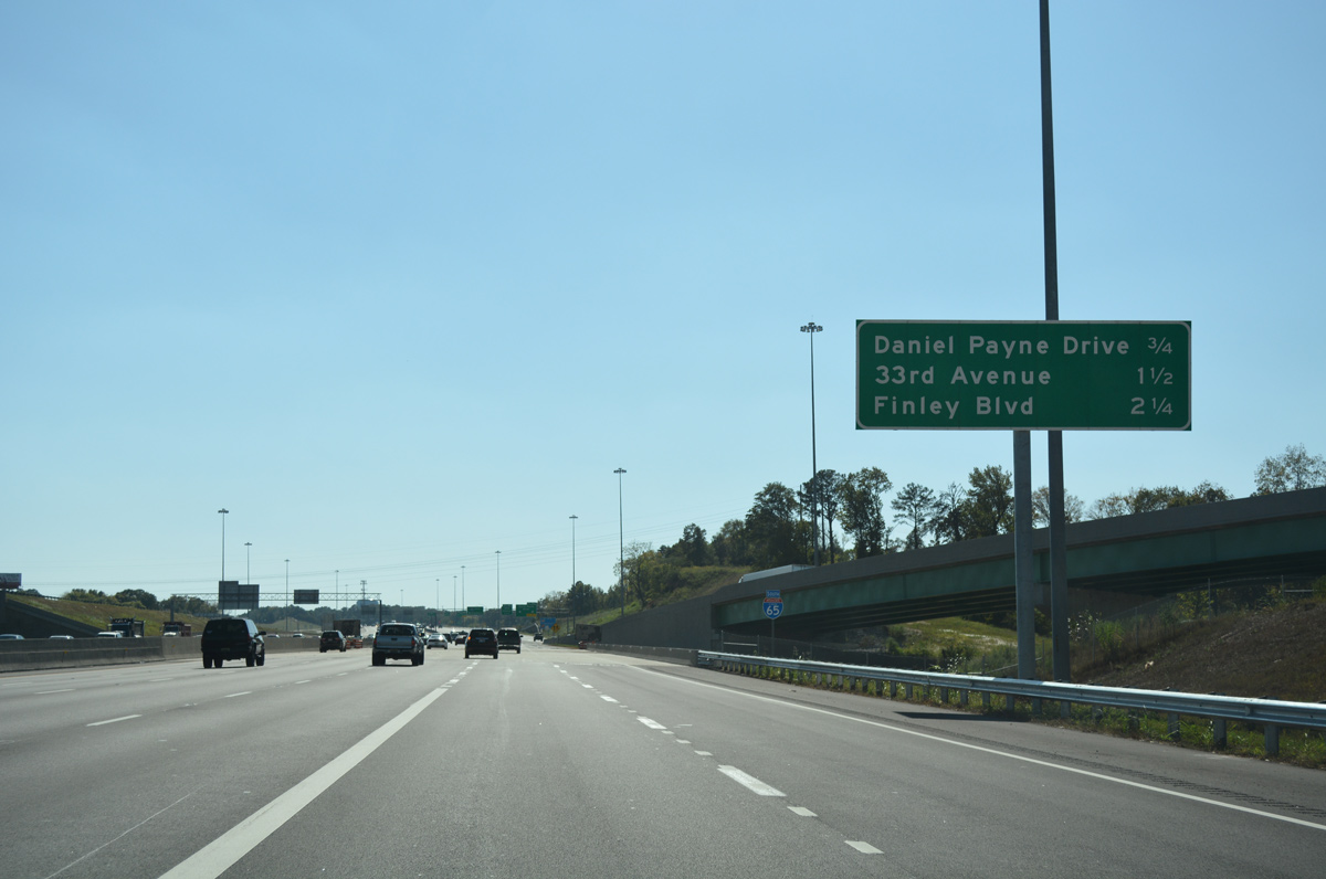
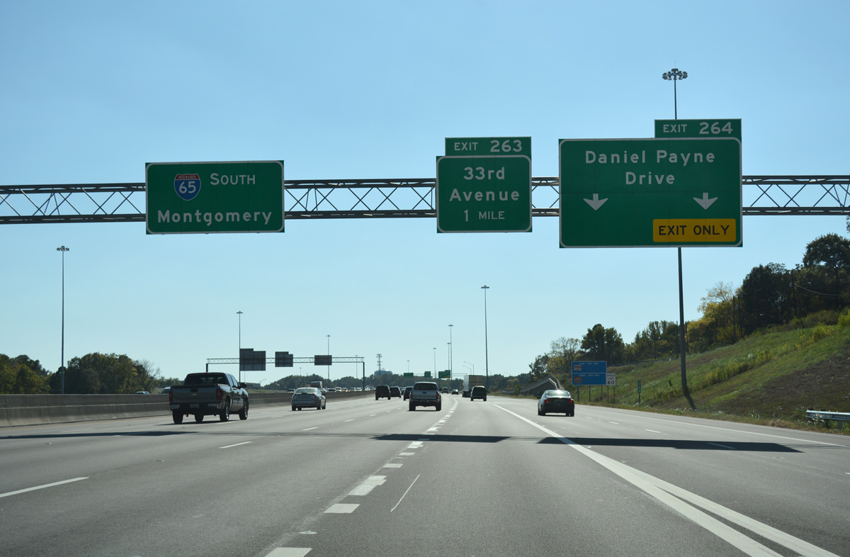
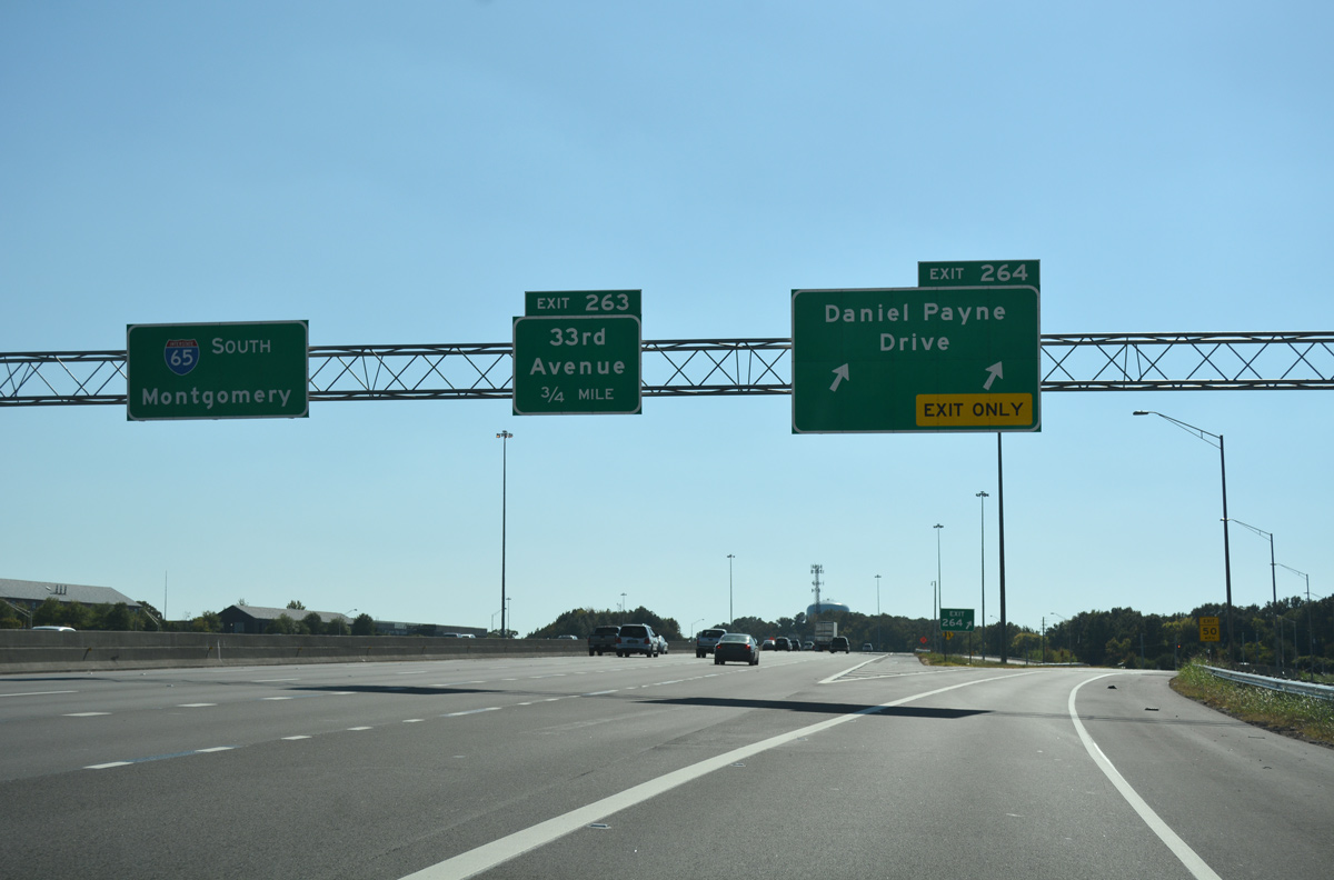
| Daniel Payne Drive stems west from adjacent 24th Street North to Exit 264 at Sayreton. 10/08/16 |
|
| 22nd Street North parallels the west side of I-65 just above this shield assembly preceding Exit 264. 10/08/16 |
|
| West from I-65, Daniel Payne Drive replaced 41st Avenue en route to Dugan Avenue and U.S. 78 & SR 5 (Forestdale Boulevard) at Pratt City. 10/08/16 |
|
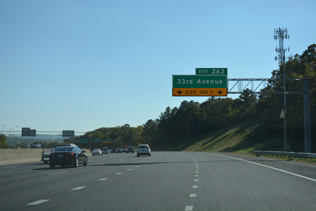
| Widening of Interstate 65 in 2009-10 swells the southbound freeway to six lanes ahead of the split diamond interchange (Exit 263) with 33rd Avenue North. 10/08/16 |
|
| Exit 263 joins 18th Street North ahead of its intersection with 33rd Avenue North as Red Mountain appears on the southern horizon. 33rd Avenue travels seven blocks east of Interstate 65 to the commercial strip of U.S. 31 (26th Street North). Westward the road loops north to become 4th Street West ahead of Hooper City and Daniel Payne Drive. 10/08/16 |
|
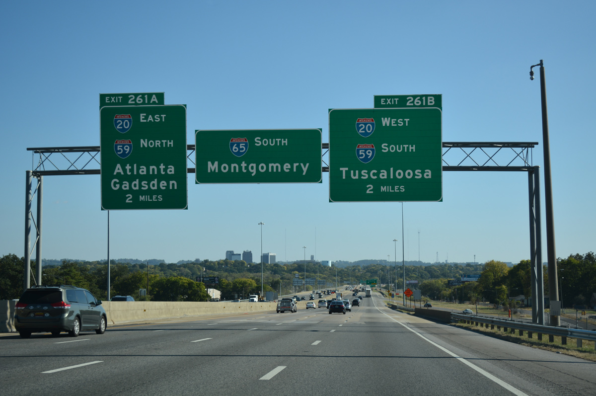
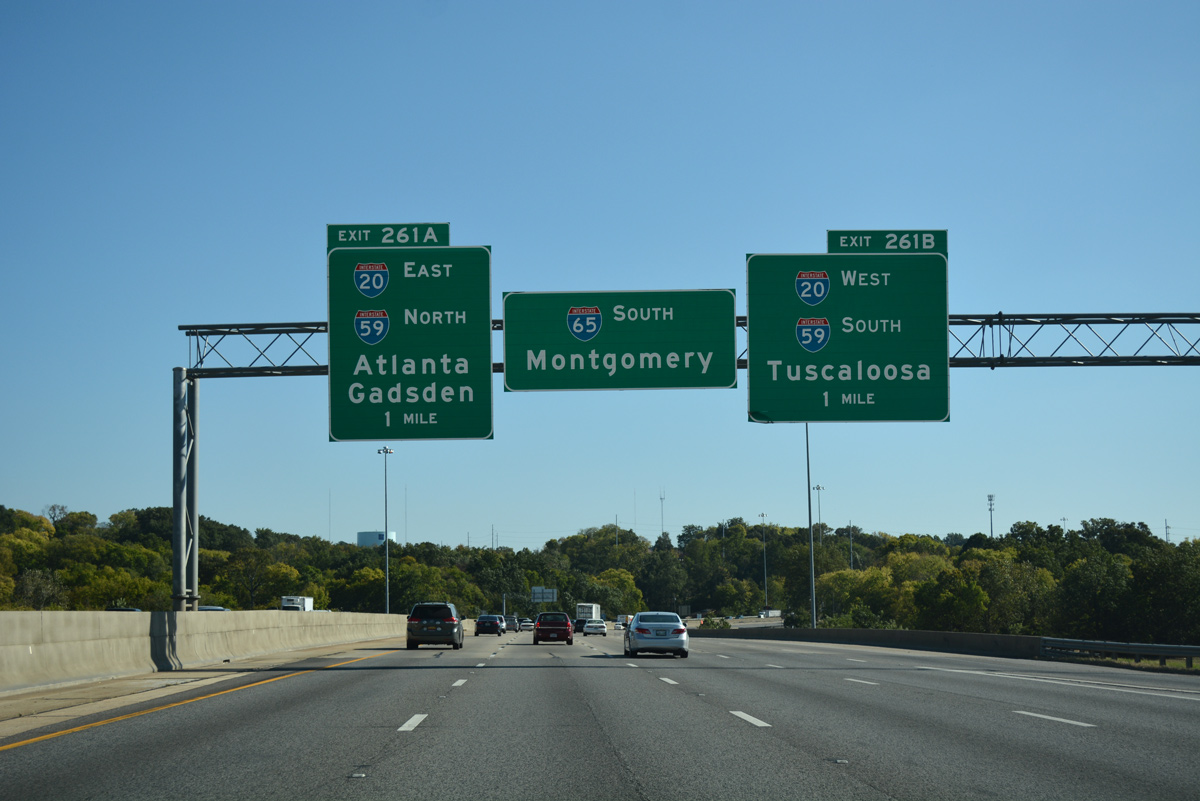
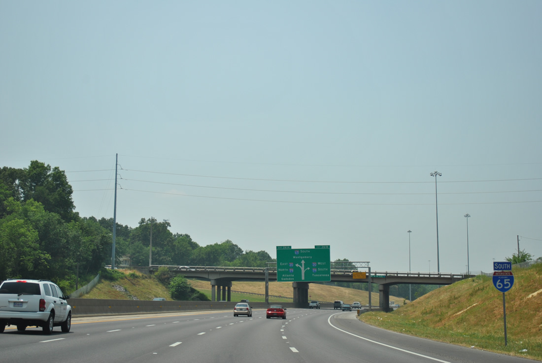
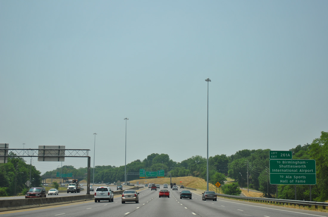
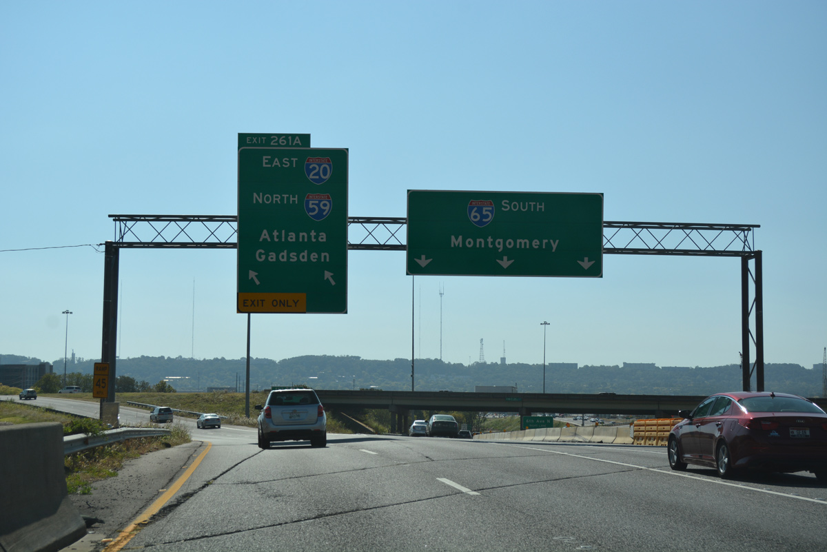
| The skyline of Downtown Birmingham comes into view beyond the first set of signs for I-20/59 (Exits 261B/A). Locally known as "Malfunction Junction", the exchange two miles ahead utilizes left side ramps. 10/08/16 |
|
| Reassurance shield for Interstate 65 south posted at the 18th Street North on-ramp. 10/08/16 |
|
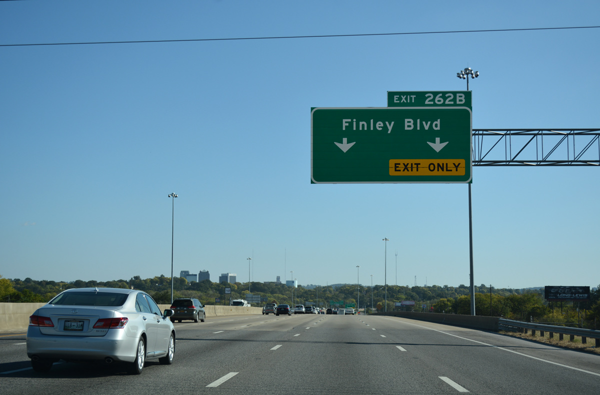
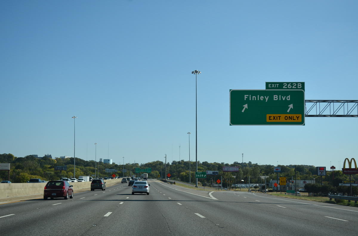
| Interstate 65 utilizes a short viaduct over 29th and 27th Avenues North, CSX and Norfolk Southern Railroads ahead of the diamond interchange (Exit 262B) with Finley Boulevard. Finley Boulevard comprises a multi-lane arterial west through Opossum Valley to U.S. 78 (Bankhead Highway) at the Thomas neighborhood of the city. 10/08/16 |
|
| A two lane ramp lowers from Interstate 65 south onto 18th Street North ahead of Finley Boulevard. The Alabama Farmers Market lies just west of Exit 262B. East from the freeway, Finley Boulevard becomes 25th Avenue North en route to U.S. 31 (Carraway Boulevard). 10/08/16 |
|
| Interstate 65 curves southwest from Village Creek and rises into the Fountain Heights neighborhood of Birmingham on the one mile approach to I-20/59 (Exits 261B/A). 10/08/16, 06/02/11 |
|
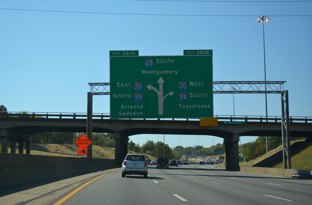
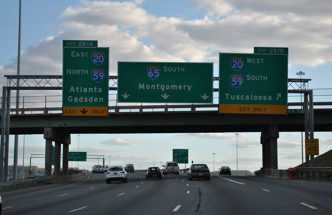
| This diagrammatic overhead and sign bridge was installed in fall of 2003 as part of a project to resign "Malfunction Junction". Work in 2003 also expanded Interstate 65 to six lanes through the four-wye interchange and expanded Exit 261A into a two lane ramp. 10/08/16 |
|
| A half diamond interchange (Exit 262A from northbound) adds traffic to Interstate 65 southbound from 16th Avenue North. A guide sign advises motorists bound for Birmingham-Shuttlesworth International Airport (BHM) to use I-20 east / I-59 north (Exit 261A). The airport was renamed to honor civil rights activist Fred L. Shuttlesworth on April 3, 2009.1 All area freeway guide signs for the airport were replaced in 2010-11. 06/02/11 |
|
| Ramps for I-20/59 depart almost simultaneously, with lane drops occurring from both sides of southbound mainline. I-20/59 venture southwest to Fairfield, Bessemer and Tuscaloosa. The tandem eastbound continue another six miles to BHM Airport and their partition. 10/08/16 |
|
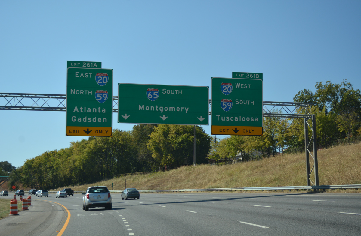
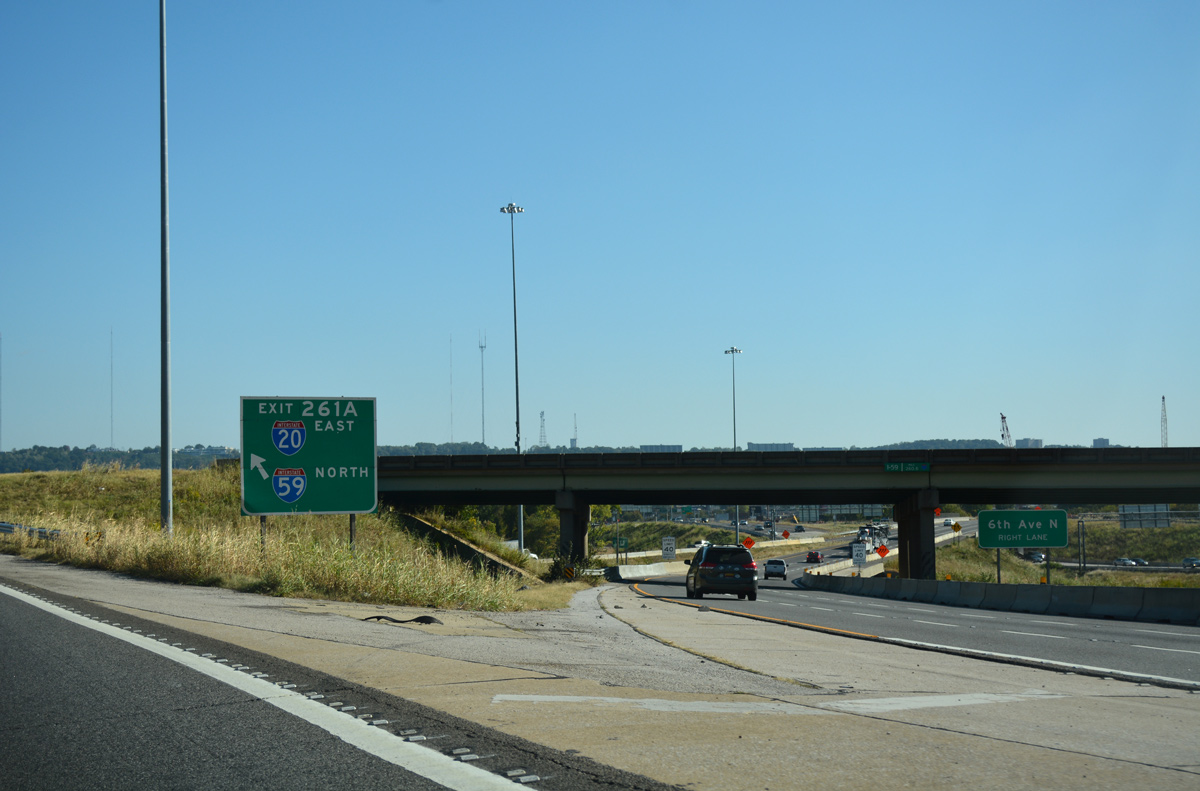
| Exit 261B departs from I-65 south for I-20/59 south 53 miles to Tuscaloosa. Construction at Malfunction Junction in 2016 removed this sign bridge, with the overpass for 12th Court demolished afterwards. 11/07/11 |
|
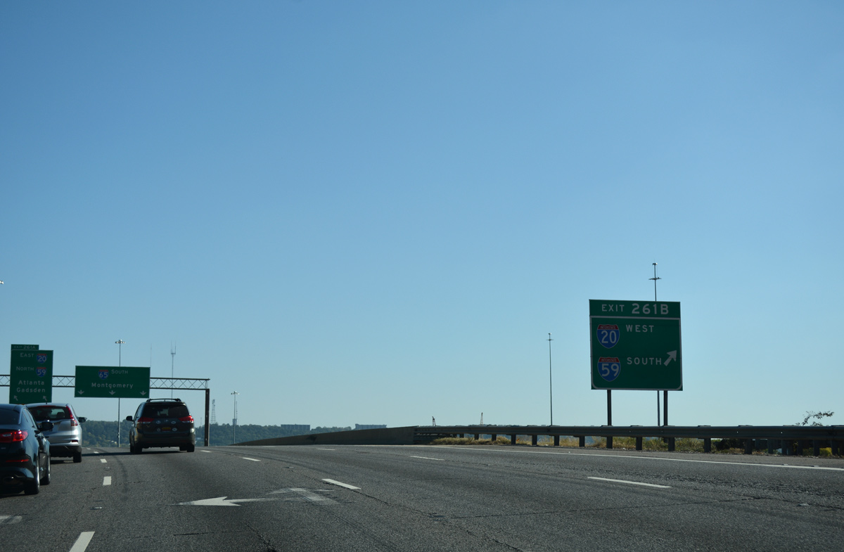
| Roadways of Interstate 65 switch sides through "Malfunction Junction", as northbound passes under southbound beyond the Exit 261B gore point. 10/08/16 |
|
| Exit 261A constitutes a short ramp to Interstates 20 east & 59 south, as the roadways of I-20/59 switch sides as well. Heading out from Downtown Birmingham, Interstate 59 continues 60 miles to Gadsden; Interstate 20 follows the U.S. 78 corridor to Leeds, Anniston and Atlanta. 10/08/16 |
|
| The I-59 / I-20 Bridge Replacement Project includes several changes at Malfunction Junction including adding a new flyover ramp from Exit 261A to the 17th Street West off-ramp. 10/08/16 |
|
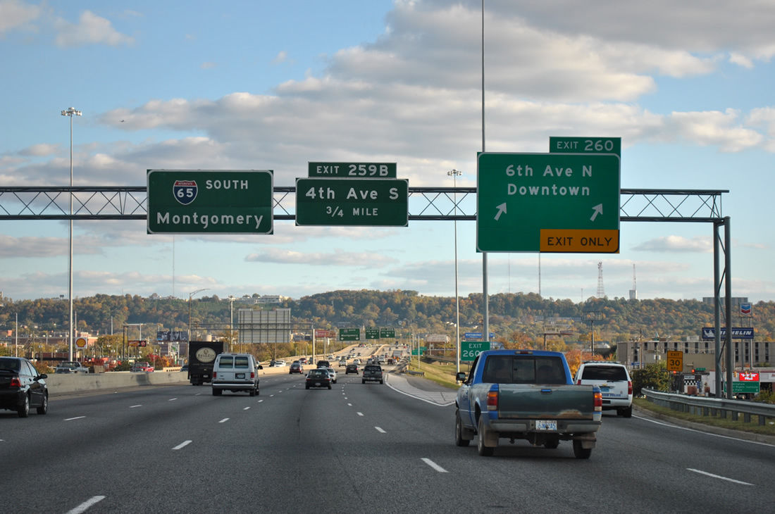
| A split diamond interchange (Exit 260) joins I-65 with the Downtown area street grid just south of Malfunction Junction. A new flyover ramp will remove a weaving traffic pattern, where motorists bound for the 10th Street North off-ramp commingle with merging traffic from I-20/59 north. 11/07/11 |
|
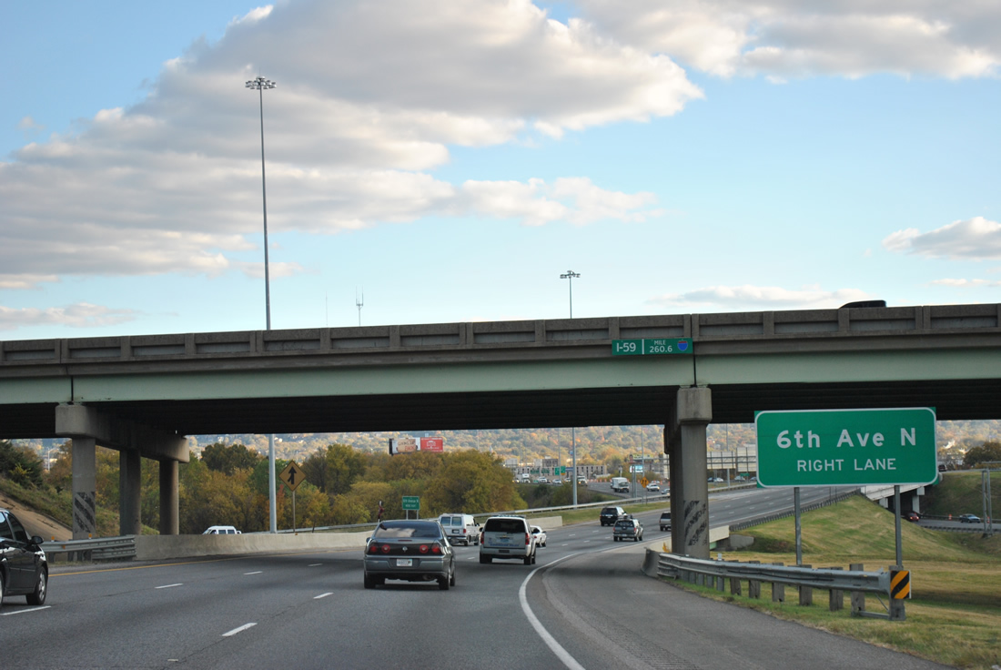
| Road work through summer 2003 added a fourth southbound lane for I-65 to Exit 260 for 6th Avenue North through 3rd Avenue North. Sixth Avenue North leads west from Downtown to Graymont, Smithfield and Legion Field, the football stadium for the University of Alabama at Birmingham Blazers. 06/02/11 |
|
| A two lane ramp departs Interstate 65 south at Exit 260 for 6th Avenue North. Omitted on guide signs are U.S. 11 and U.S. 78. The pair follow 3rd Avenue West from near Owenton and Elyton (Arkadelphia Road) to 24th Street North in the central business district. Through Exit 260, U.S. 11 north & 78 east follow 3rd Avenue North to 13th Street North, combining along 1st Avenue North into Downtown; U.S. 11 south & 78 west travel 1st Avenue North to 9th Street North before recombining one block west of I-65. 11/07/11 |
|
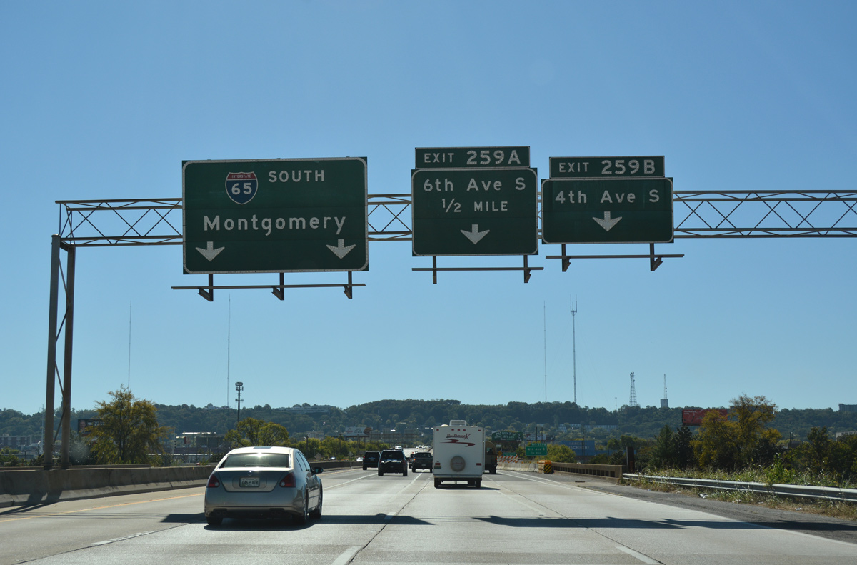
| Continuing south, Interstate 65 passes over U.S. 11 & 78 and next meets 4th Avenue South near the University of Alabama at Birmingham campus. Exit 259A immediately follows onto 6th Avenue South west to Elmwood Cemetery. Red Mountain, an assortment of communications towers, rises to the south along this stretch of Interstate 65. 10/09/16 |
|
| The on-ramp from 10th Street North and U.S. 11 south & 78 east merges onto Interstate 65 south ahead of a viaduct traveling over 1st Avenue North, the NS Railroad line, a Louisville and Nashville Railroad line, and 2nd Avenue South. The wye interchange with 4th Avenue South lies south of the viaduct in one half mile. 11/07/11 |
|
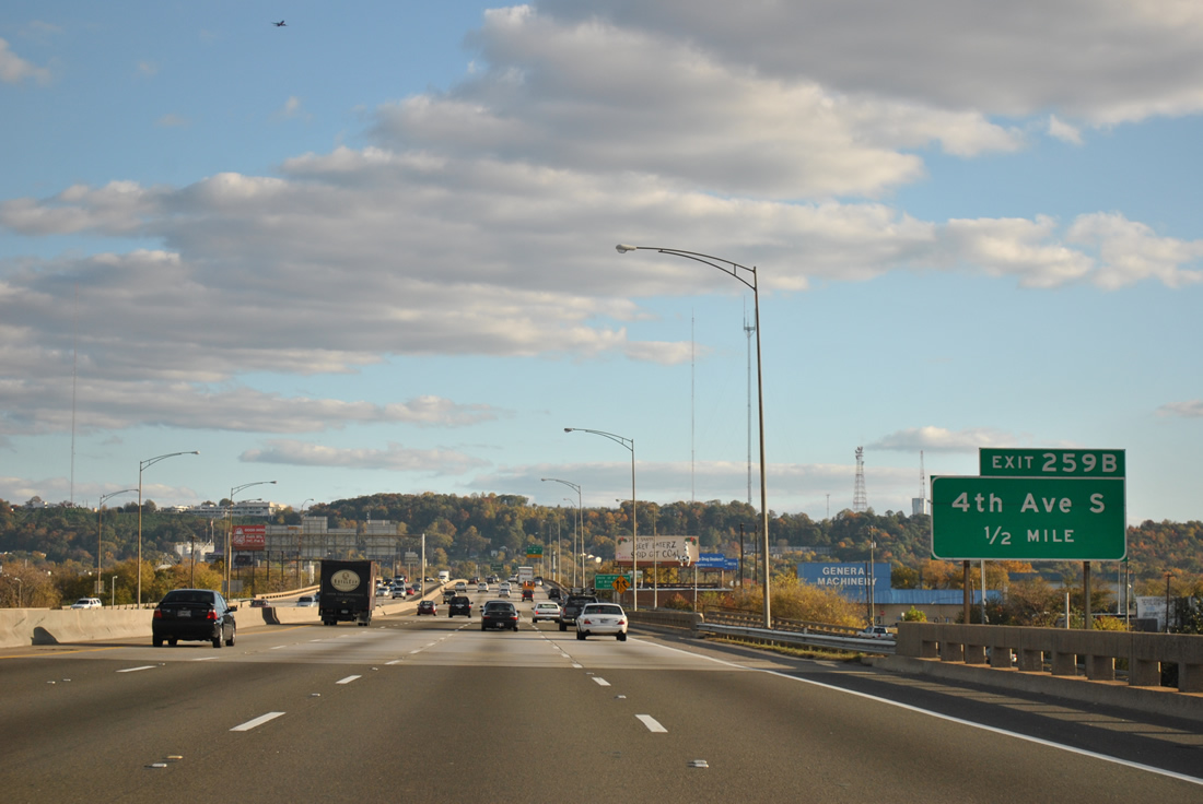
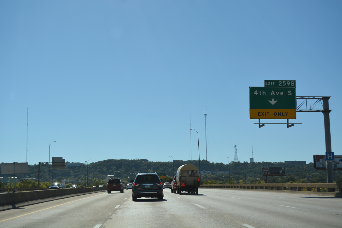
| Interstate 65 south briefly swells to five overall lanes ahead of Exit 259B. 4th Avenue South flows east from the freeway to the UAB Campus and 24th Street South, where it becomes a part of U.S. 78 east. 10/09/16 |
|
| Button copy overheads at the ramp departure (Exit 259B) from I-65 to 4th Avenue South. A modified diamond interchange (Exit 259A) follows with 6th Avenue South west and SR 149 (University Boulevard). Southbound motorists bound for SR 149 east should use 11th Street South from Exit 259B to University Boulevard. SR 149 constitutes an 8.15 mile loop west from the Red Mountain Expressway (U.S. 31 & 280) to U.S. 280 at Mountain Brook. 11/07/11 |
|
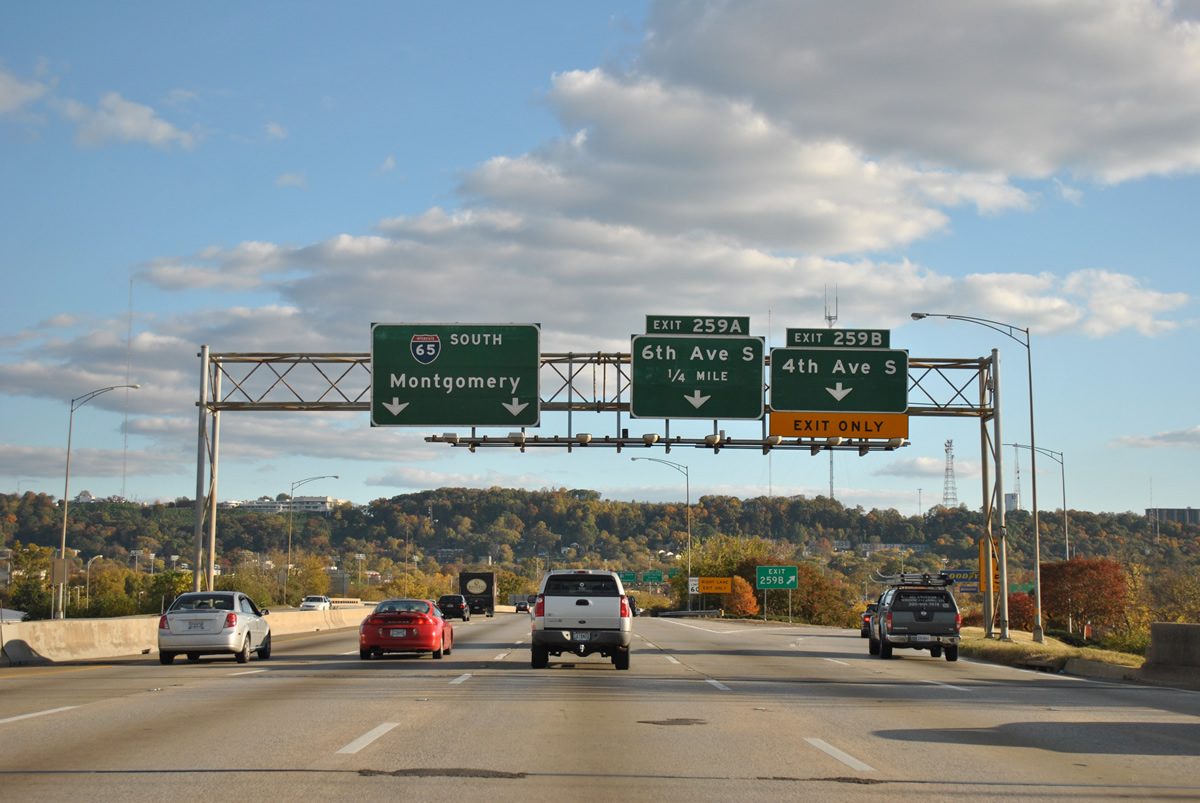
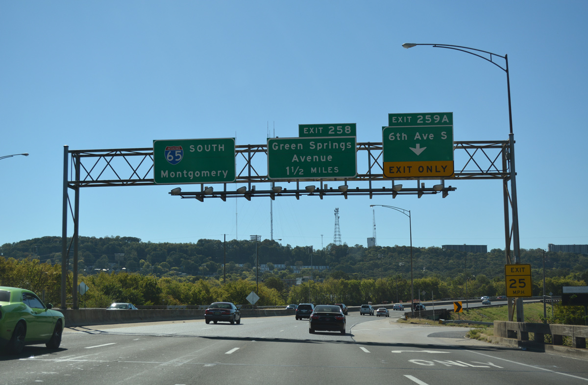
| A lane drop occurs at Exit 259A for Sixth Avenue South. This busy interchange also serves SR 149 (University Boulevard) south to Green Springs Highway and George Ward Park. Just east of the freeway is the large University of Alabama at Birmingham (UAB) campus and medical complex. The organization is the largest employer in the city of Birmingham. 10/09/16 |
|
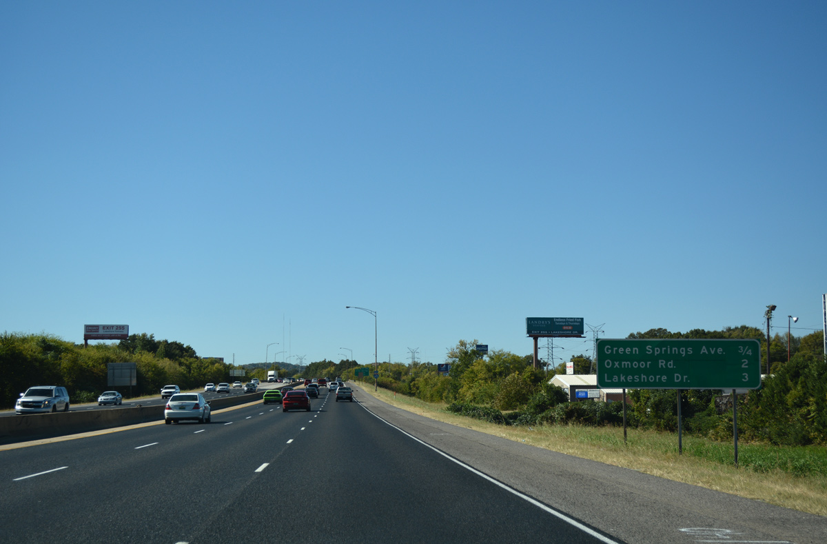
| Interchange sequence sign posted after the SR 149 (University Boulevard) on-ramp at 9th Street South. The ensuing exit serves Green Springs Avenue, an east-west street between 11th Place South and Martin Luther King, Jr. Drive. Succeeding exits with Oxmoor Road and Lakeshore Drive fall within the city of Homewood. 10/09/16 |
|
| Interstate 65 reassurance marker posted on the stretch of freeway paralleling SR 149 (Green Springs Highway) and the L & N Railroad line. 16th Avenue South passes below by adjacent George Ward Park. 10/09/16 |
|
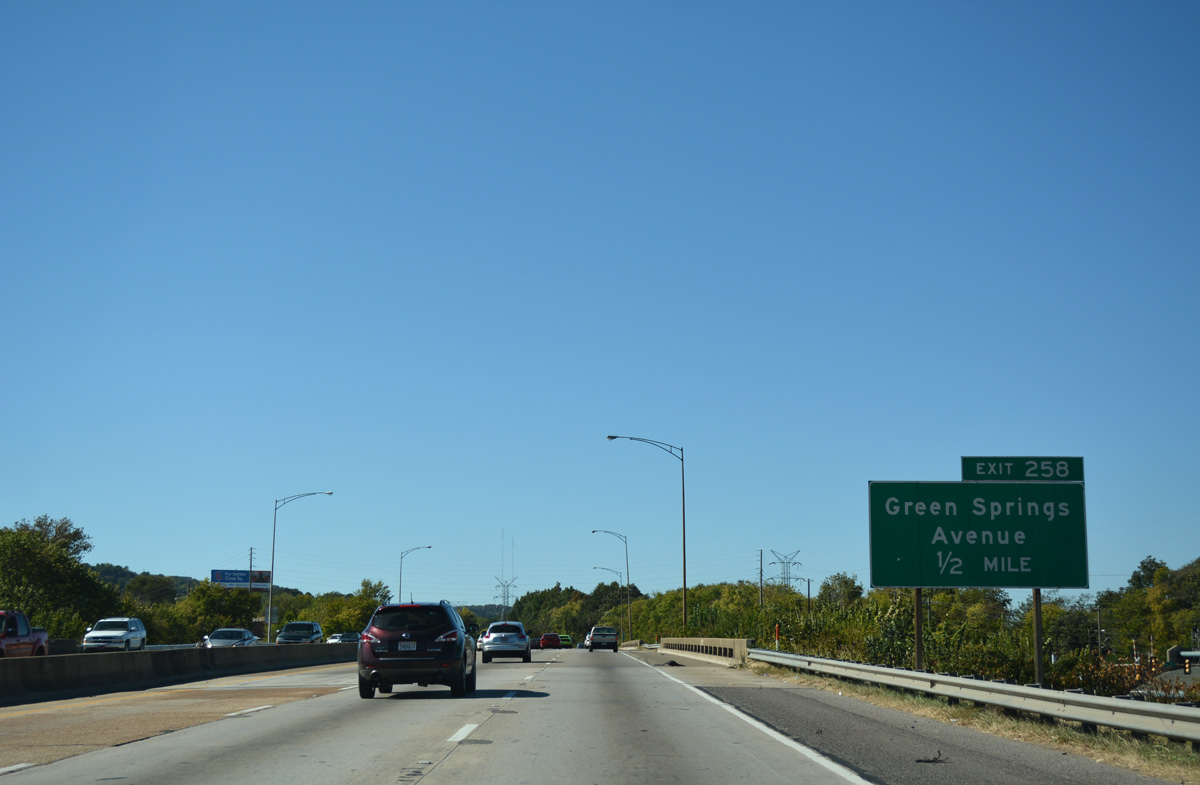
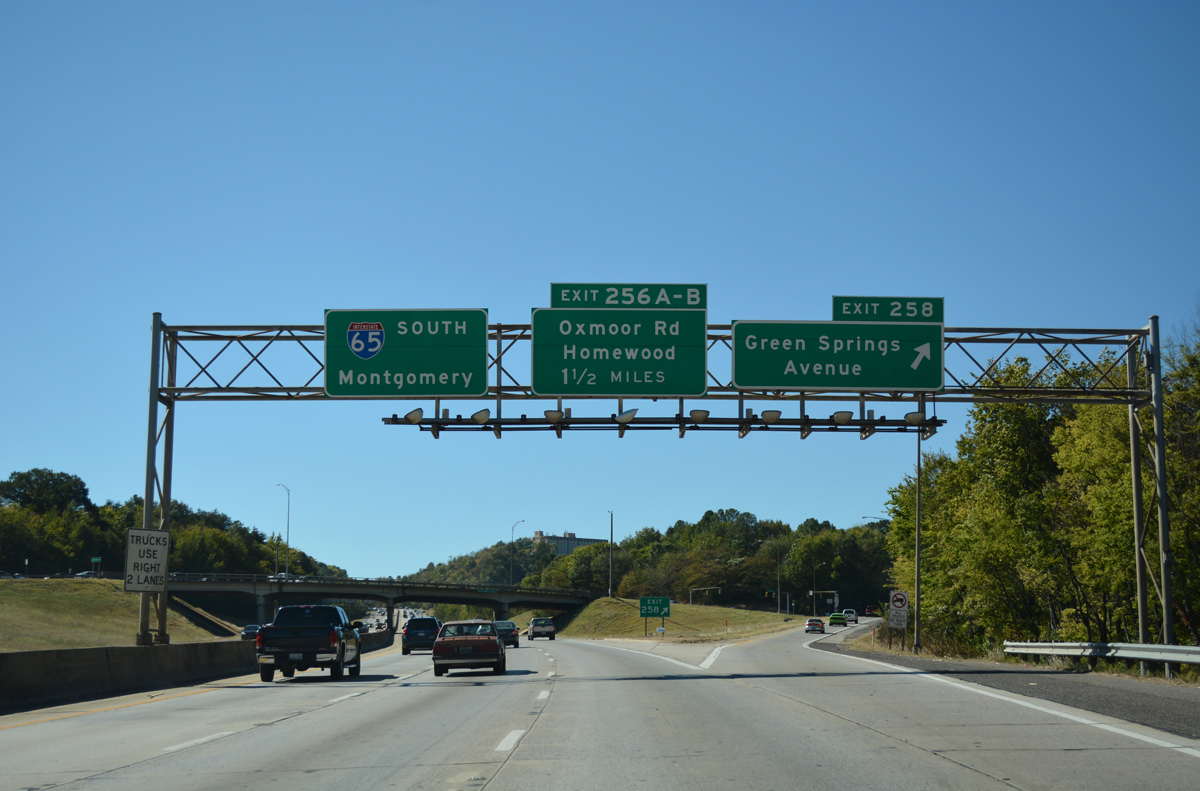
| A diamond interchange (Exit 258) joins Interstate 65 with Green Springs Avenue in one half mile. Green Springs Avenue becomes Dennison Avenue west from MLK, Jr. Drive to Beverly Station and Jefferson Avenue; Jefferson Avenue continues the urban arterial west to Jones Valley in west Birmingham. 10/09/16 |
|
| Exit 258 parts ways with Interstate 65 south for Green Springs Avenue. I-65 and adjacent SR 149 cross Red Mountain over the next mile to the Edgemont community of Homewood and Oxmoor Road (Exits 265B/A). 10/09/16 |
|
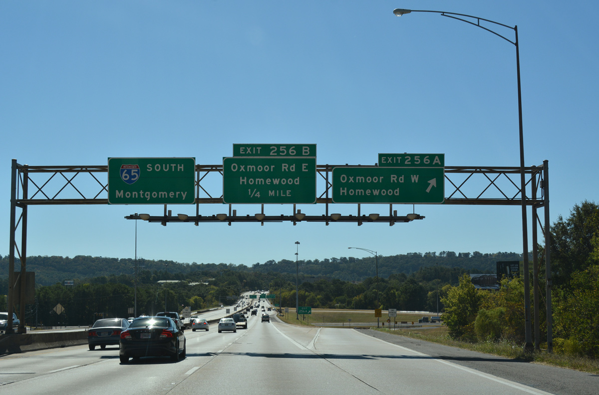
| The parclo interchange with Oxmoor Road is the first of two exits from I-65 for the city of Homewood. Exit 256A separates from the freeway mainline onto Oxmoor Road / Boulevard west to Edgemoor Estates and industrial parks in western Shades Valley. 10/09/16 |
|
| A loop ramp (Exit 256B) follows onto Oxmoor Road east to adjacent SR 149 (Green Springs Highway) and Palisades Boulevard east onto Red Mountain. Oxmoor Road east from Palisades Drive, leads to central Homewood and U.S. 31 (Montgomery Parkway). 10/09/16 |
|
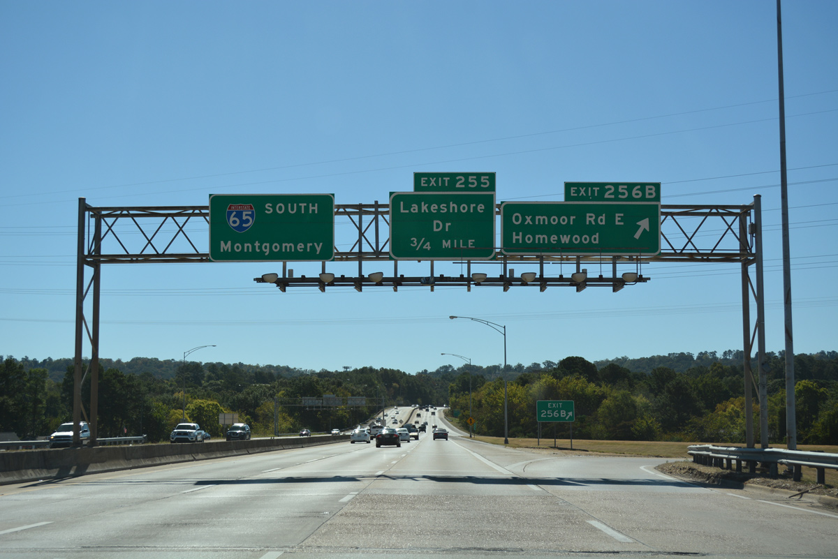
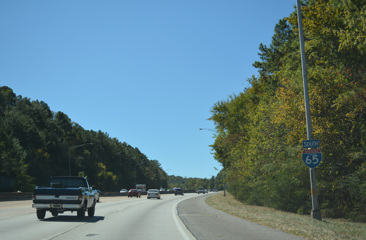
| Interstate 65 again climbs and leaves Shades Valley between Exits 256 and 255 (Lakeshore Drive). 10/09/16 |
|
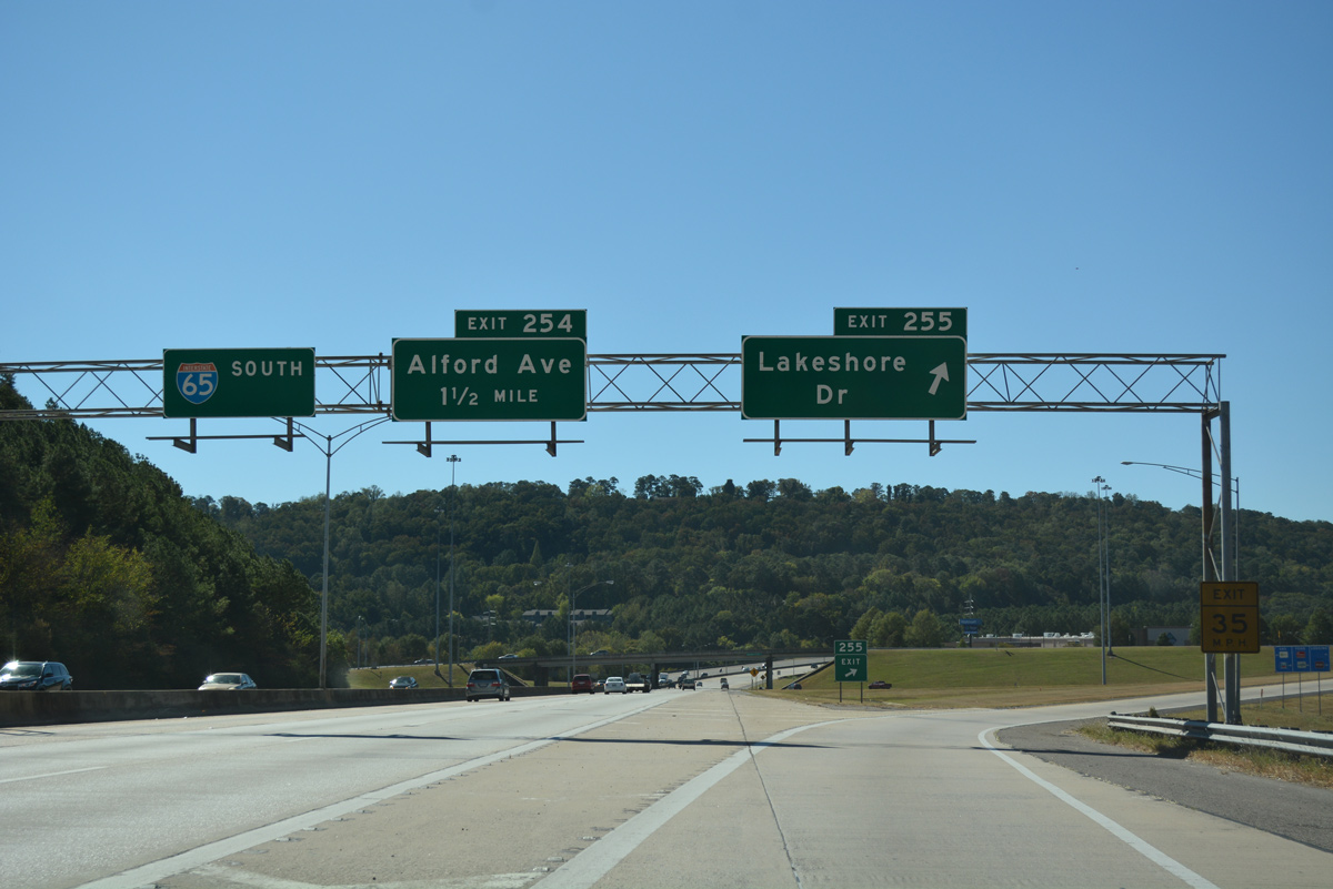
| Southbound at the parclo interchange (Exit 255) with Lakeshore Drive. This exchange was constructed during the mid-1990s to connect with an extension of Lakeshore Drive west from SR 149. Southwest from Exit 255, Lakeshore Parkway comprises an arterial route to Oxmoor Valley Golf Course and the city of Bessemer. SR 149 follows Lakeshore Drive eastward to Samford University and the Shades Creek Parkway interchange with U.S. 280. 10/09/16 |
|
| Continuing the climb onto Shades Mountain from the Lakeview Park community of Homewood and Shades Creek. 10/09/16 |
|
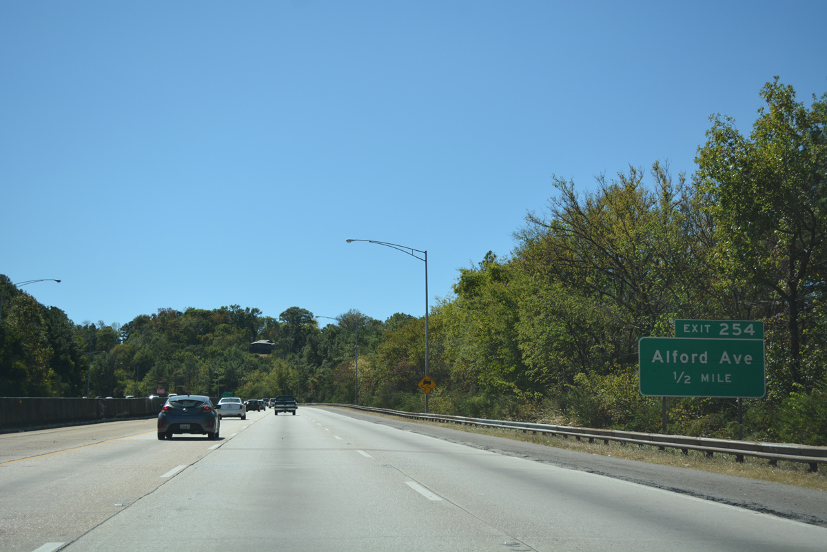
| Interstate 65 southbound leaves Homewood on the half mile approach to Alford Avenue (Exit 254). The approaching surface street travels west through the Shades Cliff neighborhood of Hoover, paralleling Shades Crest Road. Eastward, the street becomes Shades Crest Road as it enters Vestavia Hills. 10/09/16 |
|
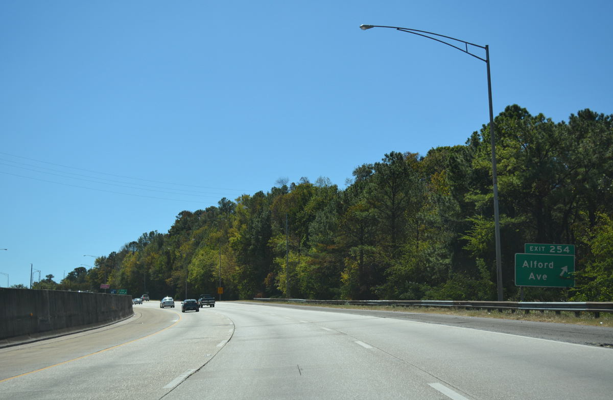
| Entering the diamond interchange (Exit 254) with Alford Avenue (Jefferson County 97) on Interstate 65 south. Alford Avenue, in conjunction with Shades Crest Road, serves the Bluffs Park neighborhood of Hoover. The County Road continues far to the southwest, crossing Interstate 459 near the Shelby County line. 10/09/16 |
|
| The roadways of I-65 separate with a wooded median as the freeway angles southeast between the Regent Forest and Gentilly Forest subdivisions. 04/14/13 |
|
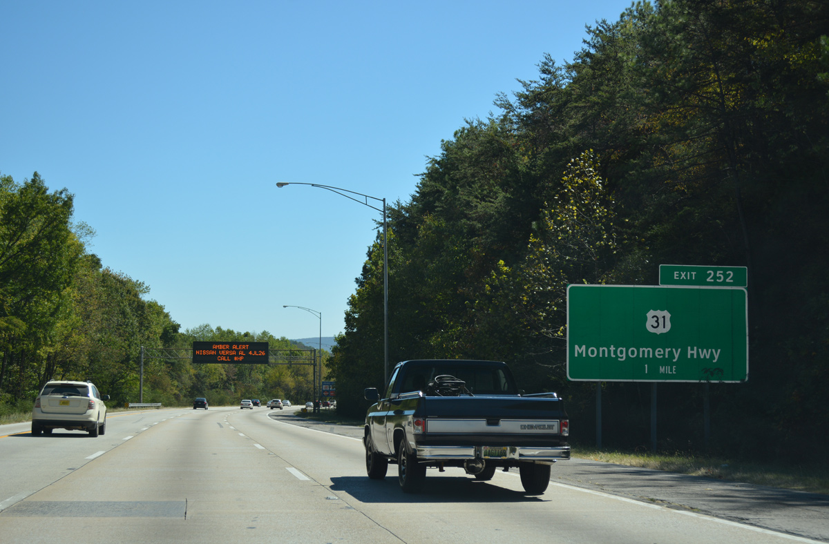
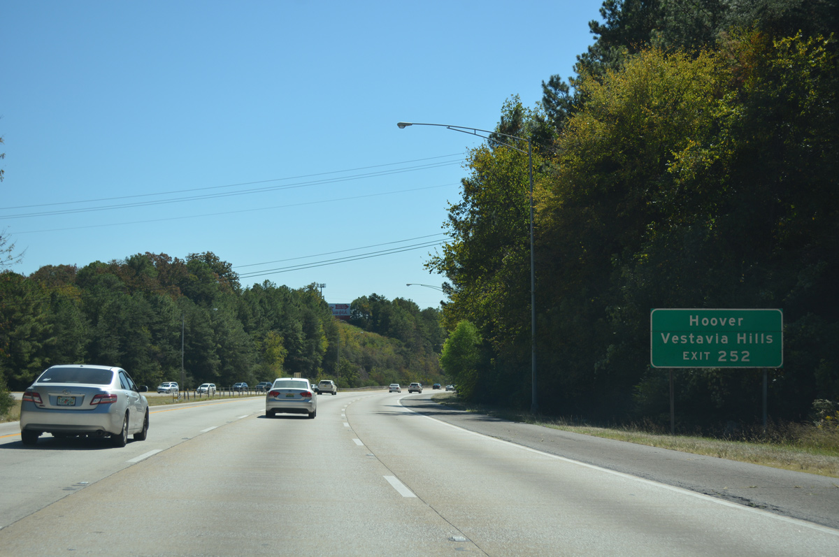
| U.S. 31 angles southwest from Homewood along Montgomery Highway to cross paths with Interstate 65 at Exit 252. 10/09/16 |
|
| Interstate 65 separates the cities of Hoover and Vestavia Hills on the descent toward U.S. 31 (Exit 252). Montgomery Highway comprises a multi-lane arterial through both cities with heavily developed frontage consisting of apartment complexes, subdivisions and retail centers. 10/09/16 |
|
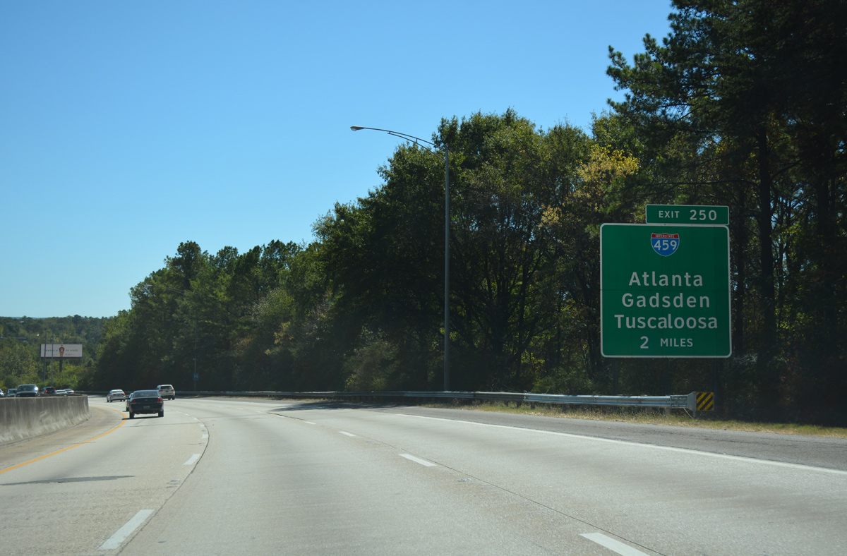
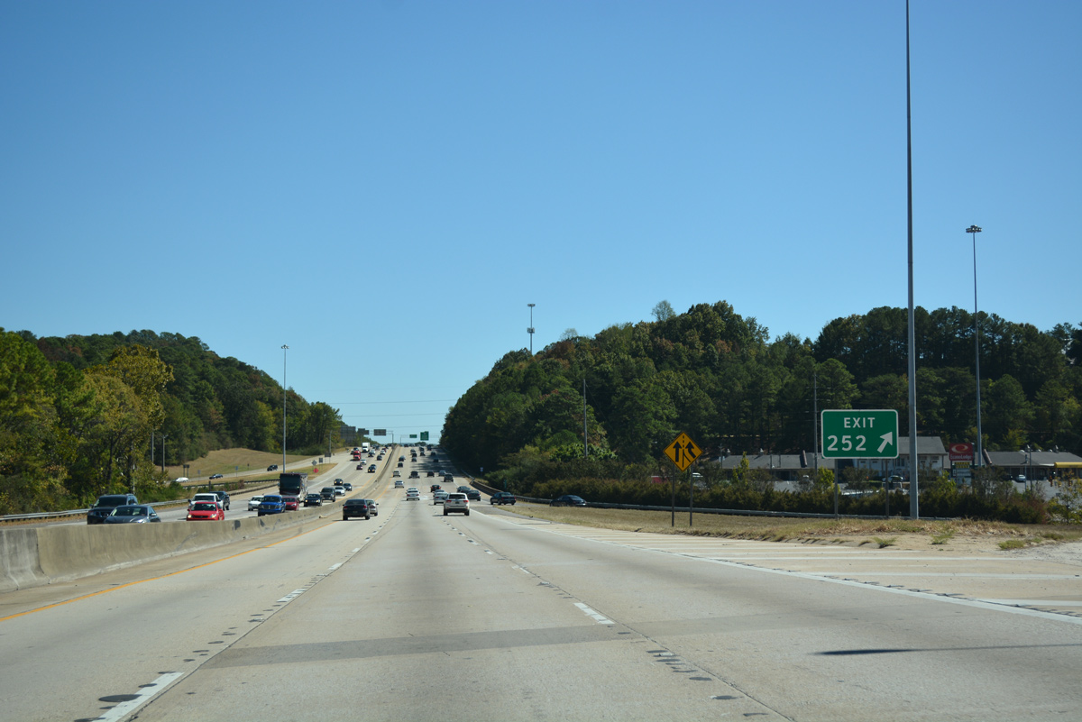
| The first guide sign for Interstate 459 (Exit 250) precedes the parclo A2 interchange (Exit 252) with Montgomery Highway. ALDOT generally posts two mile advance signs for Interstate to Interstate junctions. 10/09/16 |
|
| Exit 252 departs from I-65 south with no additional guide signs referencing U.S. 31 (Montgomery Highway). Off-ramps from I-65 tie into U.S. 31 intersections with Lorna Road south to Patton Chapel and County Road 99 (Columbiana Road) north. 10/09/16 |
|
| This reassurance marker stands ahead of the Wisteria Drive underpass south of U.S. 31. Work commenced in March 2011 on a $21 million project to rebuild a 2.3 mile stretch of I-65 between Exits 252 and 250. Construction included the repaving of ramps at Exit 252 and replacement of the 1981-concrete roadway on the freeway mainline.2 04/14/13 |
|
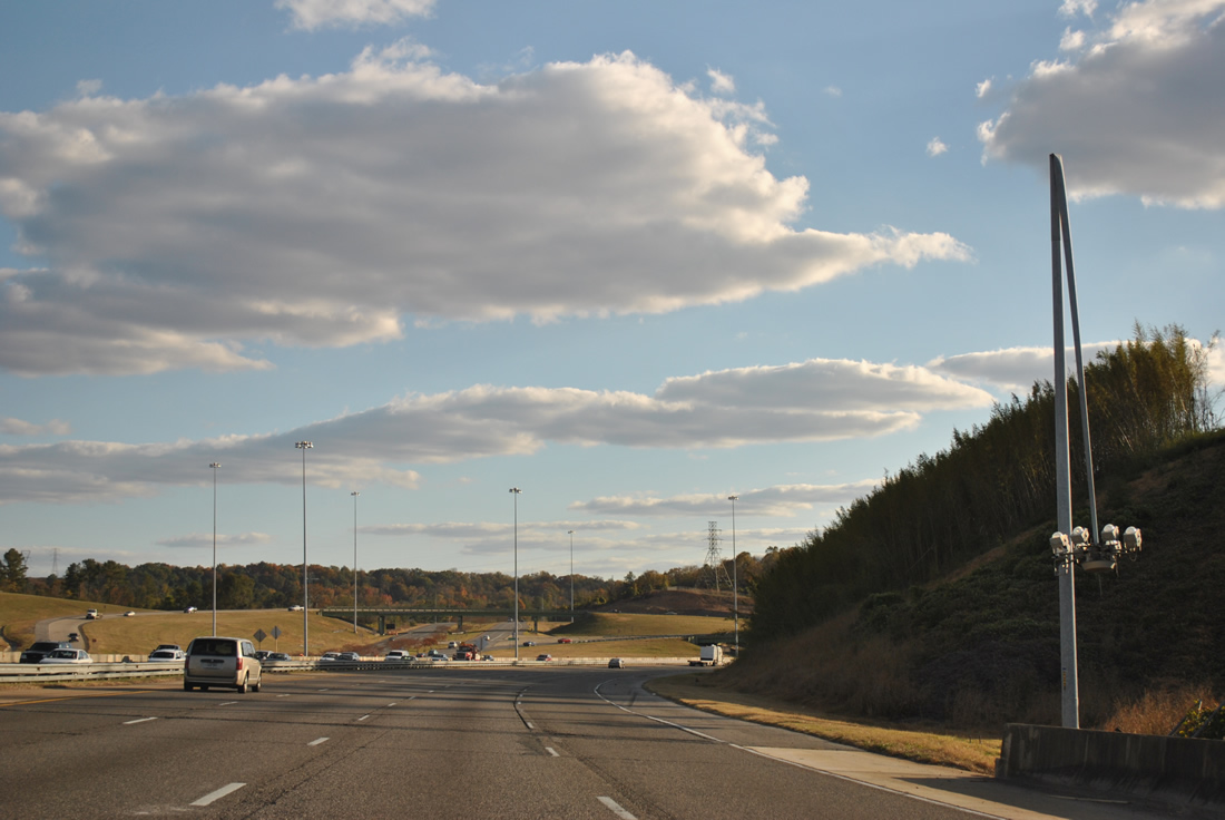
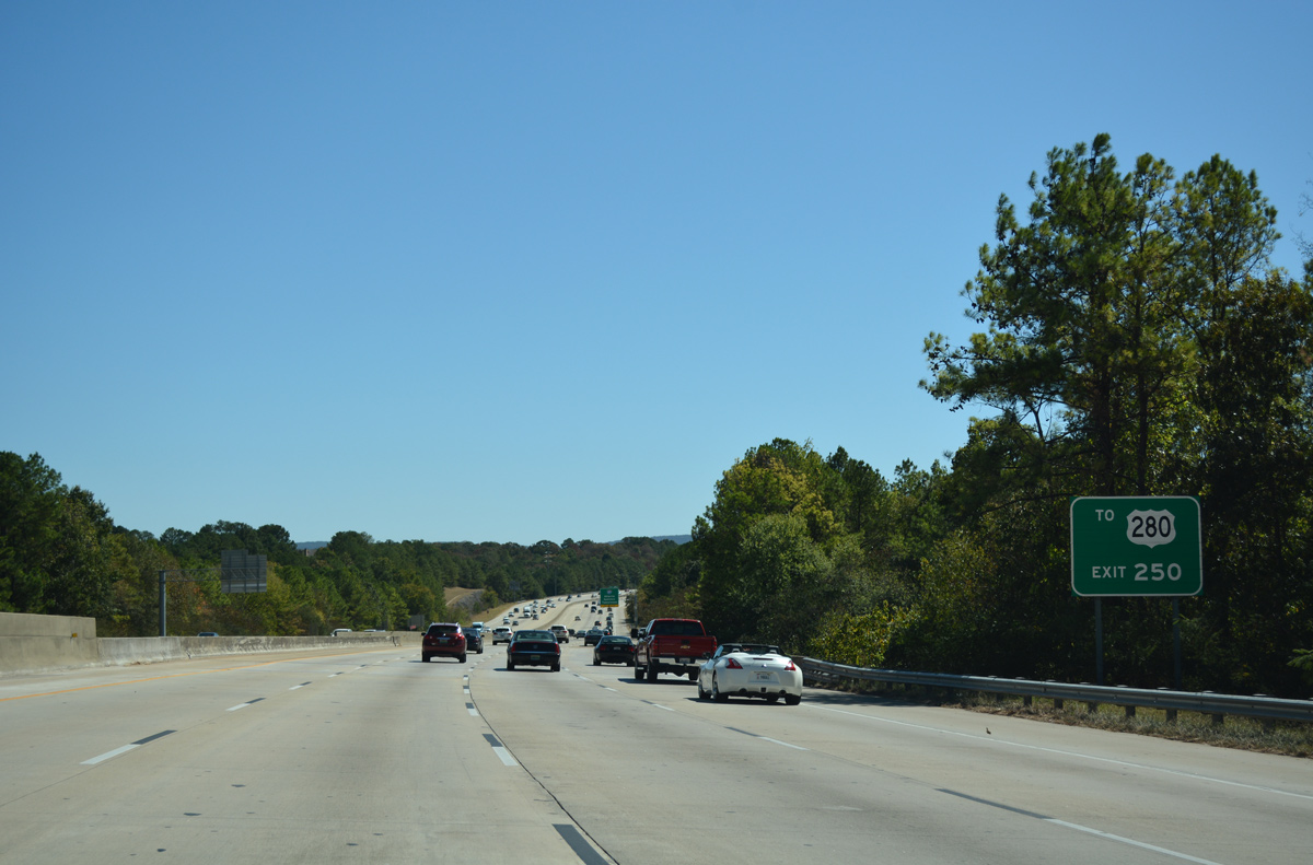
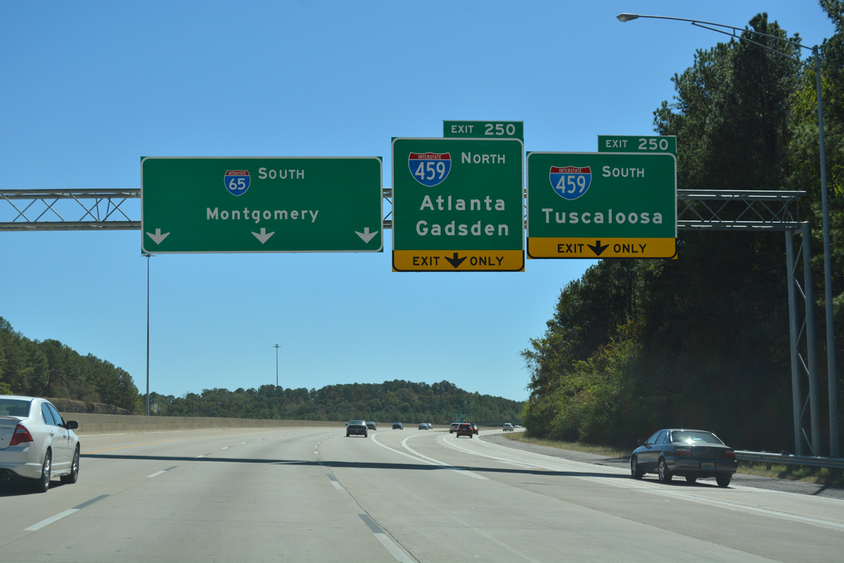
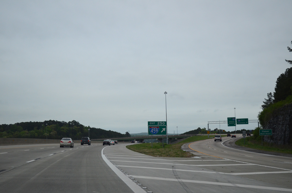
| Interstate 65 turns southeast on the one mile approach to the symmetrical stack interchange (Exit 250) with Interstate 459. I-459, completed in 1984, provides a 33.35 mile bypass of Birmingham for Interstates 20 and 59 between Bessemer, Irondale and Trussville. 10/09/16 |
|
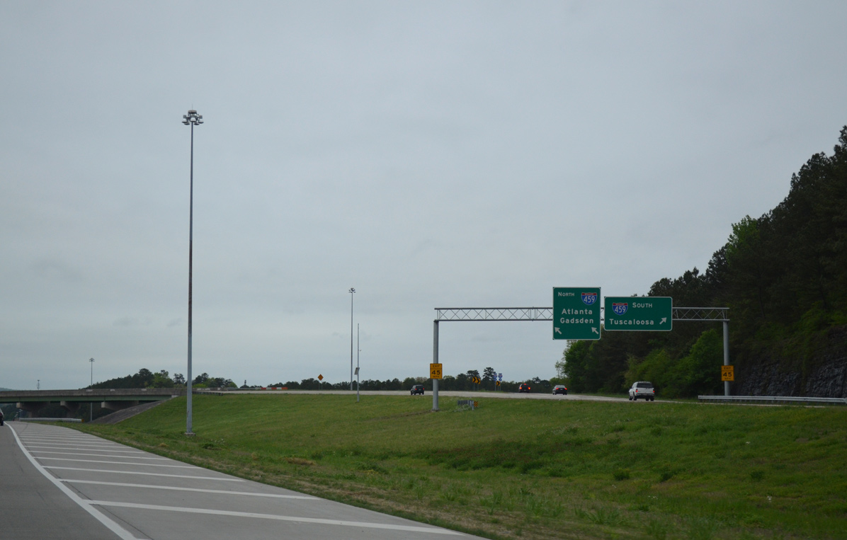
| Travelers destined for U.S. 280 and the southeast Birmingham suburbs should follow Interstate 459 east from Exit 250 to Exit 19 of the belt line. U.S. 280 comprises a heavily developed corridor from Birmingham southeast through Homewood, Mountain Brook, and Cahaba Heights. 10/09/16 |
|
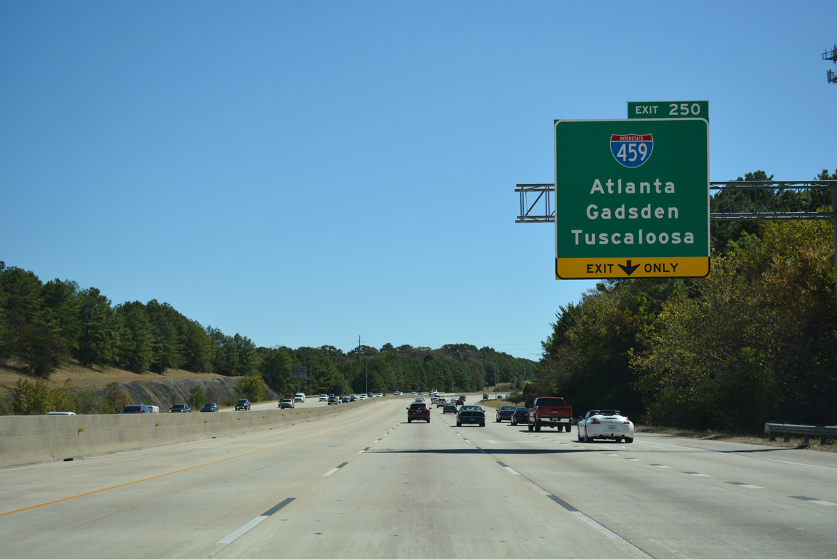
| Interstate 459 features control cities for I-20 west / I-59 south (Tuscaloosa), and I-20 east (Atlanta) and I-59 north (Gadsden). The freeway also serves Birmingham area traffic interests with interchanges at Bessemer (Exits 1 and 6), Hoover (Exits 10, 13A/B), Vestavia Hills (Exit 17), Birmingham/Mountain Brook (Exits 19 and 23), Irondale (Exits 27 and 29), and Trussville/Birmingham (Exits 31, 32 and 33). 10/09/16 |
|
| All traffic movements to Interstate 459 depart in unison at Exit 250. Interstate 459 leads west 15.37 miles to I-20/59 in west Bessemer Proposed Interstate 422, the North Birmingham Belt Line, is slated to run north from that junction to Hueytown and Adamsville. If completed, the route will take 25 years of work and $4.7-billion.2 10/09/16 |
|
| Interstate to Interstate junction gore point signs in Alabama usually feature a route marker. 04/14/13 |
|
| Interstate 459 east reaches Interstate 20 in 13.92 miles and ends at Interstate 59 in 17.97 miles. 04/14/13 |
|
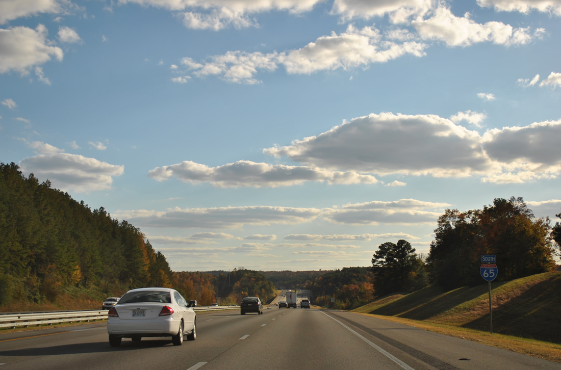
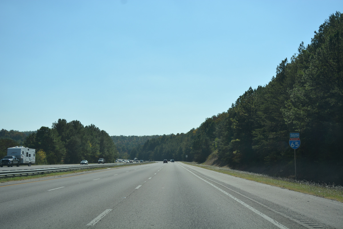
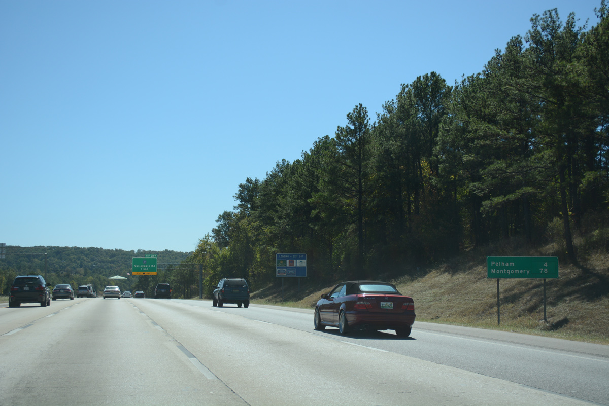
| Construction completed in December 2011 added a fourth southbound lane from Interstate 459 to Exit 247, Shelby County 17 to Pelham. Montgomery is a 78 mile drive. 06/25/12, 11/07/11 |
|
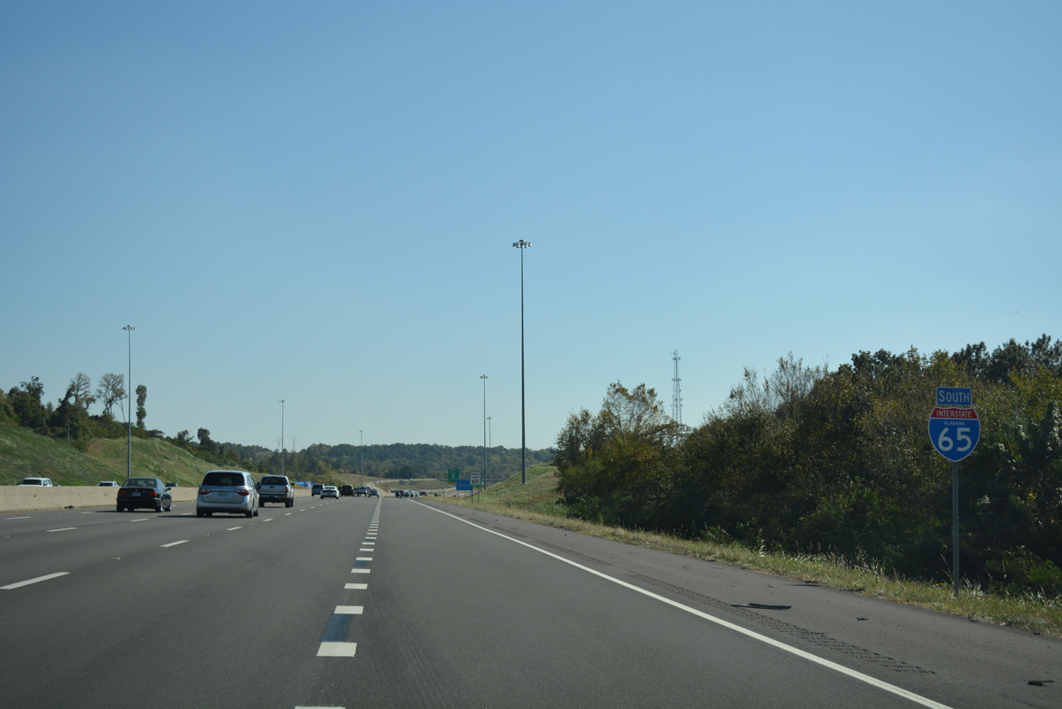
| Interstate 65 south lowers to cross the Cahaba River into Shelby County on the one mile approach to Exit 247. County Road 17 (Valleydale Road) joins the freeway with the Riverchase community of Hoover and Pelham. 06/25/12 |
12/28/09, 08/08/10, 06/02/11, 11/07/11, 06/25/12, 04/14/13, 10/08/16, 10/09/16 by AARoads
Page Updated 05-16-2017.

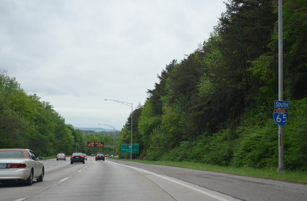
 South
South