|
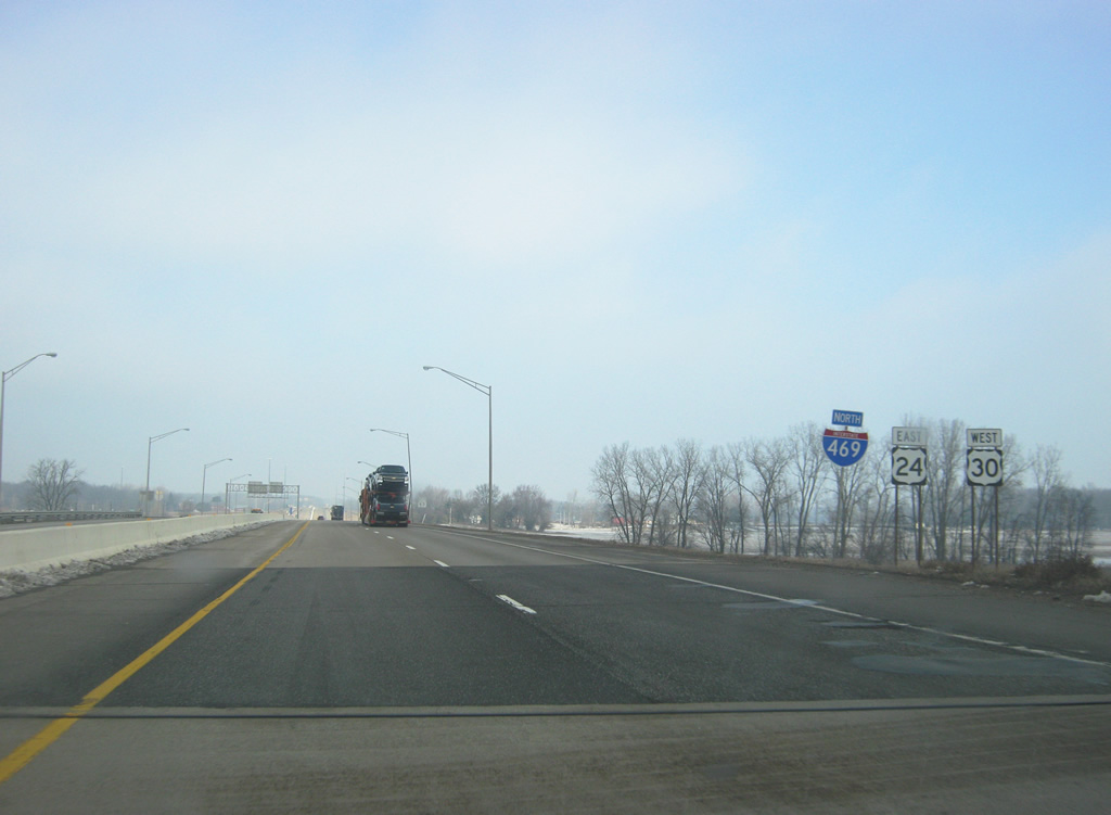
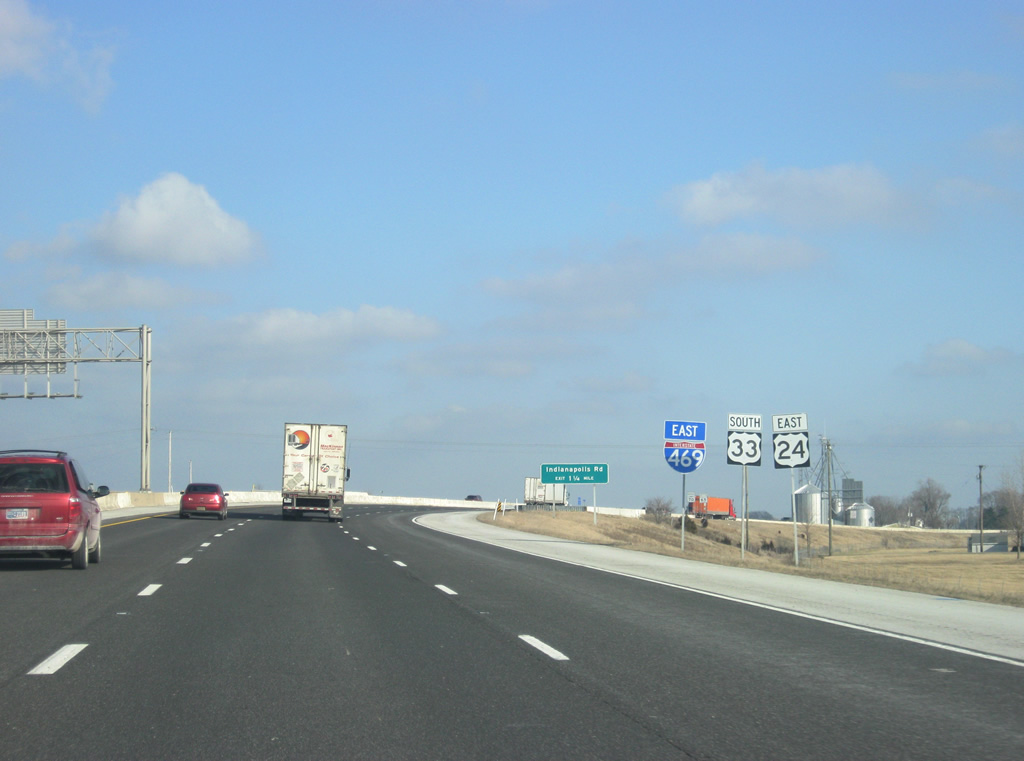
| Interstate 469 north begins at the interchange with Lafayette Center Road and Interstate 69, U.S. 24 east & U.S. 33 south. Both U.S. 24 and U.S. 33 follow Interstate 469 to the east. A two lane ramp heads east to serve both Interstate 69-U.S. 33 north & U.S. 24 west back to Fort Wayne and Interstate 69 south to Muncie, Anderson and Indianapolis. Despite the fact that three-digit loops in Indiana are typically not given control cities, Interstate 469 here does have a control city of Fort Wayne. 09/19/09 |
|
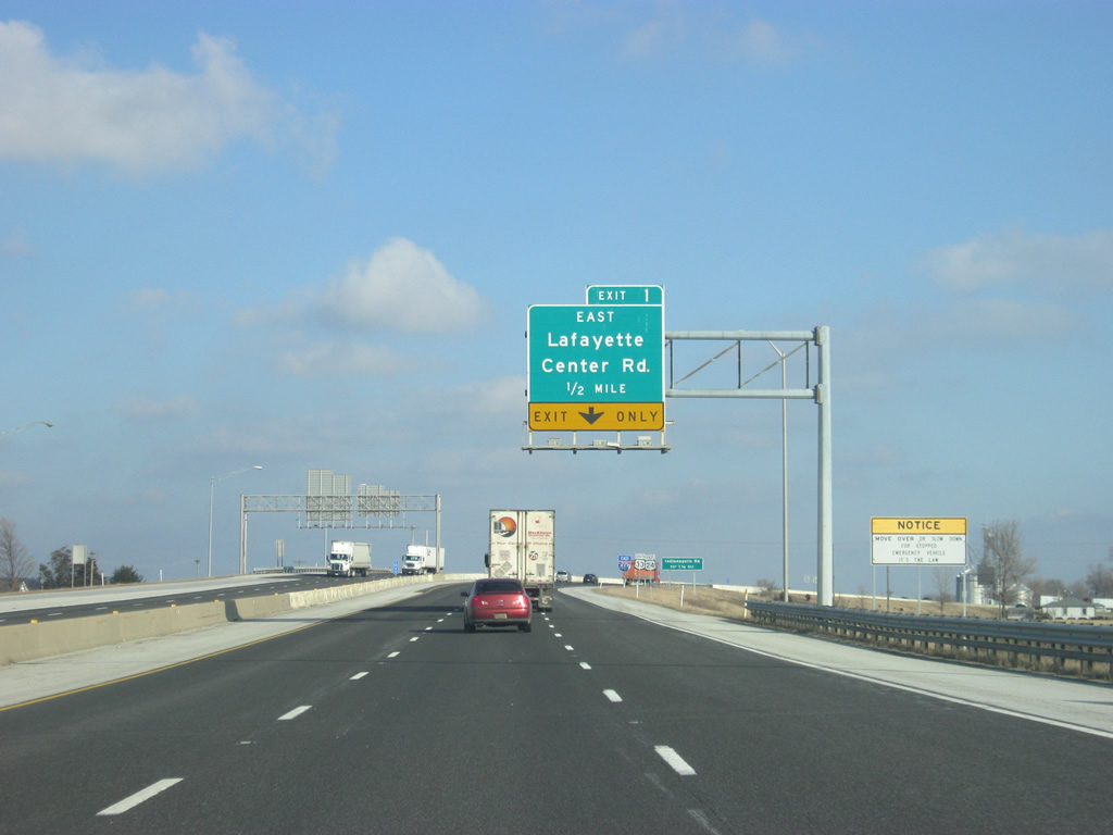
| The entrance ramp from Interstate 69 north onto Interstate 469 north becomes an auxiliary lane for Exit 1 to Lafayette Center Road. 02/06/12 |
|
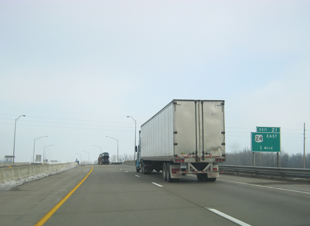
| Both U.S. 24 east and U.S. 33 south are signed along Interstate 469 for their multiplex around the southern part of the beltway, unlike the Interstate 465 beltway around Indianapolis. 02/06/12 |
|
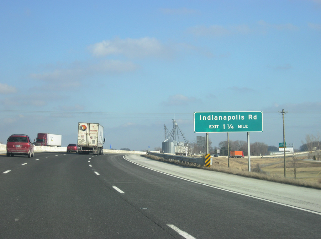
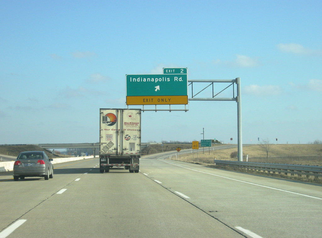
| With Exit 1 to Lafayette Center Road still up ahead, a guide sign announces the mile and three quarters approach to Exit 2 for Indianapolis Road, which represents the alignment of State Road 3 decommissioned in 1972 due to the completion of Interstate 69. 02/06/12 |
|
| Tom Worrel Road connects Exit 1 and Lafayette Center Road with Feighner Road. The original alignment of Lafayette Center Road was built over with Interstate 469 leading from the directional cloverleaf interchange with Interstate 69. This is why the Exit 1 panels indicate "East", as westbound continues directly to Exit 0. 02/06/12 |
|
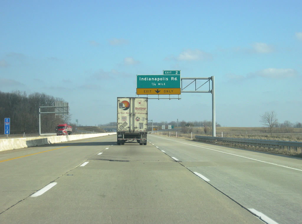
| Interstate 469 turns southeast on the quarter mile approach to Exit 2 and Indianapolis Road. Indianapolis Road travels northeast to Nine Mile and Airport Expressway (as Smith Road). Extension of airport runways made the road discontinuous northeast to the segment of Indianapolis Road north of Airport Expressway. 02/06/12 |
|
| Indianapolis Road south continues to Zanesville on the Wells County line. From there it becomes Marzane Road (a combination of the towns of Markle and Zanesville, the two endpoints of the road). South of Markle it resumes being SR 3. 02/06/12 |
|
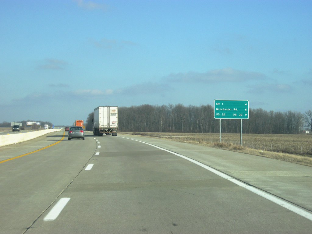
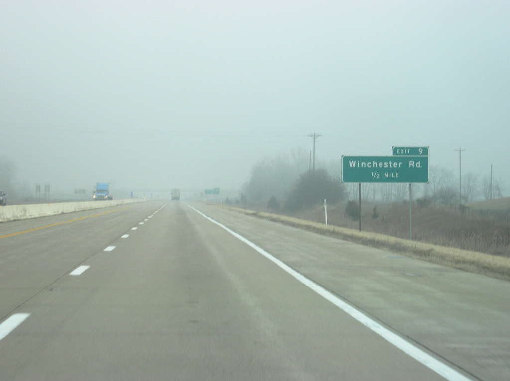
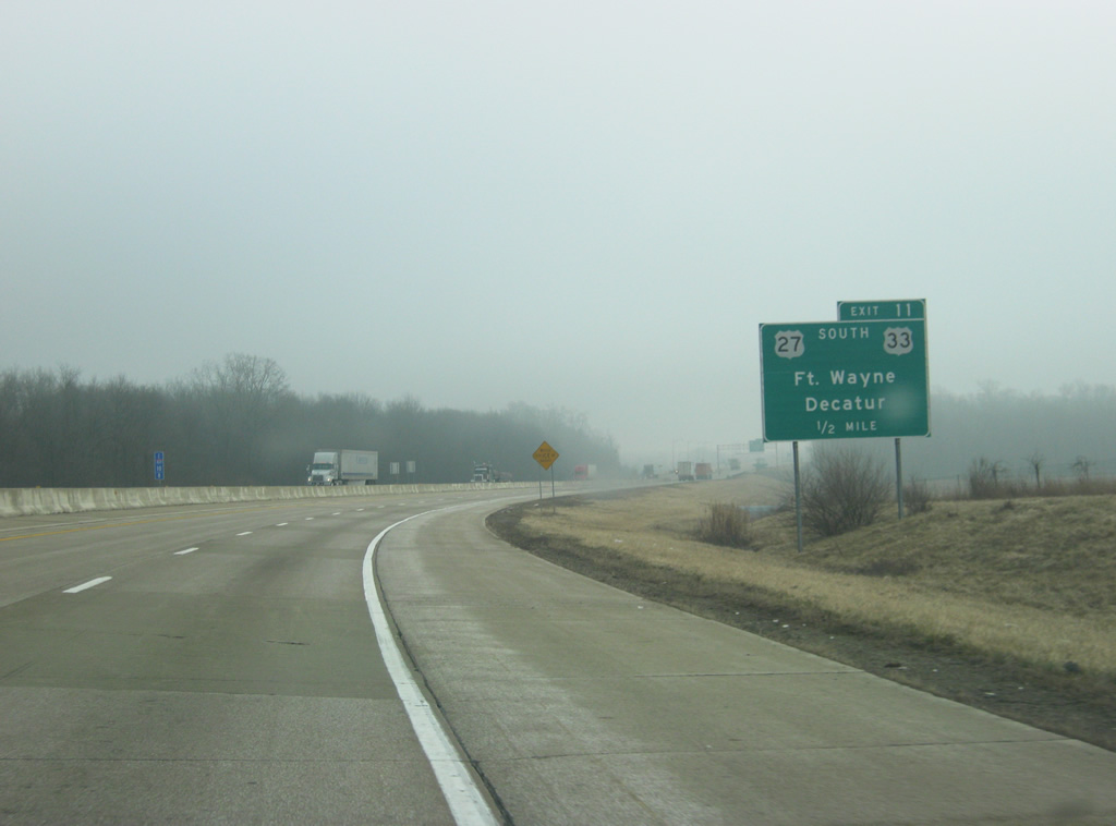
| An interchange sequence sign substitutes for control-city based mileages on this panel of Interstate 469, U.S. 24 east & U.S. 33 south posted four miles out from the diamond interchange with SR 1 south. Winchester Road is six miles out while the interchange with U.S. 27 and U.S. 33 south is nine miles away. 02/06/12 |
|
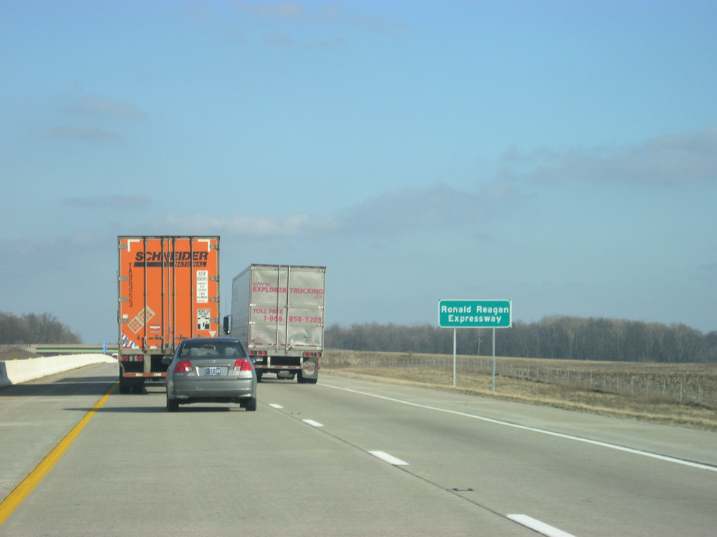
| Interstate 469 is formally named the Ronald Reagan Expressway, though the name is not commonly used. Agricultural fields dominate the view of the beltway for the first 16 miles. 02/06/12 |
|
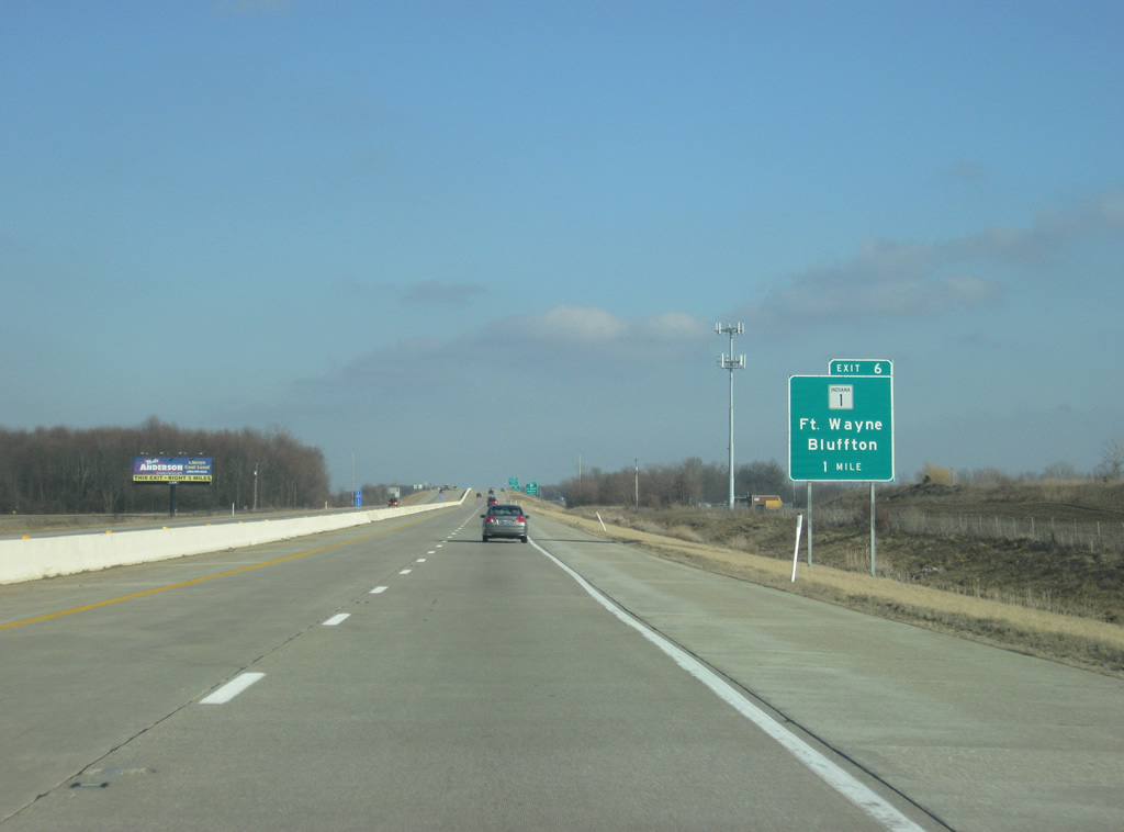
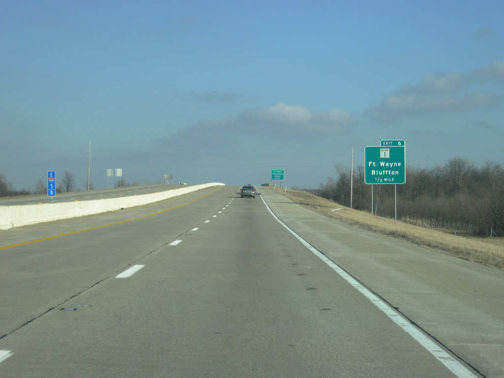
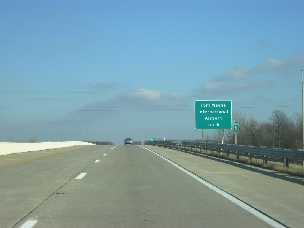
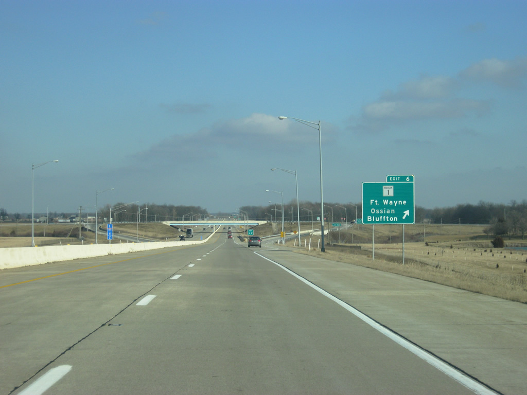
| SR 1 north and Bluffton Road south come together at the Exit 6 diamond interchange in one mile. Exit 6 represents the north end of the 139.8 mile stretch of SR 1 between Fort Wayne and Lawrenceburg. A northern section of SR 1 exists from Interstate 69 to Ellis for 40.7 miles as well. 02/06/12 |
|
| Bluffton Road carried SR 1 signage northward to a turn onto Airport Expressway north to Paulding Road and a merge with U.S. 27. Southward, Bluffton Road remains as SR 1 to the east of Yoder and the Wells County line. 02/06/12 |
|
| The Fort Wayne International Airport can be reached by taking Bluffton Road north from Exit 6 to Ferguson Road, which heads west toward the Lieutenant Paul Baer Terminal. 02/06/12 |
|
| SR 1 south joins Interstate 469 and U.S. 24-33 with Ossian and Bluffton in Wells County at Exit 6. 02/06/12 |
|
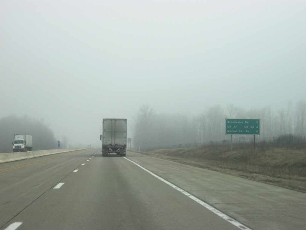
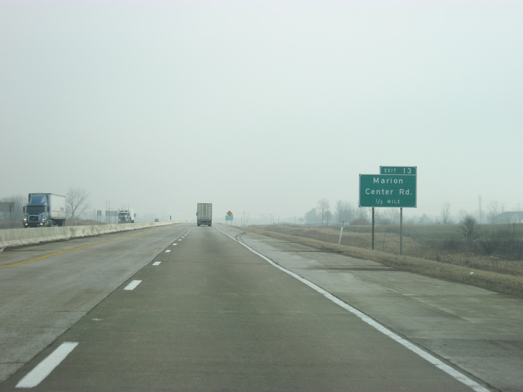
| East of Exit 6, Winchester Road is two miles away. U.S. 27 & U.S. 33 south are next at a distance of four miles with Marion Center Road following at six miles. 02/06/12 |
|
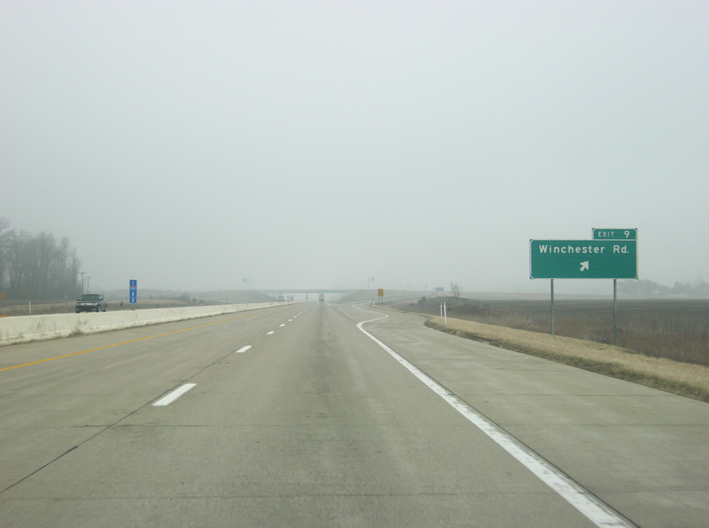
| Kinking northeasterly, Interstate 469-U.S. 24 east & U.S. 33 south next meet Winchester Road at a diamond interchange (Exit 9). 02/06/12 |
|
| Interstate 469 eastbound at the Exit 9 off-ramp to Winchester Road. Winchester Road spurs south from Bluffton Road in Fort Wayne to Poe and Decatur. 02/06/12 |
|
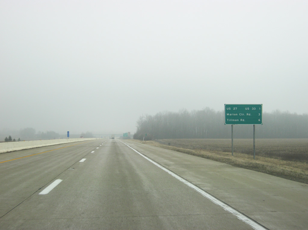
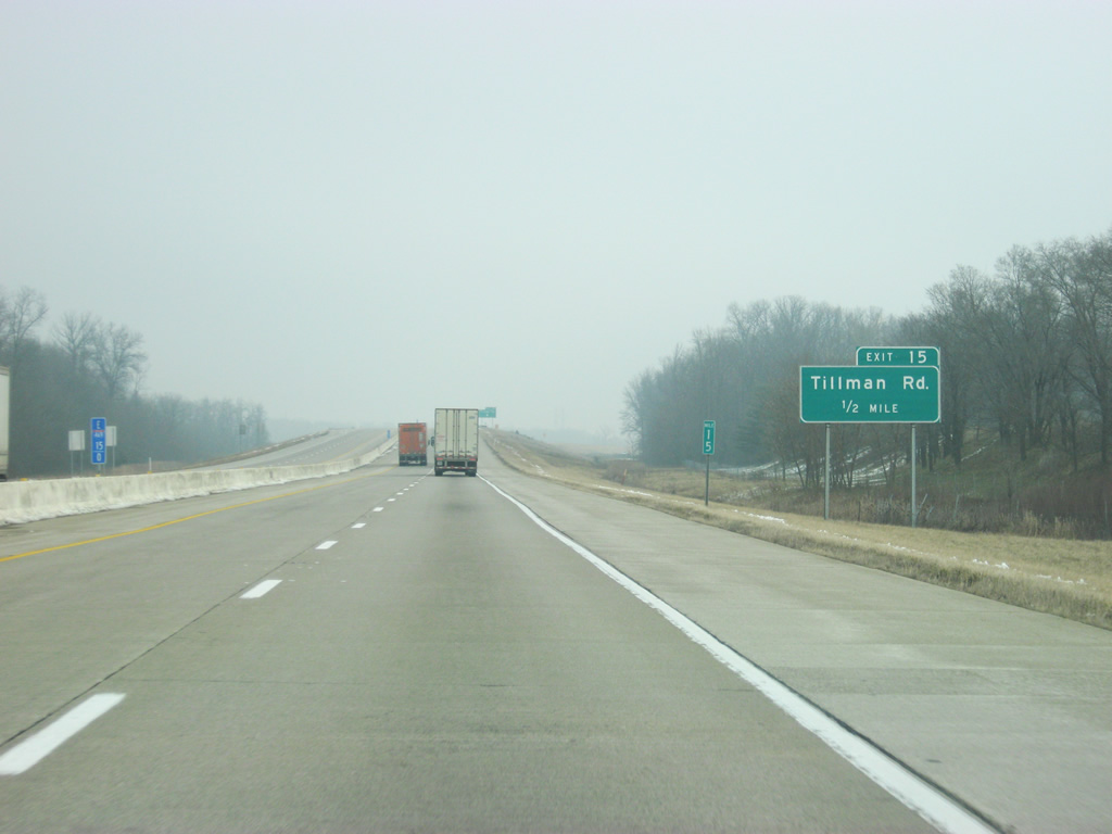
| A distance sign gives the distances to the next three interchanges along Interstate 469 north: U.S. 27 & U.S. 33 south (one mile), Marion Center Road (three miles) and Tillman Road (six miles). 02/06/12 |
|
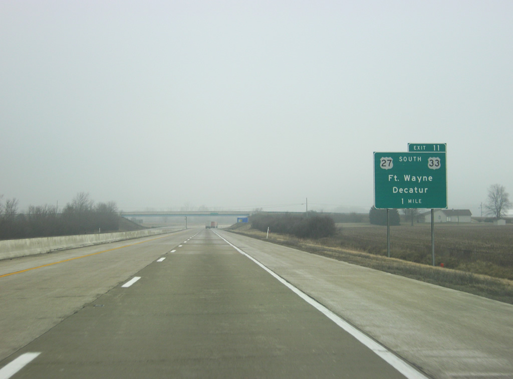
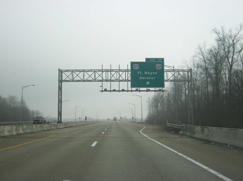
| One mile west of the diamond interchange (Exit 11) with U.S. 27 and 33 south (Decatur Road) on I-469. U.S. 27/33 combine southeast from the Fort Wayne bypass 10.2 miles to Decatur and U.S. 224. The pair split south of Decatur for respective paths to Berne and Wilshire, Ohio. U.S. 33 will continue southeast into Ohio along its 709 mile route that begins in Elkhart and ends in Richmond, Virginia. 02/06/12 |
|
| U.S. 27 ends at Exit 111 off Interstate 69, having been truncated south from Grayling, Michigan in 2002. U.S. 27 is a 1,364 mile route leading south from Fort Wayne to Miami, Florida. Within Indiana, the route joins Fort Wayne and Richmond with Cincinnati, Ohio. 02/06/12 |
|
| Eastbound Interstate 469 & U.S. 24 cross over the St Mary's River at the ramp departure of Exit 11 to U.S. 27 and U.S. 33 south. U.S. 27 is one of the two holdouts to remain along a surface route through Fort Wayne (the other is SR 930). The US Highway follows Decatur Road north to Lafayette Street and a one way couplet with Clinton Street (south) to downtown Fort Wayne. 02/06/12 |
|
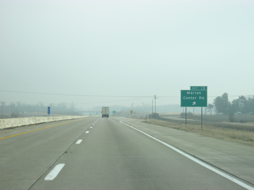
| East of Exit 11, Interstate 469 and U.S. 24 east remain multiplexed. Marion Center Road (Exit 13) follows in one mile, succeeded by Exit 15 (Tillman Road) in three miles and Exit 17 (Minnich Road) in five miles. 02/06/12 |
|
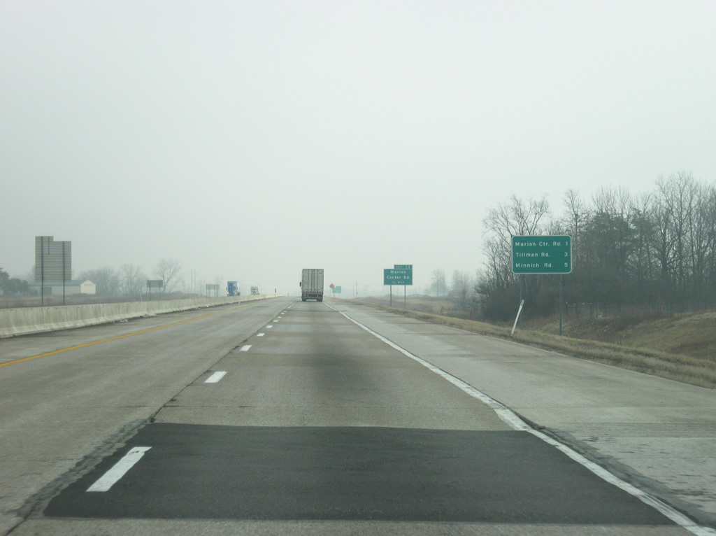
| Marion Center Road ties Interstate 469 & U.S. 24 with Maples Road, Wayne Trace and Adams Center Road at a roundabout 0.8 miles north of Exit 13. Wayne Trace angles northwest into the suburbs of Fort Wayne with the other roads mainly serve agricultural interests. 02/06/12 |
|
| Exit 15 departs Interstate 469 & U.S. 24 east. Marion Center Road ventures south from the freeway to U.S. 27 & 33 (as Somers Road) east of Poe. 02/06/12 |
|
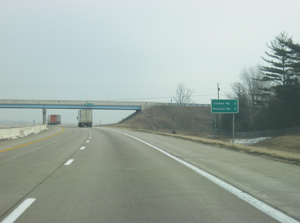
| Wayne Trace passes over Interstate 469 & U.S. 24 east of Exit 15 on a southeast trek to Minnich Road near Hoagland. The Tillman Road interchange is two miles away while Minnich Road is four miles away. 02/06/12 |
|
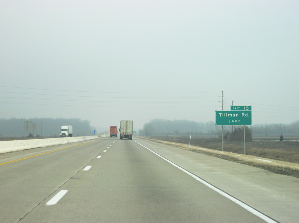
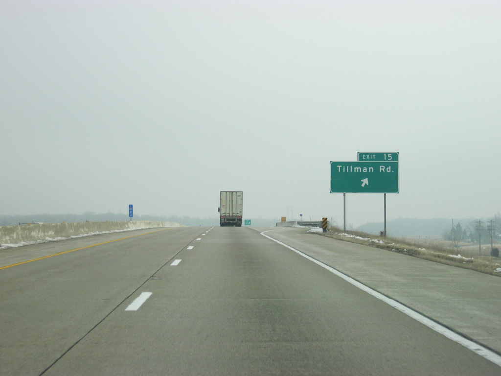
| Tillman Road crosses paths with Interstate 469 & U.S. 24 at a diamond interchange (Exit 15) in one mile. 02/06/12 |
|
| Tillman Road meets the freeway between two crossings with Norfolk Southern Railroad lines amid a swath of farm land. The rural road heads east from Exit 15 toward Maples and an end at Tillman by U.S. 30 and Zulu. 02/06/12 |
|
| West from Exit 15, Tillman Road reaches southern areas of Fort Wayne at the Eastland Gardens neighborhood and U.S. 27 (Lafayette Street). 02/06/12 |
|
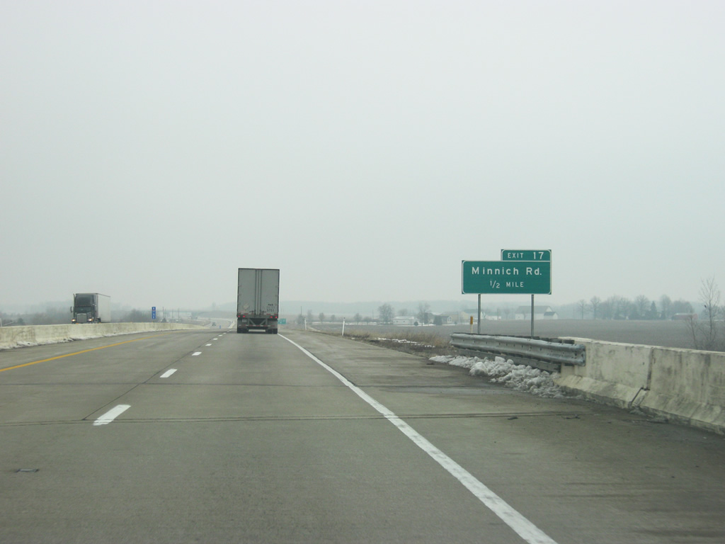
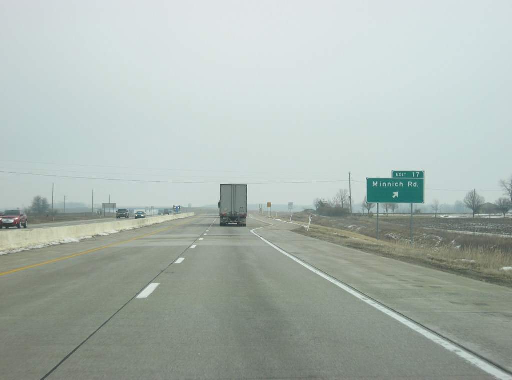
| Interstate 469 north & U.S. 24 east approach the outskirts of New Haven at the half mile approach to the folded-cloverleaf interchange (Exit 17) with Minnich Road. 02/06/12 |
|
| Minnich Road stems south from Dawkins Road (Old SR 14) and SR 930 in New Haven to meet Interstate 469 & U.S. 24 en route to Hoagland in rural southeast Allen County. 02/06/12 |
|
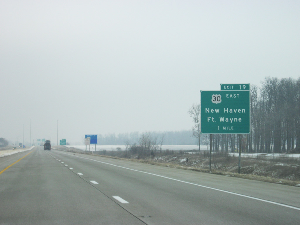
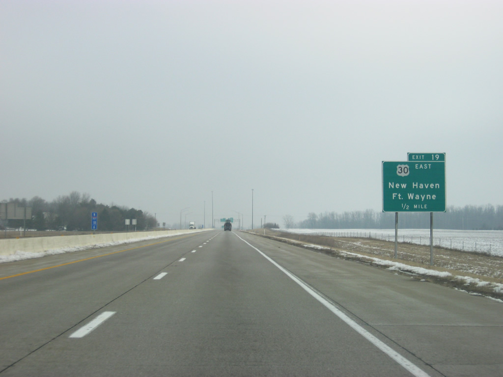
| Forthcoming Exit 19 joins the freeway with Lincoln Highway East (SR 930 west) on the east side of New Haven in one mile at a six-ramp parclo interchange. 02/06/12 |
|
| In a half mile, Exit 19 will depart Interstate 469 & U.S. 24 east for SR 930 west (Lincoln Way East) to New Haven and downtown Fort Wayne. SR 930 travels 13 miles along former U.S. 30 within the beltway created by Interstates 69 and 469. SR 930 was the original bypass of Fort Wayne when first built in 1950. 02/06/12 |
|
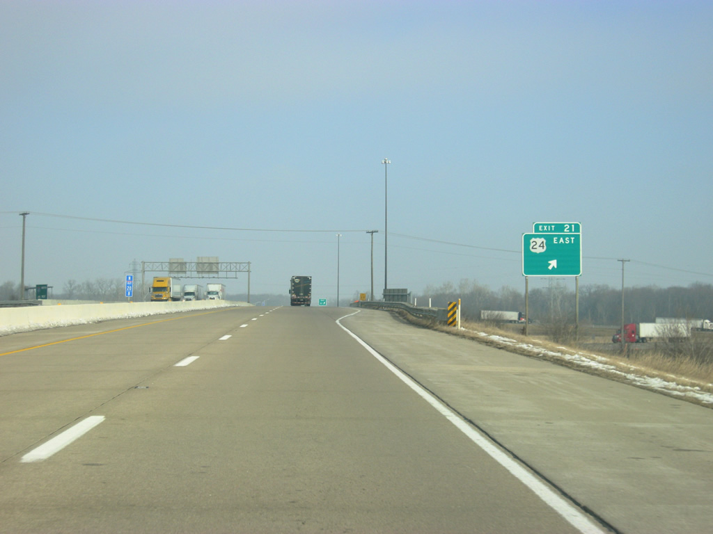
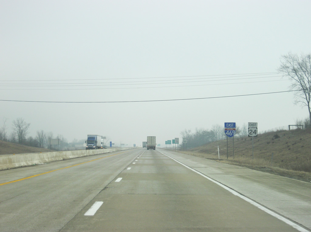
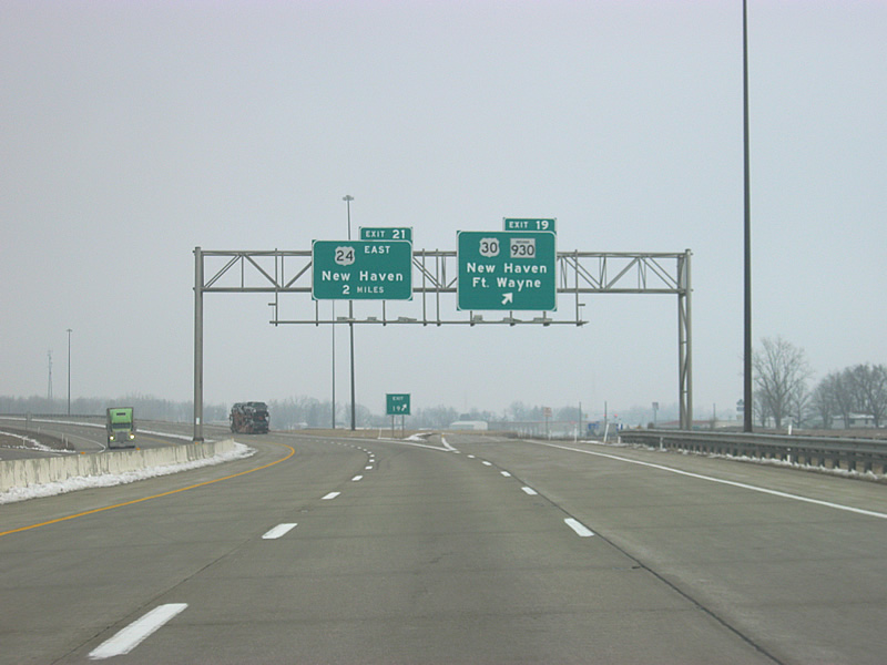
| U.S. 30 eastbound parts ways with Interstate 469 south at Exit 19. The highway continues 13.8 miles to the Ohio state line. All of U.S. 30 from Indiana east to Van Wert, Delphos and Canton consists of four lane roadway, with stretches upgraded to freeway standards. From Exit 19, U.S. 30 west will follow Interstate 469 to its northern terminus at Interstate 69. In two miles, Interstate 469 south & U.S. 30 westbound drivers enter a folded-cloverleaf interchange with U.S. 24 (Exit 21). 02/06/12 |
|
| Construction presently involves the upgrade of the U.S. 24 corridor leading east to the Ohio state line to expressway standards. Known as the "Fort to Port" Corridor, the U.S. 24 expansion is undertaken in an effort to join Fort Wayne and Toledo, Ohio with a high-speed four lane highway. U.S. 24 is already a four lane roadway east from the Indiana state line to Defiance, Ohio and work is slated for completion on the Indiana portion by late 2012. 02/06/12 |
|
| Interstate 469 carries U.S. 24 east and U.S. 30 west for the two miles in between Exits 19 and 21 on the east side of New Haven. Old SR 14 (Dawkins Road), which the northbound freeway passes before this reassurance shield assembly, combined with U.S. 24 in New Haven, with the tandem joining U.S. 30 west to Coliseum Boulevard (SR 930). SR 14 was truncated from Fort Wayne eastward to the Ohio state line near Edgerton around 1990. 02/06/12 |
|
| Exit 21 loops onto U.S. 24 east at Rose Avenue from Interstate 469 north & U.S. 30 west. The new four lane alignment will tie directly into Exit 21 and parallel two lane U.S. 24 just south of its present course parallel to the Maumee River. U.S. 24 connects Woodburn and areas of eastern Allen County with Fort Wayne otherwise. Former U.S. 24 followed Rose Avenue west to a southward turn into the New Haven city center. 02/06/12 |
|
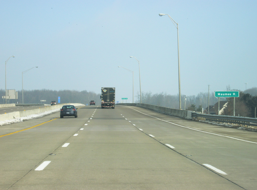
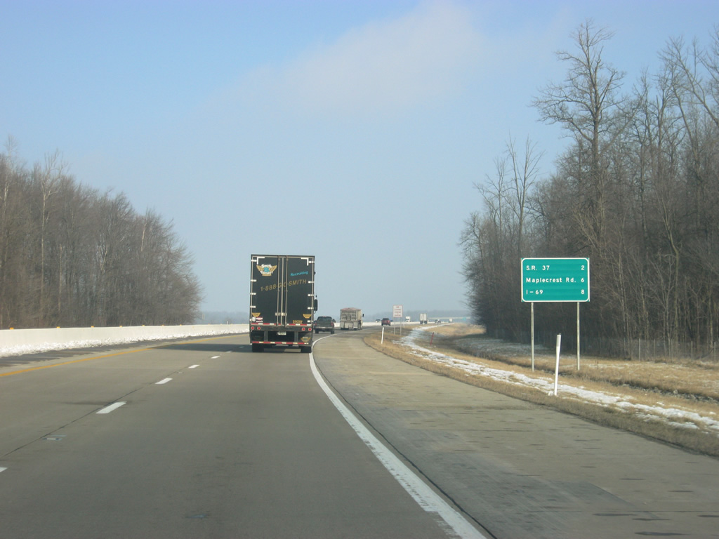
| Heading north from Exit 21, Interstate 469 north & U.S. 30 west cross the Maumee River. The distances to the final three exits along the Fort Wayne beltway for SR 37 north (two miles), Maplecrest Road (six miles) and Interstate 69 (eight miles) are listed. 02/06/12 |
|
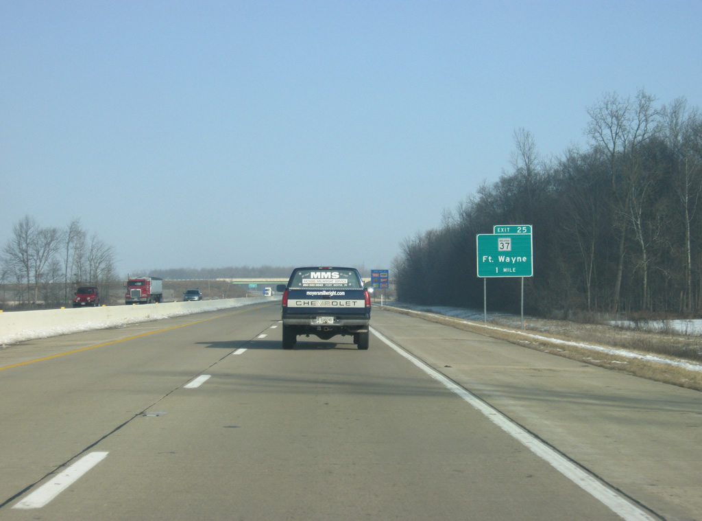
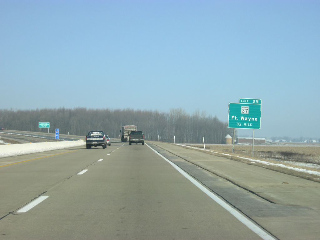
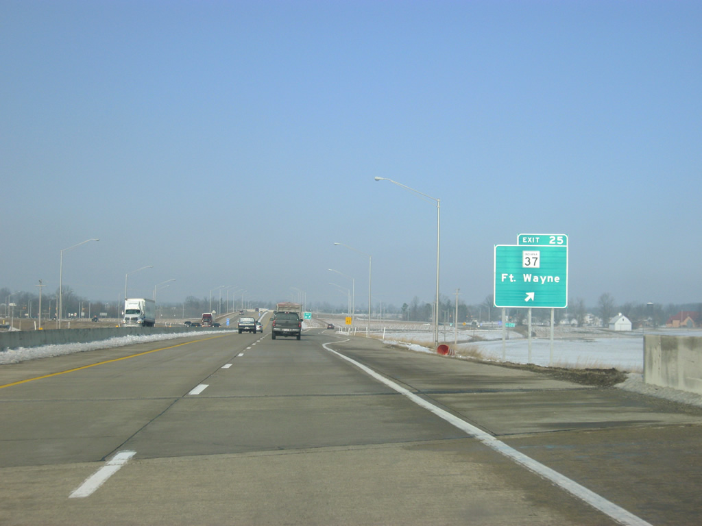
| Going north from the Maumee River bridge, Interstate 469 is at the one mile approach to SR 37 (Exit 25). SR 37 angles northeast from Interstate 469 & U.S. 30, 30.5 miles to Cuba, Harlan and the Ohio state line (where the route transitions into SR 2). 02/06/12 |
|
| Maysville Road stems west from Exit 25 and SR 37 to Stellhorn Road west, the original path of SR 37 into Fort Wayne. SR 37 followed Stellhorn Road to Coliseum Boulevard (SR 930), where the route combined with then U.S. 24-30 & SR 14 west to Interstate 69 (Exit 109). Before the construction of Coliseum Boulevard, the state highway continued along Crescent Avenue to Anthony Boulevard before hitting up Jefferson Boulevard and following the path of U.S. 24 through Downtown Fort Wayne. 02/06/12 |
|
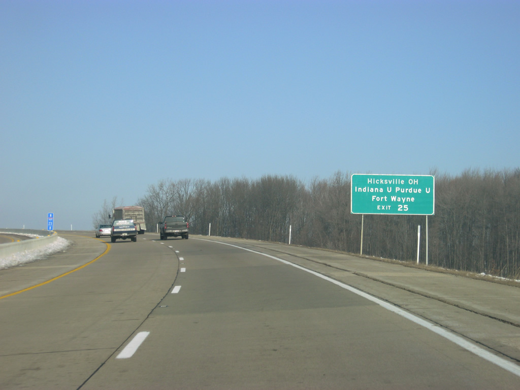
| The community of Hicksville, Ohio is about 17 miles to the northeast along SR 37 and SR 2. Indiana University-Purdue University Fort Wayne (IPFW) is reached by taking the aforementioned routing of former SR 37 to Crescent Avenue. 02/06/12 |
|
| Interstate 469 & U.S. 30 west reach Exit 25 to SR 37 north and Maysville Road south. Maysville Road continues from the freeway through a retail area nearby to suburban areas along State Boulevard and Lake Avenue. SR 37 exists in a second alignment from Marion south to Indianapolis and Tell City. 02/06/12 |
|
| North of Exit 25, Maplecrest Road is three miles and Interstate 69 four miles away. 02/06/12 |
|
| Agricultural frontage gives way to clusters of single family homes along the west side of the freeway and newly built subdivisions along the north side at Wheelock Road as the beltway turns back toward the west for its final approach to Interstate 69. 02/06/12 |
|
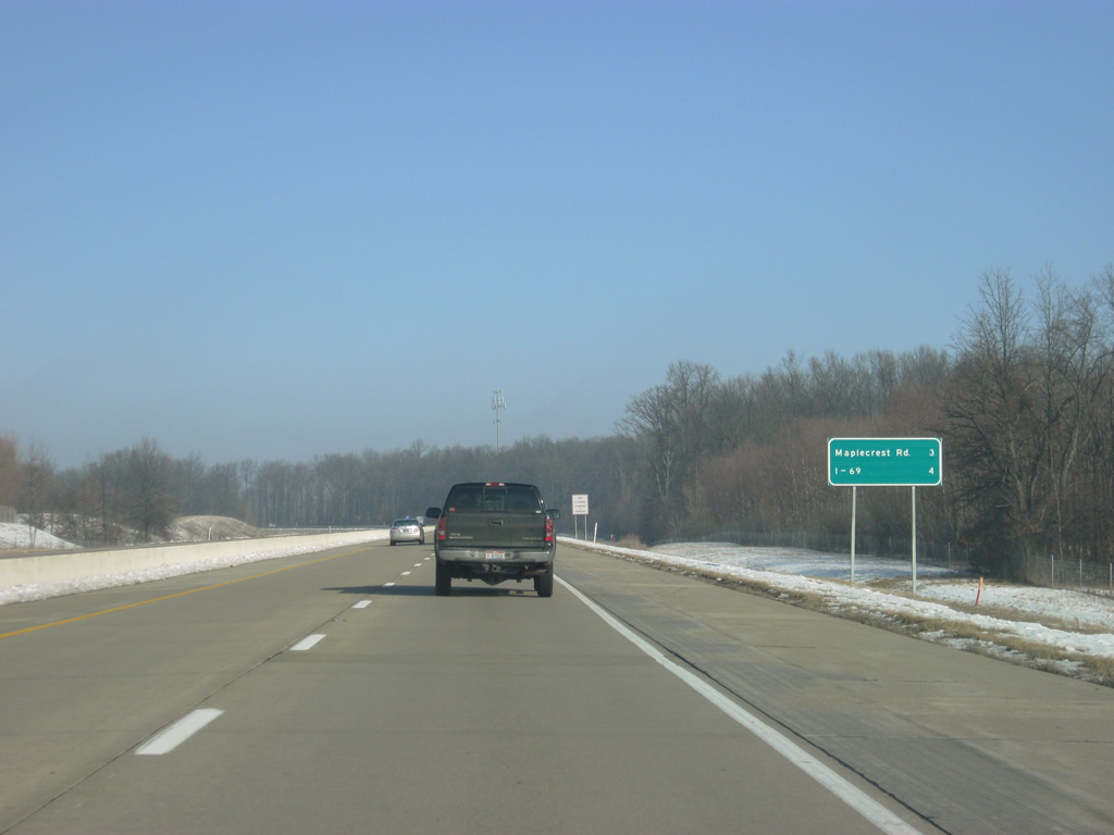
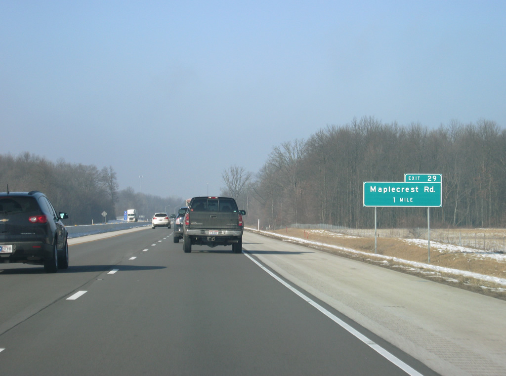
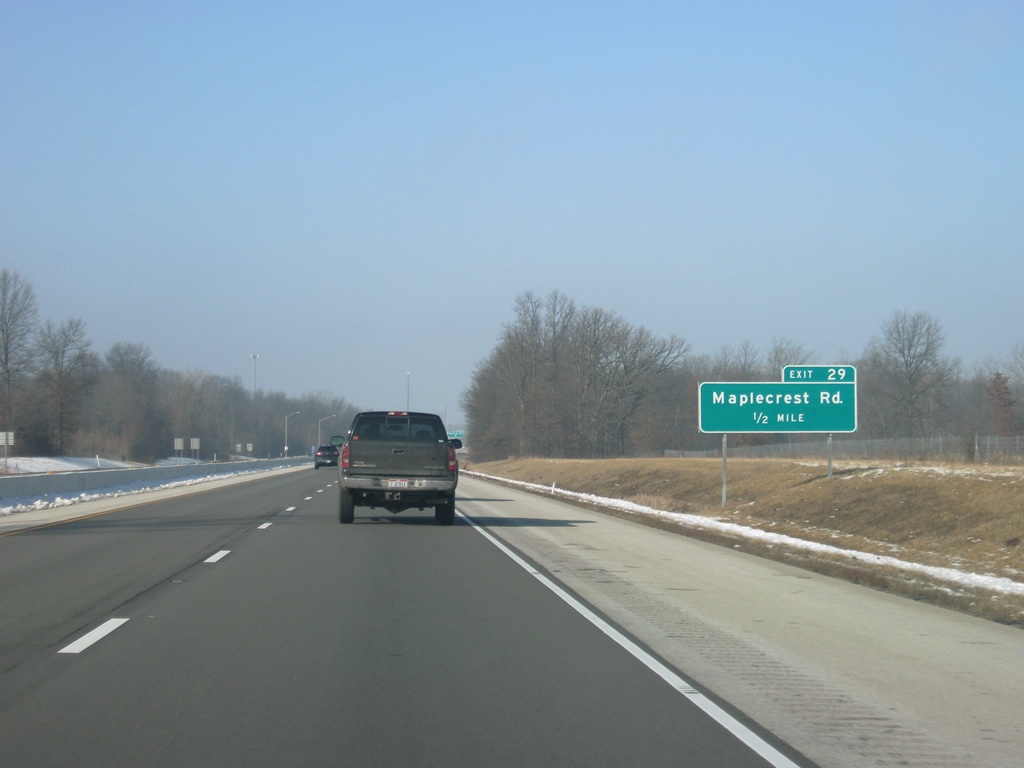
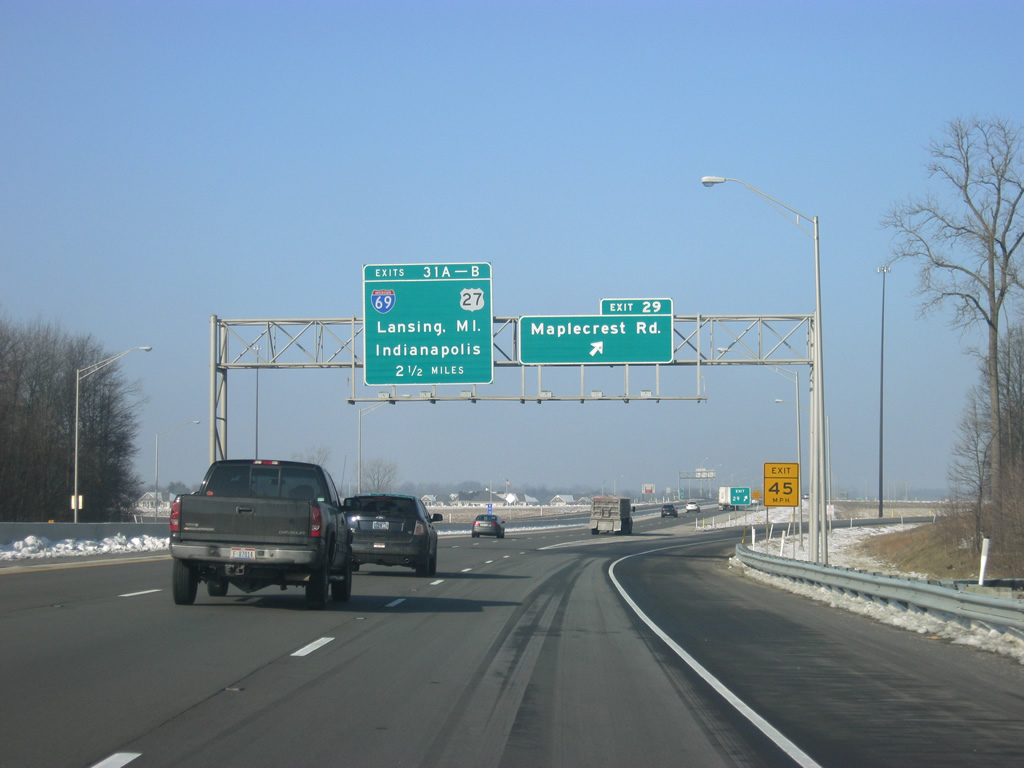
| A six-ramp parclo interchange (Exit 29) joins the freeway with Maplecrest Road in one mile along Interstate 469 & U.S. 30 west. 02/06/12 |
|
| One half mile east of the Exit 29 off-ramp to Maplecrest Road south to Northeast Fort Wayne. Maplecrest Road comprises a suburban arterial route south to Lake Avenue. 02/06/12 |
|
| Interstate 469 & U.S. 30 westbound at Exit 29 to Maplecrest Road. Maplecrest Road was extended north from Rothman Road in conjunction with construction of the Fort Wayne freeway loop. From the north, Maplecrest Road heads up to St. Joe Road, which overtakes Maplecrest Road from near Exit 29. Northward the road ventures toward Leo-Cedarville; southwest St. Joe Road passes by the Brooklake Estates neighborhood to Crescent Avenue (former SR 37). The northern terminus of Interstate 469 at Interstate 69 is 2 1/2 miles away. 02/06/12 |
|
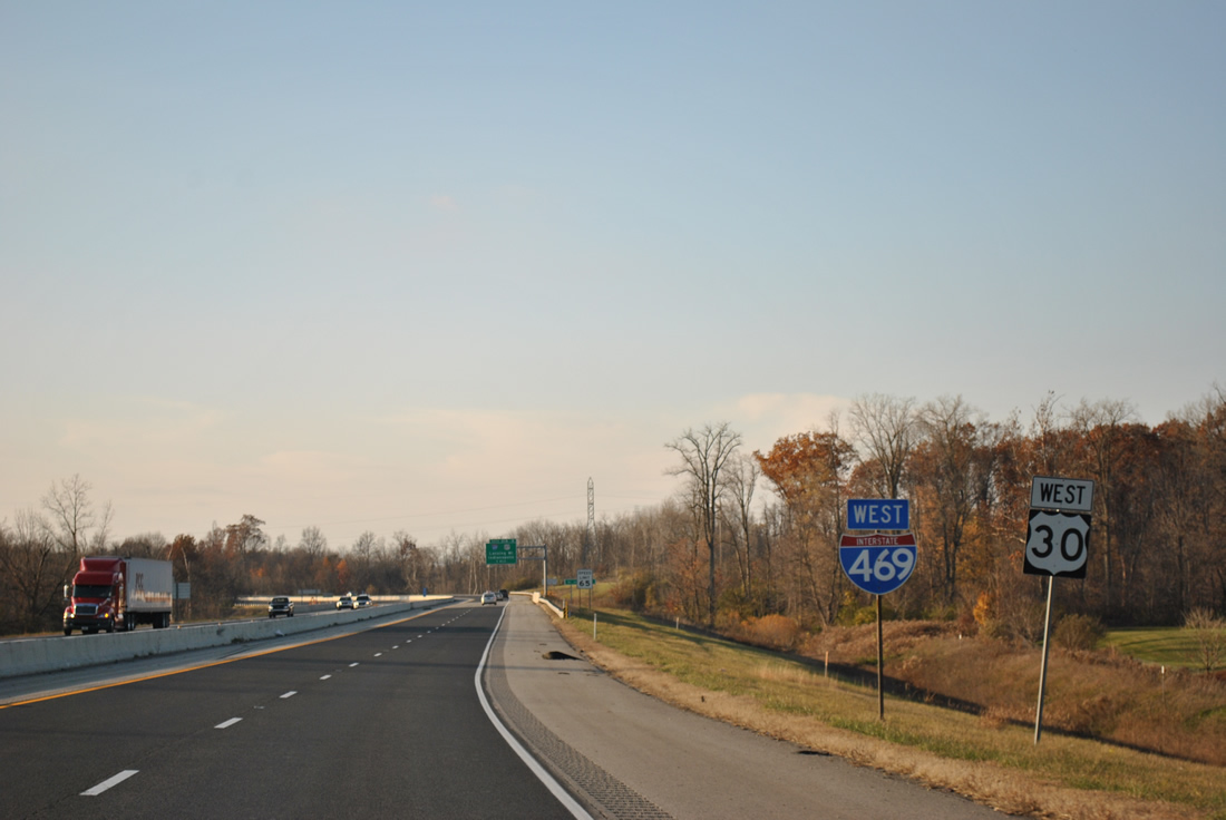
| The final westbound shield posted for Interstate 469 along U.S. 30 near the St. Joe Road underpass. 11/06/11 |
|
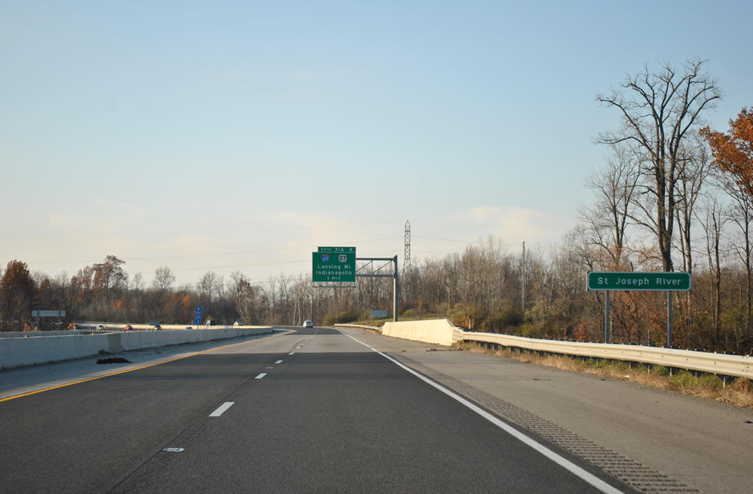
| Spanning the St. Joseph River along Interstate 469 & U.S. 30 west. This stretch of I-469 was the last to open when it did on October 23, 1995. 11/06/11 |
|
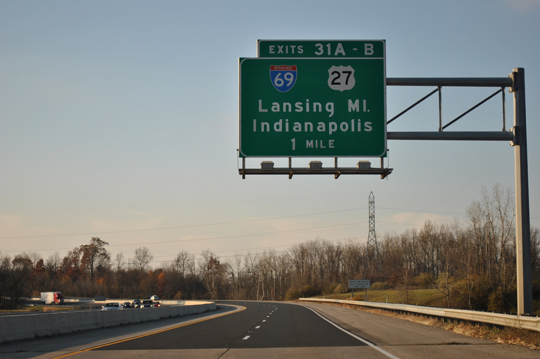
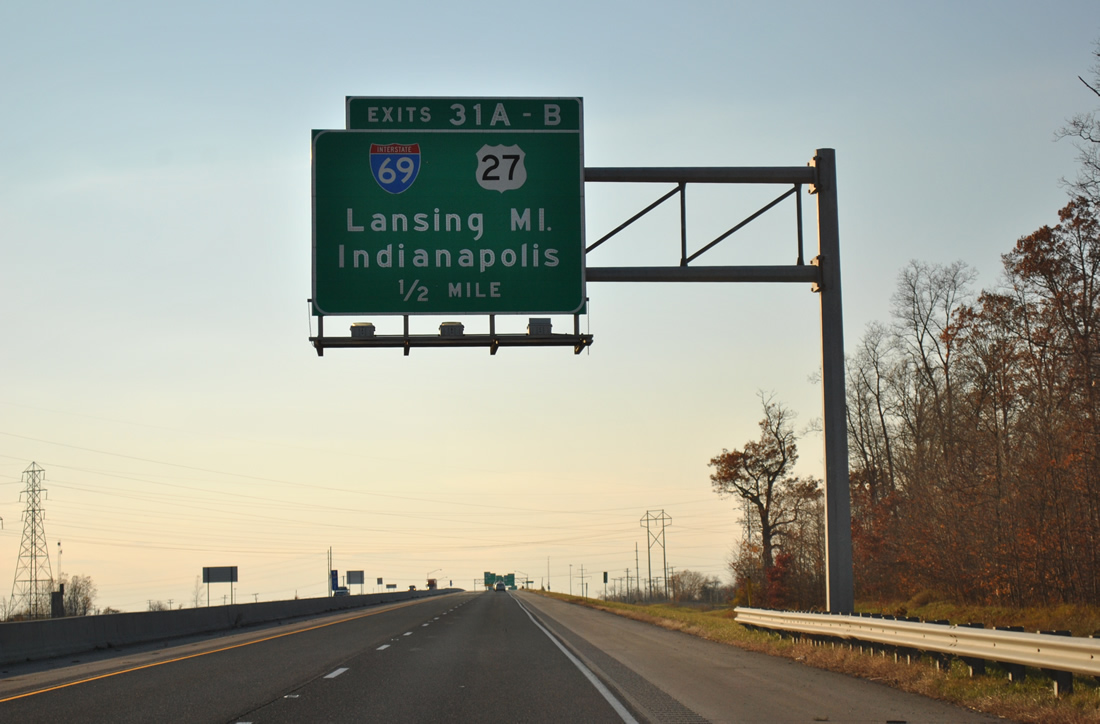
| A trumpet interchange facilitates movements between Interstate 469 & U.S. 30 west with Interstate 69 at Exits 31A/B in one mile. Button copy signs retain the pre-2002 cosigning of U.S. 27 along Interstate 69. 11/06/11 |
|
| Ascending toward a crossing over Leo Road on the half mile approach to Exit 31 and Interstate 69. Interstate 69 enters Fort Wayne from Lansing, Michigan, 117 miles to the north. 11/06/11 |
|
| Interstate 69 north supplanted U.S. 27 as the main route north to Auburn, Angola, Coldwater and Lansing, Michigan. For awhile the two were cosigned along the entire drive between Fort Wayne and Lansing. This ended in 2002 when MDOT and INDOT successfully petitioned AASHTO for a truncation of U.S. 27 north of Lansing and an extension of U.S. 127 north from Lansing to Grayling over former U.S. 27 in 2002. 11/06/11 |
|
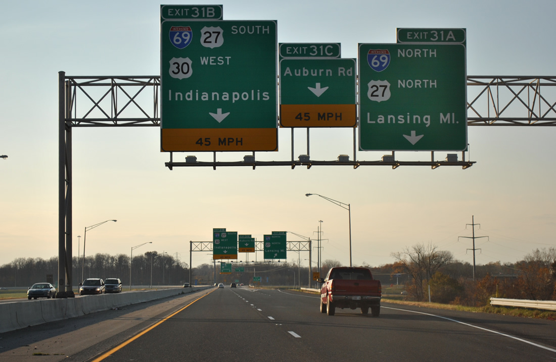
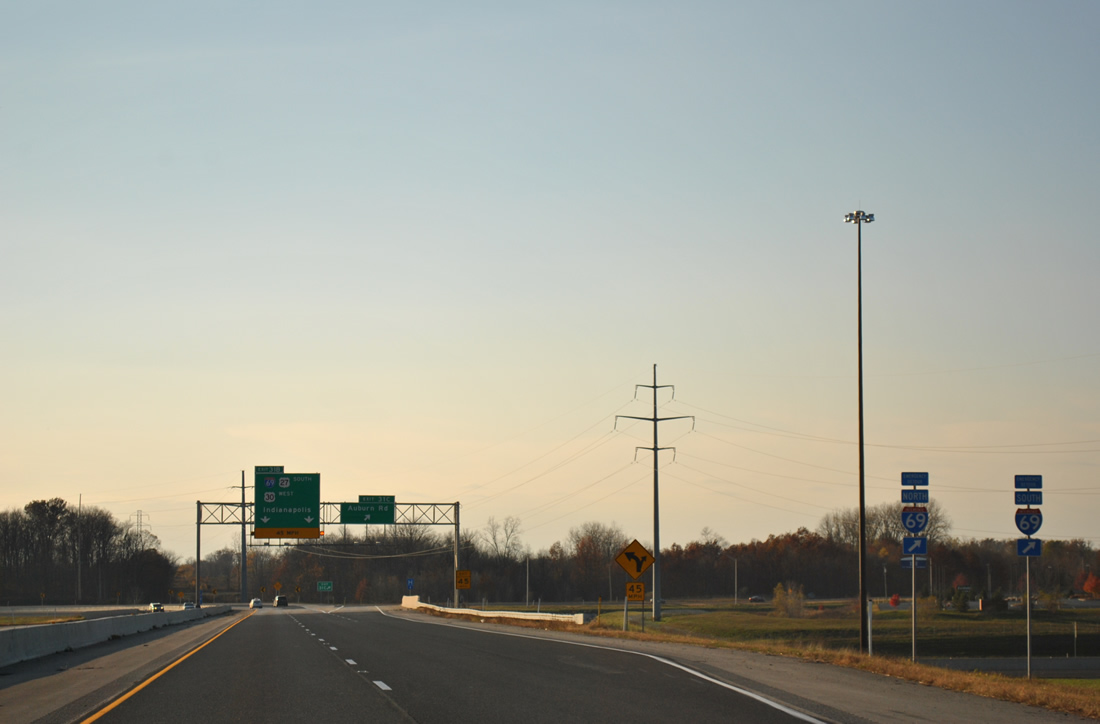
| Exit 31A departs Interstate 469 & U.S. 30 west for Interstate 69 north. U.S. 30 west curves onto Interstate 69 south into Fort Wayne, sharing pavement with the freeway 6.2 miles to Exit 109 (U.S. 33). 11/06/11 |
|
| Exit 31C provides a northbound Interstate 469-only connection to Auburn Road by Dupont Hospital. The off-ramp doubles as part of an Emergency Detour route for Interstate 69. Auburn Road parallels I-69 south to Clinton Street and north to the Dekalb County line. 11/06/11 |
|
| Interstate 469 & U.S. 30 west default onto Interstate 69 south (Exit 31B) toward downtown Fort Wayne. Indianapolis currently represents the south end of Interstate 69, but new construction will extend the route southwest to Bloomington and Evansville. 11/06/11 |
Page Updated 01-24-2012.


 East
East  South
South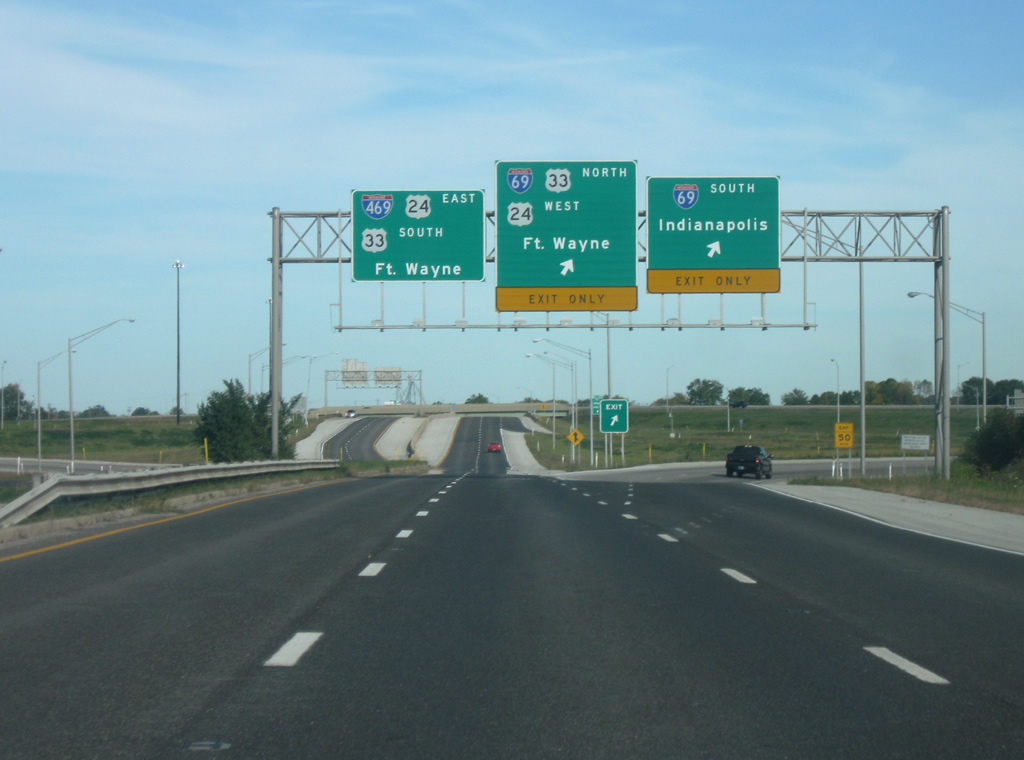

 West
West