|
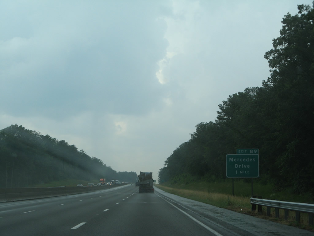
| One mile ahead of the split diamond interchange (Exit 89) joining I-20/59 with Mercedes Drive and Daimler Benz Boulevard. 06/12/08 |
|
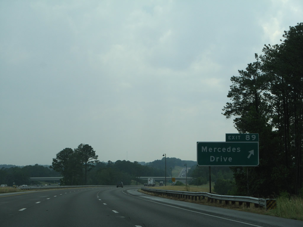
| The roadways of I-20/59 separate as Exit 89 departs for Mercedes Drive. Service roads line both sides of the freeway to Daimler Benz Boulevard. The Mercedes-Benz U.S. International plant is located nearby at Vance. The facility began operation in 1997.1 06/12/08 |
|
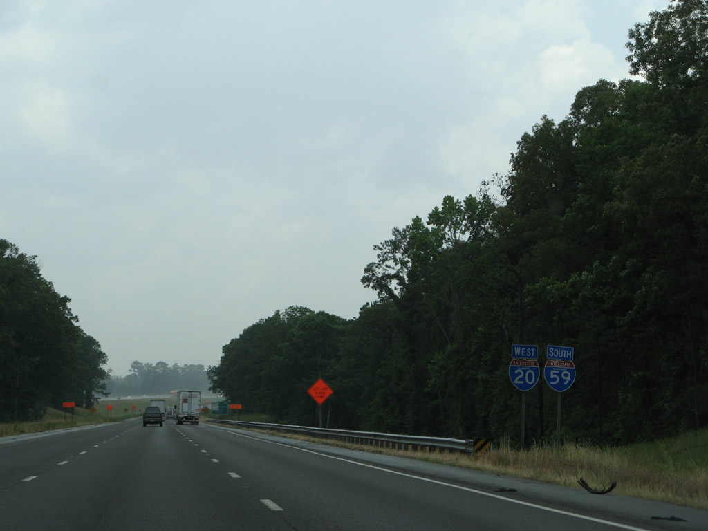
| The roadways of I-20/59 converge west of Exit 89 and this shield assembly. 06/12/08 |
|
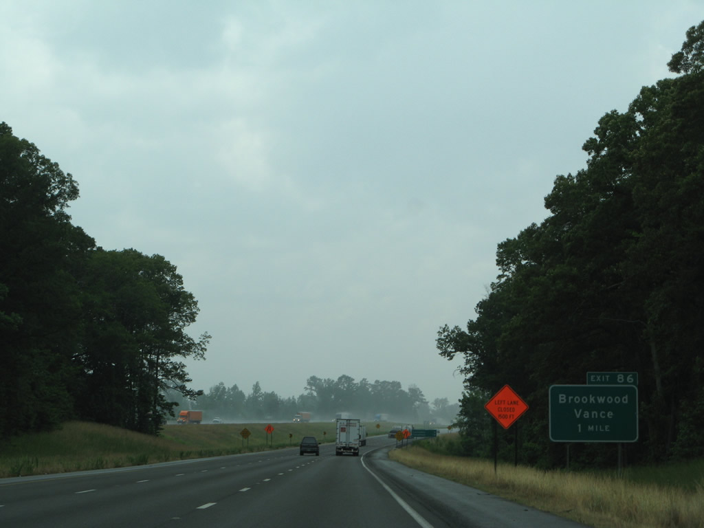
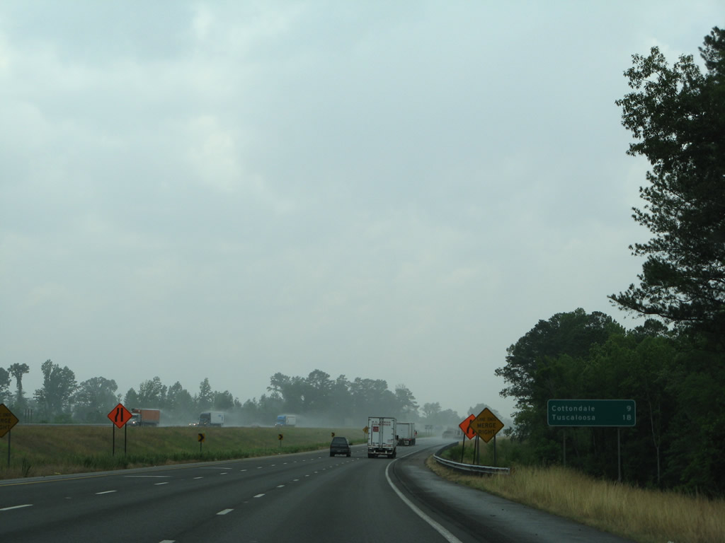
| Tuscaloosa County Route 59 (Covered Bridge Road) meets I-20/59 at a diamond interchange (Exit 86) in one mile. 06/12/08 |
|
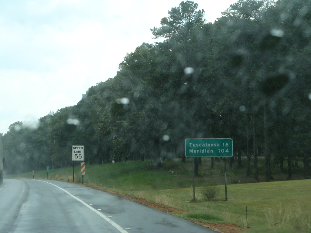
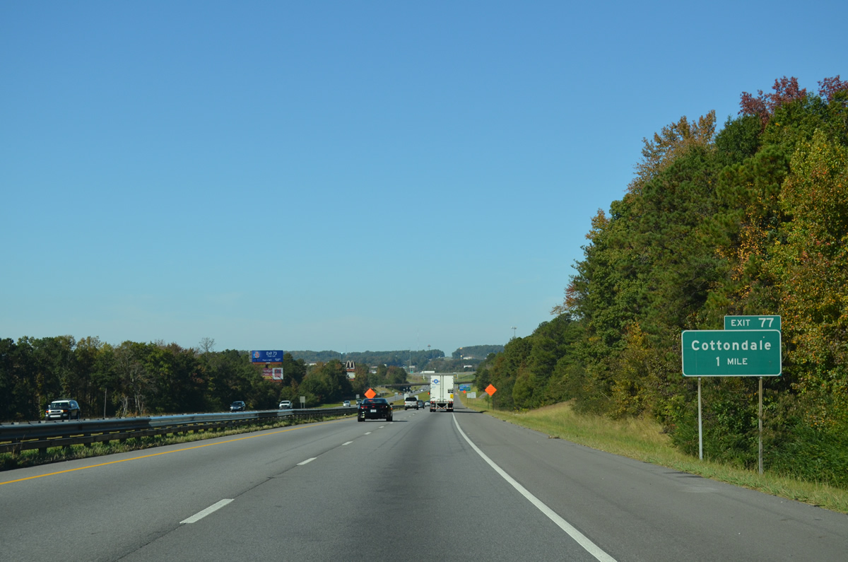
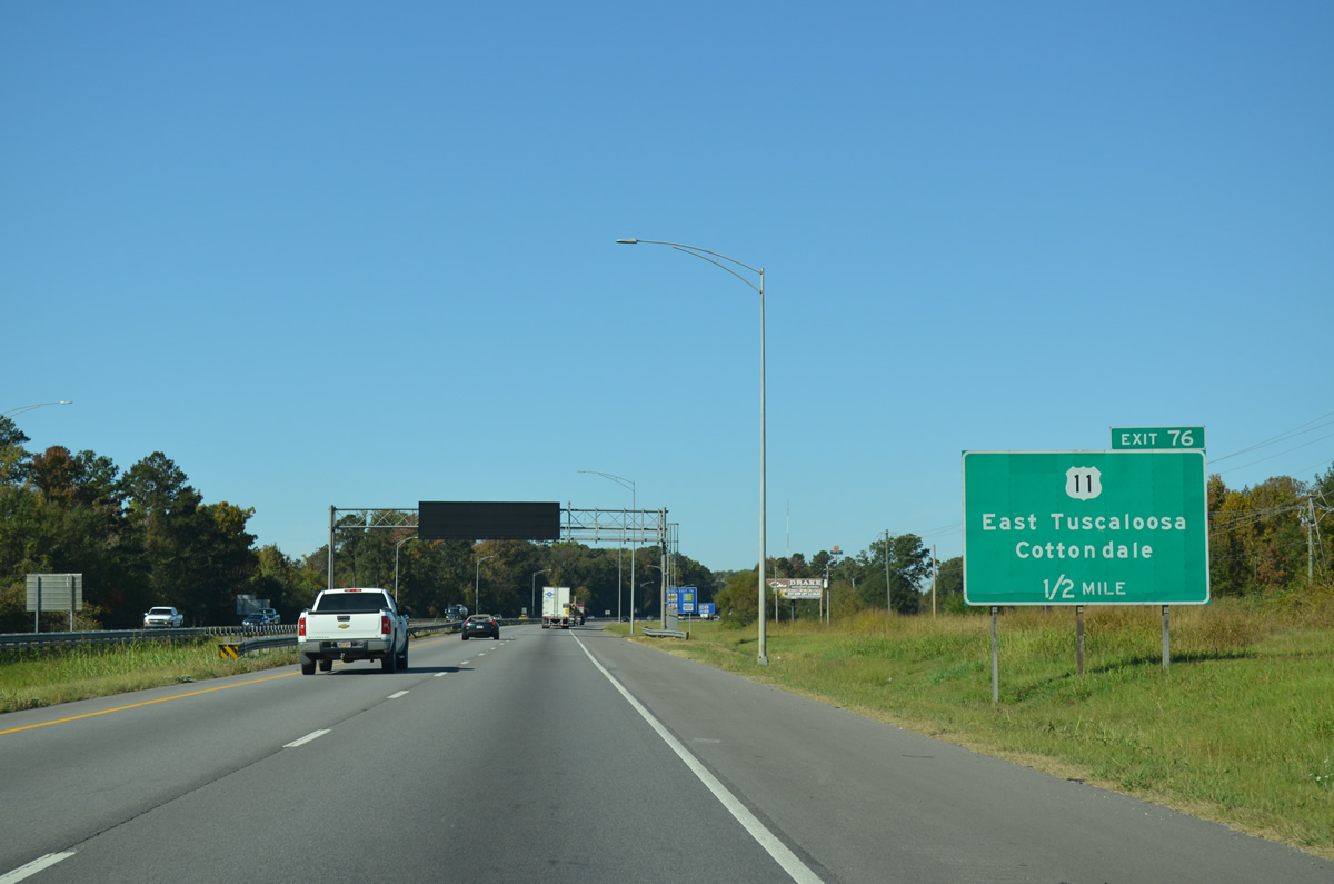
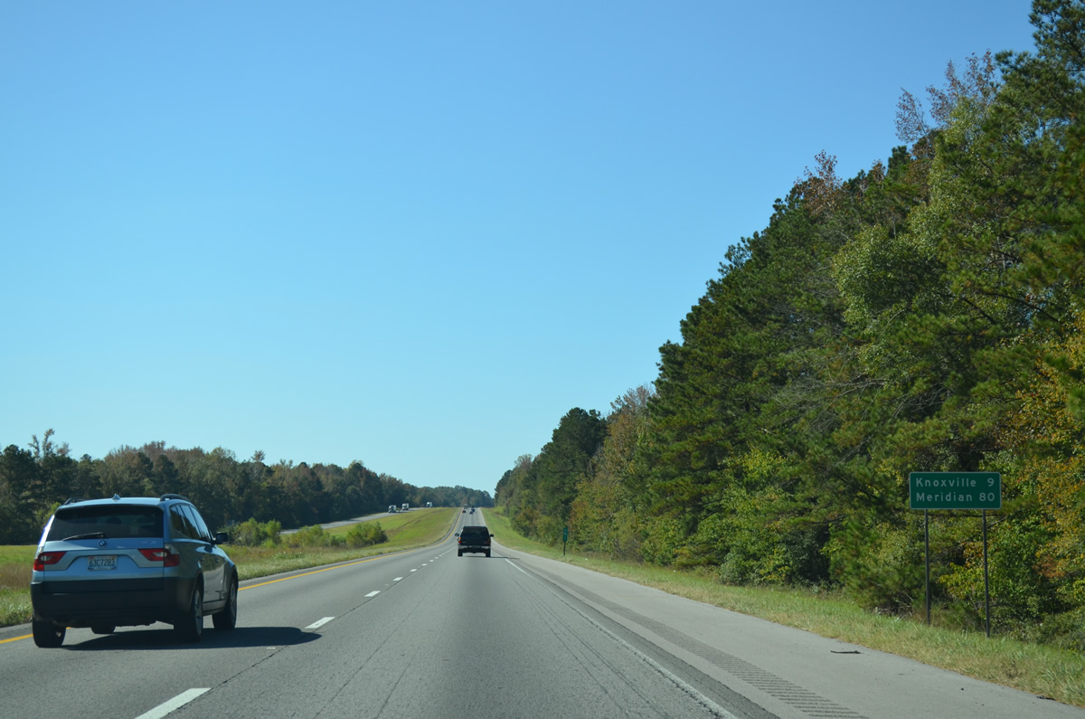
| Cottondale, a community within the Tuscaloosa city limits along U.S. 11, is nine miles to the west. Downtown Tuscaloosa is 18 miles away. 06/12/08 |
|
| Widening of I-20/59 between Exits 97 and Exits 89 occurred in 2002-03. Further six lane expansion west toward Exit 78 was underway in 2008. 2002/03 road work coincided with a project installing barrier medians east toward Bessemer due to a high number of cross over accidents. 09/28/03 |
|
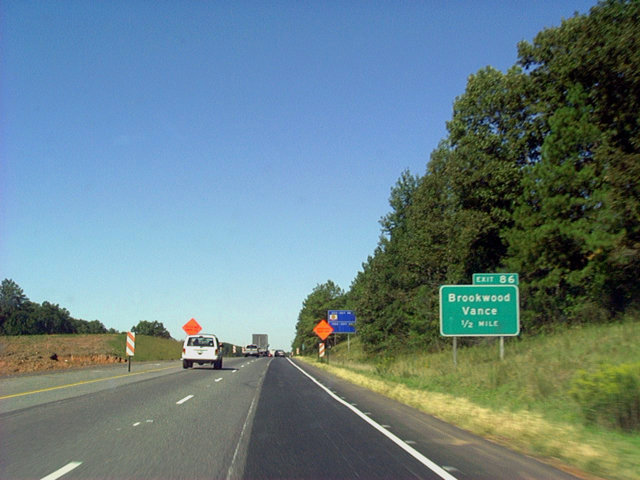
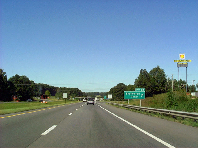
| CR 59 (Covered Bridge Road) leads 1.03 miles south from Exit 86 to U.S. 11 near Cedar Cove. Northward Covered Bridge Road extends 5.63 miles to SR 216 in the city of Brookwood. 09/28/03 |
|
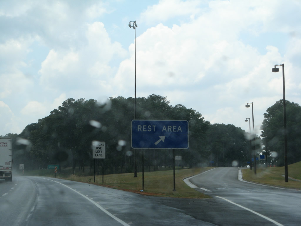
| Rest areas line both sides of I-20/59 west of Little Hurricane Creek and east of the Ed Stephens Road overpass. 06/12/08 |
|
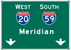
| Meridian reappears on this westbound distance sign posted at the Tuscaloosa County rest area. 06/12/08 |
|
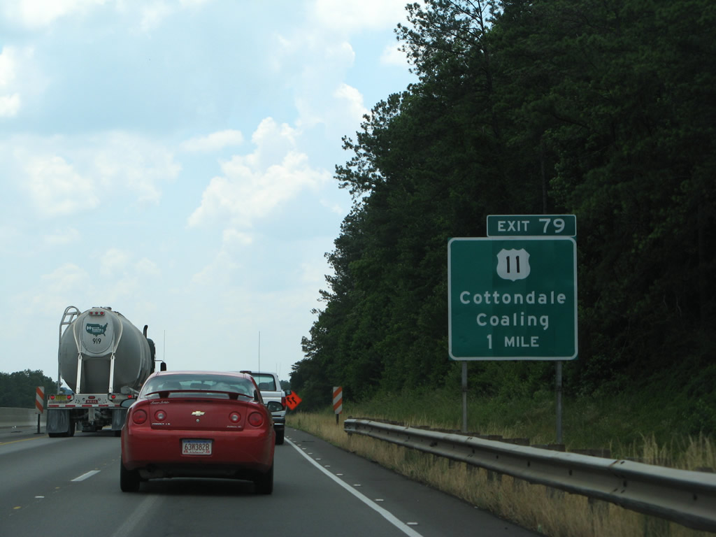
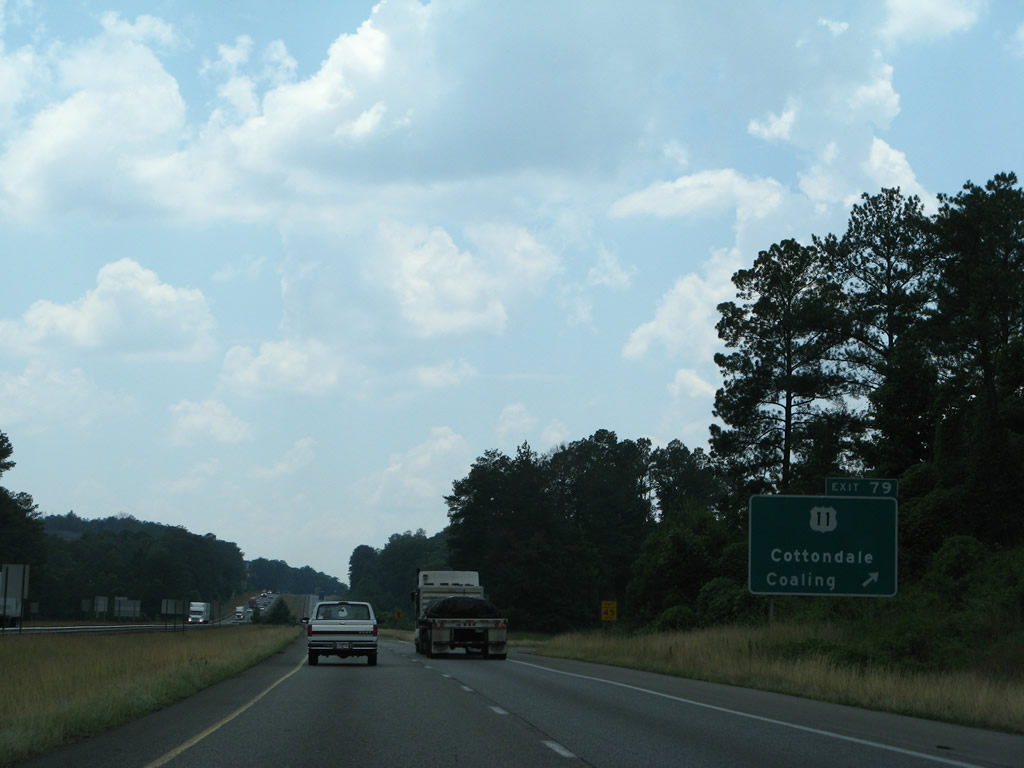
| U.S. 11 crosses paths again with I-20/59 at Exit 79 in one mile. The rural highway becomes more suburban along University Boulevard westward toward the community of Cottondale. 06/12/08 |
|
| A folded diamond interchange (Exit 79) joins I-20/59 with U.S. 11 (University Boulevard) adjacent to a Norfolk Southern Railroad. U.S. 11 northbound leads east into the town of Coaling. 06/12/08 |
|
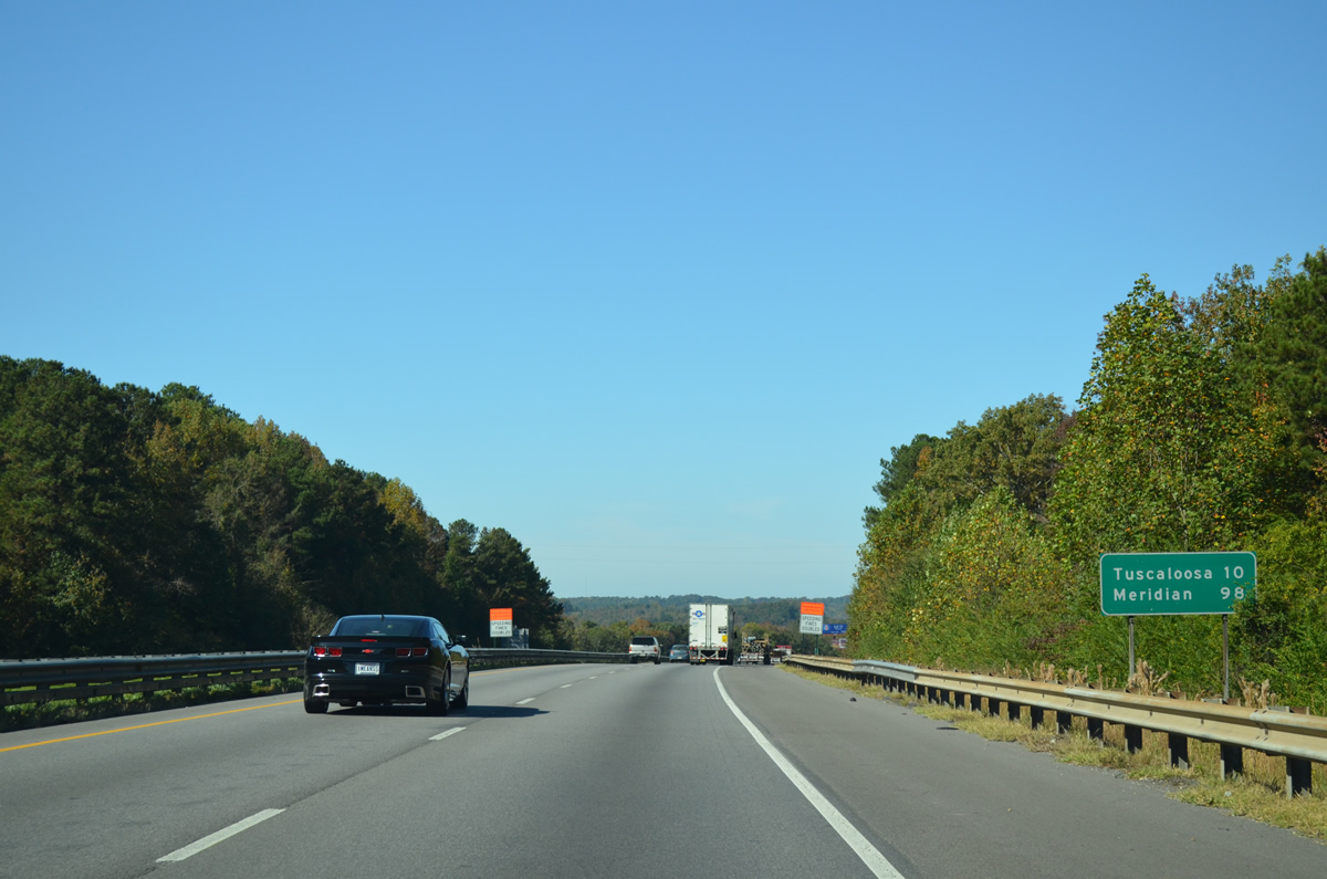
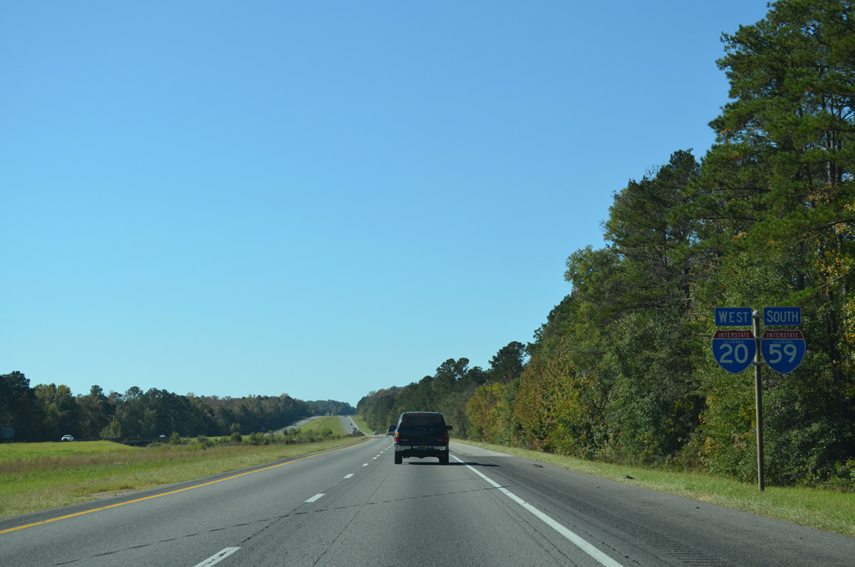
| Traversing hills west of Coaling, I-20 west / I-59 south travel to within 100 miles of Meridian, Mississippi. 10/21/12 |
|
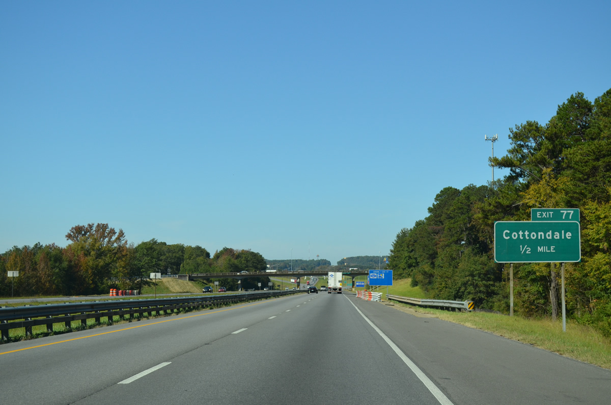
| CR 85 follows Buttermilk Road south from U.S. 11 and SR 215 in Cottondale to meet I-20/59 at a parclo interchange (Exit 77) in one mile. 10/21/12 |
|
| Buttermilk Road was expanded into a five lane arterial as part of a $10 million project from I-20/59 southward to Bradford Boulevard between November 2007 and 2010.2 This work coincided with the construction of a new loop ramp from CR 85 north onto I-20/59 south. 10/21/12 |
|
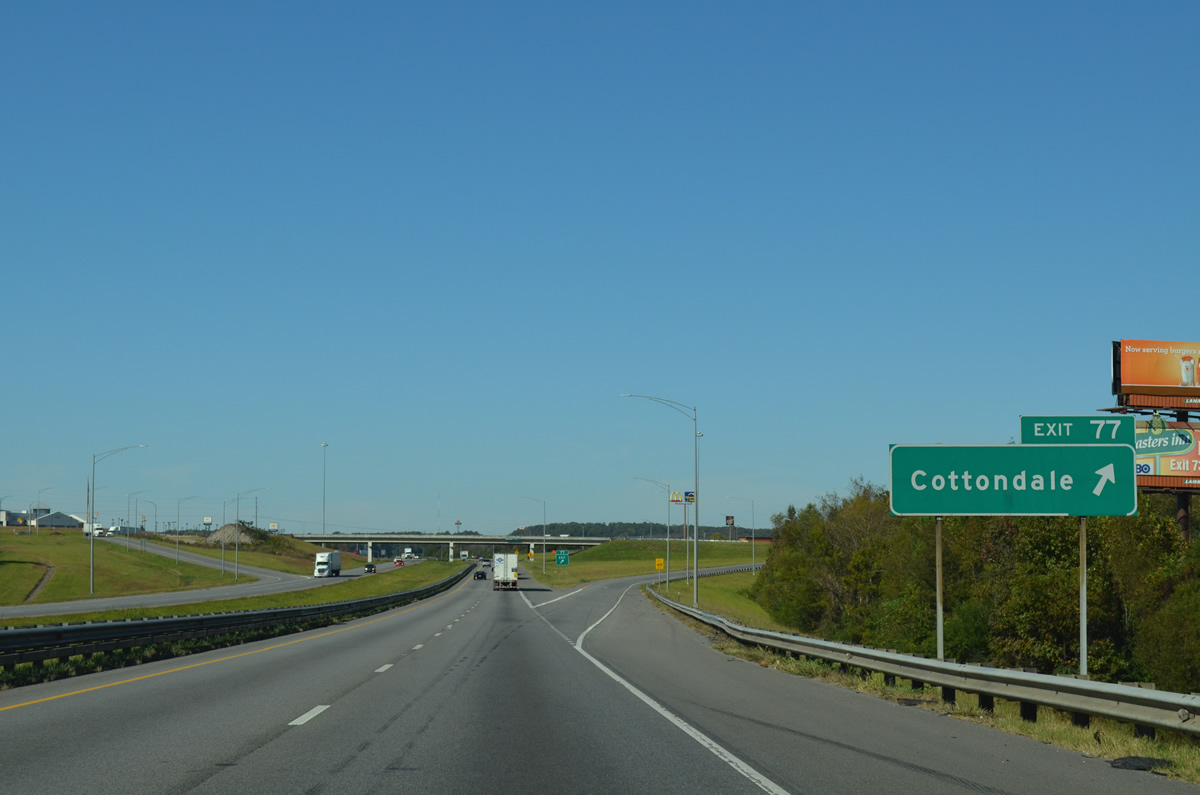
| Exit 77 departs I-20/59 south for Buttermilk Road (CR 85). A number of travel amenities are located nearby and a service road (JVC Road) lines the north side of the freeway westward from CR 85 to U.S. 11 (Skyland Boulevard). 10/21/12 |
|
| Confirming markers for I-59/20 south posted after the Buttermilk Road entrance ramp. 10/21/12 |
|
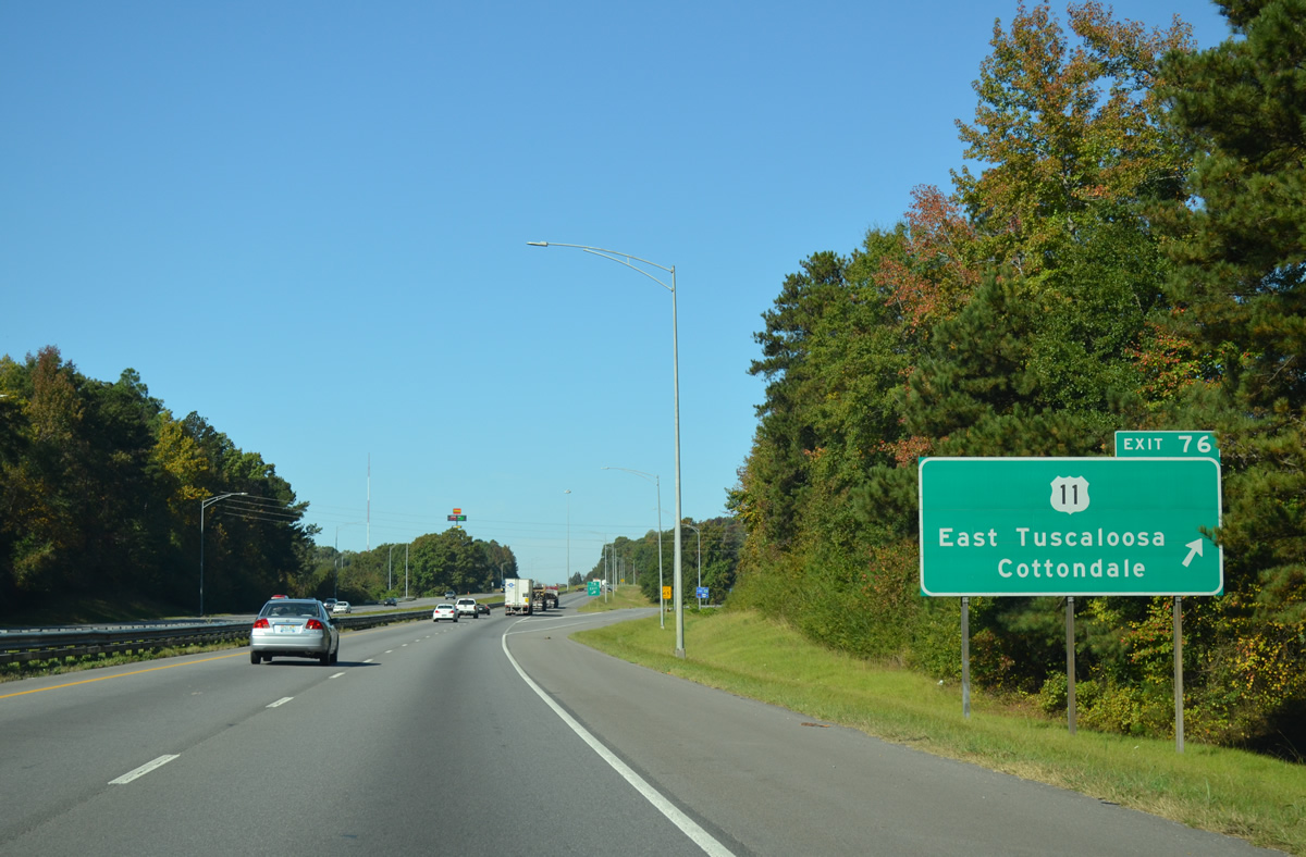
| U.S. 11 shifts southwest from University Boulevard (SR 215) at Cottondale onto Skyland Boulevard to meet I-20/59 again at Exit 76. 10/21/12 |
|
| Skyland Boulevard (U.S. 11) comprises a busy commercial arterial west from the diamond interchange at Exit 76 to the south end of Interstate 359. 10/21/12 |
|
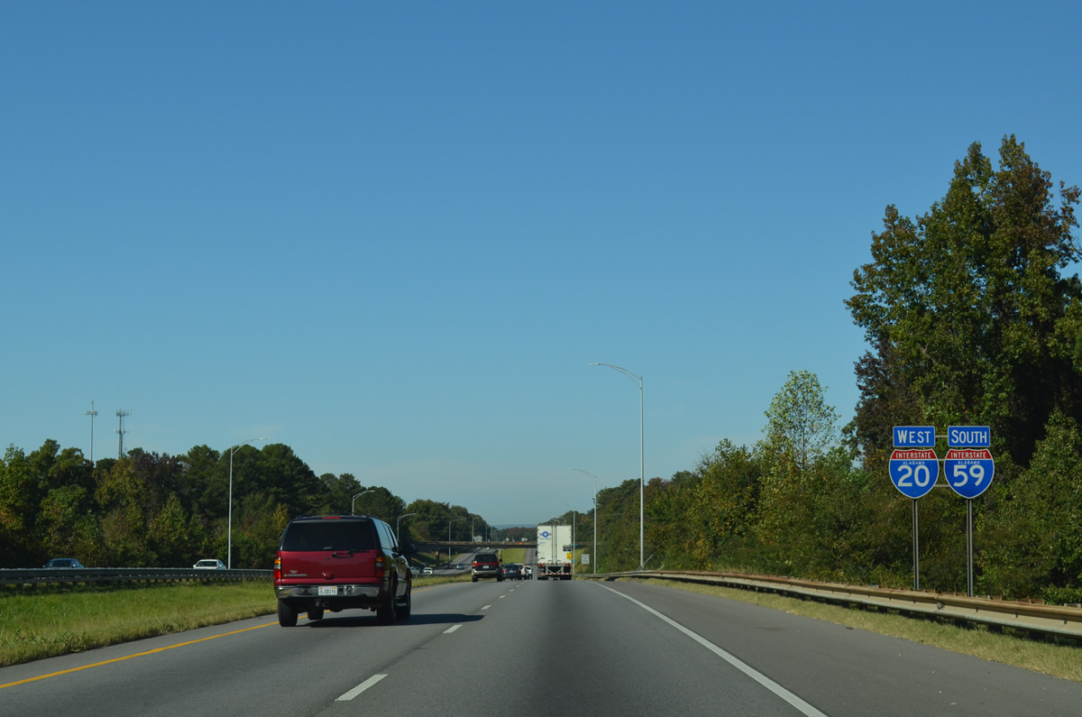
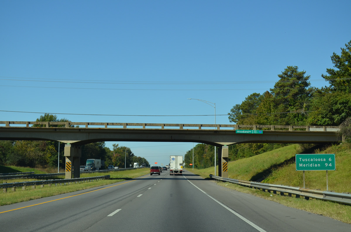
| I-59/20 advance west by several subdivisions to the Woodland Road overpass. 10/21/12 |
|
| Downtown Tuscaloosa lies 6.5 miles to the northwest. Meridian, Mississippi is 94 miles to the southwest. 10/21/12 |
|
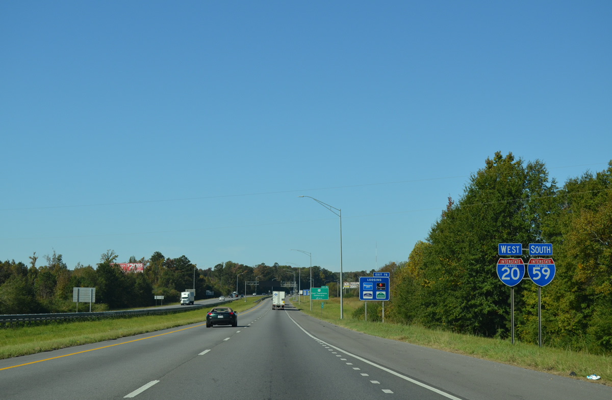
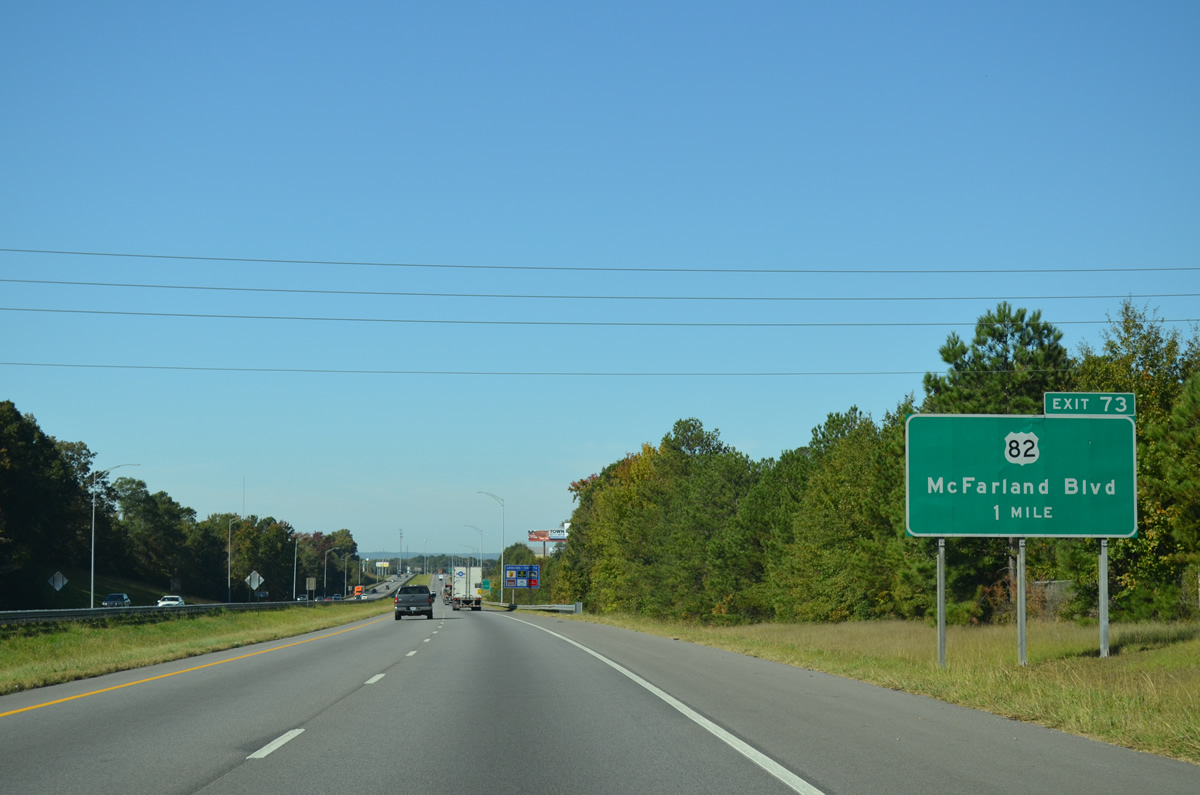
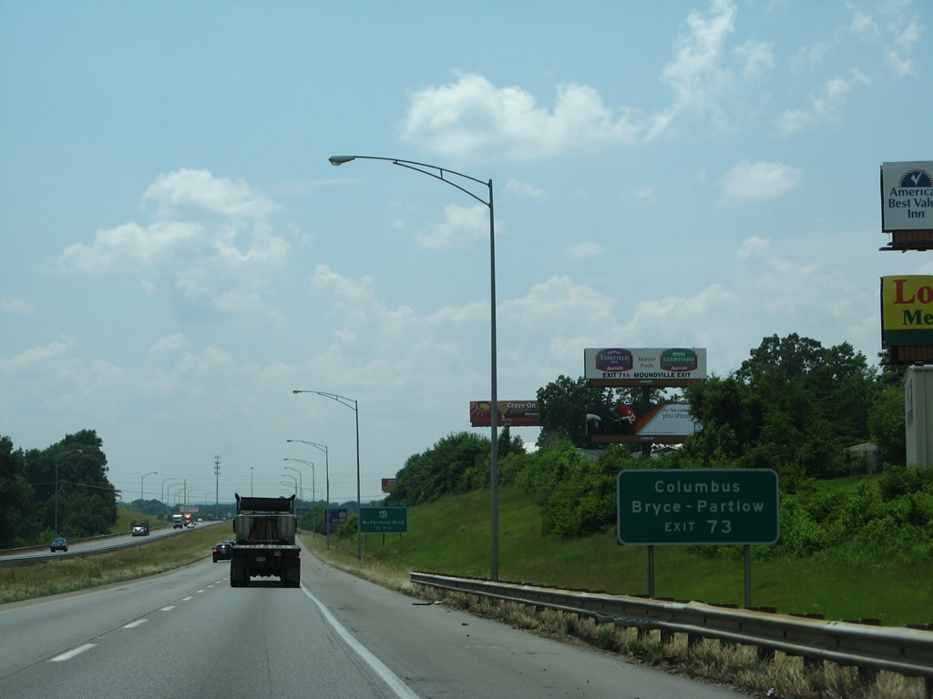
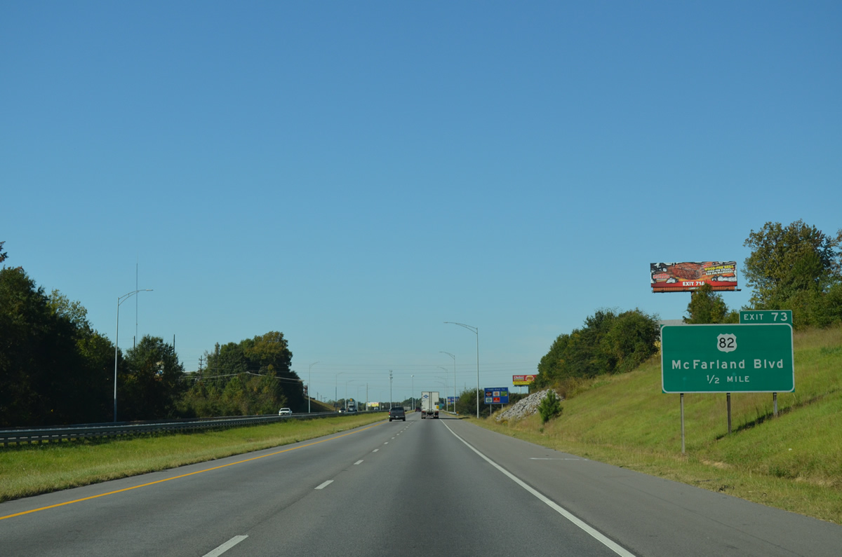
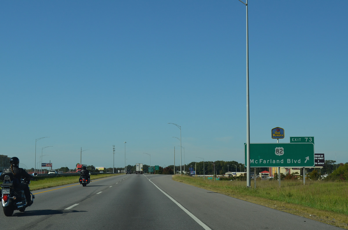
| U.S. 82 (McFarland Boulevard) runs north from SR 215 (Old Montgomery Highway) to a single point interchange (Exit 73) with I-20/59 in south Tuscaloosa. 10/21/12 |
|
| West from Tuscaloosa and Northport, U.S. 82 continues to Pickens County and the state line. U.S. 82 upgrades to a freeway west to the cities of Columbus and Starkville, Mississippi.
McFarland Boulevard is the most direct route to the University of Alabama campus and Bryce and Partlow Hospitals. 06/12/08 |
|
| U.S. 82 (McFarland Boulevard) becomes an expressway north from University Boulevard (old SR 215) and the University of Alabama to Rice Mine Road in Northport. 10/21/12 |
|
| U.S. 82 joins the Tuscaloosa area with Centreville and Montgomery from the southeast. The proposed Eastern Bypass, a controlled access route angling northwest from ahead of Exit 77 onto the Paul Bryant Bridge (SR 297) across the Black Warrior River, would tie into U.S. 82 west of Tuscaloosa Municipal Airport (TCL). 10/21/12 |
|
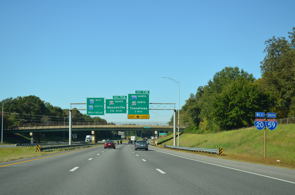
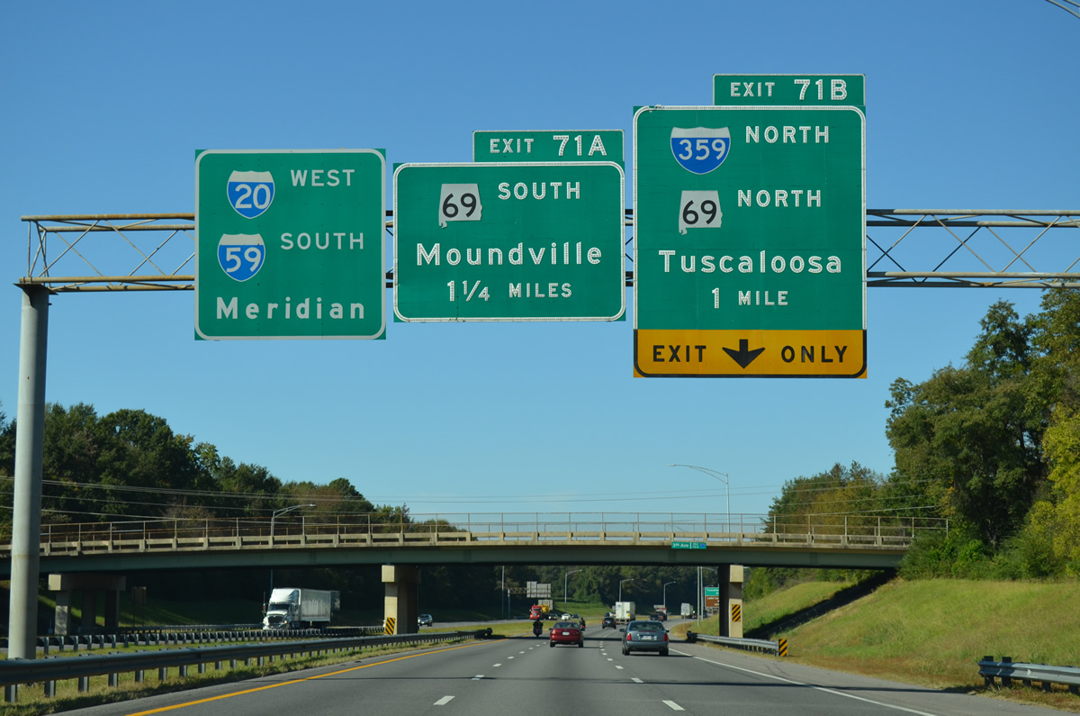
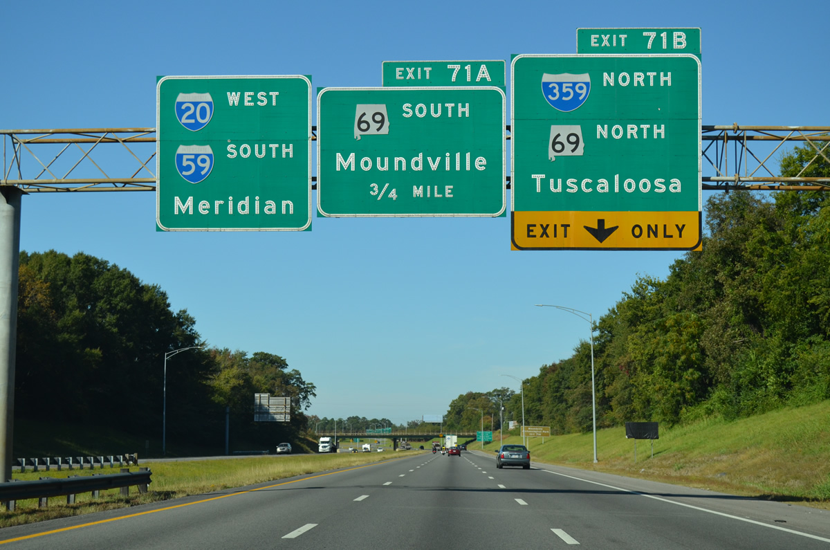
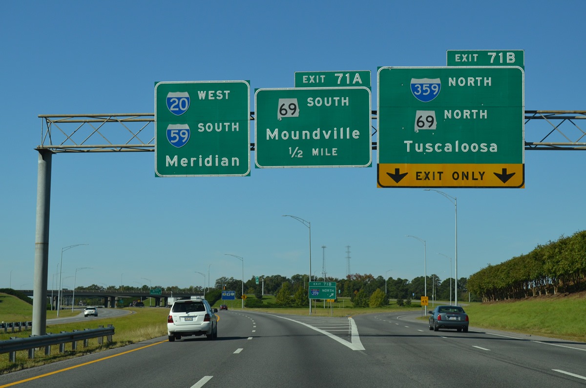
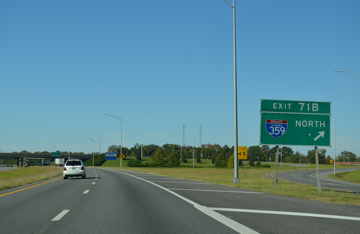
| Combining with SR 69, U.S. 11 turns northward from Skyline Boulevard to join Interstate 359 at Exit 71. I-359 constitutes a 2.78 mile long route to the Tuscaloosa central business district. 06/12/08 |
|
| Reassurance markers posted near the 3rd Avenue E overpass. 10/21/12 |
|
| A lane drop occurs at Exit 71 B for I-359/SR 69 north and U.S. 11 south to Downtown Tuscaloosa. SR 69 continues with U.S. 43 north from 15th Street across the Black Warrior River into Northport. 10/21/12 |
|
| I-359 north connects with U.S. 43 to Northport, Lake Lurleen State Park and U.S. 82 west to Tuscaloosa Regional Airport (TCL). 10/20/12 |
|
| U.S. 11 was relocated from parallel 24th Avenue (SR 215) onto I-359 when the freeway was completed in 1983. U.S. 11 follows I-359 to 15th Street, where it joins U.S. 43 south to Stillman College and Eutaw. 10/21/12 |
|
| A directional cloverleaf interchange joins I-59/20 with I-359/U.S. 11-SR 69 at Exit 71. 10/21/12 |
|
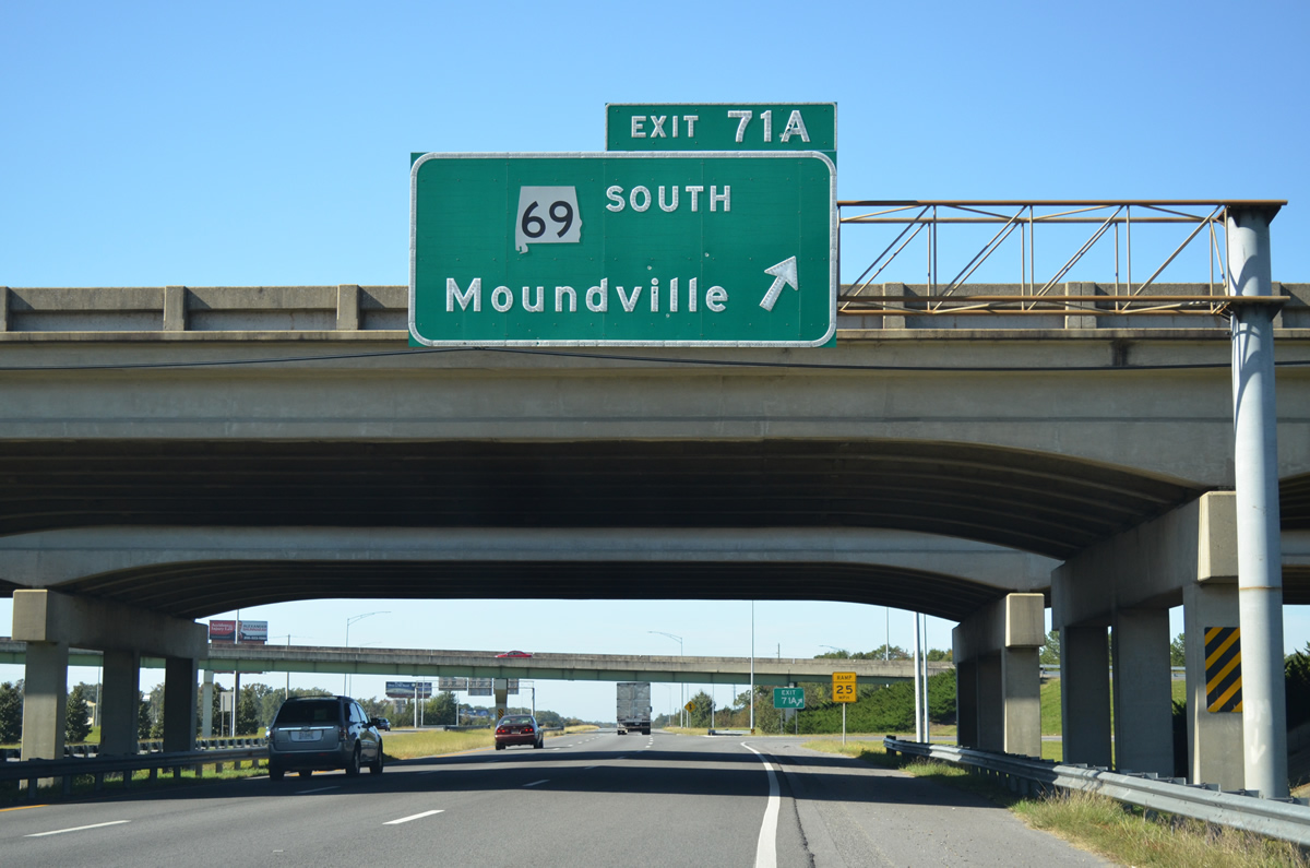
| South from I-359/U.S. 11, SR 69 joins the Tuscaloosa area with Moundville along a 13 mile long divided highway. Points of interest for SR 69 include Moundville Archaeological Park and Shelton State Community College. 10/21/12 |
|
| I-59/20 south vacate the Tuscaloosa city limits beyond a Norfolk Southern Railroad overpass. 10/21/12 |
|
| The unincorporated community of Fosters was the succeeding exit nine miles to the southwest until the Northport/Tuscaloosa Western Bypass was constructed. 10/21/12 |
|
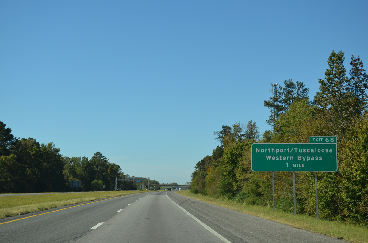
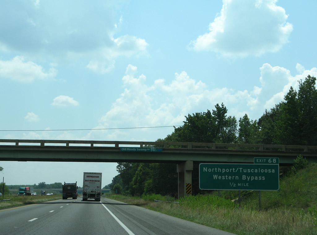
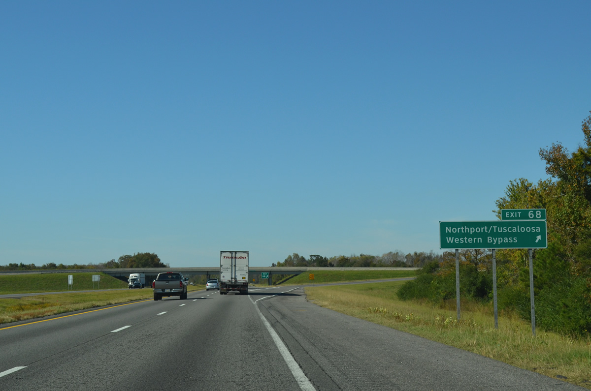
| Passing by Friday Lake, I-59/20 advance west to Exit 68 for Joe Mallisham Parkway, the Northport/Tuscaloosa Western Bypass. 10/21/12 |
|
| Northport/Tuscaloosa Western Bypass includes a toll bridge across the Black Warrior River. Work on the western bypass commenced in 1999 and the road was completed to U.S. 43 at Northport by late 2005.3
The guide sign for Exit 68 at the Old Moody Swamp Road overpass was removed by 2012. 06/12/08 |
|
| Joe Mallisham Parkway heads 4.29 miles north from the trumpet interchange at Exit 68 to Industrial Park Drive and Boone Boulevard beyond the Black Warrior River. 10/21/12 |
|
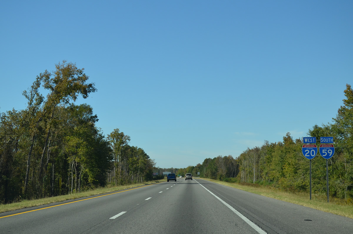
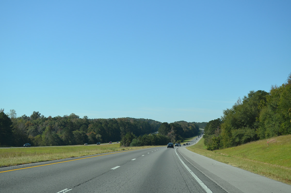
| I-59/20 plie across areas of wetlands southwest toward the Black Warrior River. 10/21/12 |
|
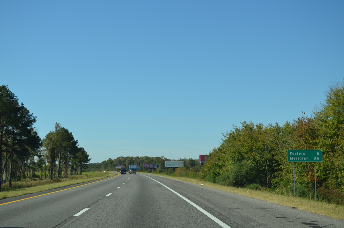
| Meridian, Mississippi is 86 miles to the southwest. 10/21/12 |
|
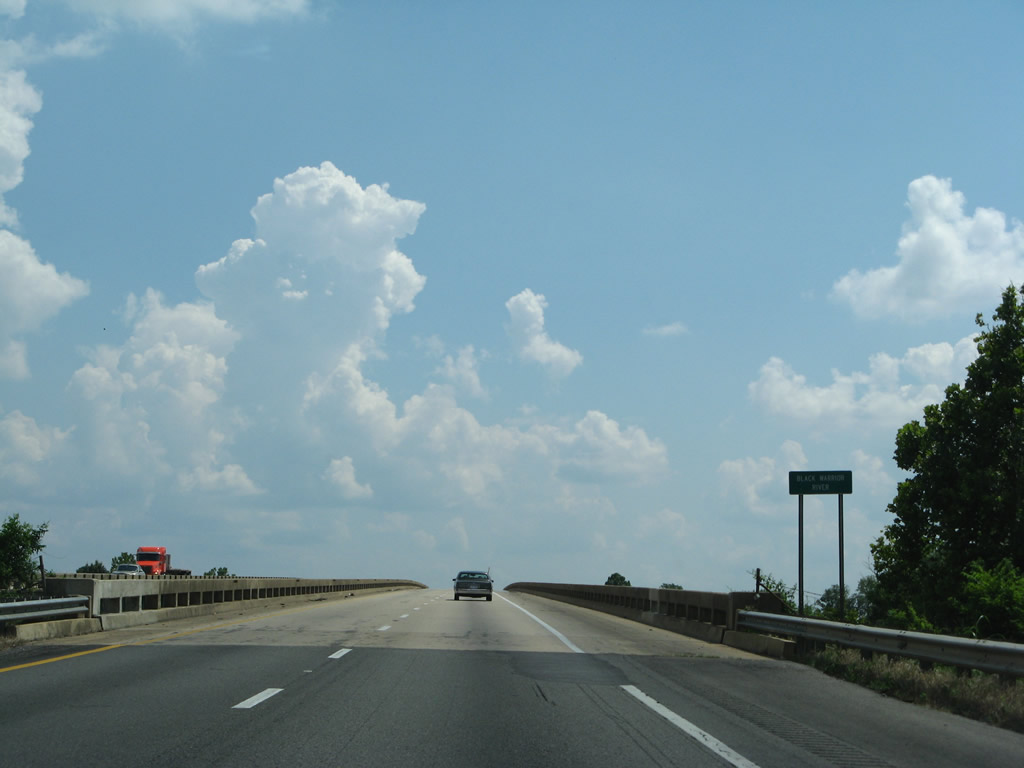
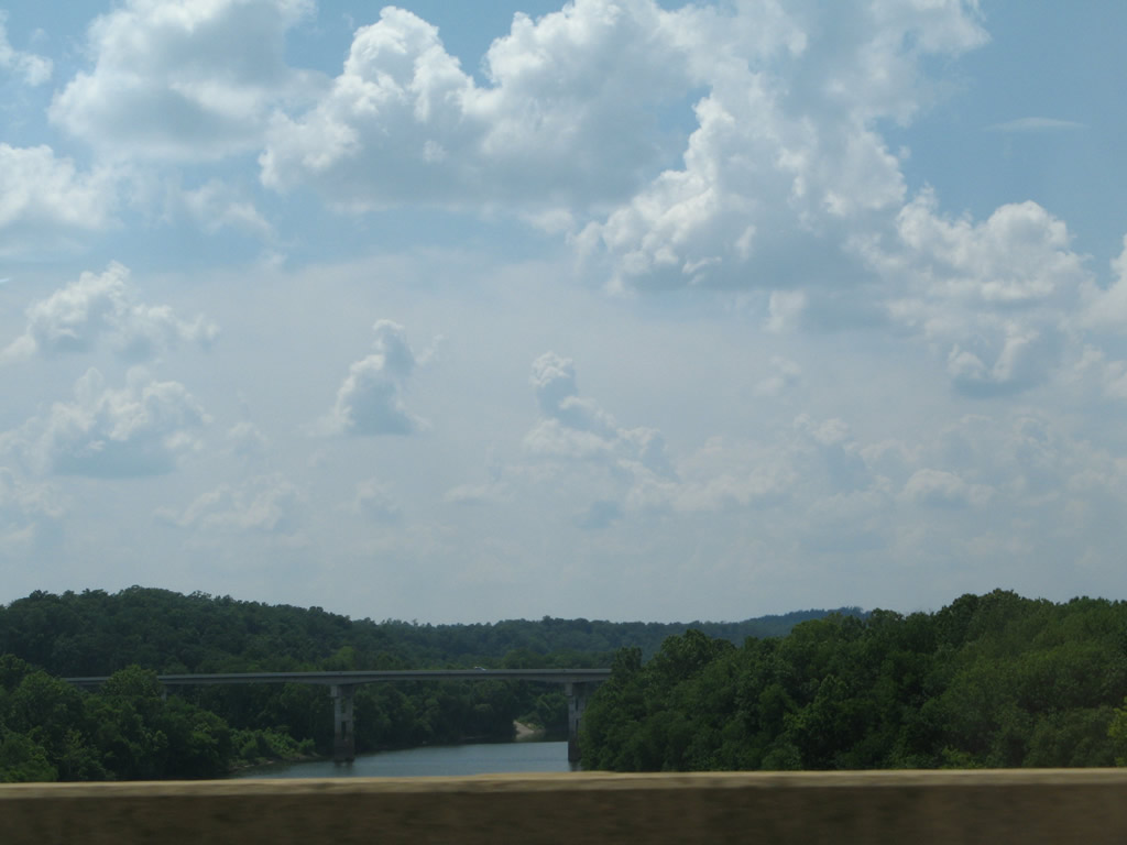
| The bridges taking I-59/20 over the Black Warrior River were built in 1969. 06/12/08, 10/21/12 |
|
| U.S. 11/43 cross the Black Warrior River just west of I-20/59. 06/12/08 |
|
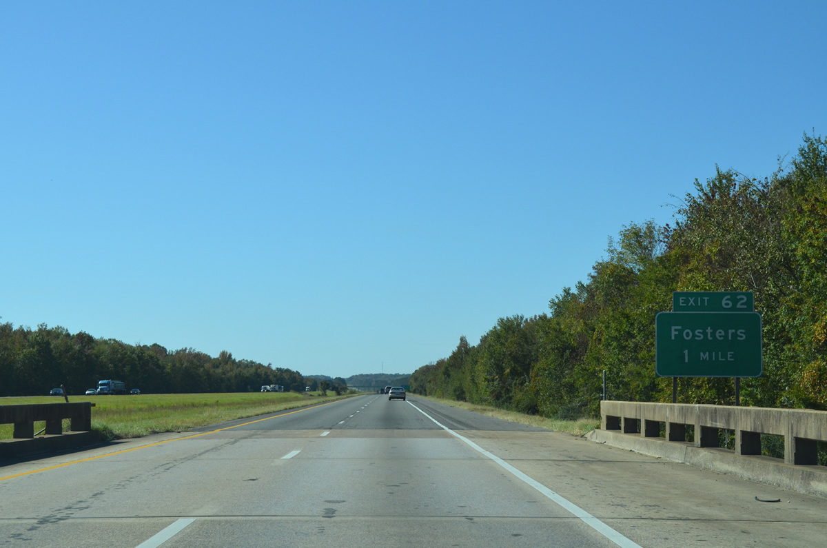
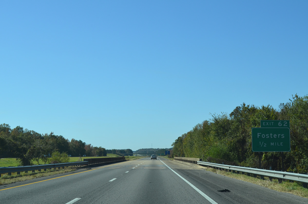
| A diamond interchange (Exit 62) joins I-20/59 south with Holley Springs Lane to the unincorporated community of Fosters in one mile. 10/21/12 |
|
| Holley Springs Lane was transferred to state control in April 2016 and designated SR 300. The state route connects I-59/20 with U.S. 11/43 and CR 10 (Gainesville Road). 10/21/12 |
|
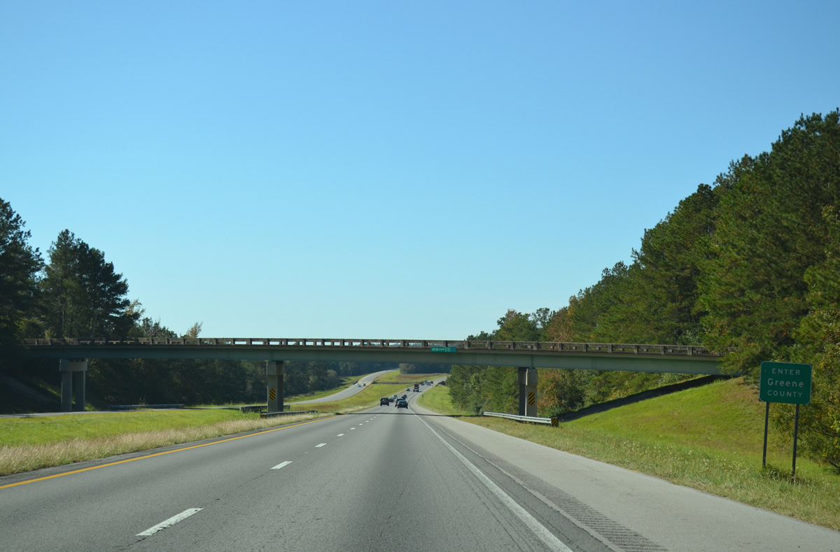
| U.S. 11/43 remain parallel to I-20/59 southwest into Greene County while CR 10 west from SR 300 to CR 51 north connects Fosters with Romulus. 10/21/12 |
|
| I-20/59 rise onto a series of hills southwest of Grant Creek. 10/21/12 |
|
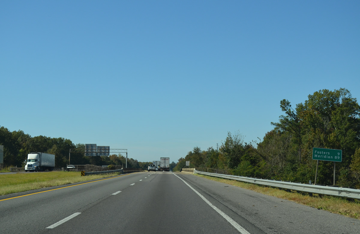
| The majority of the 80 miles between Fosters and Meridian, Mississippi constitutes undeveloped timberland. 10/21/12 |
|
| 2010 traffic counts along I-20/59 southwest from Tuscaloosa ranged between 26,640 vehicles per day (vpd) south of Exit 62 to 19,600 vpd near Epes. 10/21/12 |
|
| Tuscaloosa County Route 75 stems south from U.S. 11/43 near Ralph to become Greene County Route 56 across I-20/59 just beyond the county line. 10/21/12 |
Page Updated 10-24-2012.

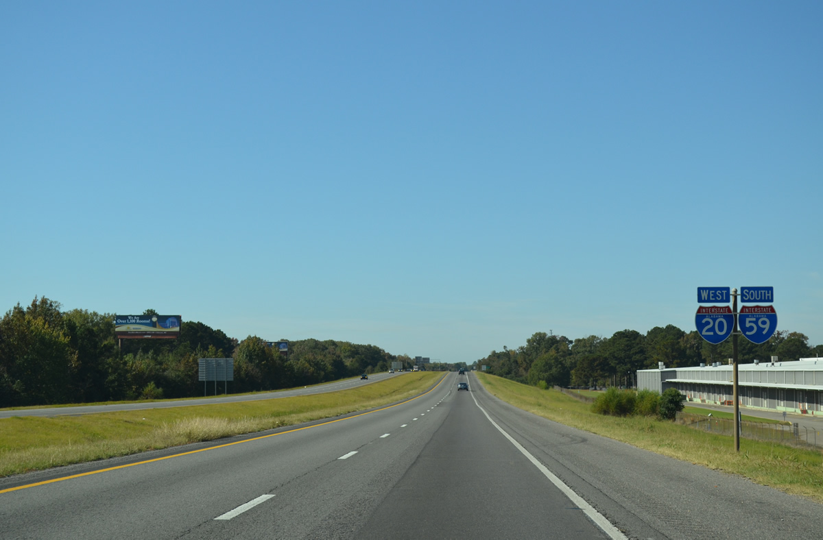
 West
West  South
South