|
| U.S. 31 enters Indiana for its 266 mile trip across the Hoosier State. The highway is known as the St. Joseph Valley Parkway and signage along the highway enforces that name. Here the highway enters St. Joseph County (population 266,931), home to South Bend and the University of Notre Dame. The county is also the economic and cultural heart of the Michiana region of Northern Indiana and Southwestern Michigan. 06/03/11 |
|
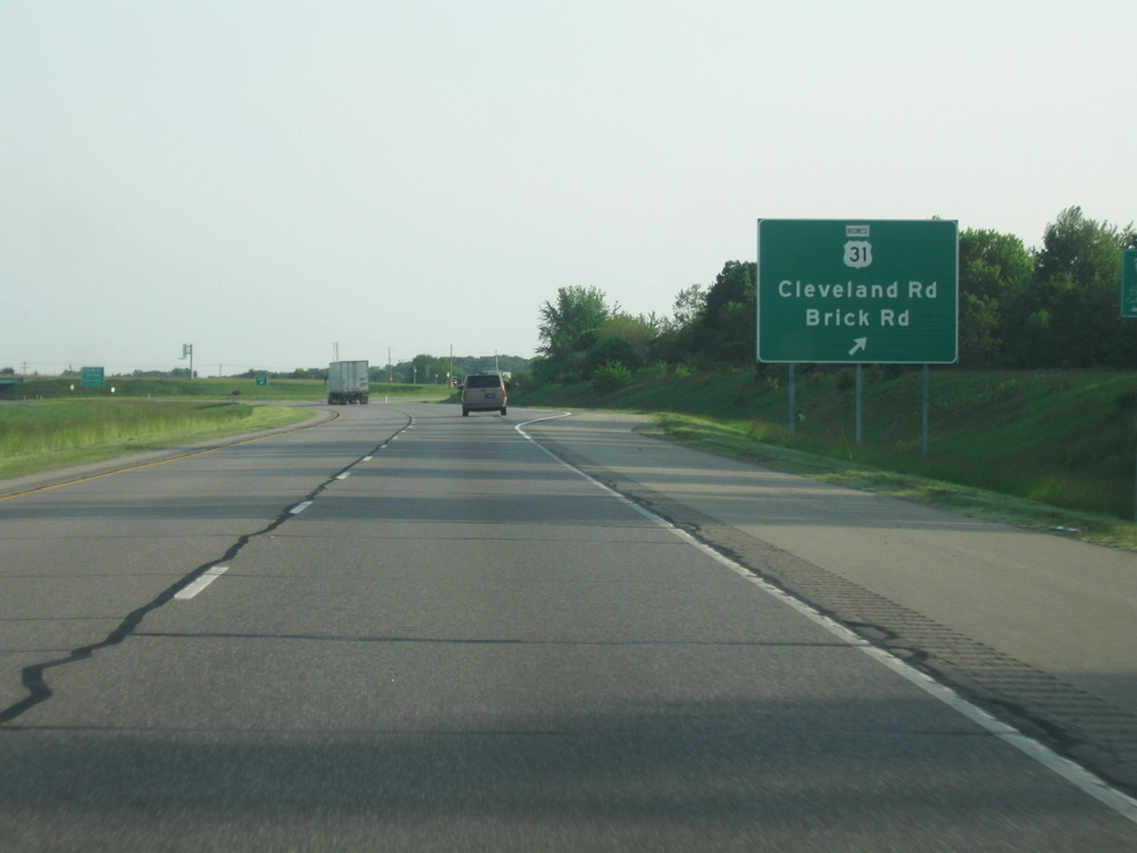
| The first interchange is for Brick Road/Cleveland Road. The highway is also referred to as Business U.S. 31, but the business routing is a local designation. Business U.S. 31 travels southward with SR 933 through South Bend, returning to U.S. 31 on the south side of town via Michigan Street. The route south of SR 933 is locally maintained but signed with older shields. Brick Road continues west from Cleveland Road to an adjacent business park before ending at Primrose Road near Twin Lakes. Cleveland Road parallels I-80/90 closely from its split with Brick Road east to Roseland. 06/03/11 |
|
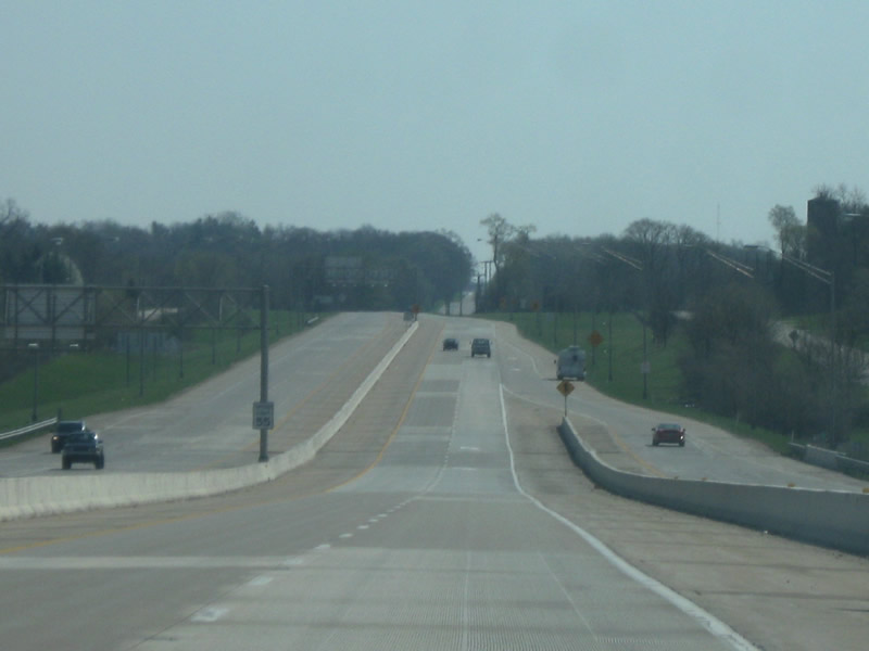
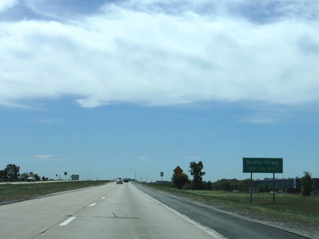
| U.S. 31 (St. Joseph Parkway) southbound after the split with U.S. 31 Business (Cleveland Road) on the half mile approach to Nimtz Parkway. 09/02/05 |
|
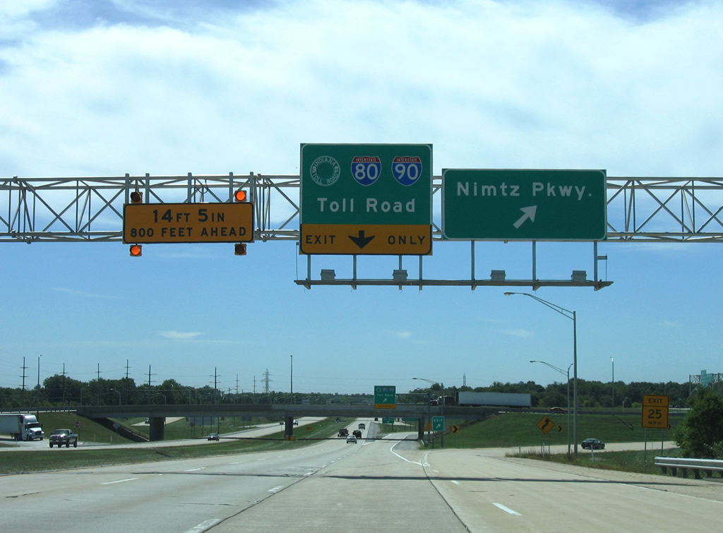
| The southbound off-ramp to Nimtz Parkway leaves U.S. 31 and circumvents the adjacent trumpet interchange with the Indiana Toll Road access road. Nimtz Parkway leads east from St. Joseph Valley Parkway to industrial parks northeast of South Bend Regional Airport (SBD). 09/02/05 |
|
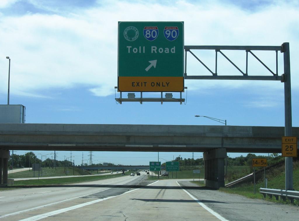
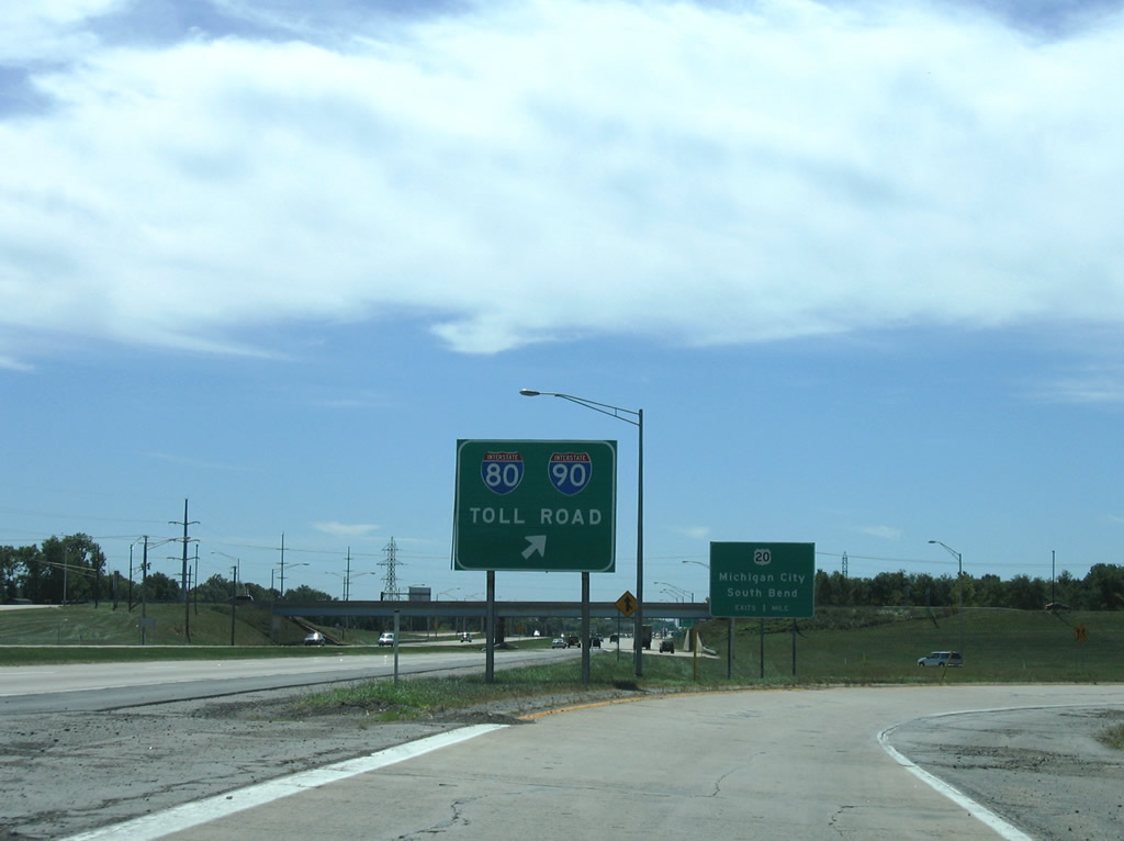
| I-80/90 meet U.S. 31 at the Exit 72 trumpet interchange. The tandem travels 278.40 miles between Lake Station, Indiana and Elyria, Ohio. 09/02/05 |
|
| Looping onto the Plaza 72 access road from U.S. 31 south, one mile north of its merge with U.S. 20 east. I-80/90 head east to Elkhart and Toledo, Ohio and west to Gary and Chicago. 09/02/05 |
|
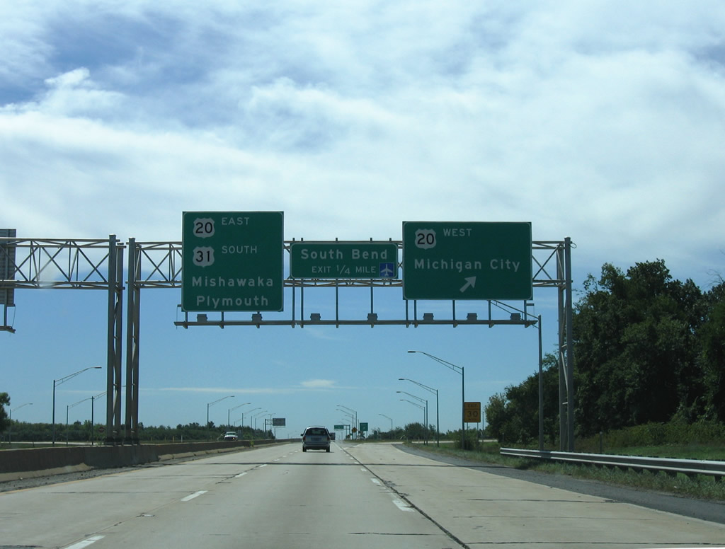
| U.S. 20 joins U.S. 31 along St. Joseph Valley Parkway south to their split at Michigan Street. U.S. 20 continues the freeway east to Mishawaka and Elkhart while U.S. 31 resumes its southward course to Plymouth and Indianapolis. 09/02/05 |
|
| Heading south along U.S. 31 (St. Joseph Valley Parkway) toward the cloverleaf interchange with U.S. 20 west and Lincoln Way West (old U.S. 20). 09/02/05 |
|
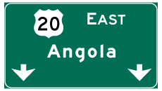
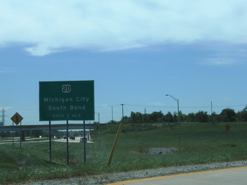
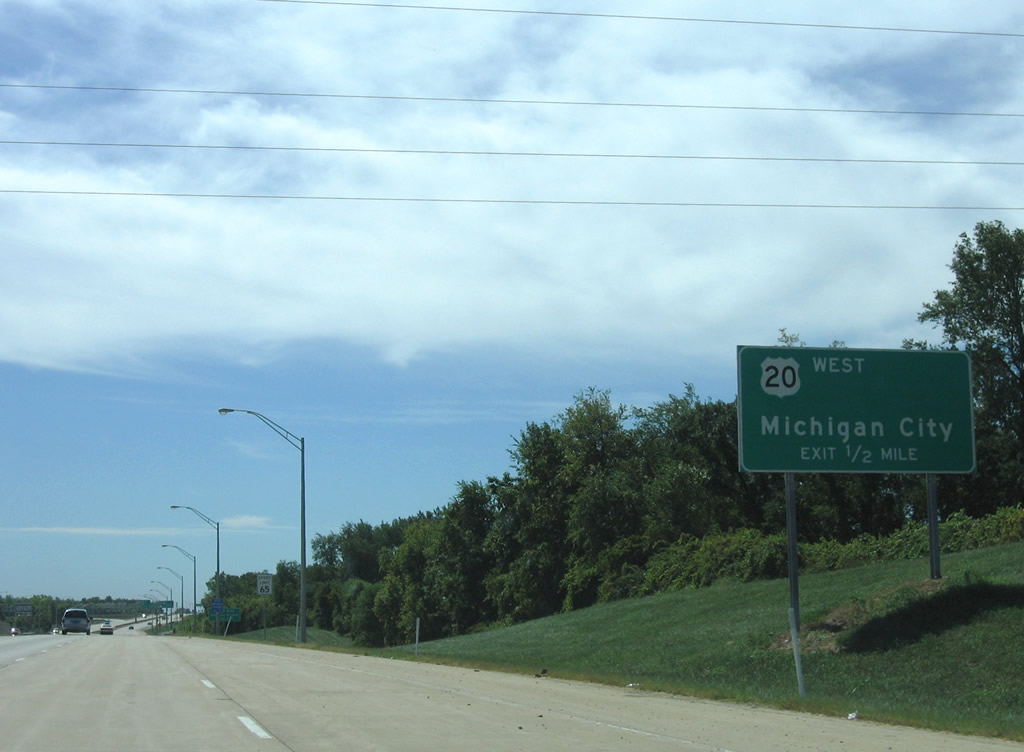
| U.S. 20 west travels from the South Bend area to New Carlisle and Michigan City. The US route travels 153.5 miles statewide between Hammond and Ohio east of Angola. 09/02/05 |
|
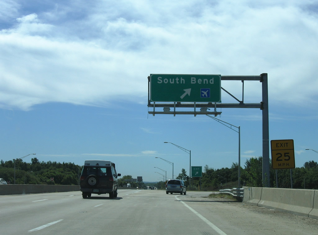
| Lincolnway West represents the pre-1982 routing of U.S. 20 east to South Bend Regional Airport (SBD) and downtown South Bend. 09/02/05 |
|
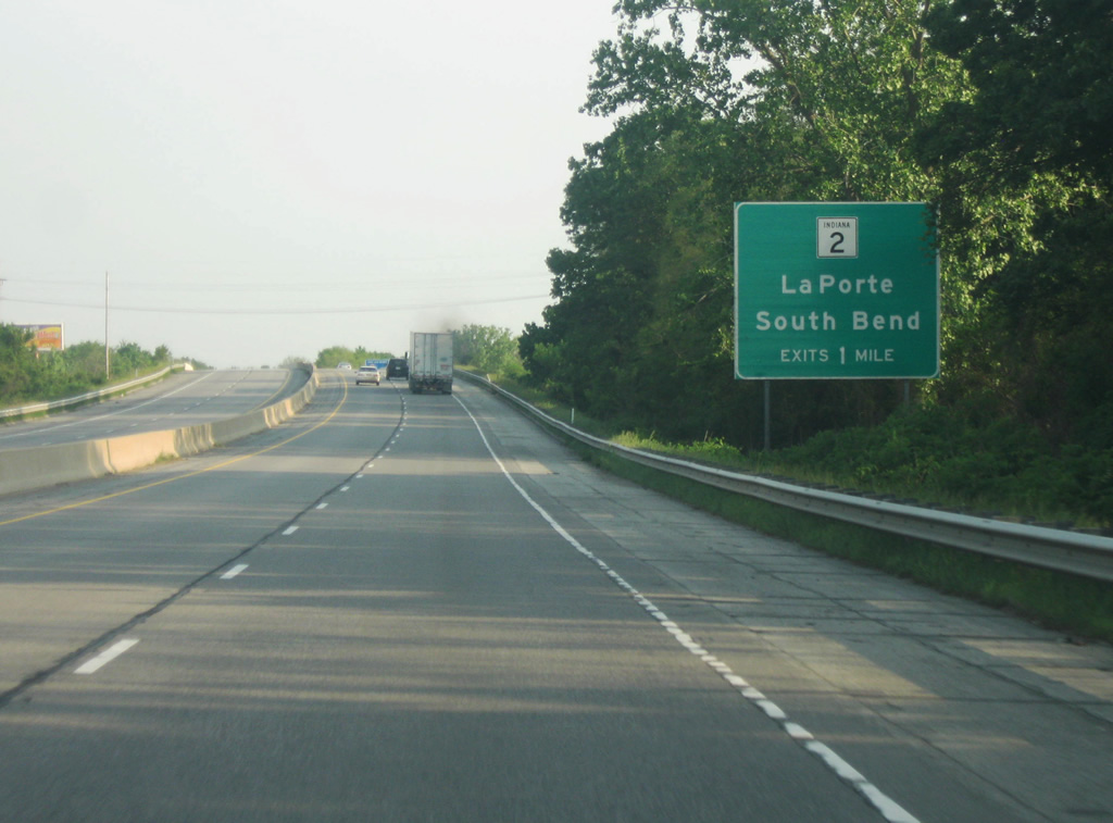
| South of the U.S. 20 (Lincolnway West) interchange, the SR 2 West interchange is one mile away. To the east, the road is called Western Avenue and represents the original routing of SR 2 to the center of South Bend. 06/03/11 |
|
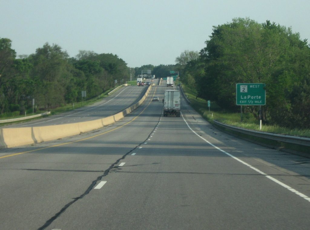
| Now a half mile away from the ramp to SR 2 West. SR 2 is an 81 mile state highway that starts at the St. Joseph Valley Parkway (U.S. 20/U.S 31) and angles southwest to LaPorte, Valparaiso, Hebron, and Lowell before ending at the Illinois border. The highway is a four lane expressway from South Bend to LaPorte and serves as an alternative highway to the Indiana Toll Road for traffic from LaPorte to South Bend. 06/03/11 |
|
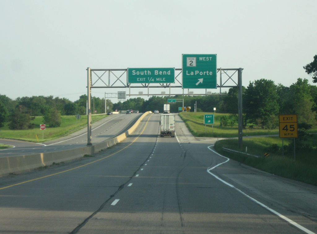
| The St. Joseph Valley Parkway (U.S. 20/U.S 31) at the cloverleaf interchange with SR 2 West/Western Avenue. Unlike other urban areas in Indiana where the local street name takes precedence over the regional control cities, Western Avenue is not noted on the highway signs and only South Bend is mentioned. Before the completion of the St. Joseph Valley Parkway SR 2 was routed along Western Avenue to downtown South Bend. 06/03/11 |
|
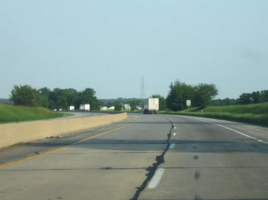
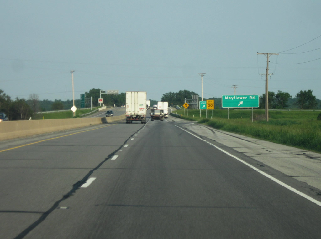
| South of the SR 2 West/Western Avenue interchange, the next upcoming interchange is with Mayflower Road, under a mile away. Note that the speed limit of 65 miles per hour. This is the only non-interstate route in the state that currently has that speed limit. 06/03/11 |
|
| Now at the Mayflower Road interchange. Mayflower Road used to be SR 123 before decommissioning in the 1980s. The old state road connected SR 23 to the south with the old U.S. 20 south of the South Bend Regional Airport. 06/03/11 |
|
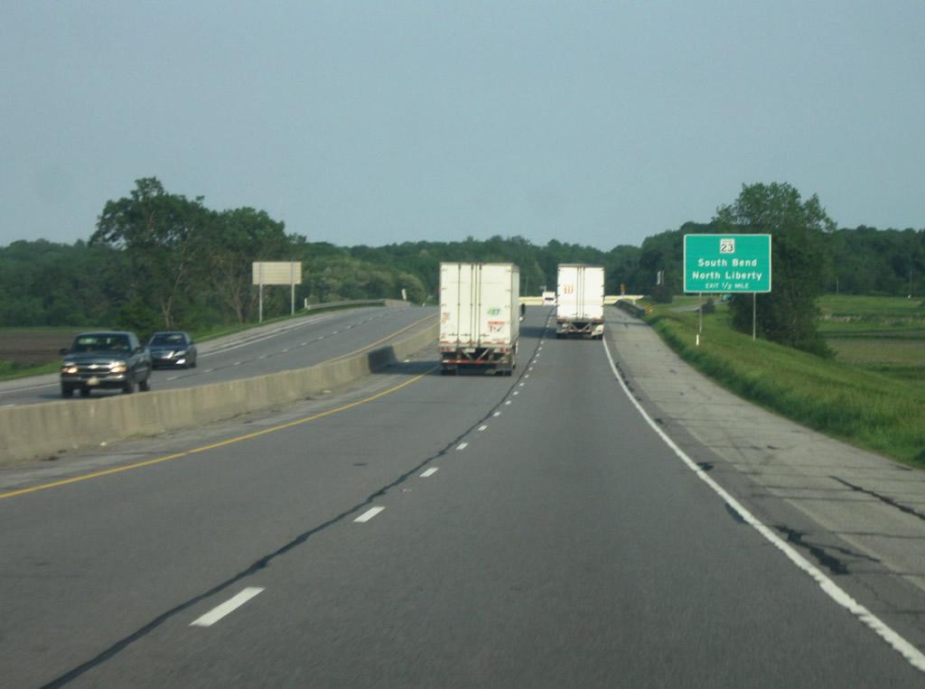
| South of the Mayflower Road interchange, the next interchange coming up is with SR 23. SR 23 goes for 51 miles from SR 10 in Starke County and runs through Walkerton and North Liberty before going through South Bend. It is one of two state highways that still run through the city as it follows Prairie Avenue northeast toward the center of South Bend. The highway extends up to the Michigan state line in Granger. 06/03/11 |
|
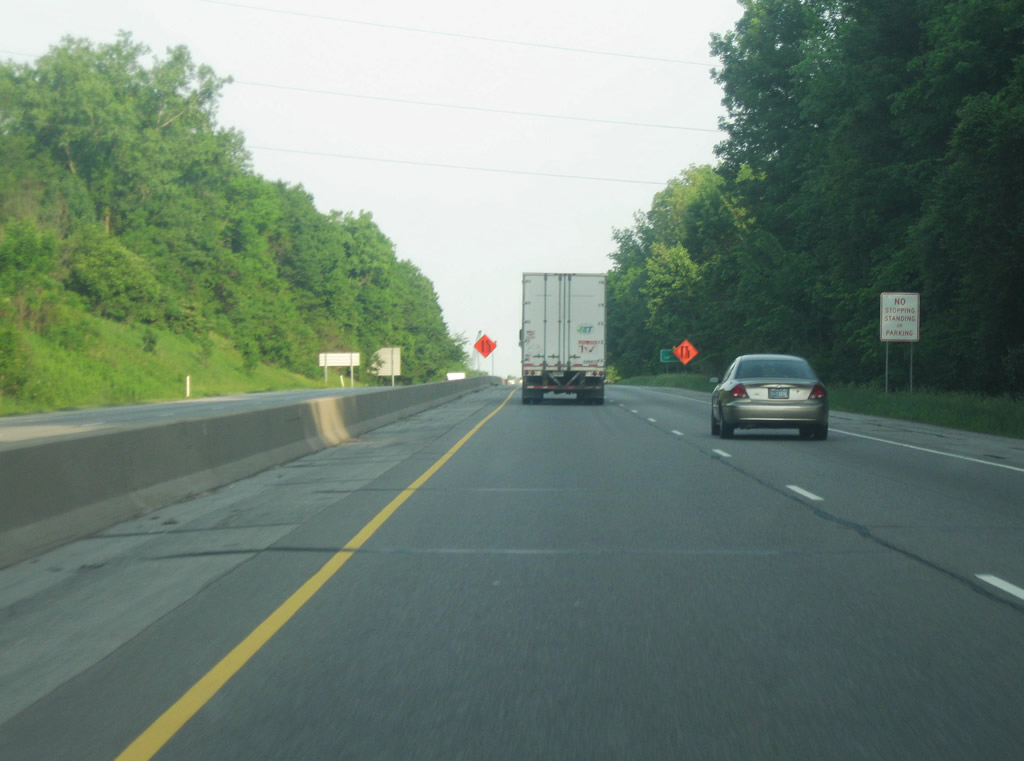
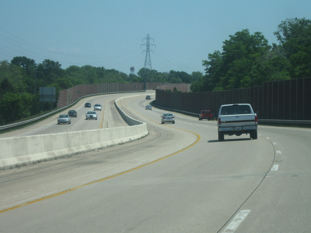
| South of the SR 23 interchange, the St. Joseph Valley Parkway (U.S. 20/U.S. 31) climbs a hill that represents the North-South Continental Divide boundary, which separates the Ohio (and thus Mississippi) River watershed from the Great Lakes (St. Lawrence River) watershed. 06/03/11 |
|
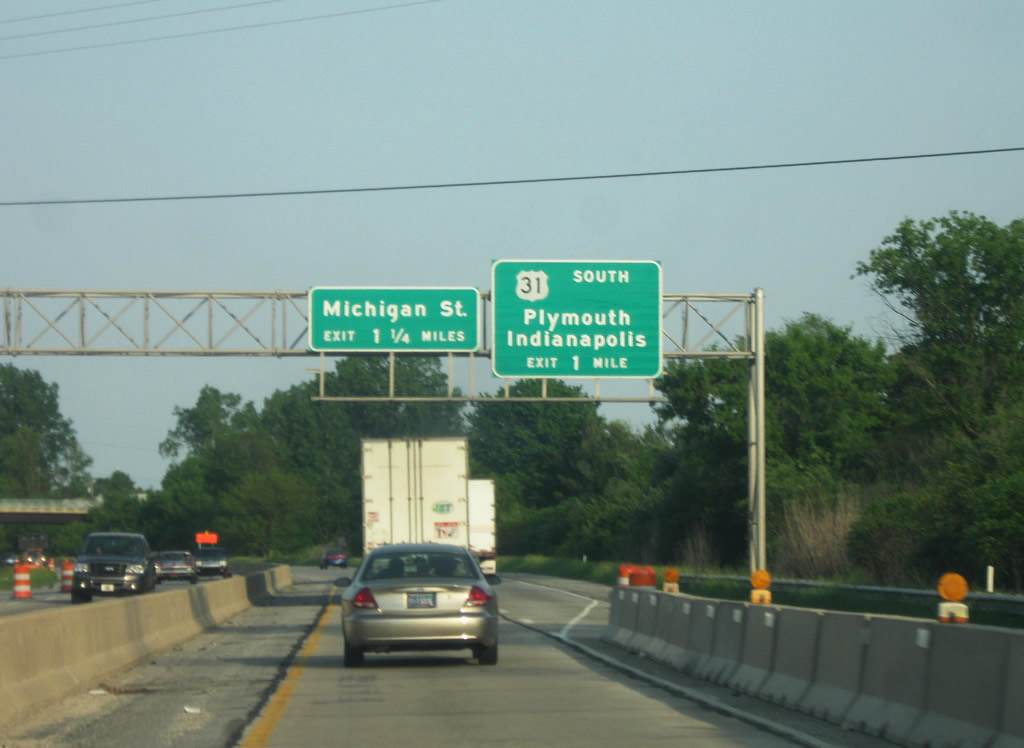
| Now coming up to the U.S. 31 South/Michigan Street interchange. Michigan Street represents the original U.S. 31 that ran up through Downtown South Bend as part of a one way pairing with Main Street (which carried U.S. 31 South). North of downtown, Michigan Street carries SR 933 up to the Michigan state line. There are several restaurants and shops located just north of the interchange at the intersection of Michigan Street and Ireland Road. 06/03/11 |
|
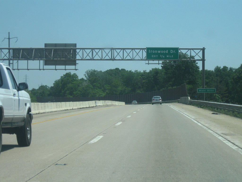
| U.S. 31 exits the St. Joseph Valley Parkway to continue its route south toward Lapaz, Plymouth, Kokomo, and Indianapolis. Plymouth is about 20 miles away with Indianapolis around 130 miles. U.S. 31 south of the Parkway is a four lane arterial into Marshall County before becoming a four lane expressway to Interstate 465 in Indianapolis. A new freeway segment of U.S. 31 from the Parkway south to U.S. 30 in Plymouth will be completed by 2014. From this point eastward, U.S. 20 becomes the sole highway in route to Mishawaka and Elkhart. 06/03/11 |
|
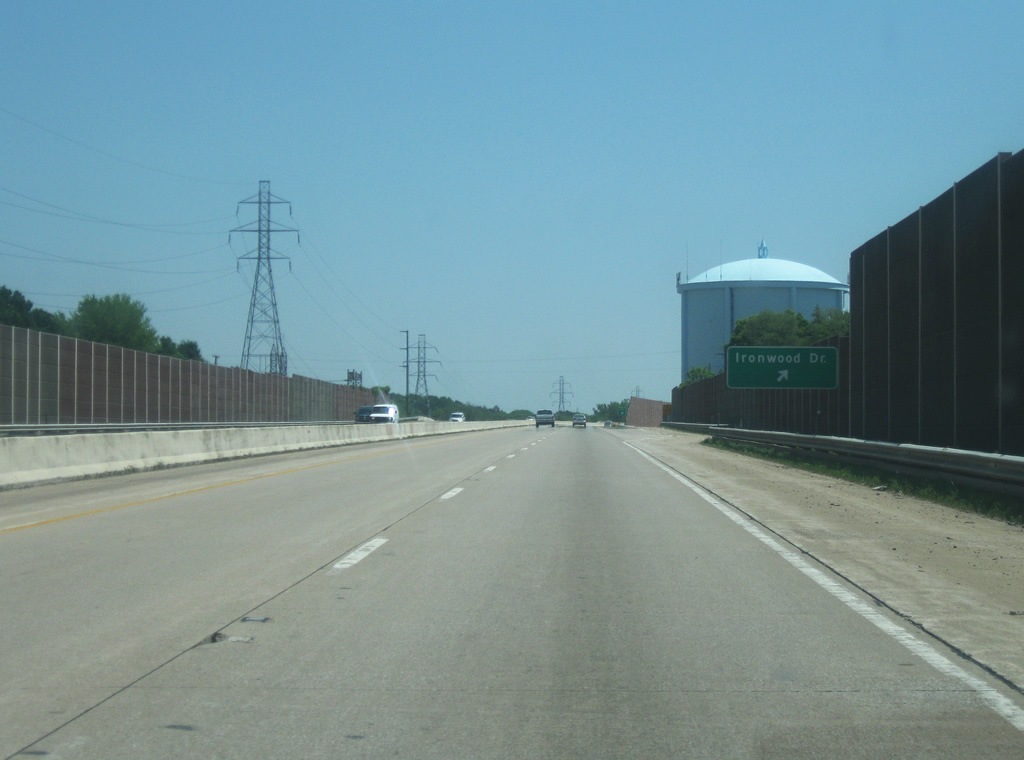
| East of the U.S. 31 South/Michigan Street interchange, the St. Joseph Valley Parkway (U.S. 20) enters a suburban part of southern South Bend. Ironwood Road is the next interchange at 3/4 miles. Note the transition to all concrete for the highway surface, indicating that this is the newer stretch of highway. 05/30/10 |
|
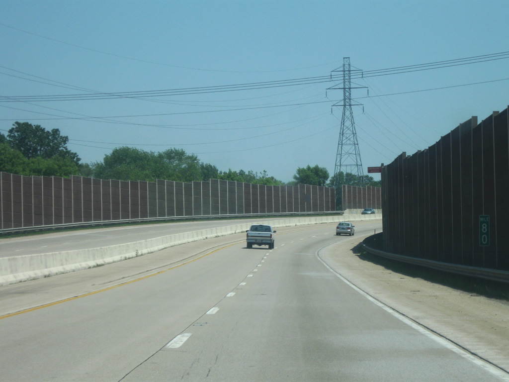
| Sound barrier walls abut the St. Joseph Valley Parkway (U.S. 20) from between the U.S. 31 South/Michigan Street and Ironwood Road interchanges. This is the only section of the highway that goes through a residential area, hence the walls. In the second picture, a mile marker is present for U.S. 20. Mile markers in general are not used along this highway because of the combined nature of the western half of the Parkway. 05/30/10 |
|
| Now at the Ironwood Road interchange, this is the only Single-Point Urban Interchange (SPUI) in Northern Indiana. Ironwood Road is a four lane arterial that crosses the eastern part of South Bend, providing access to Indiana University-South Bend and the University of Notre Dame. The St. Joseph County Fairgrounds can be accessed by taking Ironwood Road south. East of here, the Parkway links up with SR 331 at Bremen Highway and Elm Road/Capital Avenue before leaving St. Joseph County. 05/30/10 |
|
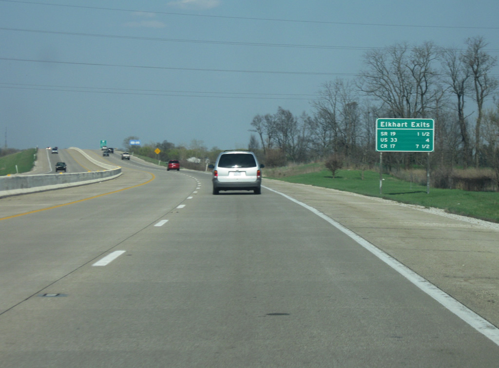
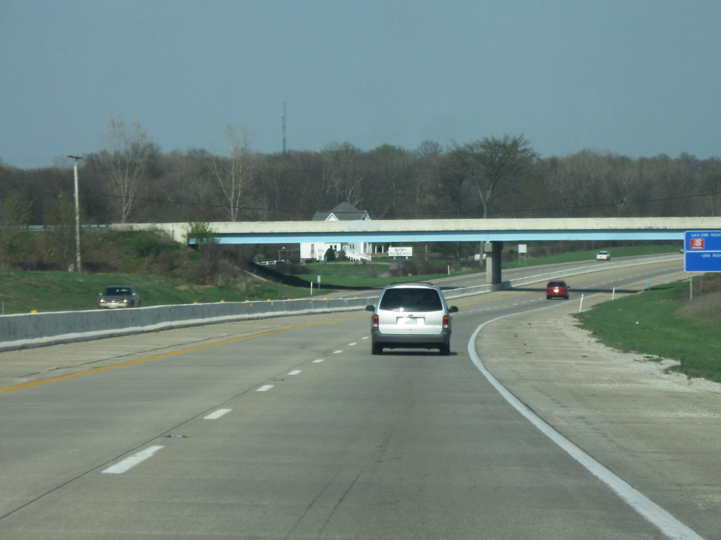
| Now in Elkhart County (population 197,559), home to Elkhart and Goshen and part of the Indiana Amish Country (along with adjacent LaGrange County). Elkhart (population 50.949) is an older industrial city that forms a core part of the Michiana area. The three interchanges serving Elkhart are with SR 17, U.S. 33, and County Road 17. In Elkhart County, the highway is also known as the Dean R. Mock Expressway, although the name is rarely used. 04/10/10 |
|
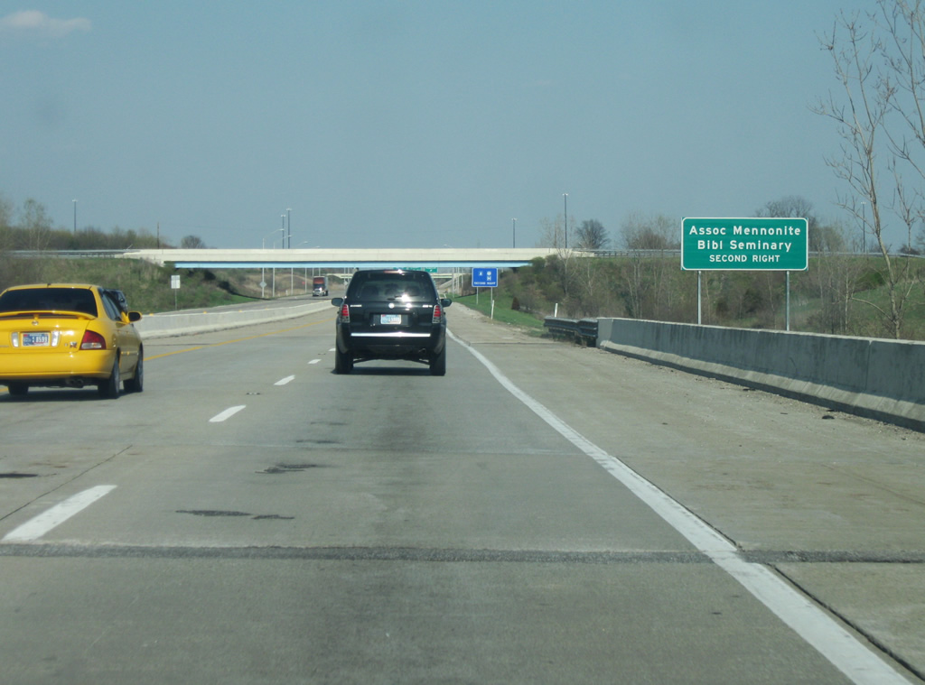
| The St. Joseph Valley Parkway (U.S. 20) angles to the northeast toward the interchange with SR 17, known as Nappanee Road in Elkhart. SR 19 is a 143 mile state highway that starts in Noblesville in Central Indiana and heads through Tipton, Peru, and Nappanee before heading through Elkhart. A sign in the second photo identifies the Associate Mennonite Bible Seminary in Elkhart. Why the word "bible" had to be abbreviated is unknown. 04/10/10 |
|
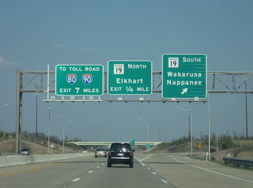
| The St. Joseph Valley Parkway (U.S. 20) at the SR 19 interchange. The first ramp heads to SR 19 south toward Wakarusa and Nappanee. Nappanee in southwestern Elkhart County is home to Amish Acres, a popular Amish attraction in the state. A loop ramp directs traffic northward on SR 19 to Nappanee Road. Utilizing Nappanee Road and Bristol Road, SR 19 bypasses Elkhart to the west and north before heading north toward the Michigan state line with an interchange at the Indiana Toll Road. Contrary to the sign, the Toll Road isn't seven miles away, but County Road 17 which meets the Toll Road is. 04/10/10 |
|
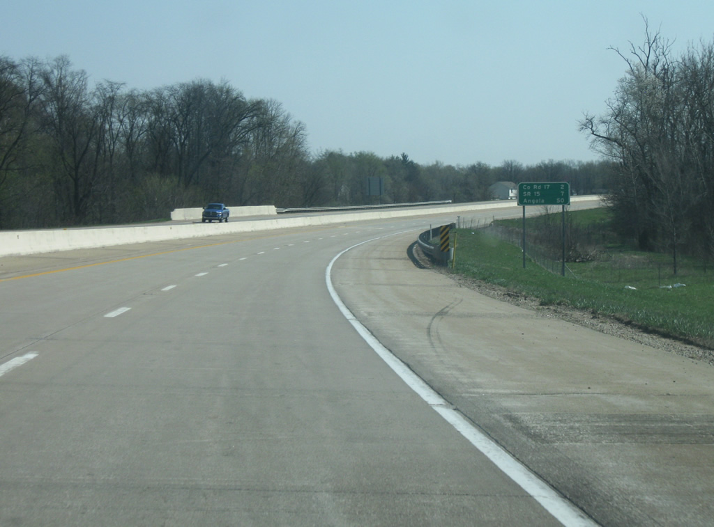
| East of the U.S. 33 South interchange, Elkhart County Road 17 is 2 miles away, as is the end of the St. Joseph Valley Parkway. SR 15 near Bristol is seven miles away with Angola (at the intersection with Interstate 69) at 50 miles away. 04/10/10 |
|
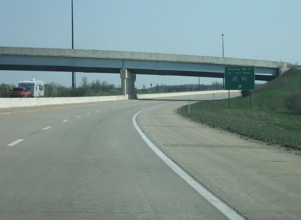
| The St. Joseph Valley Parkway approaches the interchange with Elkhart County Road 17. The highway still has an appearance of an urban freeway with the jersey barrier as we bypass the southeastern side of Elkhart. Ivy Tech Community College can be accessed via the County Road 17 interchange. Numerous industrial parks are also accessed via County Road 17 between the St. Joseph Valley Parkway (U.S. 20) and Indiana Toll Road. 04/10/10 |
|
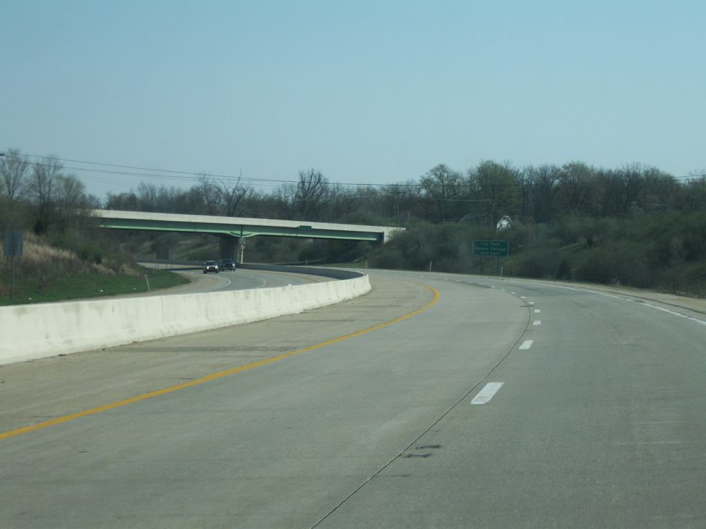
| The St. Joseph Valley Parkway now reaches its final interchange with Elkhart County Road 17. County Road 17 is a four lane arterial that was built to connect the St. Joseph Valley Parkway (U.S. 20) with the Indiana Toll Road (Interstate 80/Interstate 90). The four lane road continues south and connects with U.S. 33 in between Elkhart and Goshen and will be constructed along the western side of Goshen, the county seat of Elkhart County in the future. 04/10/10 |
|
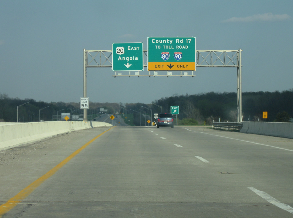
| On the entrance ramp from eastbound Toledo Road (old U.S. 20) to U.S. 20, another exit ramp directs Toledo Road traffic to Elkhart County Road 17. U.S. 20 continues east to Angola as the St. Joseph Parkway comes to an end. 04/10/10 |
|
| The St. Joseph Valley Parkway comes to an end as the highway reverts to two lanes as U.S. 20. The stretch of U.S. 20 from Elkhart County Road 17 to SR 15 is slated on being expanded to four lanes by 2014. From this point, the highway heads toward Middlebury, Shipshewana, LaGrange, and Angola before leaving at the Ohio border. 04/10/10 |
Page Updated 01-24-2012.


 South
South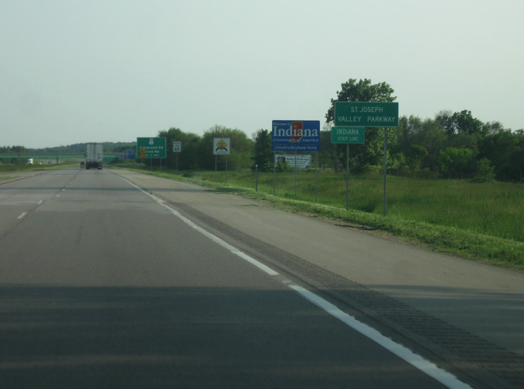
 East
East