
U.S. 40 stretches across much of Maryland, traveling along portions of the original National Road east to Baltimore and along the Pulaski Highway east from Baltimore to Hares Corner, Delaware. U.S. 40 enters the Free State at Strawn and leaves it east of Elkton.
U.S. 40 Maryland Guides
U.S. 40 travels 3.74 miles southeast from Pennsylvania along National Pike to a cloverleaf interchange joining Interstate 68 and U.S. 219. U.S. 40 combines with I-68 east to Cumberland and Interstate 70 at Hancock. I-70/U.S. 40 overlap east from Hancock to Left Exit 9 near Indian Springs. U.S. 40 (National Pike) shifts north, traveling independent of I-70 east into Hagerstown.
Through Downtown Hagerstown, U.S. 40 partitions into a couplet along Washington Street east and Franklin Street west. Turning southeast along National Pike, U.S. 40 leaves the city at a cloverleaf interchange (Exit 32) with Interstate 70. U.S. 40 parallels I-70 south to South Mountain, where the two switch sides between Bartman Hill and Wolfsville Crossing.
Continuing southeast into Frederick, U.S. 40 enters the city along Patrick Street, a heavily developed commercial arterial tying into a cloverleaf interchange with the freeway along U.S. 15. U.S. 15/40 briefly overlap south to the exchange at Jefferson Street. U.S. 15 branches southwest from there alongside U.S. 340 while U.S. 40 remains southeast along a freeway connecting with I-70/270.
Interstate 70 and U.S. 40 again combine east from I-270 at Frederick to Exit 82 beyond West Friendship. U.S. 40 separates from the freeway southward along Baltimore National Pike to Ellicott City. Continuing into Baltimore County, Baltimore National Pike leads to Catonsville and into the city of Baltimore between Ten Hills and West Hills.
U.S. 40 enters Baltimore along Edmondson Avenue east ahead of Hunting Ridge. The six lane boulevard leads U.S. 40 east to Franklin Street beyond Gwynn Falls. U.S. 40 follows Franklin Street to a couplet with Mulberry Street. A below grade freeway originally built for Interstate 170 takes U.S. 40 east between Franklin and Mulberry Streets from Pulaski Street to Greene Street (MD 295) outside Downtown Baltimore. The couplet of Franklin/Mulberry Streets concludes at the Orleans Street Viaduct.
The Orleans Street Viaduct spans I-83 (Jones Falls Expressway) and several streets east to Ensor and Gay Streets at the Penn - Fallsway neighborhood. U.S. 40 continues at-grade along Orleans Street to Johns Hopkins Hospital, McElderry Park and Pulaski Highway at Elwood Park.
The remainder of U.S. 40 from east Baltimore to the Delaware state line follows Pulaski Highway. An older commercial arterial, Pulaski Highway enters Baltimore County at Rosedale and proceeds northeast to Middle River. Paralleling Interstate 95 to the south, U.S. 40 continues east into Harford County ahead of Joppatowne and Aberdeen.
Crossing the Thomas J. Hatem Memorial Bridge, U.S. 40 spans the Susquehanna River east from Havre De Grace to Perryville in Cecil County. Tolls are collected electronically in the eastbound direction of the through arch bridge. Beyond Perrysville, U.S. 40 (Pulaski Highway) passes north of Charlestown en route to North East and the county seat of Elkton.
U.S. 40 Cecil County Average Annual Traffic (AADT)
- 28,168 - Thomas J. Hatem Memorial Bridge
- 25,151 - MD 222 to MD 272
- 32,621 - MD 272 to MD 279
- 33,011 - MD 279 to MD 213
- 30,431 - MD 213 to MD 781
- 29,051 - MD 781 to Delaware state line
Source: Maryland Department of Transportation (MDOT) - 2016 Traffic Volume Maps by County
U.S. 40 Truck - Baltimore
U.S. 40 Truck serves in-city commercial traffic using the US route across Baltimore. The truck route bypasses U.S. 40 alignments along the couplet of Franklin / Mulberry Streets and Orleans Street between Edmondson Avenue and Pulaski Highway. Although sparsely signed, U.S. 40 Truck follows the following route from west to east:
- Hilton Parkway north to North Avenue
- North Avenue east to Belair Road
- Belair Road north to Erdman Avenue
- Erdman Avenue south to the Pulaski Highway
U.S. 1 overlaps with U.S. 40 Truck both on North Avenue between Monroe Street and Belair Road and along Belair Road between North Avenue and Erdman Avenue. U.S. 40 Truck also combines with MD 151 on Erdman Avenue to an interchange with Pulaski Highway at Interstate 895 (Harbor Tunnel Thruway). A companion U.S. 1 Truck route follows U.S. 40 Truck along Hilton Parkway and North Avenue between U.S. 40 and U.S. 1 respectively. U.S. 1 Truck continues south of Edmondson Avenue via Hilton Street to Caton Avenue and U.S. 1 (Wilkens Avenue). U.S. 1 Truck is signed even more sporadically than U.S. 40 Truck.
 scenes scenes |
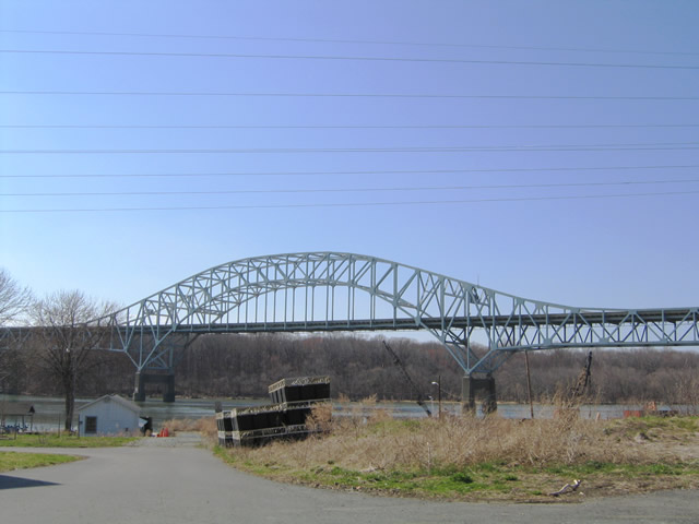 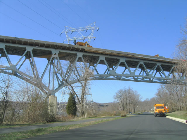 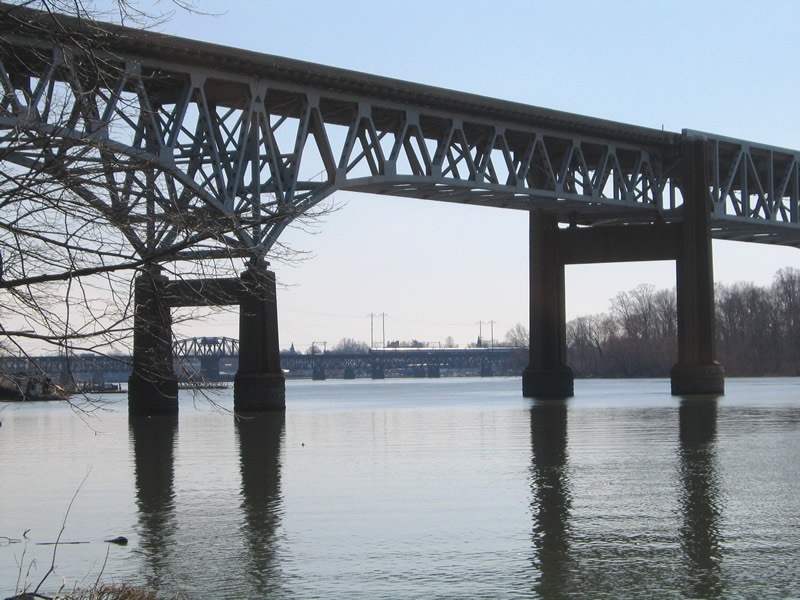  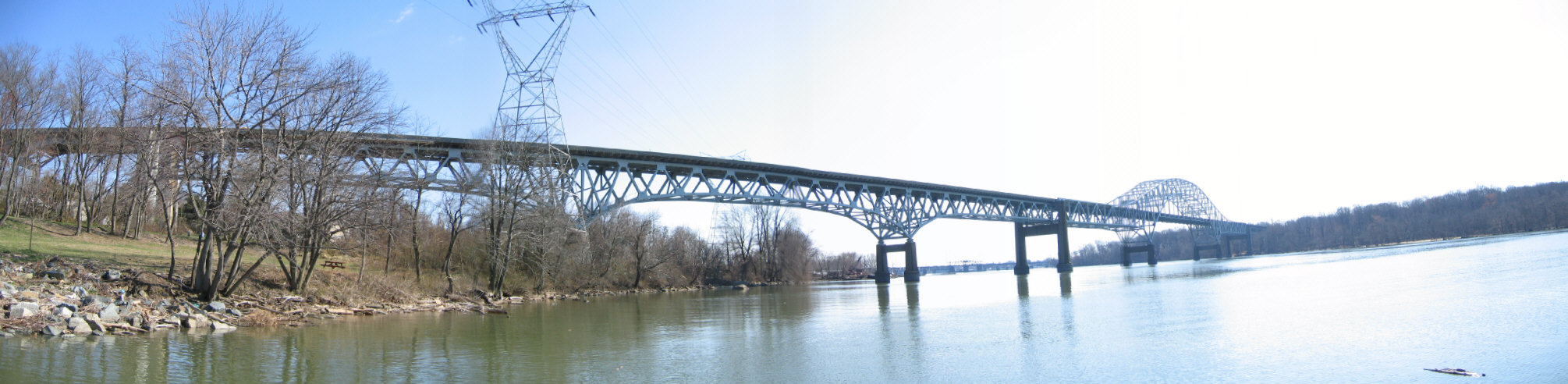 | Ground level views of the Thomas J. Hatem Memorial Bridge as seen from Frenchtown Road in Perryville. Frenchtown Road parallels the Susquehanna River between MD 7 (Broad Street) and Mt. Ararat Farm Road outside of Port Deposit and MD 222 (Bainbridge Road). A boat launch site lies along the river just north of the U.S. 40 cantilever bridge. Parallel to the span on the southside is the AMTRAK Northeast Corridor bridge. 03/28/04 |
 | Northbound Aisquith Street at U.S. 40 (Orleans Street) in the city of Baltimore. U.S. 40 travels east to Johns Hopkins Hospital and west onto the Orleans Street Viaduct from here. 06/27/10 |
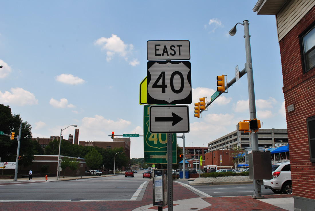 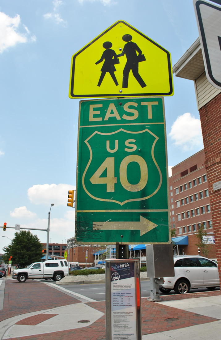 | Caroline Street northbound at U.S. 40 (Orleans Street) by Johns Hopkins Hospital in Baltimore. Posted at this intersection is a modern U.S. 40 trailblazer and an old city-installed assembly both pointing toward eastbound Orleans Street. 06/20/12 |
Photo Credits:
03/28/04, 06/27/10, 06/20/12 by AARoads
Connect with:
Interstate 68 - National Freeway
Interstate 70
Interstate 81
Interstate 270
Interstate 695 - Baltimore Beltway
U.S. 1
U.S. 15
Route 7
Route 213
Route 222
Page Updated 11-04-2022.