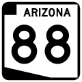
Known as Apache Trail, Arizona State Route 88 is one of the oldest routes in the state highway system. The route was also part of the original Ocean to Ocean Highway until 1922.
The original route was constructed in 1904 as a wagon road to provide access to Roosevelt Dam during construction of the dam. Expansion work in the 1920s widened the road to accomodate automobiles. A final reroute taking the road around Canyon Lake and Apache Lake was completed by 1936.
The road remains in the same condition as it was in 1936. Due to the steep grades, the road was never eligible for the federal aid system, so it has always remained a state highway. While portions of the road are paved, the majority is covered either by decaying asphalt or is a dirt road.
SR 88 is designated as the Apache Trail Historic Road. The highway is a favorite weekend getaway of Phoenix residents. The route however navigates along a narrow and winding course with steep grades and sheer dropoffs. While it is a safe road, it is very challenging to drivers. Several sections of Fish Creek Hill have barely enough room for two cars to pass. The section from the Fish Creek overlook to Apache Dam is restricted to trailers of less than 40 feet, and RVs are not recommended on the route.
Special thanks to Thomas Gunther for his assistance with the photography of Apache Trail.
|
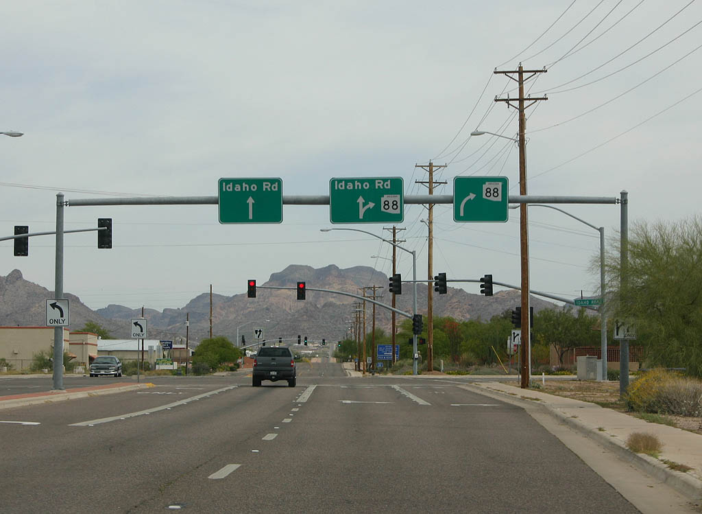
| When U.S. 60 was rerealigned onto former SR 360 in 1992, SR 88 was rerouted onto Idaho Road through Apache Junction in 1992. 04/22/07 |
|
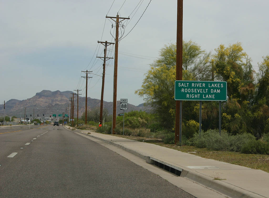
| SR 88 shifts northeast onto Apache Trail from Idaho Road north in the city of Apache Junction. 04/22/07 |
|
| One of the few reassurance markers for SR 88 posted along Apache Trail eastbound. 04/22/07 |
|
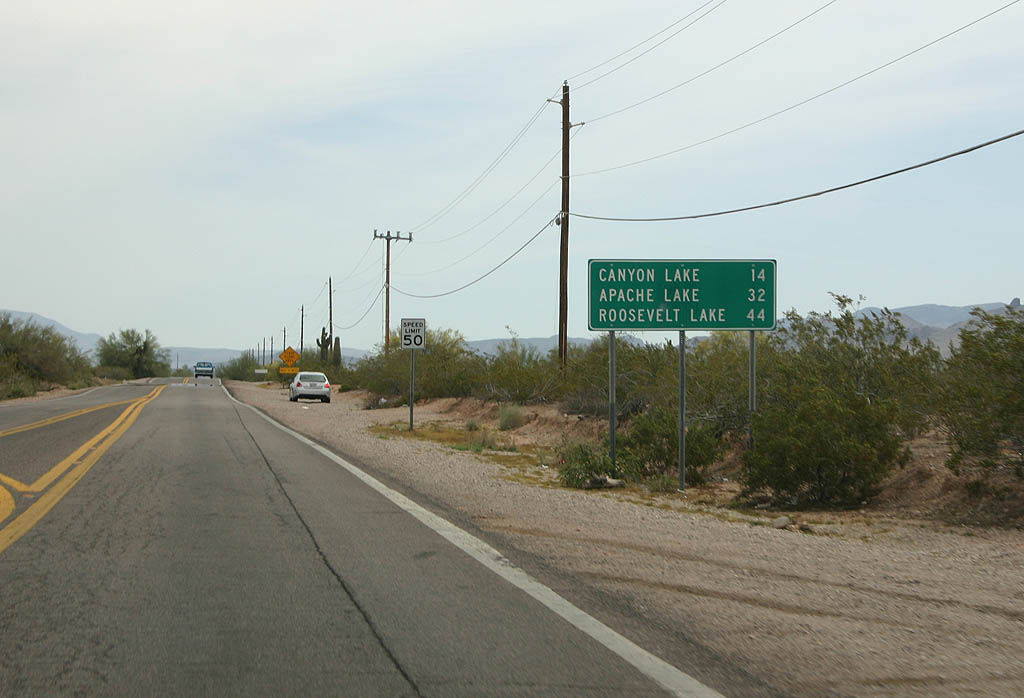
| Distance sign to Canyon Lake, Apache Lake and Roosevelt Lake. Apache Trail parallels the Salt River, passing all three lakes. 04/22/07 |
|
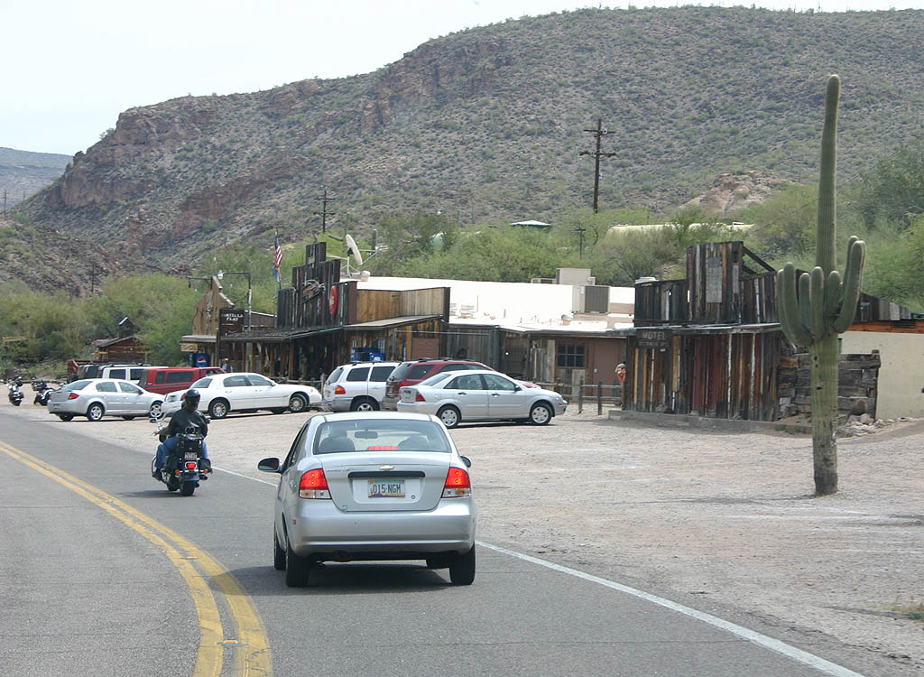
| SR 88 passes the ghost town of Goldfield. Goldfield was founded in 1892 following a gold strike, and thrived for five years before dying off once the mines closed.1 04/22/07 |
|
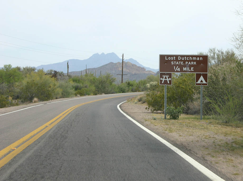
| SR 88 continues northeast to Lost Dutchman State Park. Legend has it that there was a great gold strike in the 1840s, but it ended with an Apache ambush. A Dutchman supposedly found the mine in the 1870s, but the location died with him. The mine has never successfully been located since.2 04/22/07 |
|
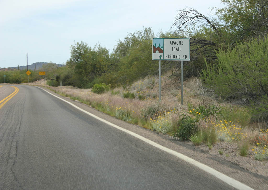
| Apache Trail is a designated Arizona Scenic Byway. The route was established as a scenic road in 1986.3 04/22/07 |
|
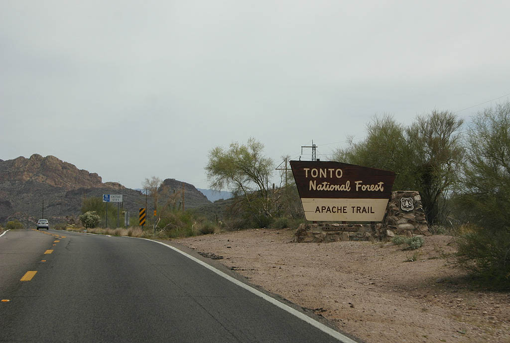
| Apache Trail leads SR 88 east into Tonto National Forest. 04/22/07 |
|
| Distance sign to Canyon Lake, Tortilla Flat and Roosevelt
(which lies on SR 188). 04/22/07 |
|
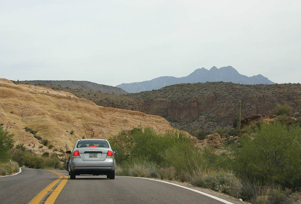
| Entering the Superstition Mountains, SR 88 makes a series of S-curves through the terrain. 04/22/07 |
|
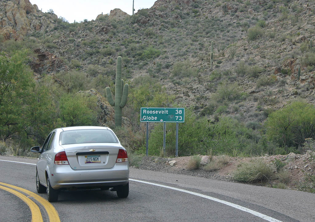
| Distance sign to Roosevelt (38 miles, on SR 188)
and Globe (73 miles, on U.S. 60). 04/22/07 |
|
| Apache Trail winds through Apache Gap then descends towards Canyon Lake. 04/22/07 |
|
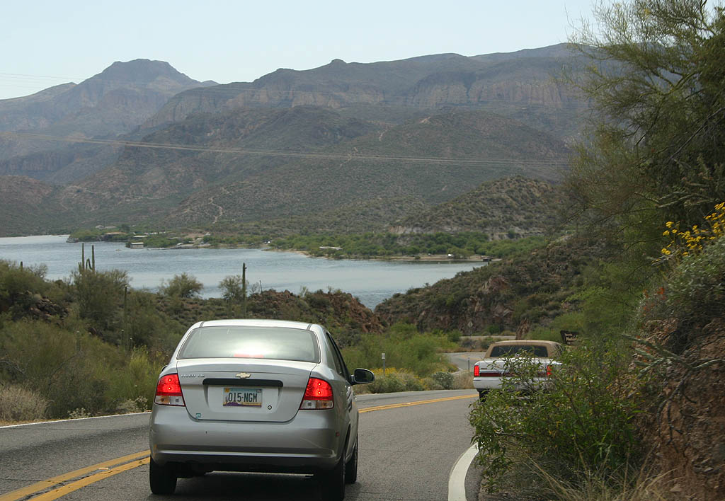
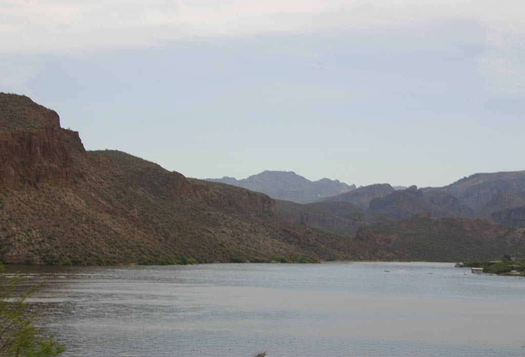
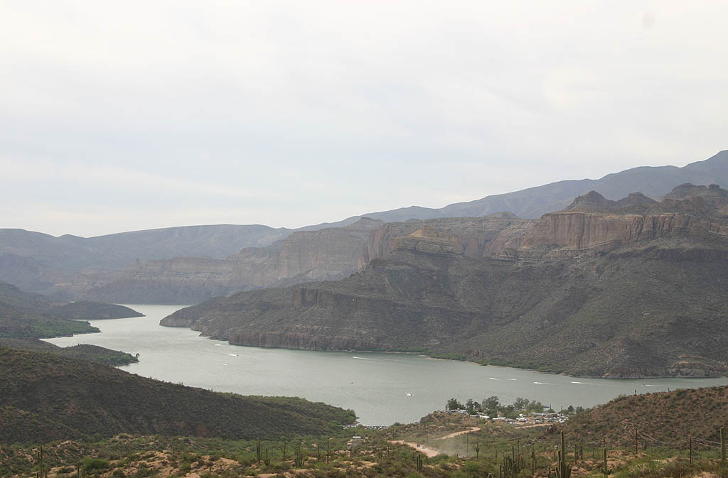
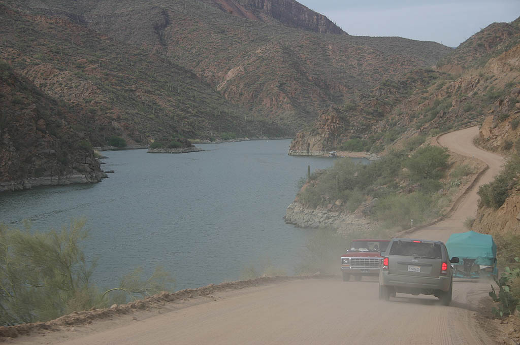
| SR 88 lowers through a short canyon to parallel the shoreline of Canyon Lake. Prior to construction of Canyon Lake, the route previously paralleled the river. 04/22/07 |
|
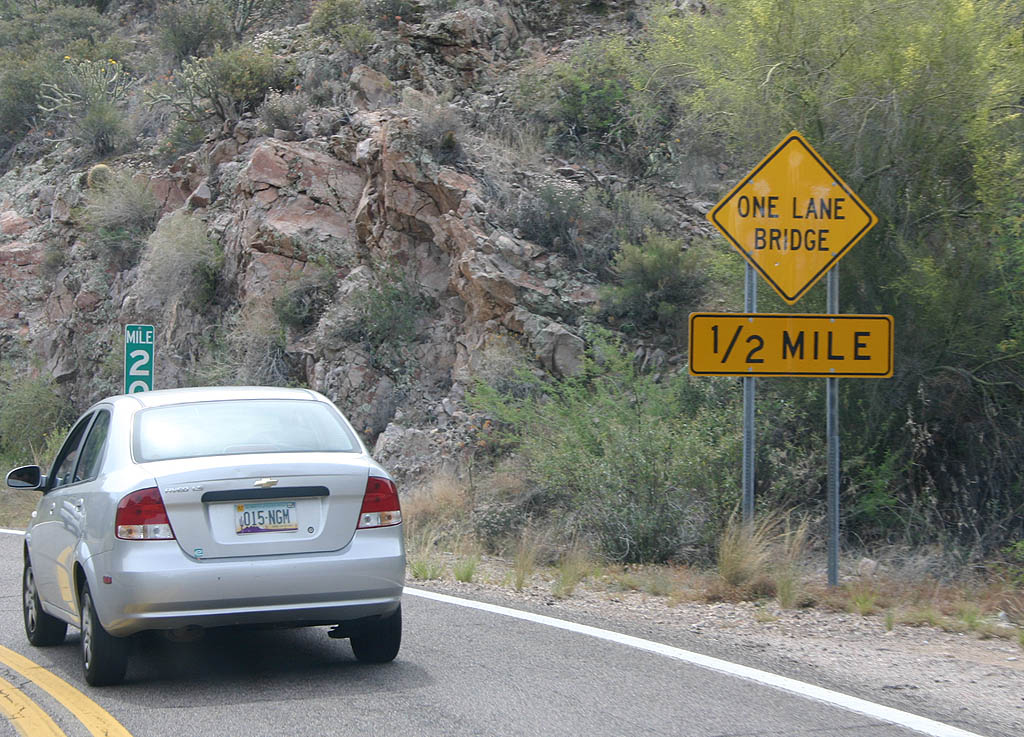
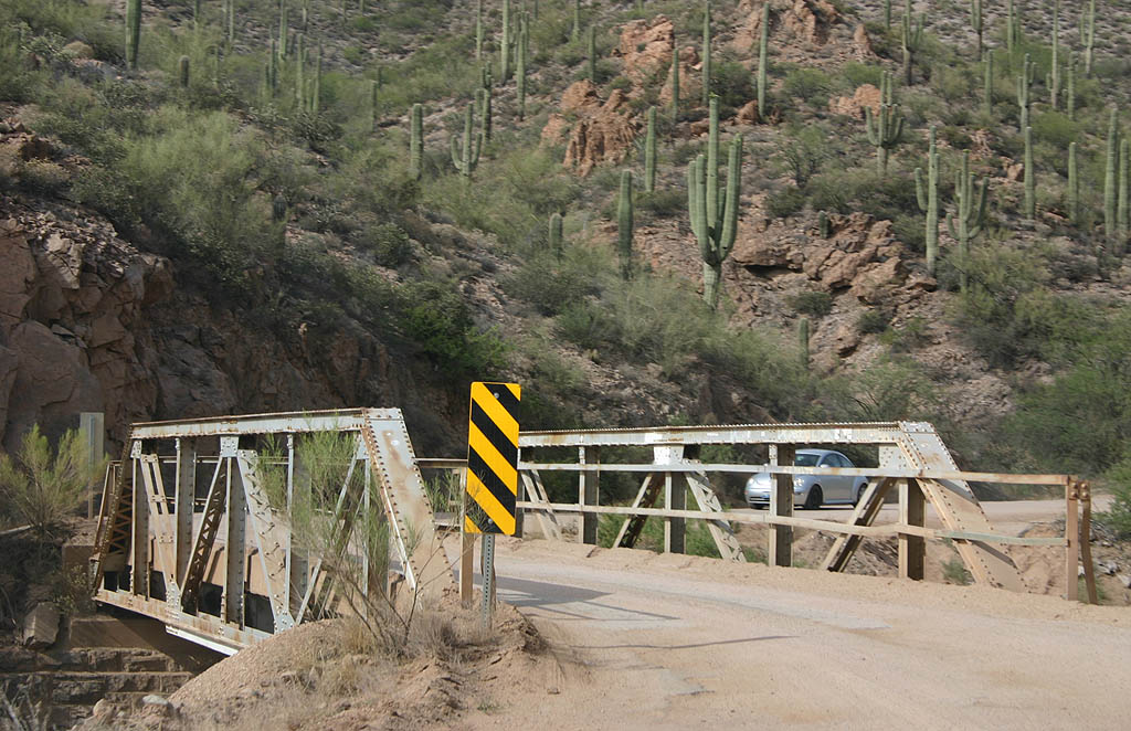
| Advance warning for the first of many one-lane bridges
along SR 88. All of these bridges date back to the
1930s along the route. 04/22/07 |
|
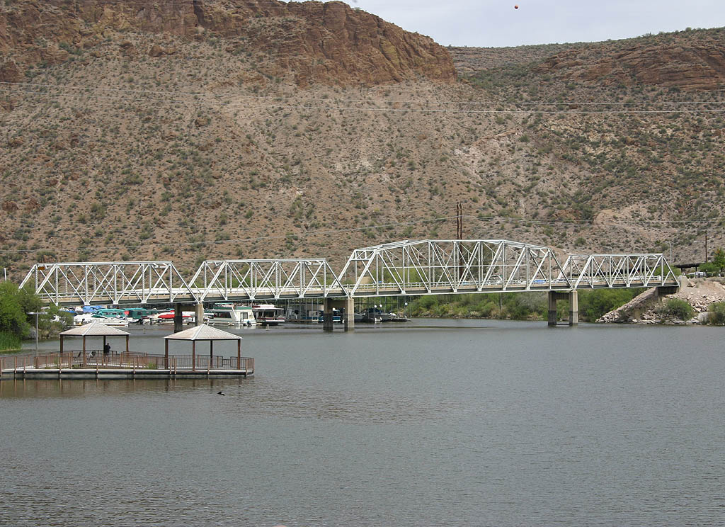
| Completed in 1925, waters in Canyon Lake are impounded by Mormon Flat Dam. Canyon Lake is 142 feet deep at the dam, with a maximum water elevation of 1660 feet MSL. 04/22/07 |
|
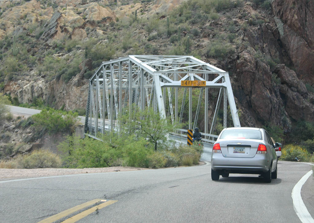
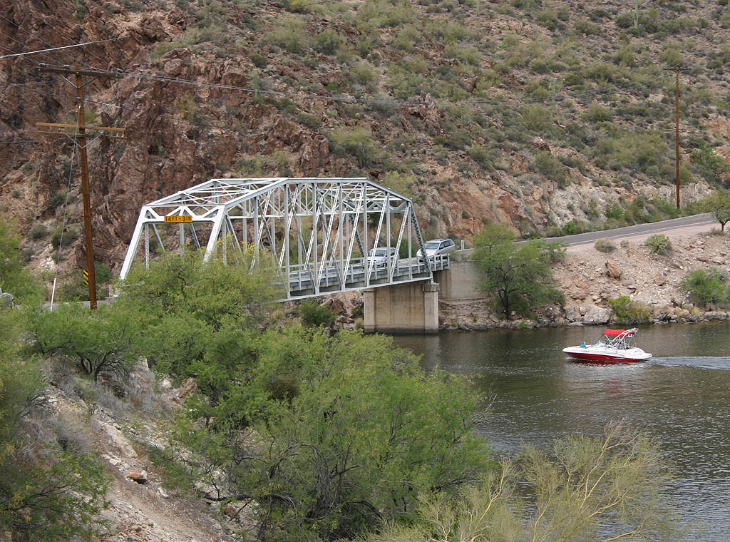
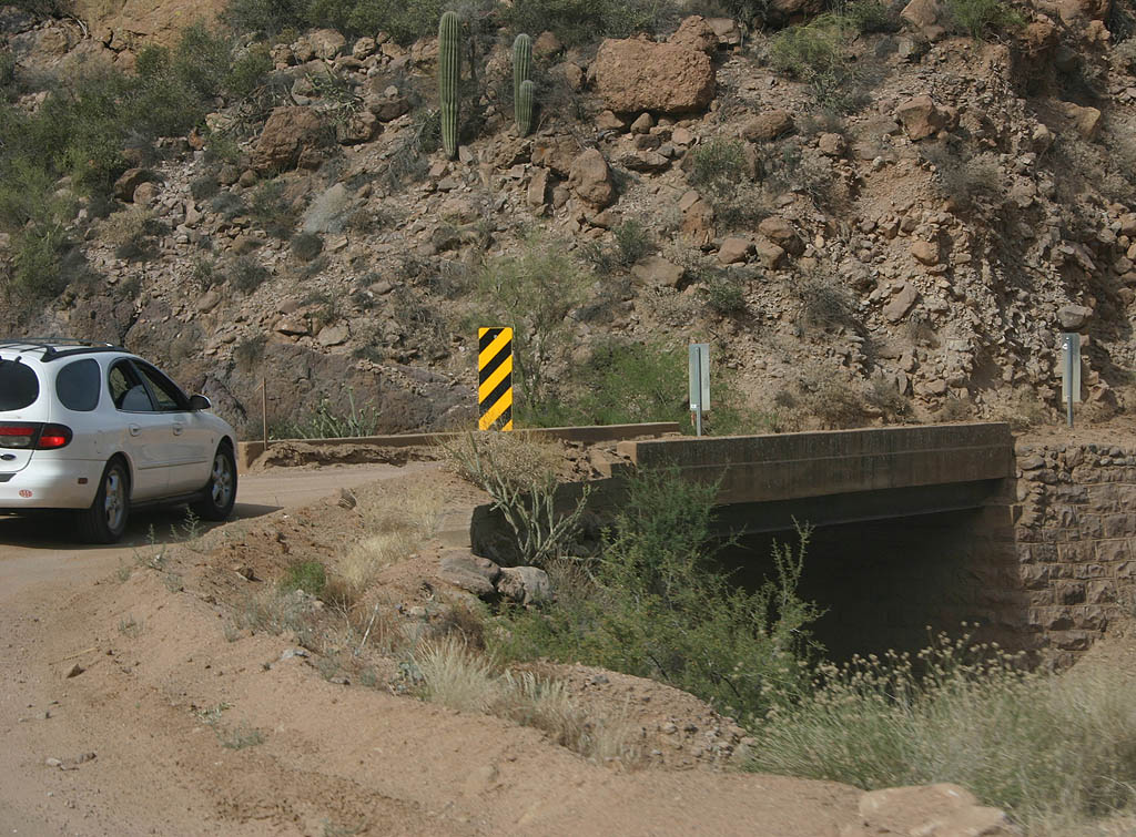
| The first single lane bridge along SR 88 crosses First Water Creek. Completed in 1937, this bridge has a corrugated steel deck. 04/22/07 |
|
| Looking west back at the span across First Water Creek. 04/22/07 |
|
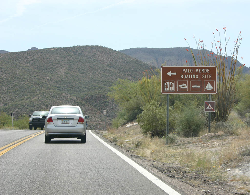
| SR 88 east at the road to the Palo Verde Boating Site on Canyon Lake. 04/22/07 |
|
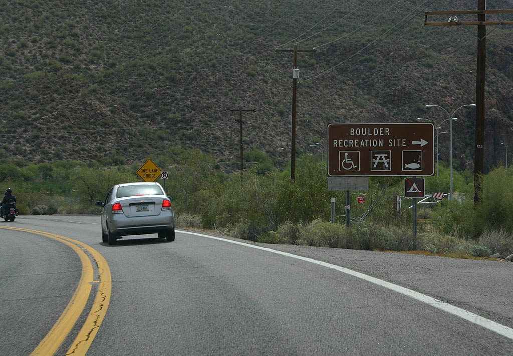
| The Boulder Recreation site lies along Boulder Creek, which flows into Canyon Lake. The recreation site includes a picnic area and is popular with fishing. 04/22/07 |
|
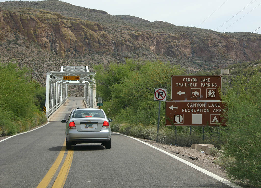
| An access road to the Canyon Lake Trailhead and Canyon Lake recreation area precedes the Boulder Creek Bridge. 04/22/07 |
|
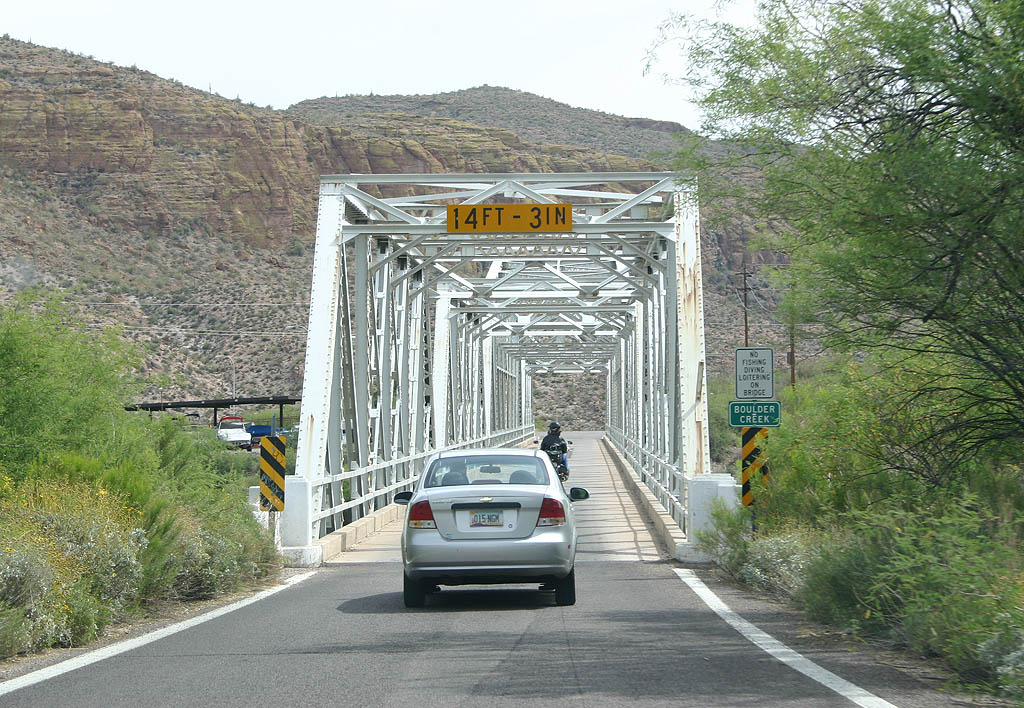
| 488 feet in length, the Boulder Creek Bridge was completed in 1937. 04/22/07 |
|
| Accommodating a single of traffic, the Boulder Creek bridge has a concrete deck. 04/22/07 |
|
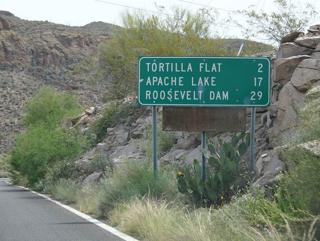
| Distance sign to Tortilla Flat, Apache Lake and Roosevelt
Dam. 04/22/07 |
|
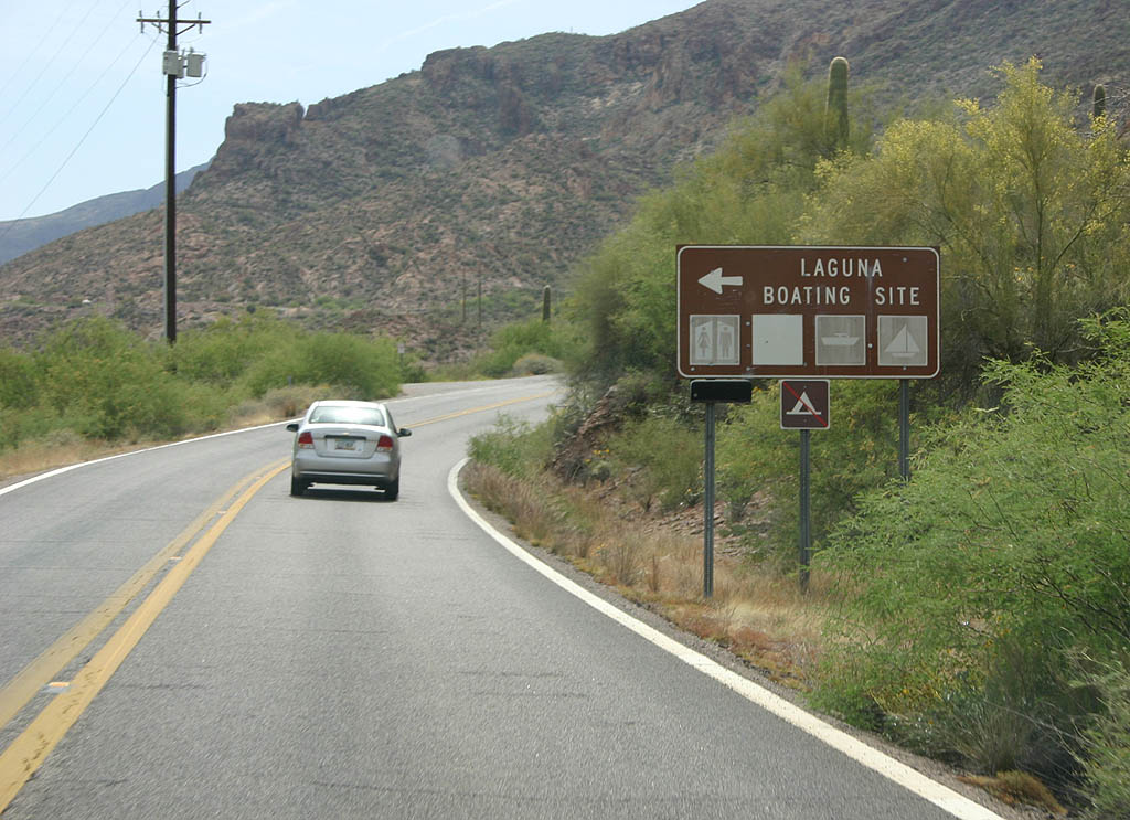
| The Laguna Boating Site is the last boat ramp located along Canyon Lake. Beyond this point, SR 88 diverges from the river toward Tortilla Flat. 04/22/07 |
|
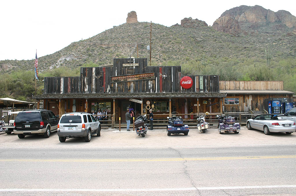
| Tortilla Flat is located along Tortilla Creek. Established in the 1860s, the town went through several boom and bust periods. 04/22/07 |
|
| With a population of just 6, Tortilla Flat is a popular day trip from Phoenix. The town burned down in a fire in 1987, but was rebuilt from donations by loyal patrons. Attractions include the popular Superstition Saloon, with walls covered by dollar bills. A shop next door serves Prickly Pear ice cream. 04/22/07 |
|
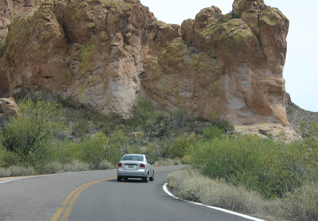
| Curving away from Tortilla Creek, SR 88 passes some articulate rock formations as the route climbs the side of the canyon. 04/22/07 |
|
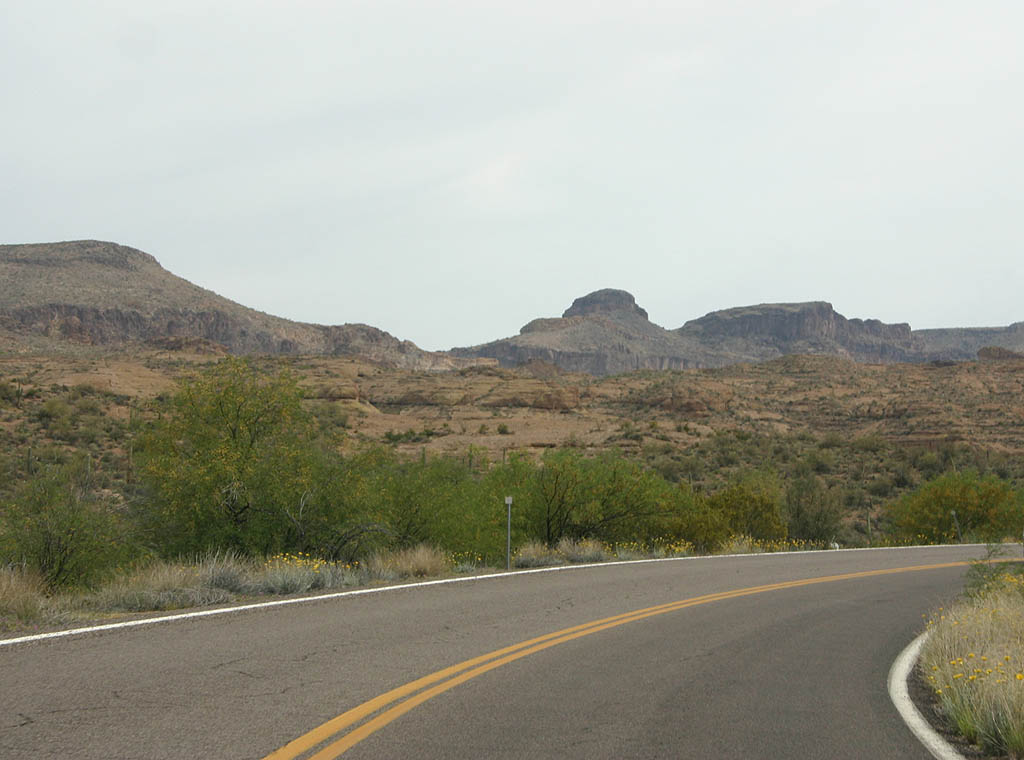
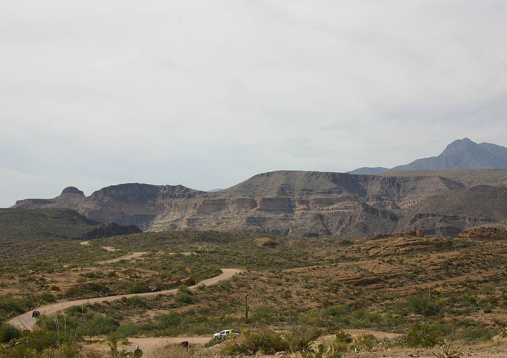
| Scenic views of Black Cross Butte and Coronado Mesa along SR 88 as it runs along Mesquite Creek. 04/22/07 |
|
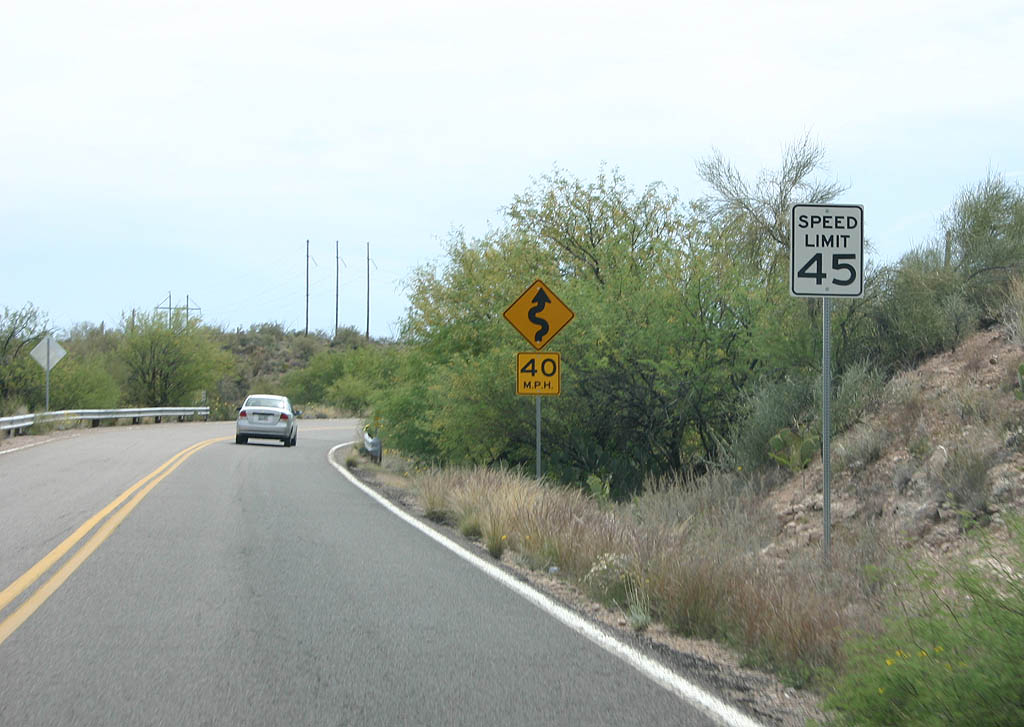
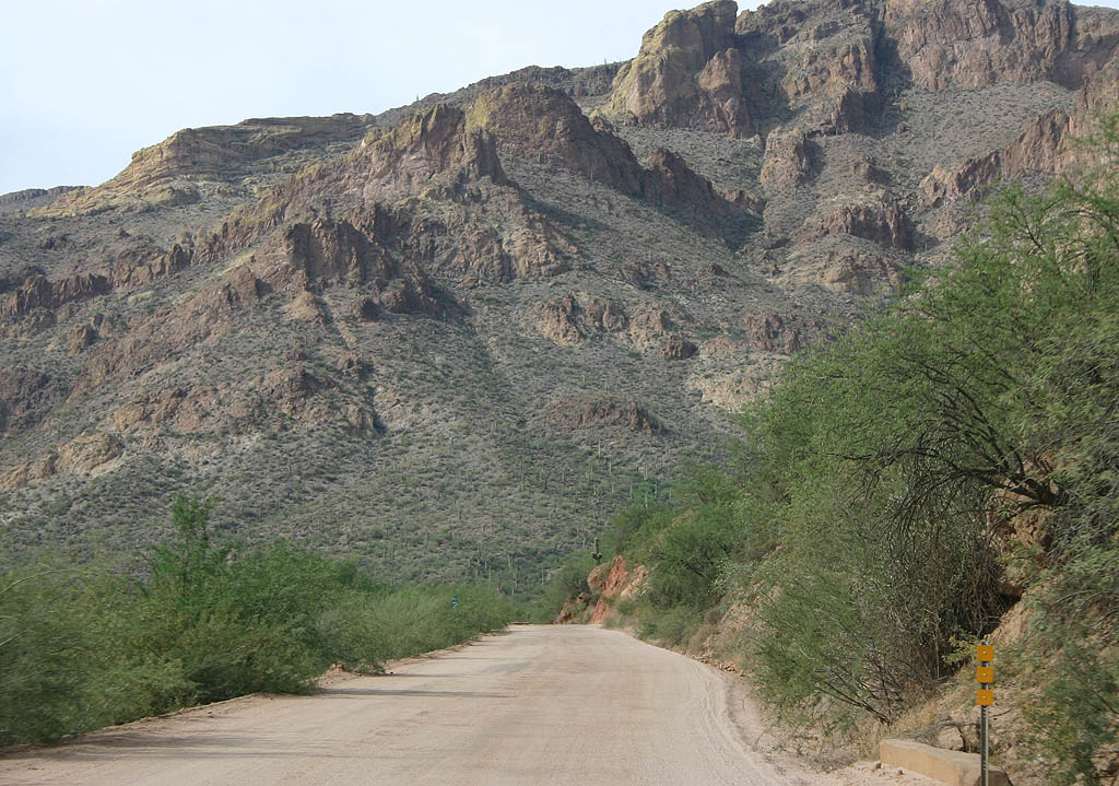
| SR 88 follows the ridgeline above Mesquite Creek for a distance. The 45 MPH speed limit is the highest along Apache Trail. The majority of the route is posted at 25 MPH or less. 04/22/07 |
|
| This reassurance marker is the last one seen eastbound. 04/22/07 |
|
| Apache Trail curves east by Fish Creek Hill. 04/22/07 |
|
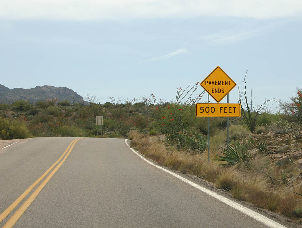
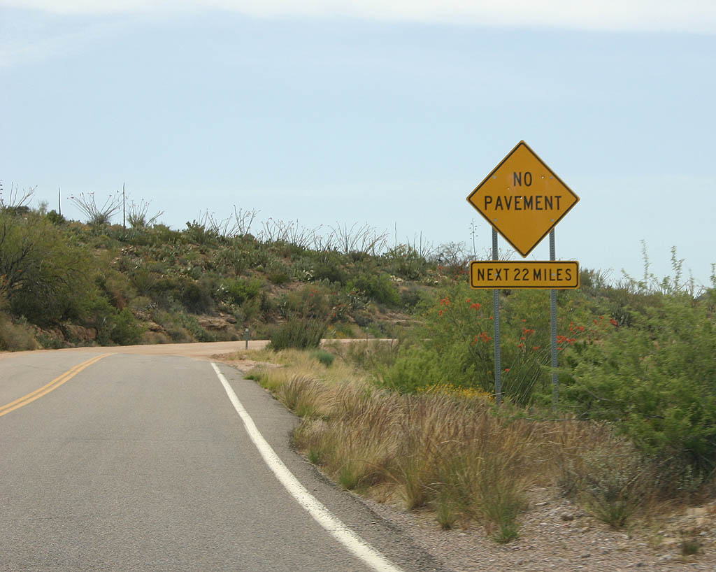
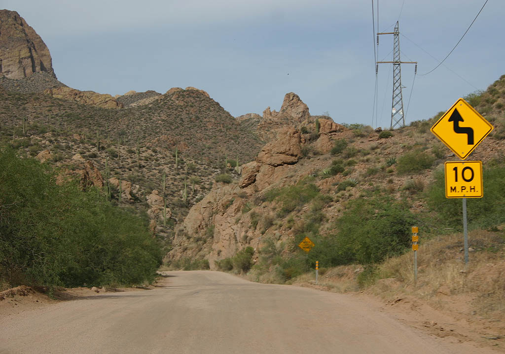
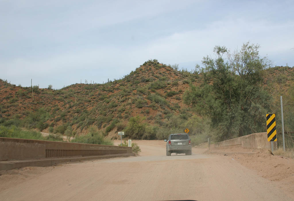
| Advance warning for the end of pavement along Apache Trail. The state route transitions to a dirt road In 500 feet. 04/22/07 |
|
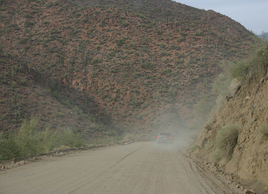
| 22 of the remaining 23 miles of SR 88 are gravel and/or dirt road. The route is unpaved until Roosevelt Dam. 04/22/07 |
|
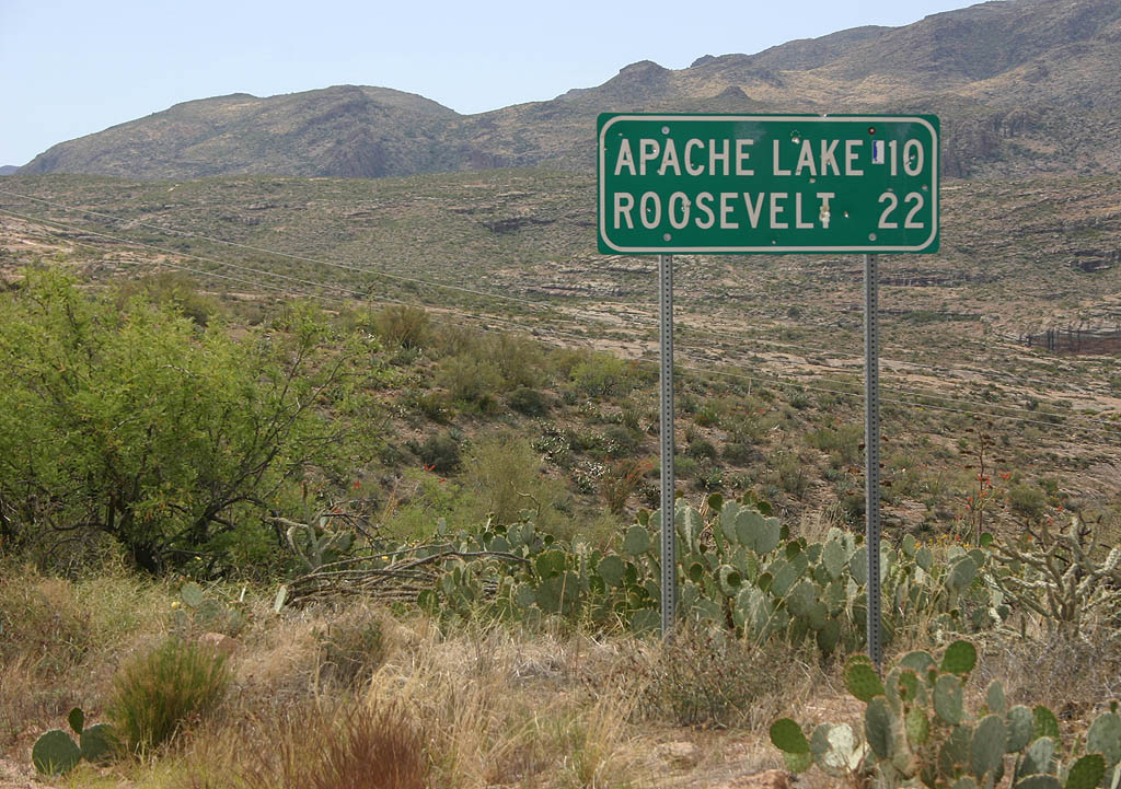
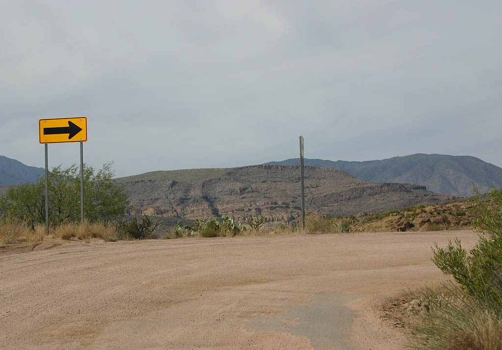
| Distance sign to Apache Lake (10 miles) and Roosevelt (22 miles). The reference to Roosevelt refers to the dam and not the census designated place. 04/22/07 |
|
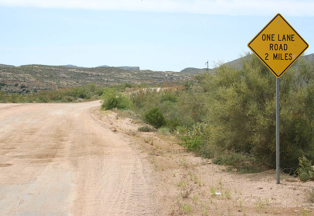
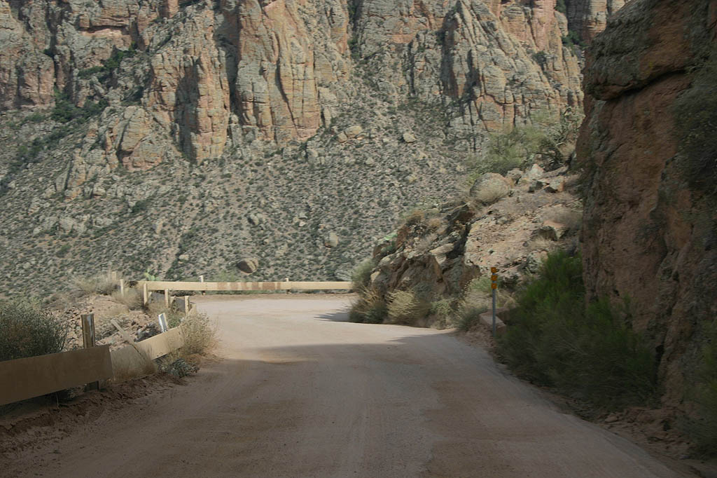
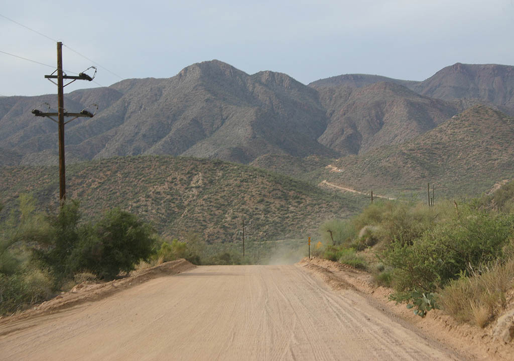
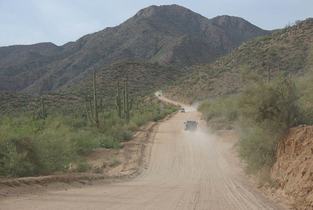
| The first few miles of the dirt road are covered by decaying asphalt, and the road is in good condition. It is still wide enough for two lanes, but in two miles, this ends and the road reduces to a single lane for the most part. 04/22/07 |
|
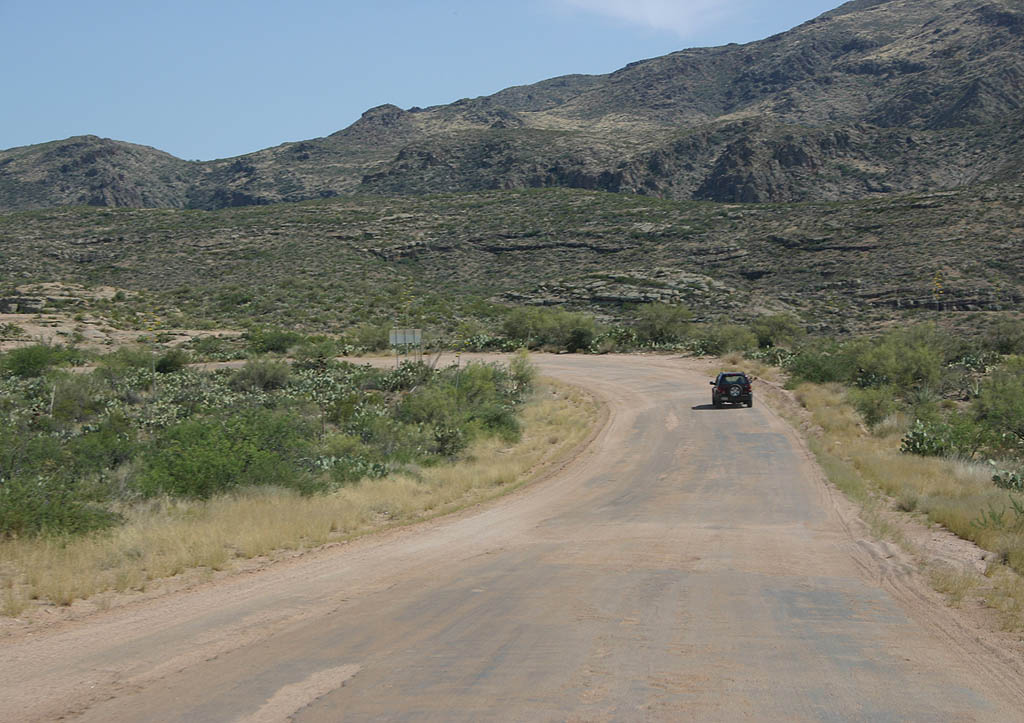
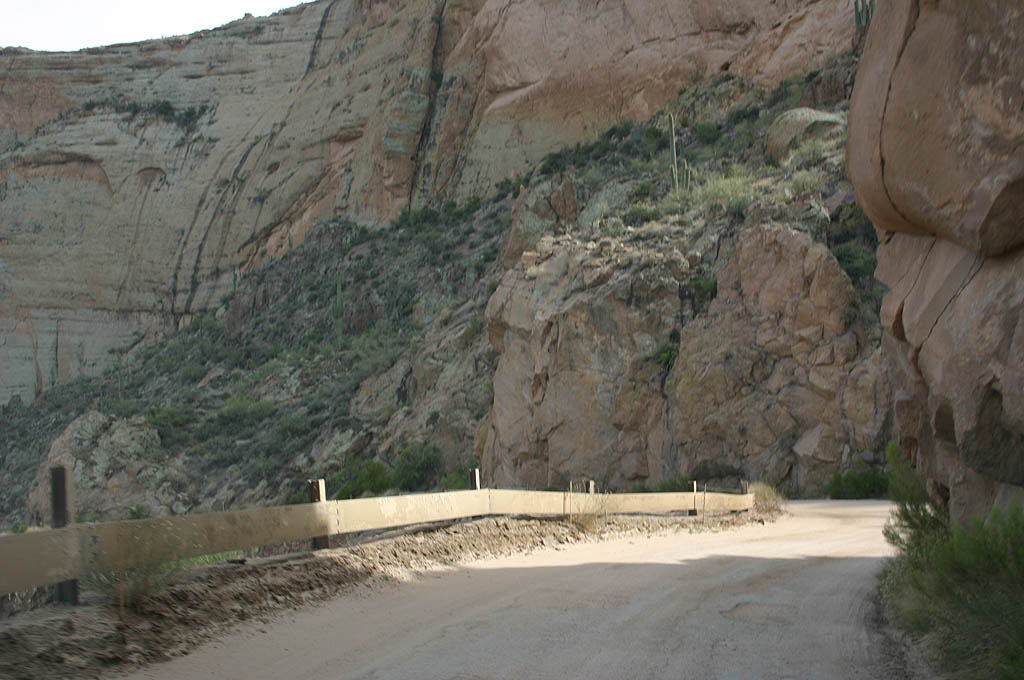
| SR 88 advances to Fish Creek Hill, initially along a road covered mostly with asphalt. 05/27/07 |
|
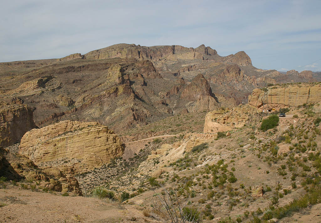
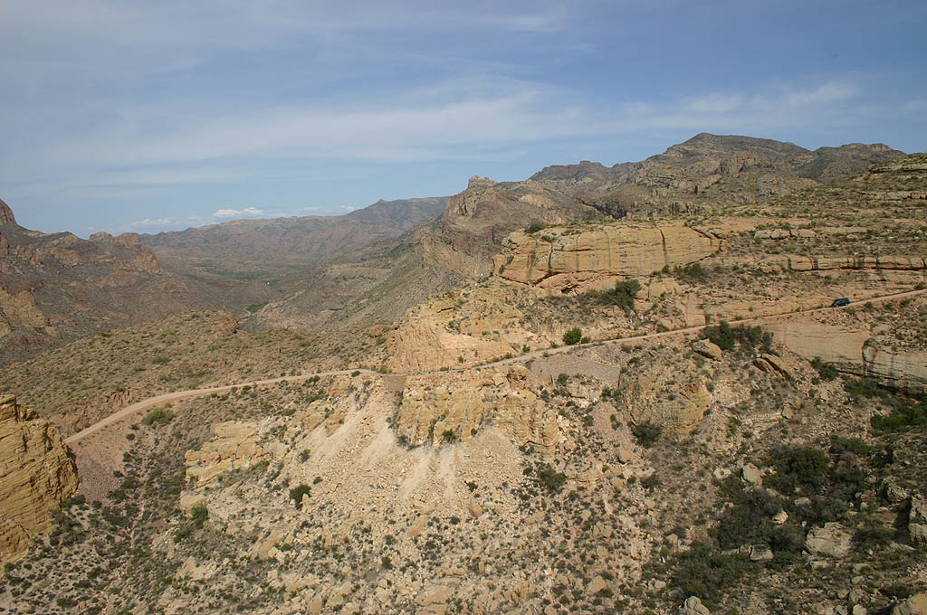
| Horse Mesa and Bronco Butte can be seen in the foreground of this photo of Apache Trail, with Goat Mountain and Buckhorn Ridge in the background. This view is from a trail overlooking the road. 05/27/07 |
|
| This sharp turn looks toward Coronado Mesa and Bronco Butte. Sharp turns like this are common along the road. 05/27/07 |
|
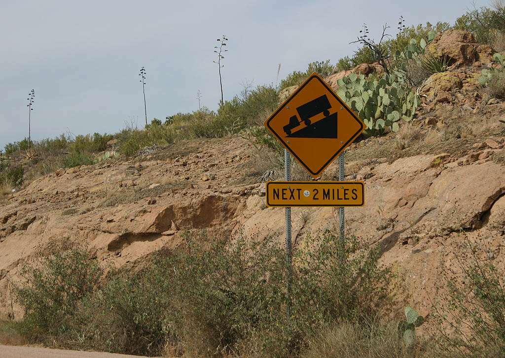
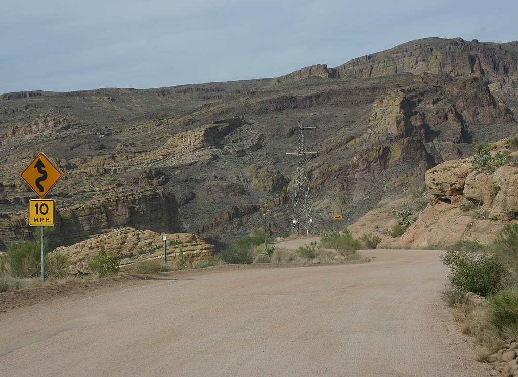
| Advance warning of the Fish Creek grade. Although relatively short at just two miles, the grade is steep, up to 10%. Including cuts and fills up to 70 feet deep, this stretch of Apache Trail was built by hand. 05/27/07 |
|
| The U.S. Forest Service built an overlook of the road and grade at the top of Fish Creek Hill. 05/27/07 |
|
| The steep grade along SR 88 at Fish Creek Hill resulted in the previous recommendation for four wheel drive vehicles only in the late 1980s. 05/27/07 |
|
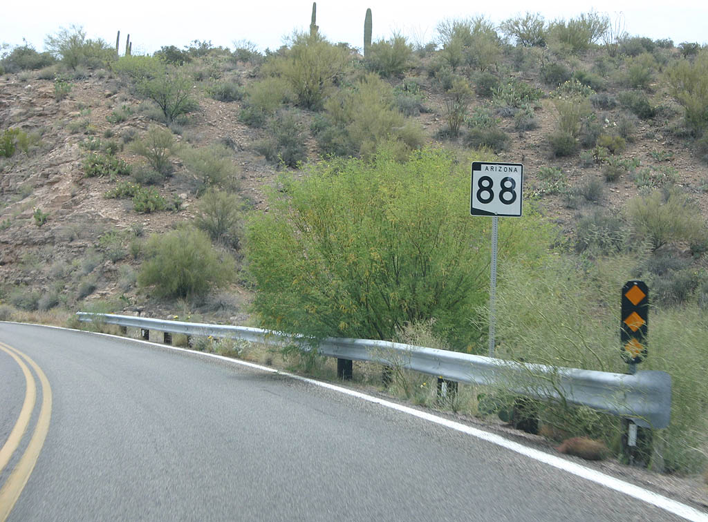
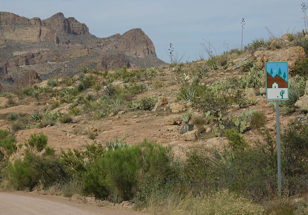
| This scenic road trailblazer is the only sign noting that Apache Trail is an Arizona State Route. 05/27/07 |
|
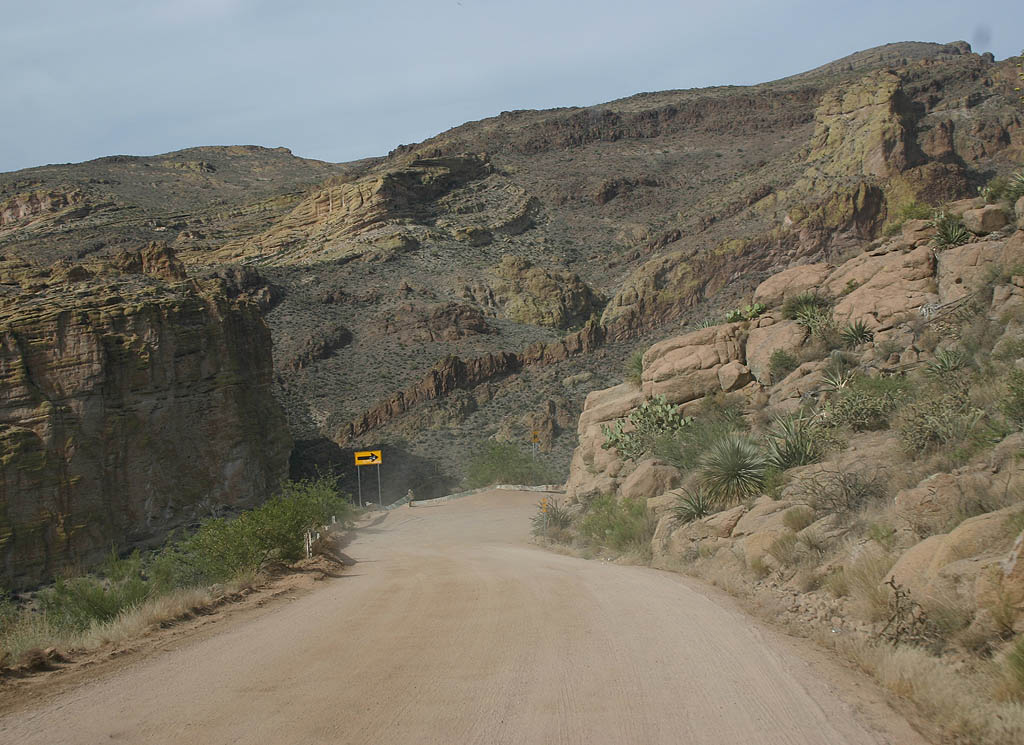
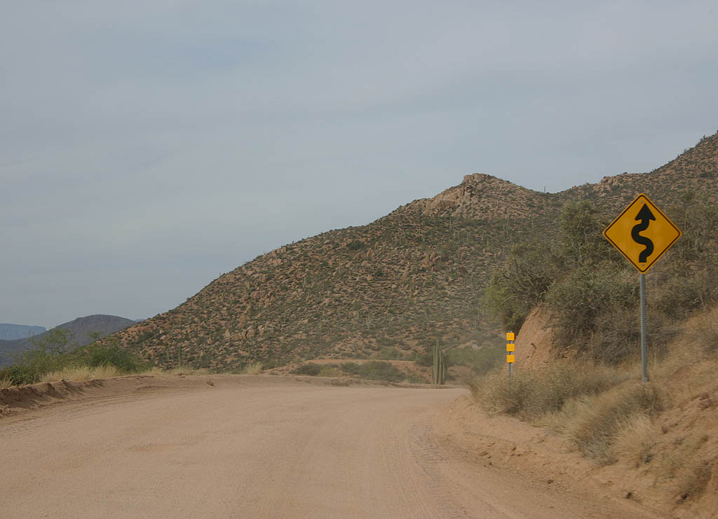
| A series of sharp curves along SR 88 across Fish Creek Hill. 05/27/07 |
|
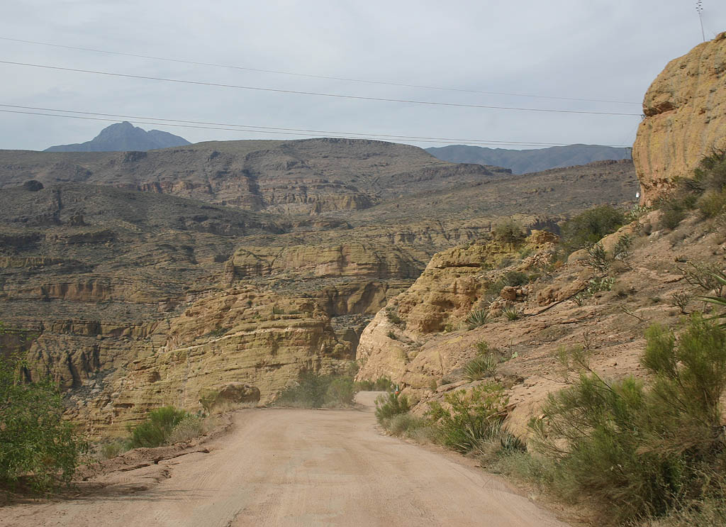
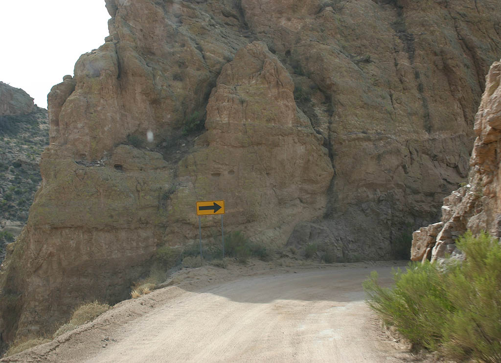
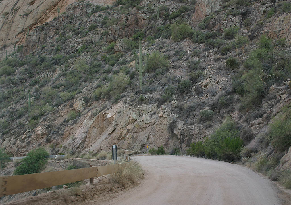
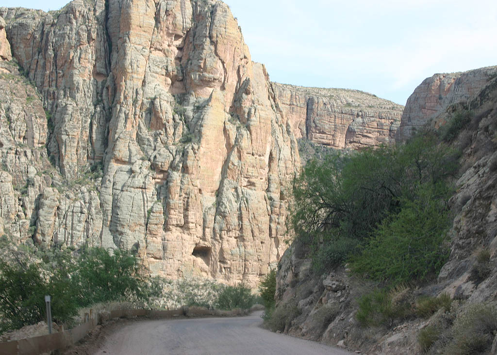
| SR 88 traverses the side of an unnamed canyon before turning into Fish Creek Canyon. 05/27/07 |
|
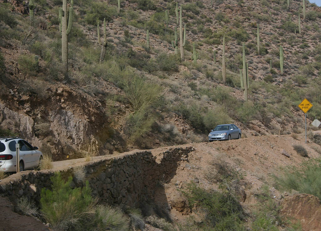
| Many sections of the Fish Creek grade are effectively one lane, with barely enough width for cars to pass. Drivers heading uphill have the right of way. 05/27/07 |
|
| This photo overlooks Lewis Pranty creek, which SR 88 follows as it departs Fish Creek Canyon. At the bottom of this photo, the curves of SR 88 can be seen, around 600 feet below this point. 05/27/07 |
|
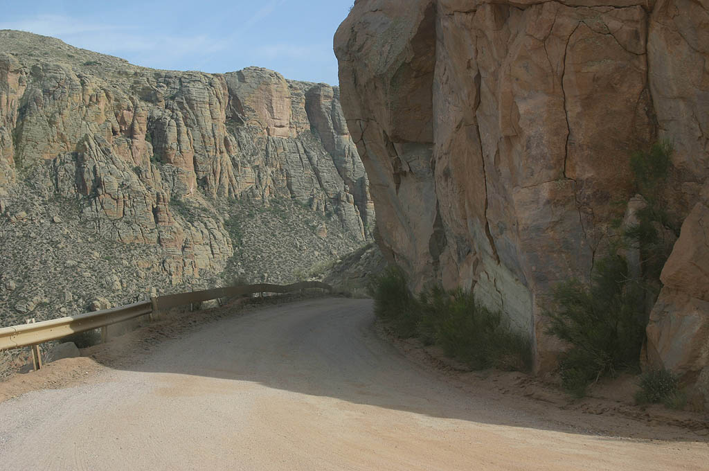
| A very narrow curve along SR 88 adjacent to overhanging rocks. 05/27/07 |
|
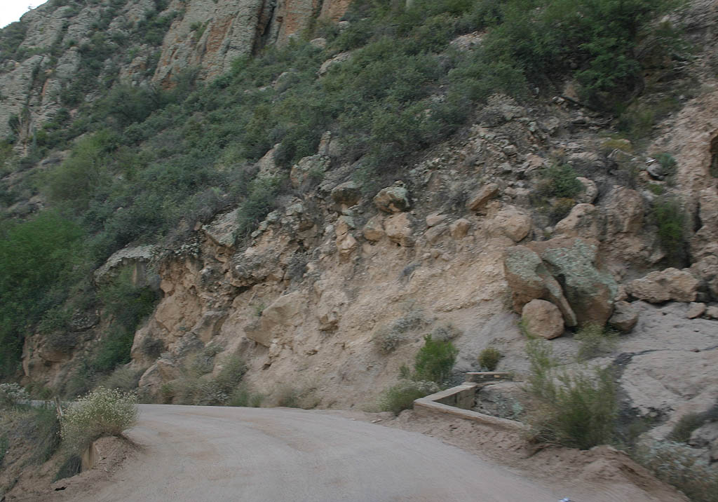
| SR 88 east continues along the steep descent through Fish Creek Canyon. 05/26/07 |
|
| Cars traveling along SR 88 (Apache Trail) westbound can surprise eastbound motorists. 05/27/07 |
|
| Many cars have slid off the side of Fish Creek Hill over the years. 05/26/07 |
|
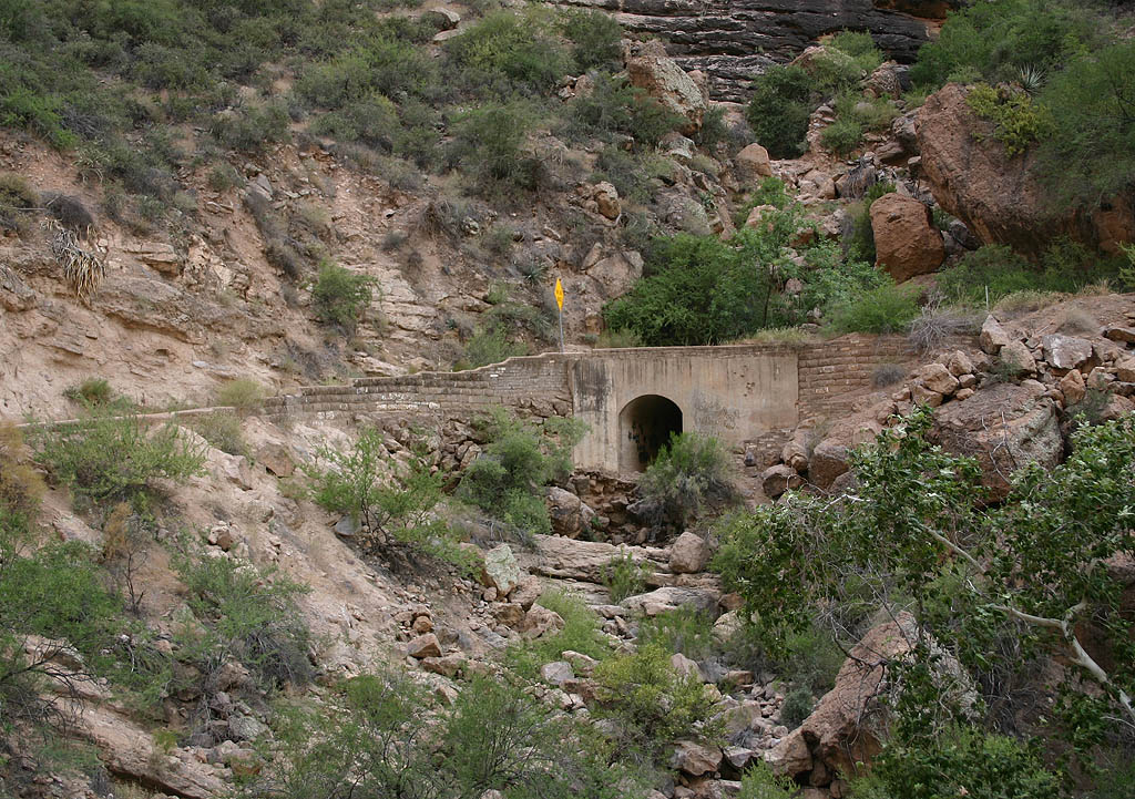
| A drainage culvert constructed under Apache Trail. 05/26/07 |
|
| The narrow width of the grade along SR 88 (Apache Trail) eastbound. 05/26/07 |
|
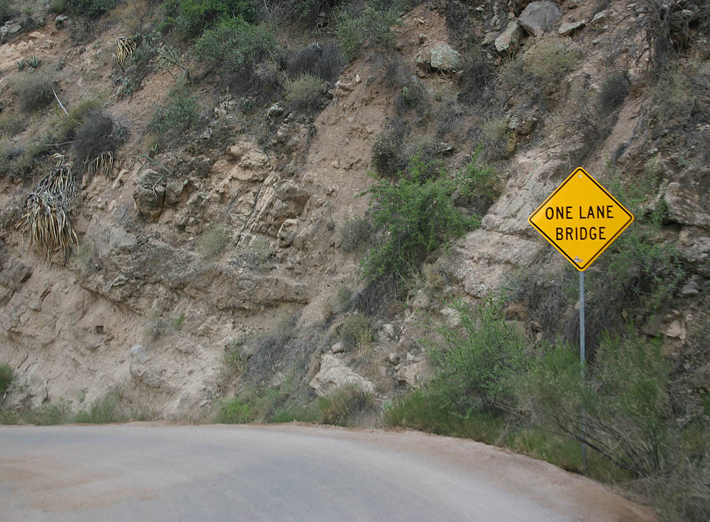
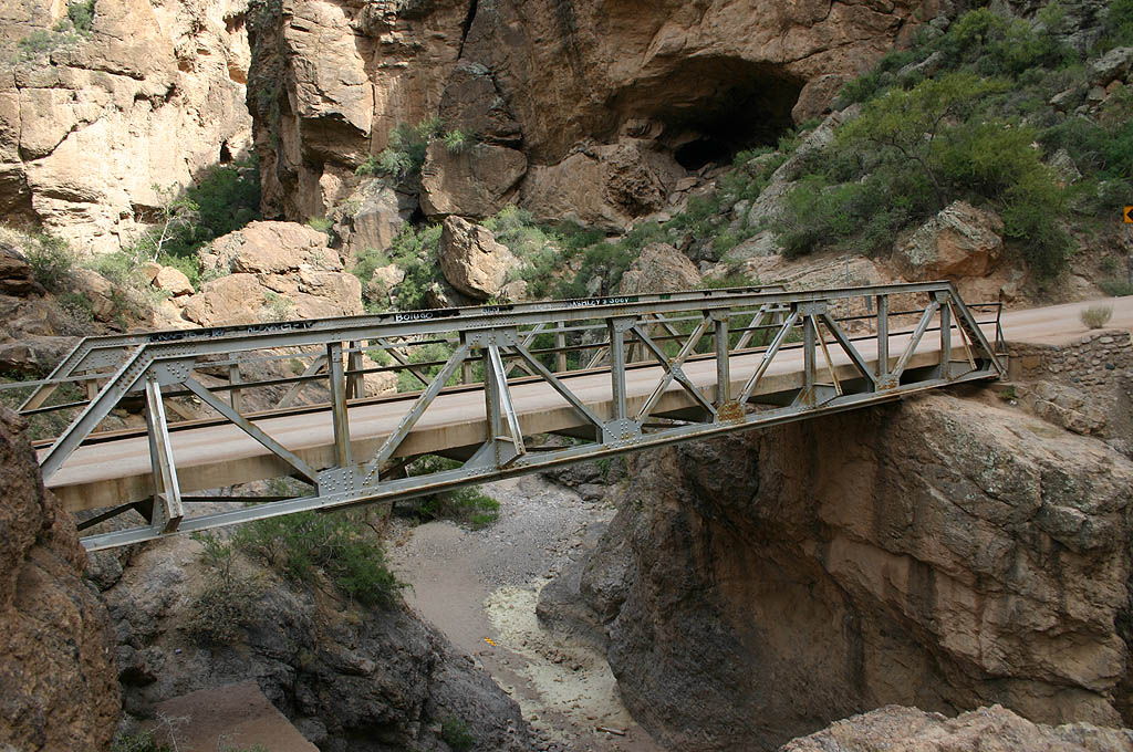
| Advance warning of the one lane bridge across Fish Creek. 05/27/07 |
|
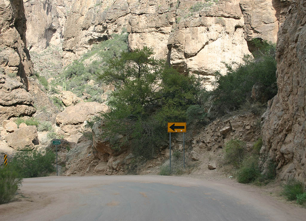
| A sharp turn at the very bottom of Fish Creek Canyon leads SR 88 east onto the one lane bridge crossing the creek. 05/27/07 |
|
| The Fish Creek bridge dates back to 1928. 05/27/07 |
|
| Located next to the Fish Creek bridge, this culvert dates back to the original construction of SR 88. 05/27/07 |
|
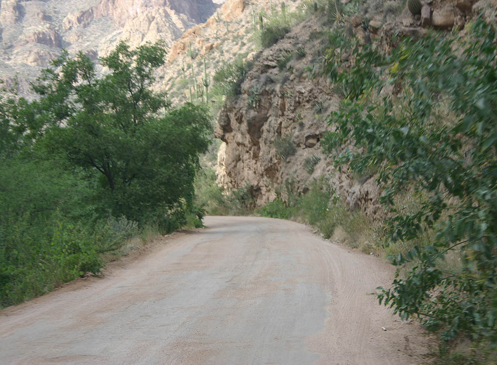
| SR 88 turns east to parallel Lewis Pranty Creek. The water provided by the creek supports taller vegetation than seen previously on the hill. 05/27/07 |
|
| The walls of Lewis Pranty canyon are quite impressive,
rising up to 1000 feet above the canyon floor. 05/27/07 |
|
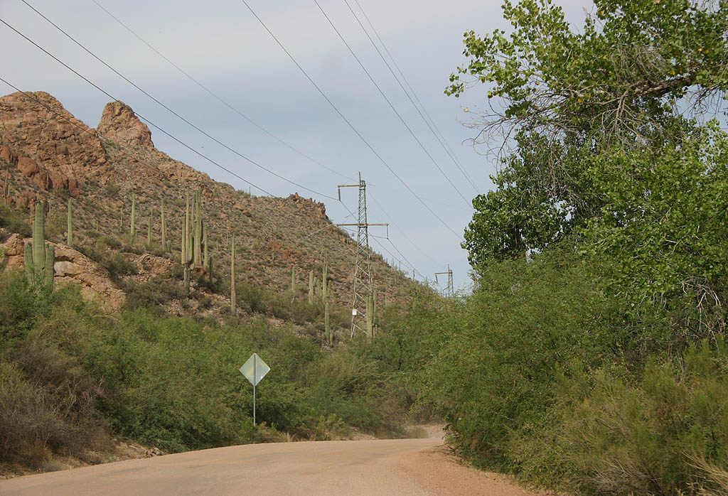
| SR 88 navigates alongside the creek bed ahead of another single lane bridge. Supplying Phoenix with electricity, the overhead power lines parallel Apache Trail to Roosevelt Dam. 05/27/07 |
|
| The oldest along SR 88, the bridge over Lewis Pranty Creek was completed in 1922 when Apache Trail was rebuilt. 05/27/07 |
|
| Turning north across a low drainage divide, SR 88 leads away from Lewis Pranty Creek toward Apache Lake. 05/27/07 |
|
| Some of the original rock retaining walls along the Apache Trail. 05/27/07 |
|
| SR 88 crosses Dry Wash here on the northeastern course above Apache Lake. The road originally traveled closer to the Salt River, but was moved up the hillside in the 1920s with the construction of Horse Mesa Dam. 05/27/07 |
|
| SR 88 descends from the hills above Apache Lake and passes near Burnt Corral Creek. 05/27/07 |
|
| This is the first view of Apache Lake from Apache Trail east. SR 88 was rerouted in 1925 to avoid the construction of Apache Lake. 05/27/07 |
|
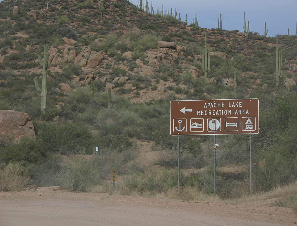
| SR 88 east at the Apache Lake recreation area. Next to this access road is an overlook of the lake. 05/27/07 |
|
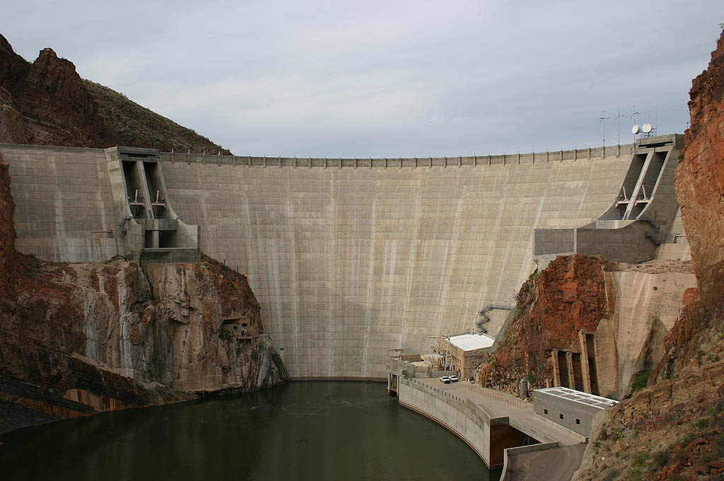
| Apache Lake was formed by Horse Mesa Dam. Constructed between 1924 and 1927, the 305 foot high concrete dam impounds a 266 foot deep lake. 05/27/07 |
|
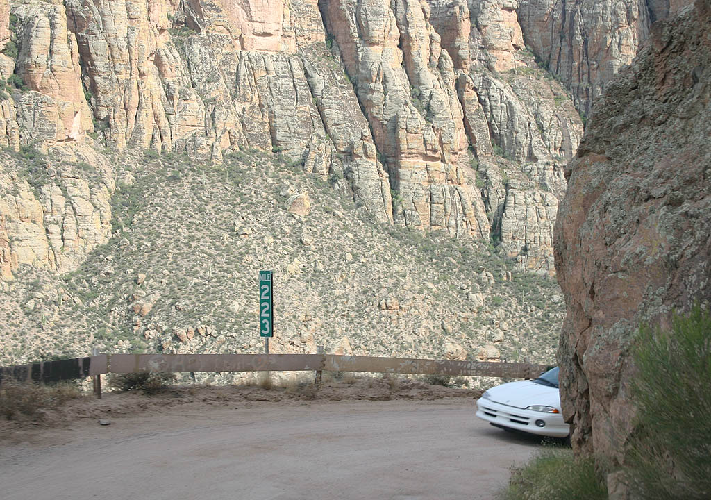
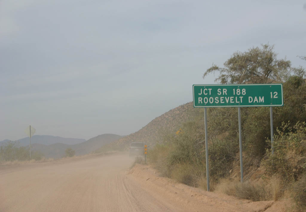
| Distance sign to SR 188 and Roosevelt Dam (12 miles). 11 of the remaining 12 miles are entirely unpaved with no asphalt overlays. 05/27/07 |
|
| North of Apache Lake Marina, SR 88 straddles the side of Apache Lake as it proceeds north to Roosevelt Dam. 05/27/07 |
|
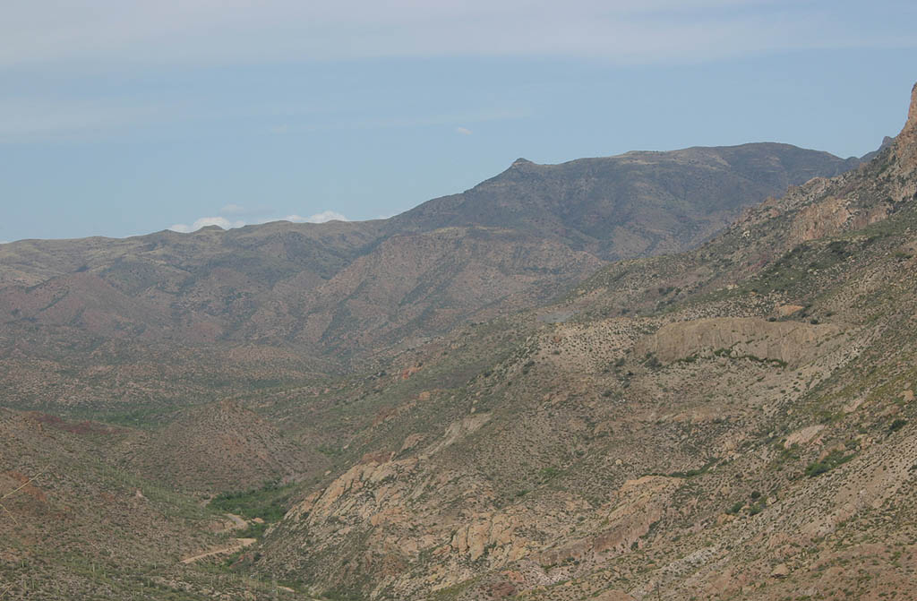
| Vineyard Mountain, located just southwest of Roosevelt Dam, comes into view along SR 88 eastbound. 05/27/07 |
|
| SR 88 crosses Davis Wash on a bridge built in 1939. This is the last of the vintage bridges along Apache Trail. 05/27/07 |
|
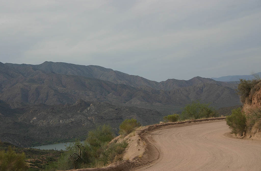
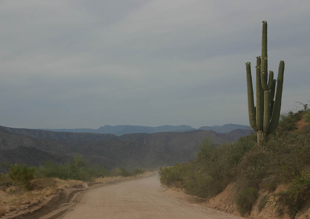
| SR 88 traverses areas along the upper reaches of Apache Lake. 05/26/07 |
|
| Before reaching Roosevelt Dam, SR 88 drops back down next to the Salt River and upper reaches of Apache Lake. 05/27/07 |
|
| SR 88 rises again quickly from the river toward to Roosevelt Dam. 05/27/07 |
|
| Roosevelt Dam was the first dam along the Salt River, and the project that led to the construction of Apache Trail. Completed in 1911, the dam was once the world's highest Masonry dam. A critical part in the development of Phoenix and the Valley of the Sun, the dam was rebuilt in the early 1990s in concrete to add storage capacity. 05/27/07 |
|
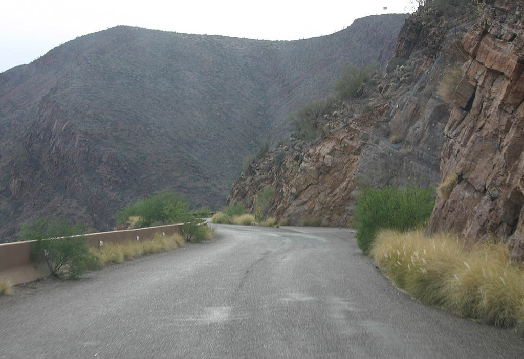
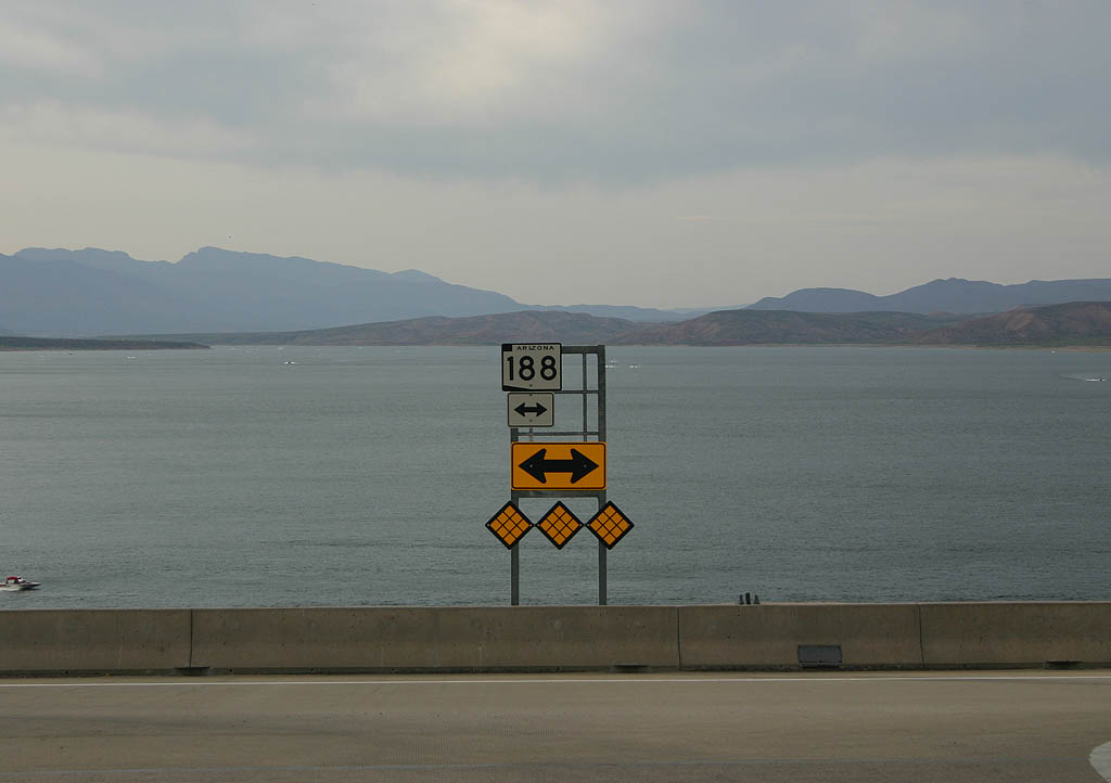
| Just past the access to Roosevelt Dam, SR 88 becomes a paved road again. The route passes a vista point over Roosevelt Dam and Roosevelt Lake, with a view of the bridge built in 1991 that takes SR 188 over the lake. 05/27/07 |
|
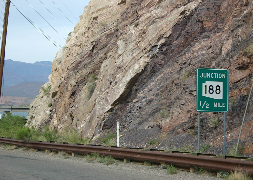
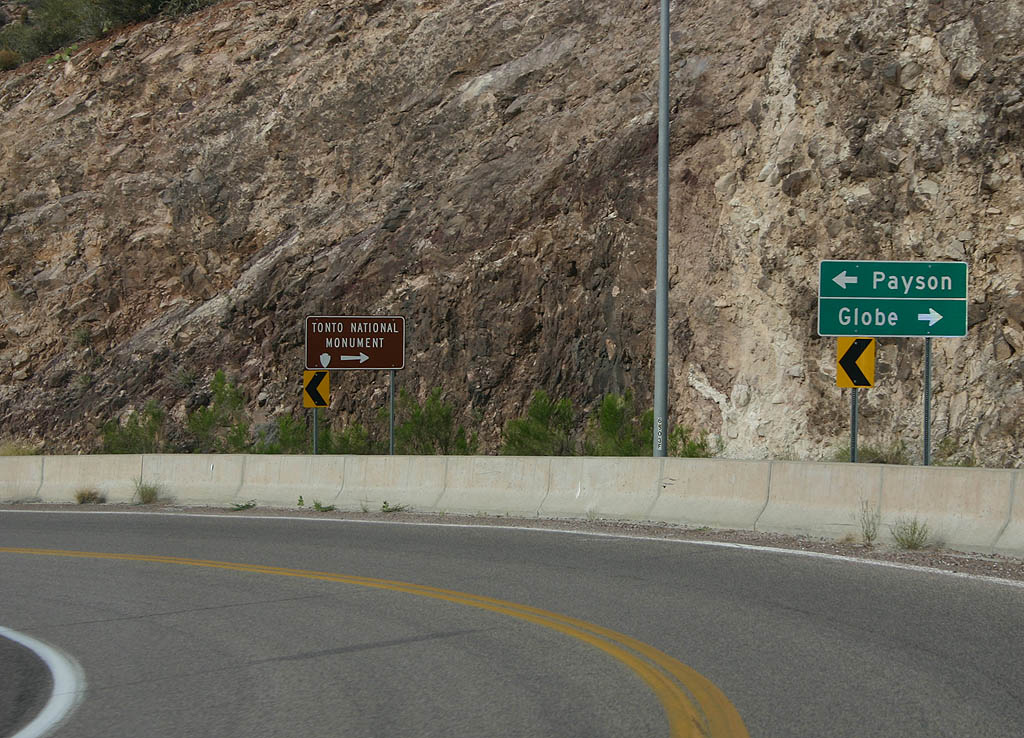
| SR 88 east concludes at SR 188 in a half mile by the Roosevelt Lake Bridge. The adjacent span was completed in 1991 as part of the SR 188/88/Roosevelt Dam reconstruction. 05/27/07 |
|
| SR 188 connects SR 88 with Payson via SR 87 and Globe via U.S. 60. 05/27/07 |
|
| Until 2000, SR 88 turned south along SR 188 to end at U.S. 60 near Globe. This sign assembly included space for the continuation of SR 88. 05/27/07 |
Sources:
- Goldfield Ghost Town. http://goldfieldghosttown.com/
- Lost Dutchman State Park - Park History. https://azstateparks.com/lost- dutchman/explore/park-history.
- Driving the Apache Trail. http://www.azcentral.com/travel/ drives/articles/fav-apachetrail-CR.html Azcentral.com.
04/22/07, 05/26/07, 05/27/07 by Kevin Trinkle
Connect with:
U.S. 60
State Route 188
Page Updated 05-30-2007.


 East
East