
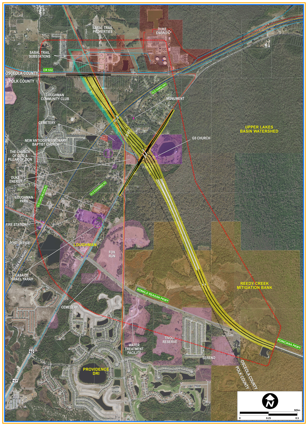
Poinciana Parkway is a 7.2 mile toll road linking Ronald Reagan Parkway east of U.S. 17/92 in Polk County with Poinciana in western Osceola County. Operated by the Central Florida Expressway Authority (CFX), Poinciana Parkway was built primarily as a limited-access toll road. The initial segment of Poinciana Parkway opened April 30, 2016 between U.S. 17/92 in Loughman and Marigold Avenue in Poinciana. The second phase, completing it to Cypress Parkway, opened to traffic November 18, 2016.1 Costing $135 million to build,2 the parkway extends southeast from Ronald Reagan Parkway over the Reedy Creek Mitigation Bank to half diamond interchanges with Marigold Avenue and KOA Street. All electronic toll (AET) gantries operate along the parkway north of Marigold Avenue and north of KOA Street.
CFX commenced work expanding Poinciana Parkway from two to four lanes in February 2021. The widening project included building new bridges and ramps at Marigold Avenue and KOA Street, and realigning the south end of the toll road westward to intersect CR 580 (Cypress Parkway) across from Solivita Boulevard. The Capacity Improvements Project was completed in December 2023.3
State Road 538 / Poinciana Parkway Guides
Long range plans call for Poinciana Parkway to be part of a large limited-access system around the greater Kissimmee/St. Cloud area, which includes the Southport Connector and a southern extension of SR 417 (Central Florida GreeneWay). Designs for a three mile extension of SR 538 to Polk County Road 532 commenced Spring 2020. Poinciana Parkway will shift onto a new alignment from its end at Ronald Reagan Parkway to CR 532 at the northeast corner of Polk County. Improvements also include an interchange with U.S. 17/92 and widening of County Road 532 between Old Lake Wilson Road and U.S. 17/92.4,5
Poinciana Parkway was previously under the jurisdiction of the Osceola County Expressway Authority (OCX). CFX assumed control and maintenance for Poinciana Parkway on December 31, 2018. With that change, OCX signs for Poinciana Parkway were swapped out with State Road 538 markers by January 8, 2020.
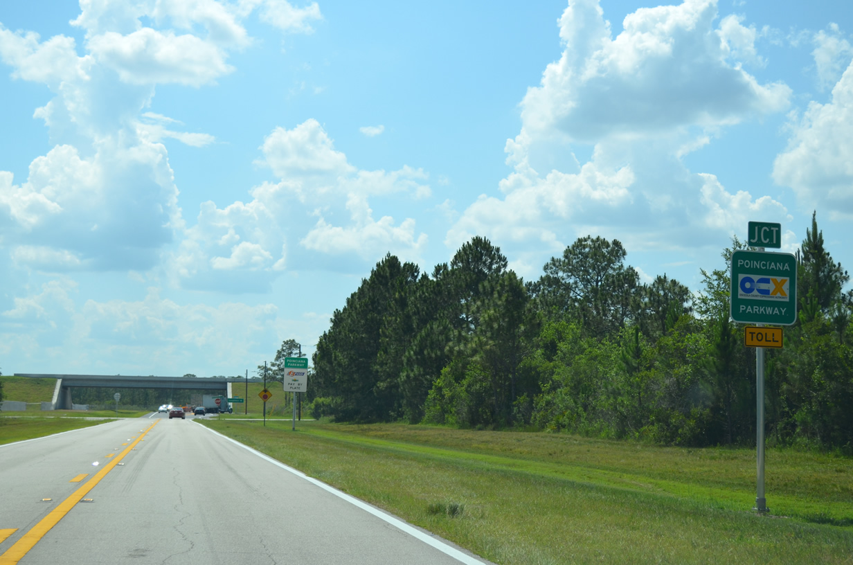
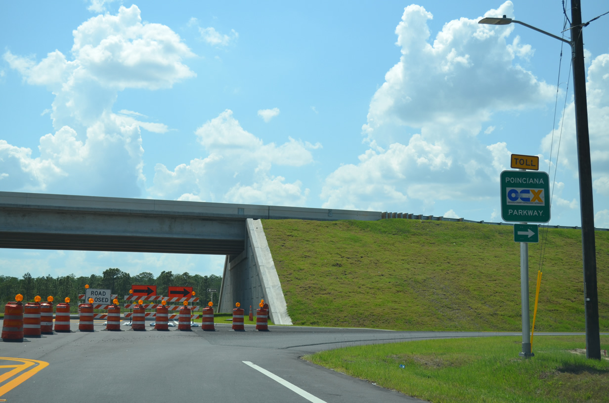
 Scenes Scenes |
 | Marigold Avenue provides one of three access points between Poinciana Parkway and the Poinciana area. Primarily a two lane arterial, Marigold Avenue stretches through the length of Poinciana, connecting with an unrelated section of Poinciana Parkway in Polk County. 04/30/16 |
 | Marigold Avenue was extended west from Eastbourne Road to the half diamond interchange with Poinciana Parkway (SR 538). 04/30/16 |
- "2nd Leg of Poinciana Parkway Opens Today", The Ledger, November 18, 2016.
- Poinciana Parkway FAQs sheet. Poinciana Parkway Project (www.osceolaxway.com).
- "Media Alert: CFX Announces Opening of the Newly Improved SR 538 / Poinciana Parkway." Central Expressway Authority (CFX), news release. December 21, 2023.
- PD&E Study - Poinciana Parkway Extension - CFX official web page
- SR 538 Project - CFX official web page
Photo Credits:
04/30/16 by AARoads
Connect with:
U.S. 17
U.S. 92
Polk County Road 580
Page Updated 02-19-2024.